While walking Te Araroa in 2020, back in this post (Day 150 Timaru River to Pakituhi Hut), I noticed on the DOC map that there was a hut called Moonlight & Roses Hut. I thought at the time “it’s up high in the mountains and seemingly has no track to it, I wonder what it’s like and who stays there?“, and ever since that day that thought was in the back of my mind. Since I was already down this way with all my hiking gear having just done the Routeburn Track, what better time to find out!
Obviously when walking Te Araroa, the majority of huts you find are full of people, or even the rare times you do end up staying on your own in a hut, you know that heaps of people have been through before. So I have wanted to try and find a hut that very few people have stayed in, and see what it was like.
In the months before this trip, I had researched on the Internet how to even get to Moonlight & Roses Hut, as there are no published paths to it. I found a few blog entries that went into fairly good detail, which was good, because without these I might not have had the guts to walk through some really remote back country terrain, and to be completely off any marked path for a day or possibly even longer.
The best blog post I found that talked about the hut was this one by Finn and Jen. From what I could tell, they were of similar fitness to me, had similar goals when setting out and followed almost the exact same route I wanted to take.
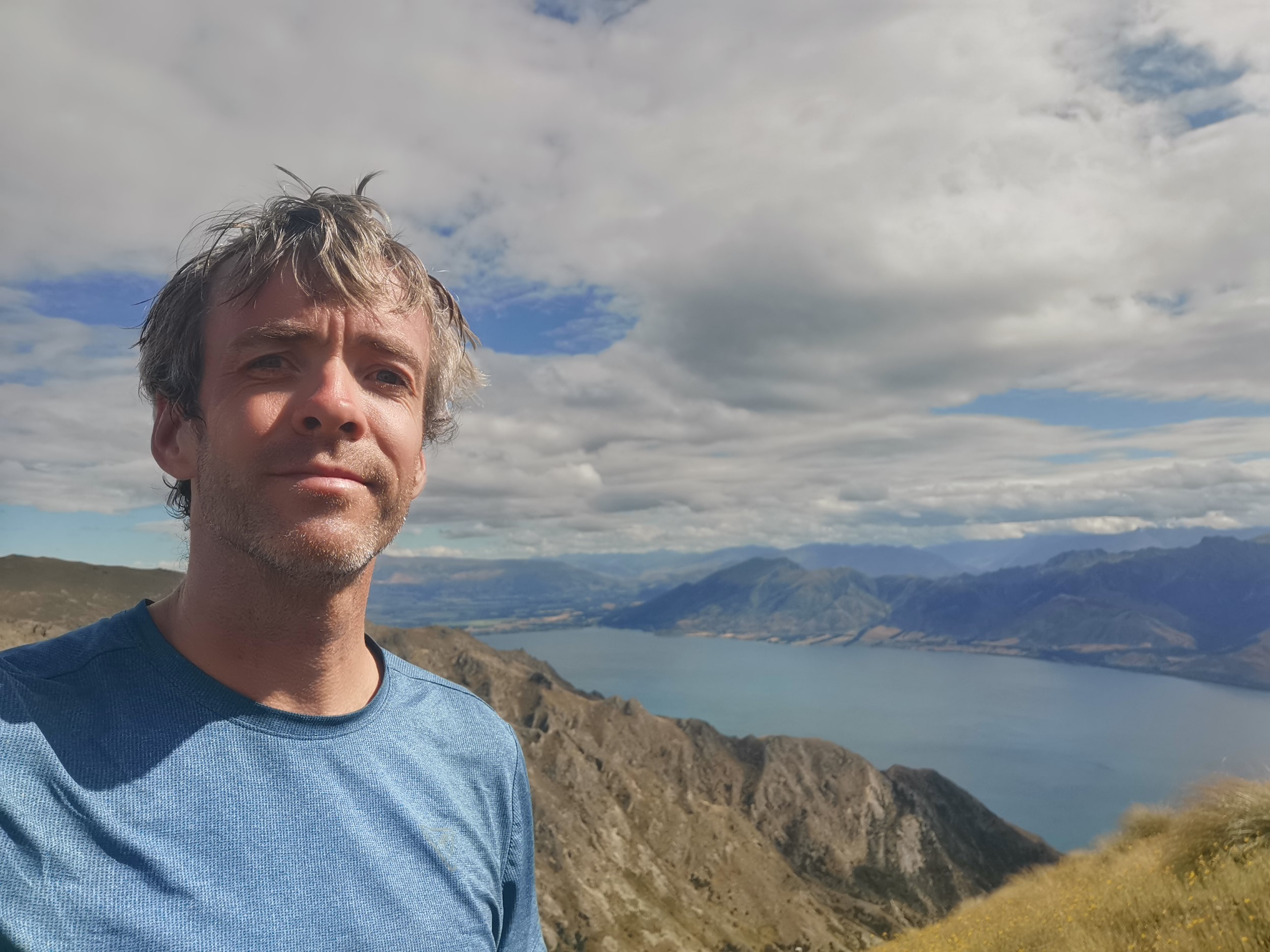
My plan was to join my friends on the Routeburn Track, and then after my friends flew back to Auckland, I allowed myself the rest of the week (Thursday – Sunday) to go exploring and find this hut. The first day would be walking to Stodys Hut from Lake Hawea (following Te Araroa but Northbound this time!), and then the next few days would be going off-trail to try and find Moonlight & Roses Hut and then somehow make my way back to civilization.
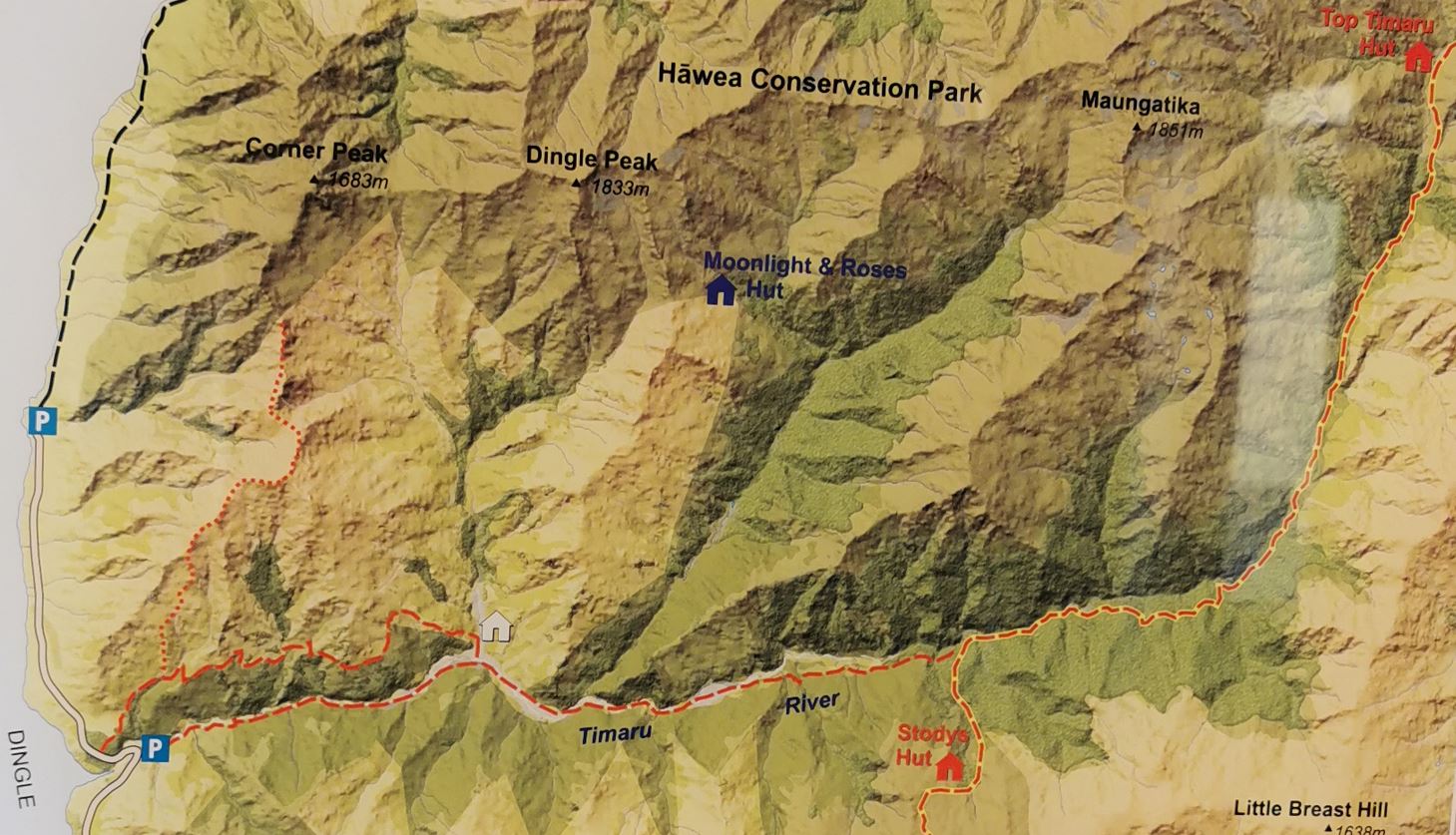
As I flew in to Queenstown, I looked out the window and recognised Lake Hawea immediately. Since I’d spent so long researching the area before I flew down (and since I’d already walked Te Araroa through here) I recognised the Hawea Conservation Park and Timaru River Valley. I managed to take this photo from the plane (and I drew these arrows where I figured I’d be going).
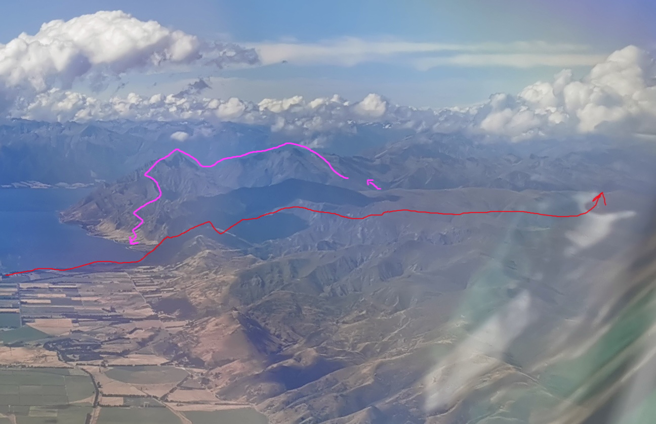
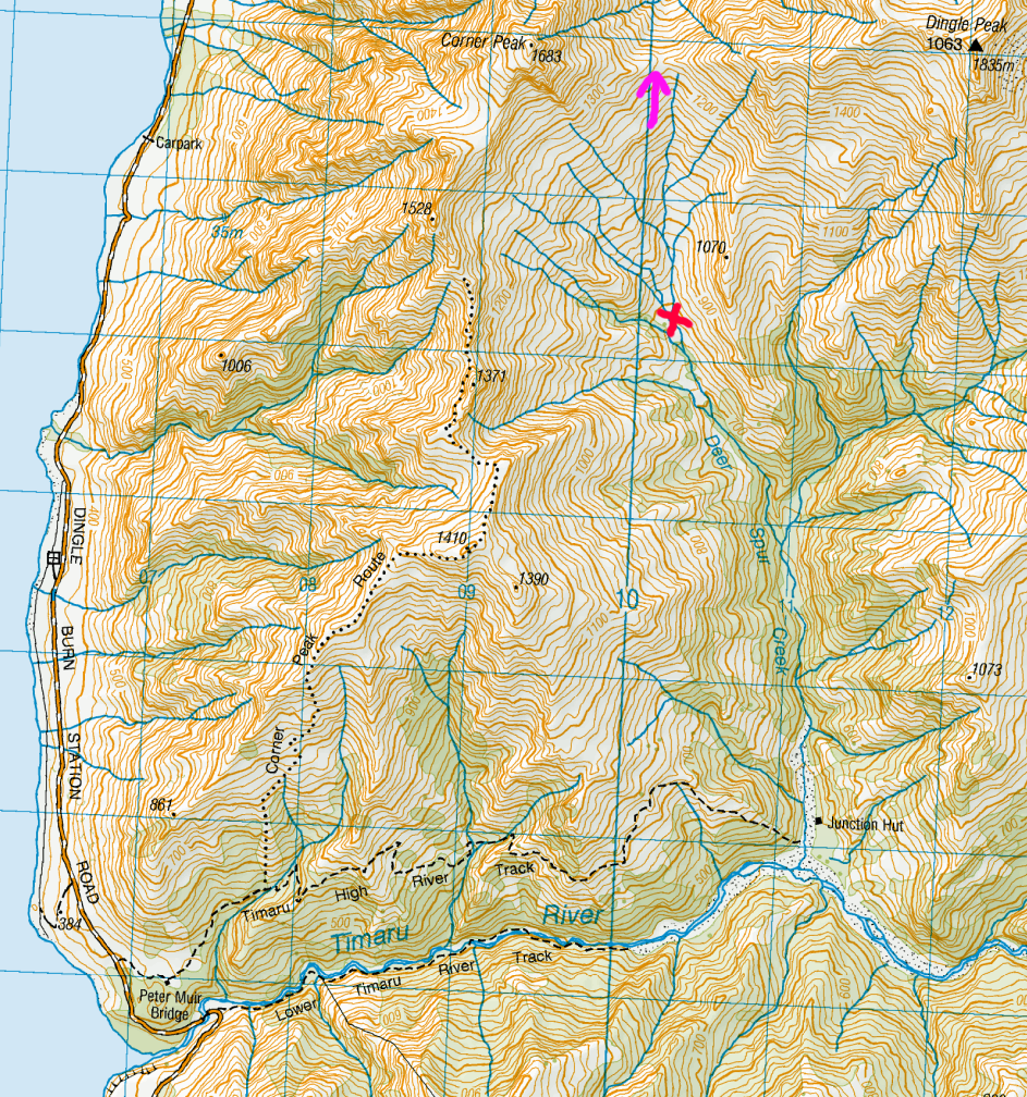
The red arrow is from Lake Hawea up over Breast Hill to Pakituhi Hut and Stody’s Hut and then down into Timaru River. I would then emerge back up the other side of the valley and Moonlight & Roses Hut would be somewhere around where the pink arrow is. Then, one option out is over the two peaks I could see, which are Dingle Peak and Corner Peak – people in blogs had done that. That would involve following the pink line on the photo, but if it turns out that it would involve too much climbing or I just didn’t feel like I could do it, then other options were to A) go out the way I came in, B) leave via Timaru River or C) go out down the Corner Peak Route (shown in the map at the top, the dotted line on the left).
I didn’t want to rush, but unfortunately since I’m now back in “regular life” with a regular job, I only had four days and then I had to catch my flight back to Auckland on Monday. And the weather forecast for Sunday was not great, so I didn’t have a lot of time to waste. Being on a timetable sucks!
DAY 1 (2 February 2023)
Total distance: 21.38km
I got on the Great Sights bus from Queenstown at 8am.
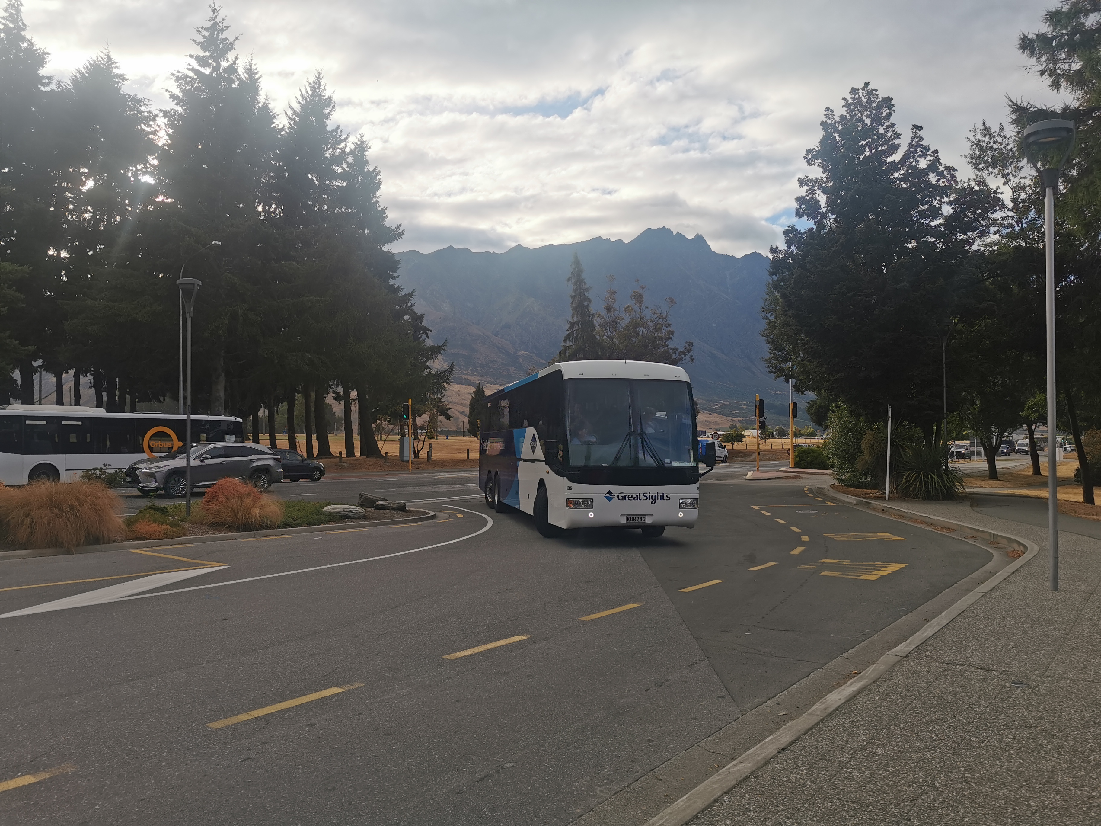
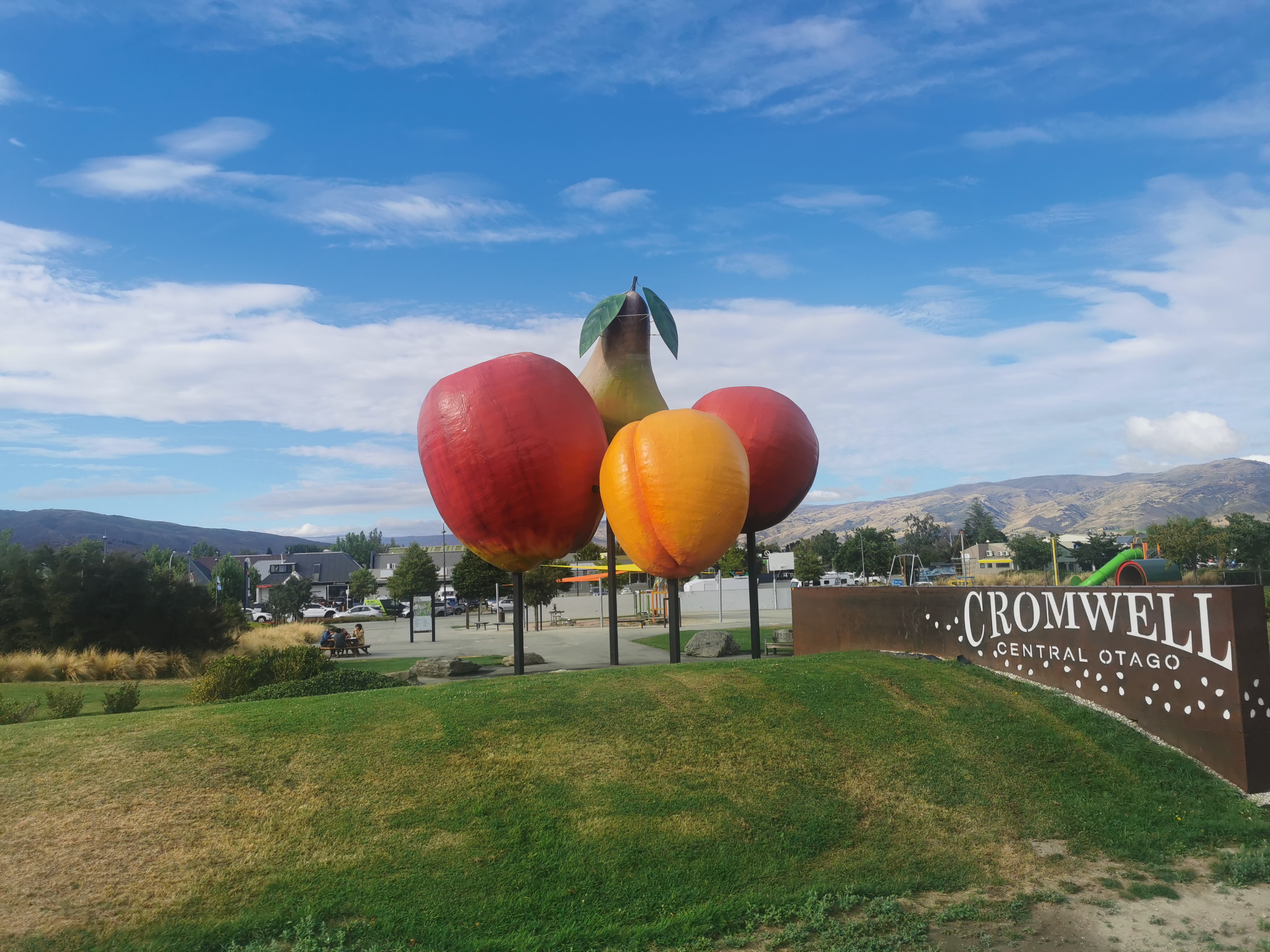
We drove past the Kawarau Bridge Bungy, apparently the world’s first bungy jump and you would be falling 43 metres should you be crazy enough to jump off it. We were due to arrive in Lake Hawea at 10:20am but because of a stop at Jones’s Family Fruit Stall along the way, we were 25 minutes late. Despite being advertised as a small family fruit shop, it was very busy. We also stopped in Cromwell and Wanaka briefly.
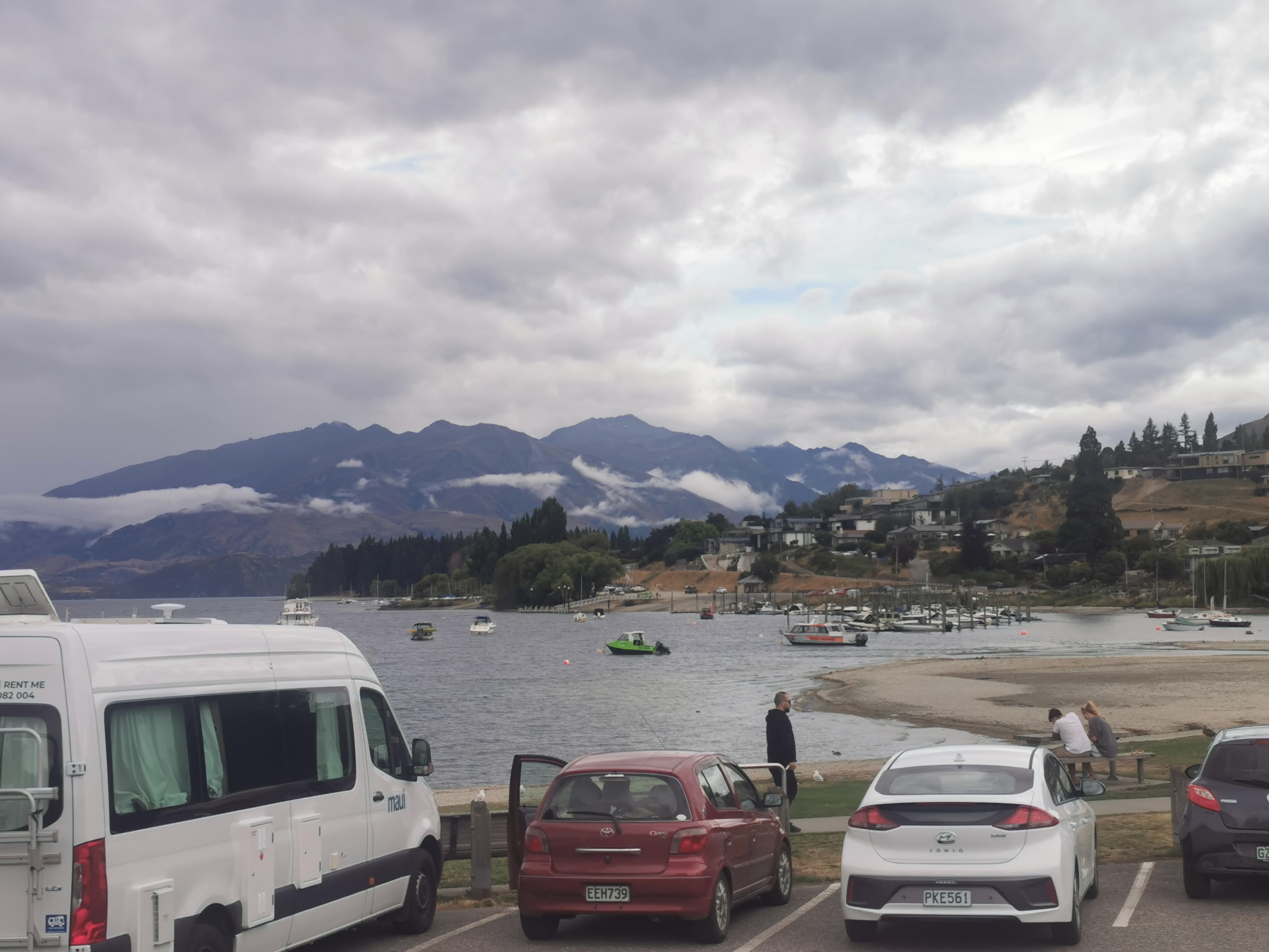
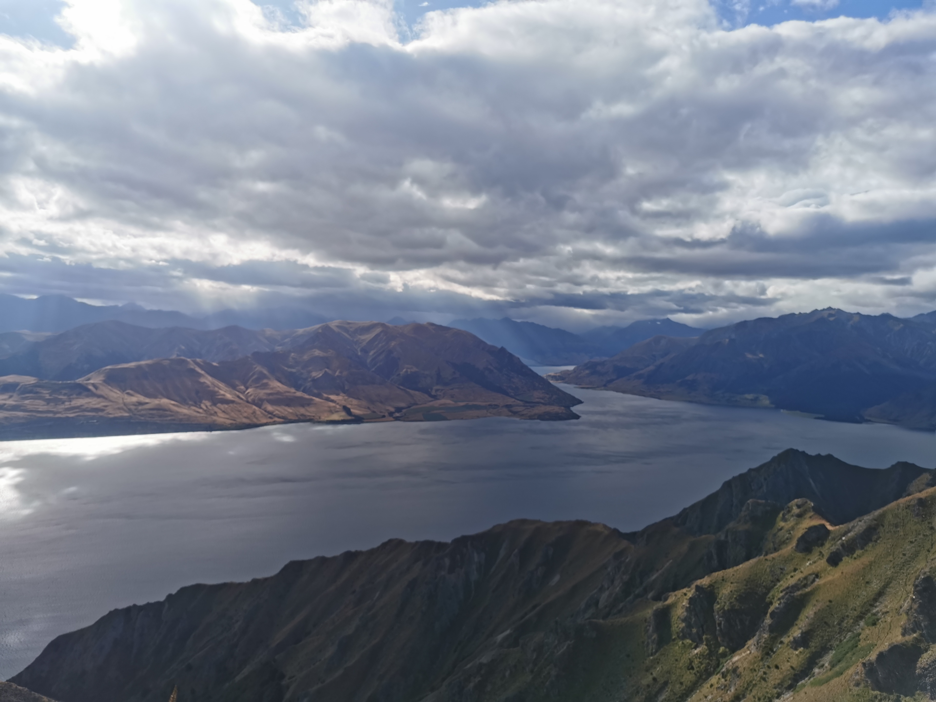
Once off the bus at Lake Hawea it was straight into walking. I was back walking Te Araroa but this time I was walking it northbound. That meant instead of the steep descent down Breast Hill, this time I had to climb it instead.
The weather for today said “heavy rain north and west of the lakes”, and I could see the bad weather when I looked in that direction, but even as I started to head towards the start of the Breast Hill track, the drizzle started.
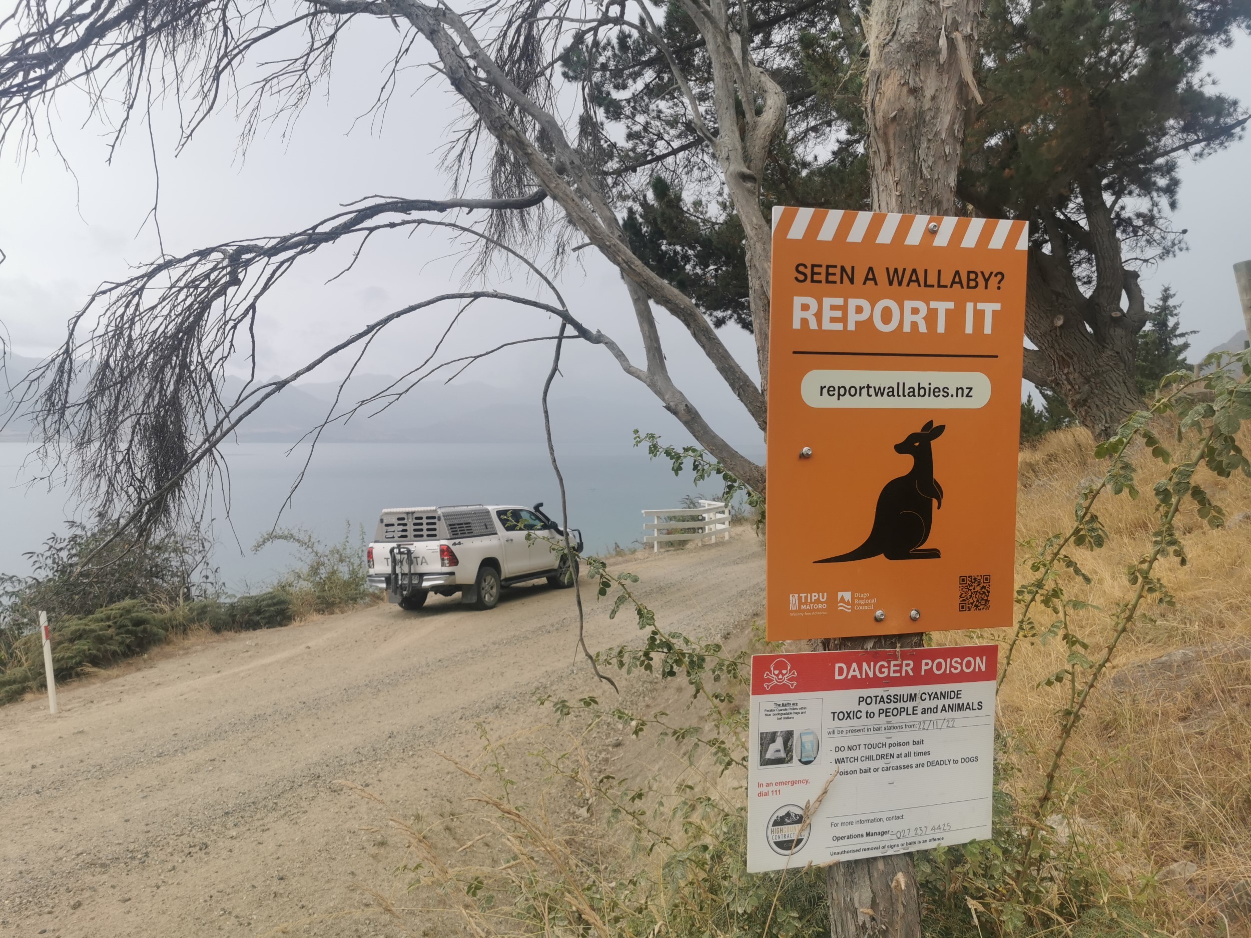
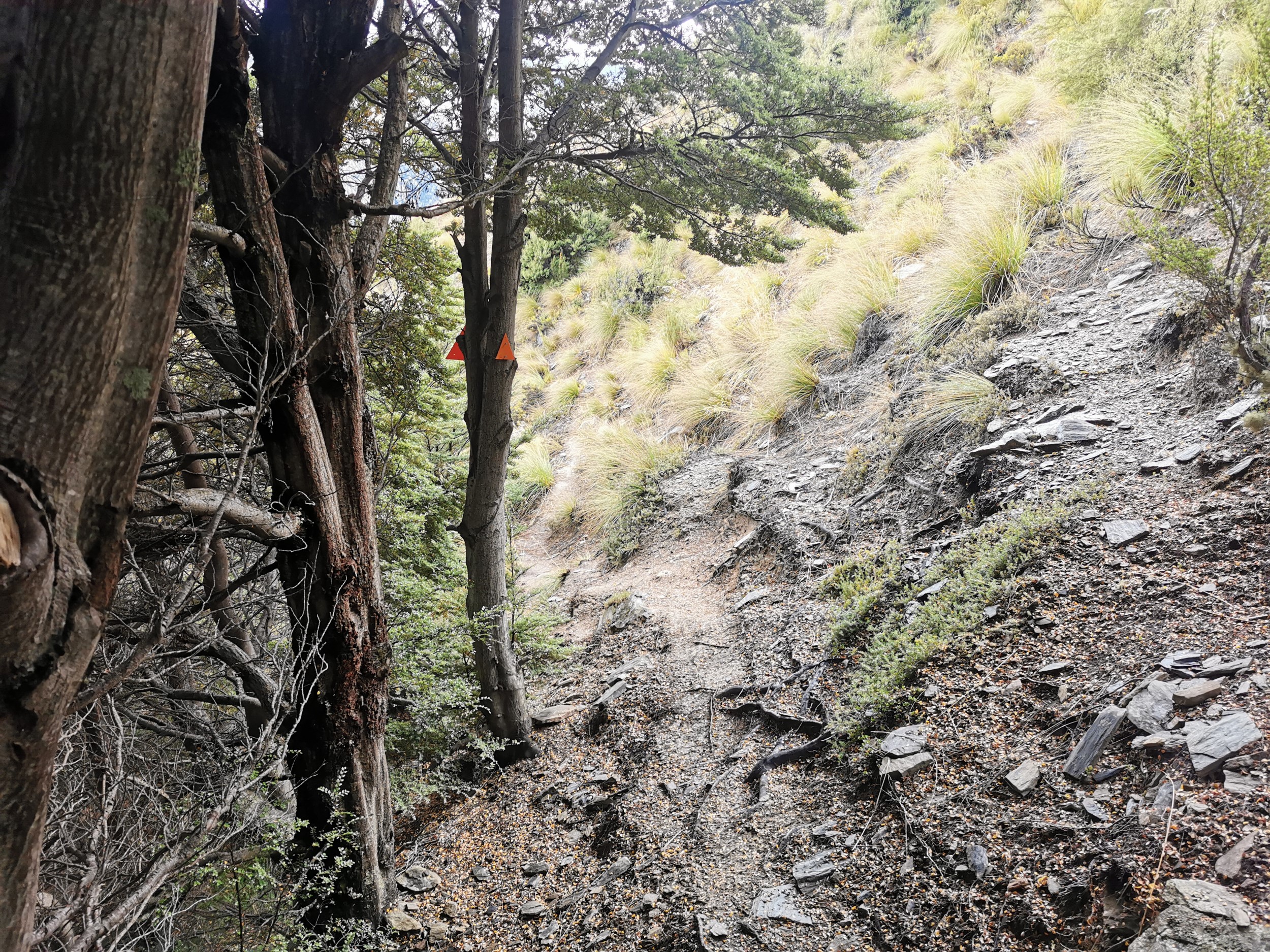
I saw the same signs that I remembered seeing when I walked Te Araroa almost three years ago.
I was clearly not “trail fit” this time, I was sure that in my TA days I would have got up the hill faster. I had to stop every 30-50 steps and take a breather. Plus it started raining at the bottom of the hill and didn’t stop until two thirds of the way up.
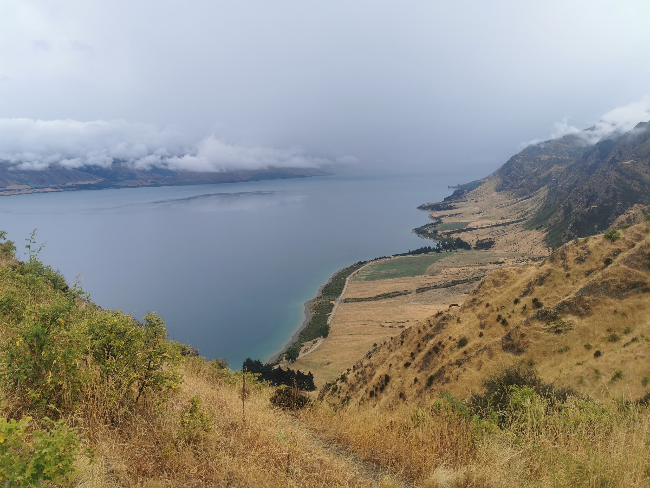
Despite the constant rain, it was quite windy near the top, and the sun did come out at the top, so I dried pretty fast.
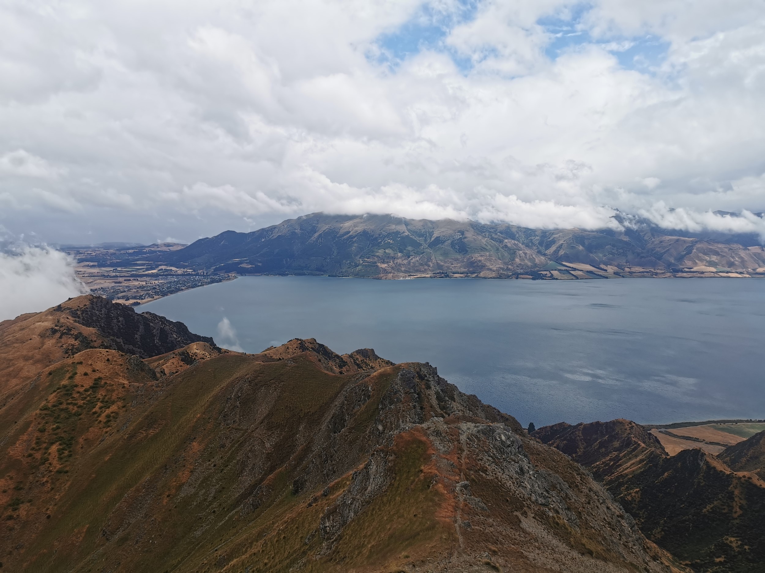
I didnt climb the extra bit to the Breast Hill summit, as I’d already seen it before.
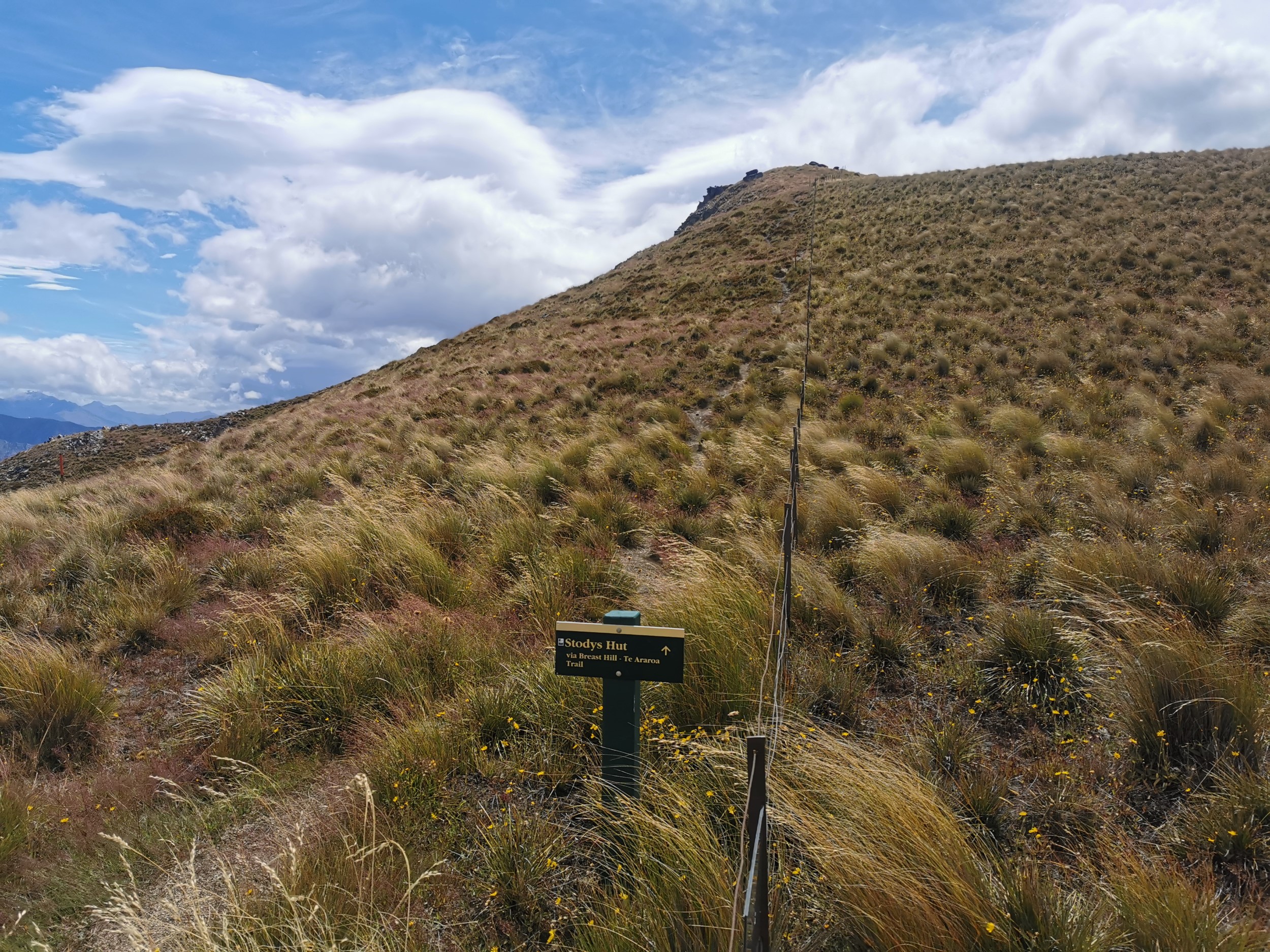
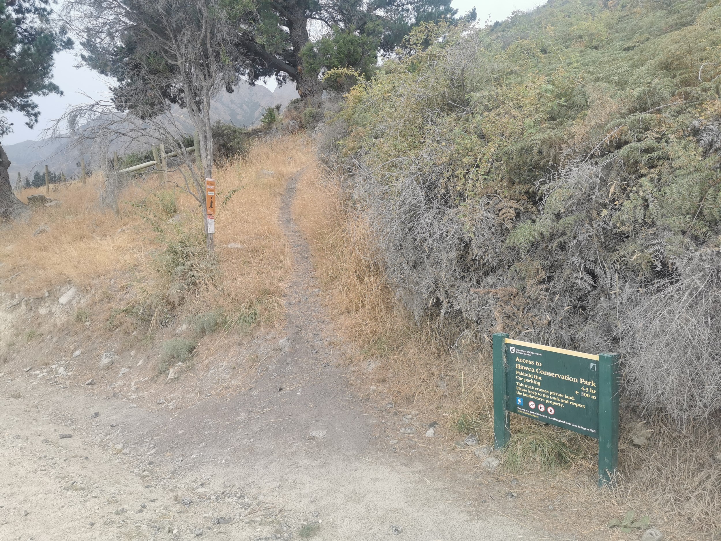
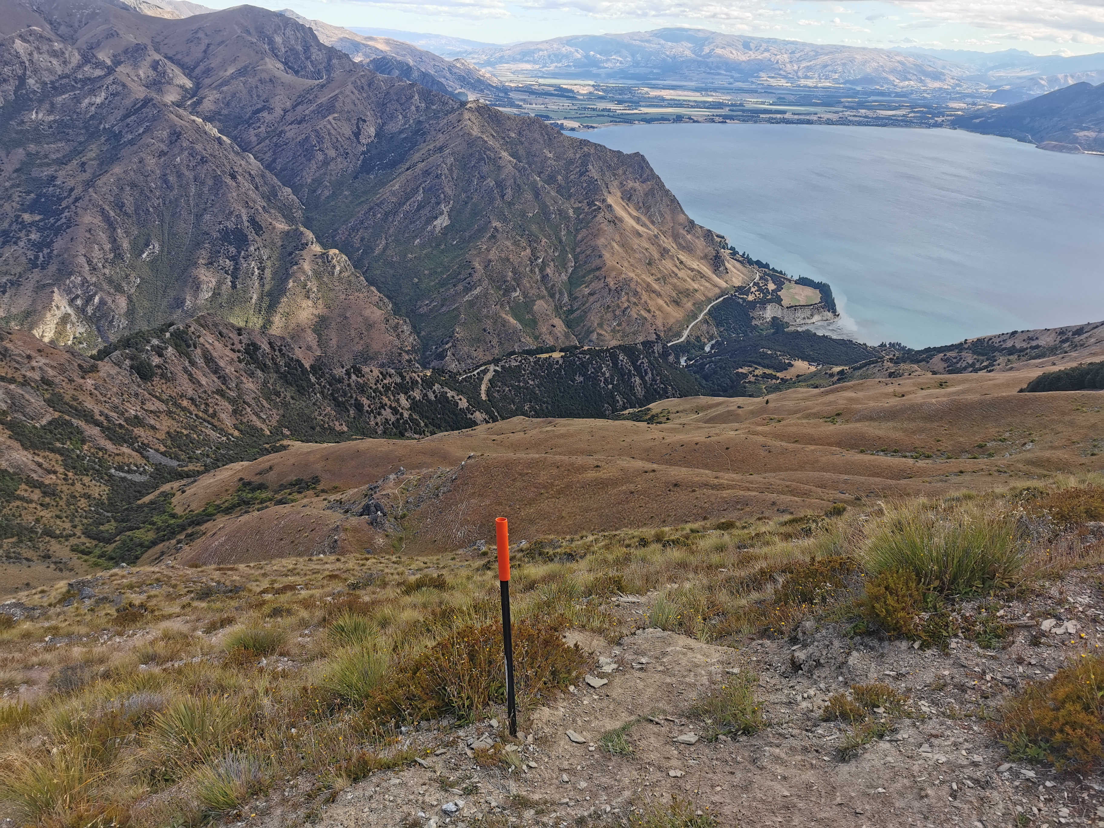
This time I walked to Pakituhi Hut with the intention of taking the slightly shorter and flatter 4WD track to Stody’s Hut.
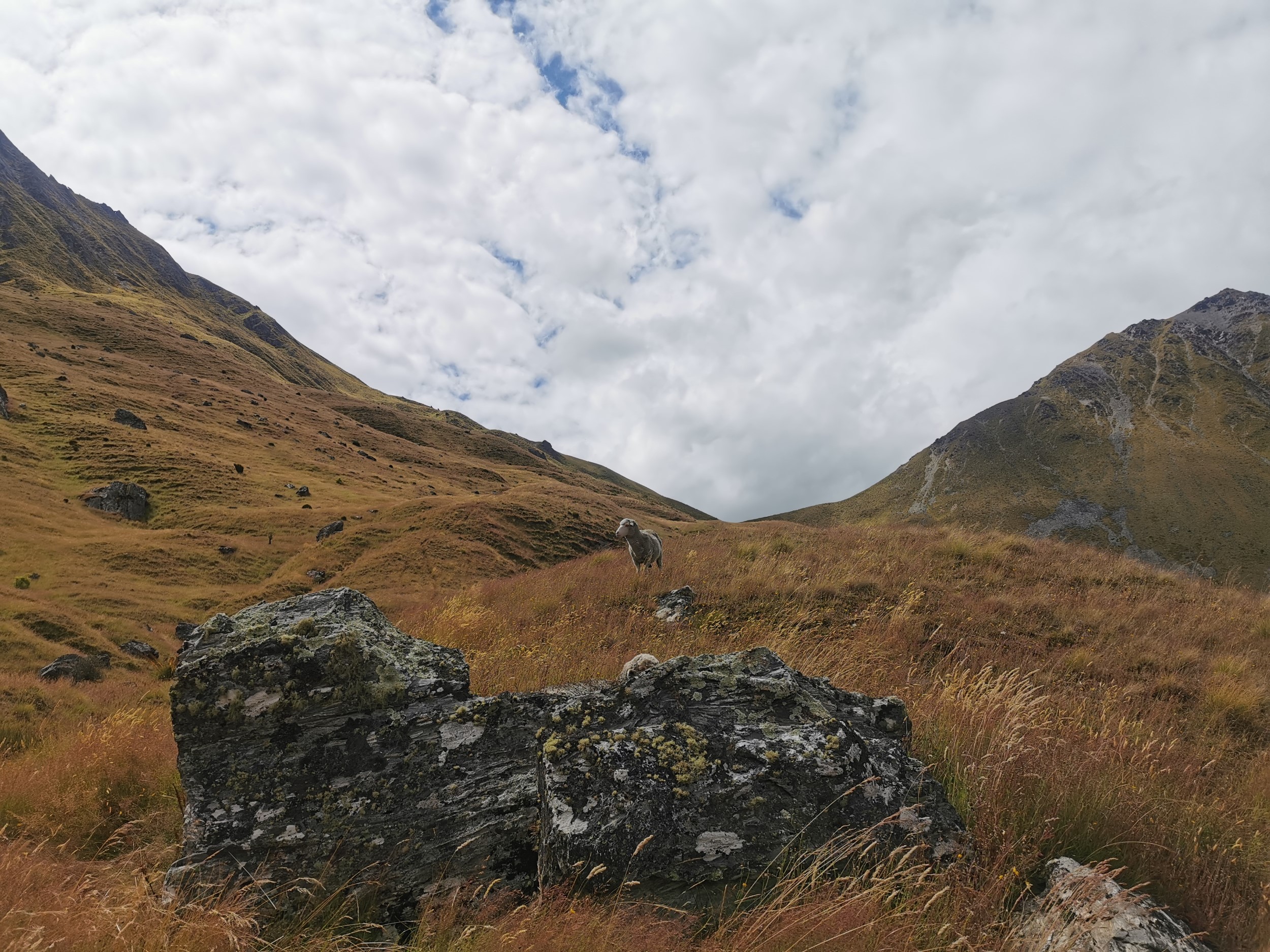
At the hut were Jenny and Tara. Tara was also planning to walk to Stody’s Hut and Jenny was spending the night at this hut. We had a chat about the trail, but then we got into a conversation about whether or not water needs to be filtered, and she seemed offended when I said I wouldn’t drink water that had flowed through farms. As a farmer herself, she didn’t seem to like that comment.
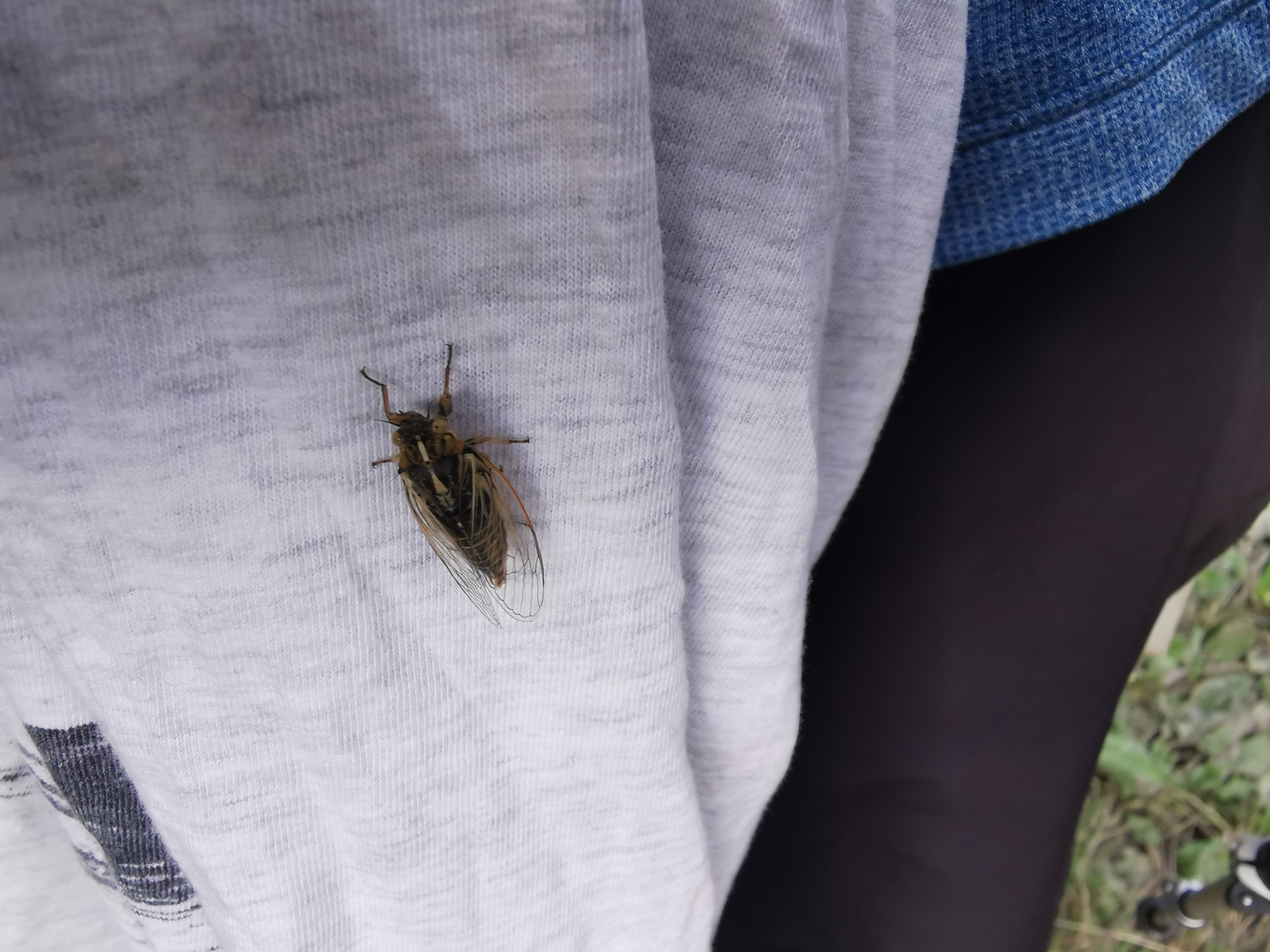
The track to Stody’s Hut was more “undulating” than flat like I remember it, again I put that down to not being as “trail fit” now as I was last time I was here. I saw at least 10 other hikers going southbound, I lost count after a while. Some of them stopped to talk to me, and some of them didn’t! Another thing I saw a lot of was cicadas, and I heard them too. Every 30 or 60 seconds I seemed to get hit by one whacking me in the face.
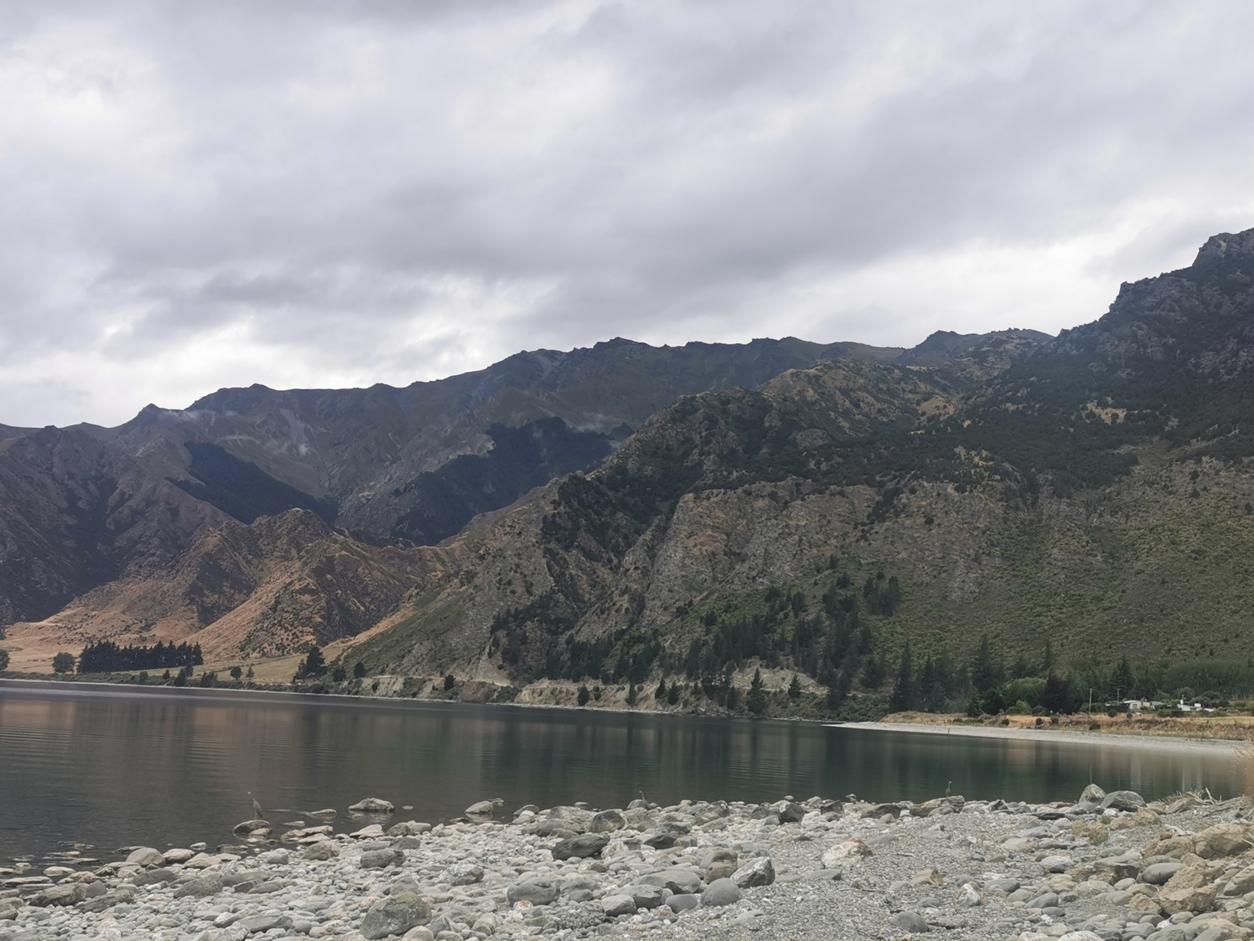
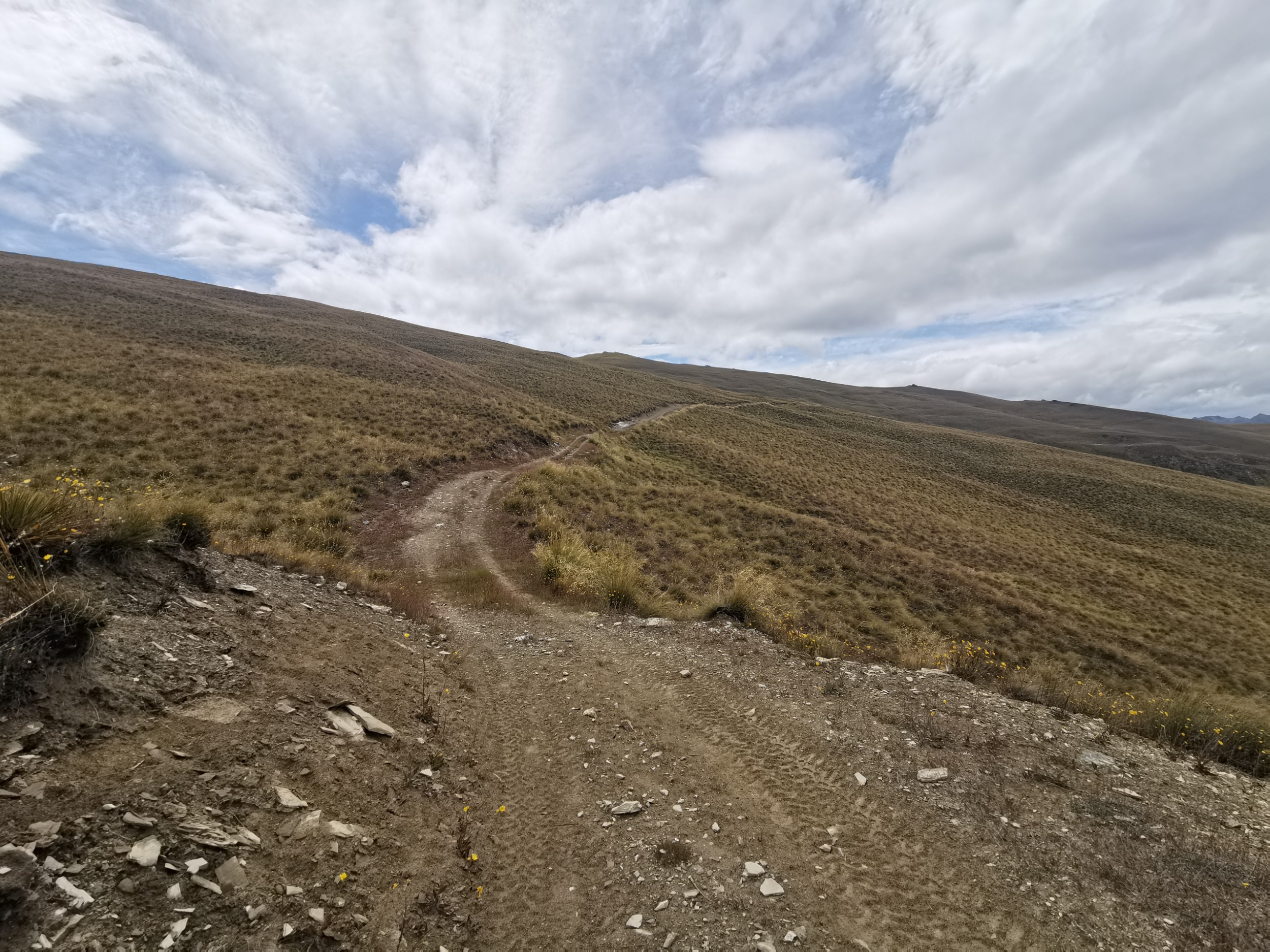
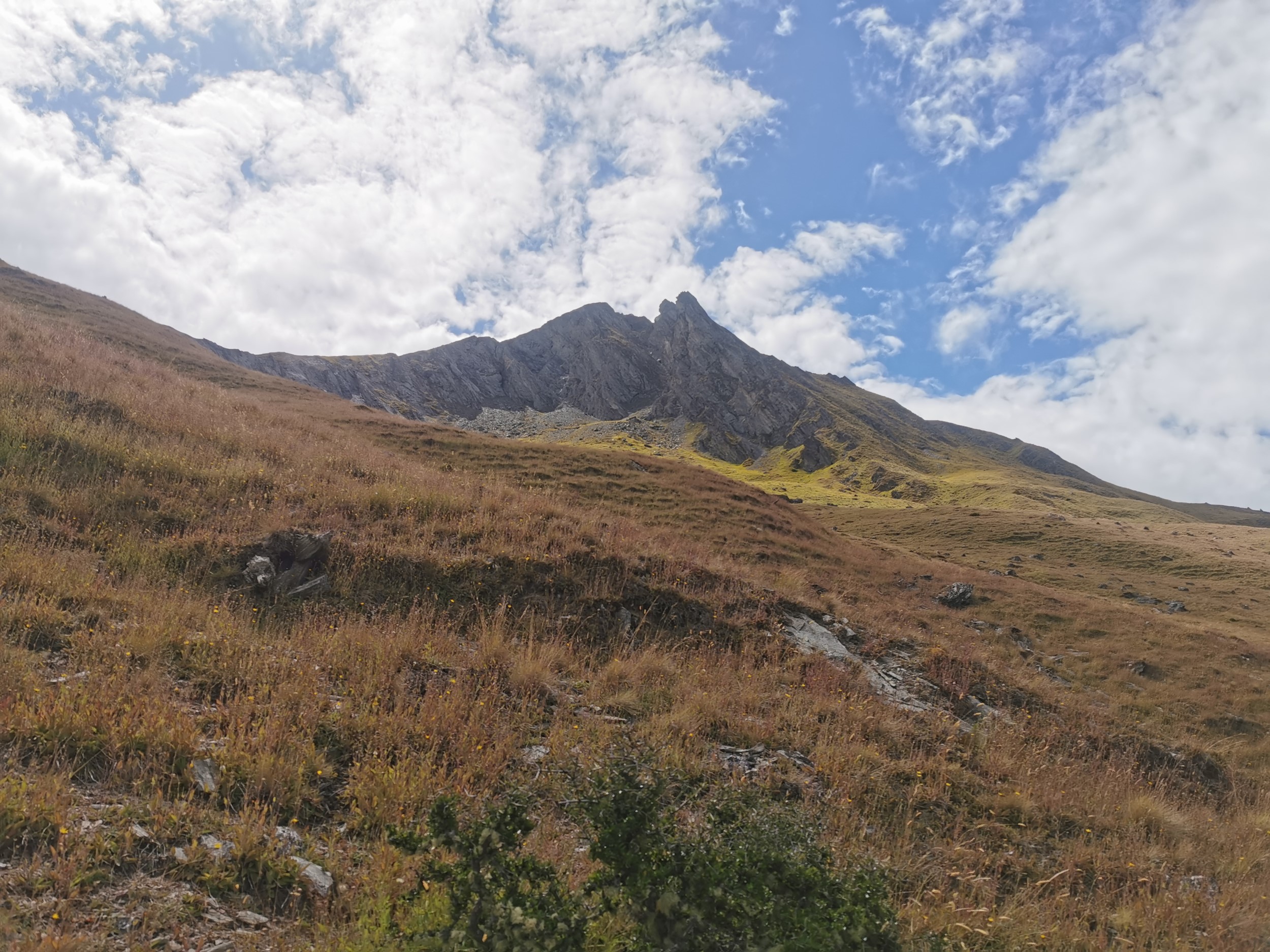
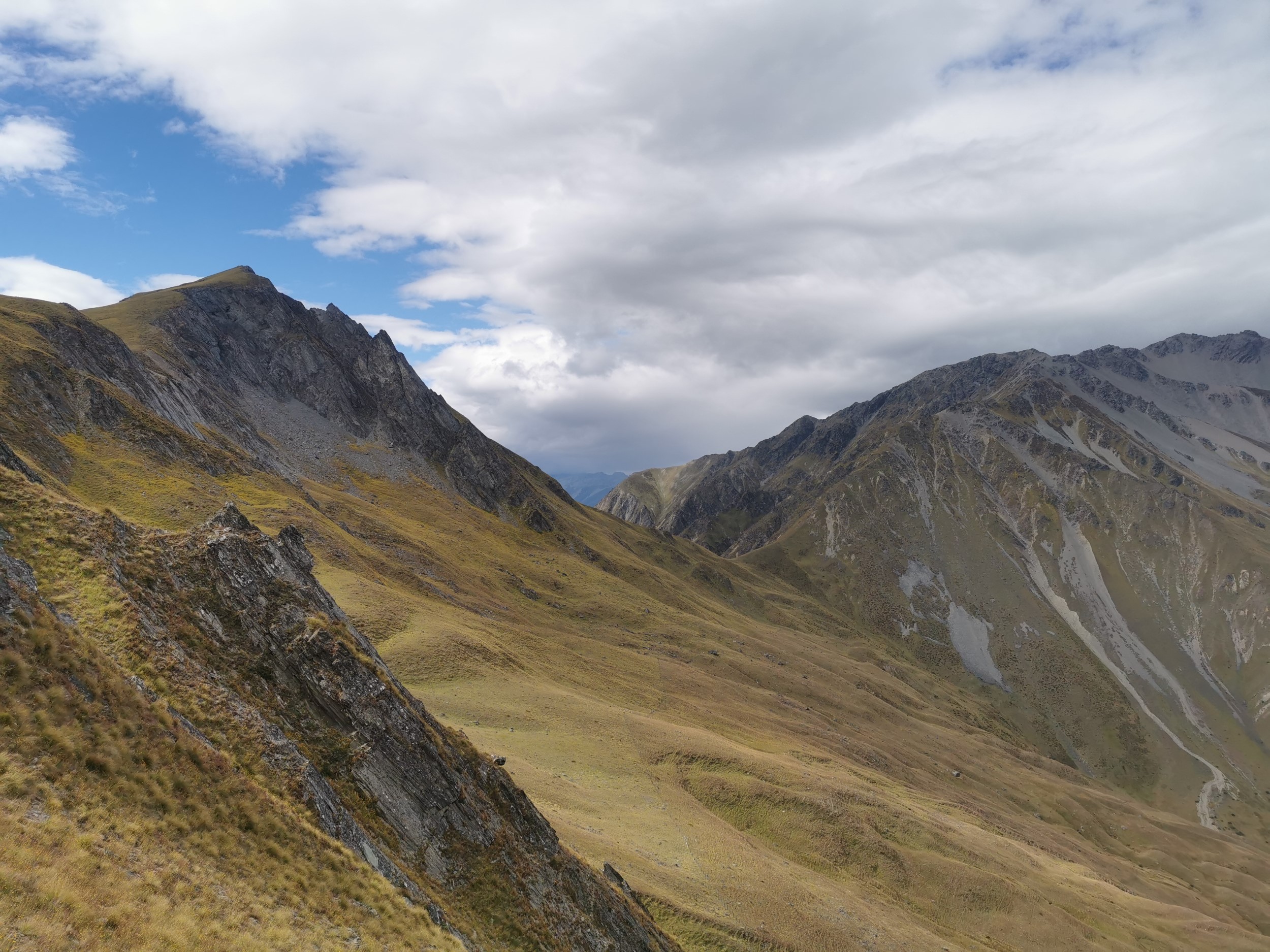
At the point above the track turns and goes downhill towards Stody’s Hut. I could see in the distance the hills I might be climbing in the next couple of days (if my sense of direction is right).
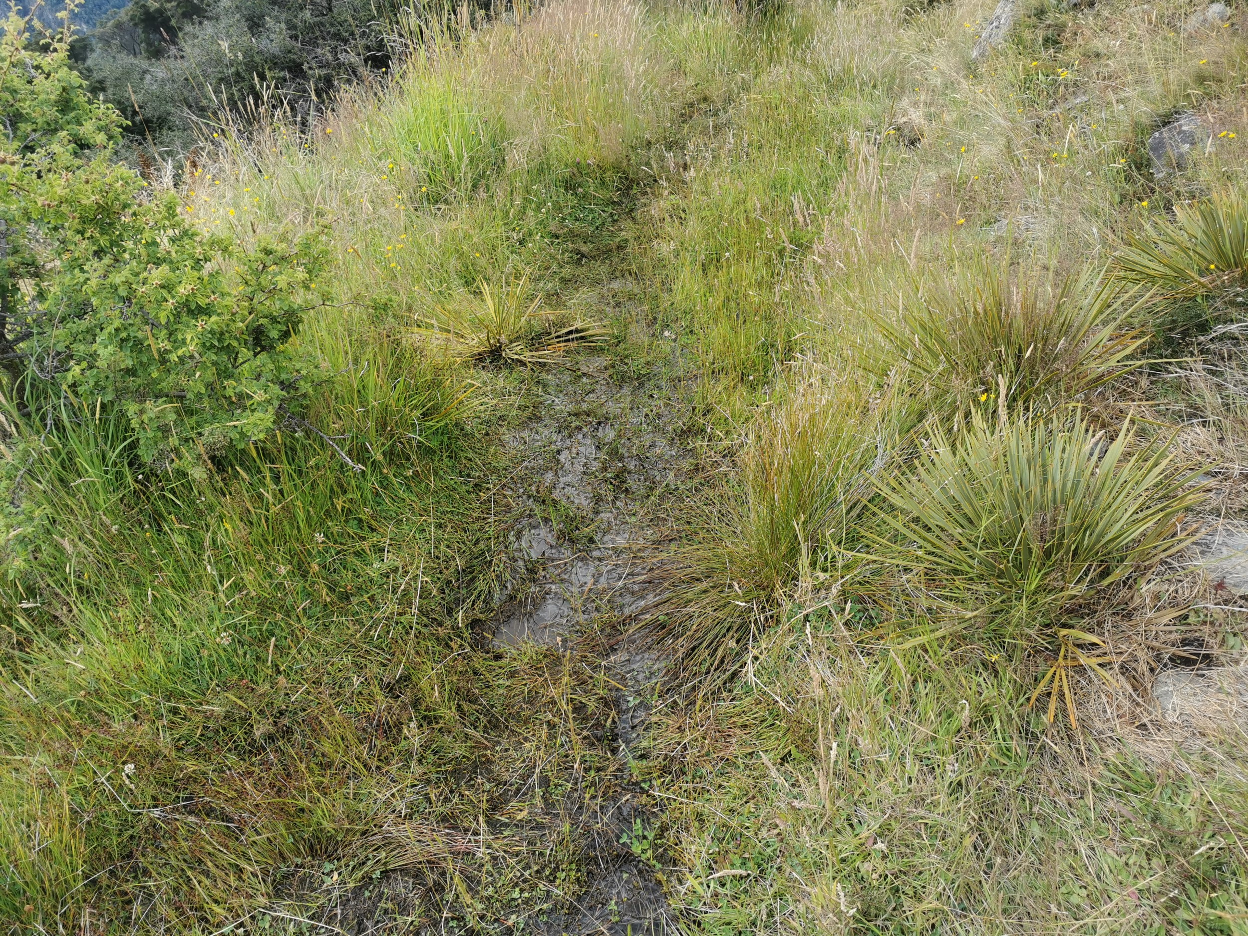
I encountered the only piece of mud on the entire trip a couple of minutes before Stody’s Hut.
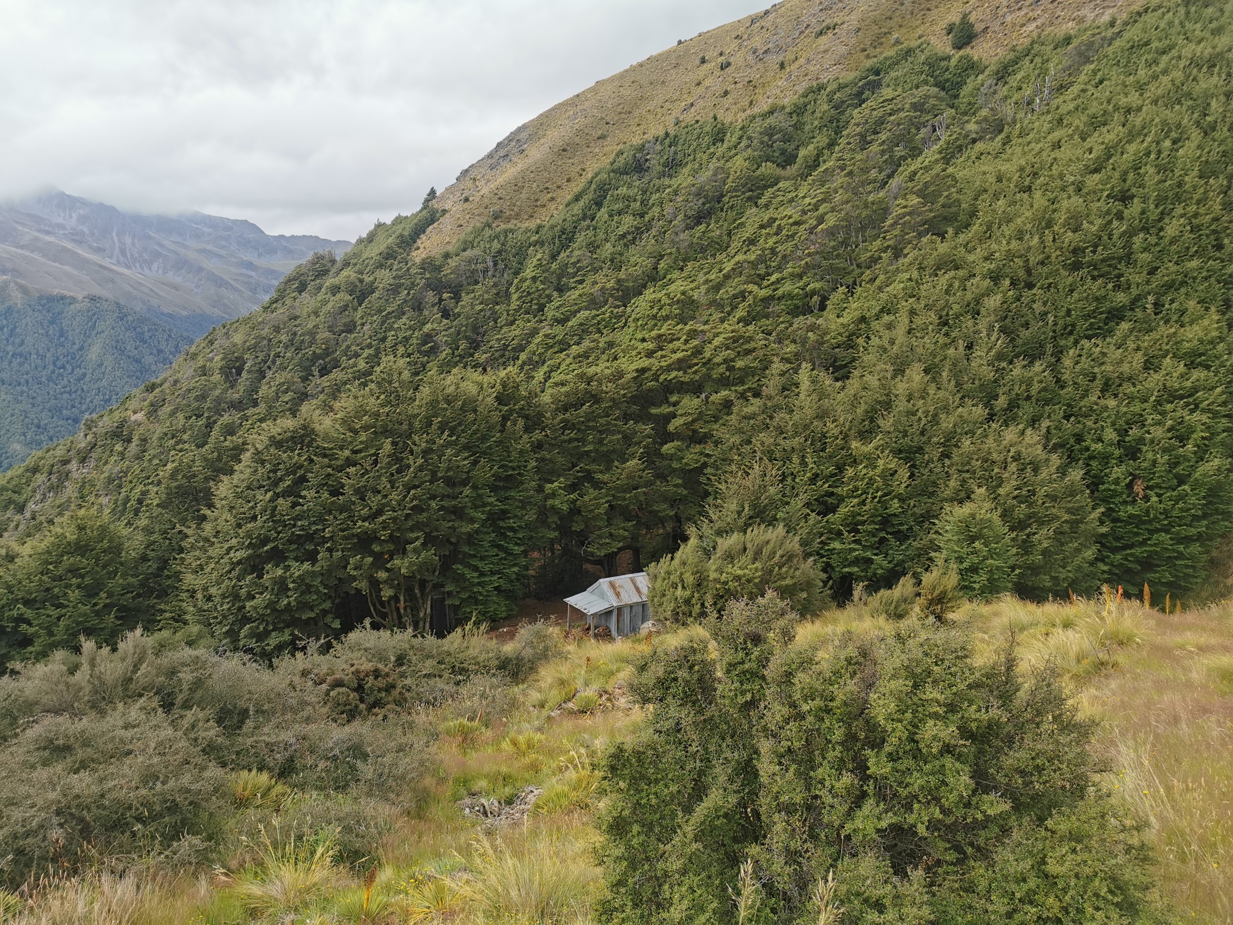
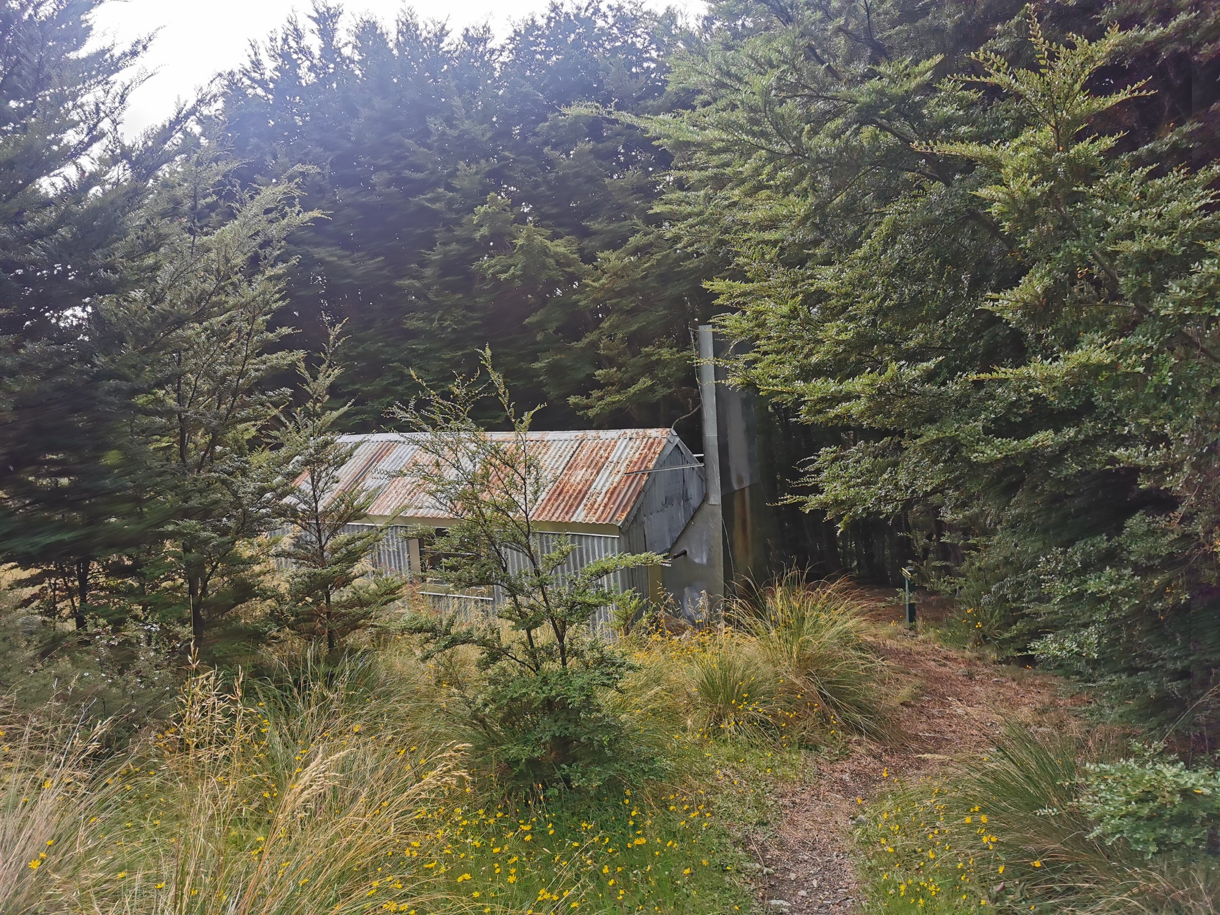
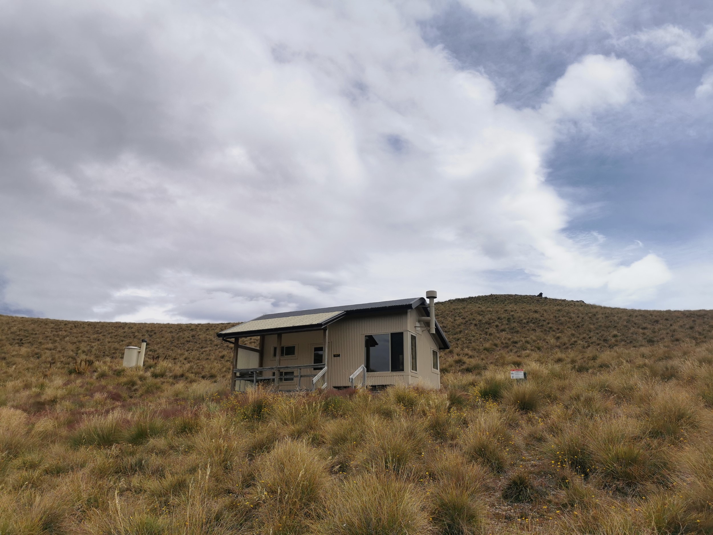
When I walked TA I only took one fleeting photo of the hut, so I made sure I took a few extra photos this time.
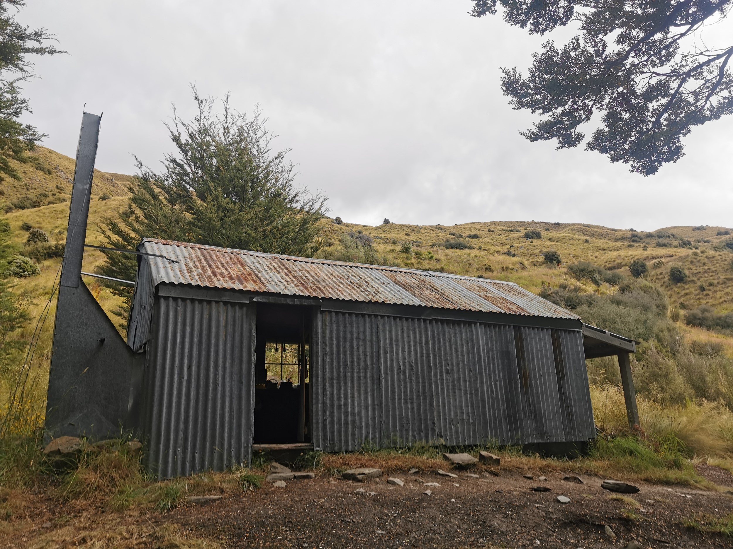
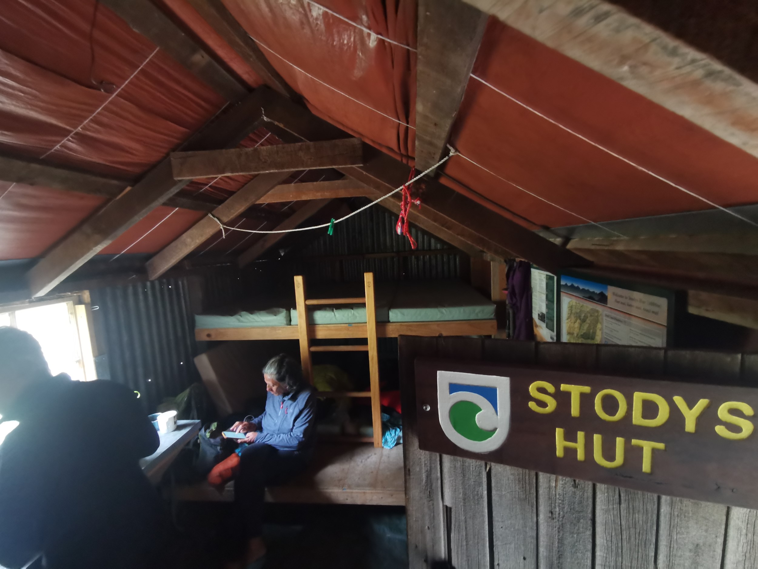
Stody’s Hut was nicer than I remember it, still one of the older and more basic huts, but they had patched holes in the roof and there was new roof and floor lining. I shared the hut with Tanya and Bev. I didnt want to be alone in Stody’s Hut but I also didn’t want it to be full, so having two others there was the perfect amount.
Tara also turned up but camped in her tent, and also another camper turned up. I didn’t catch his name but he was dressed in a business suit with a collar. Very fancy.
The thing I remember most about this hut from last time I was here is while I was having lunch, they choppered in a new intentions book, and I was first to sign it – other than the DOC guy who brought it in. I wondered if the same intentions book would still be in place nearly three years later… let’s find out!! I didn’t expect to be, because at Pakituhi Hut, the book was quite new.
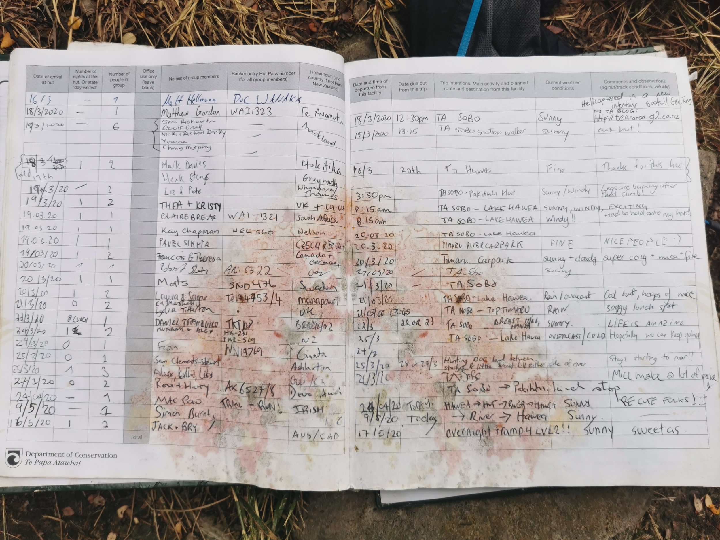
Wow I’m still in there, still at the top of the first page! I was so excited. I’m not sure why I was so happy, but just knowing that I was looking at an actual moment from Te Araroa back in March 2020 felt really good. Although I had no idea what the massive red stain was. It looks like somebody sat on it.
One other thing you can see from this page is the big absence of entries during the time of the first major COVID-19 lockdown which started on the 23rd of March 2020 and went until some time in May. I wonder how the people who had signed in on 23 March fared during the lockdown. They wouldn’t have even known about it being way out here with no phone signal.
Blog post continues below the map…
Today's walk on the map (blue = Te Araroa, red = today's walk):
DAY 2 (3 February 2023)
Total distance: 22.73km
It rained overnight, which wasn’t a surprise given the grey clouds visible for a large part of yesterday. But when I left at 8:30am, the skies were beautiful.
That made me quite happy, because I knew that to get to Moonlight & Roses Hut, I would be walking up the Timaru River and also a side creek for a large part of today. If there was too much rain then either of them might be impassable. At least I knew that if I got stuck, I should always be able to simply turn back and return the way I came (but I hoped that I wouldn’t have to do that).
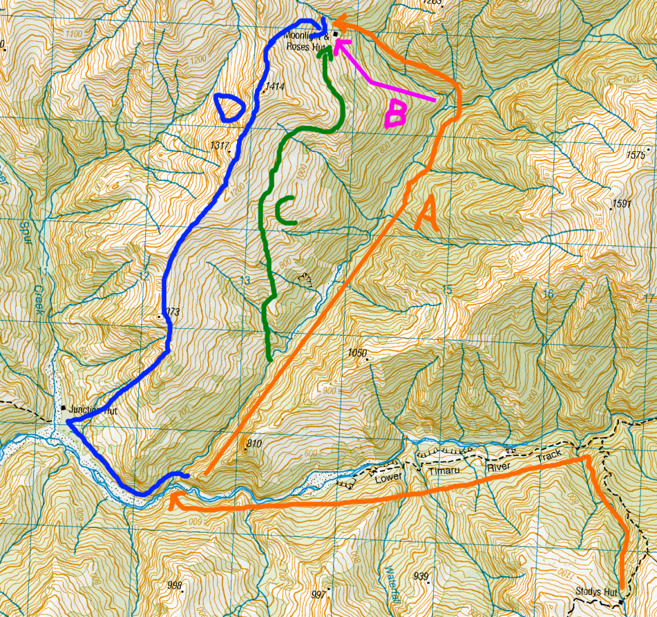
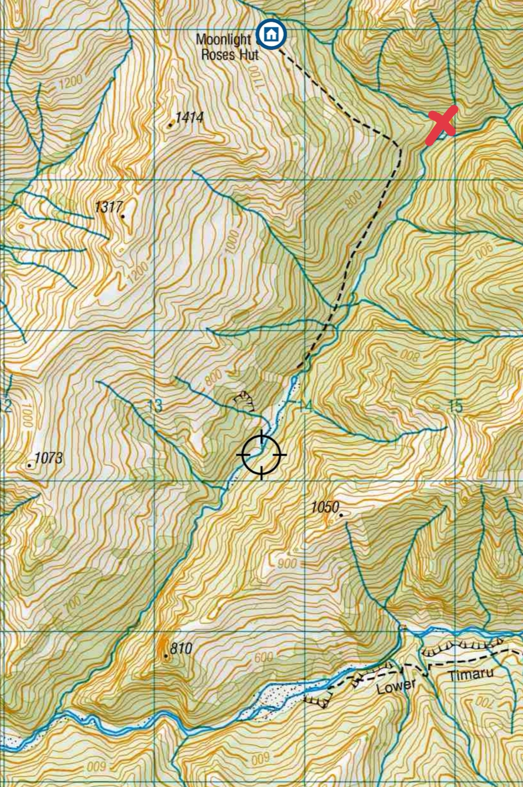
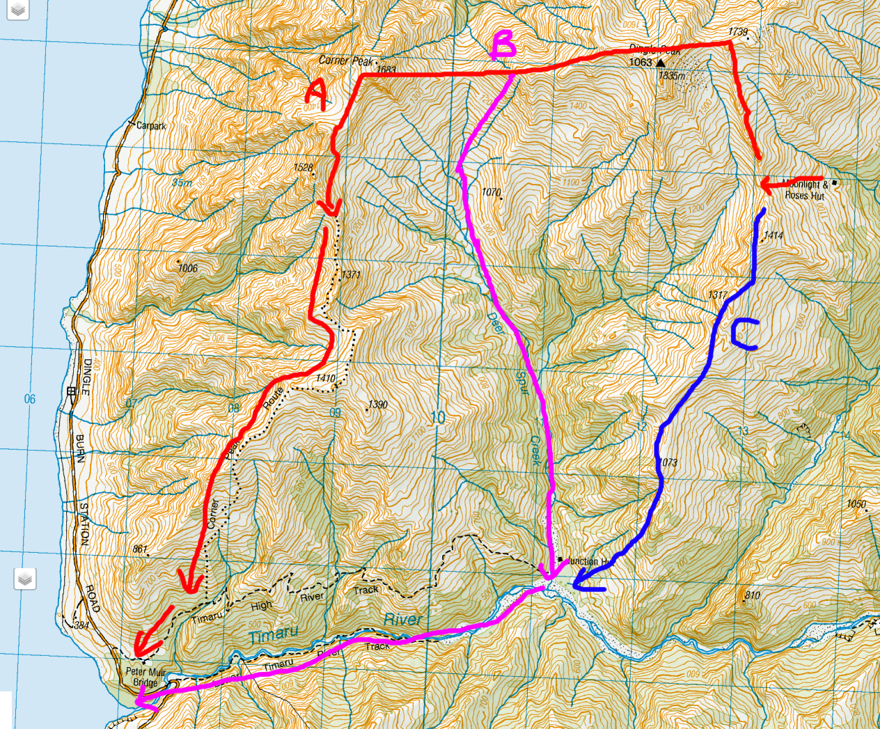
Here’s a map showing what I was up for today. It shows four options to get to Moonlight & Roses hut that I’d planned since I read they might be possible. For scale, each square is 1km x 1km.
From Stody’s Hut I’d be going down the steep hill to the Timaru River, and then walking either alongside the river or through the river for a few kilometers. Then…
- Plan A would have me turning off and following a side creek for 7 or so kilometers, and if it were possible to follow this all the way to the hut then it seems easy. But the terrain looks like it might get too steep, especially closer to the hut where the creek turns west.
- Plan B is bush-bashing through the forest from the creek. Some versions of the topographic map do actually show a path here, but I read that it’s long since overgrown and the path can’t even be seen anymore.
- Plan C is finding the shortest route to get me above the treeline, then climbing to 1,000 meters or so and then following the top of the treeline all the way to the hut.
- Plan D is what I understand a few people have done if they come from the west instead from Stody’s Hut – they go to Junction Hut, climb up to the ridgeline and then follow that.
I had no idea how realistic any of these plans actually were, but I was about to find out.
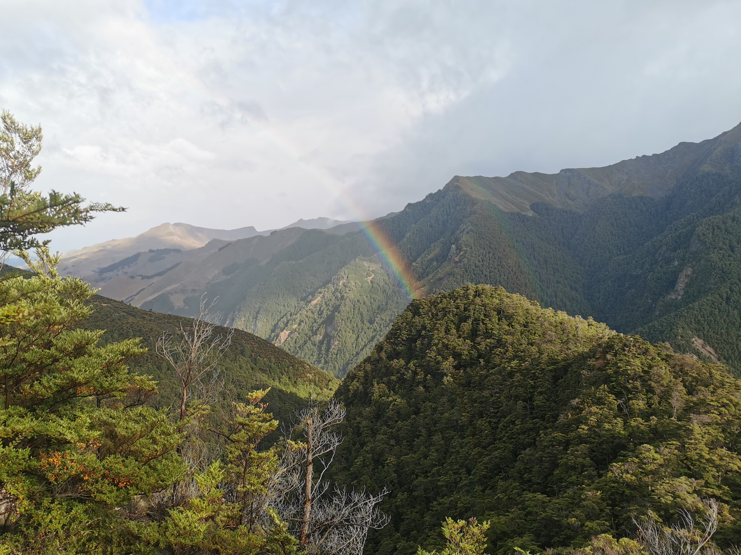
The overnight rain made the steep descent from Stody’s quite slippery and I lost my footing a few times. But at least there was a rainbow.
The descent ultimately wasn’t too bad though, and I made it to the bottom of the hill in one piece.
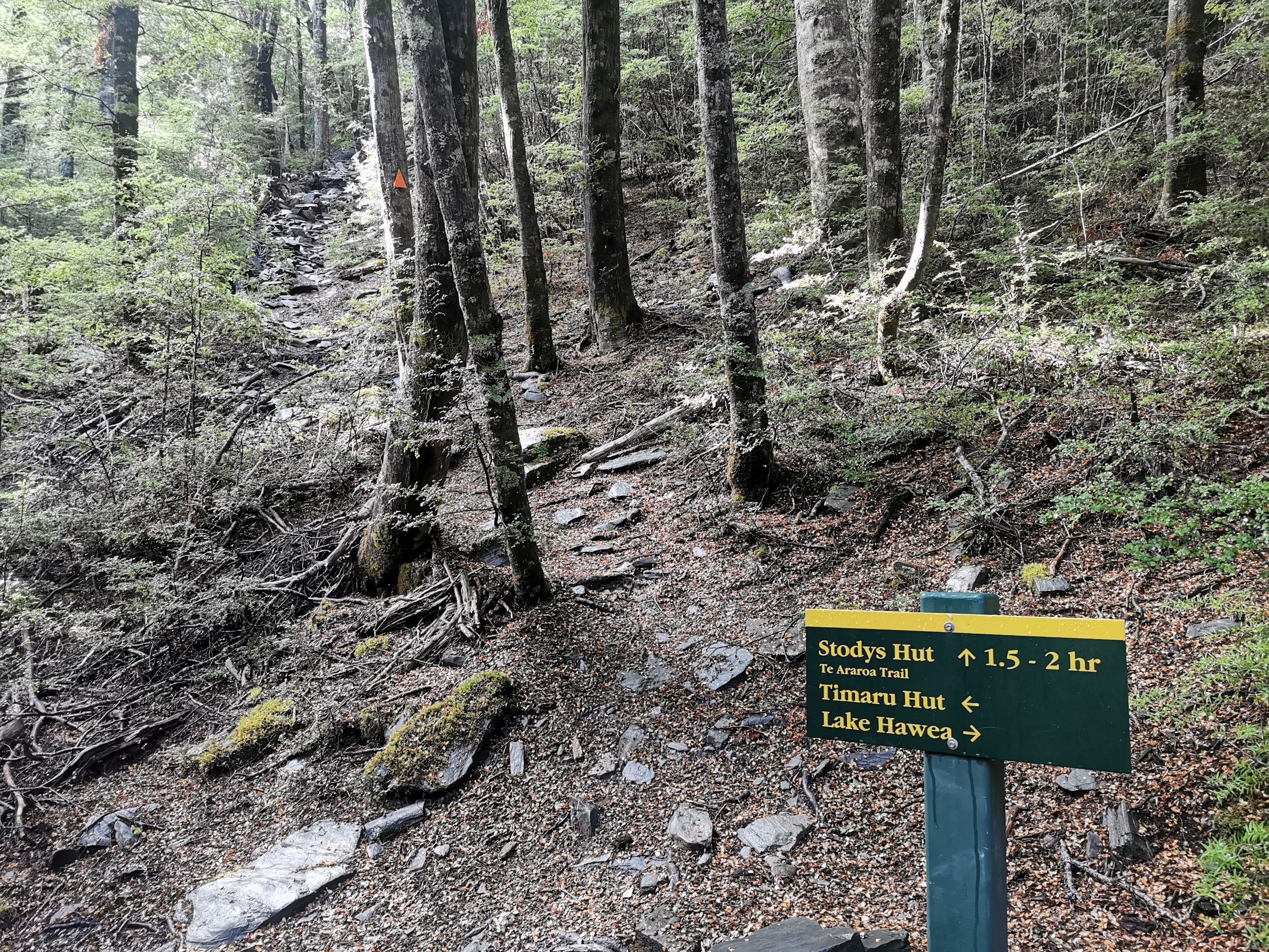
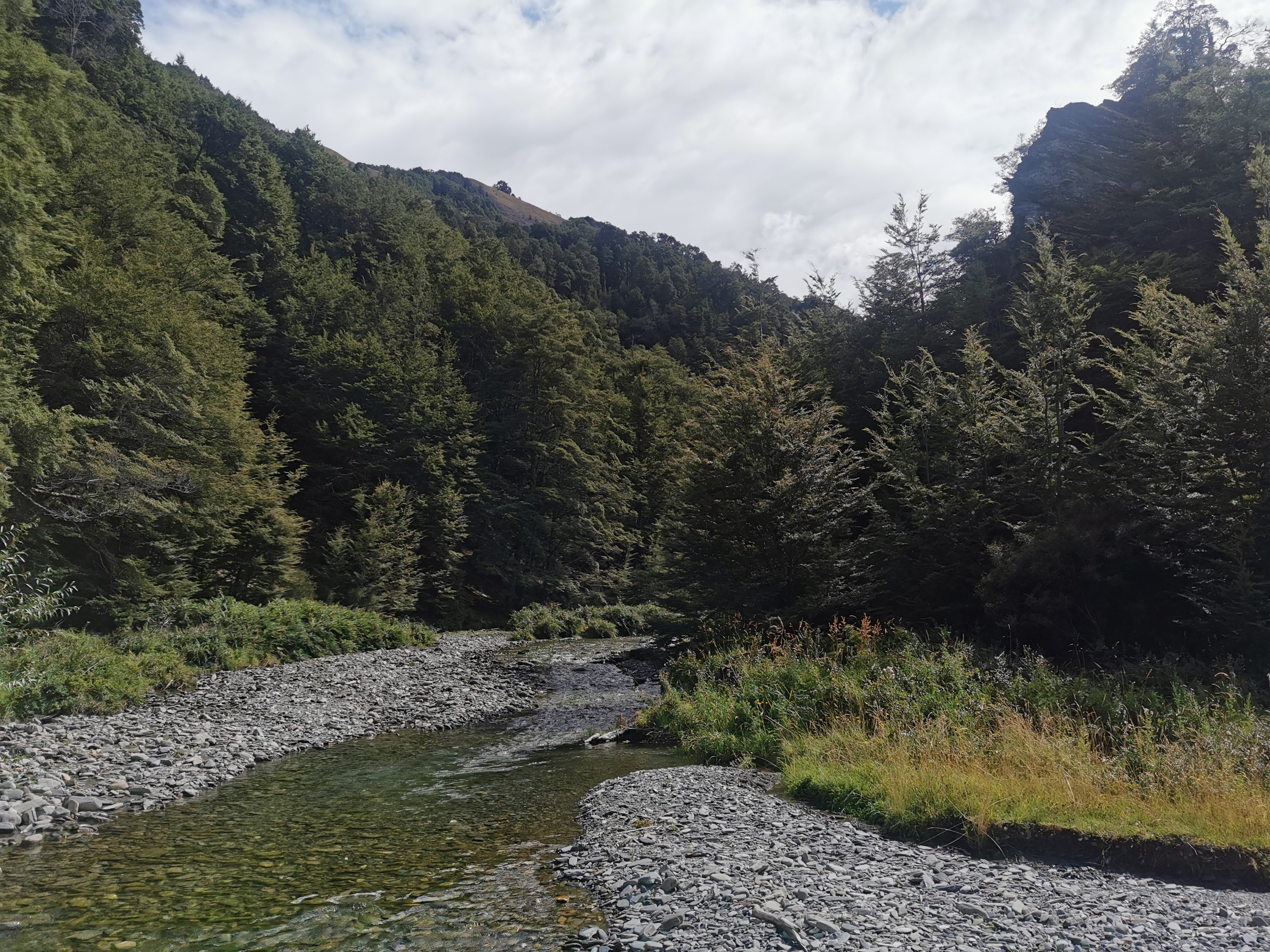
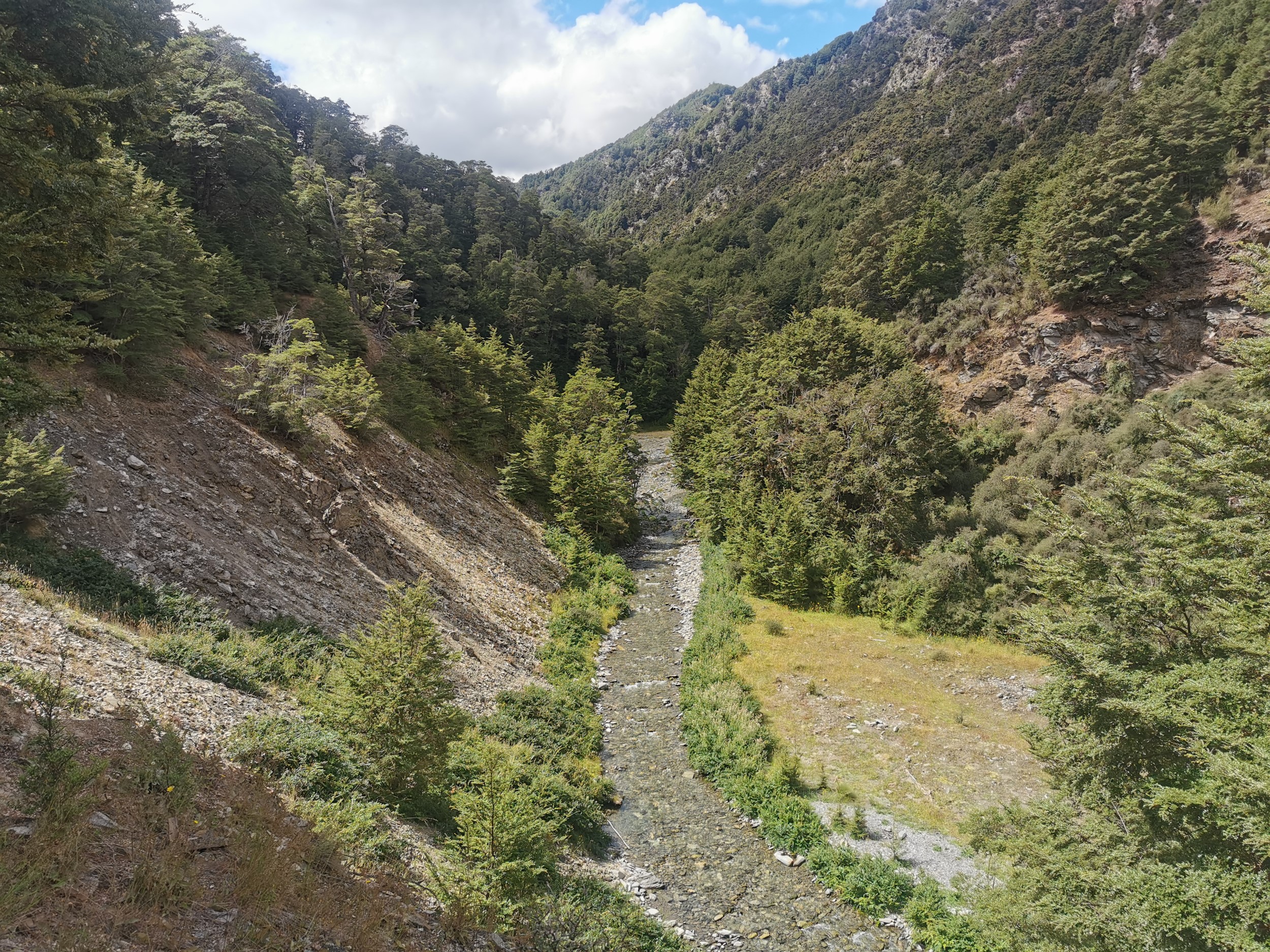
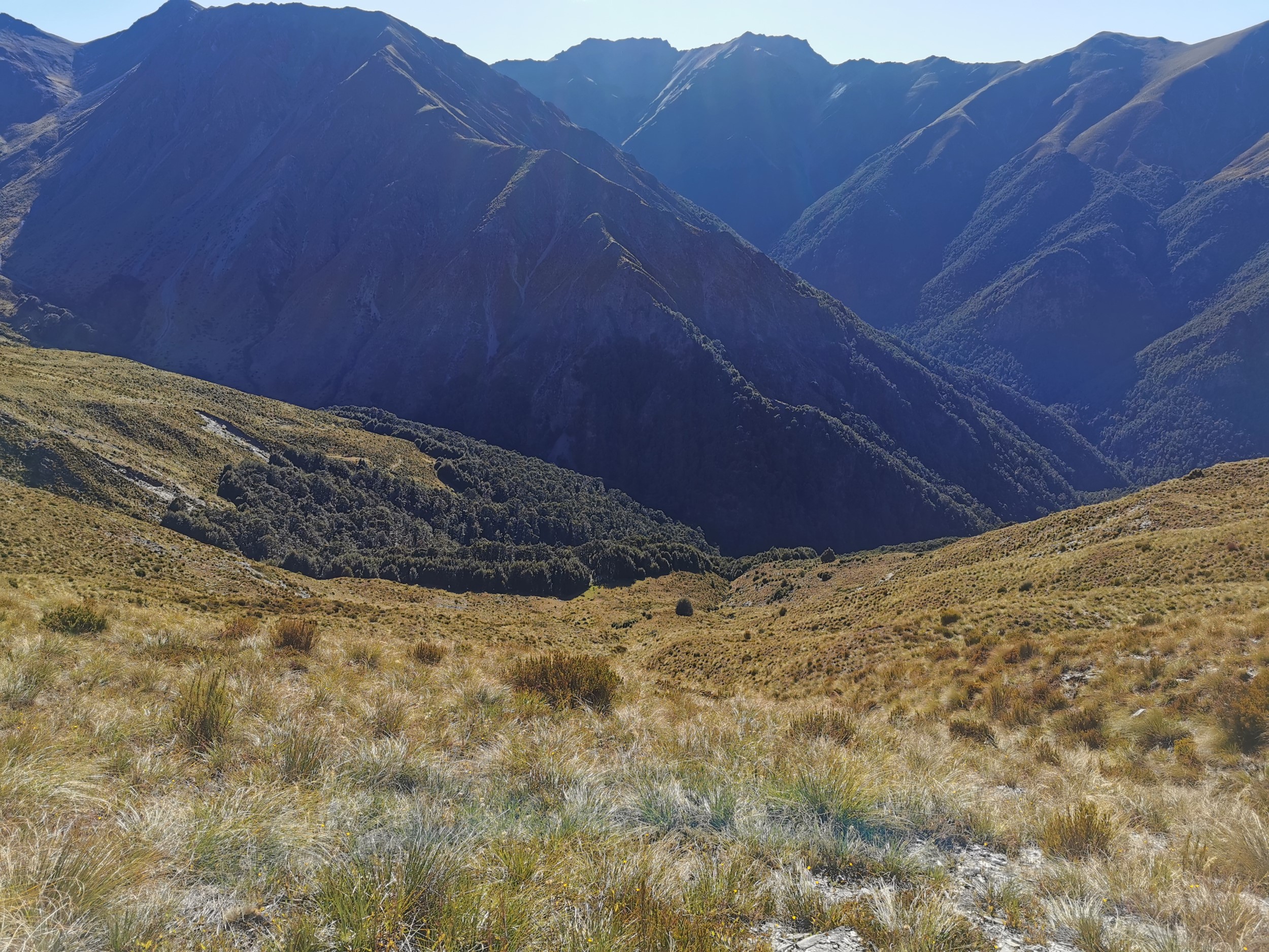
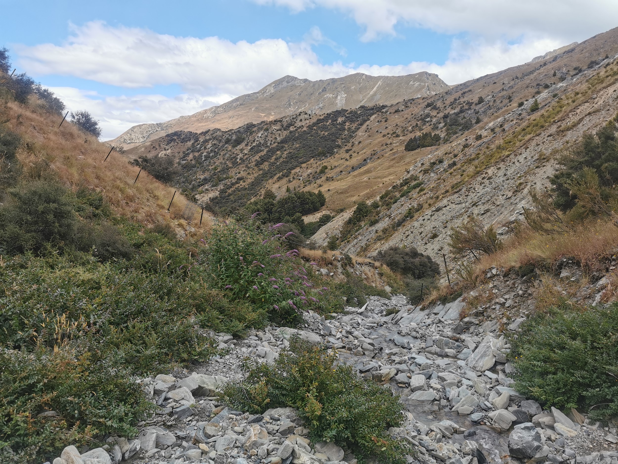
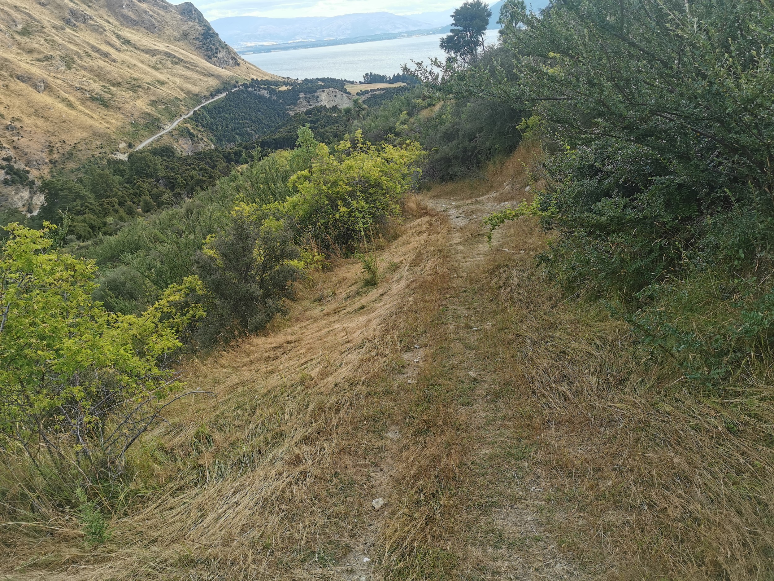
Instead of turning towards Timaru Hut which I would do if I was walking Te Araroa again, this is the point where my trek left the trail. I turned towards Lake Hawea and started walking down the Timaru River. Now I was off Te Araroa and suddenly it got a lot more isolated.
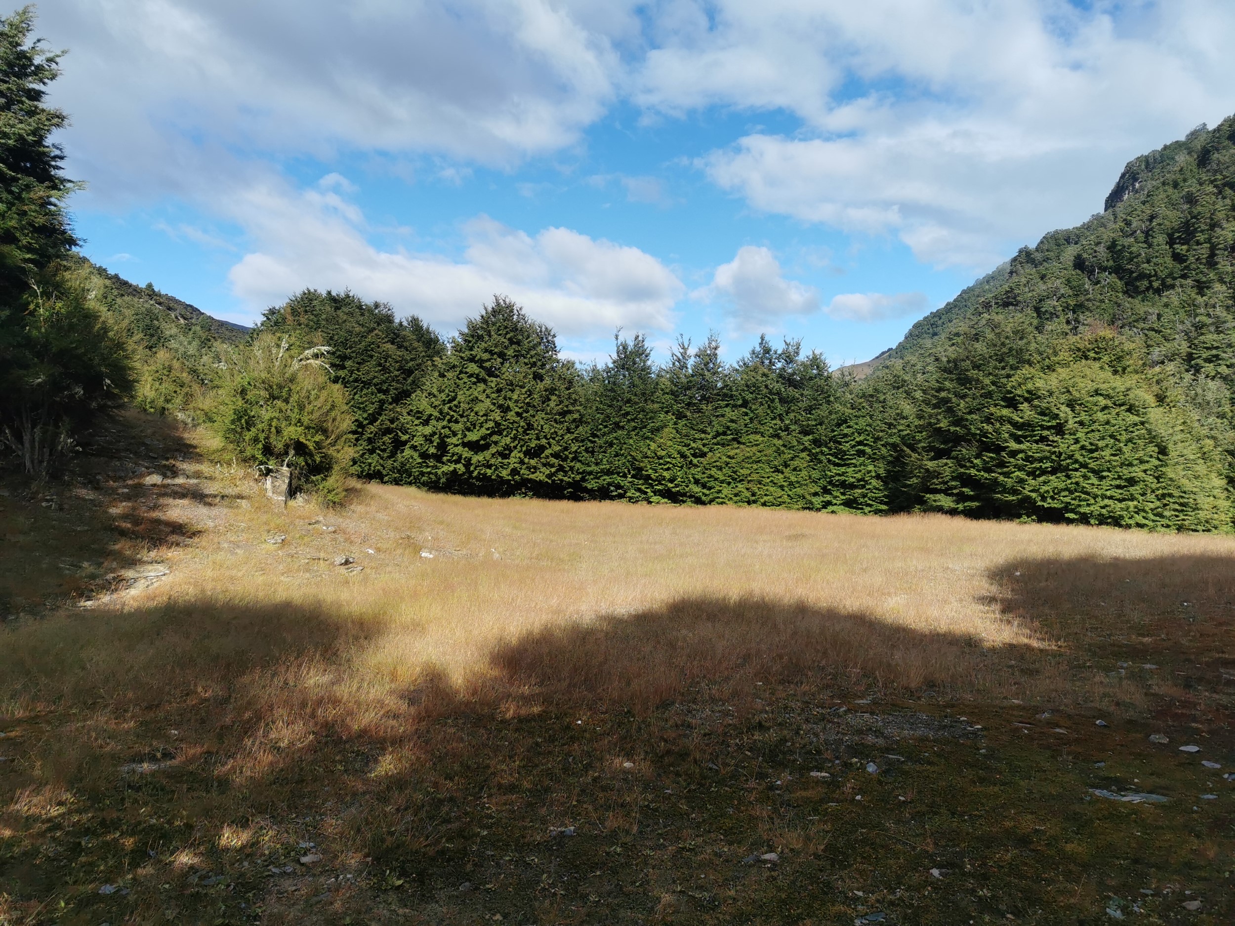
The track was through the forest at first but after a short time it went in and out of clearings and through little patches of Matagouri.
Then the path went down towards the river. This part of the hike is still an official DOC trail, so I still have the benefit of following orange markers.
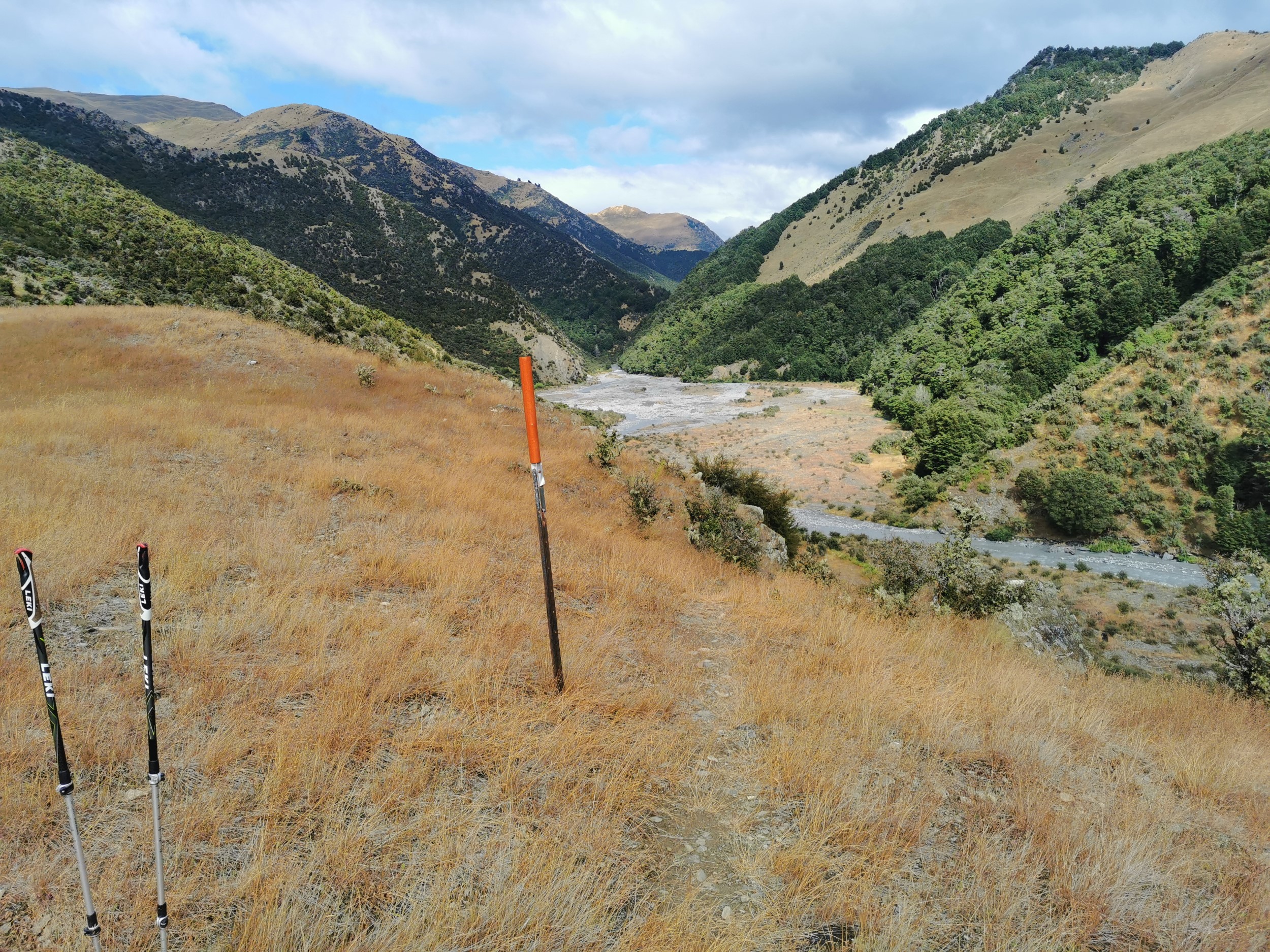
Not long after this I was walking in and out of the Timaru River.
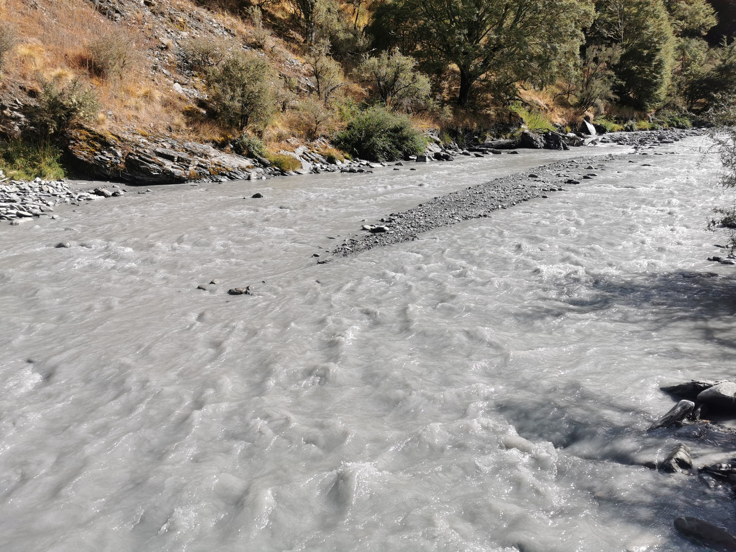
The river was really nice to walk in, but for some reason it was a grey silty colour and I couldn’t see the bottom. That was a bit unnerving but despite that it was fairly obvious that the river level was very low and I knew I’d be turning off the river after a short time. I met a hunter partway down the river. We had a chat and he said that I was about two hours from the river exit. I don’t know why I didnt tell him that I wasn’t just walking straight towards the exit and that I was trying to find this obscure hut. I thought afterwards maybe I should have mentioned it, he could have given me some tips. Oh well. The hunter turned out to be the last person I would see for 48 hours, until I got back to Lake Hawea.
I soon reached the point where the map said I had to turn and go up the side creek. As expected, there was no signpost or anything, so I had no idea what to expect. It turned out to be a six or seven kilometer walk up a very beautiful creek which never got more than knee-deep. It was very warm and very clear and an extremely pleasant walk.
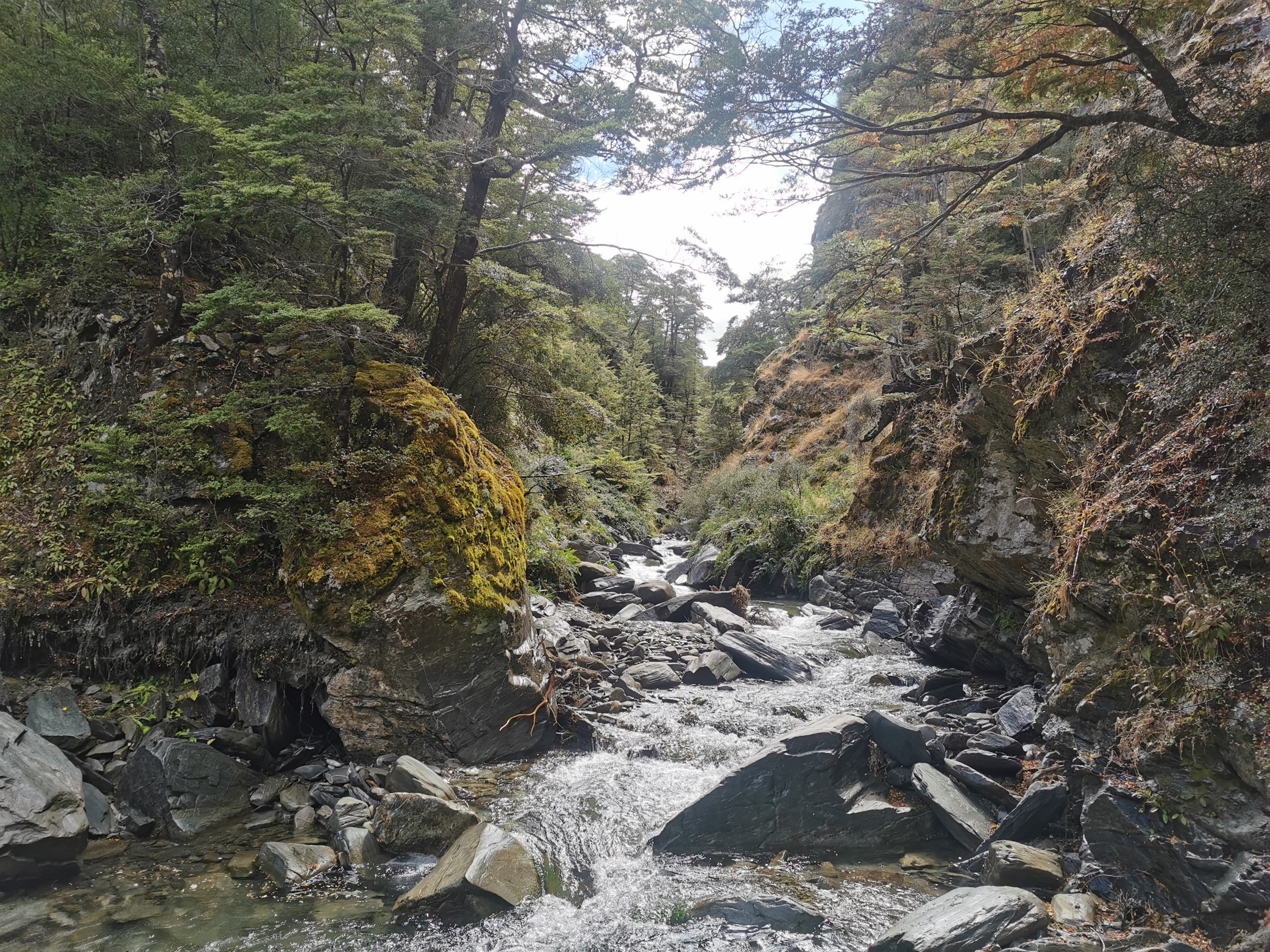
I constantly kept an eye out, looking at the sides of the creek so that if neither Plan A or B worked out, then I could find a way up into the hills and walk above the treeline. However that looked difficult, the sides of the creek were generally covered in thick bush.
It was very pleasant walking up this creek. I hoped that I could follow it all the way to the hut. But sadly, when I reached the point on the map where it turns and goes up the hill, it became impassable quite quickly. So that meant Plan A was out.
The map above shows how it looked on my phone, and on there, you can actually see this version shows a path to the hut. But, while I was walking I was always looking out for this path, and I certainly never saw it (and other blogs said the same). But if I did feel comfortable just walking directly up the hill through the forest from where I was (marked by red X) then I’d reach the hut. But I’d read from other blogs that walking blindly through the bush was slow going, and given that I was on my own and it looked quite steep from here…
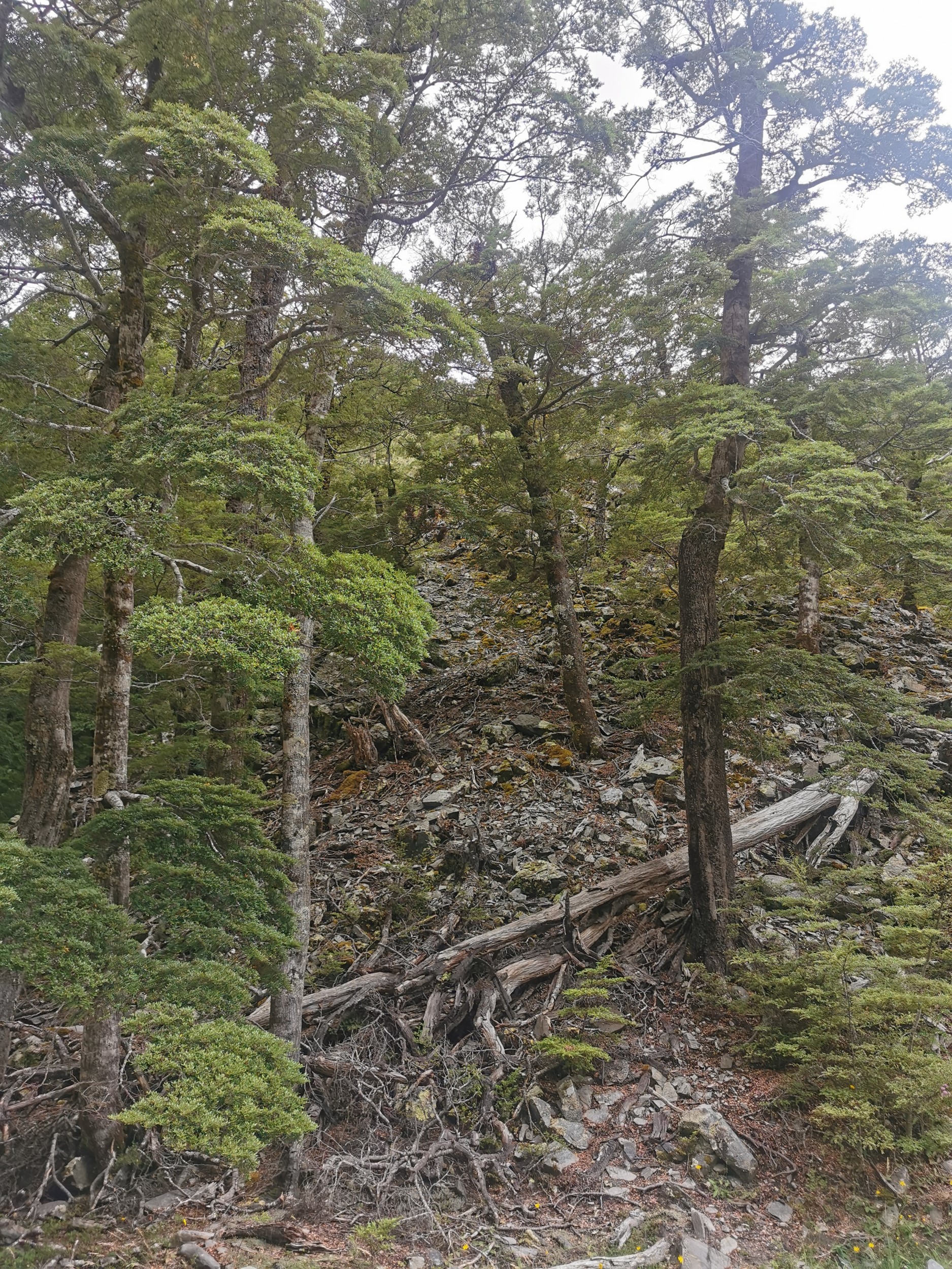
I just didn’t feel comfortable. At this specific spot it looked like I could make my way through the trees, but there was at least another kilometer through the bush to the hut, including a 200m increase in elevation. Who knows if I’d be able to bush bash the whole distance to the hut, and if I suddenly became stuck and disorientated then I didn’t know what I’d do, and it might not be easy to retrace my path to get out. I was worried I’d become stuck in impenetrable forest with no idea where I was or which way to go. Possibly an overreaction, since I consider myself good at reading a map and good at following GPS, but GPS often doesn’t work if the bush cover gets thick. So Plan B was also out.
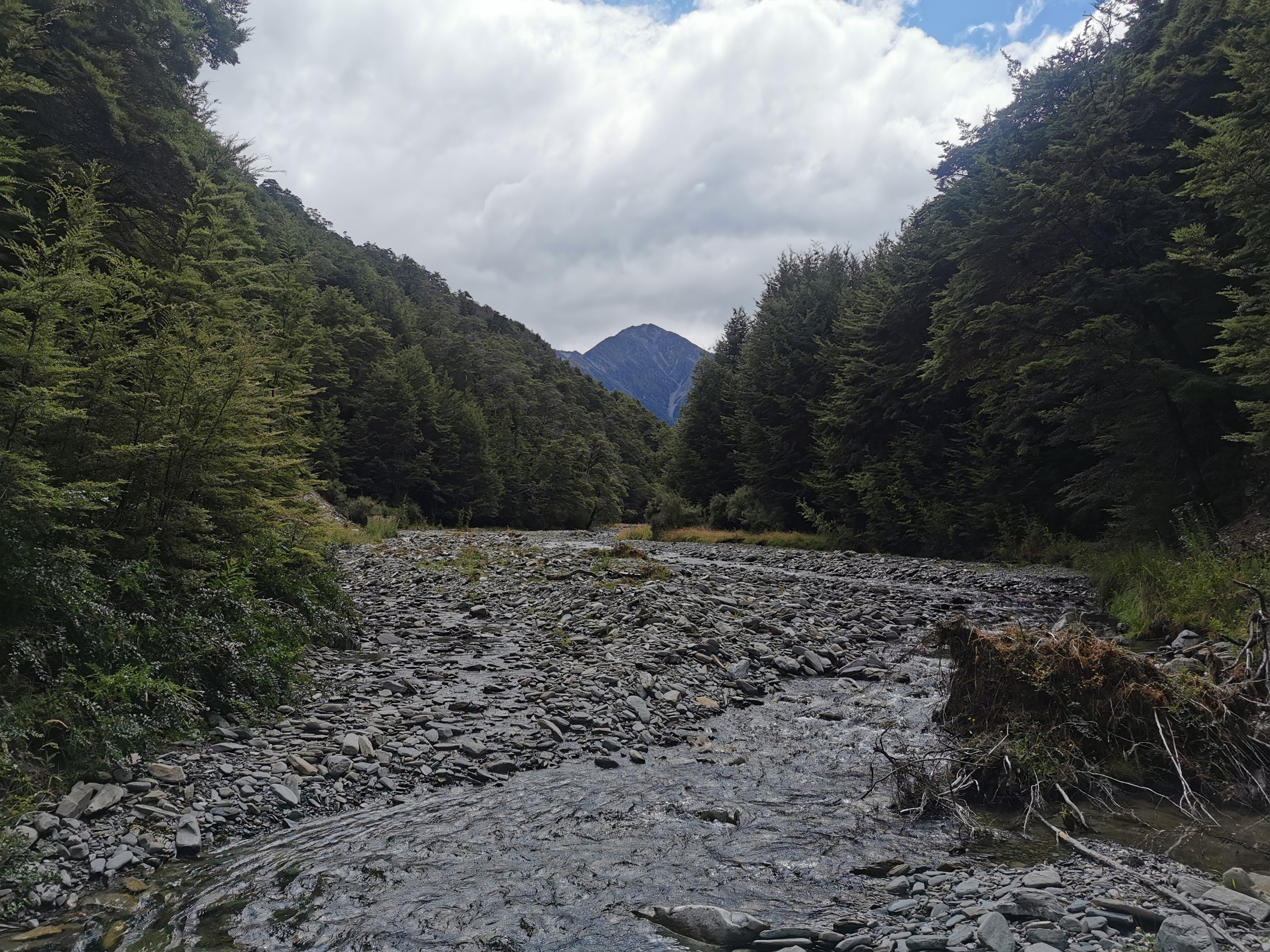
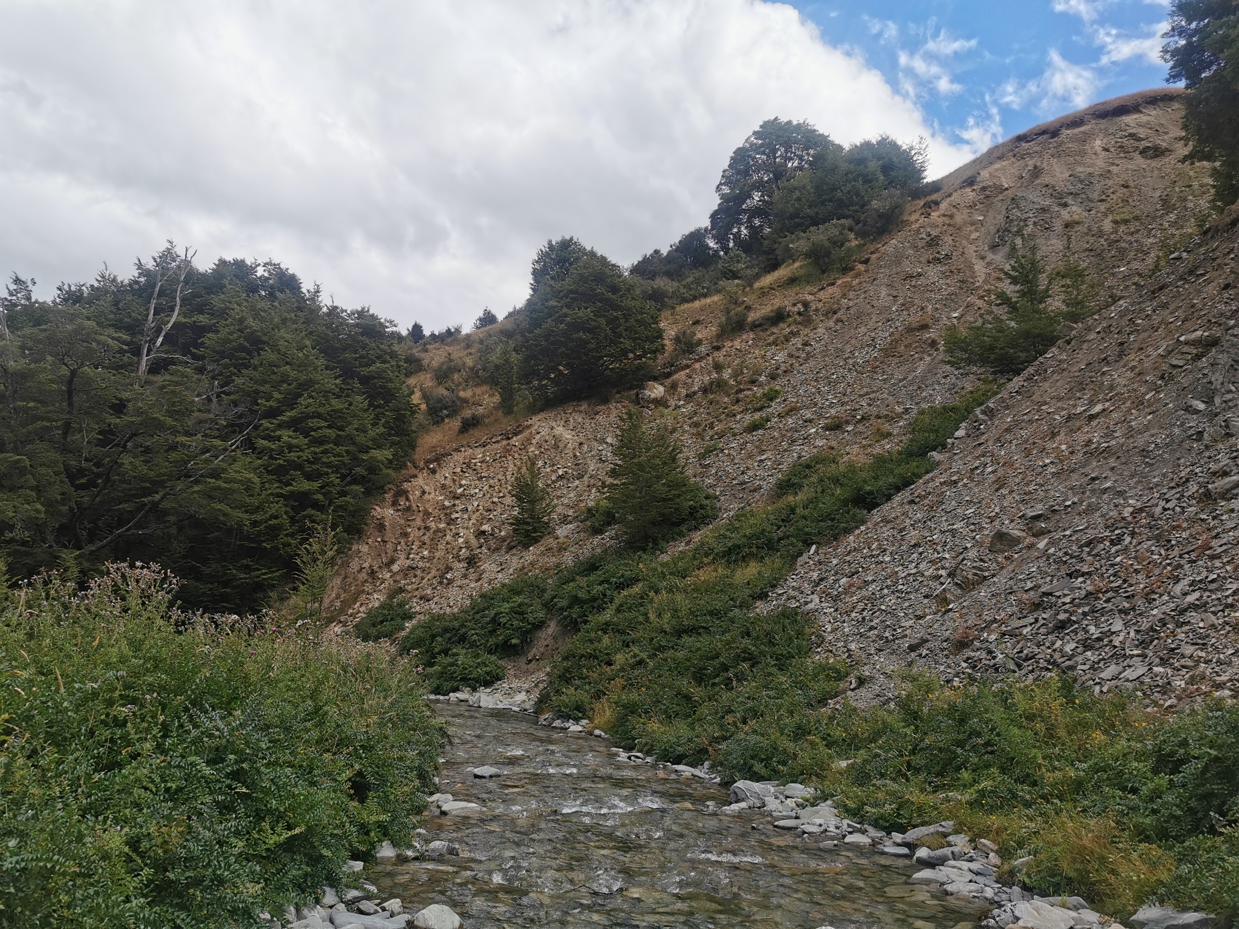
So… Plan C was to go back down the creek until I found some way to get above the treeline. Then it would be a case of following the treeline all the way to the hut. I backtracked for 3km, all the time looking for some way to get above the treeline, but all I saw was again seemingly impenetrable bush and hills that were too steep.
I didn’t really mind the backtracking, it meant I got to walk through the beautiful creek again. Plus just knowing this is not an official trail, and it was so peaceful and quiet was just really nice. However I was aware that if this didn’t work, then my only other option Plan D involved me going all the way down to Junction Hut and taking the ridgeline, but I doubted I had time for that. I was trying to beat Sunday’s rain and so I didn’t want to waste any time. I also wanted to be able to spend some time relaxing at Moonlight & Roses Hut if I ever actually made it there!
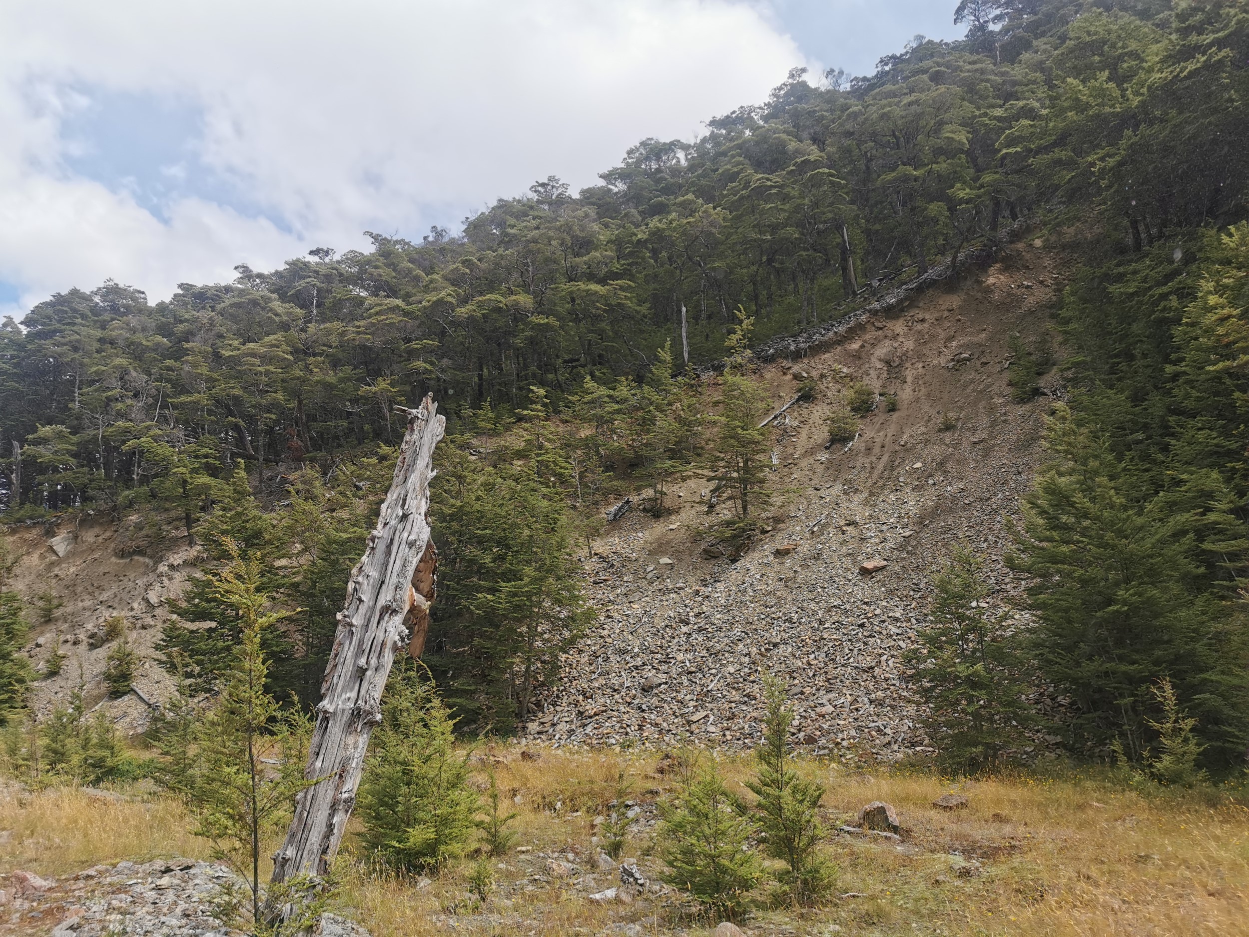
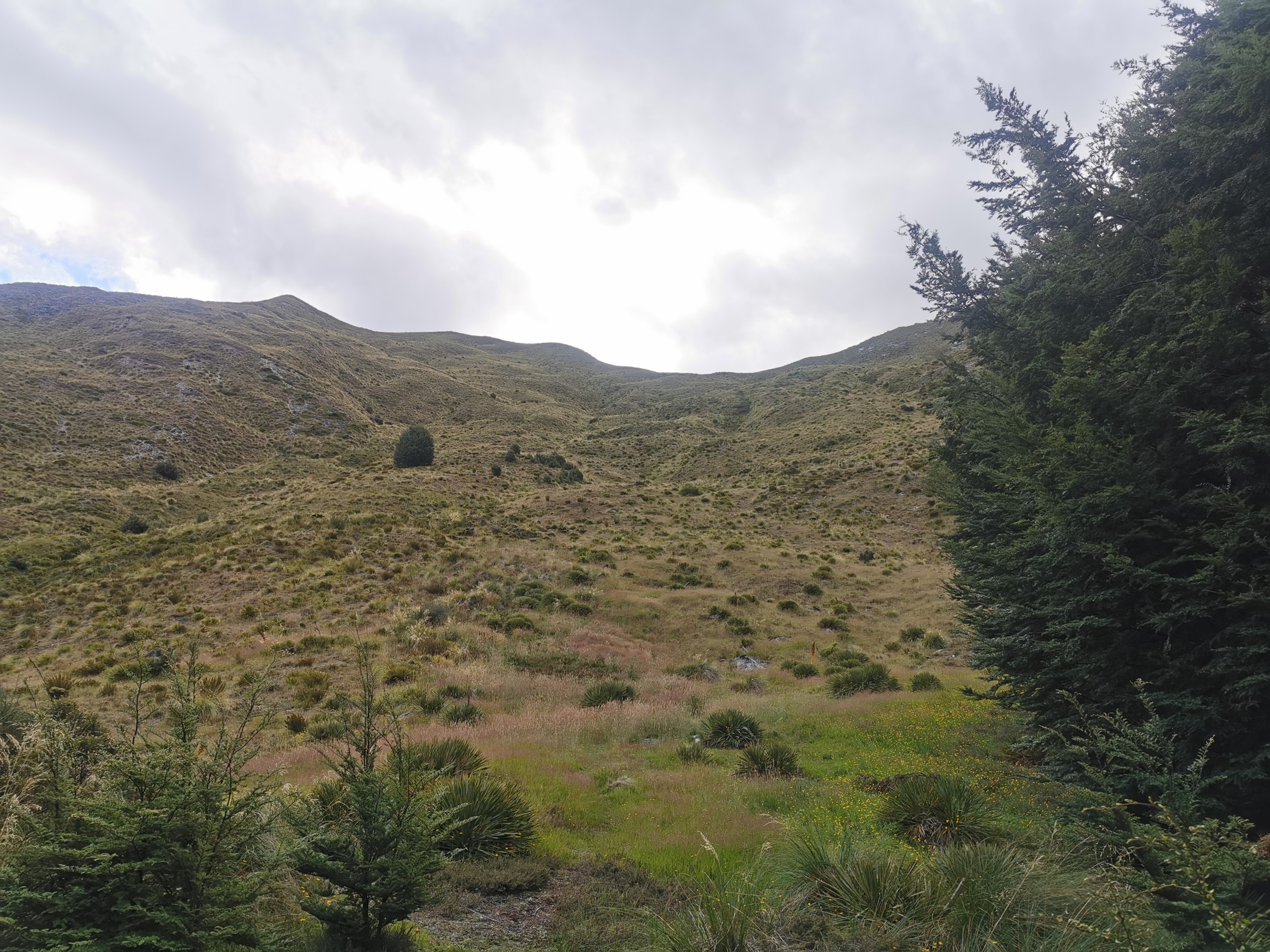
Fortunately I found this bit where even though it was still fairly steep, it appeared I could do a short scramble up the hill and I would be above the trees. I may be seeing things, but I was telling myself I could see a very faint path here up the loose rock from roughly the bottom right corner of the picture to the big tree in the centre.
This worked just fine – I’d made it above the treeline!
But with my backtracking I had descended back down to almost 500 metres and the hut was at about 1,010 metres. So I knew that first off I was going to have to climb 500-ish metres, and then the plan was to follow a consistent elevation around to the hut.
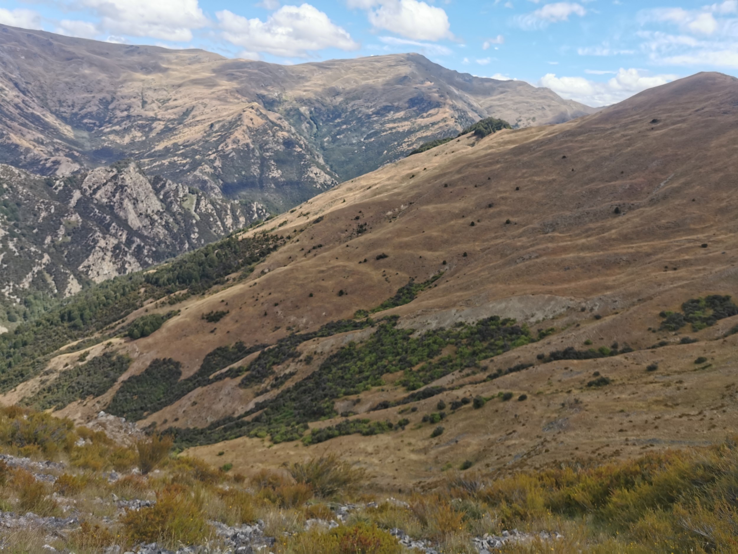
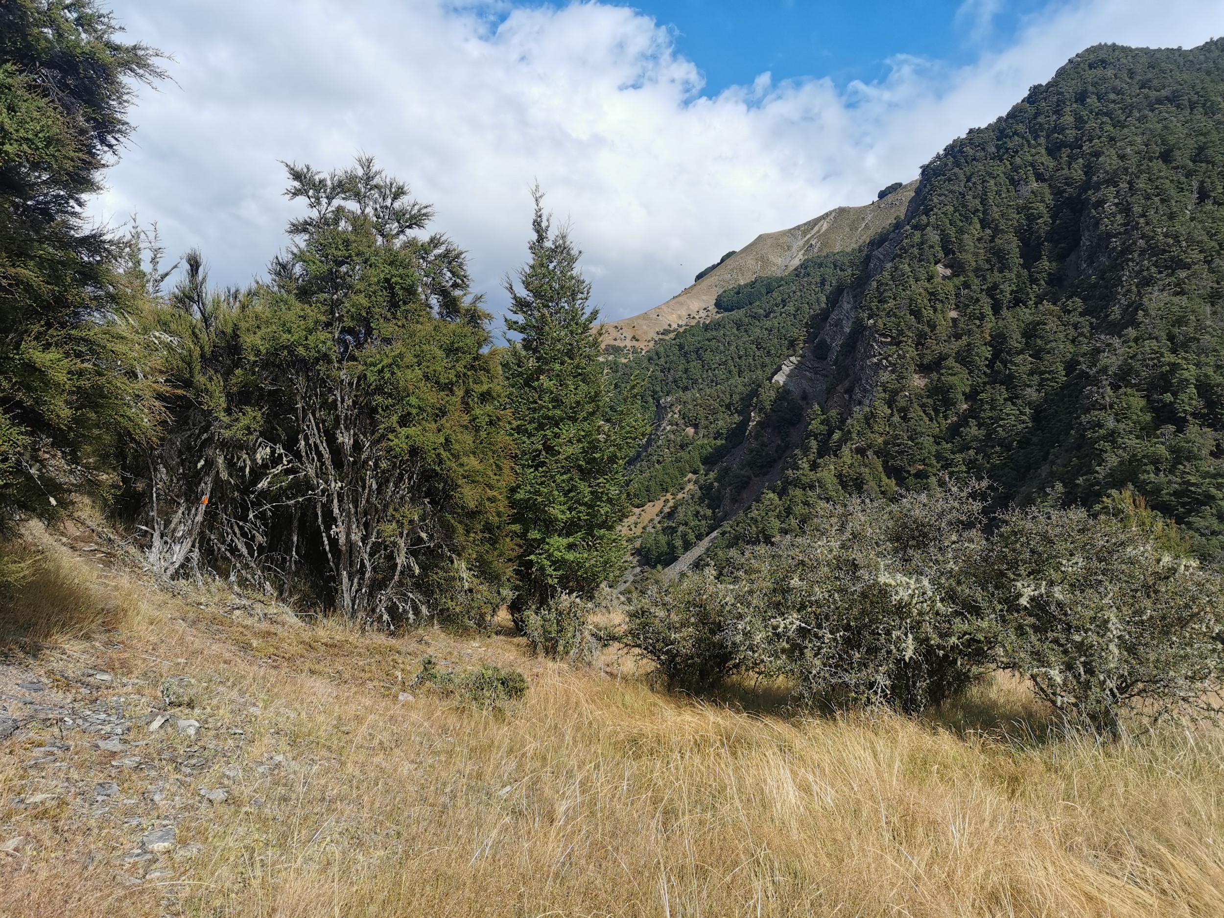
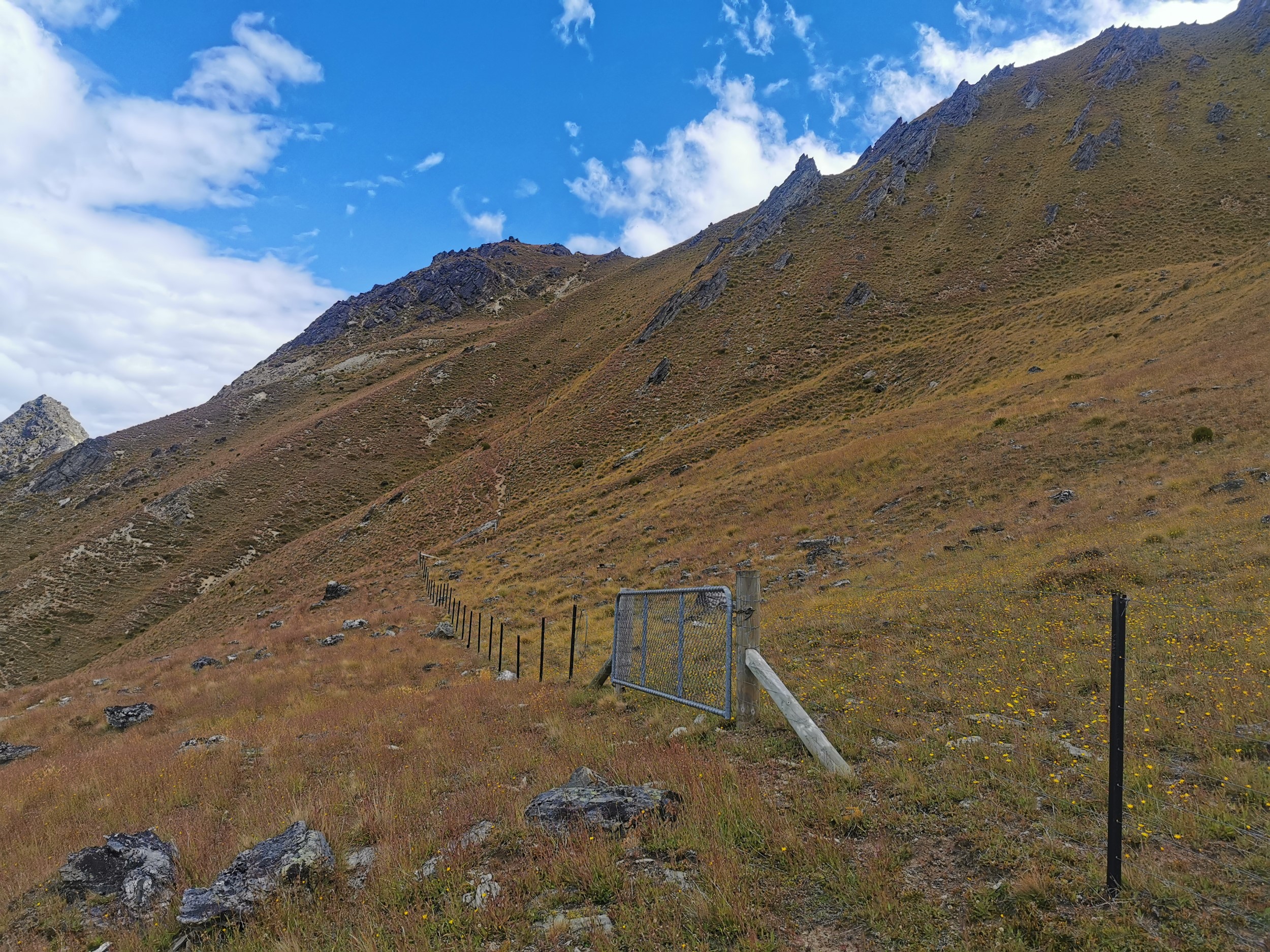
The climb was harder than expected. It was through tussock and rocks and there were a lot of Wild Spaniards to avoid. Plus I also wasn’t sure if I was on private land, or I was within the Hawea Conservation Park. I couldn’t see any animals around so I didn’t feel like I was interrupting any farm operations, but I also didn’t want any hunters to think I was an animal and therefore think I was a target. I made sure to have my bright orange pack cover on to make it clear I’m not a deer.
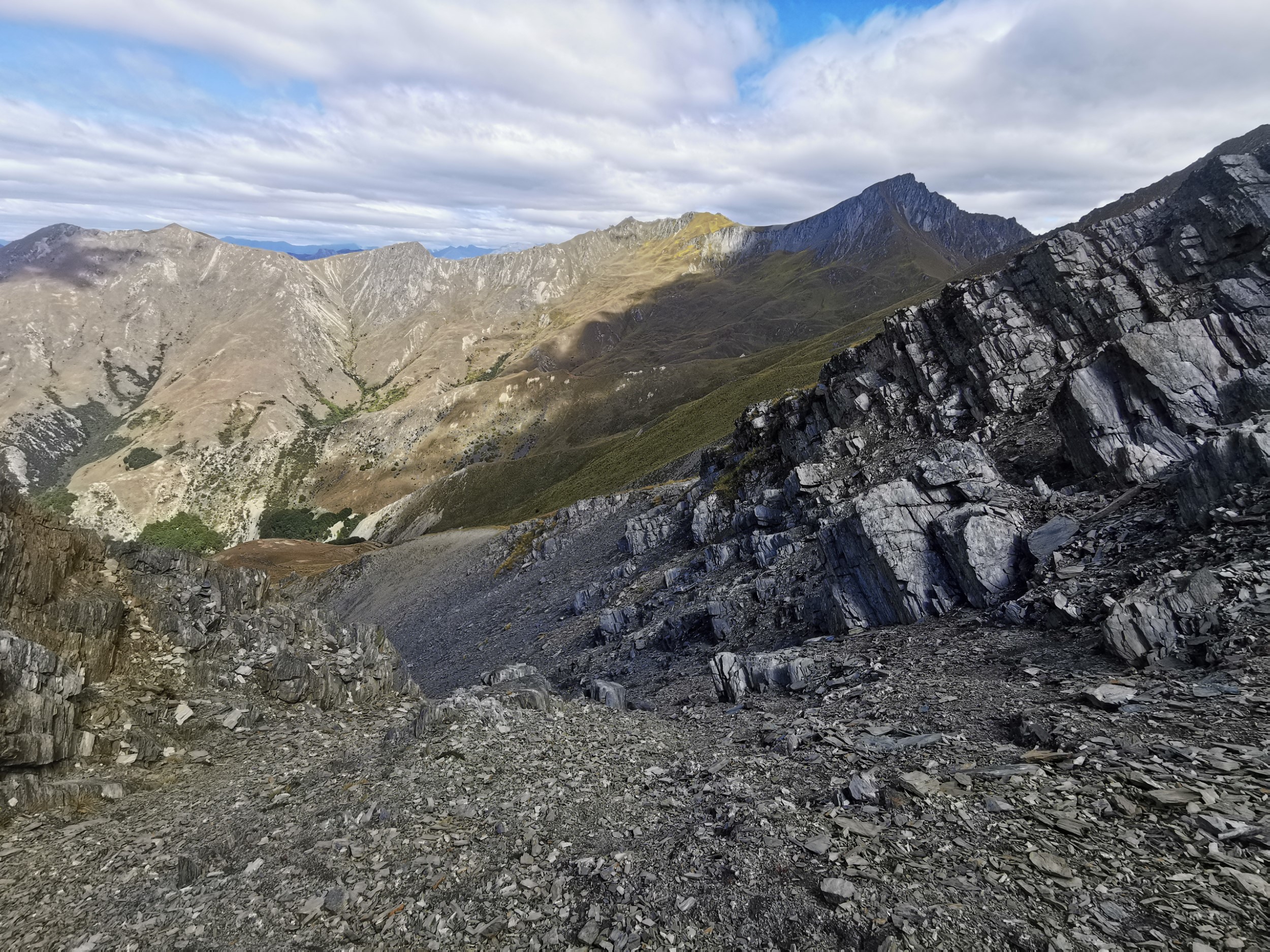
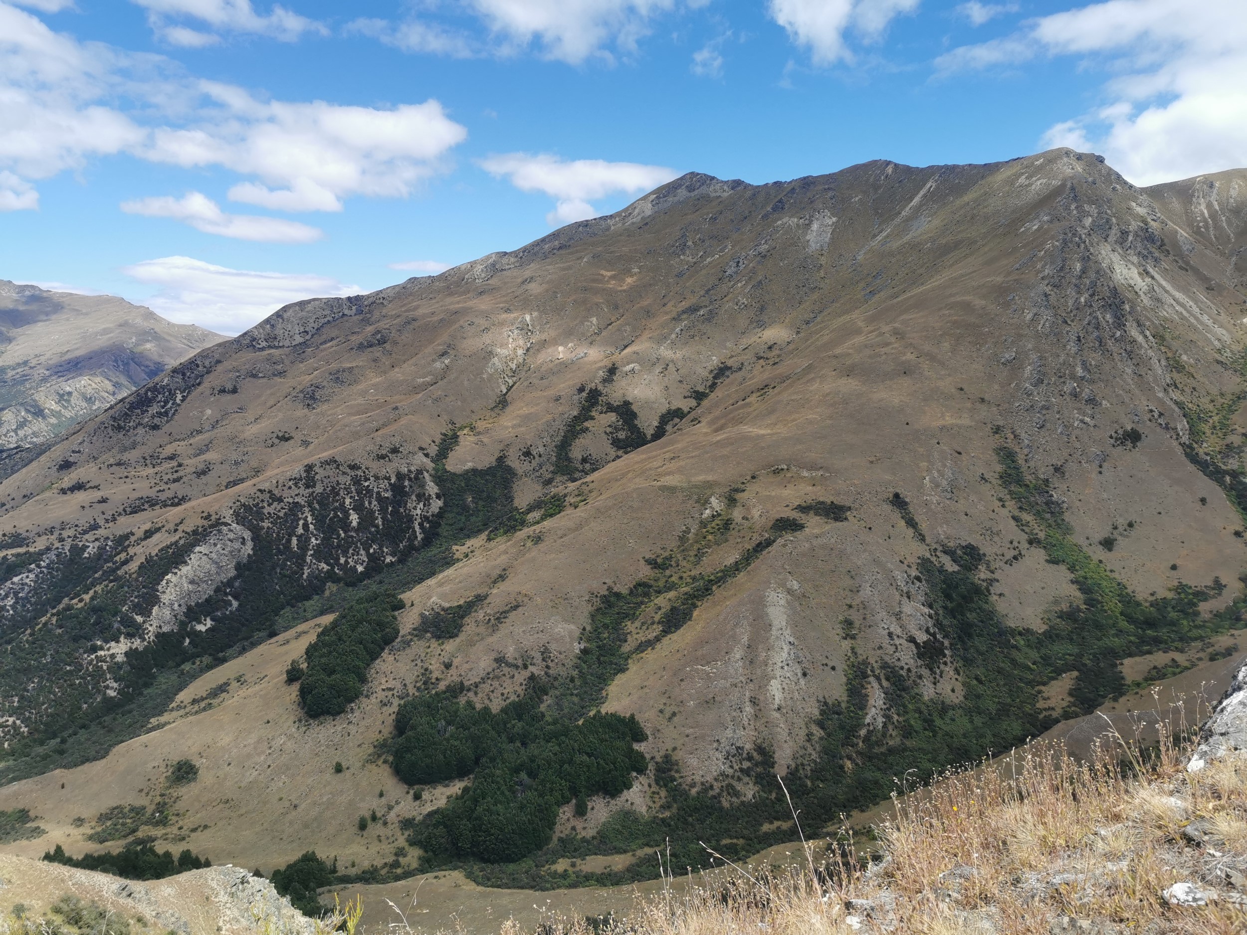
I climbed up to 1,000 meters and then tried to stick as closely as possible to that elevation, and then planned to just walk along the side of the hill to the hut. My plan was all going well despite it being much slower going in general than I expected. Until I came to this…
The topographic map did show some kind of steep bit jutting out that I’d have to avoid so I wasn’t too surprised to see it, although I undersestimated how steep it would be. I had this naive idea in my head that if I just stay at the same elevation the whole time then I can hopefully just go around obstacles – but here that would put me right in the middle of the loose rock and steepest part of the cliffs. I studied the landscape and decided I was going to have to climb higher to avoid the big rocks and scree. Then it was a bit of a scary sidle around the hill but ultimately not too bad. The tussock prevents you from slippong too far. It was just more exhausting than expected.
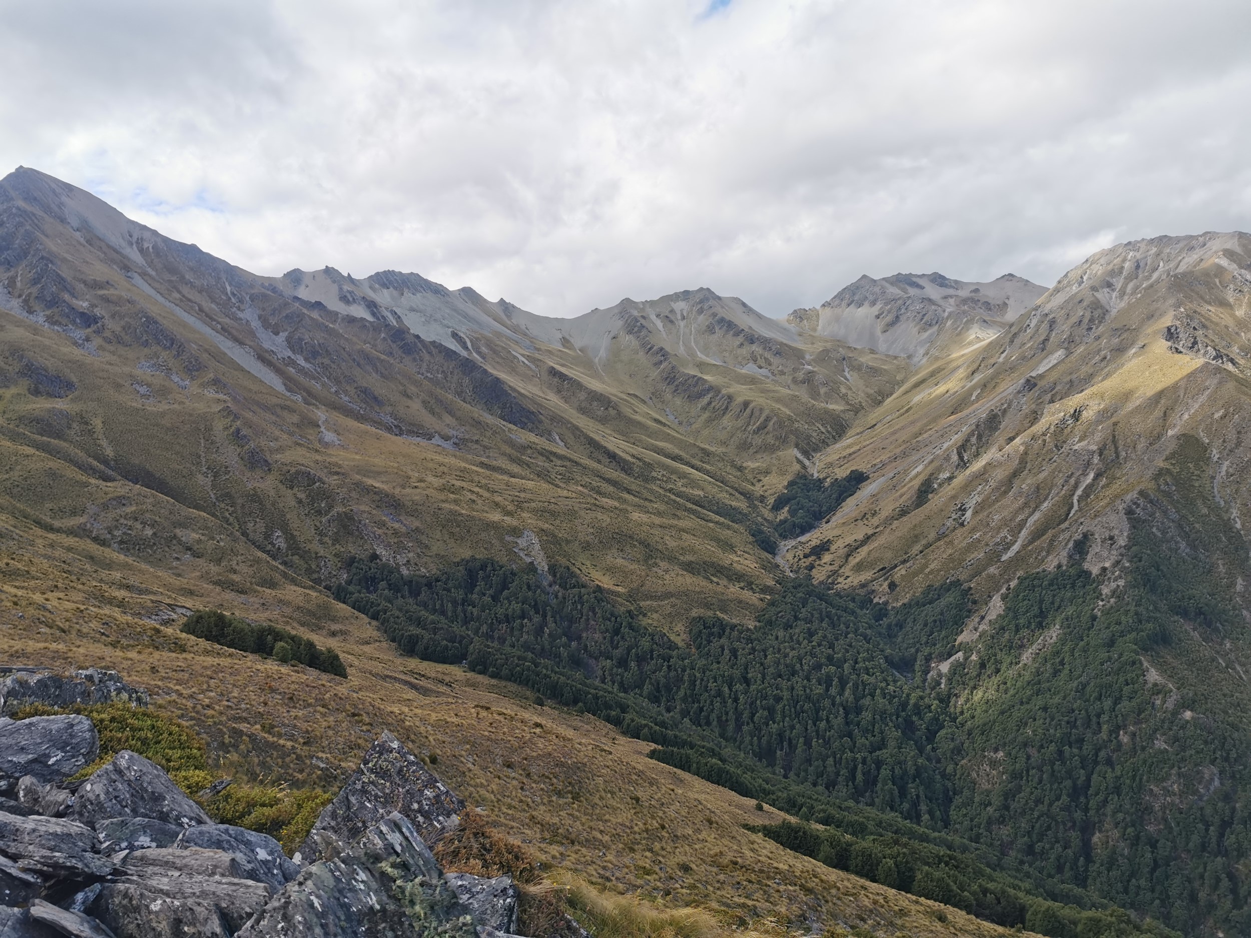
Finally round the hill, the hut was in sight. But because of the last ascent to avoid the rocks, I was now 100m or so above the hut, and I had to come down. Getting down the hill was a lot more difficult than going up it, especially when there were rocks everywhere.
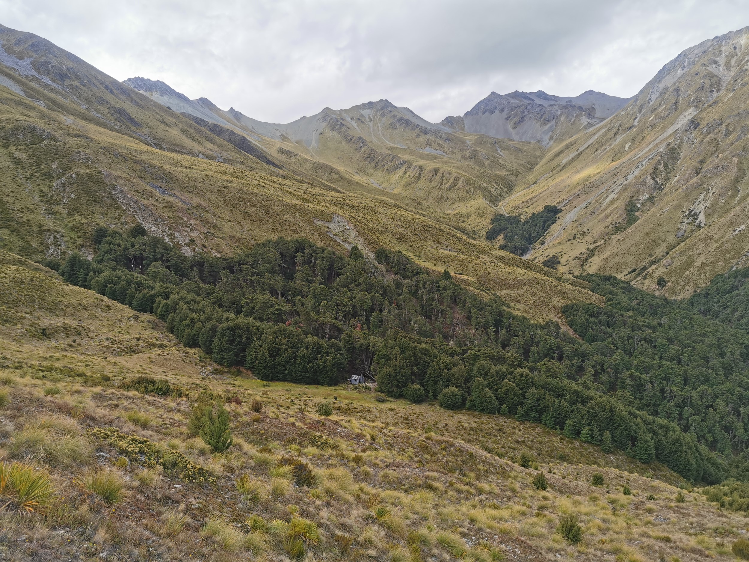
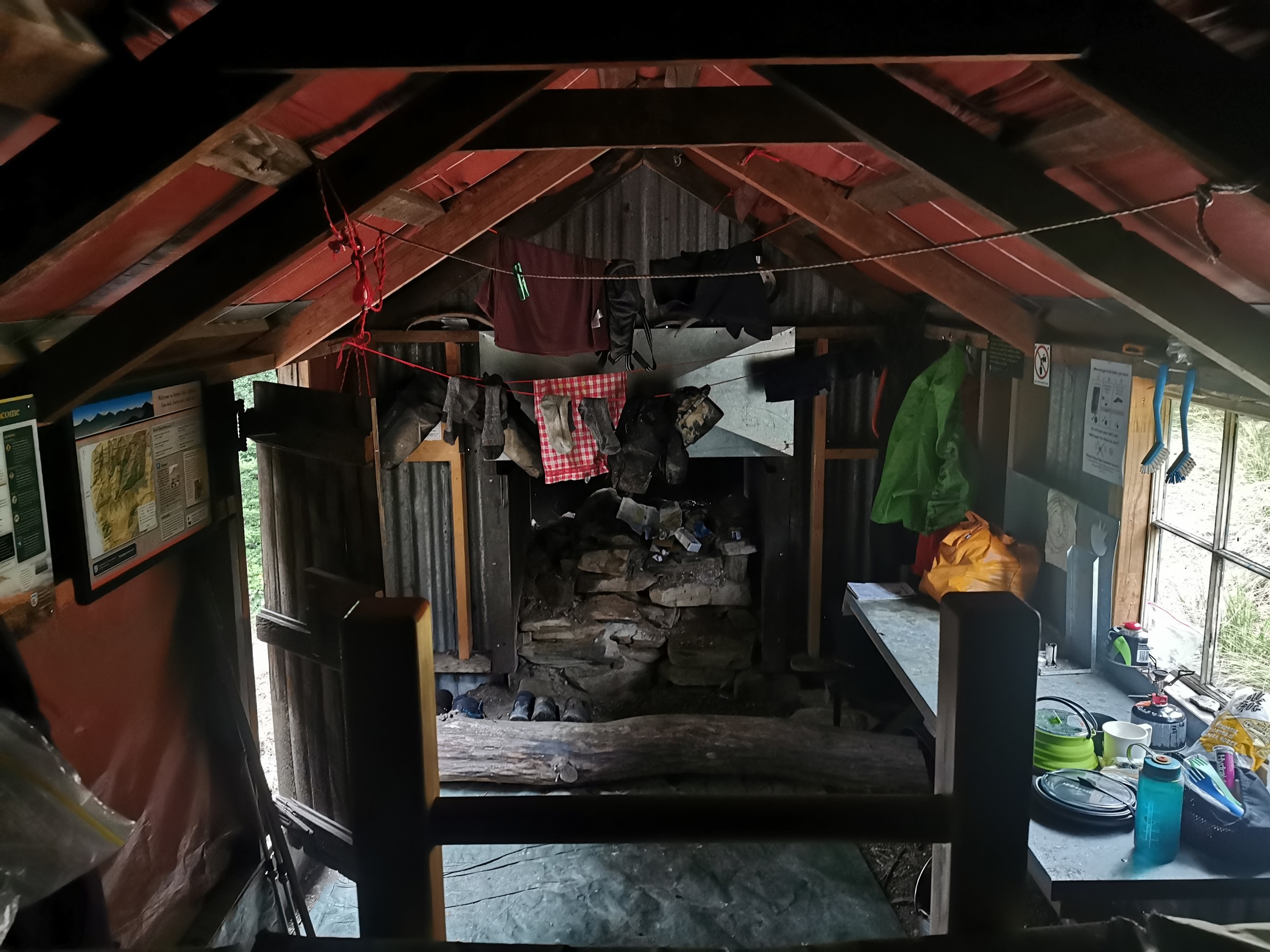
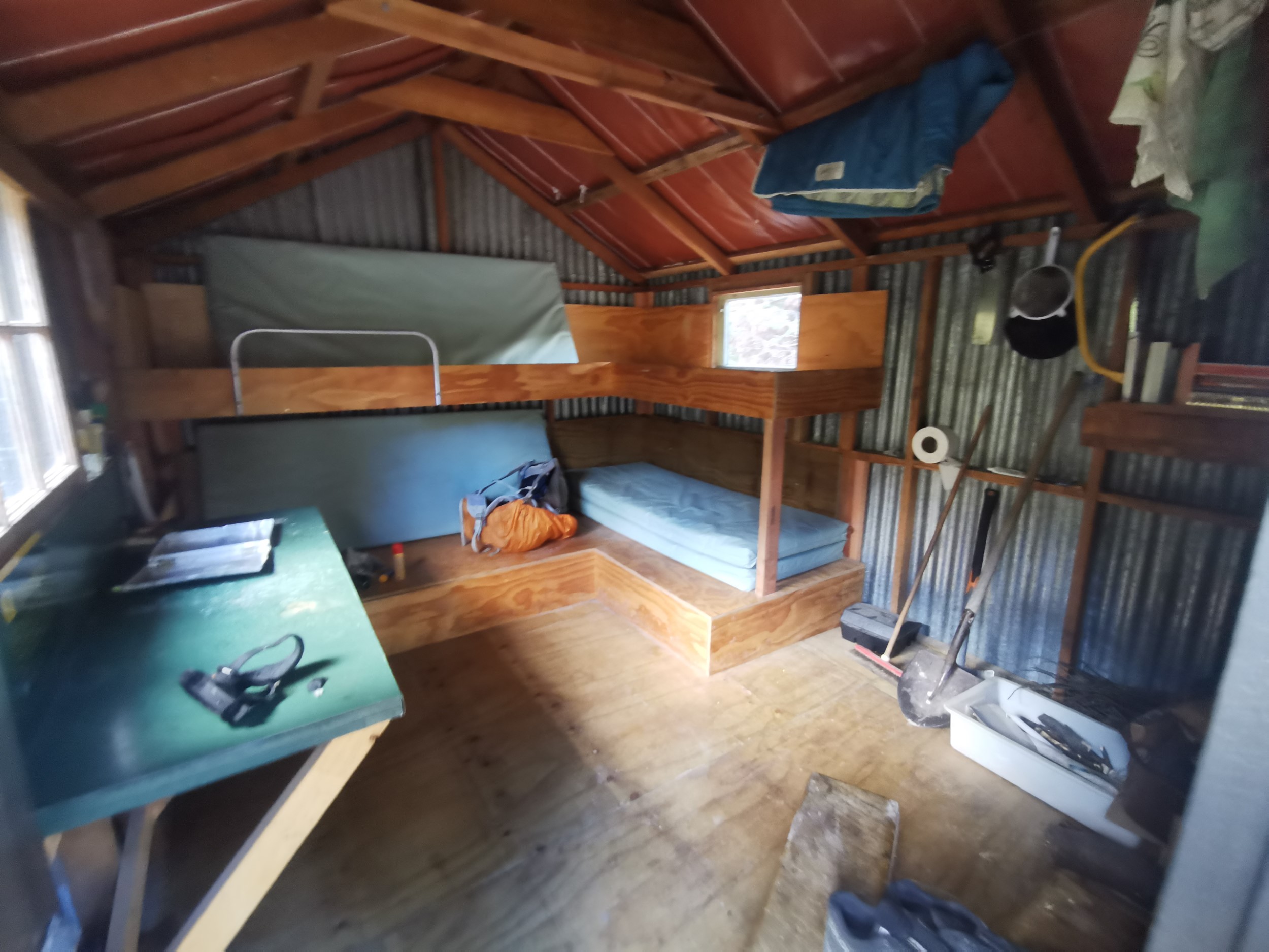
Approaching the hut I was wondering if anyone else would be there, since it was such a mission to get to. But no, it appeared to be just me. All throughout my blog, I always claimed that seeing the final hut each day was a “sight for sore eyes”, but it was different this time. This time the feeling that was in my mind is “wow, I’m still alive!” as well as “this is what I’m here for, I’ve finally made it!”. It felt quite exhilarating being off any marked route but also a little scary. Would anybody ever find me here if I hurt myself and couldn’t walk? I felt reassured that I had brought my PLB with me.
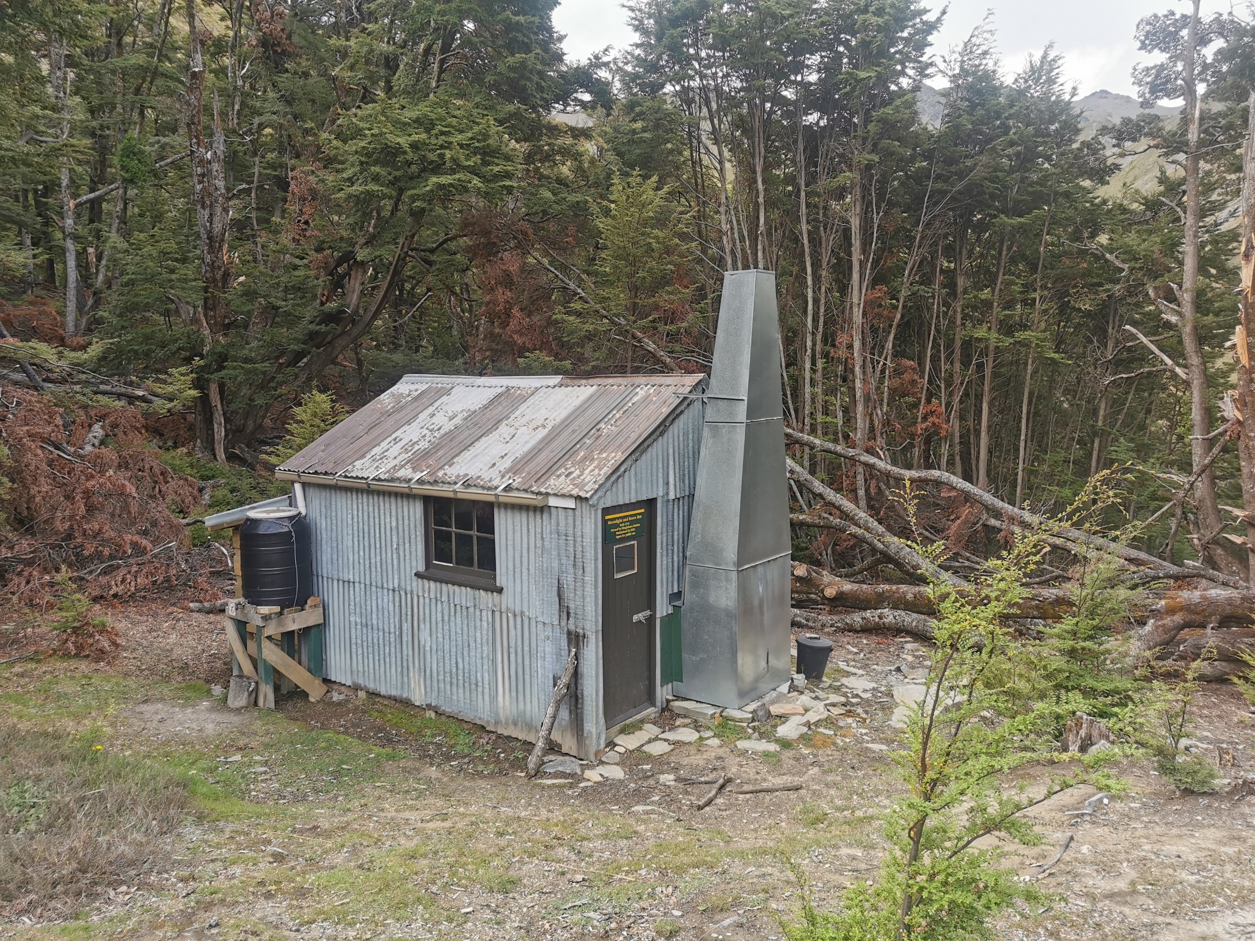
The hut was in very nice condition, despite being the fairly standard four bunks and a table, chairs and a bench that you find in most DOC huts.
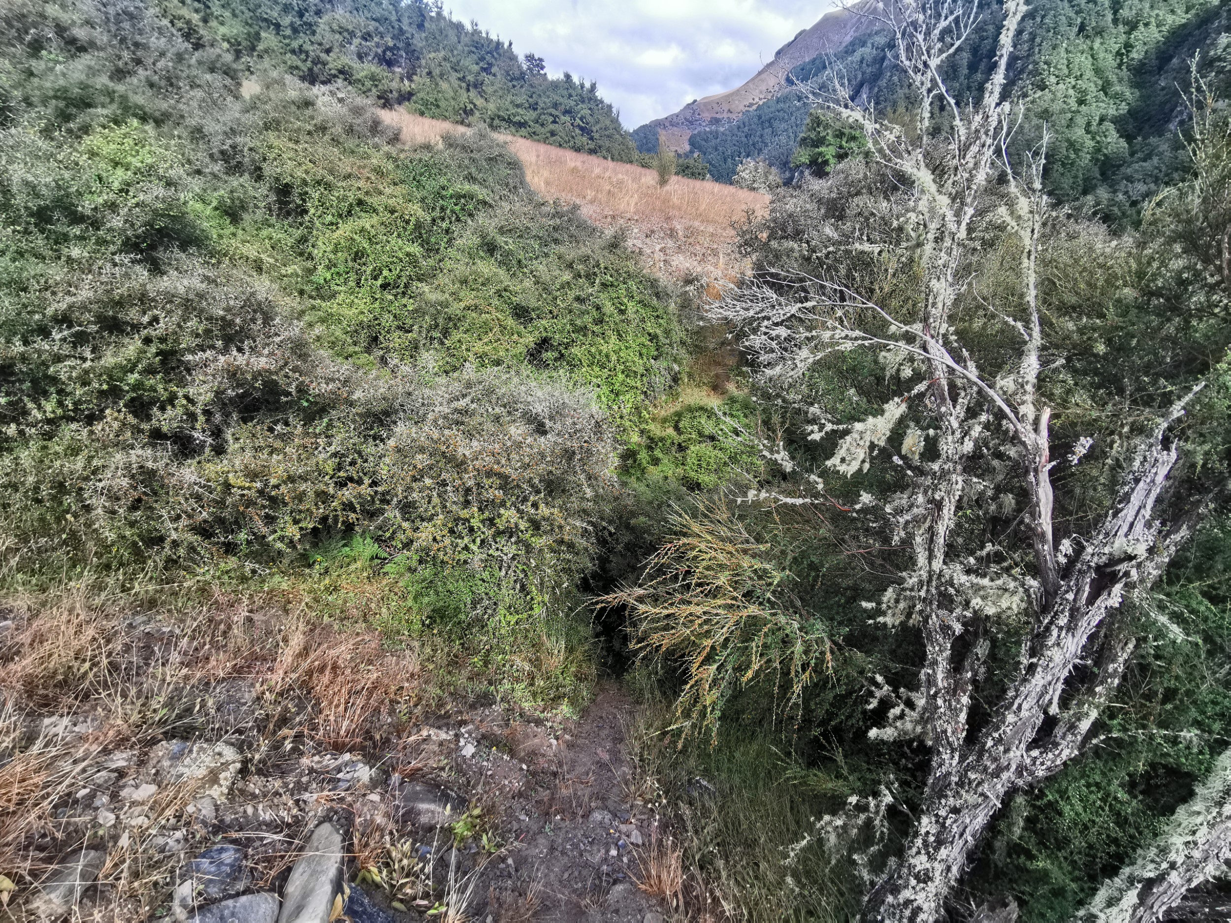
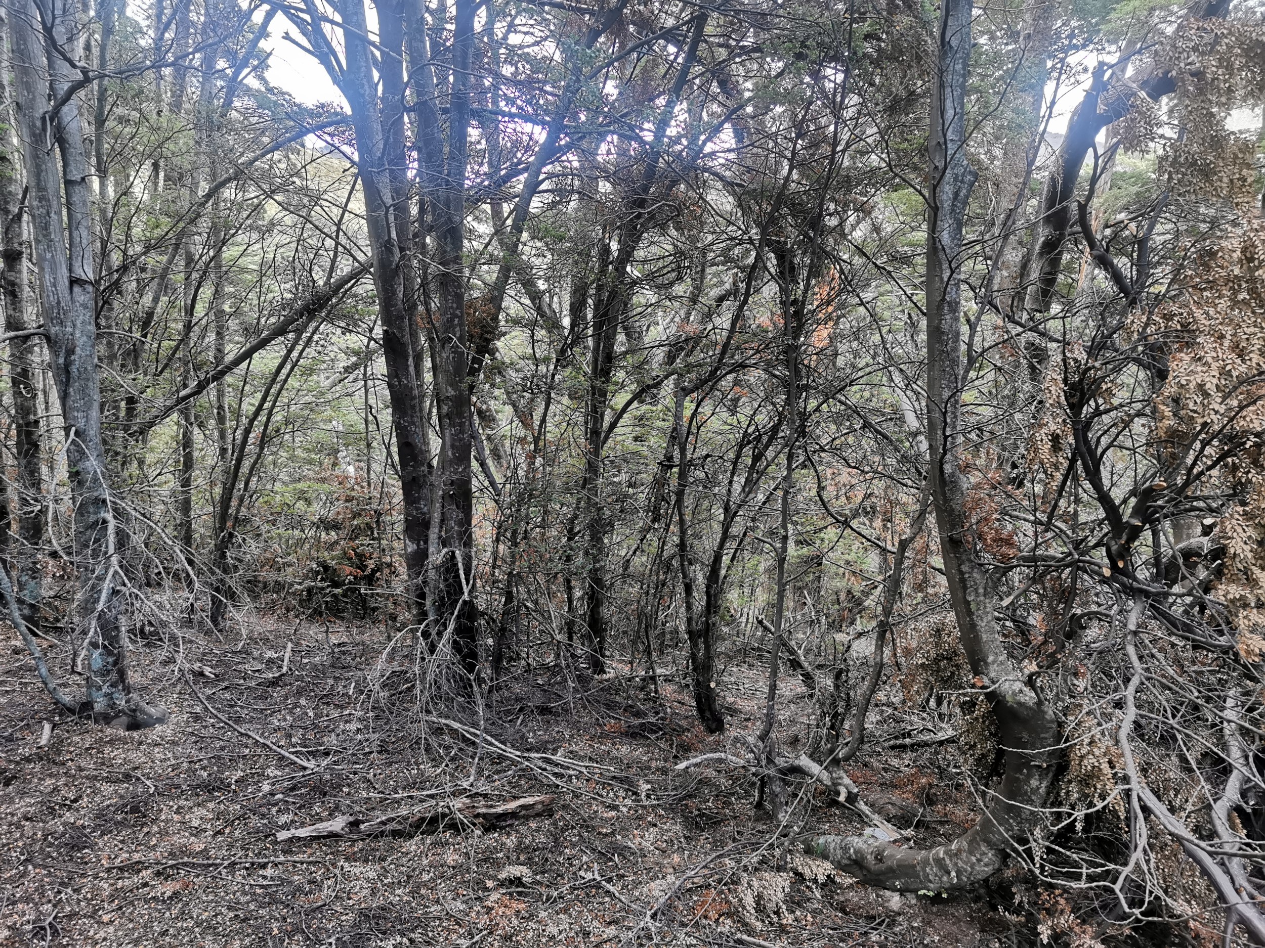
I did have a look into the trees near the hut, to see if I could have bush-bashed here from the creek. They look here too like I could have made it through them. I kind of wish I’d tried now, but better safe than sorry I thought.
Ultimately when I did get home, I looked at my map of where I walked today. Here it is:
Today's walk on the map (blue = Te Araroa, red = today's walk):
You can see how much I backtracked. And when you switch to satellite view, you can see this…
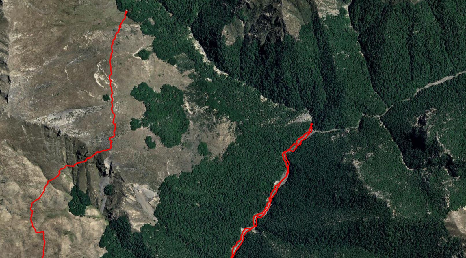
This picture really does seem to demonstrate that I should have gone up through the trees. The red path on the right is where I turned back and the path on the left is the hut. Unfortunately I had not studied the satellite view before I left, and I did not have it on my phone. It looks like, if I went the right way, I would have only had to bush bash throgh a small amount of trees. Instead, I spent hours backtracking and going via Plan C. Oh well – what’s done is done.
Outside they had cut a stump into a seat and there appeared to be a cooking area.
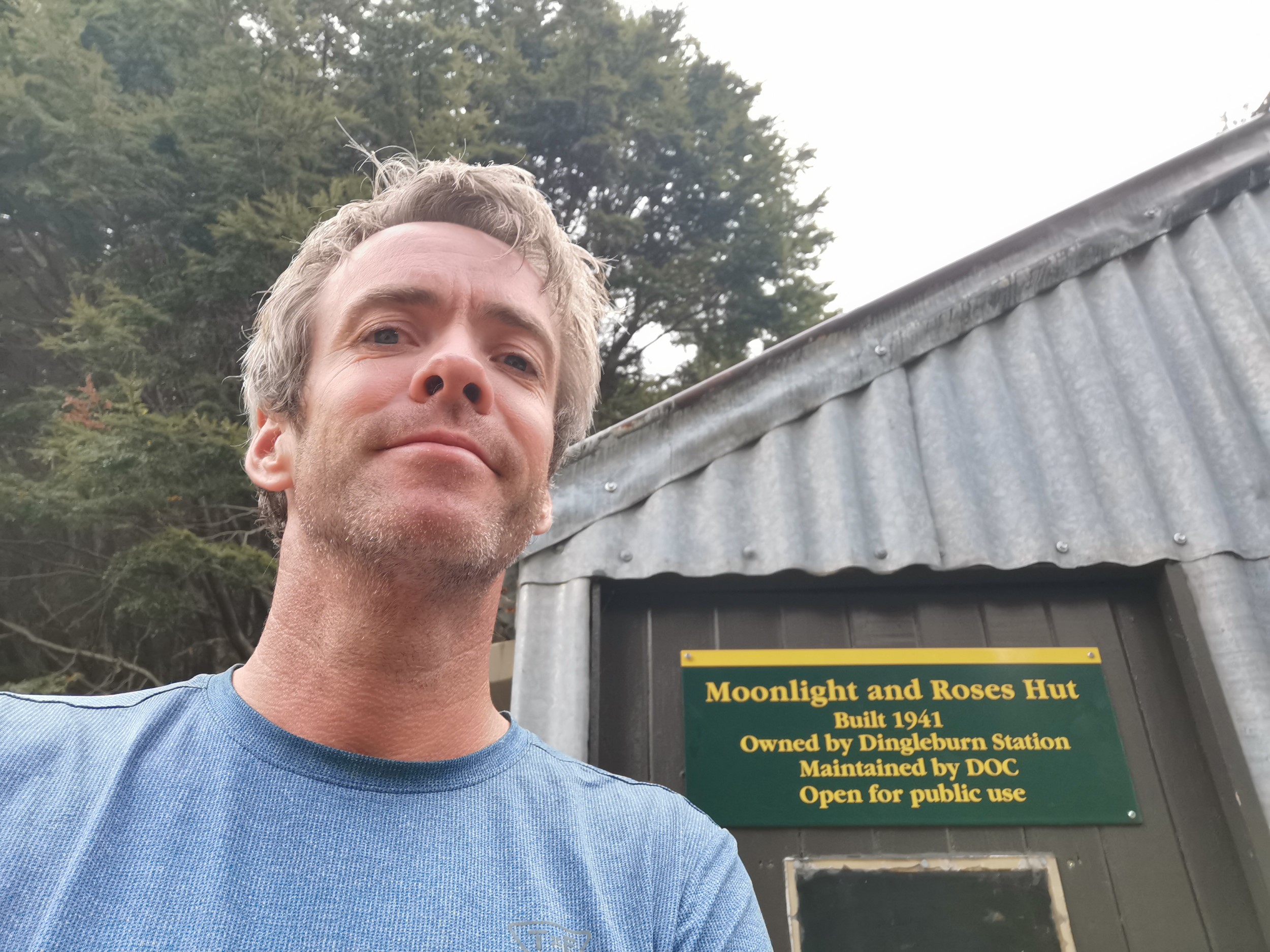
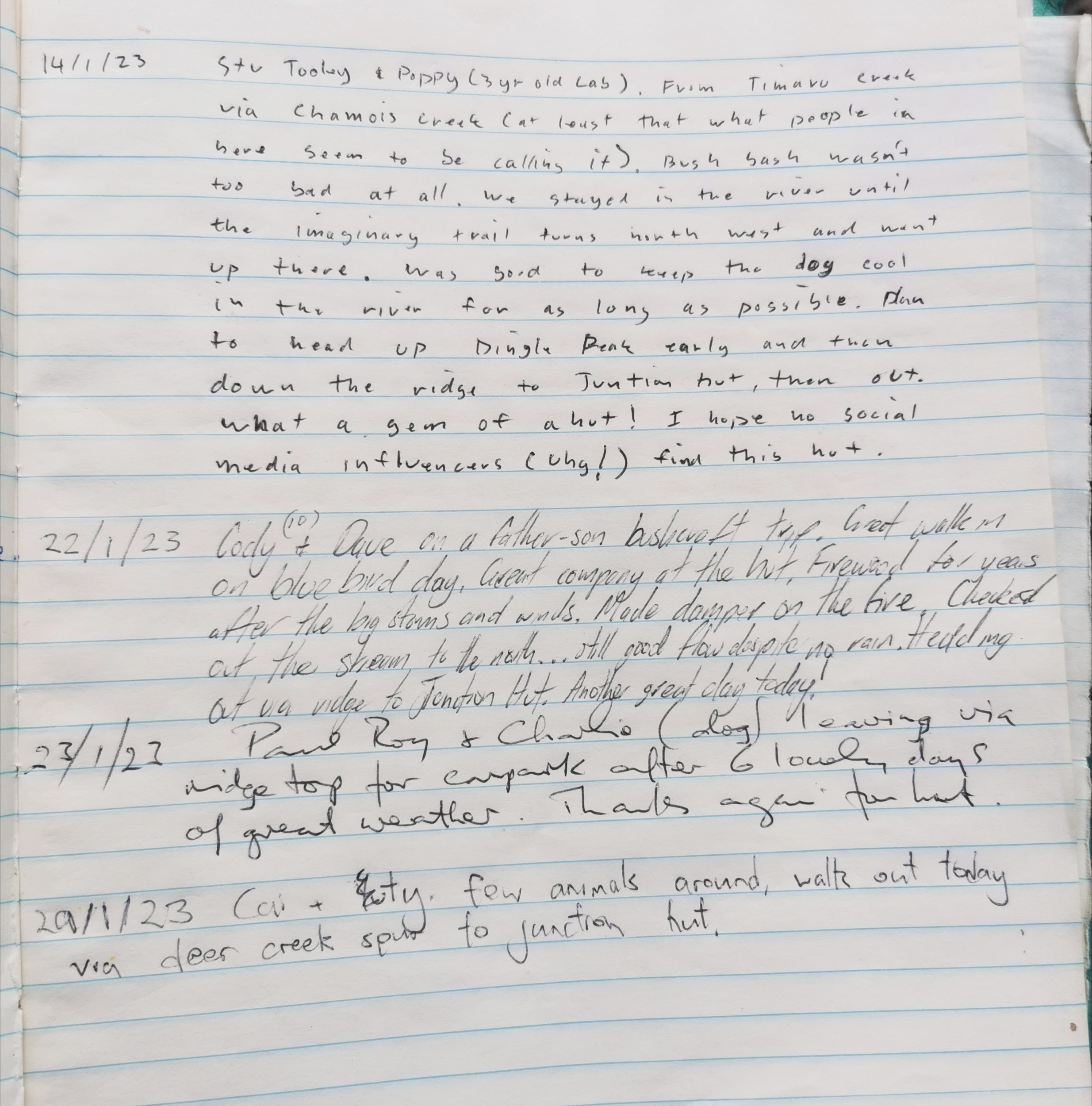
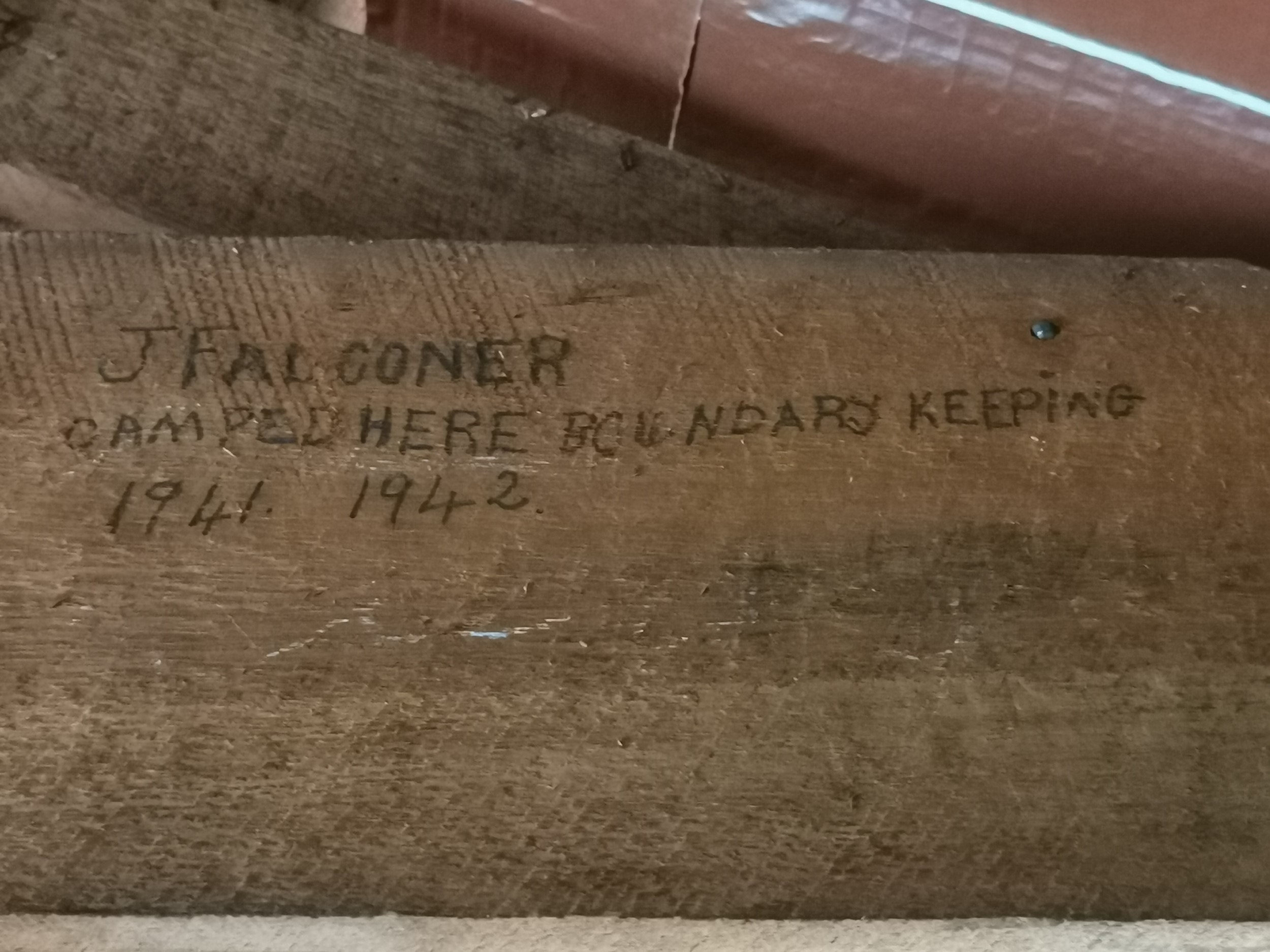
The hut was built in 1941 and the hut book went back to 1985. It was interesting reading some of the entries. Four people had been here in the last two weeks. I was the first person in almost a week, although honestly that’s more people than I expected to find staying here. I expected one a month, max.
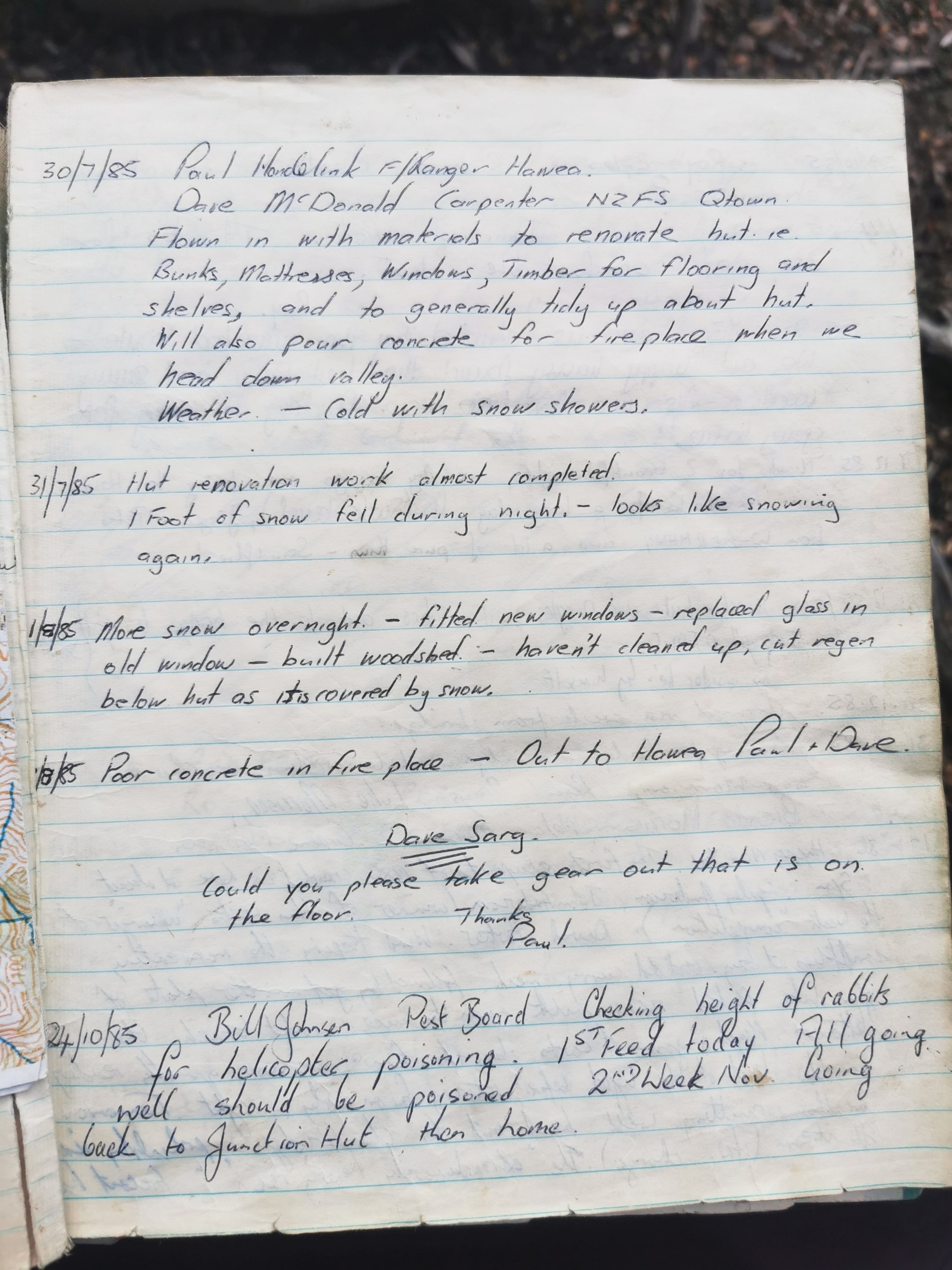
There was a reassuring piece in the front cover of the book, that showed I was allowed to be there and I wasn’t going to get shot:
Note: we don’t mind if you run all over these hills but please try not to disturb the sheep which you will find just about everywhere. Keep quiet the sheep won’t even notice you i.e. be sensible, desist from yelling rolling rocks down hills and keep dogs especially quiet if sheep are about. They will string out for miles otherwise. Have a good trip.
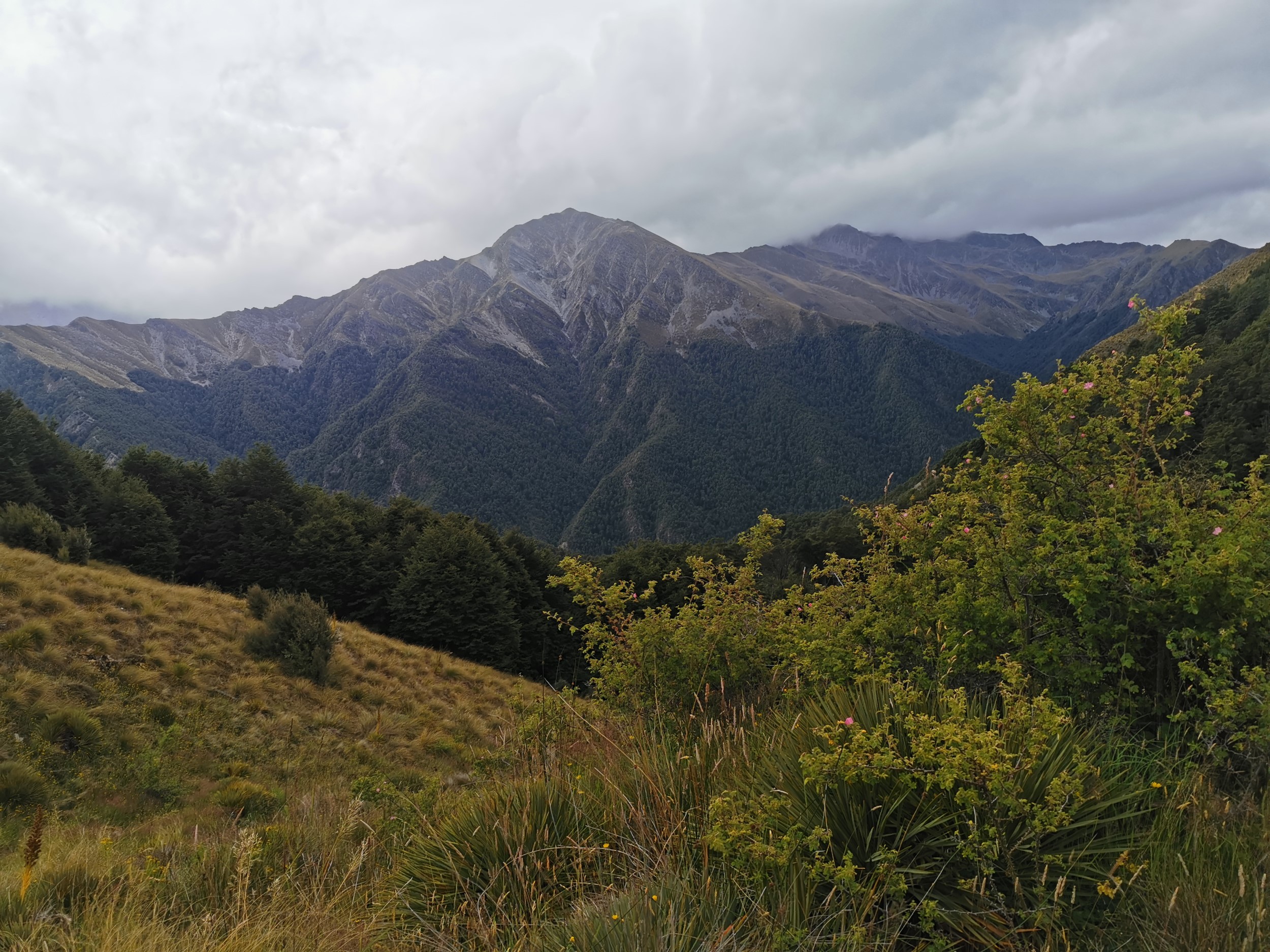
These hills are partly Dingle Burn Station and partly Hawea Conservation Park, but it’s not entirely obvious where one ends and the other begins. There are fences around which hint at the boundary but it’s not easy to be sure.
So now I had my answers to my two original questions – what is it like and who stays here? What it’s like is quite nice, and I had some idea of who stayed here based on the hut book.
I did have another question – why is the hut named Moonlight & Roses? That question I didn’t have an answer to… but the main question now was how on earth do I get out of here. All I know right now is that it’s up that hill and over the saddle, unless I want to go back out the way I came (ideally, I don’t want to do that).
That can be tomorrow’s problem. For now I just enjoyed my time alone in the hut. I didn’t have as long here as I’d hoped. I left Stody’s before 8:30am and arrived here at 6pm. It was a longer day than I expected, but I’m glad there was still at least a few hours of daylight so just sit and relax.
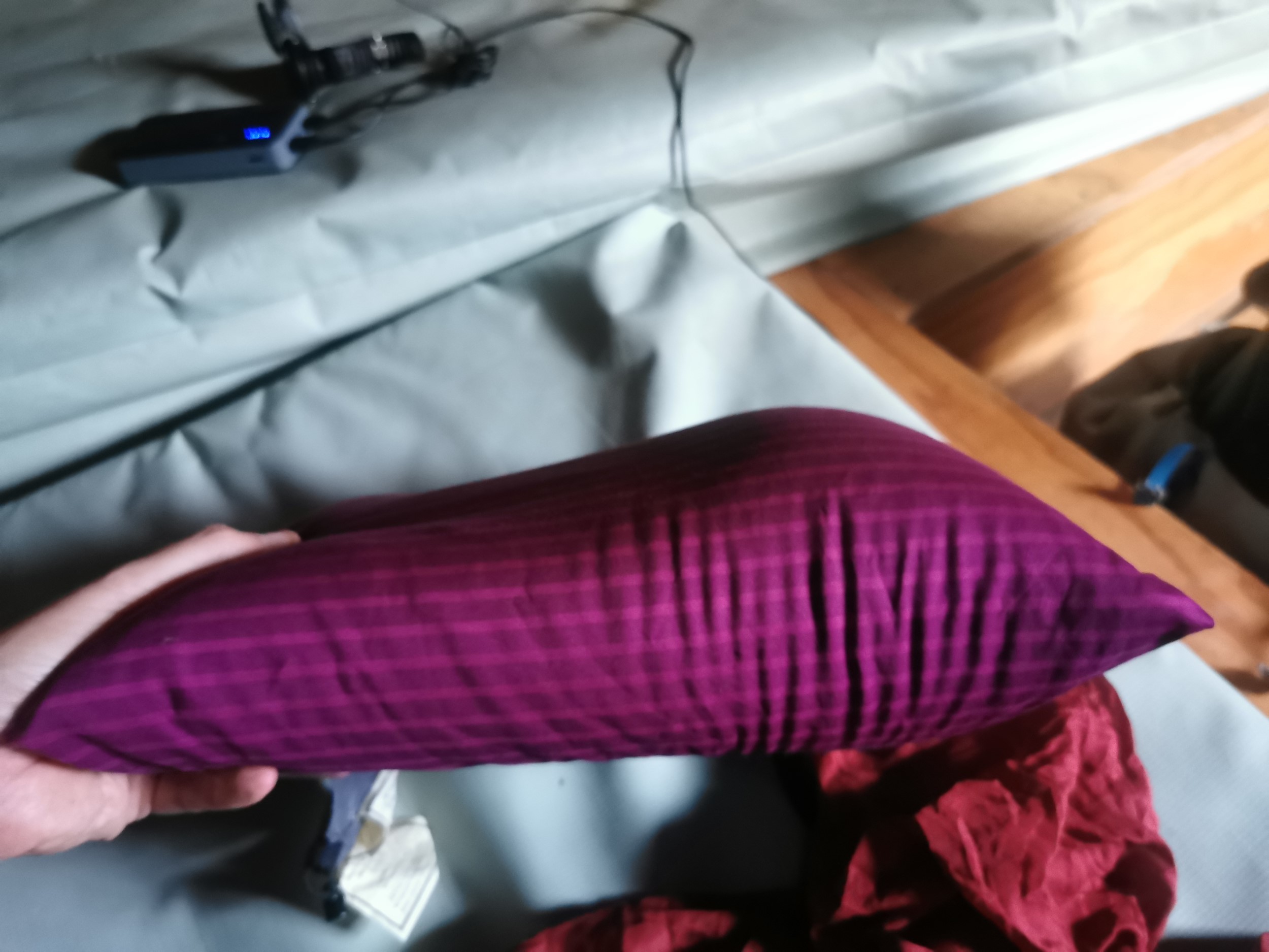
I did learn when I went to bed why my sleep has been a bit uncomfortable after the last few days of hiking – my Nemo pillow has a weird bulge in it! No wonder it felt strange.
DAY 3 (4 February 2023)
Total distance: 14.28km
I had a nice sleep in the hut, although there was a possum or something large in the firewood that kept banging on the wall not far from my head. I really wanted to sleep in but I knew I had a big day ahead to get out and back to flat ground. Given the bad weather forecast for tomorrow and the probable lack of any flat or sheltered places to set my tent up today, I had better start moving early.
I had not much of a plan on how I was going to get out of the area. Plan A was to climb Dingle Peak and Corner Peak. Lots of people mentioned it in the hut book – “in via the peaks” was a common thing to read. But i’m not really a mountain climber of any sort. As much as I’d love to do that, that seems a bit of an ask.
Plan B is roughly what Finn and Jen did, they were going to do both peaks originally but then took a shortcut to get out via Deer Spur Creek. They said it was a bit sketchy at the bottom and advised against it.
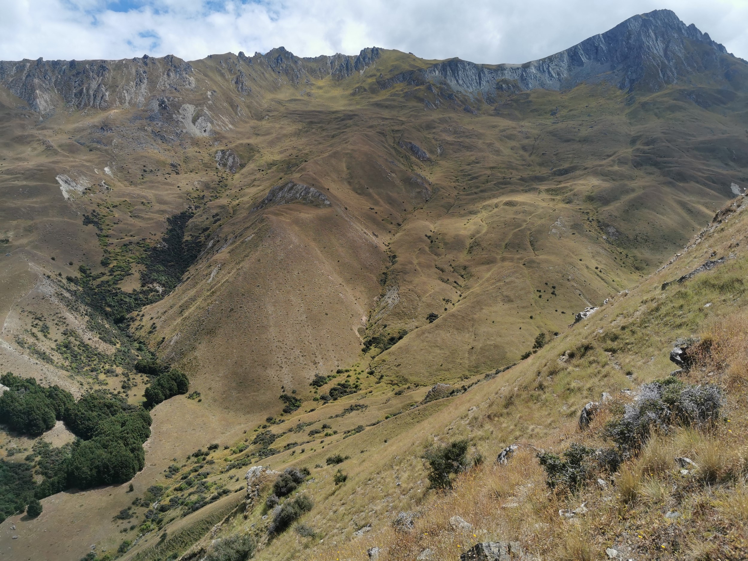
Plan C was the other route commonly written about in the hut book, as it is the route you’d probably take if you were heading straight to the hut from Lake Hawea. I wanted something a bit more adventurous though, I really wanted to go down the Corner Peak Route to see what it was like and also I knew it was a proper DOC trail so it would have markers. Whichever method I chose though, they all initially involved a walk straight uphill to the top of this saddle.
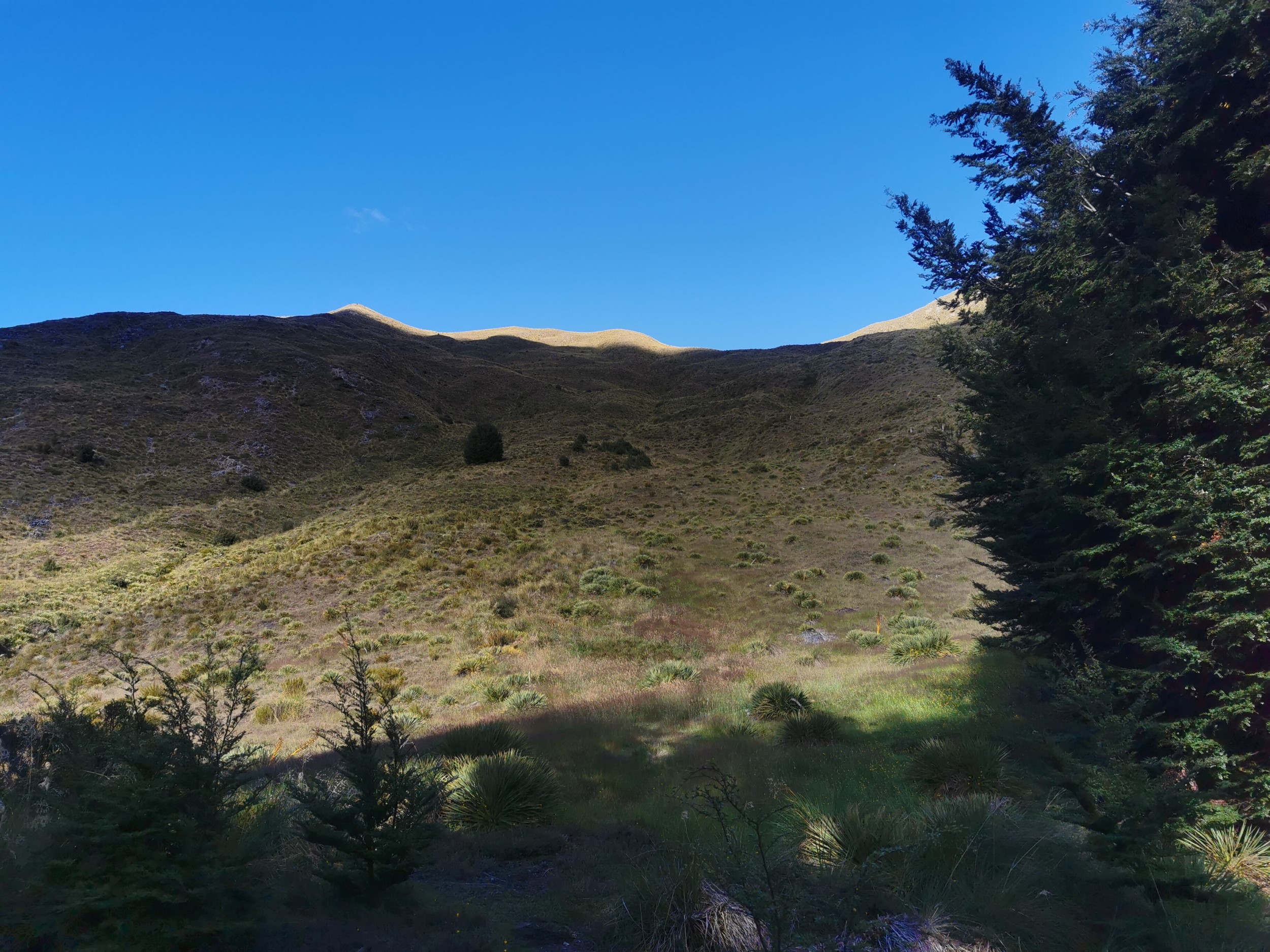
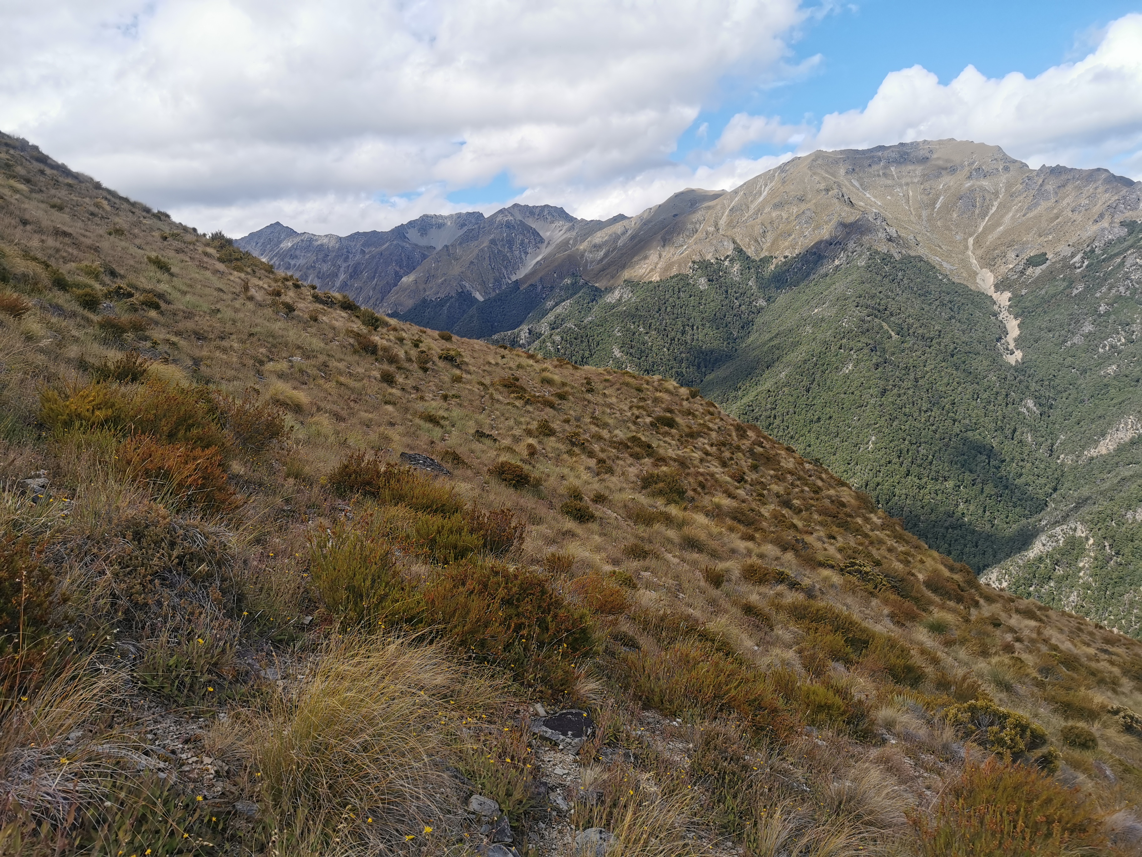
When I reached the top of the saddle, I looked to my right and saw Dingle Peak. I think I worked out pretty quickly that I don’t have the guts to go climbing up there on my own (but I did start walking up there briefly as you can see in the map of my walk further down).
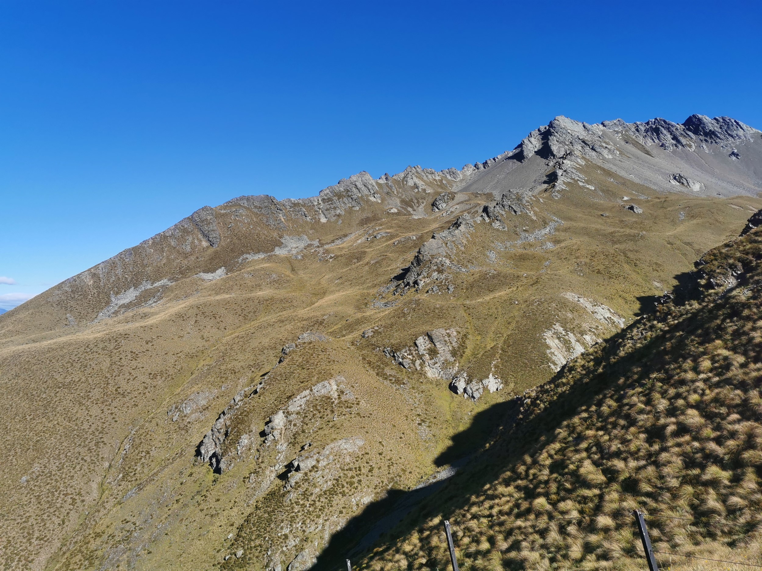
So instead, I thought I would go for the “sidle around the hills” option. It was the same option that I went with yesterday – I was at about 1300 metres up here at the top of the saddle and the start of the Corner Peak Route is 1400-ish so if I just stayed at the same elevation then in theory, I could get to the route with a minimum of effort. Of course, that was in theory.

The first part of this plan wasn’t too bad, after I managed to creep along loose rocks. I was always nervous walking along loose rocks – when you’re on a formed trail like Te Araroa, you know that heaps of people have walked them before you, but out here, for all I know I could be the first person ever to walk in this exact spot.
I did think though that the lake looked a long way away. You can see it peeking between the hills in the next photo. It did cross my mind, perhaps I should still consider Plan C which would be a lot easier. But no, I pushed on.
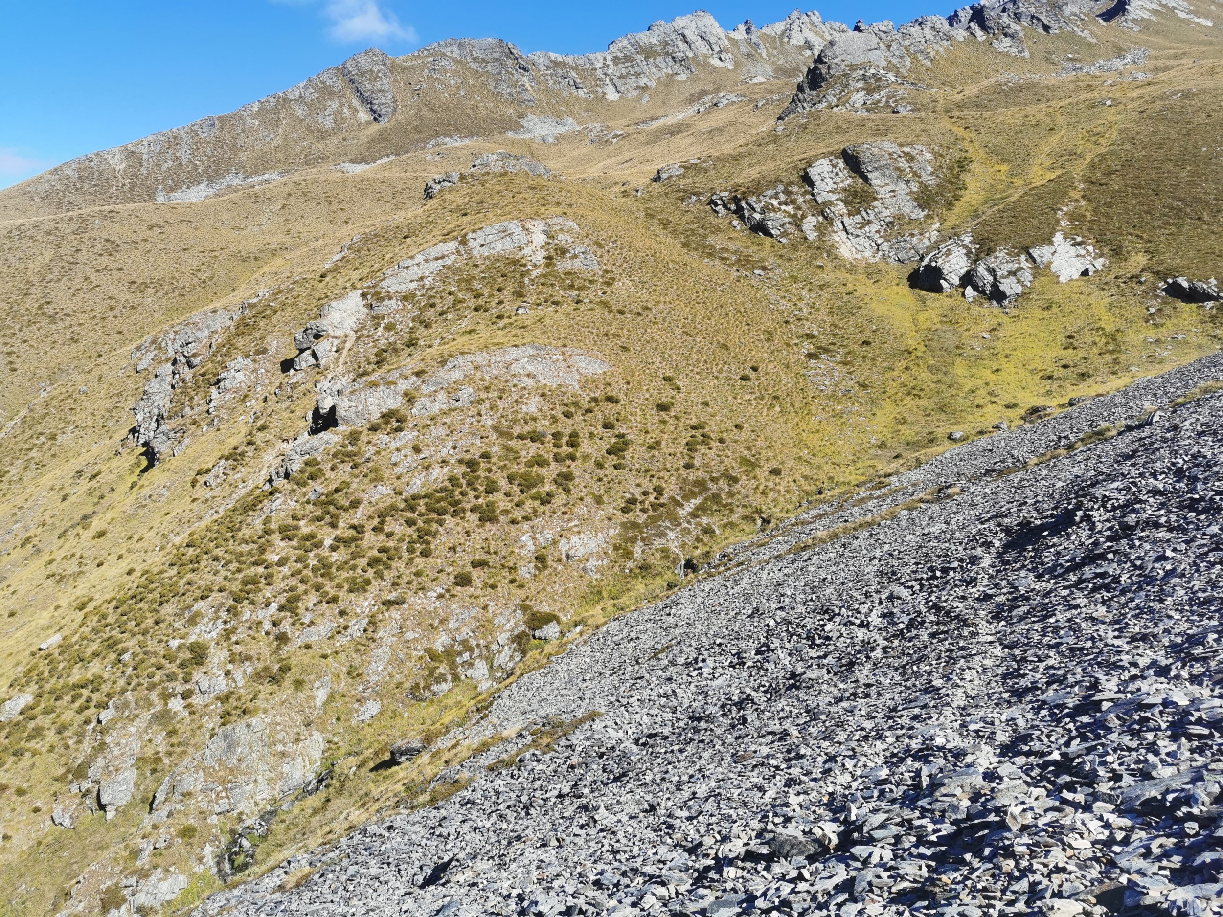
A bit like yesterday, it was tougher than I thought. Although it looks fairly easy to walk on when viewed from a distance, this kind of terrain is just walking through either tussock, small plants or loose rocks. There was never any flat ground and sometimes you might find the odd goat trail or something, but in general it was a bit weird knowing there’s no guarantee of finding an easy path out!
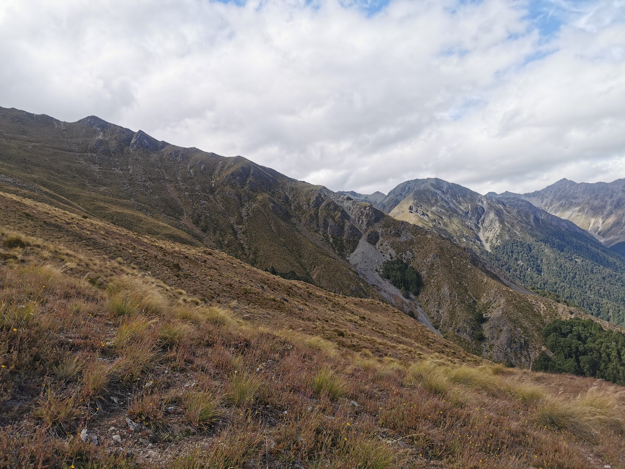
My plan to stay at the 1300-ish elevation was okay until about midday, but then the terrain started getting rougher, and creeks started carving out big trenches down the side of the hills. Unfortunately I didn’t feel like I could get across this bit easily.
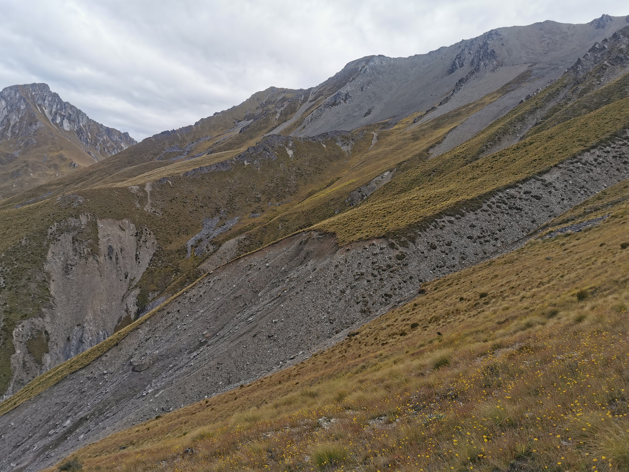
One way around here was right up the top, near the peaks, across the loose rocks. Since I had realised by now that I did not like the loose rocks, the only other real option was go down the hill until I found a point where these small creeks were passable. I had to drop 500m to find a place where I could cross this bit. Actually, descending was always the hardest part of the day on this kind of terrain. Going up is simply hard work, but going down you really have to be careful not to slip or twist your ankle or fall.
Even once I’d found my way across this creek, from here the hills were pretty steep. I spent a bit of time trying to find the best way through this particular area. In the end I crossed the fence in the picture above and pulled myself up the hill on the right using the fence once I’d crossed it.
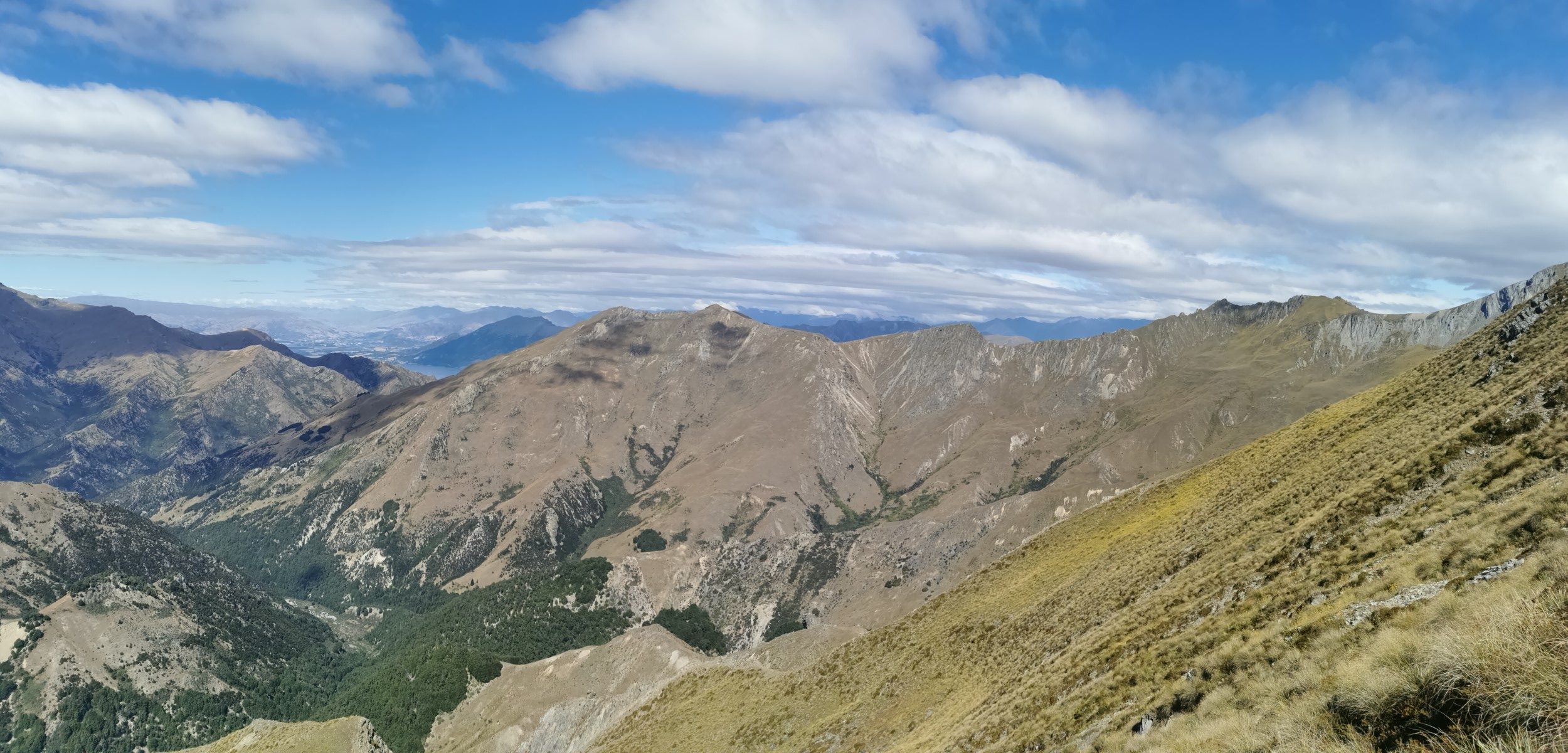
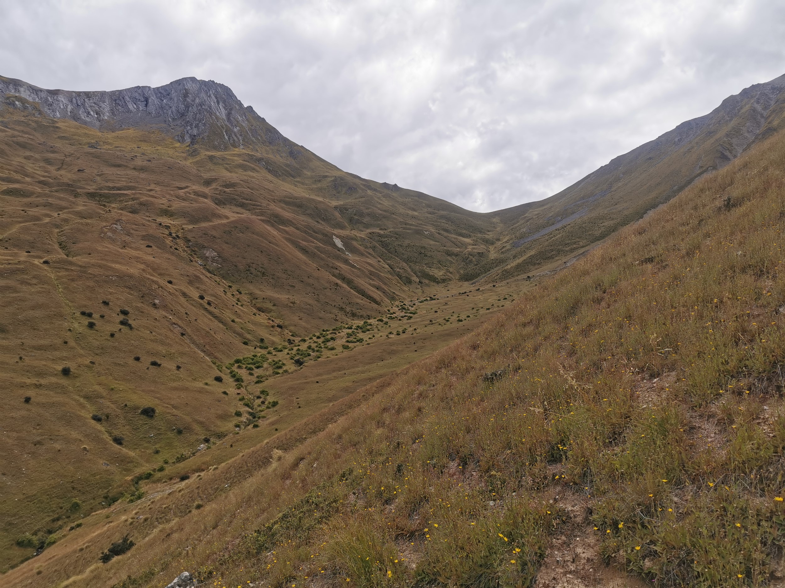
By now it was 2pm and I’d only covered about 6 kilometers. I was starting to worry, especially since I knew I had to climb back up from 800m up to 1400m. Although, while it still was quite steep, it didn’t look too treacherous from here on, as long as I took the right path up this hill.
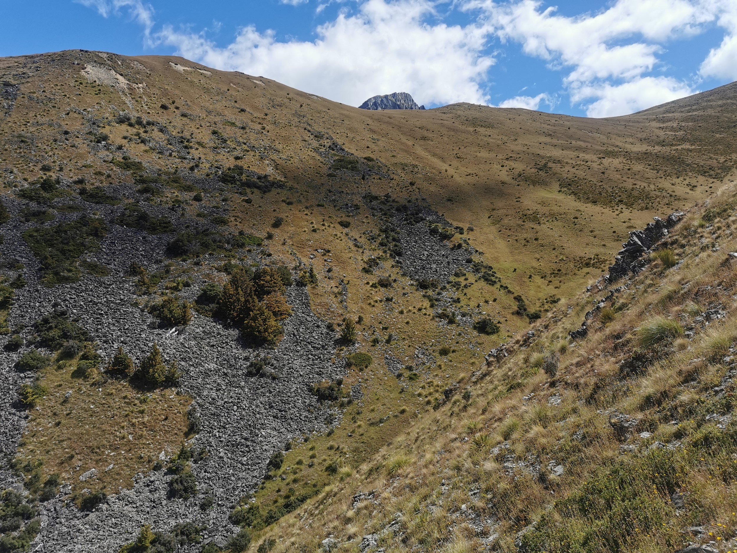
When I turned my head just a bit to the right, I could see Corner Peak.
If I turned my head a little bit further right, I could see the saddle between Dingle Peak and Corner peak. I had thought earlier in the day that even if I don’t summit either of the peaks, then I would at least like to drag myself up to the top of this saddle so I could see the view over the other side. It would be a similar kind of view to what I would have seen from the top of either of the peaks. But because I was making such slow progress, I decided I didn’t have the time unfortunately.
The saddle is the pink arrow on the next map, and I was where the red cross was. I decided it wasn’t doable given how late it was – I was headed for the Corner Peak Route, the dotted line on the left.
I started climbing to where the dotted line starts on the map. There was no telltale sign yet on the hills of what I was heading towards, but the topographic map app I was using had a great feature where it rotates the map to the way I’m facing. That meant as long as the dotted line was in front of me on the map, then I was headed roughly in the right direction.
I started seeing some sheep. I remembered the note in the hut book about keeping away from the sheep so I did my best to avoid them as much as I could.
Dragging myself up nearly 600m of altitude was tough this late in the afternoon after not expecting to have to do it. And the sun was real hot, without any shelter anywhere. But eventually, I did come to another fence.
It was great to see this, because the fence was going up roughly to the location which I was trying to head to, and when people build fences they seem to typically build them on the least steep part of the hill possible. So I stayed as close to the fence as possible and dragged myself up to the top of the hill.
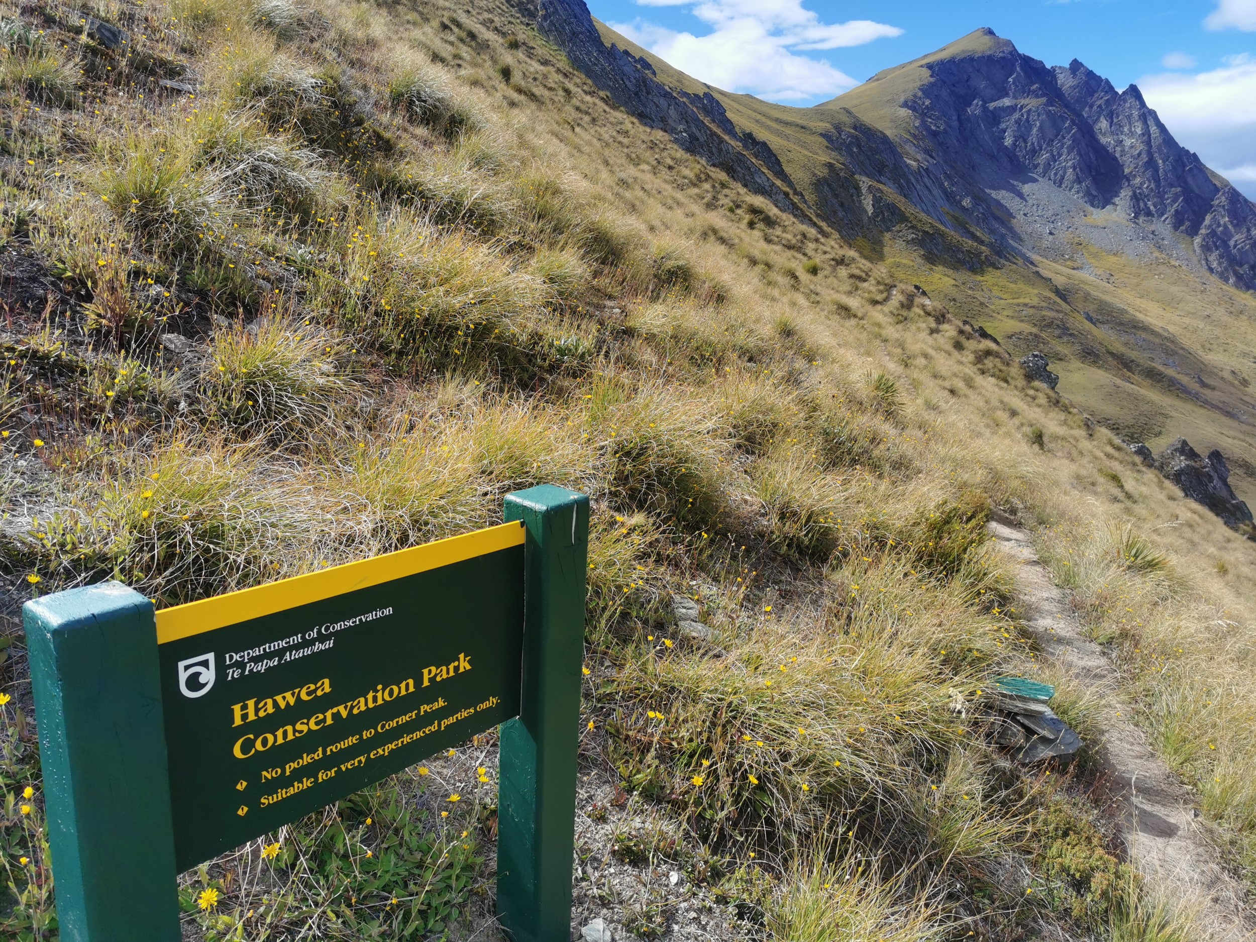
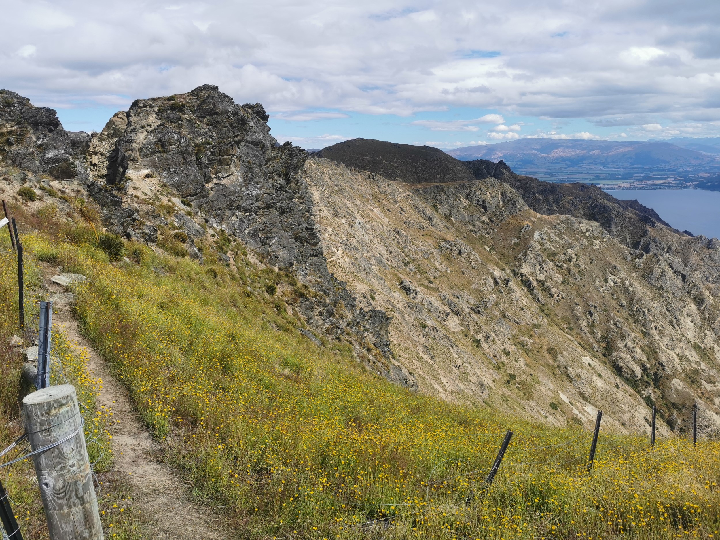
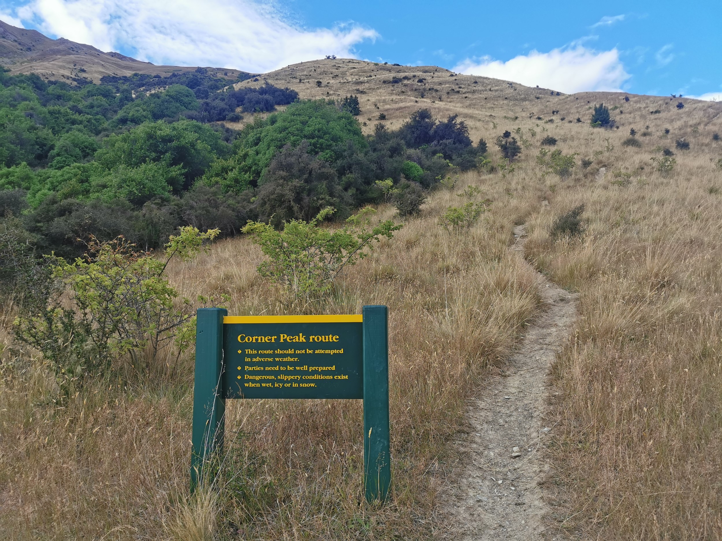
I’d reached the start of the Corner Peak Route! It was nearly 5pm by this point and I still had a long way to walk back down to Lake Hawea from 1400m up but at least now I was following an actual path with orange markers. The sign above says “No poled route to Corner Peak” and “Suitable for very experienced parties only”.
I’m experienced at hiking but not so much at climbing, so ultimately I was happy with my chosen path. Although looking back at the two peaks, I started to think again that I would like to have attempted going over the tops of the two peaks.
My next job was to get down. The trail was easy enough to follow (except for this first bit through this pile of rocks where I lost it a couple of times).
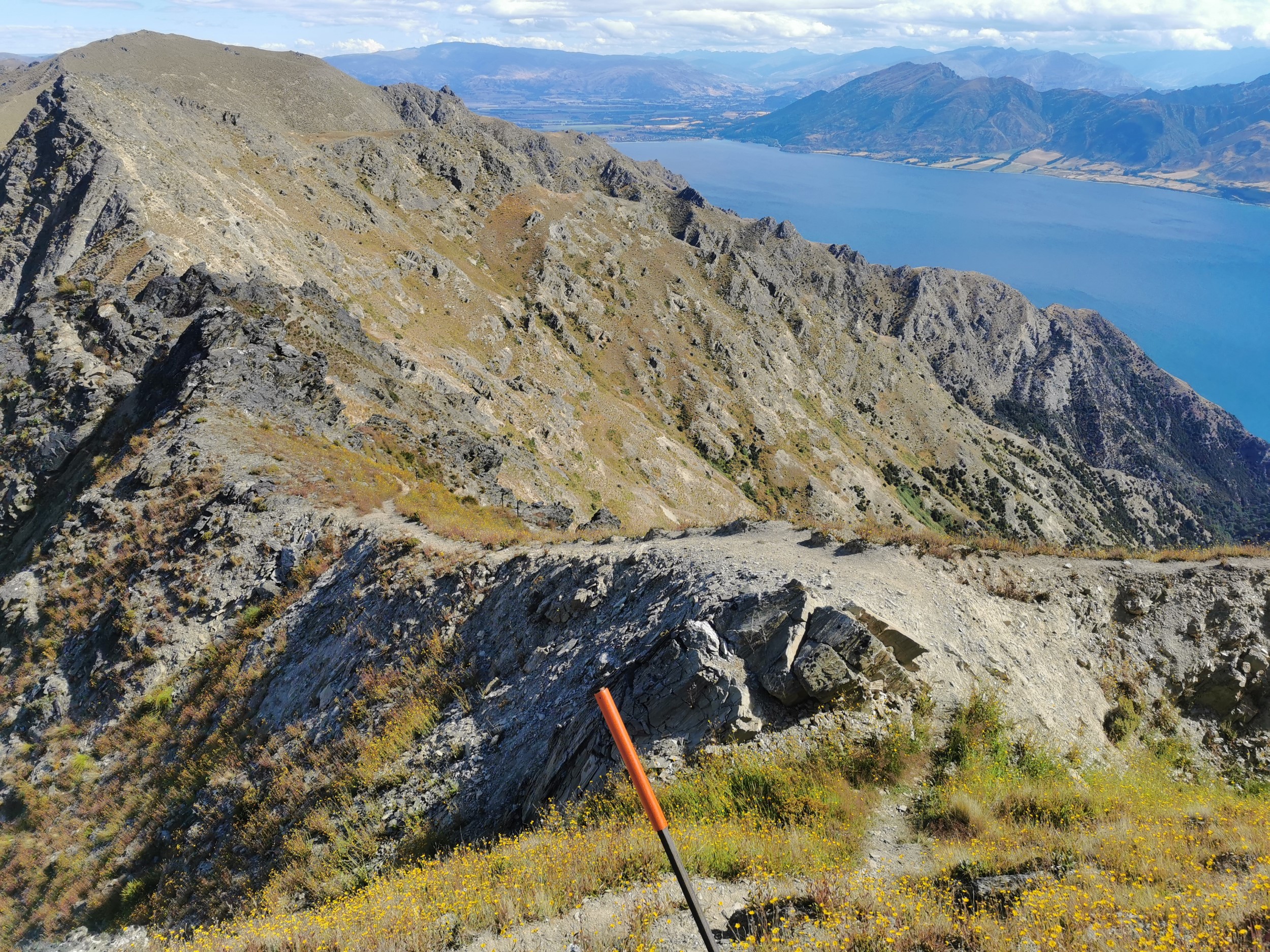
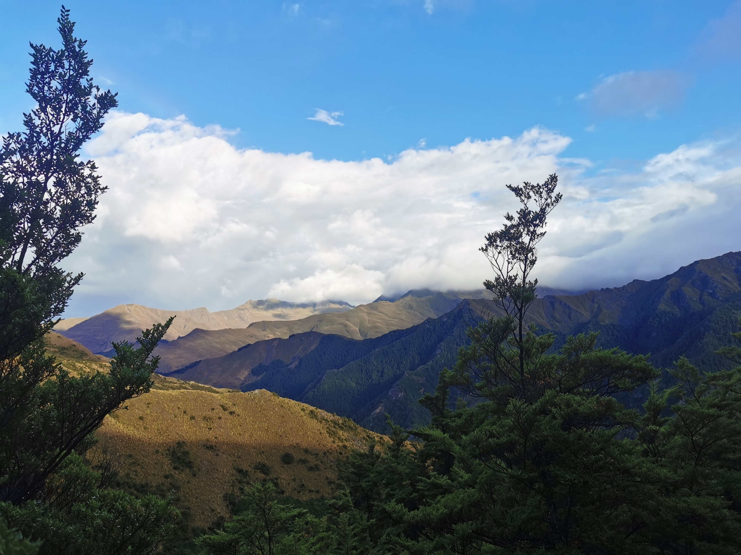
On the way down there were nice views…
But the path was consistently steep and did not let up.
Near the bottom of the route was actually the steepest part.
I was very glad there was no more elevation gain though. I was very glad I didn’t have to haul myself back up this hill.
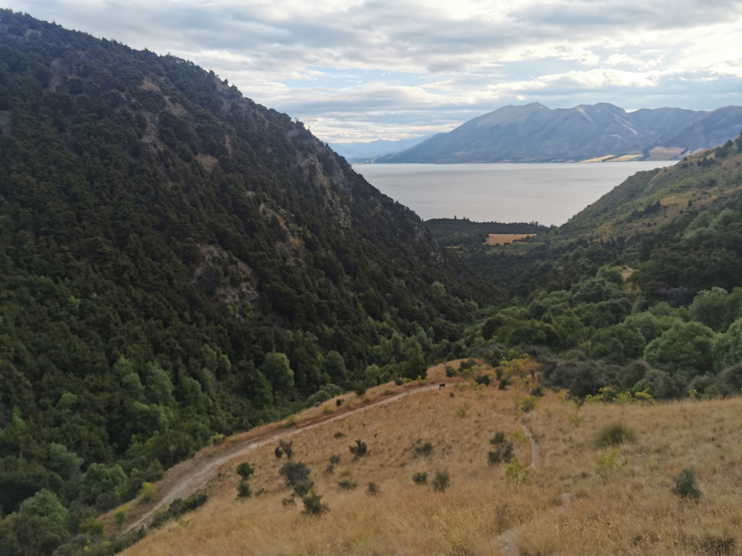
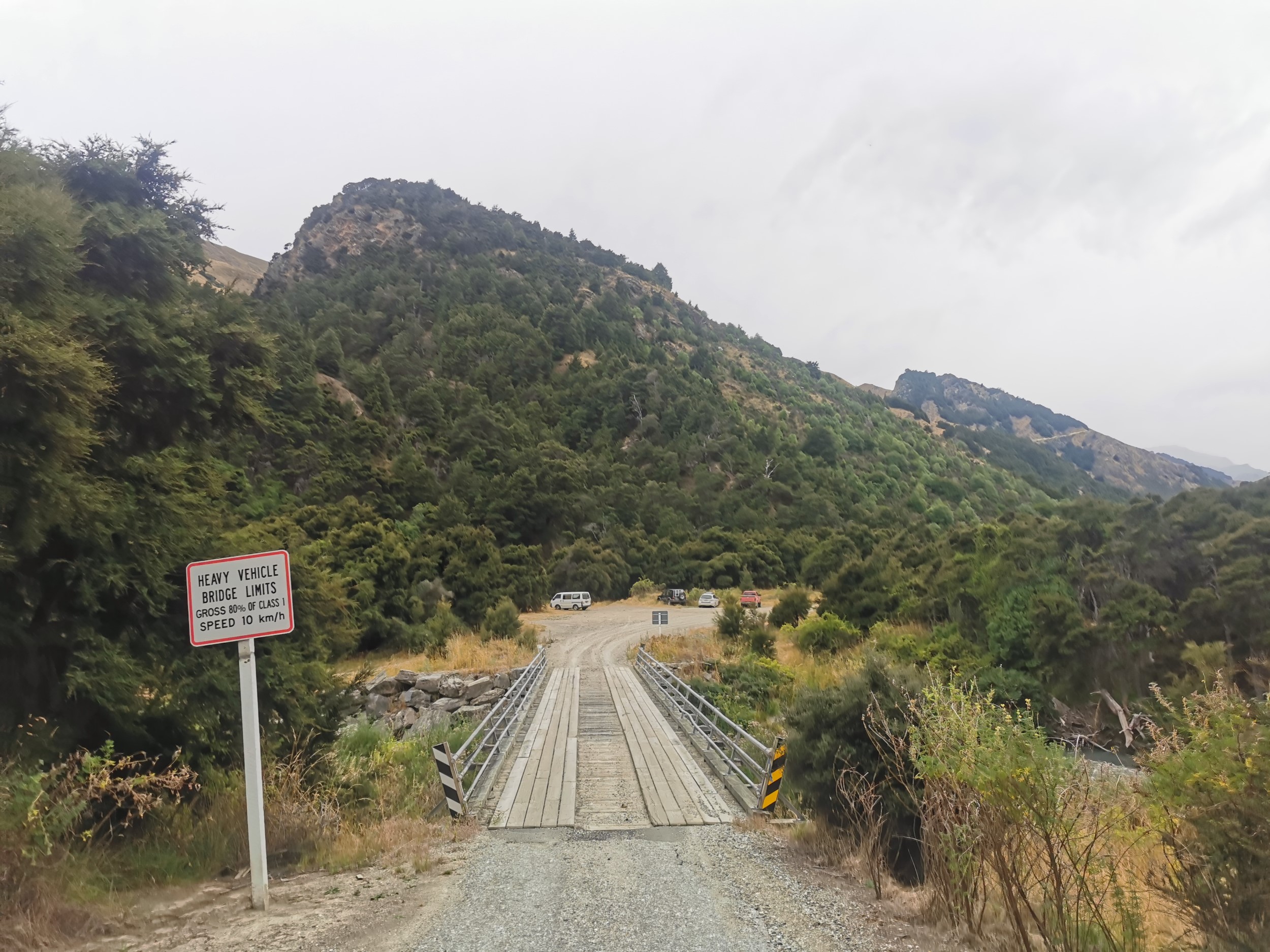
From here I joined the Timaru High River Track. It was surprising to see it was 4WD standard.
I found a small bit of flat land in the trees nearby and set up my tent. I was very sore and it was nice to lie down and eat the last of my food.
Today was a very fun adventure but I wondered several times if I’d pushed myself too far. It’s over now though, and I can rest knowing that I’m not going to die up in the mountains this time!
Today's walk on the map (blue = Te Araroa, red = today's walk):
DAY 4 (5 February 2023)
Total distance: 15.3km
The last day was a shorter day, almost entirely walking the road back to Lake Hawea.
I had packed up and left by 7:30am and I thought perhaps I might encounter somebody in this carpark going back to Lake Hawea township who might want to give me a ride, but no people were around.
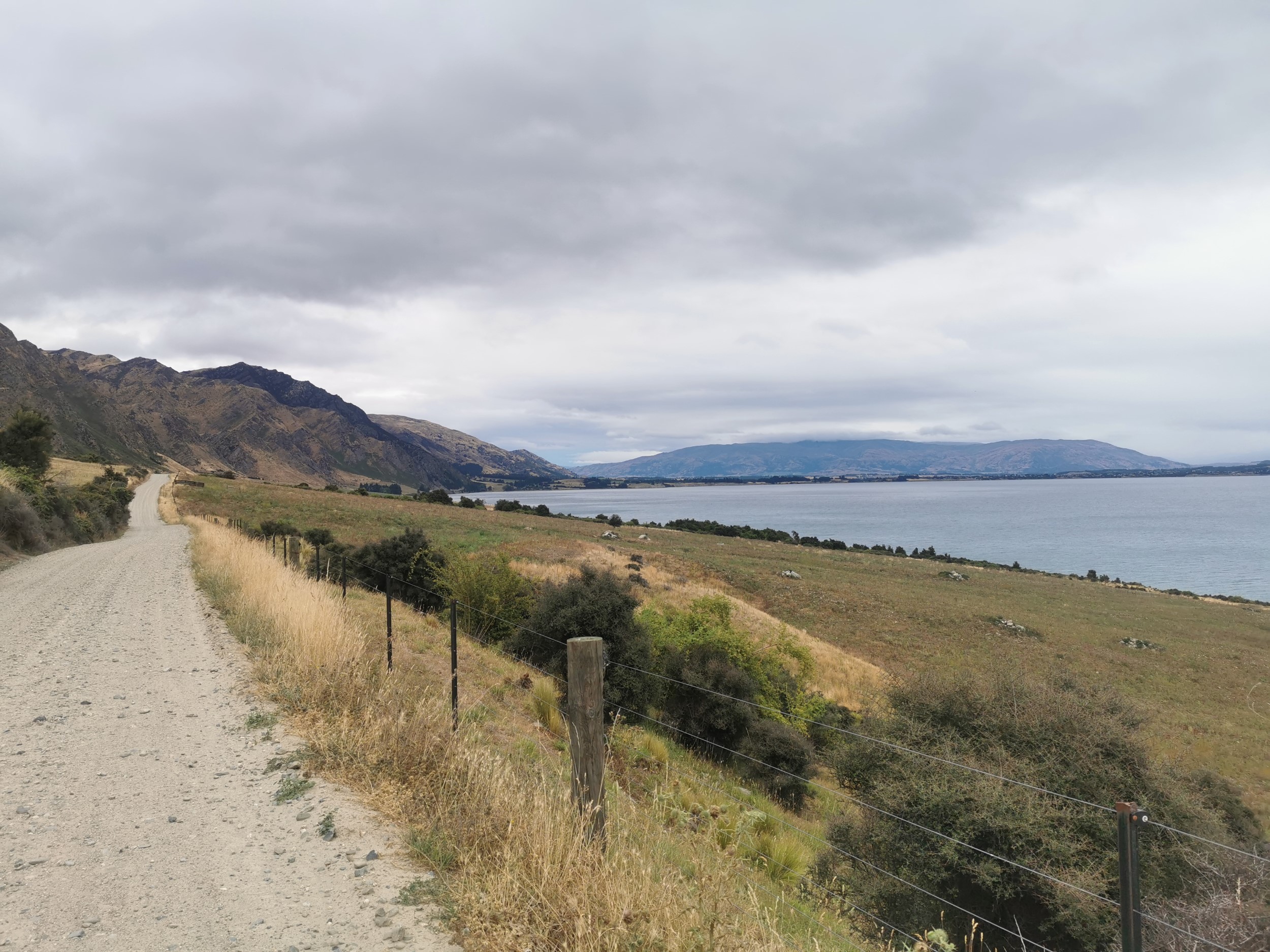
In fact, for the two hours I spent walking the road, not a single car passed me going back to the town – and there were only two cars on the road in total going in the other direction.
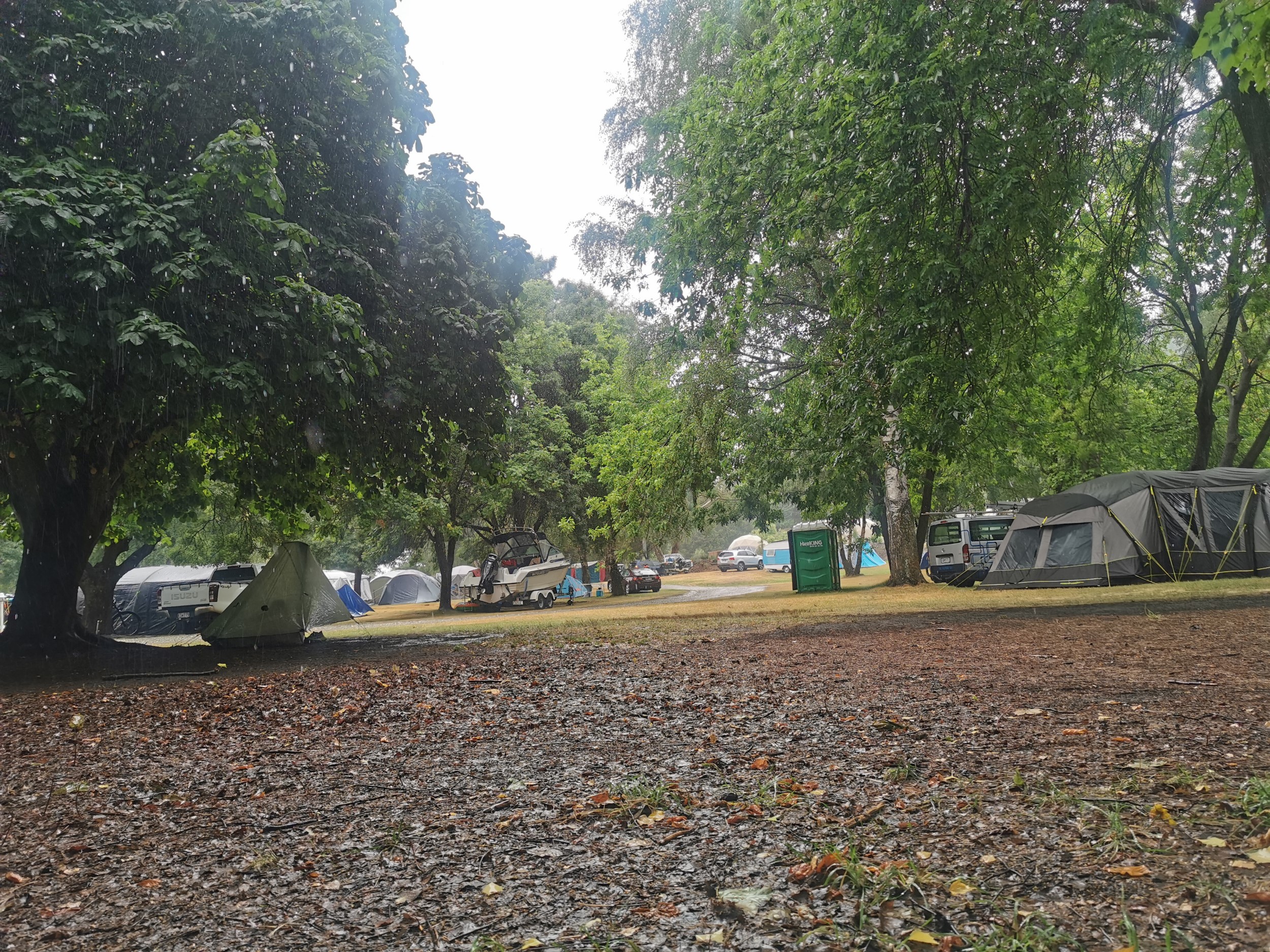
I stopped in and had breakfast at the only cafe in Lake Hawea (which is where I stopped recording my walk). I didn’t spend long there because I went from spending almost 48 hours without seeing any other person, to being in what felt like the loudest cafe in the world. It really was sensory overload for me so I had my breakfast quickly and made my way to the only campground in town to set up camp.
Today's walk on the map (blue = Te Araroa, red = today's walk):
Once I’d set up my tent, it rained for most of the rest of the day, so I spent the time just resting. My bus back to Queenstown was not until the next day.
The rain was kind of a drizzle all day, but it rained so hard nearby on the West Coast near Haast that a lot of buses were cancelled, including the bus I was meant to take tomorrow, due to slips! The next day, to get back to Queenstown, I actually ended up hitchhiking from Lake Hawea to Wanaka and then caught a different bus from there. That was very easy though, it took only 10 minutes in the morning to get a hitch from a nice lady who lived in Hawea and worked in Wanaka.
Thanks very much for reading. I hope this has inspired you to go and find Moonlight & Roses Hut yourself one day, or if not, go and find some other hut at least! If you have been to this hut before, I’d love to read your comments.
Today's walk on the map (blue = Te Araroa, red = today's walk):
Great adventure Matt.
Have met plenty of folks who have read your TA blog thus year.
Keep exploring.
Thank you for taking the time to share your latest adventure. My wife and I were able to spend a year in Aotearoa New Zealand on two ocassions over a decade ago. While based in Auckland we took every opportunity to explore the rest of the country. Our walks didn’t take us quite so far into the bush so I’m enjoying the chance to explore with your assistance. I especially loved the photo in this post of the giant fruit by the farm stand. There seems to be a great love for Kiwis of oversized road side art. The giant trout on the way into Gore comes to mind. Here is a link to my blog of that time. https://notanauspiciousbeginning.wordpress.com/2012/05/