Date: 20 October
Distance walked: 41.4km 
Trail covered: kms 340.9 to 381.6
Weather: pleasant and then cloudy and cold
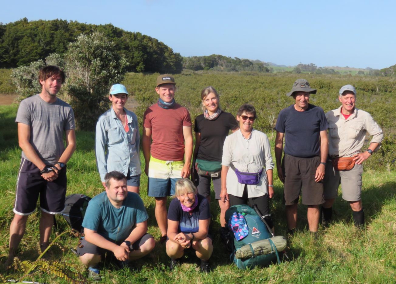
Number of TA walkers walking together at one point: 9
This morning I had set my alarm for 4:20am because we were scheduled to leave Nikau Bay Eco-Camp at 5am exactly. This is the only way we would be able to do both of the two upcoming river crossings at low tide. I also didn’t want to hold up Nick and Robert because they start early on a normal day and I didn’t want to be doing these crossings by myself. I’ve never done a “real” river crossing before, one that needs to be planned, and I won’t lie I was quite nervous.
I woke up at 1:30am, then again at 2:15am. I managed to sleep right through until 3:55am when I saw the light on in the main kitchen area and also needed to pee. So I got up. Had a small breakfast of muesli with milk and a muesli bar, because that required only minimal cleaning up.
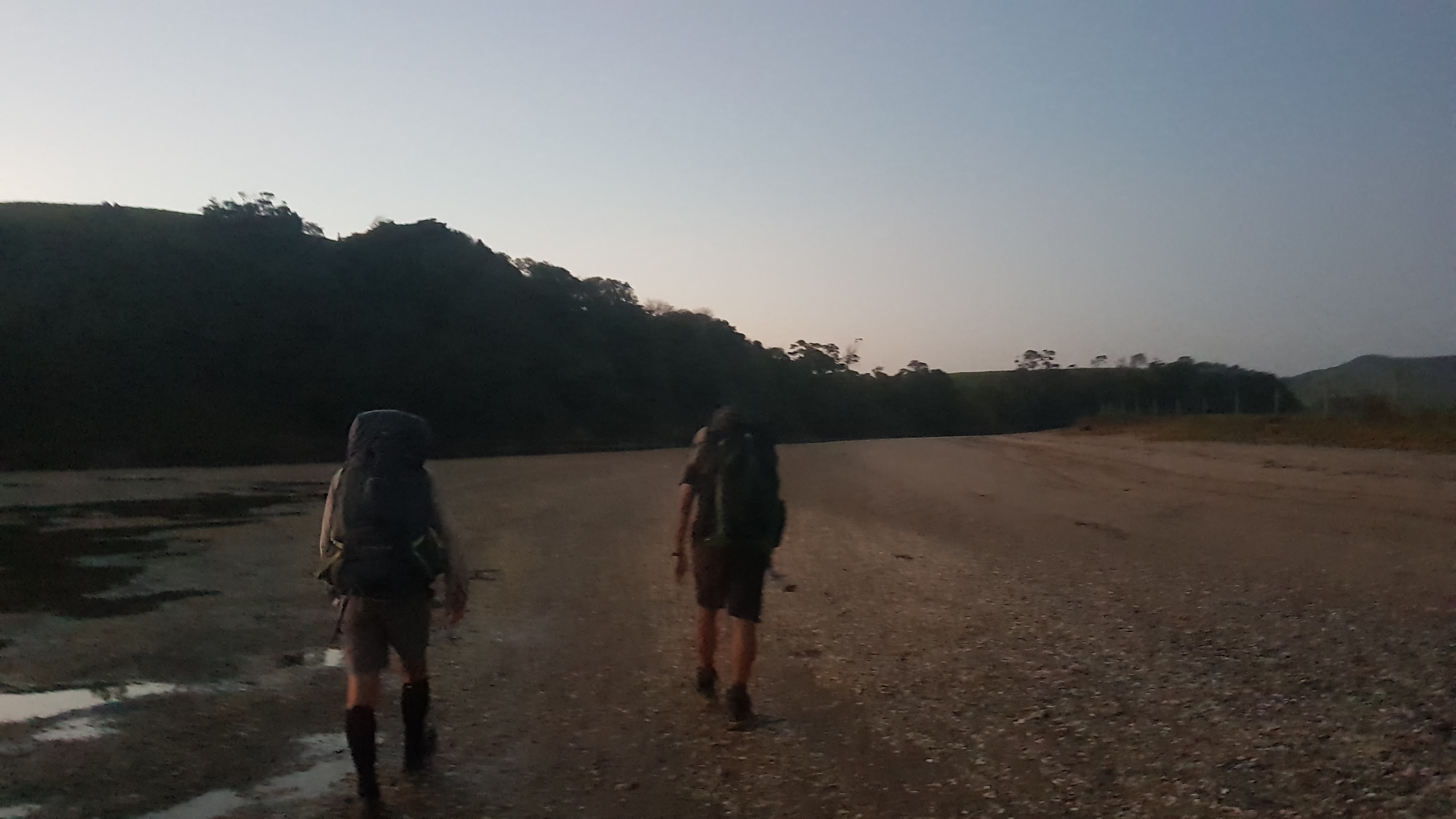
We left at 4:50am since we were all ready ten minutes early, and made our way out in the dark. The other two had quite powerful headlamps but I only had my $4 KMart headlamp. It was good enough though. The path to the river was mostly a gravel road and as long as you could see the path then there wasn’t anything to trip over or watch out for.
Although at one point we did detour 400 metres in the wrong direction. We followed the markers but didn’t realise they were leading us down the detour path (the path you would take if the tides are wrong which adds at least 11km to the journey) instead of the main path. So we had to backtrack. That cost us 10 minutes, and I thought that wasn’t ideal but low tide was around 6am and we were okay to walk the 5km to the first crossing in that time – the Horahora River.
It was hard to see much in the dark but we did start seeing “private – Maori Land” signs around. Luckily we were okay as we had each paid our $5 for the right to be there. At one point we did also walk very very close to a house, “Violet’s” house, right down the side of it. But she knows why we’re there.
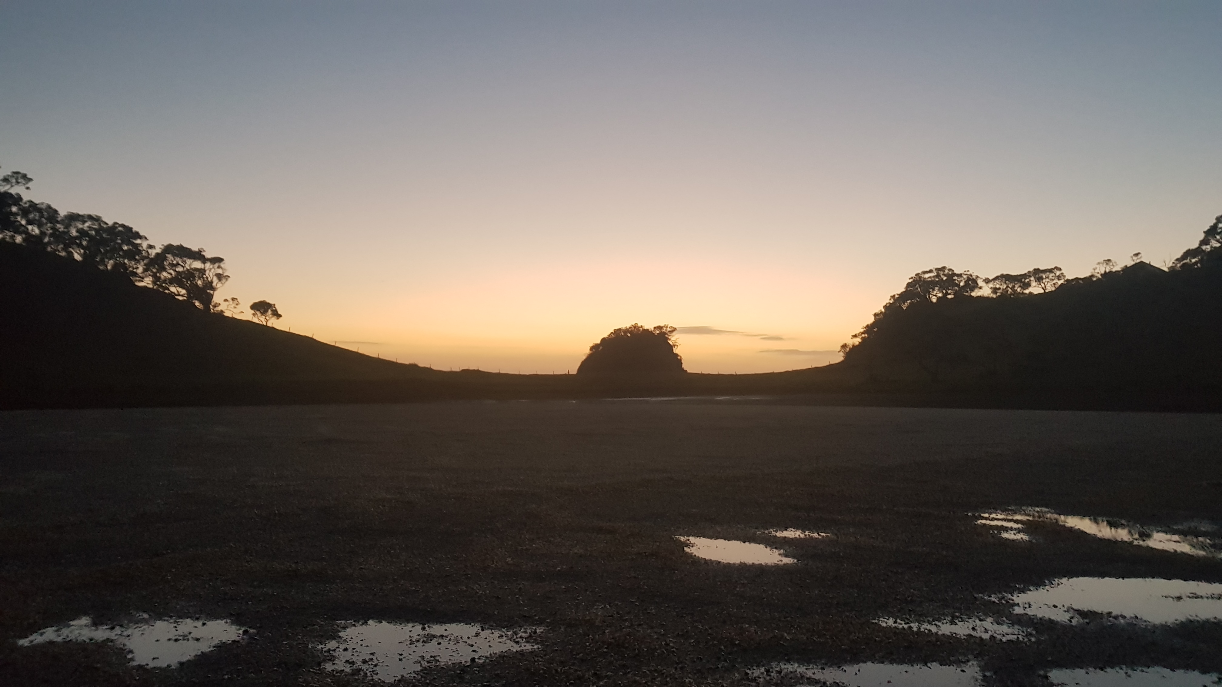
There were no photos up to this point because it was so dark. But I did get to see my second sunrise of the trip so far – the only other one being the morning of Day 2 of Twilight Campsite where I had oriented my tent towards the sunrise without even realising.
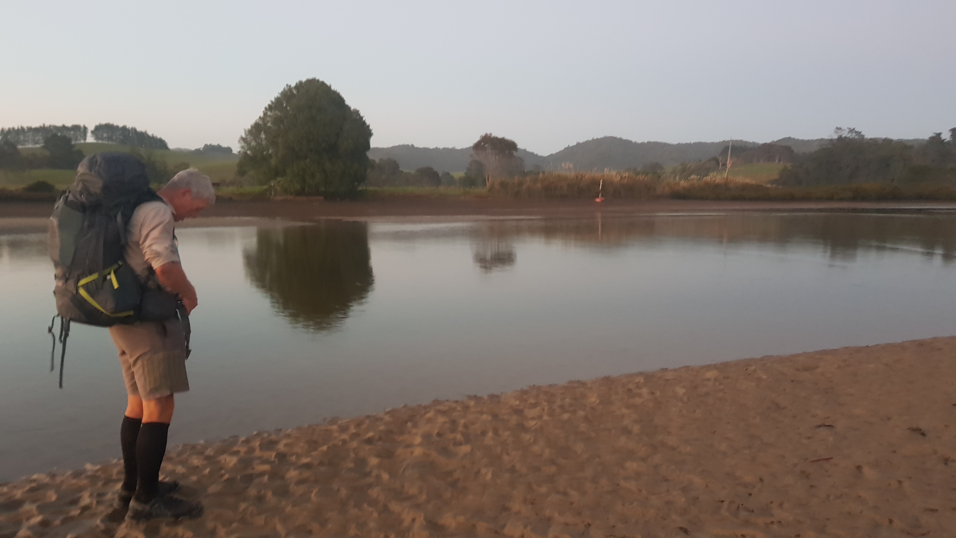
A short walk through a tiny bit of bush and a bit of mud and here we were at the Horahora River. I started to get nervous at this point. I remembered back to when I first considered even doing the trail and I had said to myself “I’d do it if there weren’t so many river crossings – I don’t like the water!”, well here was the first real test.
I’d been preparing for this – I had even rearranged my pack differently so that if the water turned out to be chest height, which apparently was a possibility, that the things in the bottom of my pack wouldn’t get too wet. But honestly, the river didn’t look too bad once we found the marked place to cross.
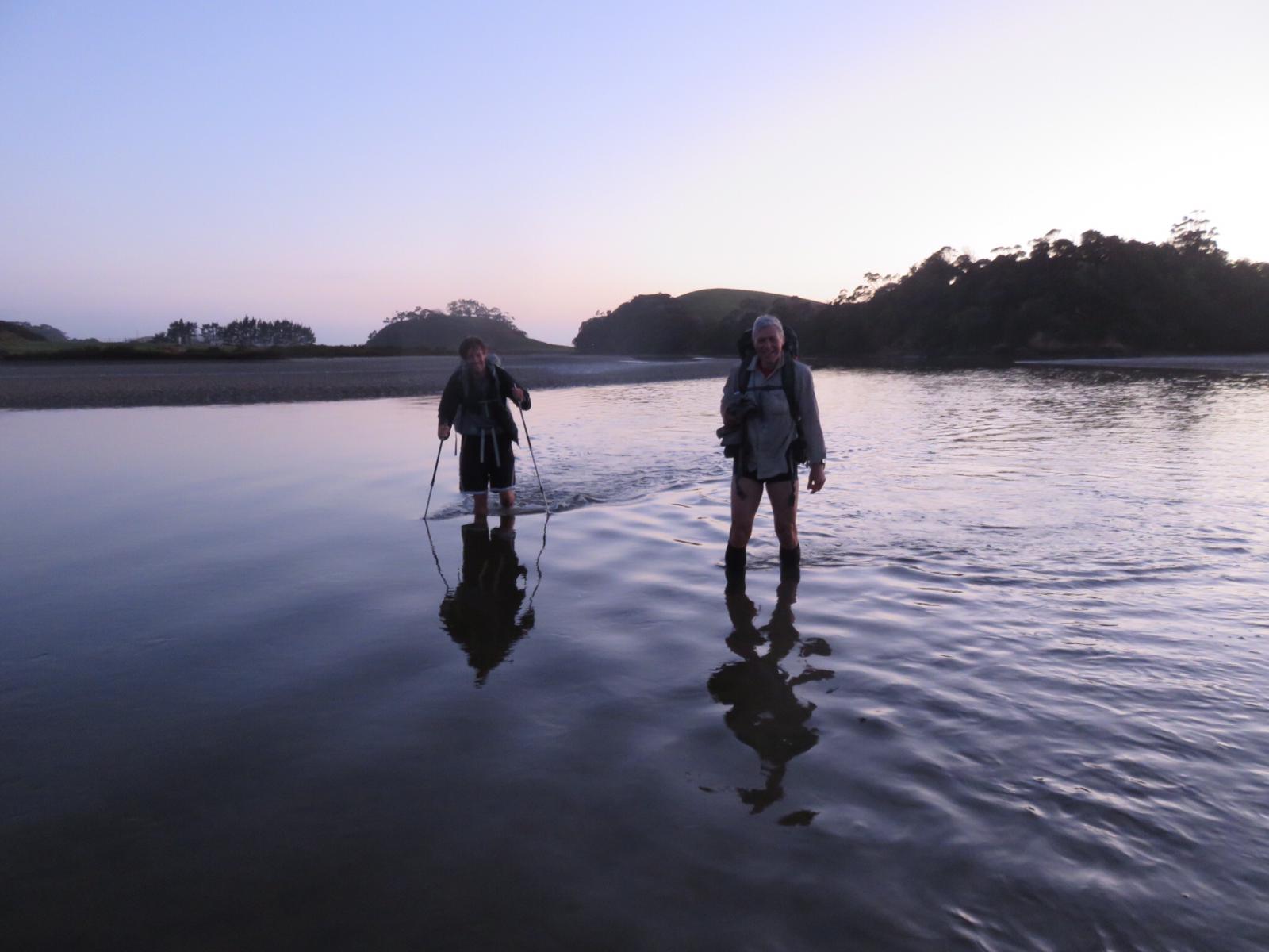
And, well, with all the anticipation it turned out to be a bit of a fizzer. The water barely even reached the bottom of my shorts.
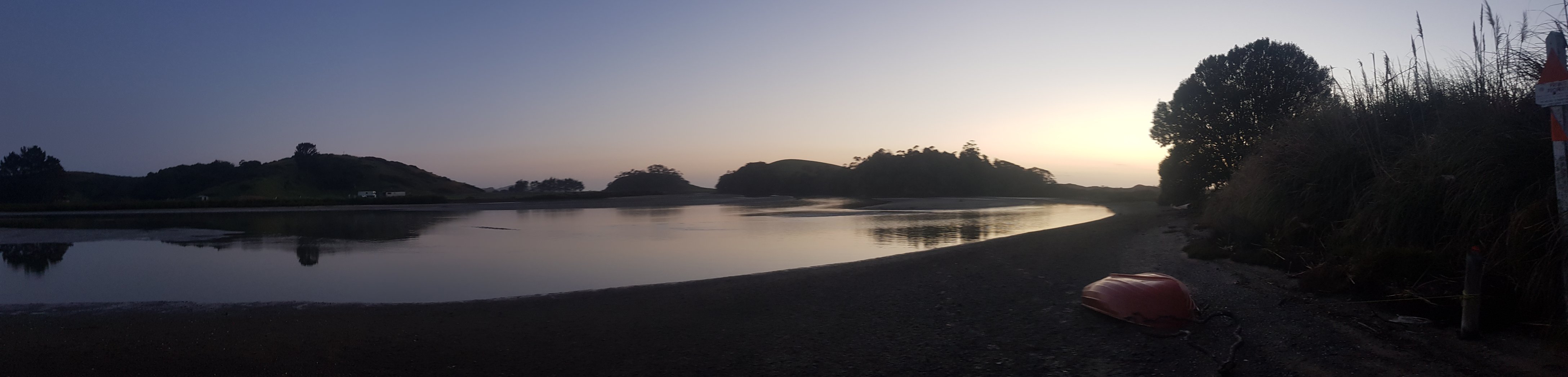
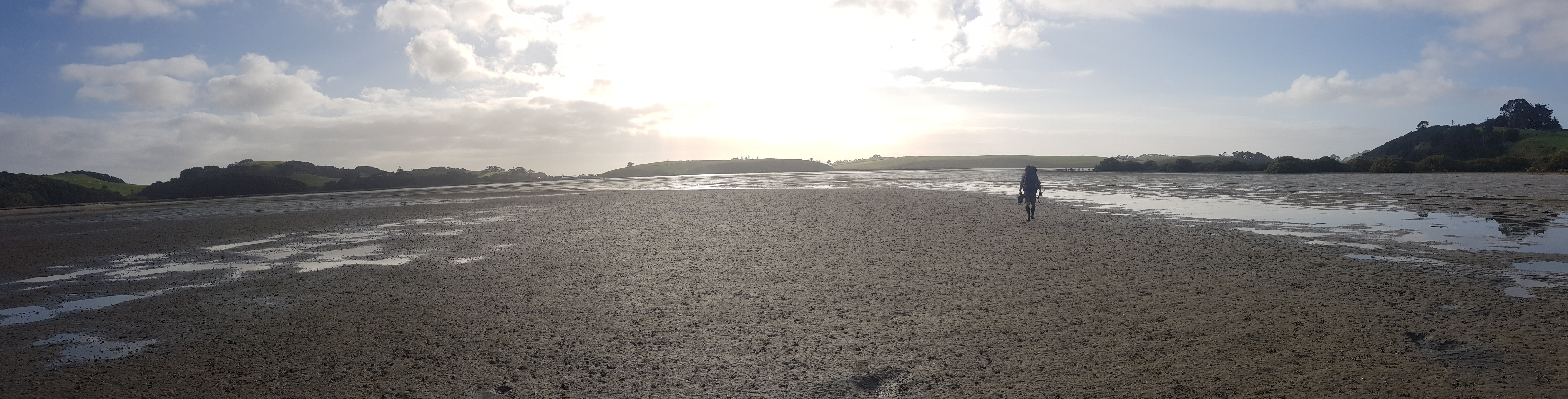
The sunrise across the water was beautiful.
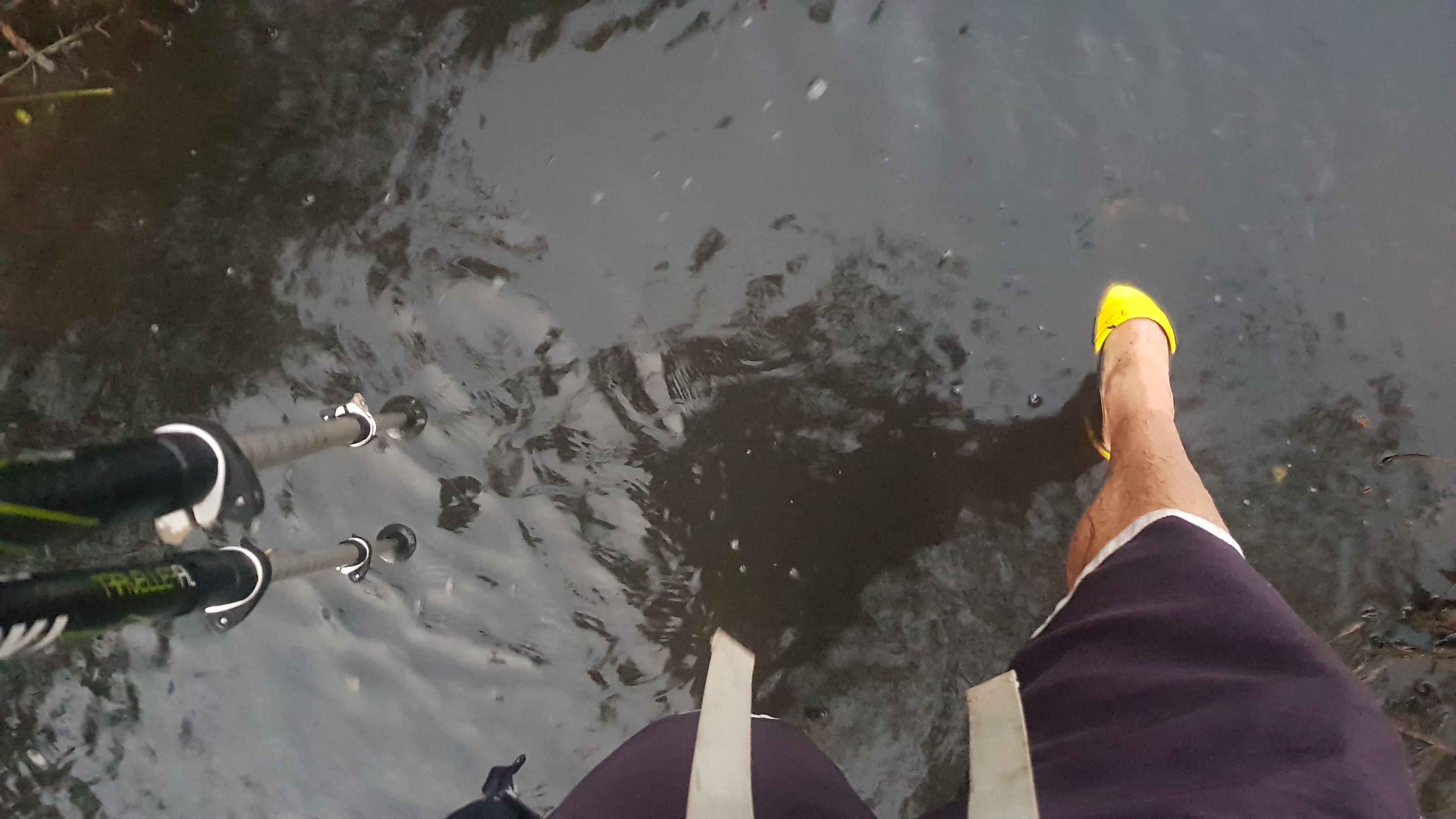
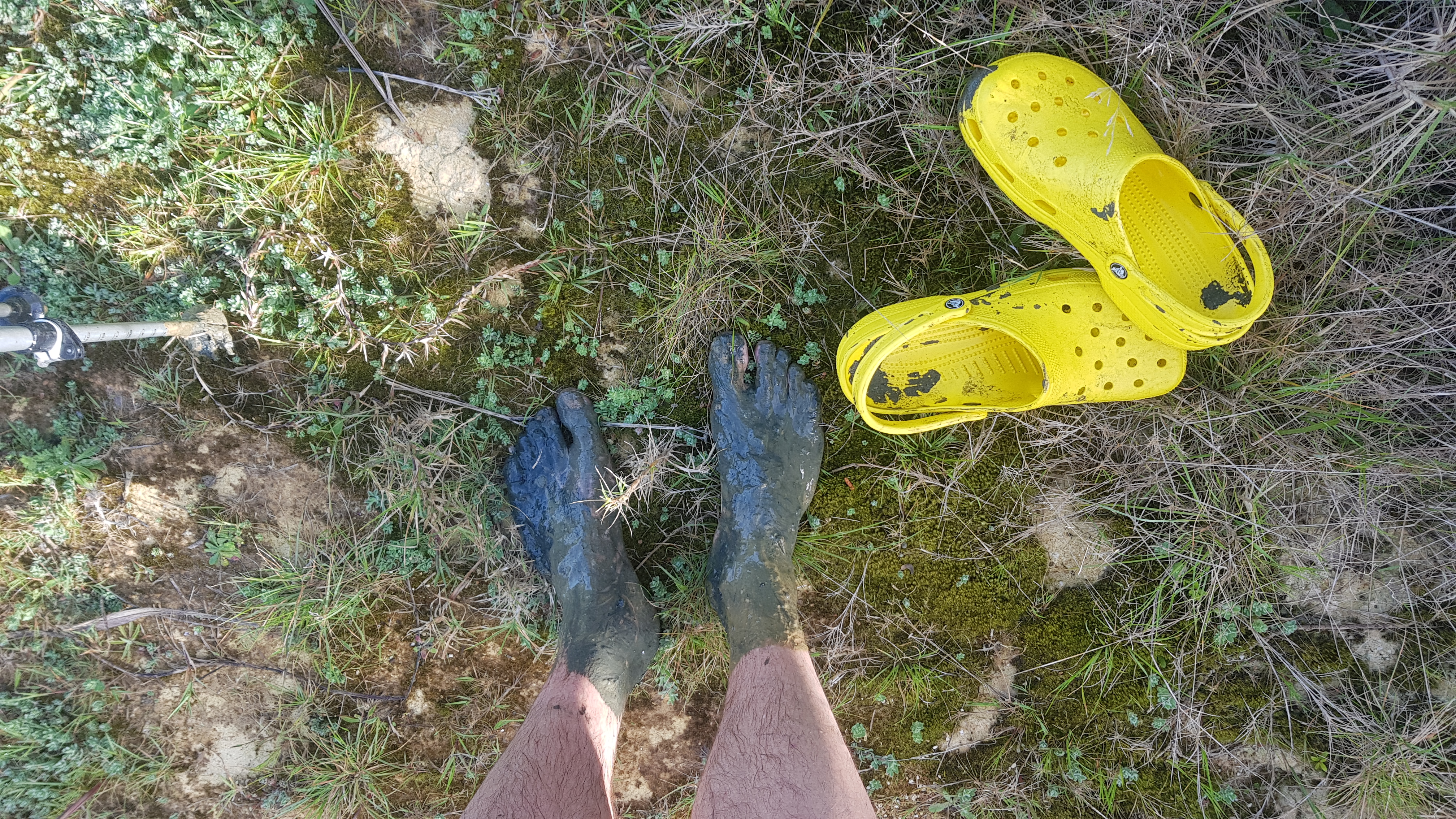
The mud at the south end of the river was quite intense. I couldn’t even see my bright yellow crocs.
I was glad that the low tide wasn’t any earlier. It was only just getting light at the end and if low tide was 20 minutes earlier I wouldn’t have been confident that I could see – even though the bottom of the river was just sand and mud.
We started walking to the next crossing. It was 7km through the small settlements of Pataua North and Pataua South. There was a footbridge connecting these two places, so no risk of getting wet there.
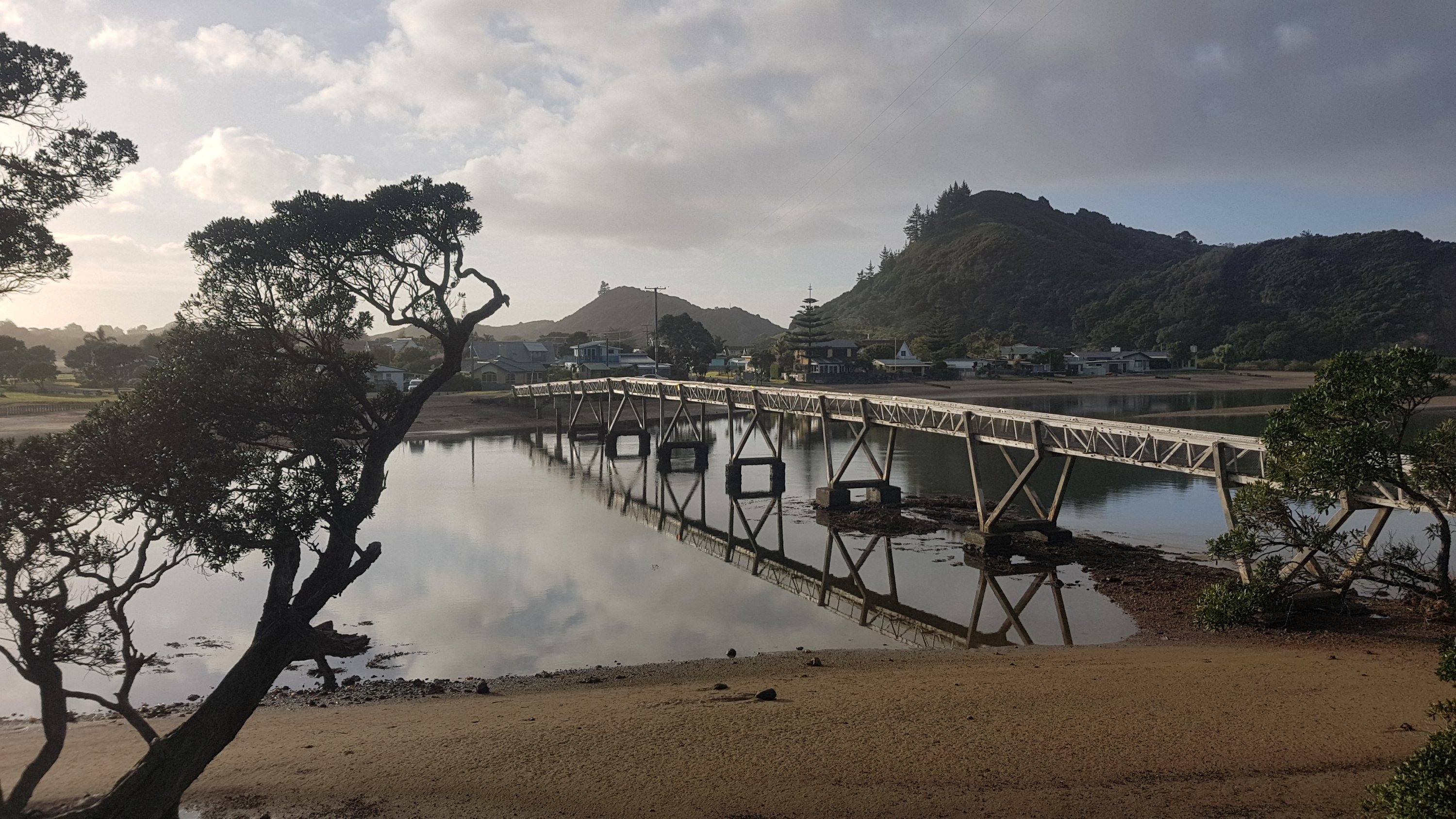
While crossing the bridge, the sound of seagulls was deafening. Can you see the two “islands” of seagulls here? We could certainly hear them!
These were very small settlements. This series of signs does a good job at describing all the local landmarks.
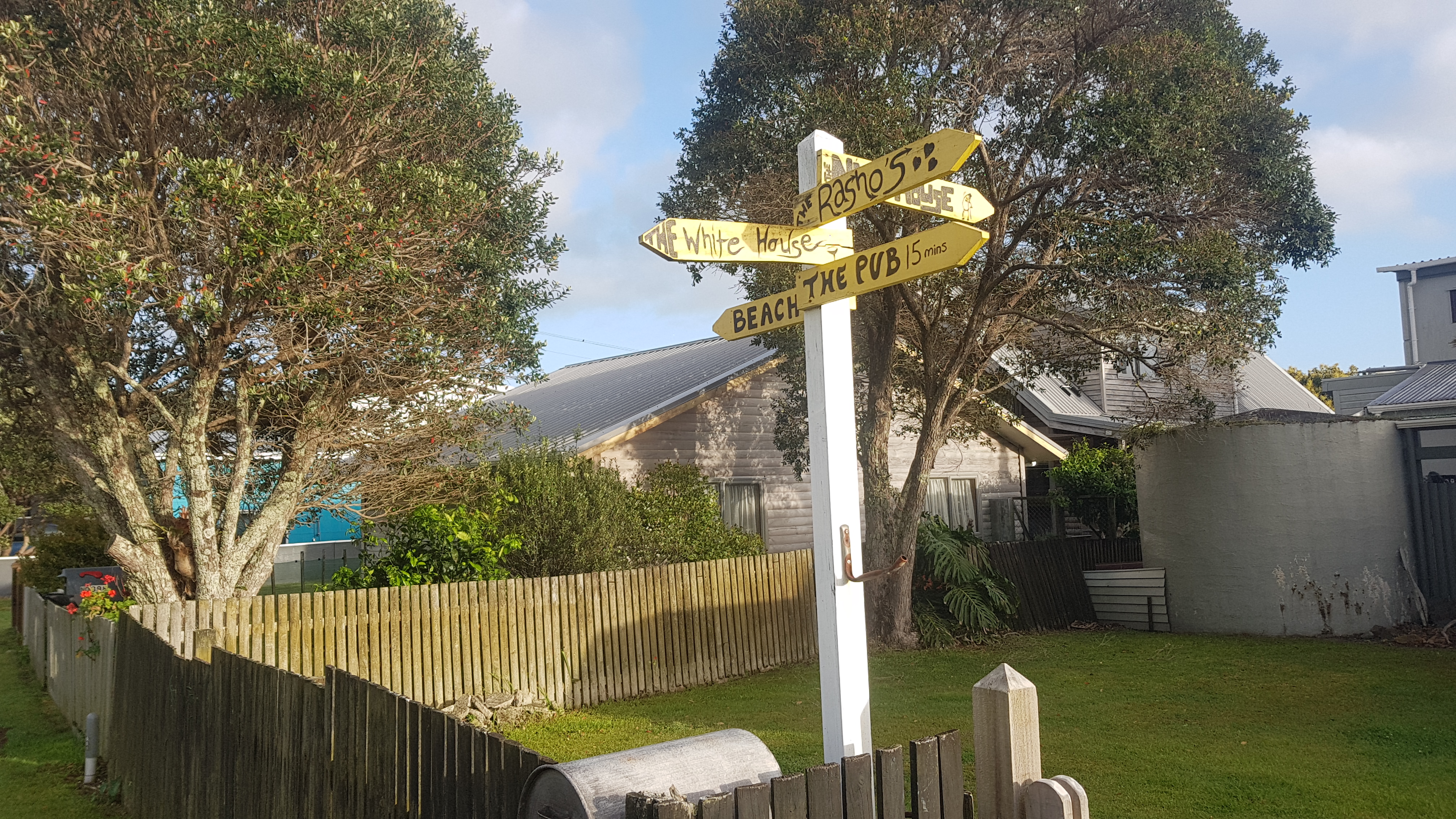
The one behind says “nut house”. And I don’t think I ever saw the pub. But what I did see were Robert’s crocs.
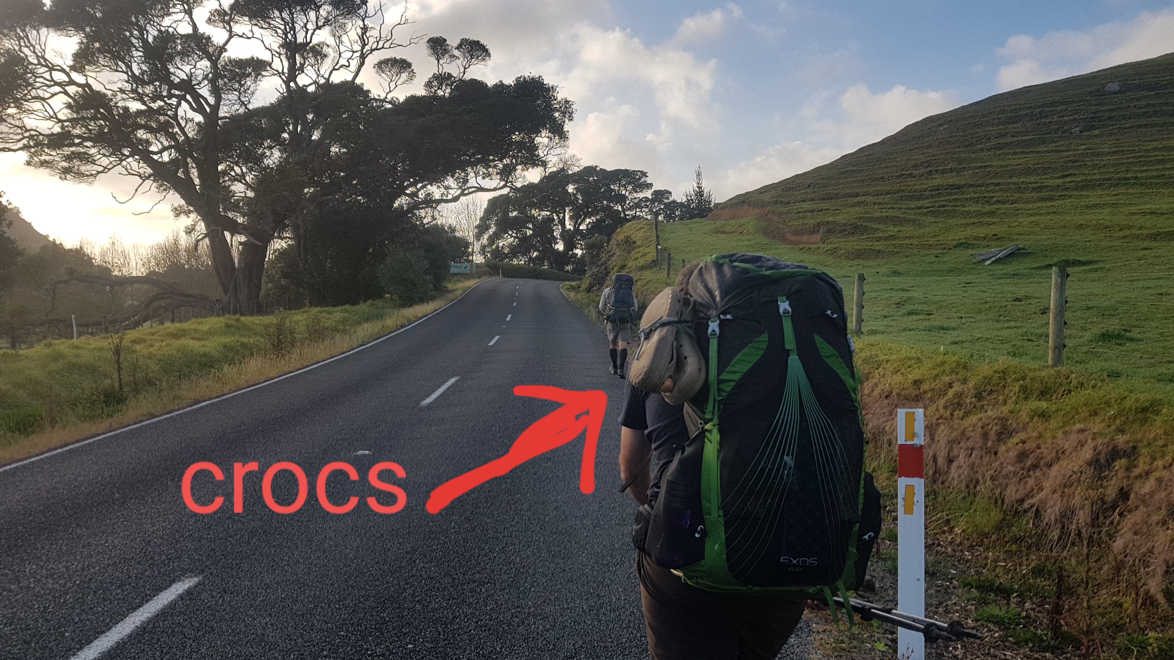
In fact crocs were a lot more prevalent than I expected – 50% of people seemed to have them. Although they were always grey or black or brown. I haven’t seen another yellow pair. Good too, because they won’t get mixed up.
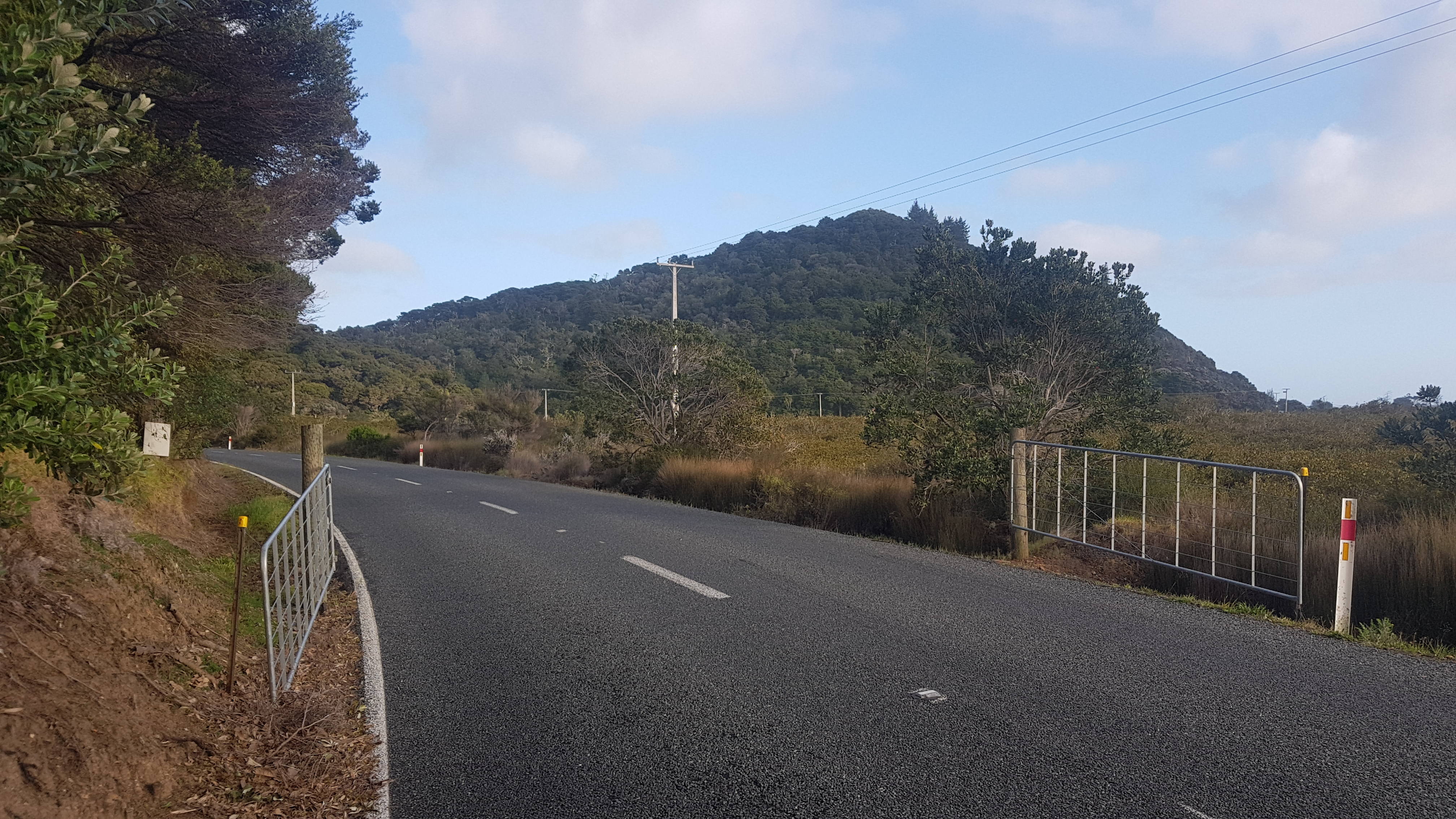
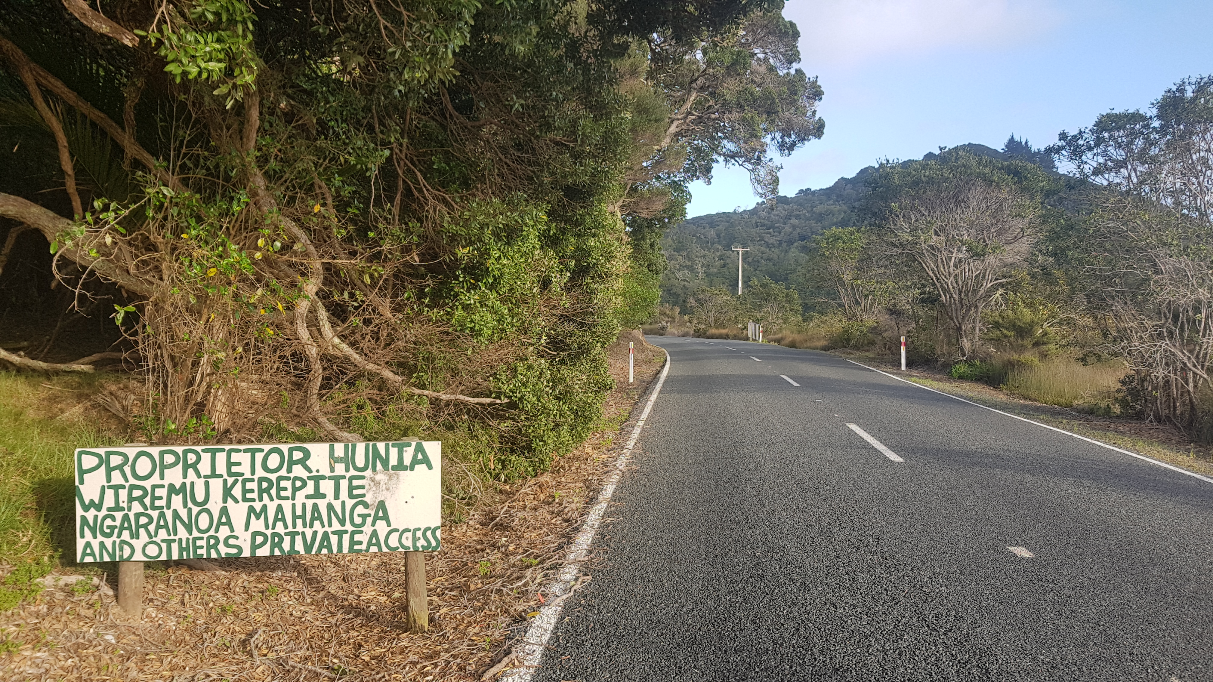
Also, I think this settlement, or at least Pataua South, might be Maori land, because there were gates blocking the road:
And this sign:
Anyway, we pressed on. It was an hour and a half after low tide when we reached the second crossing – the Taiharuru River. Although James from the camp last night had said this one was real shallow. Of course his definition of shallow and my definition of shallow might be diferrent.
The first bit was muddy, and I took my crocs off and walked in bare feet, as did Nick. But Robert soldiered on through the mud in his boots.
This crossing was different. The first crossing was “walk 200 meters across this river and you’re done”. This one you had to walk in and out of the water and across bits of sand which were varying degrees of muddiness. The total distance of this crossing was about 2km.
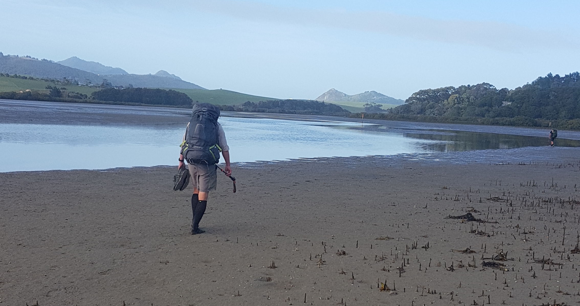
Turns out that this crossing was even more of a fizzer. The water barely got higher than my ankles. In fact the deepest part of the whole crossing was the mud at the end. There was a lot of thick mud at the end of this crossing, as you can see.
I was worried for nothing about these river crossings! I had read comments on Facebook about people who experienced deep water. Obviously by following the advice on James’ big information board from yesterday, we had it sussed.
At one point we could see a group of people out in the distance, who were also doing the crossing at a different point. It was hard to see who they were, I thought at first they were a family playing on the sand but then they started crossing the water.
Turns out it was another group of TA hikers, who had stayed the night at Tidesong B&B, located between the two crossings. It was Olivia and Frederick, who I hadn’t seen since Russell Forest, Ralf who I last saw at Paihia, and three new people – Kay from Putaruru, and Tina and Agneta who I think are Swedish (apologies if I’m wrong!)
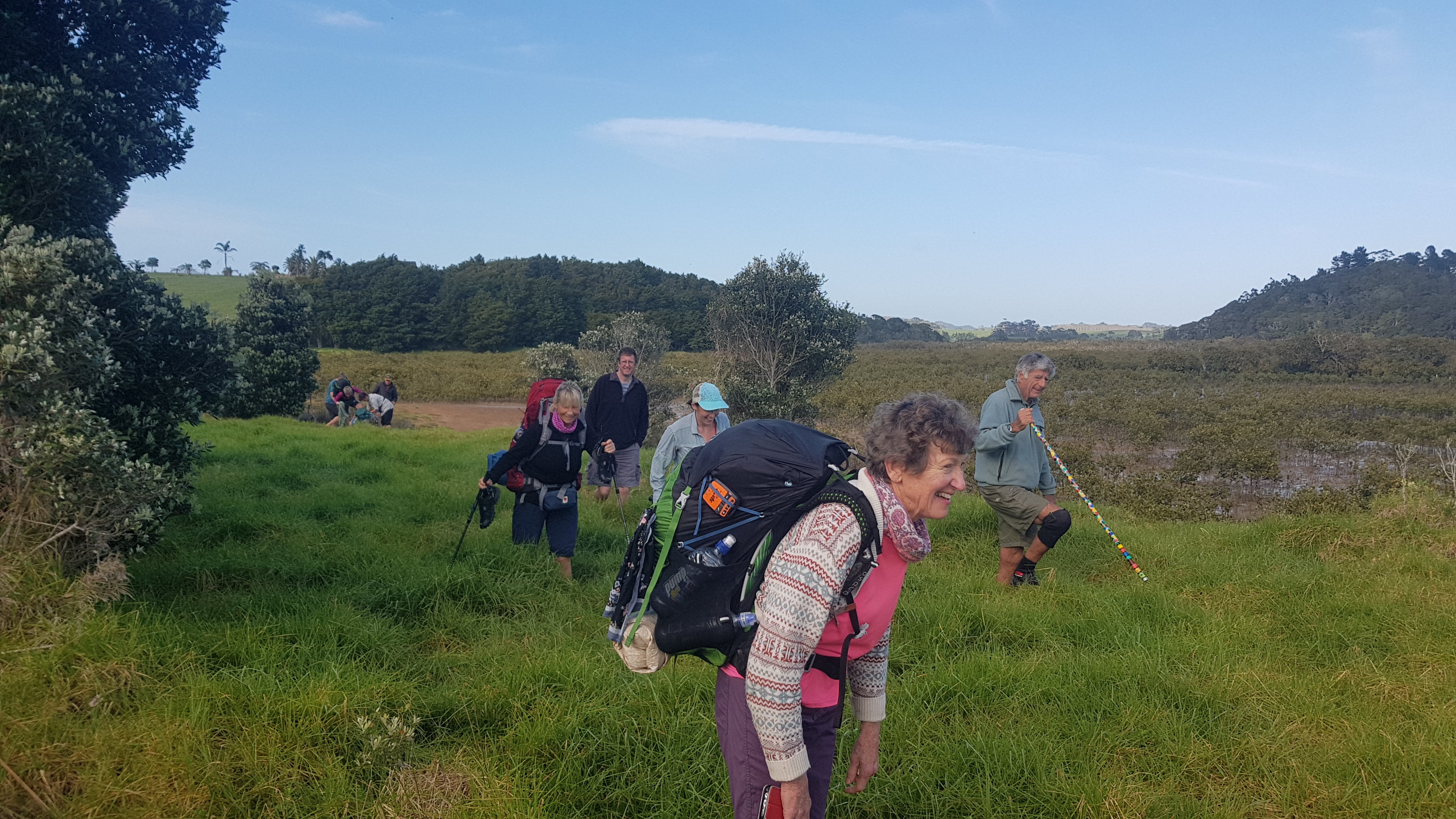
We walked together for a short time but it became clear that we all had different skill levels. Olivia is a speedster and she disappeared fast, however that was okay, Nick, Robert and I had already walked 19km by this point whereas the rest were just starting out.
Before she took off, Olivia mentioned that she had organised a boat between Whangarei Heads and Marsden Point for tomorrow at 9am. I really wanted on that boat so I didn’t have to organise my own crossing. But that would mean either a big day today, or an early start tomorrow. Actually, an early start isn’t so bad. I actually really liked our 5am start, and hope to do it again sometime.
She also mentioned that all the accommodation around Whangarei Heads was full. She said that she and Ralf spent two hours trying to find accommodation for everyone in the group. Interesting. I’m not going to worry about that now. Surely there must be a place to camp on the upcoming Mount Lion.
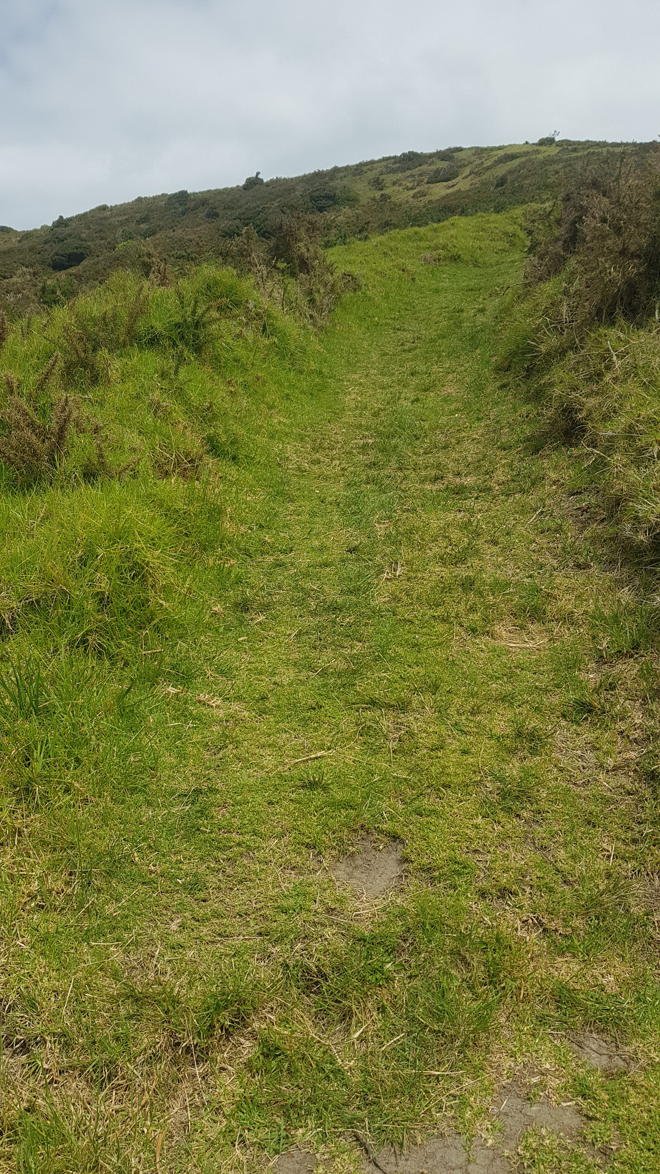
We all went different speeds over something called Kauri Mountain. Interestingly, we didn’t really notice any Kauri. It was gravel road followed by a short bit through the forest. It was quite steep in places. Some of the group went slowly and didn’t speak as they were puffed.
Nice views though. Although they would pale in comparison to the views that came later in the day, although I didn’t know that yet.

We finally got to Ocean Beach on the eastern side of the peninsula. Not a very imaginative name for a beach really, is it.
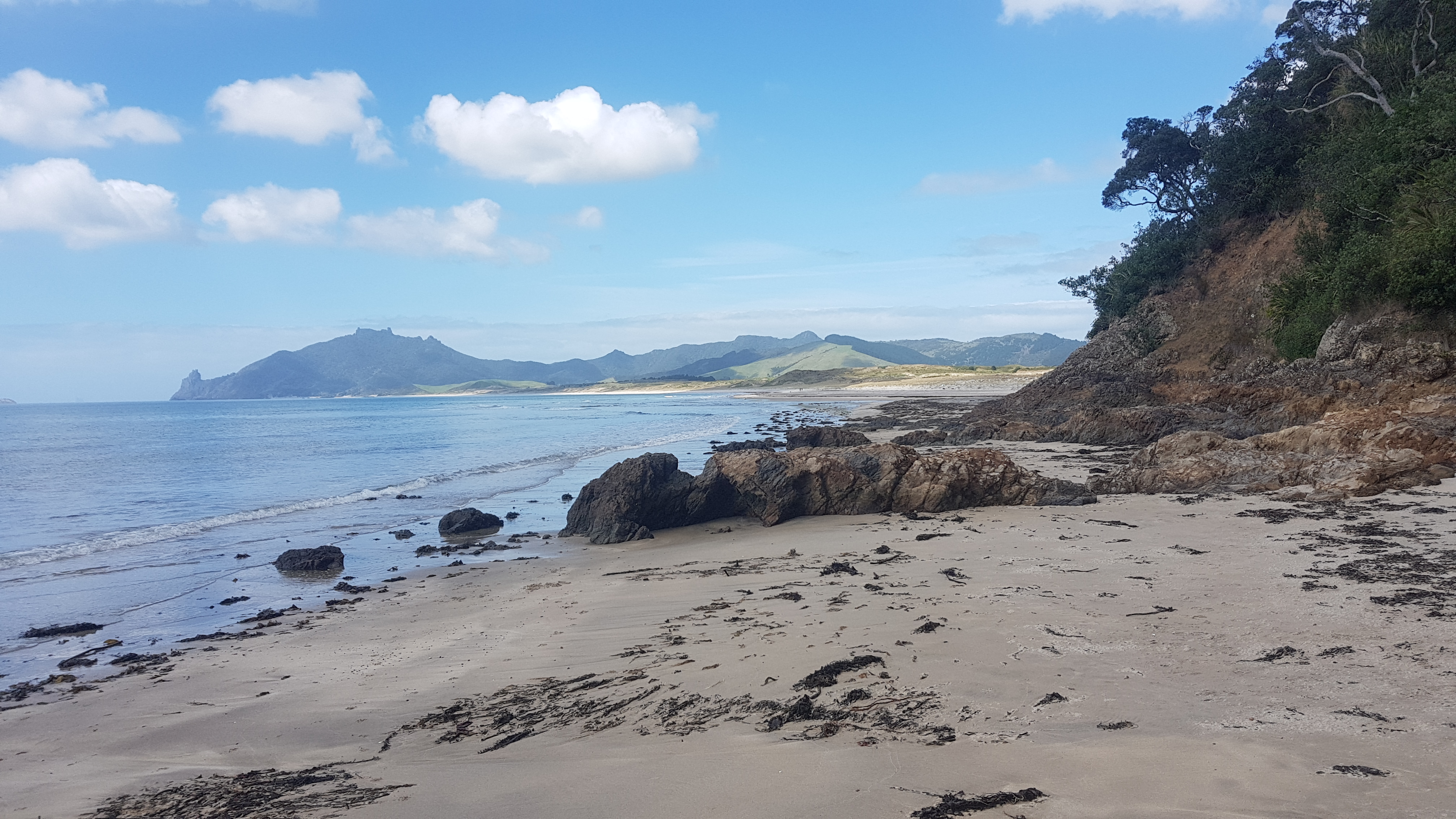
Looks innocent enough, but after climbing over the first few rocks, the beach just seemed to go on forever. We walked for a short while before deciding that it was time for a lunch break. The 11am picture is Robert and I having lunch on the only seat around, while Nick decided for some reason to have his lunch up in the dunes.
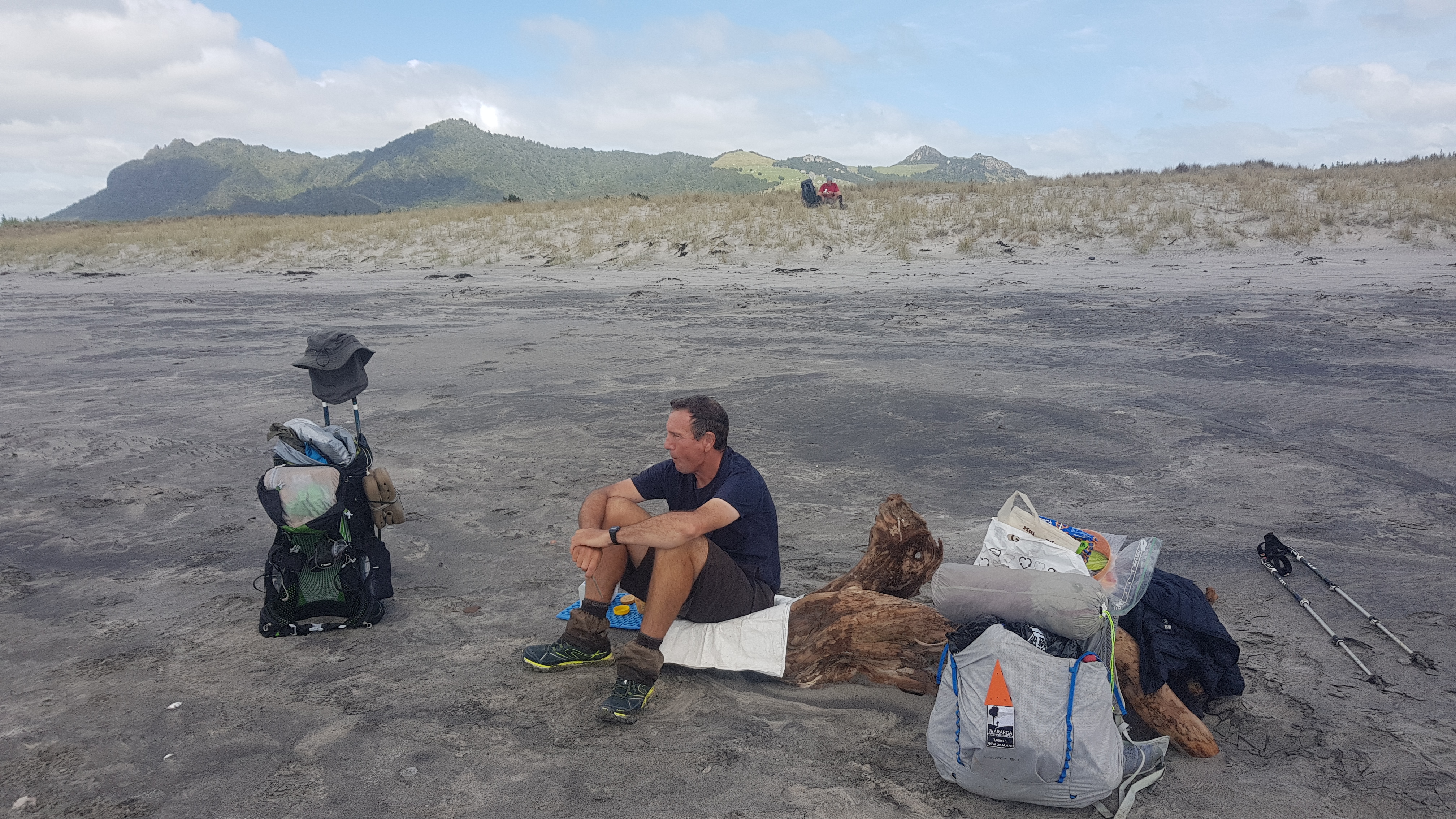
It feels weird as I write this that the 11am picture today features so far down the blog post. Obviously we had an early start. I had already been up for 7 hours at this point, and walked about 23km.
The beach is long, obviously nowhere near as long as Ninety Mile Beach, but long after you’ve already walked such a long way. The only other difference is that this time the water was on your left instead of on your right, which actually was weird and often made me feel like I was heading north instead of south.
The beach kept going and going. Twice you thought you were at the end, but each time it was just a bunch of rocks and then there was more beach.
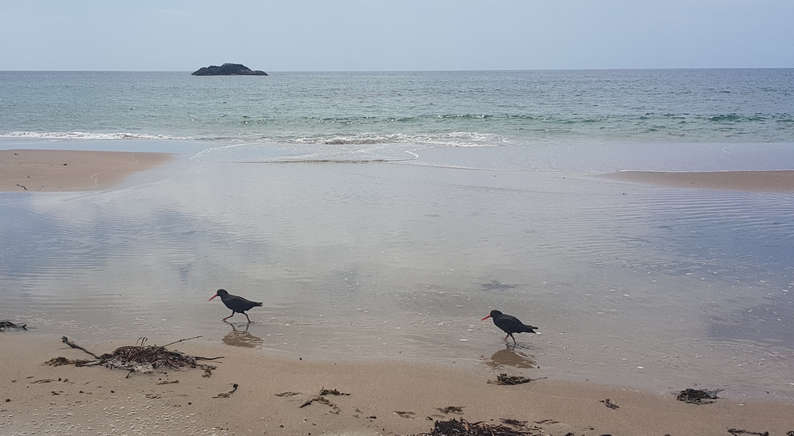
Even though not much is around, I don’t get sick of seeing the oystercatchers.
While going down the beach, we all discussed what the nine of us were doing tonight. After this beach walk was Te Whara and Mount Lion tracks, which are steep and hard and go up to 475m in elevation in a very short time.

We already knew that Olivia was off and going over the mountains. Nick and Robert said they were going to stop at Ocean Beach Campground for the night and attempt the mountains tomorrow. Frederick is going to hitchhike to Whangarei because he needs new shoes. And I was surprised that the other four are simply skipping the mountains altogether for various reasons – injury, lack of time, or they just look too hard. I still didn’t know what I was going to do.
I was surprised at the number of people who decide to skip sections. Jeremy from yesterday and then four of this group too. But I understand people have different reasons for doing the trail. However I am not skipping any sections – I told myself that at the start.
I walked with Nick and Robert up to Ocean Beach Camp. It was a nice little spot which just seemed to be somebody’s back yard, but it had an outside toilet and shower – didn’t find out if the shower was hot or cold. The cost for a tent was $15 paid by honesty box.
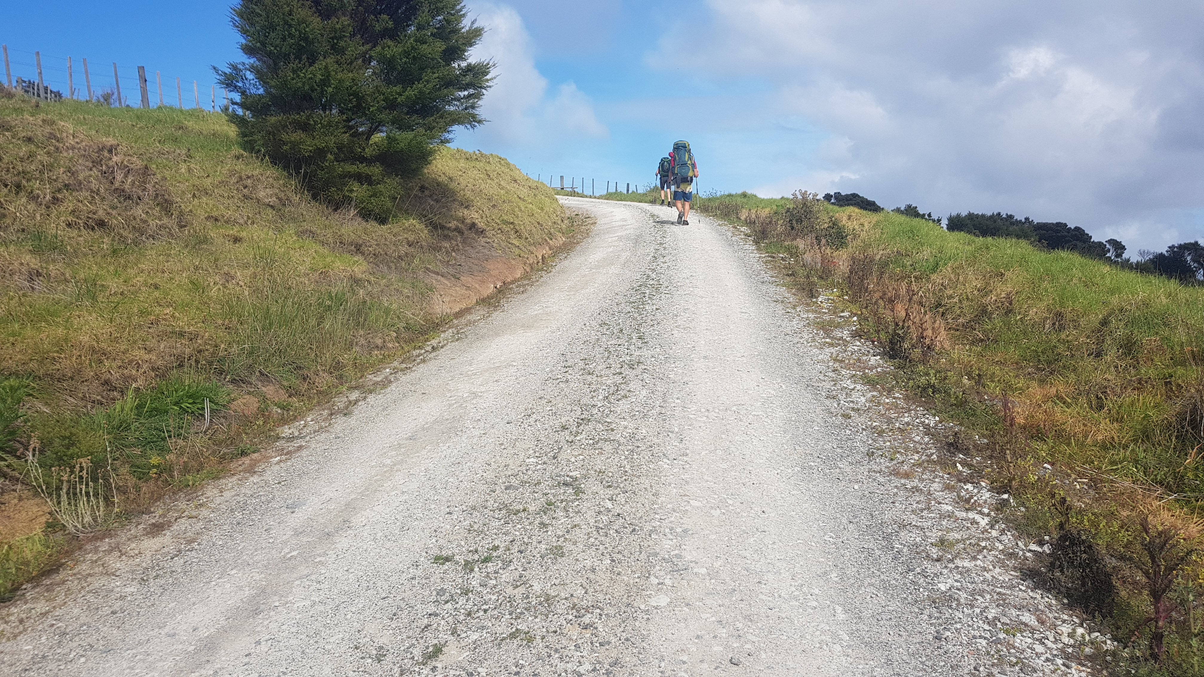
After resting a bit with them I decided I had the energy to go on over the mountains. I’d done 31km by now but because of the early start I was feeling good after a rest. So I pushed on. The first bit was up a particularly steep bit of sand:
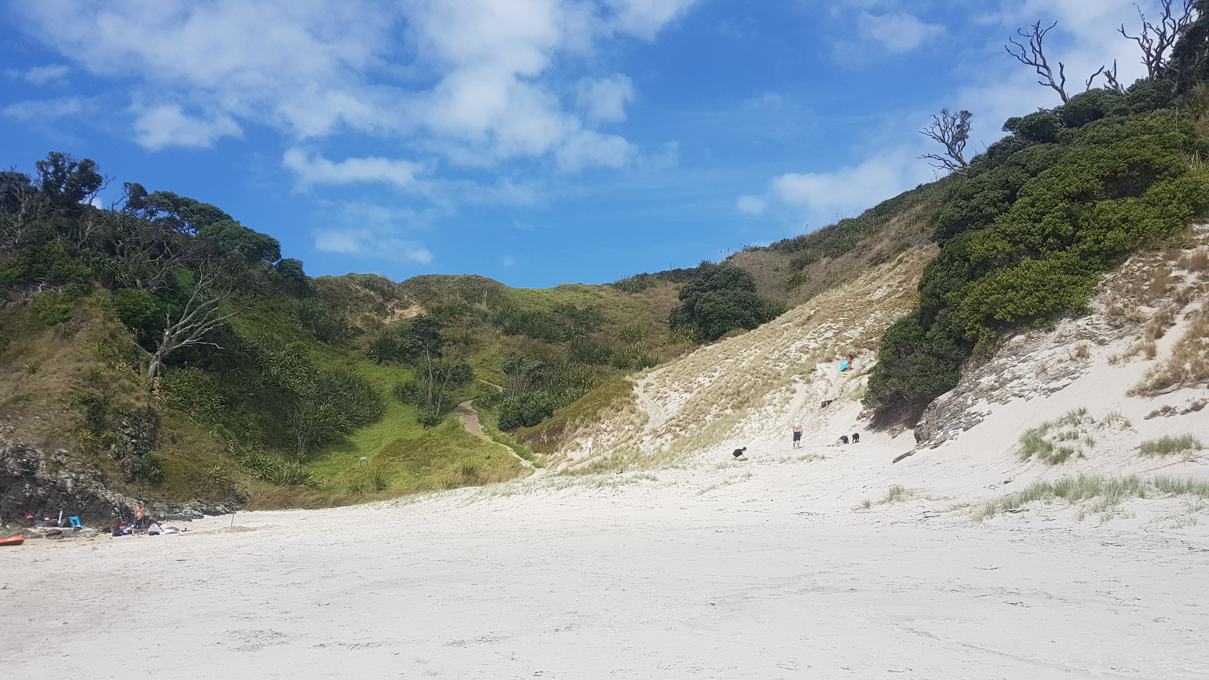
There was a young girl on the steep bit of sand who was screaming at her Dad, who remained surprisingly calm. I’m not sure what her problem was.
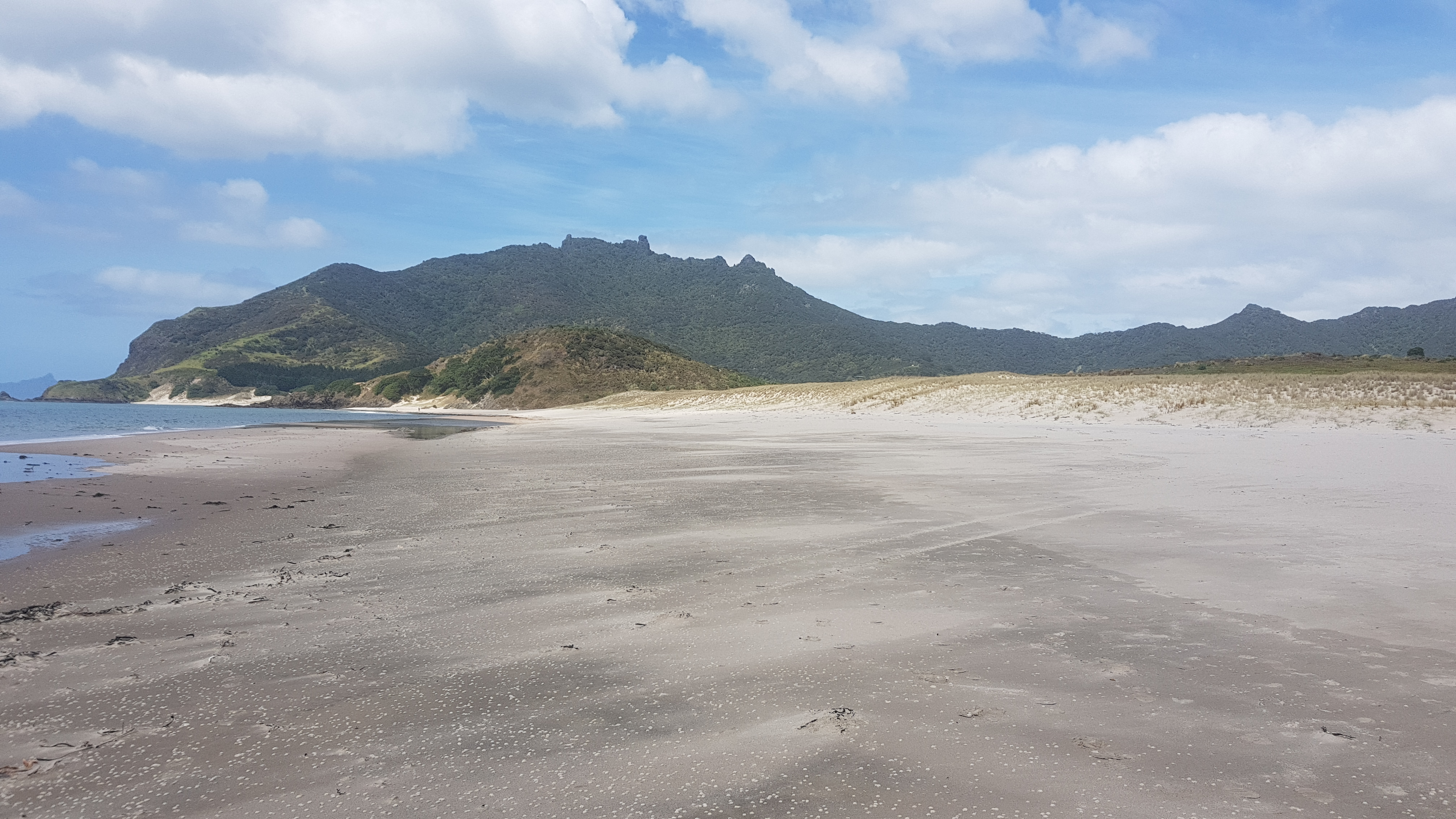
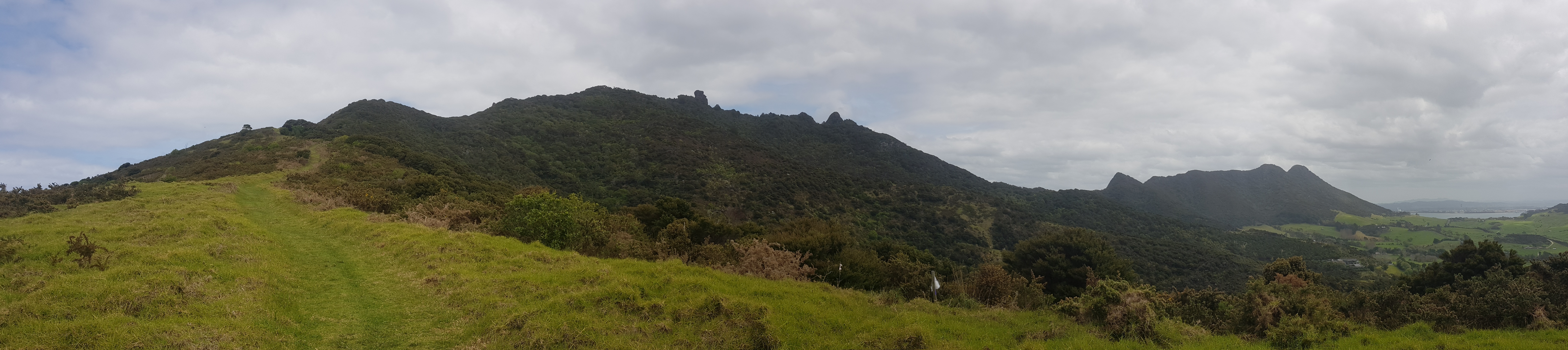
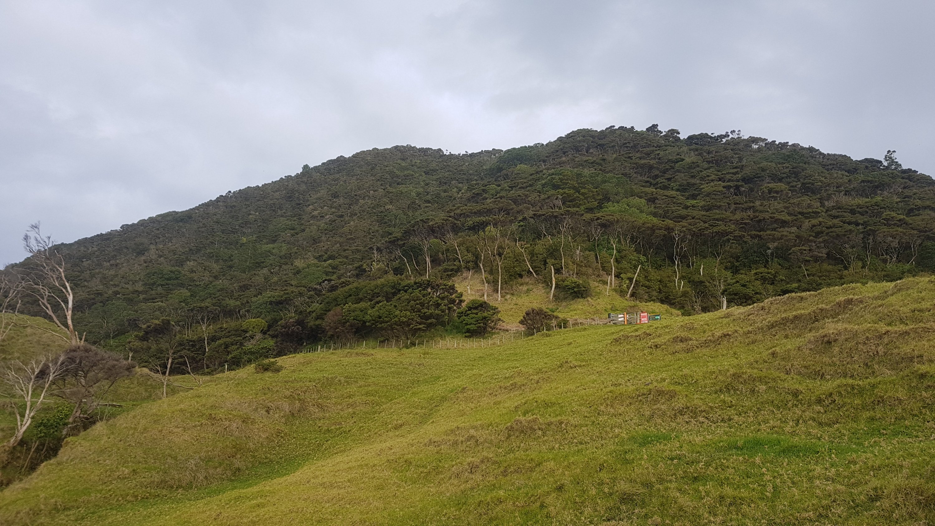
Then the next bit was not quite as steep, but it was long.
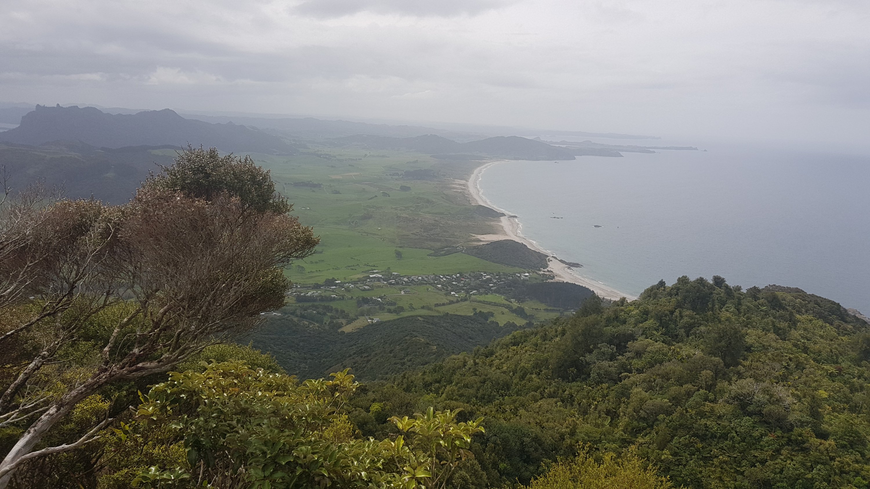
I did get a good view at what was coming up though. I’d be walking right along the ridgeline there. The left hand side and highest point is Te Whara, otherwise known as Bream Head Summit, and the right hand side is Mount Lion.
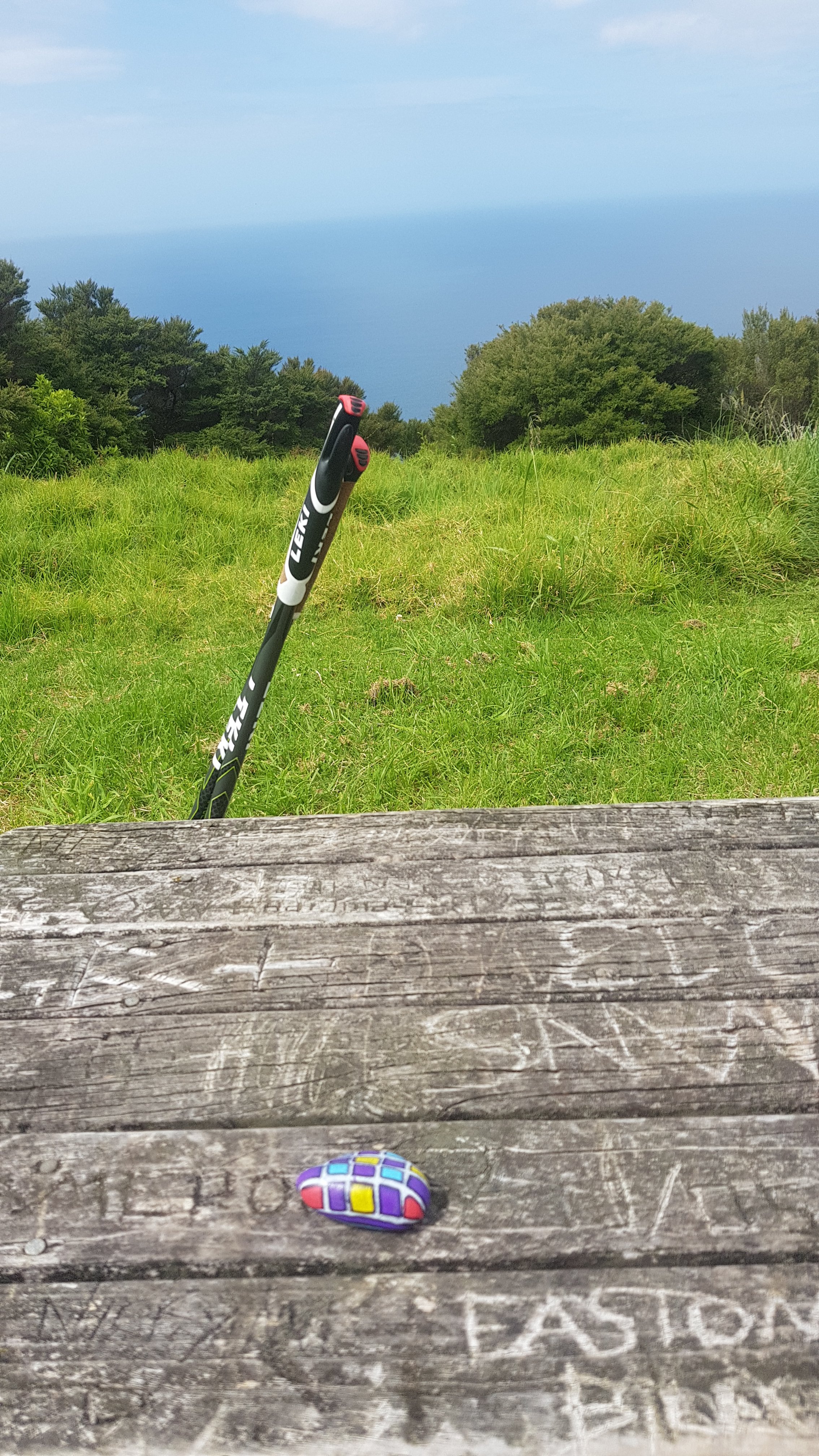
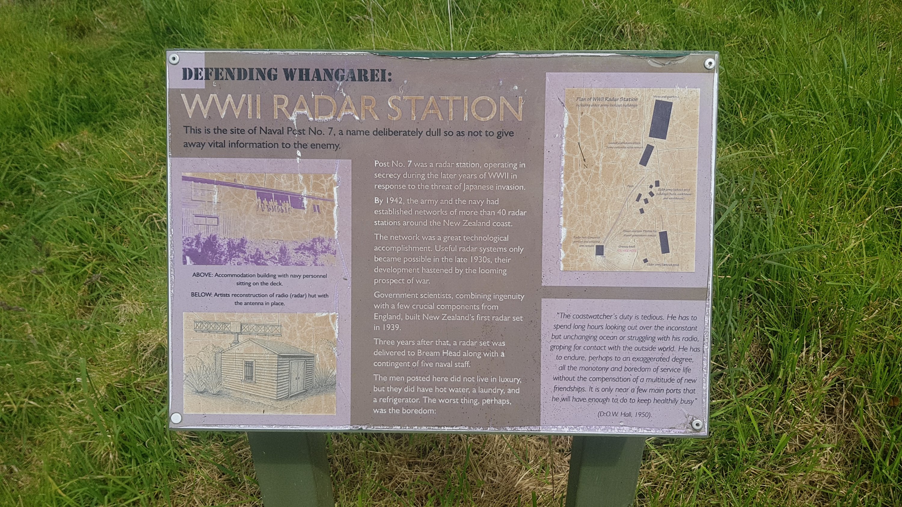
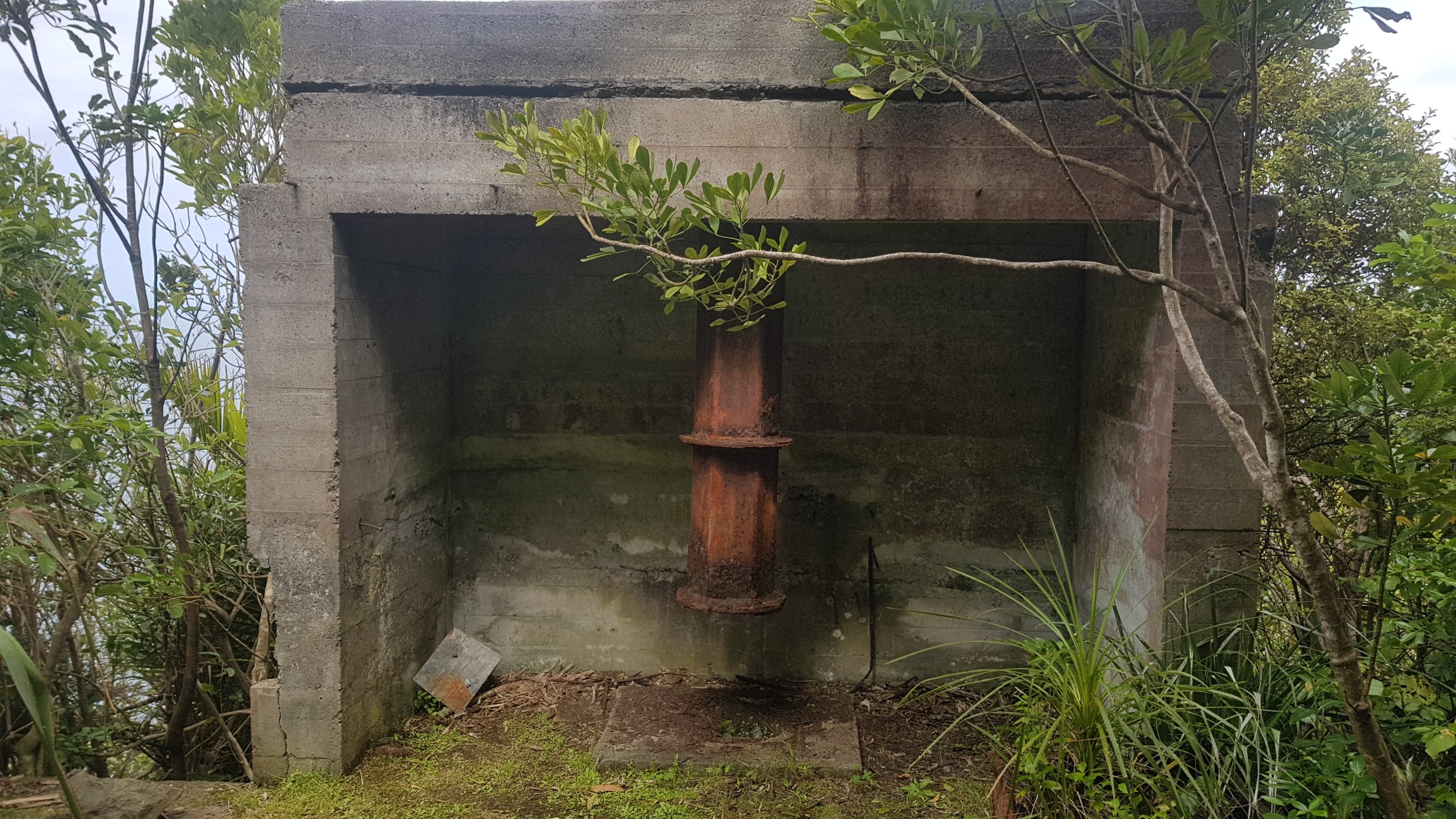
Up here was a table next to some information about the World War II installation that was up here. The table had a painted rock on it. I had seen these rocks in Auckland – people hide them and then other people find them and rehide them. I like moving them on but this was not the right terrain for me to be carrying unnecessary weight.
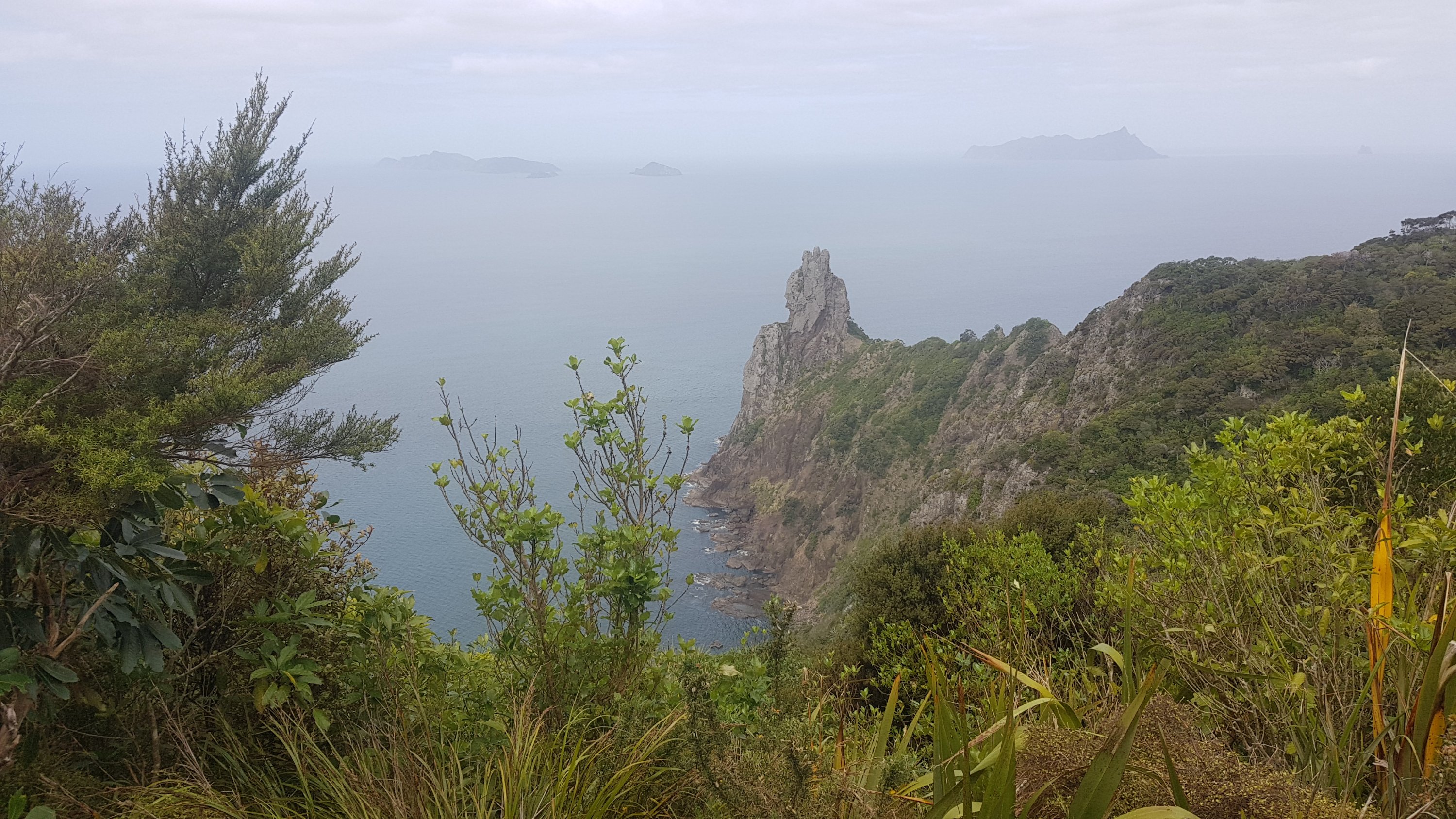
Not much further and I could start to see out the south side of the peninsula. It was very steep, like everywhere else in this area.
This was one of the parts of the WWII installation. I think it is what remains of the radar station.
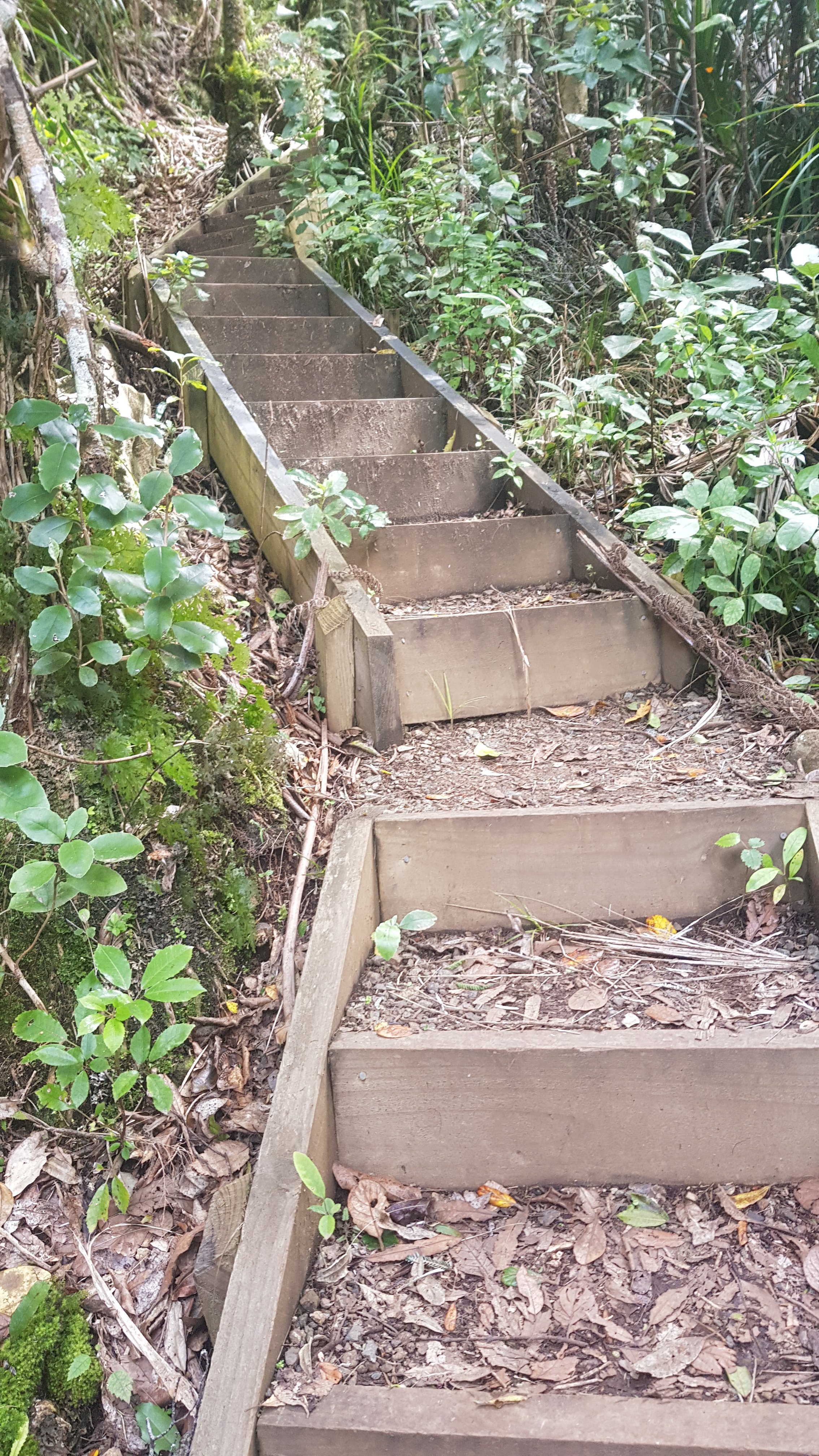
Then came the stairs – lots and lots of stairs. It reminded me of Puketi Forest and all its stairs. These were about the same difficulty.
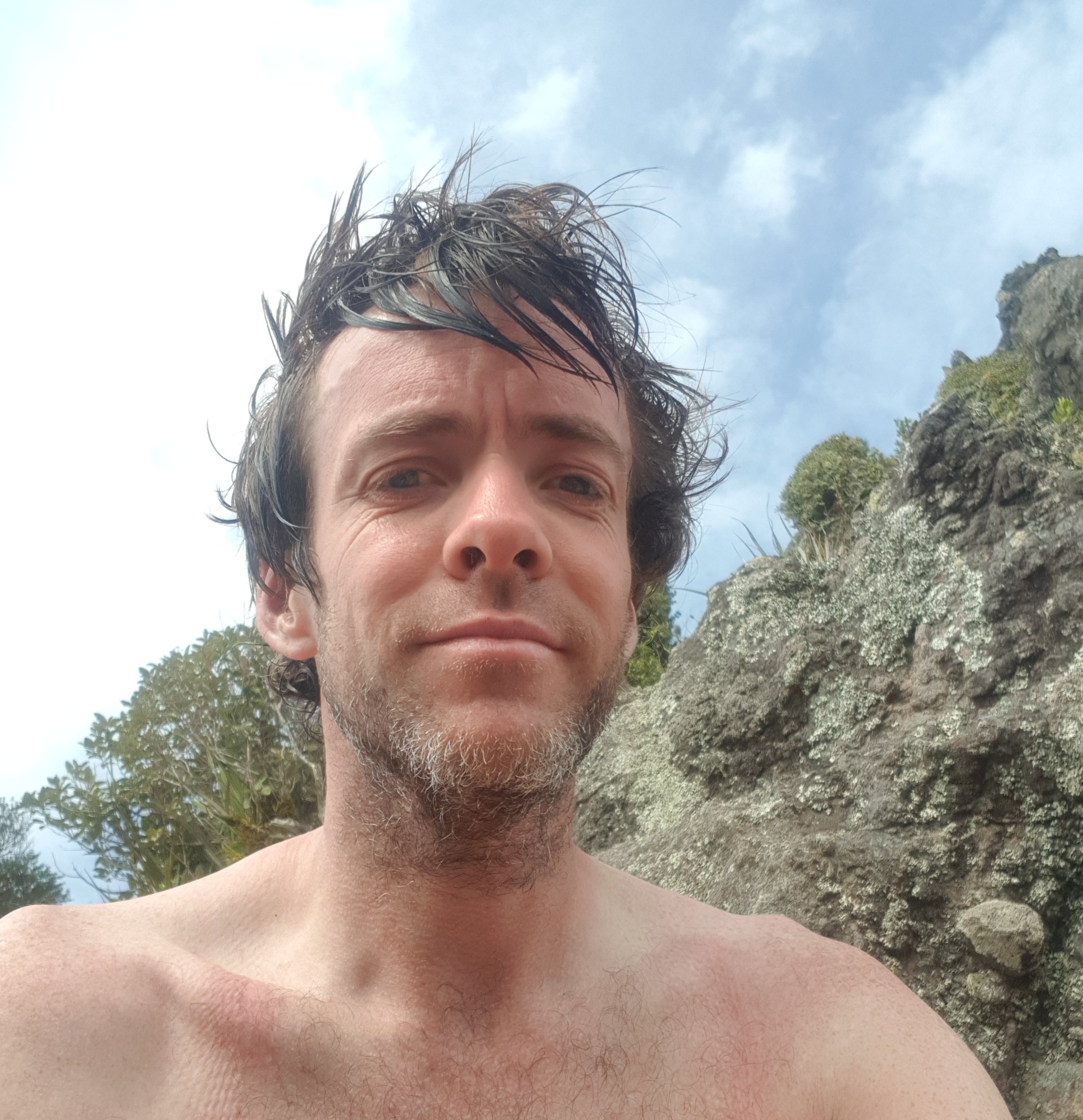
Still, better than scrambling up a steep and muddy hillside. The difference here was that it was mid-afternoon and very hot and I was sweating buckets. I took my shirt off since there was nobody around! And I took a selfie at the summit. You can see how the straps from the bag were pressing into my shoulders since I wasn’t wearing a shirt.
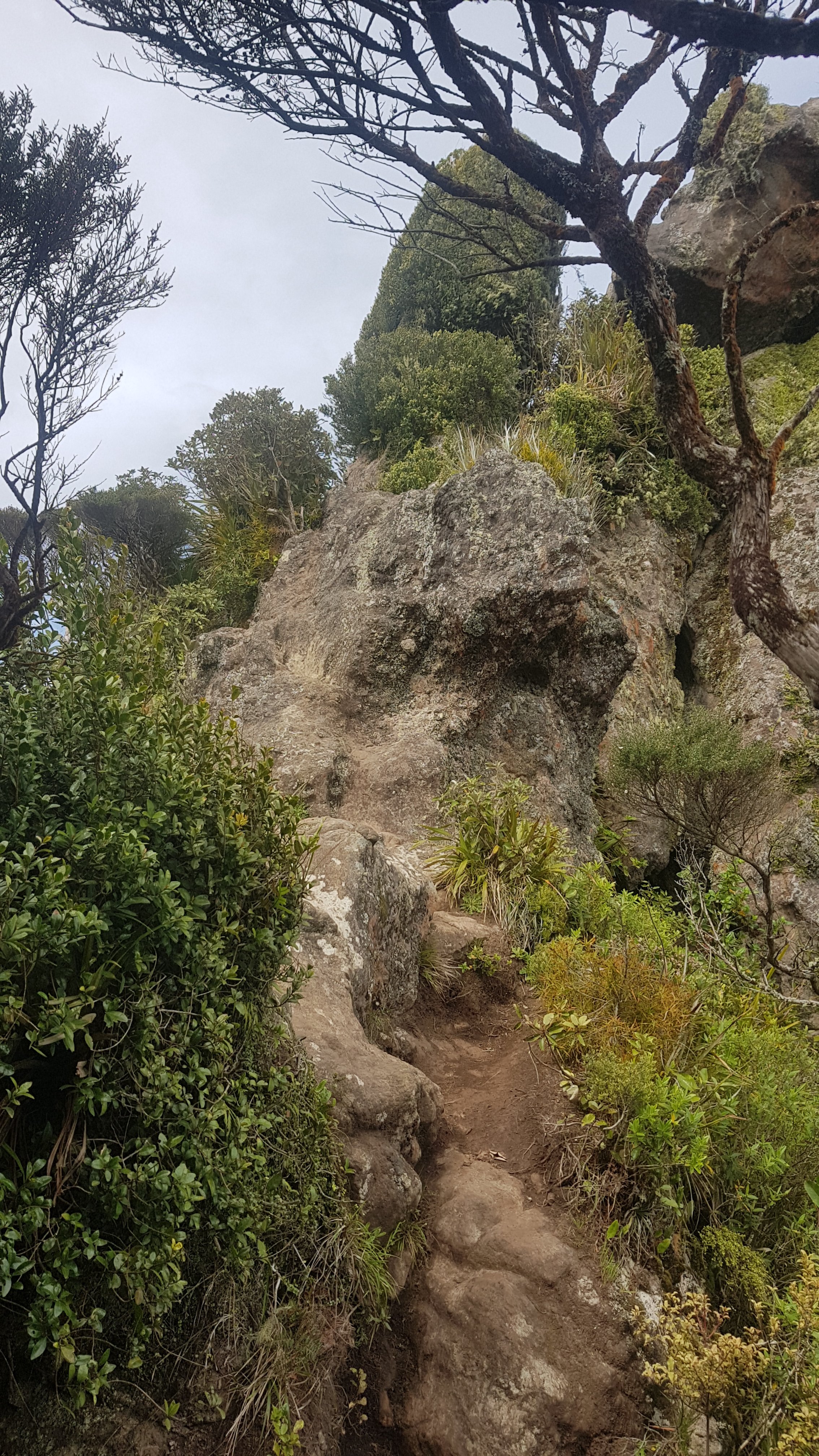
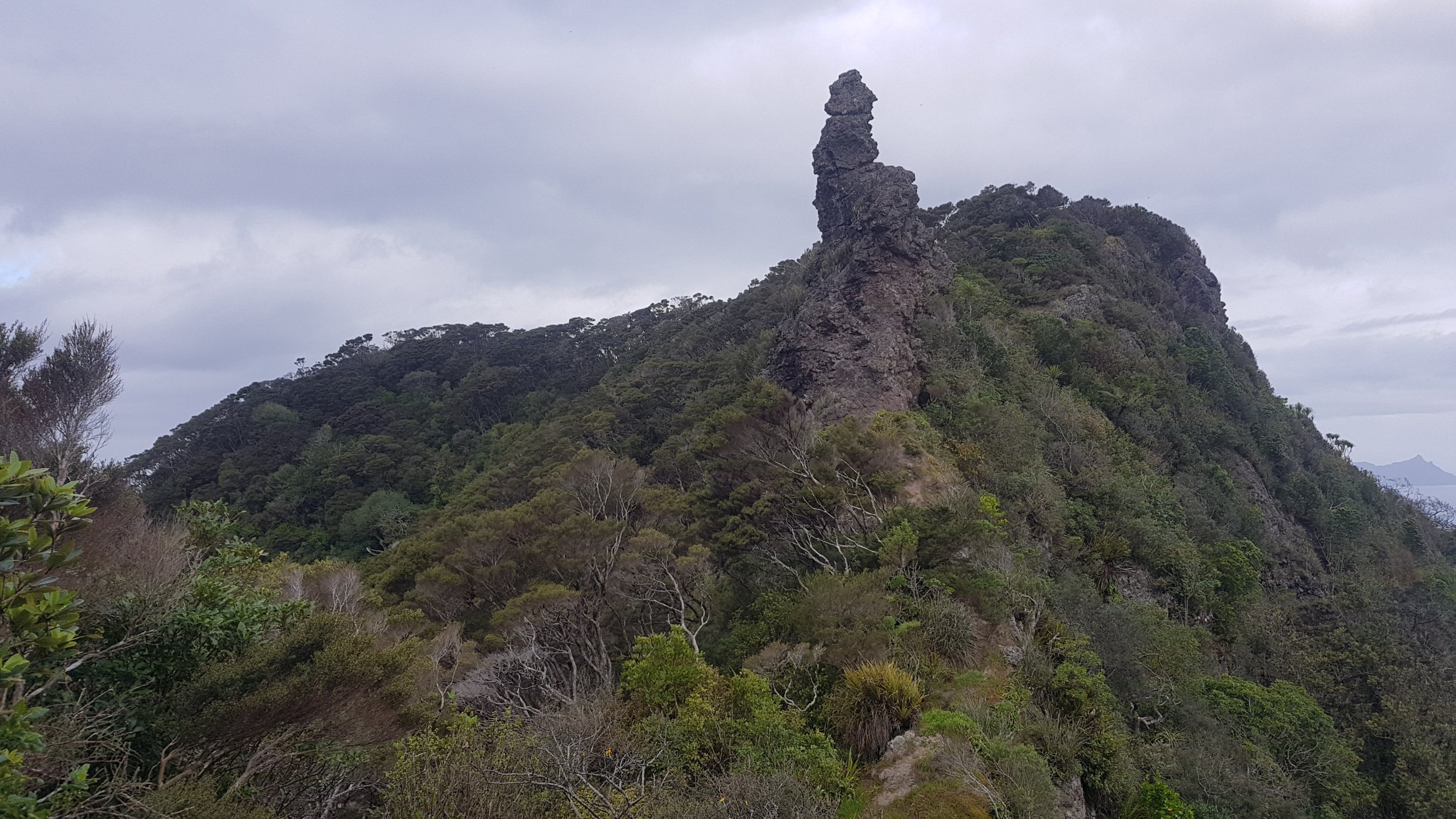
At this point you could climb a bit further and grab a geocache at the top of the rocks. But it was a real climb. I didn’t trust that I wouldn’t fall, and anyone that did fall would almost certainly not live to tell about it. This is what you had to climb to get the geocache which was apparently under the shrub. Looking at it now it doesn’t look steep but it was windy and I was getting exhausted.
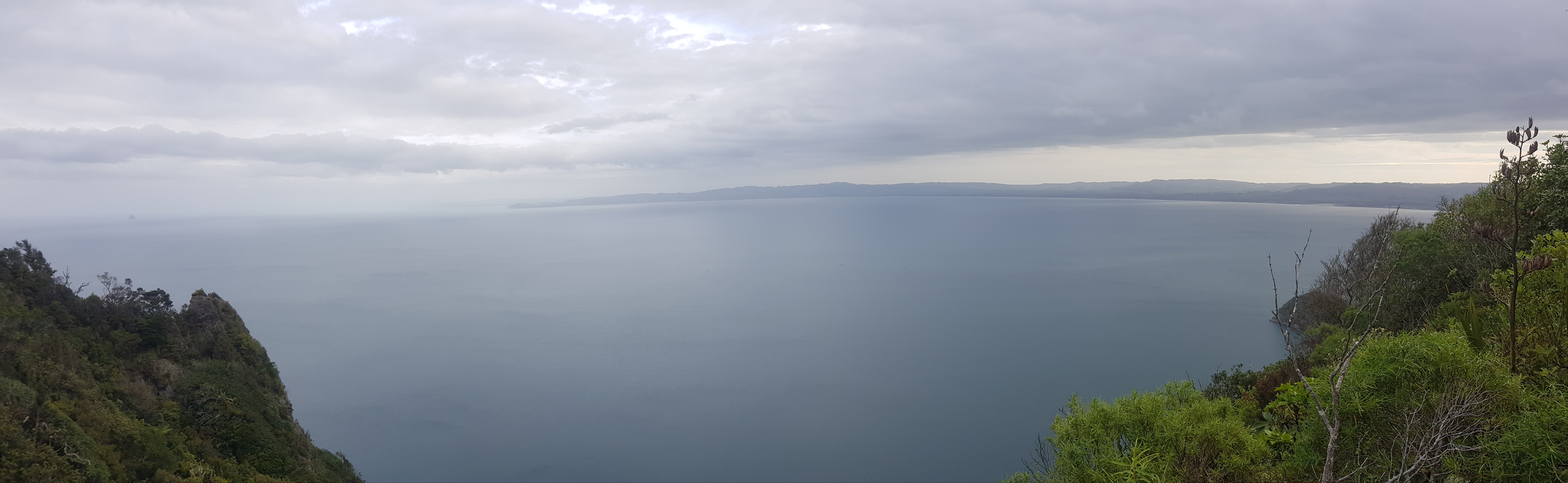
It was hard to capture the sheer expanse of water that you could see from up here, because there was not a lot of space at the summit.

What was easier to see is all of Ocean Beach that I had walked down, plus Kauri Mountain and beyond.
I continued on without finding the geocache.
I did find this rock though, which if I’m honest is a bit suggestive.
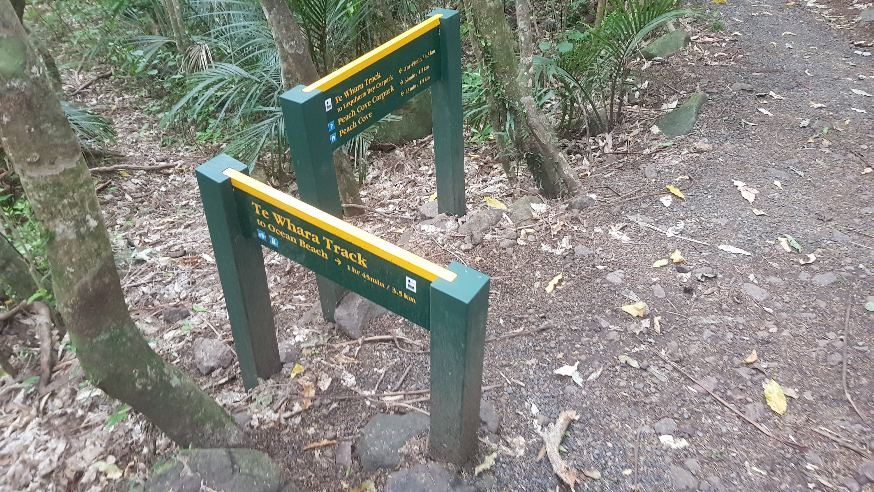
Came to this intersection. This is where you can detour to the Peach Cove hut and campsite, but the problem is that it’s a 250m descent to it, and the same ascent tomorrow back to this point. So I didn’t go and camp there.
From the summit down to this point then up to the Mount Lion summit was 475m down to 200m and then back up to 350m high, although the ascent this time wasn’t so steep. Not long after here it actually got quite cloudy and cold. It was a nice relief actually from the never ending sweating from earlier today. And it never rained.
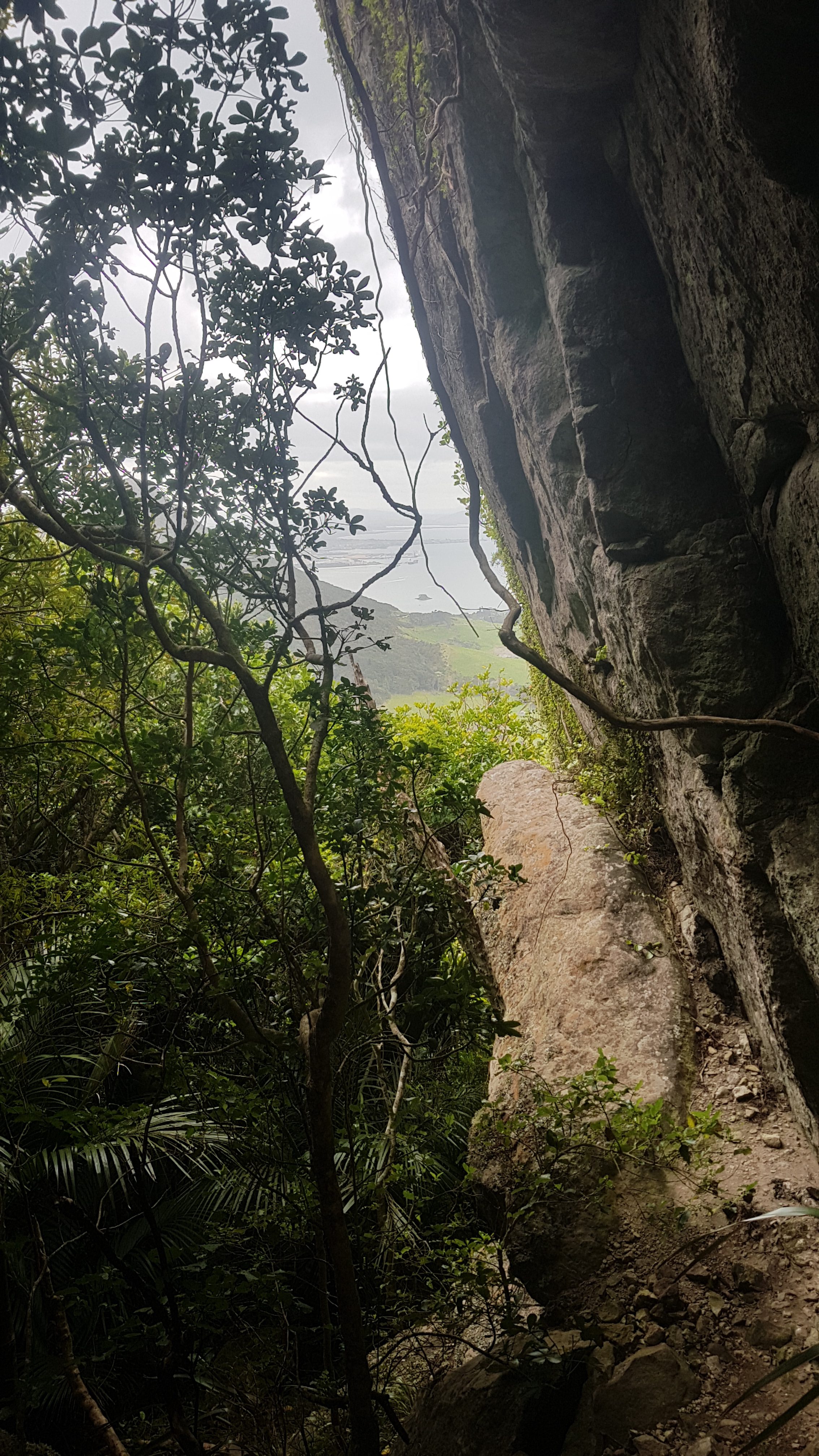
I found a better spot to capture the big expanse of water that you saw looking south.
The last section of this path had been closed until as recently as a few days ago. They were supposed to be doing Kauri Dieback prevention. It didn’t look like they finished – the stuff they put down to lay a new path was there but the path itself wasnt complete.
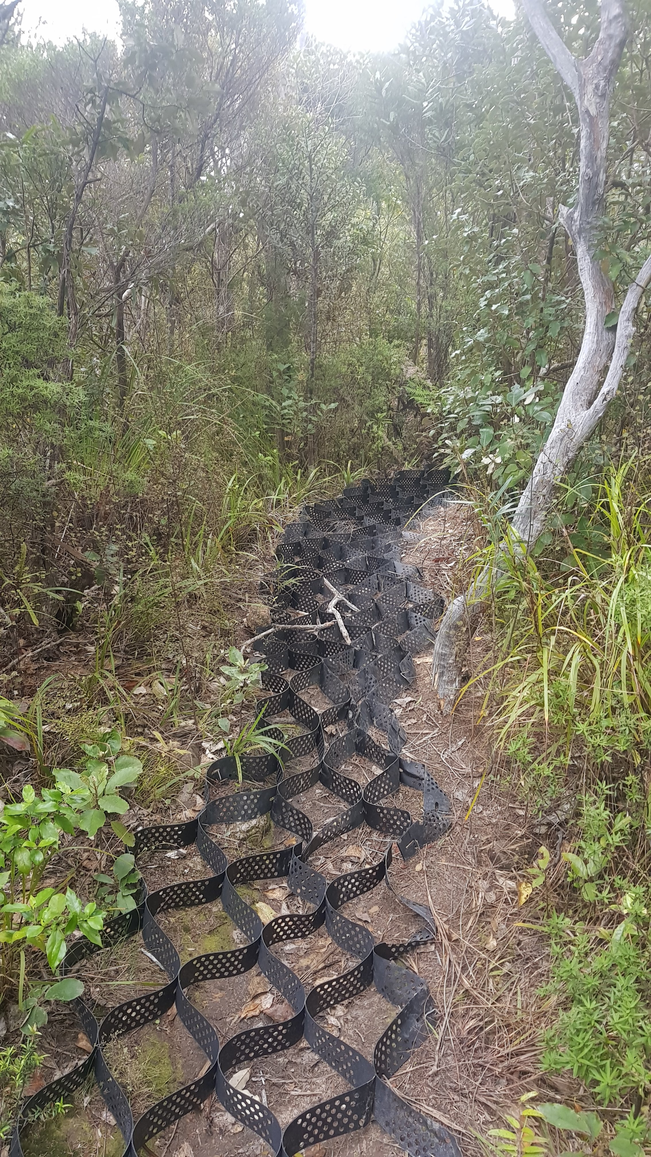
It was quite hard walking on this stuff, but people had clearly done it.
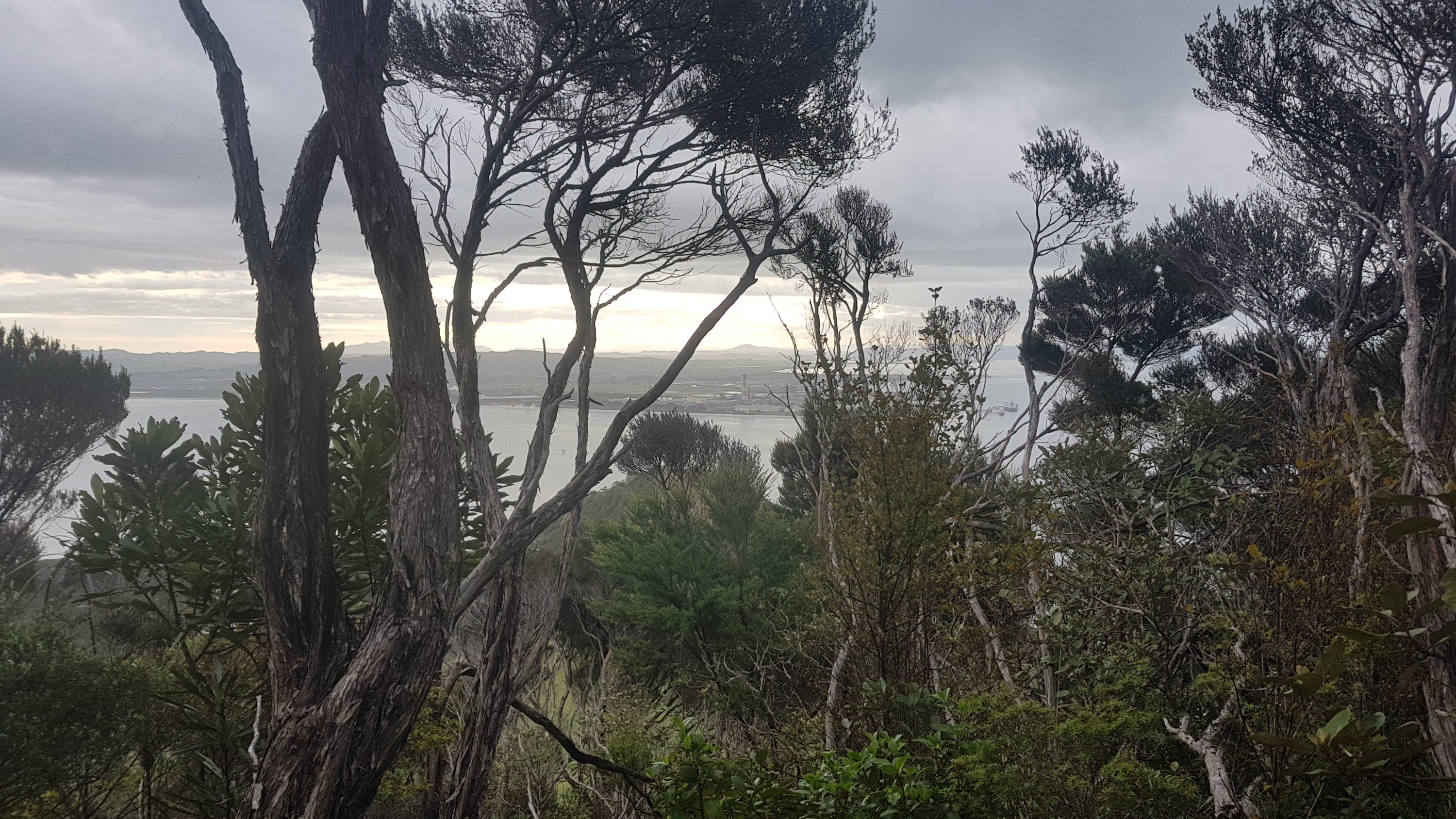
Down here I got my first glimpse through the trees at Marsden Point, which is where you start from after you get a boat from Whangarei Heads.
It was 6pm by now and so I really needed to start thinking where I was going to spend the night. There were a few flat spots along the way to pitch a tent but I wanted to wait until as far as possible through the mountain to reduce the earliness of my waking up tomorrow to a minimum. However the descent from Mount Lion was just stairs, stairs and more stairs. Not a single flat piece of ground to be seen. Plus I noticed once I got out of the mountains that camping isn’t actually allowed up there anyway. And once you actually came out of the forest, you hit farmland which had a surprising number of people walking on it, so it would be hard to stealth camp.
Because I heard earlier that accommodation was scarce I just went on Airbnb and booked the cheapest accommodation that was between my current location and where the boat launches at Whangarei Heads. It was a two-bedroom self contained guest house, but that’s all I knew, because I didnt even read the description. As long as it had hot water and a bed, how bad could it be.
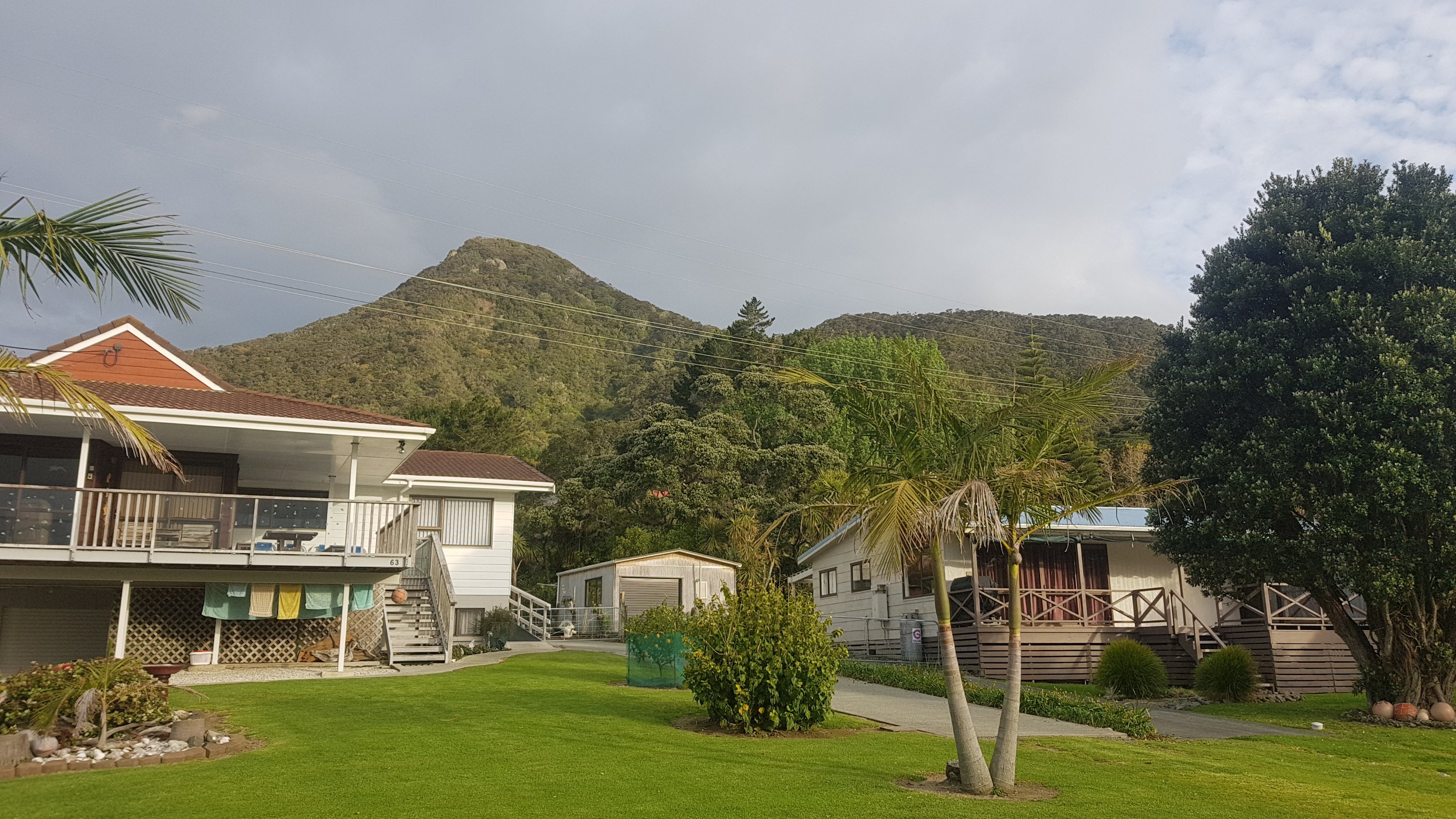
I received an email shortly after acknowledging my booking which was nice. It can be hit or miss booking at such short notice on Airbnb but if you pick a “Superhost” then they are much less likely to cancel or have an inaccurate listing or calendar. It was in Taurikura, a place which didnt even seem to exist on Google Maps but I had the address and it was right on the trail so I just walked and admired the view. There are so many great views of mountains around here, they look amazing. You often see them between people’s houses.
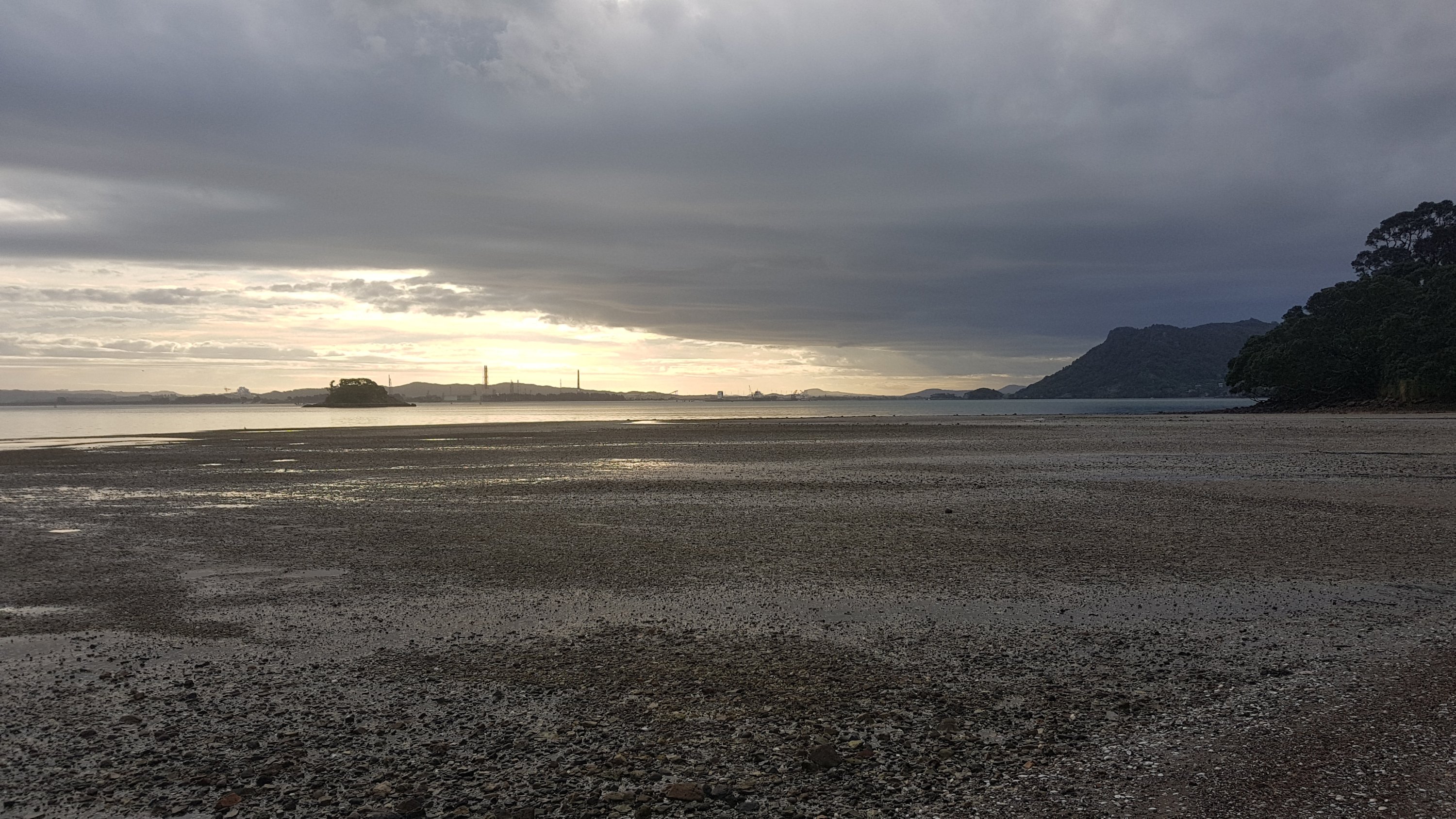
It wasnt long before the sun started disappearing and the view changed. Lots of different views along the bays here of the oil refinery.
As I came around one corner, I had a feeling that I could recognize the Airbnb from the picture.
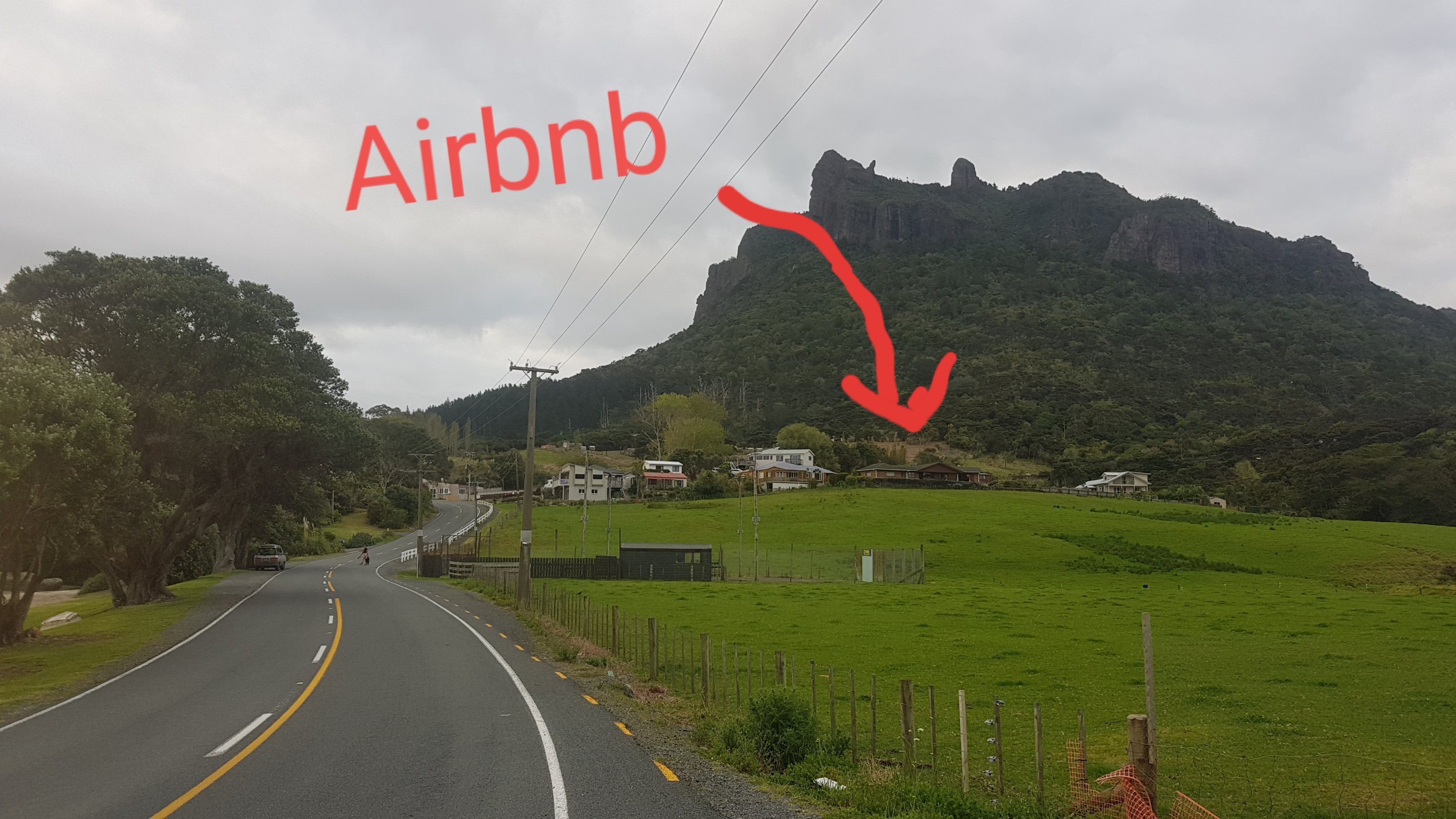
Turns out I was exactly right. My GPS watch had not long before beeped at the 40km mark. That’s a lot to walk in one day, especially with the huge ascent and descent. Interestingly, today was the day of the Auckland Marathon which I did four years in a row between 2014-2017 before I injured my hamstring and wasn’t able to run much for 18 months. So I thought maybe today I should walk the marathon distance since I can’t actually participate. Sadly though, a marathon is 42.2km and I only did 41.4km. 800 meters short. However, I would have done 800 meters of ascent today… so I am very happy with the distance covered today.
Actually I may have overdone it… again… my right foot is starting to hurt again, although not in the same place that it hurt just before I took a week’s rest last week. I’d better go easy on it tomorrow.
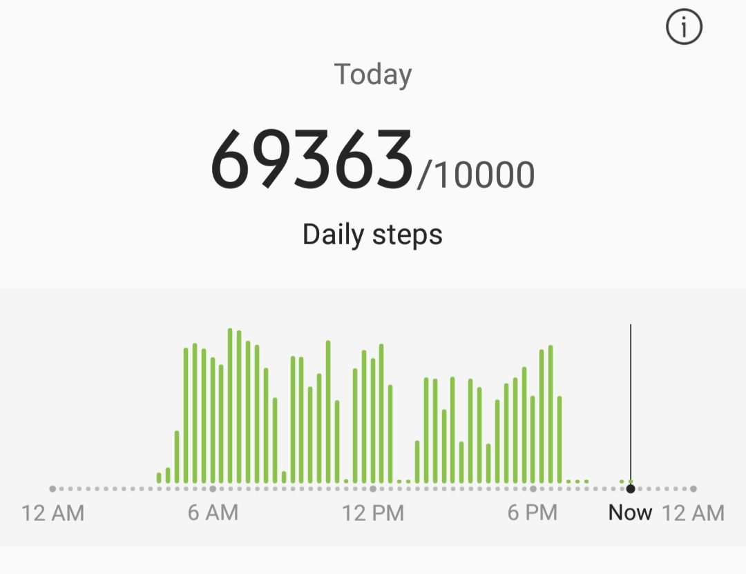
And of course, I set a new steps record, eclipsing the record I set last week when I did 52,769 from Opua to Russell Forest.
Another milestone was that I removed the “Kerikeri weather” bookmark from my phone and bookmarked the “Whangarei weather” page. Each time I do that I feel like I am progressing.
I got to the Airbnb and was sad that I didnt pass any kind of shop on the way. The “Taurikura store” was permanently closed – sad. But I got a surprise when I opened the fridge and discovered that they had left awesome food for me. A pot of yoghurt, a chocolate bar, honey, marmalade, milk and bread. It was great to see this kind of food after such a long walk. I didnt have to have another meal of Uncle Ben’s rice and a pasta snack.
I watched a bit of TV and wrote up a bit of this blog post but then I wanted a shower as I smelled bad. But oh no… no hot water!!!! Aaaaaaaaaaaaargh! How is that possible? I looked at the owner’s house next door and saw all the lights out, so I decided not to wake them, because I’m a nice guy. But I was gutted because all I wanted was a hot shower and a bed, and I only got one of these two things.
In a bad mood, I sent a quick email to the owners about the hot water saying that I would be calling them early and then I went to sleep all stinky. It wasnt a great way to end such a long day but ultimately it was a good day. 14 hours of walking and over 41km covered – can’t complain too much.
Today's walk on the map (blue = Te Araroa, red = today's walk):
Impressive distance covered. Impressive sunrise. Impressive views. Impressive rock Hmmm!! Impressive number of daily steps. All in all I’d say Impressive.
Very cool to have so many walkers together for a while. Sad about the hot water!!!
Those views look awesome. It’s a shame there wasn’t more of the Radar station to see.