Date: 18 January
Trail covered: 21.9km (kms 1989.0 to 2010.9)
Weather: same as every other day recently, scorching and not a cloud in the sky
It was a patchy sleep last night. Unlike some other big huts which have the bunks in a separate room to the cooking areas, this one is just one big room. So when people started fidgeting and making breakfast at 5am and 5:30am, it was hard not to be a part of it, whether you wanted to or not.
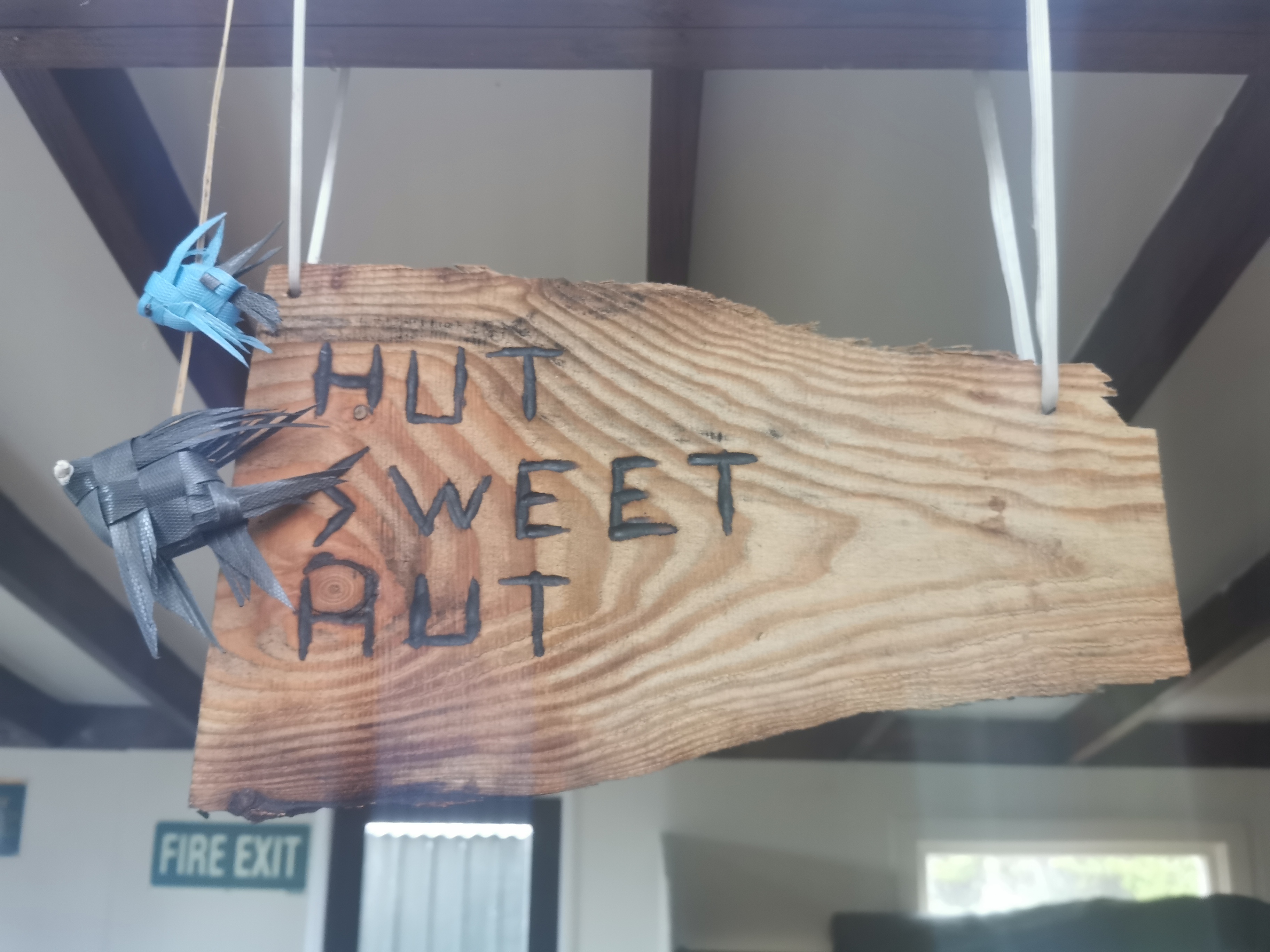
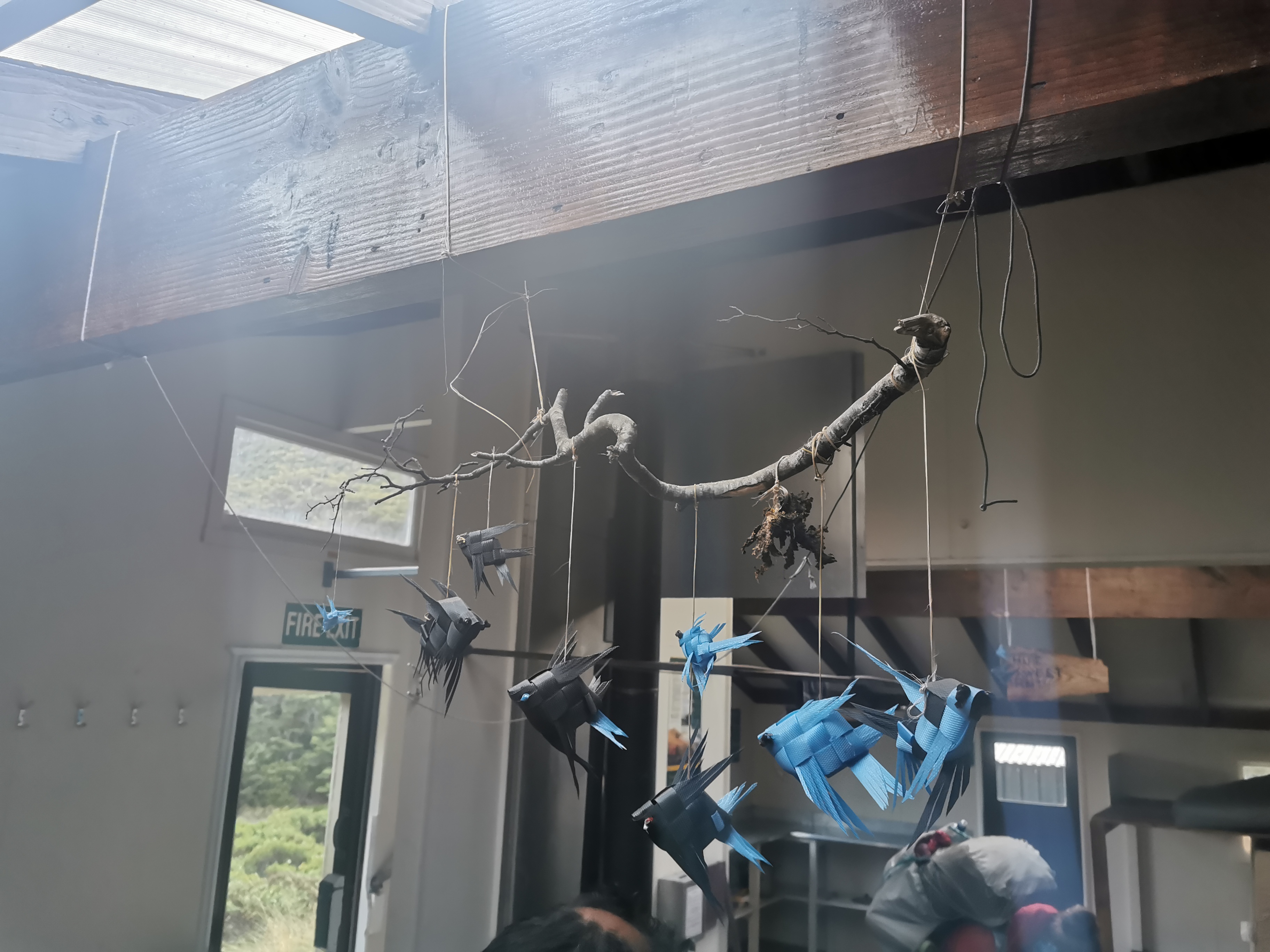
One thing this hut did have that other’s didn’t were these little decorations and nice touches.
Everybody today was sure to put on sunscreen. It was supposed to be yet another blindingly hot day and there will not be any tree cover today.
Sabine and I left shortly before 7:30am. The sun hadn’t reached us yet, it was trapped behind the mountains.
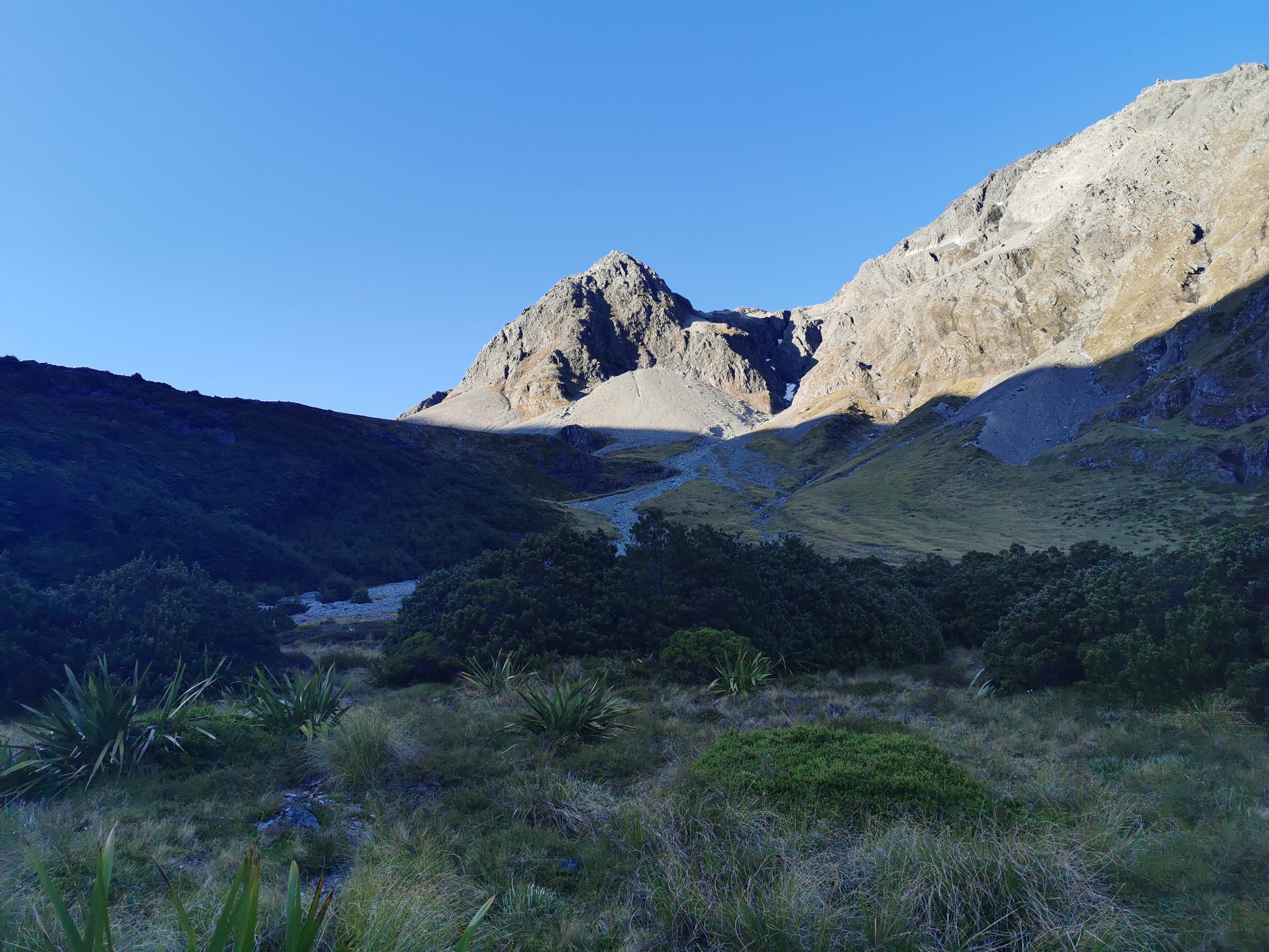
Today our aim is the Waiau Pass. It’s the second-highest point on the whole trail and the most likely point to be blocked by snow, but that shouldn’t be a problem mid-January. It’s also apparently one of the “highlights” of Te Araroa, if you believe the trail notes.
Once you’ve crossed Waiau Pass, there is an “informal campsite” at the bottom of the other side, then Waiau Hut a bit further on. However Waiau Hut is only a six-bed hut and we know thirteen people left from Blue Lake Hut southbound this morning, and Sabine and I were last to leave. So Waiau Hut is likely to be full when we get there. Maybe we can pass some people.
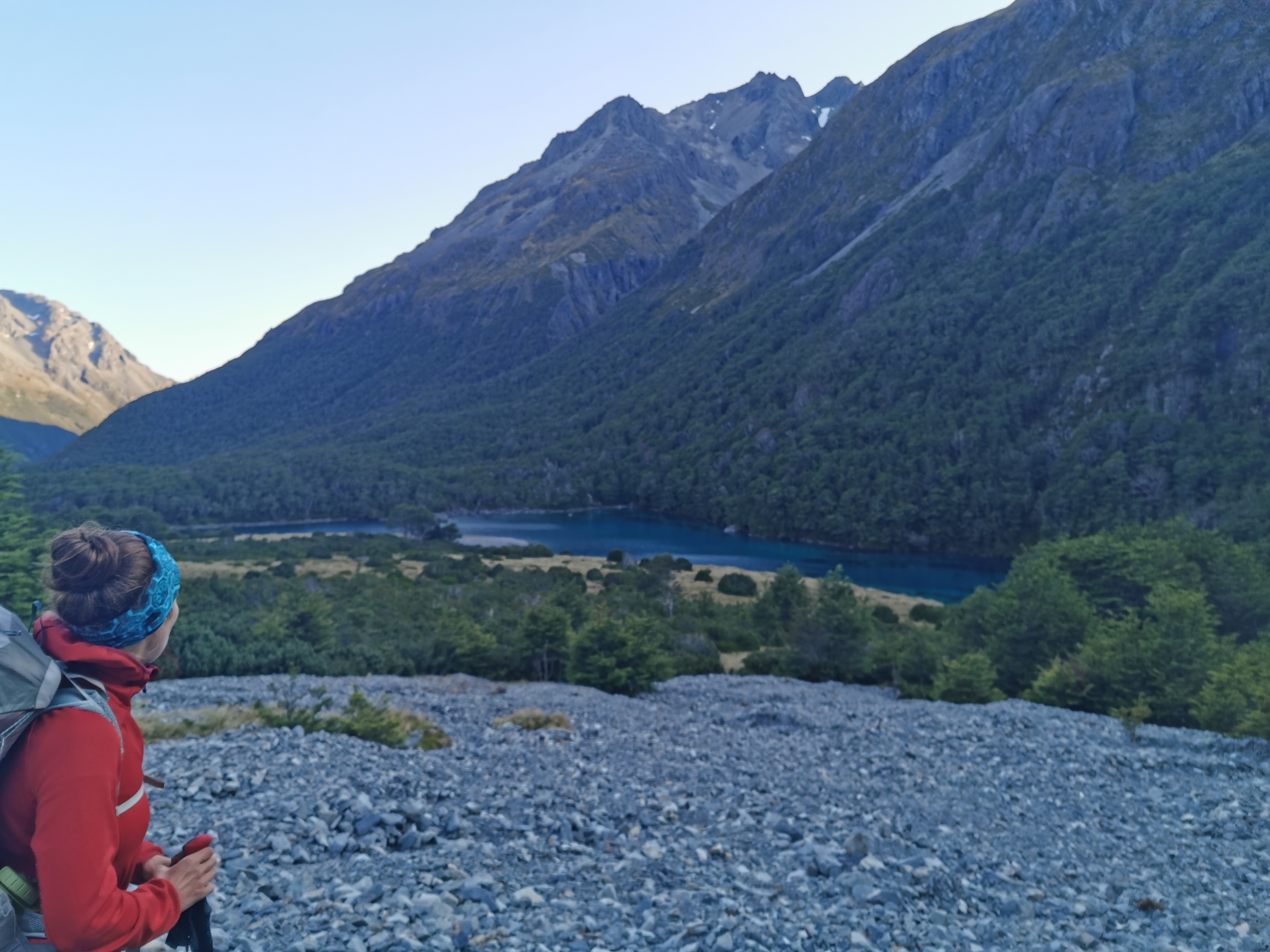
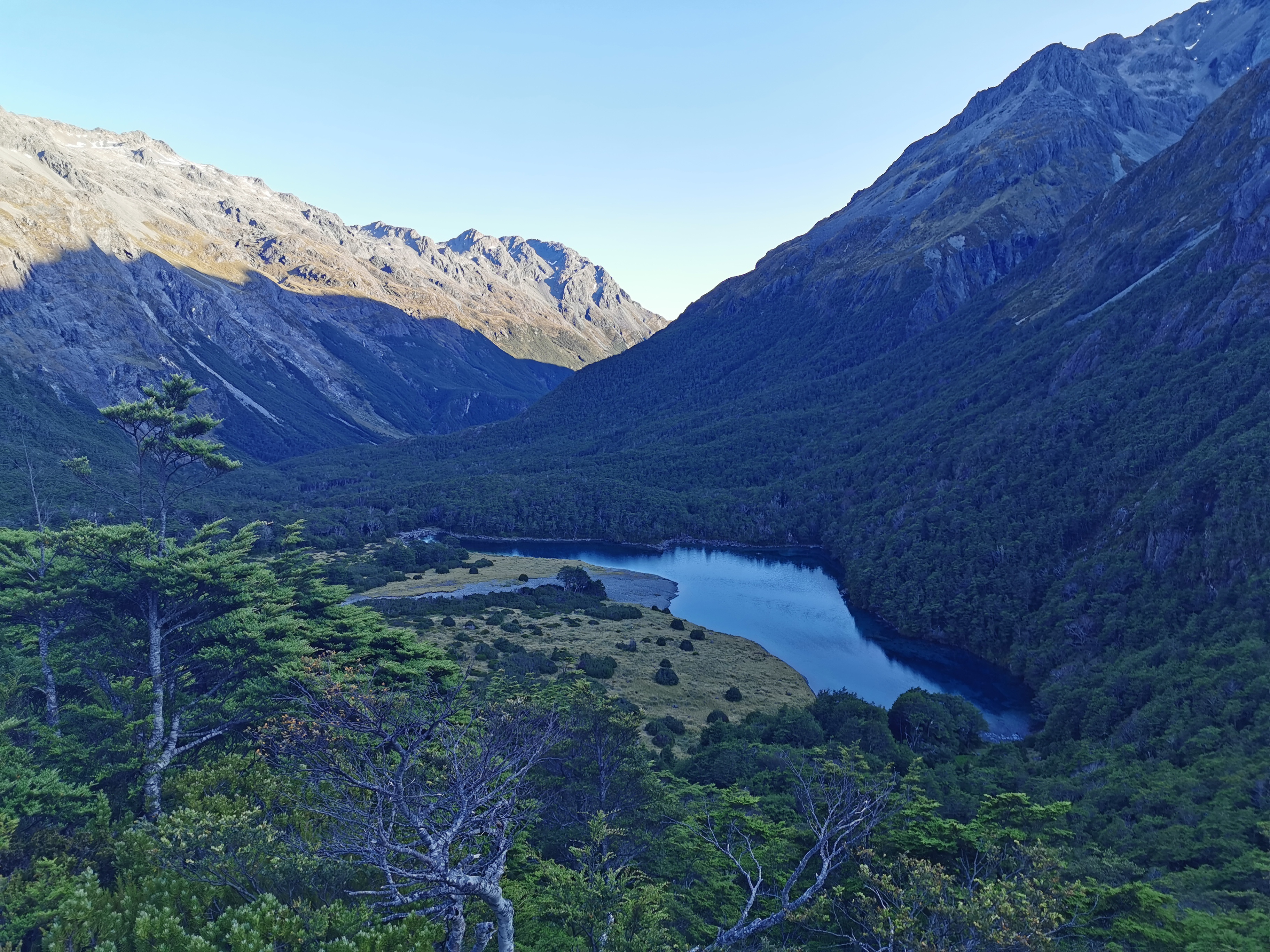
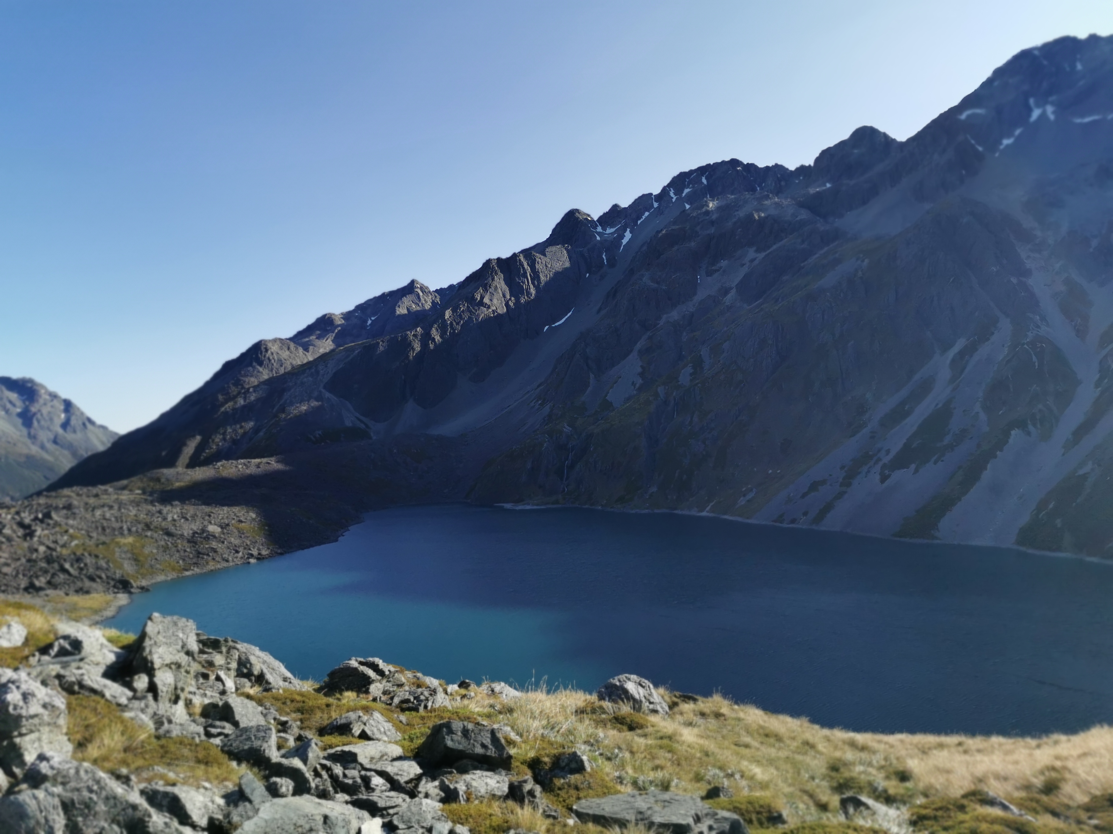
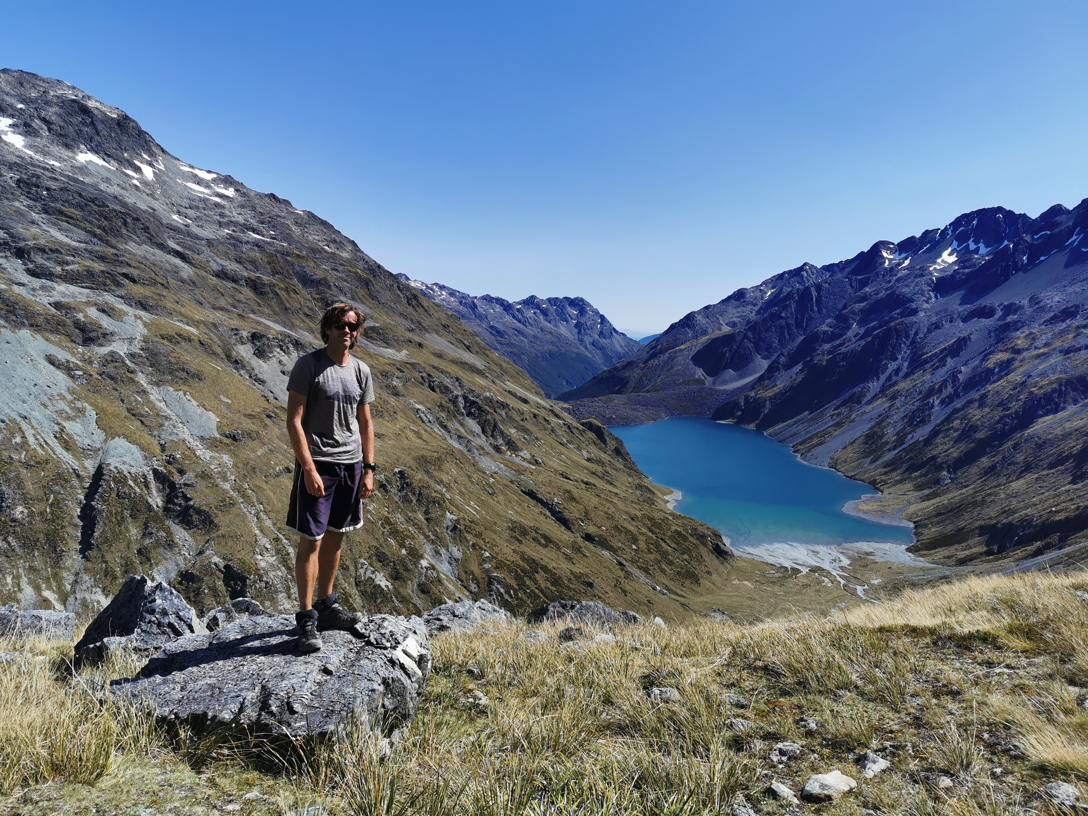
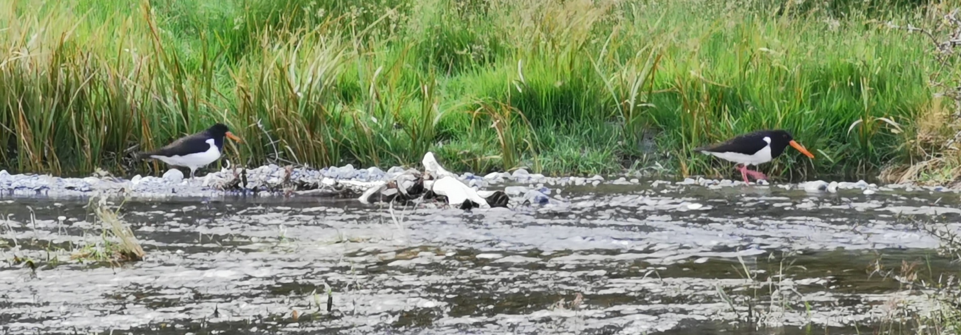
As we were walking, we got slightly better views of Blue Lake from slightly higher up. It actually even looked blue.
At 8am the sun still wasn’t much closer to reaching us. I was still in my jacket and gloves.
We passed Michelle early on, as well as a guy called Ben who she was walking with.
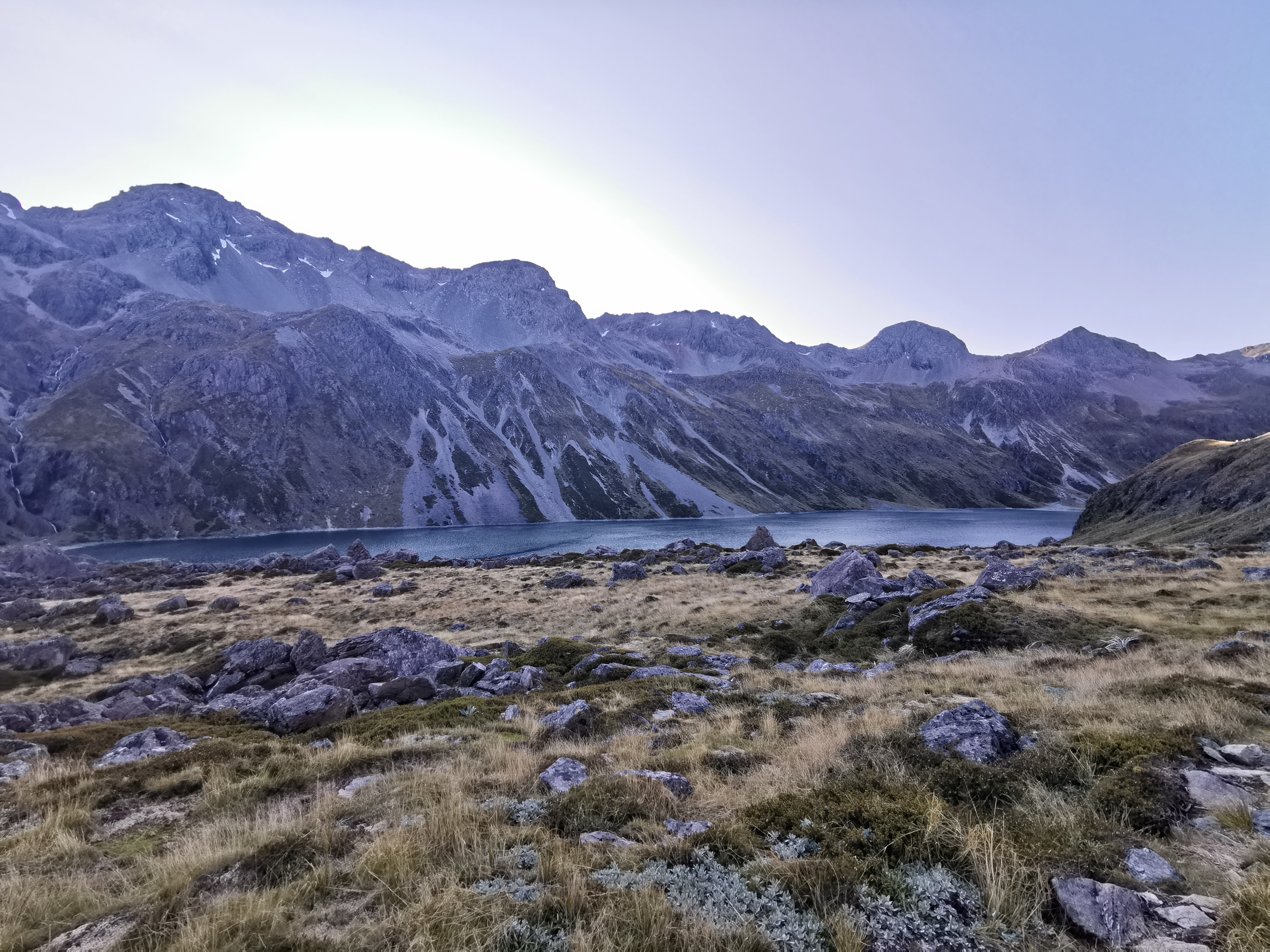
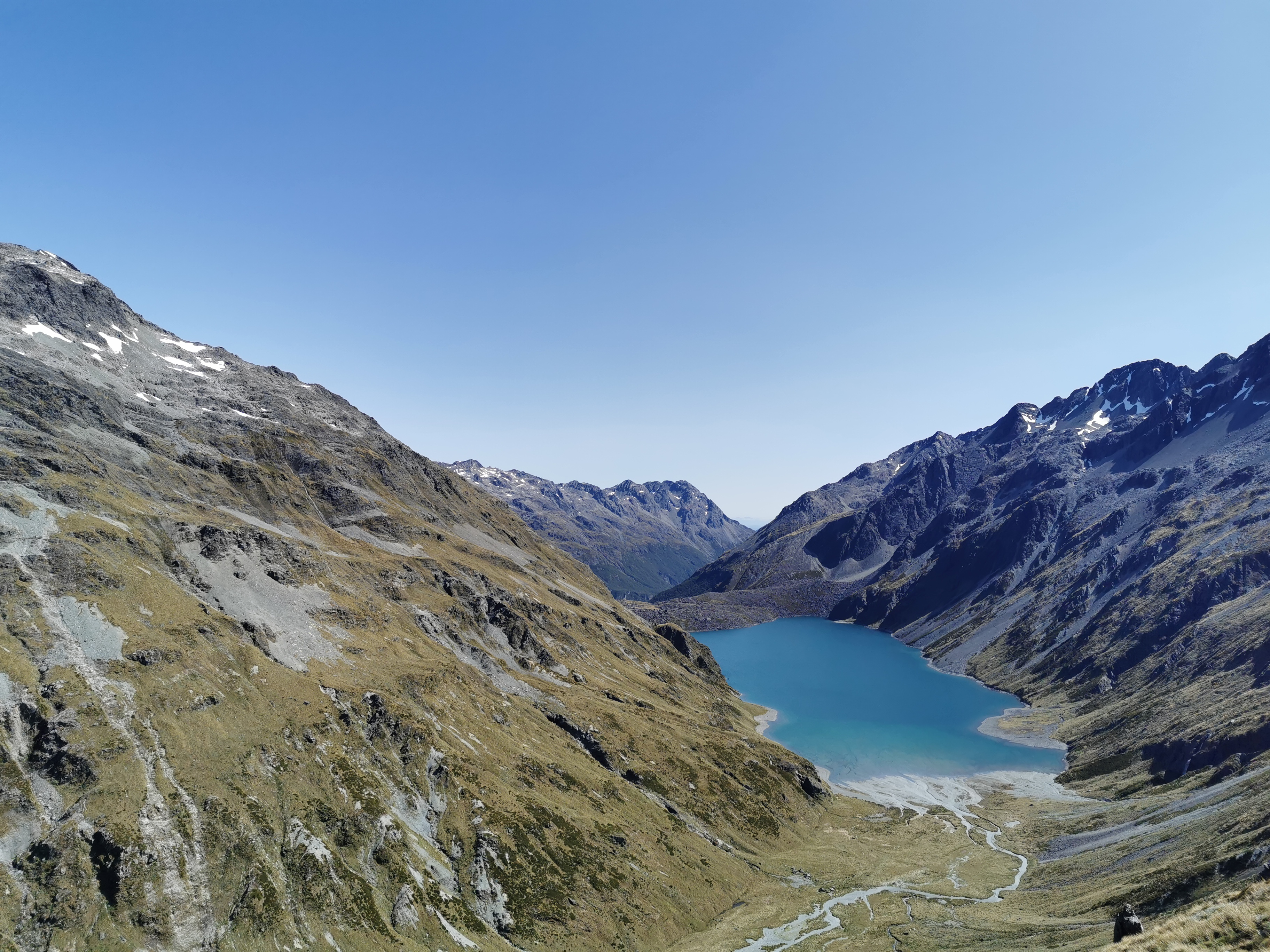
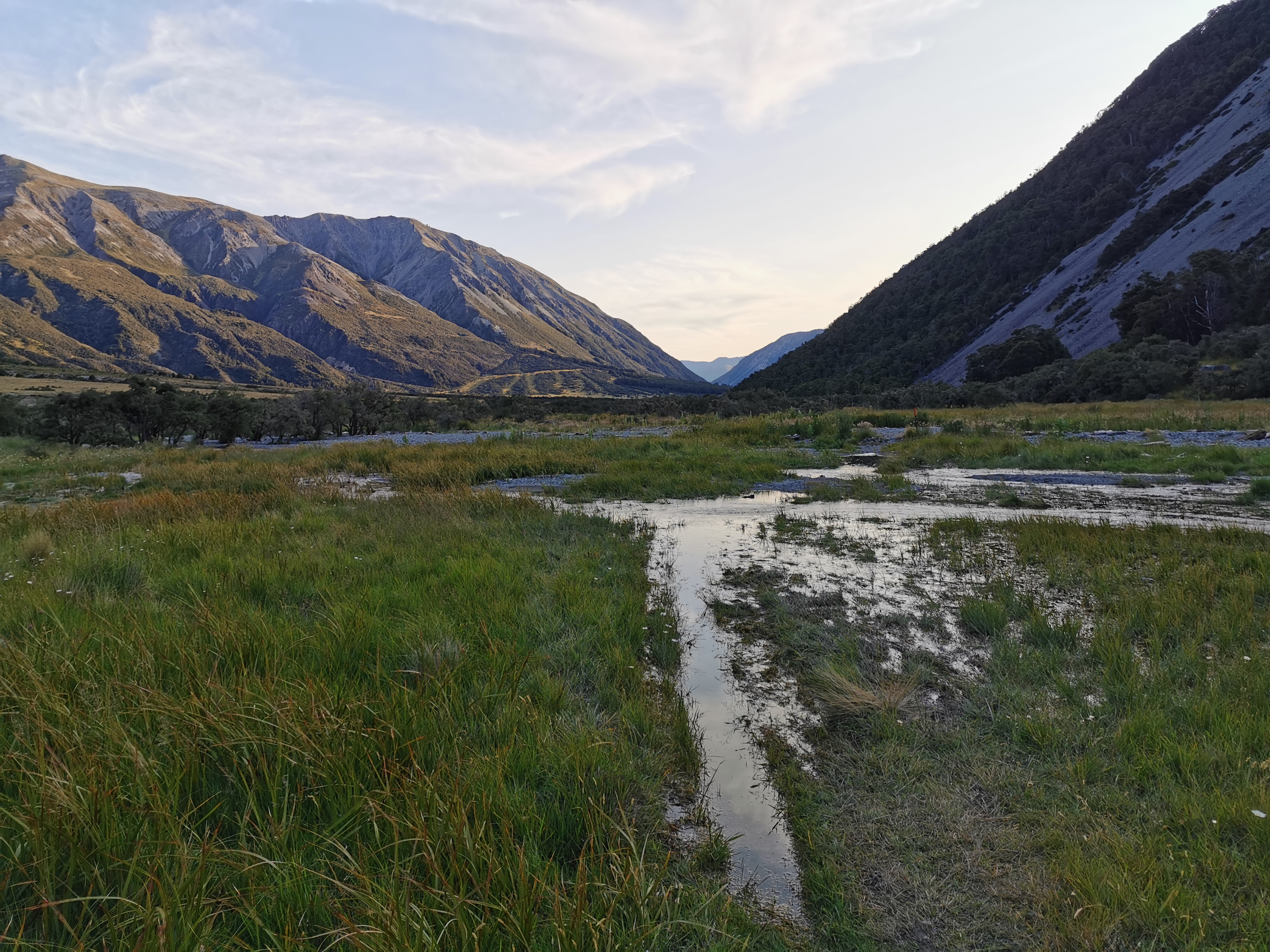
The sun just started to appear above the mountains as we got our first view of Lake Constance.
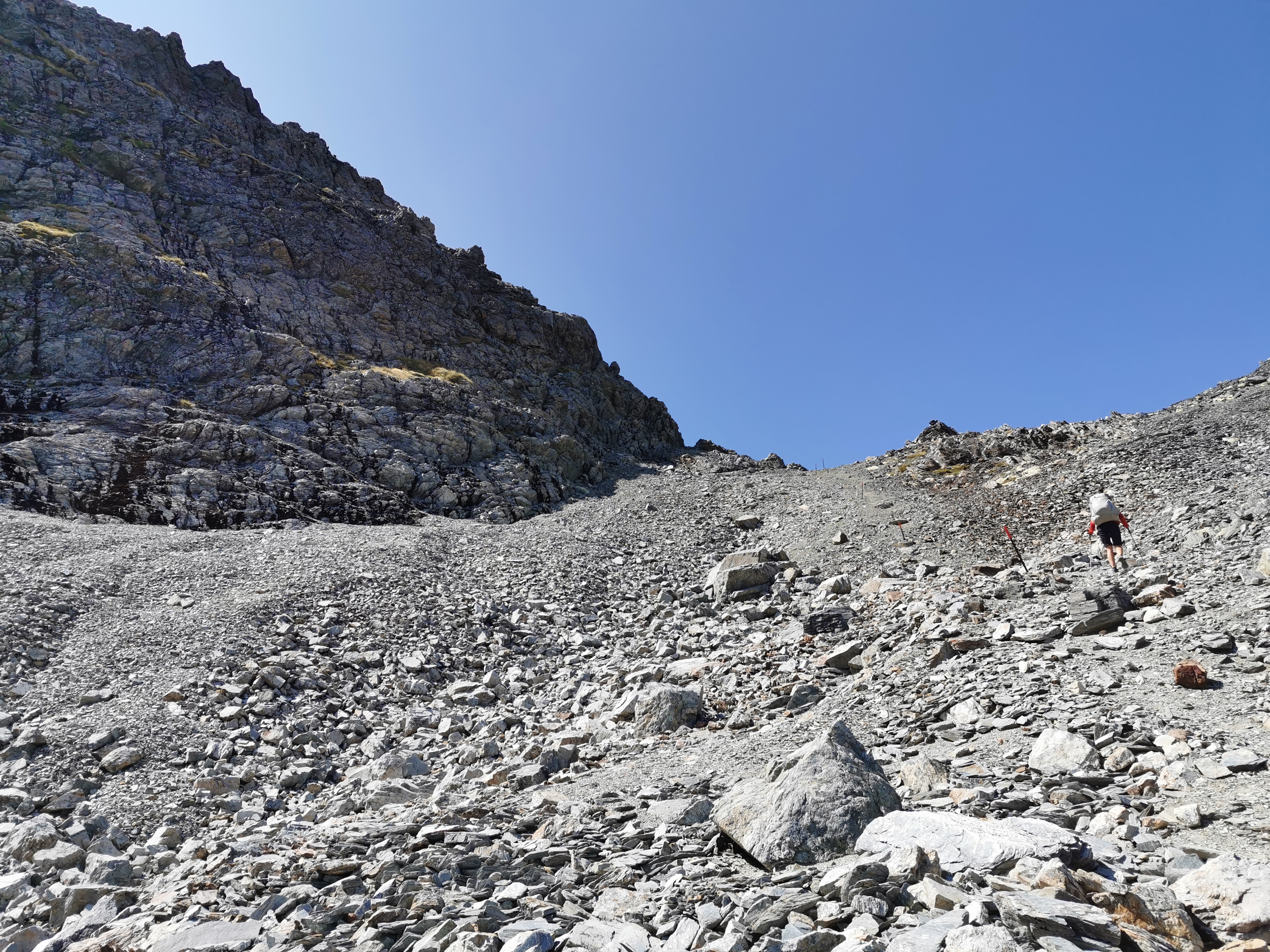
I think I was so busy admiring the lake that I started to lead us both the wrong way. Instead of going up this great big rock slide at an angle, I led us across the bottom of it which meant that we then had to climb directly up it.
Lake Constance is a beautiful lake. Sabine said it’s a “famous” lake because it appears on all the TA hikers’ Instagram feeds. I wouldn’t know because I don’t look at the feeds or stories of anybody that’s ahead of me. I don’t want to ruin the surprise of what’s coming.
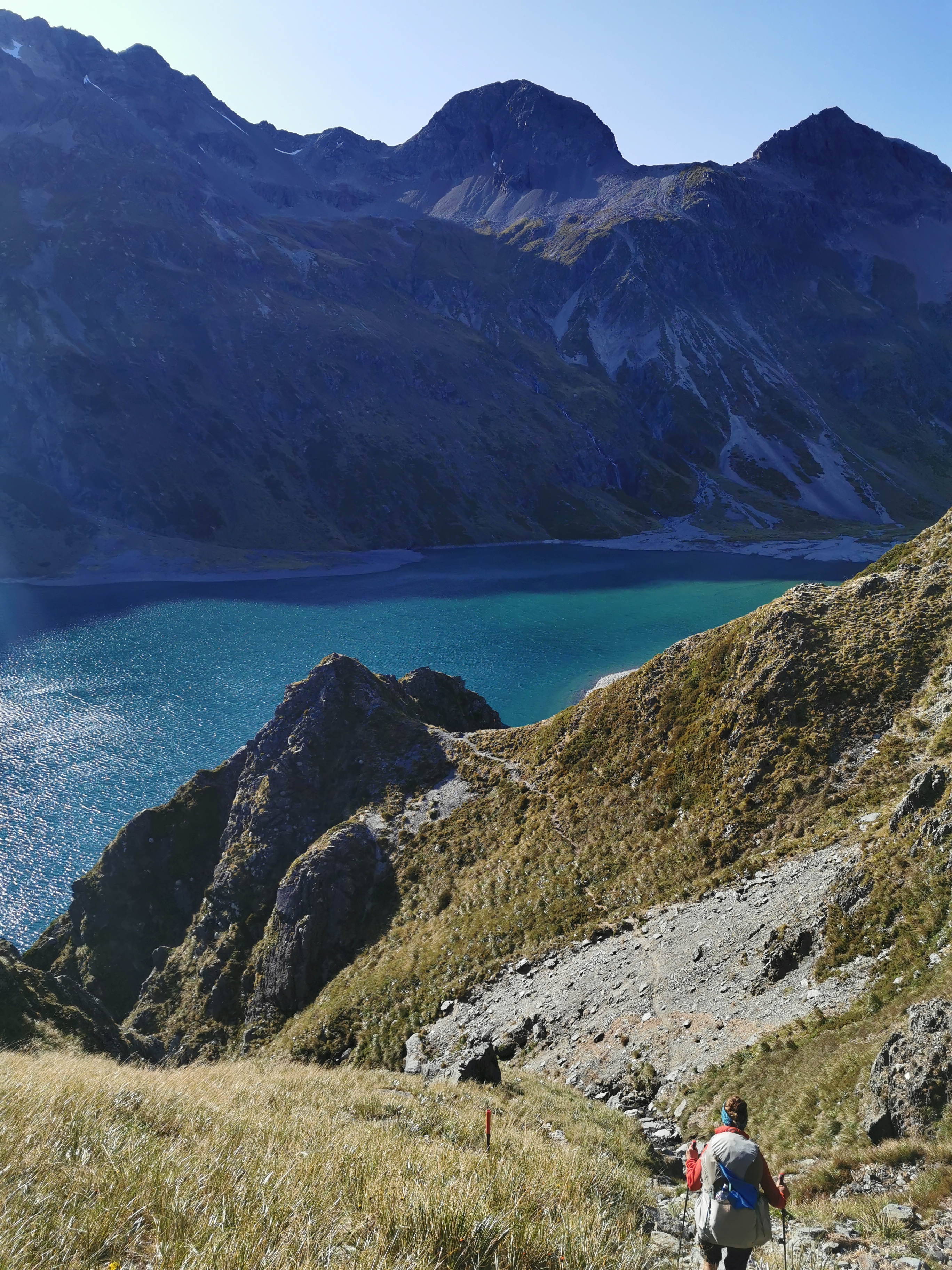
You do actually walk along the edge of it for a while, but apparently it’s not easy to walk right around the perimeter.
I saw from Rhydian’s Instagram later on that he camped at this exact spot a few days ago. It looked like a beautiful place to camp.
It was about this point where I realised that I left one of my two water bottles at the hut, which was annoying for two reasons – one is that we had just been given a lecture by the hut wardens not to leave rubbish behind (and I hate it when people do leave their rubbish in the hut) and two, I now only have one water bottle. I’ll survive with only one water bottle but I feel bad about leaving behind what is now essentially litter.
Also another thing that I lost somewhere was the orange triangle that was attached to my pack – the one that I found buried in the mud in Puketi Forest on day 10. It might have been for the best. I know that the triangle I took was buried deep in the mud and nobody would have missed it if I took it, but I think its presence was encouraging people to steal their own triangles off the trees on the trails, which I don’t encourage.
Walking along the next bit of track, Sabine noticed way up on the ridge that there is a sidle path, and she asked me if I thought we had to walk along there. Naaah, I said.
Can you see where I mean? Let’s zoom in 10x.
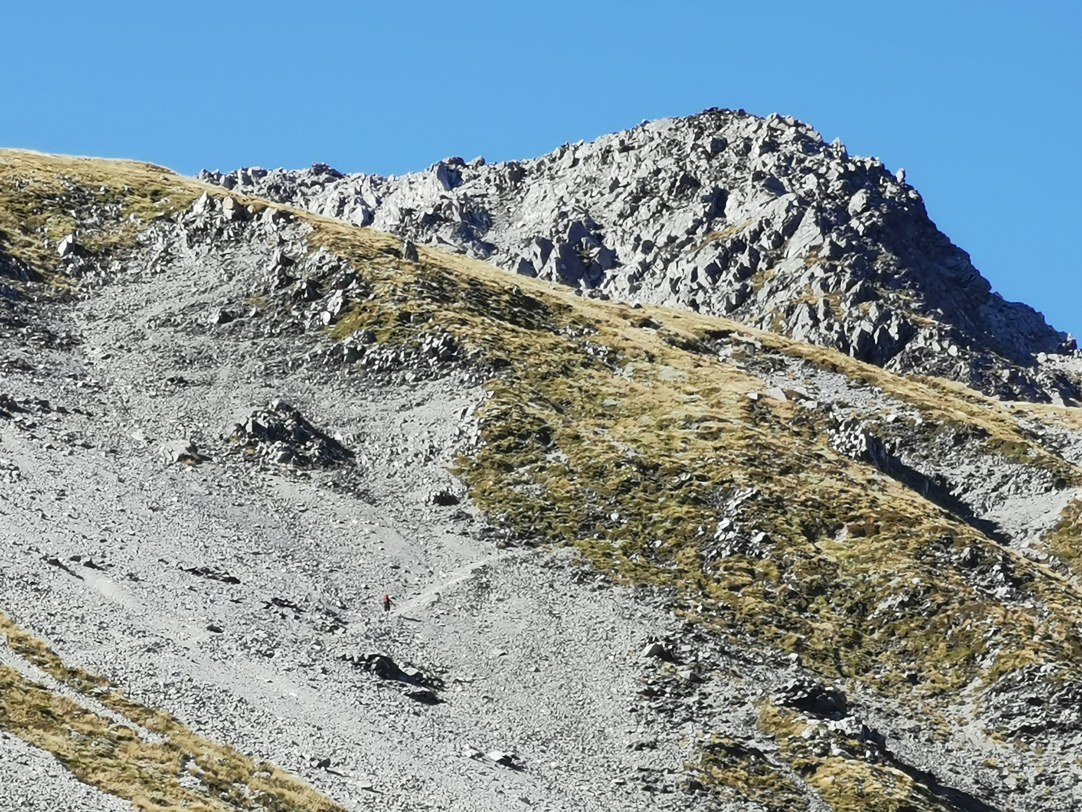
Oh wait… There’s somebody walking up there. I guess that means we are going all the way up there. Wunderbar.
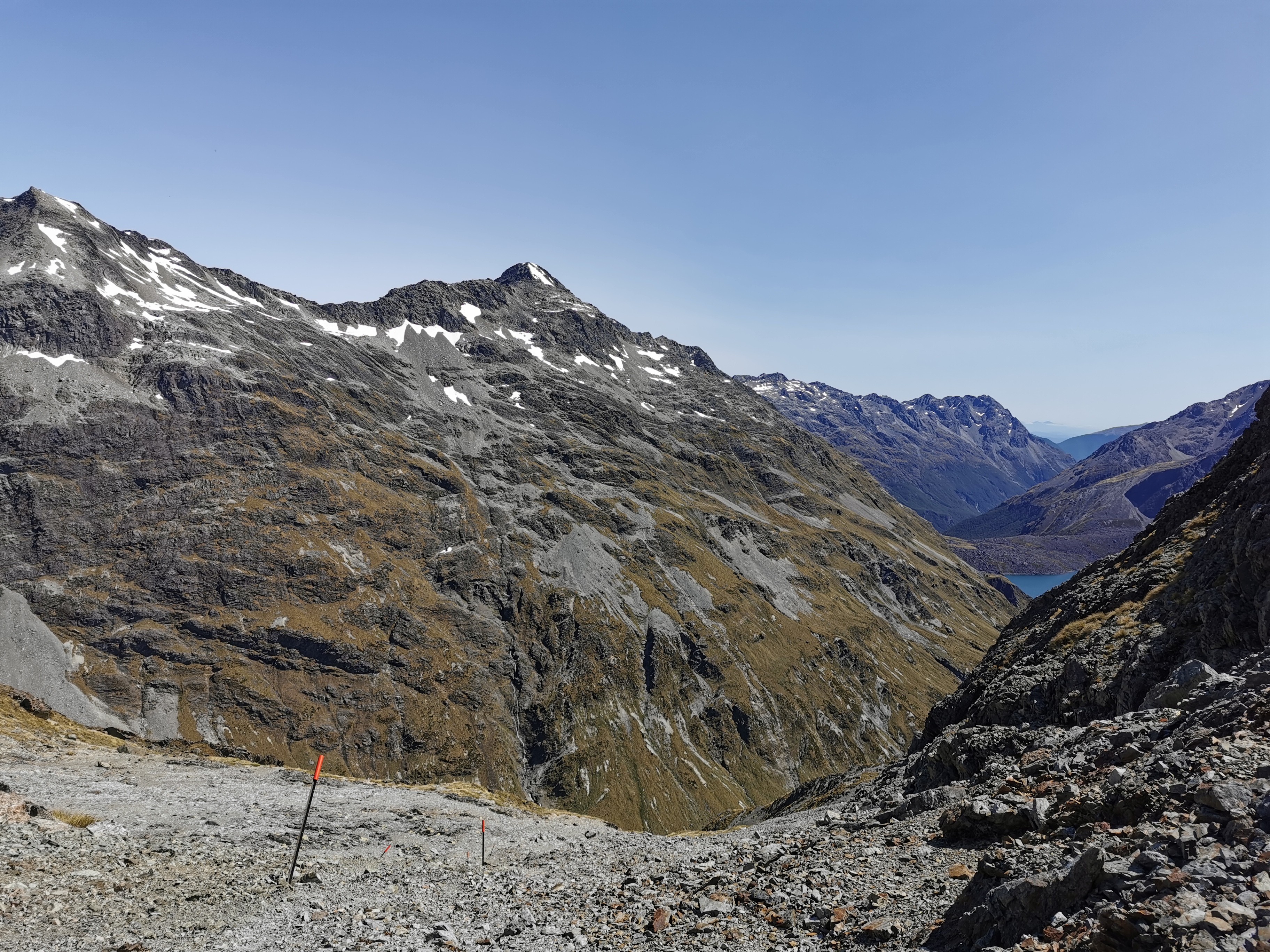
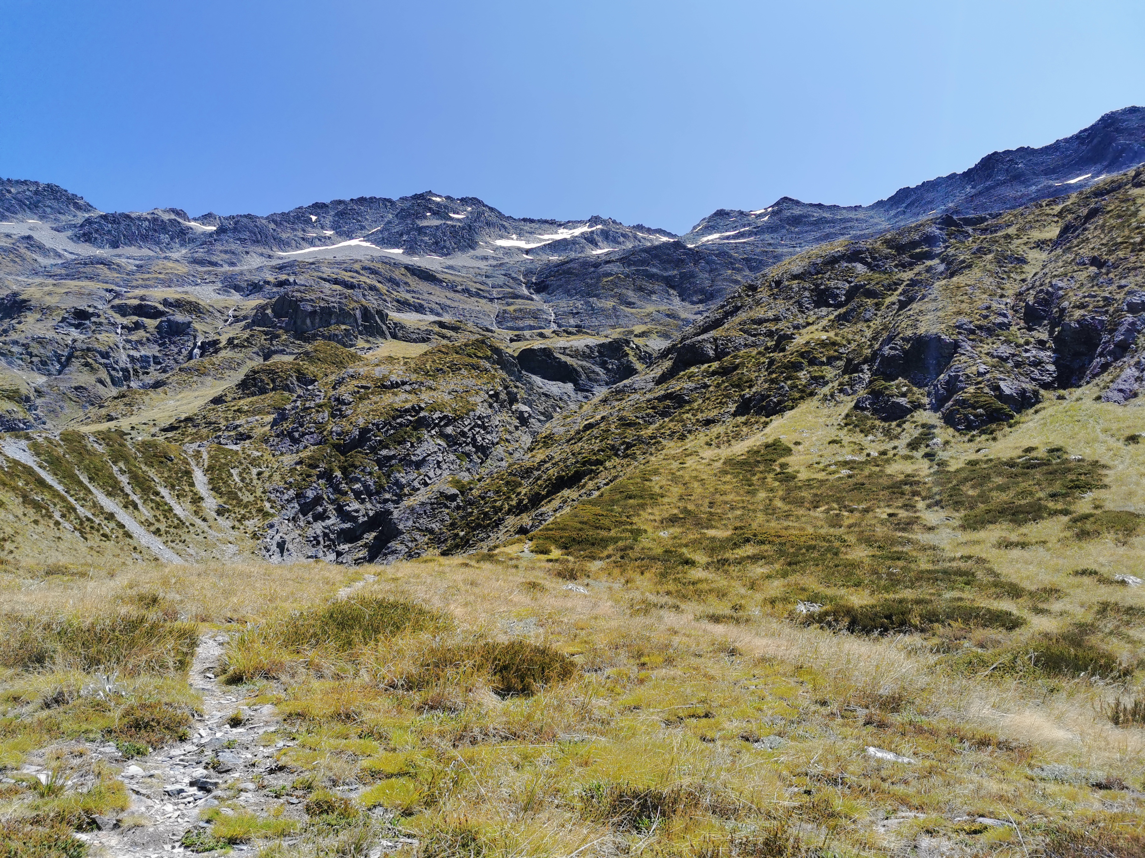
From Lake Constance, in typical TA fashion, the path suddenly goes straight up the side of the mountain.
And then across the sidle that we saw from the ground.
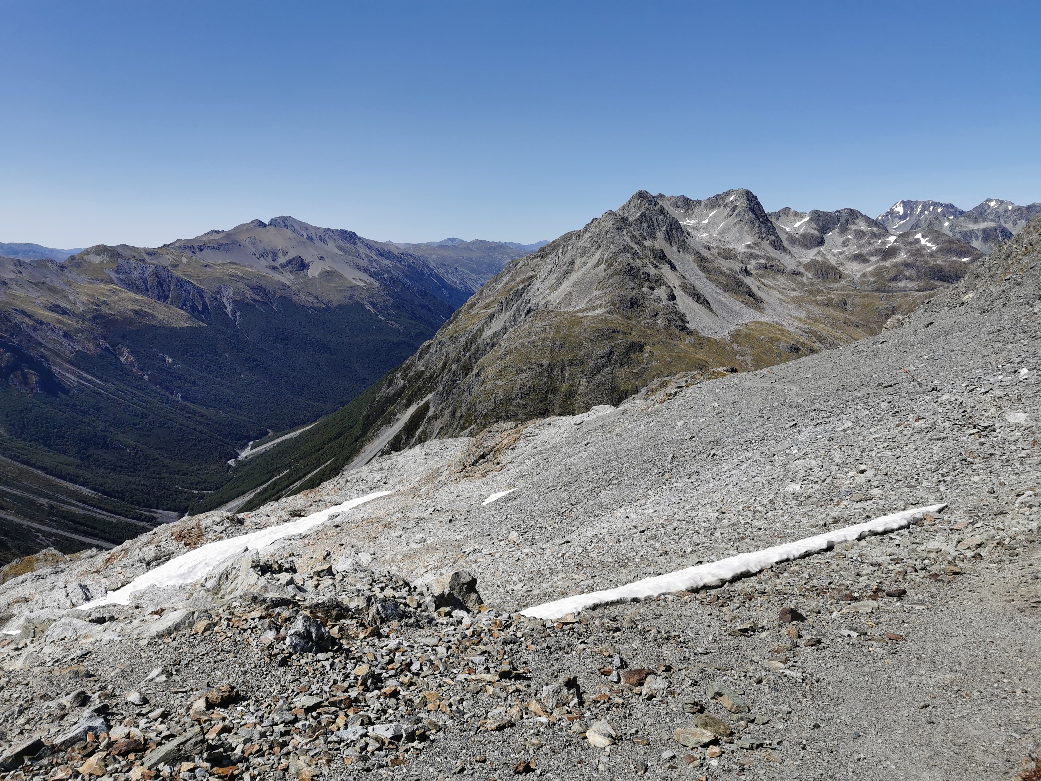
From here though the views back to Lake Constance were amazing.
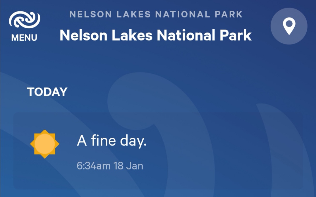
At the sidle came the familiar Facebook Messenger “ding ding ding”. That means phone coverage. So the first thing I did was update the weather forecast. Surprisingly, it was very short and sweet.
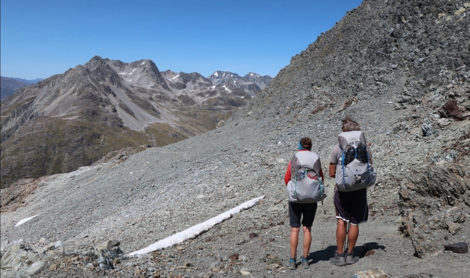
Sabine and I took each other’s photo.

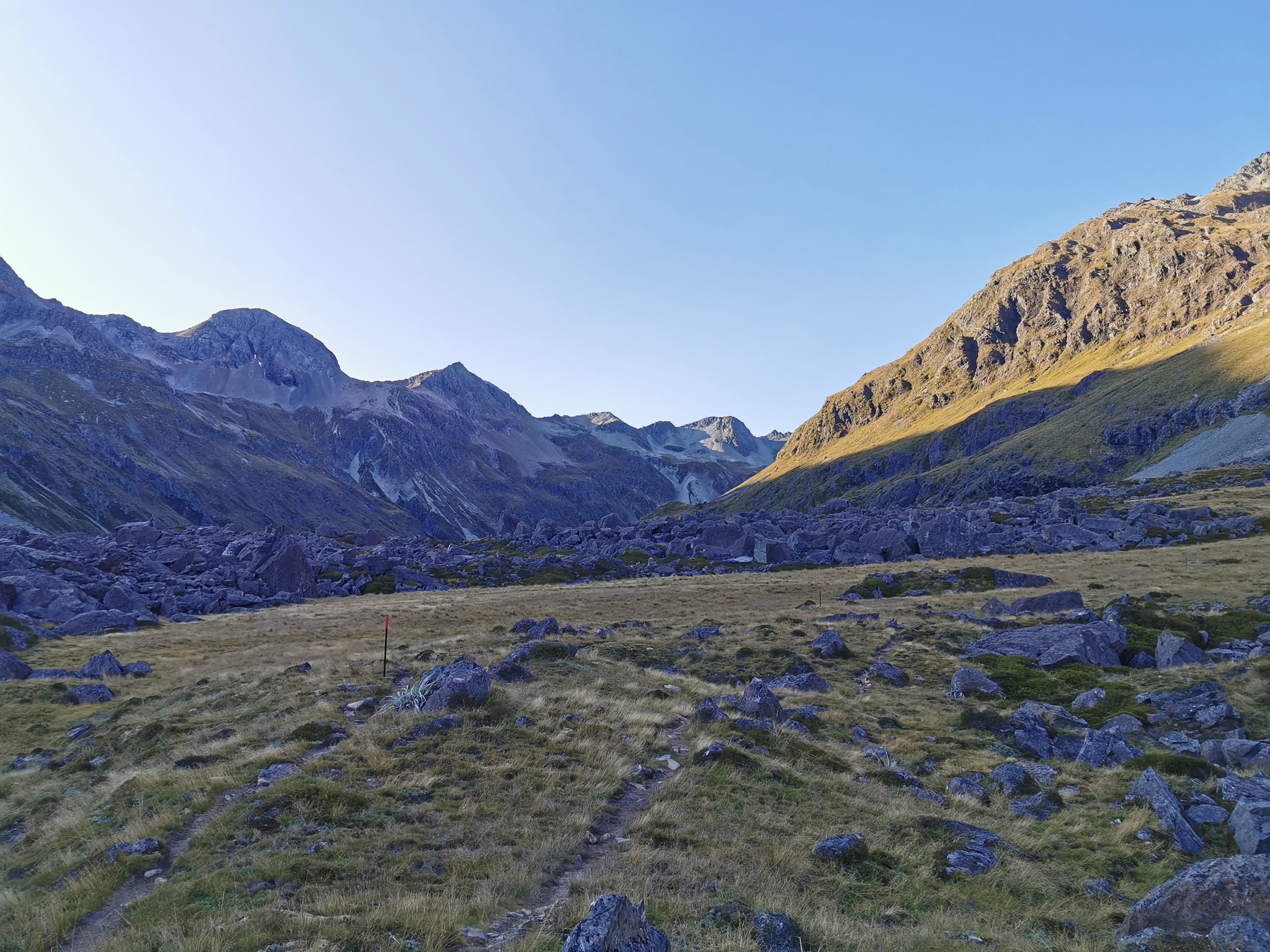
From the sidle, it’s still a bit more uphill to the top of the pass. At 11am we were nearly there.
It felt like a major achievement making it to the top of the massive Waiau Pass. The views on the other side were more mountains… And some snow!
From St. Arnaud I had booked a shuttle to Christchurch for the 22nd of January. I now realised I was making quite fast time through this section so while I had phone coverage I decided to call the shuttle and move the date to the 21st instead. Unfortunately the reception wasn’t very good. The conversation kind of went like this:
- Hi, I’m Matthew and I have a booking for the 22nd which I’d like to move to the 21st.
- Did you say the 21st?
- Yeah.
- Oh here it is, are you Dan?
- No, I’m Matthew.
- Ah I found you… So you want to move it to the 20th?
- No, the 21st please.
- [She got distracted by something] sorry Matthew, did you say the 20th?
- No, I need the 21st please!
I hung up the phone thinking for sure that she had got it wrong. Great, that means I’m going to have to call again to confirm once I get to Boyle Village.
Sabine wanted to take a photo of the two of us with our identical packs. I asked her how she was going to do it, and she pulled out this attachment for her camera which was able to cling to things. Apparently it is called a Gorillapod. I’d never seen it before, and I want one. She attached it to the top of a marker pole and set the self timer.
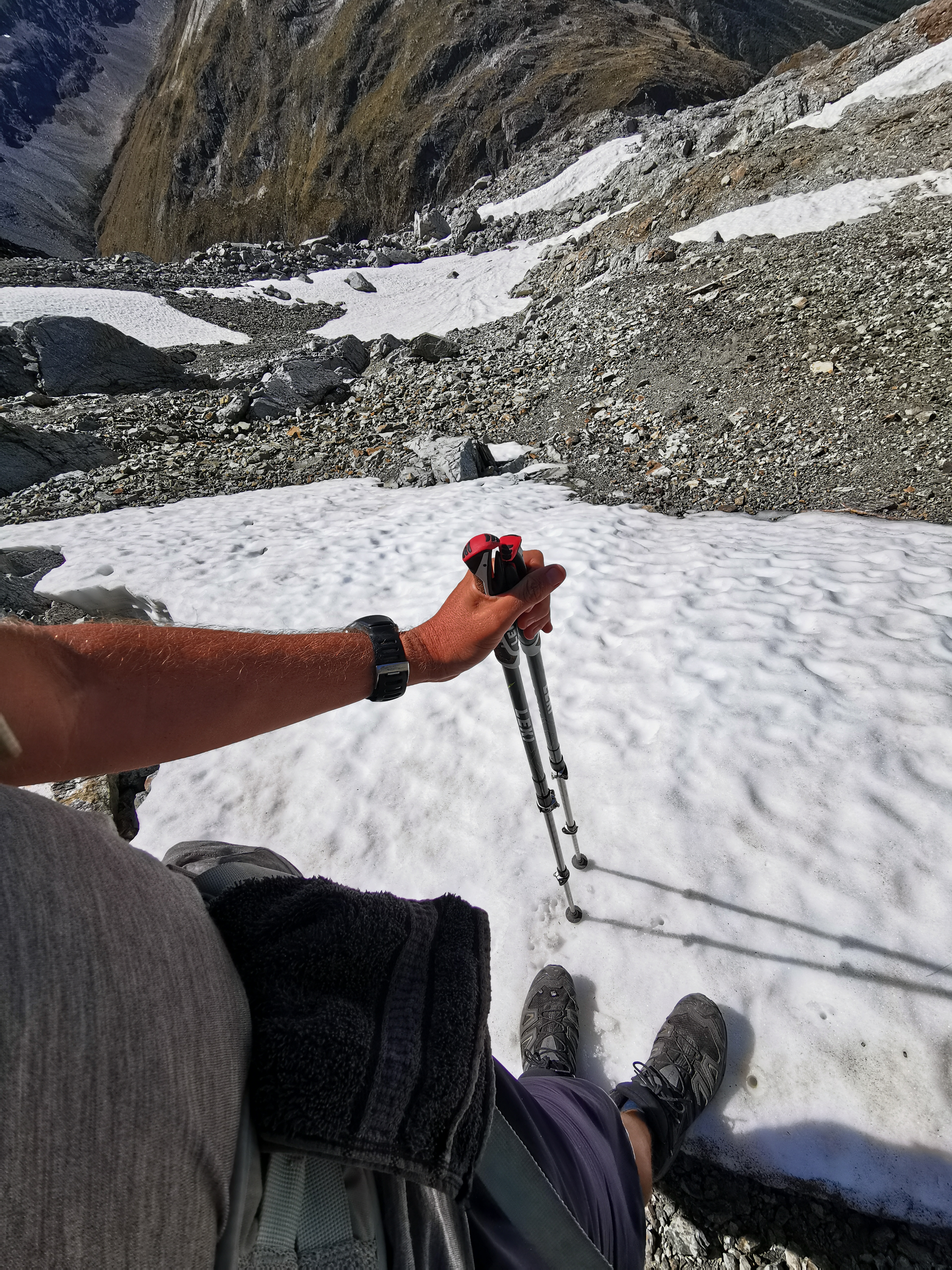
After a bit of food it was time to head down.
But I had to at least set foot in the snow once.
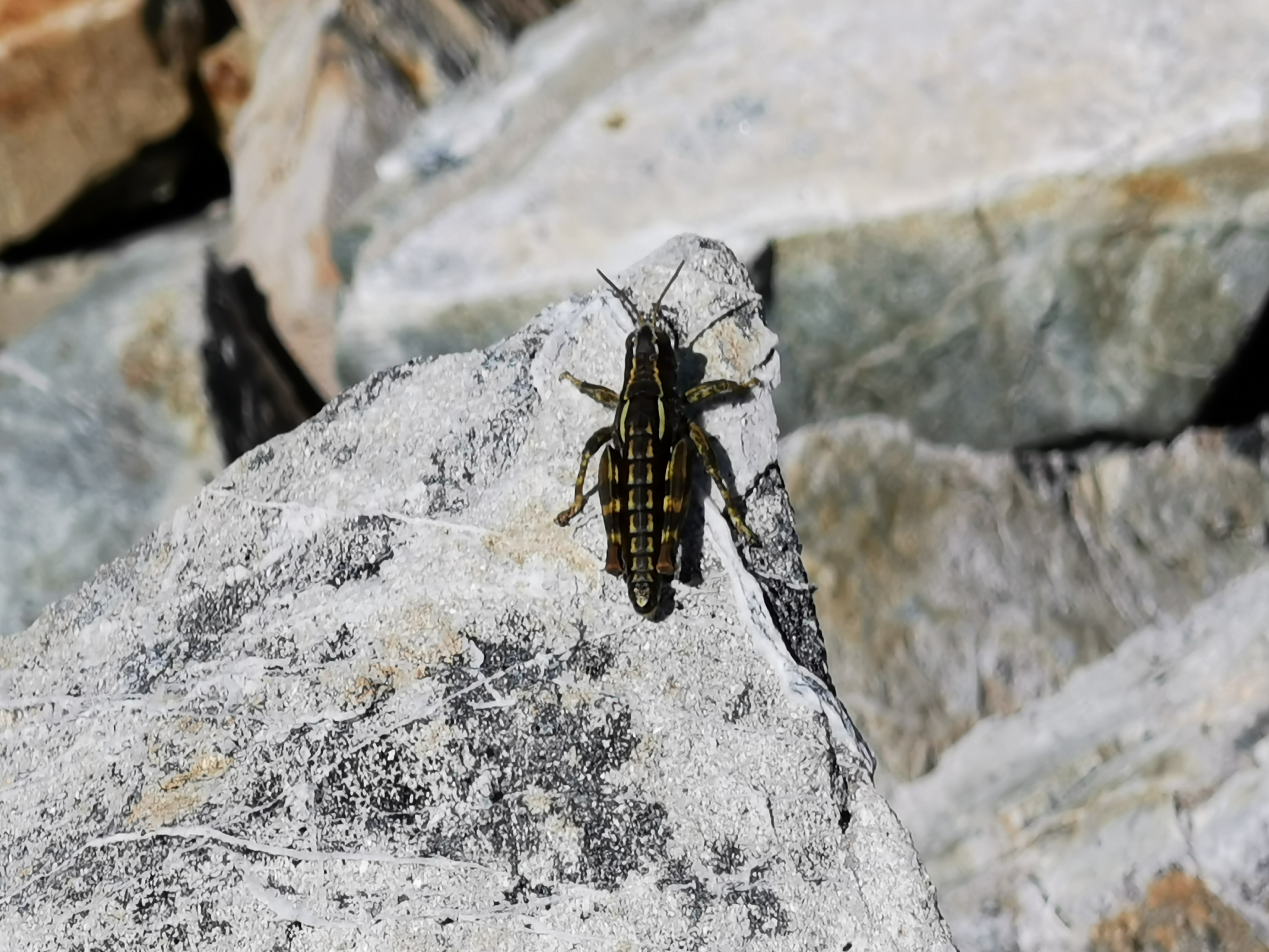
One thing I noticed up here were a lot of crickets. All the way up the hill they were there, jumping all over the place. And they were different crickets to the ones I see in the North Island. Sabine and I wondered what they live on up here.
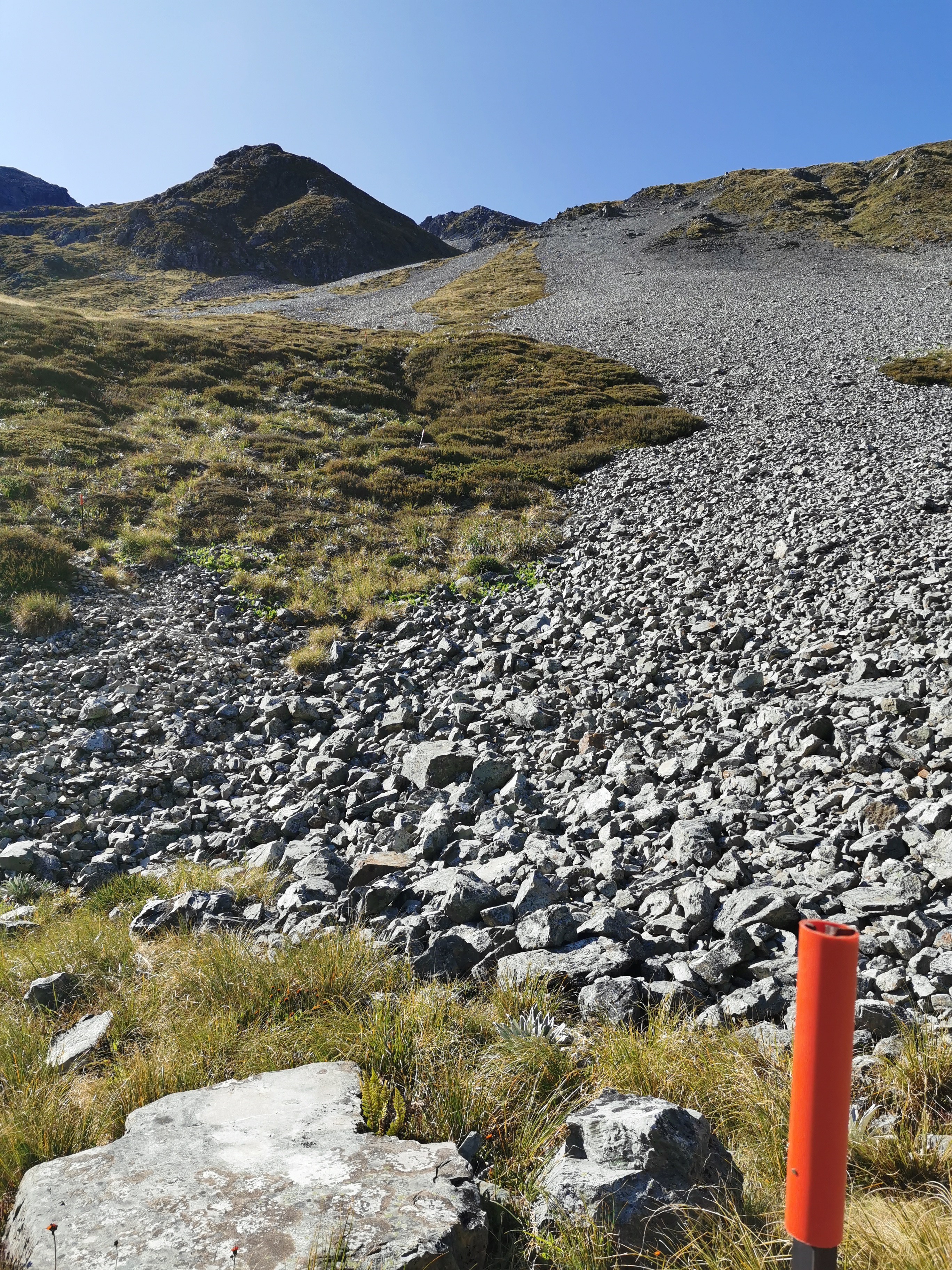
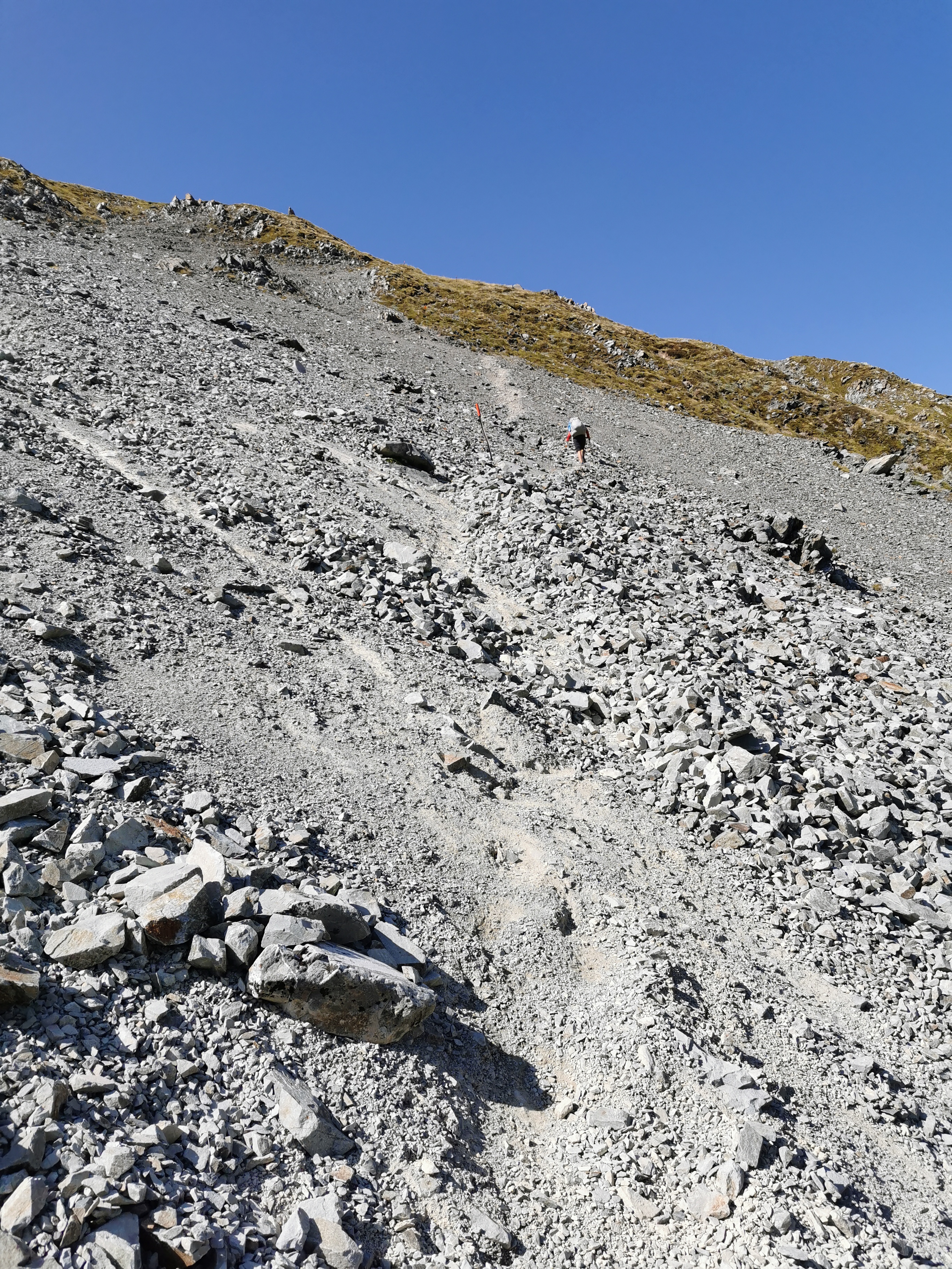
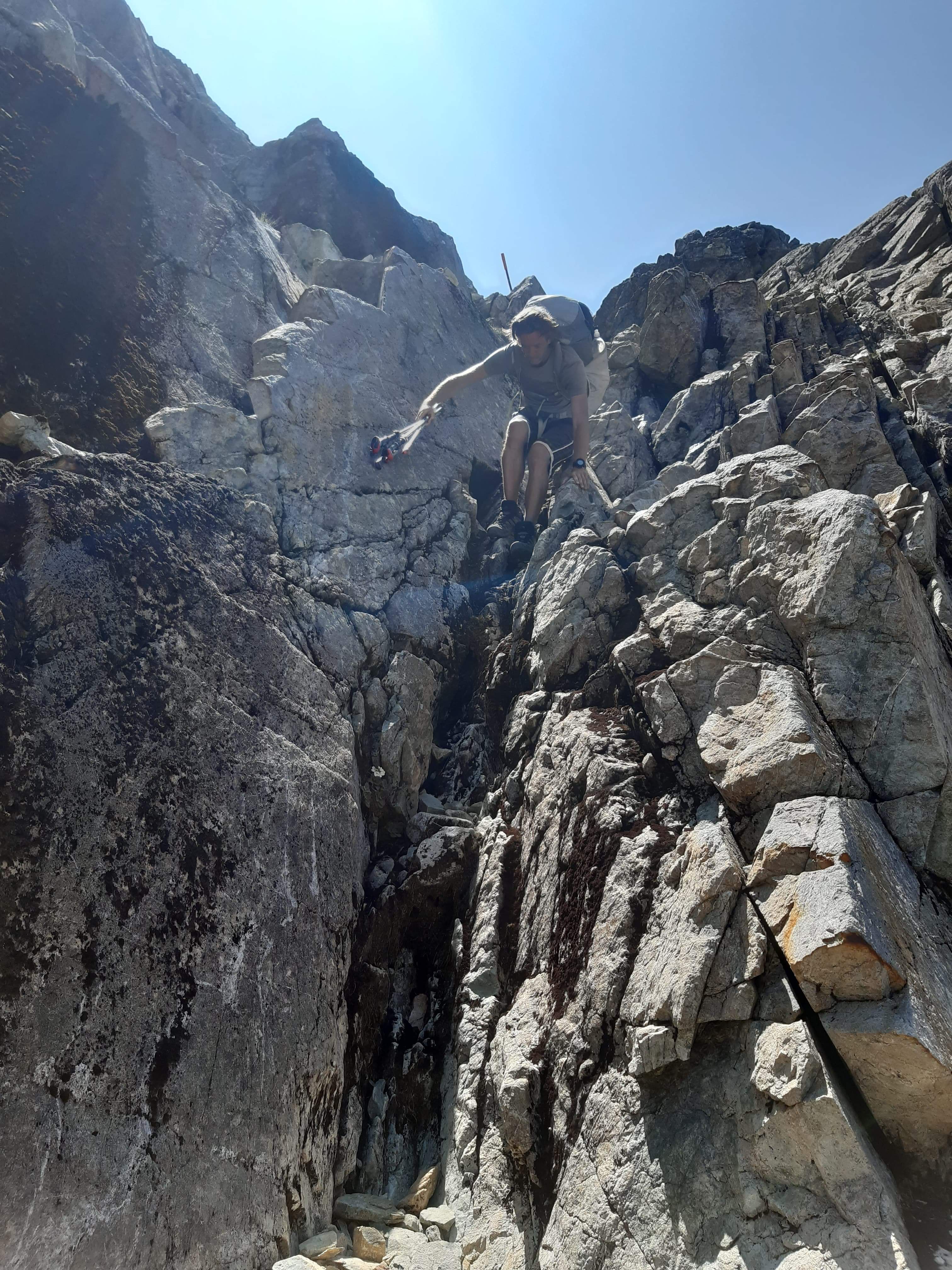
Coming down was hard. It was very steep and the rocks were big and jagged. A lot of it felt like rock climbing.
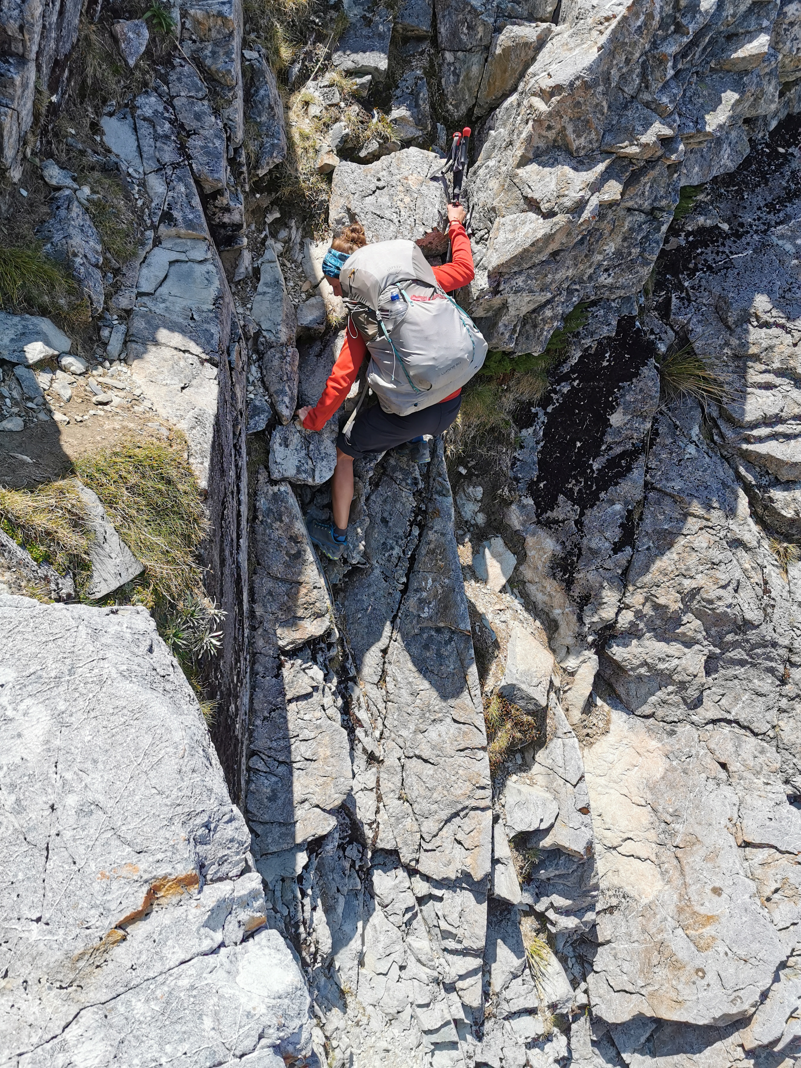
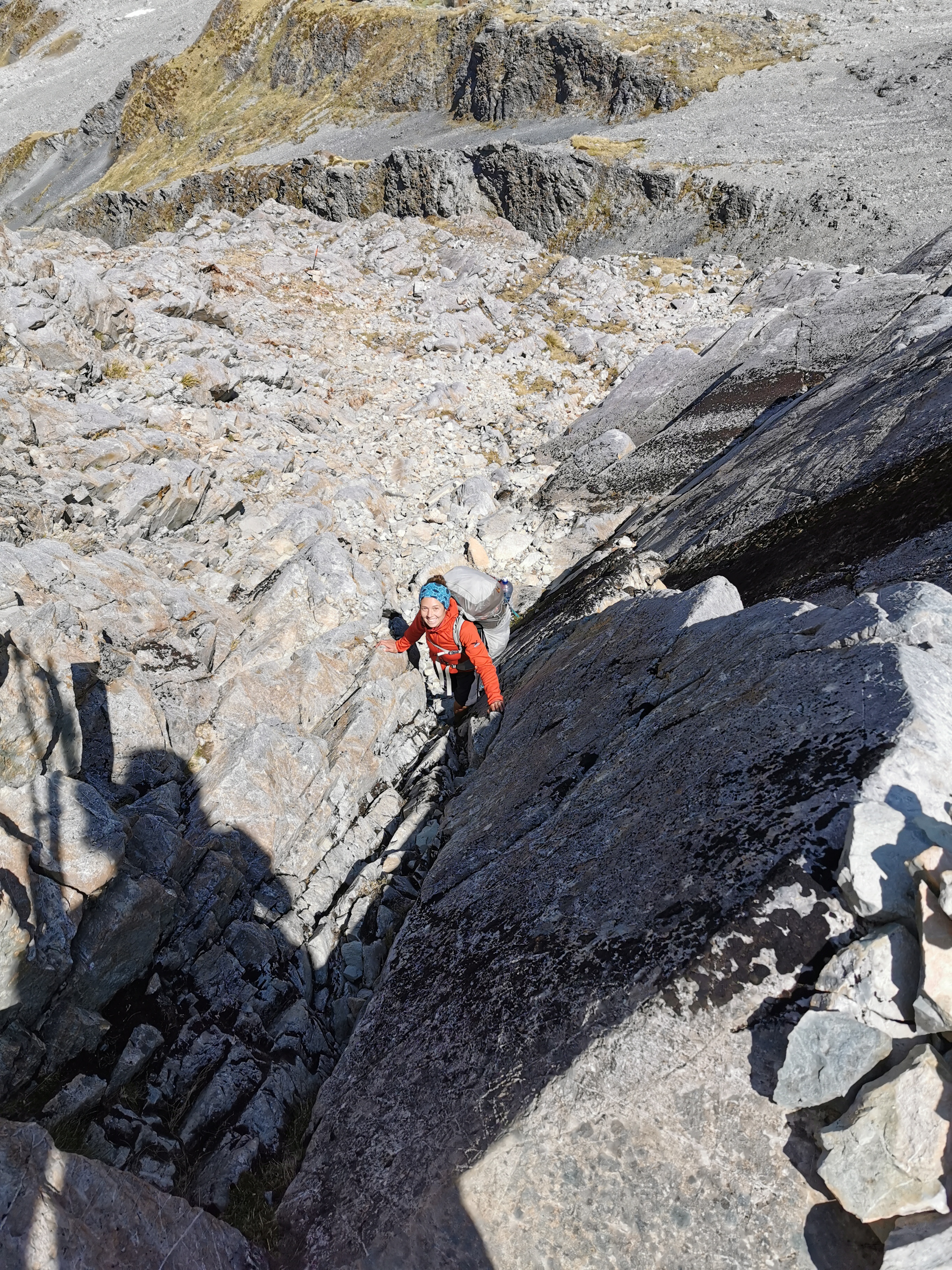
Here I am attempting the same section.
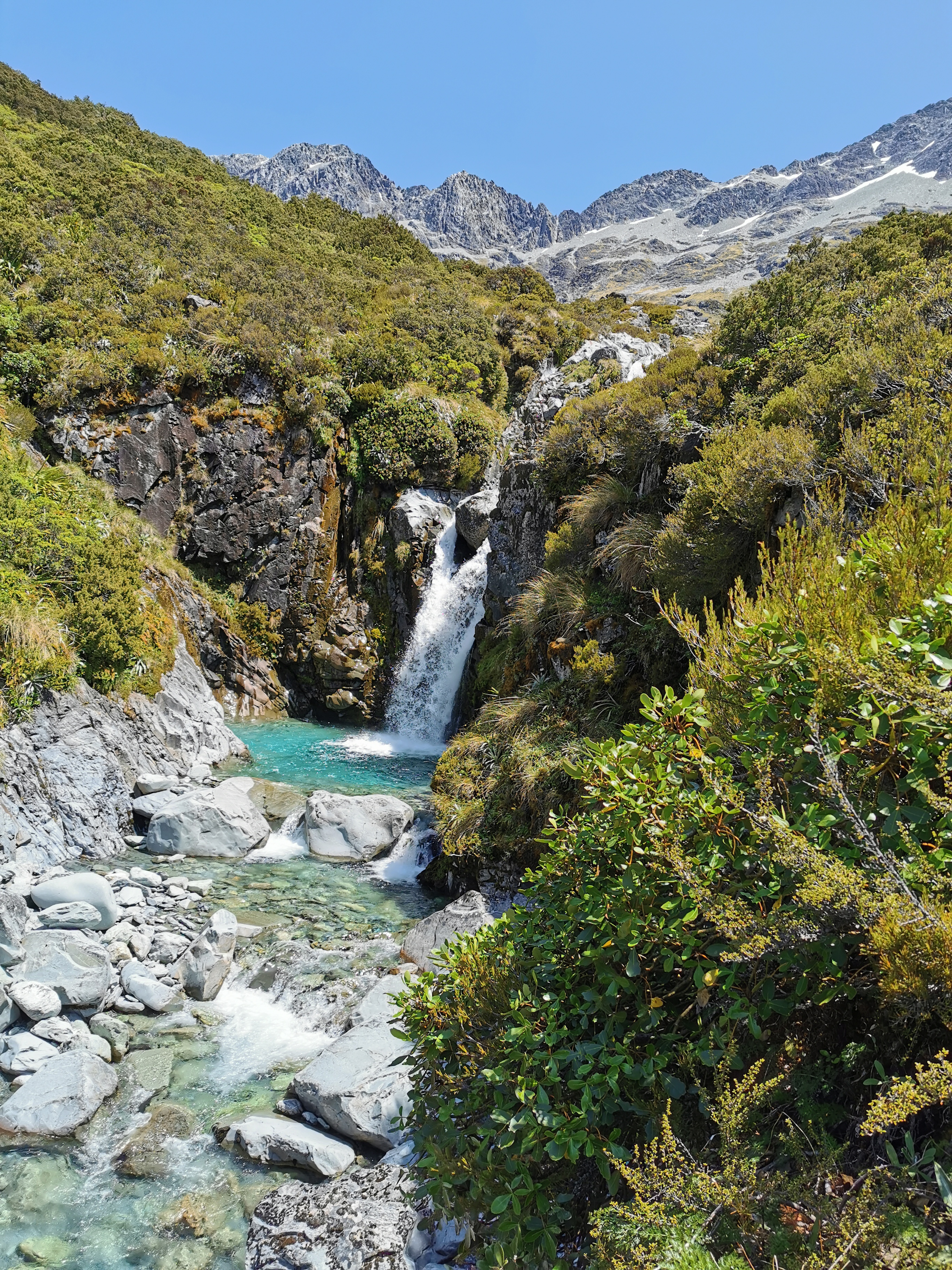
The weather really was “a fine day”. The sun showed no signs of relenting, and since I only had one water bottle now I had to refill it often. There were plenty of streams flowing down the mountain though. Here’s one I got water from:
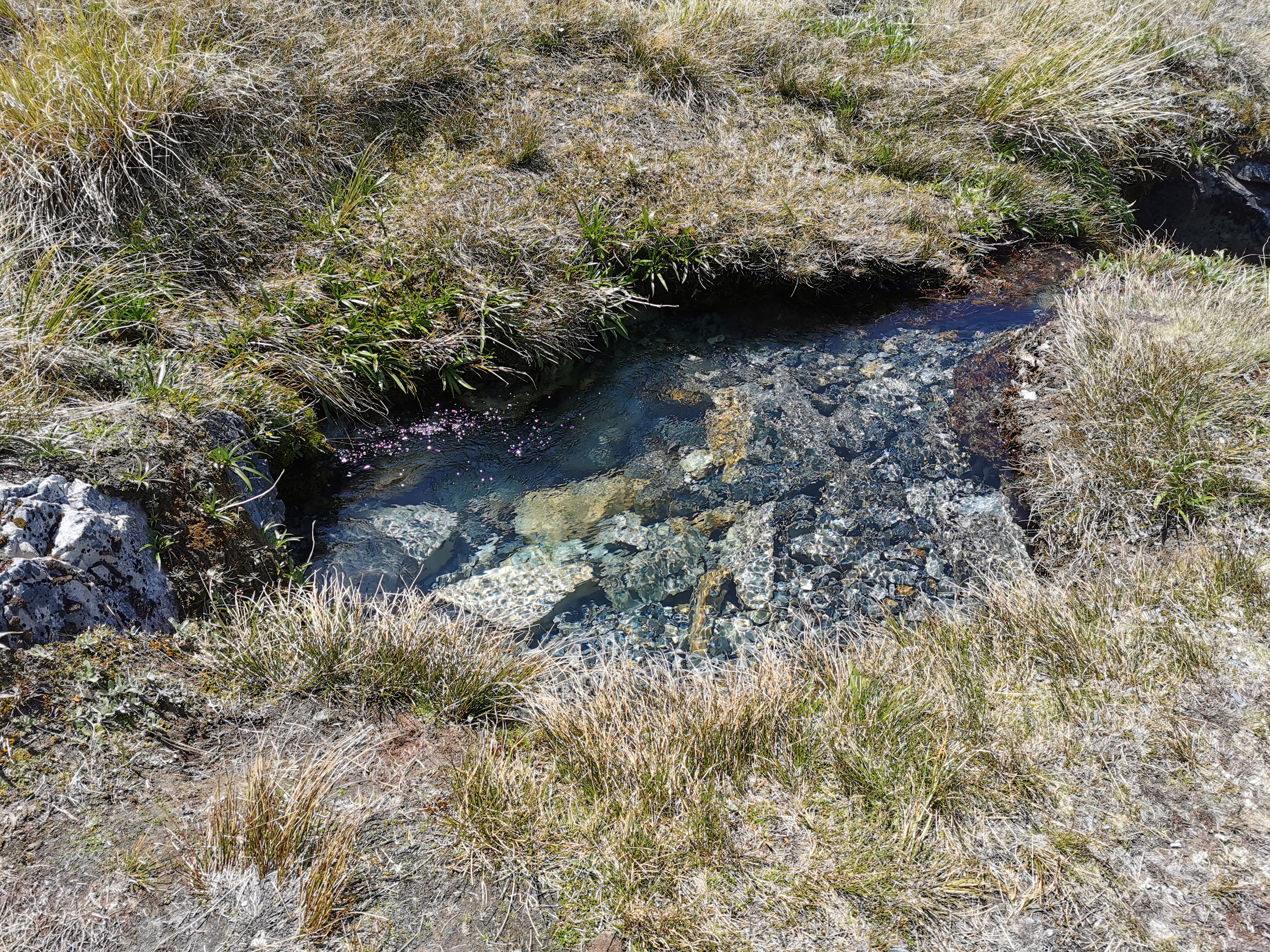
I filter the water every time because I said I always would. Here though I don’t know exactly why I did. This looks like the cleanest water in the world.
The big descent here and the big steps down onto rocks meant my knees hurt, and in fact my right leg was hurting quite a bit. I got a bit worried. I couldn’t wait for the descent to be over.
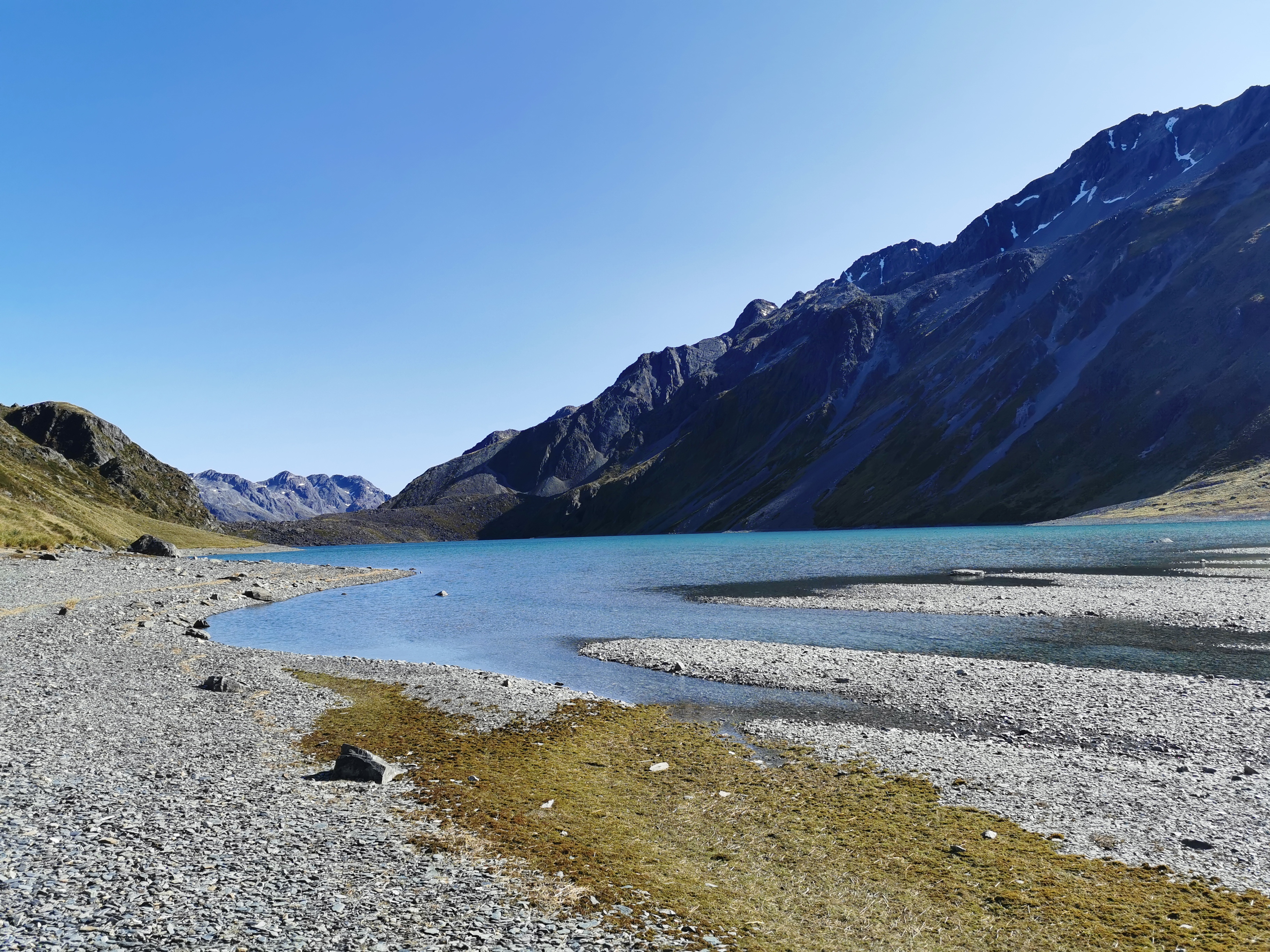
We eventually found the impromptu campsite talked about in the trail notes. It was the first shady bit all day so it was a good place to stop and have lunch. There were two other people there, a couple who were at the hut last night but I didn’t make an effort to talk to.
Because my legs hurt so much I had it in my head that I was going to camp here the night, but I asked the two that were already here if they were staying here tonight and they said yes, most likely. I really would have felt like a third wheel if I camped here with them. Also, I wanted to pass the 2,000km point which was a bit further on. And also I looked at the map, and Boyle Village is still 62km away and I have only two and a half days to get there now since I’ve changed my shuttle booking, so probably wise to press on.
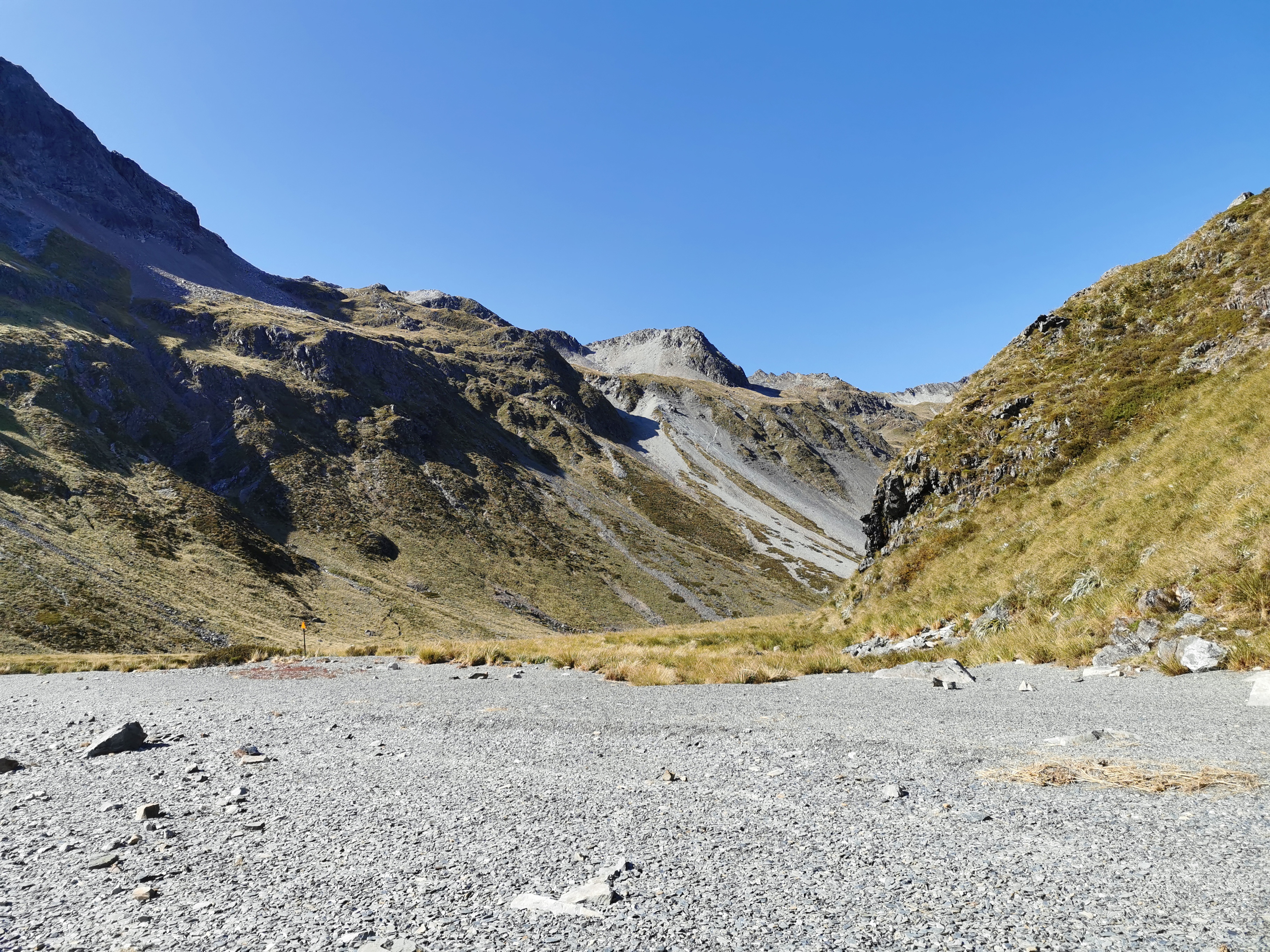
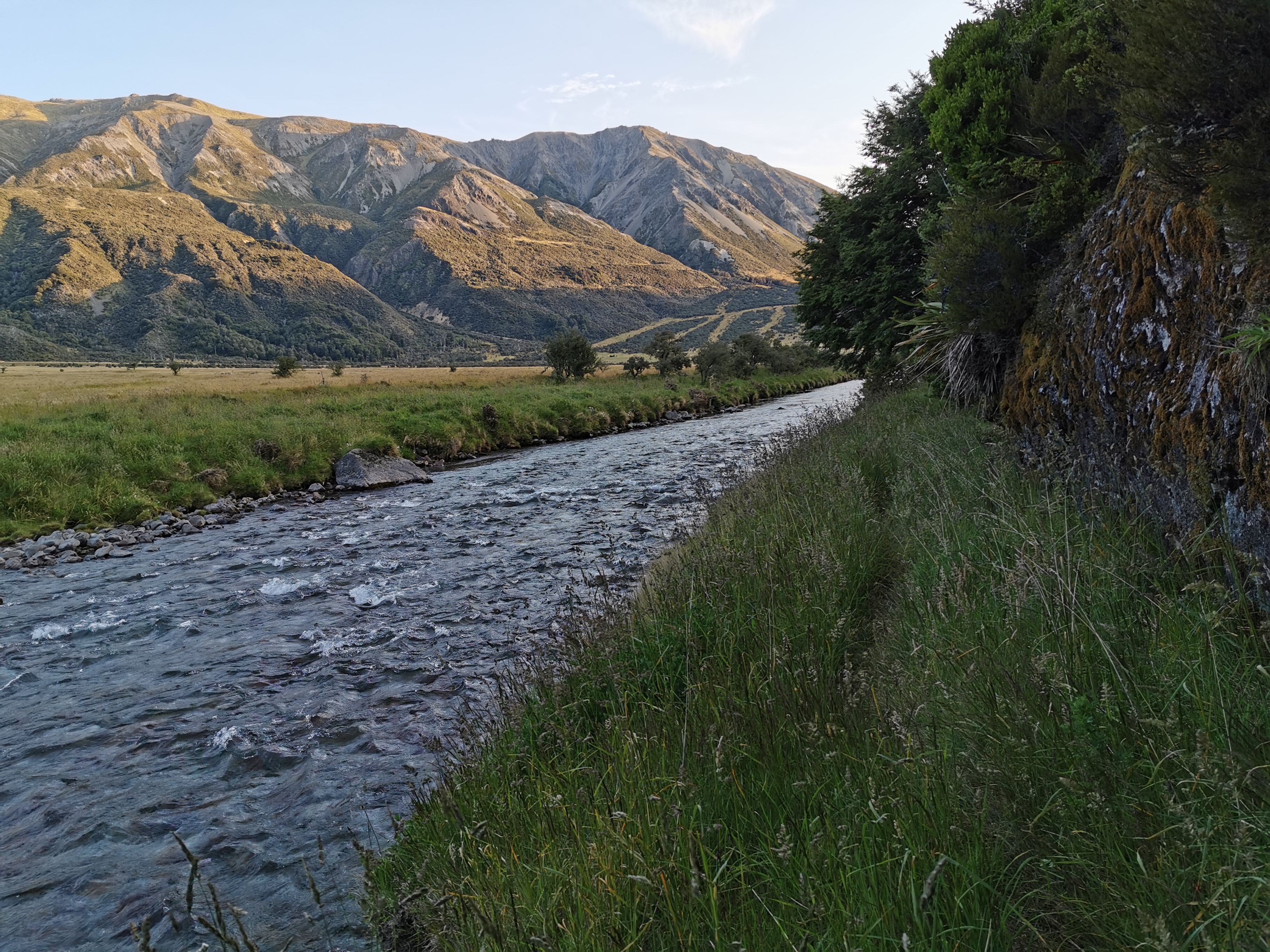
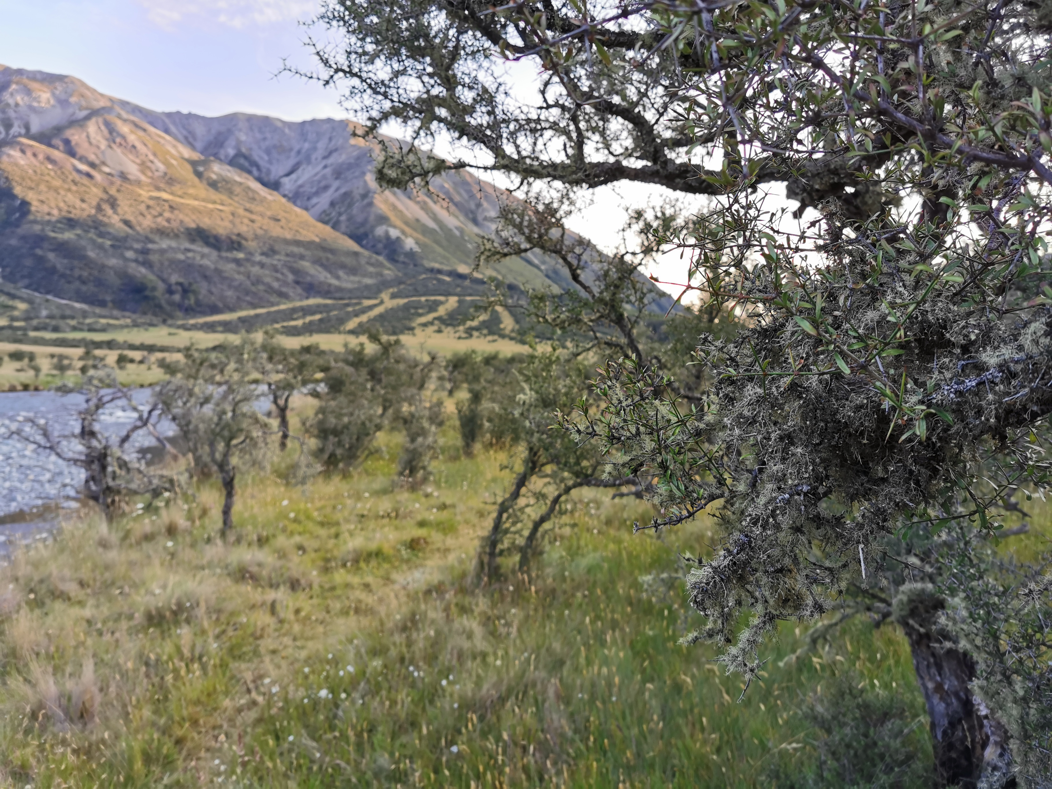
The next bit was walking alongside the river, so it was no longer a steep downhill, but it was still along rocks.
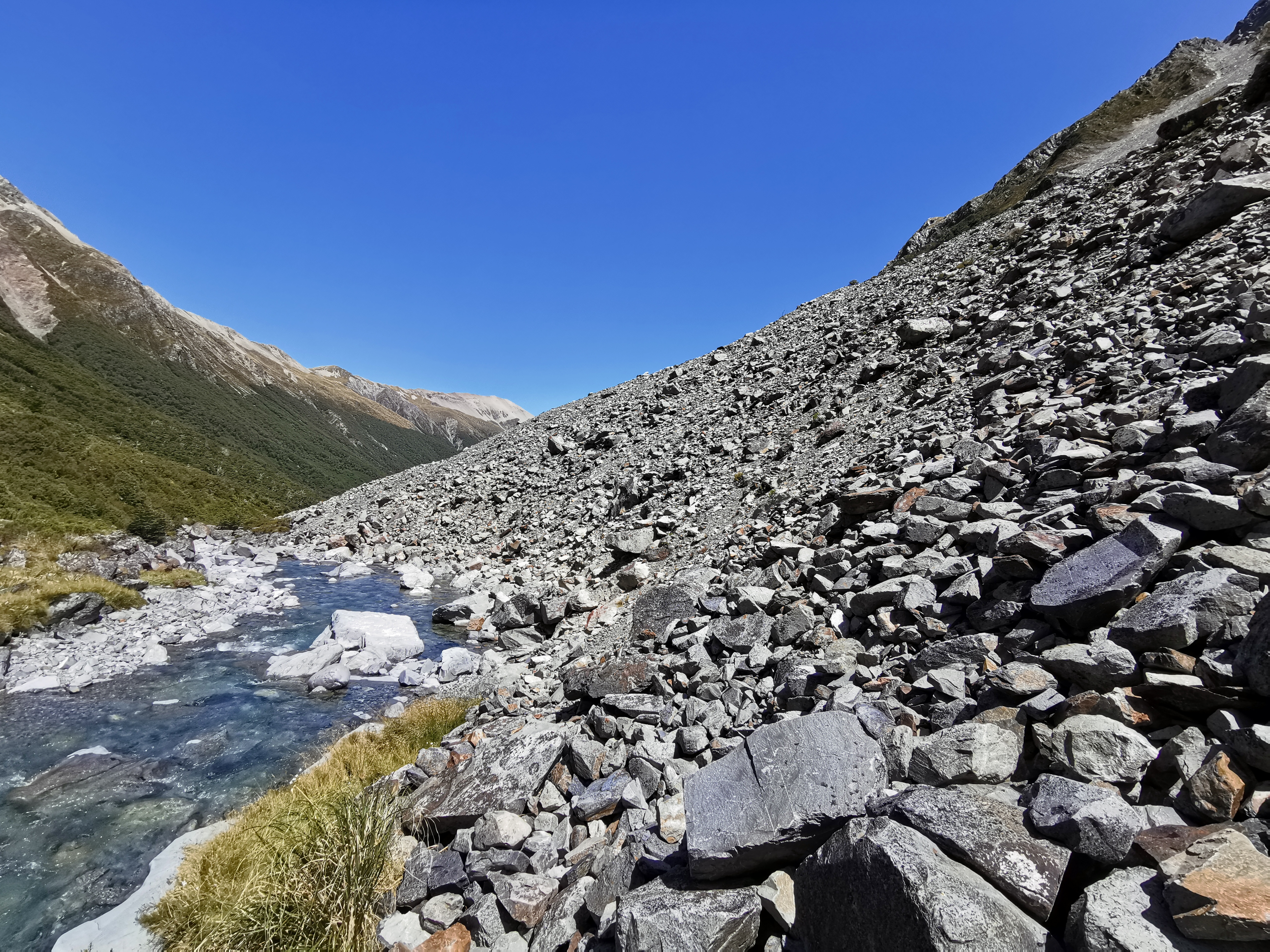
Lots and lots of rocks.
I looked up, which was a stupid thing to do. The rocks go right to the top of the mountain.
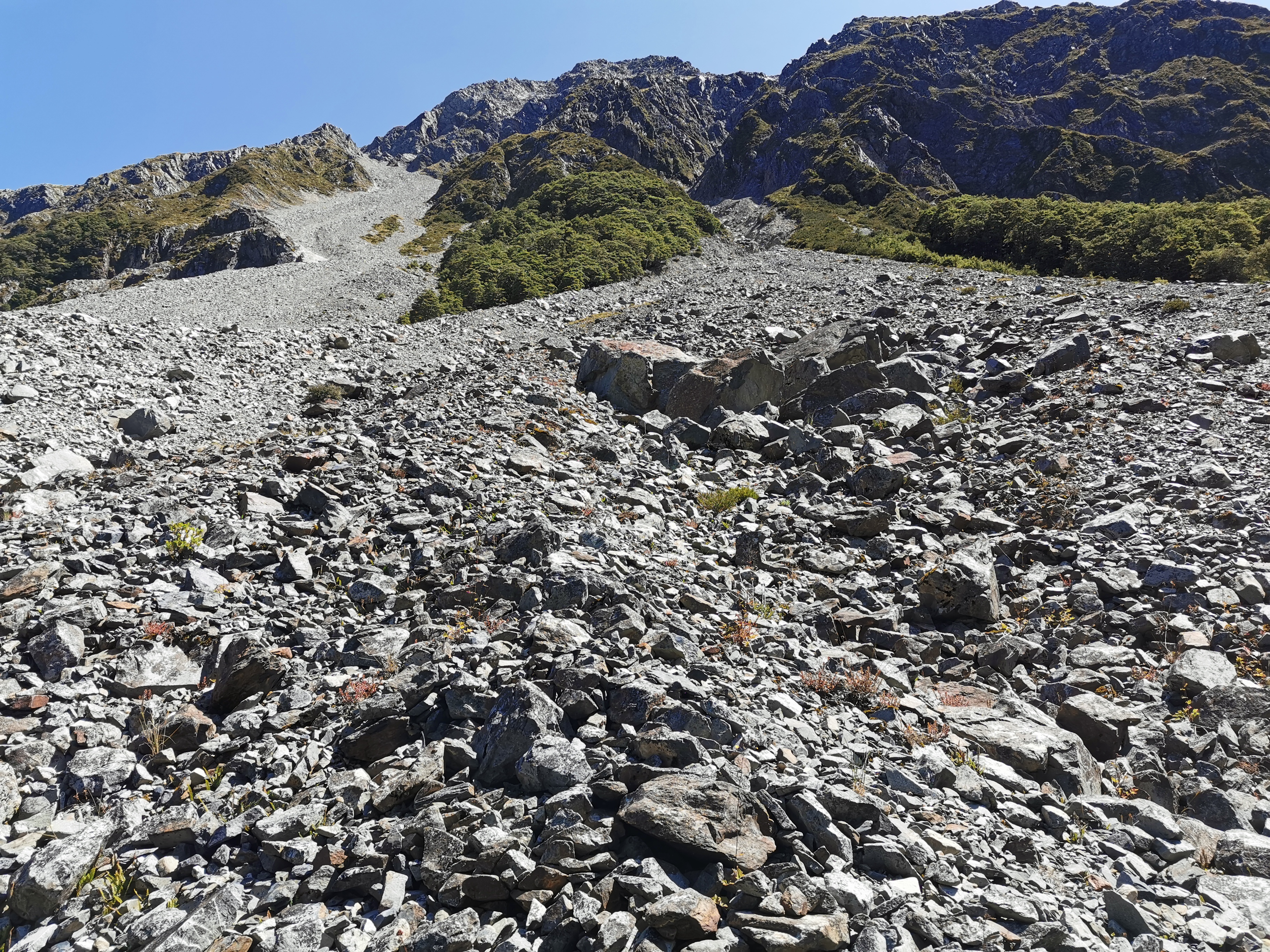
I was worried about how stable they were. What if somebody sneezed at the top of the mountain? Would it start a chain reaction with all the rocks suddenly hurtling towards me?
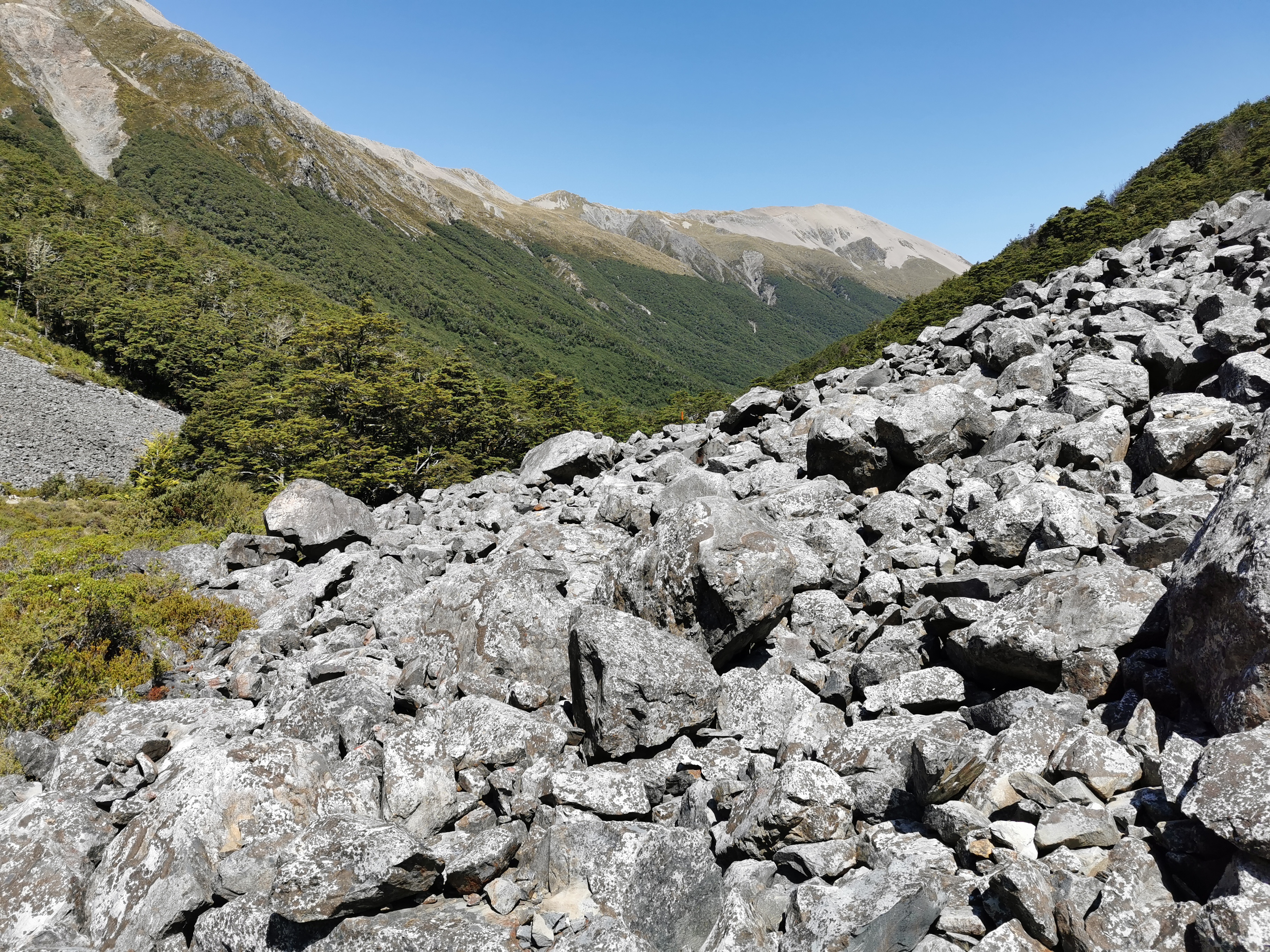
The rocks seemed to go on forever. The landscape alternated between rocks and then a bit of walking in the trees. In one such tree bit, we saw where somebody had made a “2000” out of rocks.
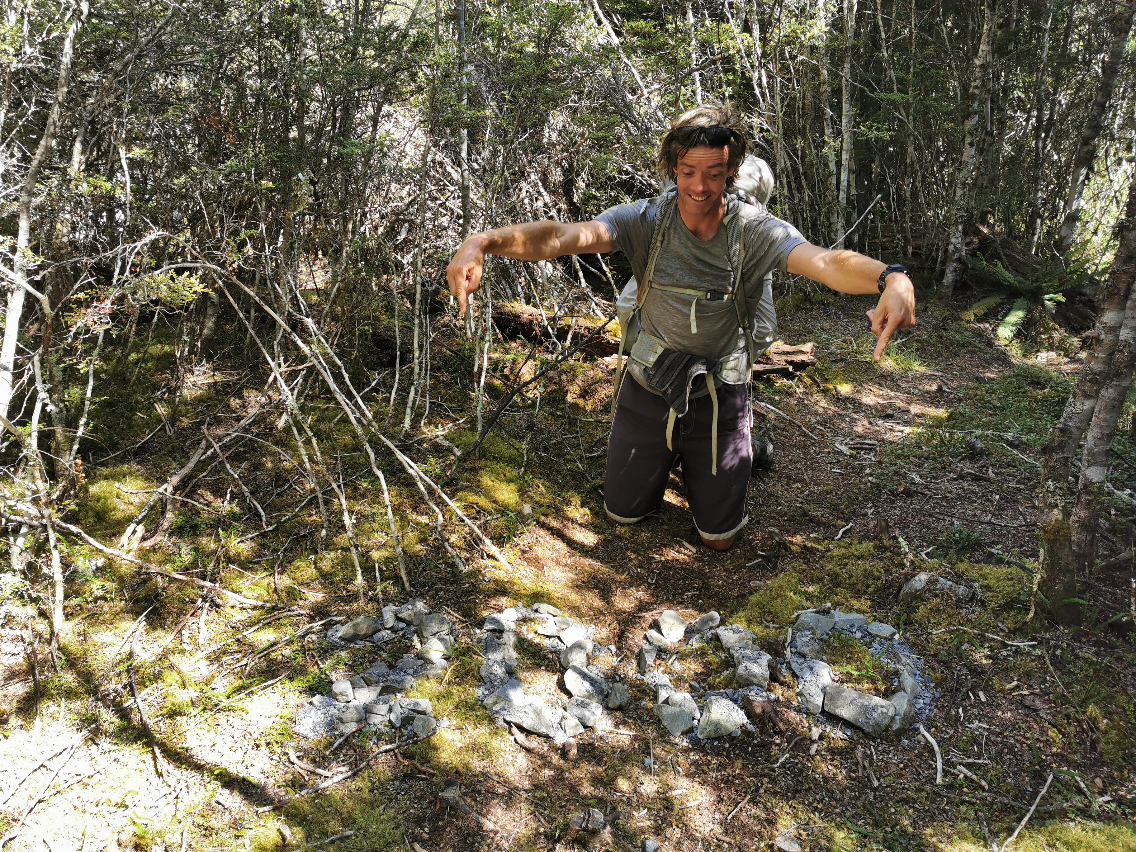
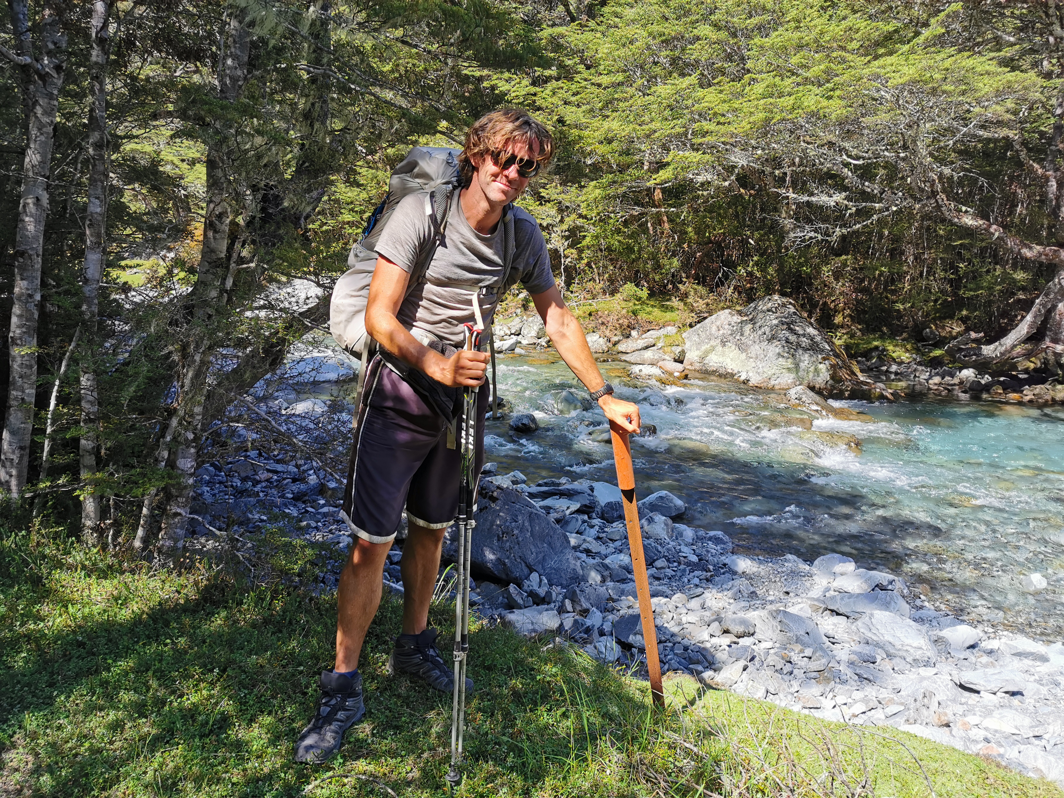
What was surprising though is that this point was only 1999.1km. Perhaps it was from a previous year or something, although it was in very good condition. So of course I had to get a photo beside it. The actual 2,000km point for this year is at this pole:
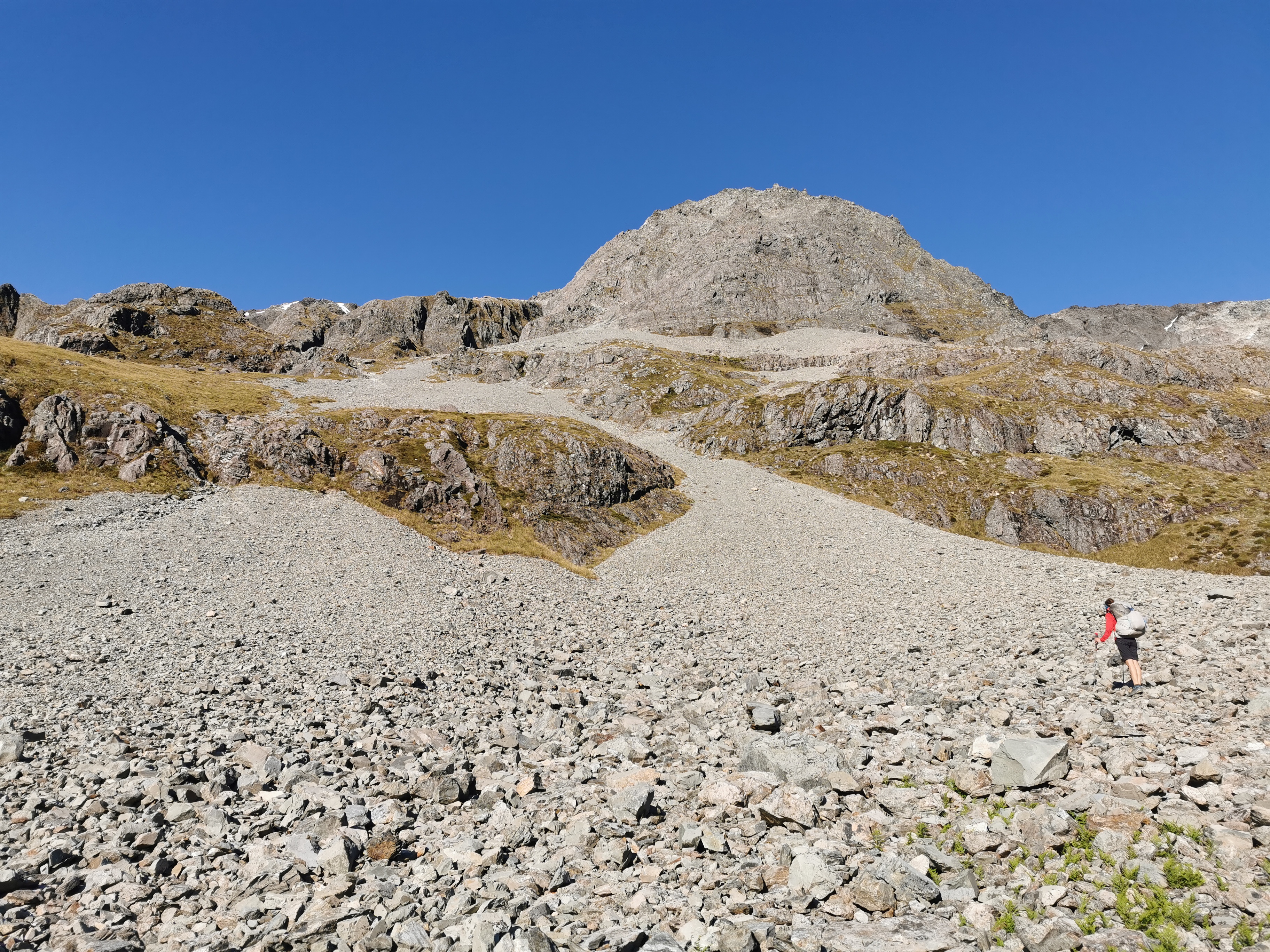
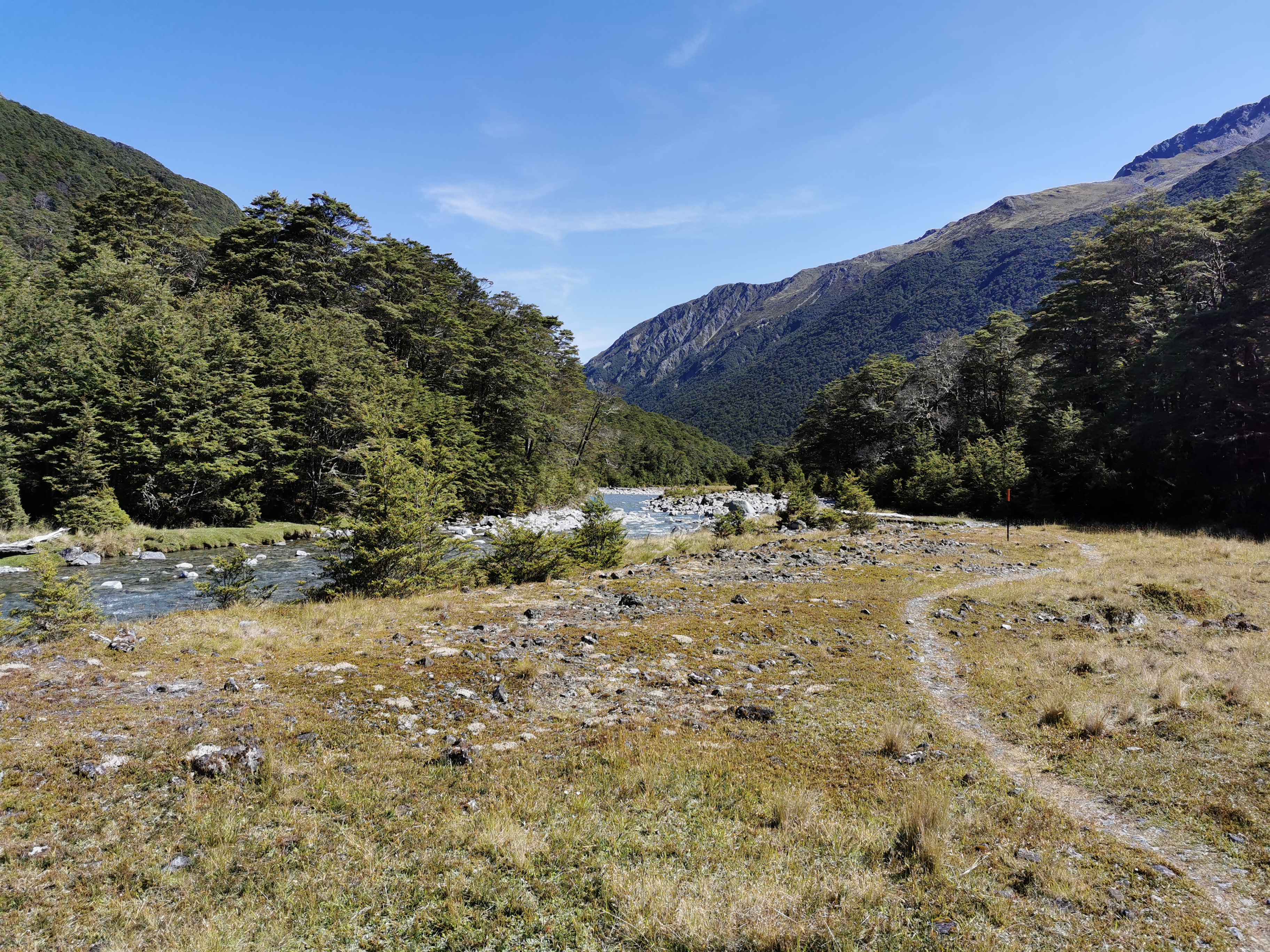
As often happens, once you are over the halfway point of a section of track, it starts getting easier as you get closer to the road and closer to civilization.
This sign showed how far we’d walked.
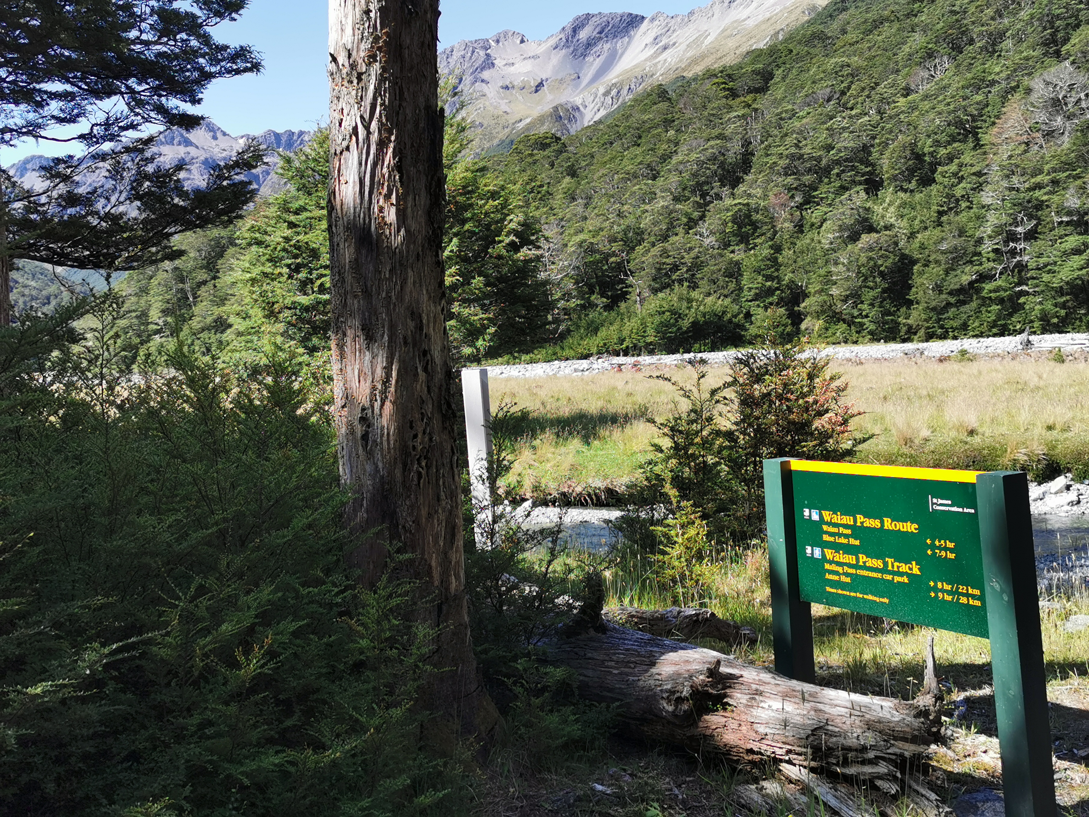
Interestingly, Waiau Hut was not listed on there. That’s most likely because it’s a fairly new hut, built in 2017.
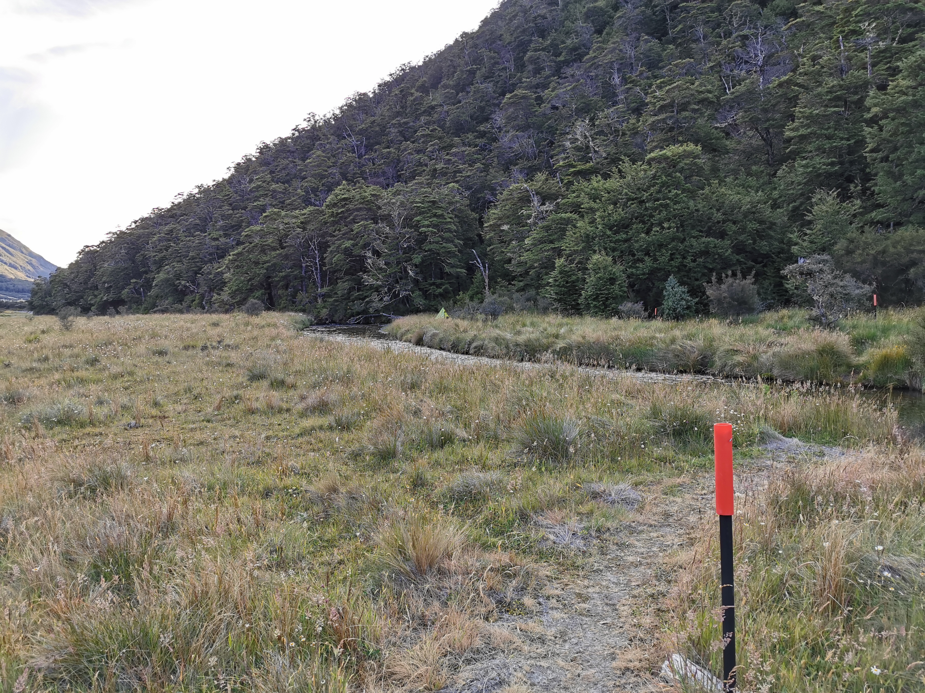
First though, you pass this:
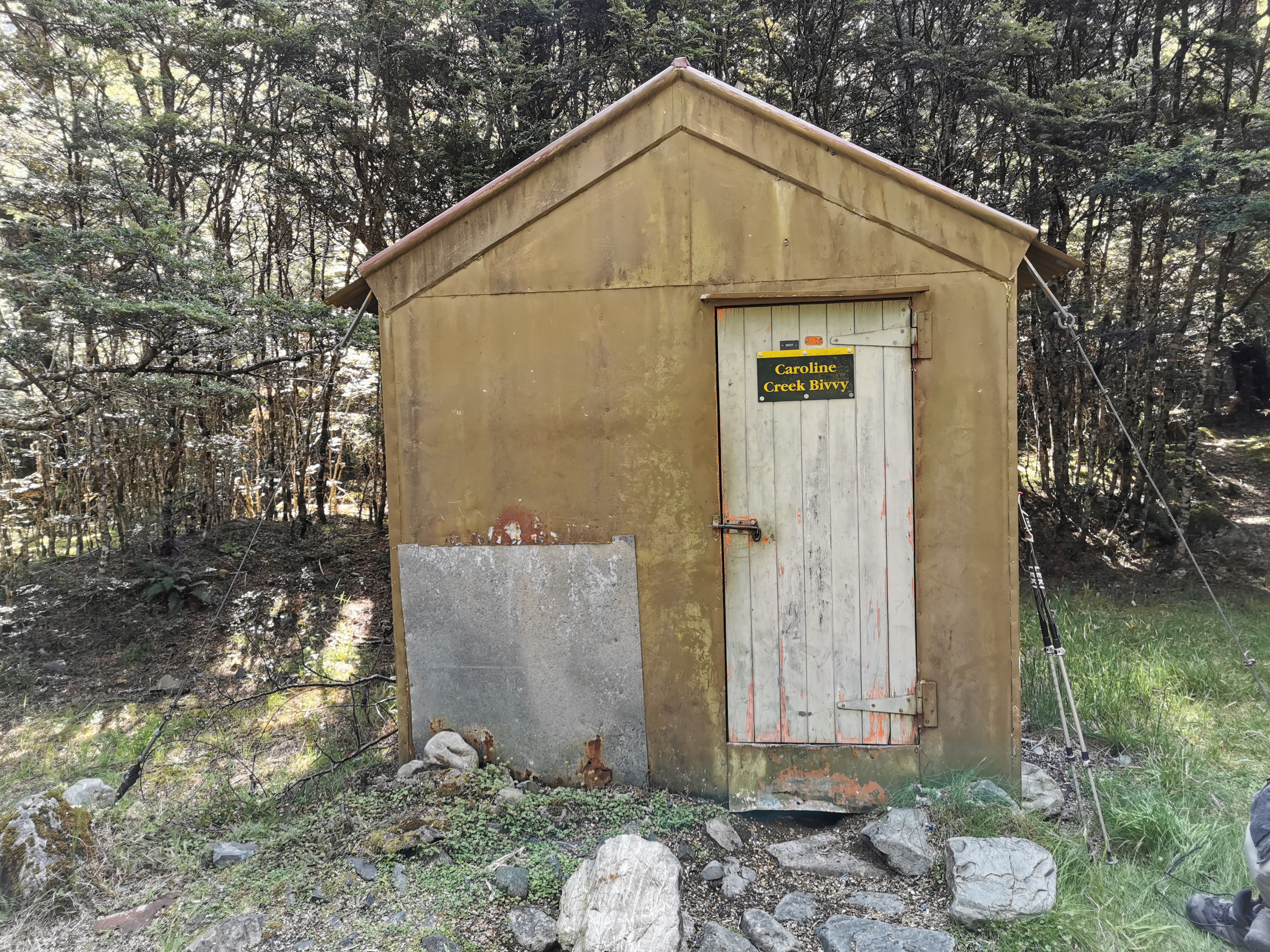
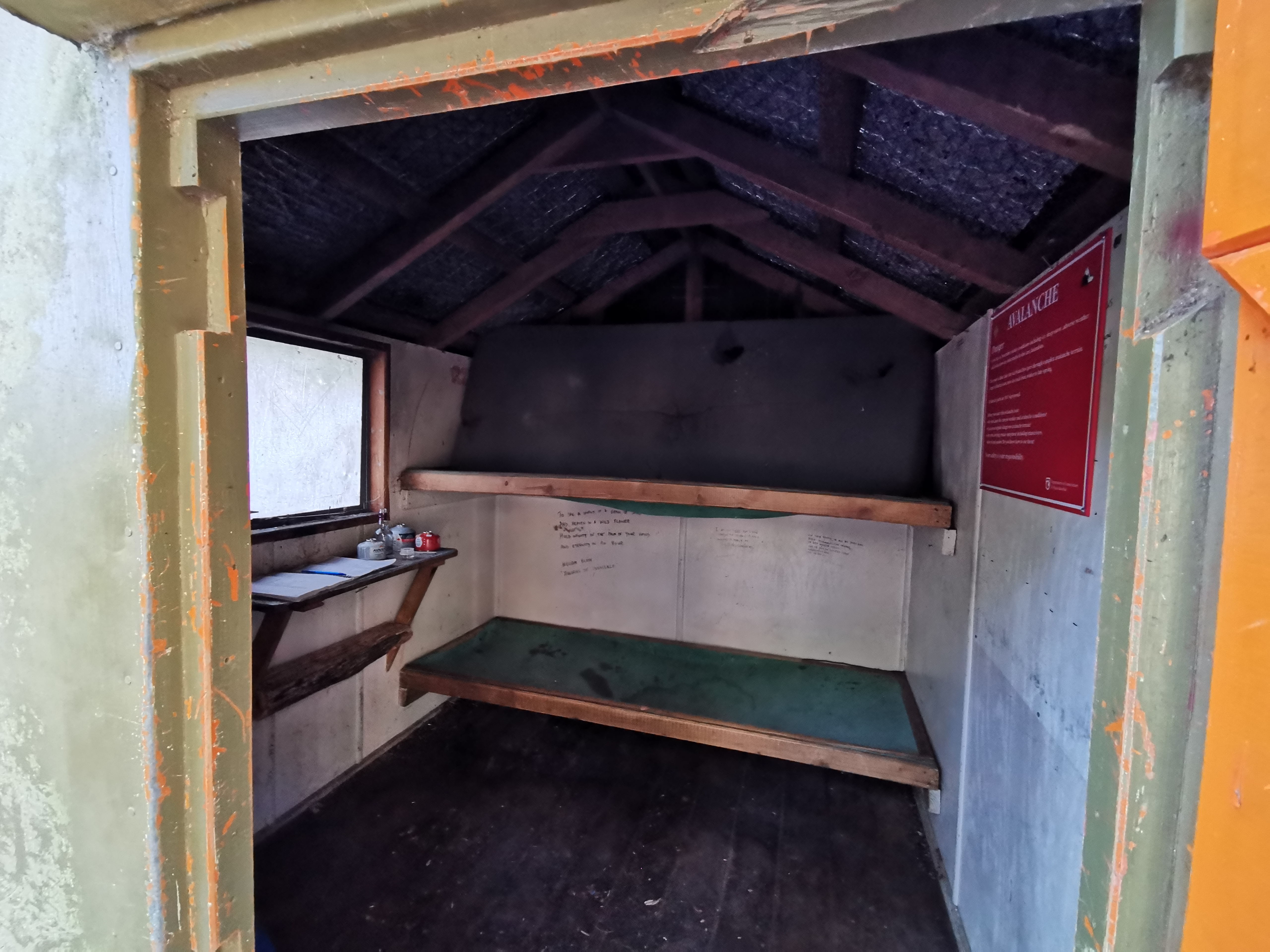
This place also wasn’t on the sign, I think because it’s officially classed as abandoned. I’m not sure I would want to stay there, it looked haunted, and besides, I don’t even think the beds were six feet long. I’d never fit on them.
It was here that we ran into another German hiker, who Sabine knew. He’d set up camp here and was cooking food.
As we walked to Waiau Hut, Sabine and I did the maths to see if there would be any space at the hut for us. There were 14 people at Blue Lake Hut, all were doing the TA, but one was going northbound. We have passed five people, so that meant six of the people were still ahead of us. Given that it’s a six-bed hut and we know of at least six people who will be there already, we resigned ourselves to not getting a bed there.
There are a few river crossings between Caroline Bivvy and Waiau Hut. They require getting wet feet or changing into crocs. Sabine went for the first option and I went for the second.
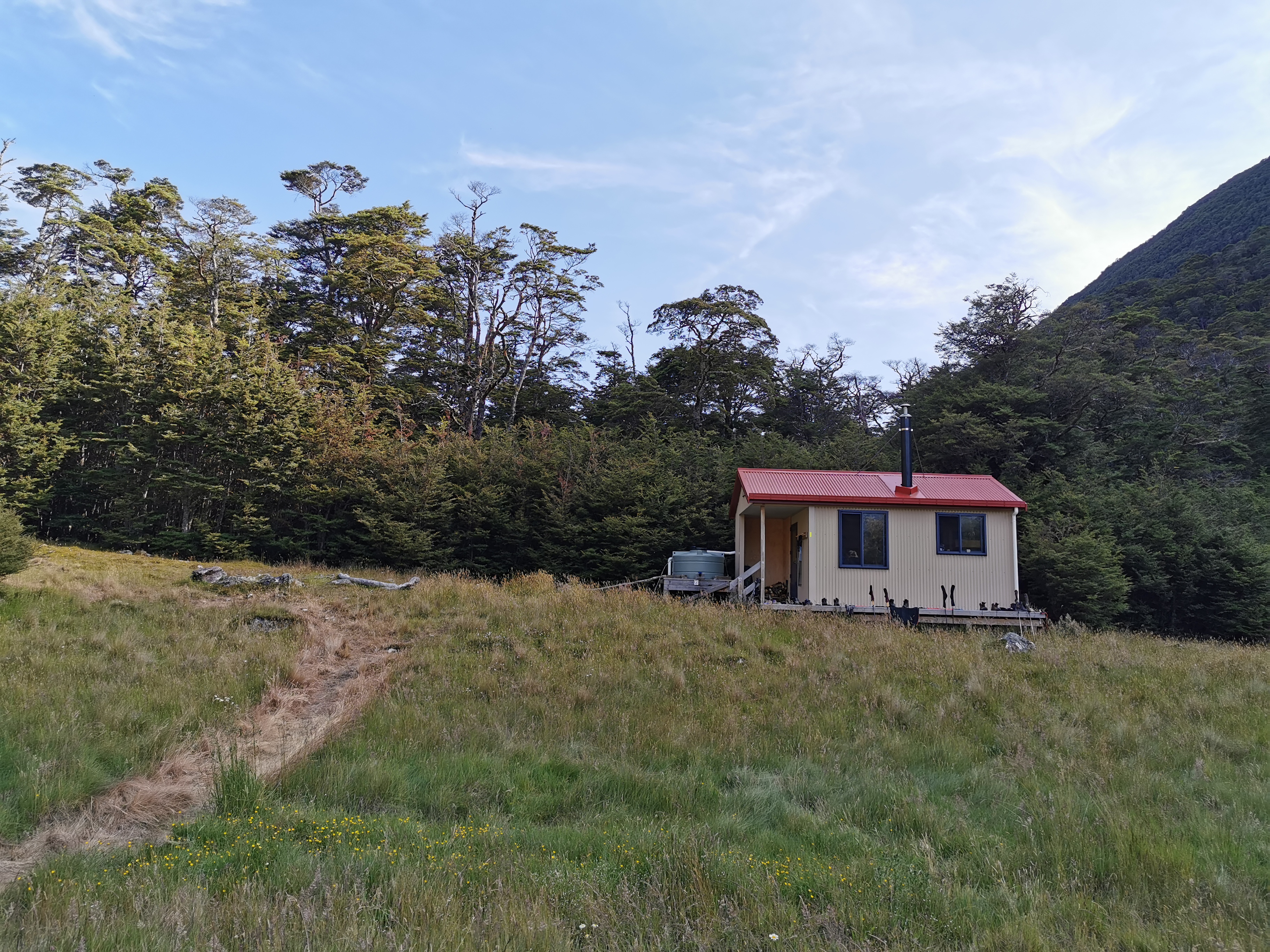
Sure enough, when we got to Waiau Hut it was indeed full, in fact there were already eight people there. Joshua and Nina were there and they had already set up their tent. They’d set up a long way from the hut itself because there was not a lot of flat land around.
It’s interesting that the hut is only two years old but it’s already over capacity. I will point out though that it was apparently donated by a generous TA walker who didn’t like the big distance between Blue Lake Hut and Anne Hut, and so handed over a bunch of money for a new hut.
Sabine went and set up her tent while I went into the hut to cook dinner and chat with people.
After I finished dinner it was 7pm. I thought to myself “my knees are no longer hurting now that the terrain is flat, there are still two more hours of daylight and there’s no flat space here to camp, so I might as well head on”. Plus as often happens, Waiau Hut was a sauna, and I would never have been able to get any sleep there anyway. And the sandfly level at the hut was over 9,000.
So I left Sabine and everyone else here and kept walking.
It was really nice walking at this time of day. The sun is no longer shining directly on me and the temperature is very pleasant. I wish my right leg would stop hurting though, then it would be perfect.
There were more river crossings after the hut and the ground was getting a bit muddy now, so I walked in my Crocs for the rest of the night. Here’s one particularly bad section:
There was also one steep bit between a fence and a big rock. It was hard to get up here in Crocs but I managed it. I couldn’t be bothered changing out of them again.
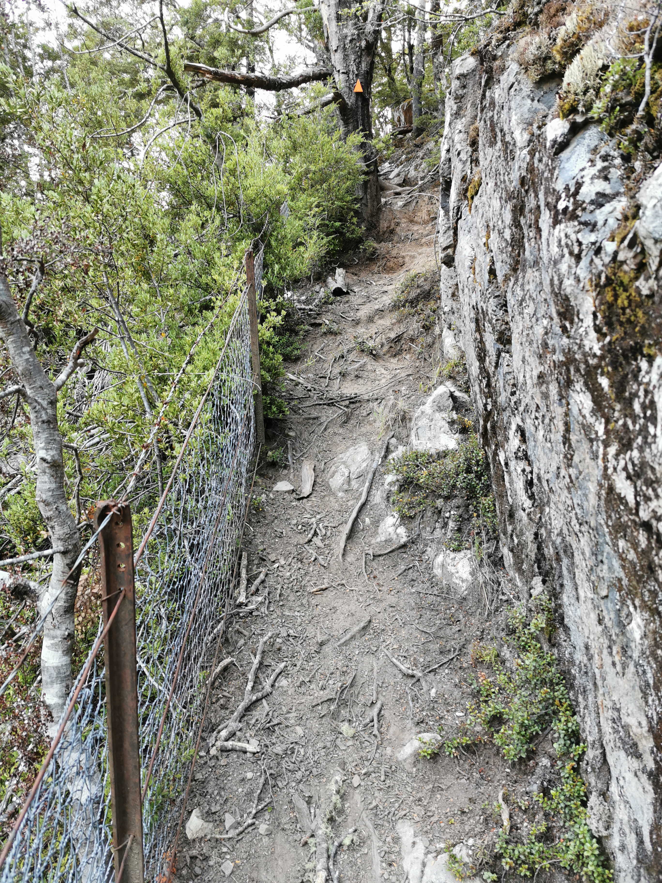
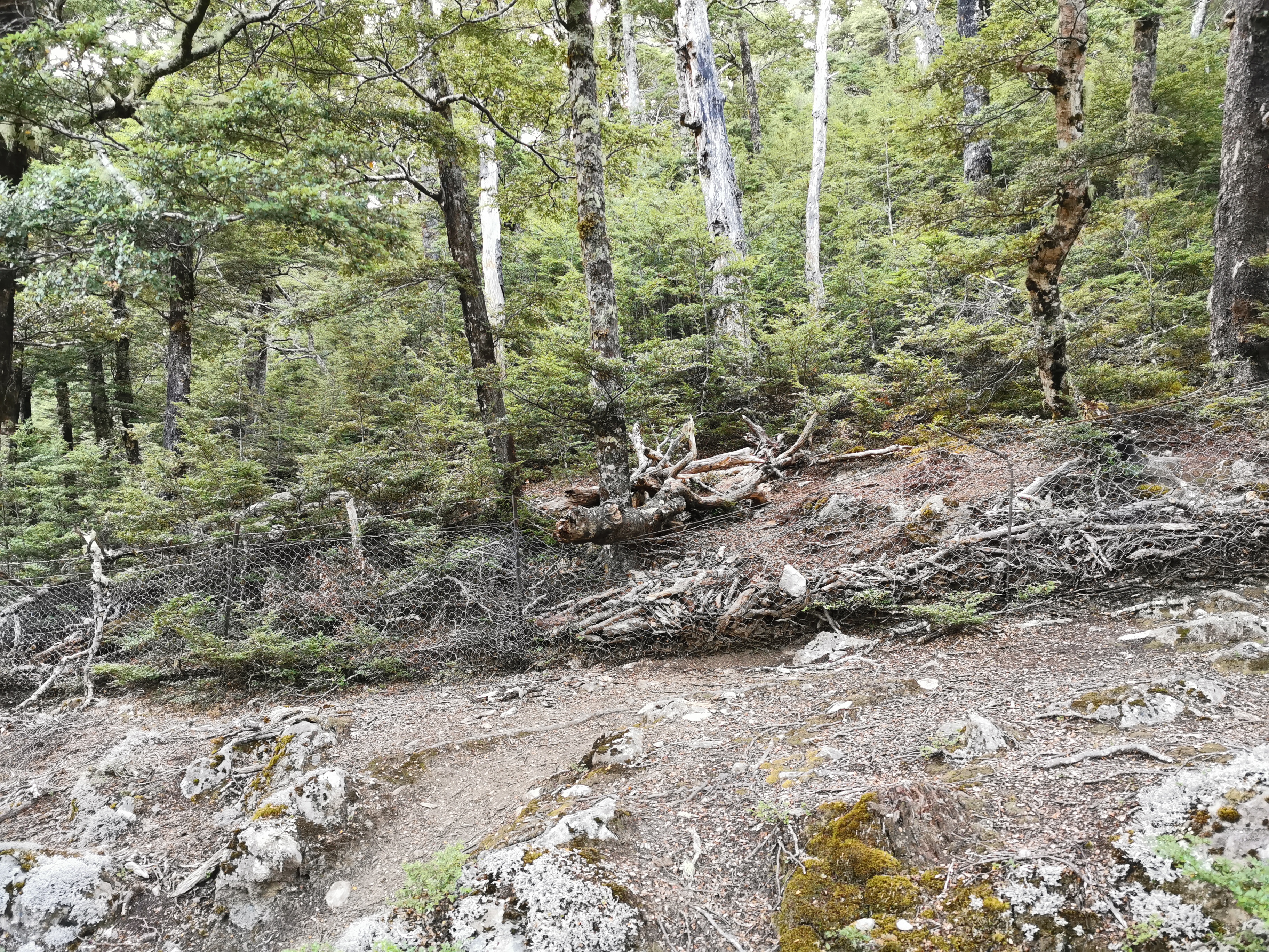
Then suddenly I found myself on the wrong side of the fence. It seemed you had to climb over the fence, and this big log on the fence made for the perfect spot.
About 3km past the hut I saw a tent set up.
Lying outside admiring the view was Clem, short for Clement, who was from France who I had seen at Blue Lake Hut but didn’t get the chance to talk to since we arrived so late. He had the same idea – saw Waiau Hut full and just decided to keep going. We had a chat about stuff, and in particular I commented on his interesting tent. He said it was an ultralight tent which weighed only 700 grams. It looked like there was nothing to it. My tent is about 1,800 grams but it’s double-layer and fully enclosed. I like that even though it may not be the lightest.
Clem was dressed head to toe in thermals, despite the warm temperature outside. That was a clear indication that the sandflies here are just as ravenous and if you don’t cover up completely then you’ll get eaten.
I continued on further, along a track which got relatively narrow in places, at least compared to the wide open valley I’d been walking down for the last few hours.
The landscape then turned into lots and lots of this type of tree.
I don’t remember seeing this type of tree in the North Island, and right here at least it’s all over the place. It looks very formidable. Is it the South Island equivalent of gorse? Actually, when you touch it it’s nowhere near as spiky as it looks.
On the other side of the river I saw some tents and also some cars. I don’t know exactly what was going on there. The topographic map just says “carpark”. I don’t have phone service so I didn’t know any more about it than that.

I decided that since it was 8:40pm by this time and the sun was probably going to disappear soon, that this was a good place to set up camp, where the people across the river can’t see me. I was now 6km past Waiau Hut.
Unsurprisingly, in the two minutes it took me to get my tent out of my pack, the sandflies found me and were brutal. I changed into my thermals to cover up my exposed skin and then set up my tent. I also had to go down to the river to get water. While I was doing that, it was like a big black cloud was following me – a big black cloud of evil biting sandflies. I got my water quickly and ran back to the tent. If I can get into the tent really quickly then hopefully not many of the damn things will follow me inside.
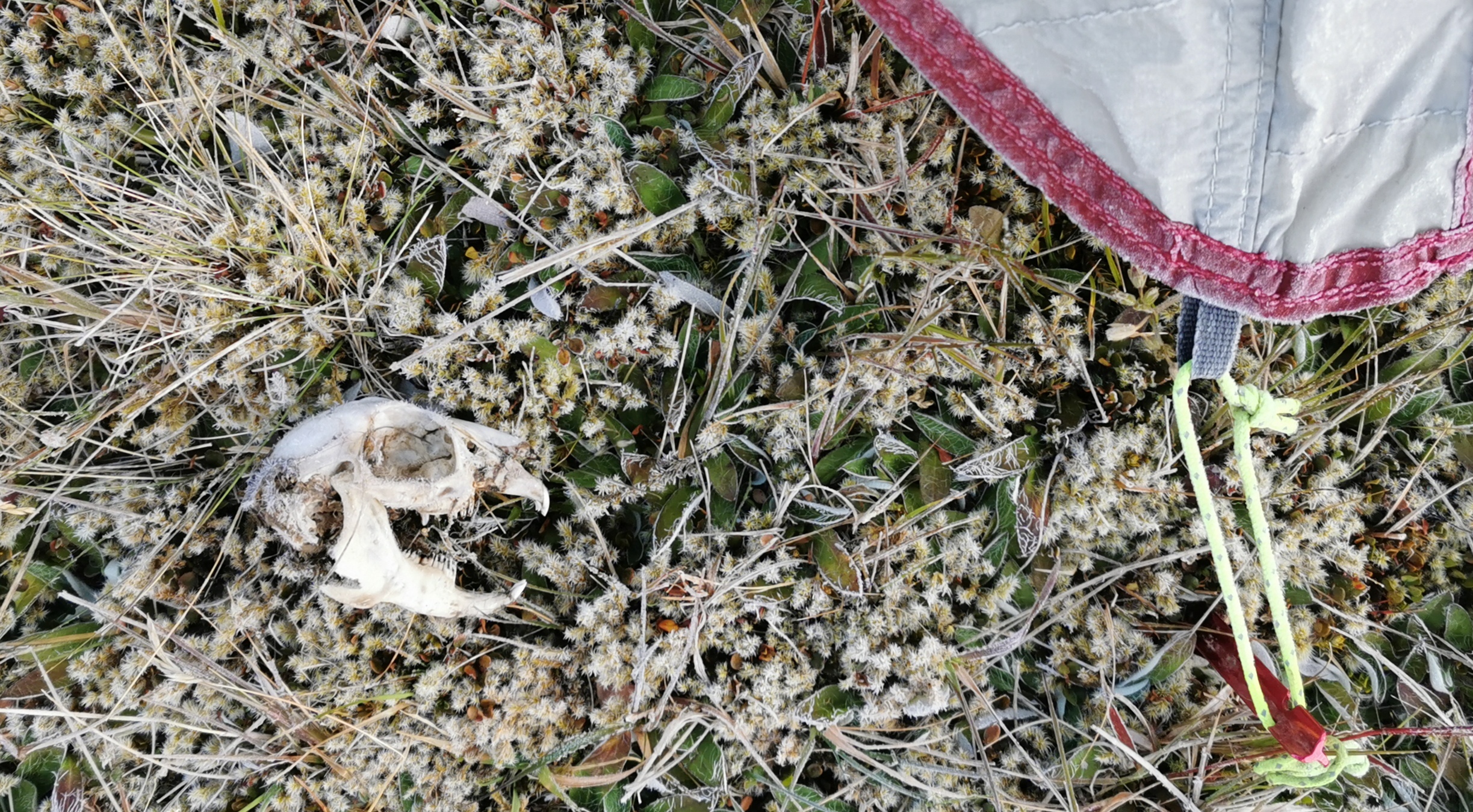
First though, I did find this thing on the way to the river and I left it beside the tent door. I hoped it would ward off the sandflies.
I got into my tent quickly and zipped it up. I think probably about thirty sandflies managed to get inside so I spent fifteen minutes killing the ones that did. One particular one that I squashed on the main mesh door to the tent left a big spattering of blood in the mesh of the door. Gross.
After I’d been in the tent five minutes there were already hundreds of sandflies trying to get in. It sounds like rain on top of the tent. It was much wore than camping outside Captains Creek Hut just over a week ago where I thought the sandflies were bad. At least I was satisfied again that new sandflies weren’t getting into the tent – I don’t think there are any holes they can get through. They can only get in when the door is open. And that means I’m not going outside tonight again.
It was a long day. I looked at the map again and noticed that there were quite a few places today where the Guthook line didn’t match the actual path. The base of the Waiau Pass was one such place, and right here as well I appeared to be off the path somewhat. But I’m following the markers and I trust them.
Once the sun went down it got very cold. I was asleep by 10pm. To get to Boyle Village, which is still about 50km away, I’m going to either have to do two medium sized days or one big day and one small day. It would be nice to get to the village before 5pm on the 20th when the shop in the Outdoor Centre is still open, so I’m going to aim for a long day tomorrow.
Today's walk on the map (blue = Te Araroa, red = today's walk):
Those spiky trees are Matagouri. Wait until you meet Wild Spainard, that’s horrible stuff.
Enjoying the blog !
I’ve heard about that stuff. I better look it up so that I can identify it and avoid it!
Well done 2000! Congratulations. Great blog by the way. Awesome adventure. “You rocks my socks ;)”
Cheers mate 🍺
I nearly forgot to say congrats on the 2000 milestone. Do we expect a 69% milestone on day 100?
It’s all in the eye of the beholder!
BUT! Those “mobile of birds” look like Mobile FISHES to me!!!
You might be right, maybe they are fishes!