Date: 12 January
Trail covered: 21.9km (kms 1873.2 to 1895.1)
Weather: rain threatened all day and drizzle started at 3pm
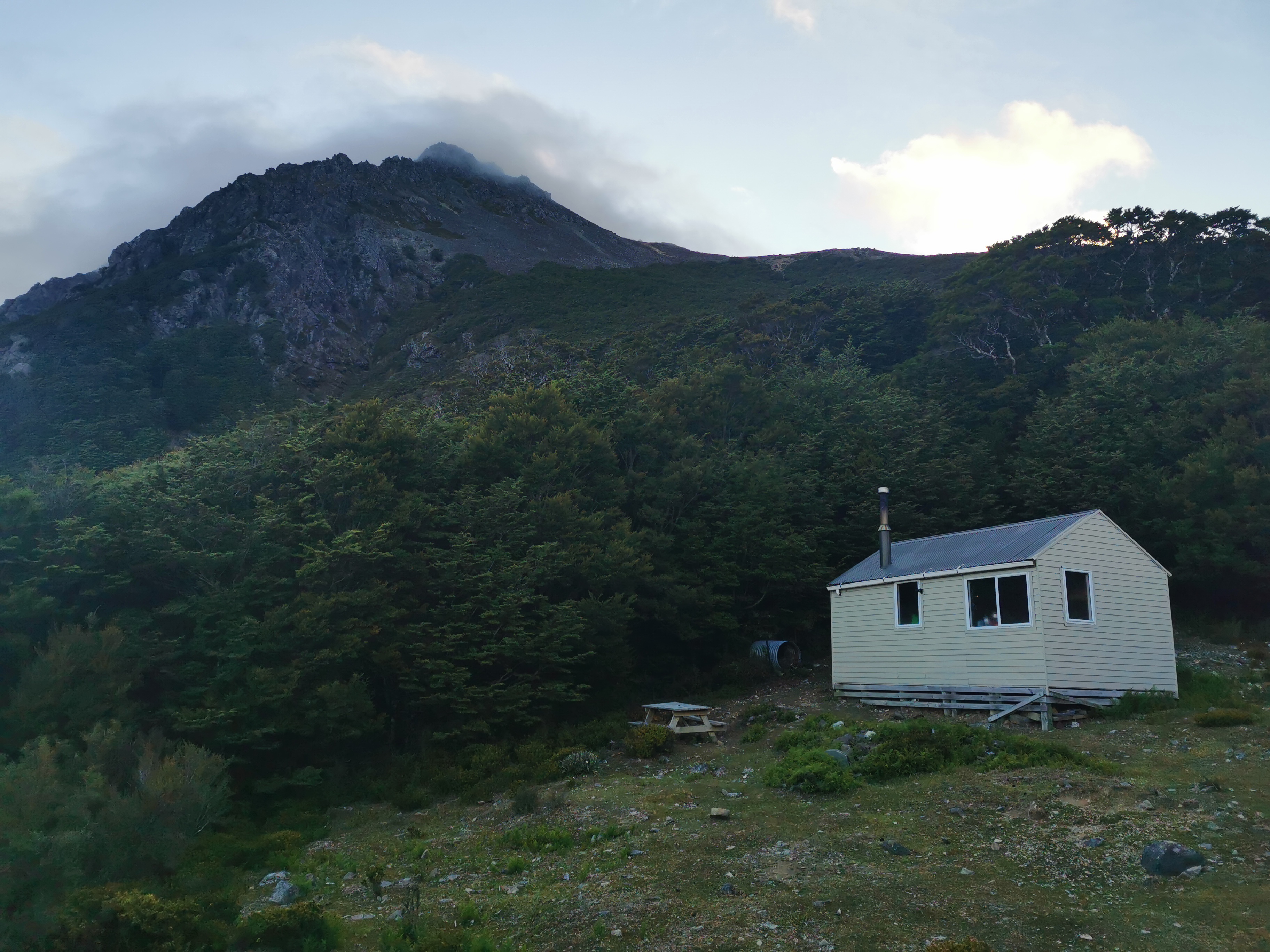
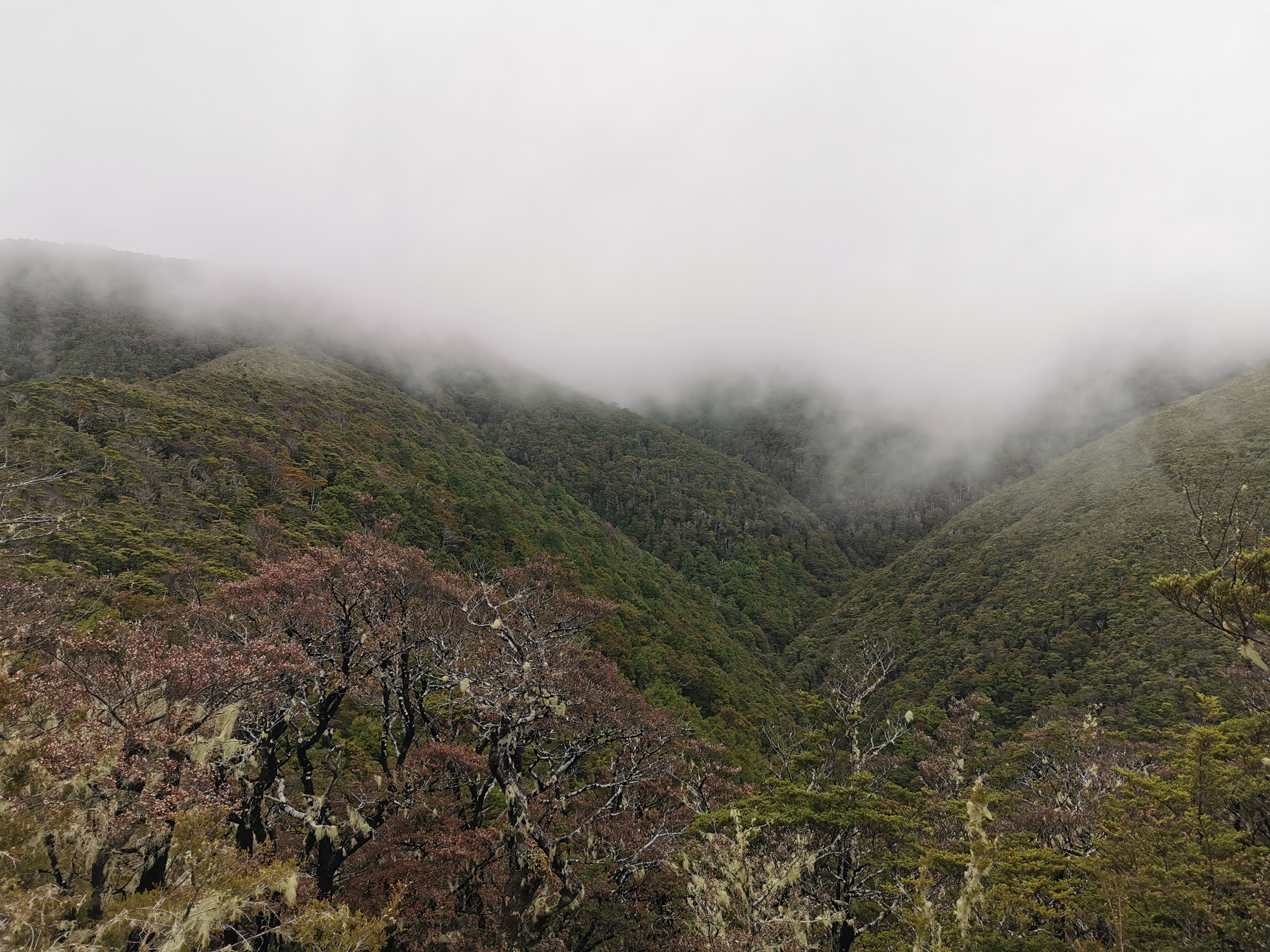
This morning when I did my usual wake up and race straight to the loo, I admired the view on the way back to the hut. It gave a clear idea of the sort of thing we descended yesterday.
While I was having breakfast I was playing with my phone and I got a notification, and it occurred to me that it didn’t vibrate when I got the notification. Come to think of it, I’m not sure I’ve ever heard my phone vibrate ever since I got it just before New Year’s. I checked all the vibrate settings – all turned on. I did the Huawei “vibration test”, and still nothing. How annoying. I probably won’t need the phone to vibrate while I’m on the trail but in day to day life that’s gonna be annoying. Hope the phone doesn’t have to go in for repair.
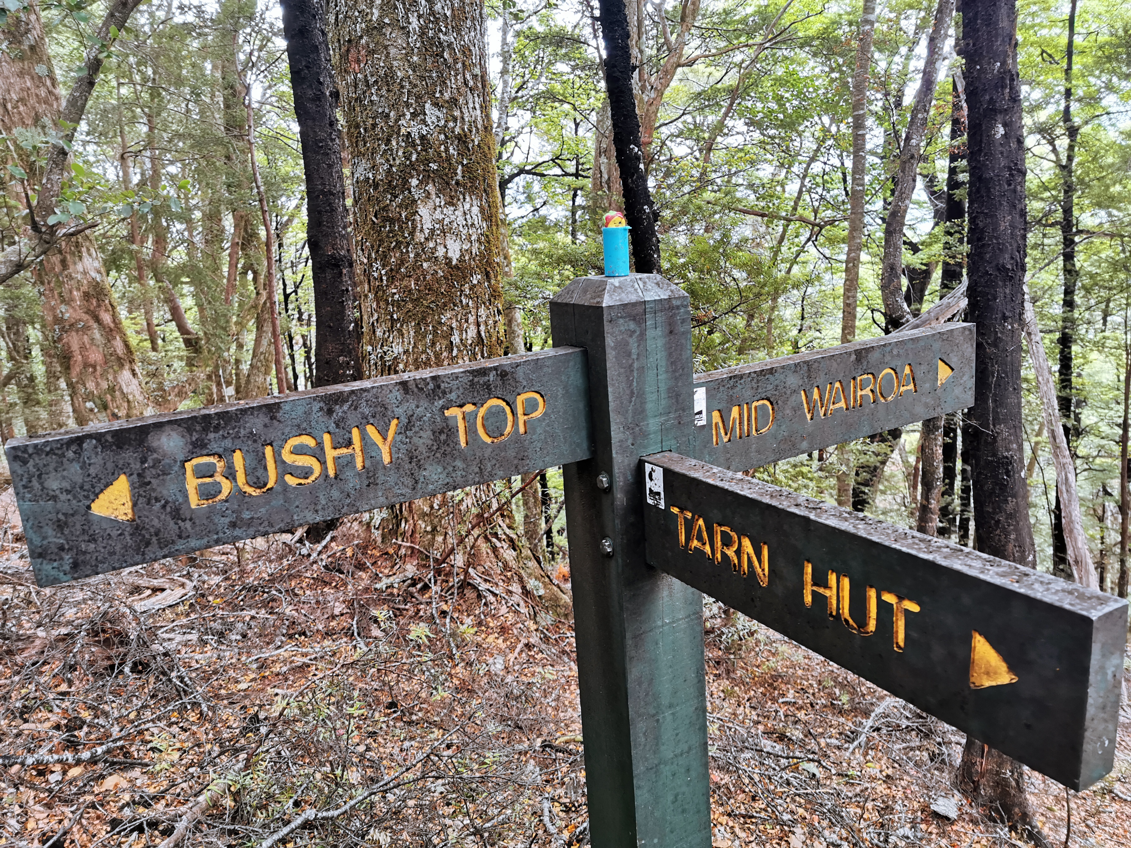
Today there are three possible huts as destinations. First is Tarn Hut which is too close. Second is Mid Wairoa Hut and third is Top Wairoa Hut. There are apparently eight river crossings between Mid and Top Wairoa Huts and it would be nice to do those after the sun has been shining on the water all day, instead of first thing in the morning tomorrow when it’s cold. So my aim was Top Wairoa Hut but can always stop early and reconsider if it feels too far. The trail notes estimate 13 hours for that journey.
I didn’t waste any time and left at 7.15 am, before everyone else. Again the gloves and jacket were on when I left.
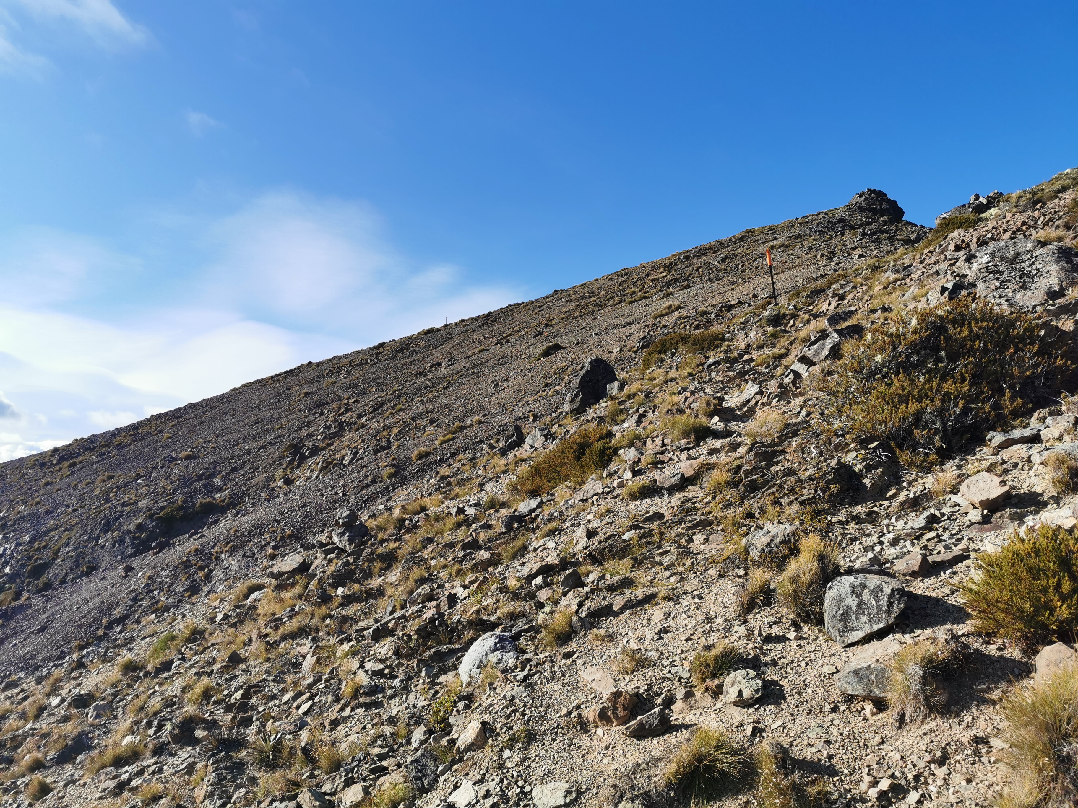
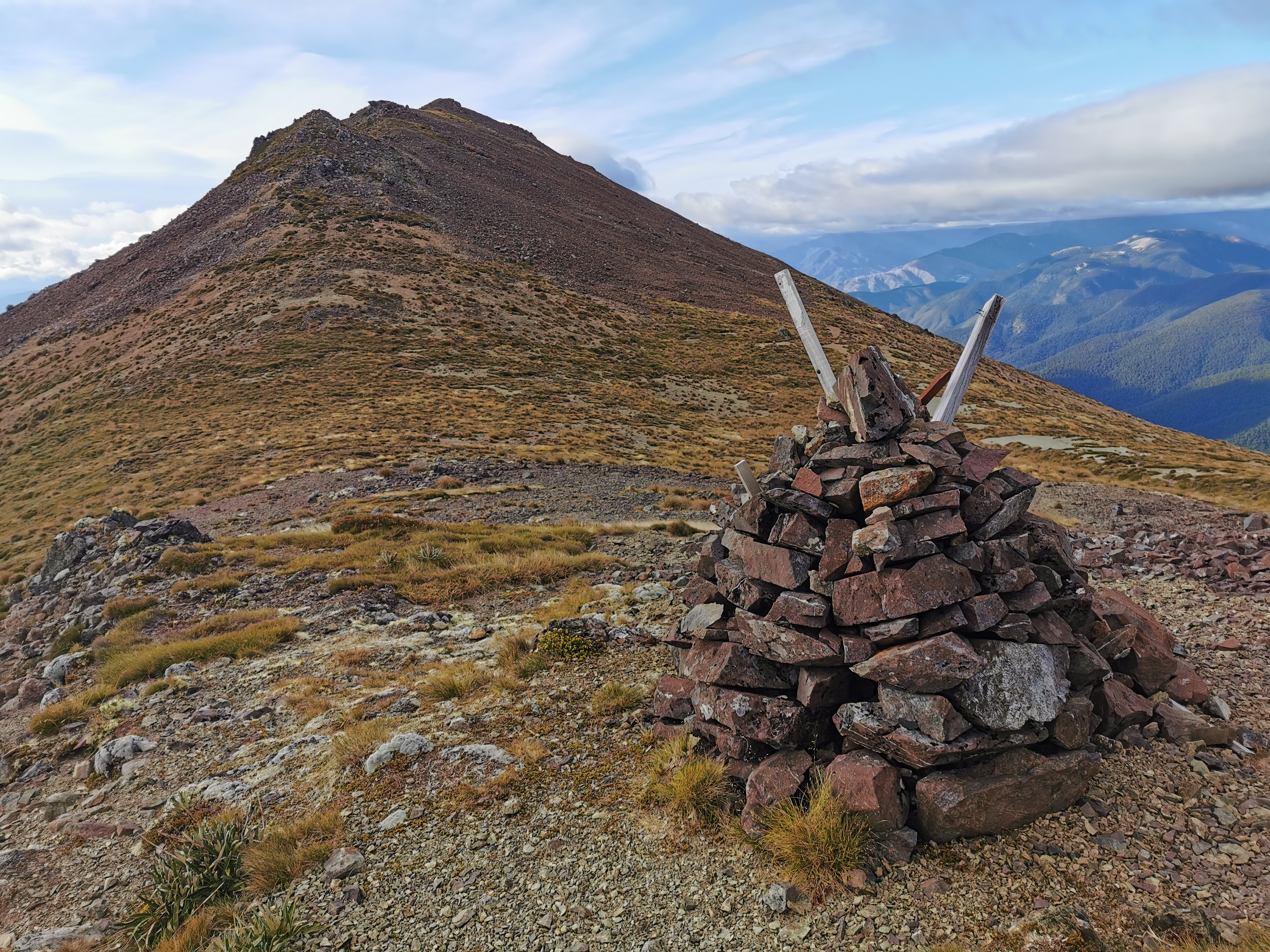
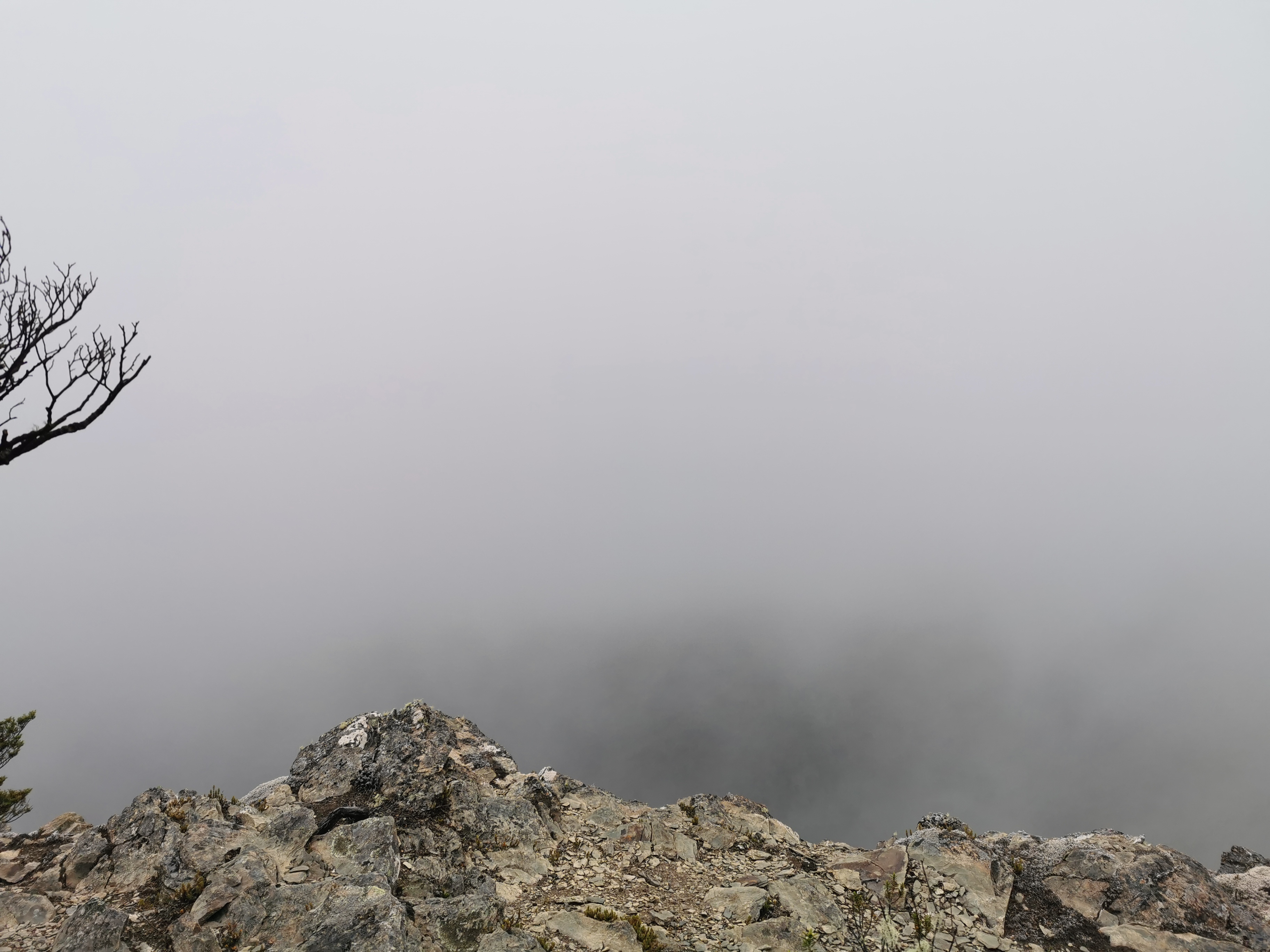
The first peak today is called Purple Top.
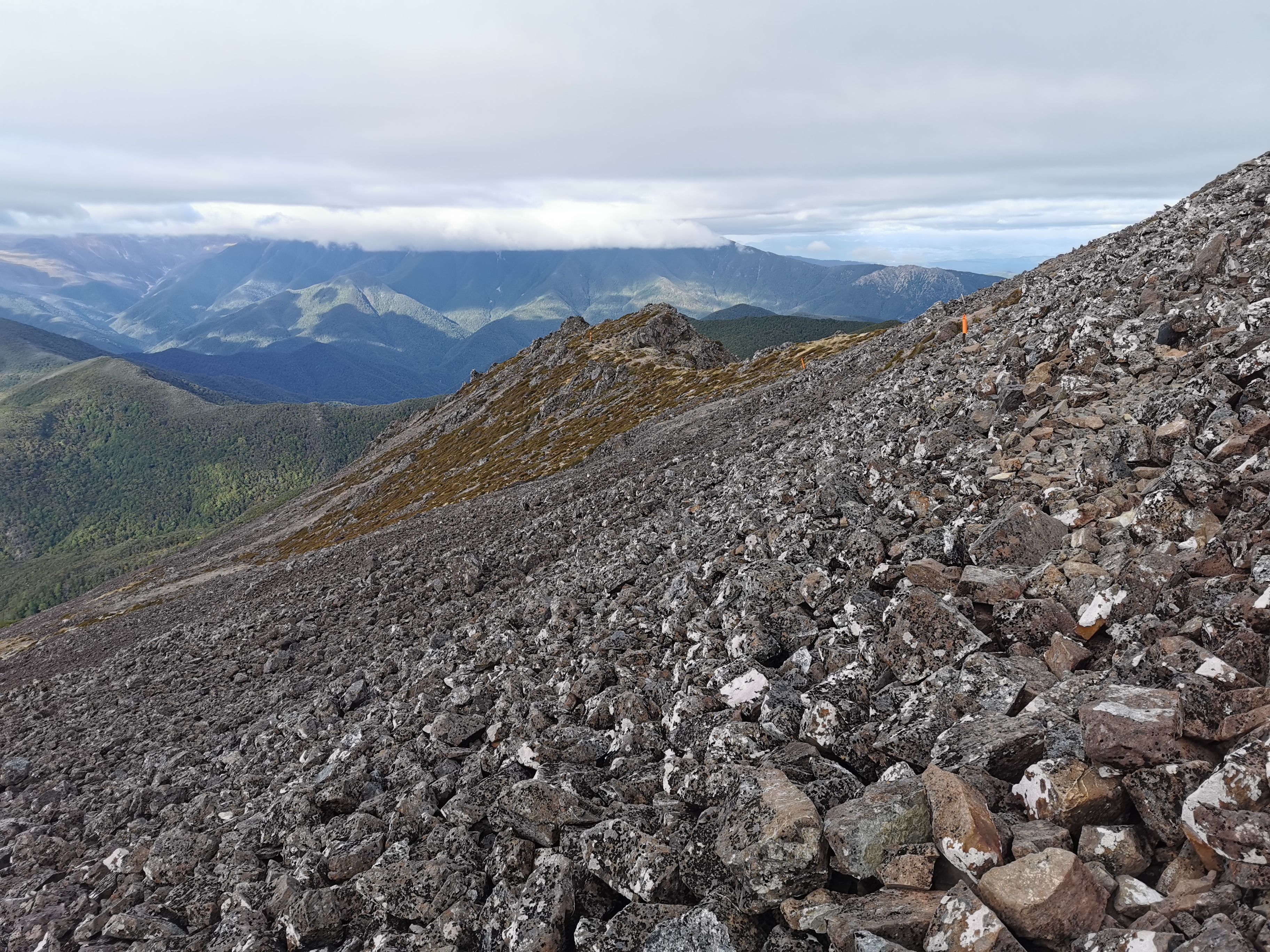
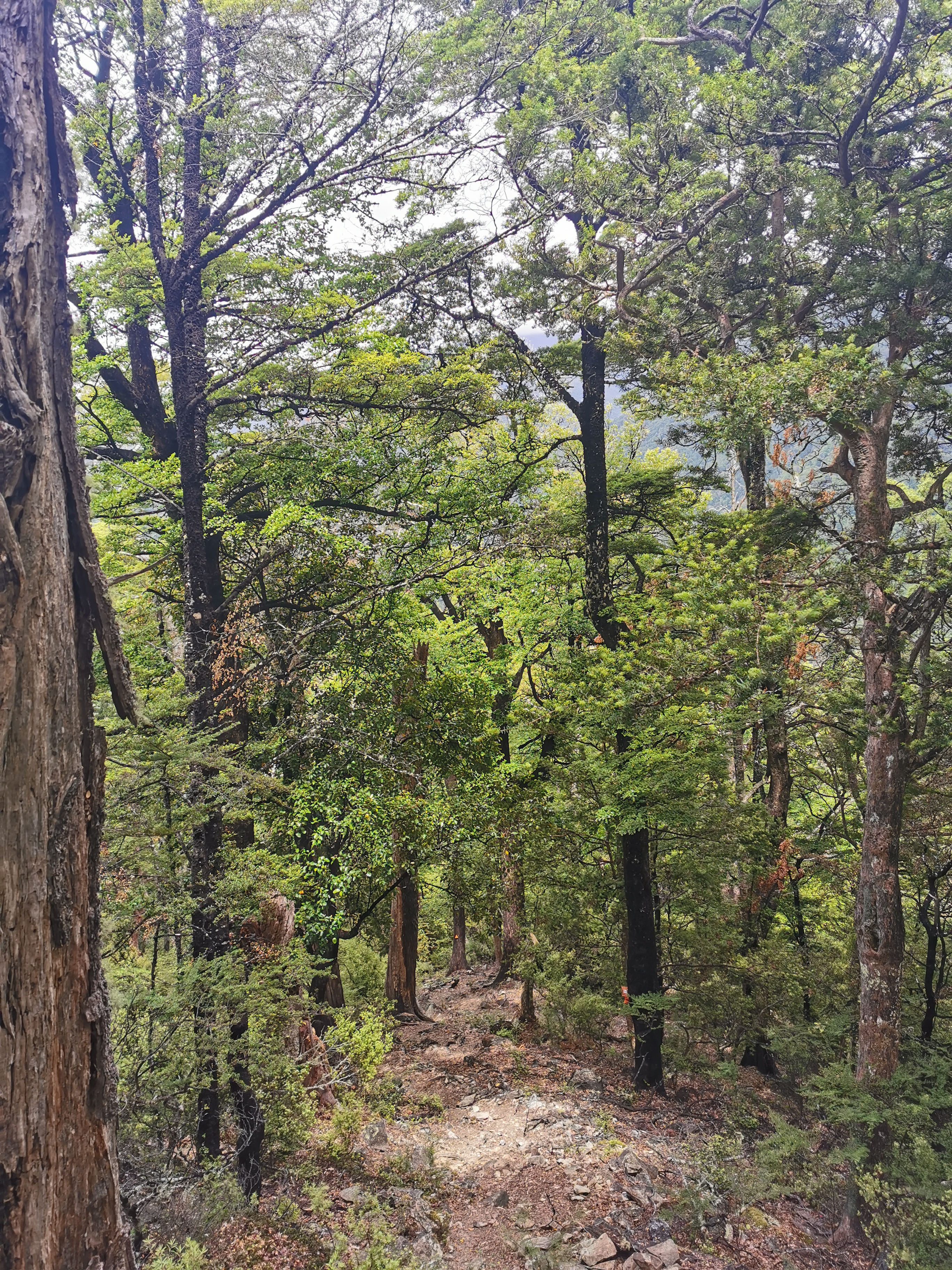
It was similar to the terrain from yesterday but a lot less steep so it was no problem at all. The sun was shining on the hillside and so it warmed up fast. The gloves and jacket came off at 7.45.
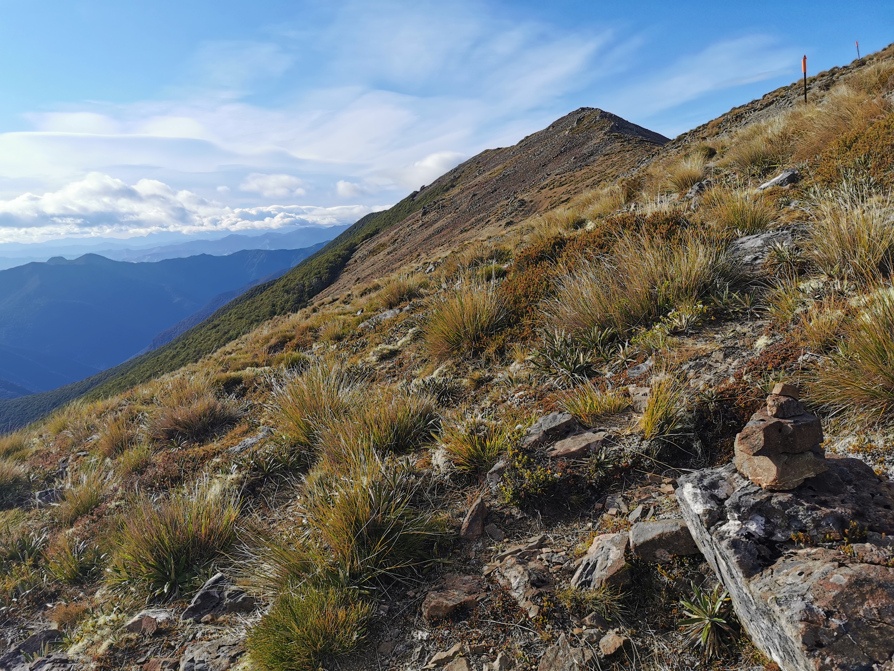
I’ve noticed over the last few days that sometimes you see little piles of rocks – cairns I think they’re called. Can you see the one in the photo above, in the bottom right? I don’t know why they’re there, perhaps they help you find the way but maybe people are just building them for fun when they have a rest. This one at Purple Top summit is worthy of a photo though.
Coming down, there were more rocks to scramble across.
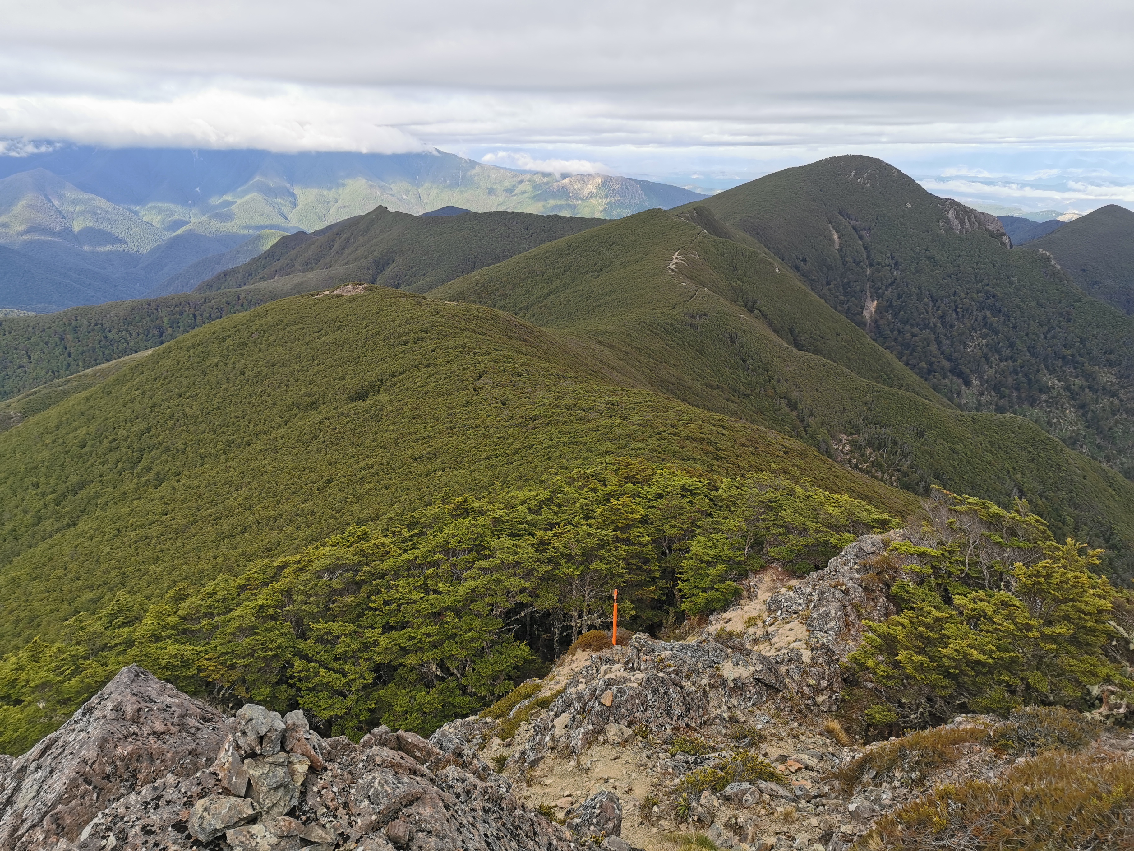
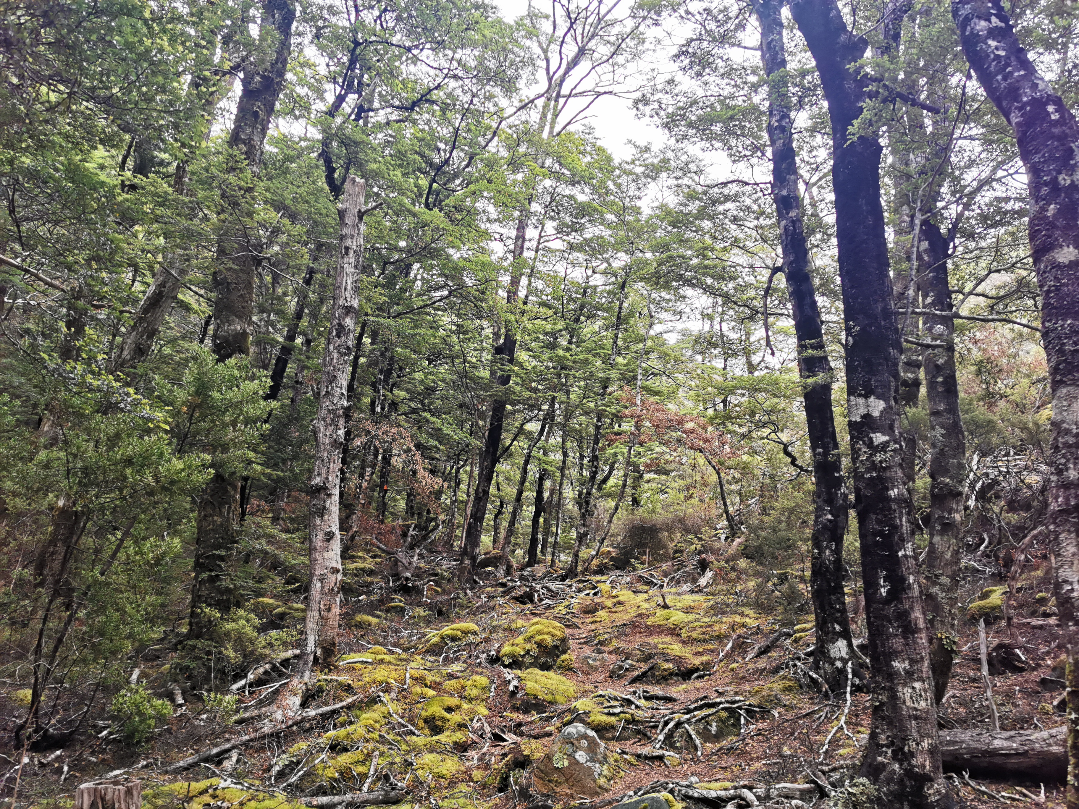
Over the summit on the non-sunny side of the peak, it was windy and cold. Thankfully the treeline appeared quickly. Ahh, I’m warm again.
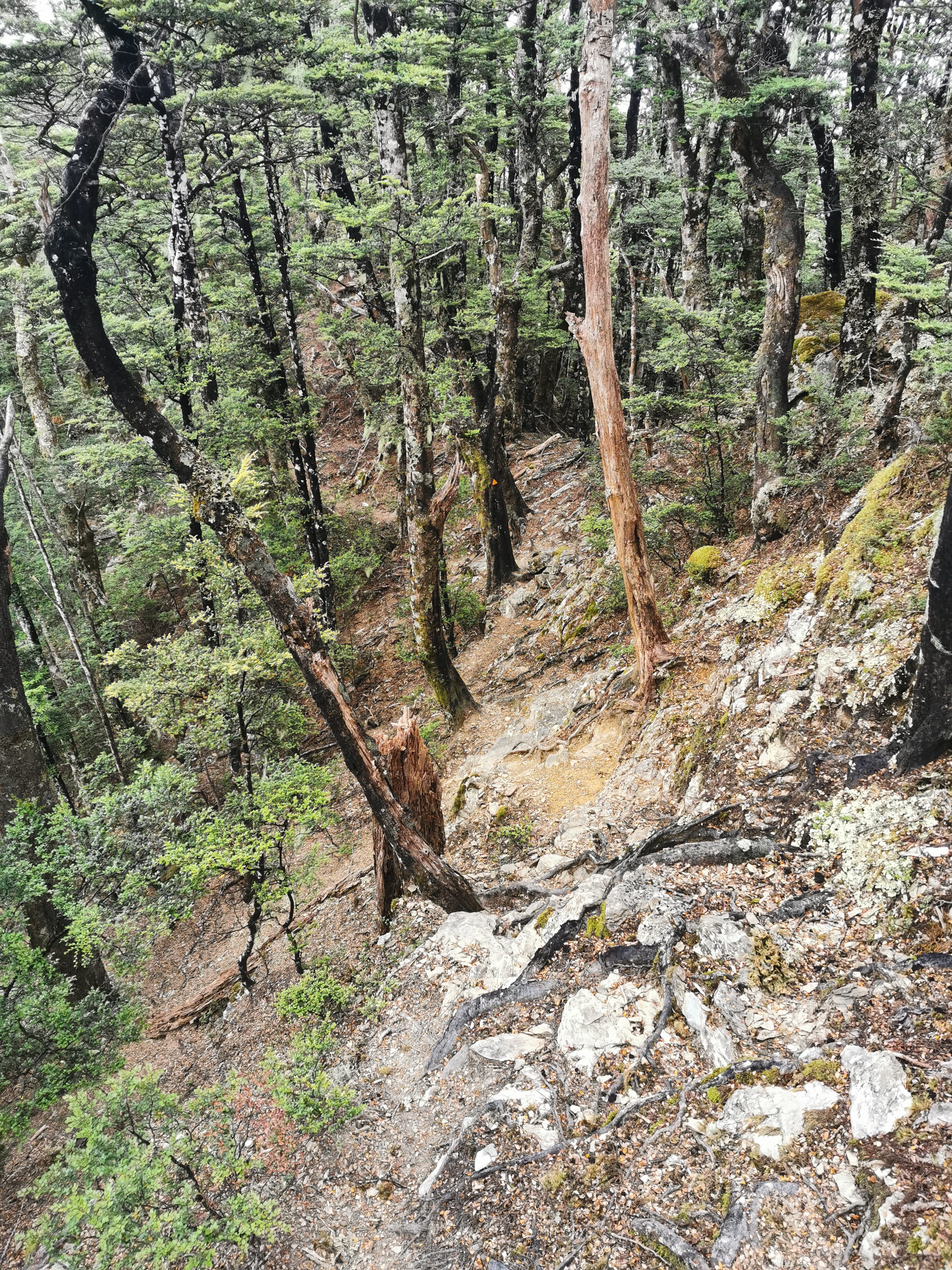
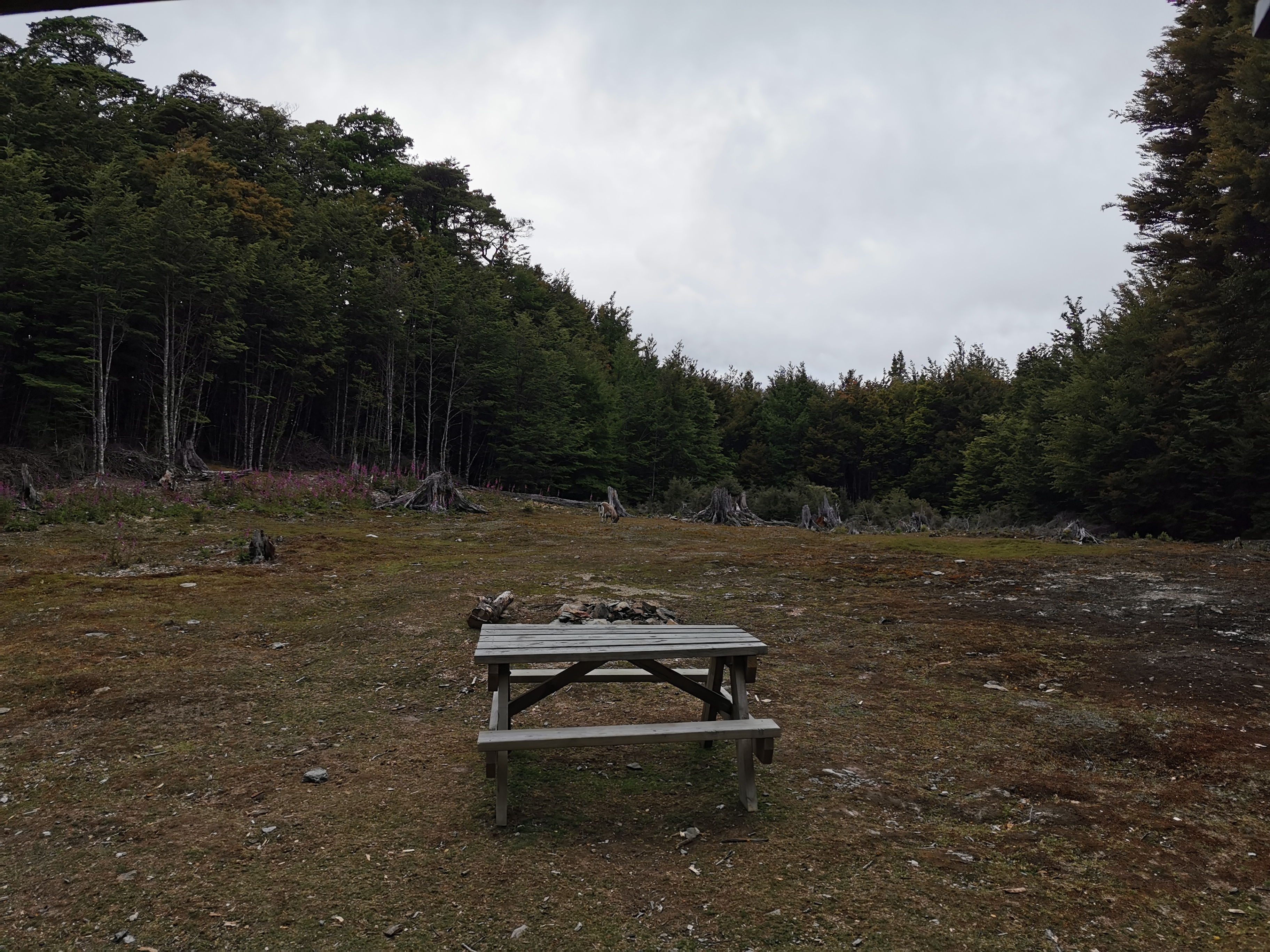
It was mostly a nice walk to Tarn Hut but there was the odd rock scramble.
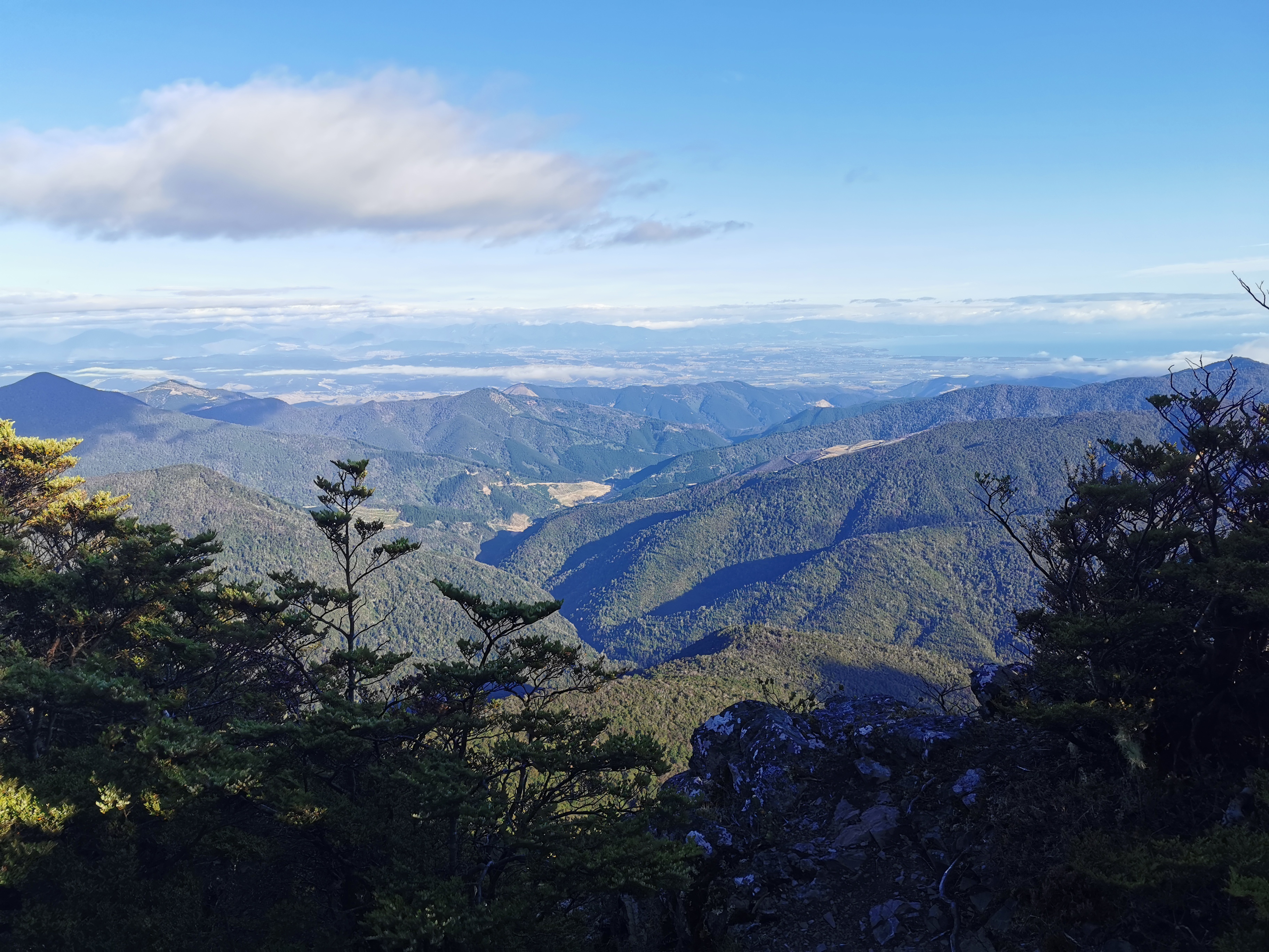
The clouds were coming over now too. The weather forecast today called for isolated showers in the Western ranges (wherever that is).
I wonder if any rain would hit? The clouds have really come over now!
It was a 500m descent down into Tarn Hut. I tripped quite a few times on the way down. Not fully tripping over, just stumbling. I’m not entirely sure why, just fatigue I guess.
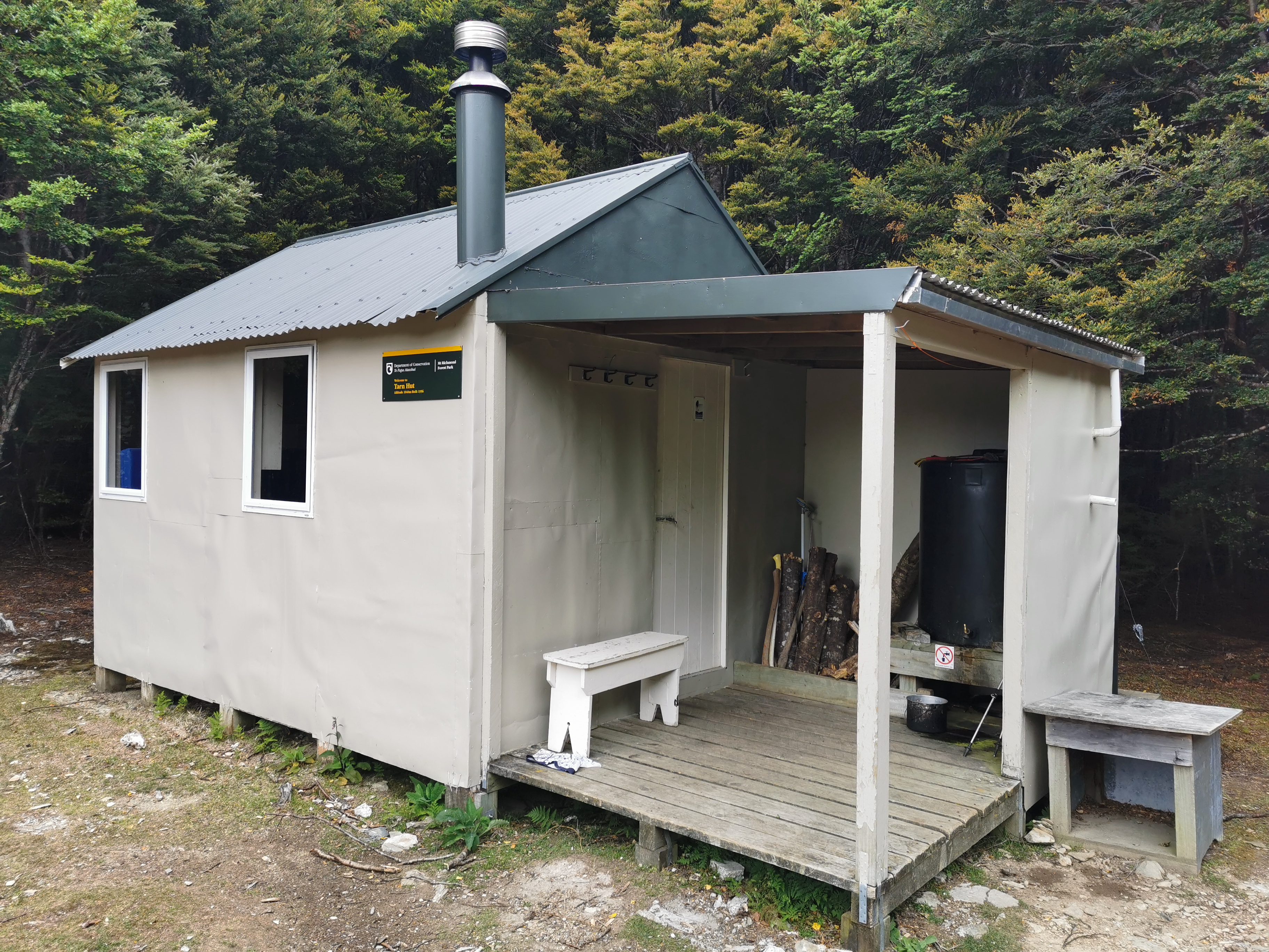
It was three hours to Tarn Hut from Rintoul. For the first time in a while I arrived to find other hikers there, which was a surprise. They were Rebecca and Christian from Switzerland. They were real nice to talk to and I learned that they were northbound hikers who started at Bluff. Exciting – I’ve just met my first proper NOBOs!
Apparently I remind Rebecca of her brother in the USA. When I pressed further it’s apparently because we both have shaggy hair and are easygoing. I’ll take that!
Encountering northbound hikers meant we could exchange information. I asked them about the upcoming river crossings, they said they’re nothing to worry about. I asked about future sections and they said this is definitely one of the longest. They asked if I had the weather forecast because they were unsure if they should go over Purple Top in what appeared to be deteriorating weather, but I told them it’ll be fine. They also said that they are just starting to find the trail busy – they’ve been passing “a flood” of southbound hikers in the last few days.
Almost everyone I talk to, including these two, seemed to be going into Nelson to resupply at Hackett Hut or Rocks Hut. That seems like an unnecessary use of an entire day. In saying that I would have a lot more chocolate right now if I had done the same thing. I haven’t found carrying 9 days worth of food that bad, although apparently I’m fast so maybe some people are carrying 10 or 11 days food.
The two NOBOs left and I had the hut to myself for a while. Here’s my 11am picture: a goat outside the hut which didn’t seem bothered by me.
Hmm, that’s weird. When the alarm on my phone went at 11am, the phone vibrated. So the phone does know how to vibrate after all. Strange! So why won’t it vibrate when I get a notification?

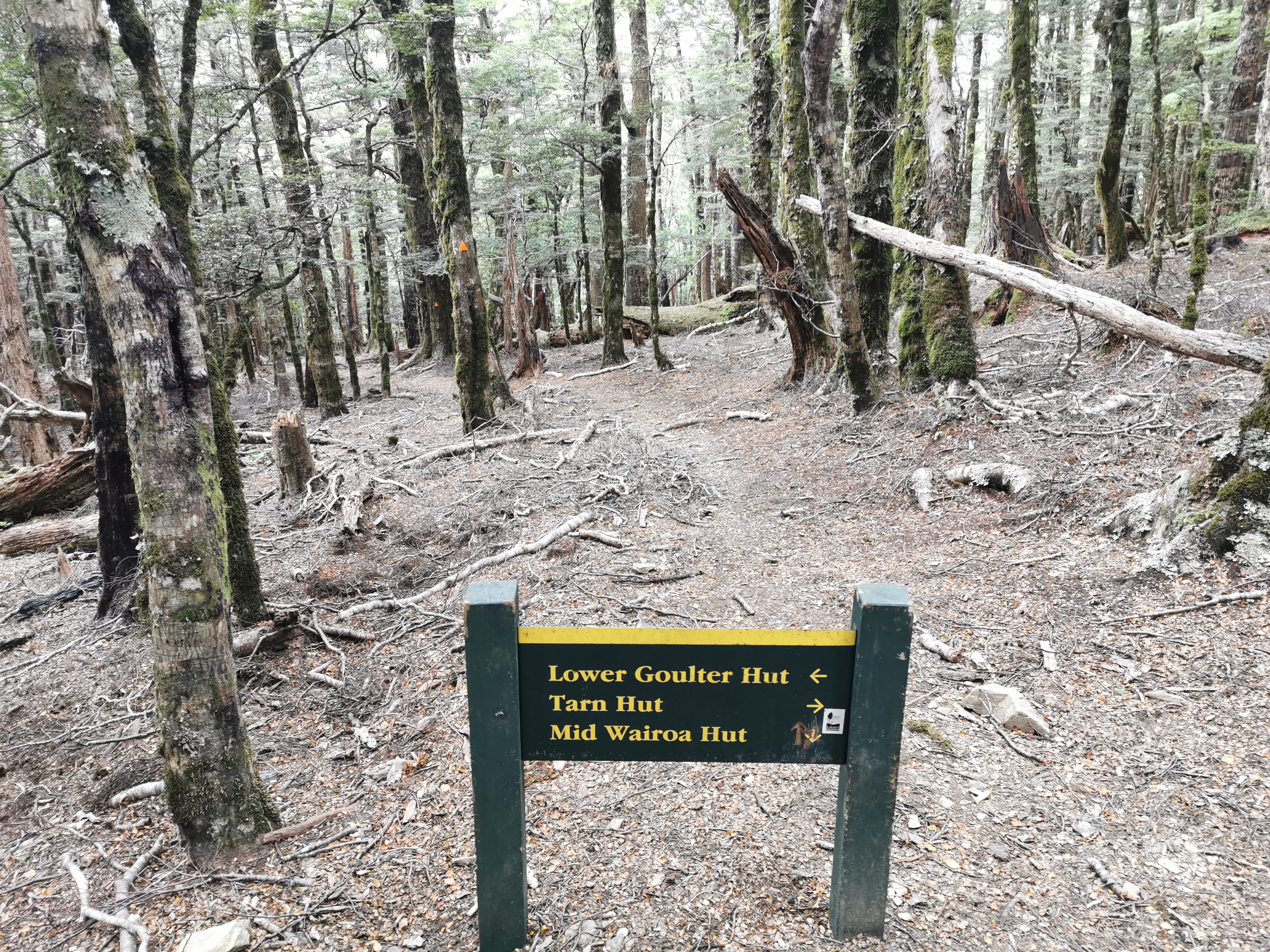
After Tarn Hut there are a couple of places where you need to make sure you go the right way. This one here was confusing – thankfully someone has etched in an arrow for Mid Wairoa Hut in the correct direction. It’s most definitely ahead, not behind!
And then a bit further on there’s another intersection. This one has a geocache and it was easy to find.
Similar to before there’s a bit of a climb out of Tarn Hut and then a big big downhill all the way to Mid Wairoa Hut. This must be the reverse of the big Starveall climb from two days ago.
1230m down to 395m.
I thought the descent seemed quite easy but I did manage to slip over onto my butt half a kilometer before the hut. So I took it a bit slower at the end.
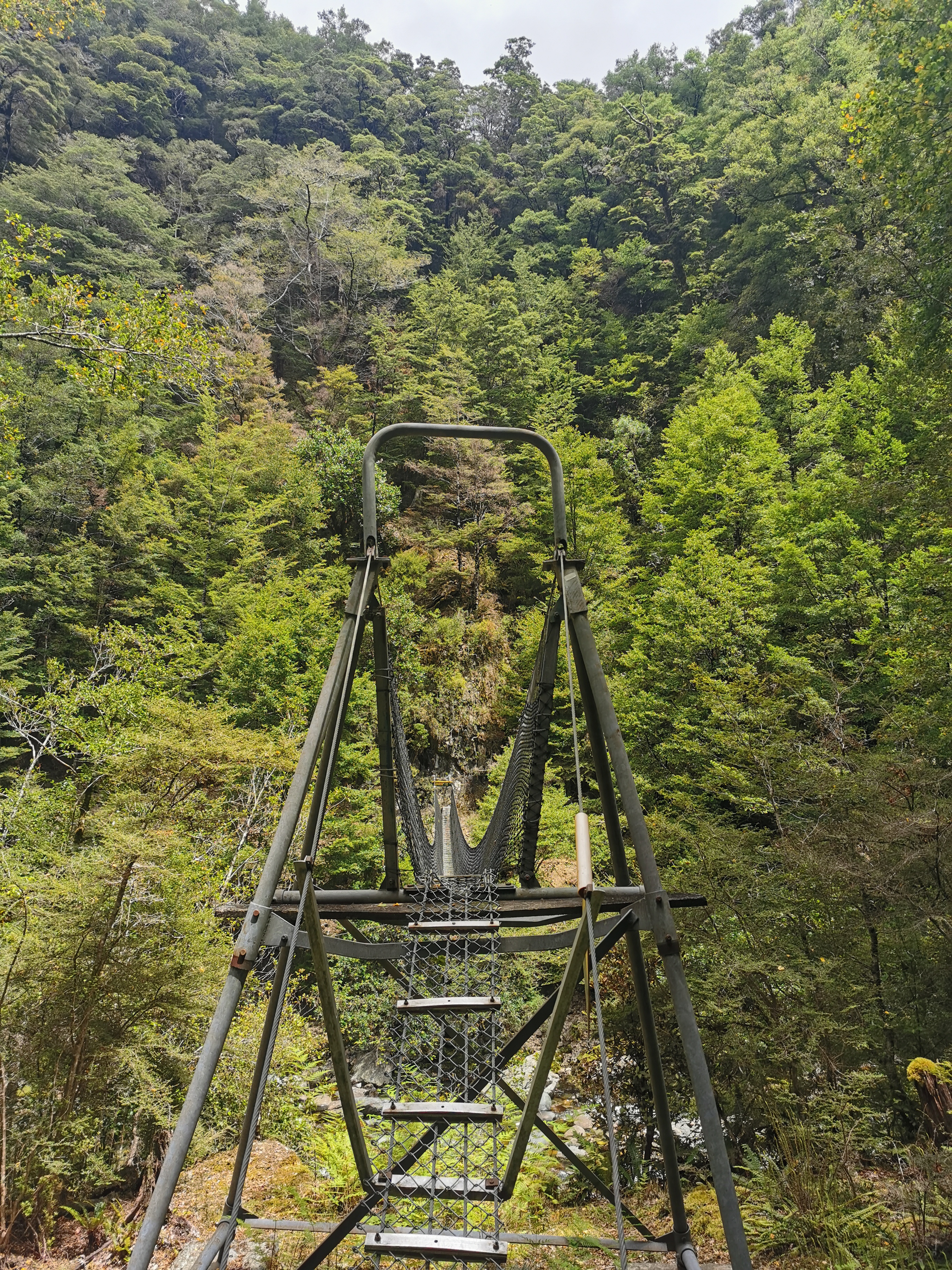
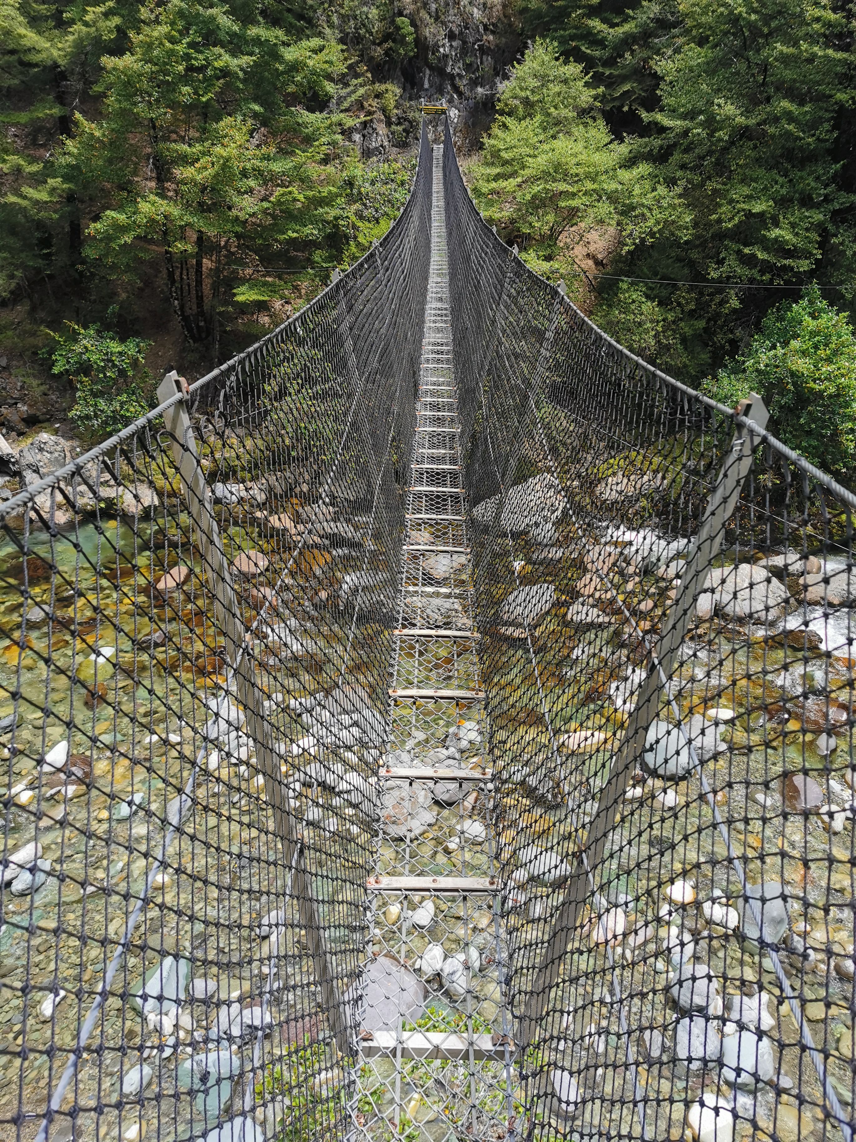
Another swingbridge. This one wobbled a lot and if you didn’t keep your body weight in the middle it felt like it was going to tip.
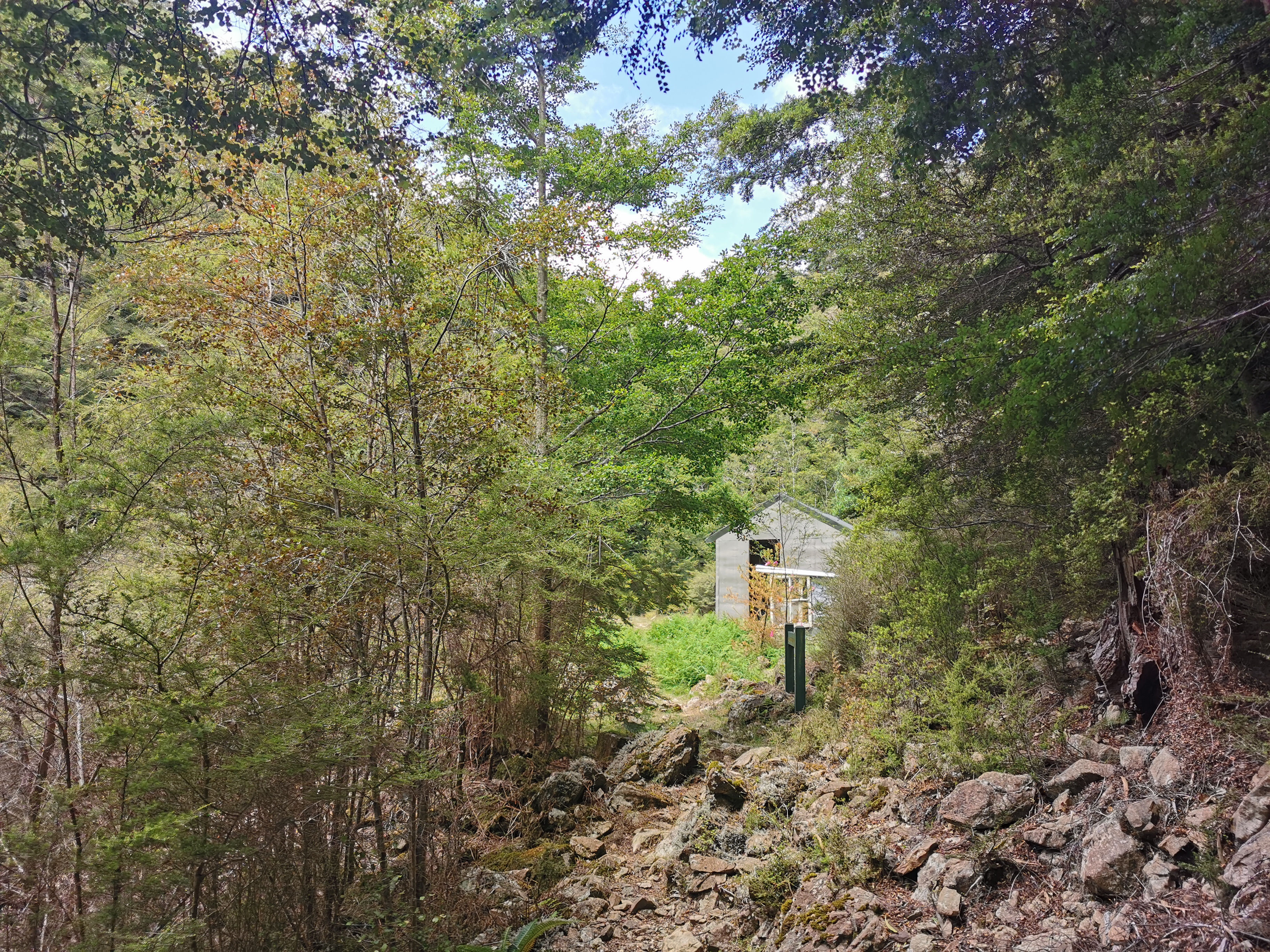
There’s Mid Wairoa Hut! It only took 2hrs15 for me to get here from Tarn Hut instead of the posted 4 hours.
This hut was a bit older, and not as nice as others. And I noticed on approach that the door had been left open. Uh oh, it’s gonna be full of bugs.
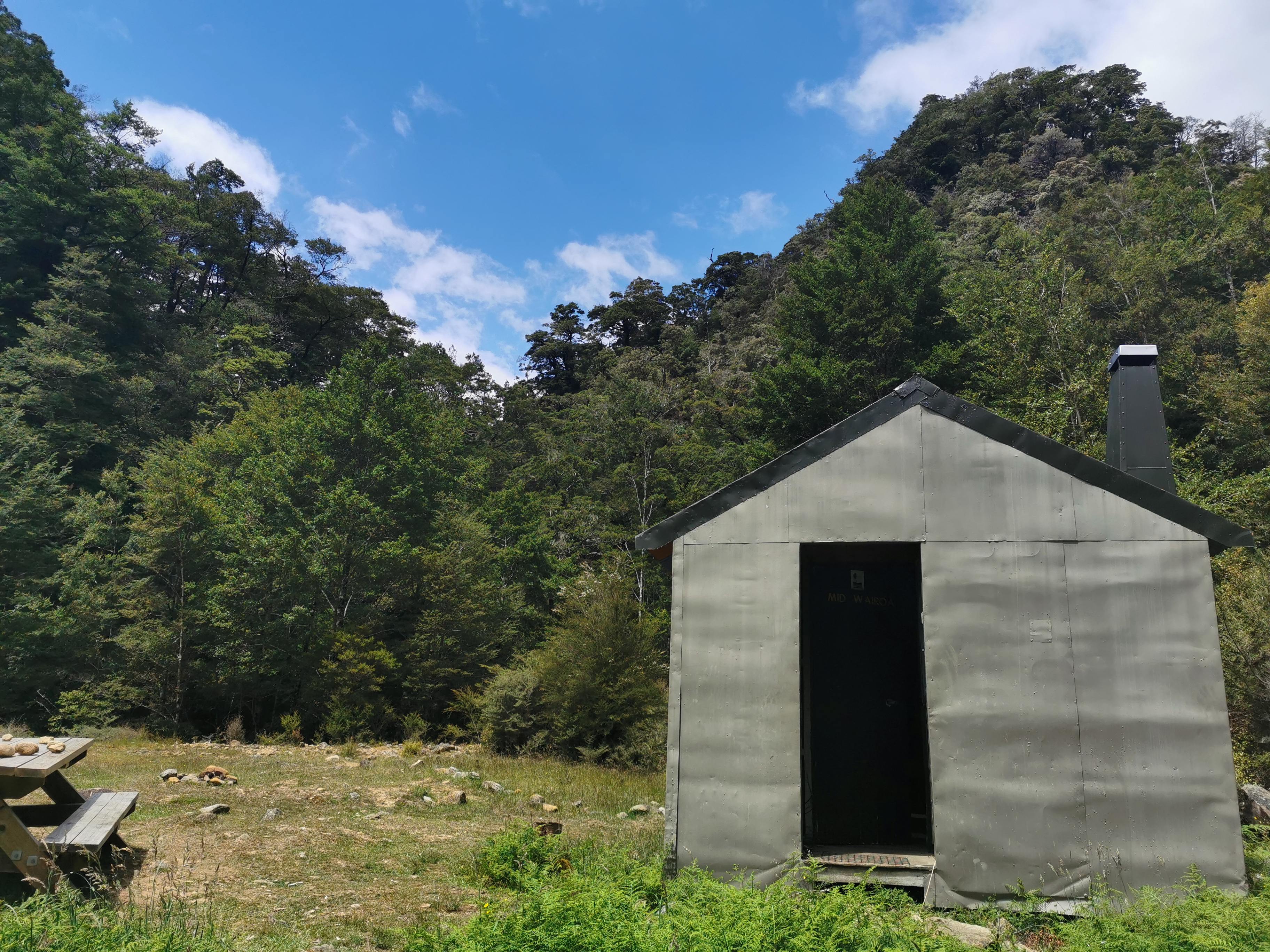
Yes sure enough it was filled with bumblebees – there were about 8 of them inside. I methodically removed them one by one out the windows with my hiking poles. People, please close the hut doors when you leave!
As you can see from these photos it really looked like the weather was clearing – there was beautiful blue sky. So I went and hung my wet things outside to dry. I was instantly mobbed by bumblebees and so had to retreat into the hut.
This comment from Alex two weeks ago in the intentions book sums up the big descent quite well.
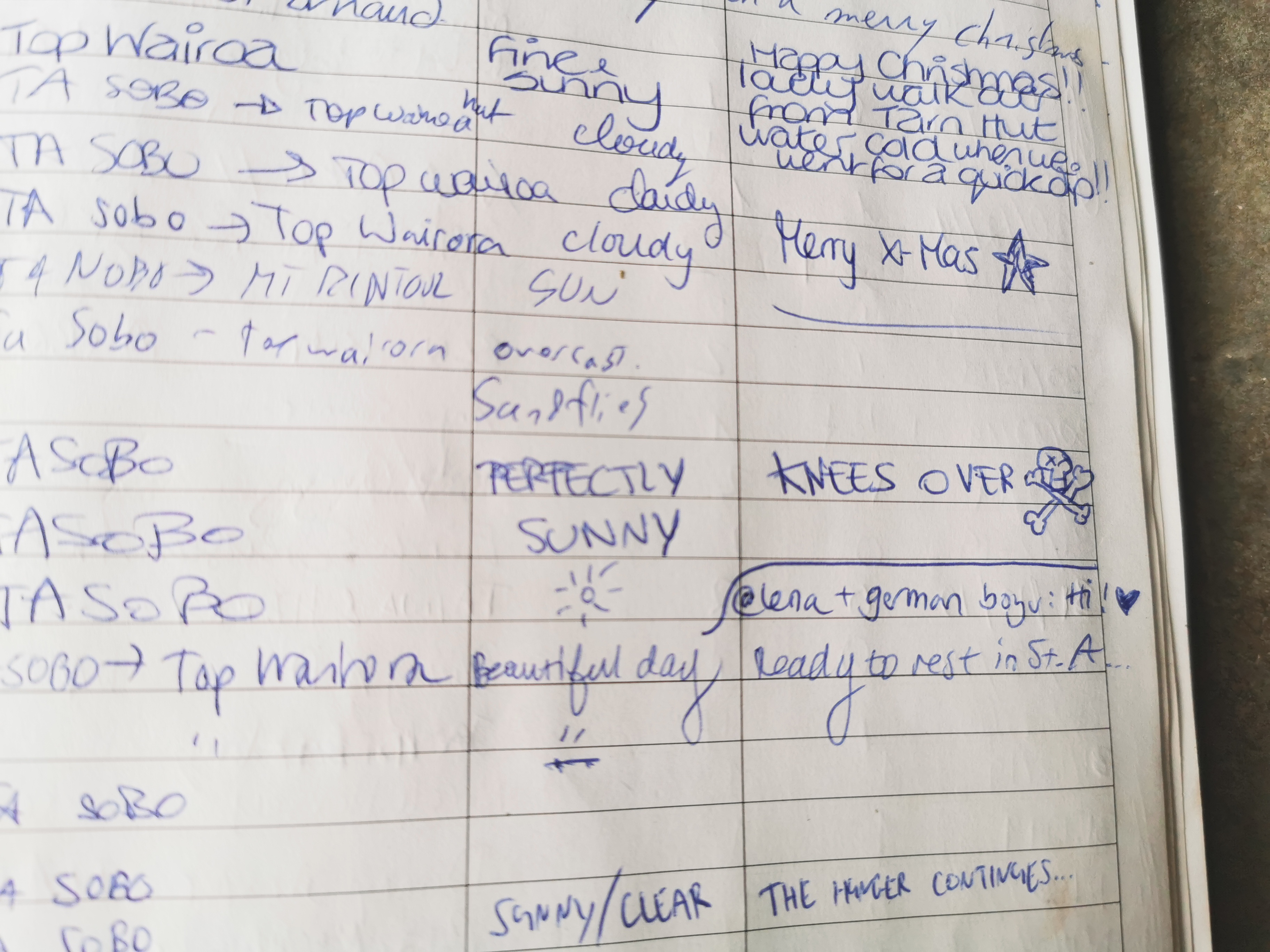
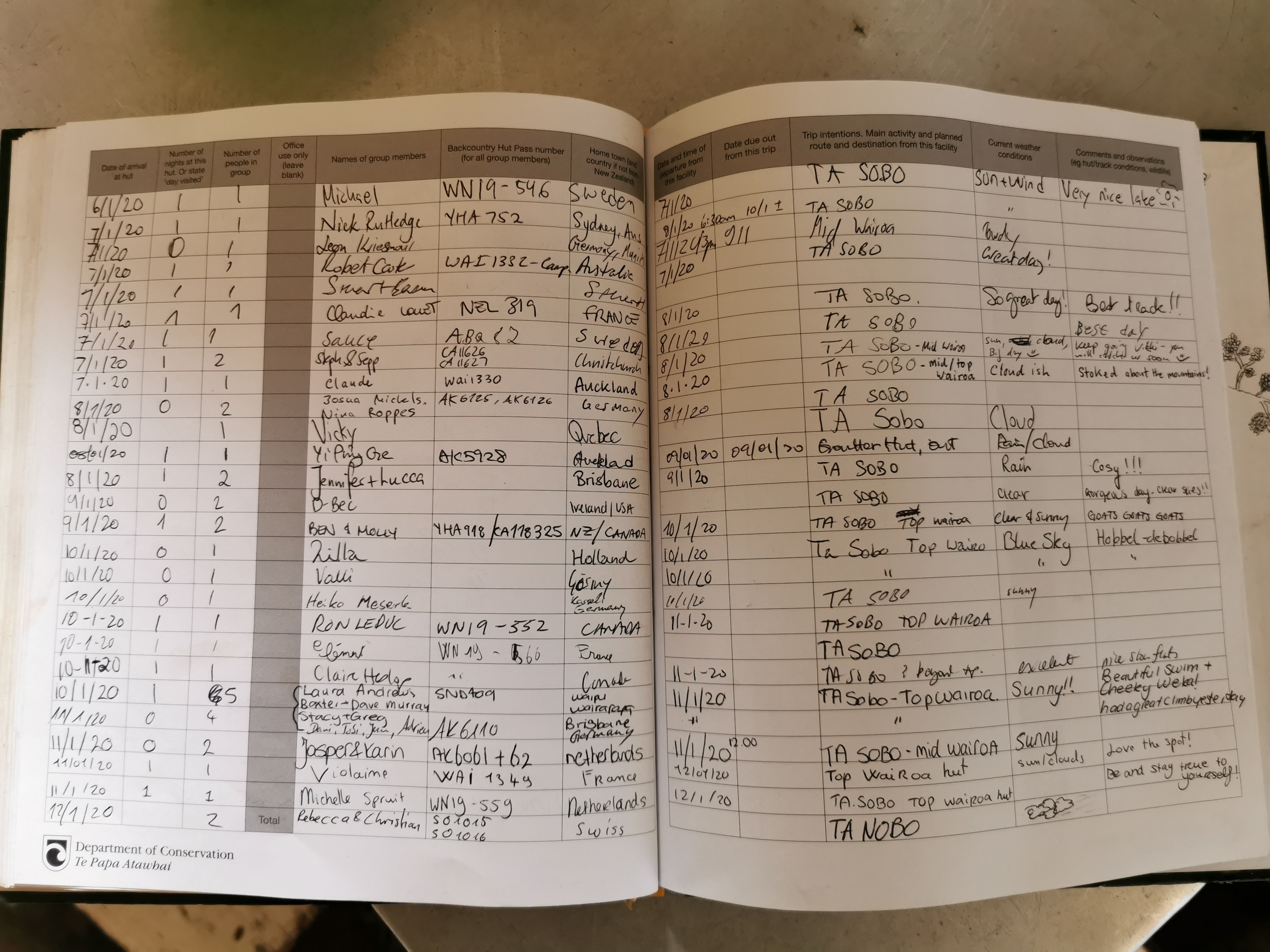
Also from the intentions book I noticed that my company tonight will most likely be Michelle and maybe Jasper and Karin, all from The Netherlands. Although now with northbound hikers on the trail, it’s harder to predict who will be at the huts.
A lot of things seem to be called Wairoa. As well as this hut and the next, it’s also the river nearby, the name of a reservoir in the Hunua Ranges in Auckland where the trail used to go past, and it’s also the name of a town near Gisborne where my friend Luke is from (one of the two people whose wedding I’m going to later this month).
Despite the nice-looking weather it did start to rain slightly just after I left the hut. I had a brief thought of “do I turn back and spend the night at the hut” but I decided to keep going as I was already wet from sweat and humidity. I did put the pack cover on though.
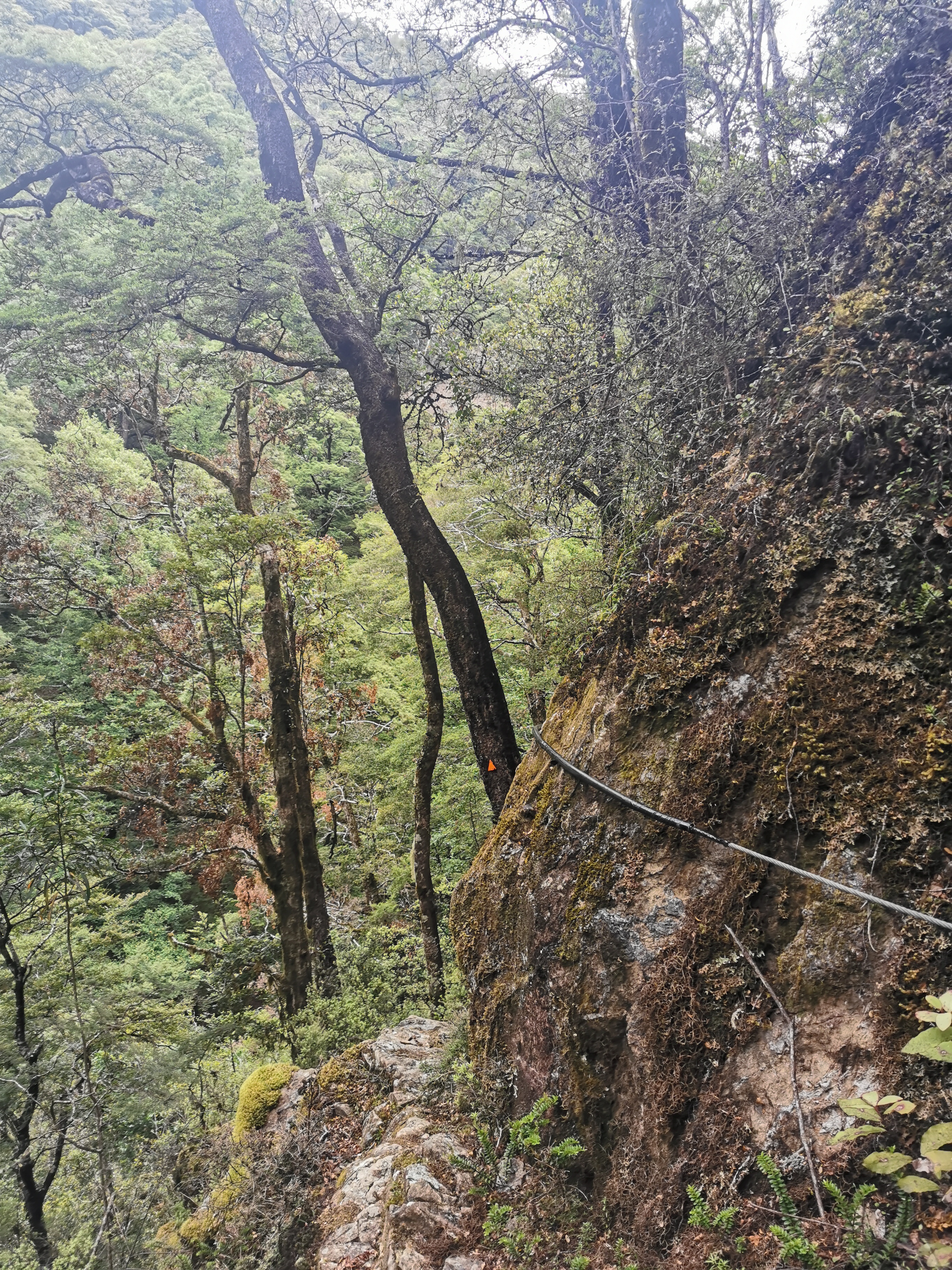
Here’s a little spoiler. The section between Mid Wairoa and Top Wairoa is “sketchy” (I think that’s the word the Americans would use). It was much more difficult than Mt Rintoul from yesterday, and I’d class it as one of the two most scary bits on the entire trail so far – tied with what I called “death ridge” in Puketi Forest.
Let’s have a look at some of the scary bits.
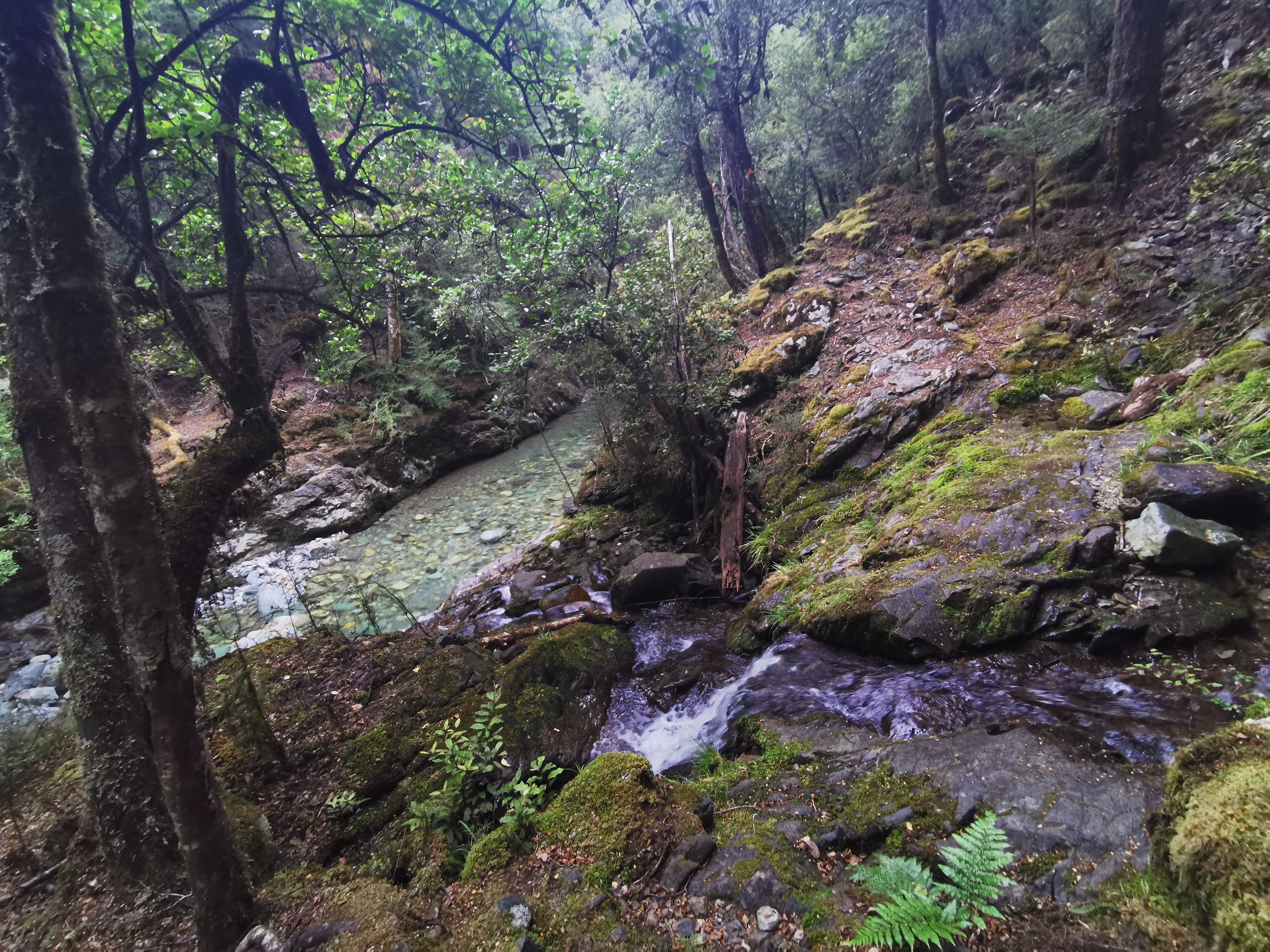
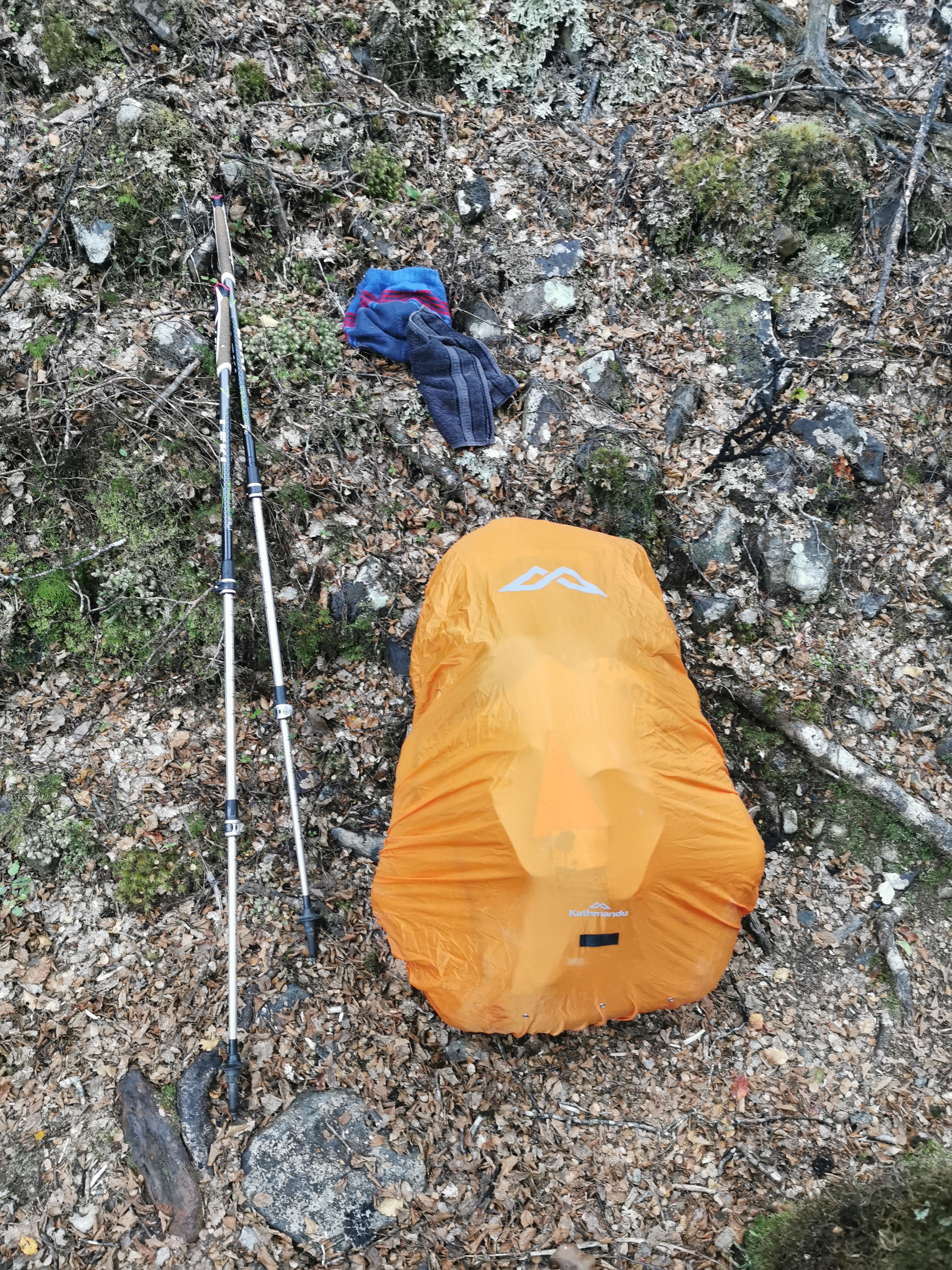
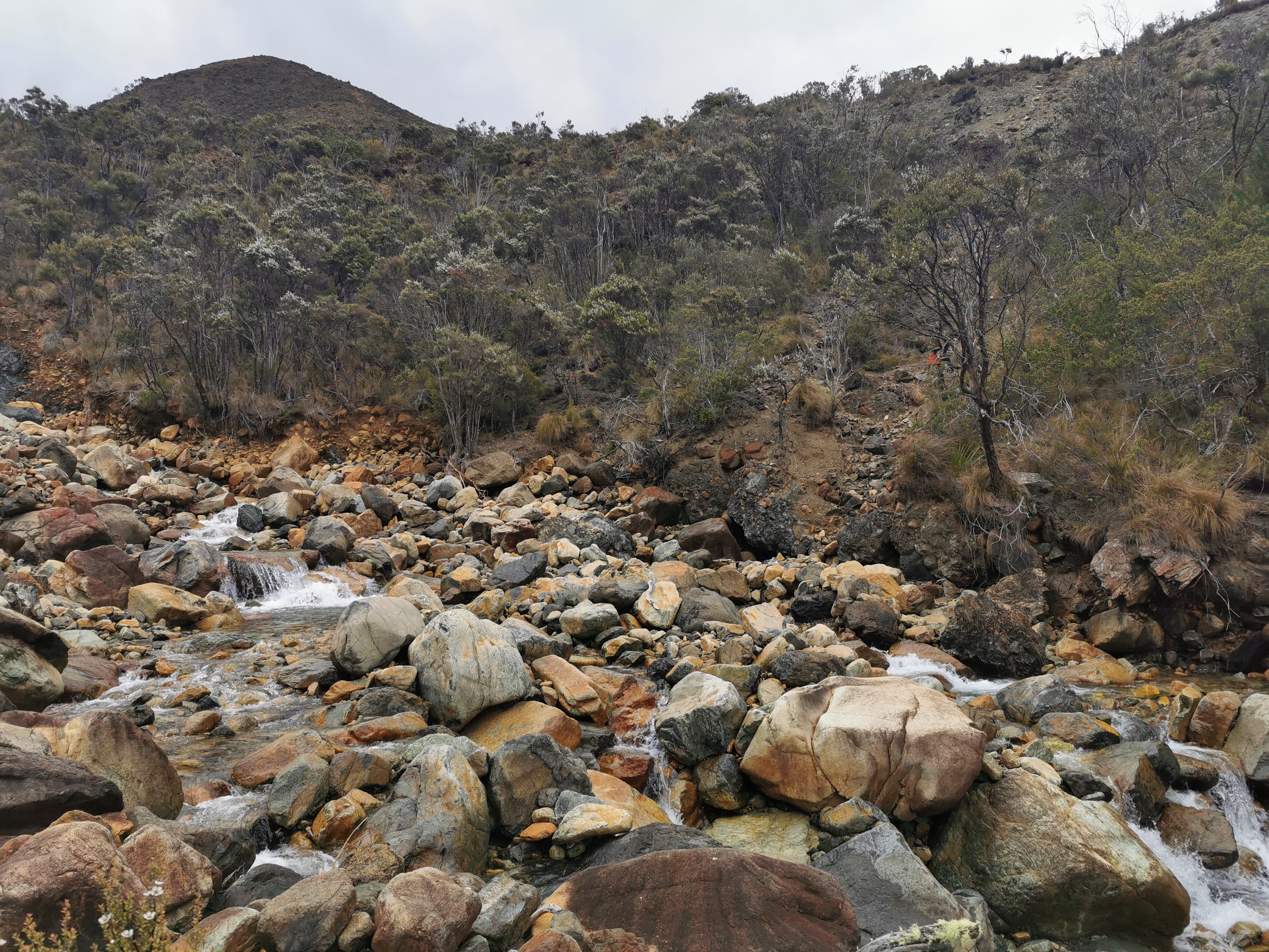
I knew there were eight crossings of what is apparently known as the “Wairoa River Left Branch”. At the first one I changed into my crocs because, well, I always do that.
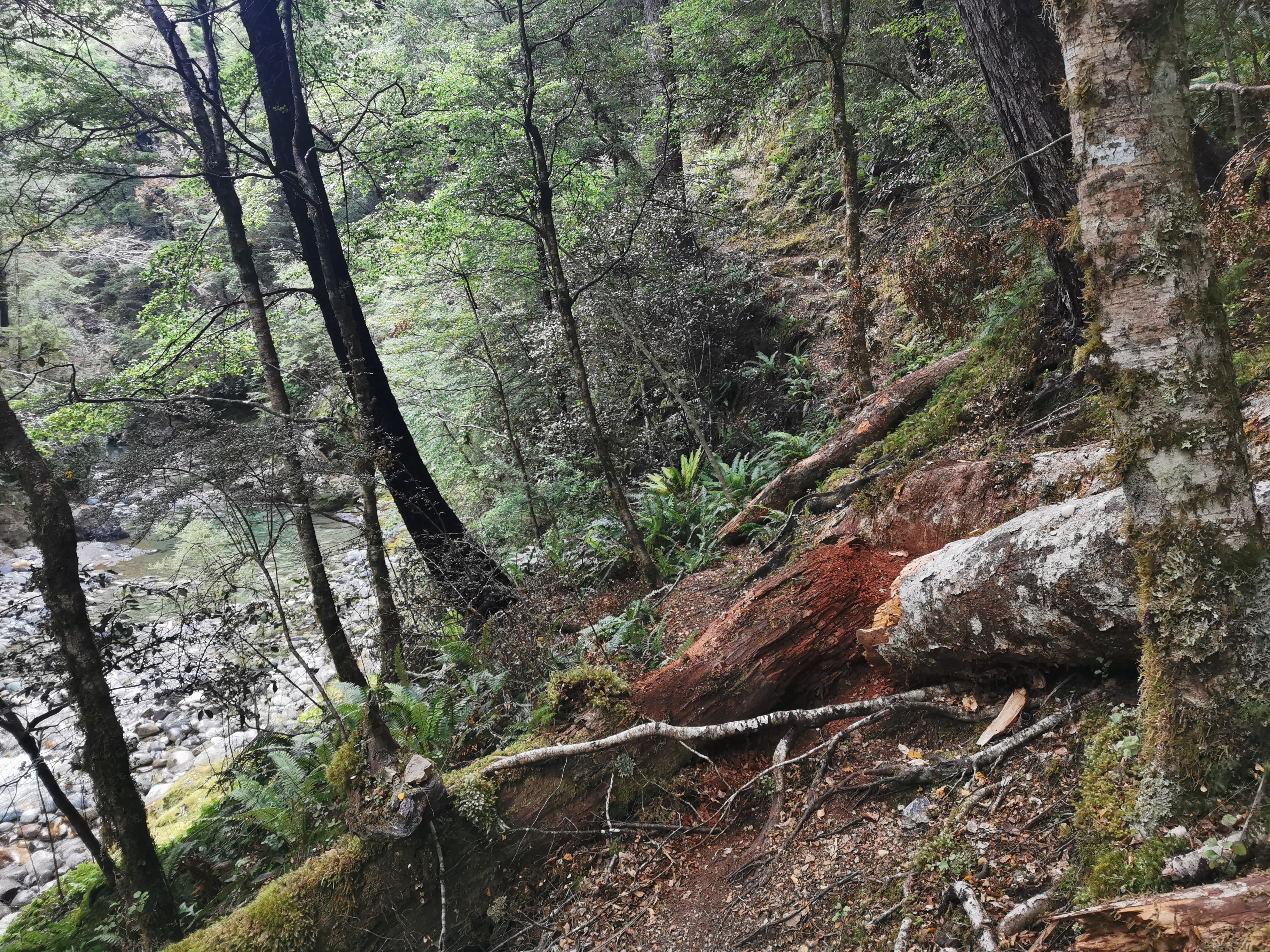
Once on the other side, the track didn’t seem so eroded and scary at first. I tried to keep my crocs on as long as I could because there are seven more crossings of this river to come. But wait, here’s a big steep drop with a big fallen tree to navigate around. Crocs aren’t gonna cut it here, so I changed back into my boots.
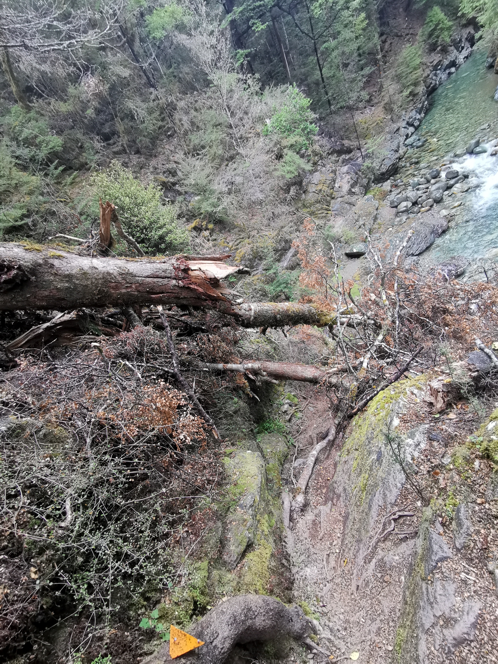
It’s hard to see from that photo exactly what I had to climb down. Looking back at it from the other side makes it a bit more obvious.
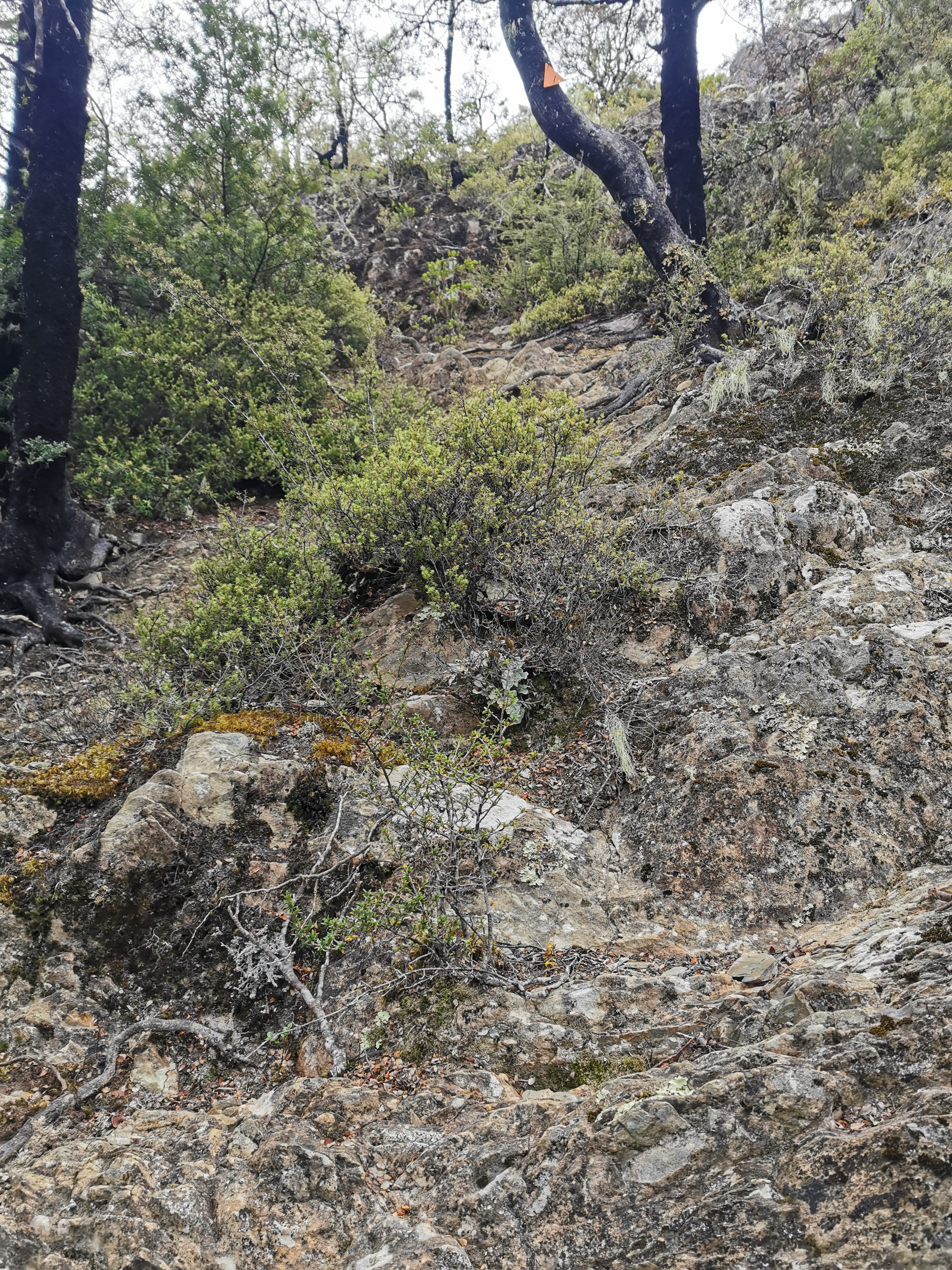
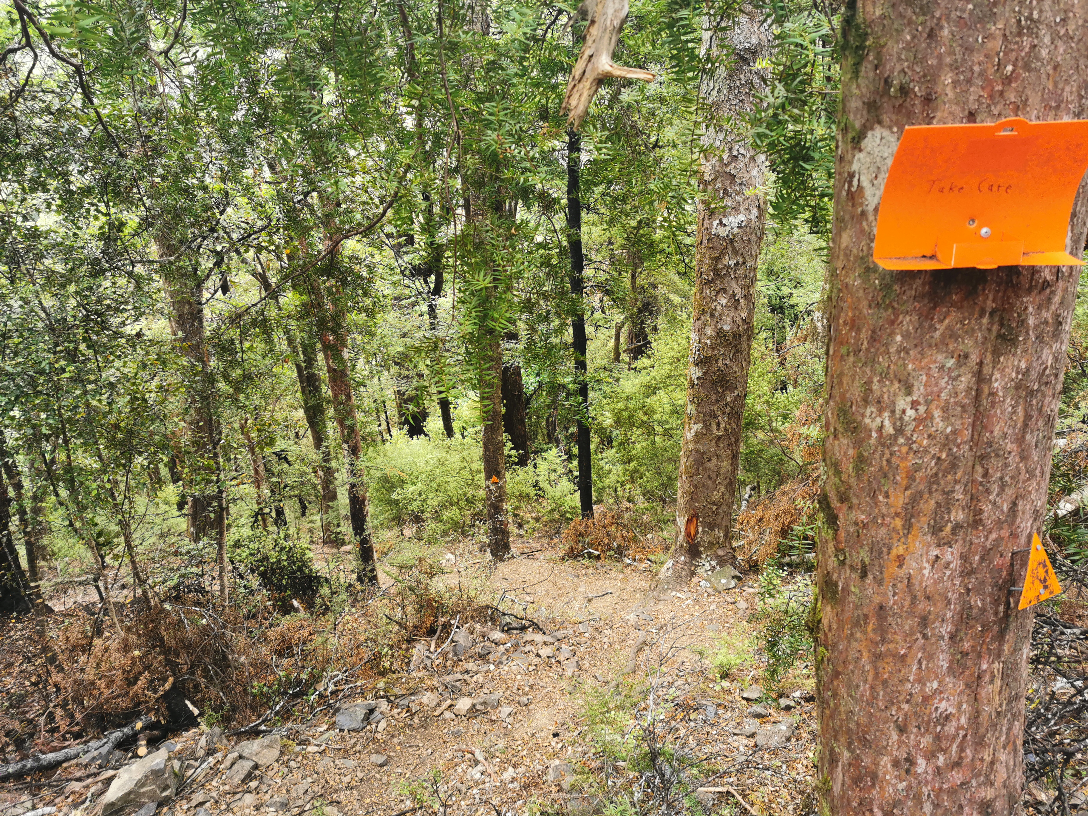
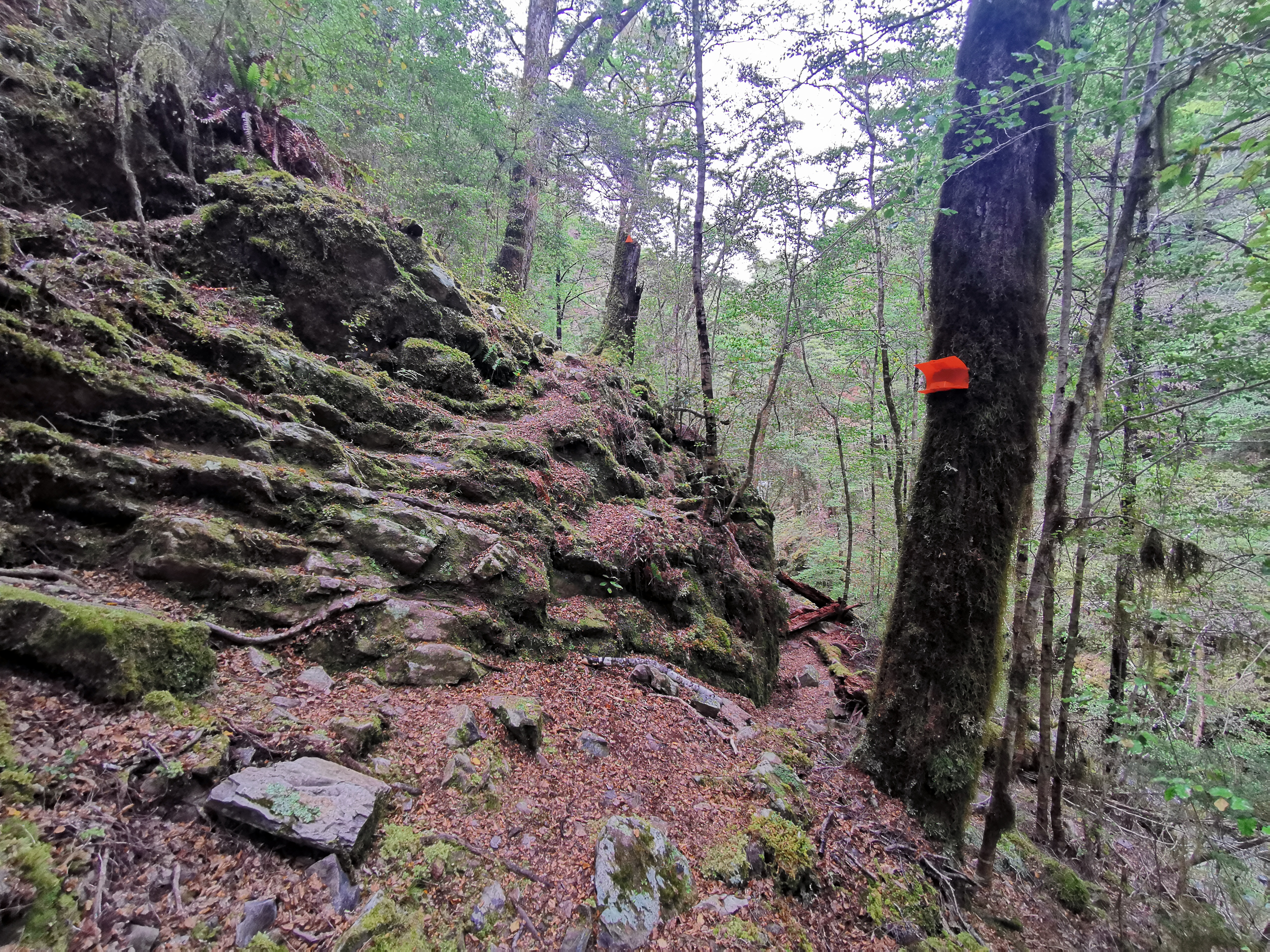
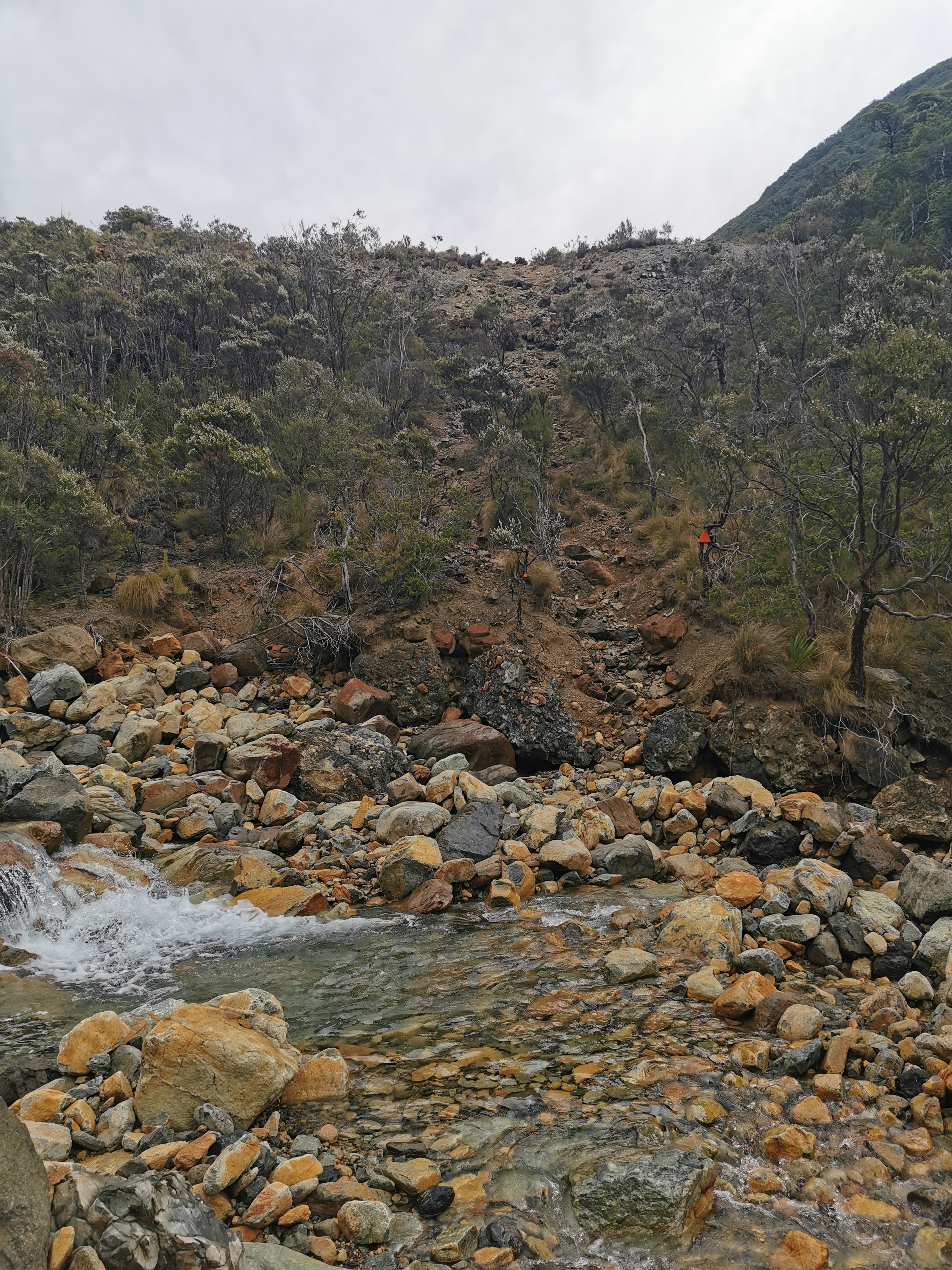
At this point, it looks like the trail goes around to the right of this rock, but it doesn’t! There’s a marker pointing up the rocks which I missed. Too distracted by the orange poison station, I guess. If you miss it, you’ll end up at what looks like a path but it’s actually a scary narrow ridgeline to nowhere! So don’t miss this turn!
This bit is scary because of the big rock with no handholds and a big drop to the right if you get it wrong.
And I don’t even know how I got past this bit.
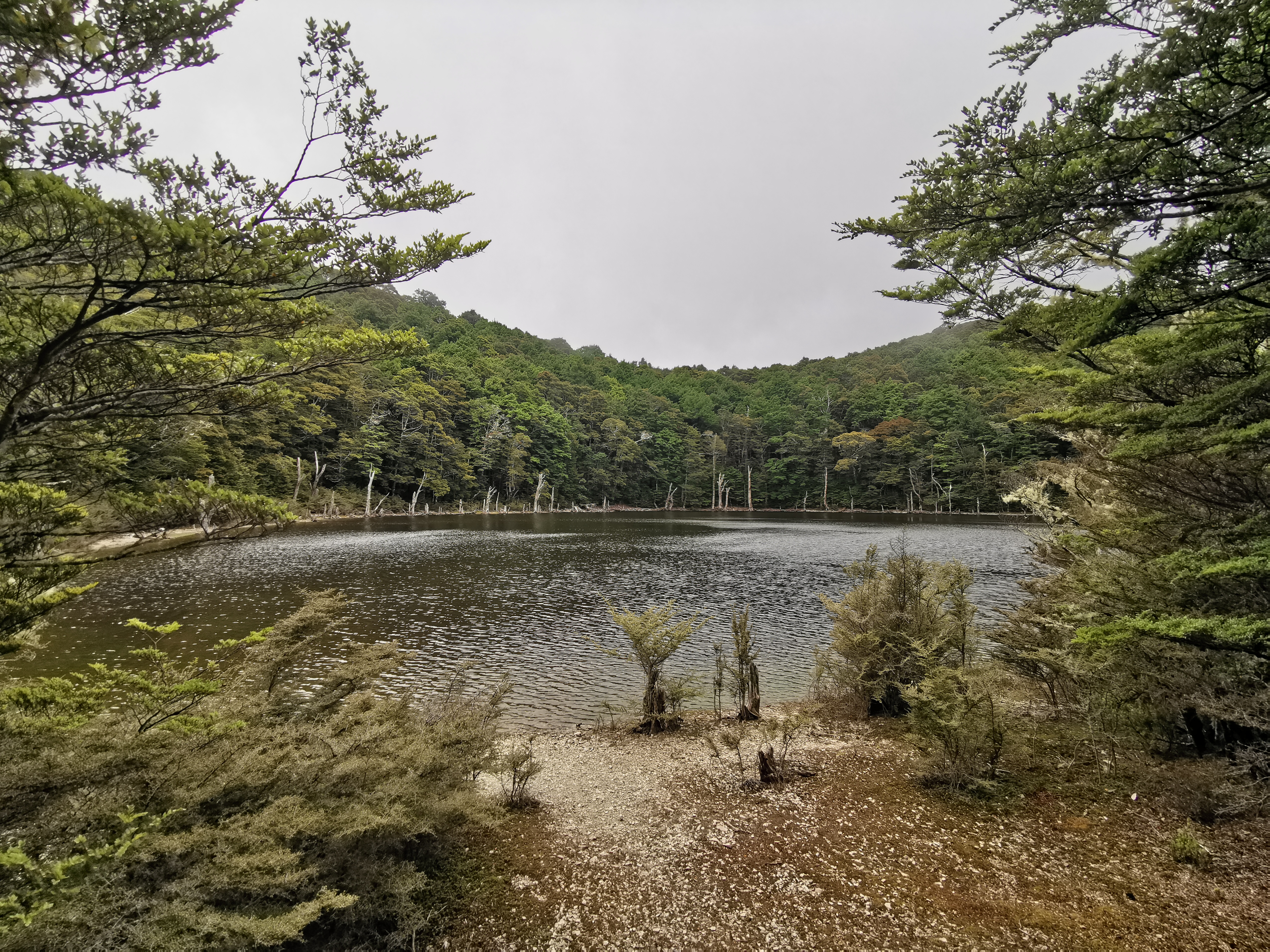
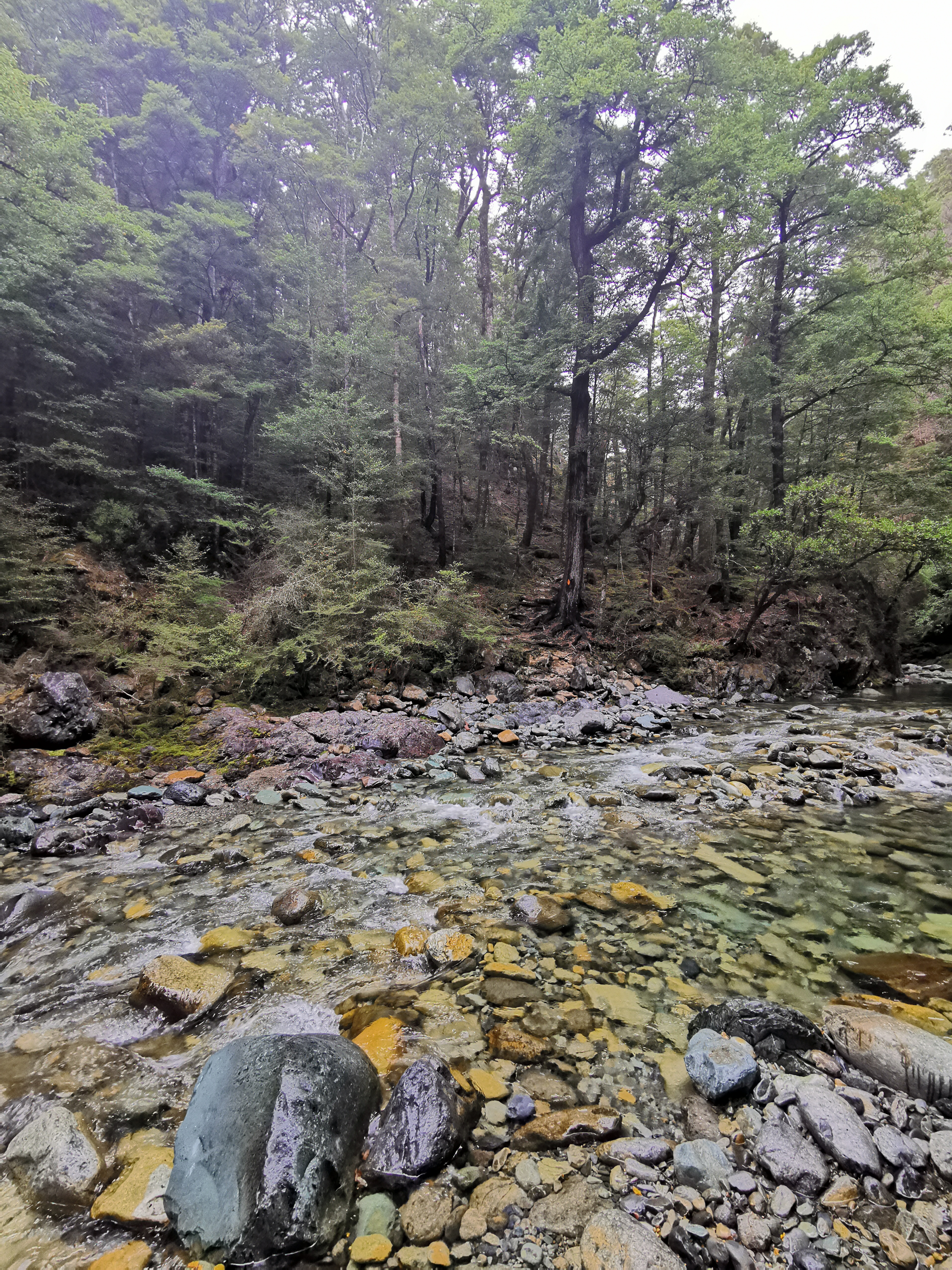
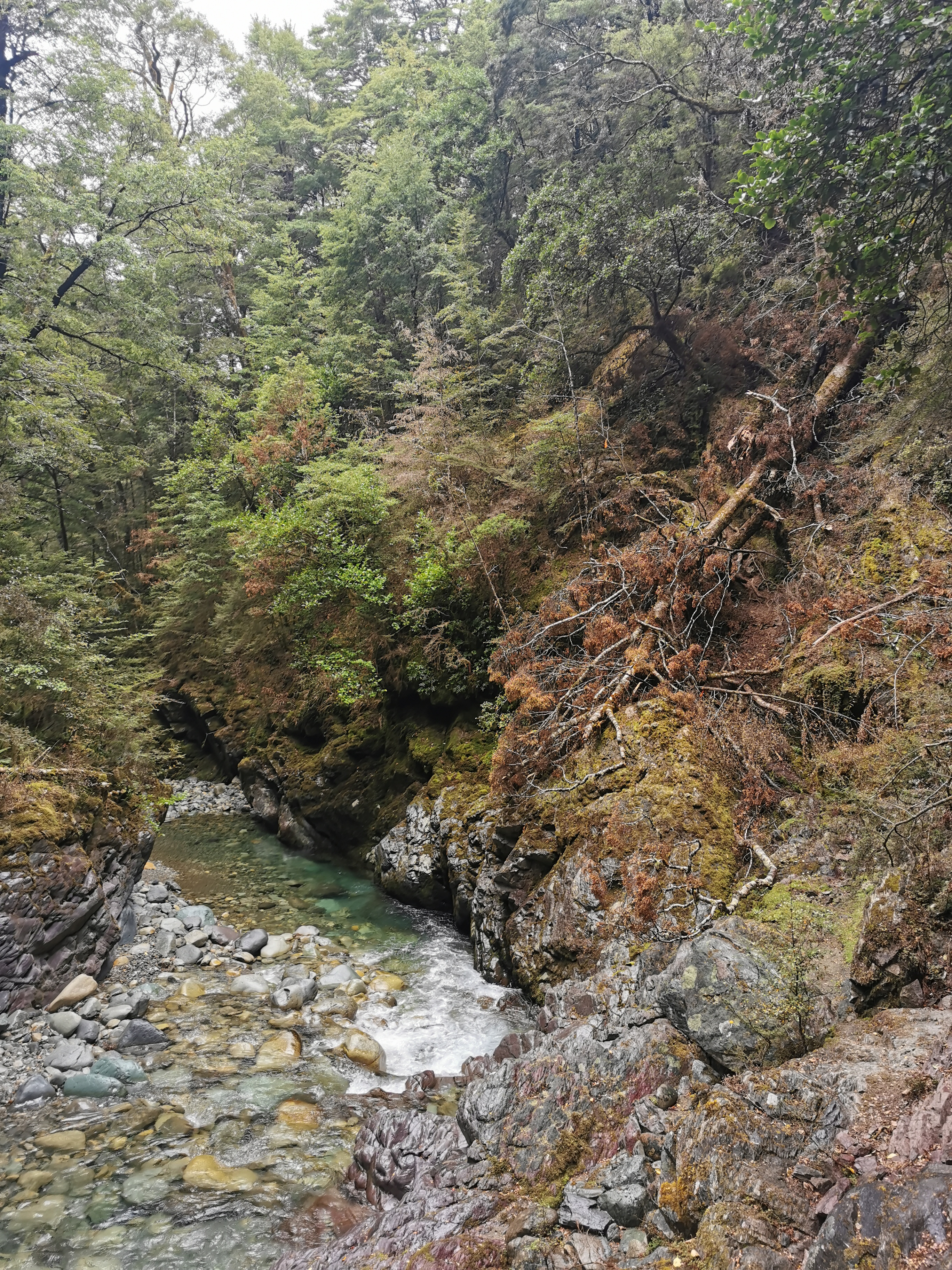
Halfway between the two huts, the sketchy bit stopped, where the second river crossing was. It was nice from there on. You often had to walk up the stony riverbed.
From crossing number 2 I changed into crocs and kept them on for the rest of the day. There was a light drizzle all afternoon and I did put my rain jacket on but it came off again quite fast. This little bit of drizzle I was sure wasn’t going to affect the river crossings.
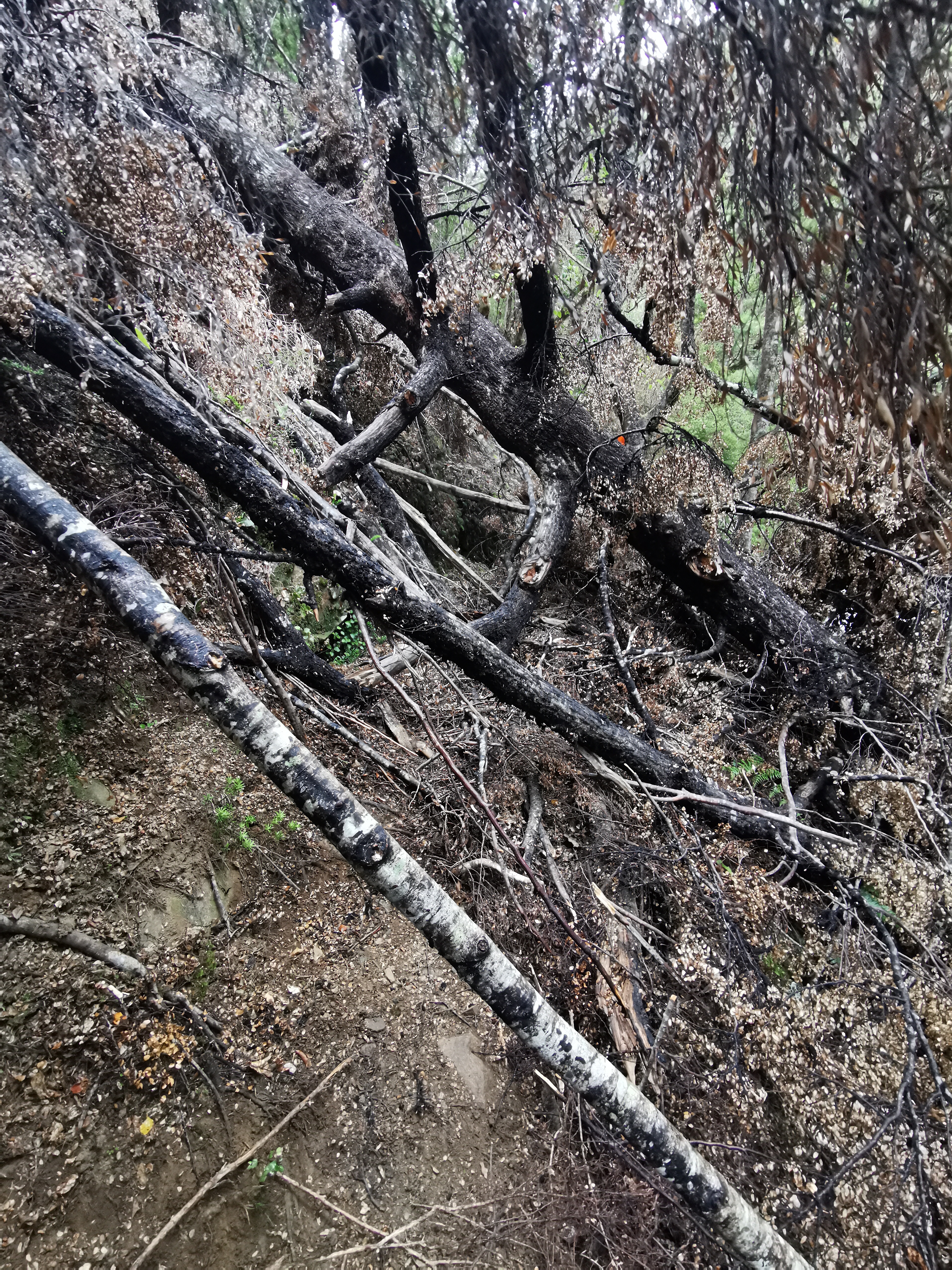
The rain though did make me think about the fire that was somewhere near here (I think) in February of last year. There had been no rain in this area for six weeks and so there was some kind of bushfire, although I can’t remember the details. I know I mentioned it before – my friends and I were walking the Queen Charlotte Track and we could see the smoke from the track. I wonder what you’d do if there was a bushfire while you were walking this big nine or ten day section of trail. Scary.
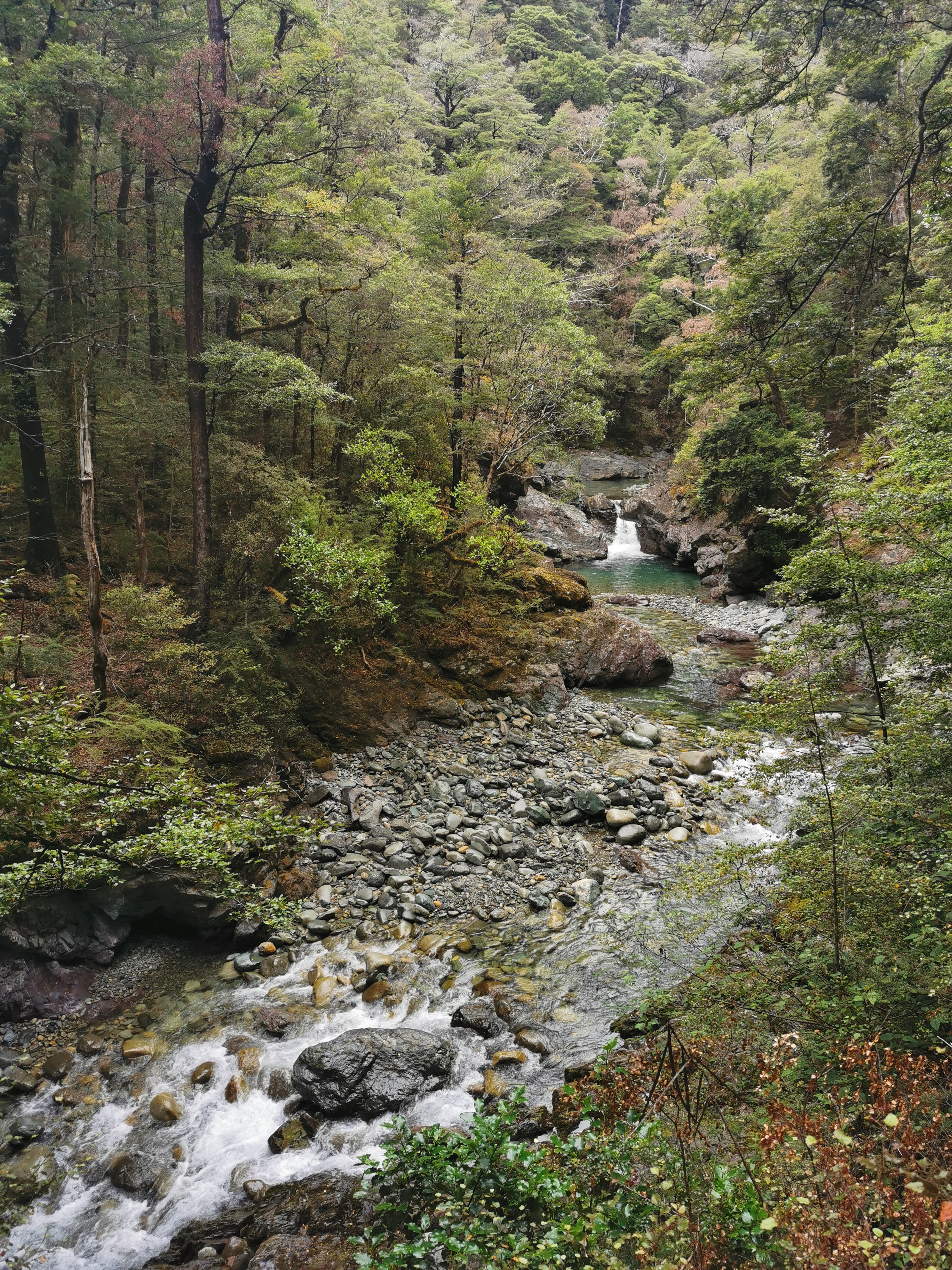
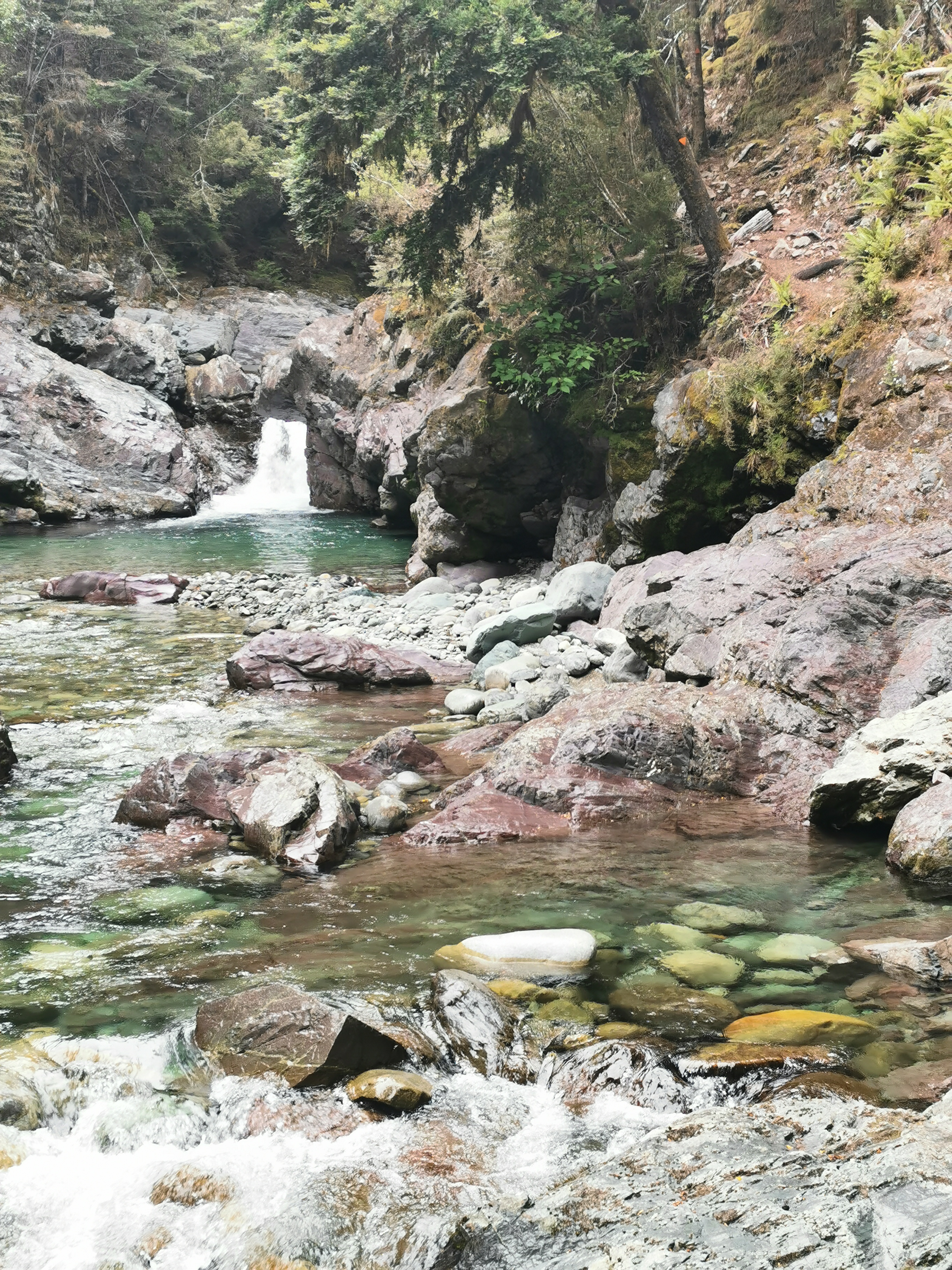
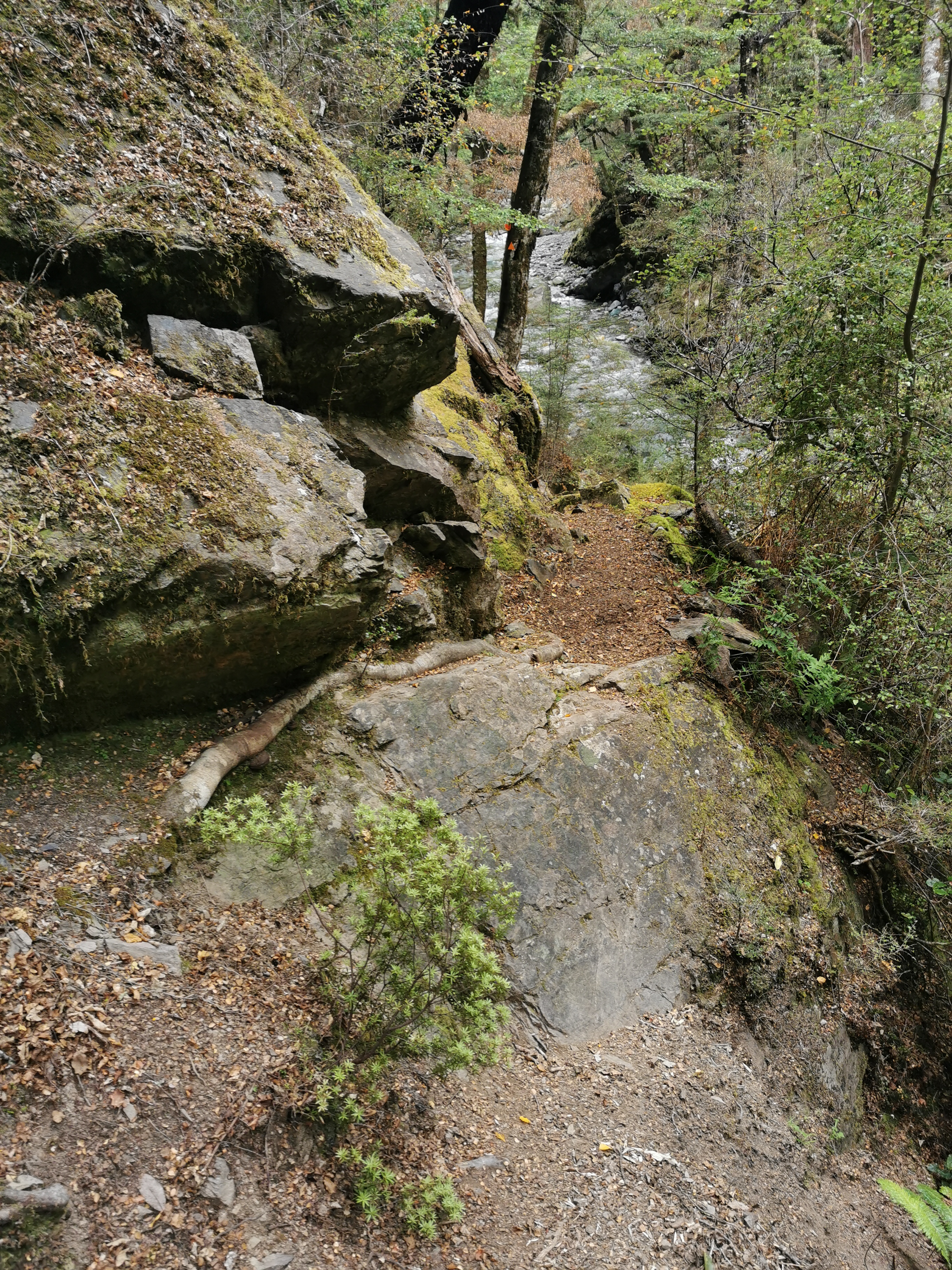
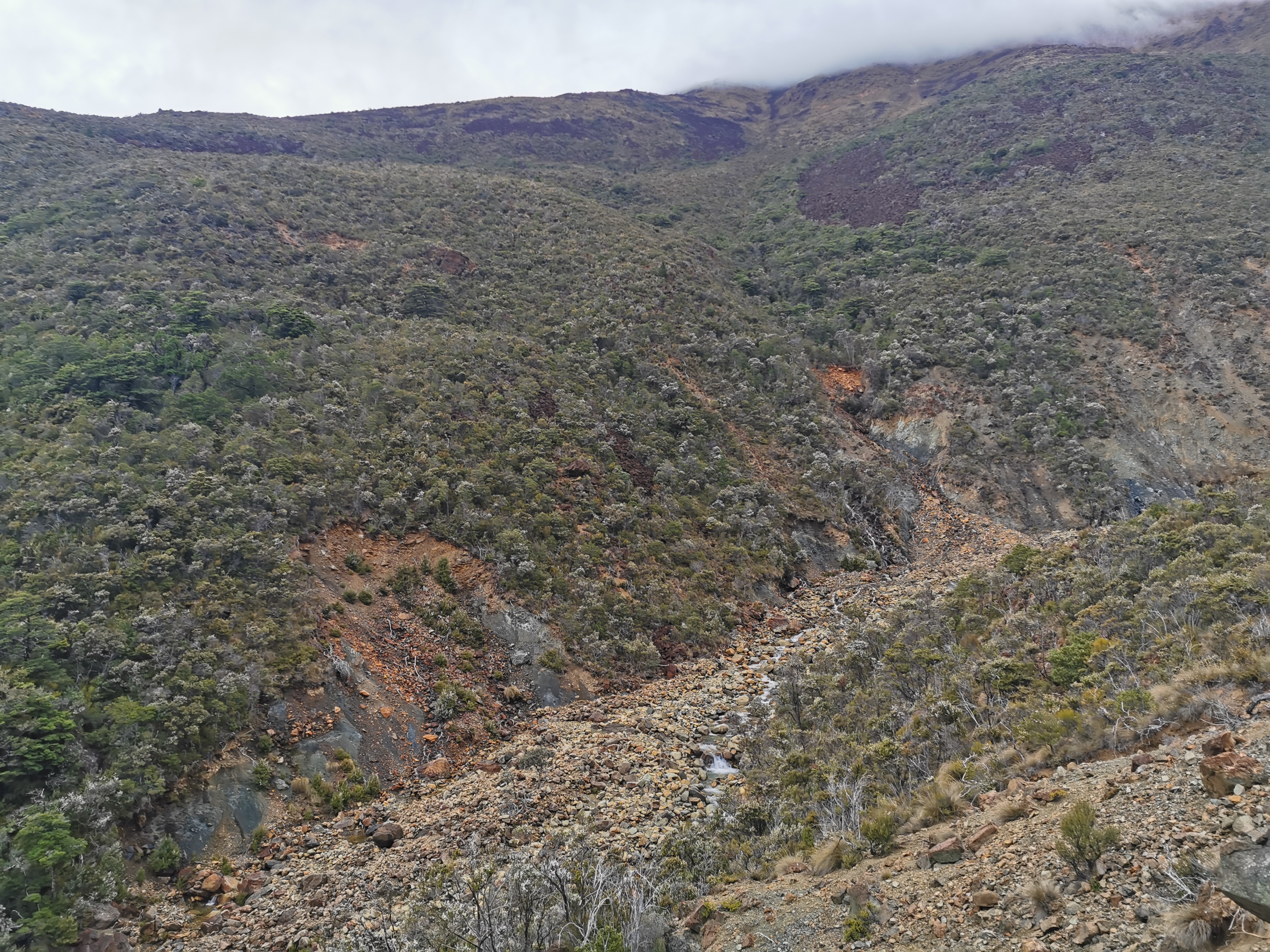
During this whole walk there was quite a noticeable uphill and I wondered how the elevation was increasing so much but I still remained beside the river the whole time. Well, the seventh crossing had the answer – there were big waterfalls!
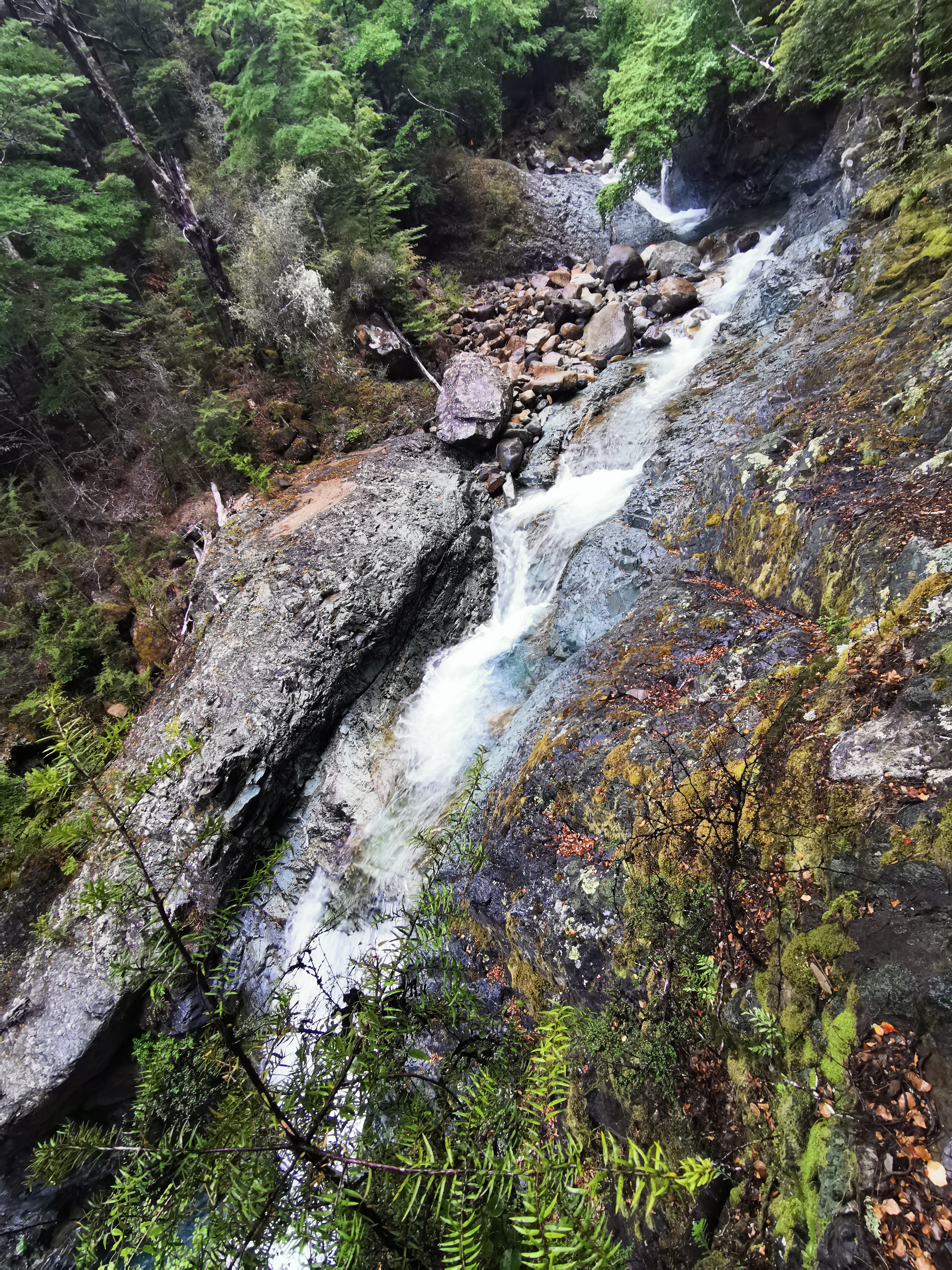
And can you see the orange triangle up the top? That’s where the crossing is! Honestly though this photo makes it look bad, but once you walk through the trees a bit you reach a fairly flat and calm piece of water. I definitely wouldn’t want to do this crossing in bad weather though.
One last bit of uphill through trees…
And then suddenly the landscape changes again.
This is the last of the river crossings. Look at the gigantic hill that is on the other side! The hut is just at the top of that hill. I’m not going to change out of my crocs just for that bit.
First I got some water just in case this was the water source for the hut as I didn’t want to have to come back down this massive hill again. In the 5 minutes I was doing that I got totally mobbed by sandflies.
I started on up the hill a bit and looked back. The river looked so tiny and insignificant from here.
It was tricky going up the massive hill in Crocs, but one I did the hut was indeed right there. The three I mentioned earlier were indeed at the hut, plus Violaime from France.
The notes said four and a half hours from the previous hut to here and that’s exactly what it took me. That’s in stark contrast to the previous section where I did it in half the time. You never know what you’re going to encounter!
There are no more photos today. I will take photos of the hut tomorrow. Tonight, even going outside for 90 seconds I get mobbed by mosquitos so no photos!
I’ve now had three relatively big days in a row and my legs are getting sore. I’m going to reward myself with two average days instead of another big day tomorrow and take my time. Besides, I don’t want to get to Boyle Village too early.
The four people at this hut were really cool and we talked about all sorts of things. But once we were in bed there were mice again. We thought that this hut had no mice reported. But we hear them in the corner.
And I saw them this time since they came out before dark. One in the middle of the hut floor and another one up on the bench. There’s at least two in here. At least they’re small mice and not big rats.
Heres another exciting bit of news, I’m going to have to manually remove my dead toenail in St Arnaud. It’s really loose now and I’d rather have it come off gracefully than have it torn off when I trip or something. Watch this space.
Today's walk on the map (blue = Te Araroa, red = today's walk):
What amazing landscape. Thanks again for the photos.
Those rock cairns are pretty common on back country tracks. People build them where they think other trampers might need a little help maintaining the right track. Built a few myself over the years.
Enjoying your blog, you probably need insect repellent going forward !
After I saw more of them I figured that’s what they were for. They also helped find good paths across rivers, I noticed. Cheers! And yes I have got some repellent, but if I used it every single time there were sandflies around it would run out in a few days!
Love the pics Matt, beautiful beech forest rather than the mainly podocarp crap on my doorstep, aka Tararua Rain Mange. You were very lucky with the fine wx during the Tararua trail section, 3 consecutive fine days a rarity even during summer.
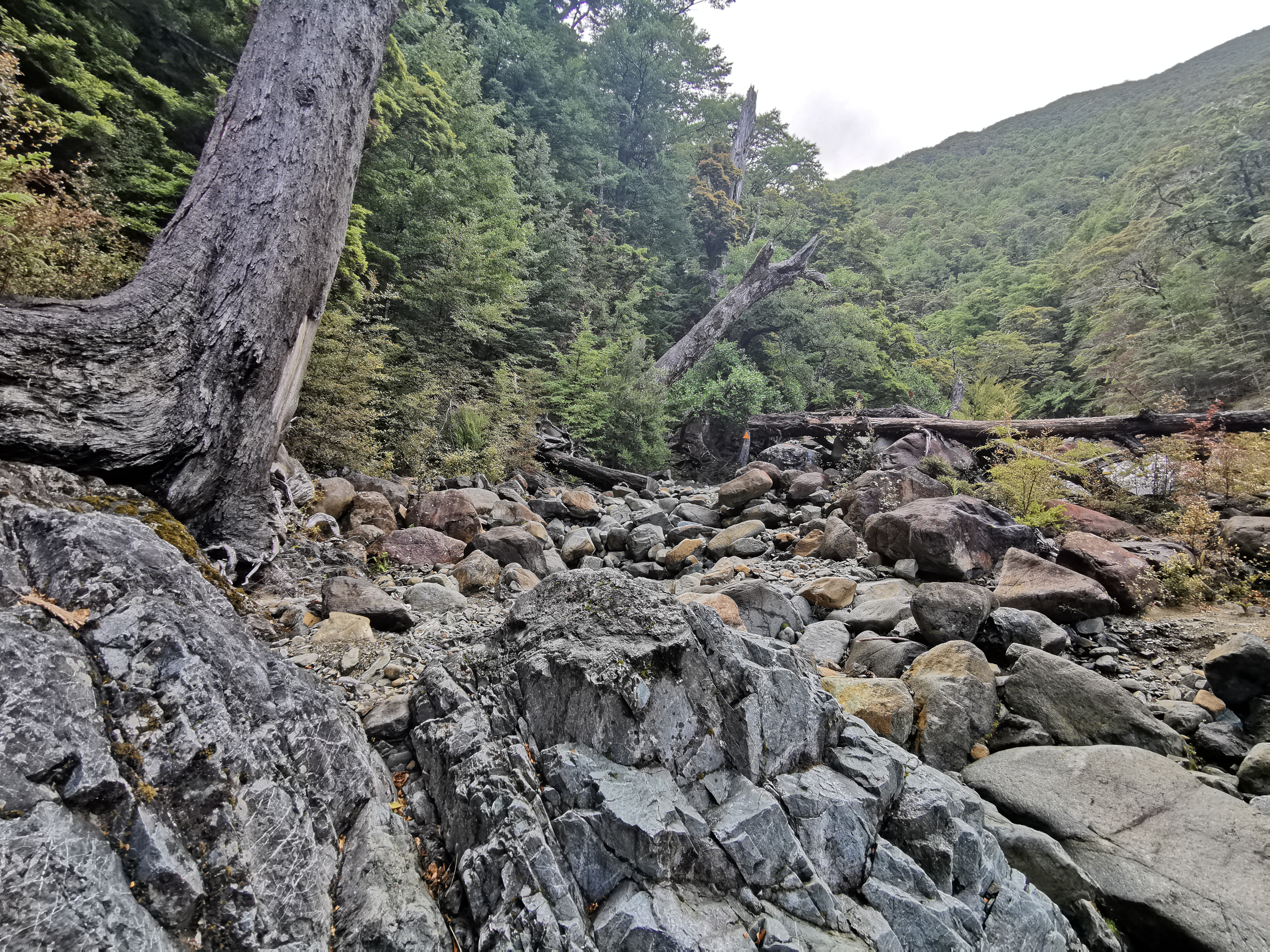
From this section south for a while there is a belt of high mineral content rocks, hence the reddish colour. It’s called the Red Hills.