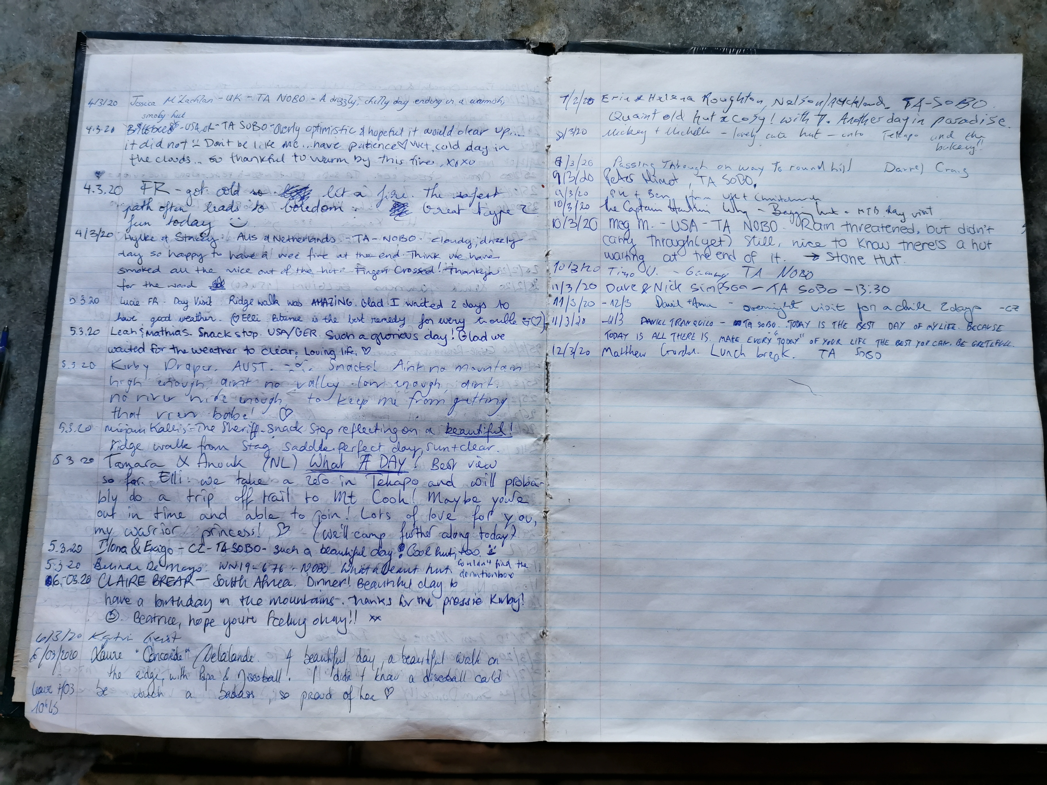
Date: 12 March
Trail covered: 49.4km, plus 2km for detours and getting to the holiday park (kms 2338.4 to 2387.8)
Weather: barely a cloud in the sky
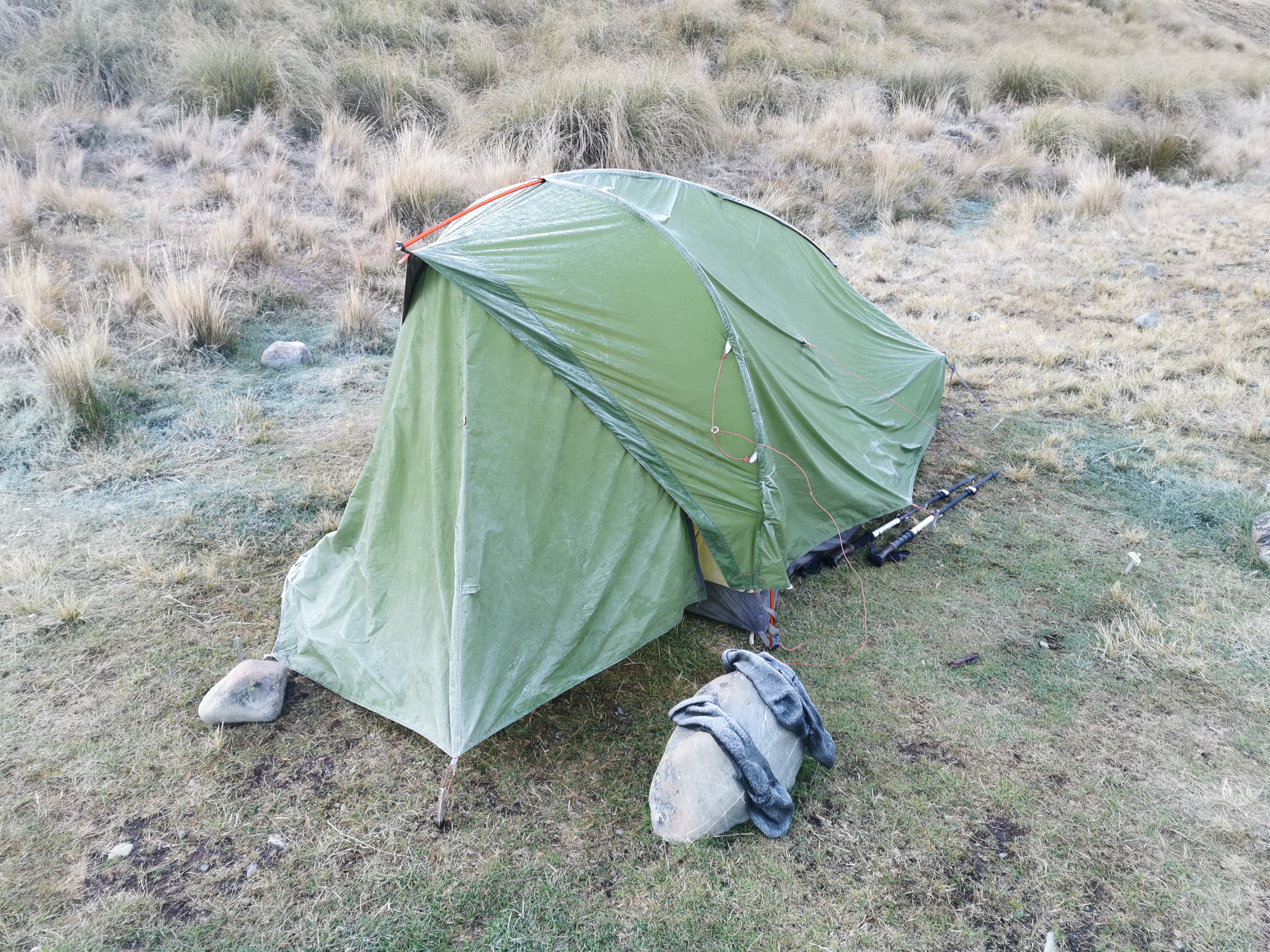
During the night it was cold. I had to zip the sleeping bag right up and get as far inside it as I could. It reminded me of when I camped up near Beeby’s Knob.
And in the morning when I got up, I noticed Timo’s tent had frozen, along with the socks he left outside. That reminded me of when that happened to me just after Waiau Hut. Timo must have had a real problem with rats previously to want to sleep outside rather than in the hut in this cold!
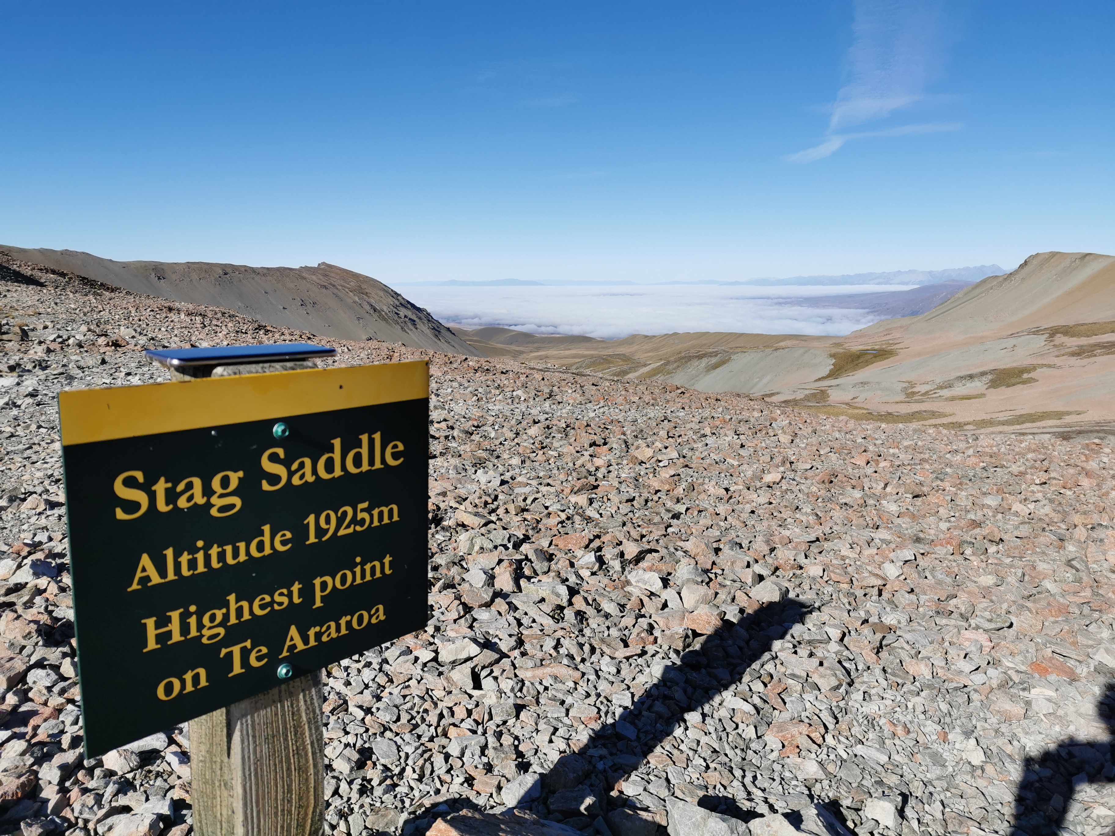
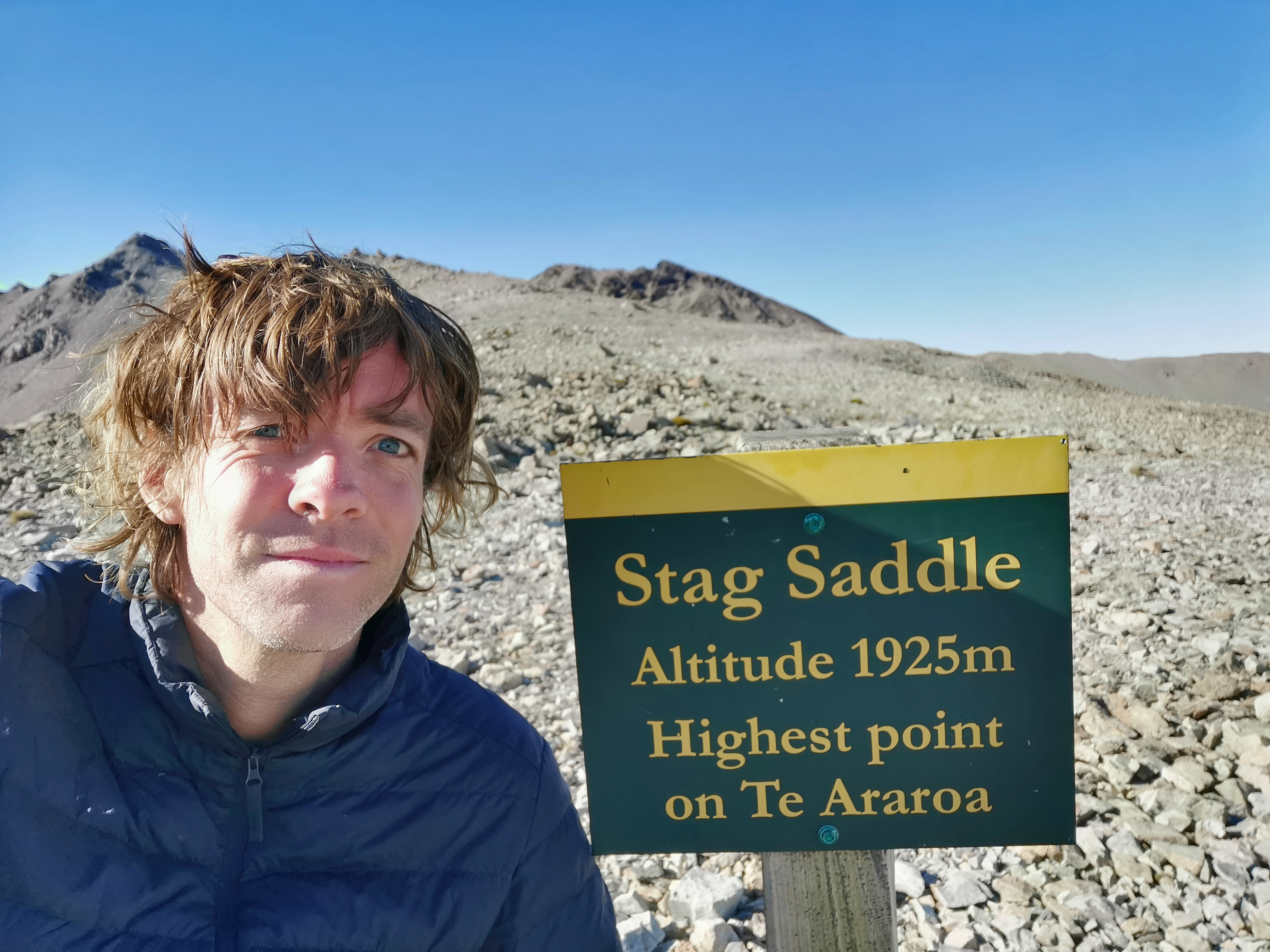
I wanted to leave early today in case I had the energy today to make it all the way to Tekapo, nearly 50km away. That seemed unlikely since I have to contend with Te Araroa’s highest point today, the Stag Saddle. But I didn’t want to rule out the idea before I’d even begun.
I changed into “the works” – no, not the burger from KFC (man I’d love one of those right now), but the full array of cold weather gear: jacket, gloves, thermals and beanie. And also crocs – on the way up to the saddle there is apparently a bunch of river crossings. The thought of my feet being permanently wet in this freezing temperature is impossible to bear. I left the hut at 7:45am, after saying goodbye to Christie and Michael. Michael is stopping in Tekapo so I won’t see him again, and Christie might cycle past me on the section between Tekapo and Twizel that she is biking.
It was cold, but the weather forecast for today was excellent and I was optimistic that once the sun came out from behind the mountains that it would be a great day and there would be excellent views from Stag Saddle.
The sun didn’t take long to appear and it made me very happy and warm.
I was listening to a song called High Hopes by Panic at the Disco. It has a really positive message, and when coupled with how good I was feeling and the amazing location I was in the middle of, I suddenly and unexpectedly got quite emotional and shed a few tears. Sometimes on the trail when you’re in these sorts of amazing places, it’s hard not to get a little bit emotional.
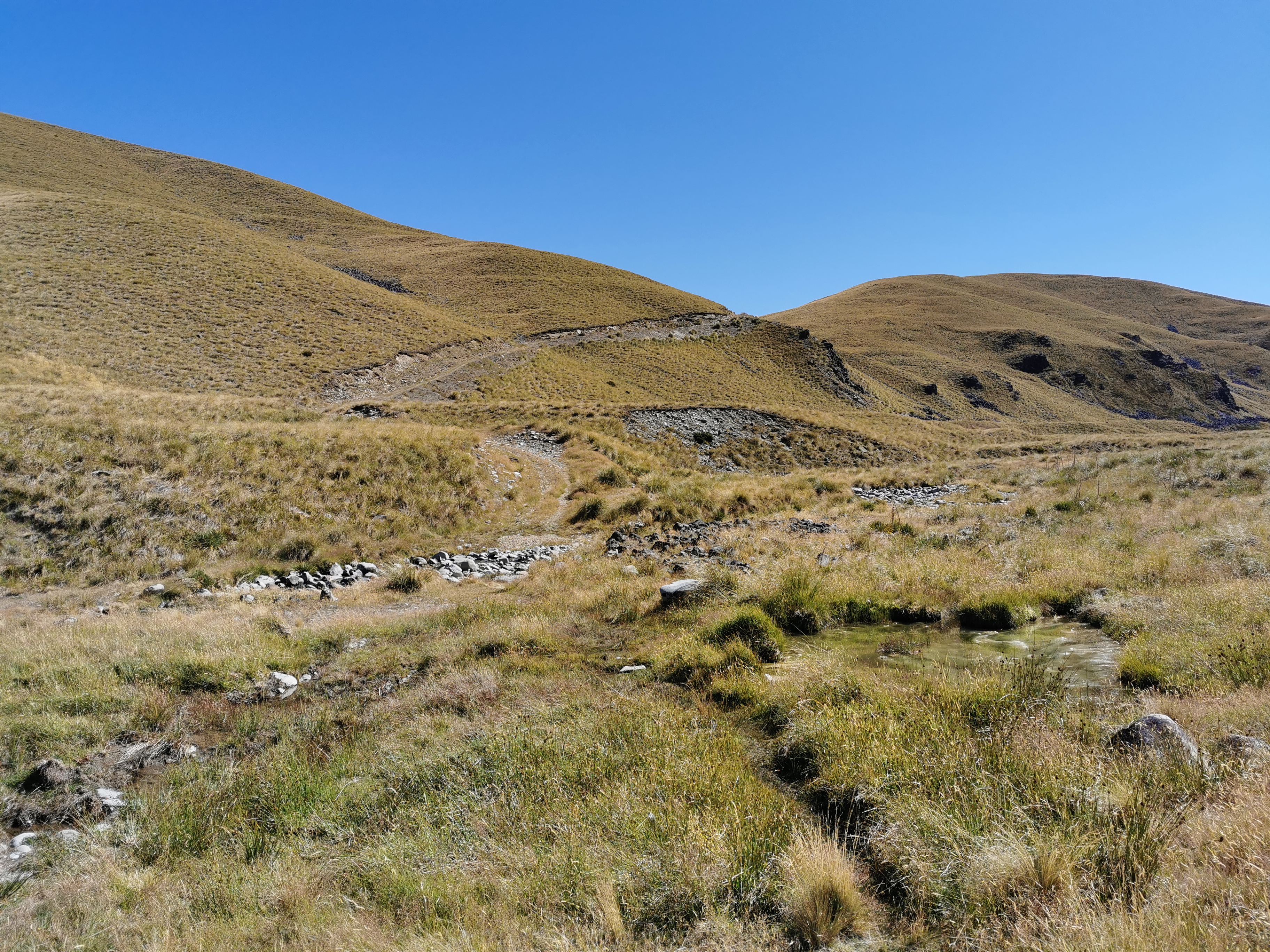
There were indeed quite a few stream crossings, and I was very happy to have my crocs on. My feet got very cold in the cold water but at least this way I can put on dry socks and boots soon.
After 15 minutes of being in the sun, the works came off, and t-shirt and shorts went on. My boots went back on too. Once you start obviously going up a steeper part of the track, it’s safe to put boots back on and they’ll stay dry.
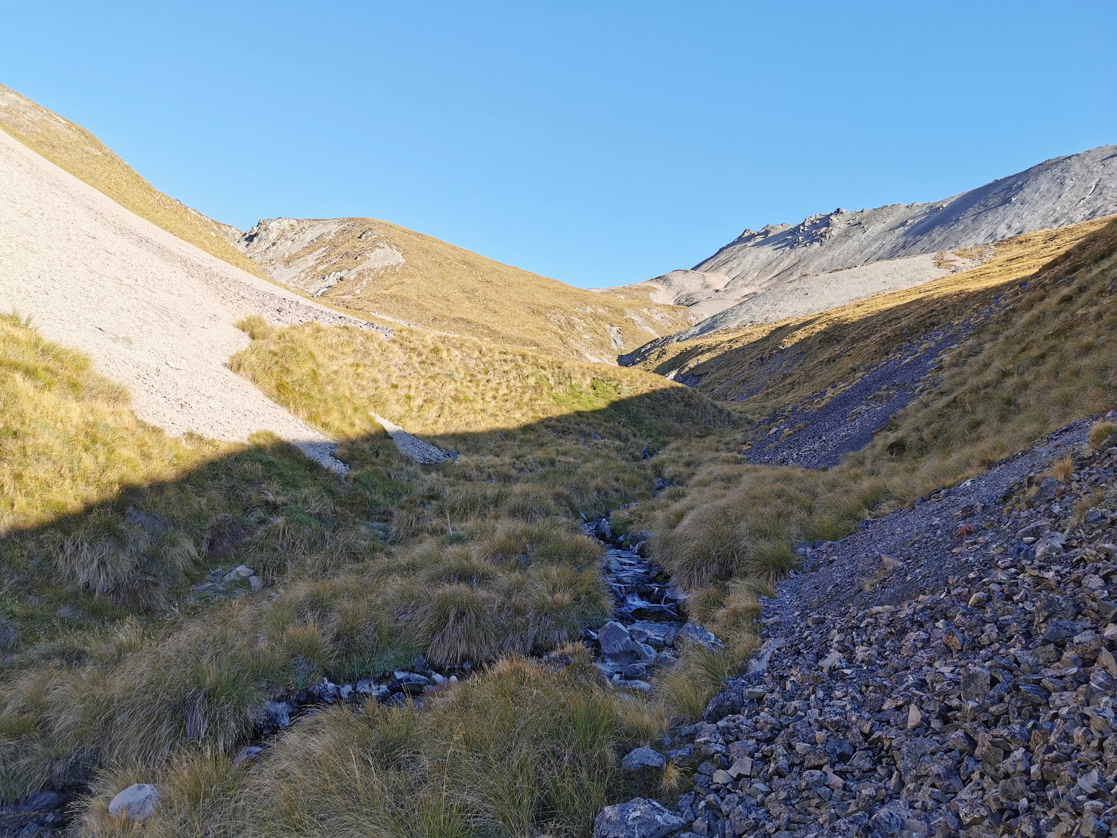
In the photo above I thought that the bit to the right was where I was heading, but no, the path takes a sudden and unexpected turn to the left and you end up going up here.
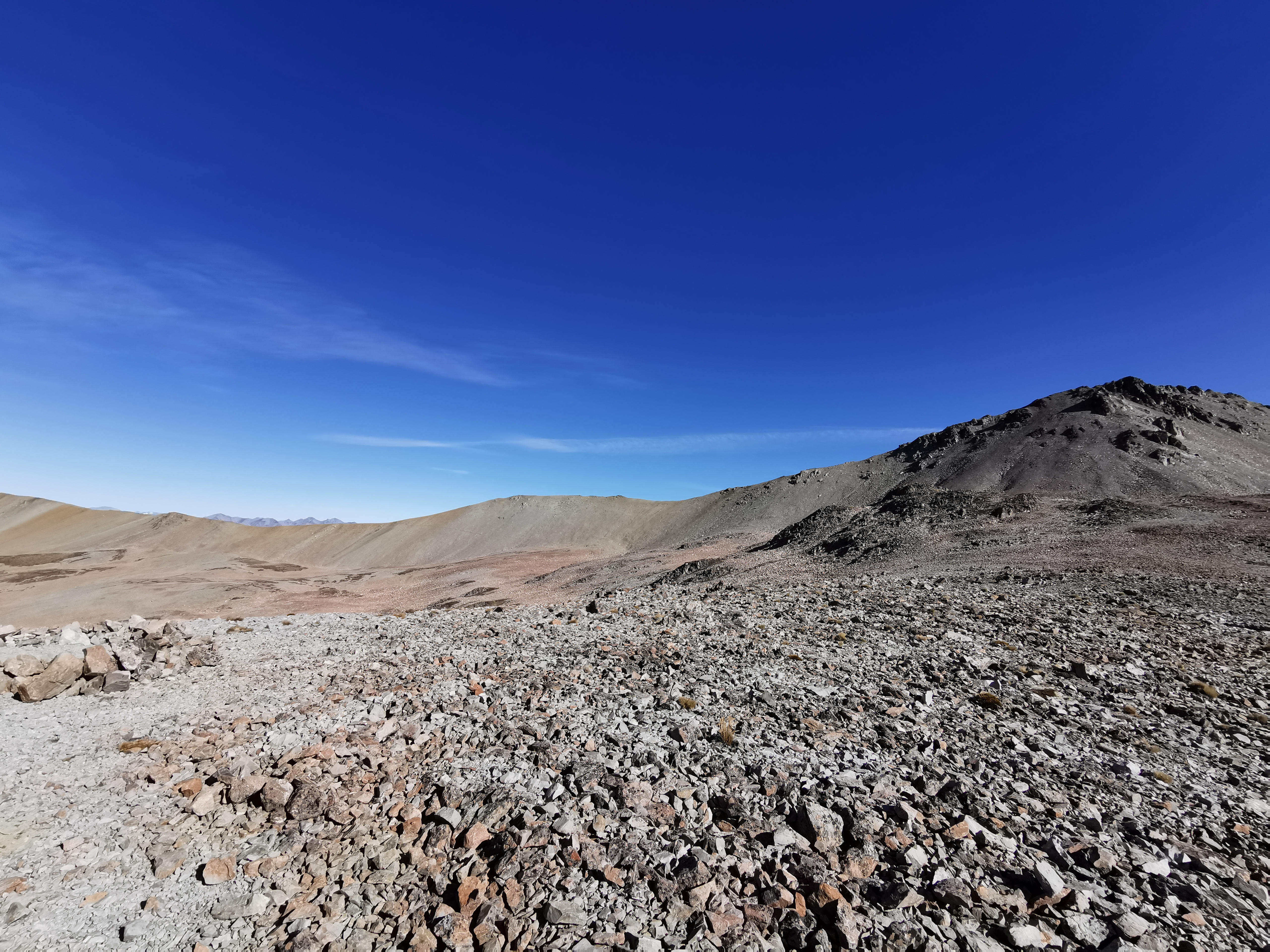
I had a look back to see where I’d come from.
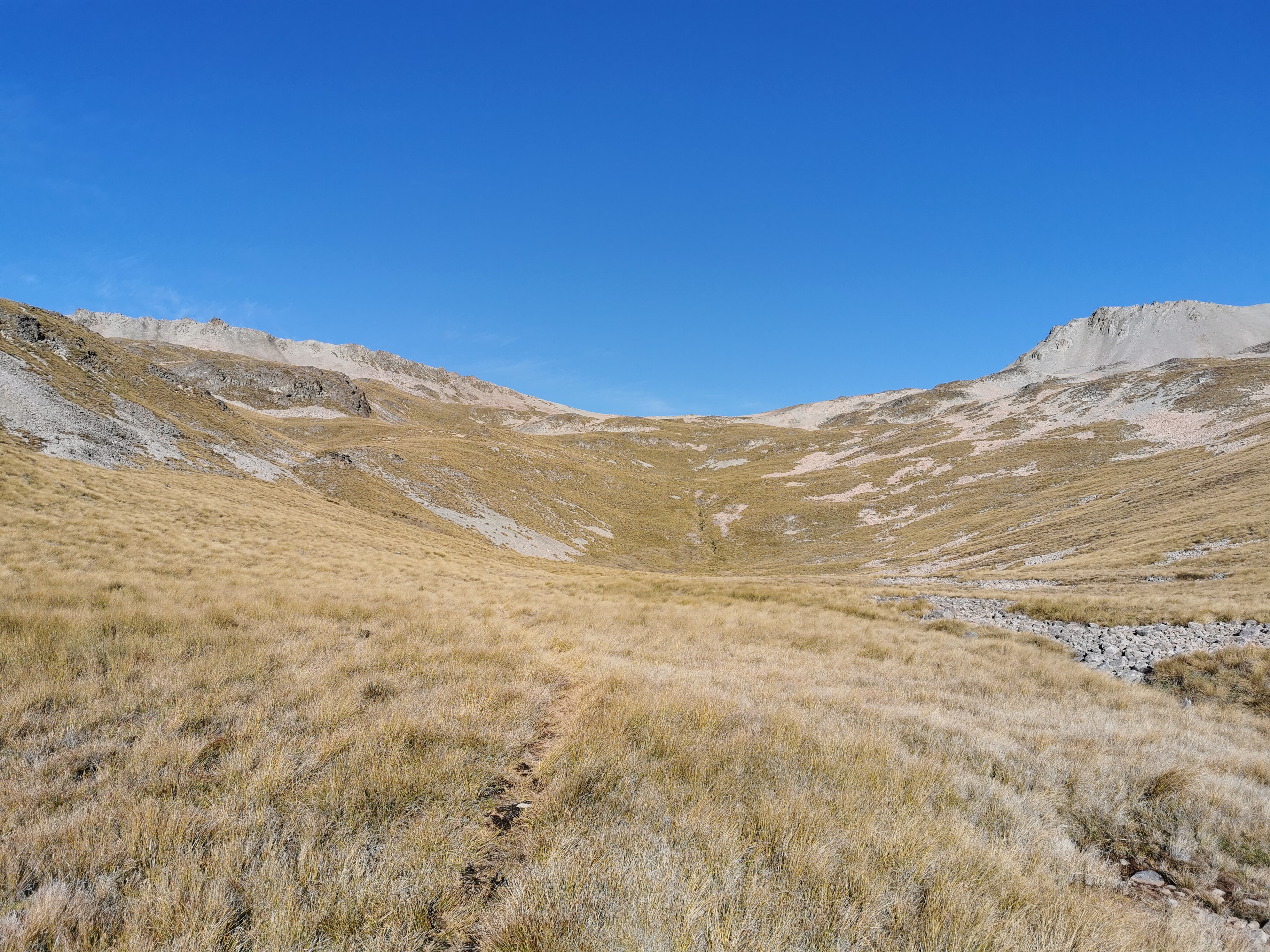
Given that this is the highest point on Te Araroa, you might expect it to be really steep, but actually it’s quite gradual compared to most other high points. You might even say it was a leisurely stroll to the top. Okay, I wouldn’t go that far.
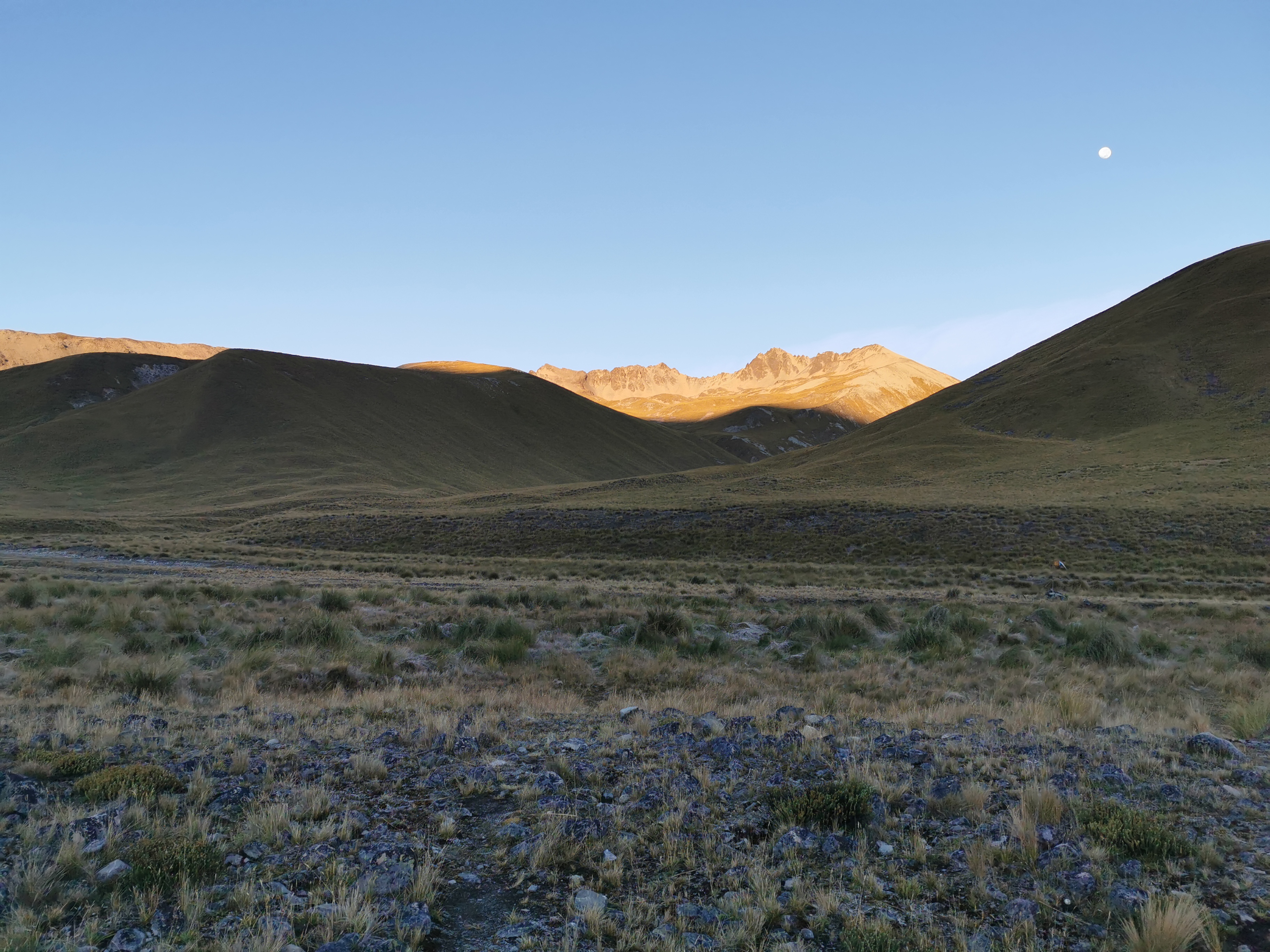
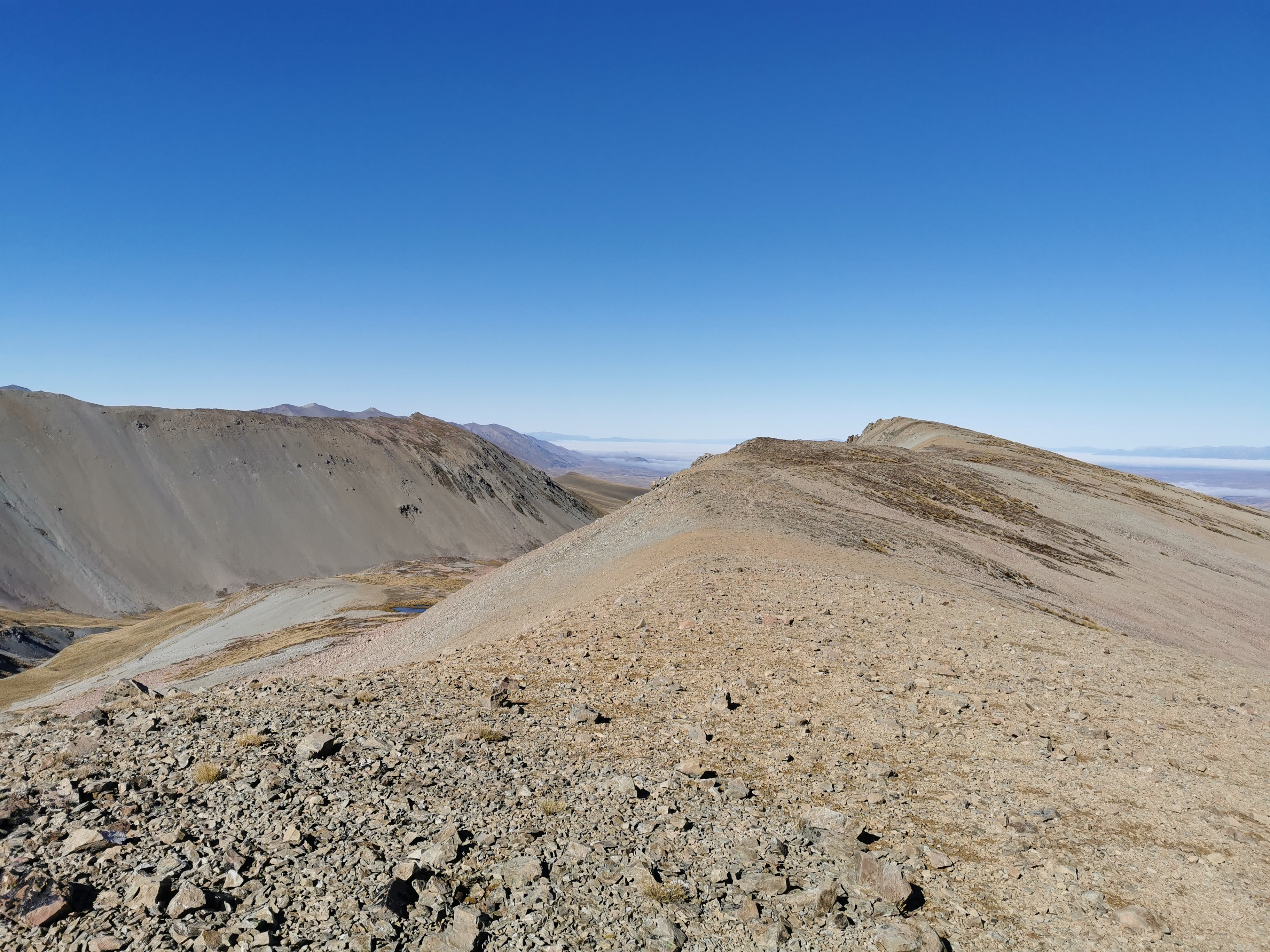
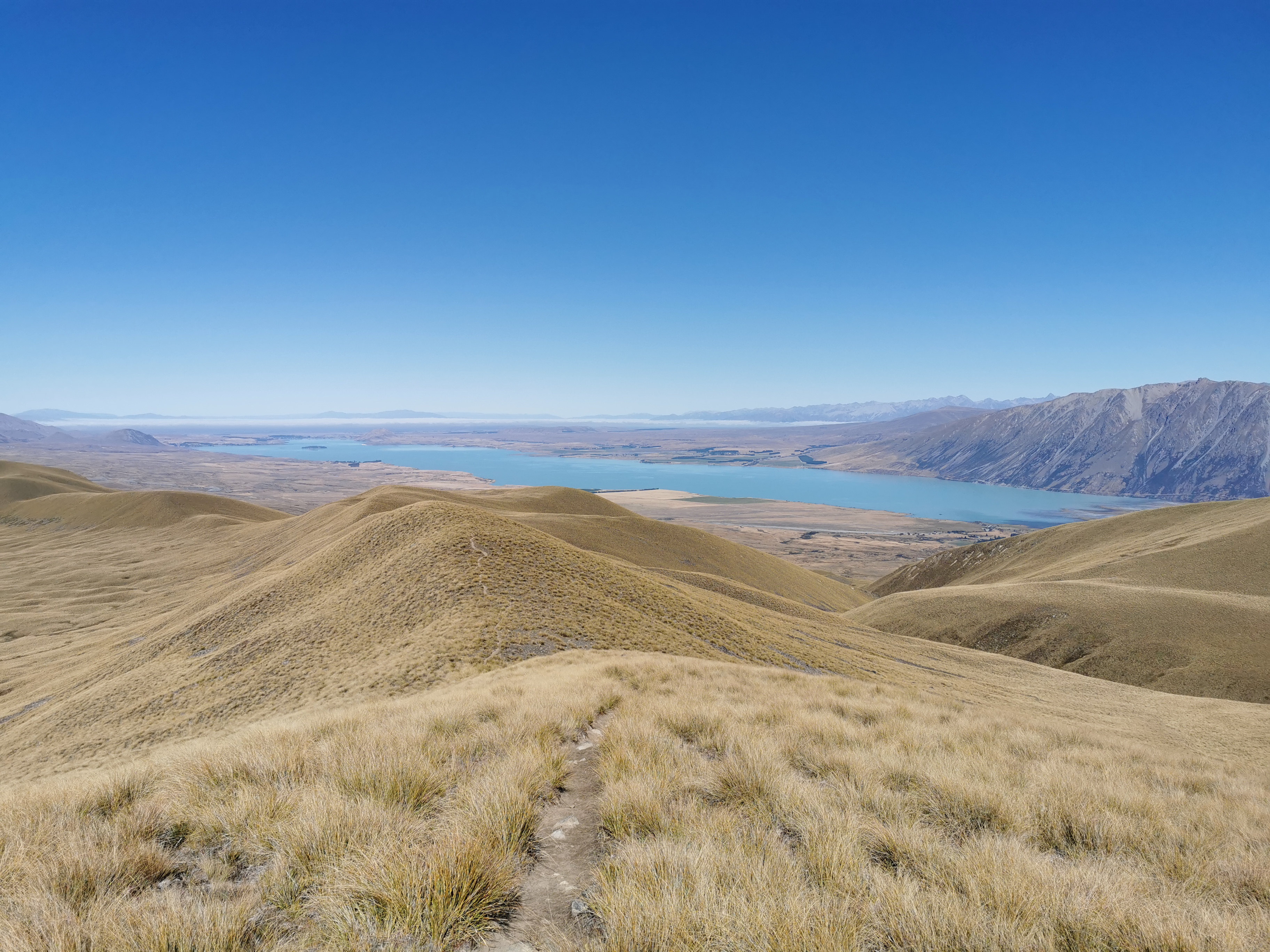
At the top, like at the top of every saddle, I got excited about what the view would be once I reached the top. I had a fair idea this time, it would be Lake Tekapo. Was I right?
Well yes, but the lake had cloud over it, it was a bit of an anti-climax!
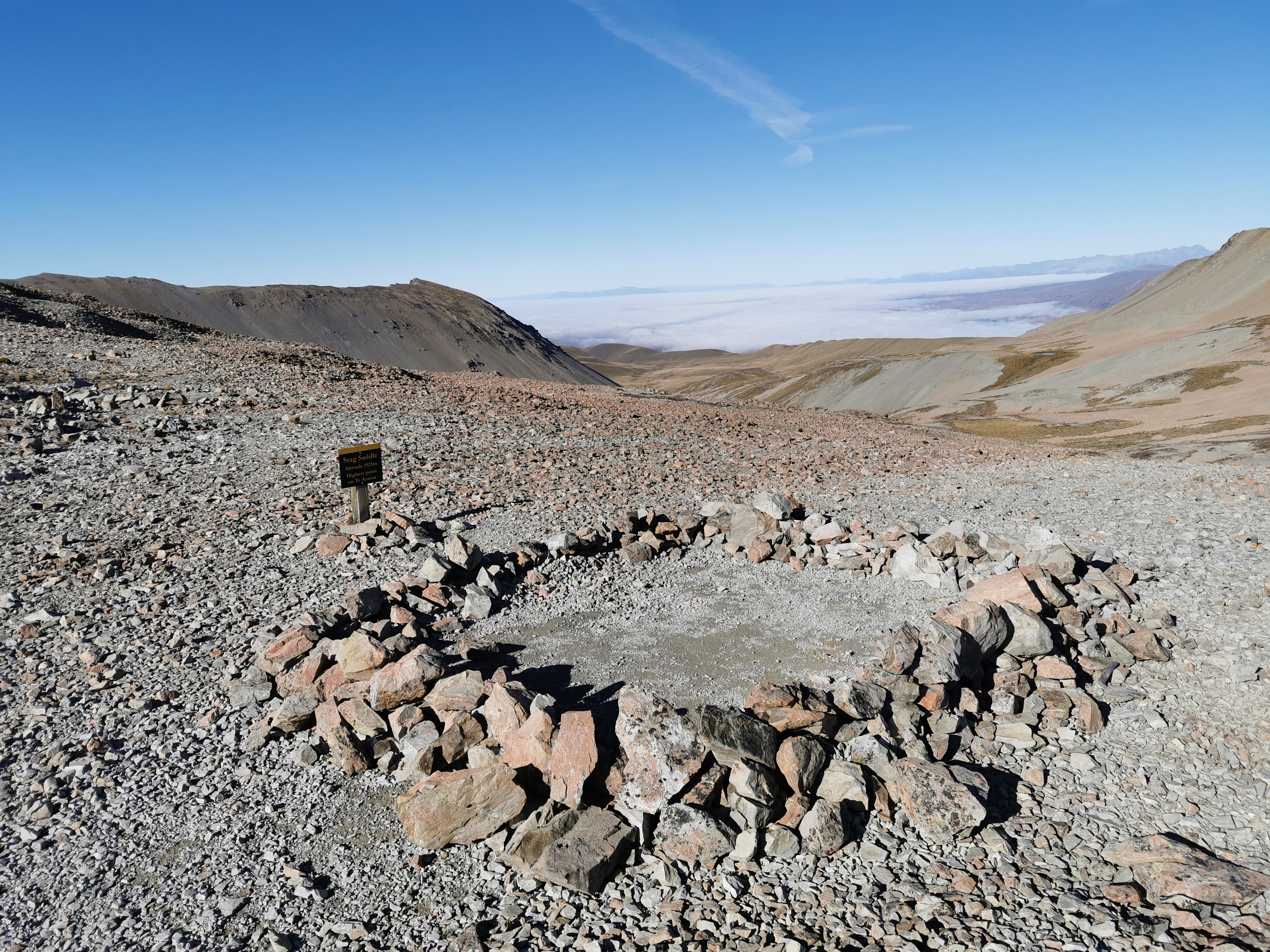
Someone had set up this ring of stones too, presumably to camp inside. I’ve seen a couple of Facebook photos of people camping up here. You’d really have to want to see the sunrise. Otherwise I don’t know why people would brave the cold and the wind. I was happy just seeing the view briefly and moving on.
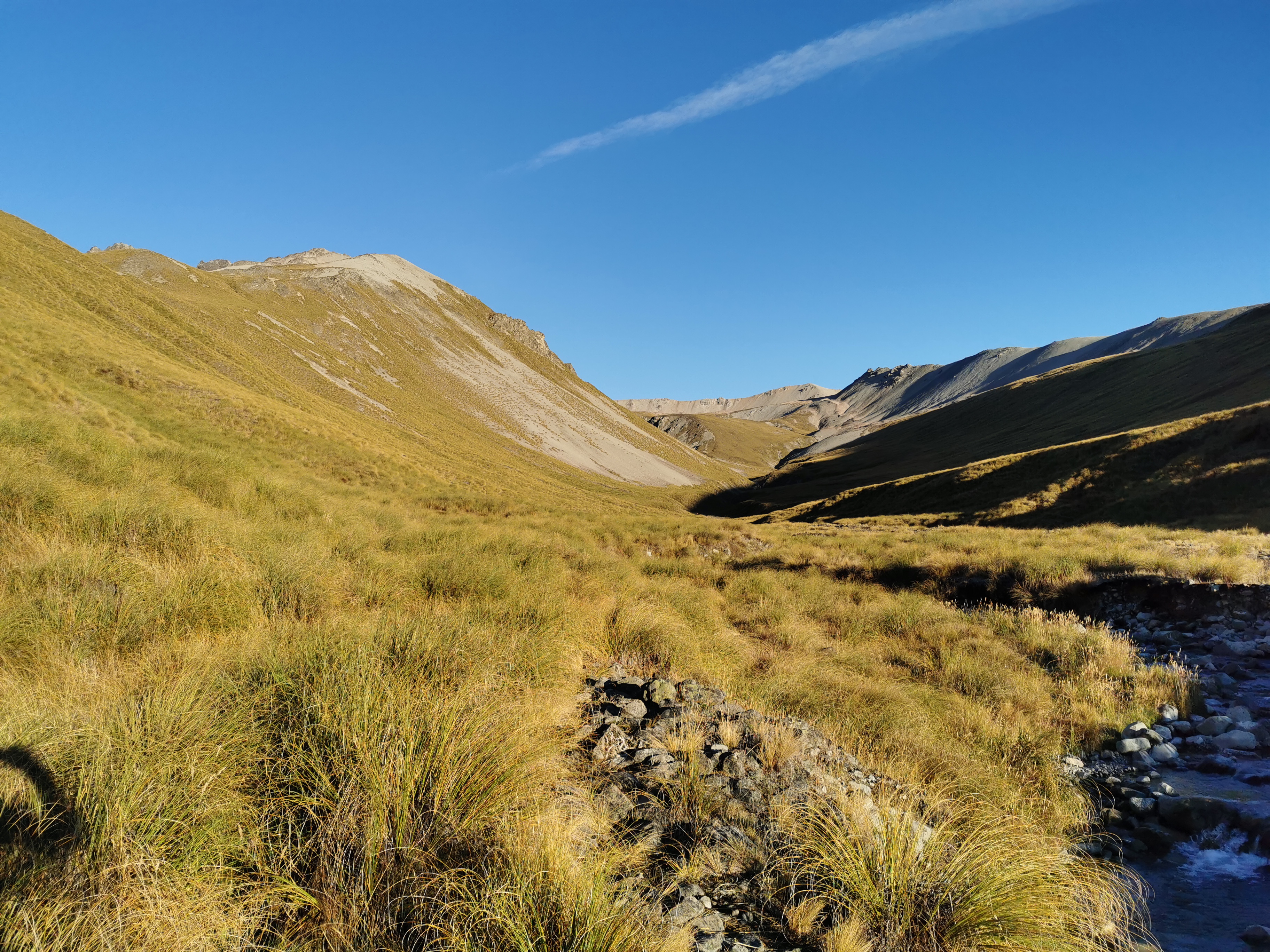
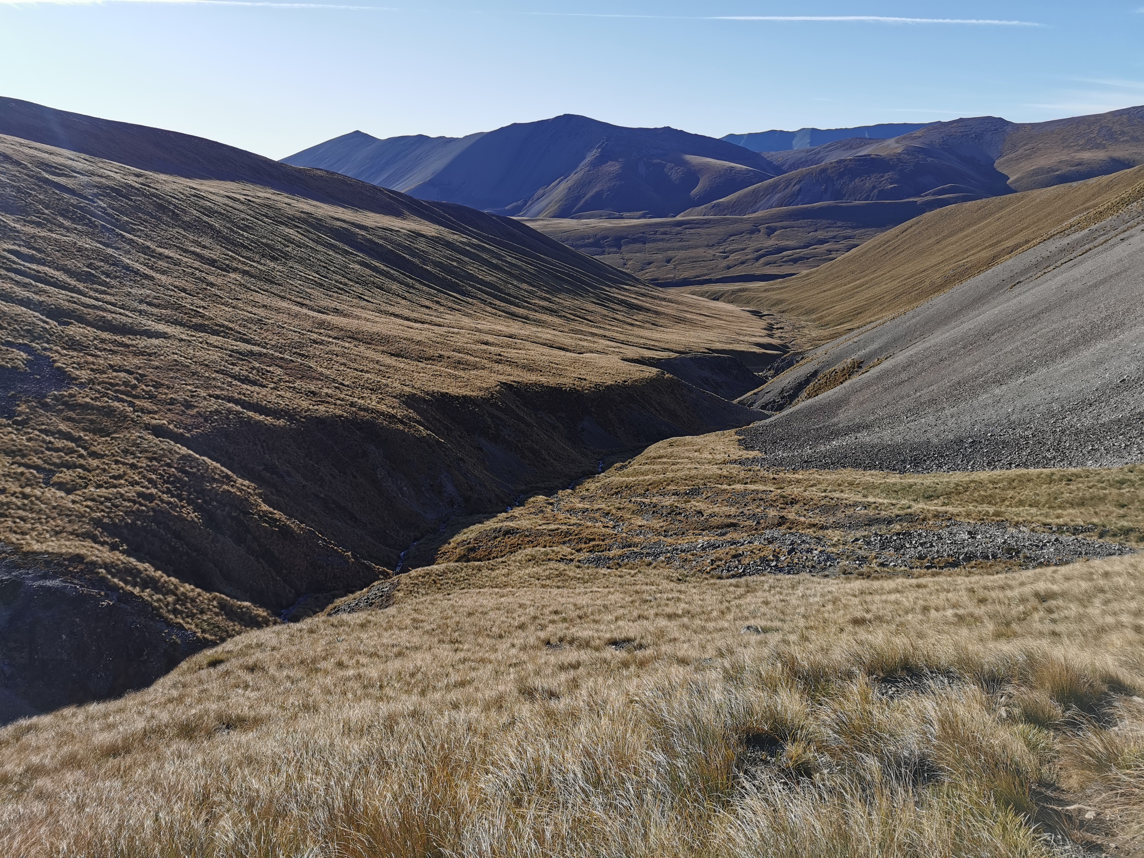
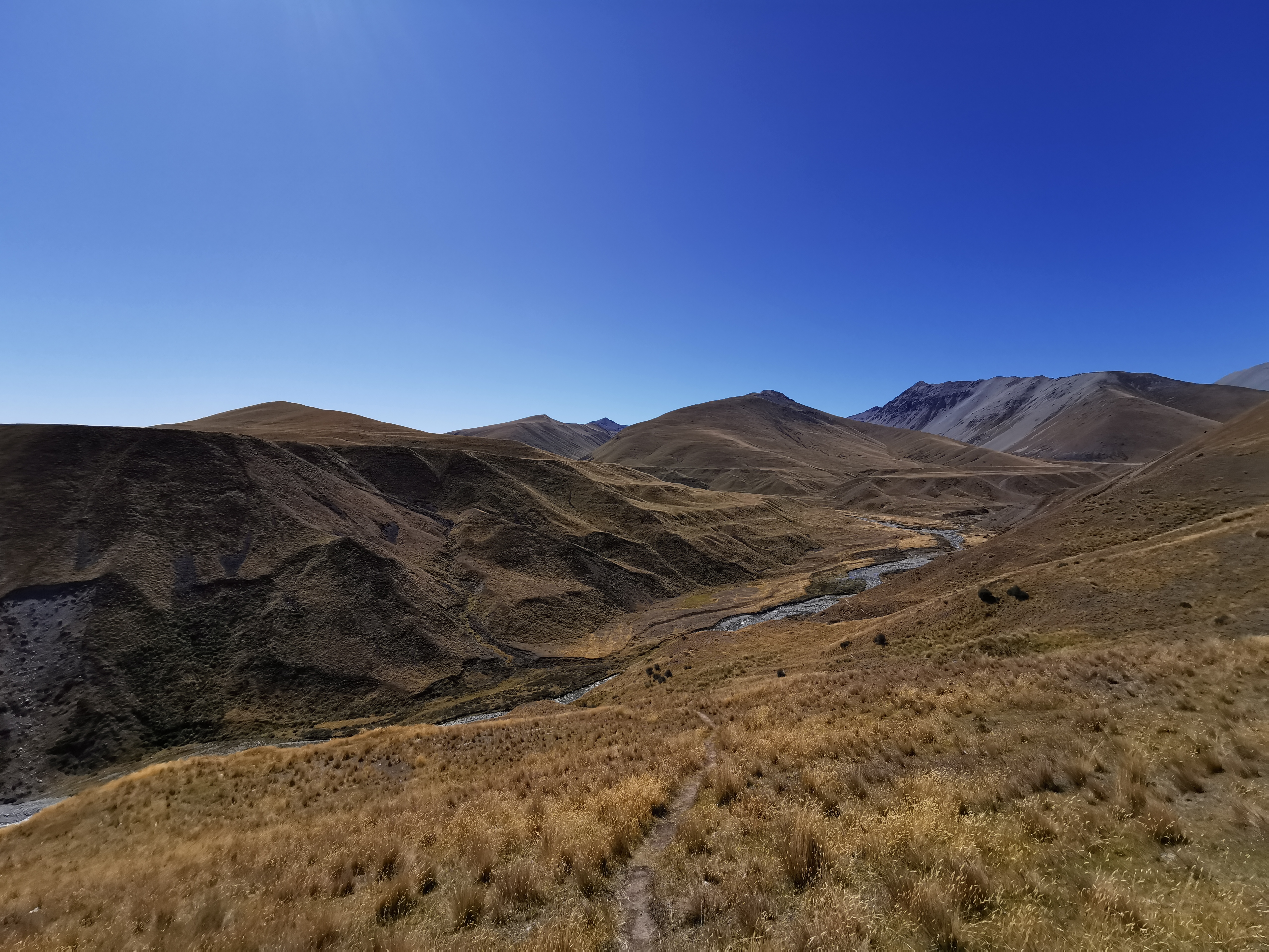
From here, the official trail heads down the valley. But everyone, and I mean everyone, says to take the alternative route down the ridge. It’s not signposted, but apparently it is easy to spot and easy to follow and you have a great view of Mt. Cook. Let’s see if I can find it. Look to the right, and you see this:
The peak on the right there is called Beuzenberg Peak. It’s not easy to tell from the photo unless you zoom in, but there is a path clear as day through the stones. So that’s where I went.
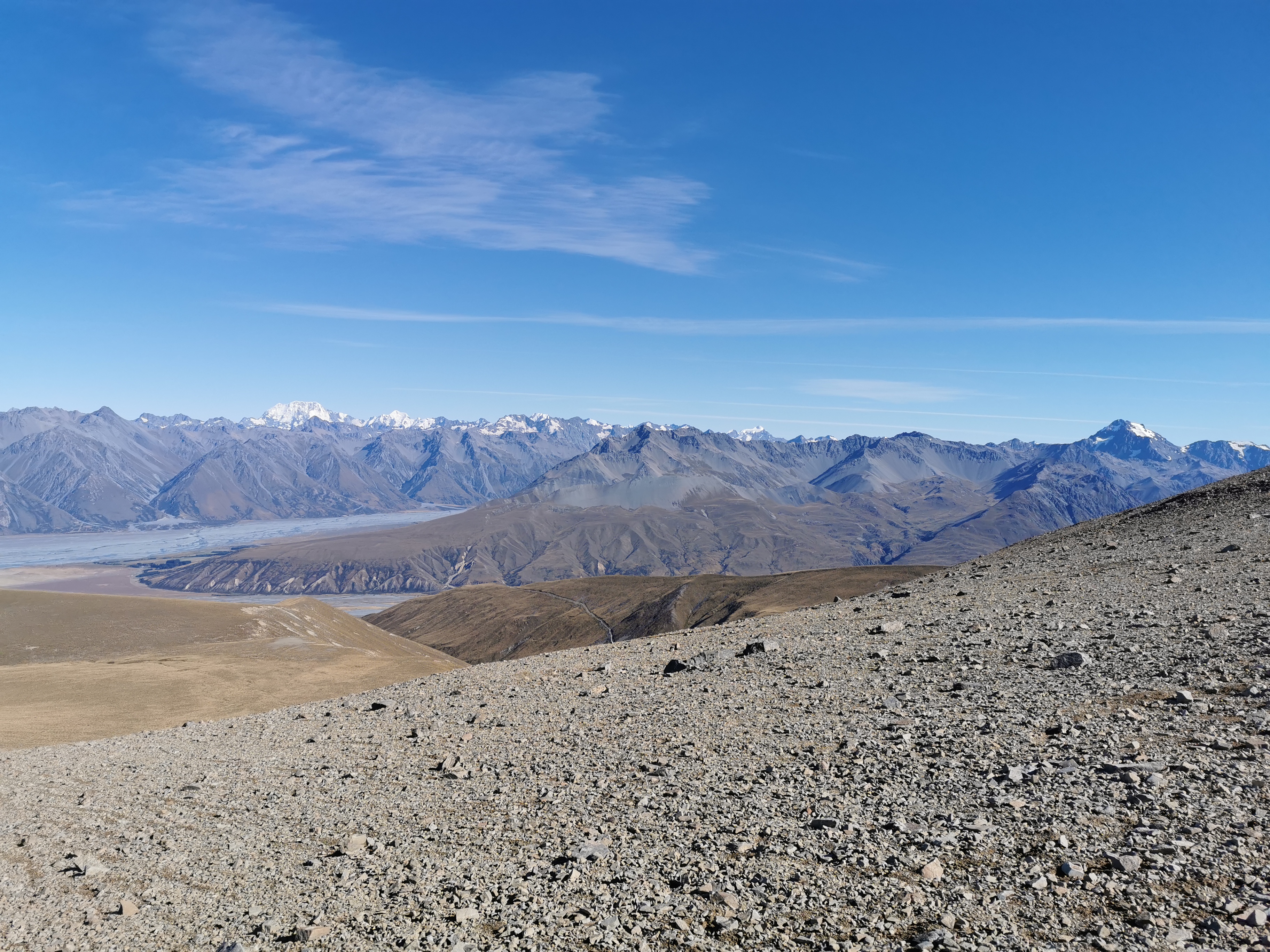
You definitely get a great view going this way, as you can see. I knew that one of the two peaks in the photo above is Mt. Cook (the highest mountain in New Zealand) but I’m ashamed to say that at first I didn’t know which one it was. Was it the snow-covered one on the left? Or was it the one on the right which looks taller? Common sense told me it is the snow-covered one.
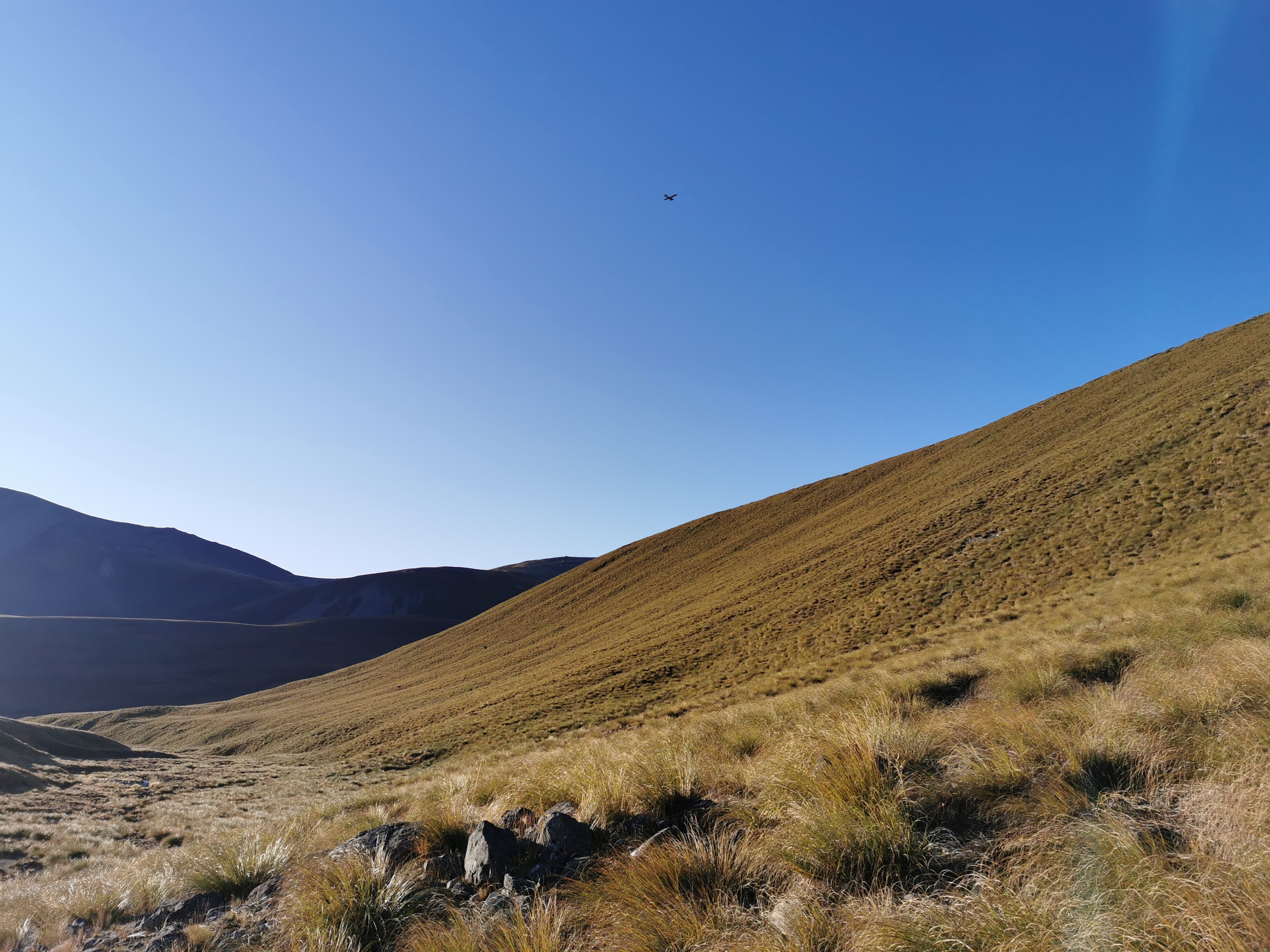
The ridge track was indeed easy to follow. Just walk along the ridge!
My 11am picture has got to be the best one yet.
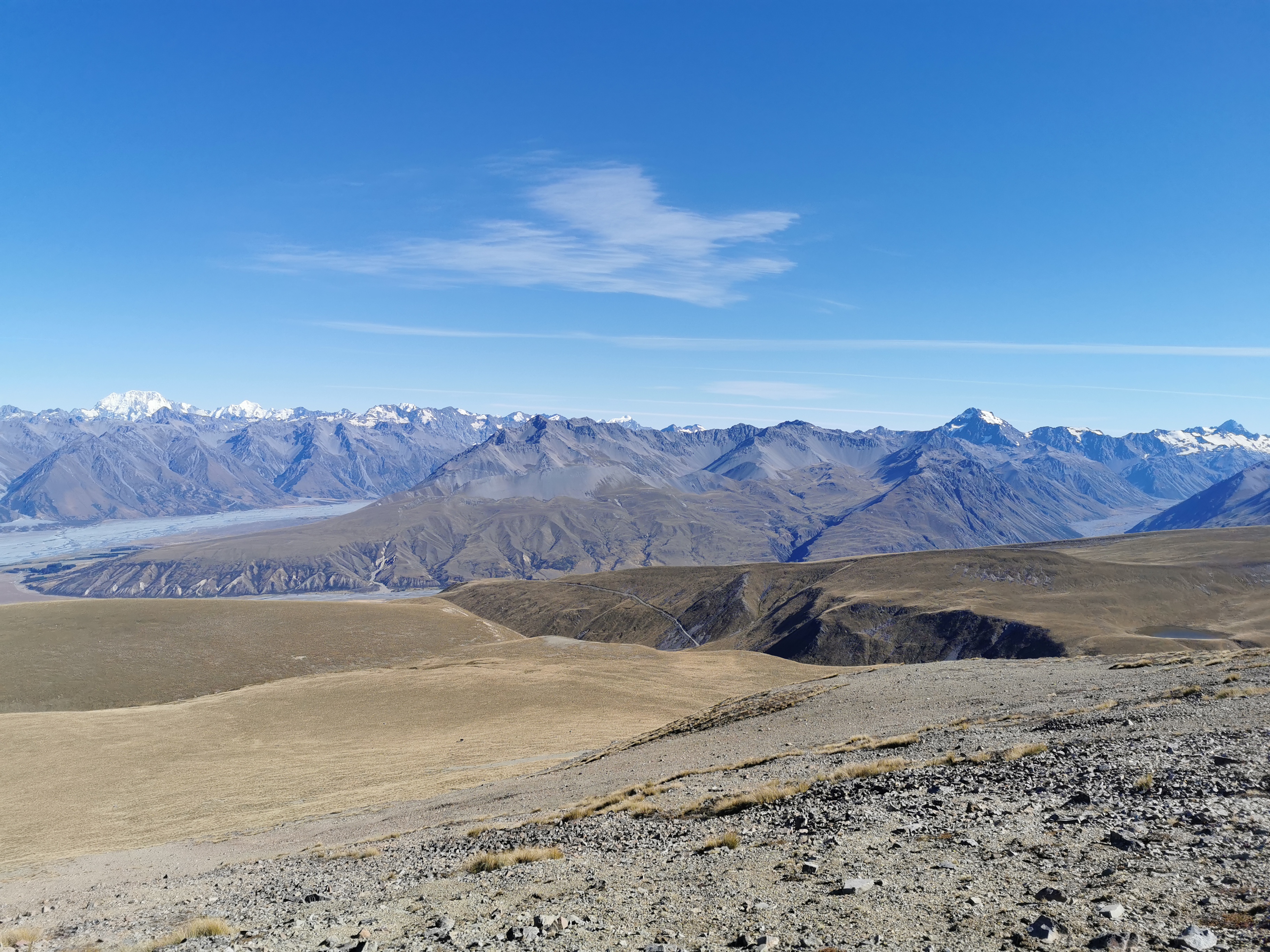
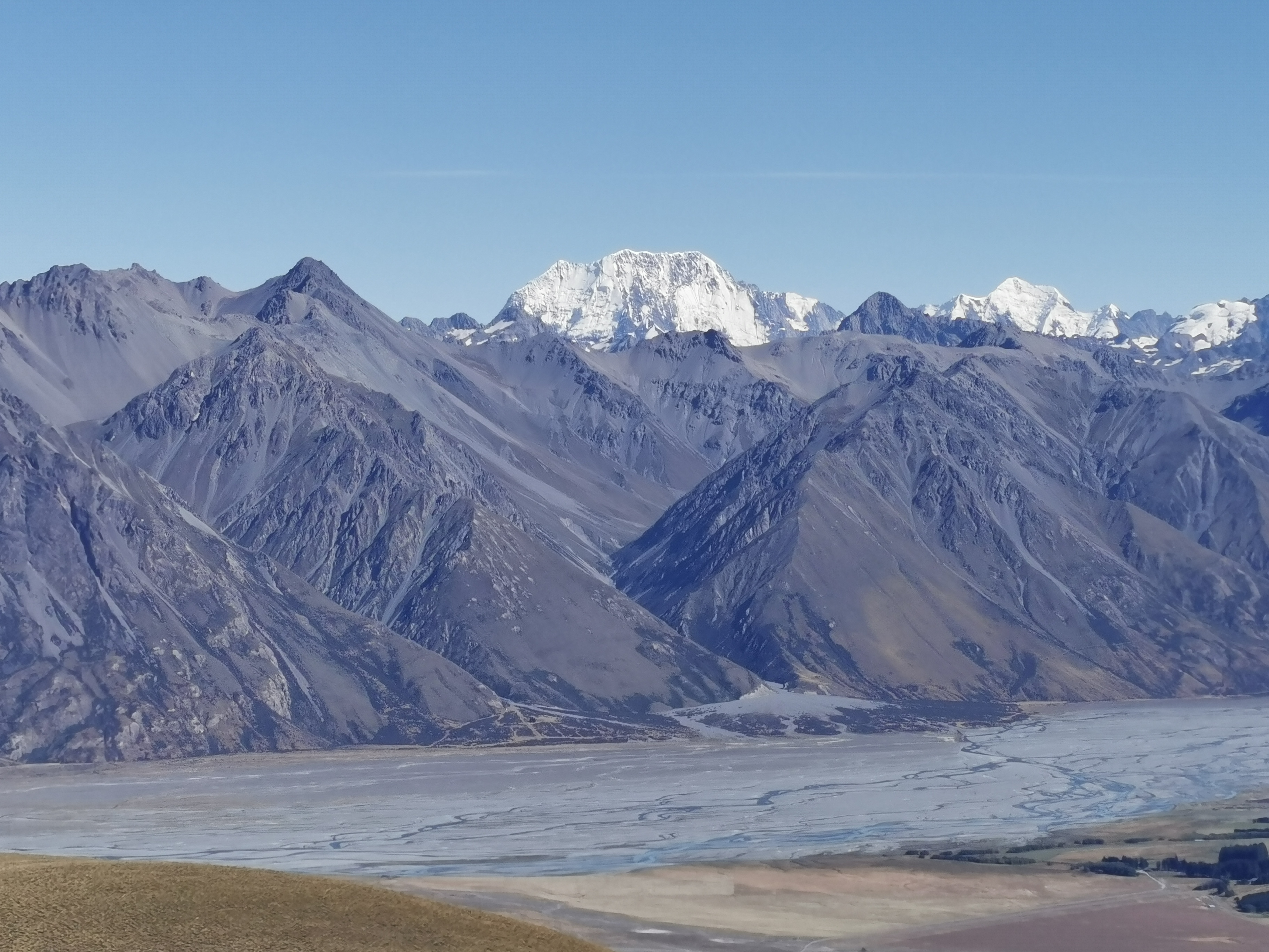
It’s a similar view to the one before, however this time at a slightly different angle it was clear that the peak on the right is much closer and so clearly isn’t Mt. Cook. Here is Mt. Cook, zoomed in:
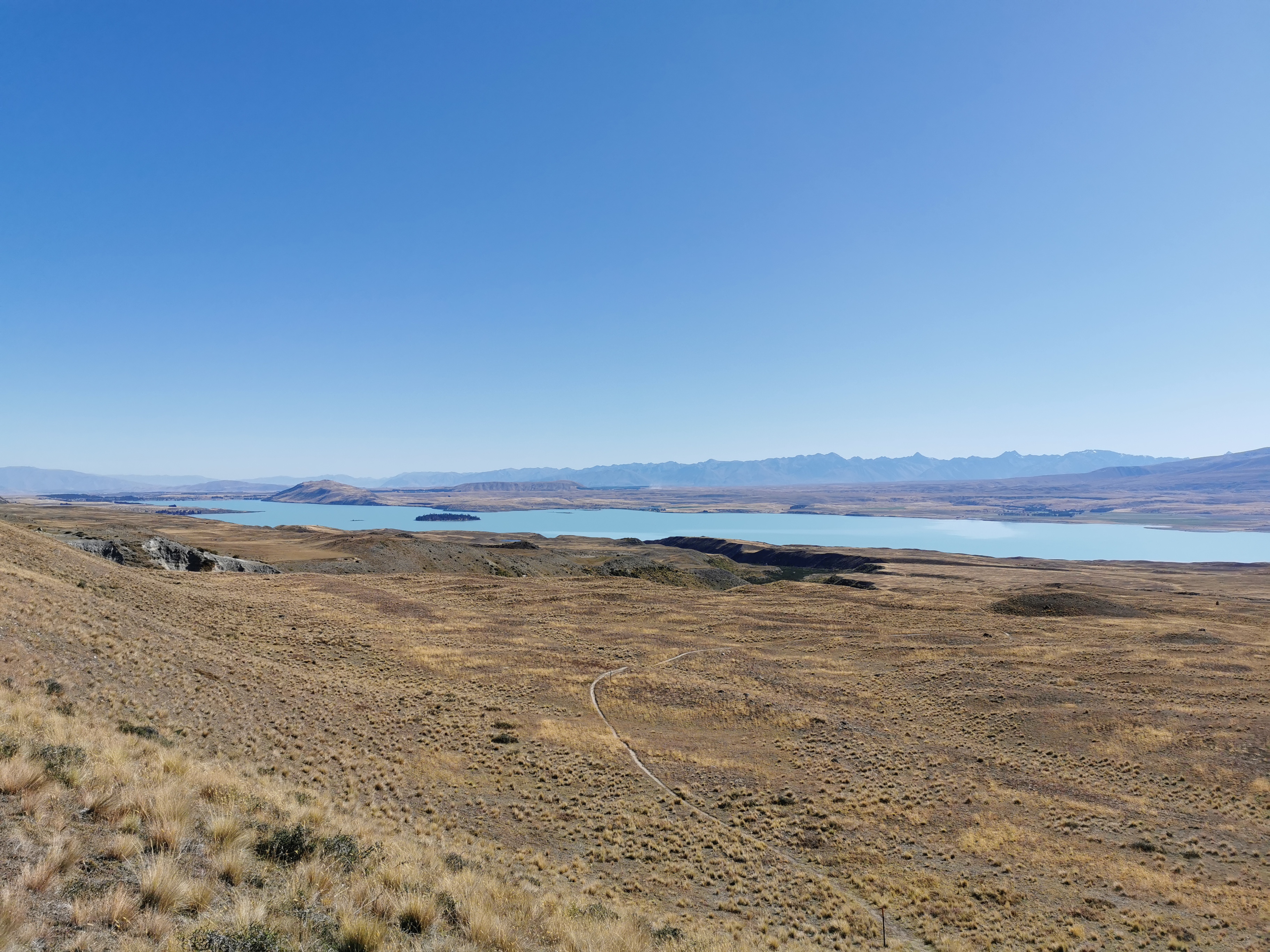
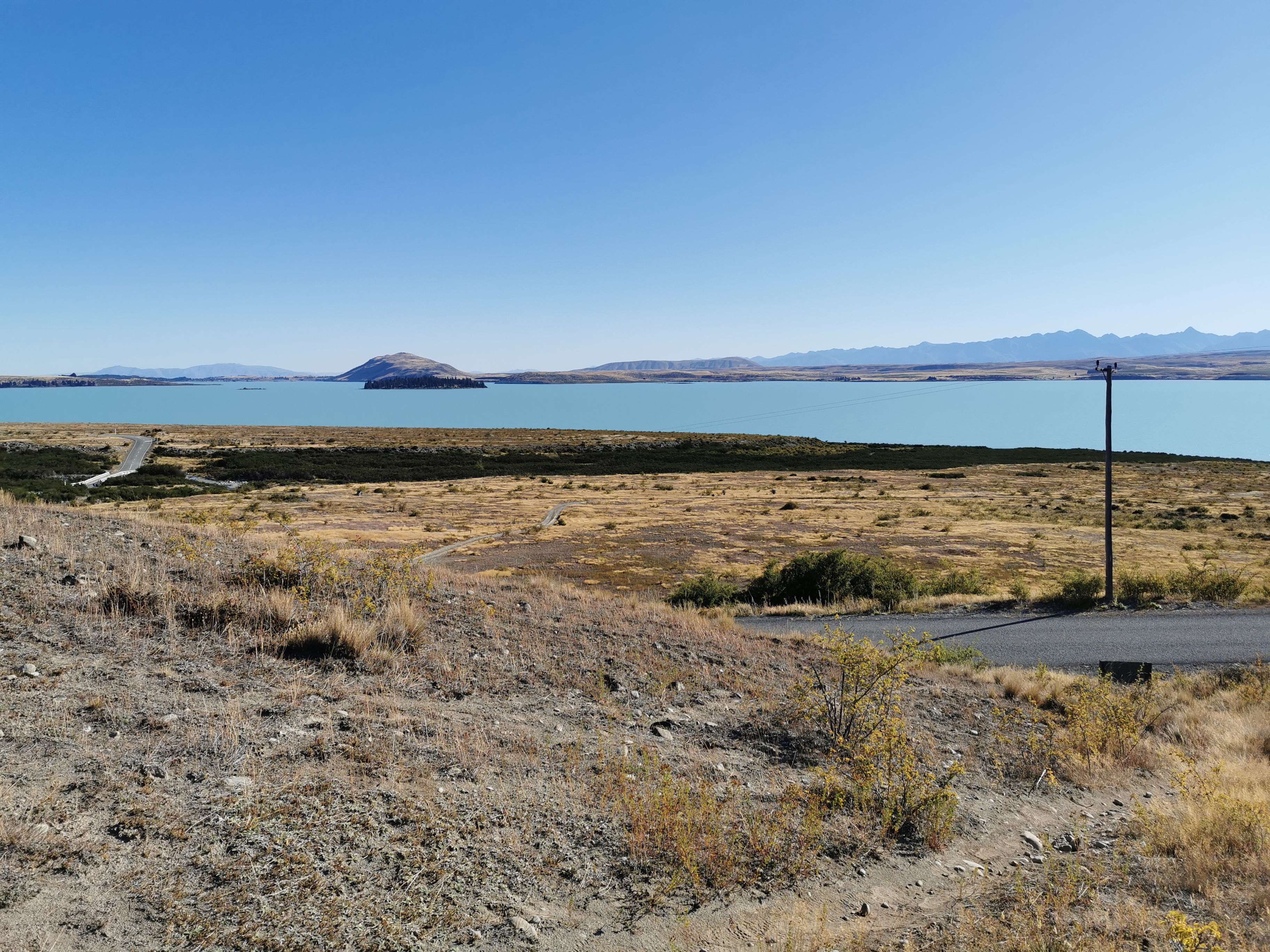
And the clouds down on Lake Tekapo vanished into the distance, so I got to see that too! The town of Lake Tekapo is right at the other end of the lake.
While I was up here, there was phone coverage. In fact, there is phone coverage most of the way from here down to the bottom. I used this time to call the Tekapo Holiday Park. Timo said that they don’t mind you arriving really late as long as you call and book in beforehand. So that’s what I did. That means I’m now committed to walking as far as Tekapo tonight, but my legs were feeling really good and I was making good time so I was okay with it.
If you call the holiday park beforehand and make a booking, they will leave a little pack with a map and your key (if required) outside reception in a little white box. I think it’s really good that they offer this service.
So now I know my ultimate destination tonight. But the question now is, can I make it to town in time to buy a nice dinner? I looked on Google Maps. There’s a place called Blue Lake Restaurant which closes at 10pm. If I walk fast I should get to Tekapo between 8:30 and 9:30 tonight so let’s go.
The ridgeline track gets a bit harder to follow once you get down a bit, but there is a sign.
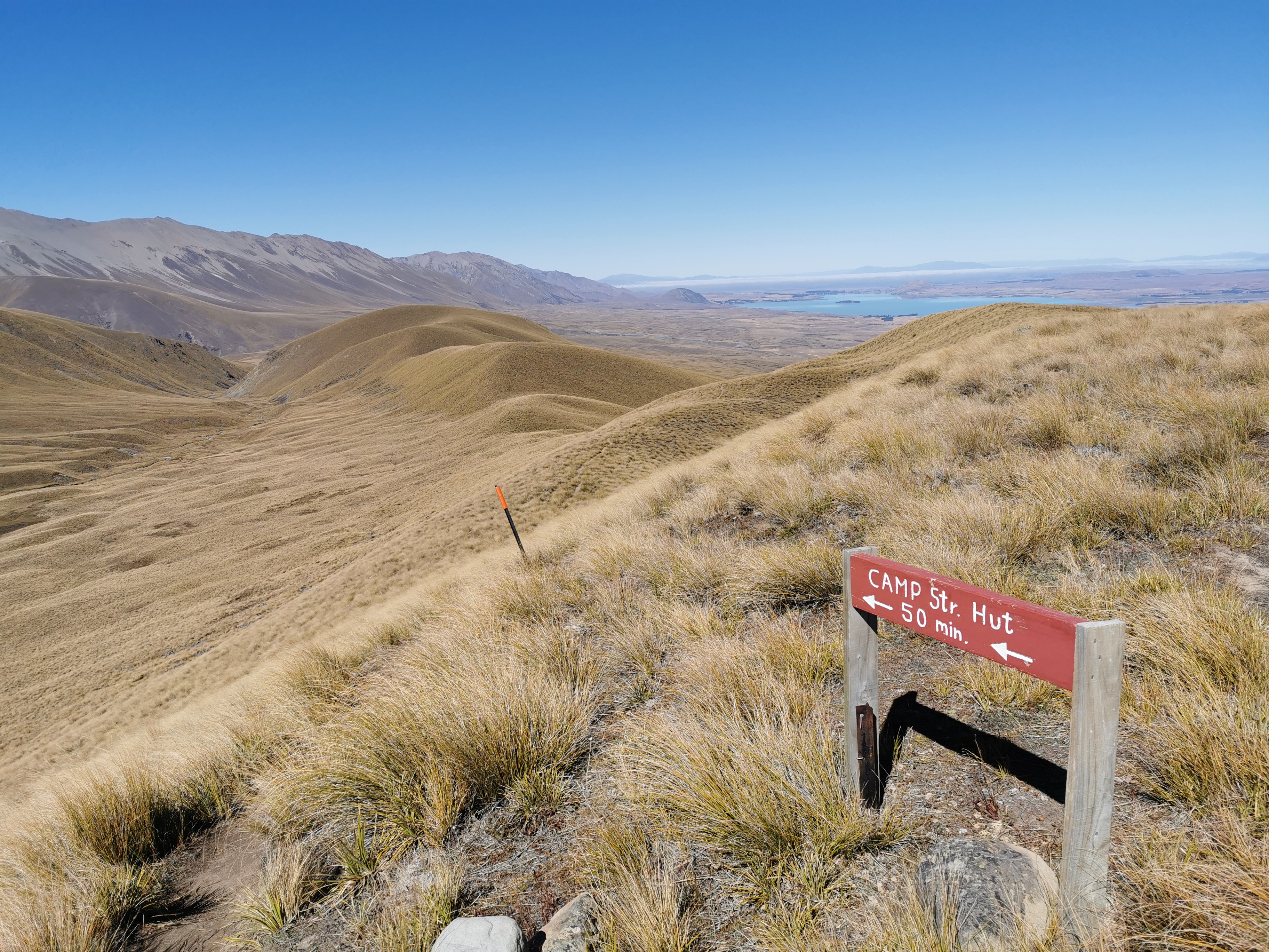
That’s clearly not a DOC sign because 1. it doesn’t look like one and 2. the time on it was surprisingly accurate, which it never is on DOC signs normally. From here it took me 53 mins to get to Camp Stream Hut, just a bit longer than the 50 minutes written on the sign.
It would be much harder to find the ridge track if you were going northbound. If you’re going north, when you see this sign:
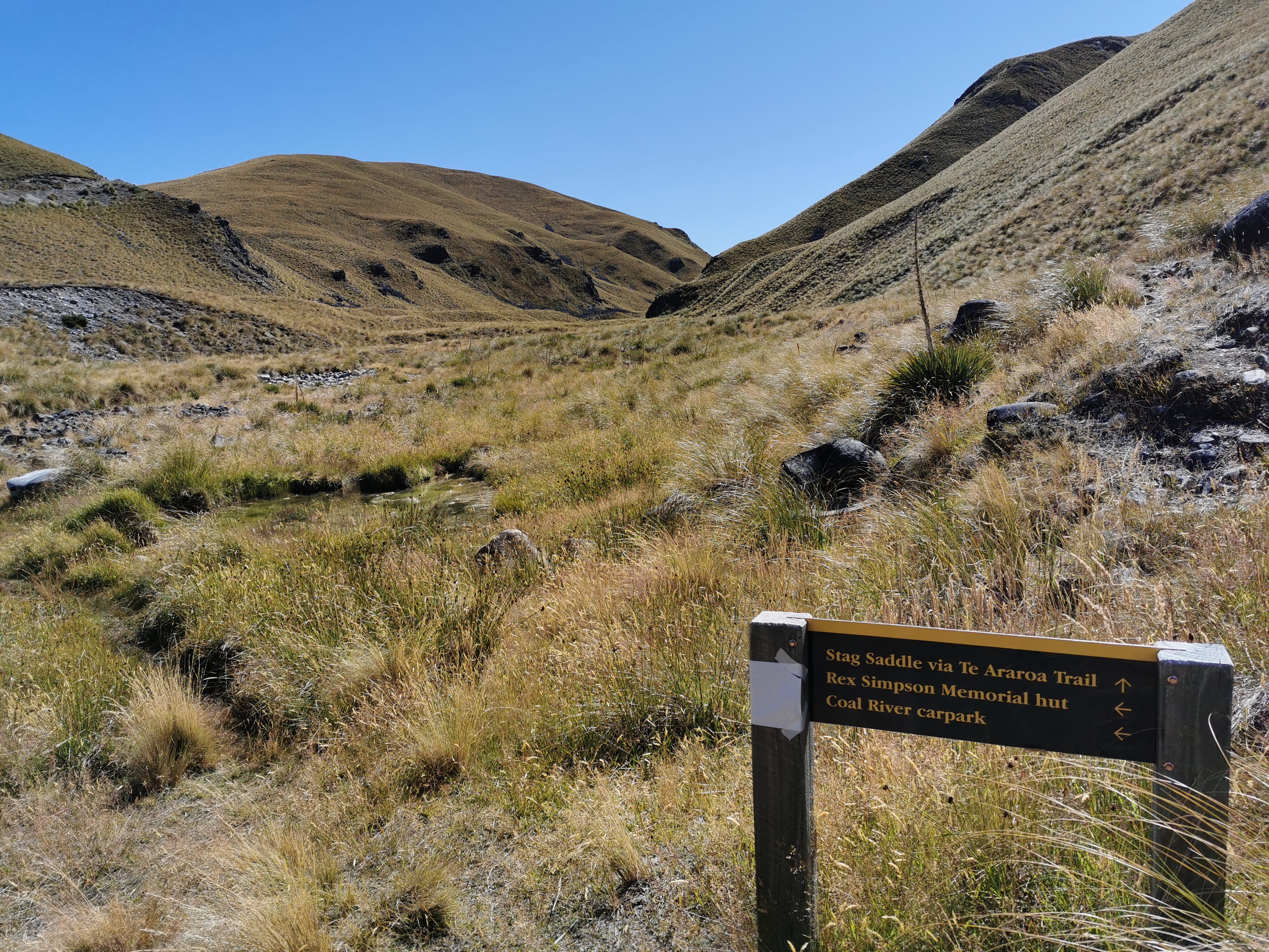
Go left towards Rex Simpson Hut, and up this 4WD track:
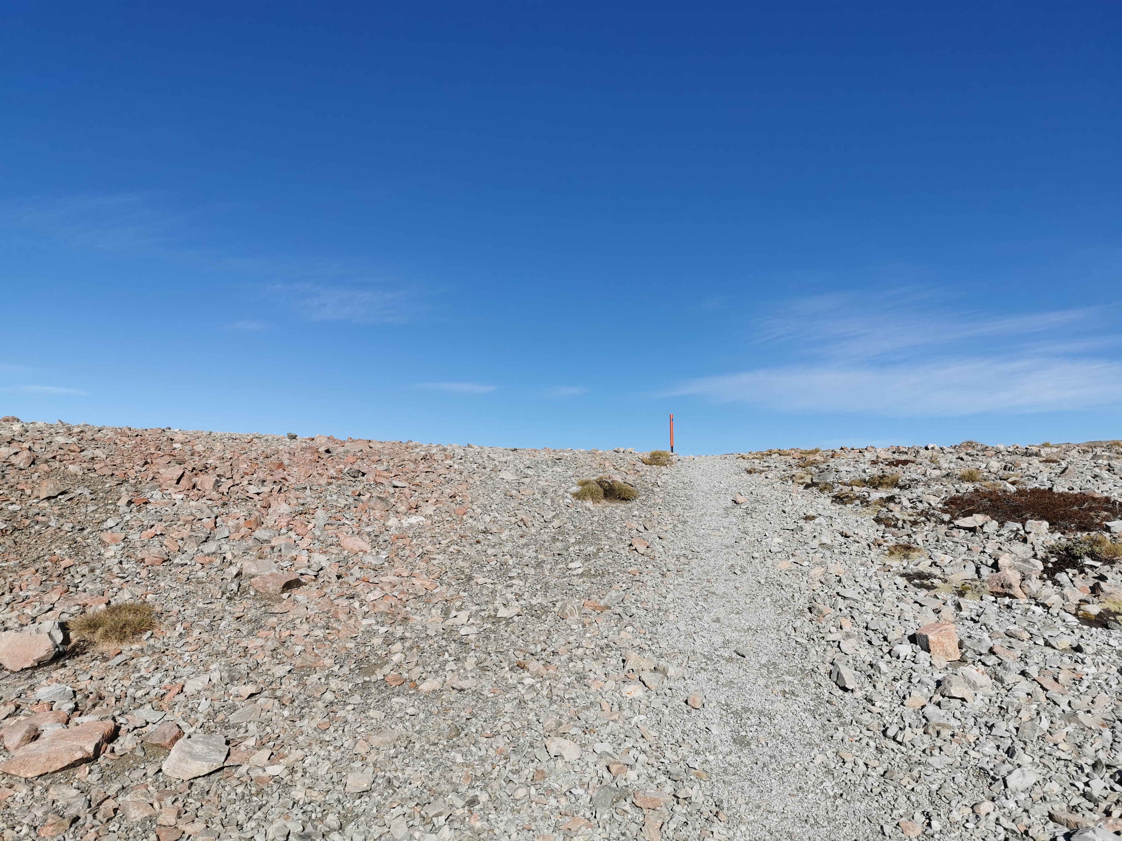
When you go up the hill and around the corner, you’ll come to this orange marker:
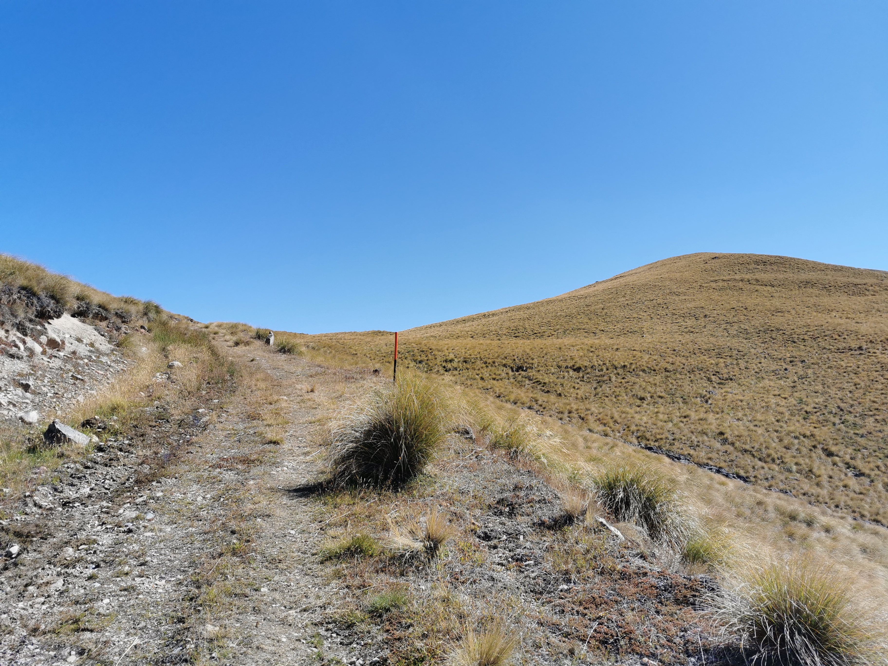
Turn right here and continue up the top of the hill. It should be obvious where to go then.
Here is Camp Stream Hut.
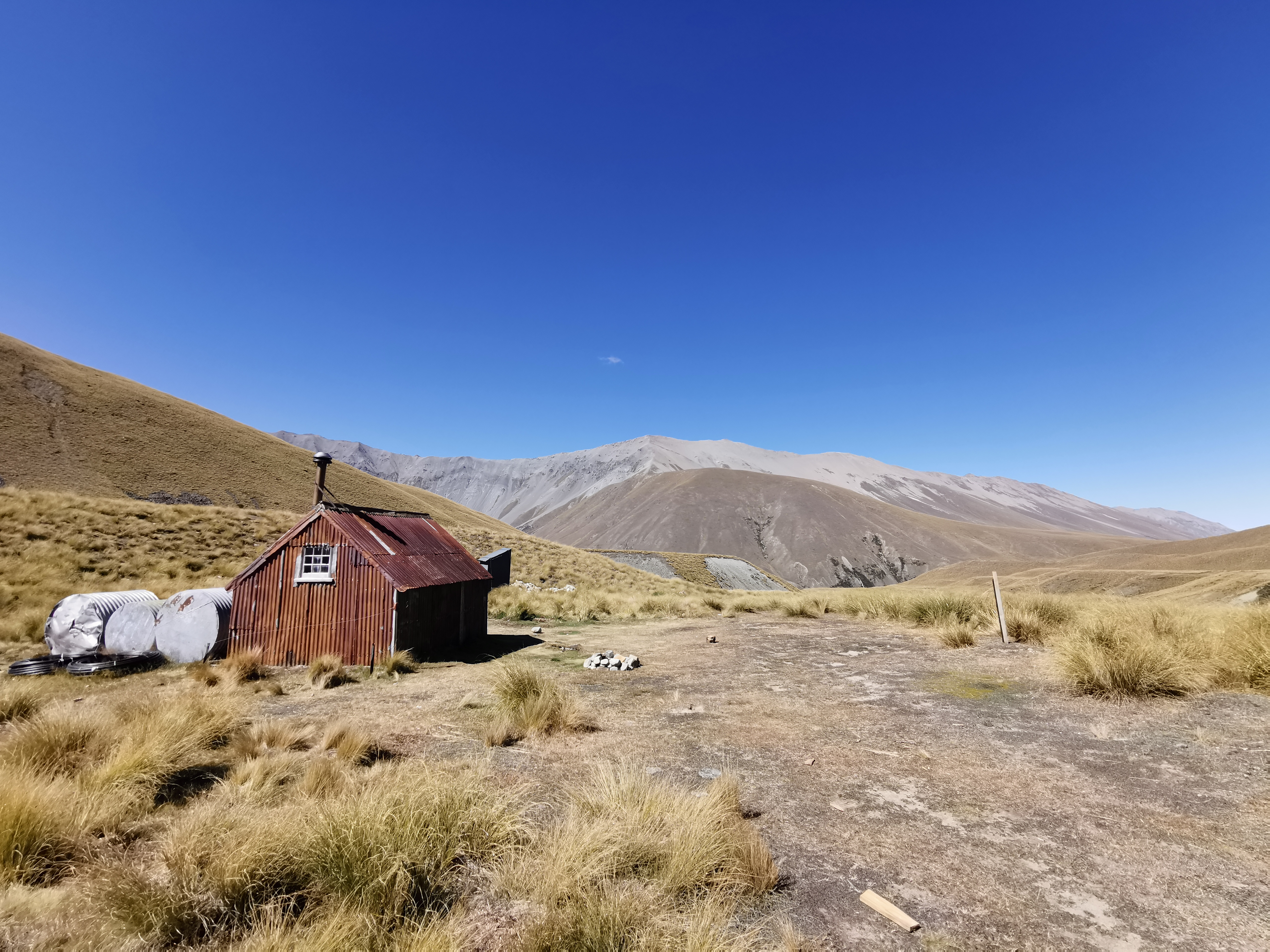
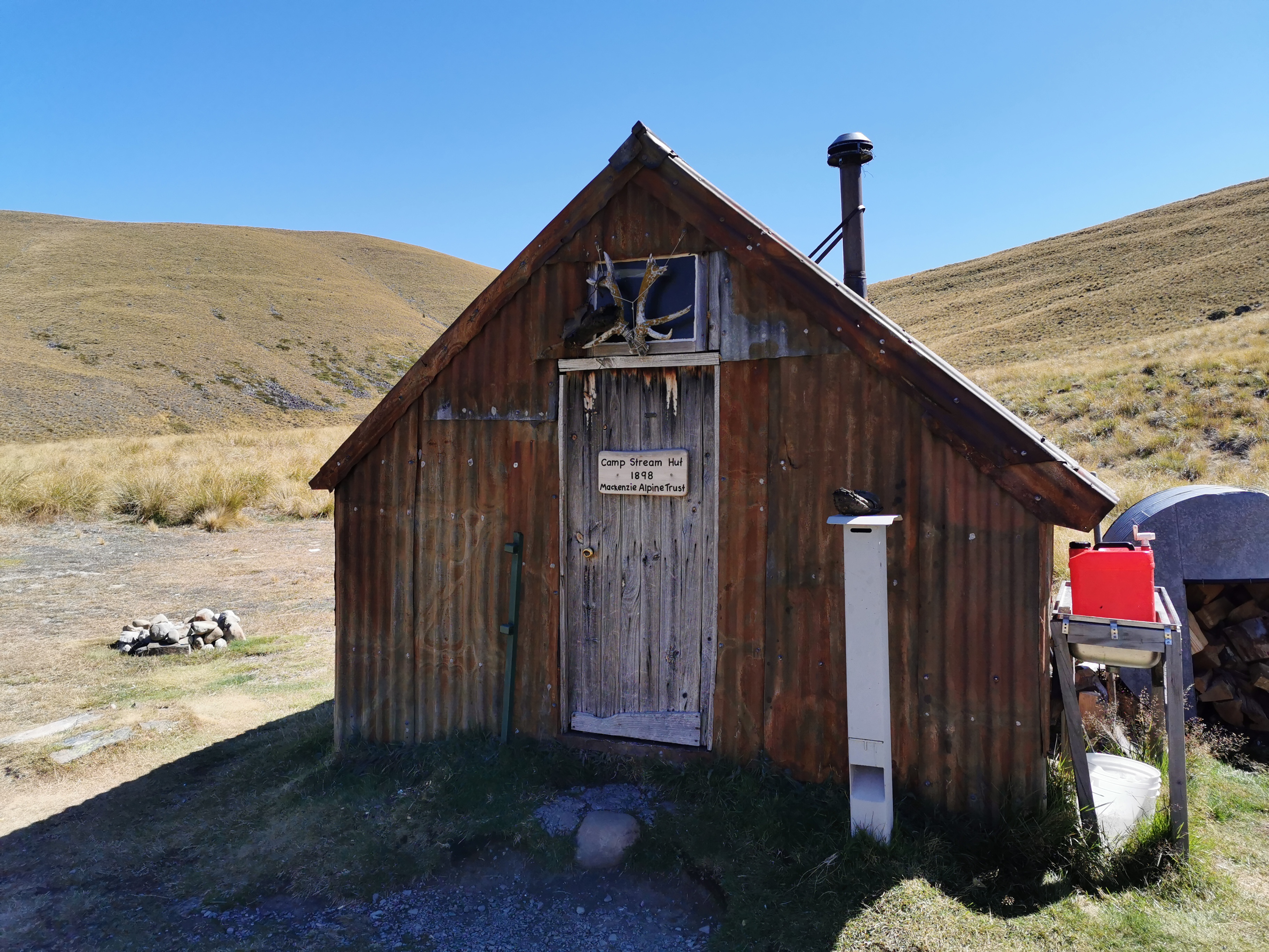

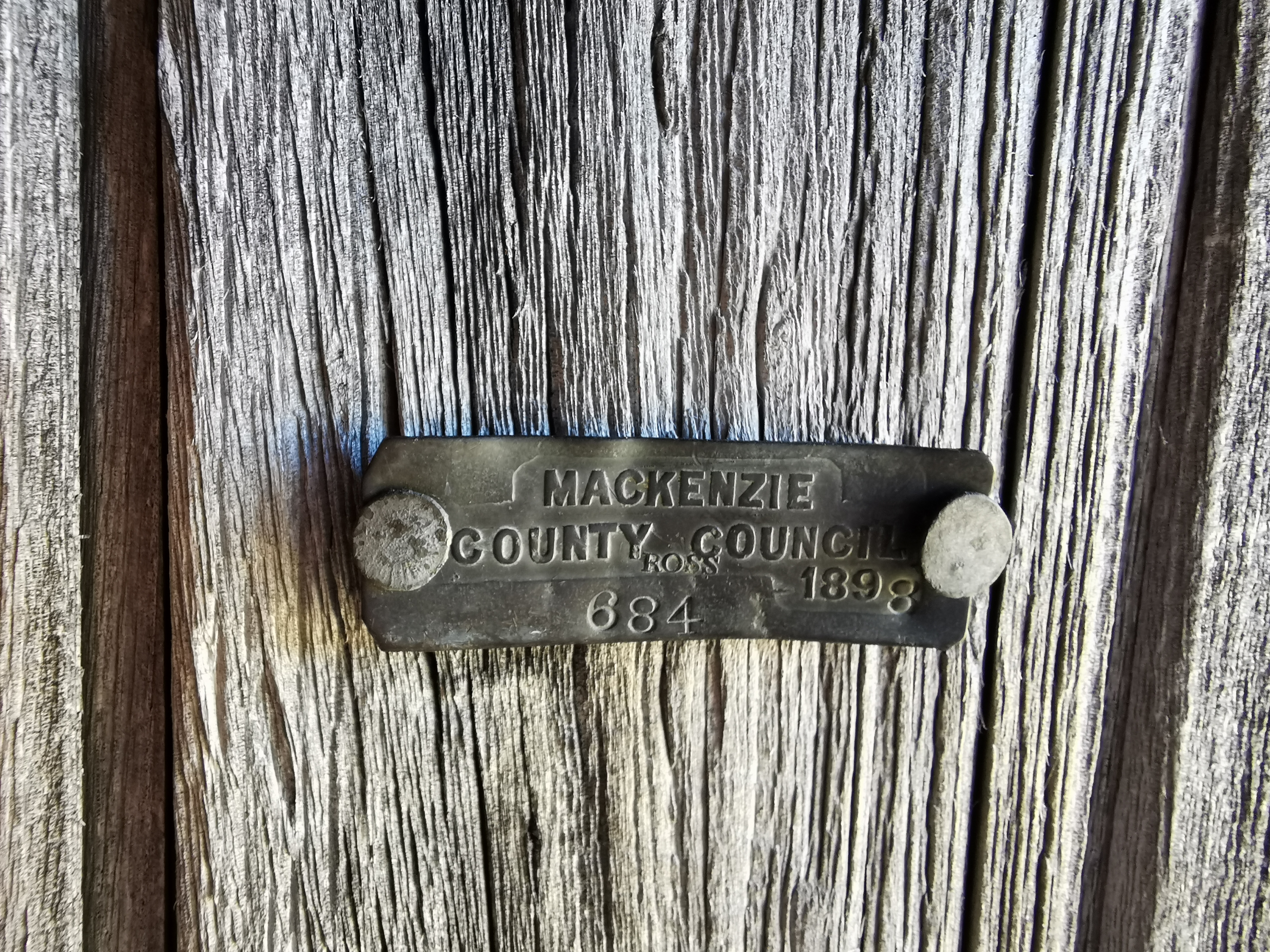
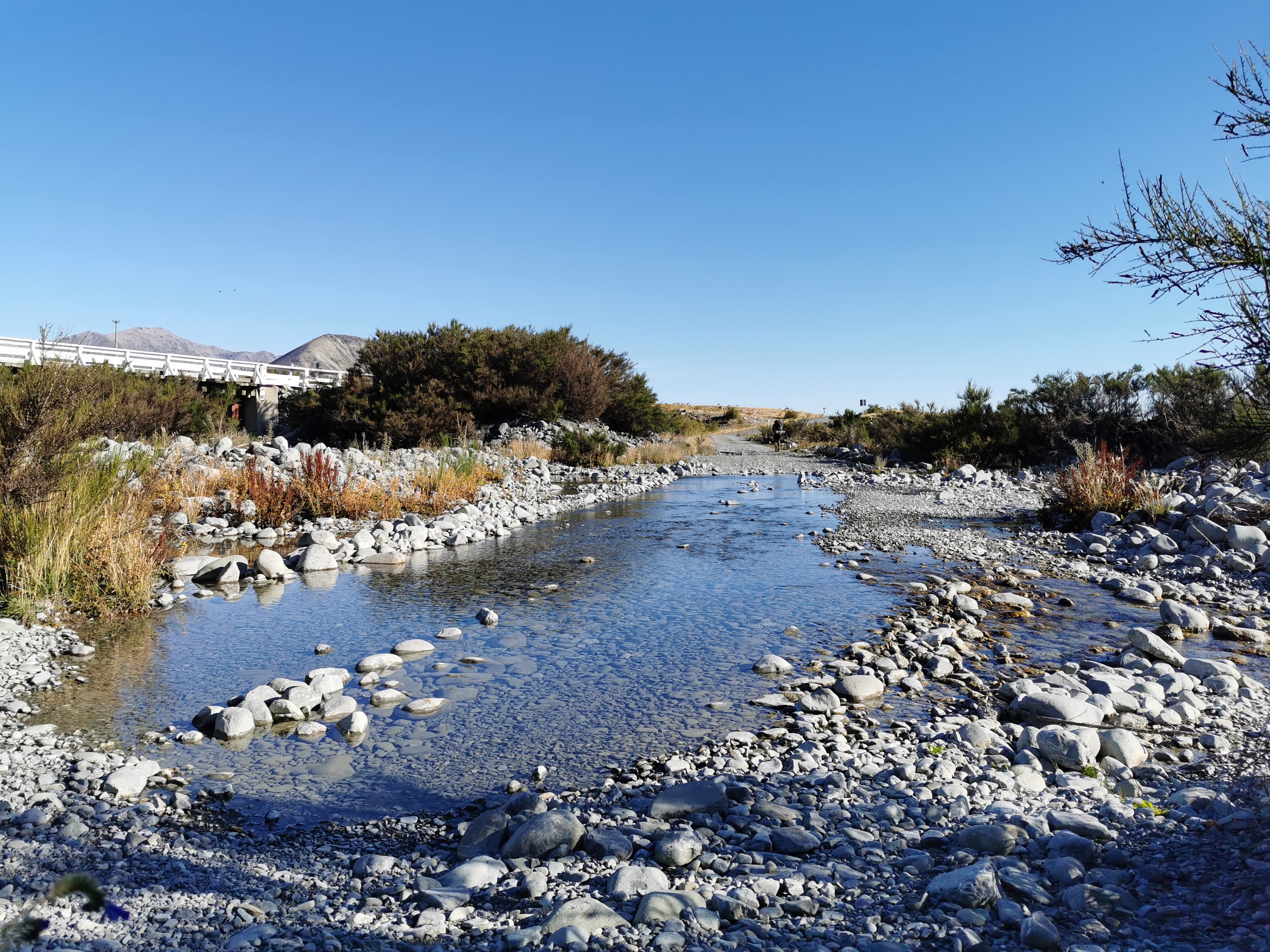
It’s a private hut run by Mackenzie Alpine Trust. They ask for a $10 donation to stay the night. There is no water near the hut, so fill up at the last stream before you get there.
At this hut, you are halfway down the South Island. The top of the South Island is 1695km and if you assume the bottom to be 3000km then halfway is 2347.5km which is somewhere about here.
I just stopped for a very quick lunch and continued on.
When you get to this point,
The Guthook line makes it look like you have to climb up over this steep hill, but that’s wrong. You’re supposed to follow the river at first. What annoys me more is that people in the Guthook comments have been writing stupid, untrue things like “the hill is 700m in elevation, be prepared”. I don’t know if they’re stupid or it’s their idea of a sick joke, but I wish they wouldn’t. If someone wasn’t good at reading a map and went on that comment alone, they’d climb right up that steep hill and get lost and potentially get hurt. I wish there was an easy way to report people on Guthook for writing this kind of untrue thing.
You do have to climb over the hill, bit not until much further down.
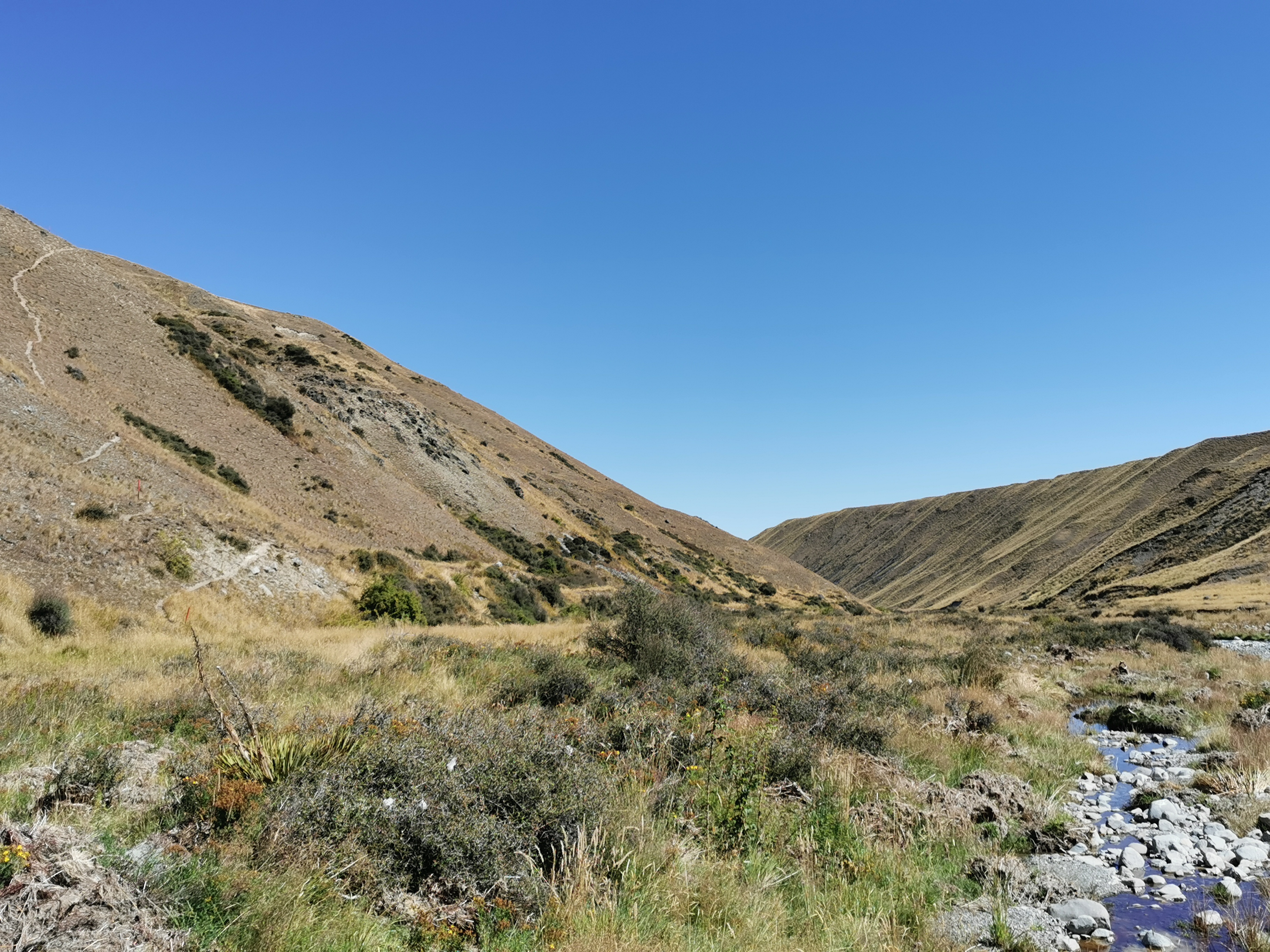
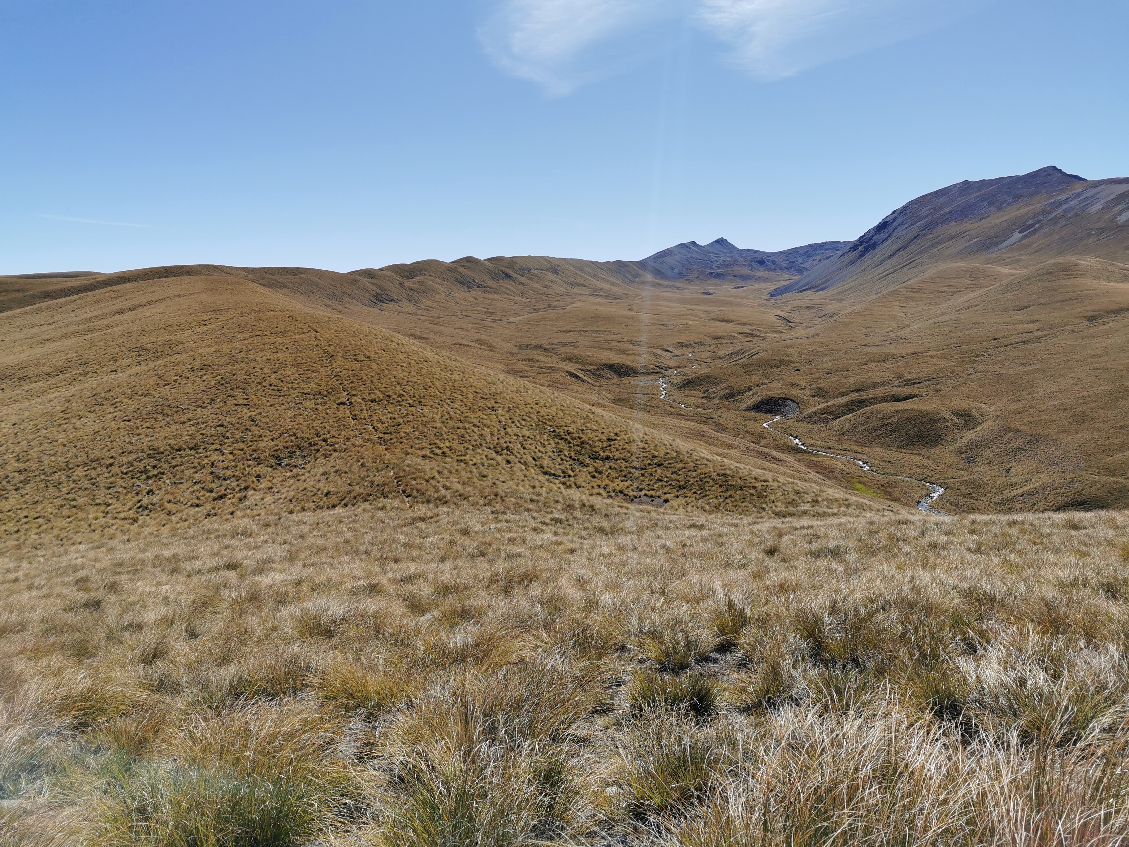
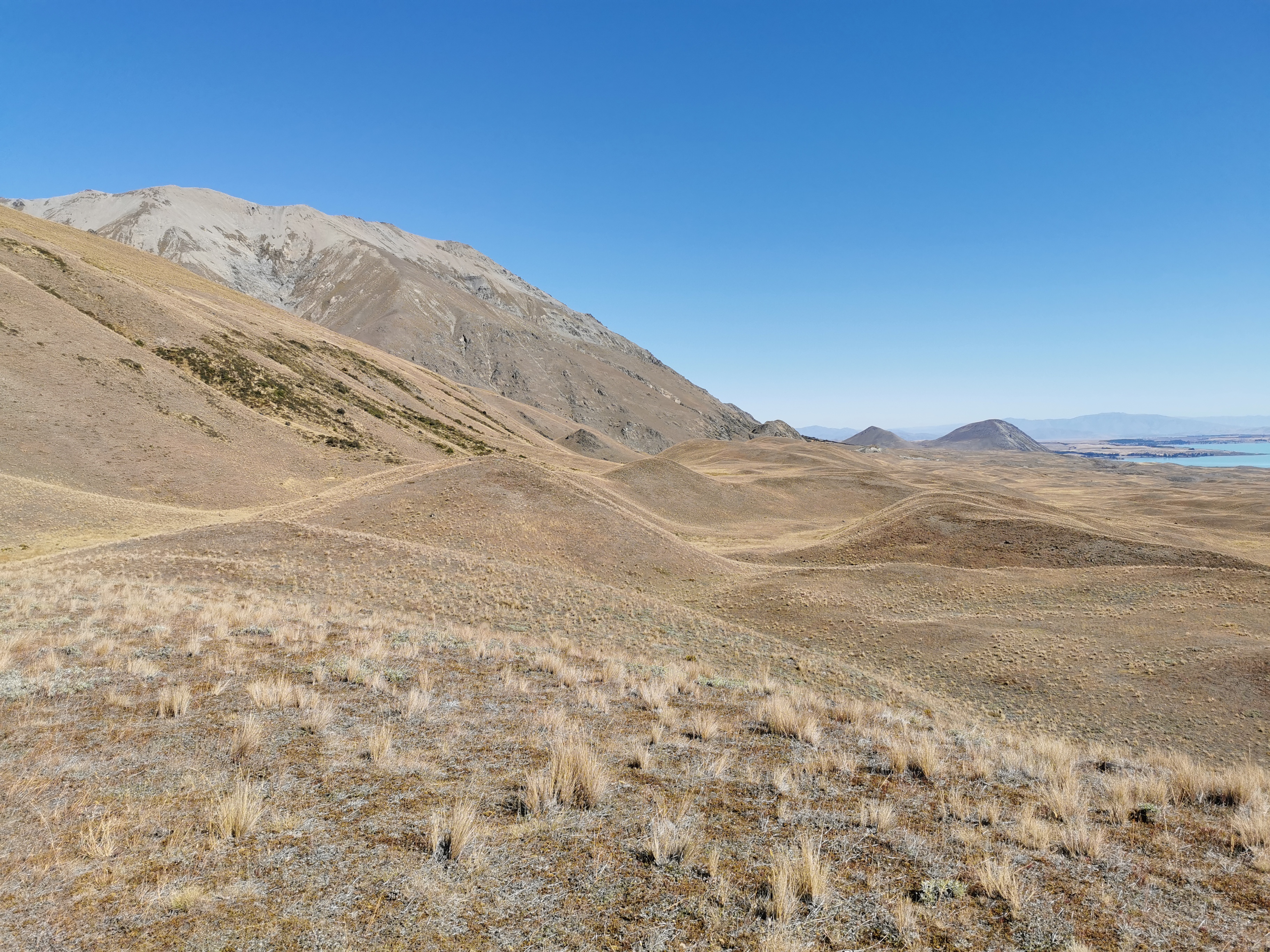
When I climbed up here, I could see opposite that there was kind of a line at a certain altitude that cut right across the landscape. Do you see what I mean? I wonder what causes that.
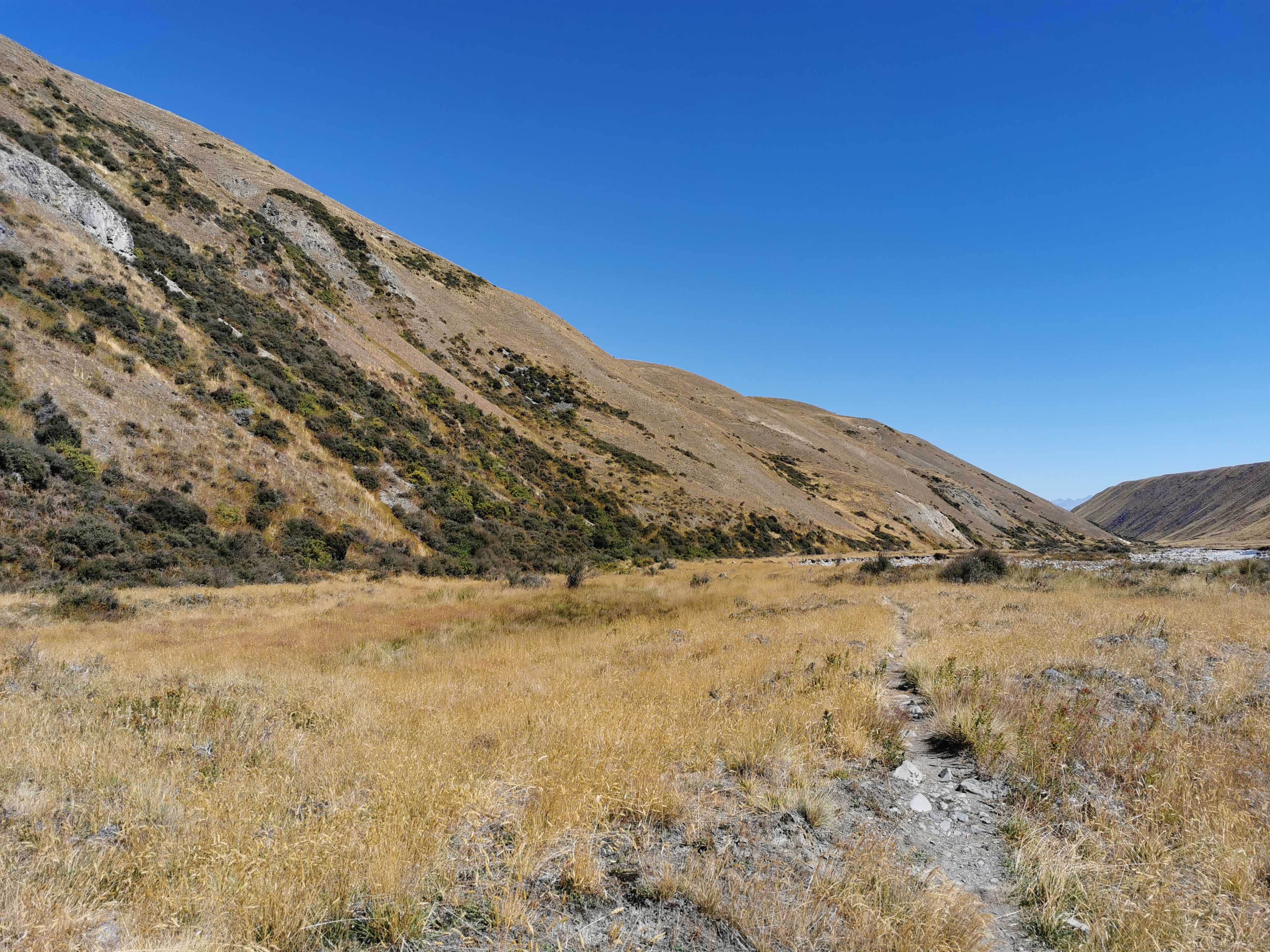
A bit further on and a bit more walking through tussock, you cross a road and reach something called the Richmond Trail.
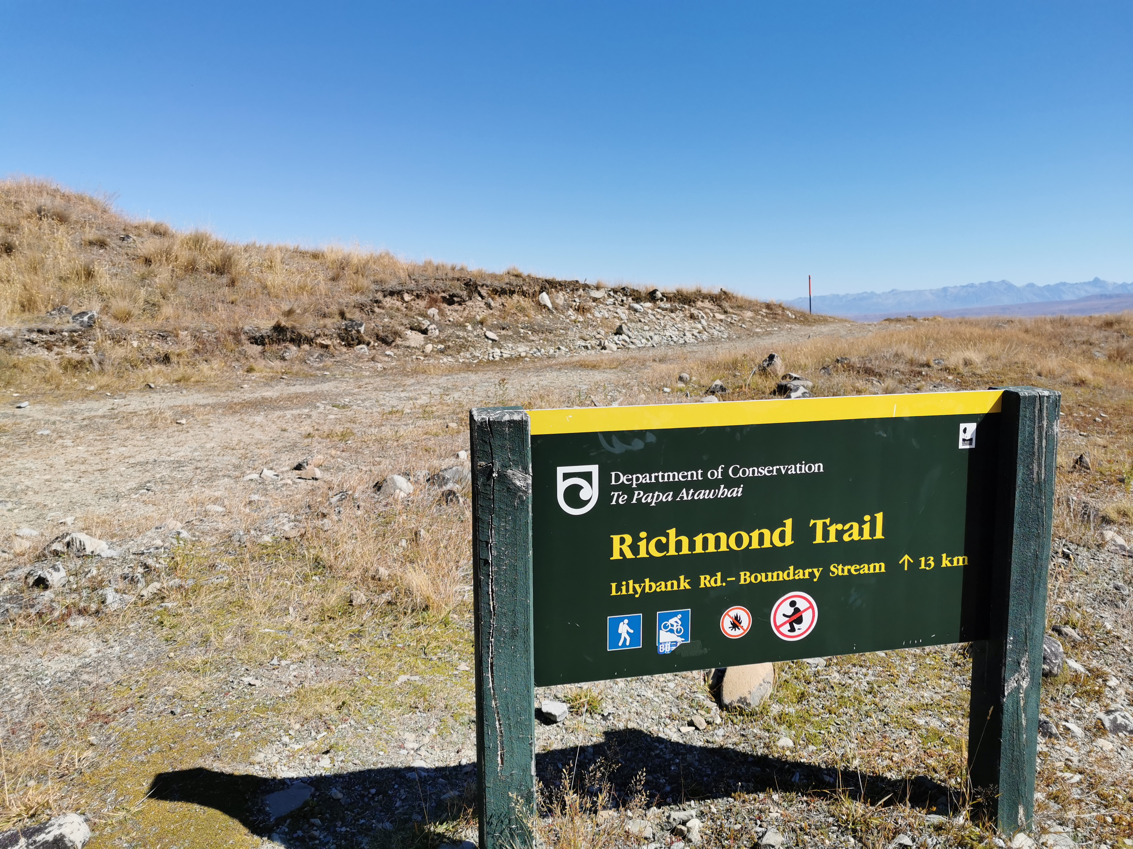
The symbols on the sign are interesting. The second one indicates that it’s a mountain bike track and therefore should be easy to walk on. The fourth one… well I’ll leave that to your imagination!
Sure enough, this section of trail is easy to walk on. Luckily too, it was 3pm by this time and Tekapo was still 30km away.

I knew that the rest of the day from here was going to be a bit of a trudge. This bit was okay but the last 18km or so is almost entirely road walking. So I put on some good music and just walked.
I did meet a northbounder at one point and he said there are other southbounders just ahead of me. I wondered if I’d meet any of them.
My GPS watch was really unreliable along here for some reason. It jumped straight from 21km to 23km and then the same from 25km to 27km so I was never really that sure how far I was from the road. It also meant the line on the map below was not particularly accurate.
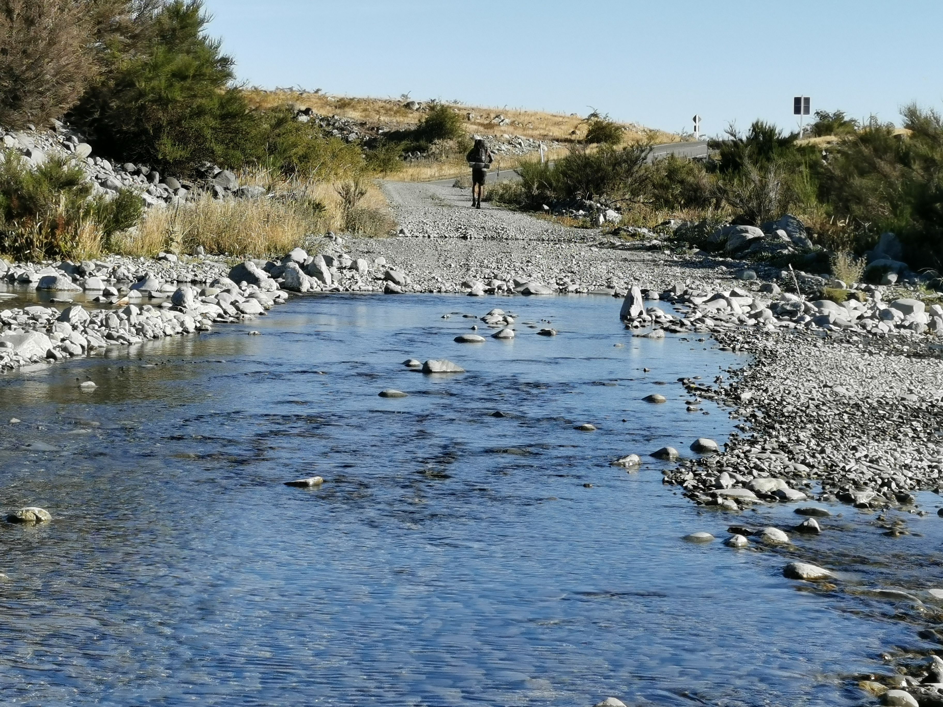
Once I reached the road, I stopped at this stream (Boundary Stream) and had a quick snack, even though I was looking forward to making it to town I was too hungry to make it there without stopping.
The trail notes say no camping between here and Tekapo. You either set up camp before here on the Richmond Trail or you walk all the way to Tekapo.
While I was having my snack, a southbound hiker named Daniel showed up to get some water from the stream. I think I startled him as he clearly didn’t expect anyone else to be around. He too was walking into Tekapo and was considering a night walk into Twizel the next day. I’d been considering that option too but didn’t want to let on.
Tekapo to Twizel is a long way – almost 60km, and there’s apparently nowhere to camp along the way. A lot of people choose to hire a bike and cycle it. Other people choose to hike it at night because it is flat and not dangerous. I might walk that section at night tomorrow if my legs feel up to it. It’s a full moon at the moment so that will be nice. But after the long day today my legs might not be up to it.
I didn’t want to let on to Daniel that I was considering the night walk too, because 60km is a long way to be trapped with someone if you don’t get on well with them!
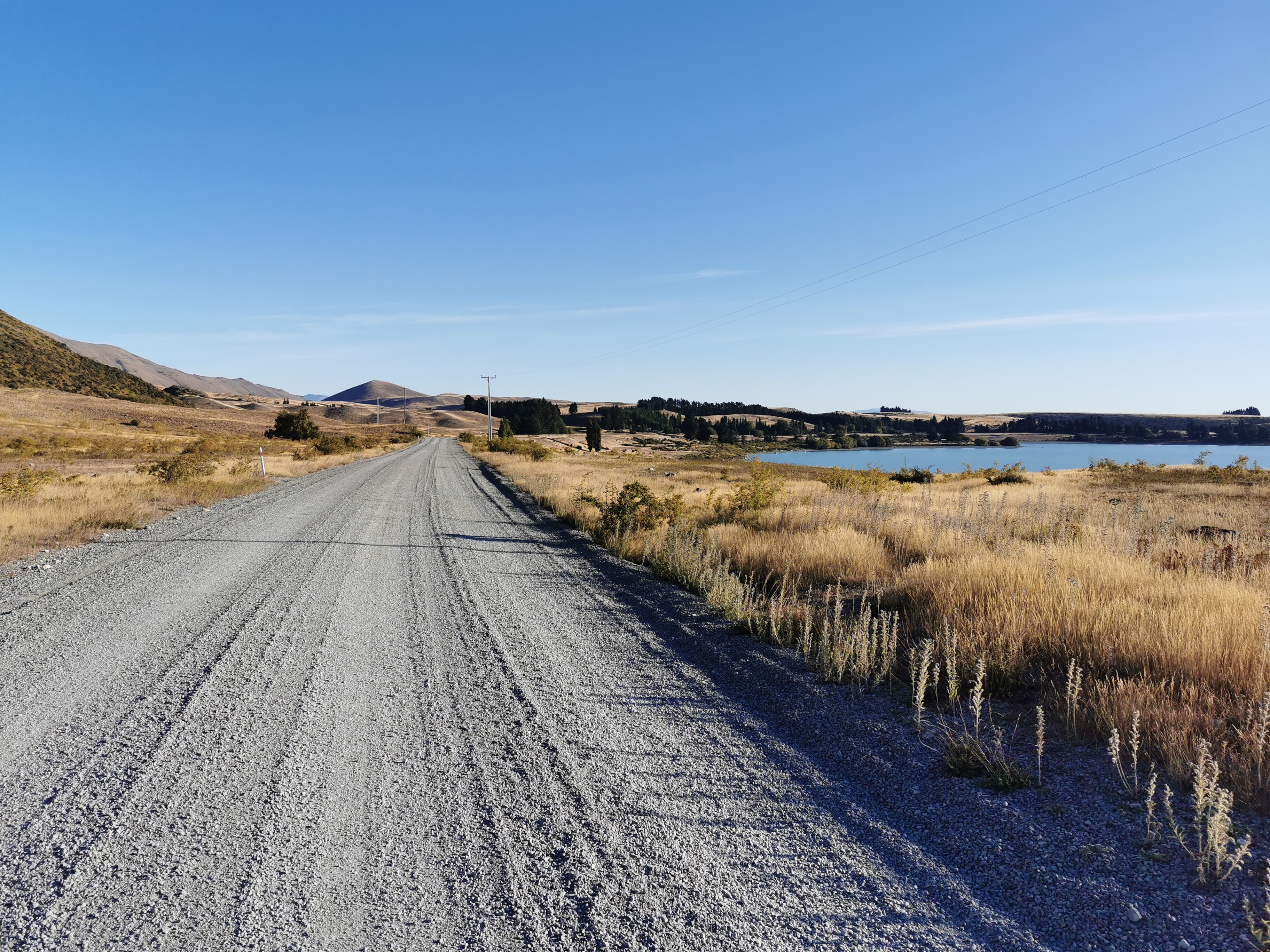
Time for the remaining 18km into Tekapo, mostly down this gravel road.
Not a lot happened on this section of the walk. It was really just one foot in front of the other for most of it, walking as fast as I could to try and get to the restaurant in time. I did see these creepy houses though.
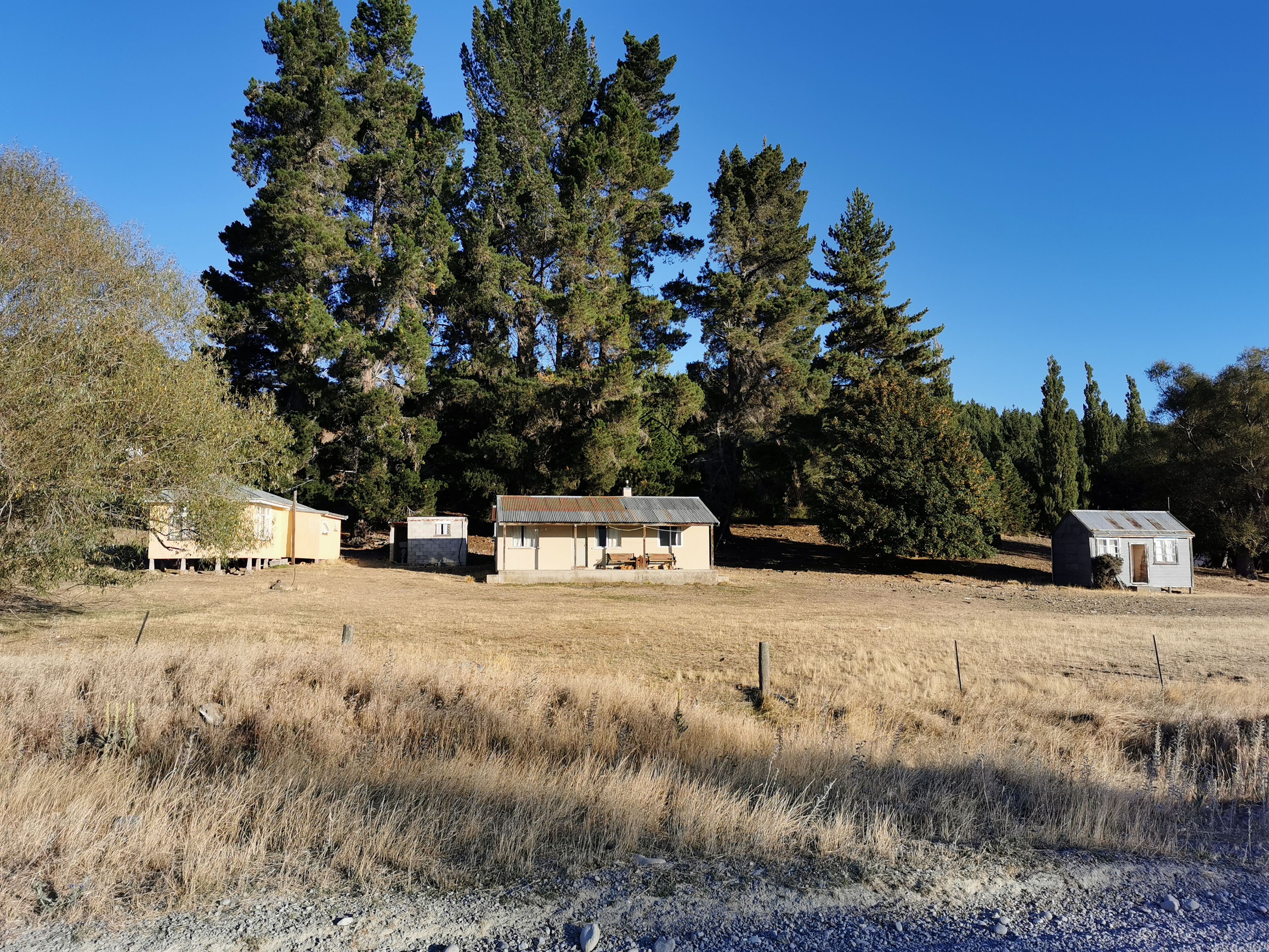
It’s hard to tell from the photo but the smallest building second from the left has a toilet with no door, totally exposed to everyone going past. Maybe that’s a thing in these parts and I just don’t get it.
After a while the town came into view, just as it was getting dark.
I did spend time trying to work out if the town is called Tekapo or Lake Tekapo, because it’s always referred to as Tekapo in the trail notes but it is Lake Tekapo on all maps. Wikipedia tells me it is officially Lake Tekapo but it’s usually just called Tekapo to avoid confusion with the lake it sits on.
I was offered a lift by a guy in a rental car, but I declined as I was only 2km from town, and of course I wouldn’t have taken it anyway regardless of how far along I was.
Not far from the town, you turn right into a park.
You then actually get to walk alongside the lake for the first time.
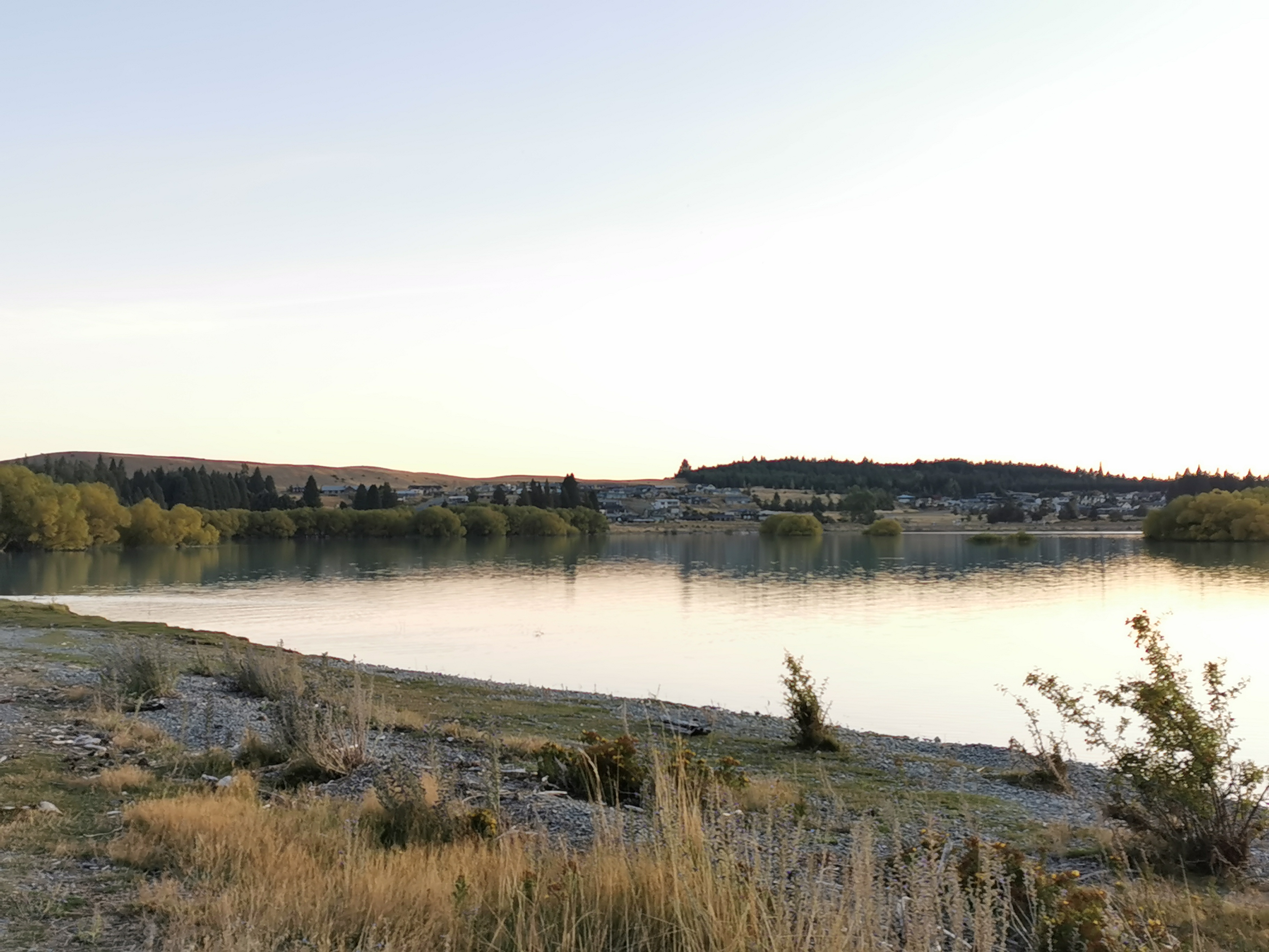
I made sure to actually touch the water at least once. It looks so turquoise while you’re walking but it is so clear once you’re up close to it.
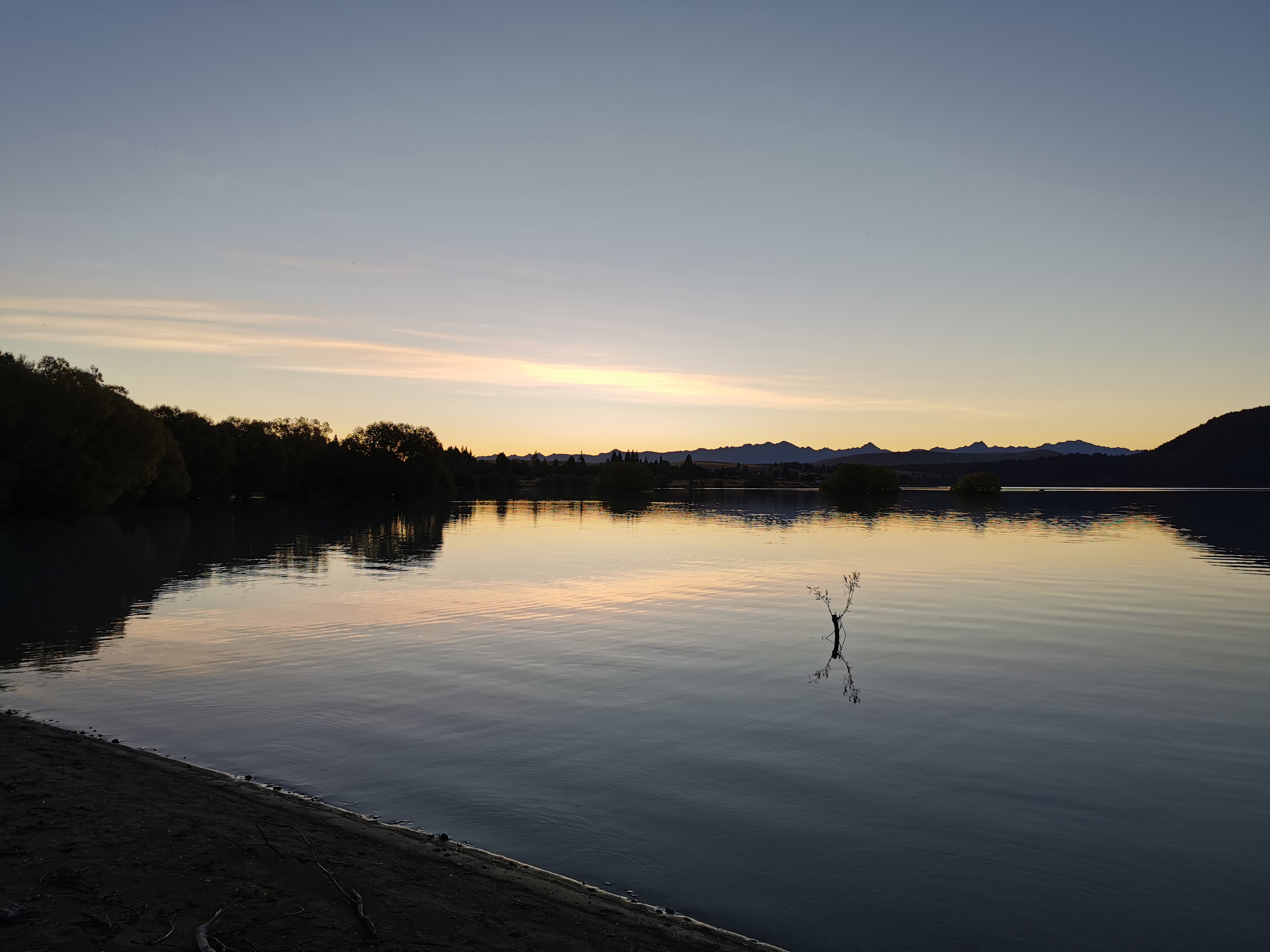
The sun was really setting now.
As I came into town, I got asked how far I’d walked today by a couple (a very common question). I told them “50km from over the hills there in the distance” and the guy said “you’re awesome”. That made me feel good.
I passed various interesting things on the way into town. I had to adjust the brightness on each photo so you could actually see anything. That’s why it looks like a different time of day in each photo, but they’re all posted in order!
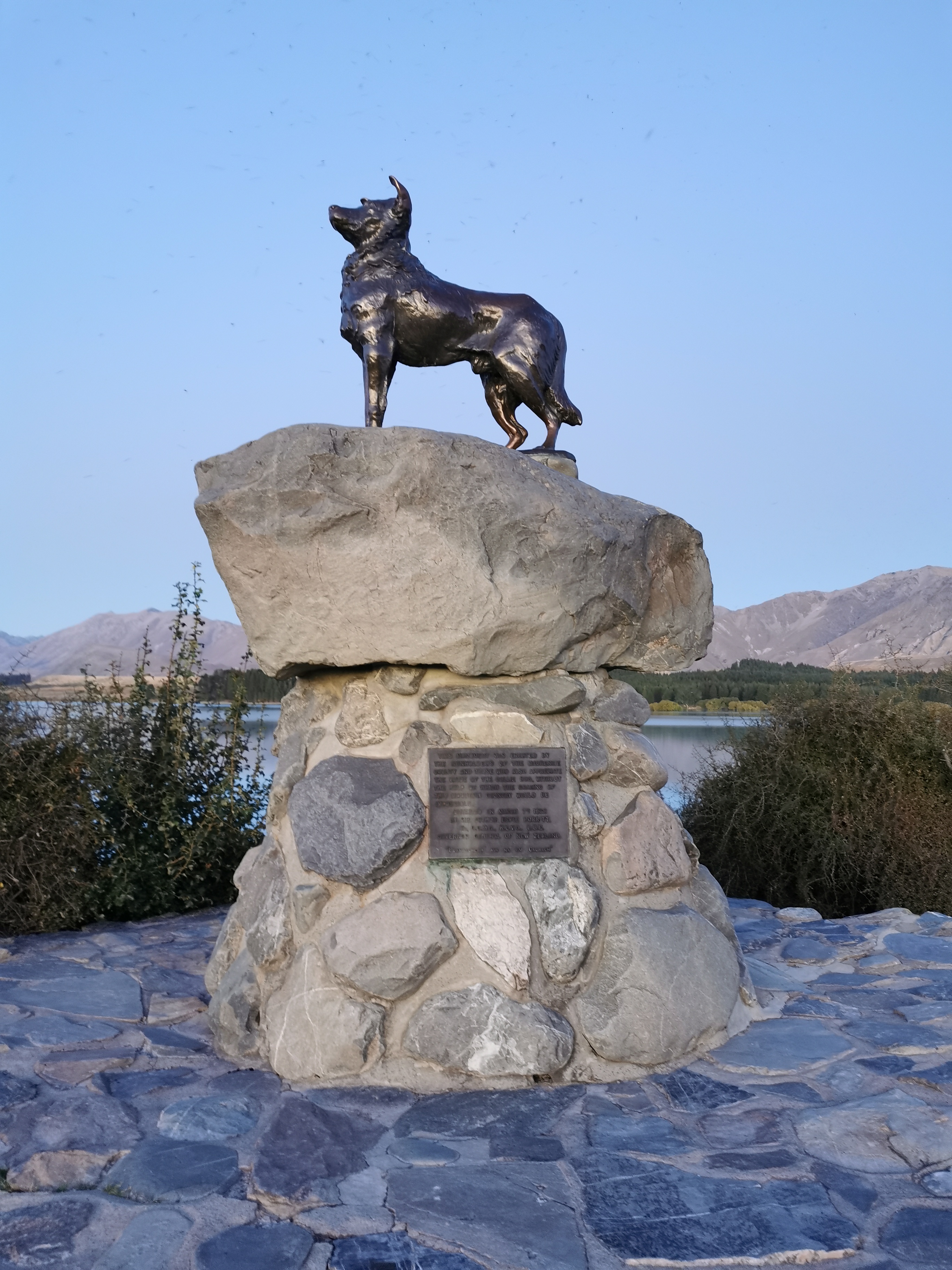
“This monument was erected by the runholders of the Mackenzie County and those who also appreciate the value of the Collie dog, without the help of which the grazing of this mountain country would be impossible. Unveiled March 7th, 1968”.
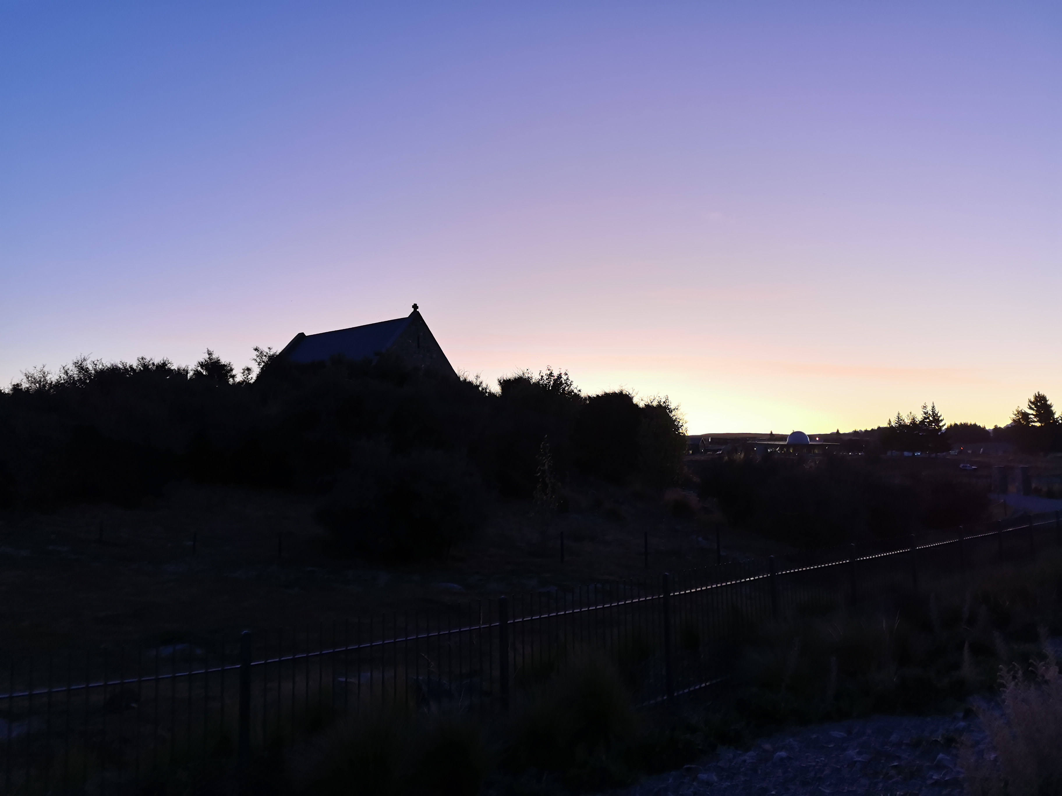
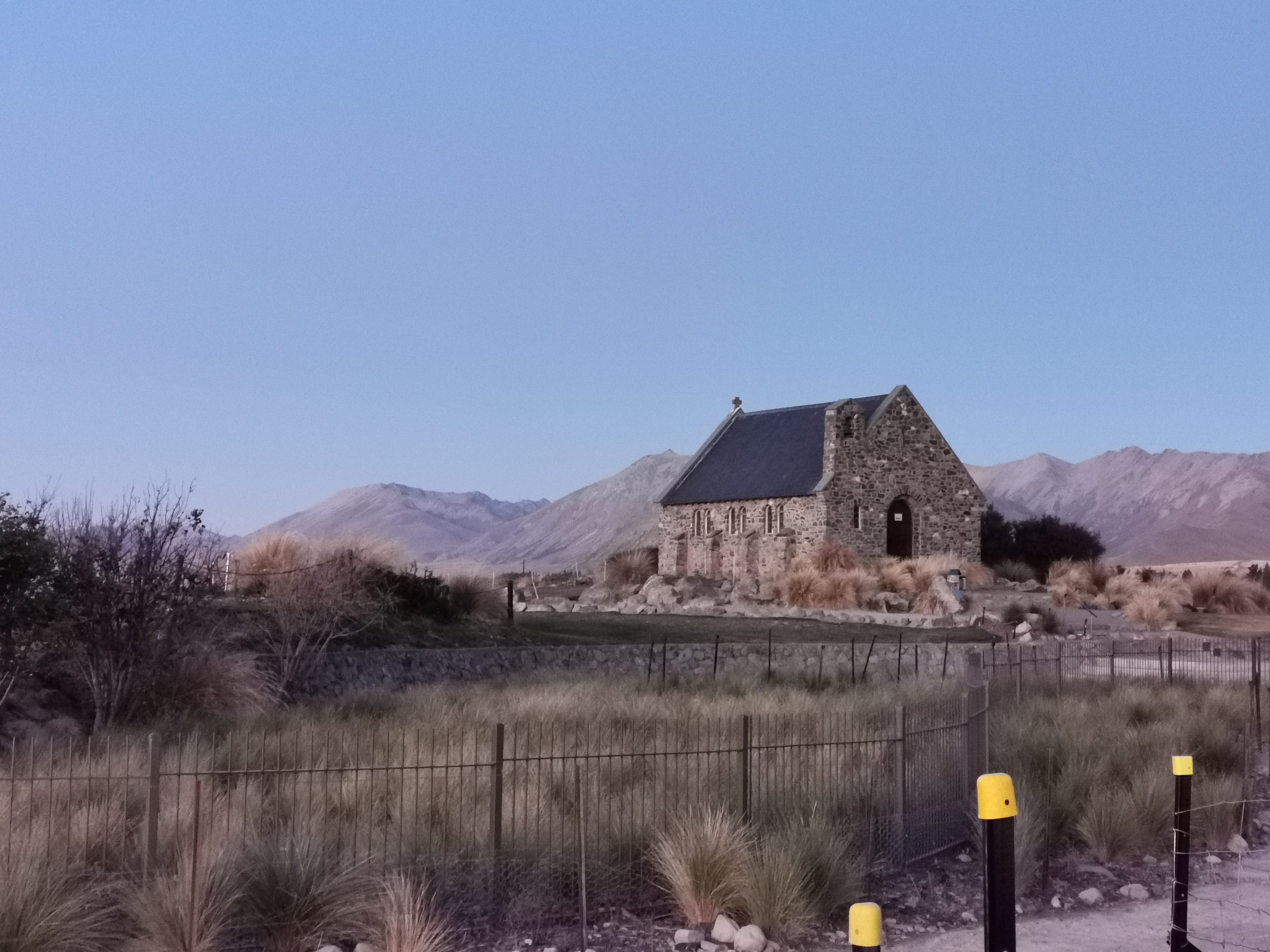
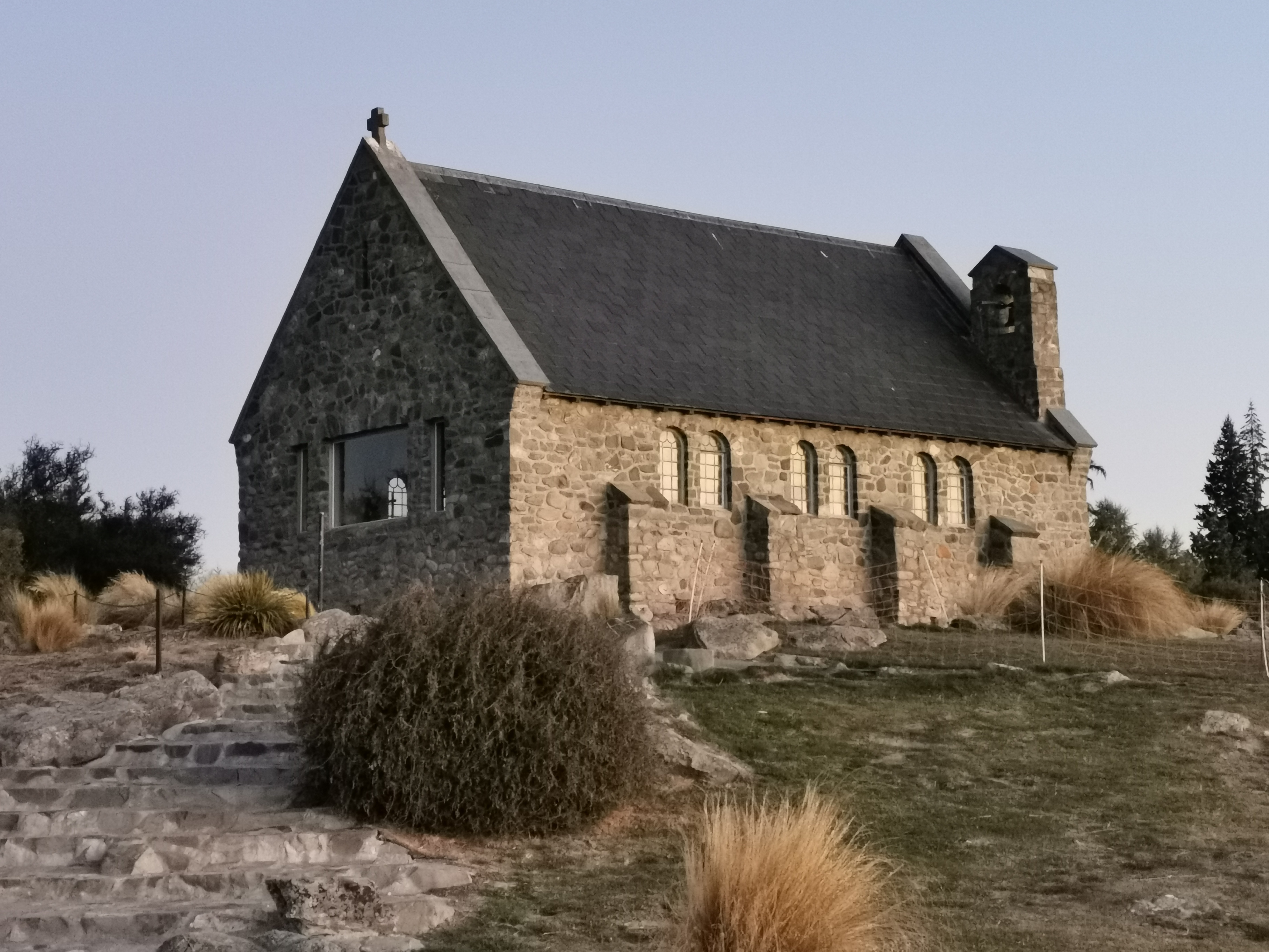
Here’s the Church of the Good Shepherd. It’s a very famous church and despite being very late, still had a lot of people taking pictures of it. I couldn’t see much on approach,
But with the right light I could still get a good picture.
Next is this pedestrian bridge. I understand it’s a fairly new bridge, which probably explains why the trail doesn’t go across it.
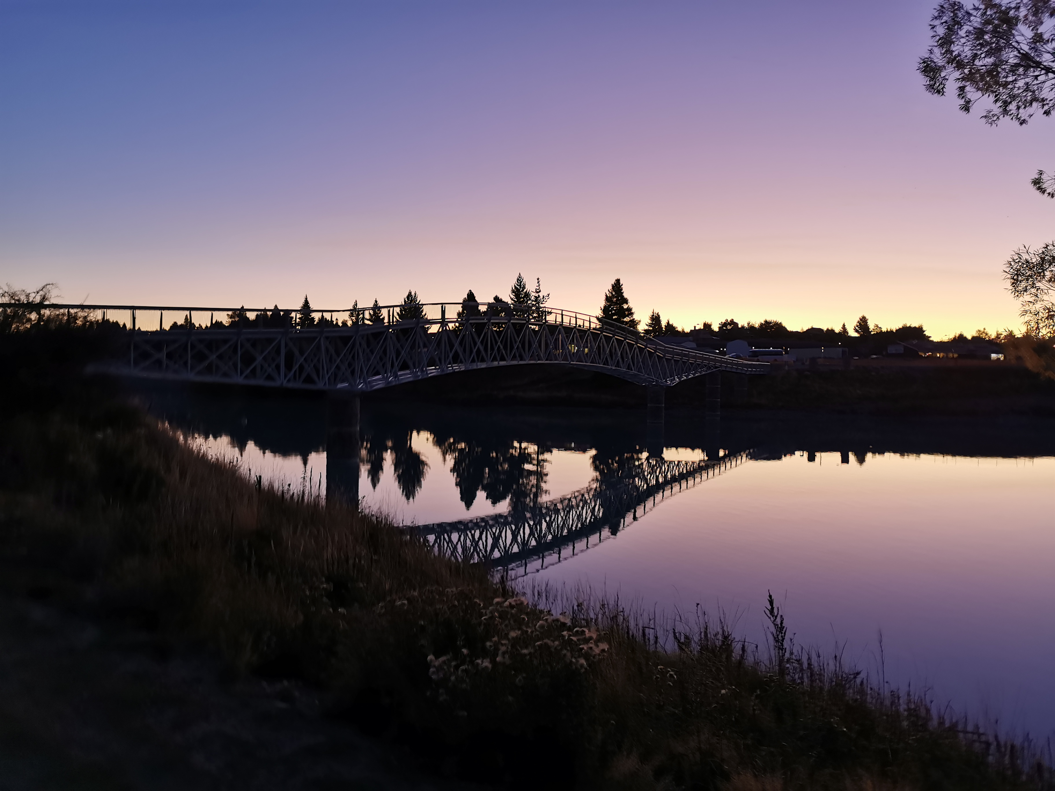
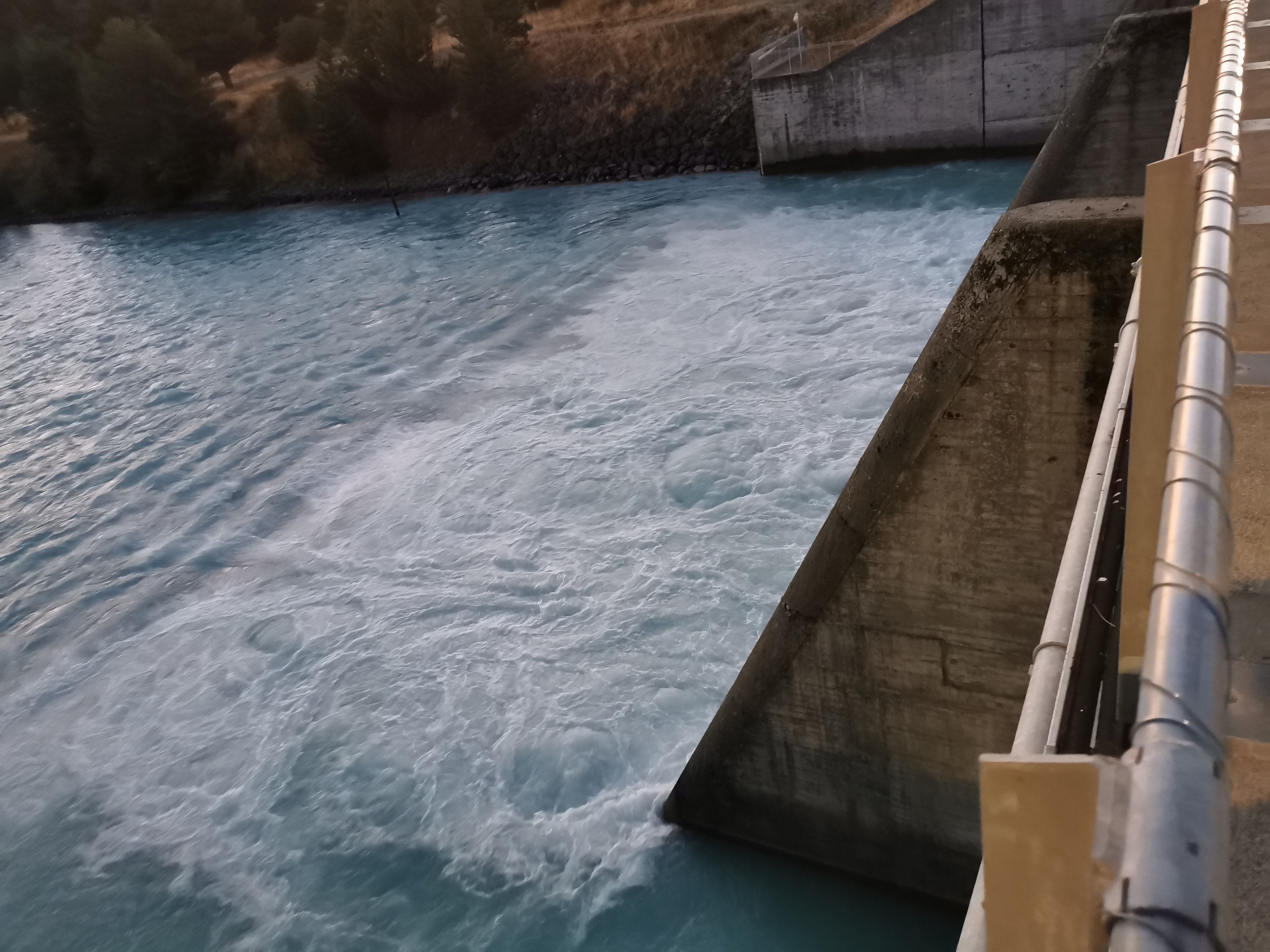
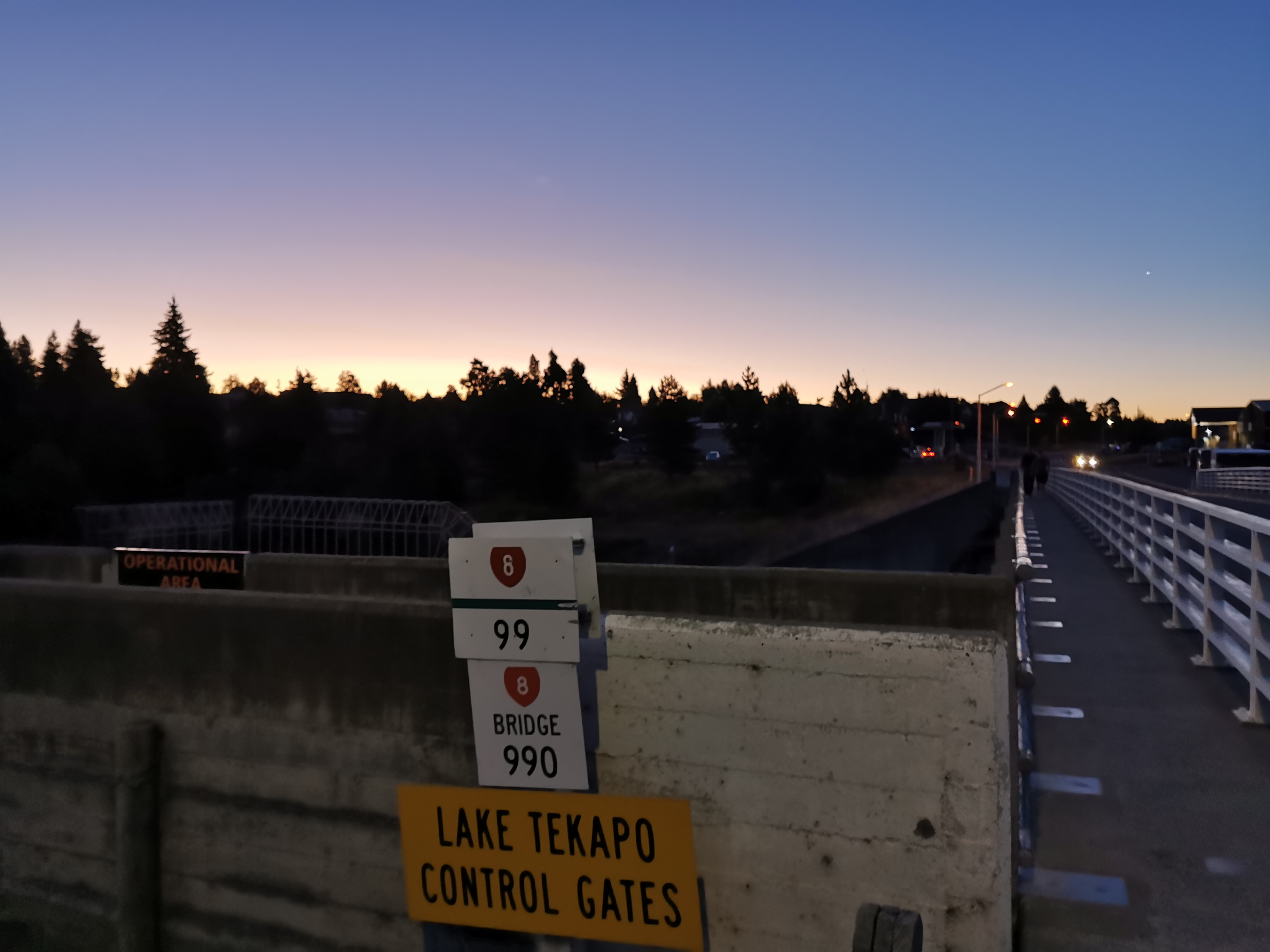
Instead, the trail goes across the road bridge, which seems to also act as flood gates.
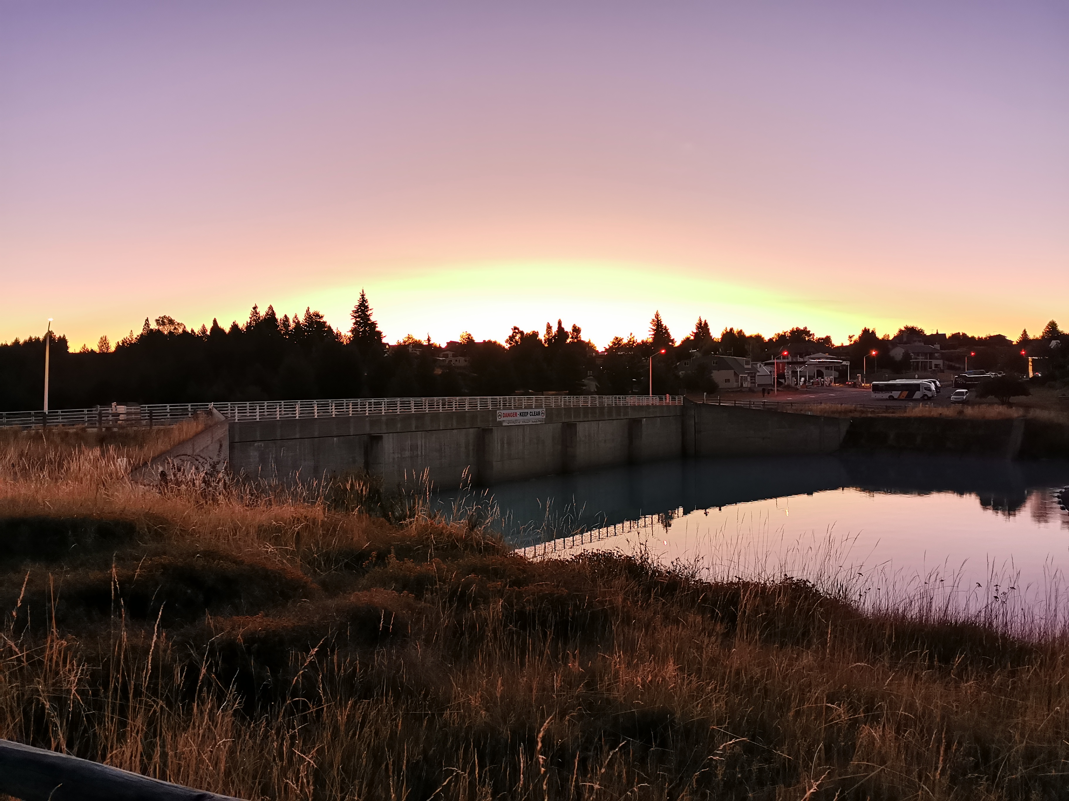
This road is State Highway 8. I’m up to the “8 highways” now. Only the 9 highways to go and I will have finished!
At first I thought the Blue Lake Restaurant might have been this restaurant, and I thought “this place is too posh, they won’t let a hiker in here”. But it turned out to just be a hotel.

The Blue Lake Eatery seemed almost as posh though.
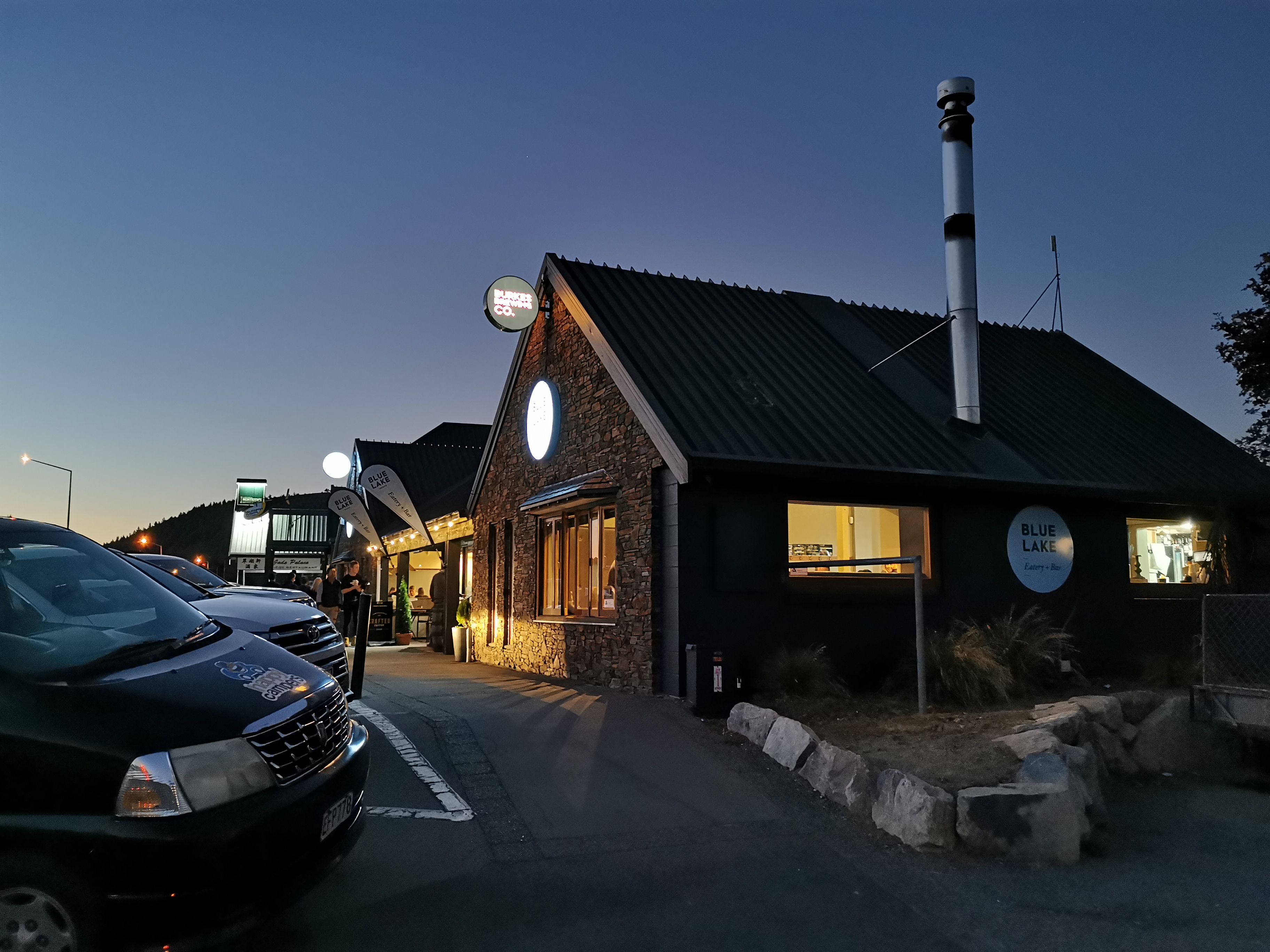
Luckily they seemed nice and the clientèle was varied and I sat far enough away from other people so that they wouldn’t be offended by my odour.
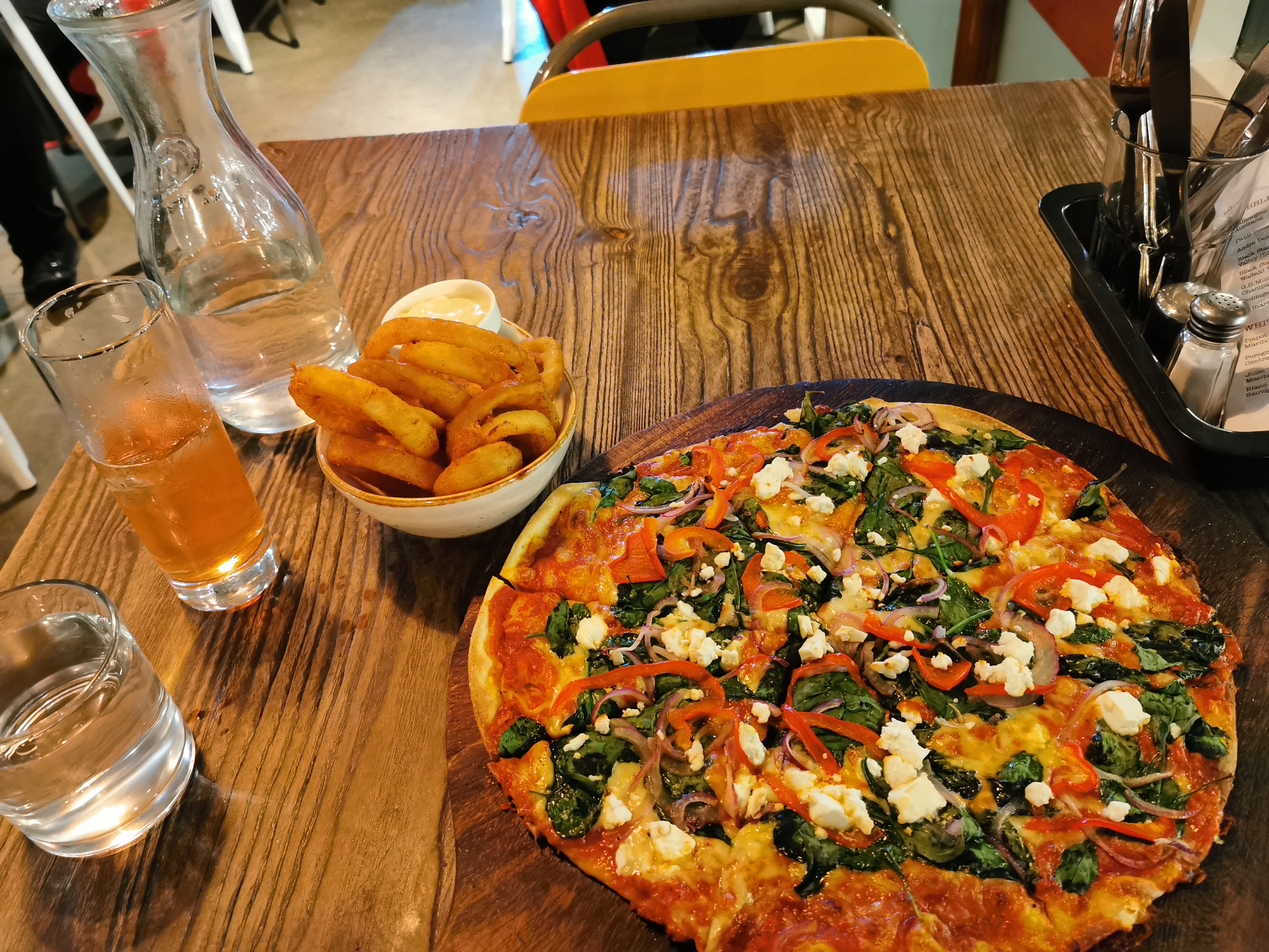
The problem here was that I didn’t really like any of the mains on offer, so the only thing I could have was pizza. I couldn’t go somewhere else because this was the only place in town that was open. So pizza (and onion rings) it was.
The whole time I was in the restaurant I was uncomfortable. I’d walked so far that even just sitting there was painful, and I was also sunburnt. I got quite shivery and cold and had to put my jacket on. I tried to straighten my legs as much as I could, otherwise they ached.
I also had dessert but didn’t photograph it. It was a nice lemon and blackcurrant thingy with French merangue. I was so full by the end of it. I wasn’t even sure I could walk the last bit to the holiday park.
The holiday park as it turned out was a fairly long way from town. It took about 20 minutes to walk the 1.5km there.
They had left a map with my name on it as promised, but it was still hard to find the tent site in the dark. The map suggested the sites would be numbered but they weren’t. There were a lot of other tents around so I felt bad setting up at 10:30pm making noise. After setting up I found the living room and plugged in my battery pack to charge it overnight. I hope it’s okay and nobody steals it. There were at least eight or nine other devices being charged in there.
It had been over a month since I set up my tent and sleeping mat, the last time was at Harper Campsite. Luckily both seemed okay – no extra mould or damage or anything. But I did notice that when I took off my left boot that my sock had filled with blood from the back of my foot rubbing against it. I was surprised because I didn’t feel anything like that while I was walking. And boy did it smell bad. I couldn’t wait to do laundry tomorrow and have a shower.
One last thing to do before attempting to sleep was to change to the last of four Guthook maps – I’m now on the map from Tekapo to Bluff. Now that I had Internet access it seemed to work this time.
I wasn’t sure how I’d sleep with my sore legs but I was glad to finally be lying down. This has been the longest day so far where I’ve had my pack the whole time, beating the previous record of Paekakariki to Ngaio so it was great to finally get some sleep.
Today's walk on the map (blue = Te Araroa, red = today's walk):
awesome effort matt you certainly earned your tea of pizza and pudding.
i hope you managed to get a good sleep as well,
Fantastic effort Matt. I remember that ache in the legs from my Marathon walking days, caused by lactic acid build up during hours of strenuous effort. We were told to relieve it by sitting in a cold bath and then lying on the floor with our legs raised up against the wall. Not the easiest thing to do in a posh restaurant or a tent…
Matt, after a long day it can be useful to do good stretches to squeeze out the lattic acid and ease the tendons.
Yeah I’ve often thought I should be doing stretches. I know they’re good.