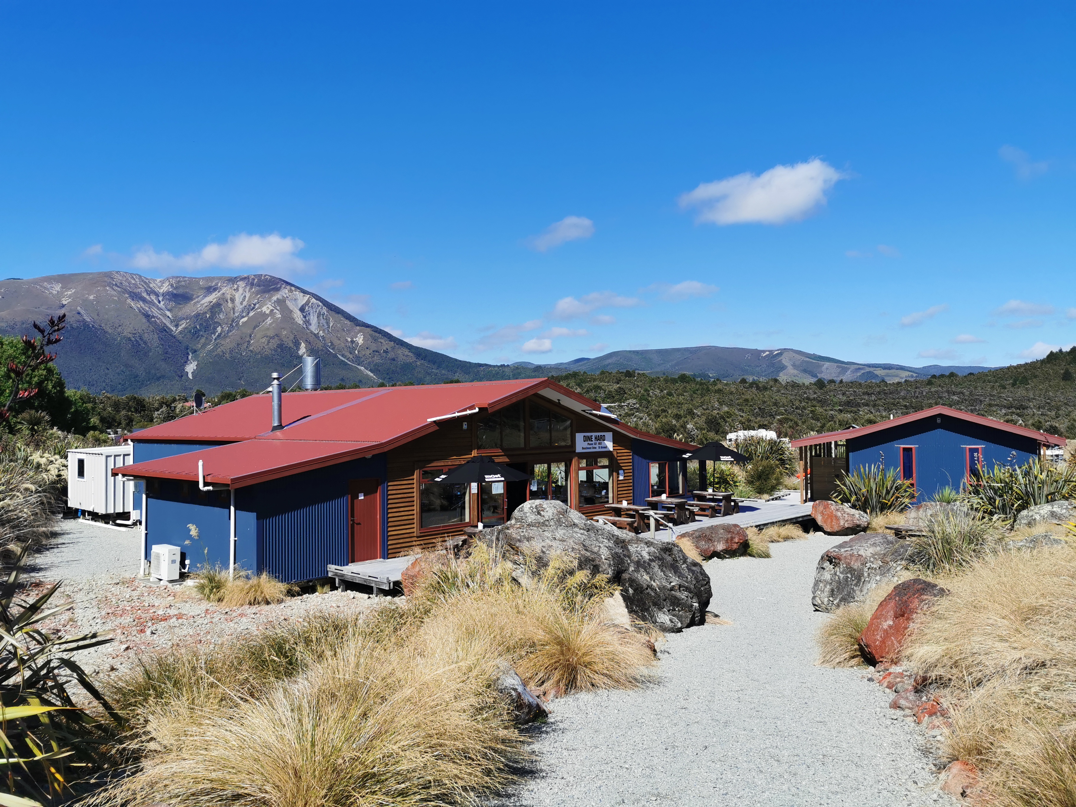
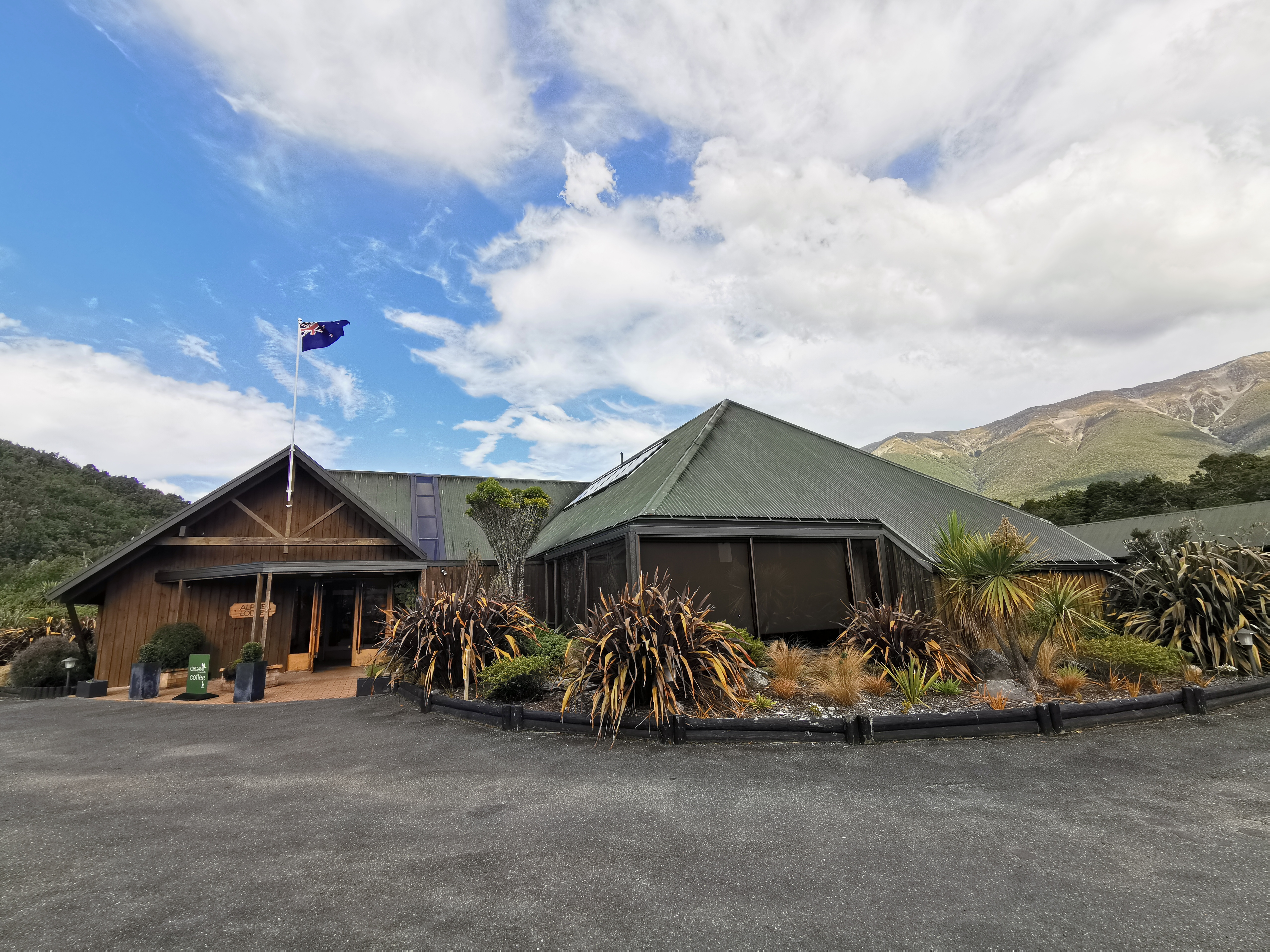
So, my Christmas break is now over, and tomorrow I’m on my way back to Pelorus Bridge via Blenheim to continue where I left off. I’m nervous and also excited.
I have decided not to count the two and a half weeks I’ve just had off from the trail as “days”, so I haven’t numbered them. The logic being that if it wasn’t Christmas then I wouldn’t have taken the days off so therefore they don’t count as days.
The biggest thing that happened during the break was that I arrived back to my house in Auckland on 21 December after flying out from Blenheim and noticed that while I was away, some lowlife stole my car. Not the greatest start to my holiday.
Gone but not forgotten
After reporting it to the police and establishing that it has been stolen and not simply towed, I worked out how I was going to get around. My friend Kane pointed out that at least I’ve had a fair bit of experience recently with walking.
It took me a few days to get over the ordeal – I was moping around a fair bit initially. But when I started looking at new cars online, it cheered me up a bit. I’ll be able to buy myself a new car as a reward for finishing the trail. And I definitely have the motivation to complete the trail now. No way am I having my car stolen to only complete 60% of the trail.
I weighed myself when I got home on 21 December and I was 75.5kg. I was 82kg when I started the trail and 78kg when I stopped in Auckland in early November. But yet on 6 January after the Christmas break I was back up to 79kg – yikes! The weight goes back on easily when you’re not walking!
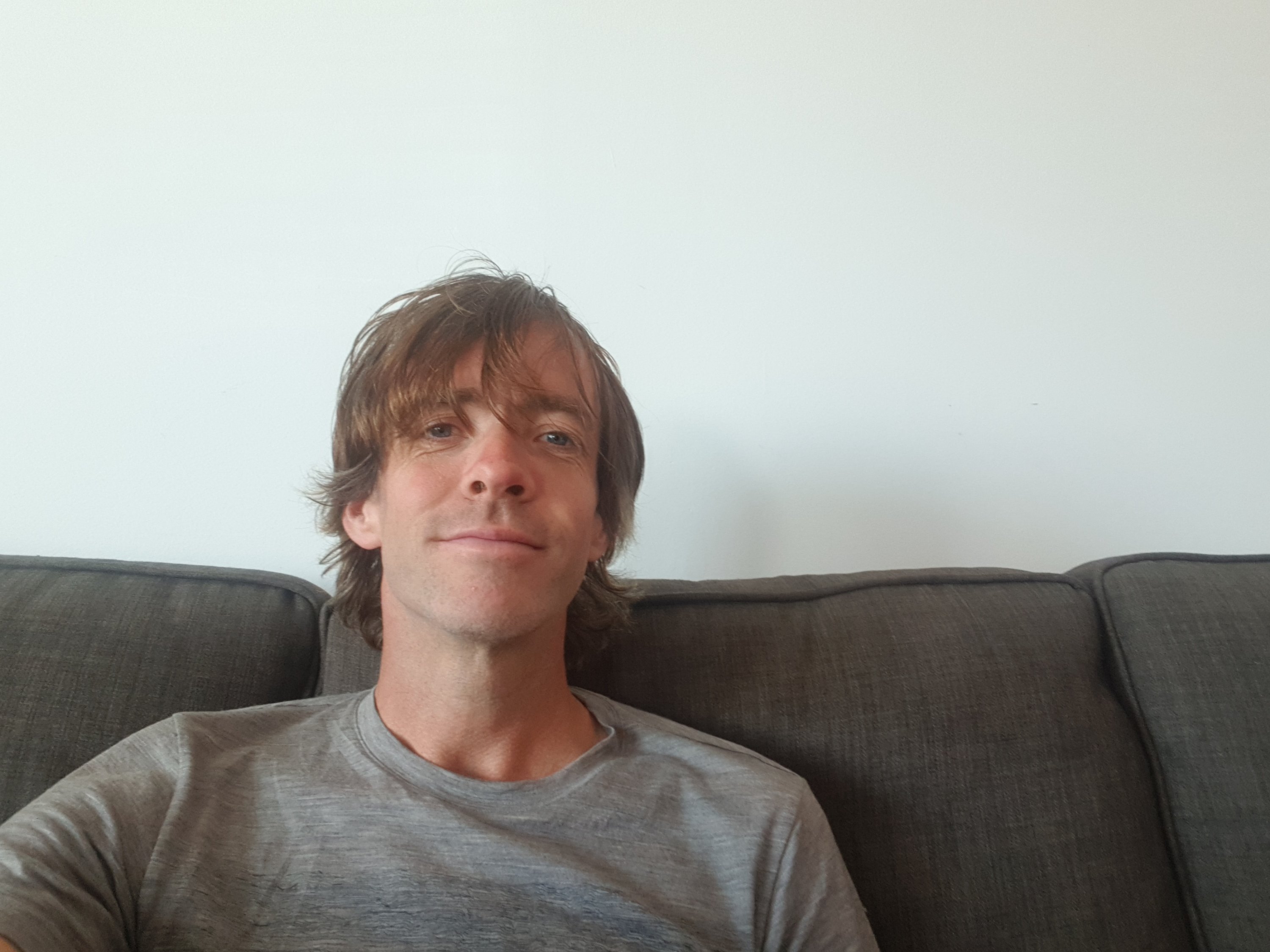
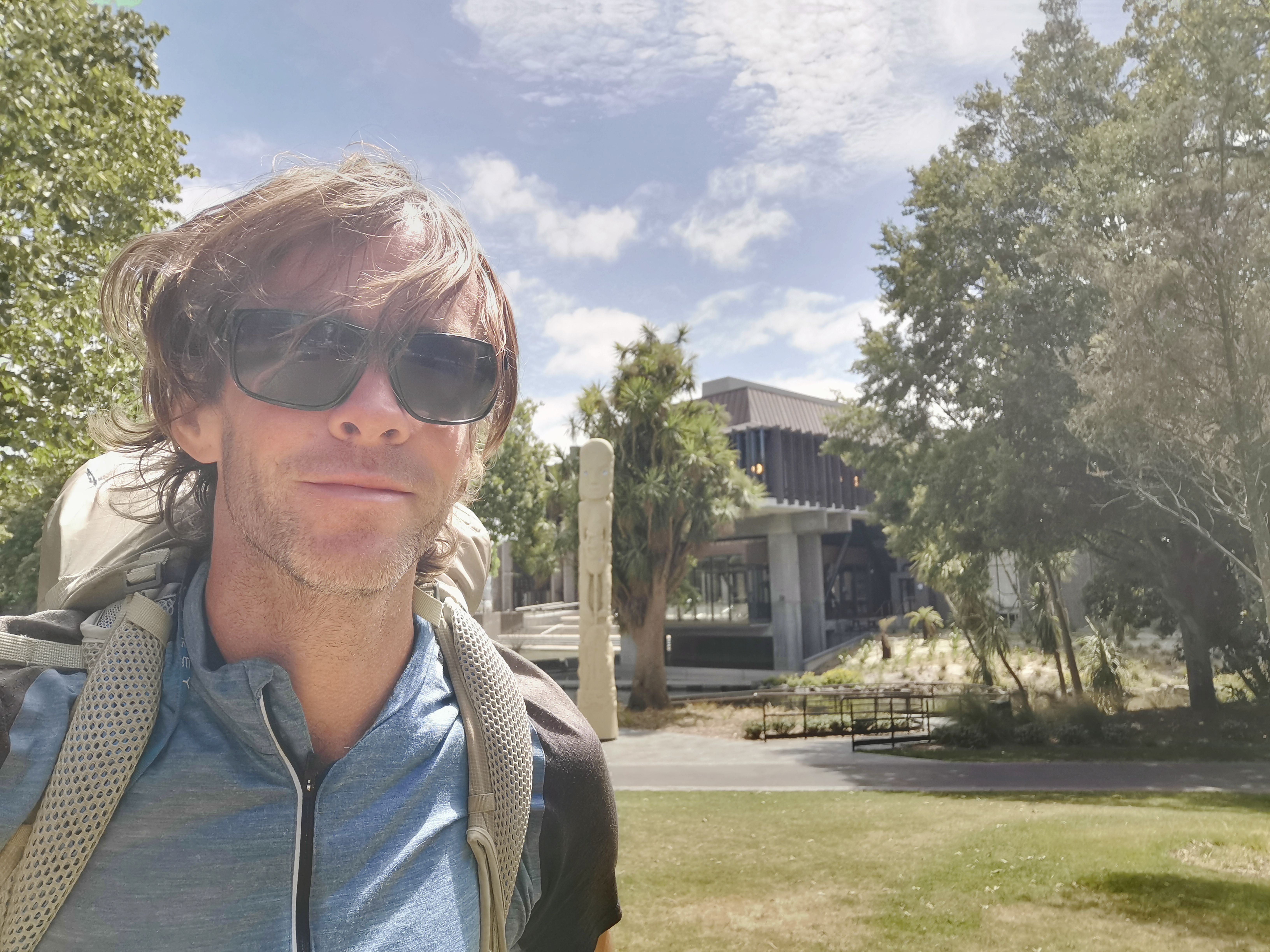
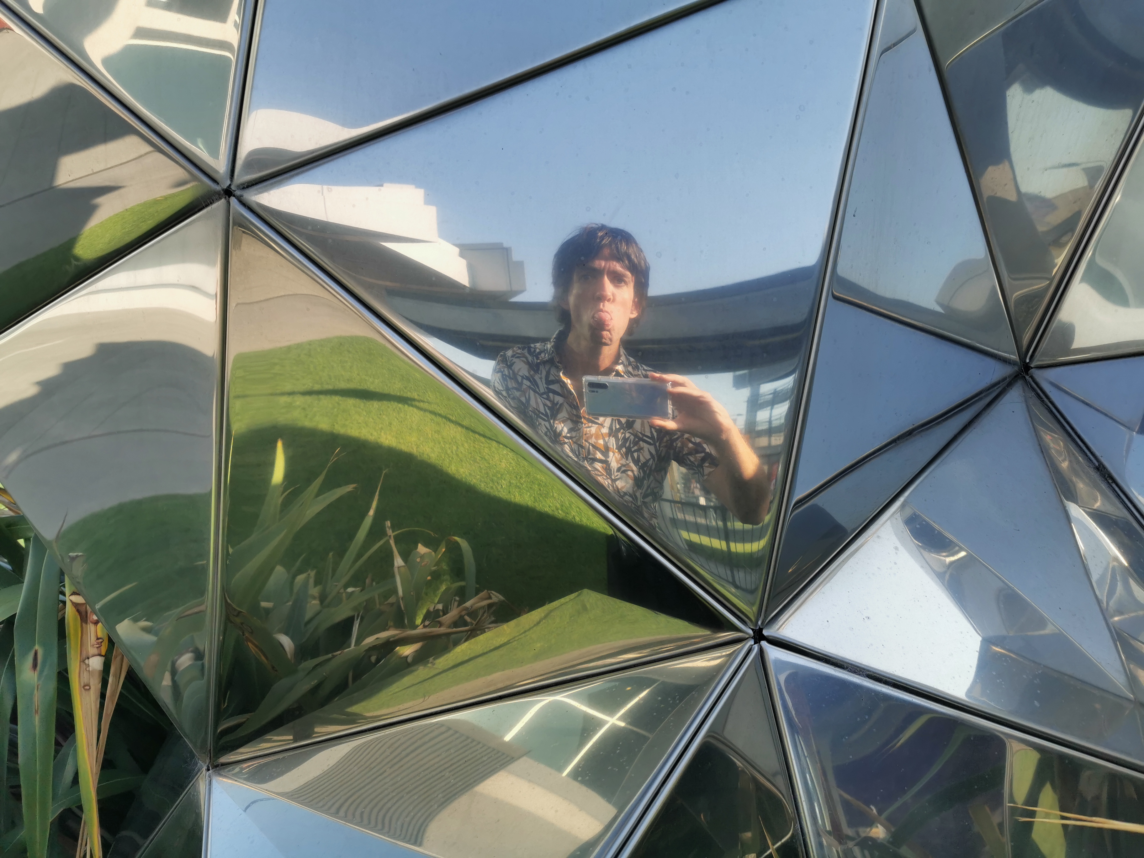
I also finally got rid of the beard and moustache… but I kept the long hair, for now at least!
New look!
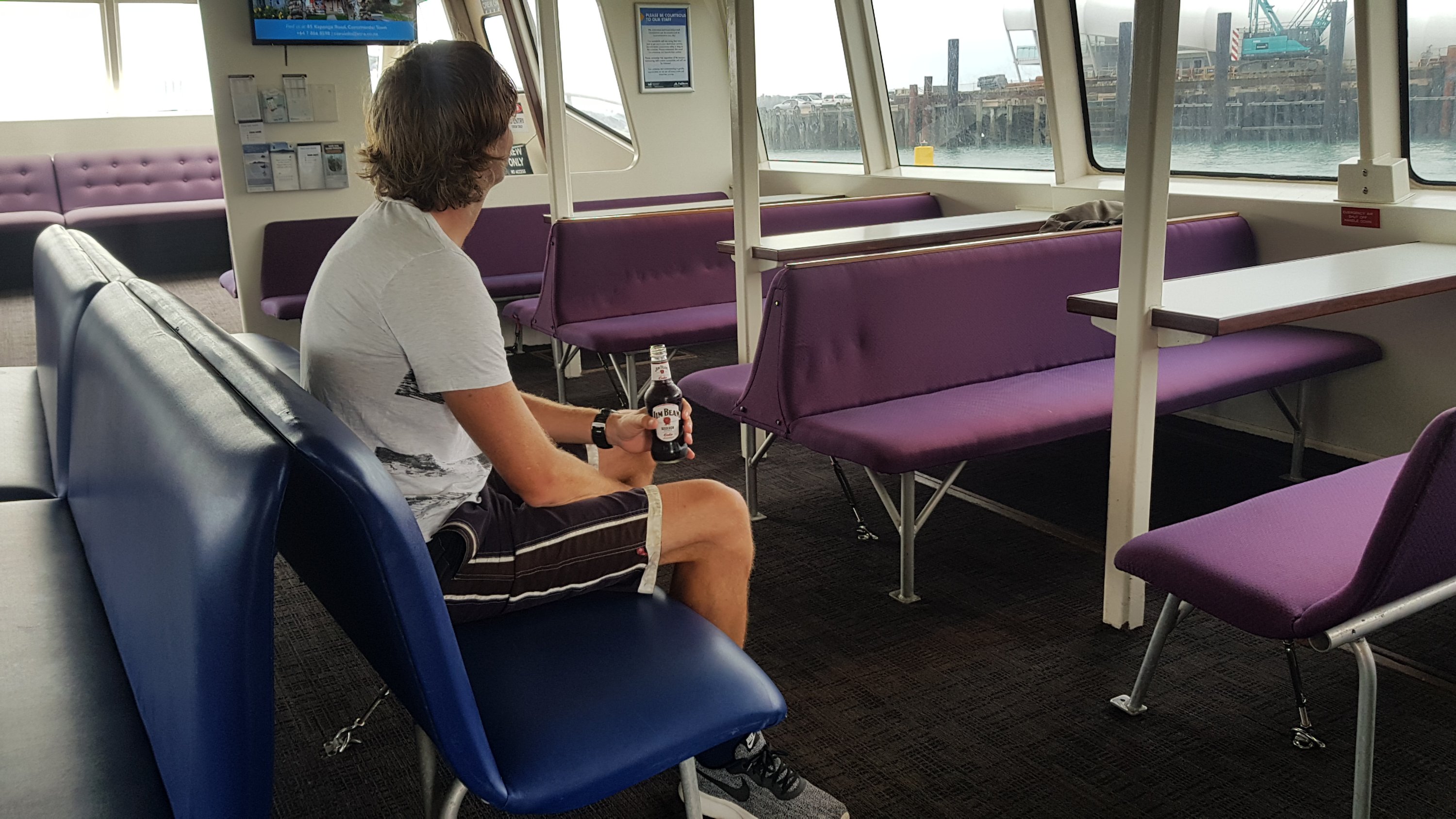
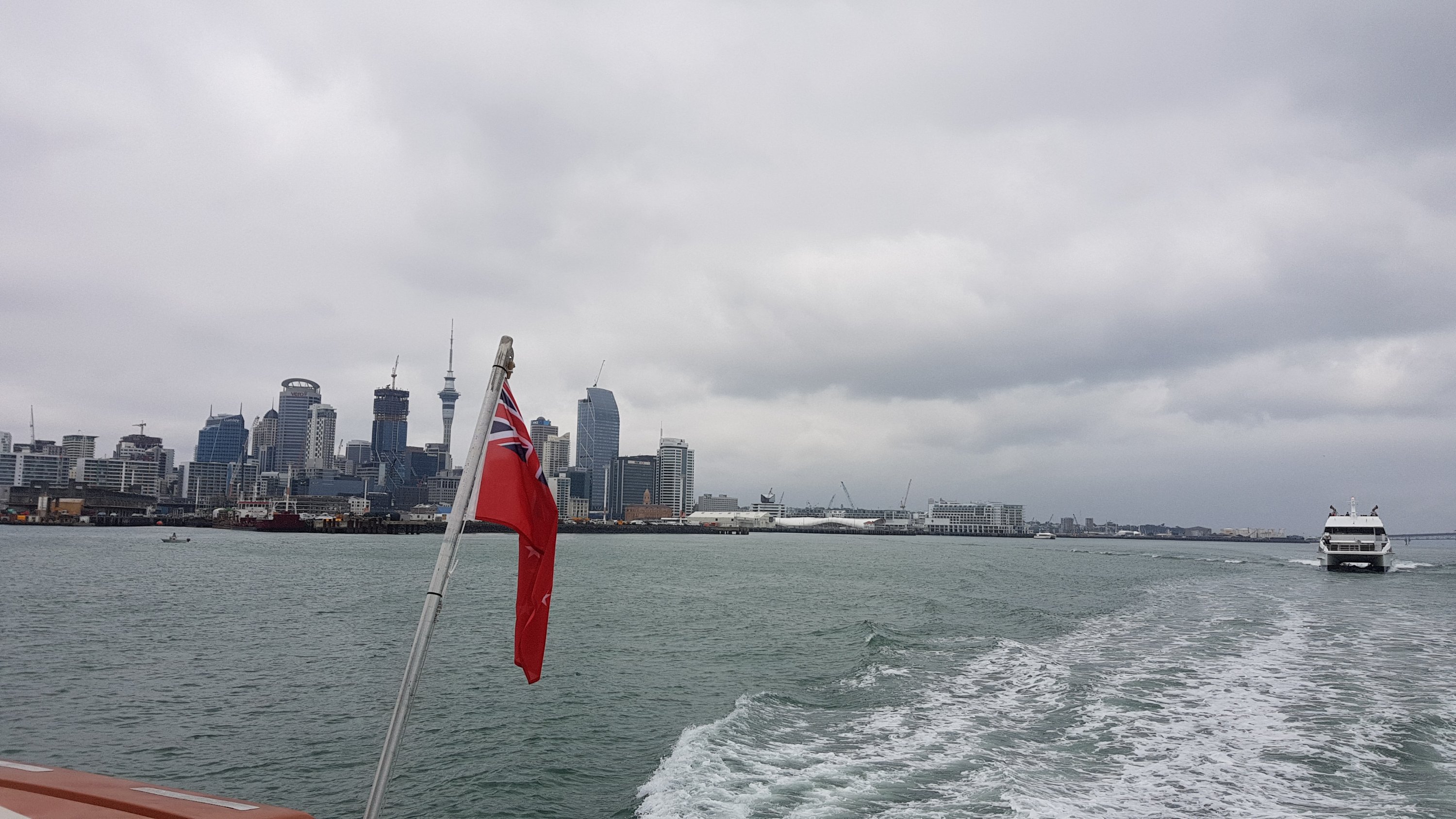
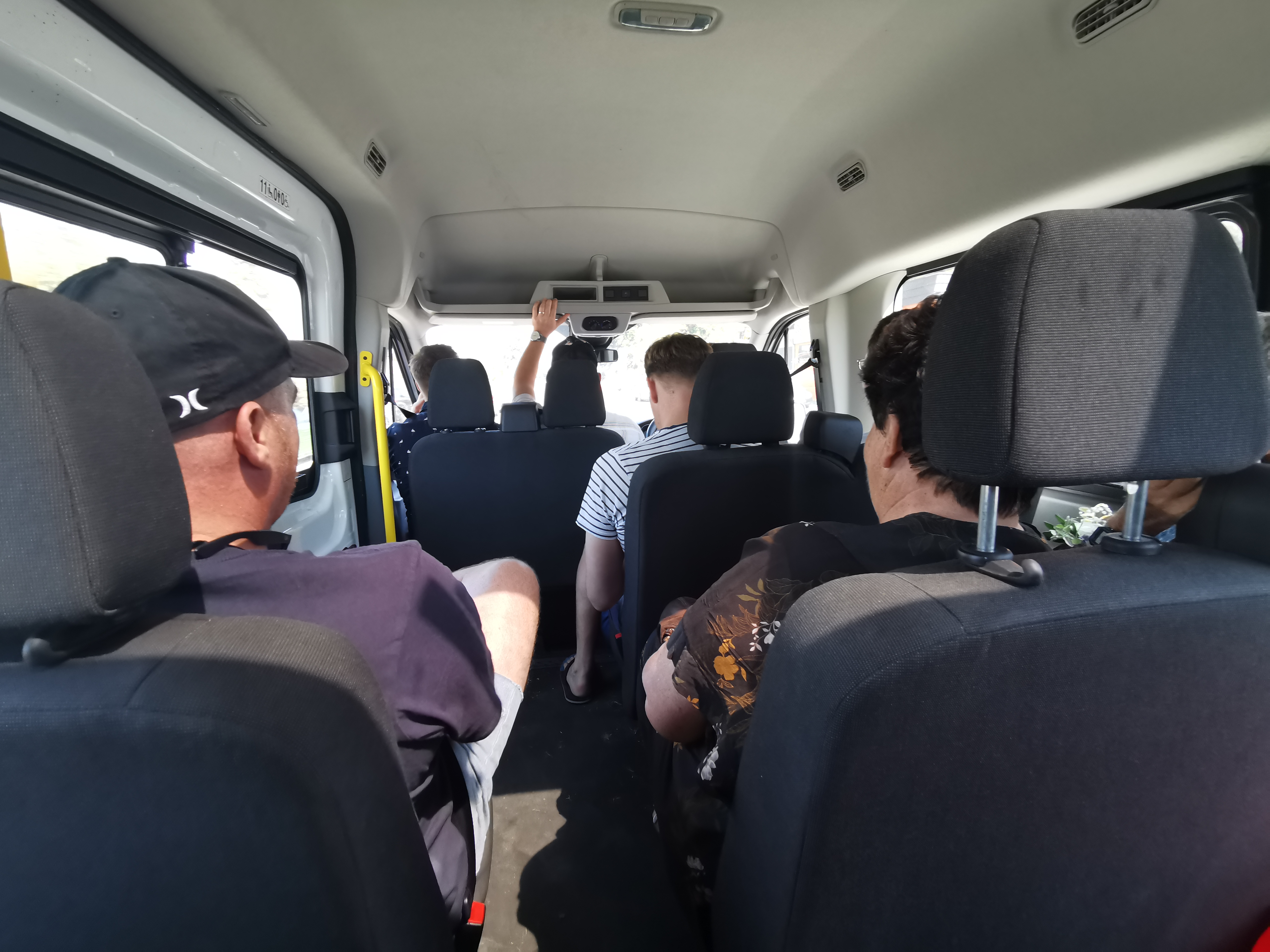
Since I had no car, I had to take public transportation to see my family at Christmas. On the plus side, I seemed to be the only person with this particular predicament.
The only one on the Gulf Harbour Ferry……with the Rangitoto Island Ferry in hot pursuit
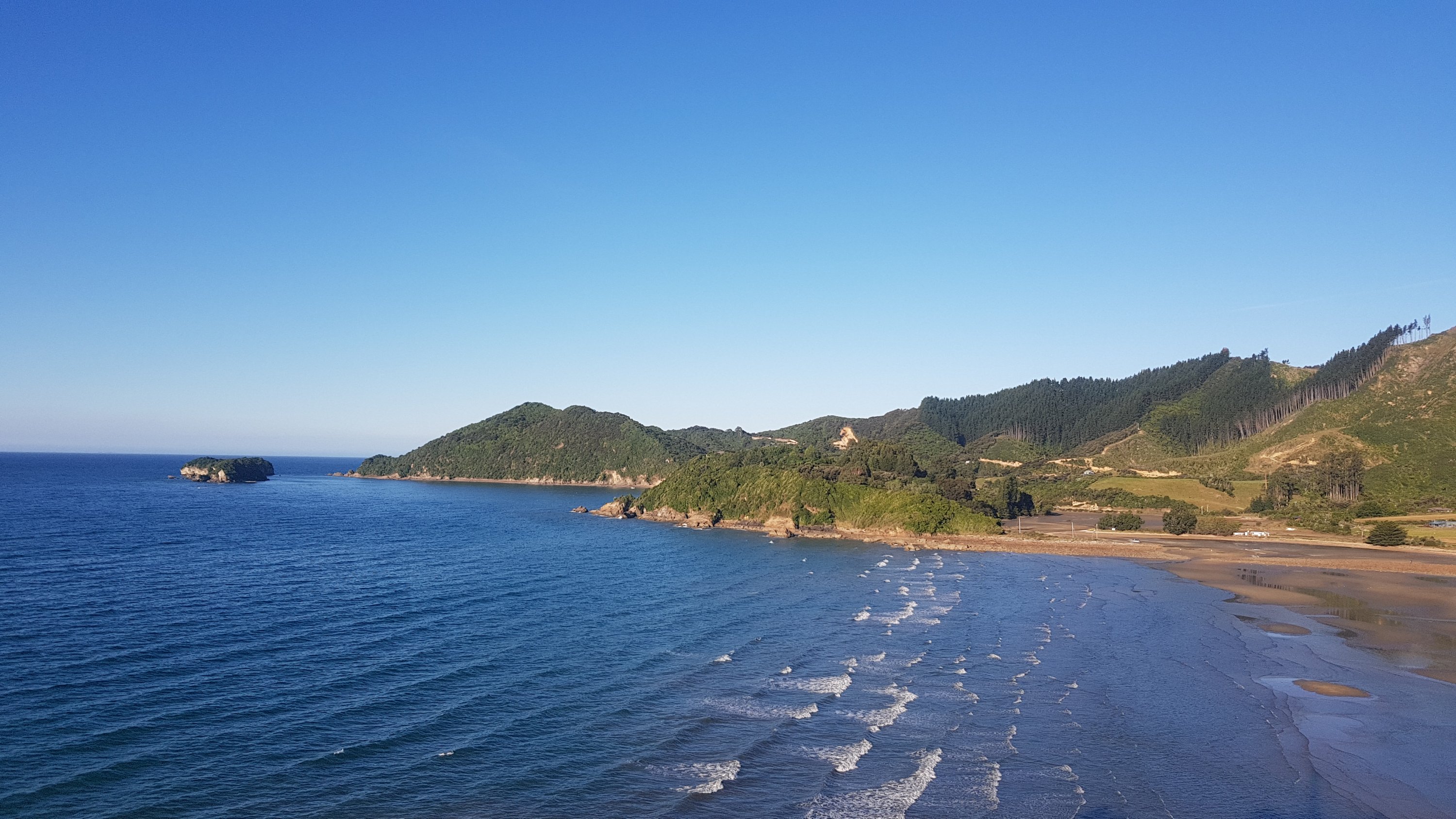
I had a great Christmas with my family. Then, I went to a place called Tata Beach with some of my friends for a few days.
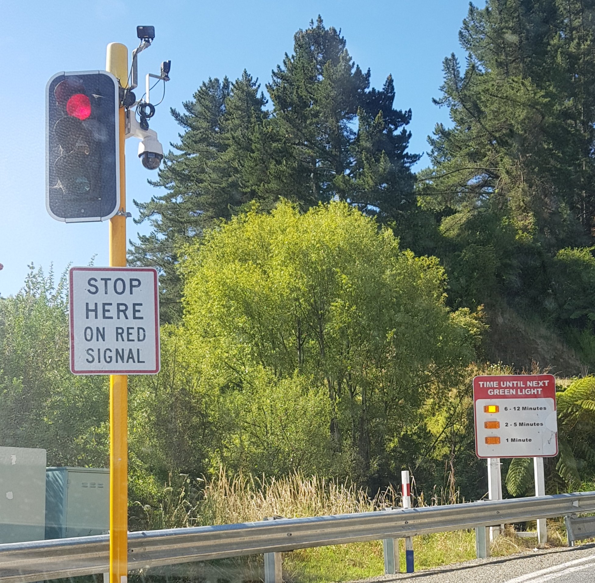
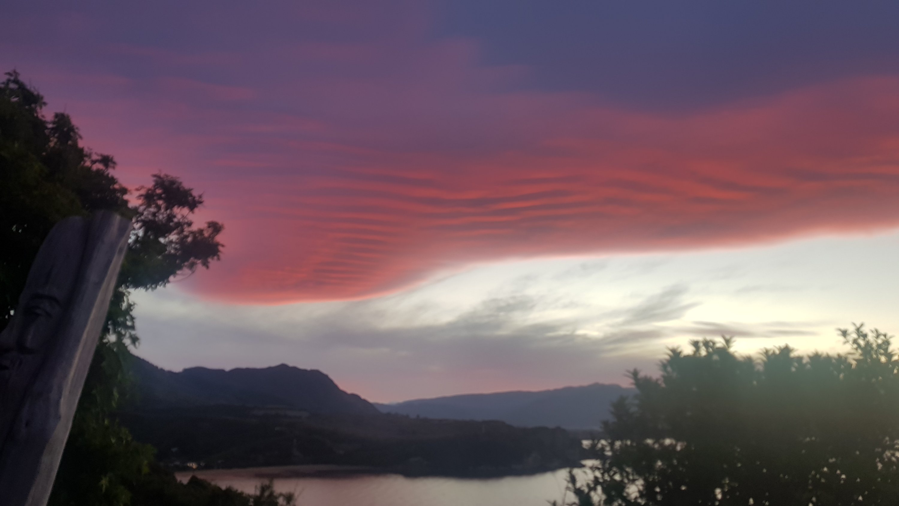
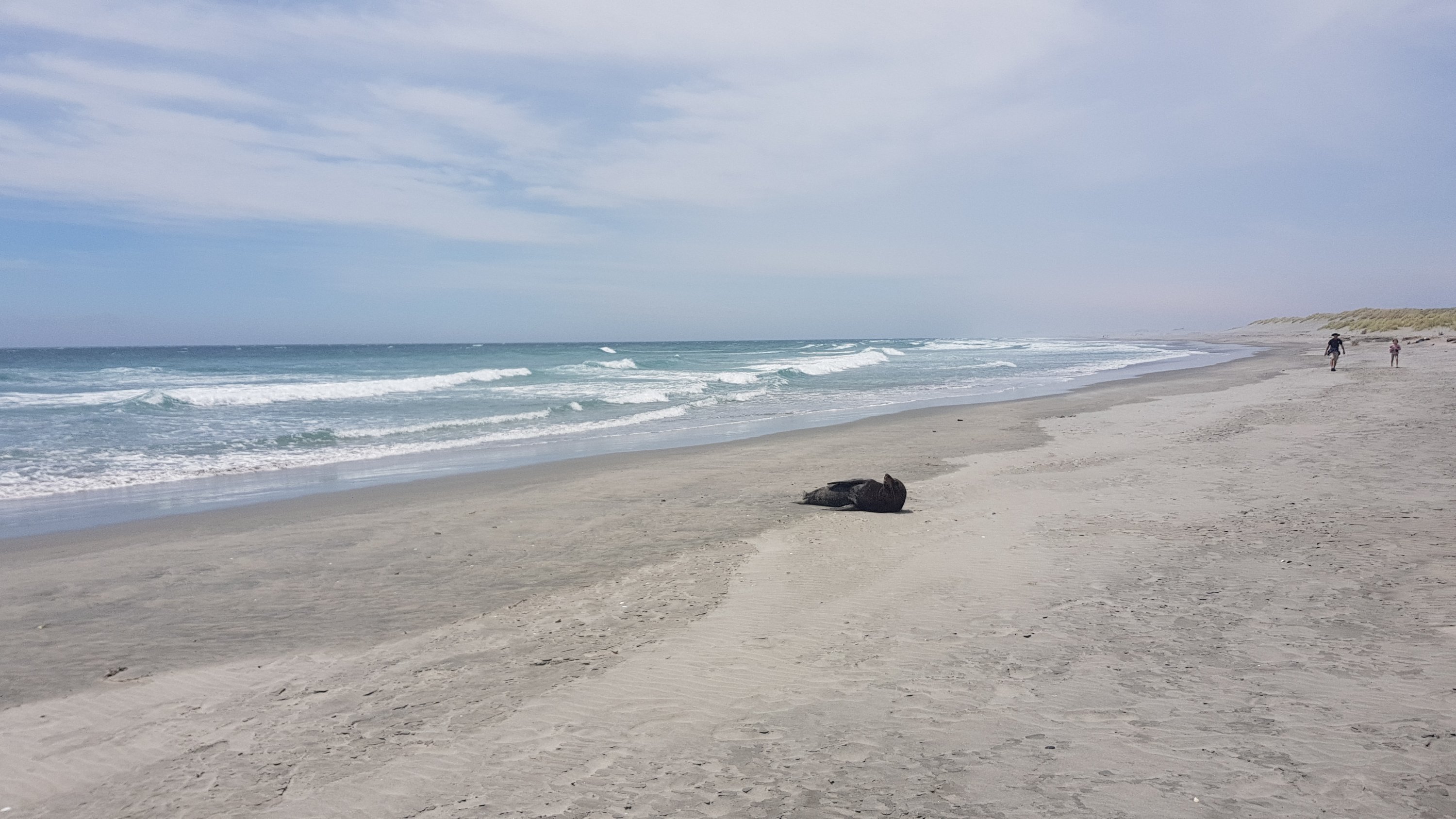
The longest wait at a red light ever…A nice sunset over the beachA very happy seal on a beach near Farewell Spit
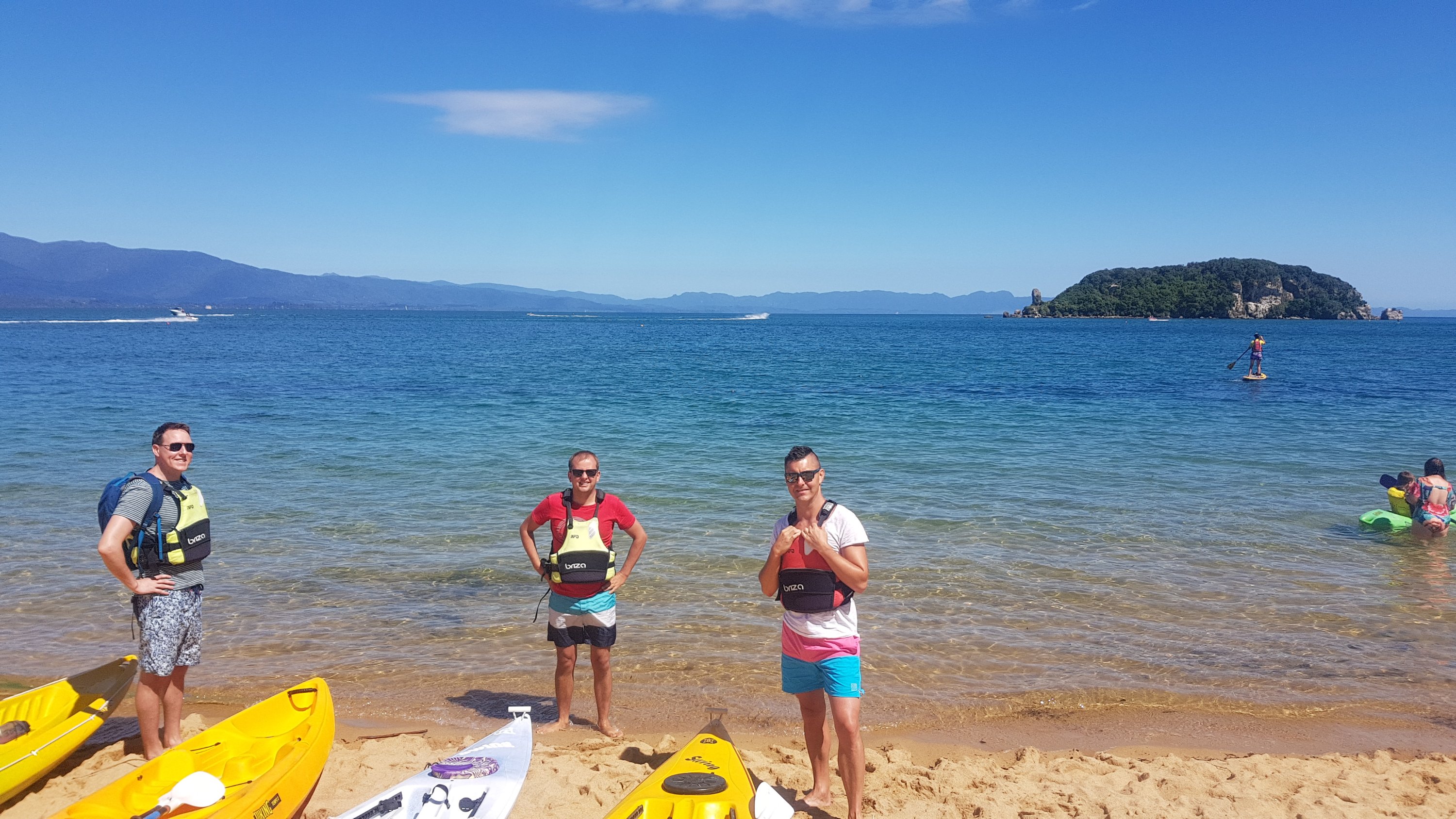
We hired kayaks while we were there…
Kayaks ready to go
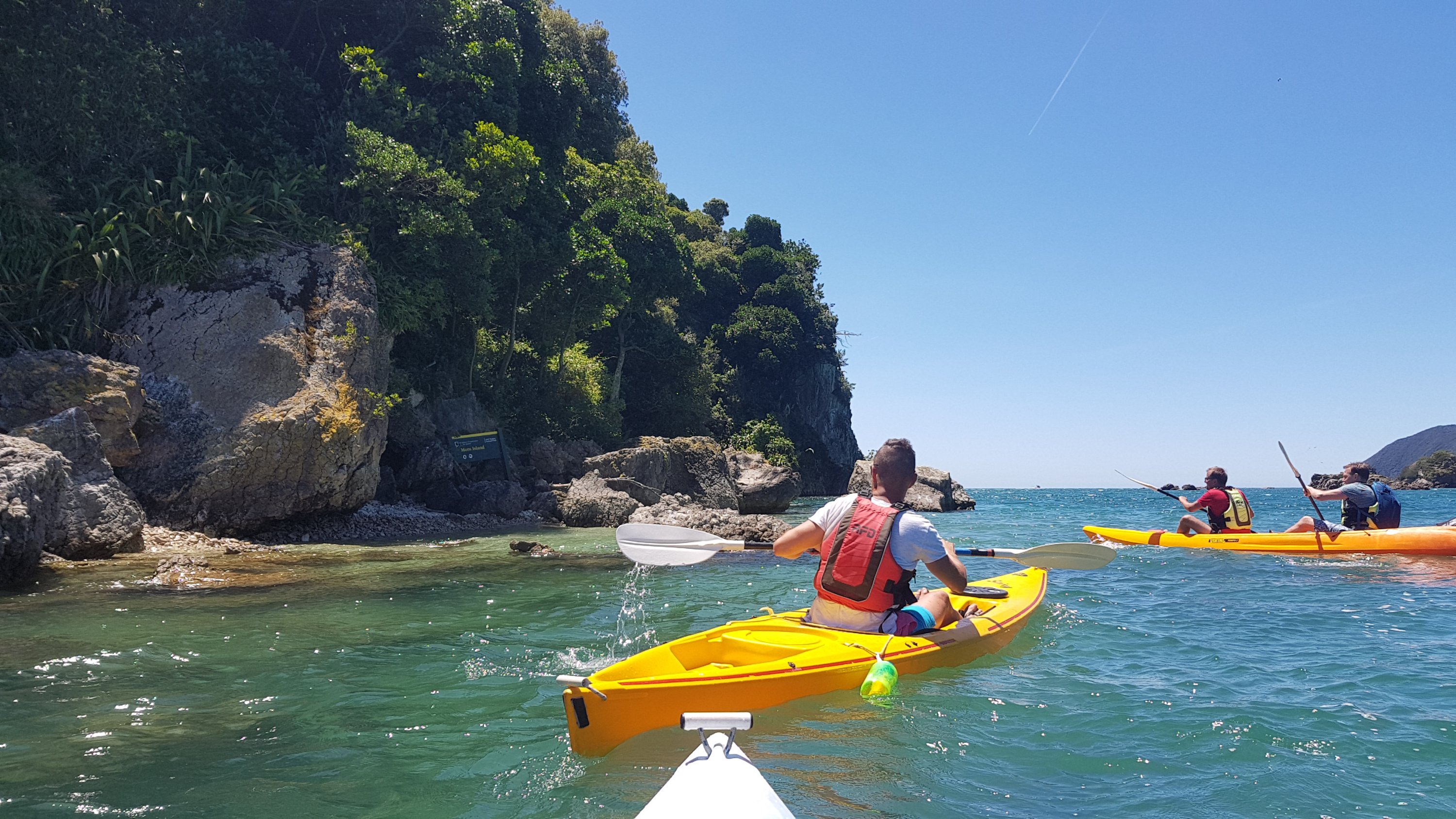
And took them to find a Terrain 5 geocache on Motu Island. I even got one of my friends into geocaching – he signed up for an account and continued looking for other geocaches even after I left!
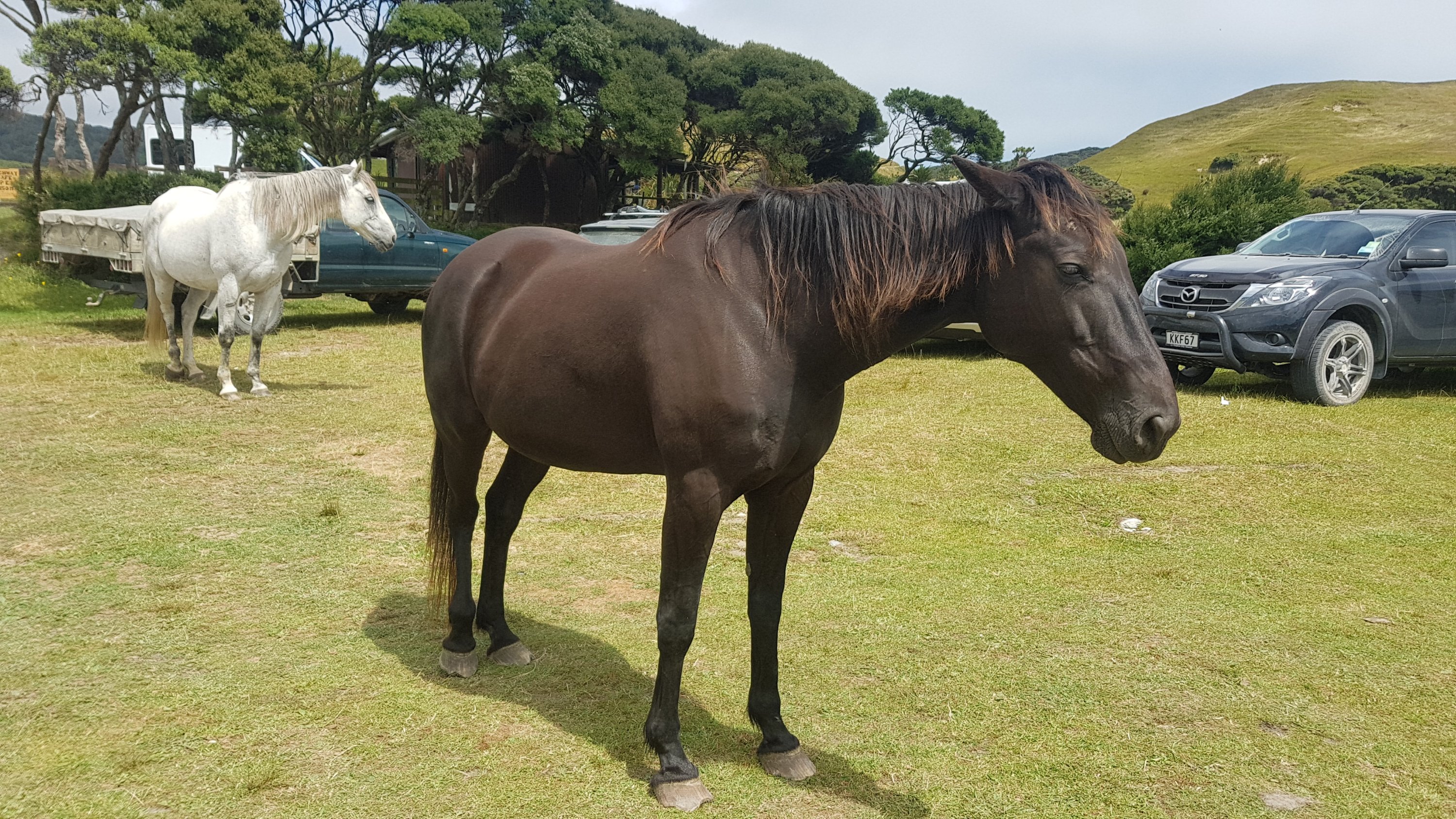
Approaching Motu IslandTata beach from our accommodation, with Motu Island on the leftGood looking horses in the car park
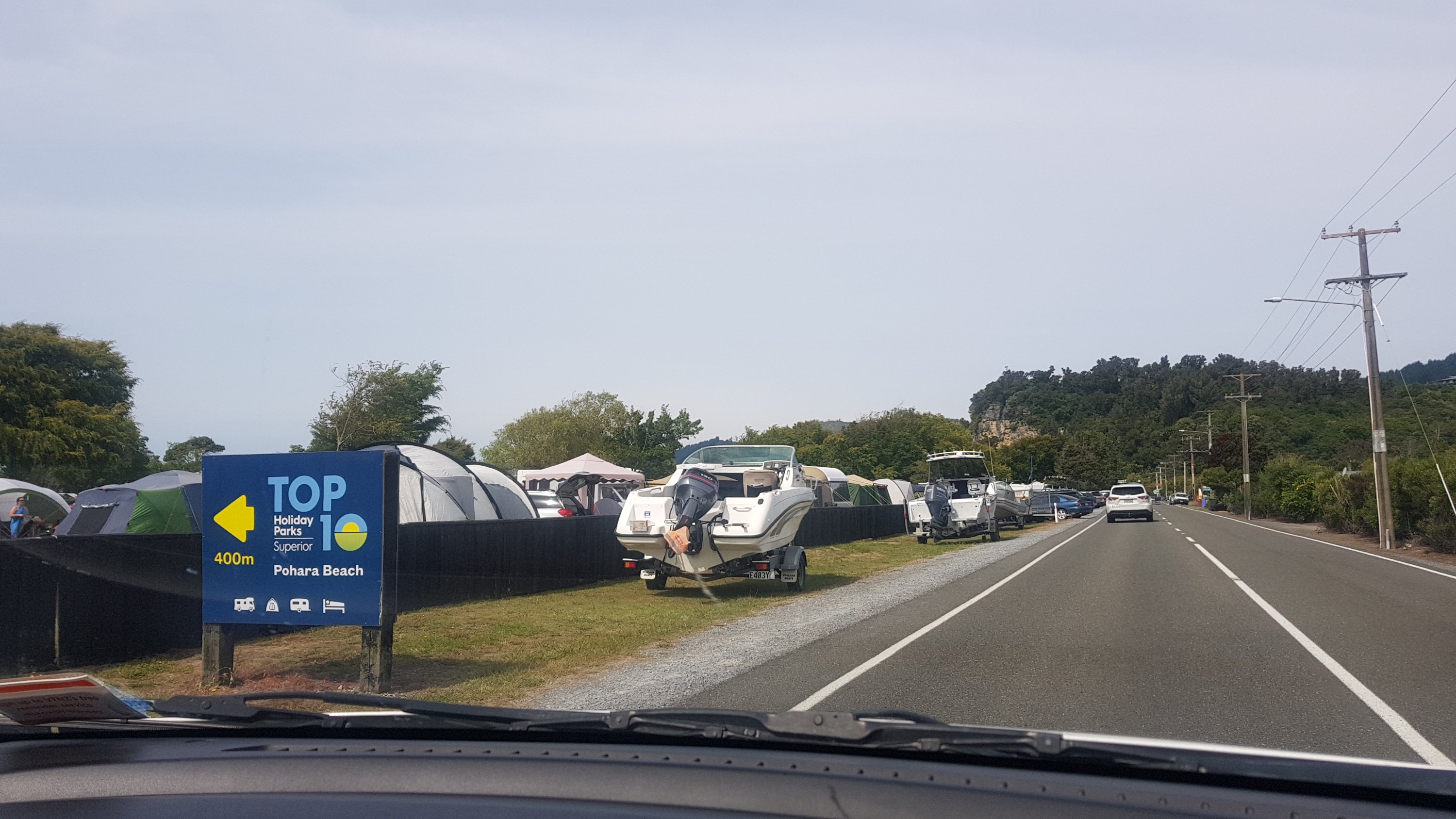
Looking on Facebook recently, I have seen lots of hikers on the Te Araroa group complain about full accommodation. I saw it first-hand here when we drove past the Top 10 holiday park at Pohara Beach. It was absolutely chocka-block despite being a huge place. Every single piece of grass had a tent or something on it. I’m kinda glad that I don’t have to deal with that right now.
Top 10 Holiday Park at Pohara Beach
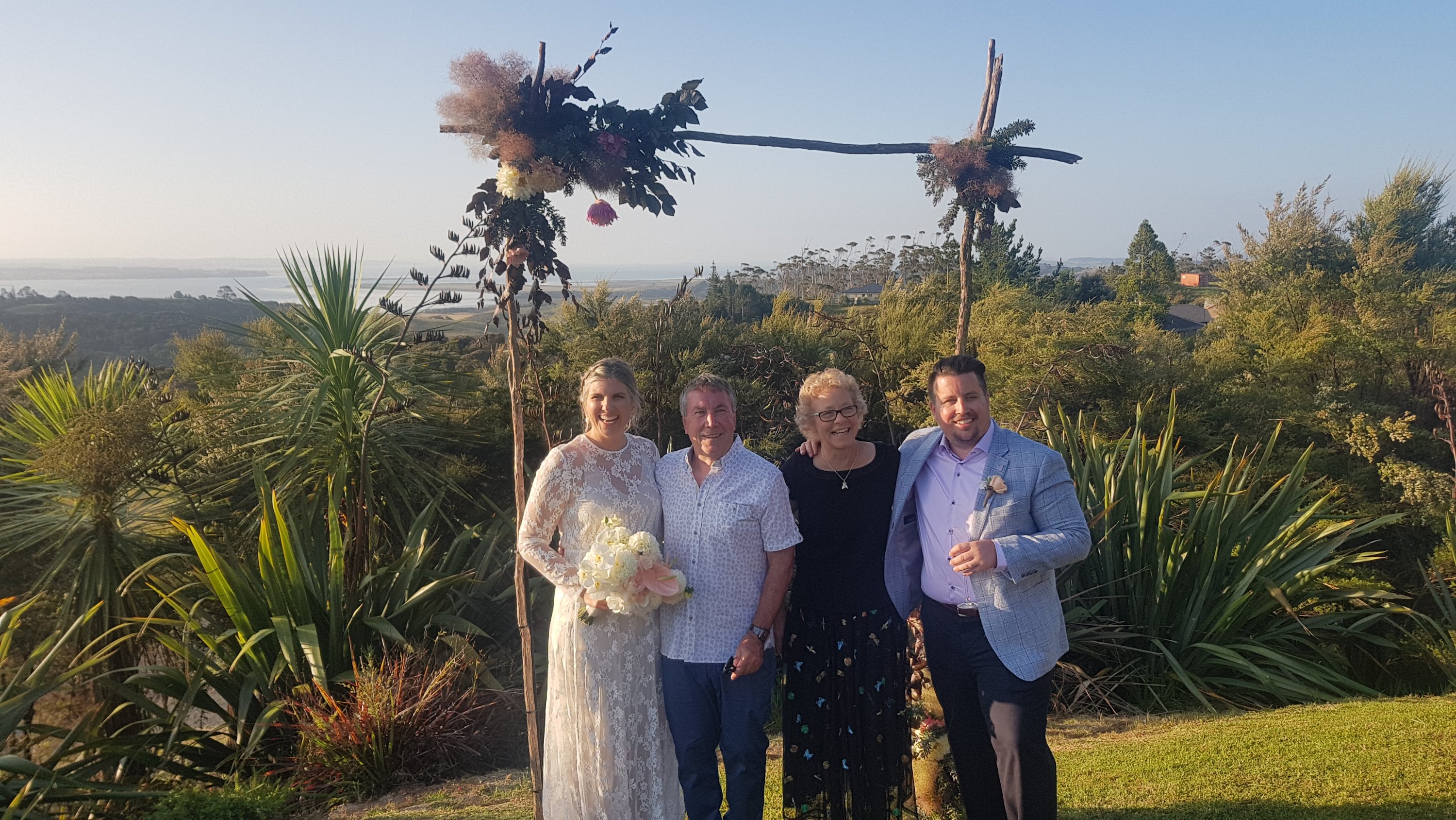
I flew back to Auckland to attend my stepbrother’s wedding on New Year’s Eve. It was advertised as an engagement party but when guests turned up they were told that it is actually a wedding. I’m one of the few people that knew in advance because they knew I was walking and so they needed to tell me the truth to make sure I turned up!
The bride and groom with my stepdad and Mum in the centre
Another surprise was that Fraser’s sister Naomi turned up from England, along with husband Paul and their son Seb. That was a surprise for everyone. Naomi told me how much of a fan she is of this blog. Hi Nomes!!
Great spelling on the electronic sign on the way home
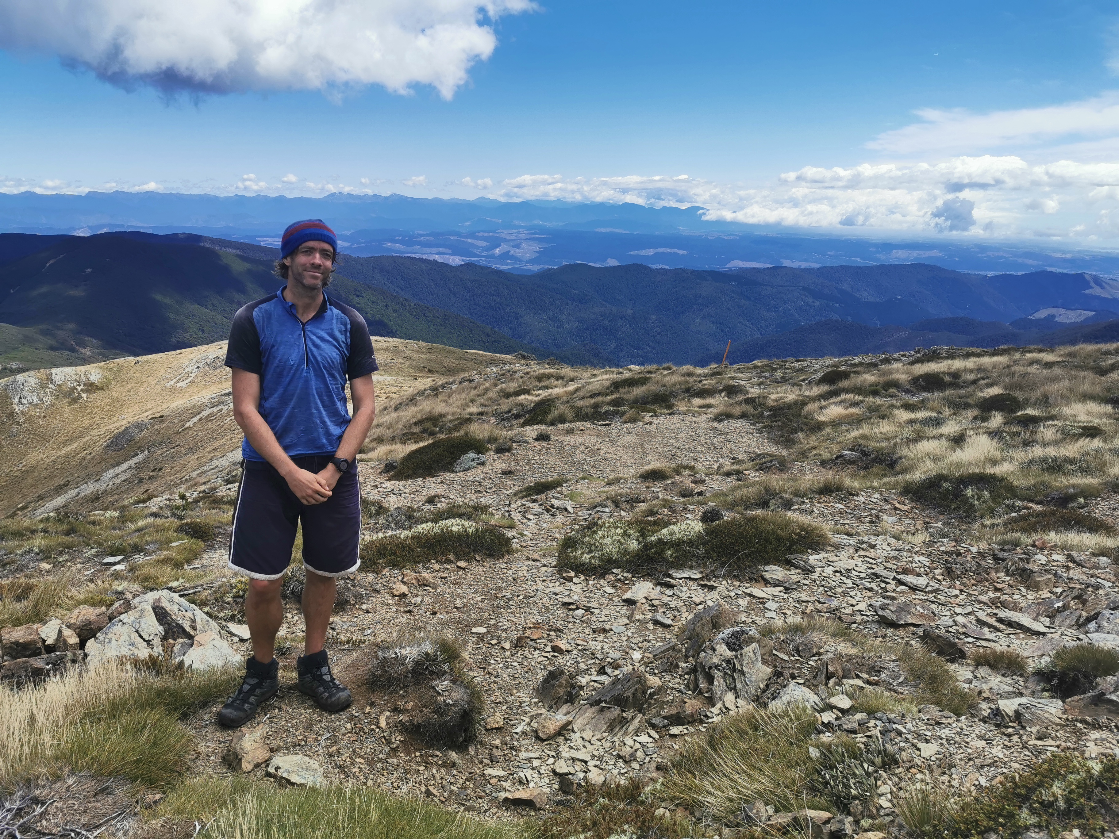
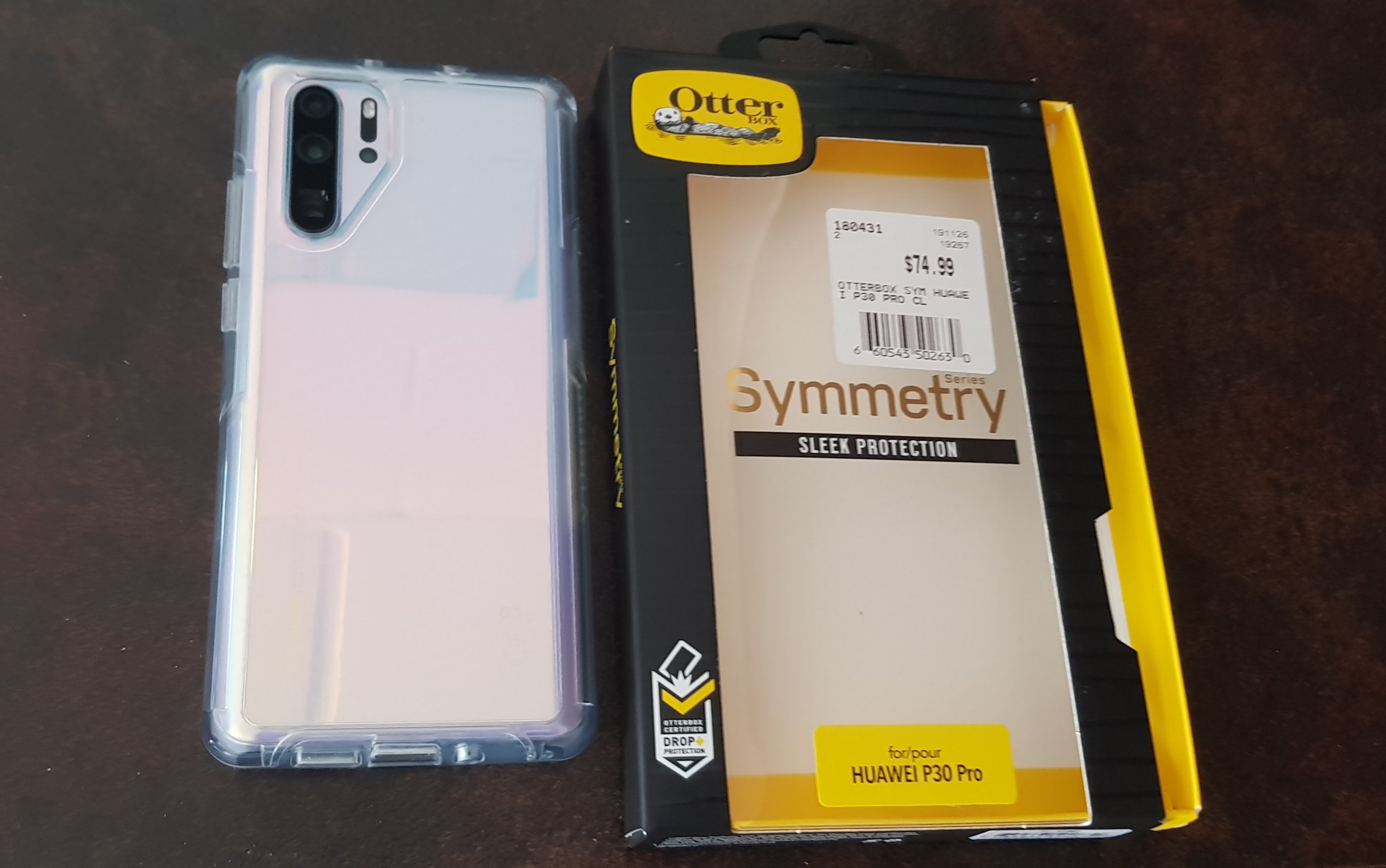
I finally bought a new phone in the Boxing Day sales to replace my backup phone that died at Te Kuiti around day 50. It’s a Huawei P30 Pro, which is supposed to have one of the best cameras on a smartphone out there. I’m happy to have a second phone again while I’m walking, in case something happens to one of them. Let’s see if the photos get better from here on with this new camera!
The P30 Pro sure has a lot of lenses…
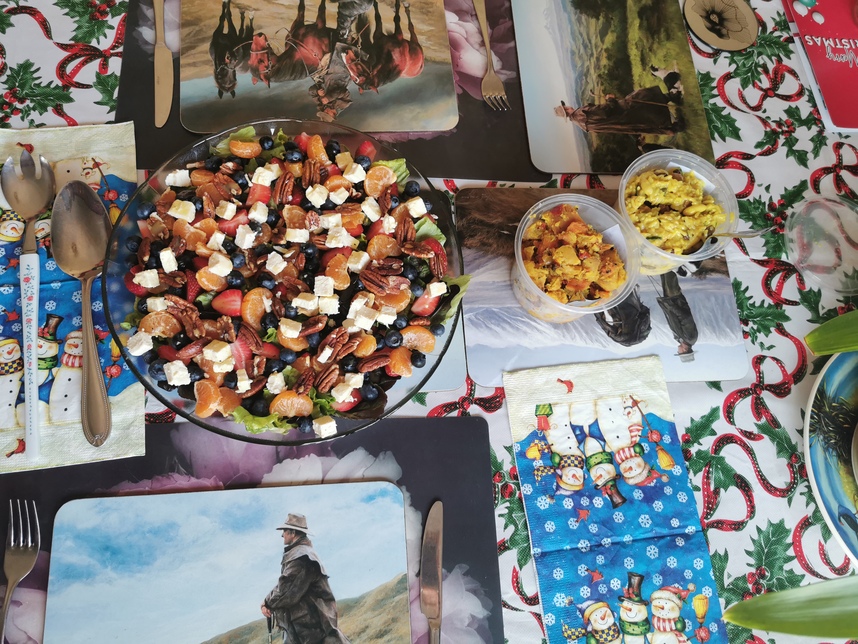
The first photo I took with my new phone was of a very colourful salad that was made for me by Lin. Hi Lin!
The colours seem to come through quite well on this phone, and you can zoom in quite far, it seems! Although the ratio of the pictures is different – the Samsung S8+ that I’ve used to take most of the photos up until now takes quite “wide” photos. The photos taken by the P30 Pro are more of a “standard” photo size.
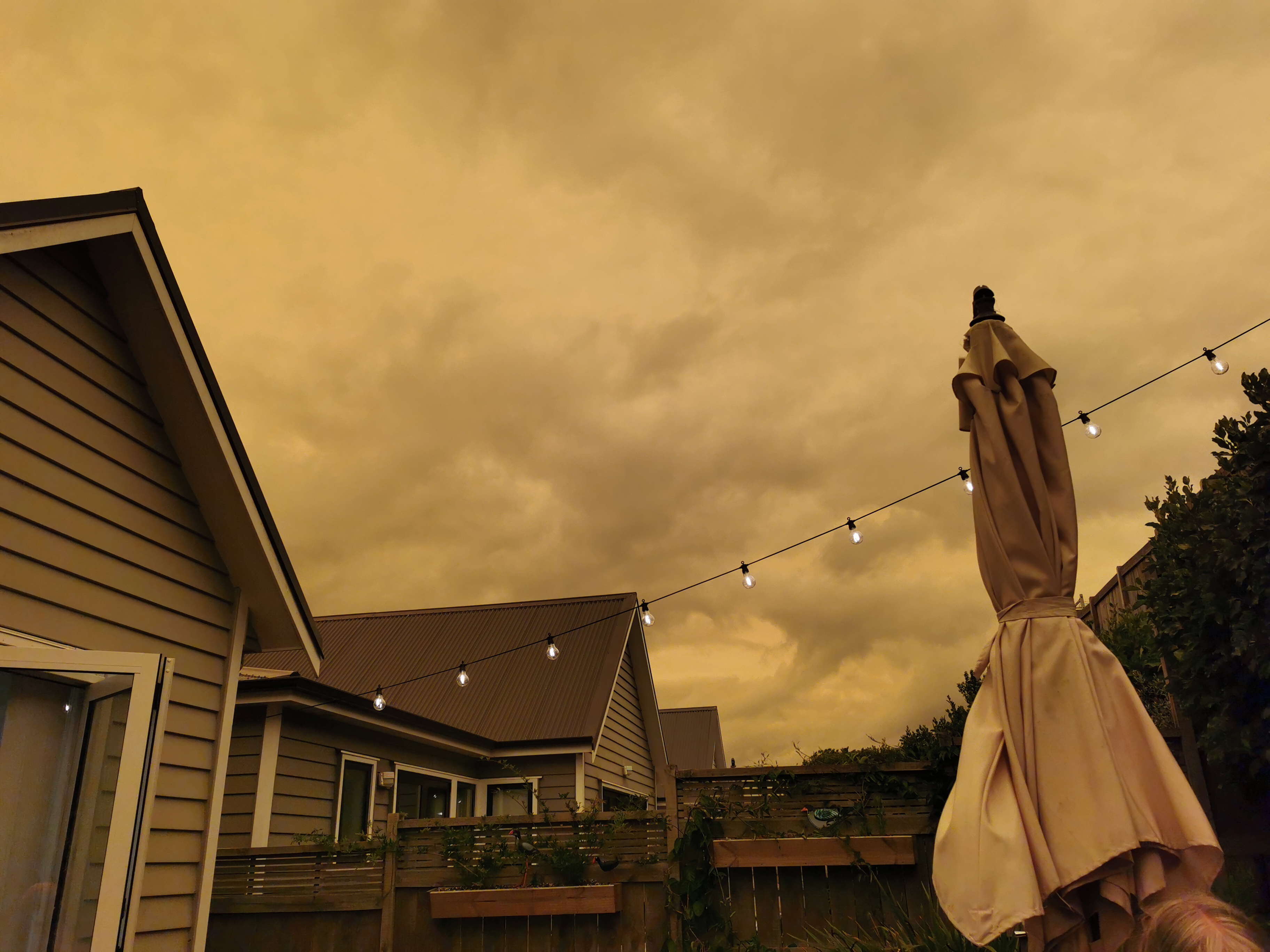
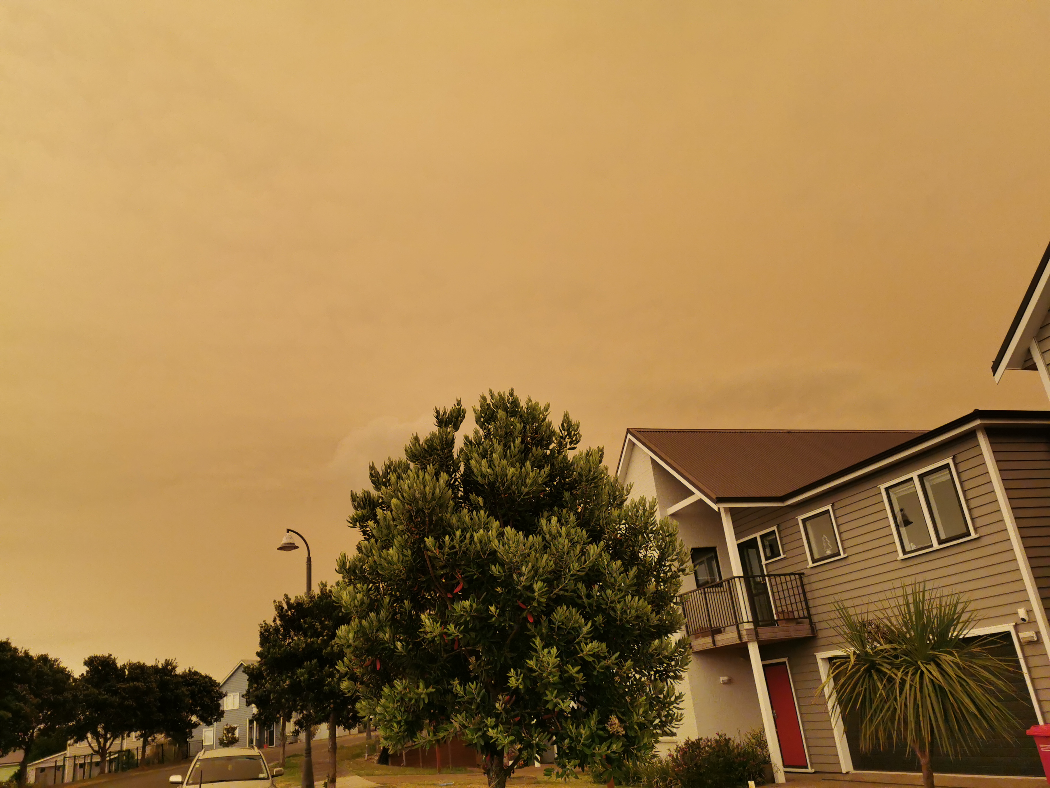
There have been a lot of bushfires in Australia recently, which is quite sad. On the 5th of January the smoke from the bushfires made its way over to New Zealand and covered Auckland and a lot of the rest of the country with a weird sepia-coloured glow. I can’t imagine what it must be like actually being near the bushfires, instead of thousands of miles away.
So yes, tomorrow I’ll be starting to walk again from Pelorus Bridge in the South Island. I’ve been looking forward to it over the last week! Although I don’t know if I’ll actually get any walking done tomorrow because on Wednesday the connection time between my flight to Blenheim and my bus to Pelorus Bridge is only 20 minutes – so if I miss the bus I’ll either have to hitchhike, which might take some time, or stay in Blenheim for one night and start walking the next day.
Also publishing new blog posts will be less frequent in the South Island – I need a good, stable Internet connection to upload the photos required for the blog, and I understand there’s not a lot of cellphone reception in the South Island. But I’m still planning on writing a daily blog post, even if I can’t publish it right away. Quite a few people over Christmas told me how much they like the blog and so I definitely have to keep writing it! Thanks to all of you!
Date: 8 January
Trail covered: 22.2km (kms 1803.5 to 1825.7)
Weather: drizzle
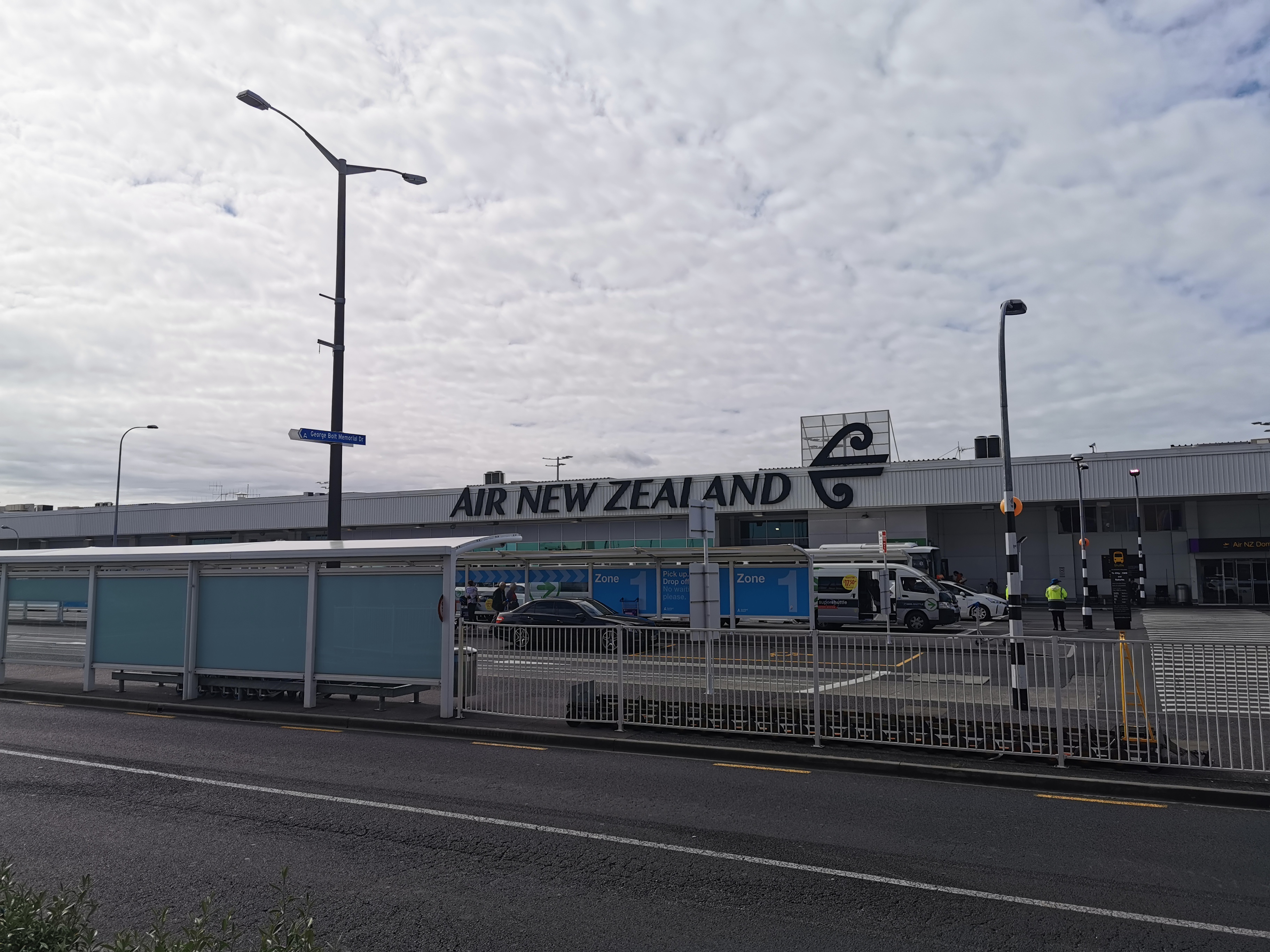
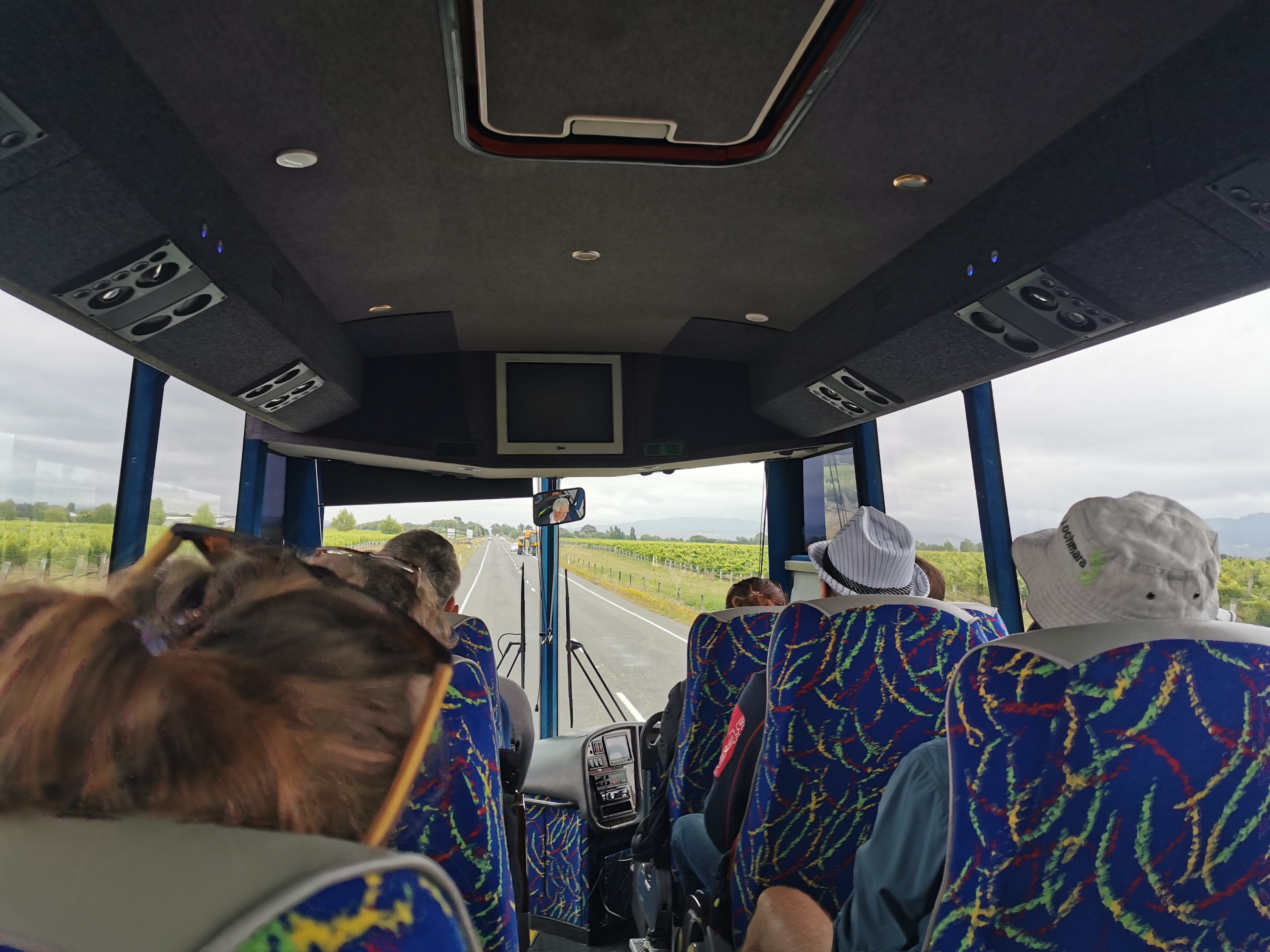
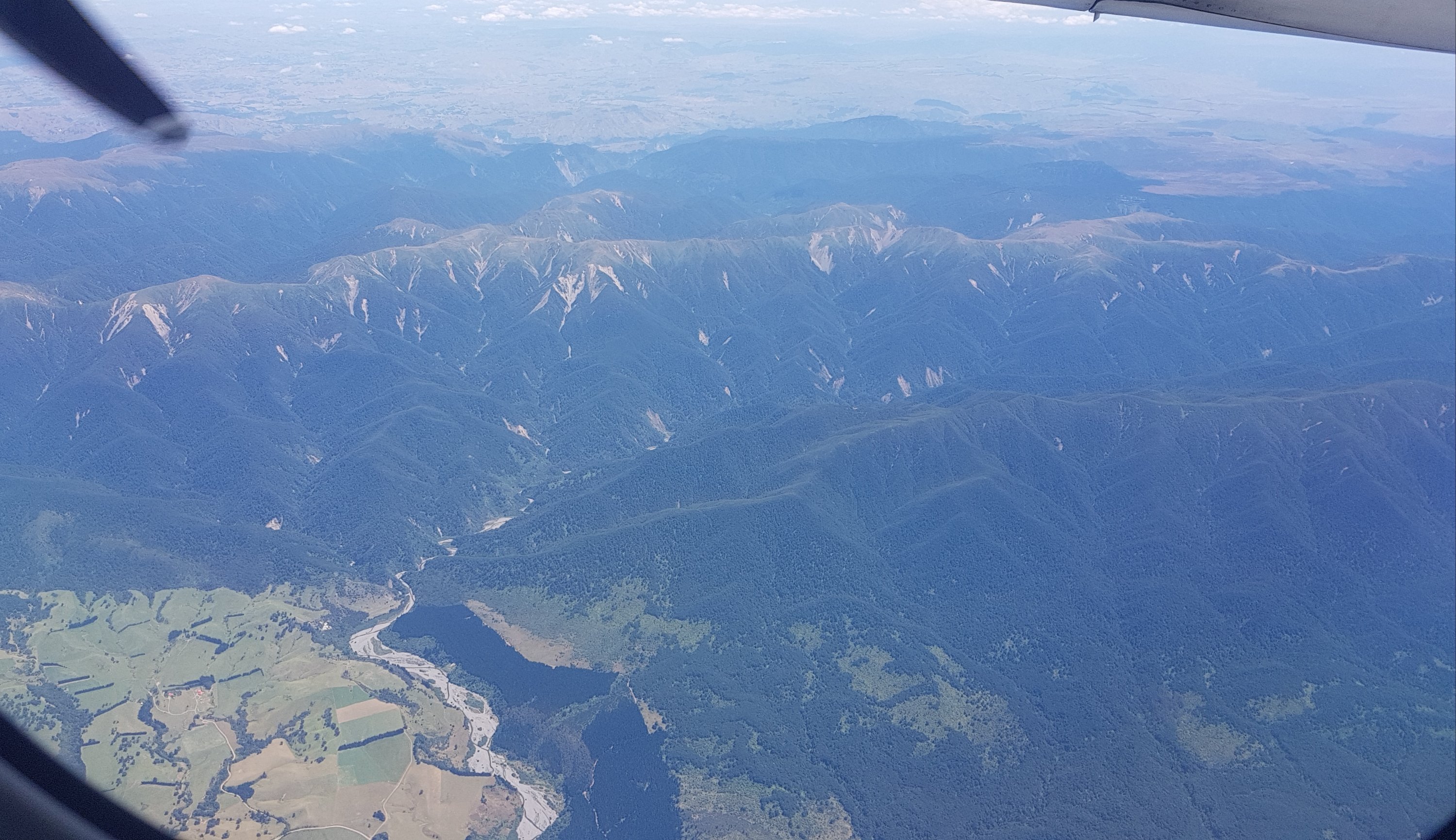
This morning, the first thing to do was to try and shift my flight to Blenheim to an earlier flight. Currently my flight to Blenheim leaves from Auckland at 11:40am, it’s scheduled to land in Blenheim at 1:10pm and the bus from Blenheim to Pelorus Bridge leaves from the airport at 1:35pm. That leaves only a twenty-five minute connection to land on the flight and get on the bus. And past experience has shown that Air New Zealand flights are always late, and the Intercity bus from Pelorus Bridge in December arrived 15 minutes early. Because that means I’m likely to miss my bus, I need to try and to switch my flight to one that’s at 9:30am.
Auckland Airport domestic terminal
I got to Auckland Airport at 8am and tried to change my flight… but no, it’s full. I waited until right up until 9am and kept checking but no seat became available. So I stayed on the 11:40am flight, and I’ll just have to accept that if the flight is late or the bus is early, then I’m going to be hitchhiking to Pelorus Bridge instead.
While I was having breakfast at the airport, the lady from aviation security came over to me and pointed out that my credit card had fallen out of my shorts pocket and was just sitting on the ground. That’s not a good start to the day… Lucky I didn’t lose it at least!
11am came and went without me taking my 11am photo. I disabled the alarm on my phone over the Christmas break and so I completely forgot. That’s the first time I’ve forgotten the 11am picture! If I had’ve remembered to take it, it would have been looking at the departures area from the cafe where I was sitting. I’ve re-enabled the alarm so I should remember from now on!
We boarded the plane on time and it appeared that the plane wouldn’t actually be late, which was nice. There was a lady sitting in my seat on the plane, which normally would annoy me a bit, but that allowed me to have her aisle seat so actually that would save me a few seconds when disembarking. Besides she was 90 years old and I would’ve felt bad asking her to move.
For the last two days I’ve had a really sore back, which has been really disappointing because I’ve had a sore back while I’ve been walking and two weeks off is supposed to have healed it. Although the back pain I’ve had in the last two days has been a real different type of pain. The back pain while walking has been a sore muscle on the side of my back, whereas this time it’s hurting right down the middle. It wasn’t hurting this morning but after a while sitting on the plane seat it started to hurt again. I really hope this doesn’t hinder me walking in the Richmond Ranges – that would suck.
Yesterday I went and got a massage in Auckland in the hope that would help with the pain. I think it did. I figured that the Chinese lady giving me the massage would be gentle and it would be relaxing, but no she was pushing as hard as she could and I think she was trying to pull my spine right out. But it definitely helped at the time.
The plane landed right on schedule, and the bags came out of the plane really fast. I was at the bus stop just outside of the airport by 1:15pm. Excellent – surely the bus can’t be twenty minutes early given that the stop is only 30 minutes from the start of the route.
I waited for the bus and by 1:50pm when it hadn’t arrived I tried to use Intercity’s bus tracking app but it didn’t work – “sorry, tracking for this service is currently unavailable”. A very unhelpful error message – why exactly is it unavailable? So I called up the call centre to ask where the bus was. The hardest part was trying to describe to the call centre guy what I was asking with the roar of the cars and trucks on State Highway 6 right beside me. But after a bit of back and forth he looked on his computer and told me that the bus was five minutes away, which turned out to be exactly right. It’s a shame I had to go to the effort of calling the call centre given they have written an app especially to answer my exact question… but at least the call centre was able to answer my question when I did call.
One on the bus it started raining. When we went through Havelock I saw three other people who looked like TA hikers – well, they definitely had walking poles and big green packs. I wonder if I’ll meet them – although they’ll be a day or so behind me.
There was also this guy with a Lochmara Lodge hat in front of me on the bus. He and a girl got off at the same stop as me.
Lochmara!
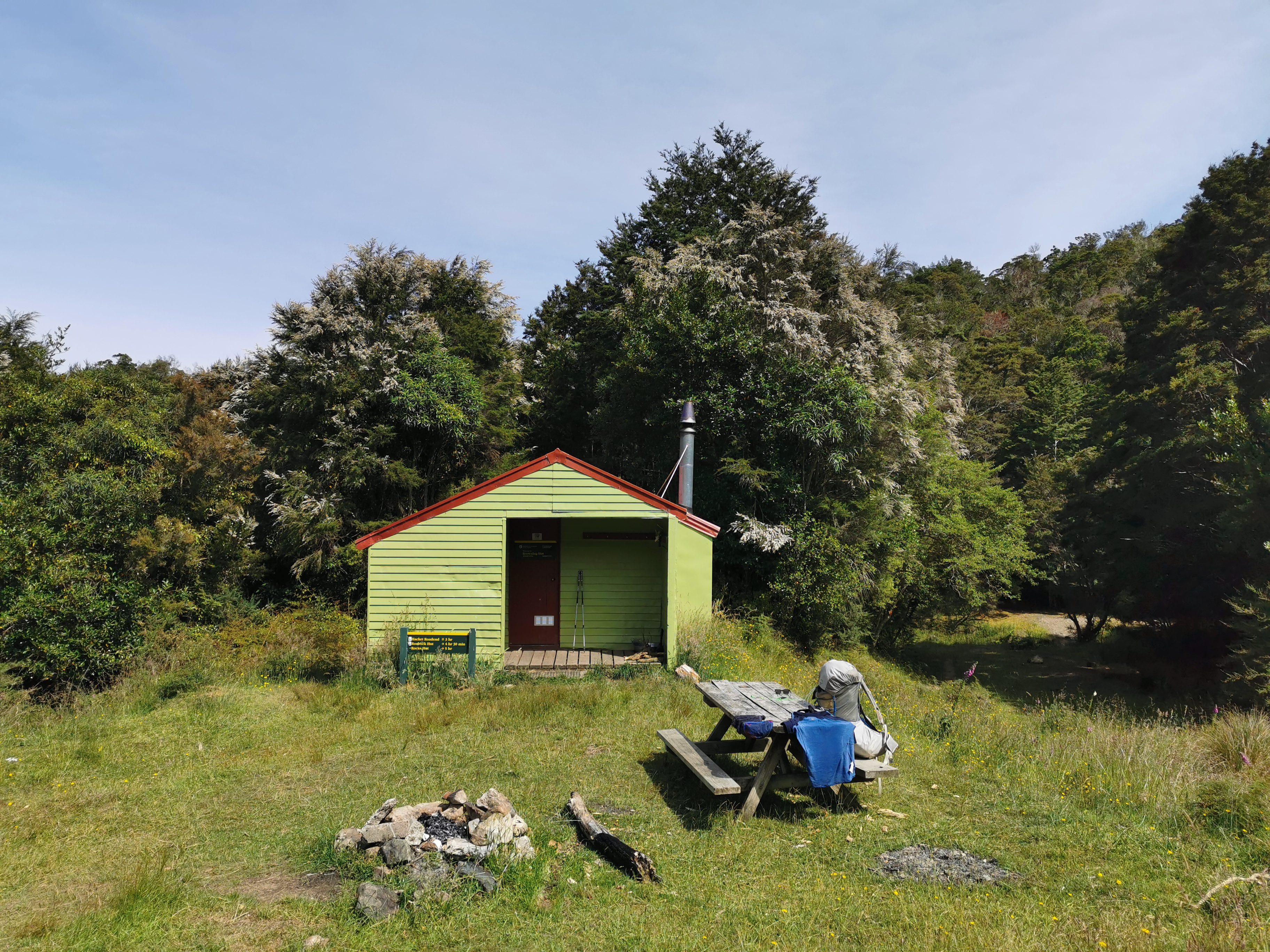
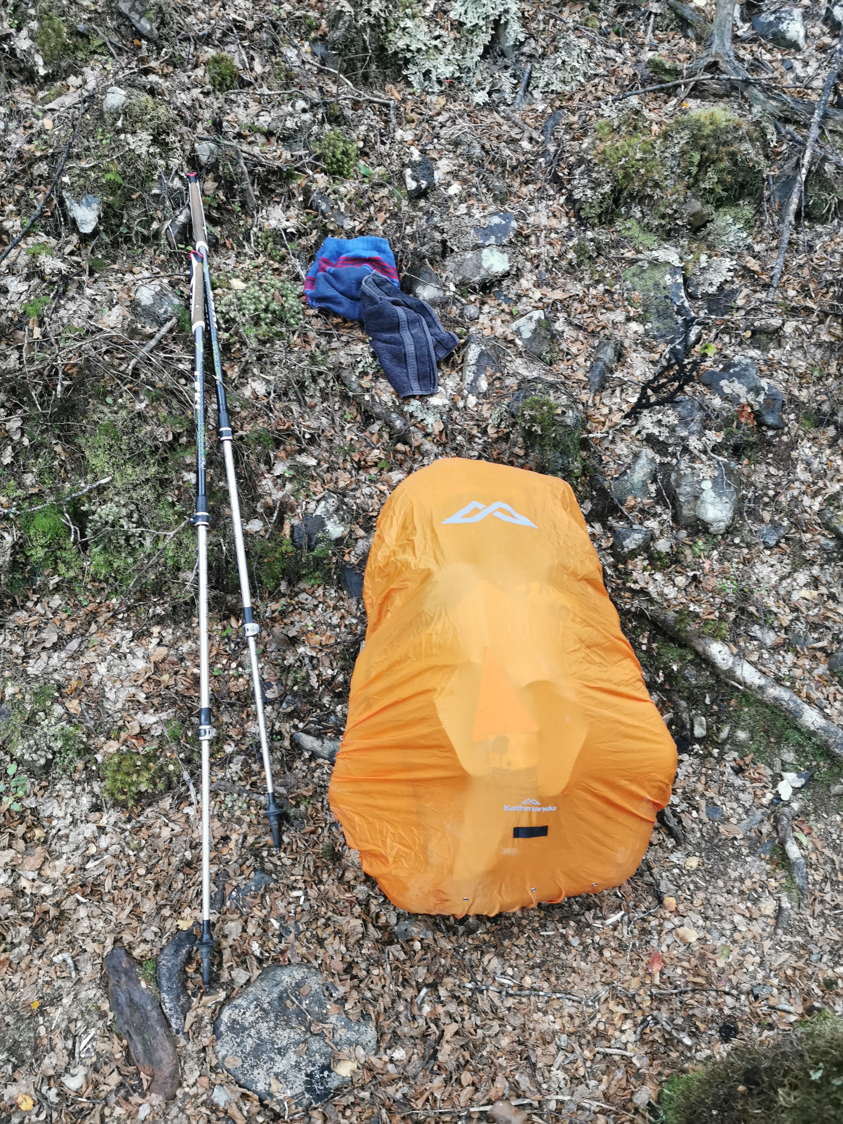
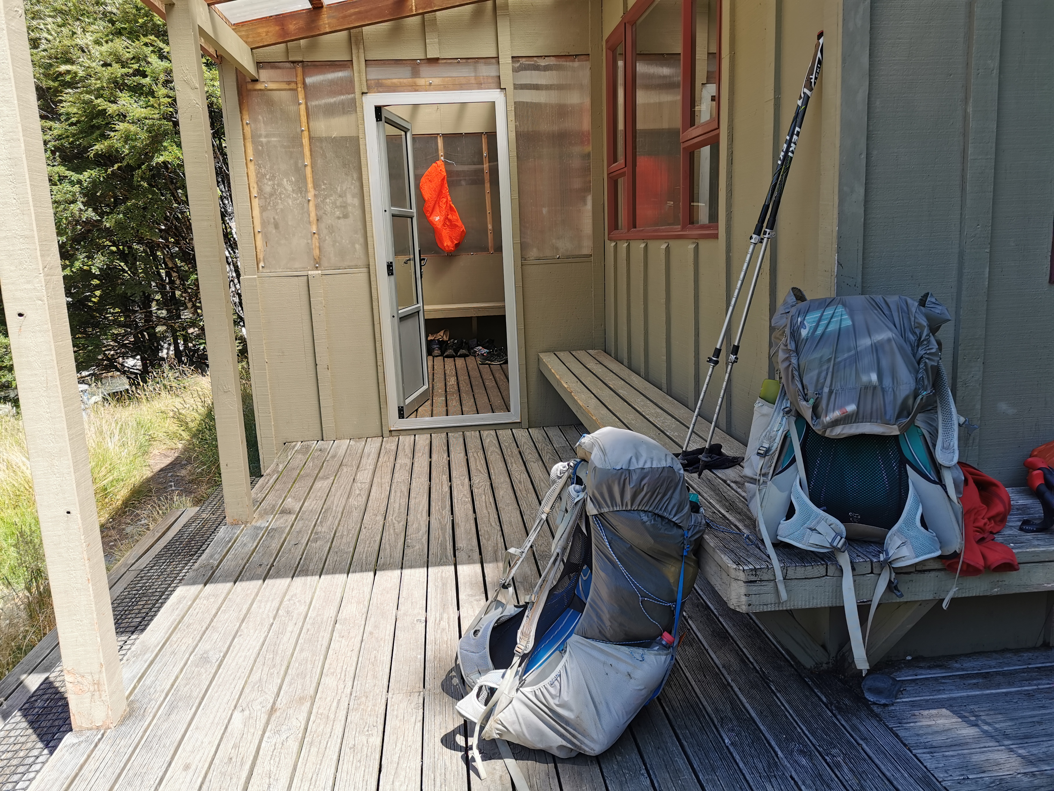
I first waited out a bit of rain at the Pelorus Bridge Cafe. The rain gave me a chance to try out the new pack cover I got from Kathmandu during the break. It’s heavier and thicker so hopefully it does a better job at keeping out the water – the old hi-viz one I had from Torpedo7 kept out no water at all despite apparently being “waterproof”. This new pack cover has two tighteners instead of just one, which means it takes a few seconds longer to put it on but it fits better.
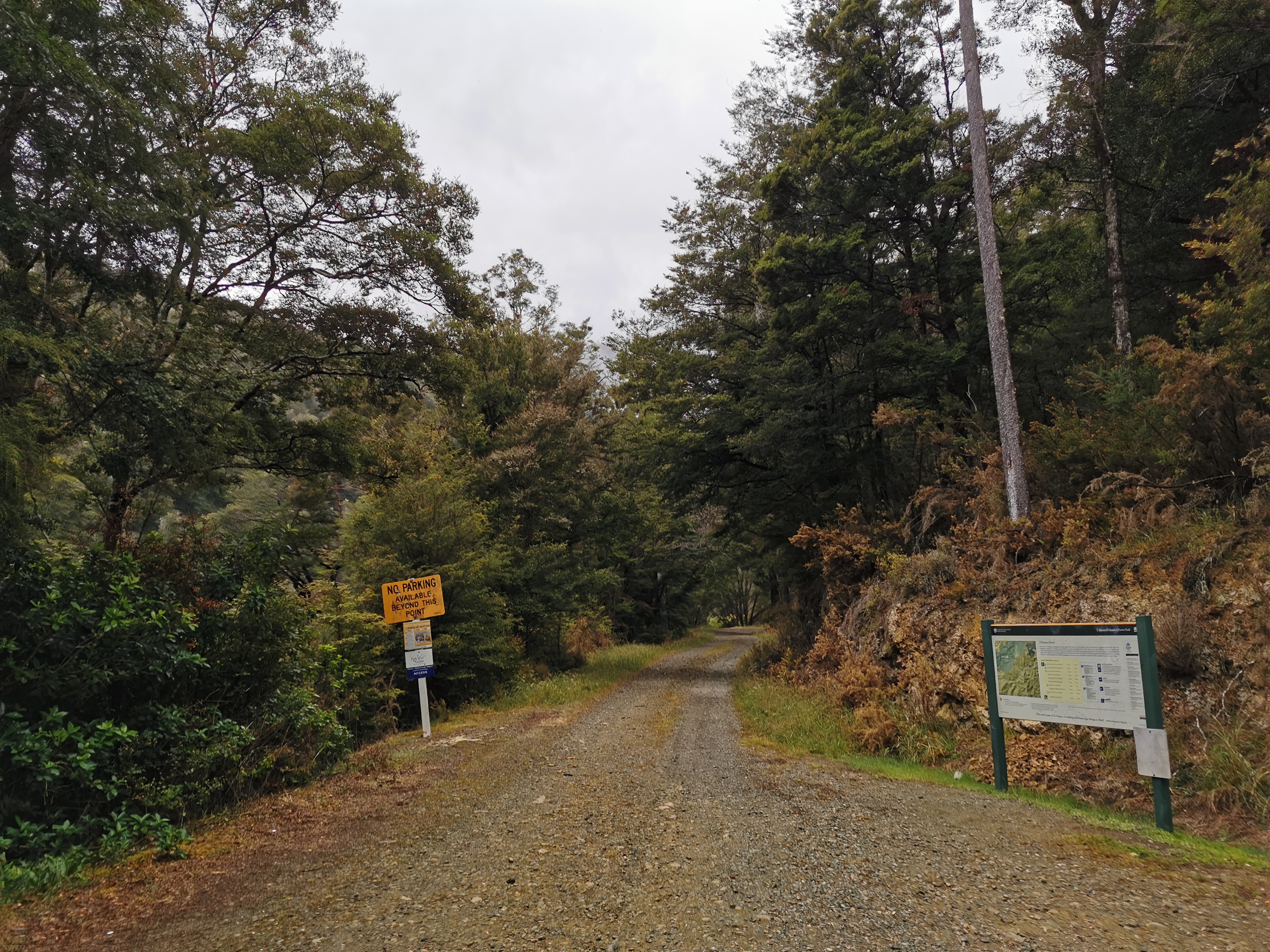
While waiting I talked to the guy running the campsite and he said that the last two weeks have been nothing but glorious weather. Of course I missed it all! I left from this exact point on 20 December in the rain and now here I am back in it again.
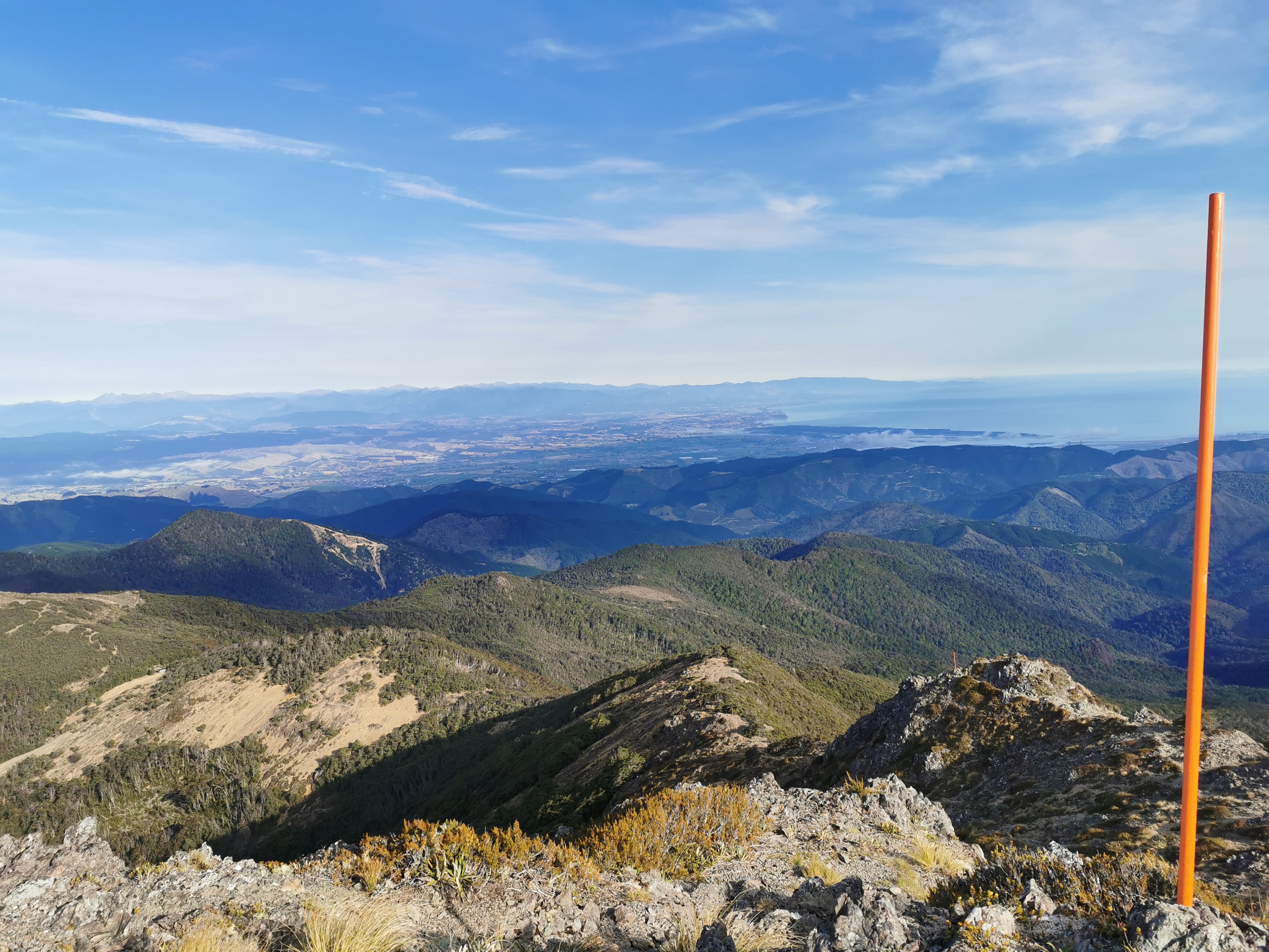
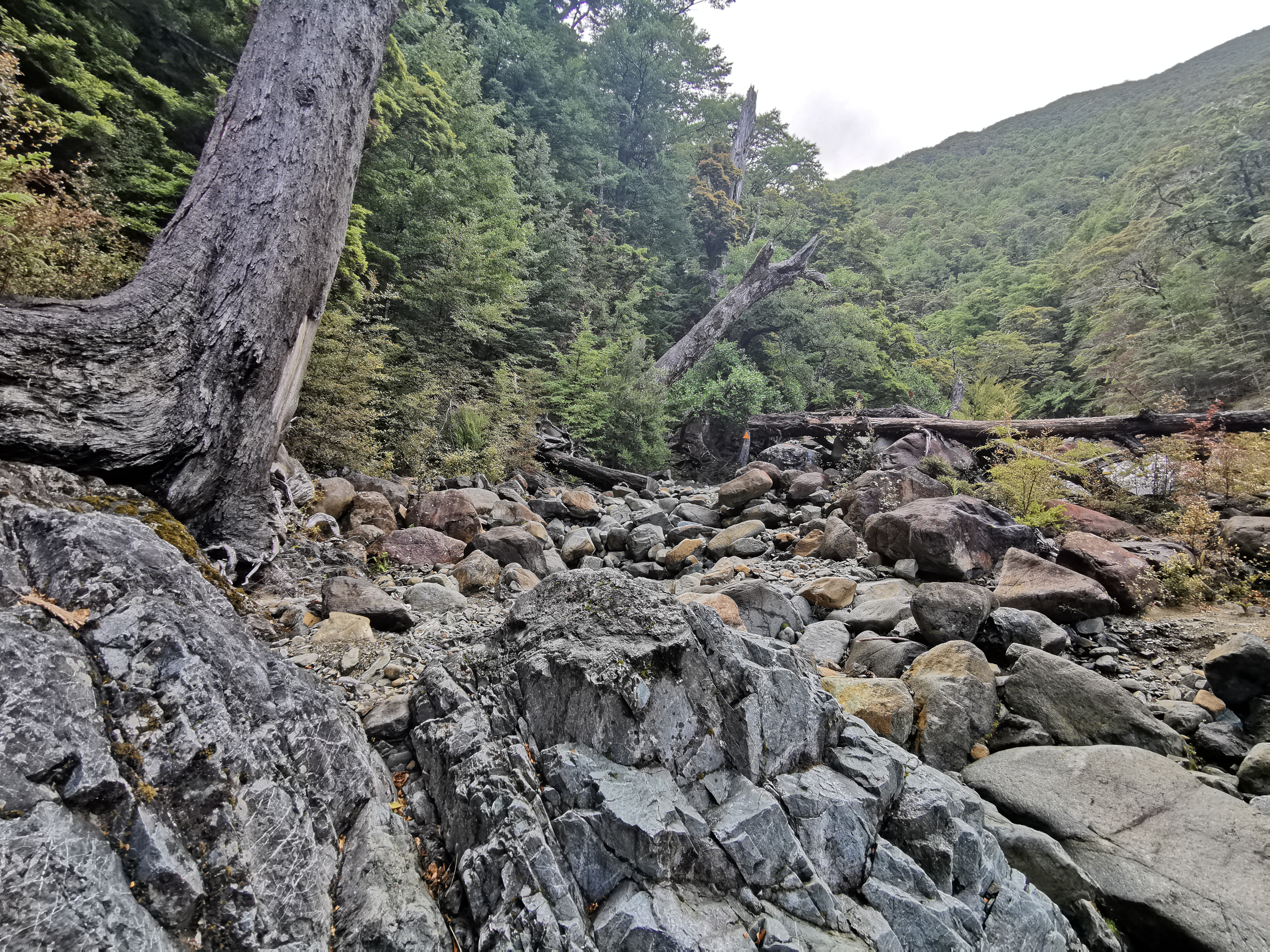
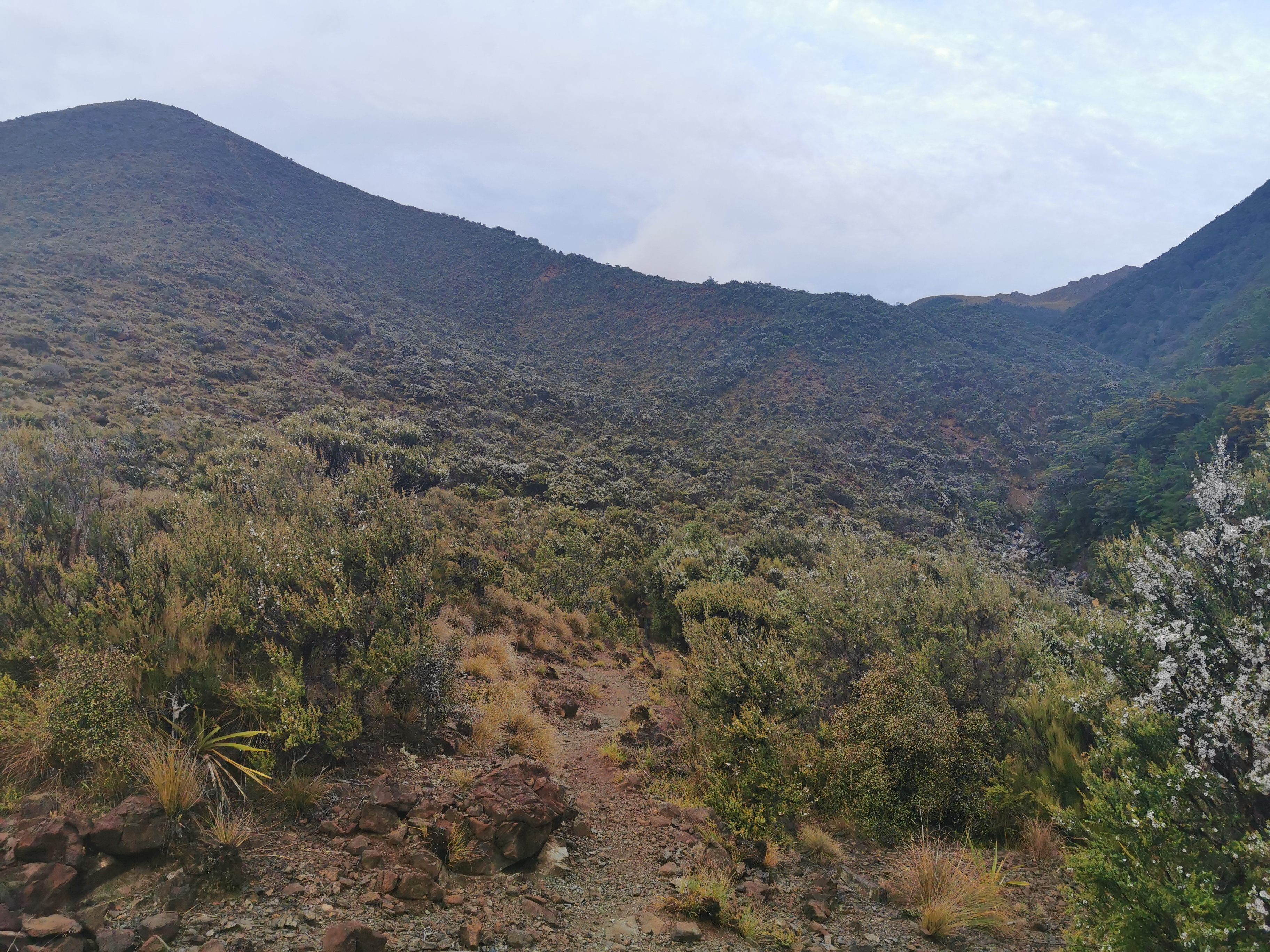
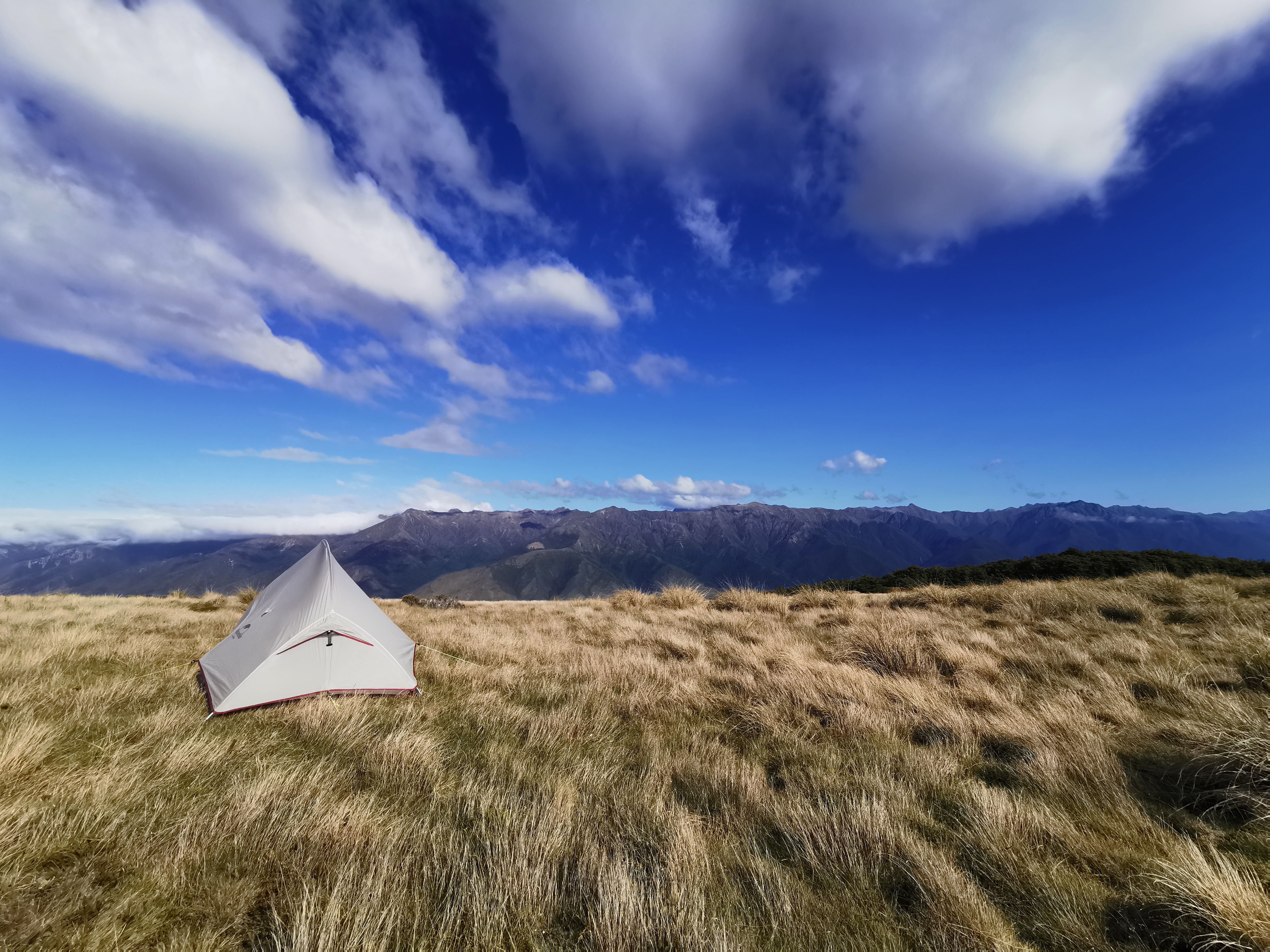
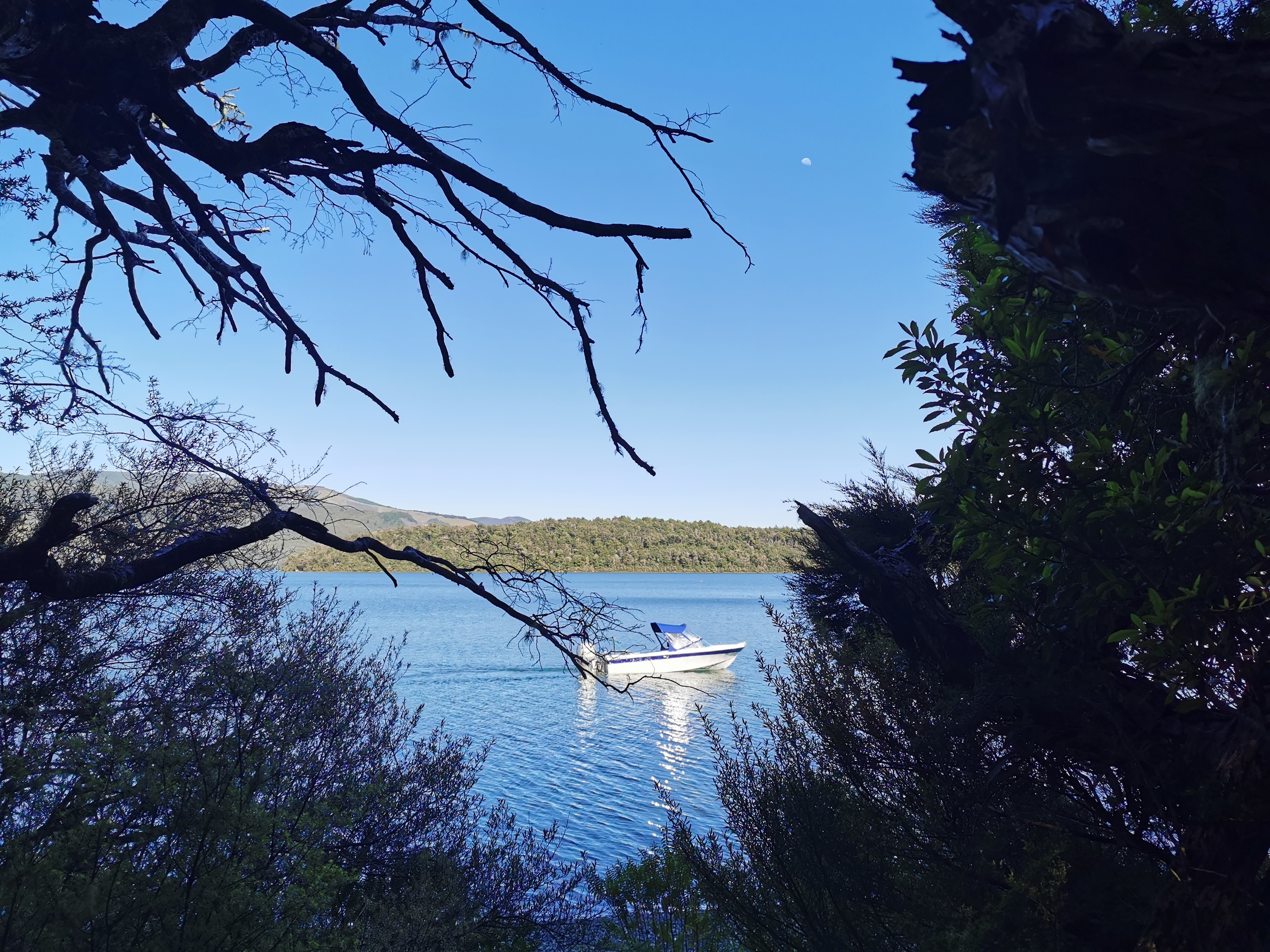
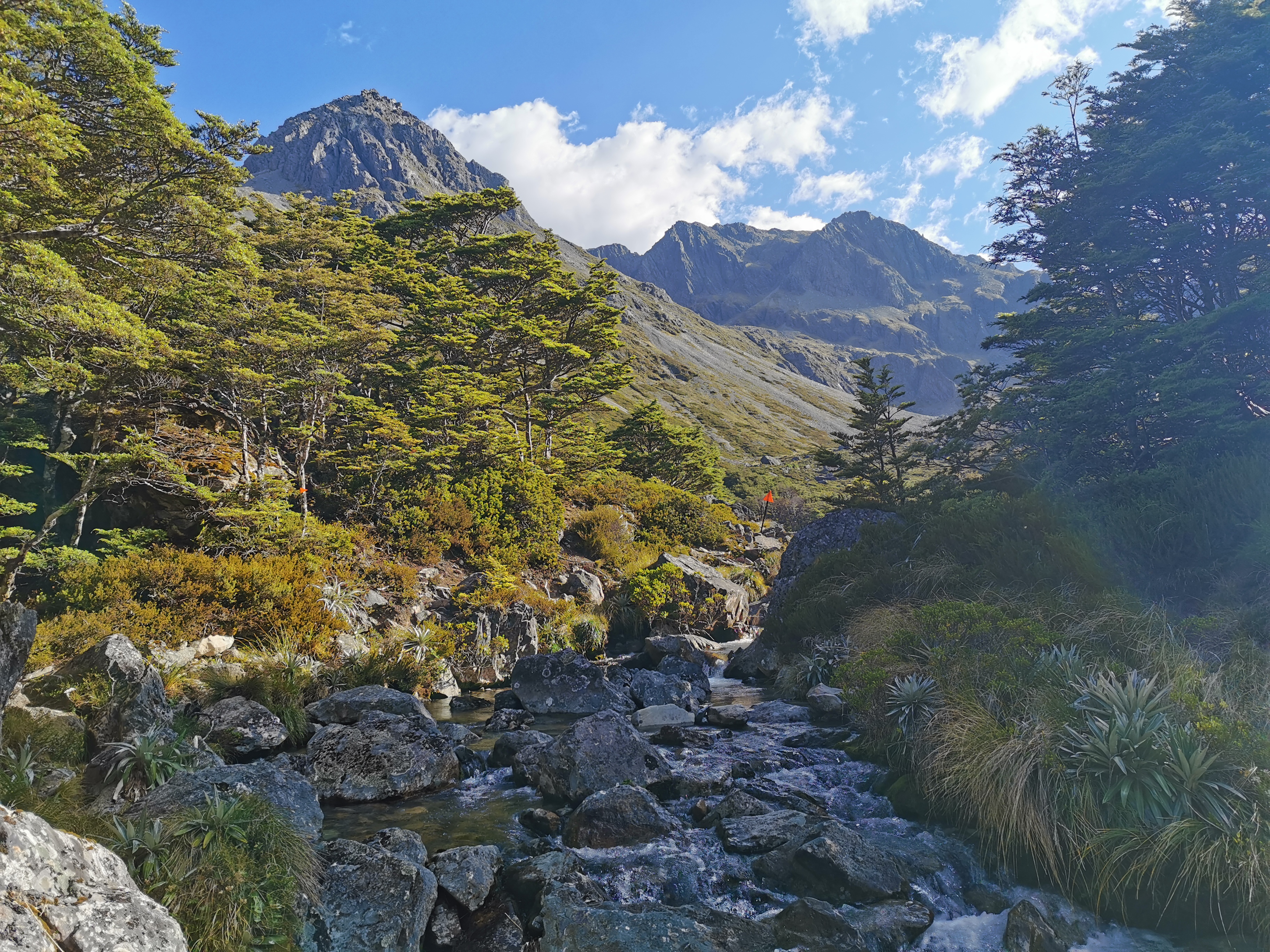
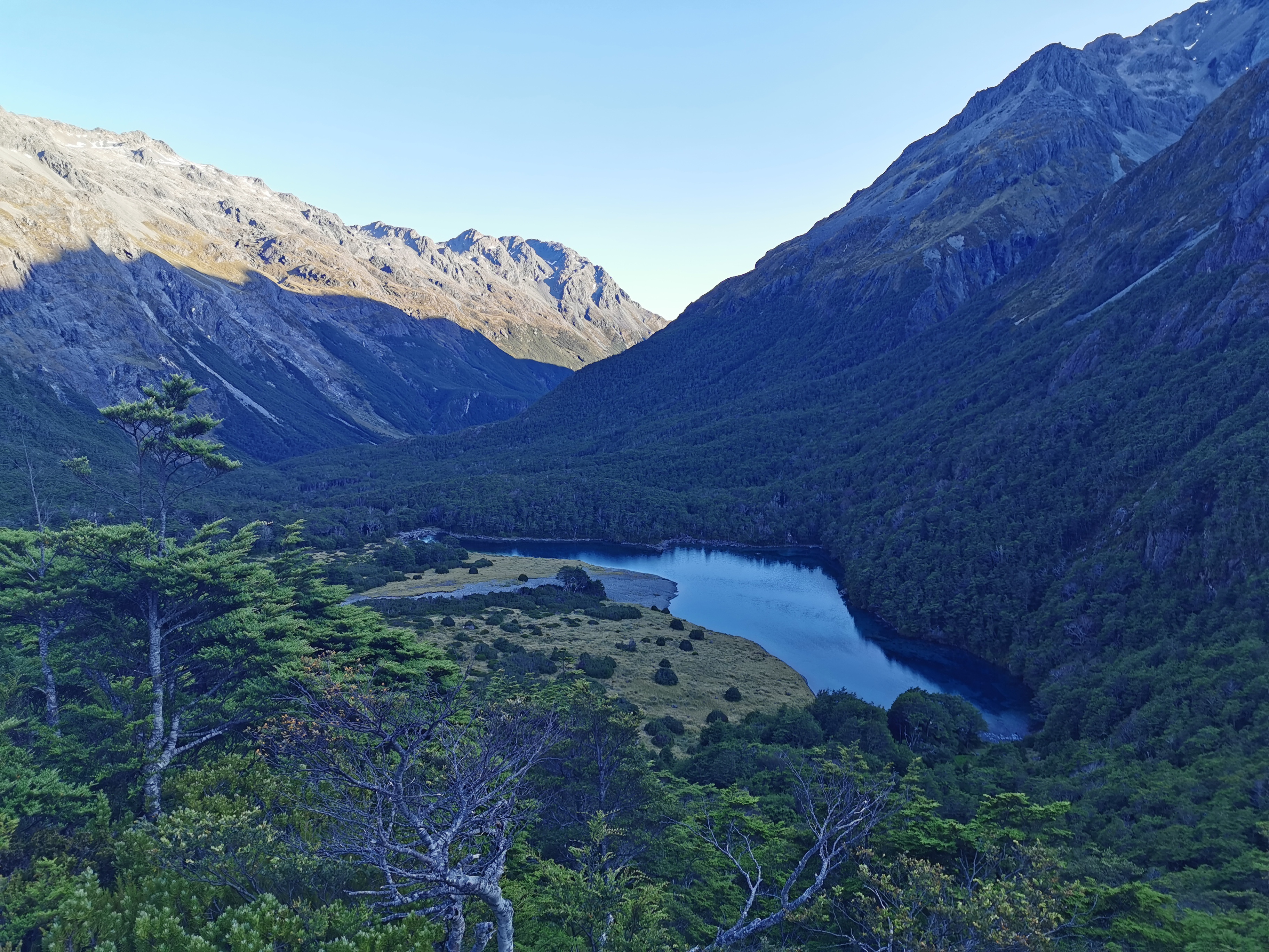
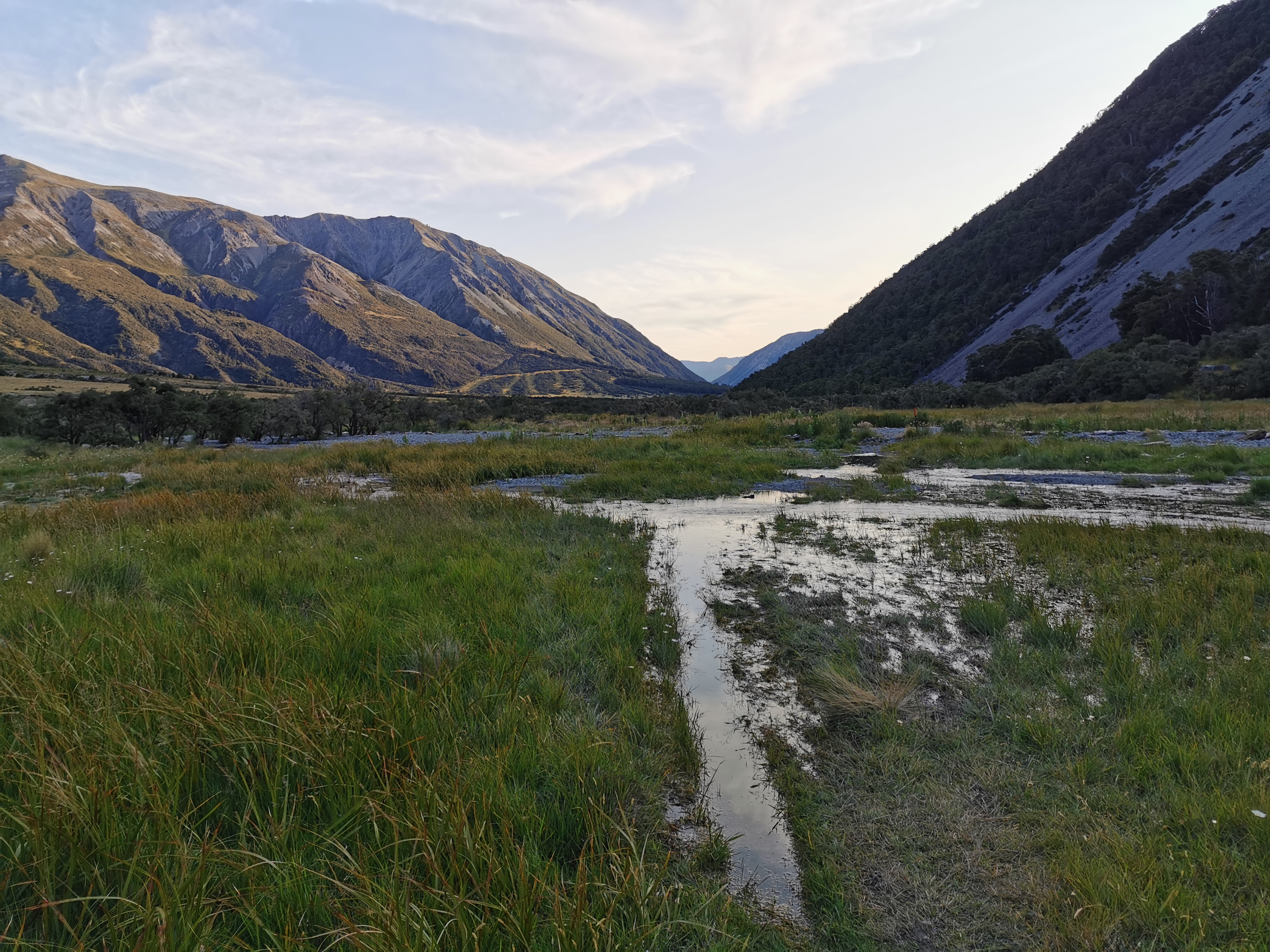
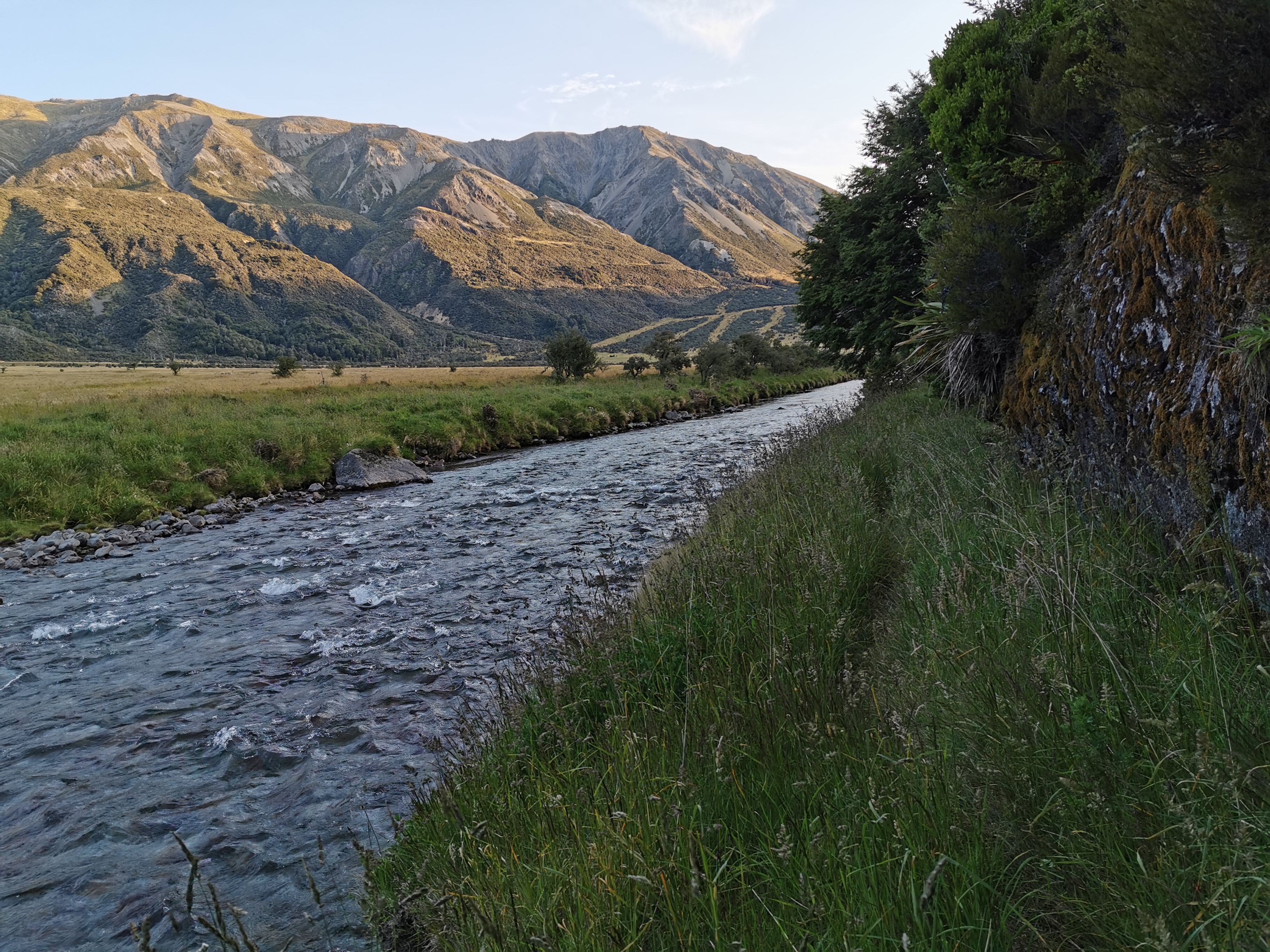
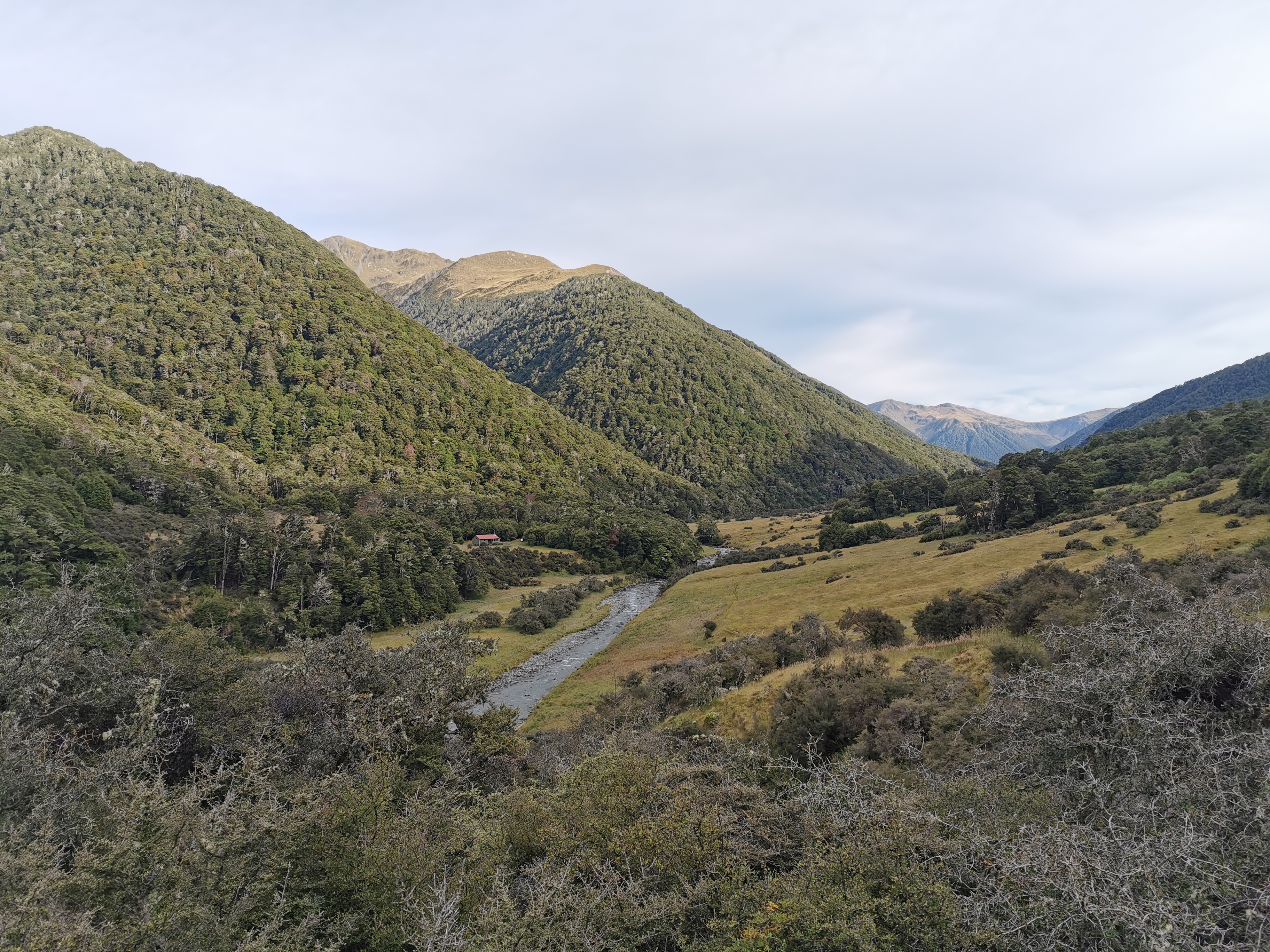
When the rain did stop, I started walking – back across the bridge that brought me here two and a half weeks ago.
Pelorus Bridge the bridge
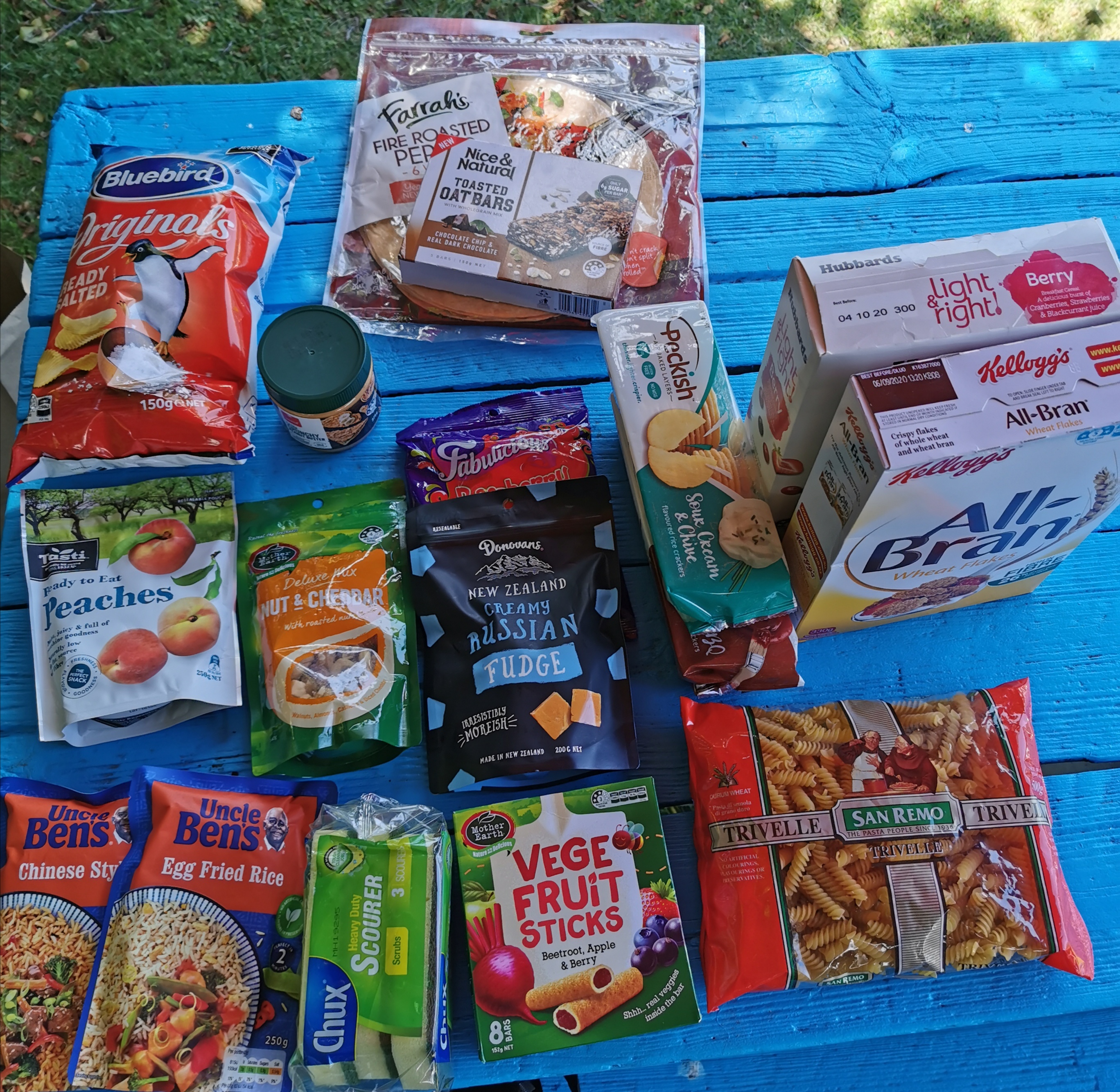
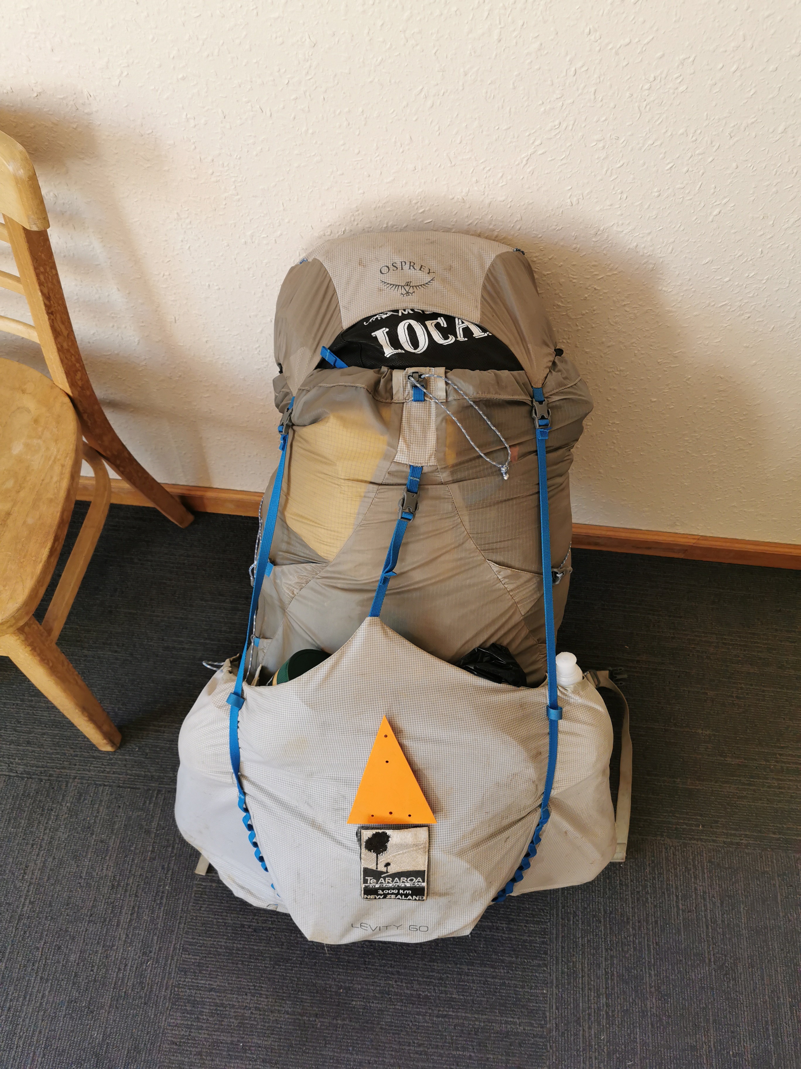
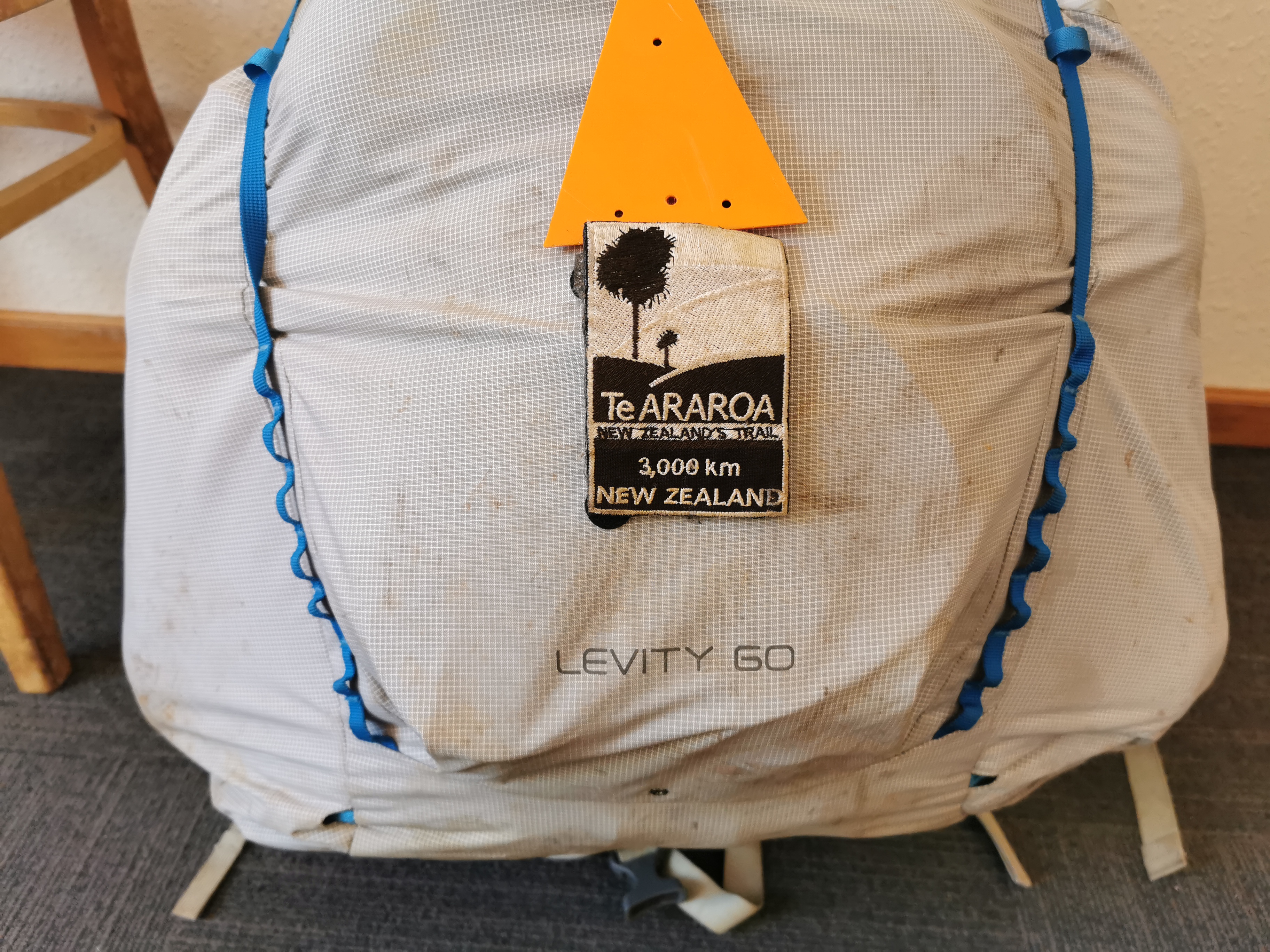
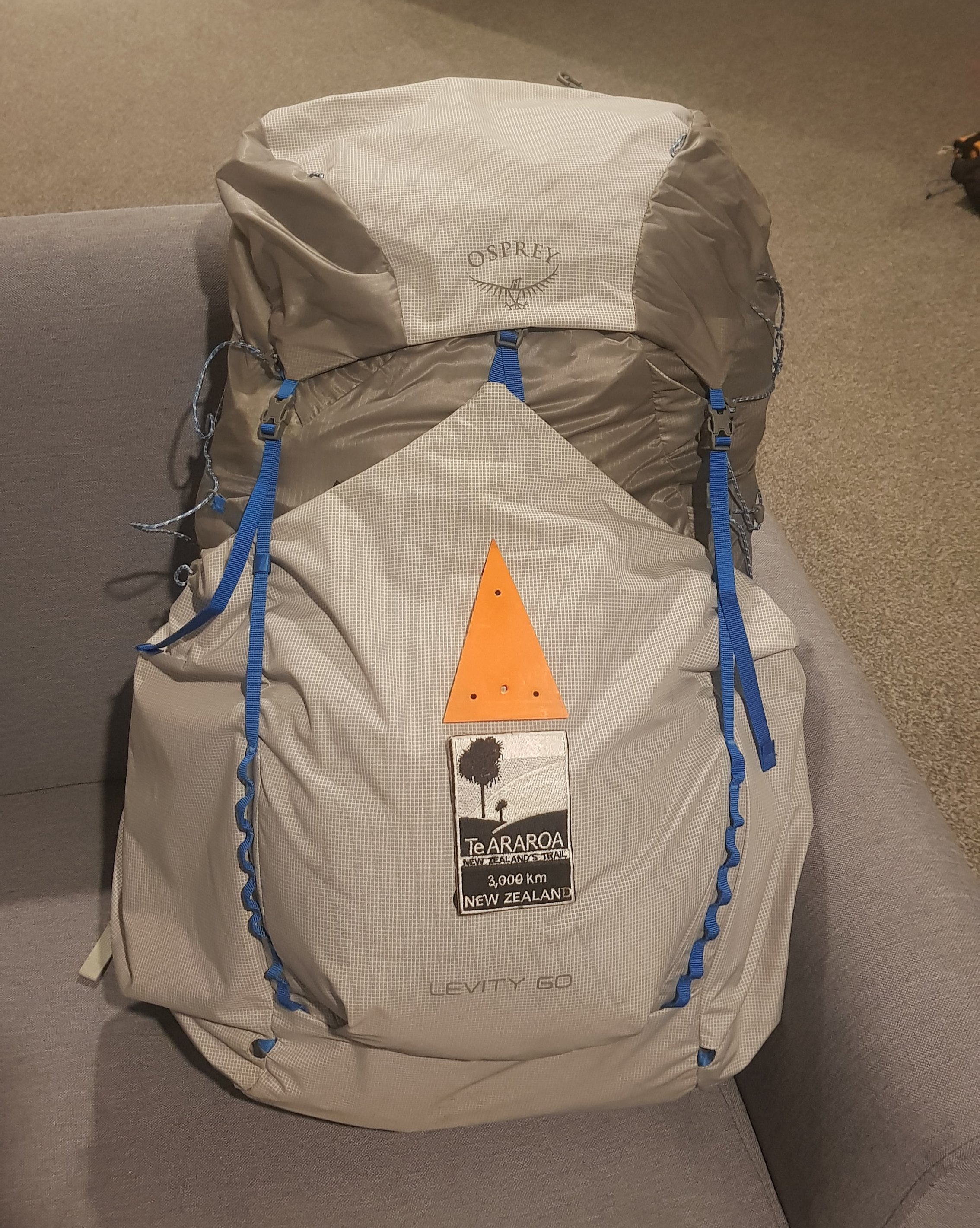
Surprisingly, the nine days of food that I have in my pack doesn’t feel heavy. And everything fits in the pack easily too. Have i forgotten something, perhaps? Or am I just properly rested now?
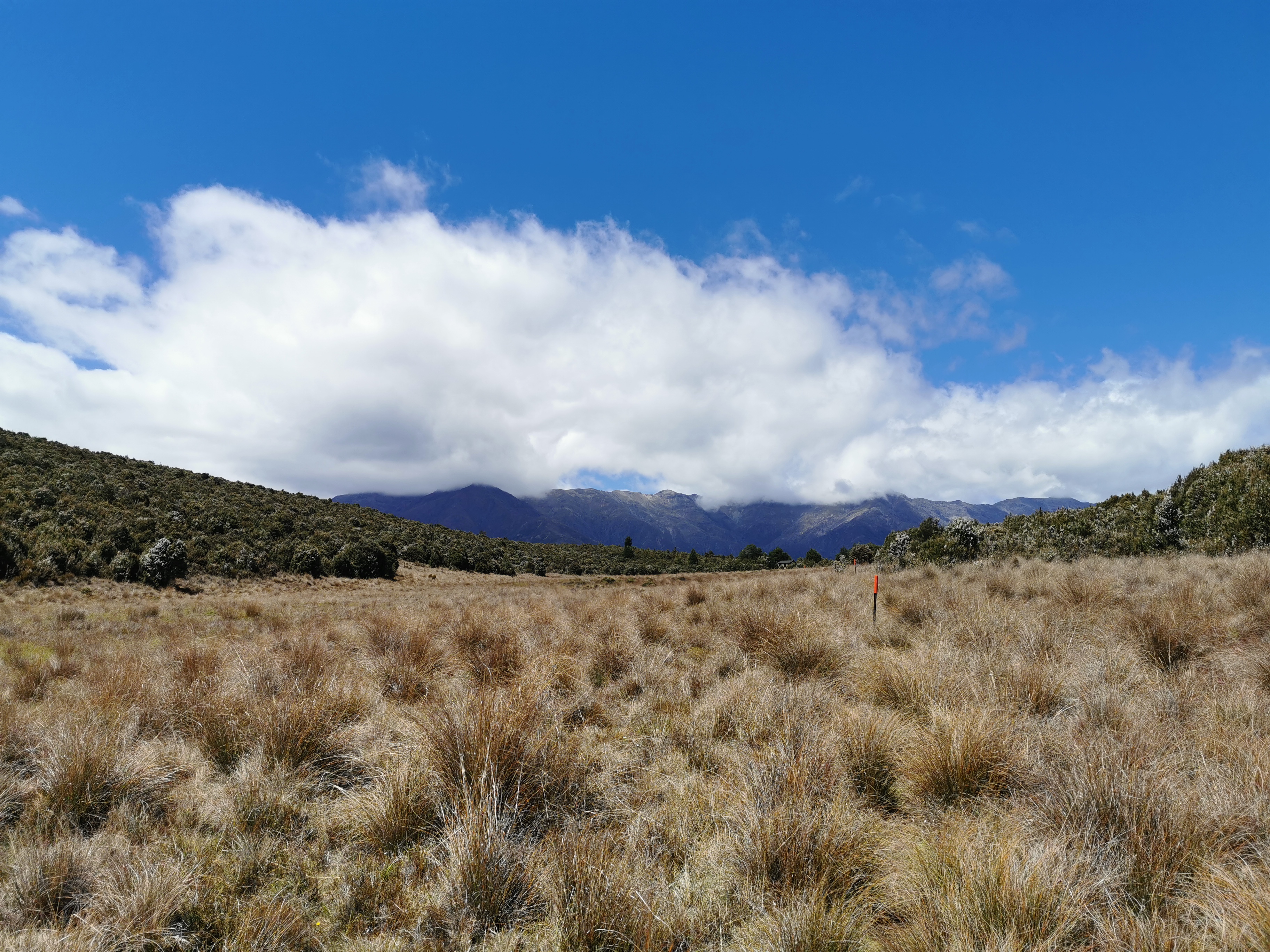
I knew that the cellphone coverage would disappear very soon so I had a quick look at the ten day weather forecast for Pelorus Bridge. No rain at all in the ten day forecast except for the rain right now. I hope that turns out to be true! The Richmond Ranges are apparently a lot like the Tararua Ranges and good weather apparently helps.
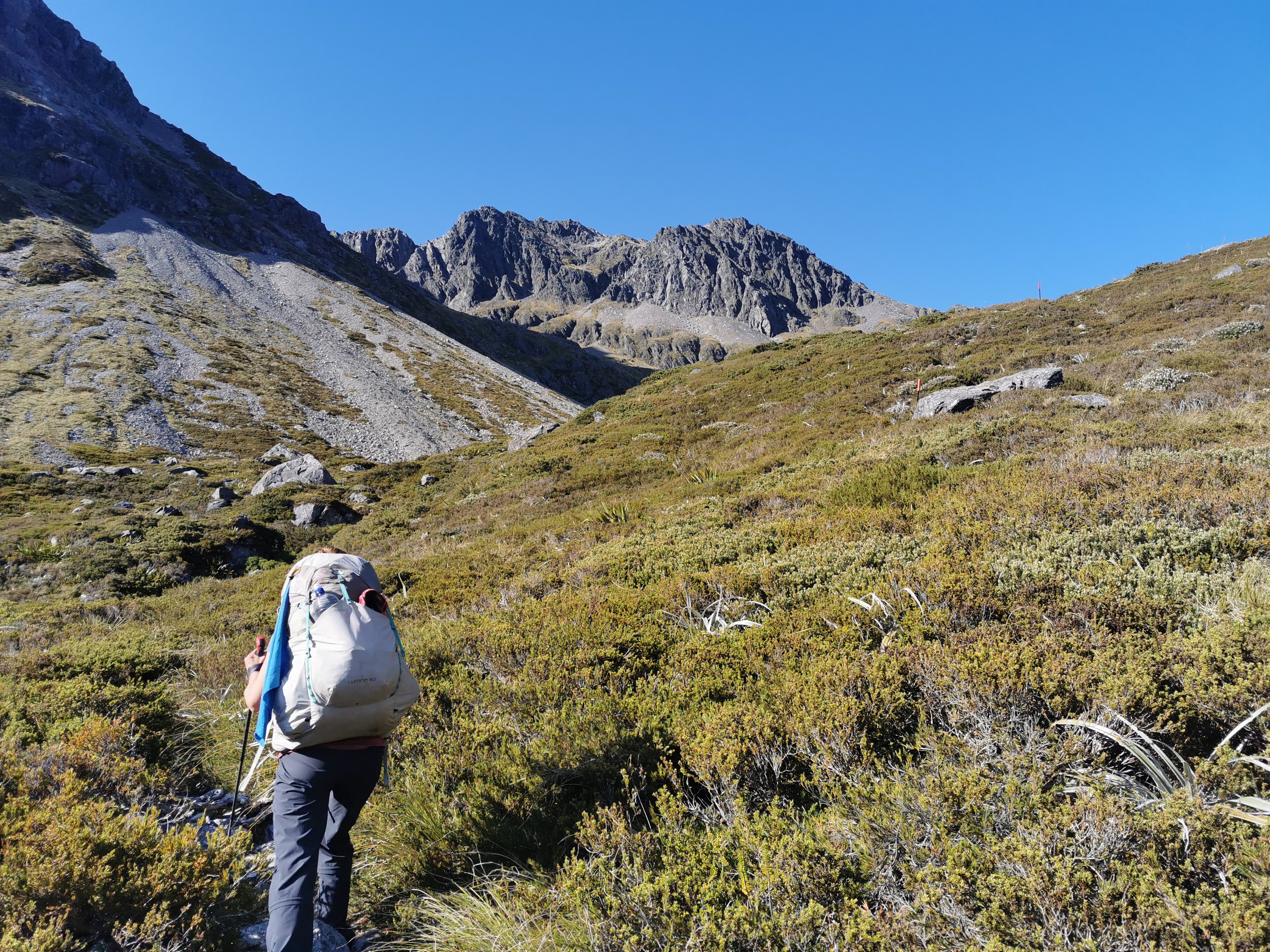
I do miss the other four though – Peter and Charlie, and Alex and Ethan. When I’m walking by myself I have a lot more things racing through my mind and I can’t shut it off – things like the insurance claim for the car being stolen, Christmas and New Year’s, and all sorts of other things. In saying that though, once the phone coverage ran out, all my worries suddenly just melted away.
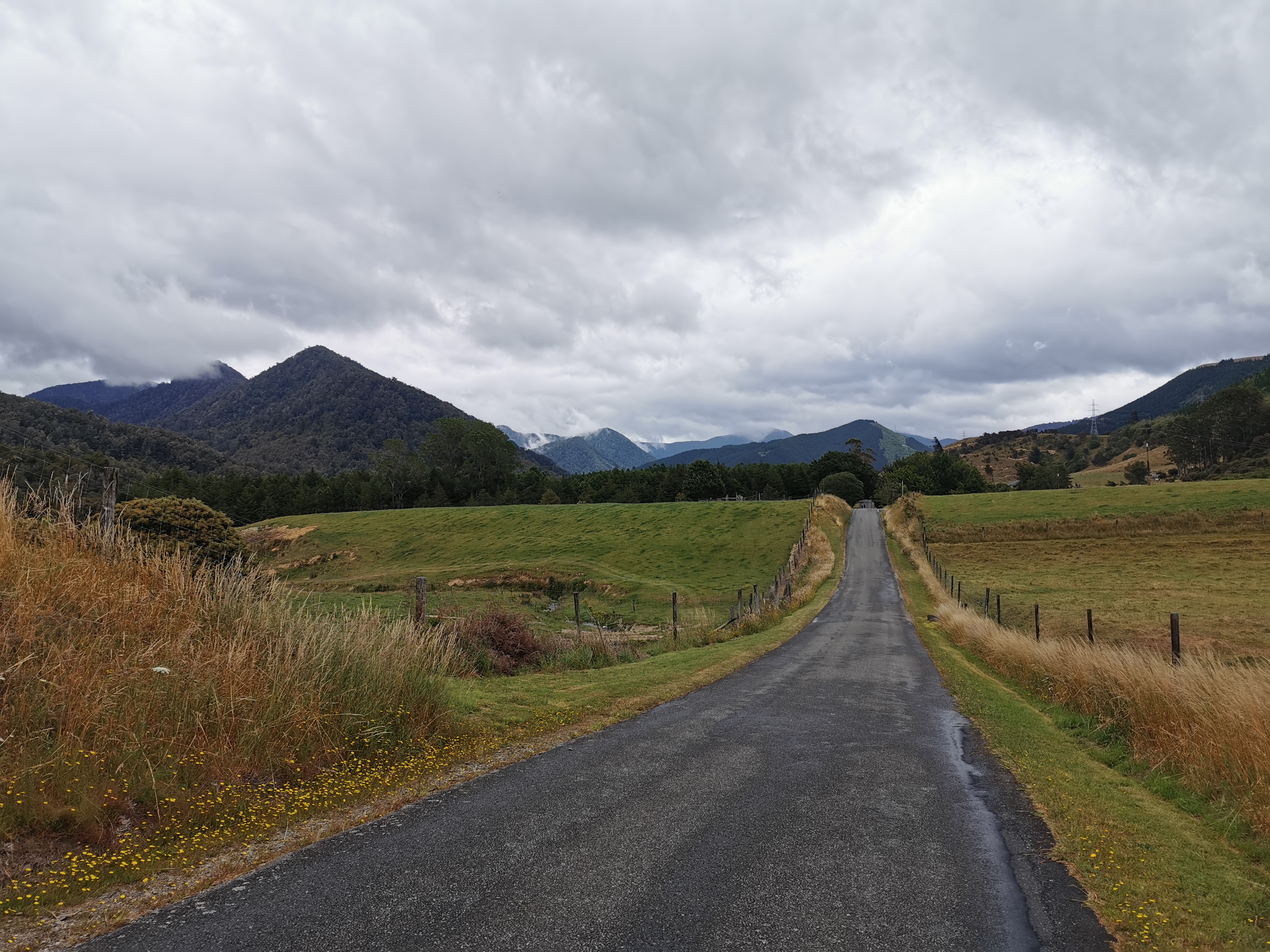
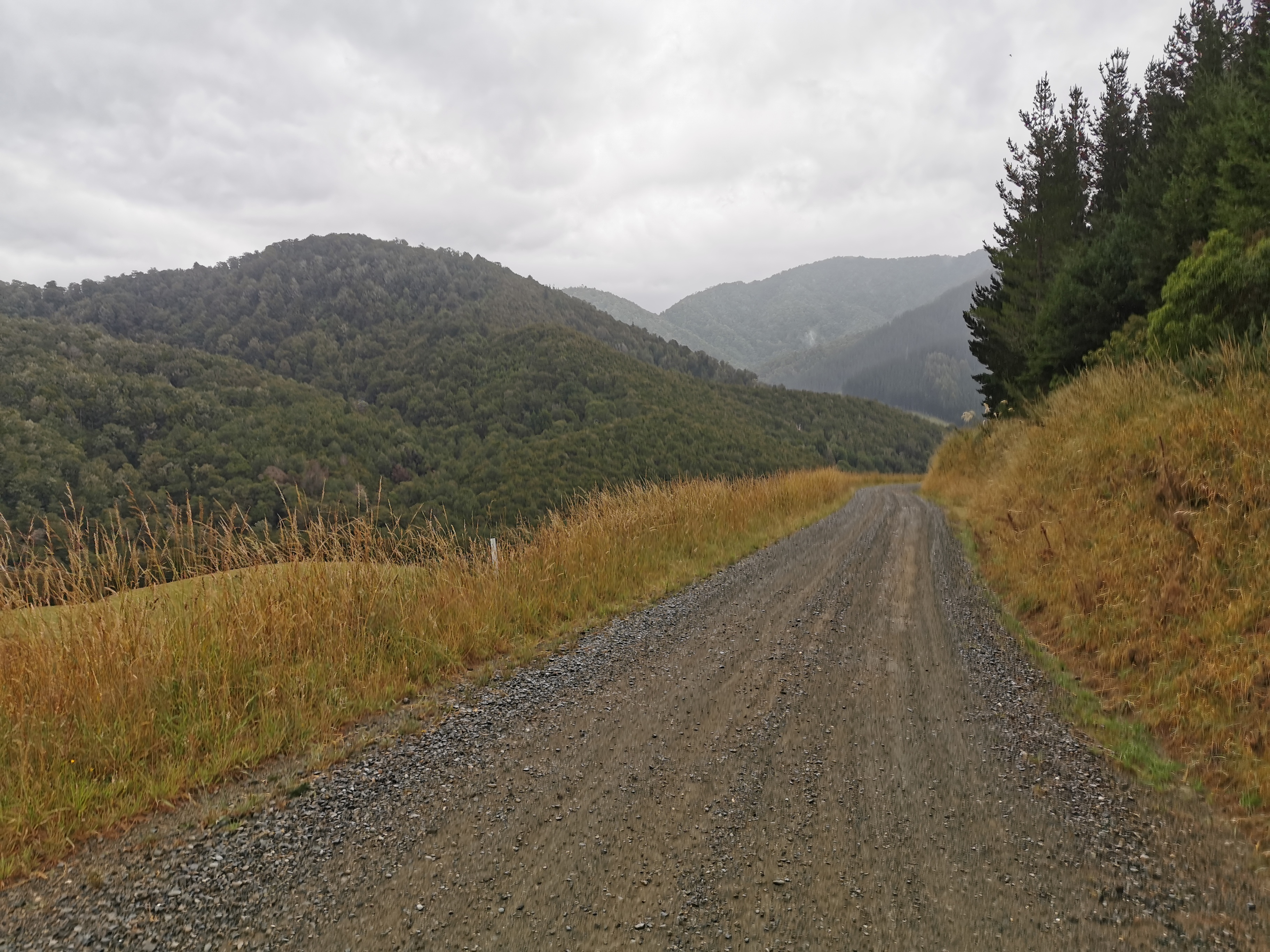
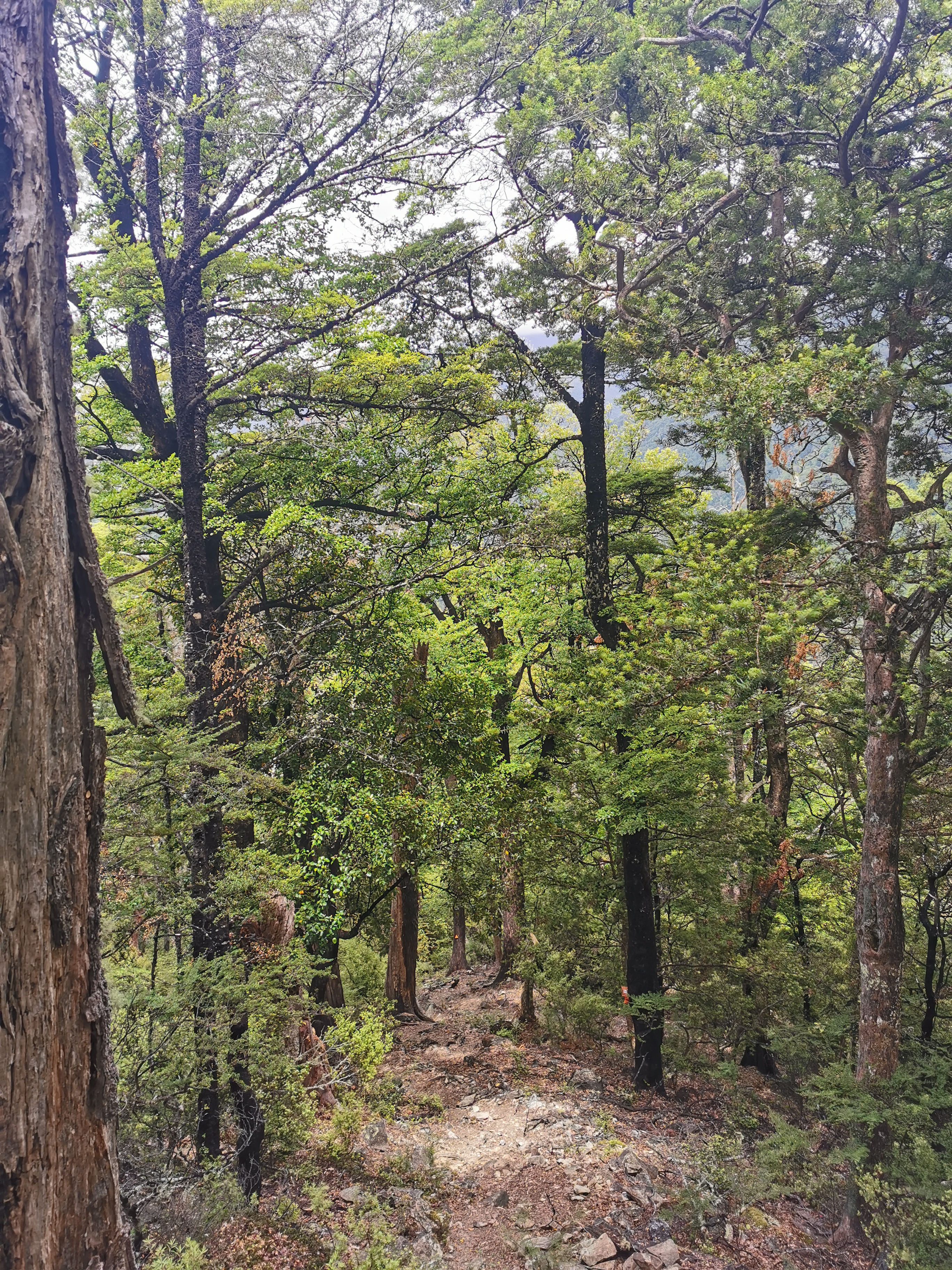
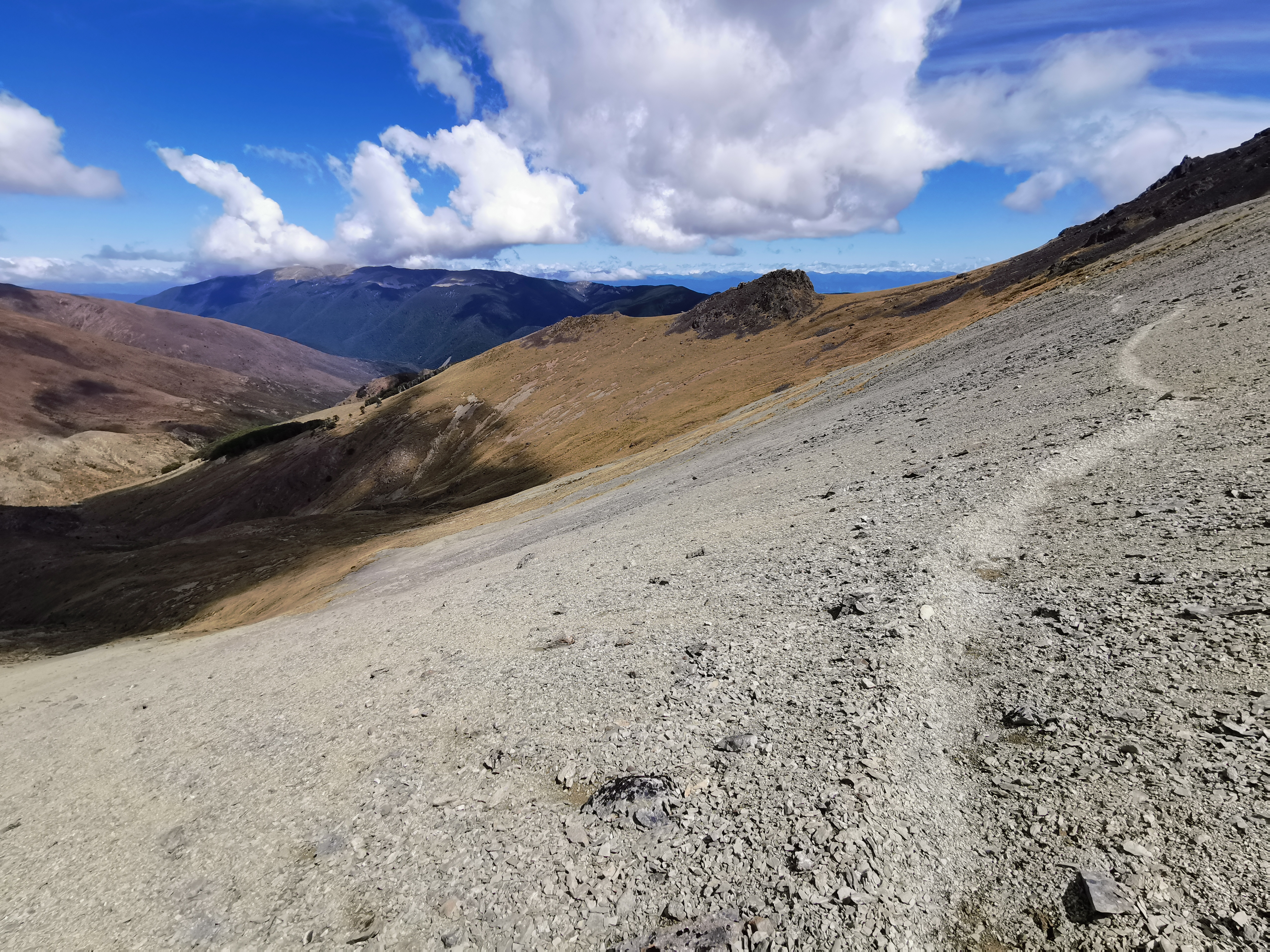
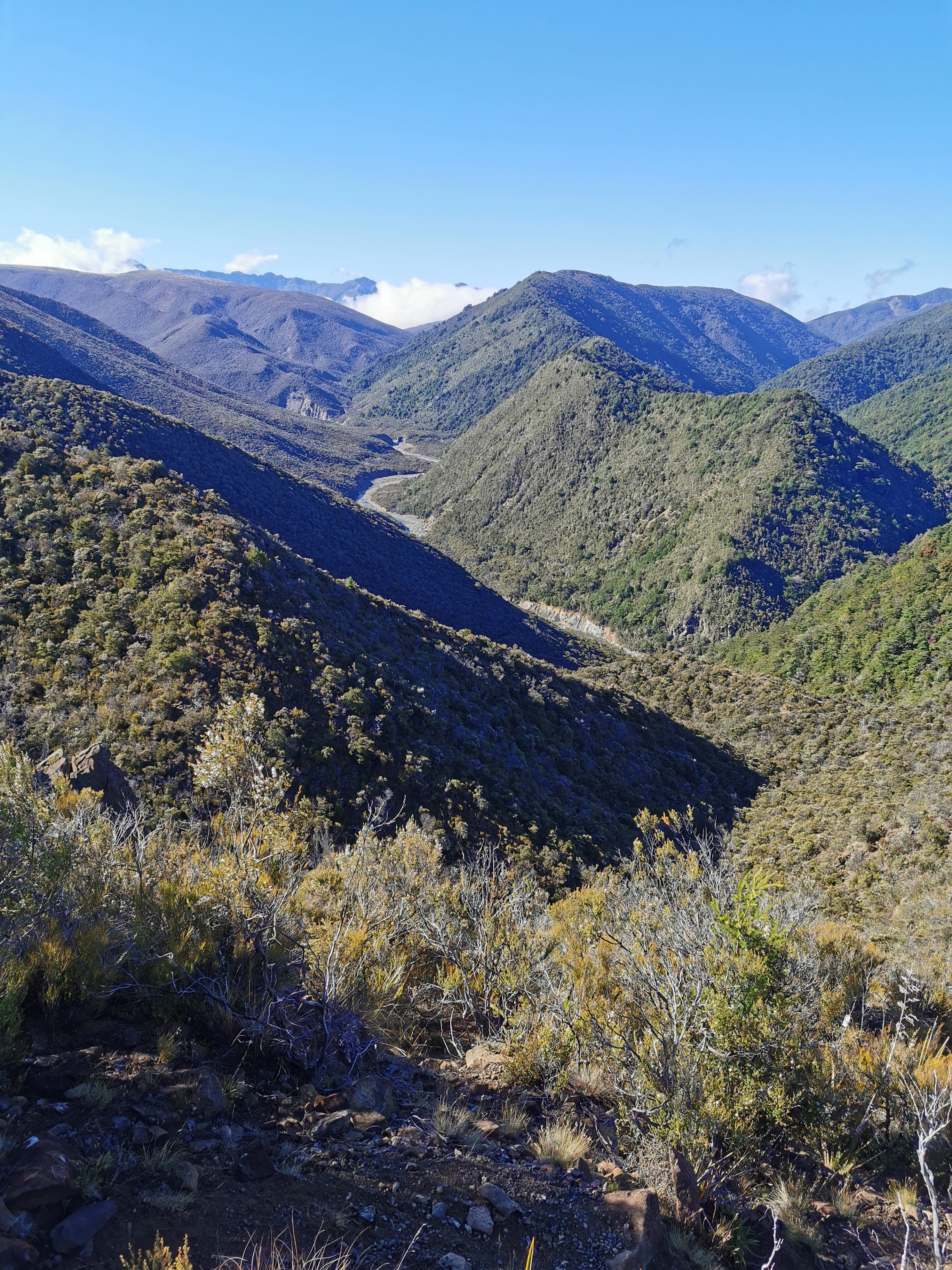
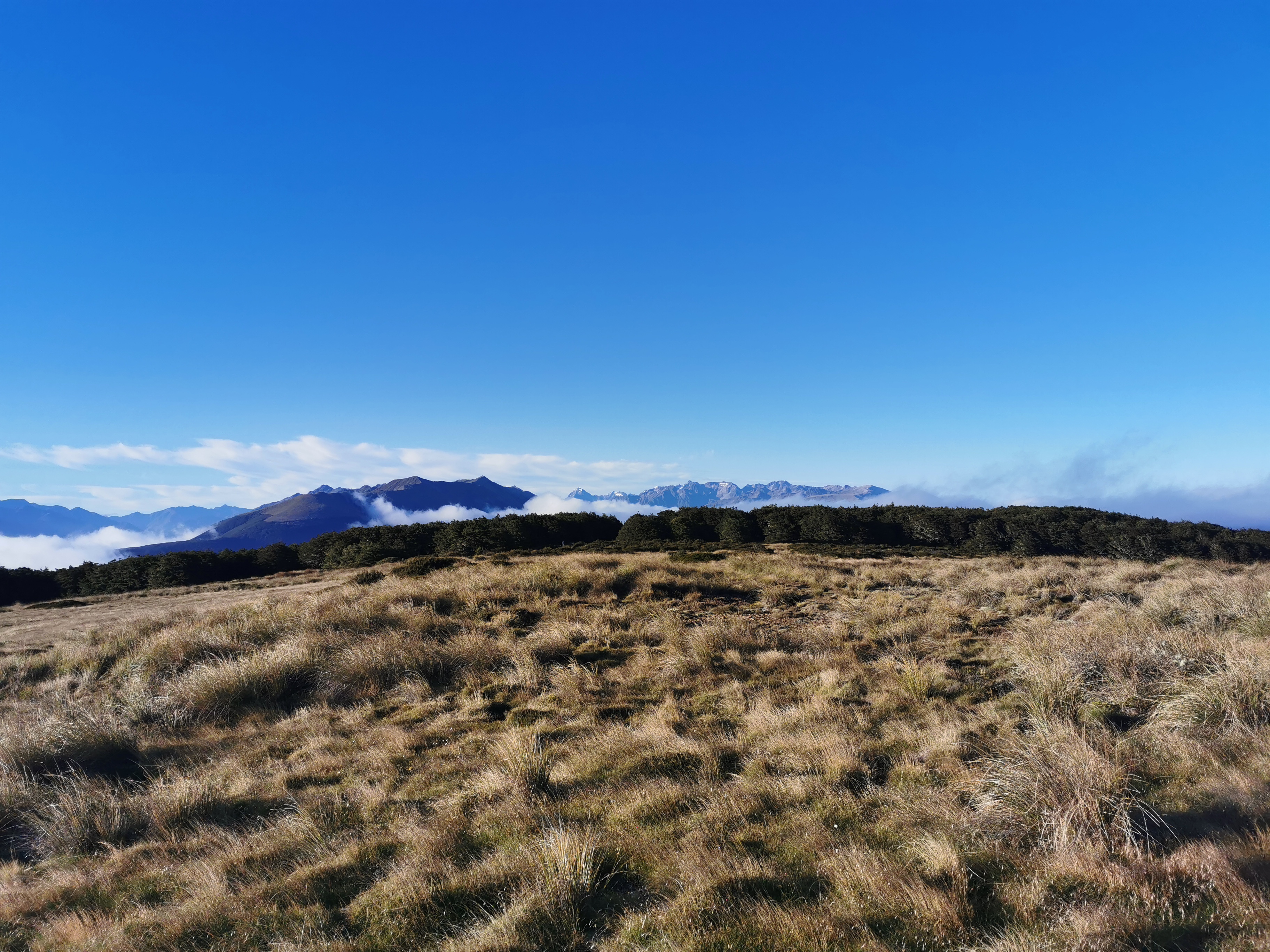
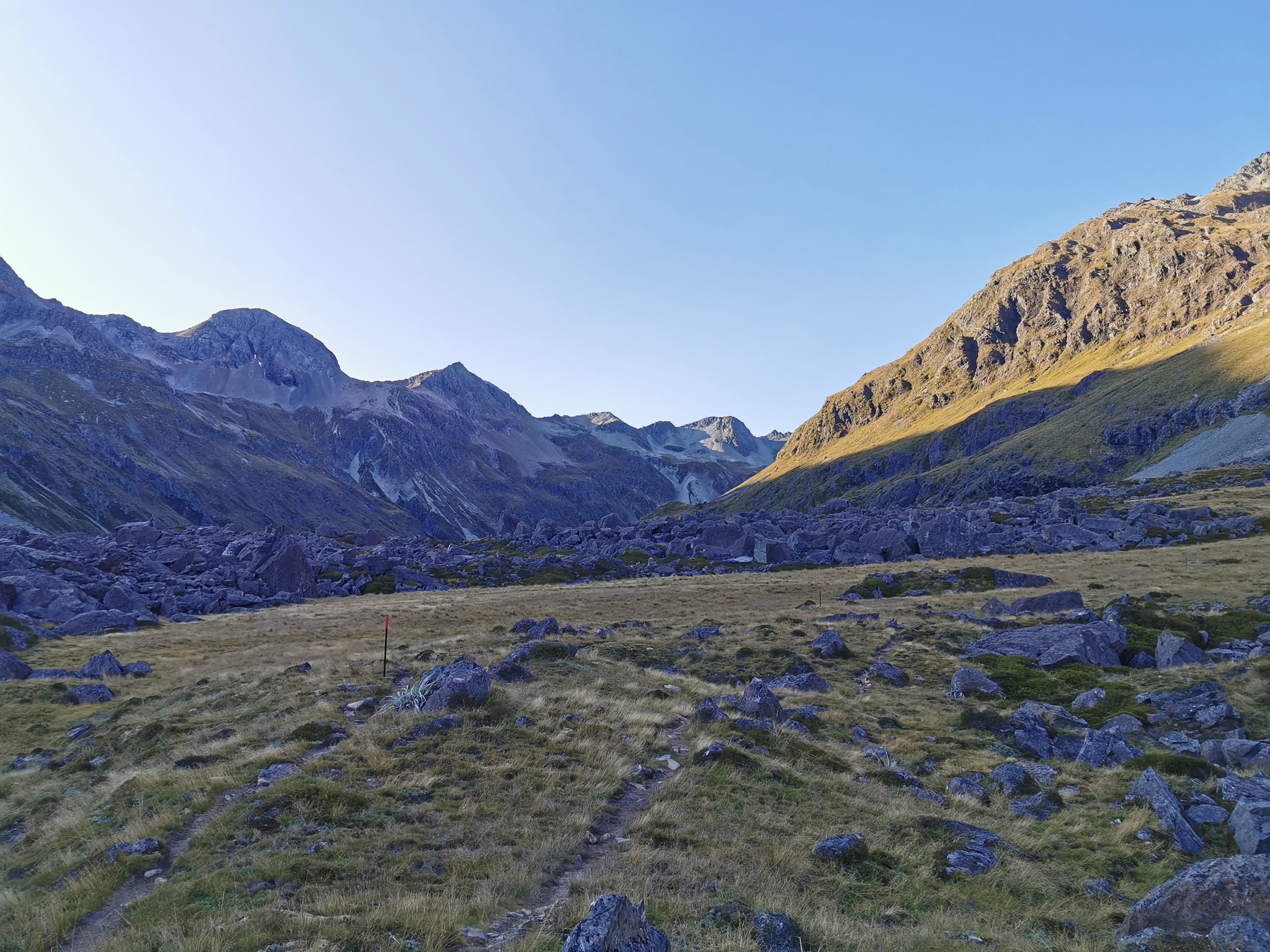
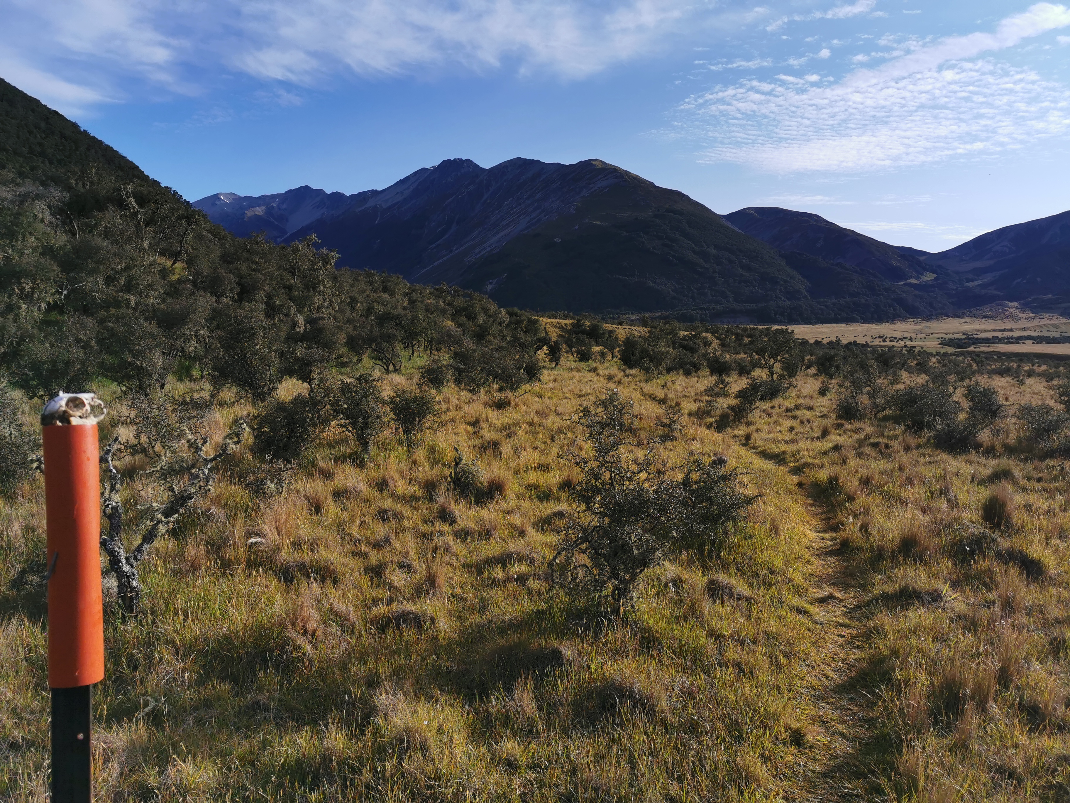
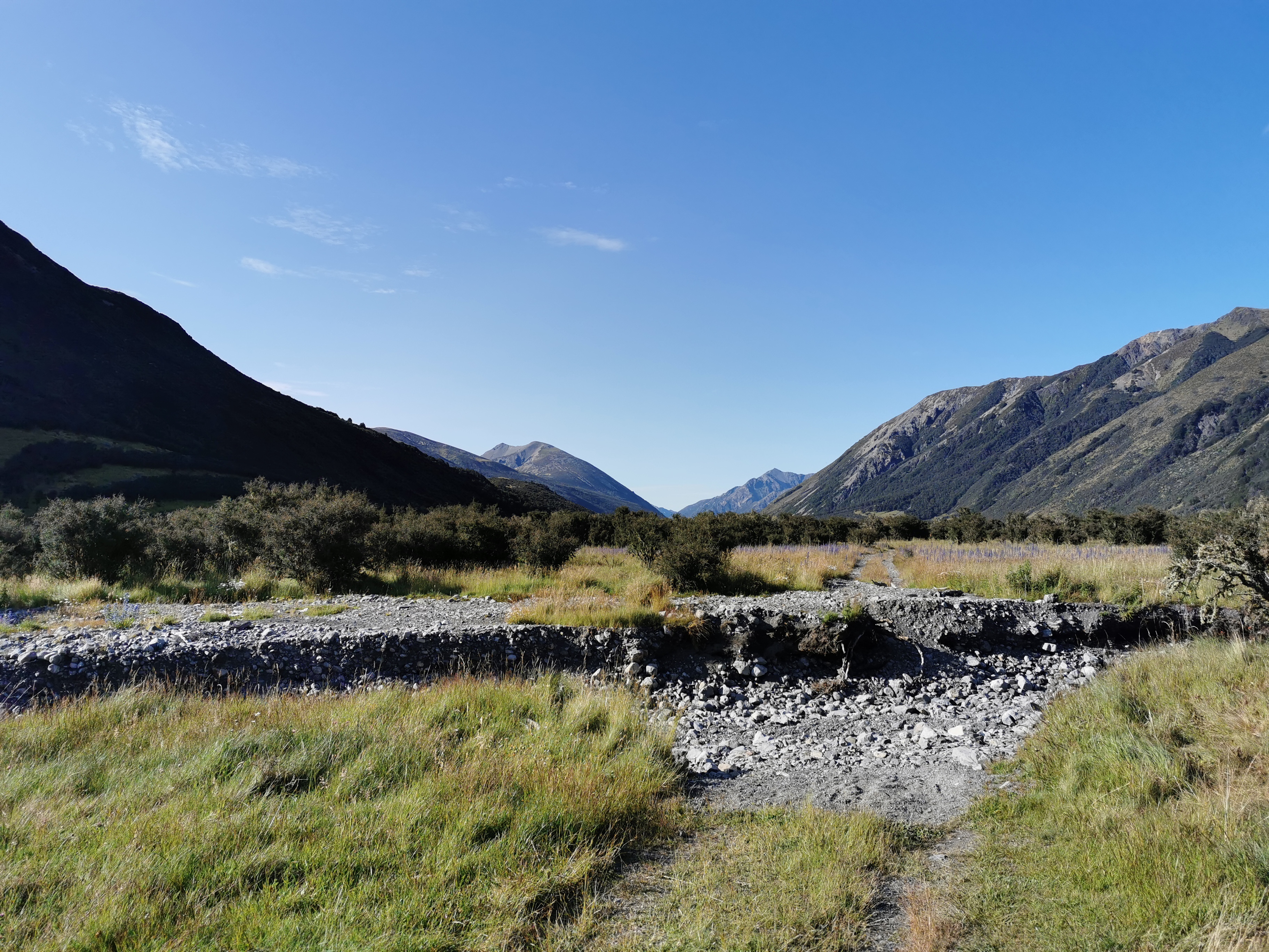
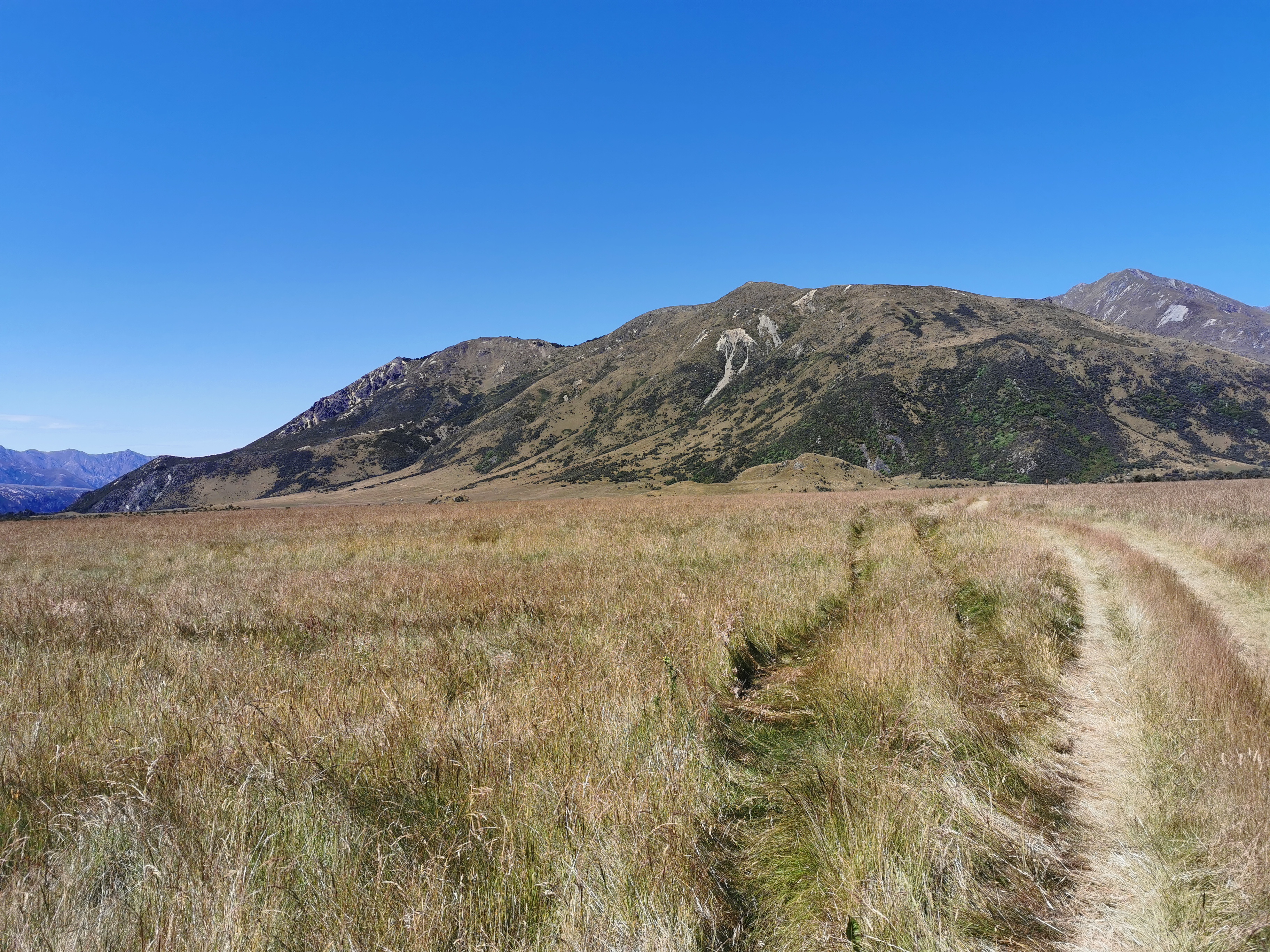
First part of the road walk
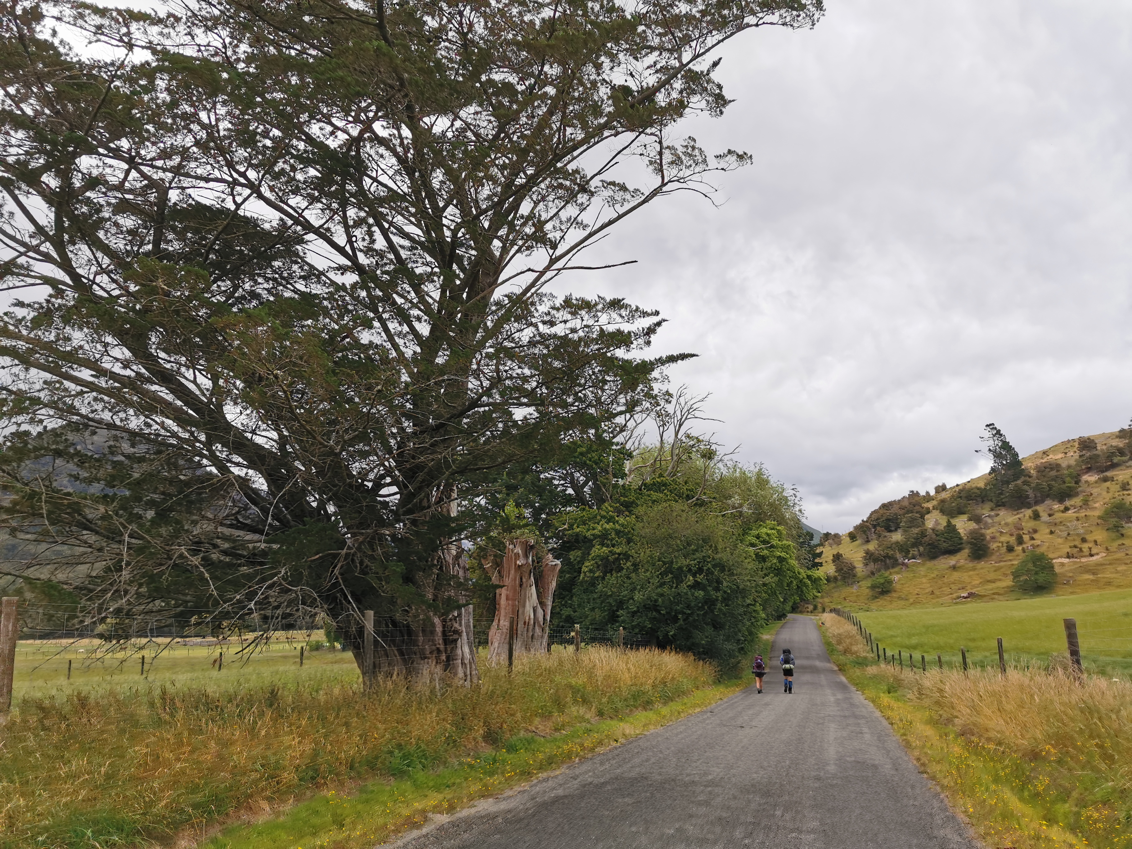
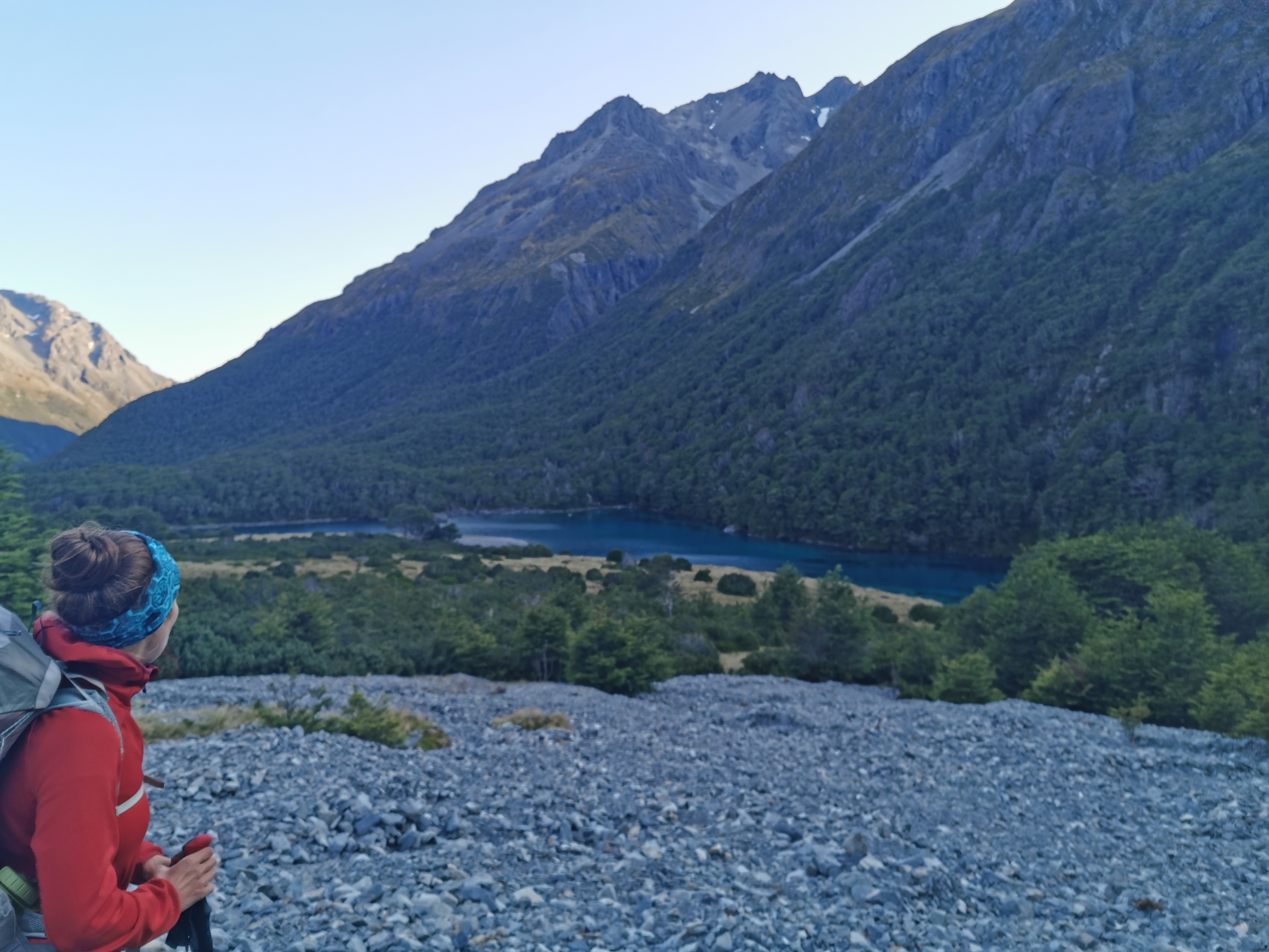
It wasn’t long until I saw two other people walking down the road.
Other people!
They turned out to be Tina and Matthew who are just walking this section. It turned out they were the two people who got off the bus at the same stop as me and it was a bit embarrassing when I didn’t realise that. I guess Matthew took off his Lochmara hat. Apparently he used to work there.
The two of them walked quite slowly so we just talked for a few minutes and I continued ahead. It was 21km from Pelorus Bridge to the first hut and given it was already about 3:30pm, they will really need to increase their pace to get there by dark. Hell, I’m not even sure I will get there by dark and I’m walking fast.
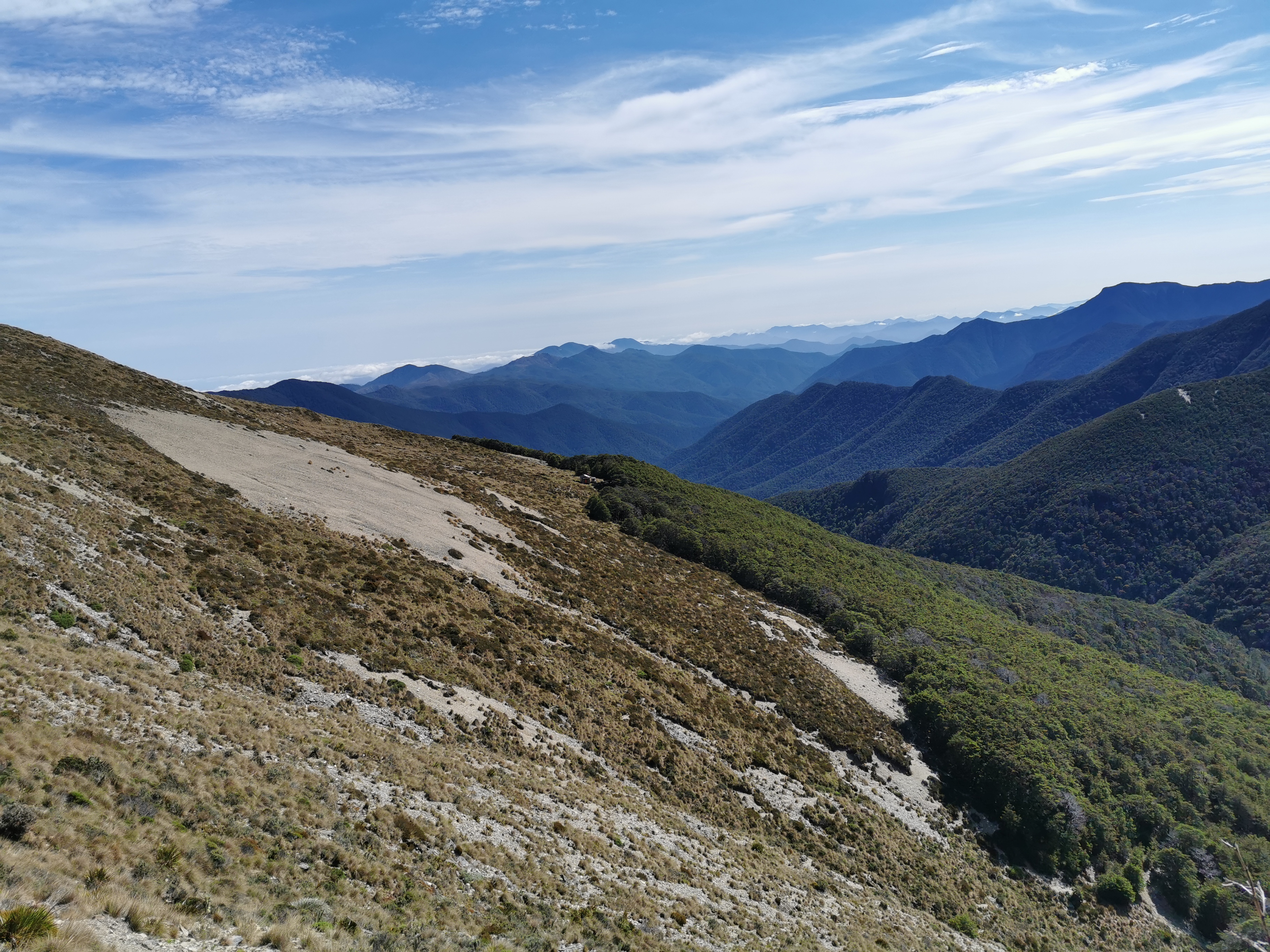
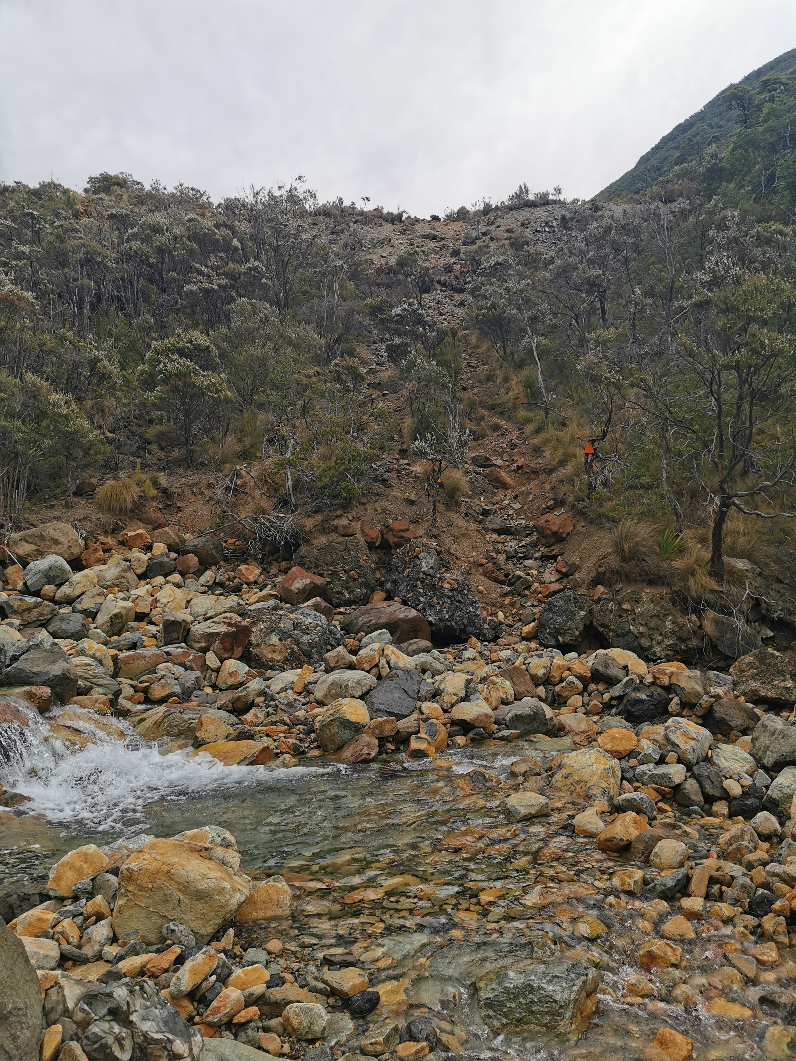
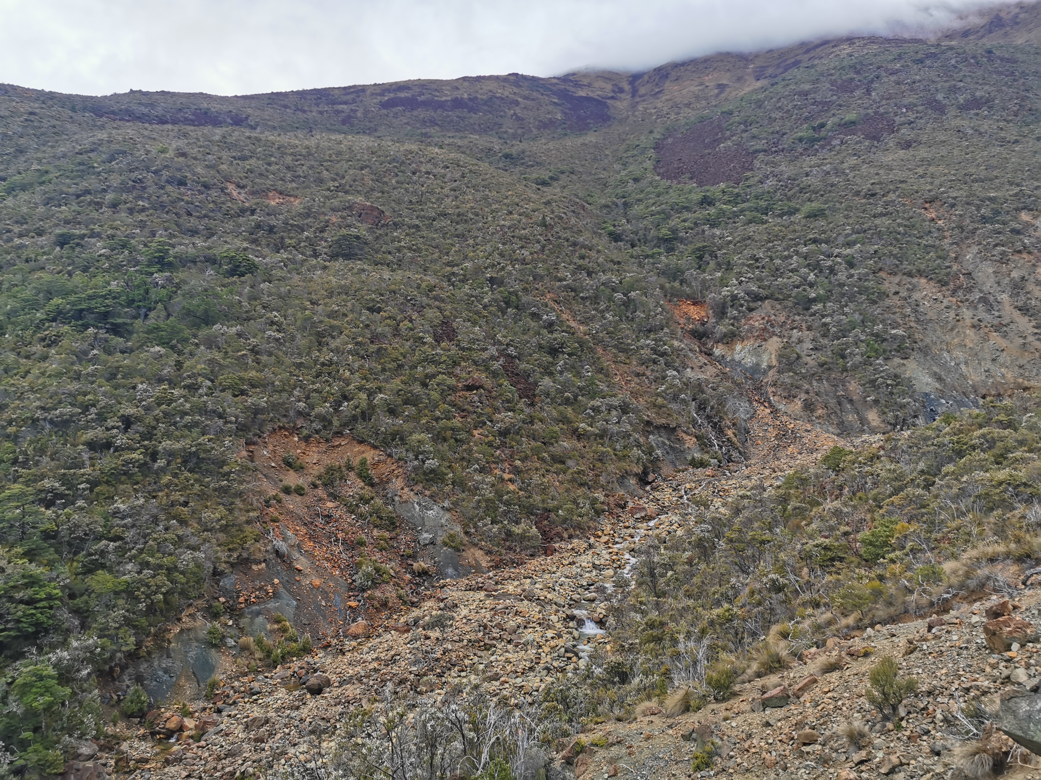
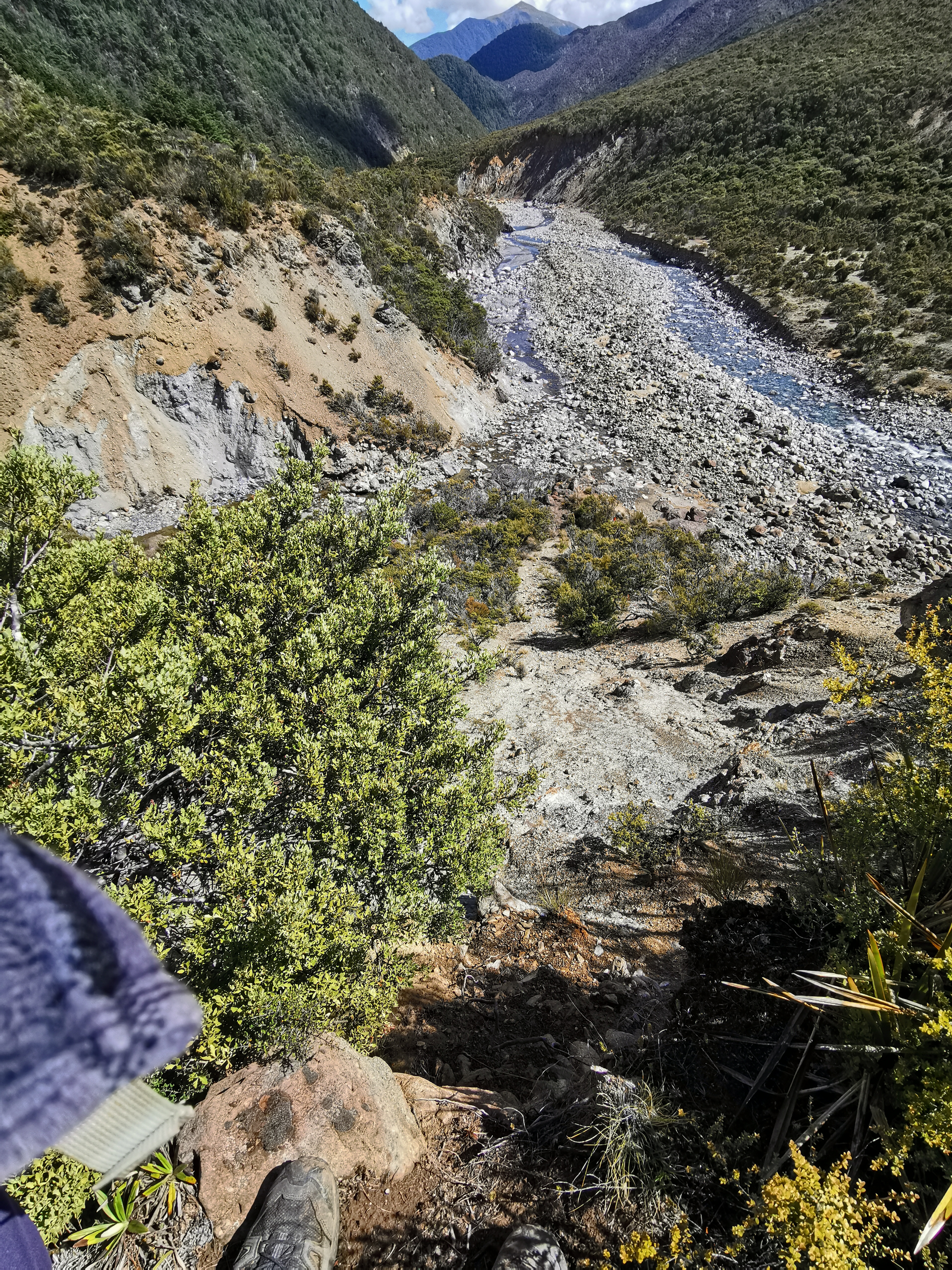
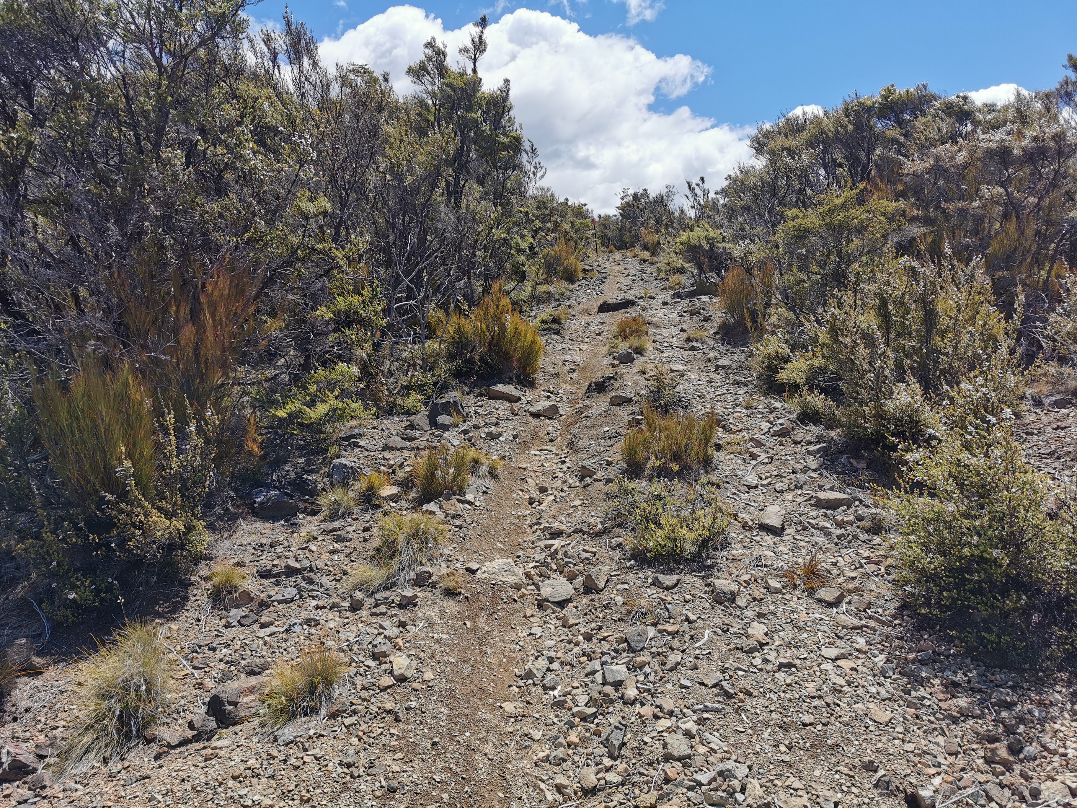
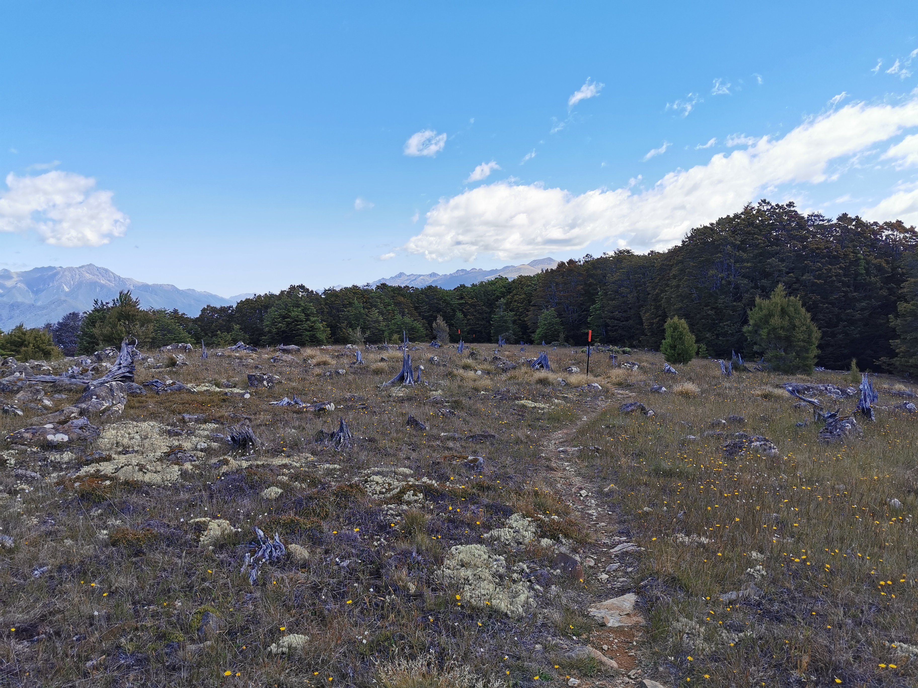
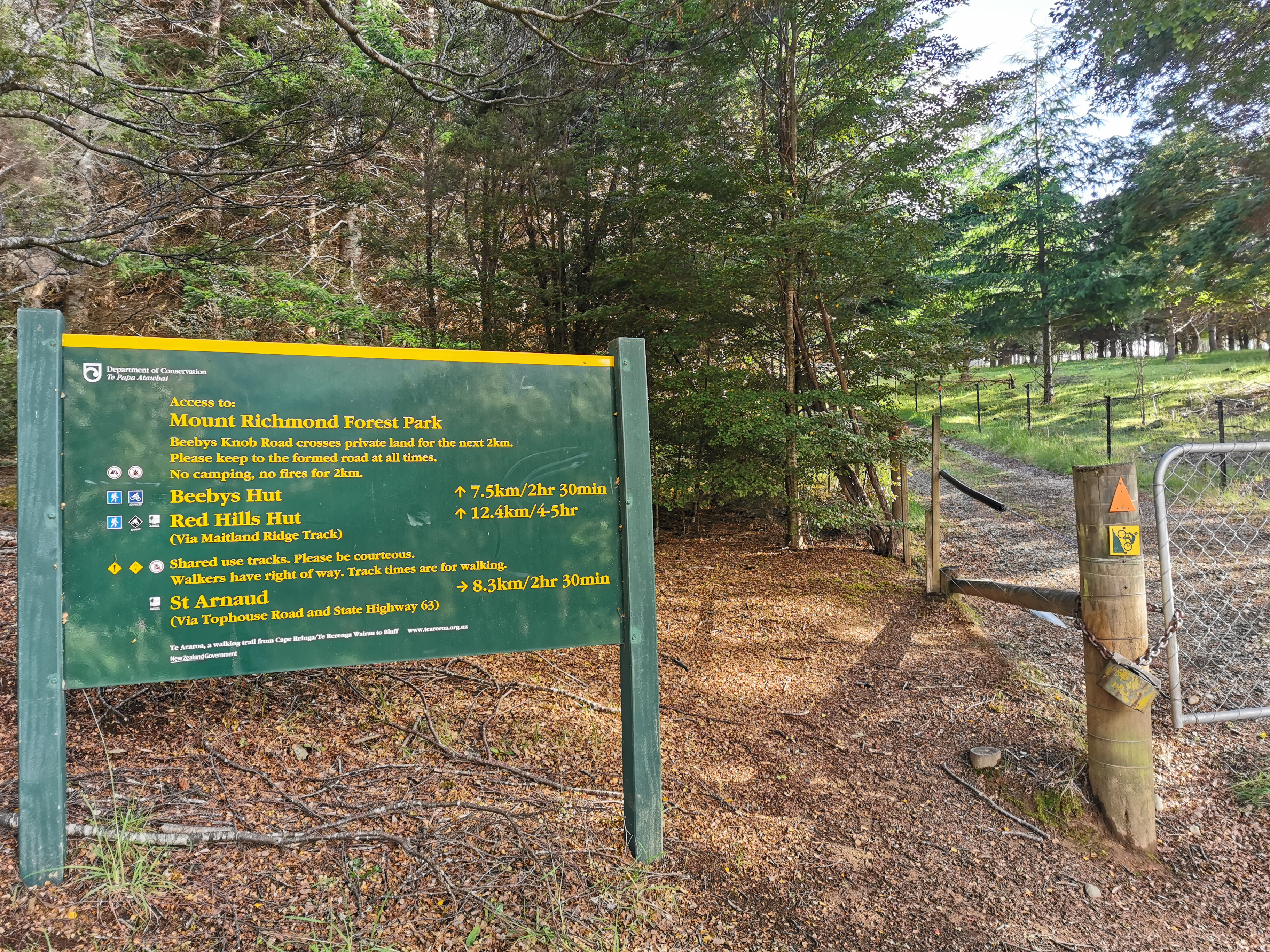
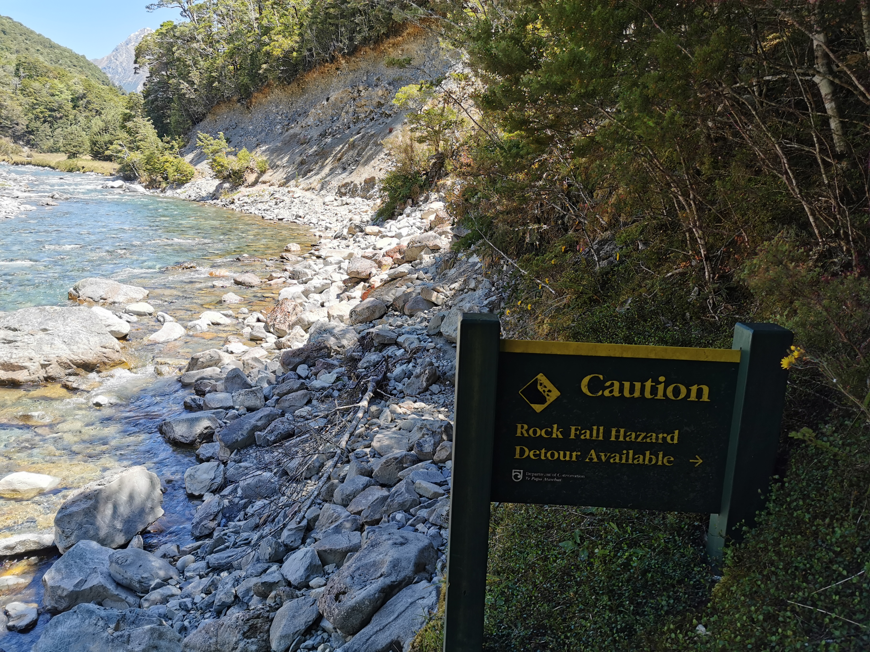
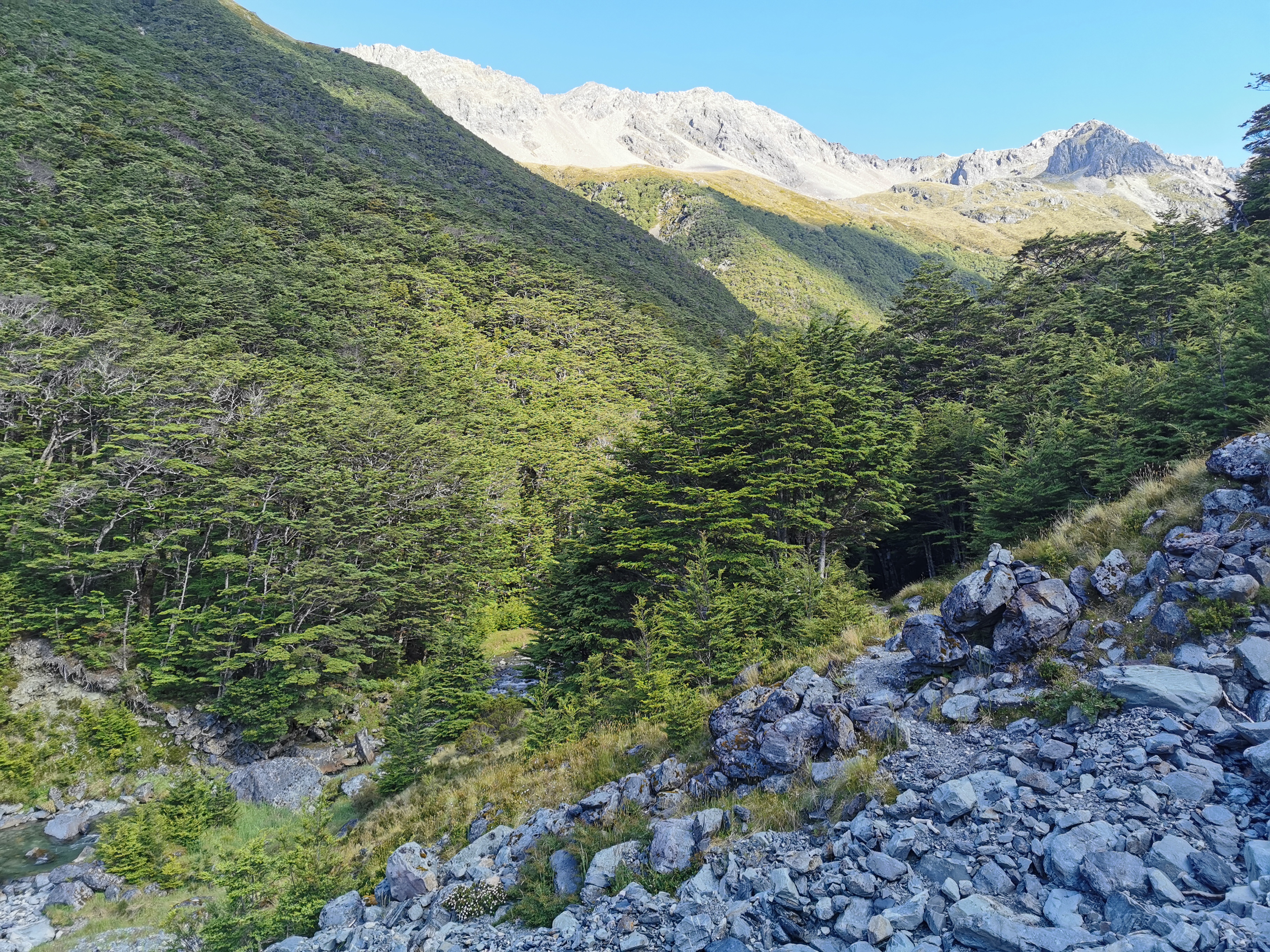
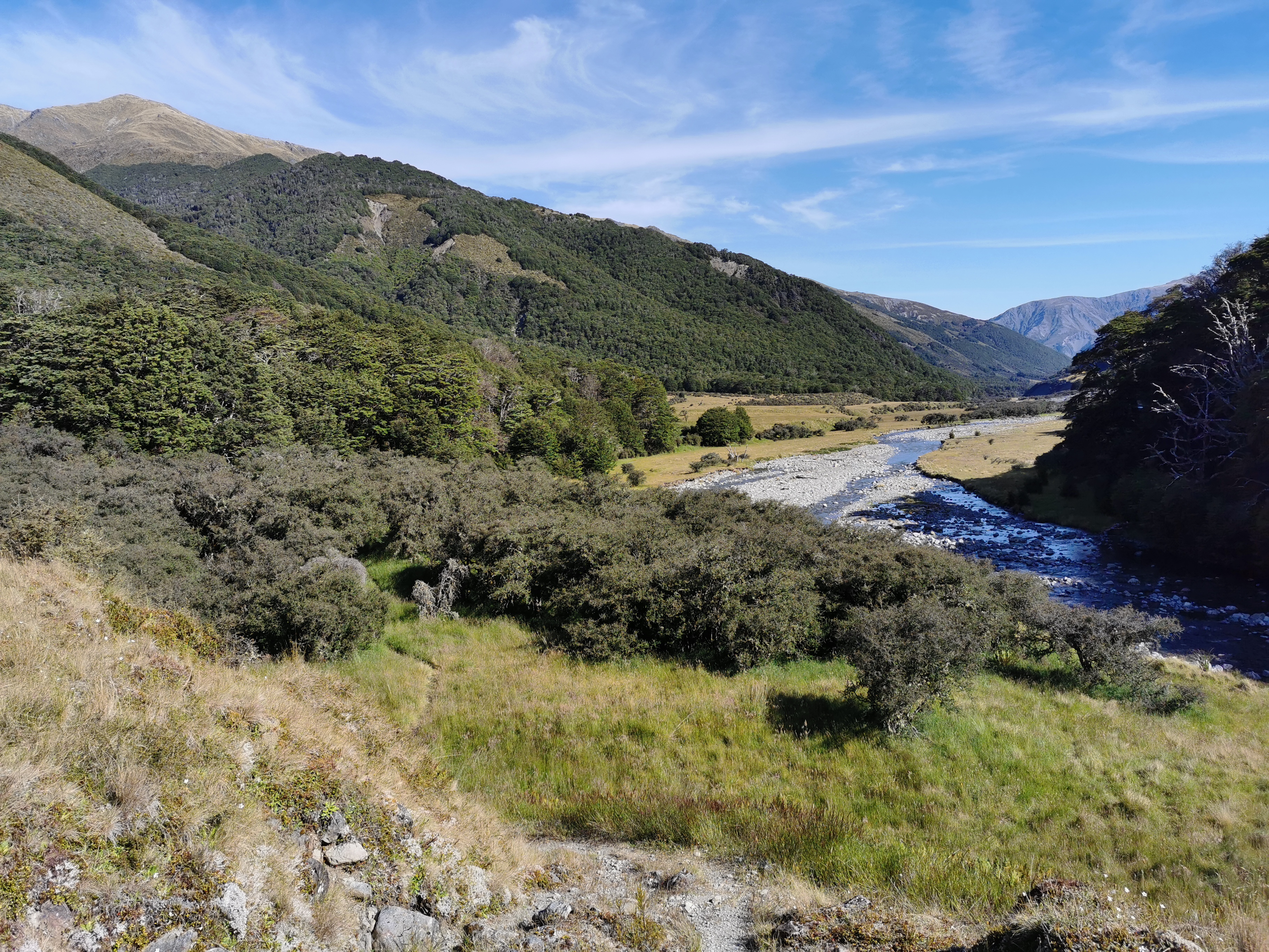
It’s 13km of road walking and then 8km of “river track”, which could be anything.
The rain is now threatening
5km in and the rain jacket went on because it started raining again. It rained for about 20 minutes. I guess my first day in the South Island is going to finish up with me being sweaty and gross from the humidity and the rain – how delightful!
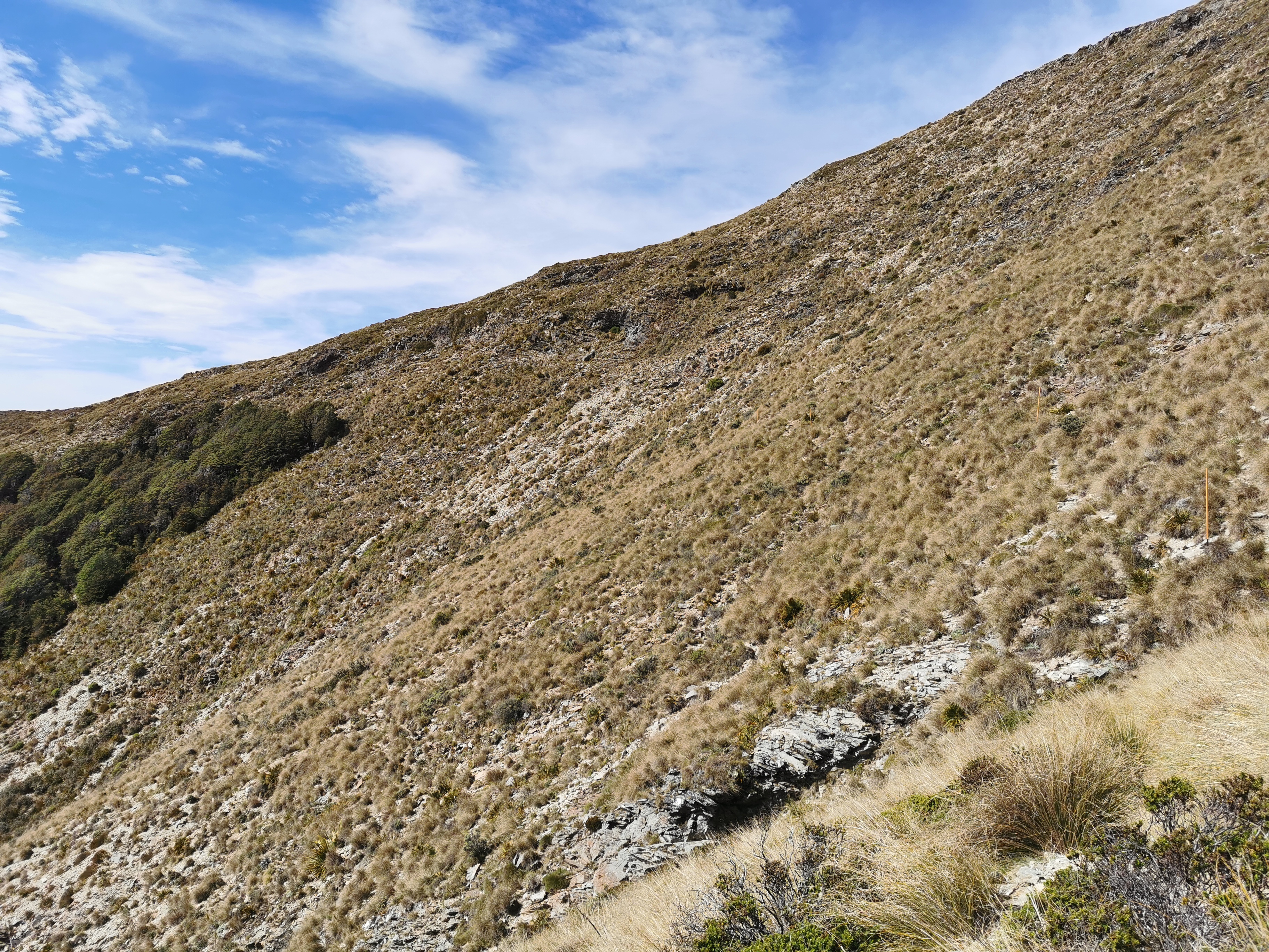
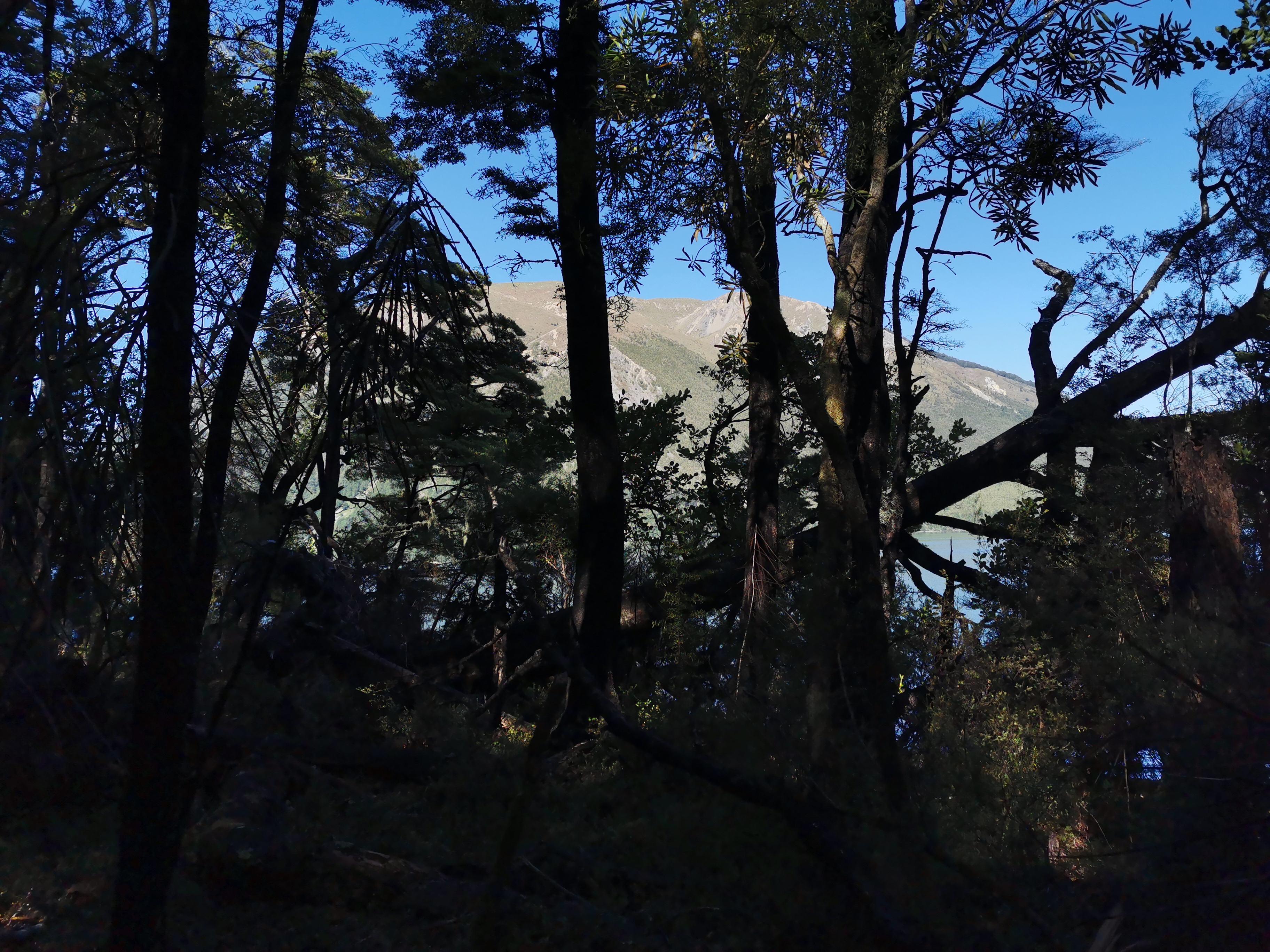
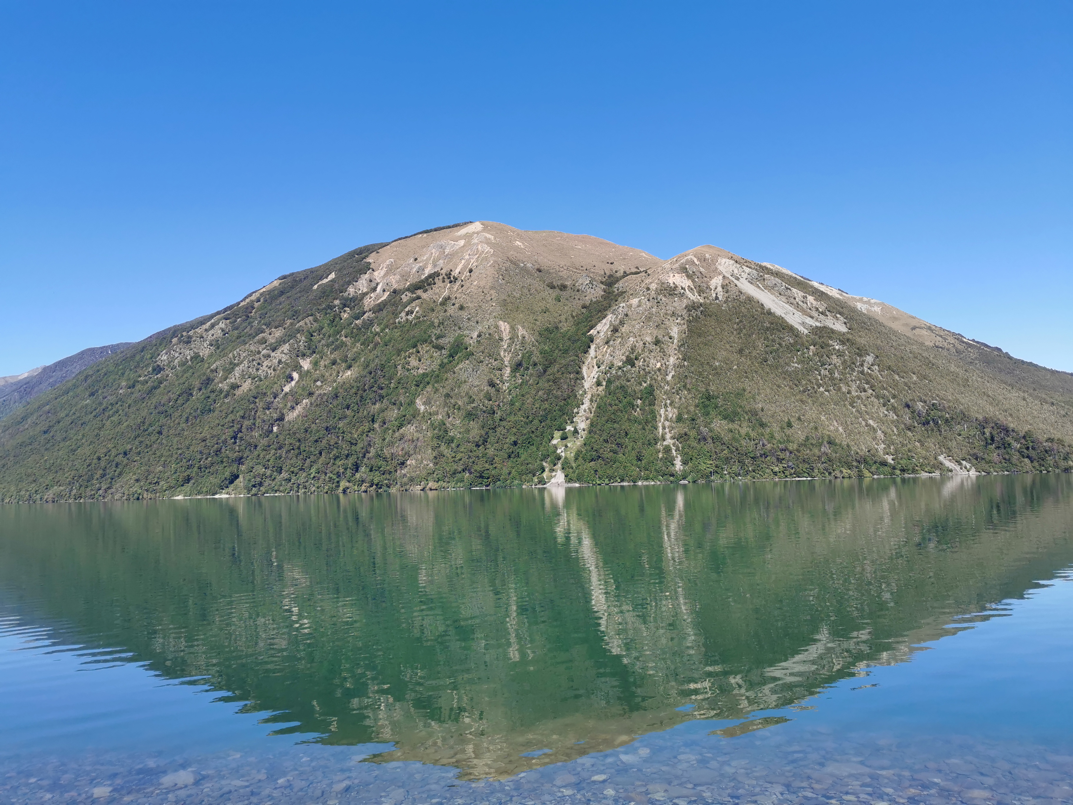
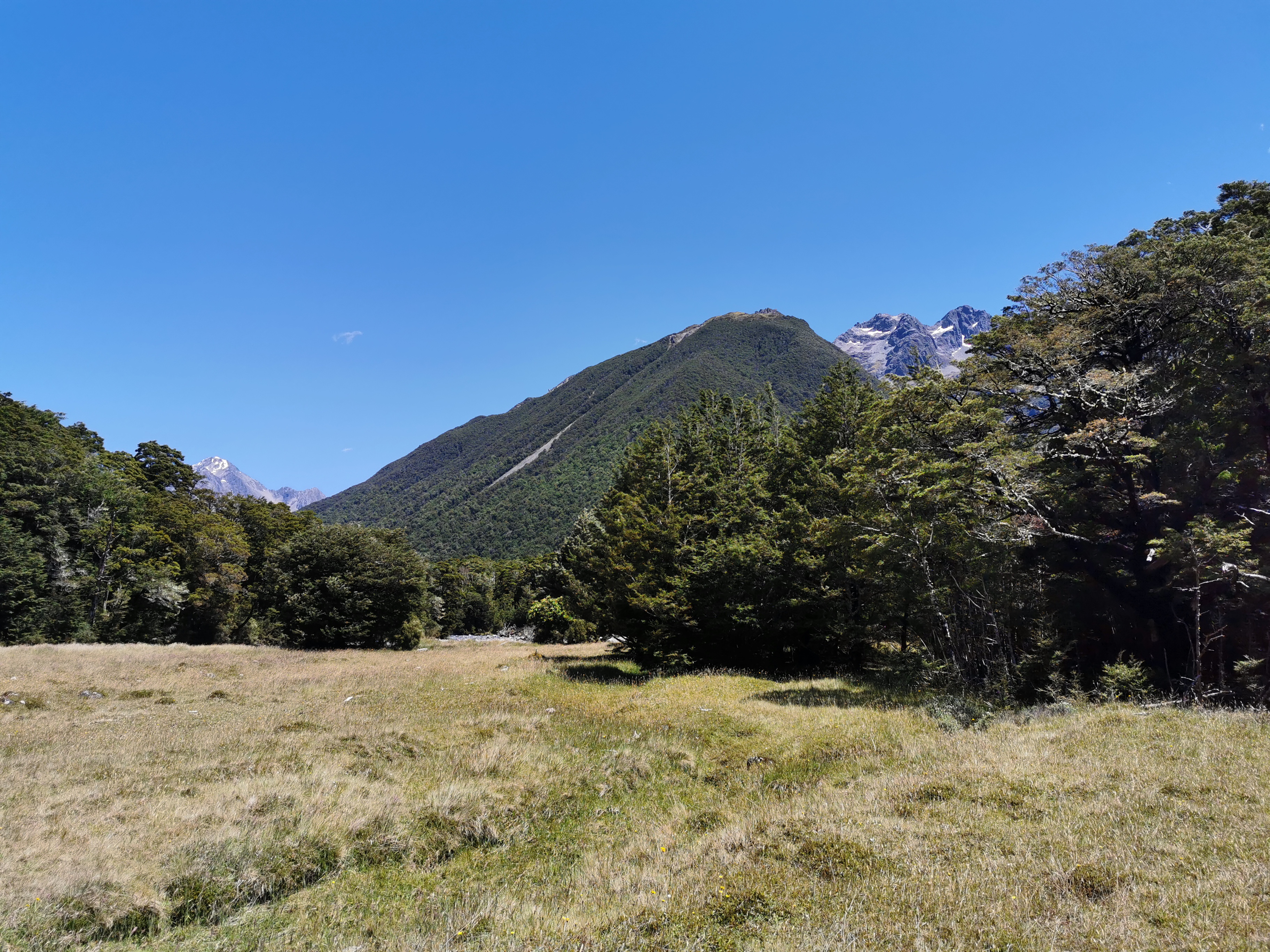
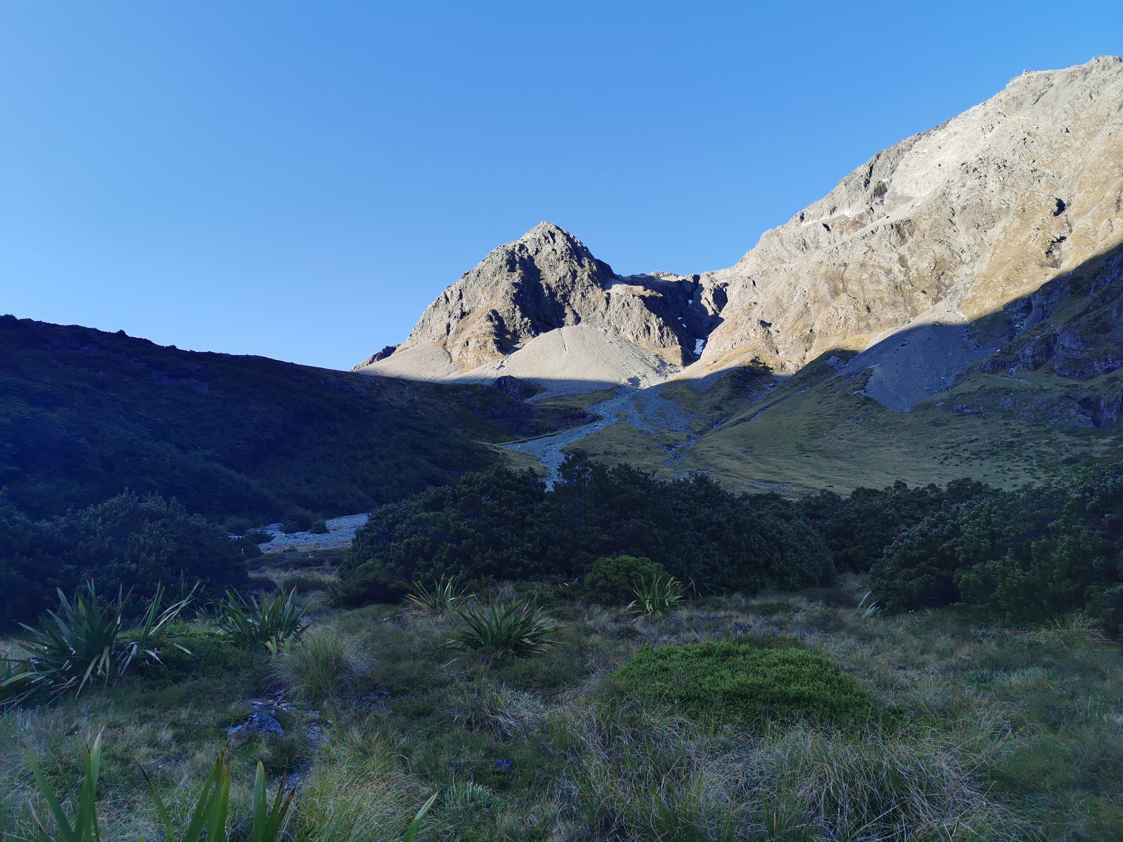
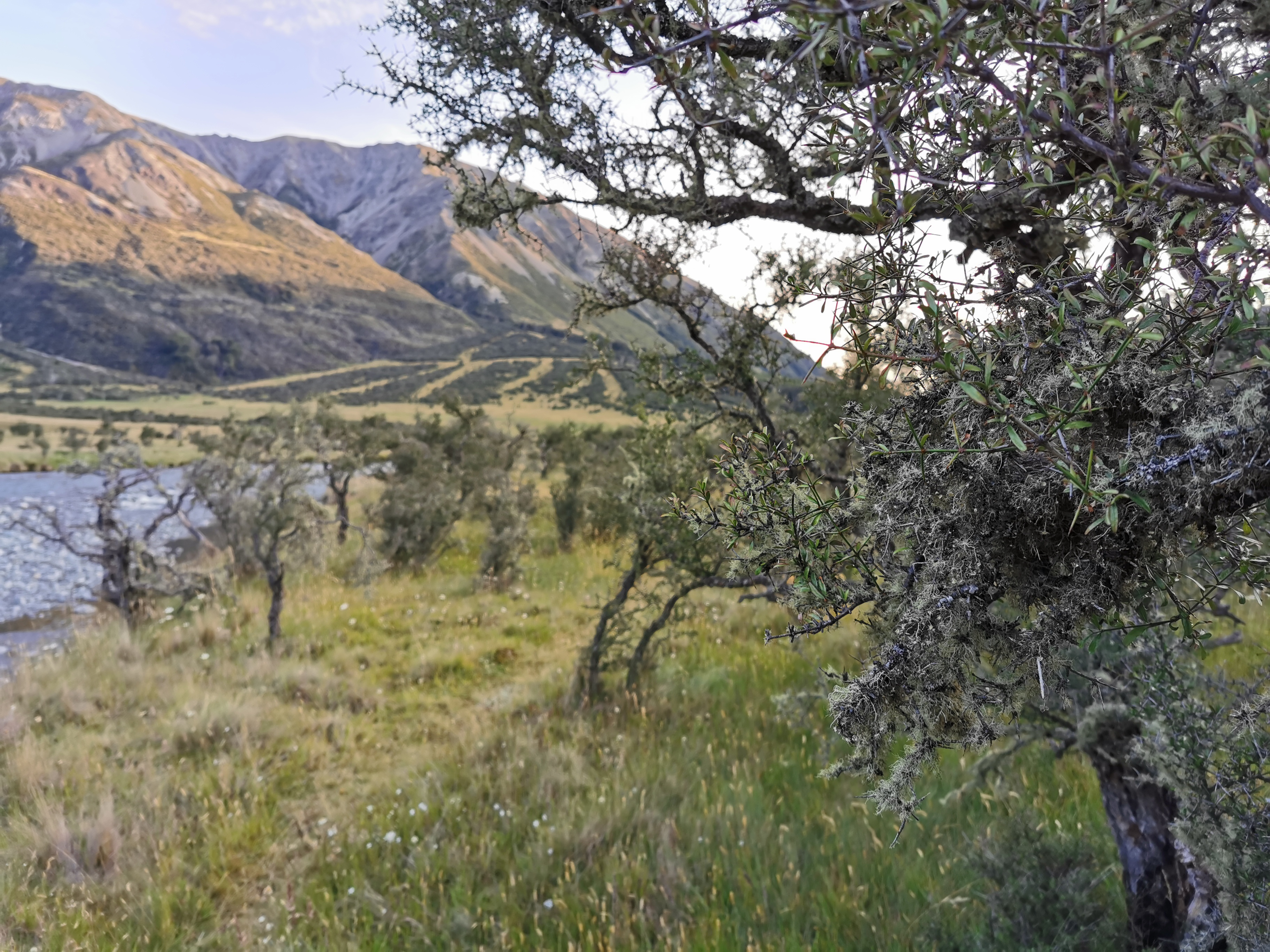
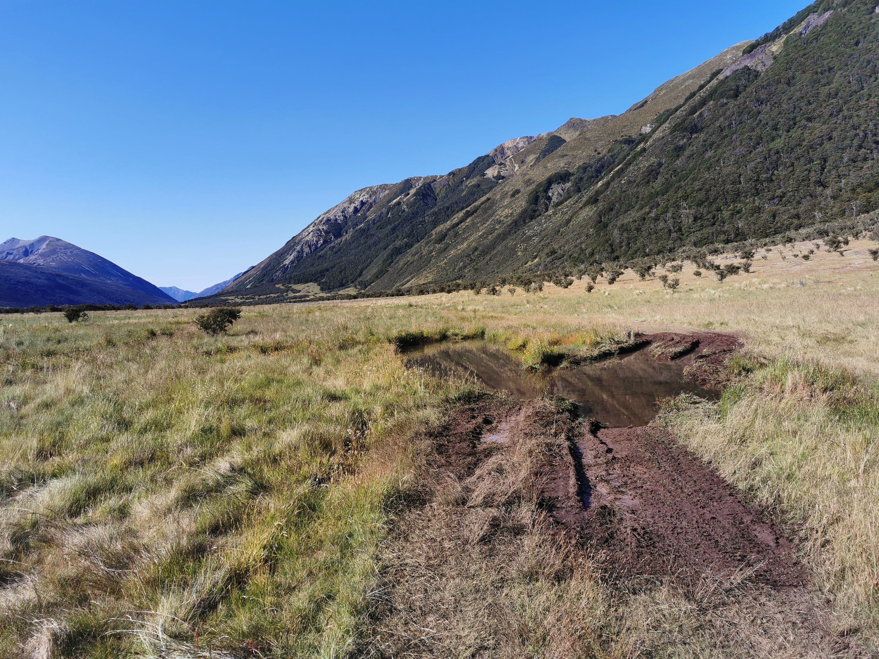
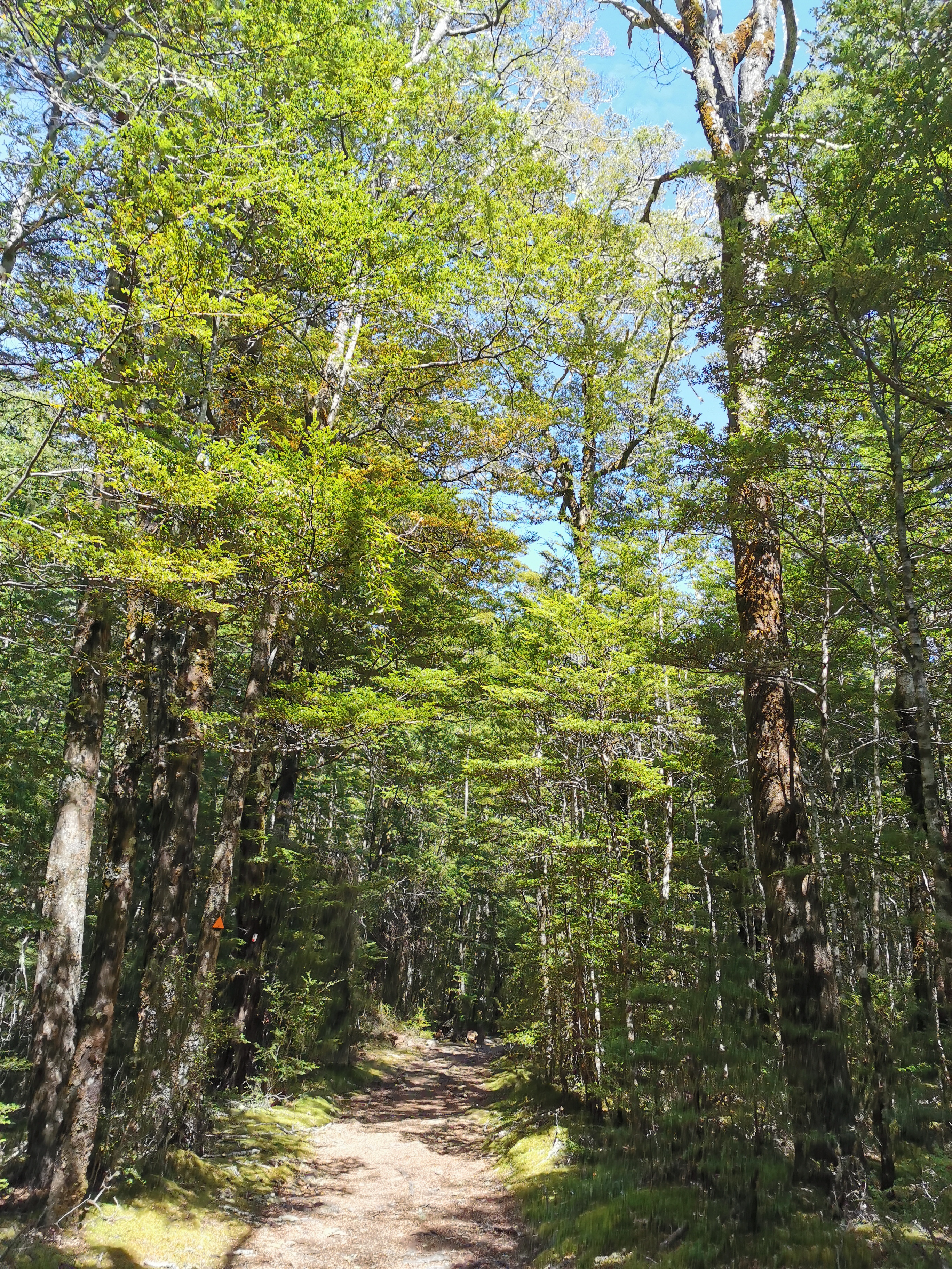
This bit of the road was very nice
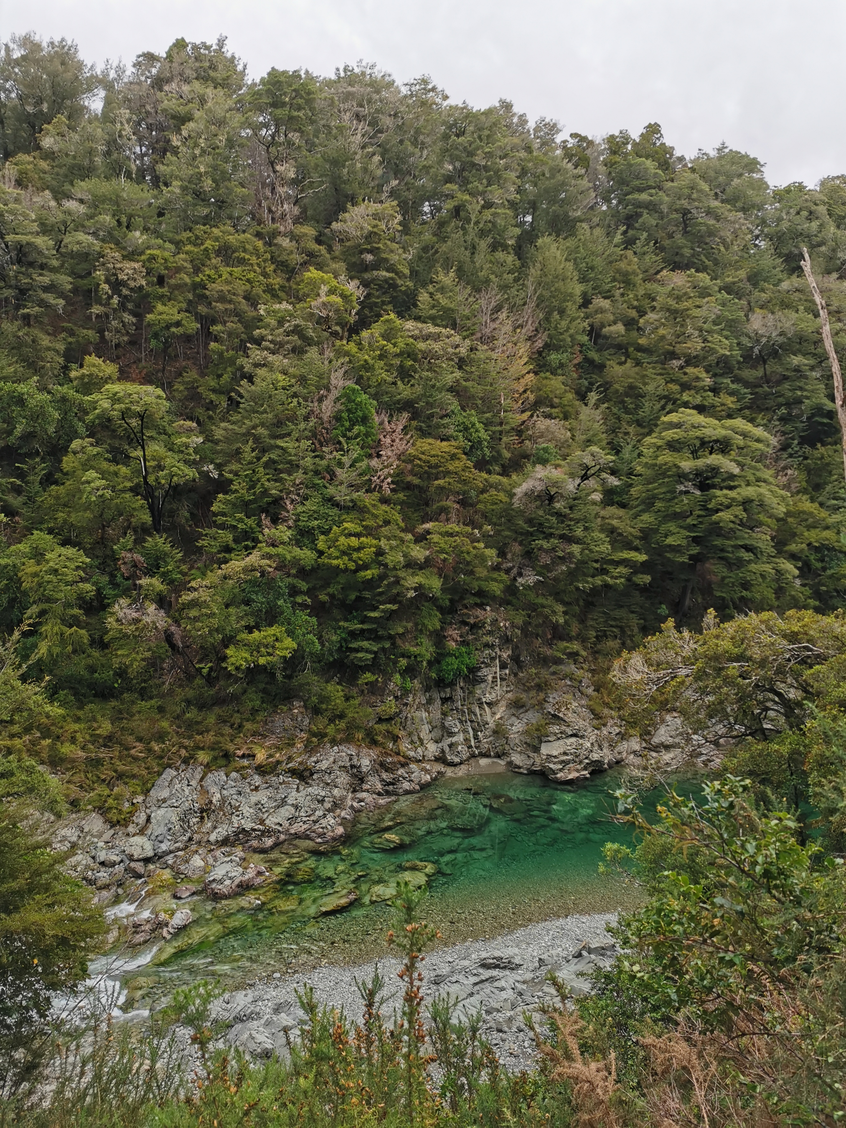
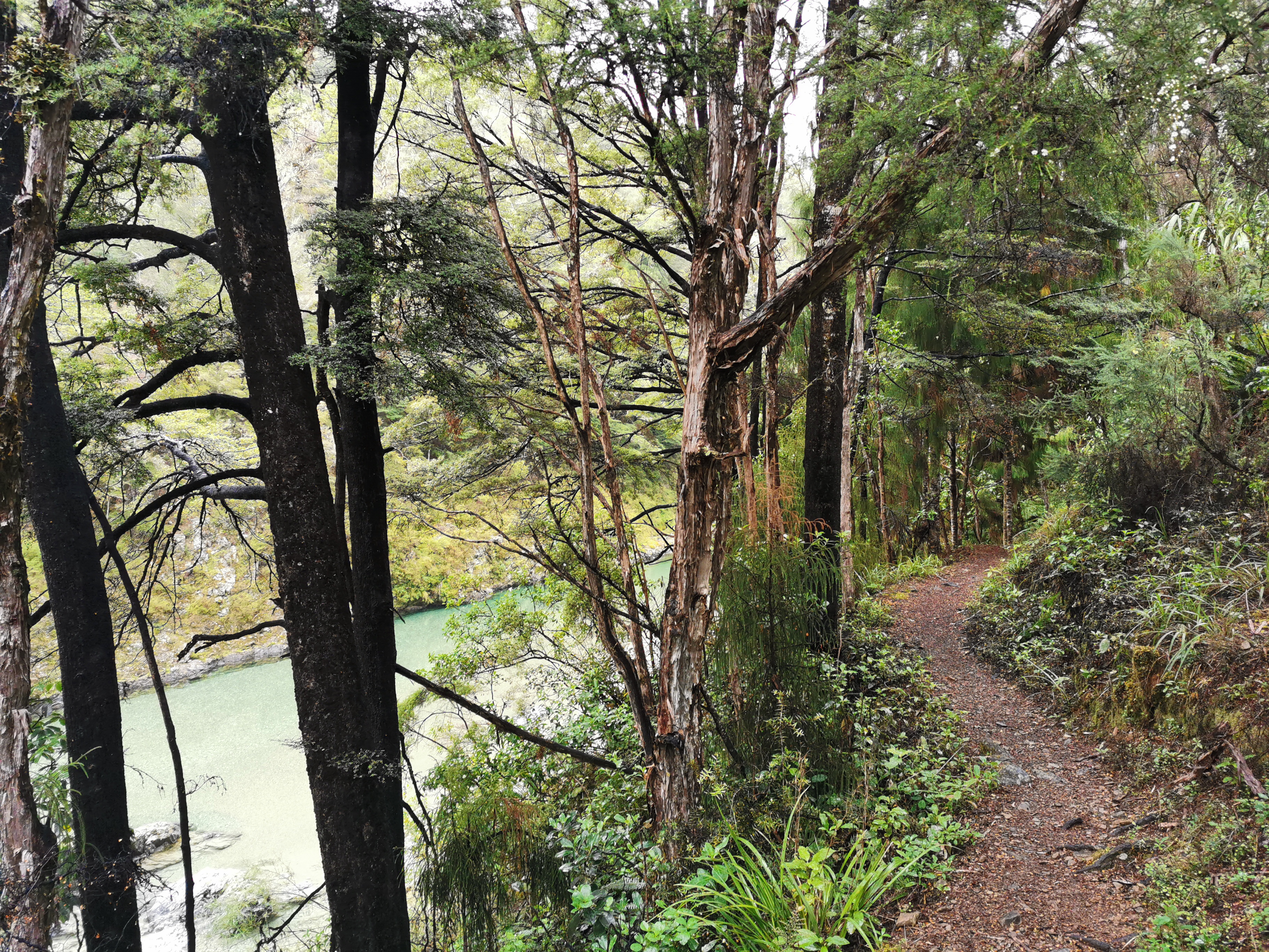
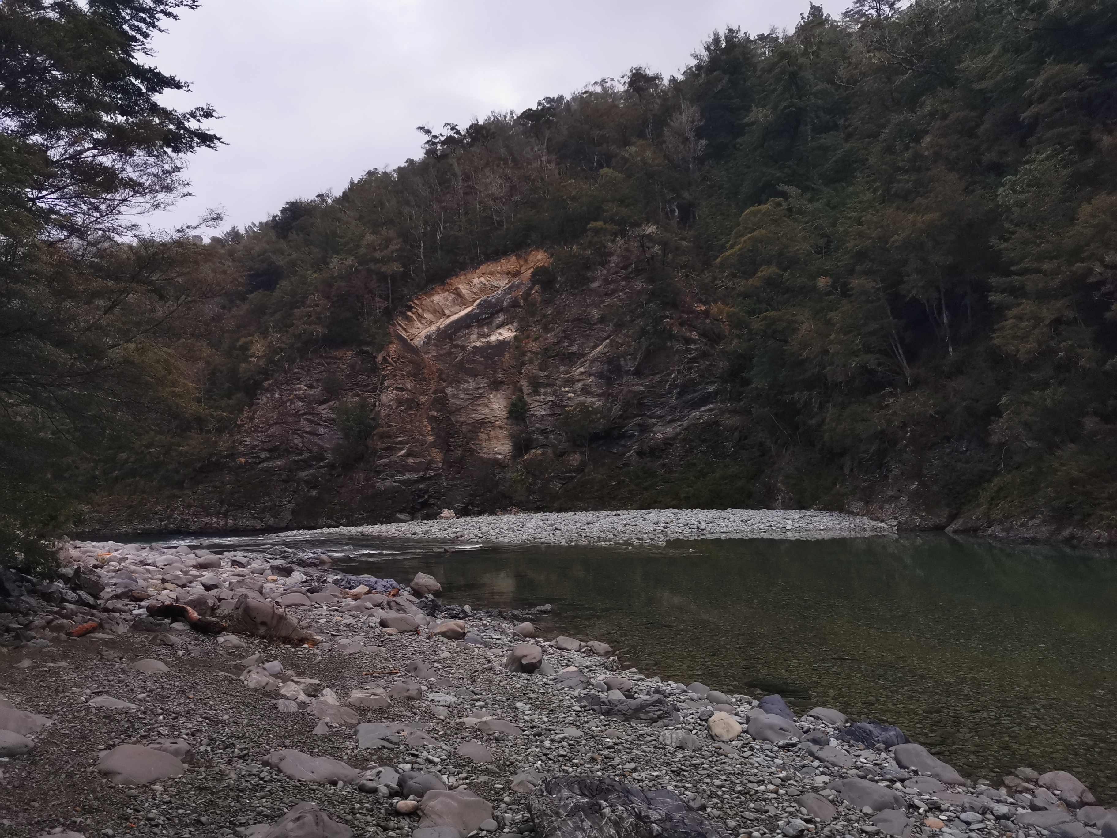
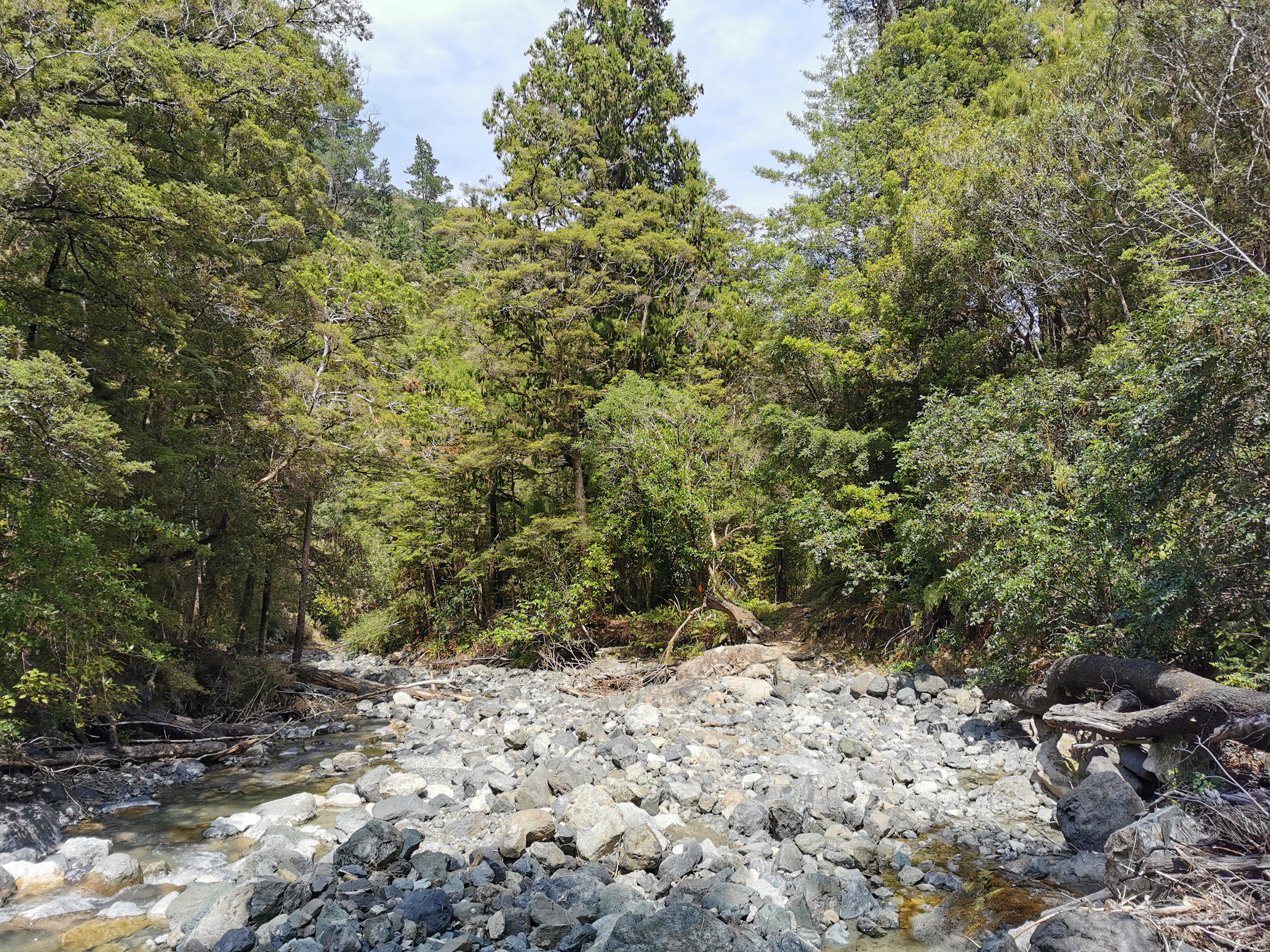
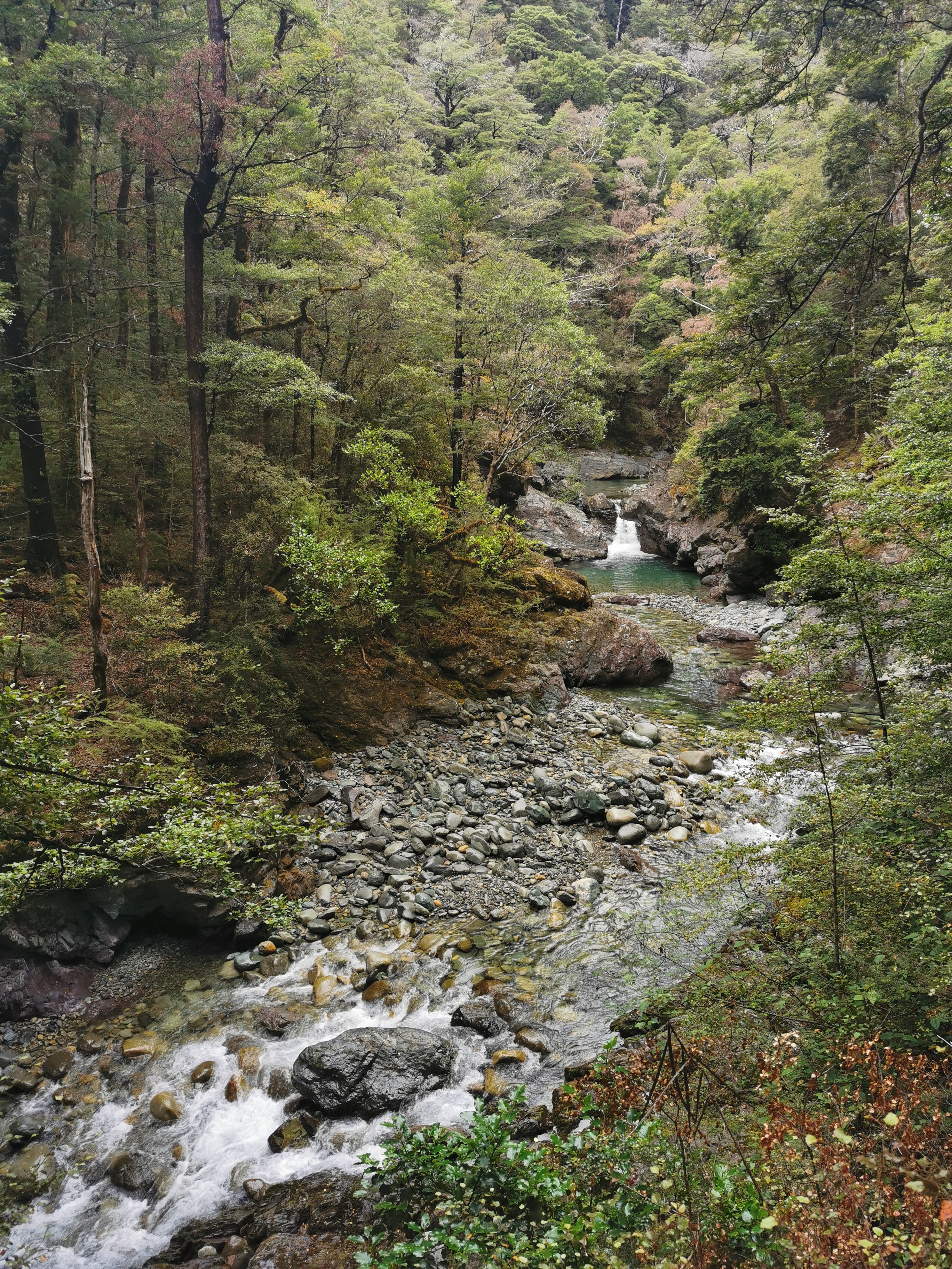
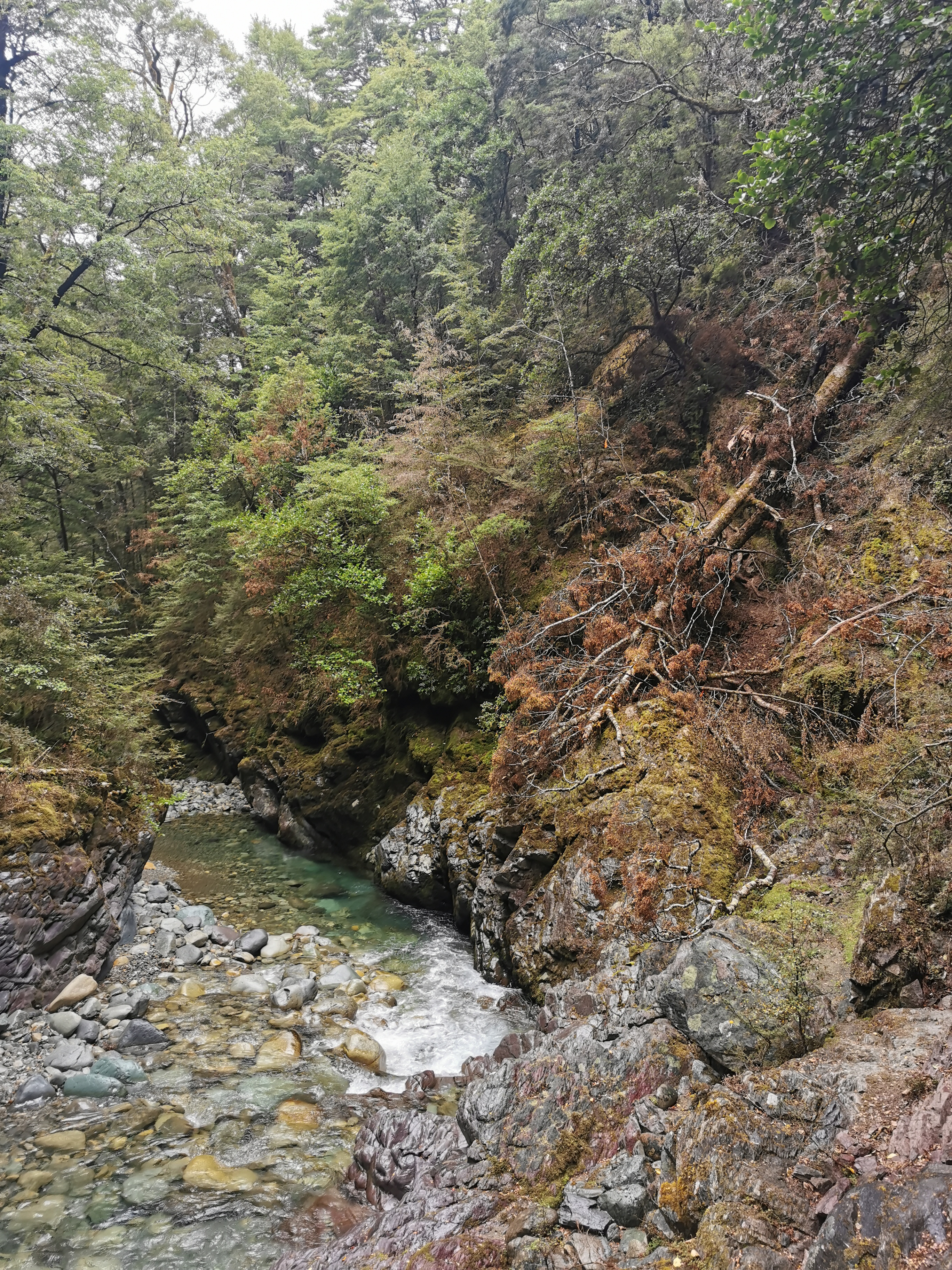
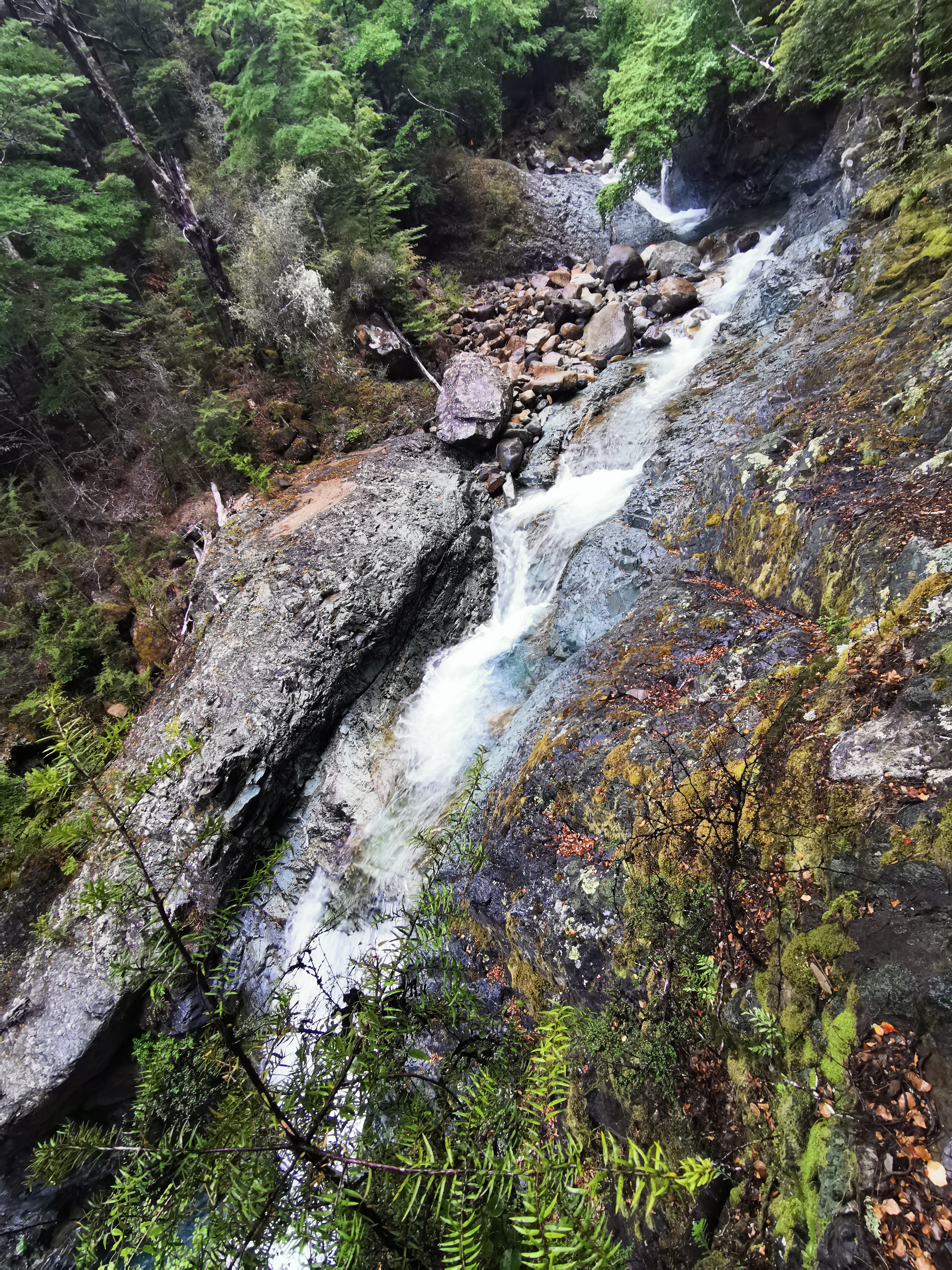
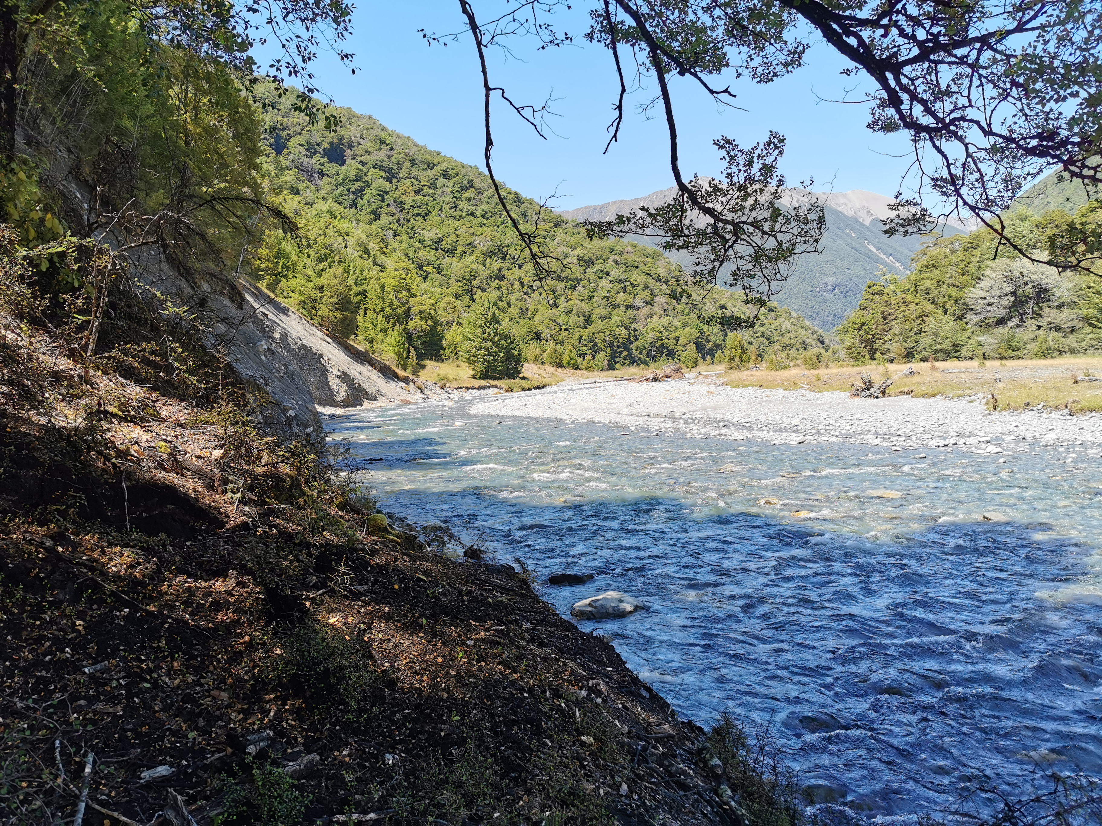
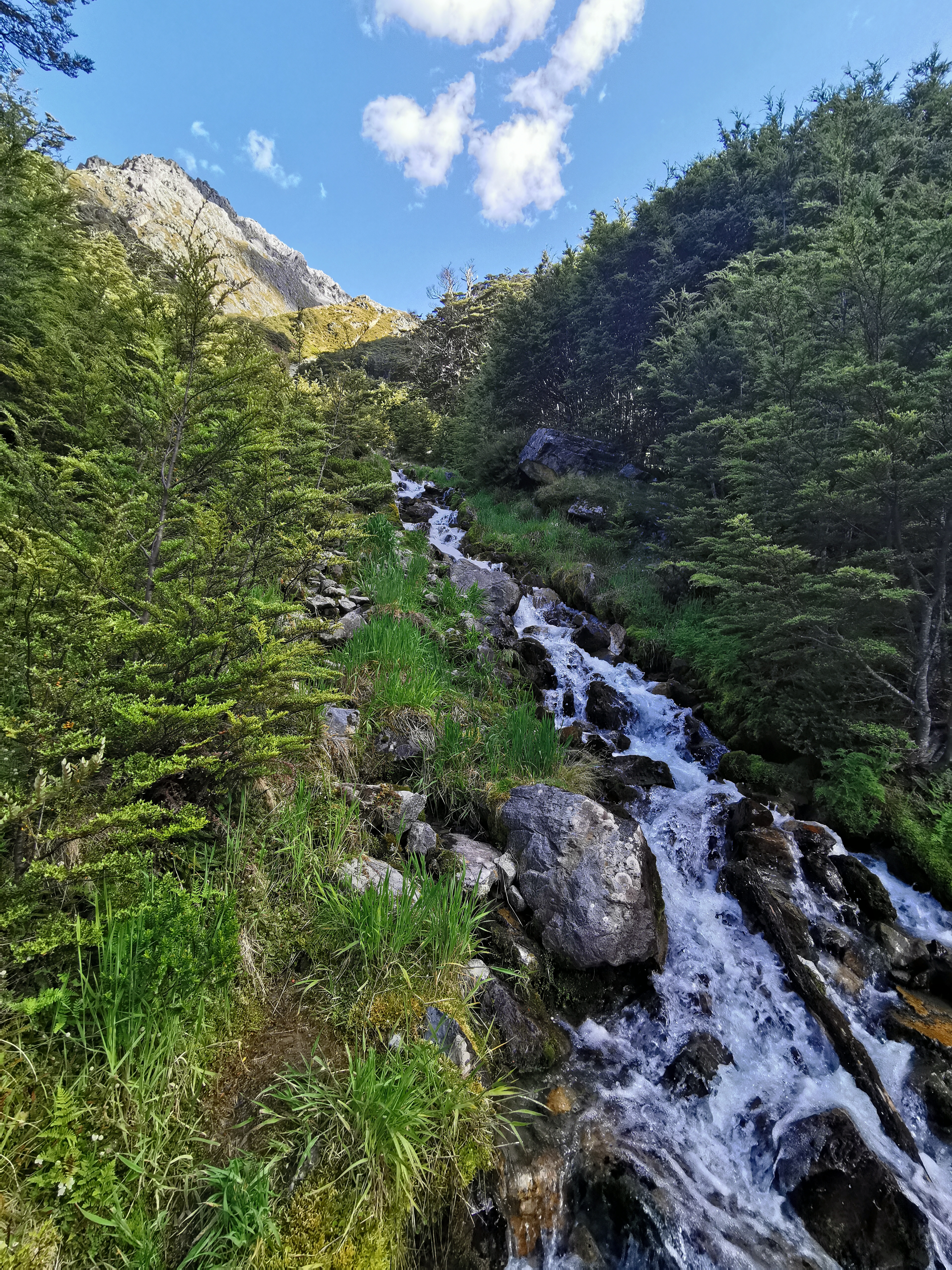
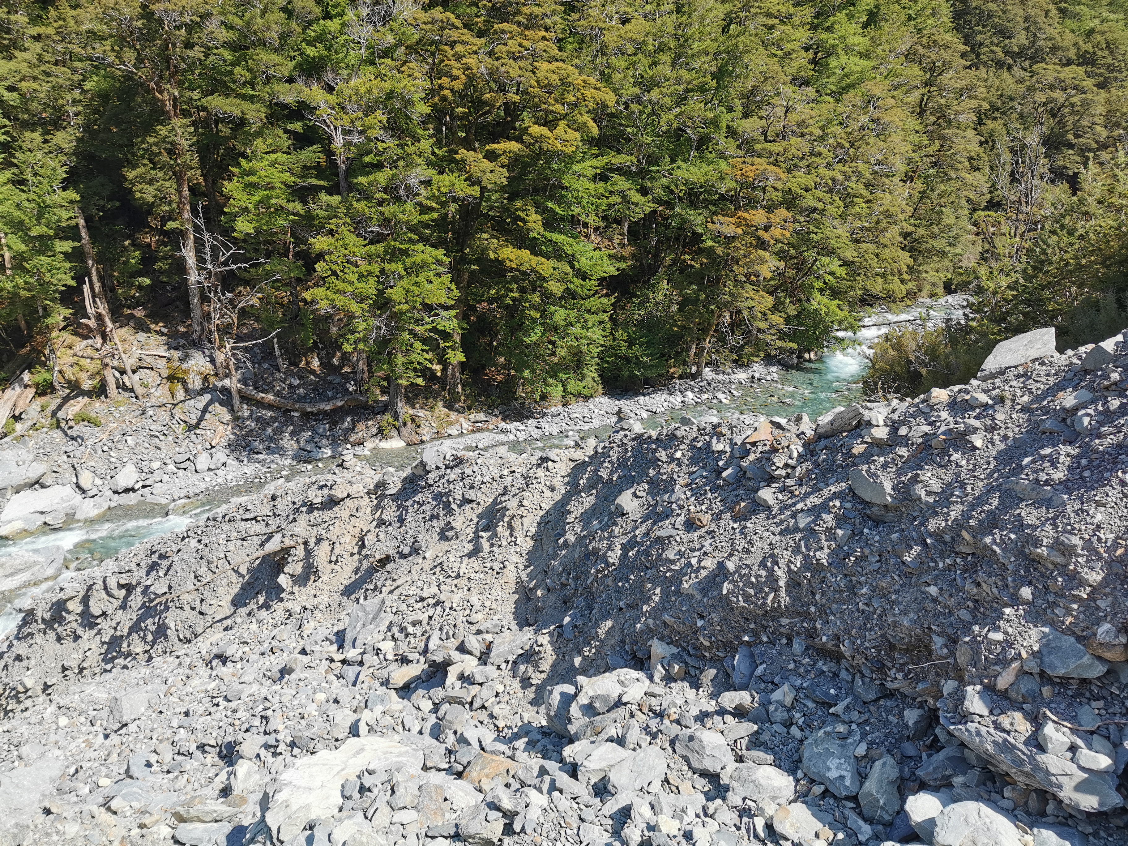
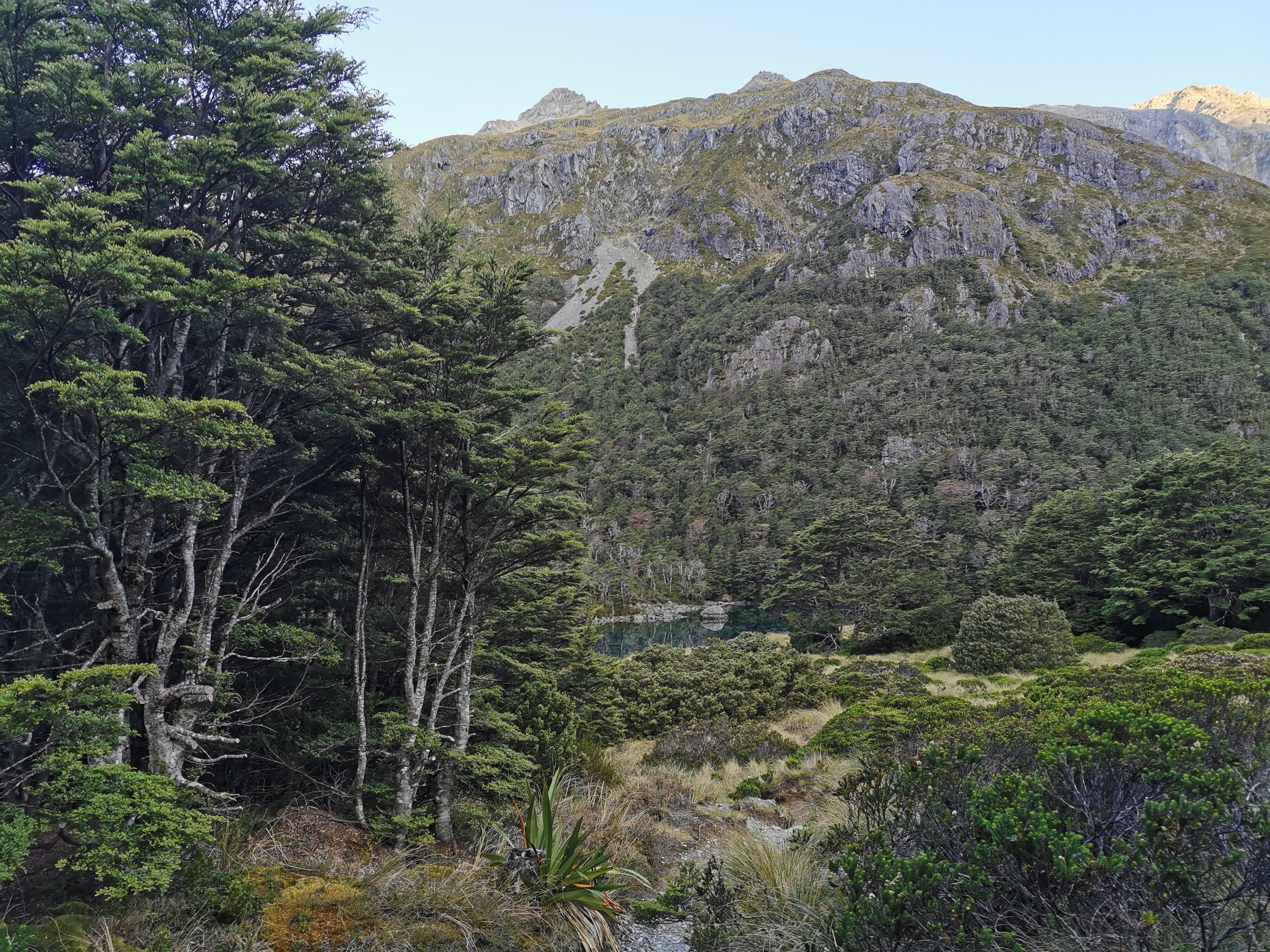
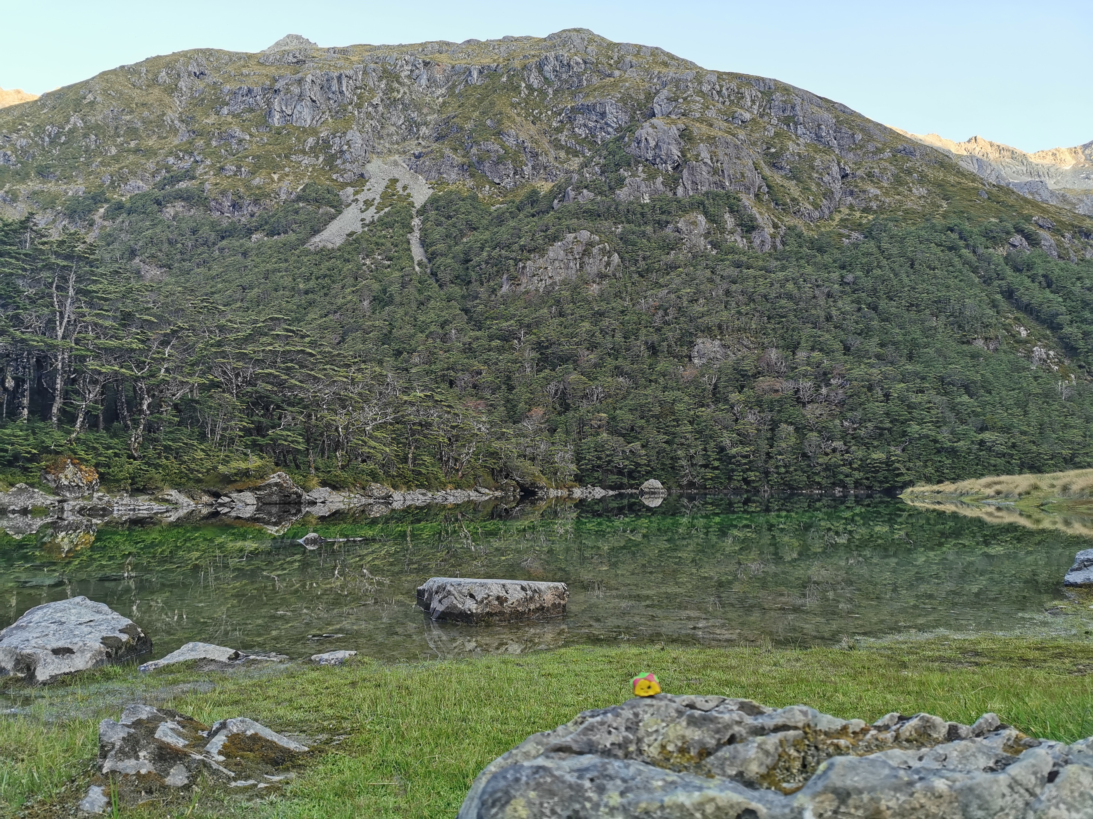
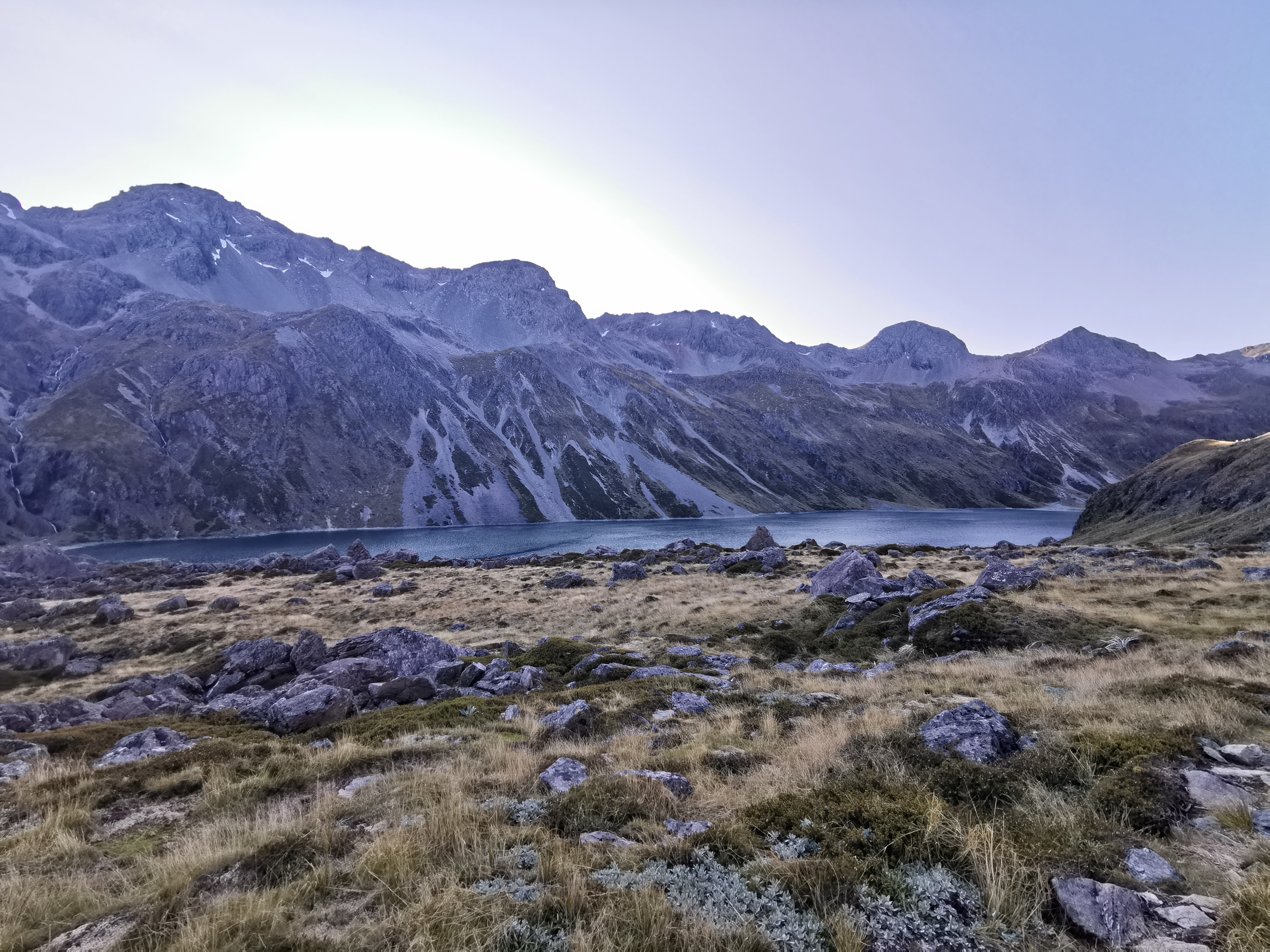
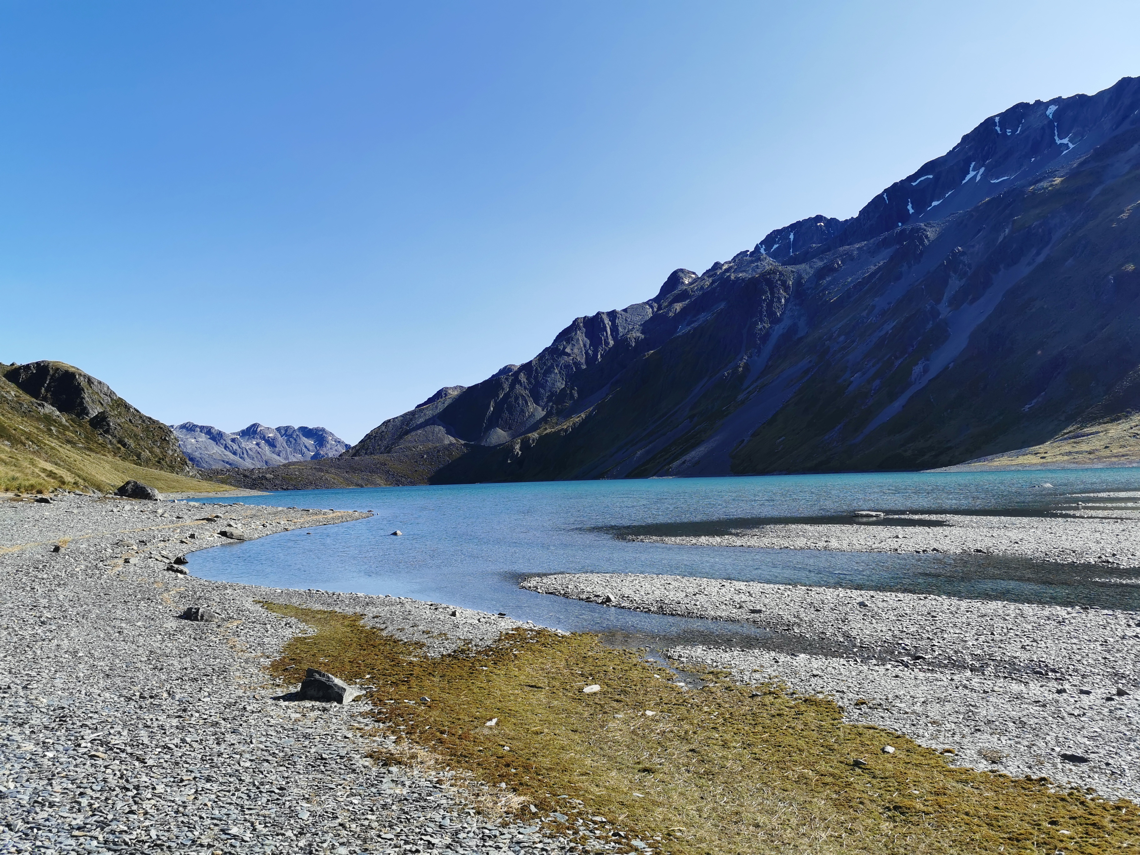
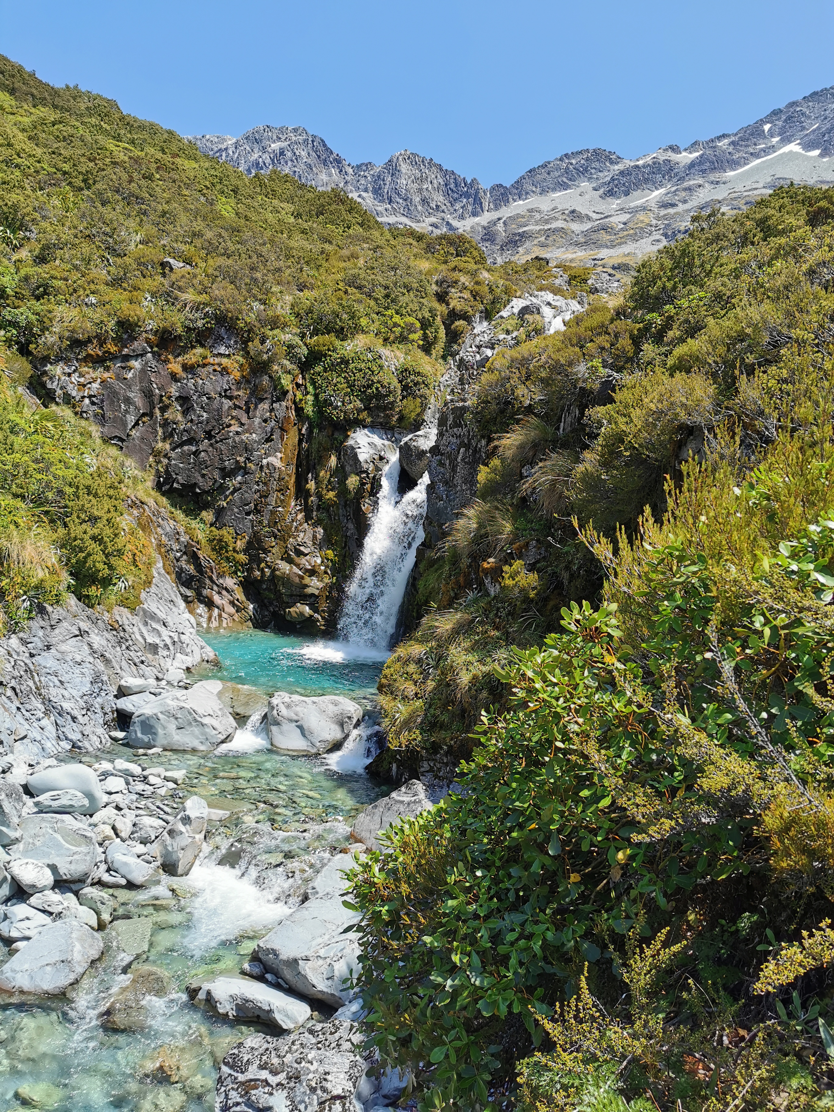
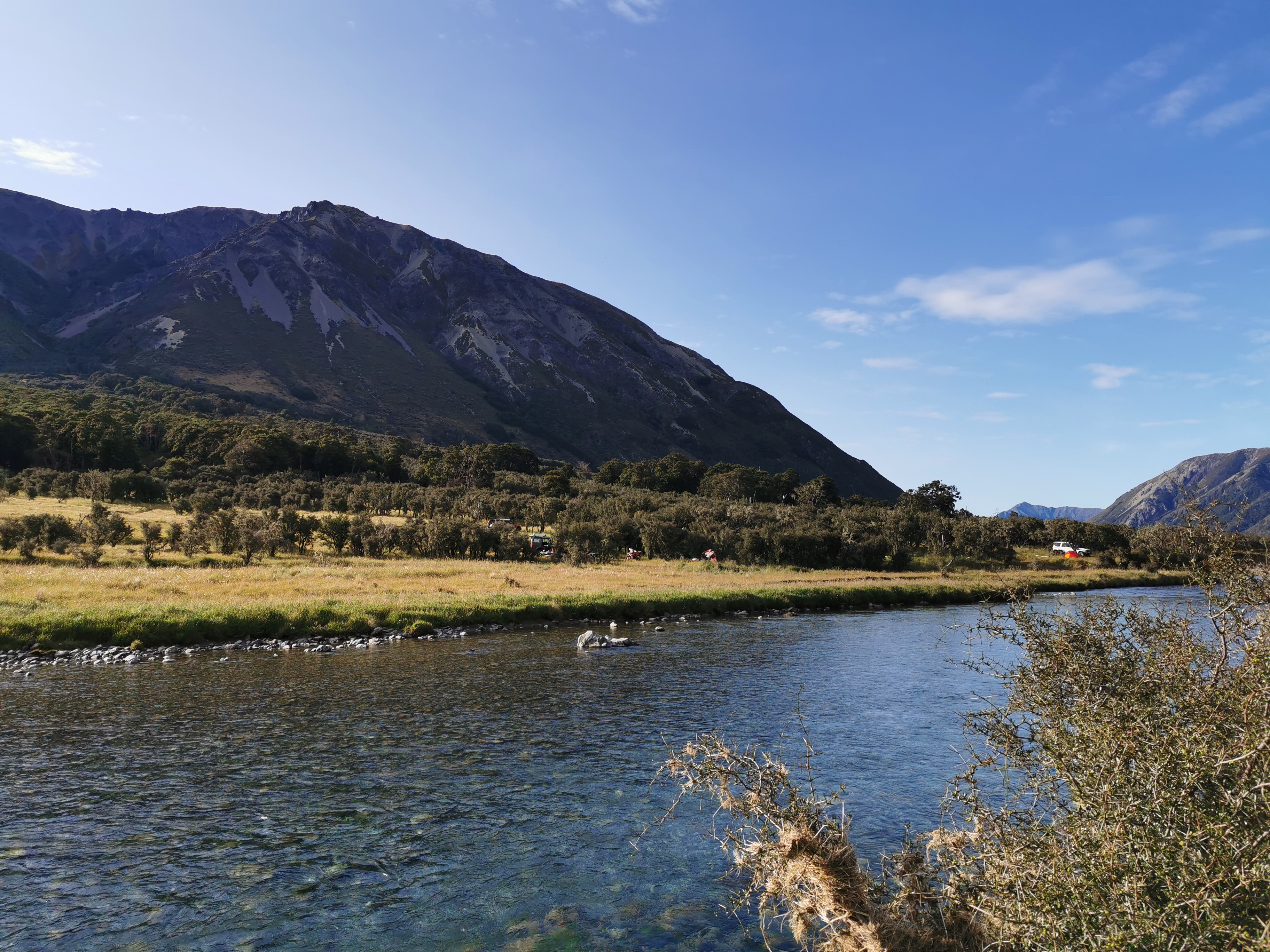
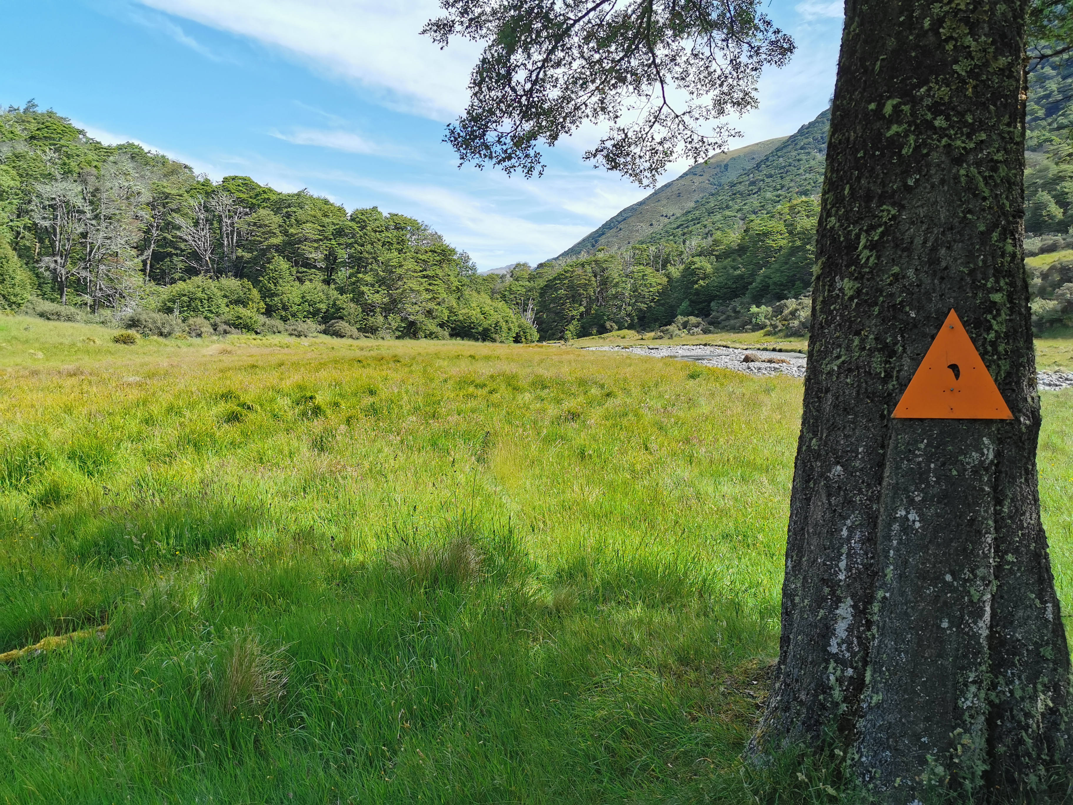
One thing that could be seen from the road was just how green the water in the river was. It was so beautiful.
Apparently it’s “emerald” – I guess green water doesn’t sound good when you think about it
Earlier on Tina and Matthew had said that they hoped the huts wouldn’t be too busy. Most of the huts around here are 6 bed huts and so they could fill up fairly easily, especially at this time of year. I said to them that given the number of people who I’d seen on Facebook that are in this area, the chance of the huts having space are quite slim.
Who will be in the huts? It’s hard to know. Back in the Tararua Ranges it was easy to know, because our group was the first group through after an extended period of bad weather so we knew the huts would be empty. But today I’d started late in the day, the weather has been mostly good and I have no idea who’s in front of me. This should be interesting. Because it was raining I kinda hoped for a space in the hut but given that I didn’t get a lot of sleep last night I was actually looking forward to a night in my tent so that I can sleep in in the morning.
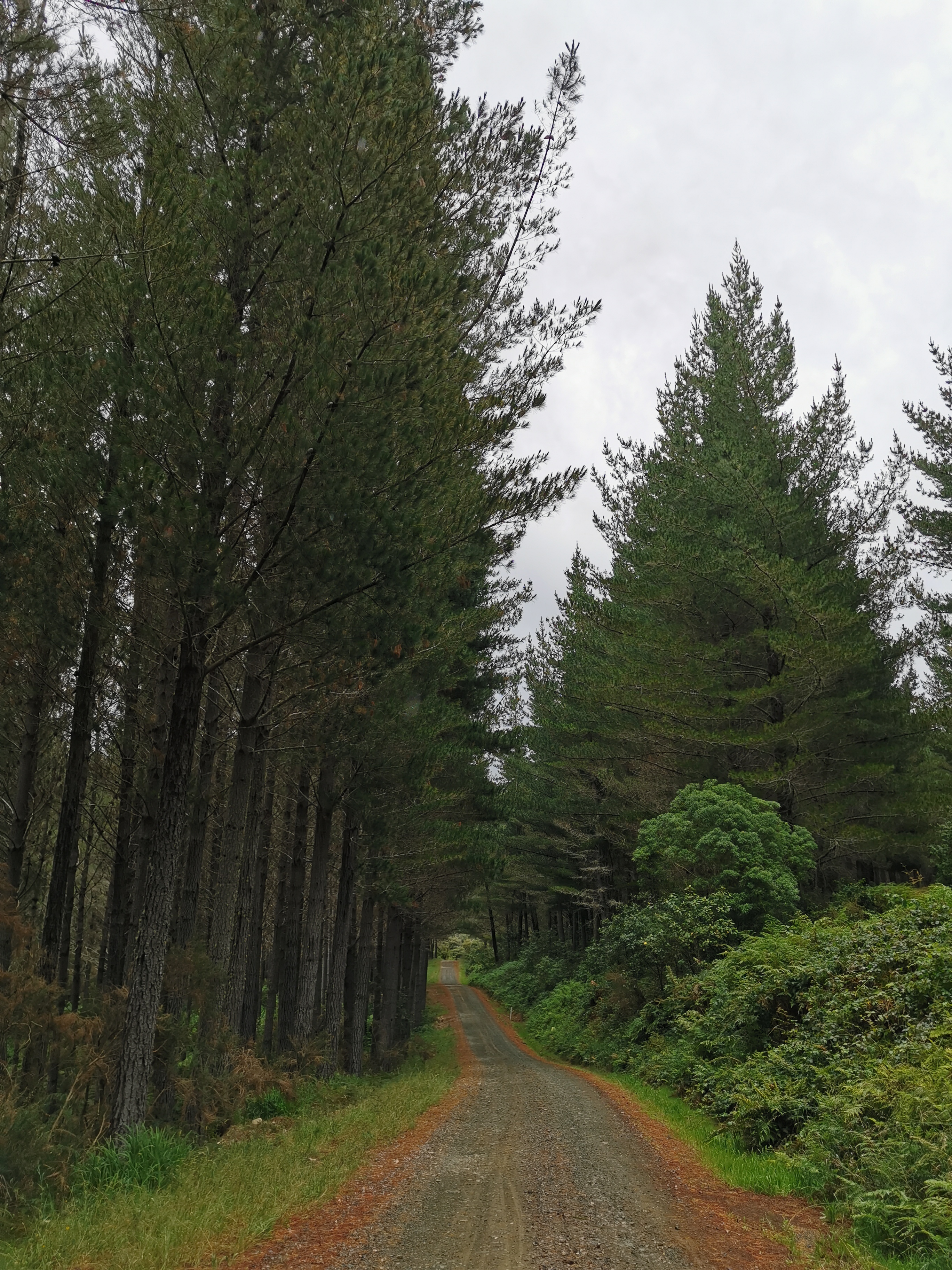
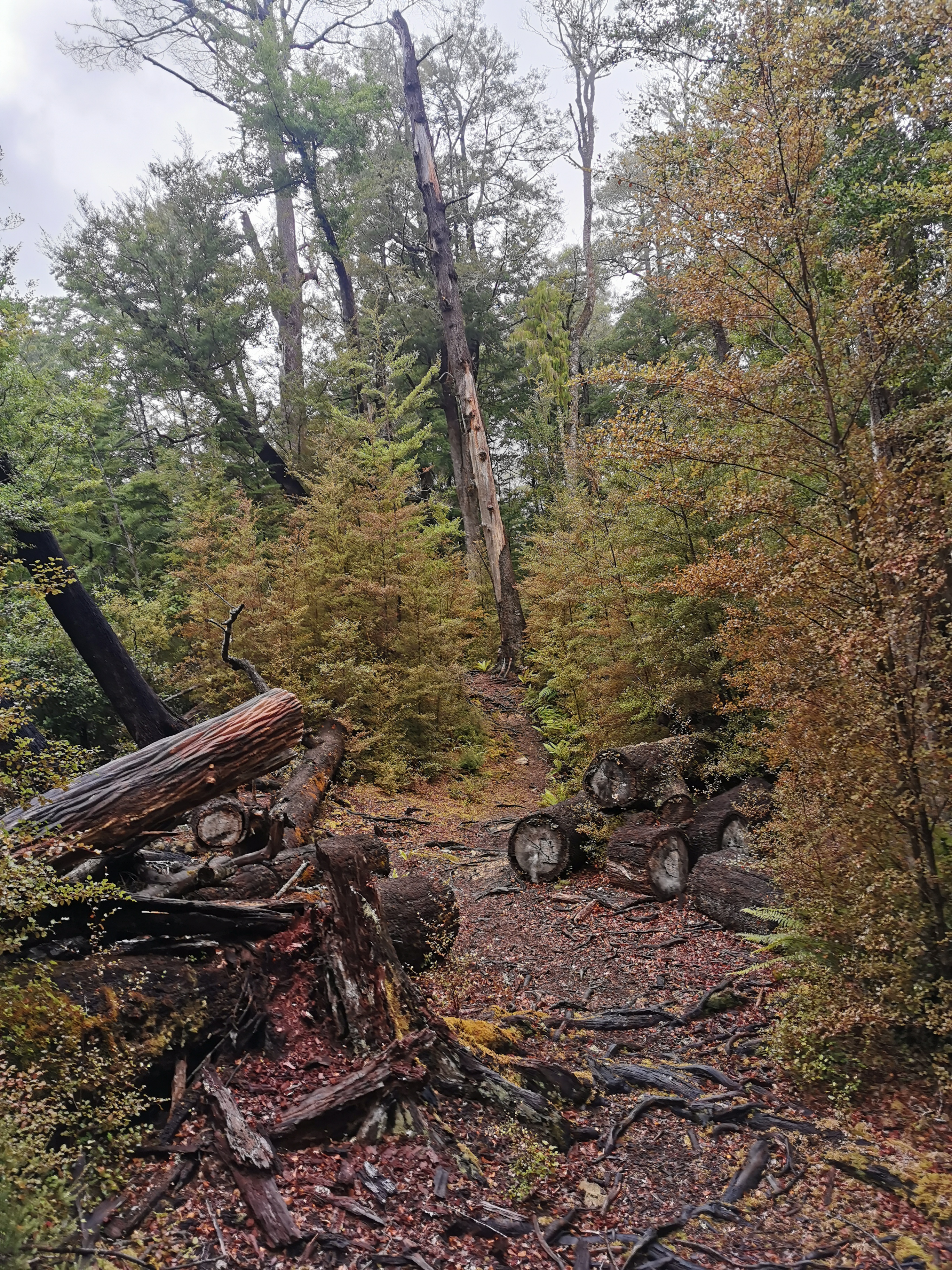
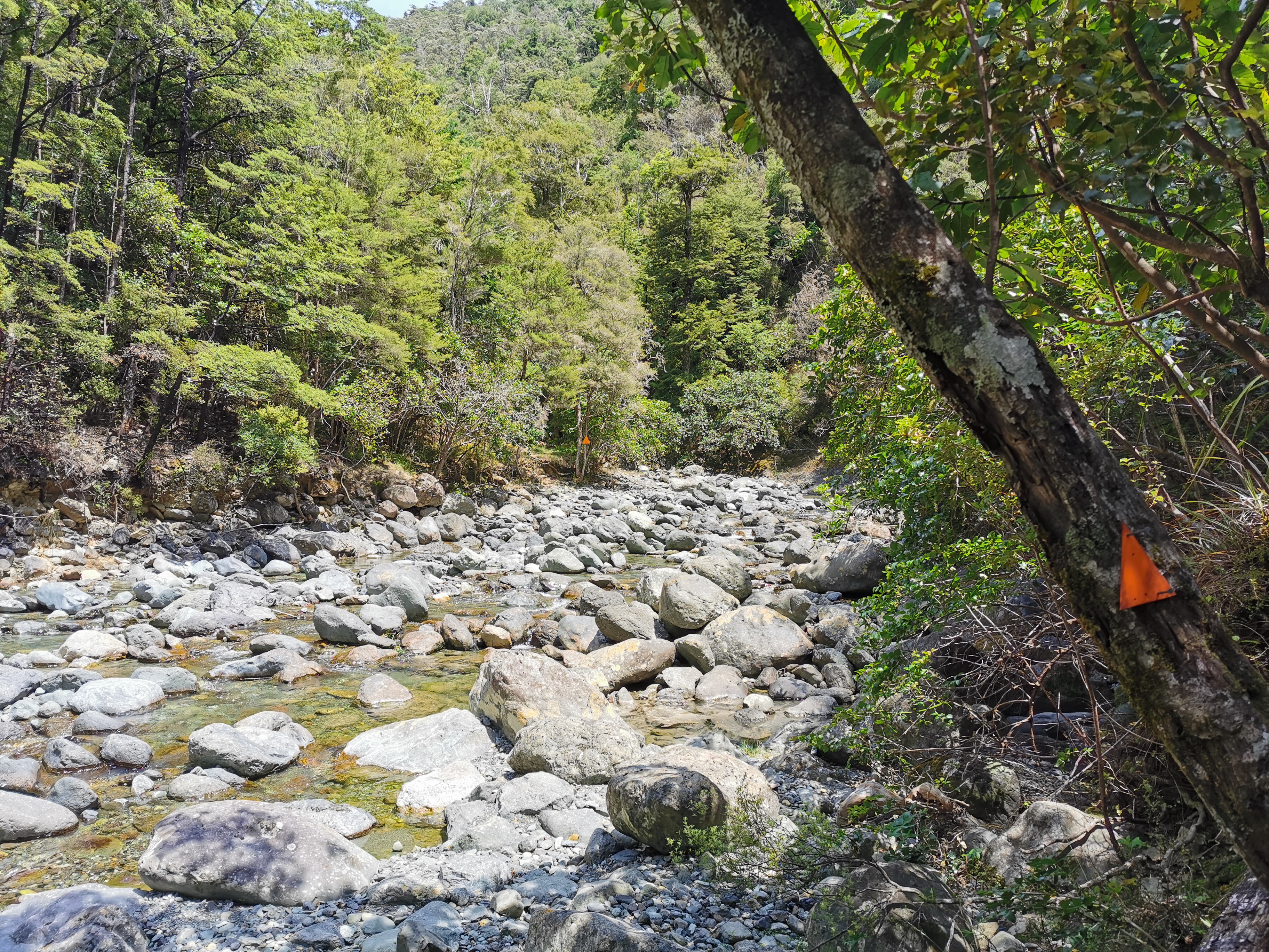
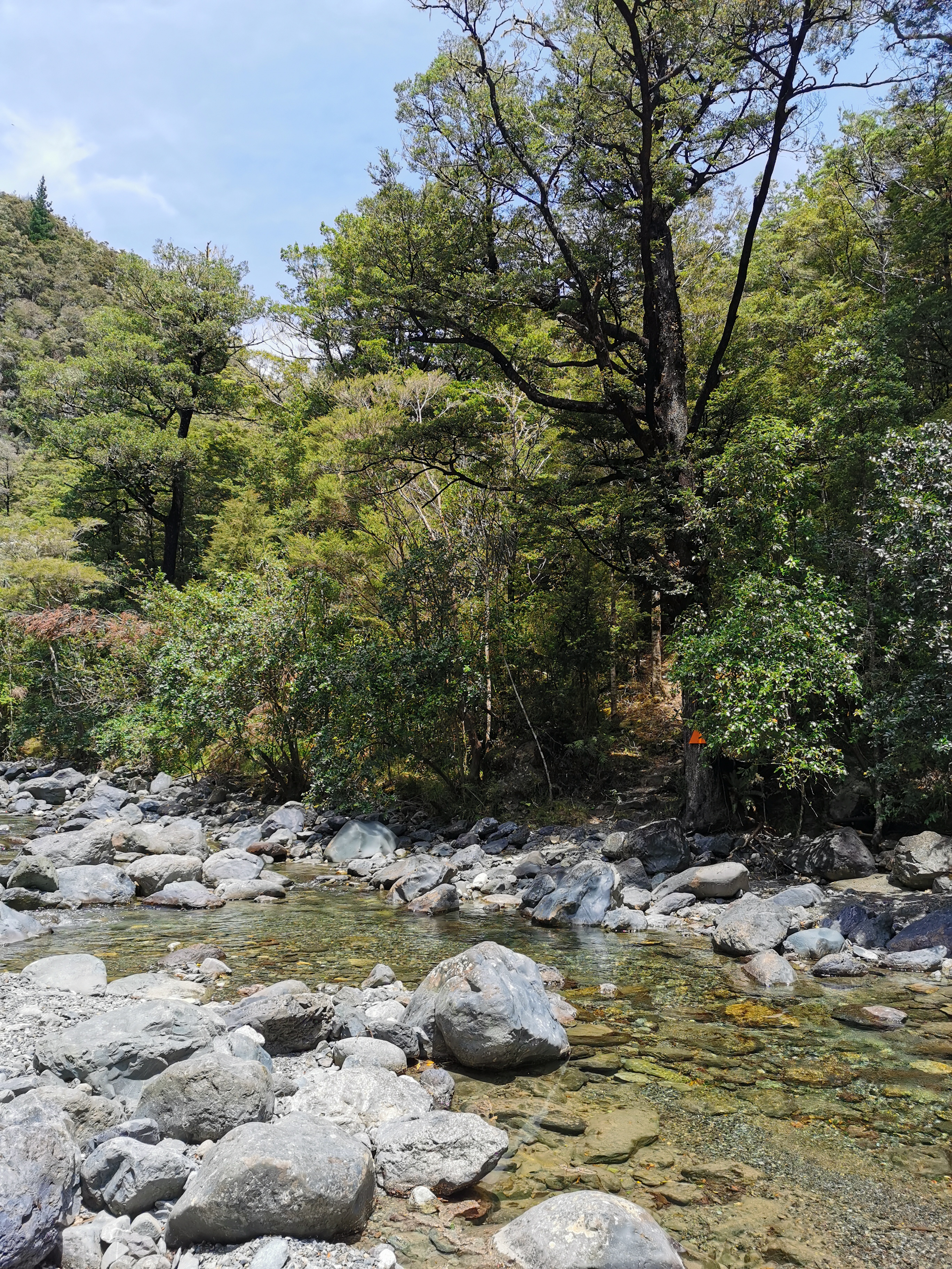
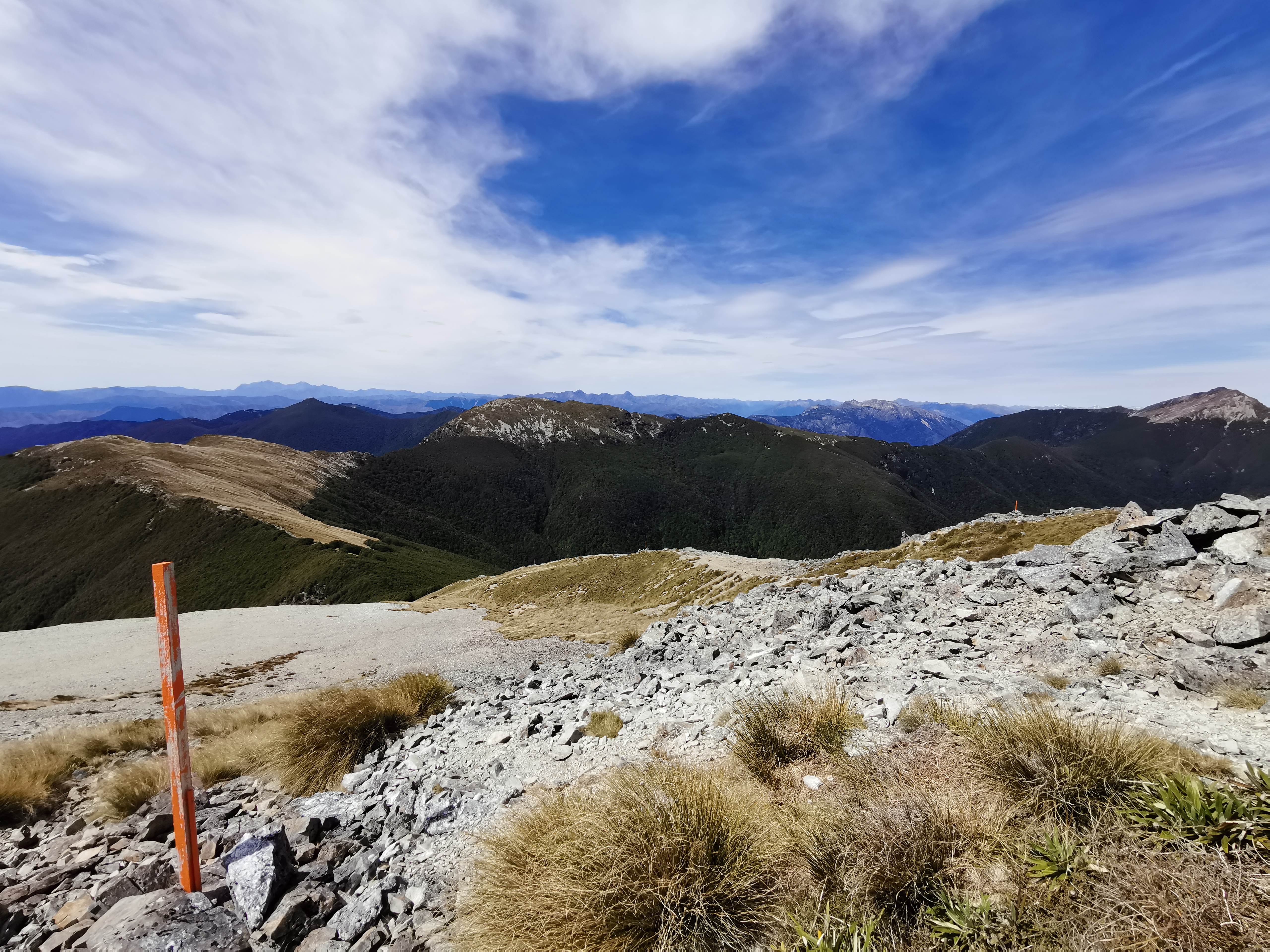
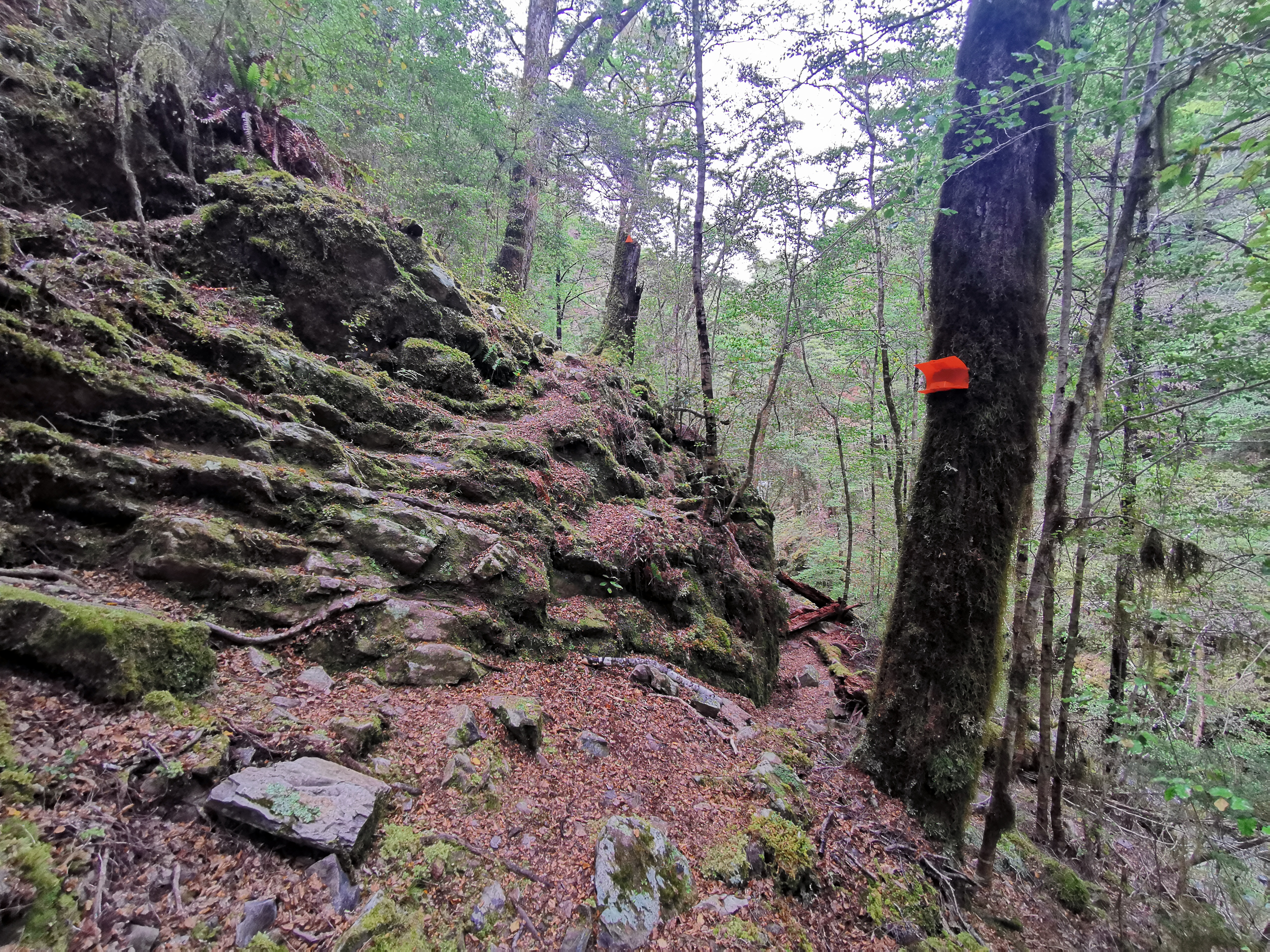
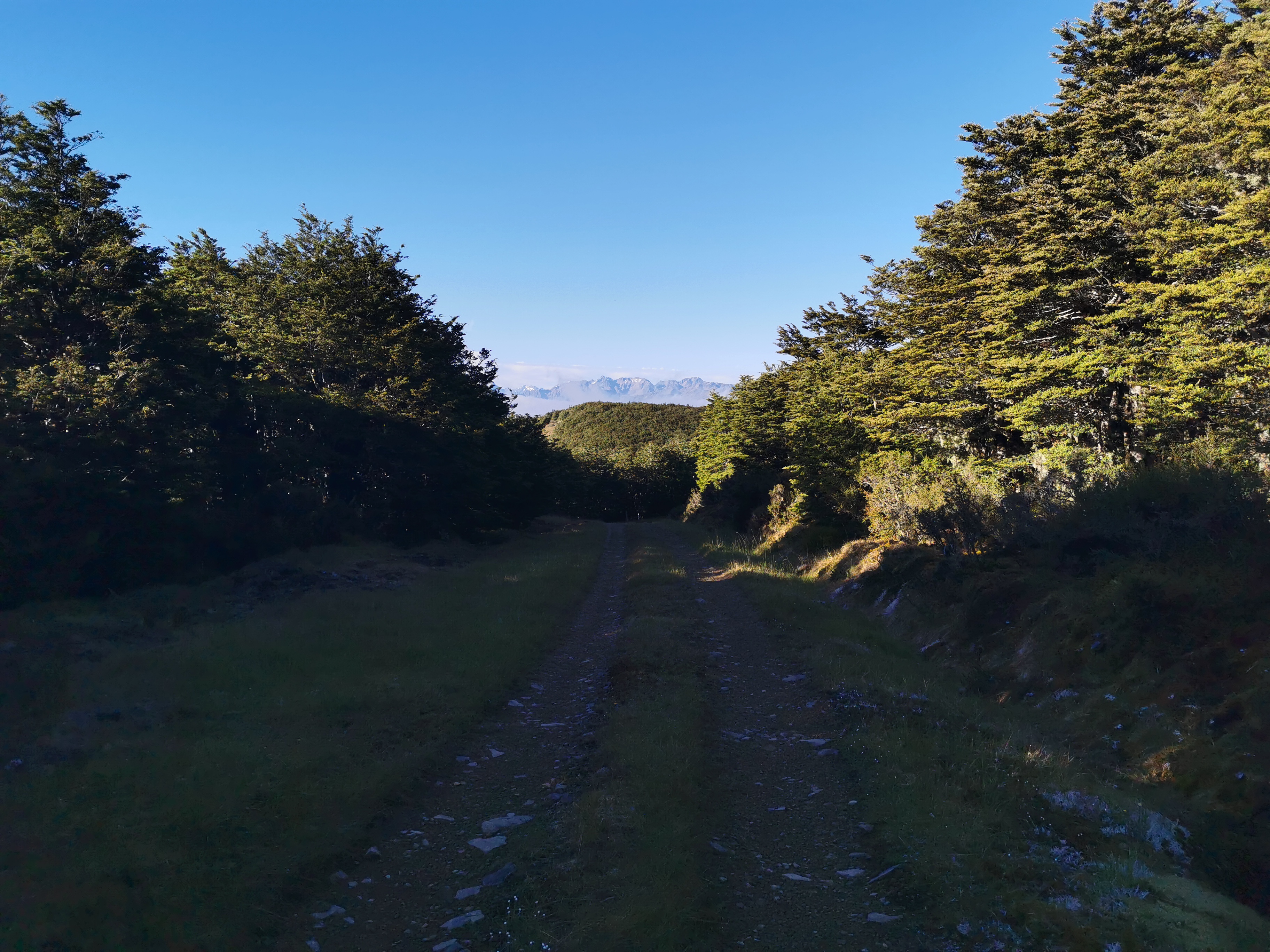
Here’s the end of the road walking.
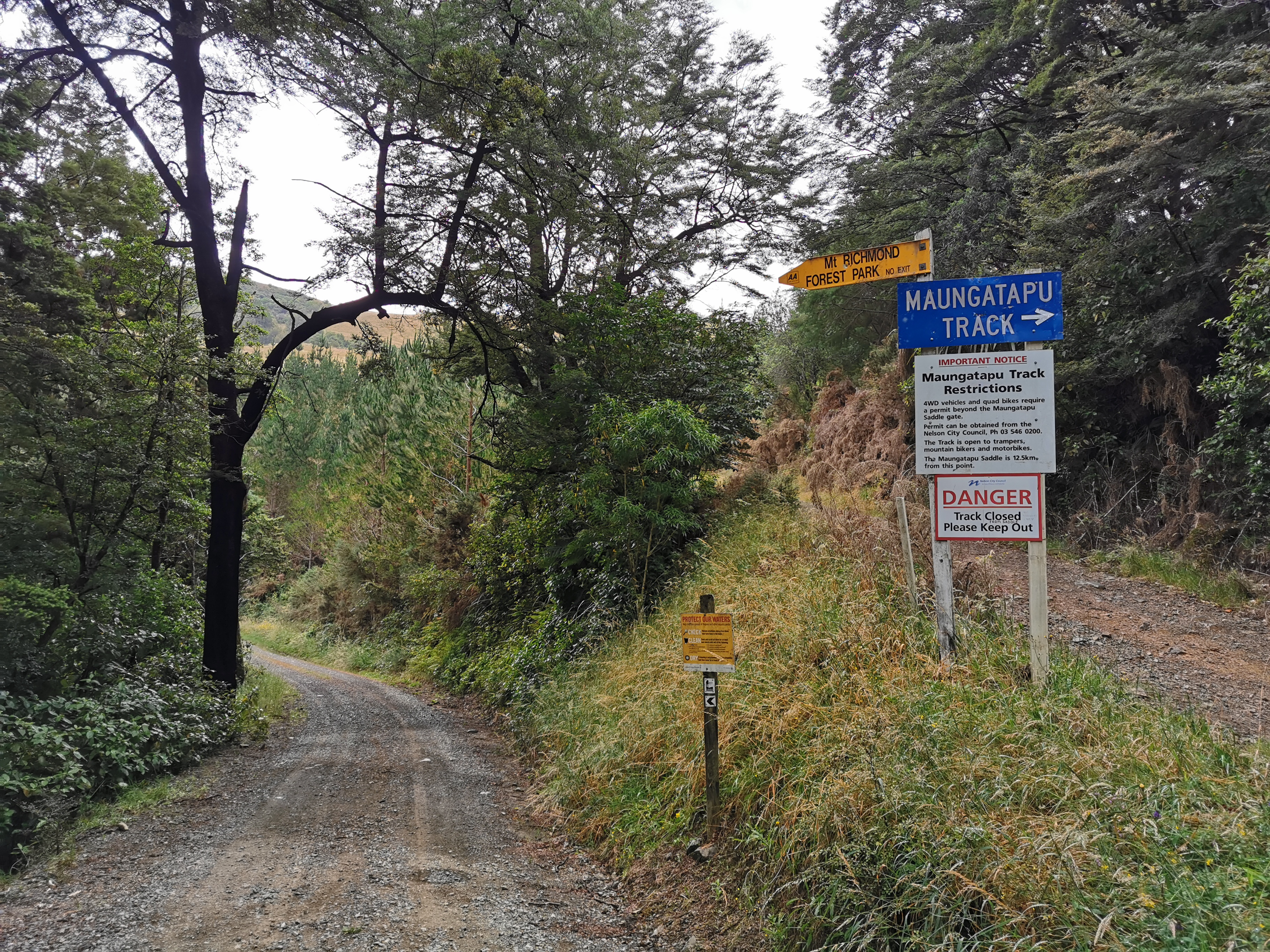
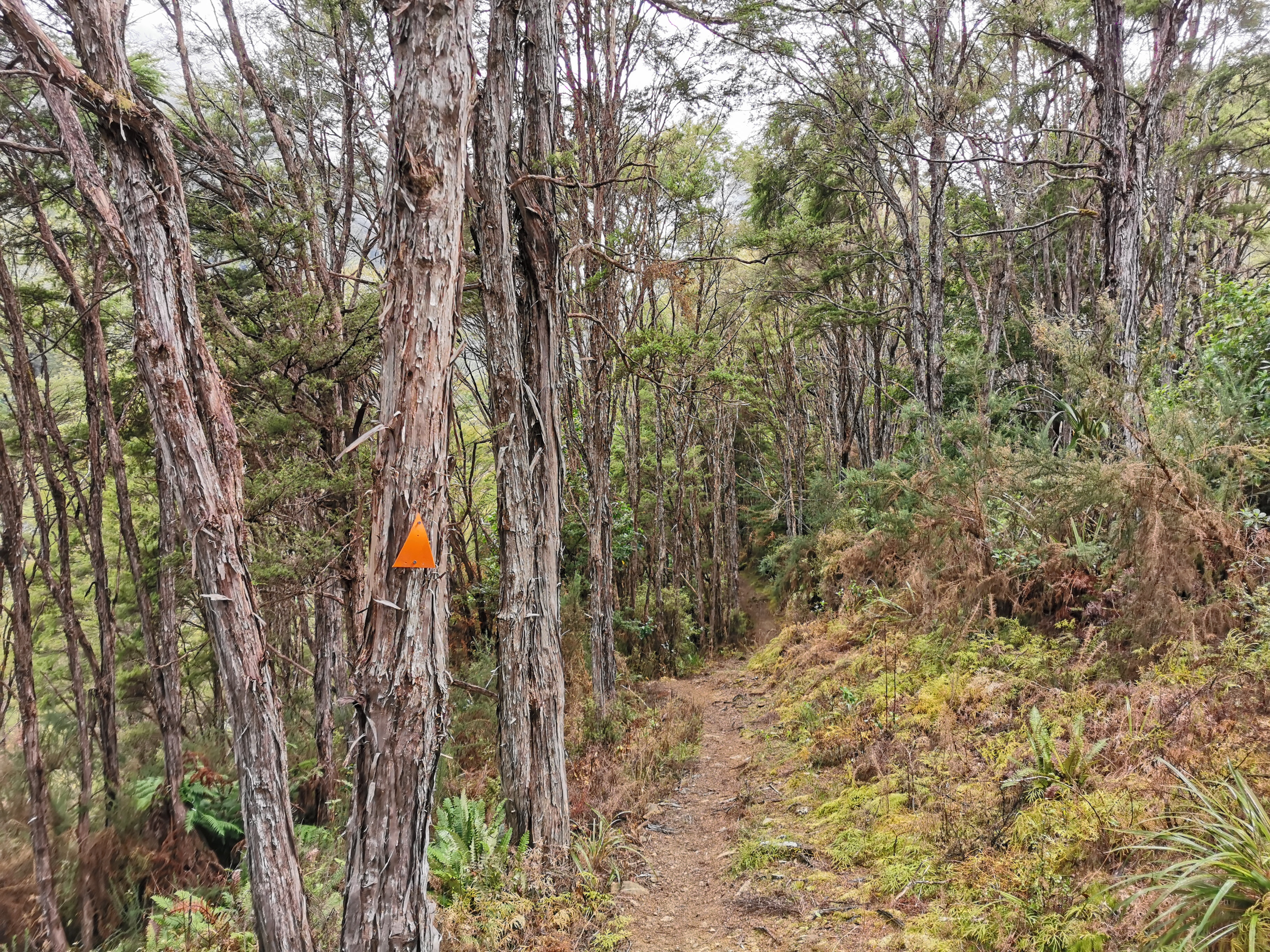
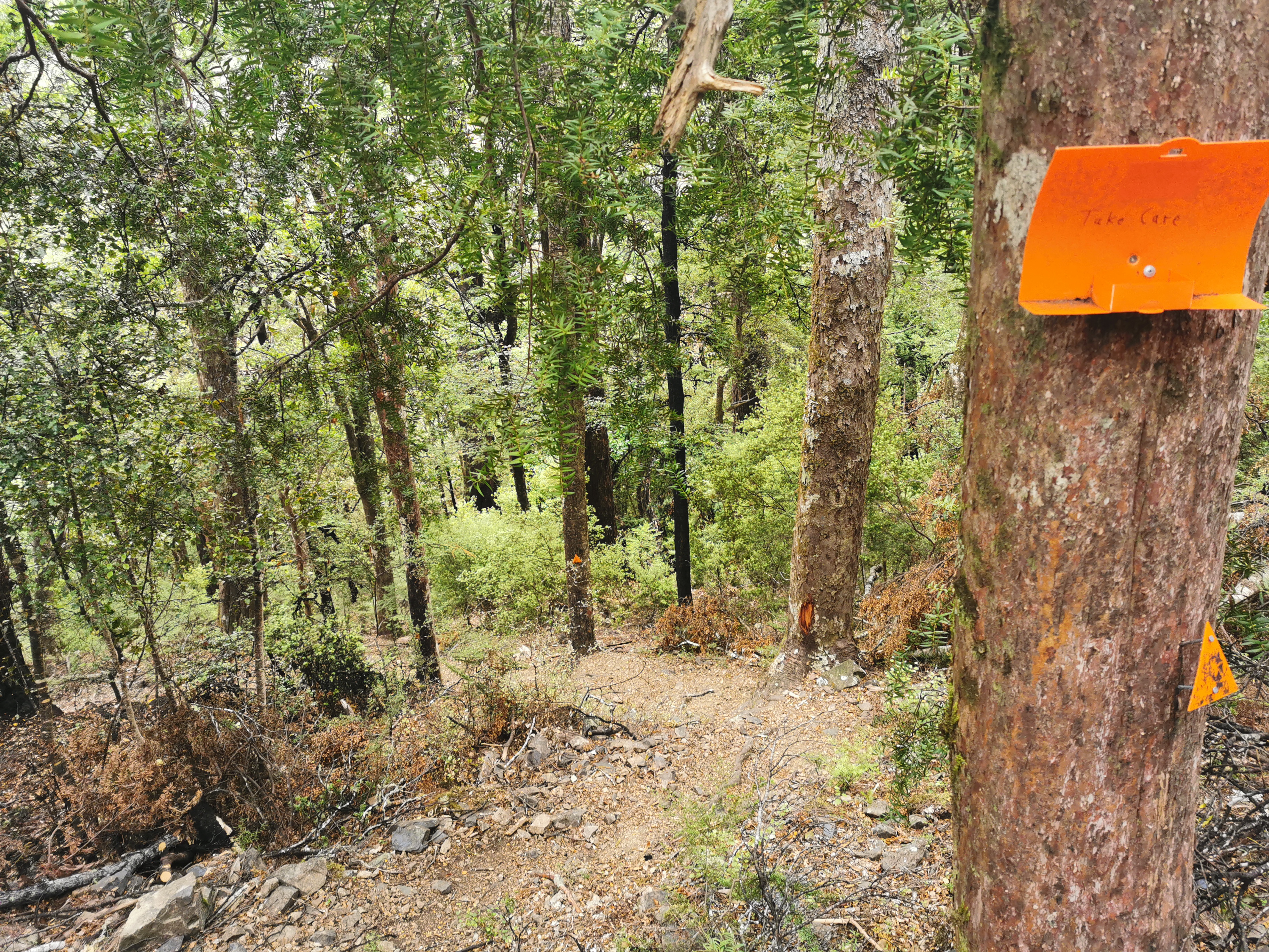
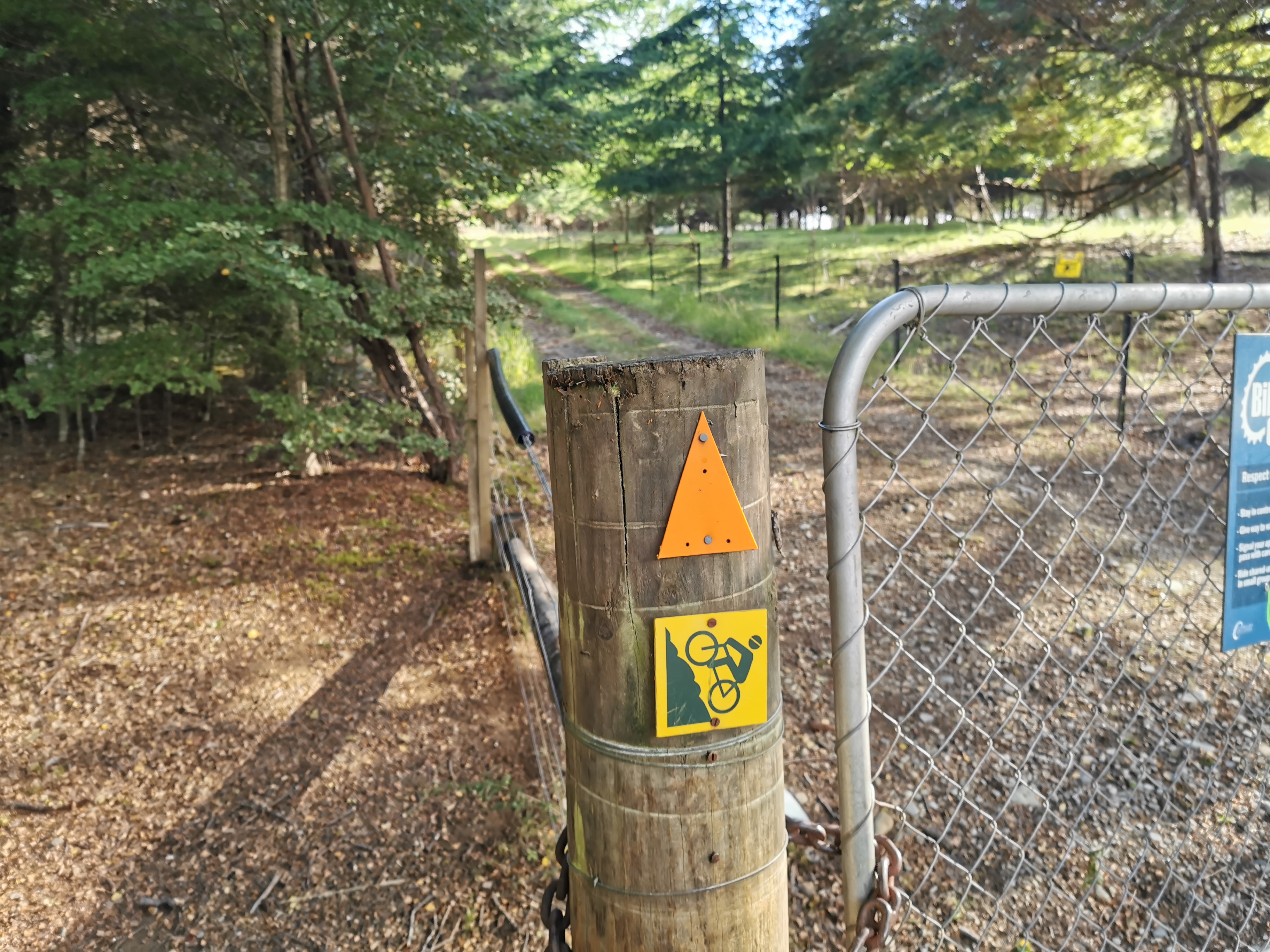
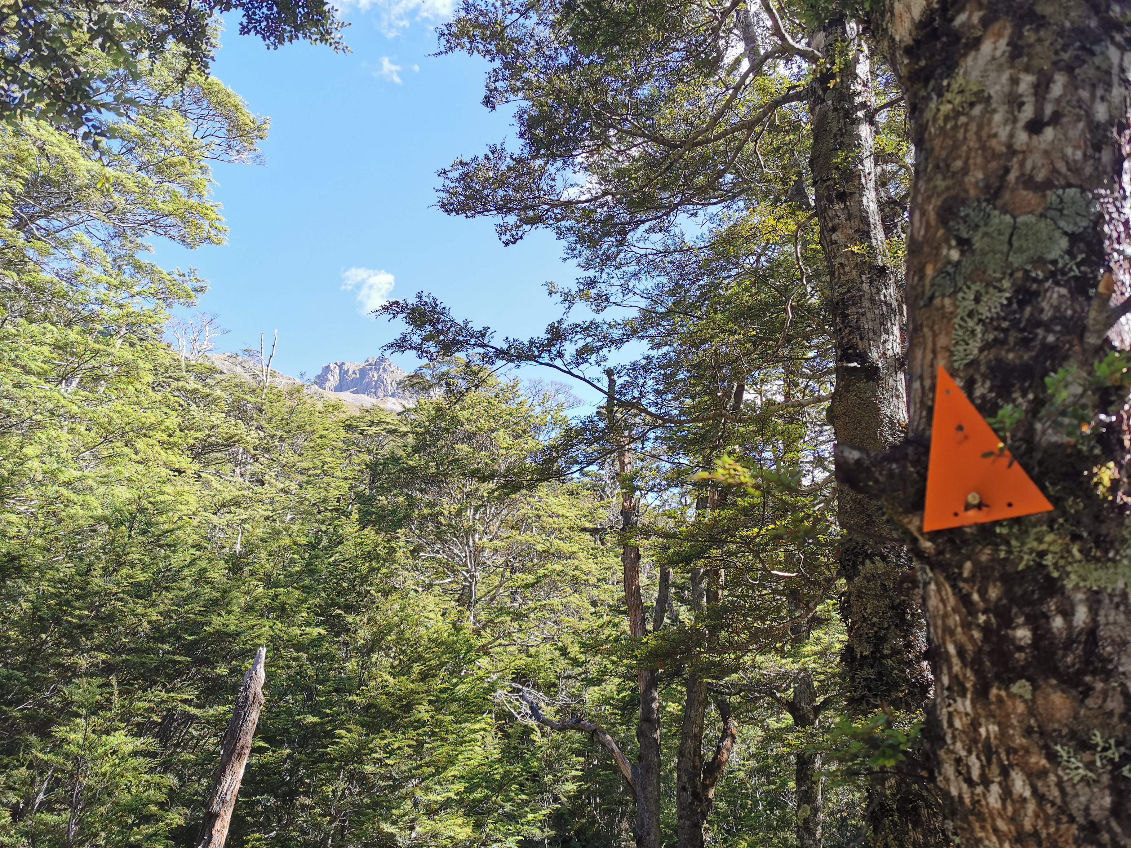
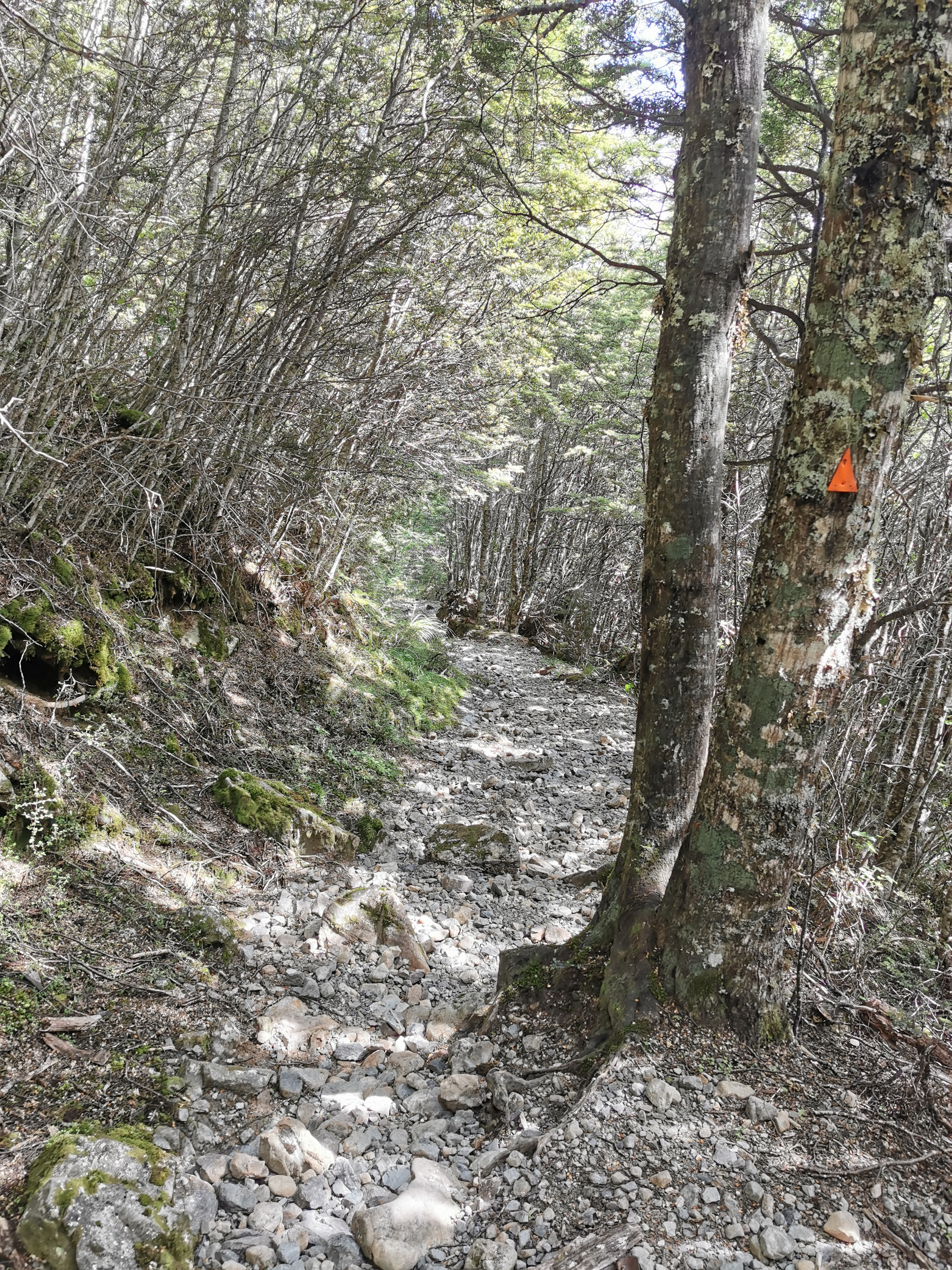
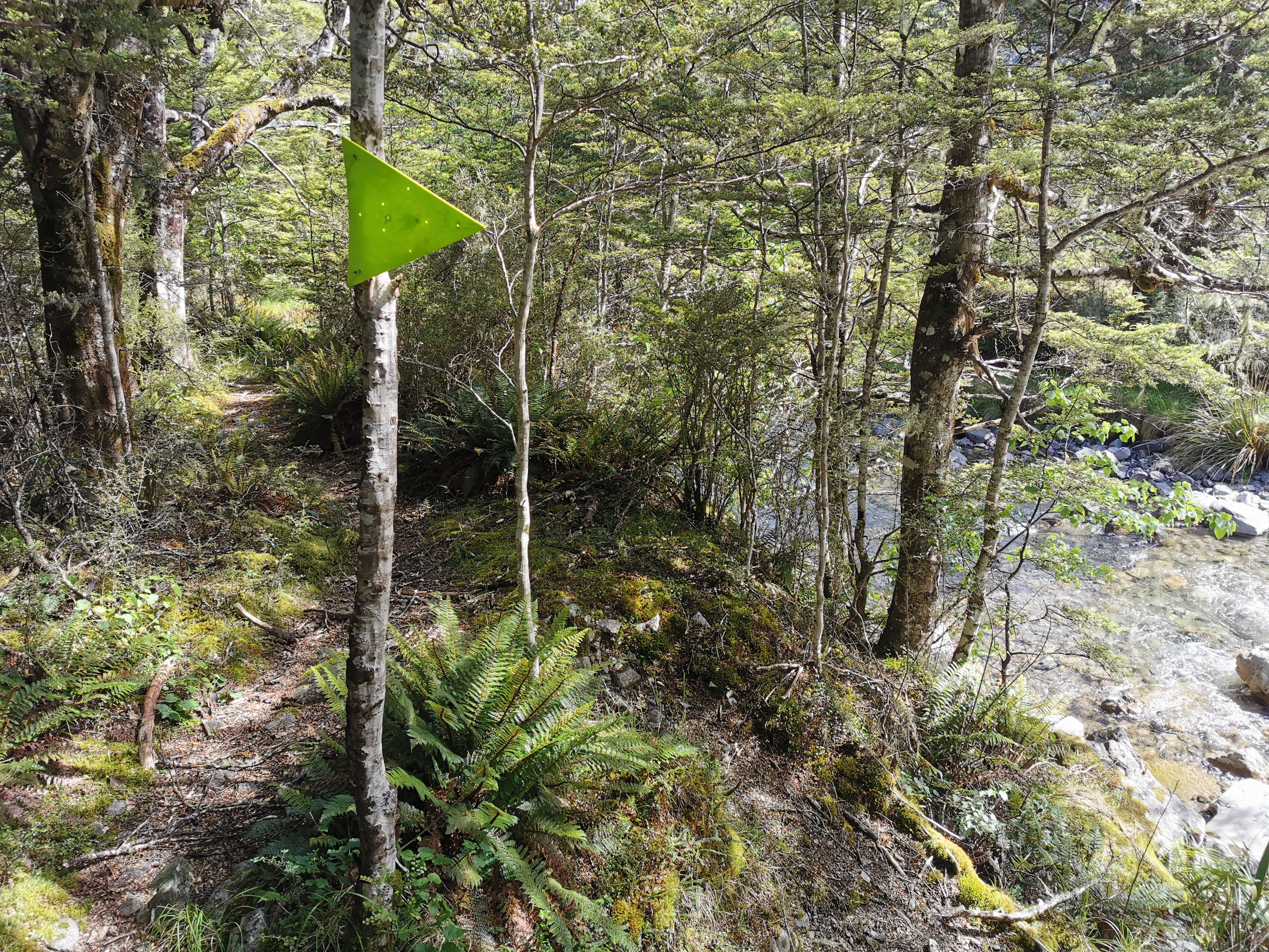
Here’s the first orange triangle of 2020.
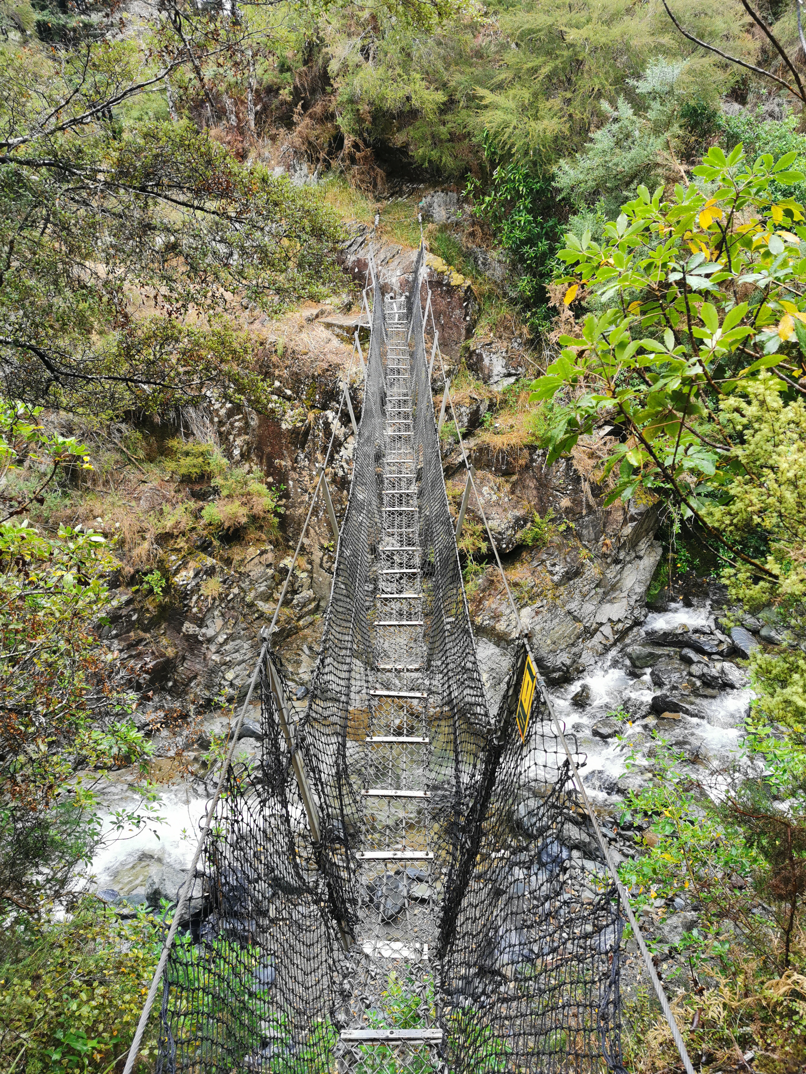
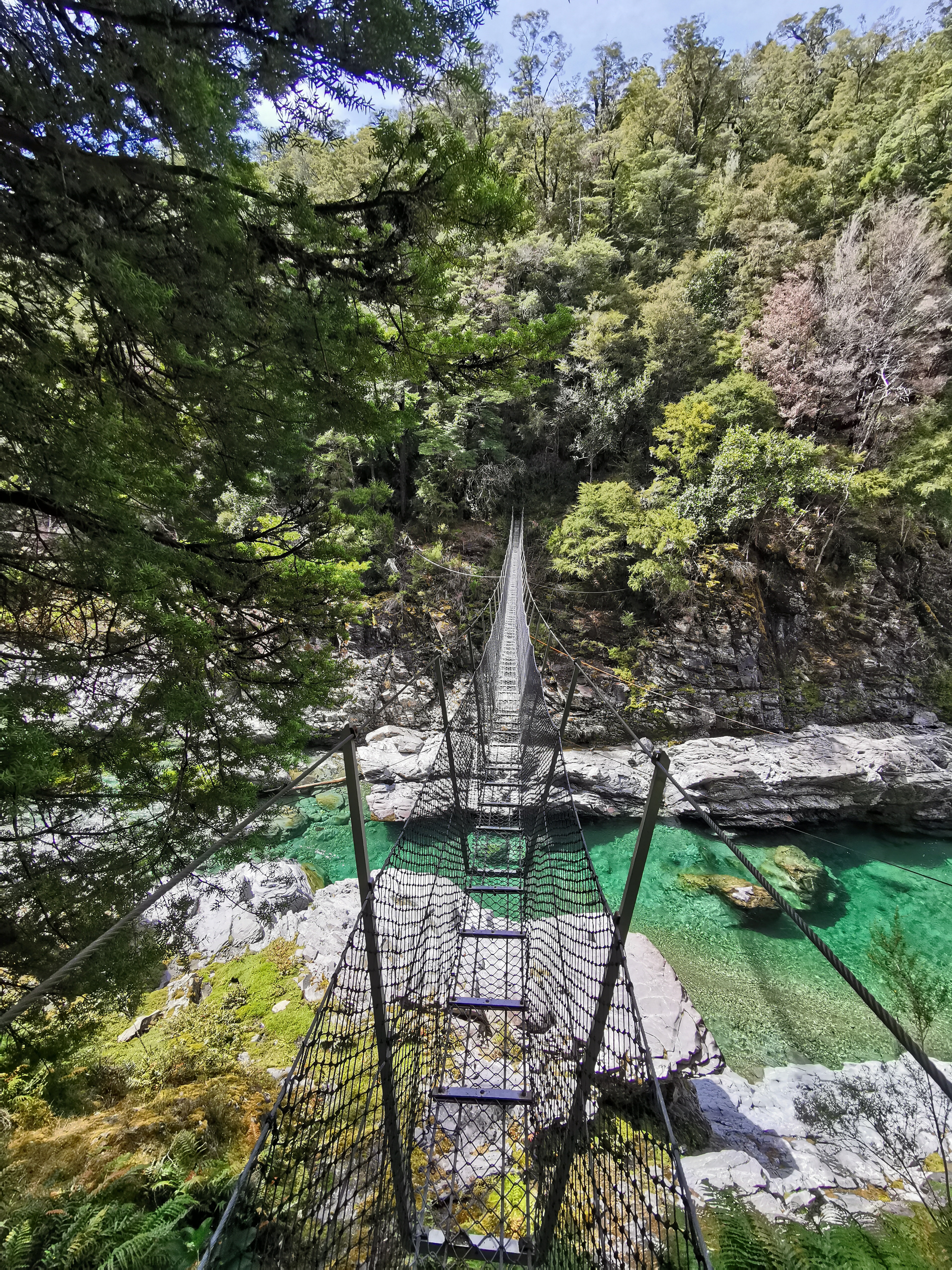
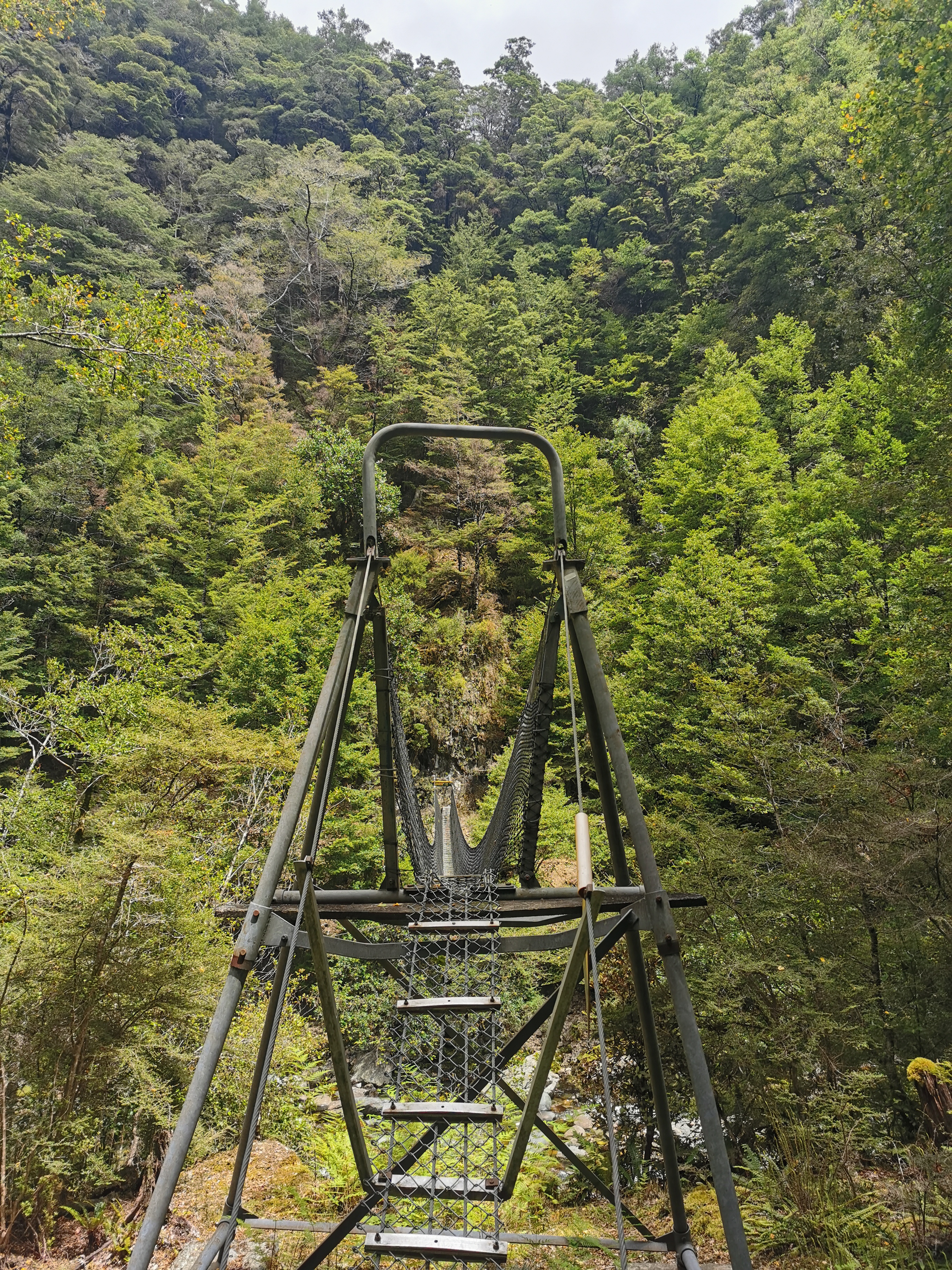
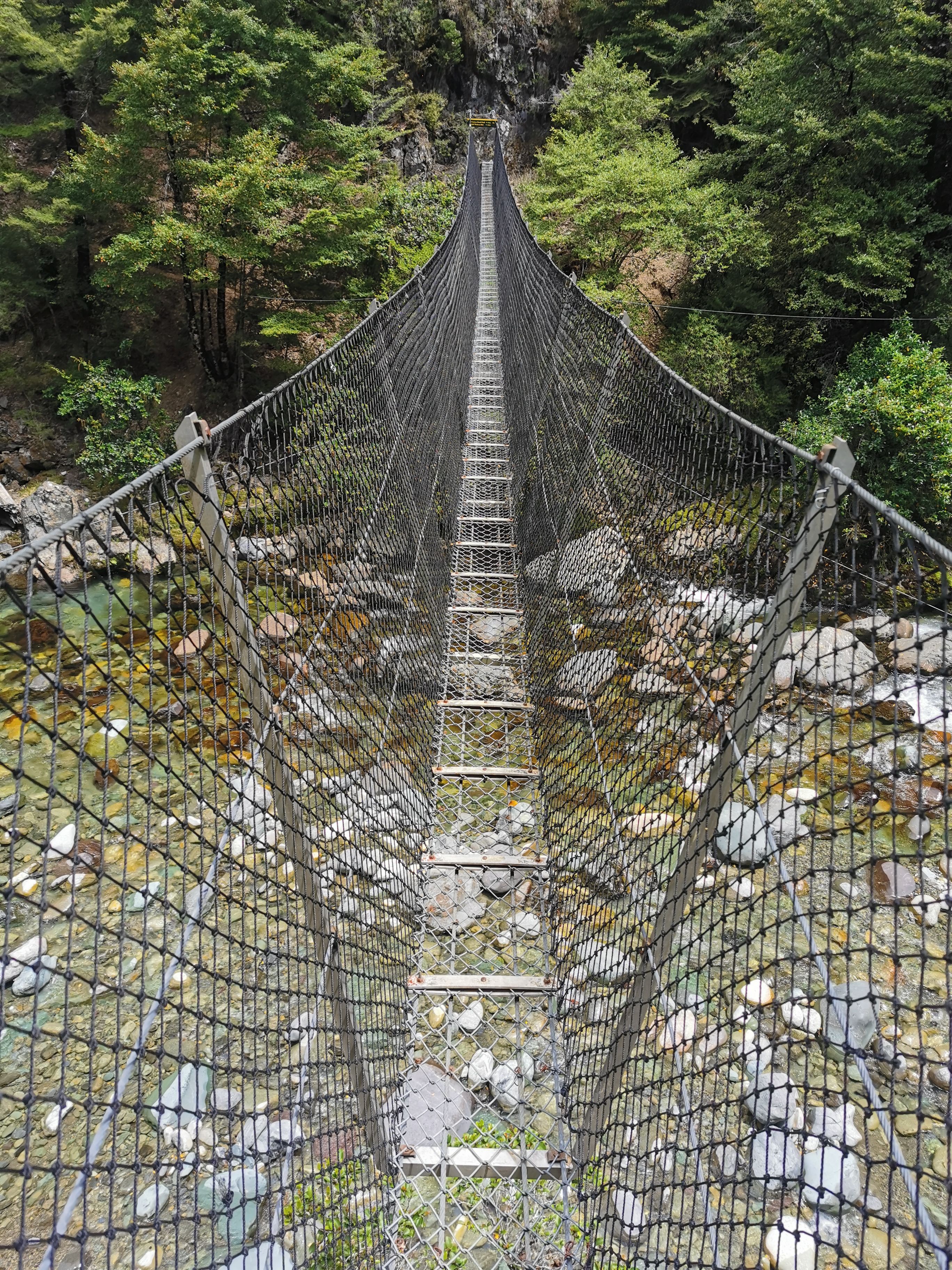
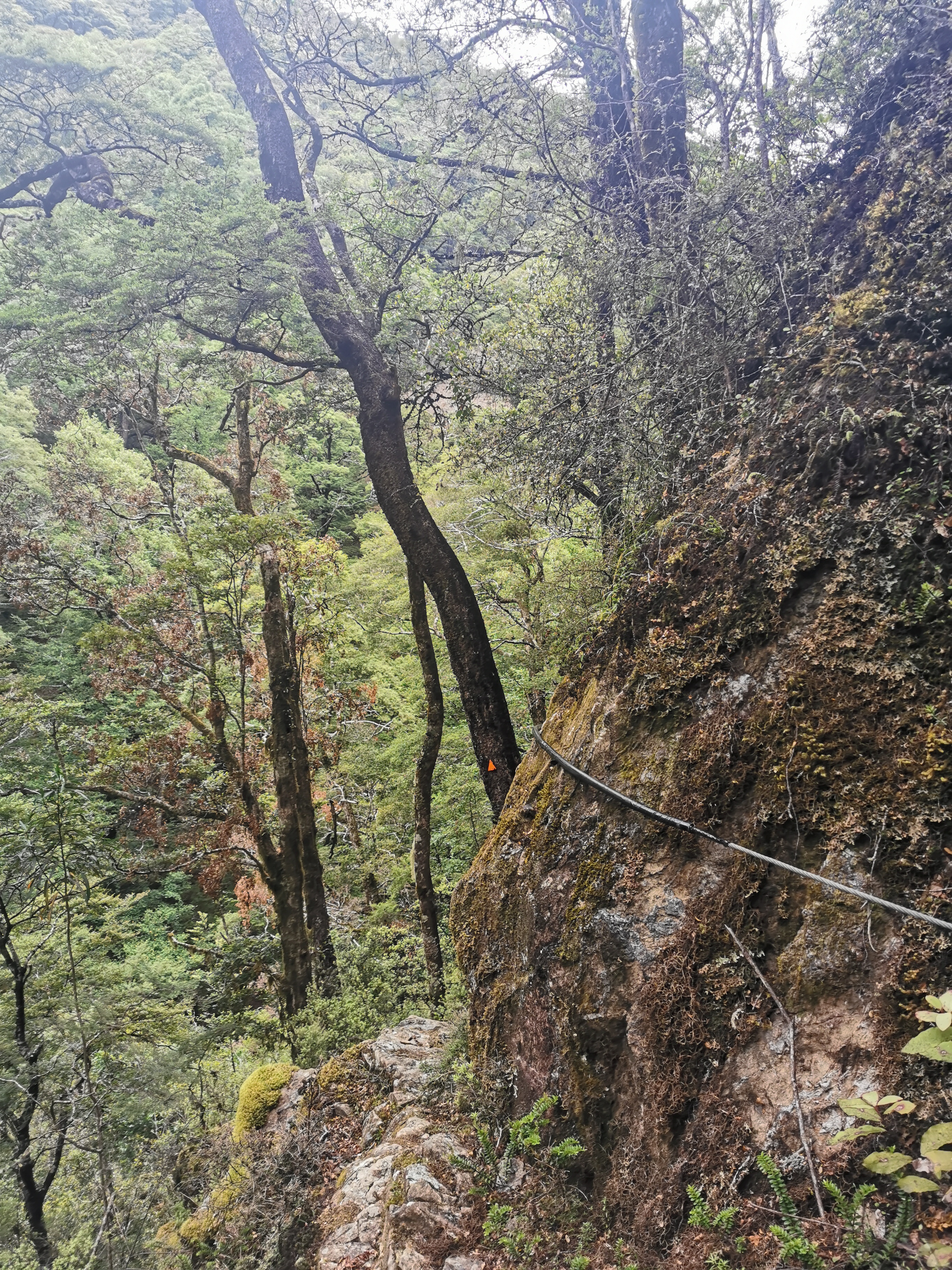
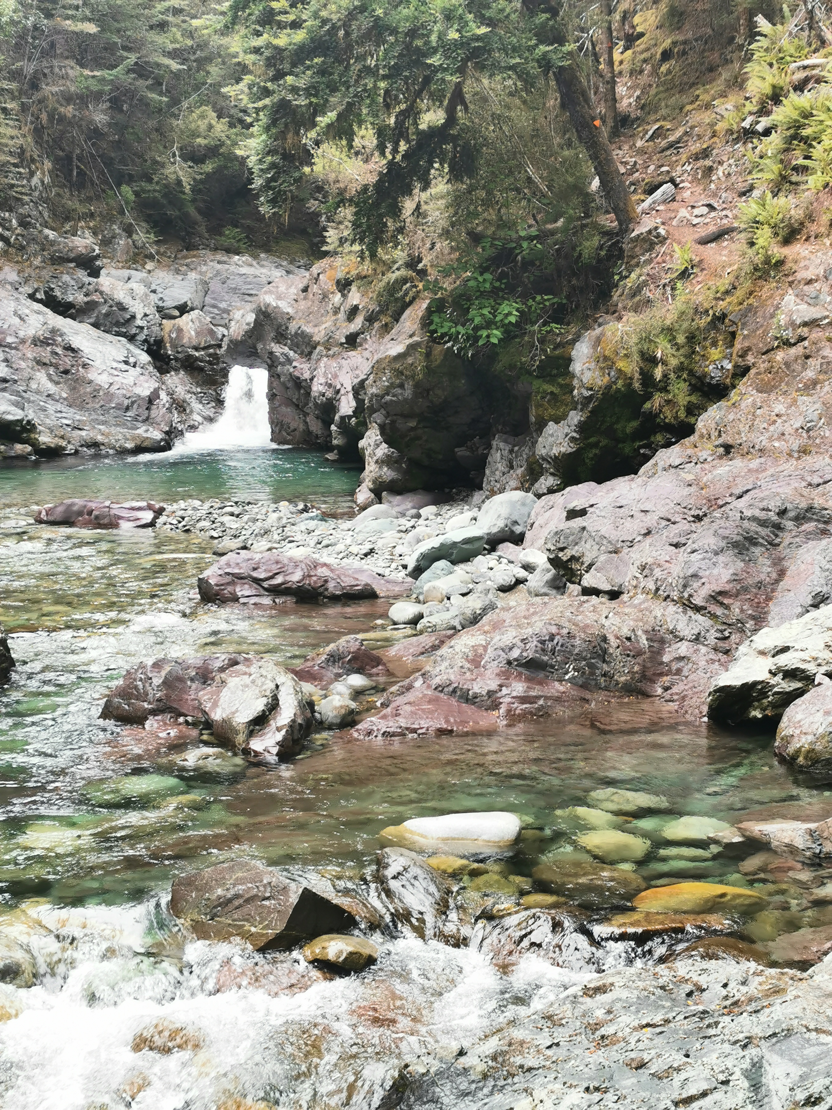
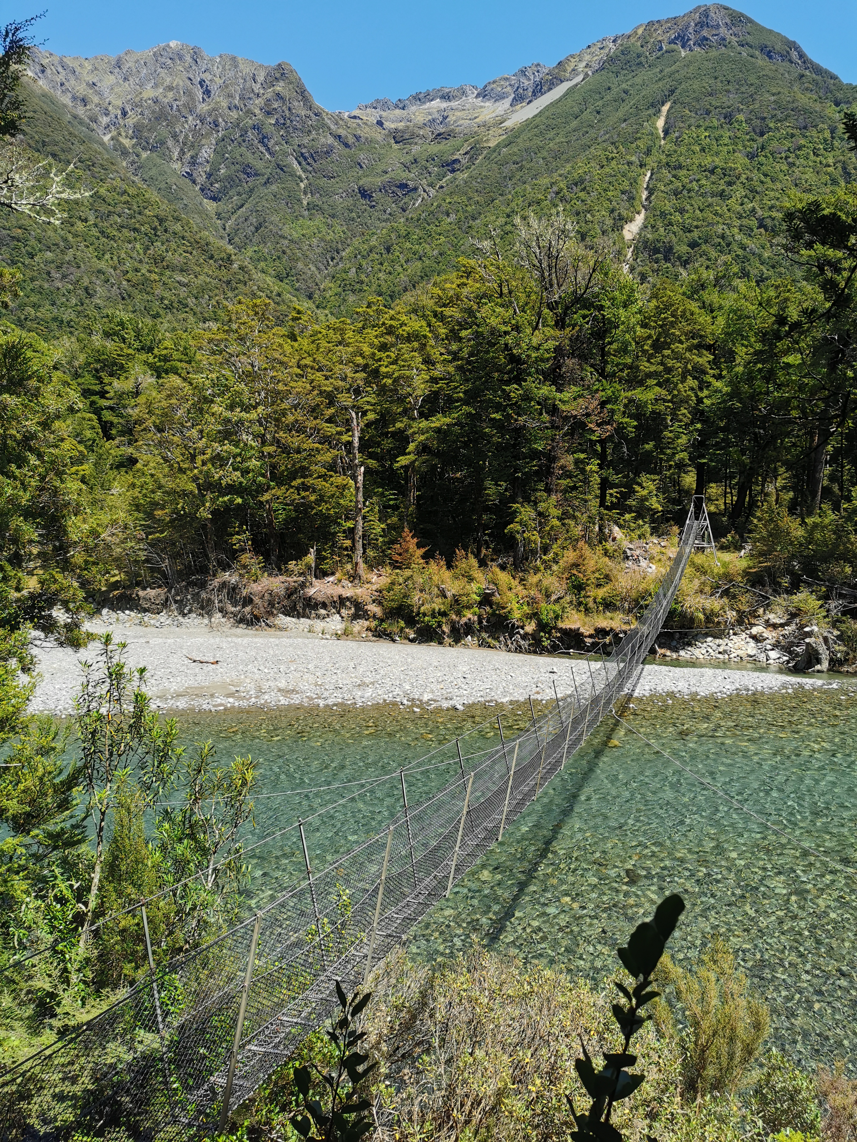
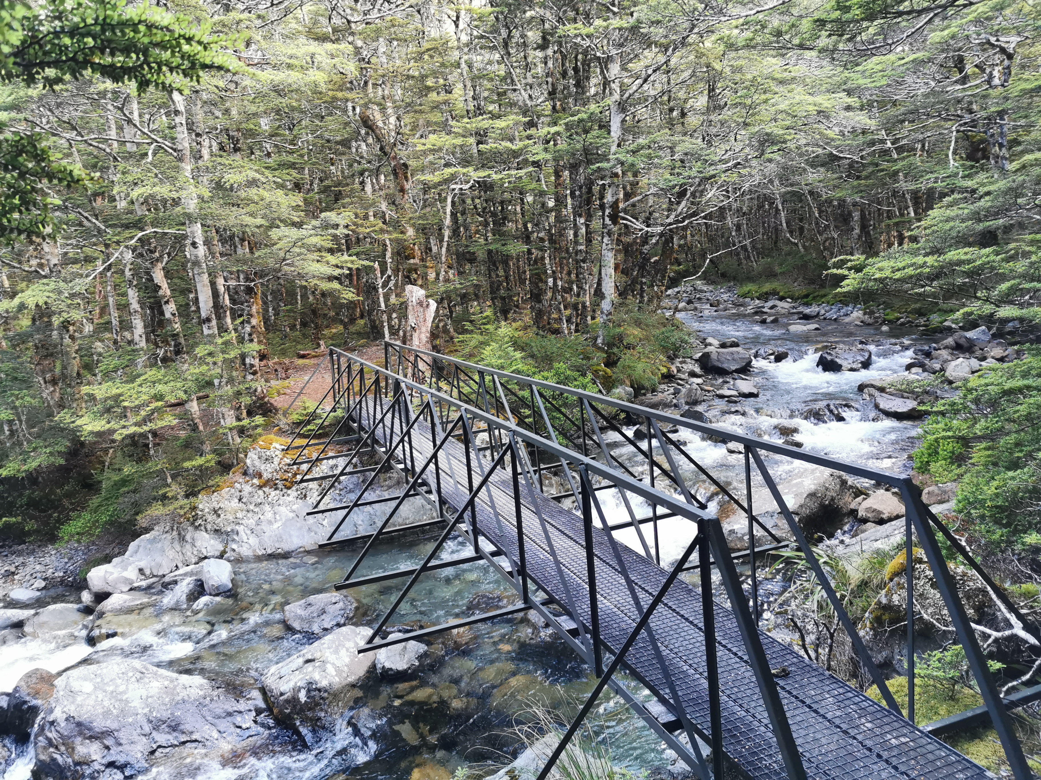
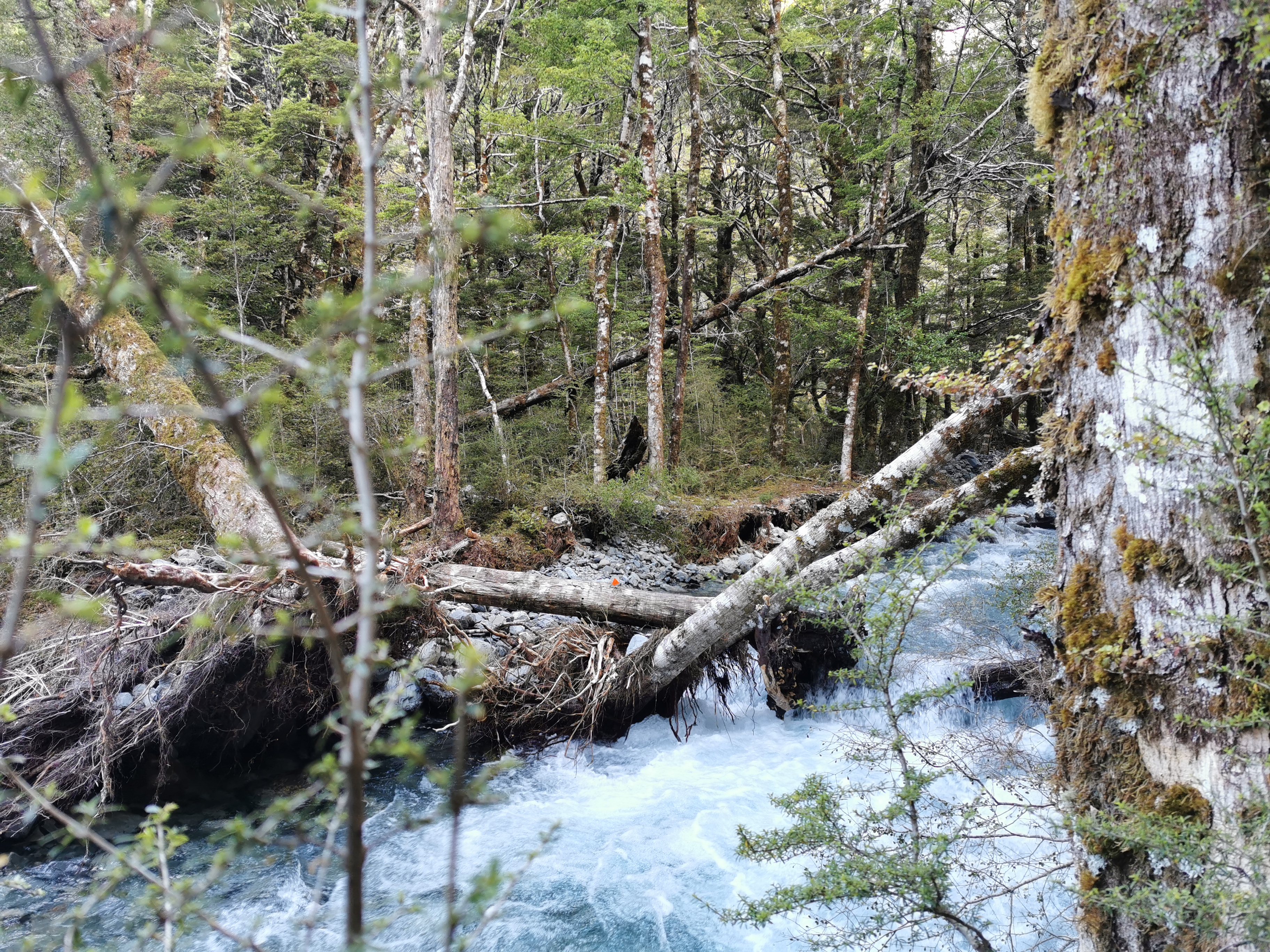
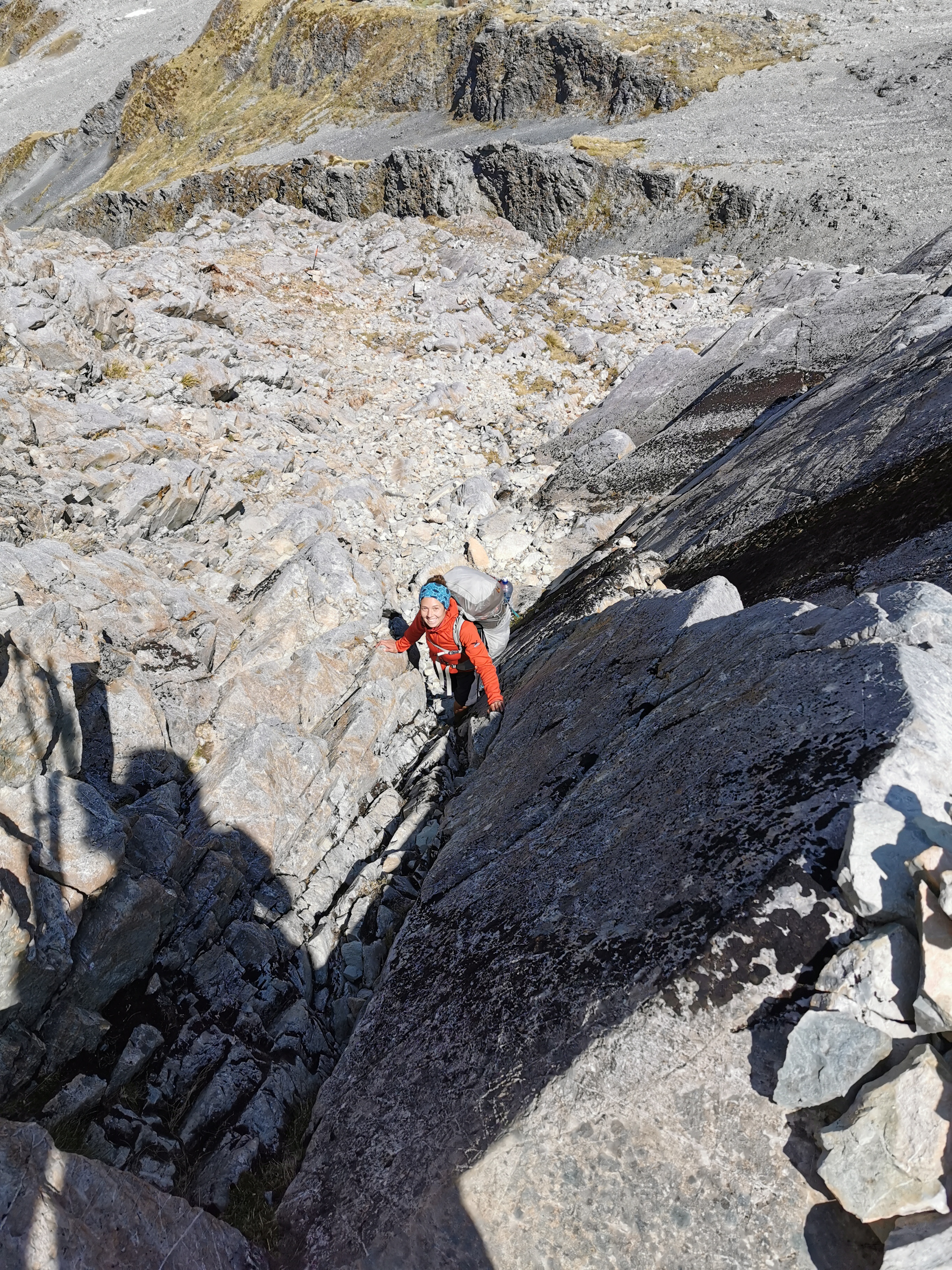
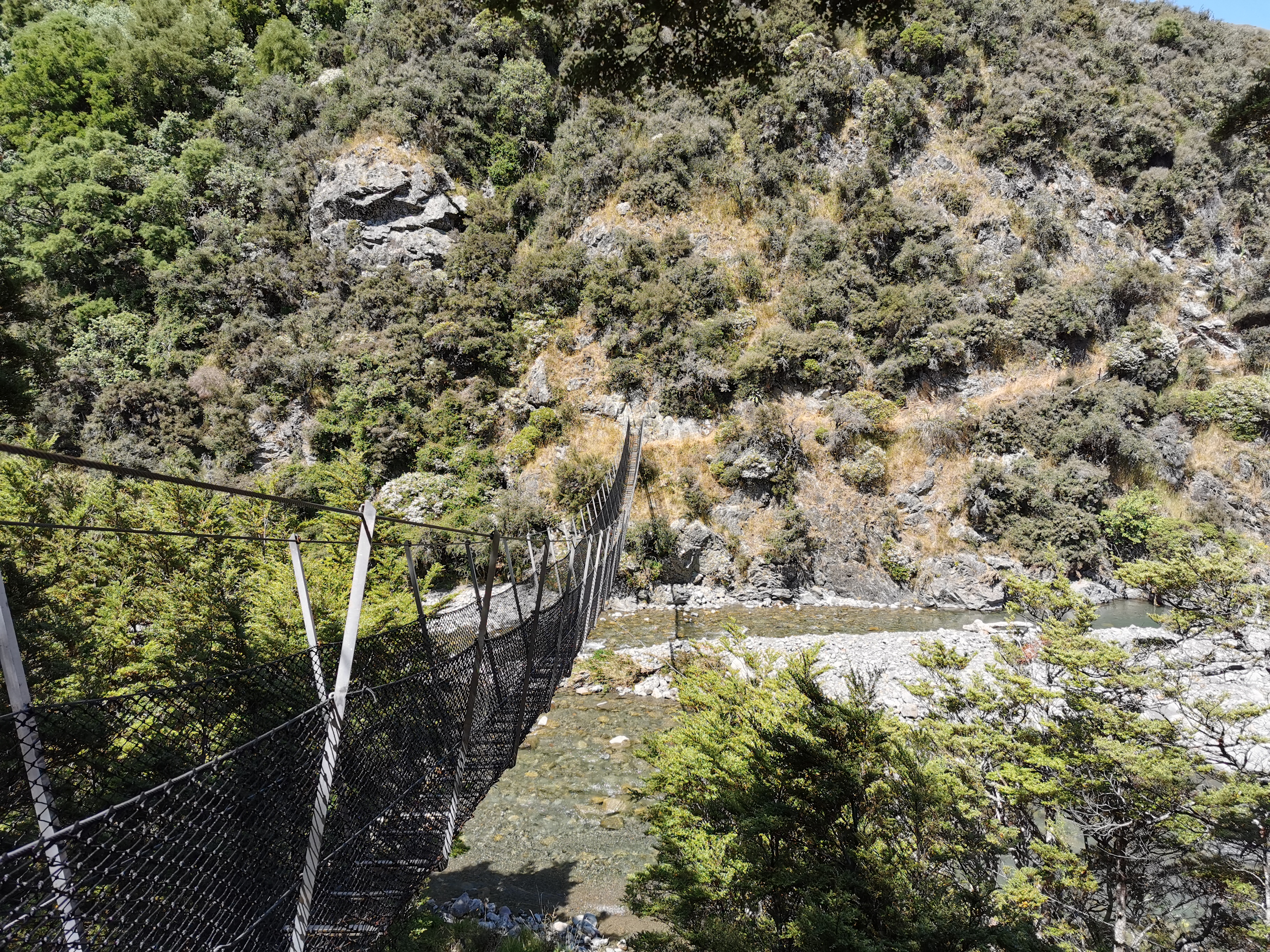
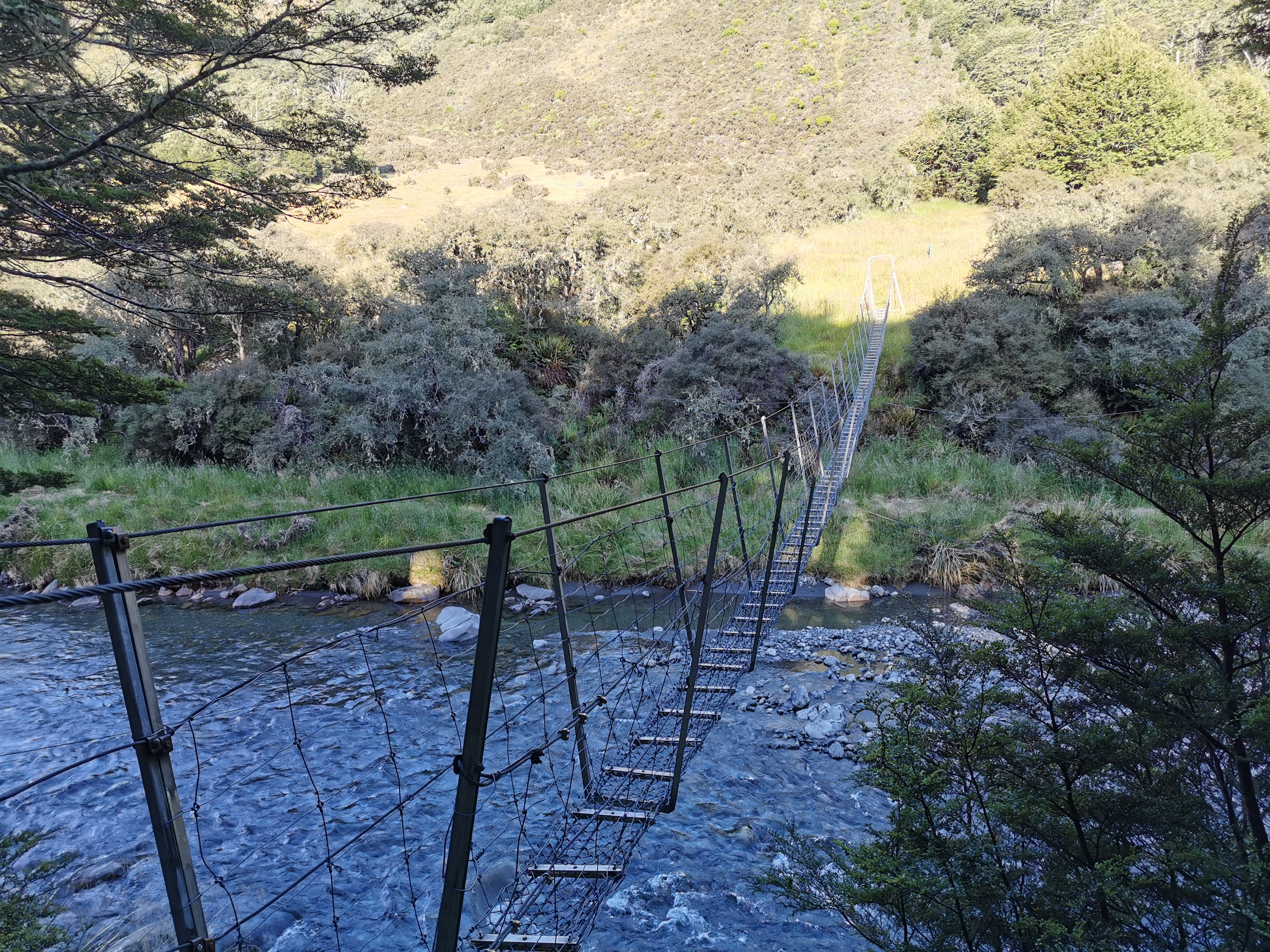
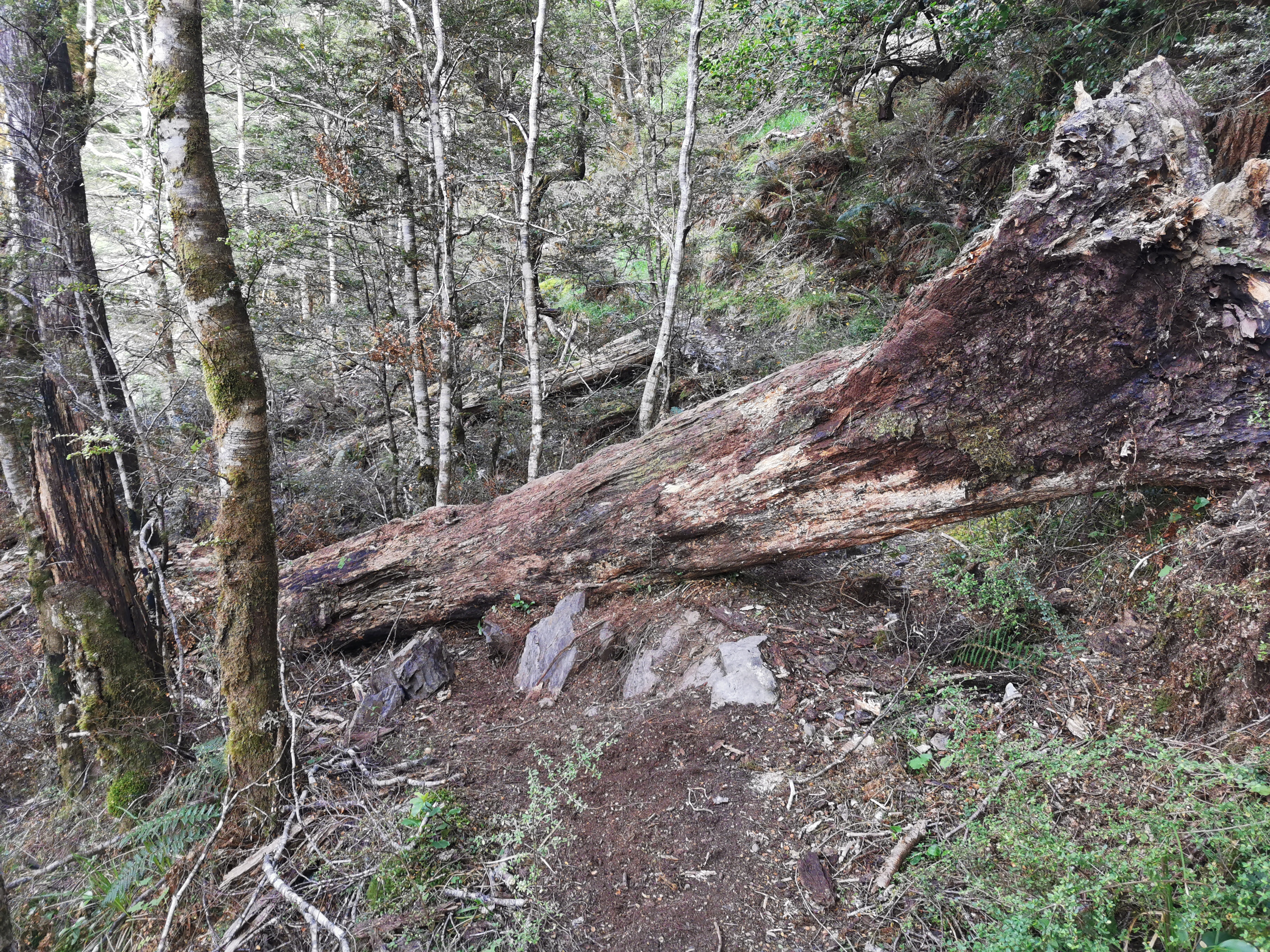
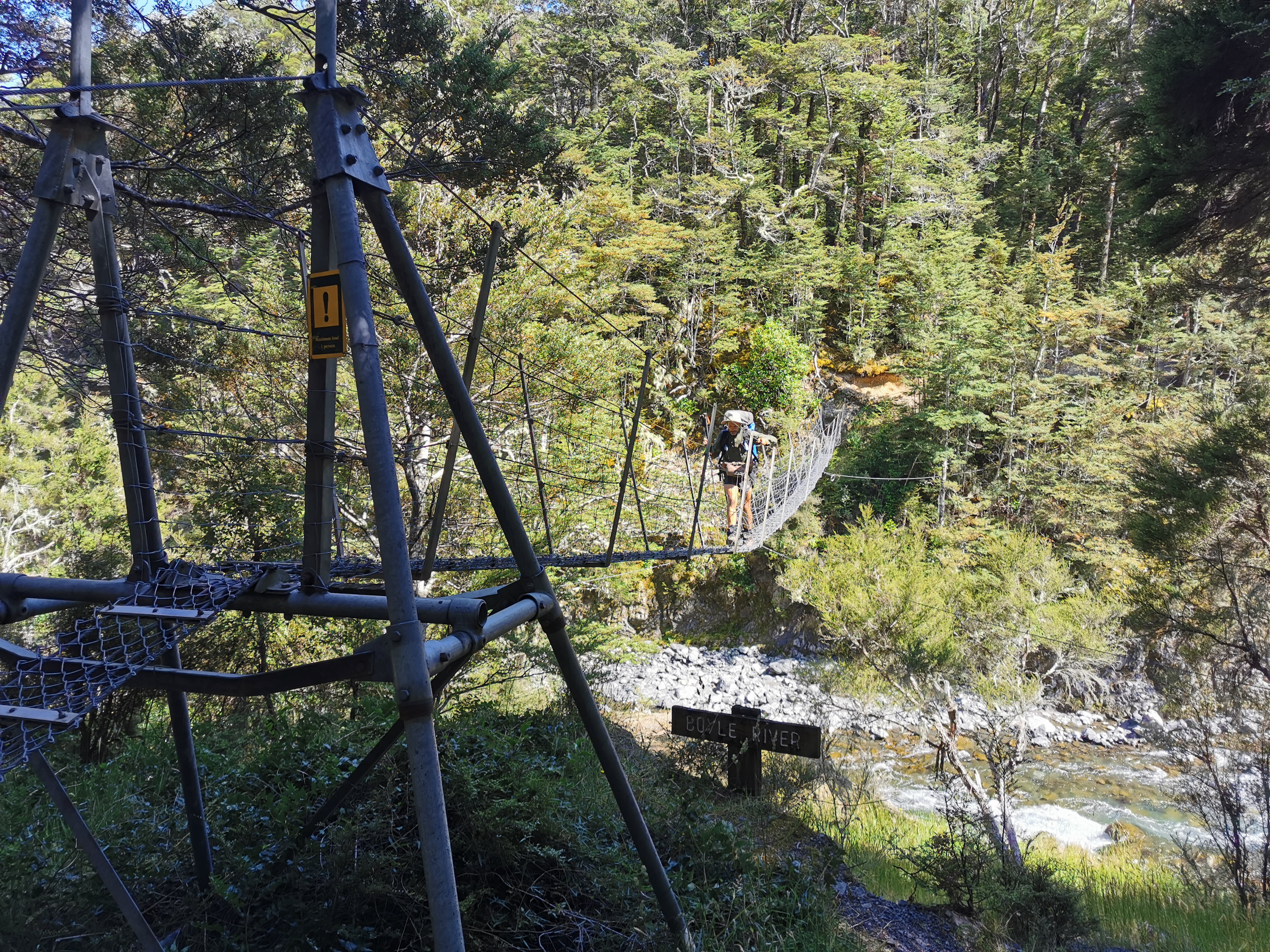
And here’s the first swingbridge.
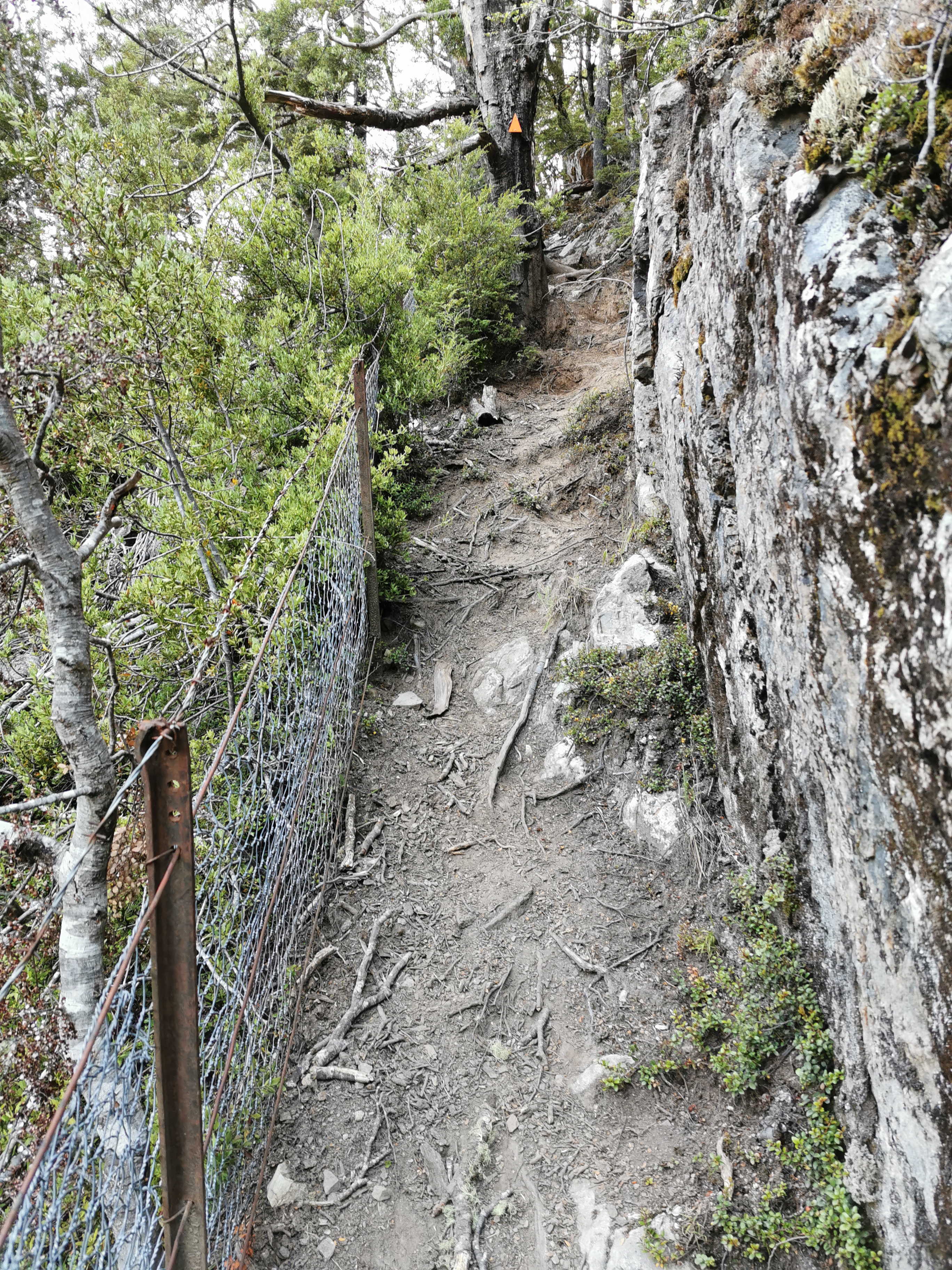
It’s one of the scary ones where there’s no solid floor
When I bend over to get something out of my pack or to duck under trees, I can definitely feel the extra weight with all the food in the pack. I’m still surprised that everything fits in the pack though. I must have bought less chocolate this time.
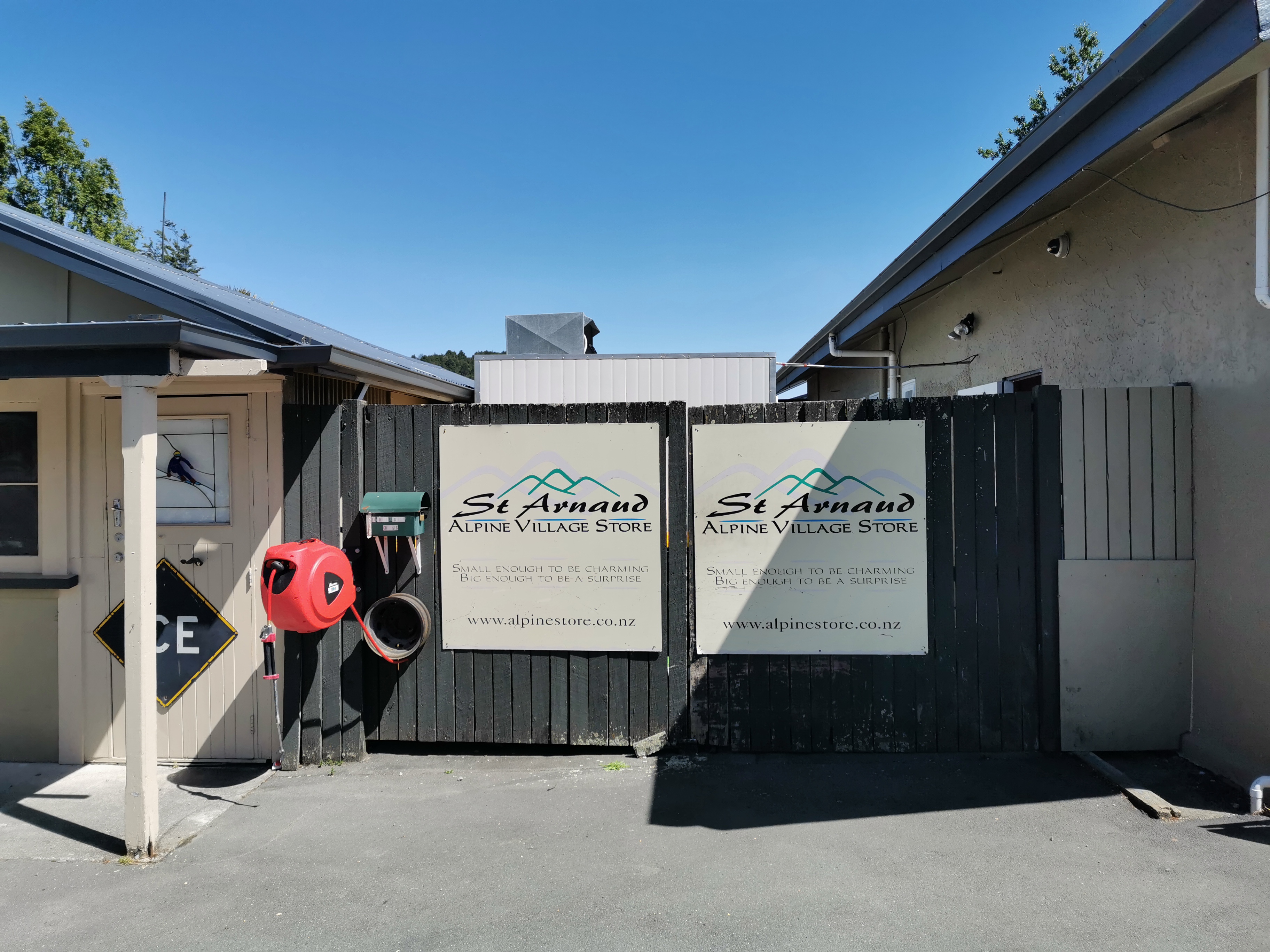
Another thing that I got yesterday was a new pair of sunglasses, because at some point over New Year’s I seem to have misplaced the free sunnies I got from near Auckland Airport. When I went to find a cheap pair of sunglasses yesterday, I picked the only pair that weren’t truly, truly hideous. But the problem with them is that they are small. They might even be kids ones. They do their job of keeping the light out of my eyes okay, but what they don’t do is keep my hair out of my face which is really annoying. I think these sunglasses will be replaced as soon as I get to St. Arnaud.
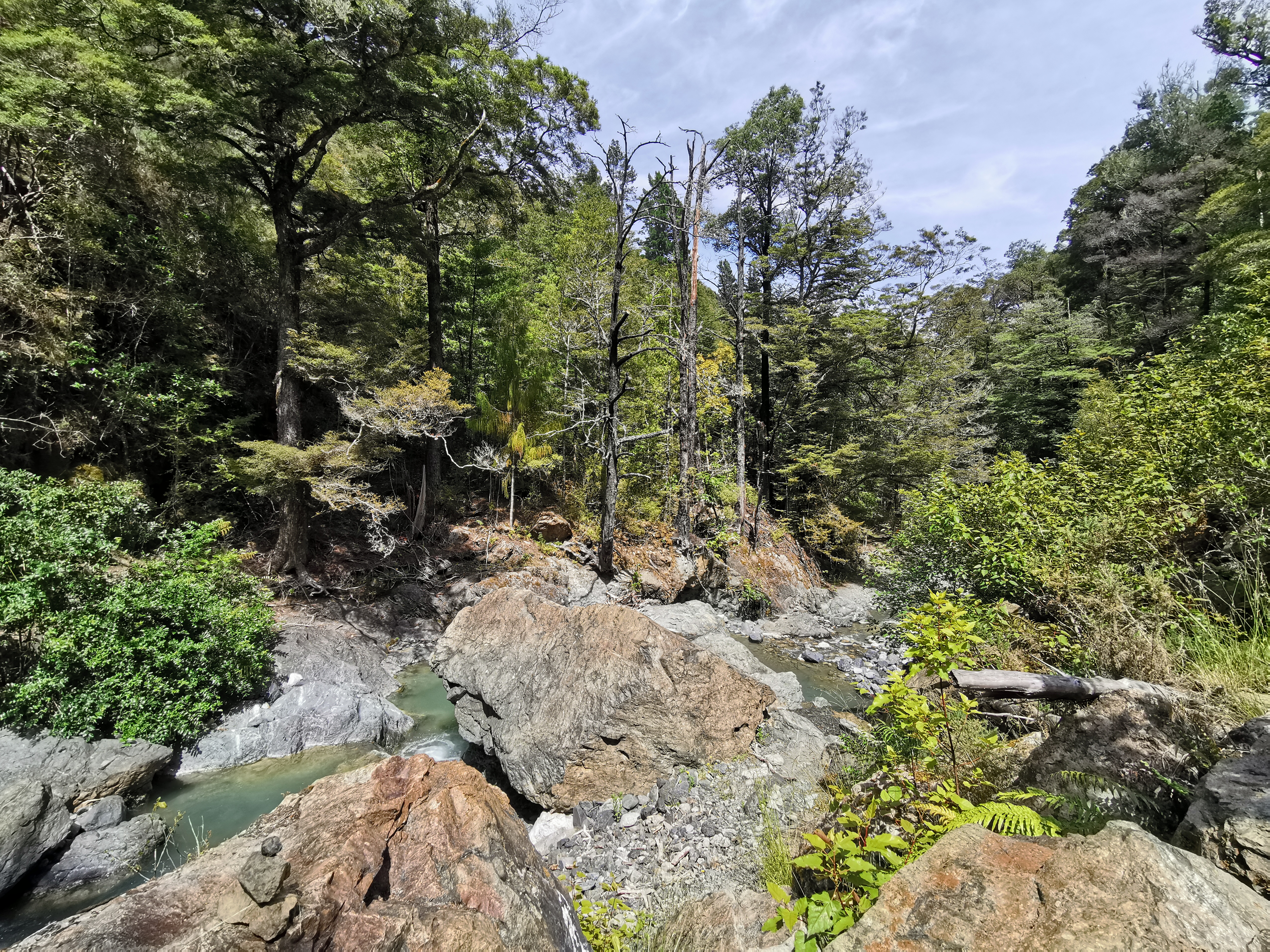
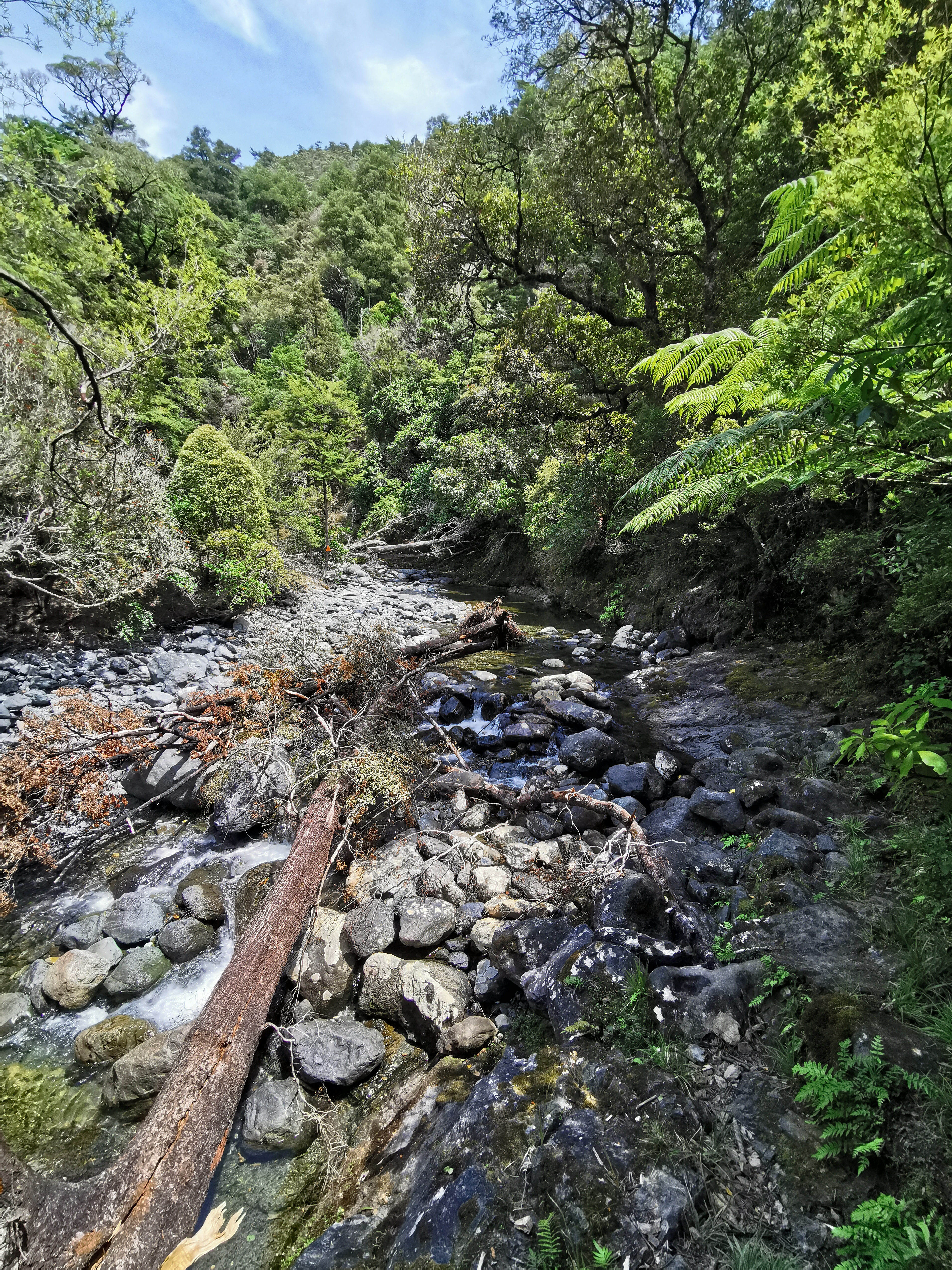
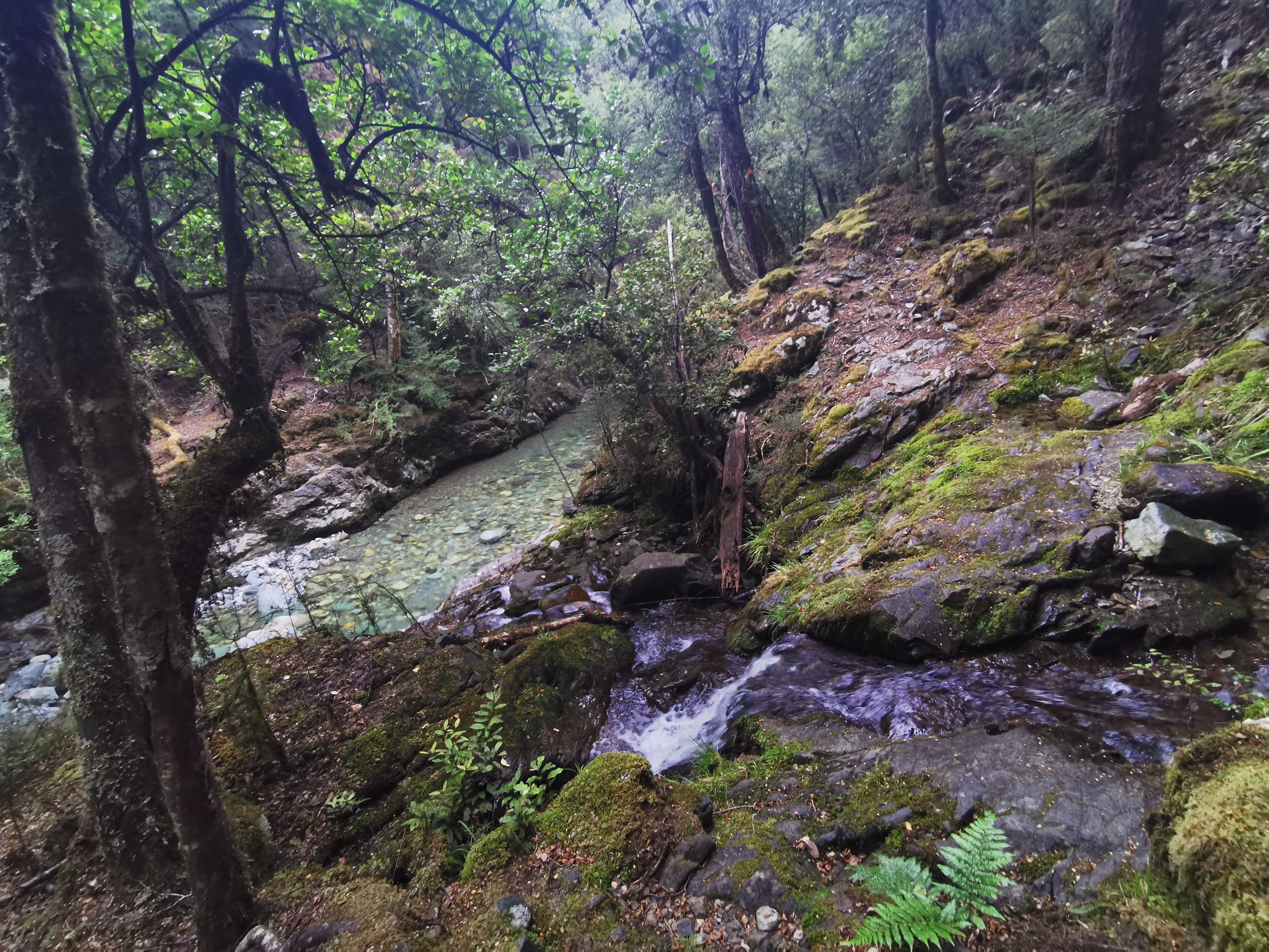
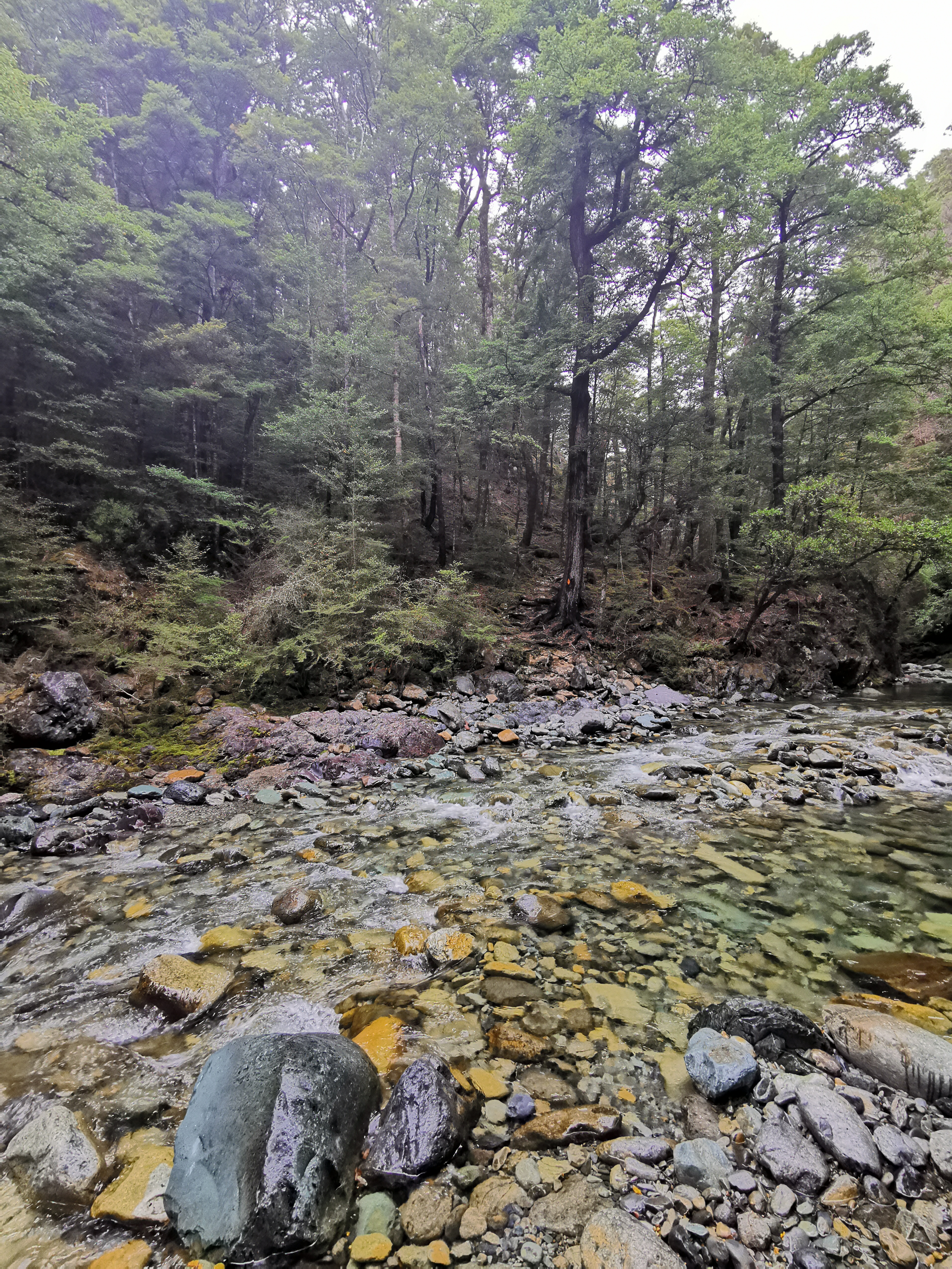
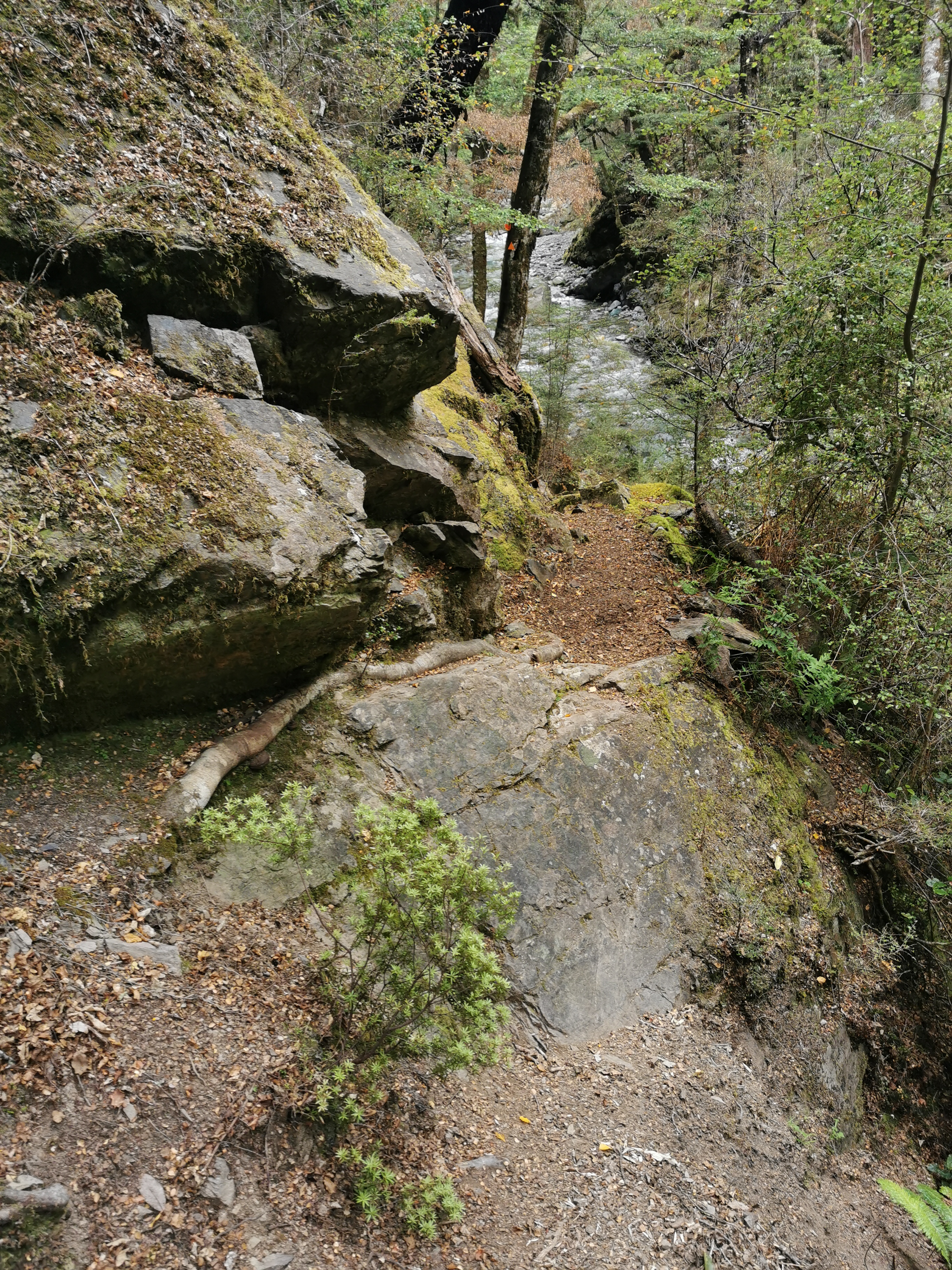
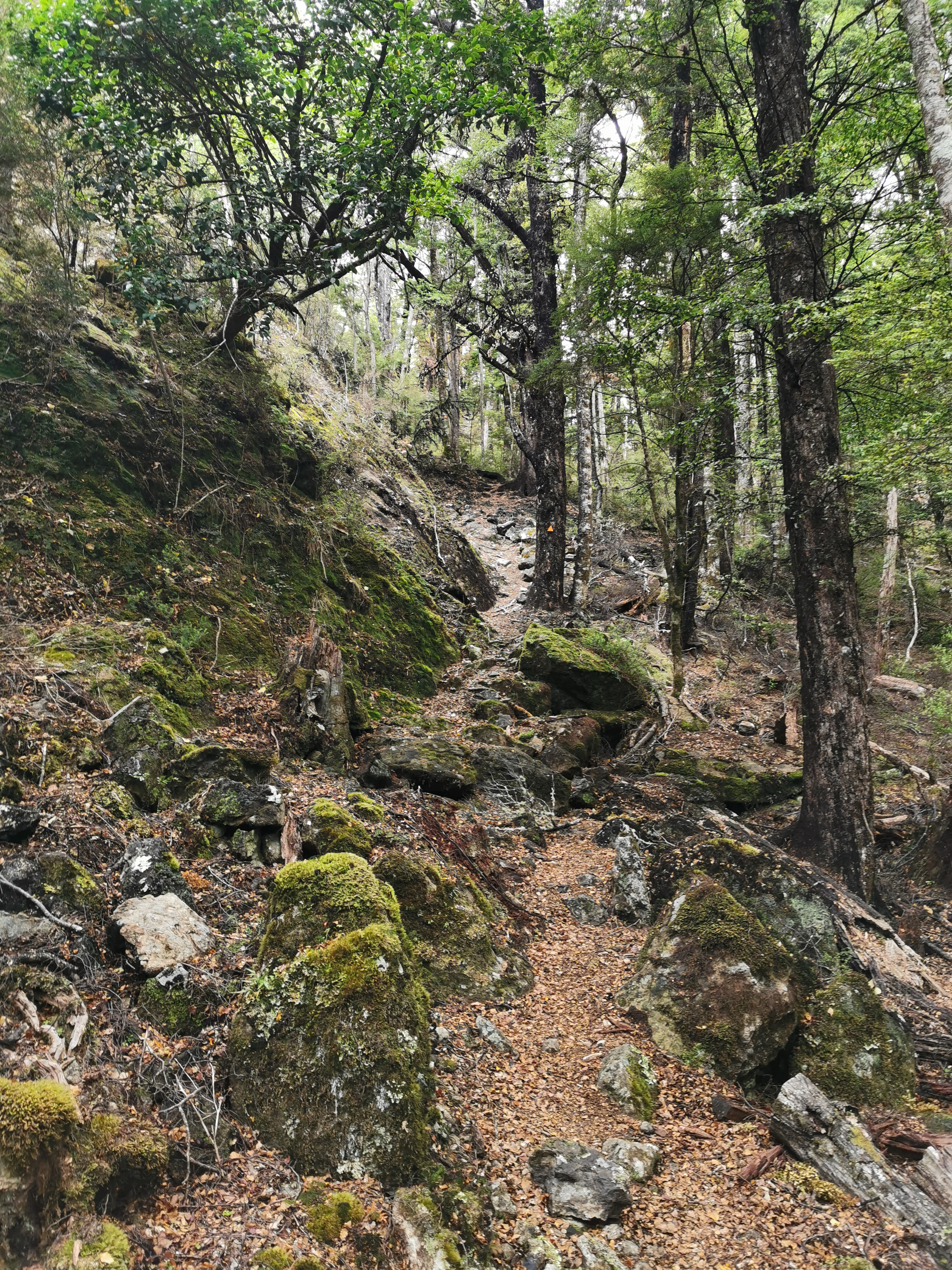
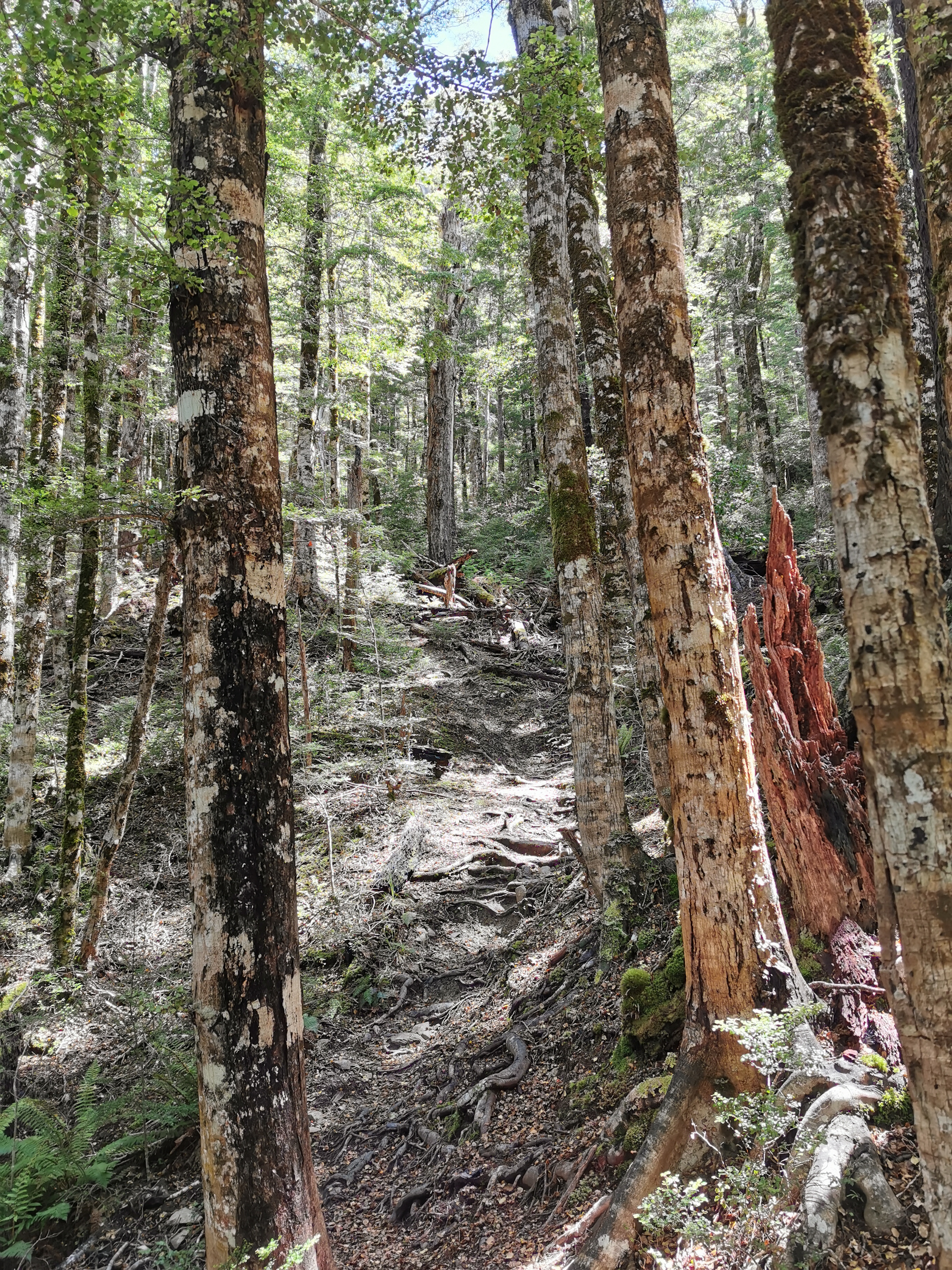
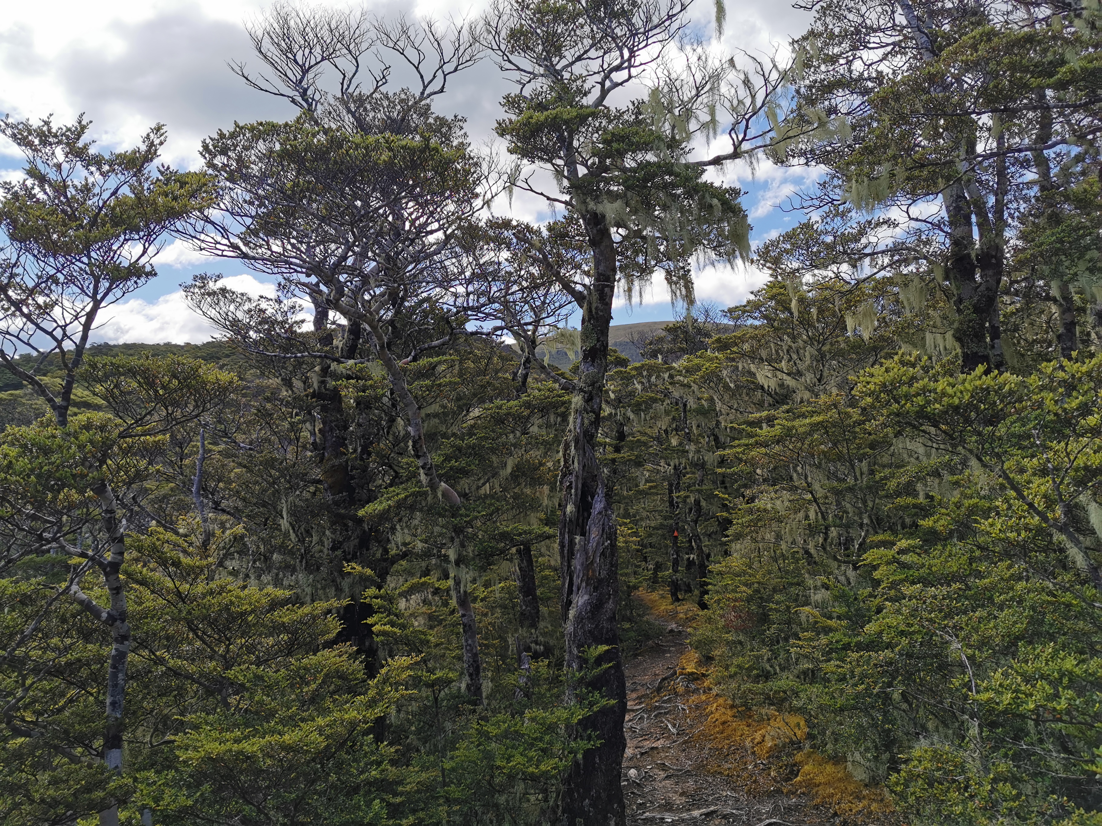
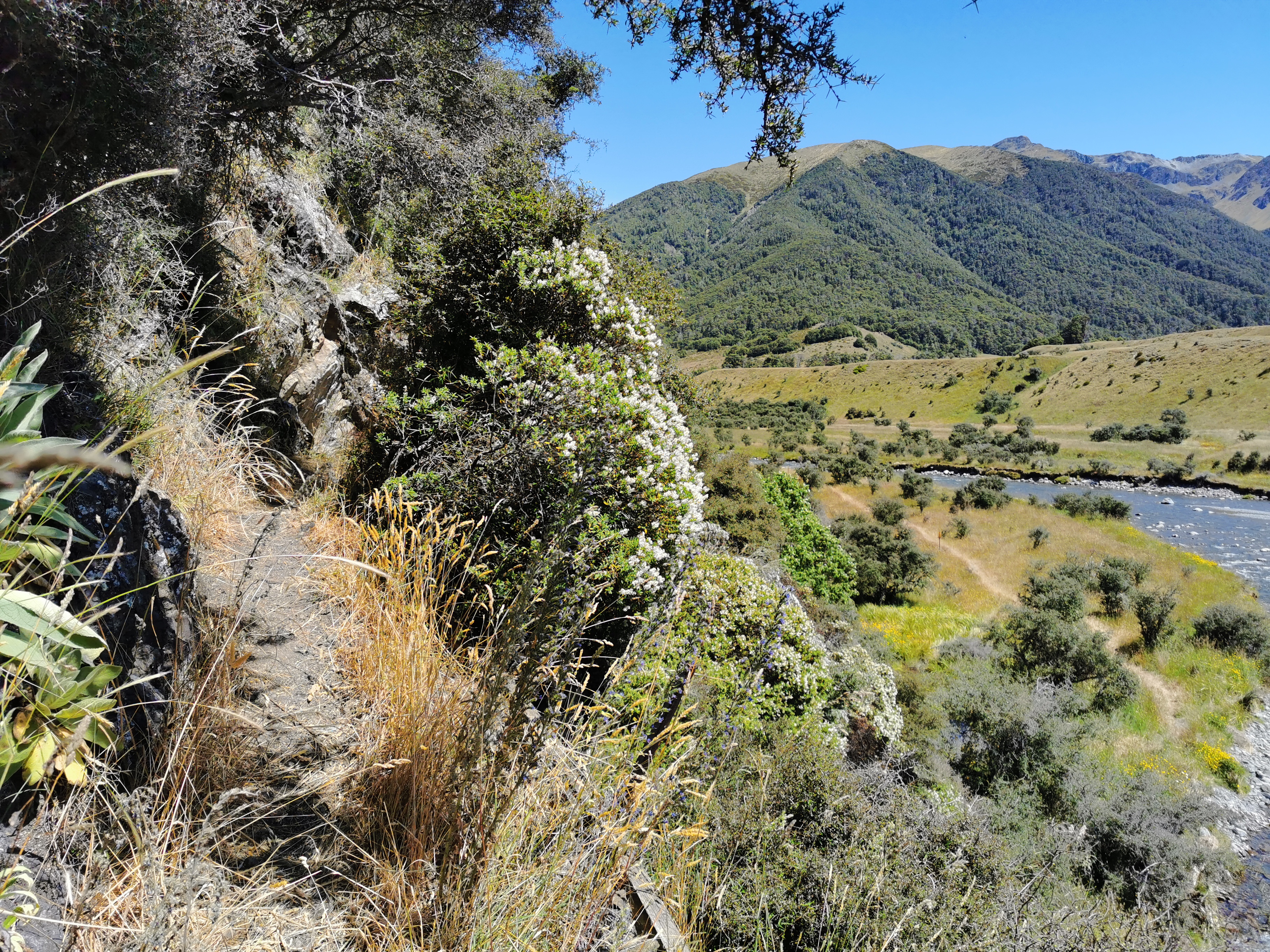
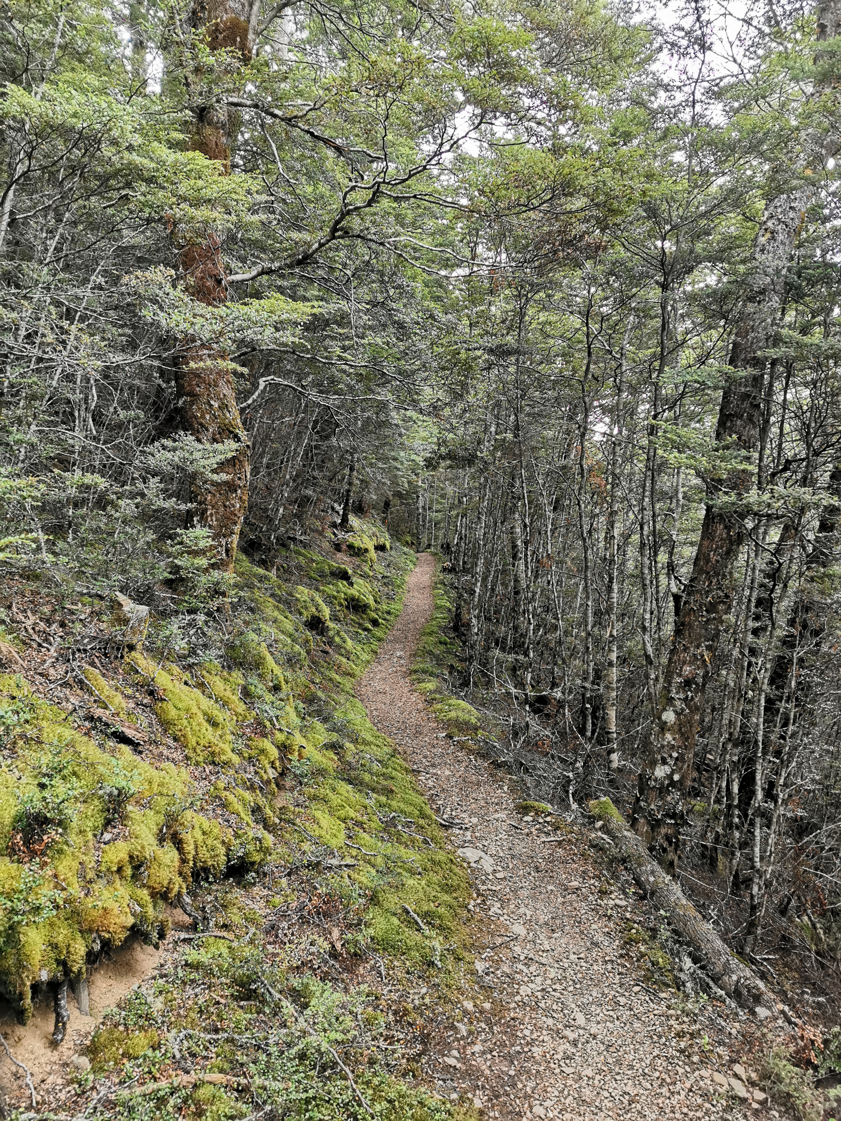
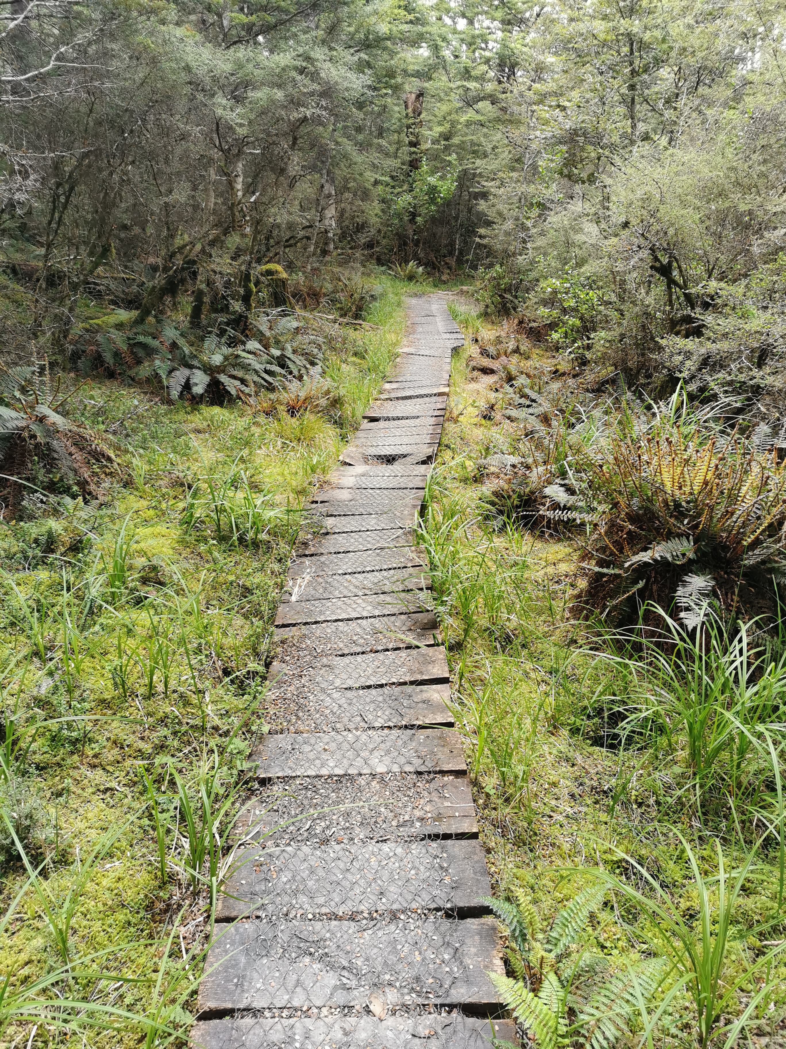
River walking
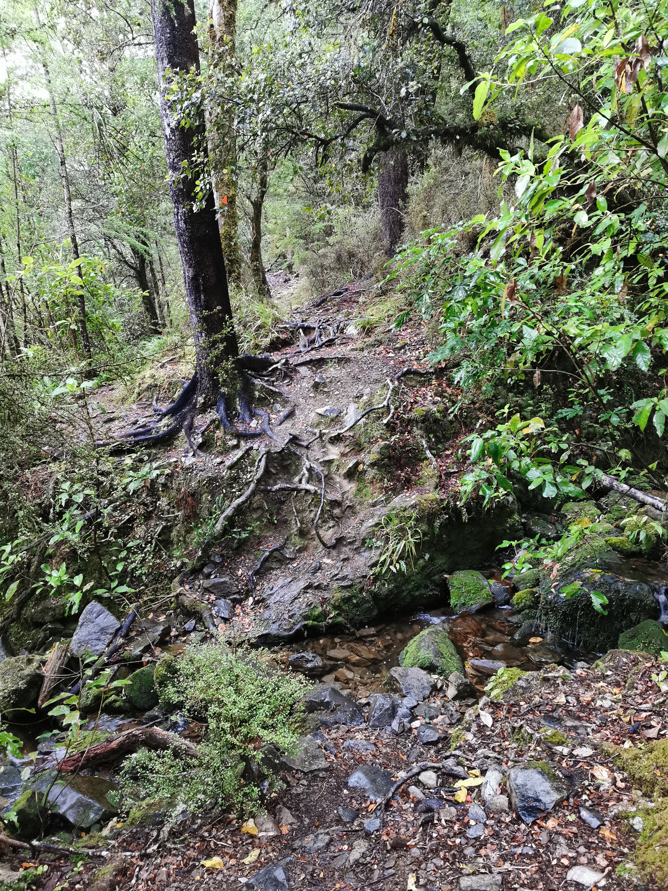
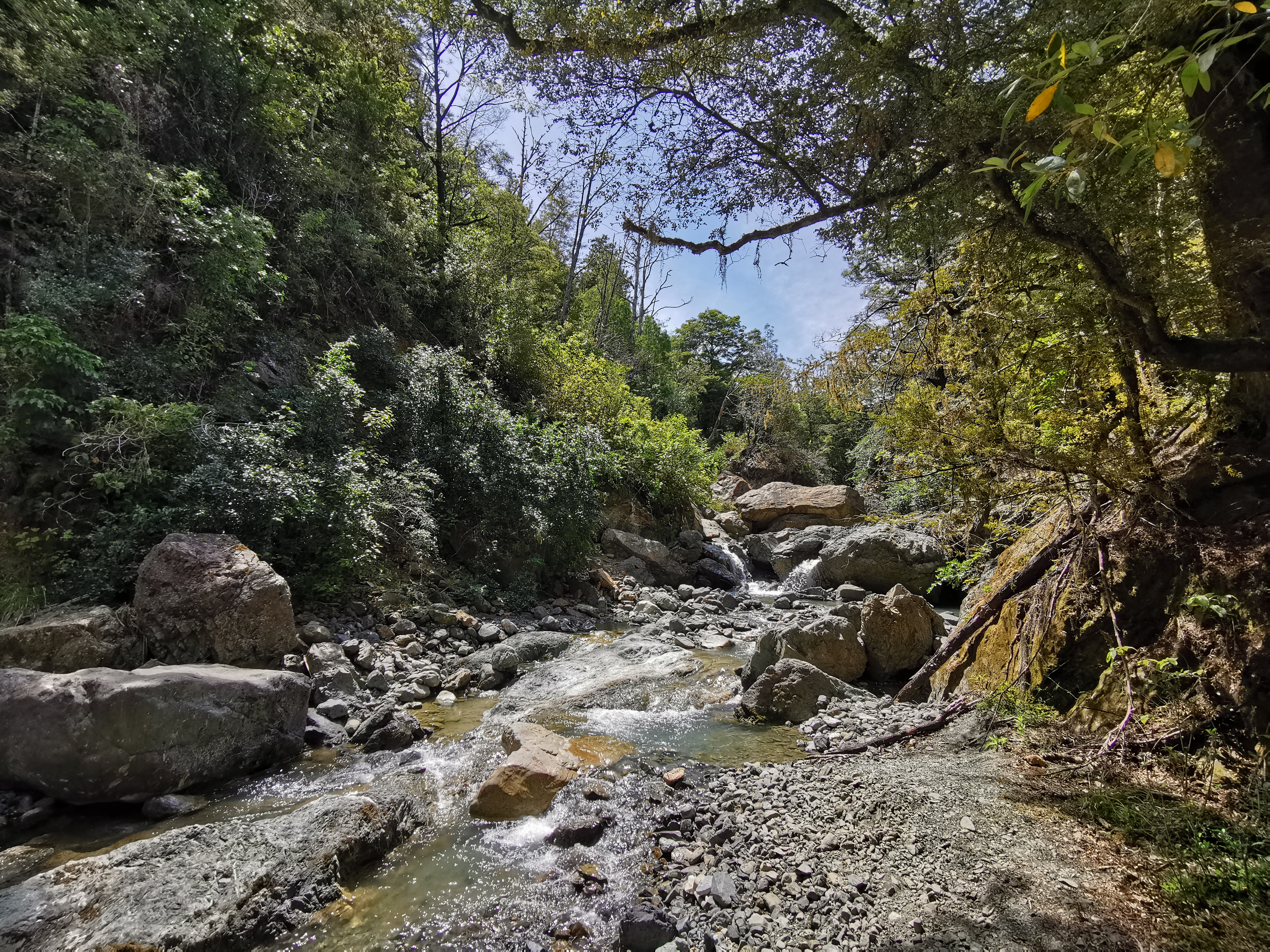
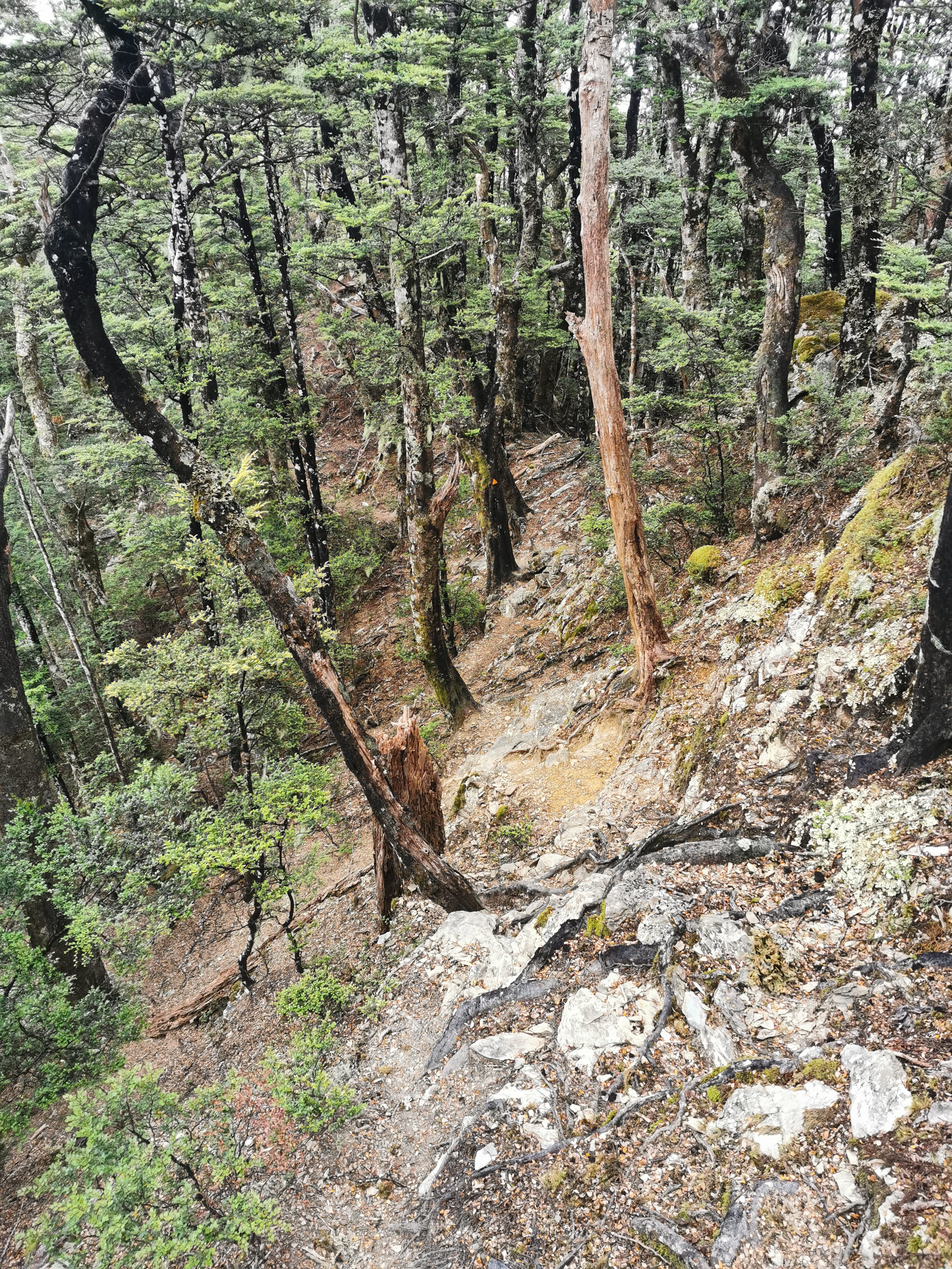
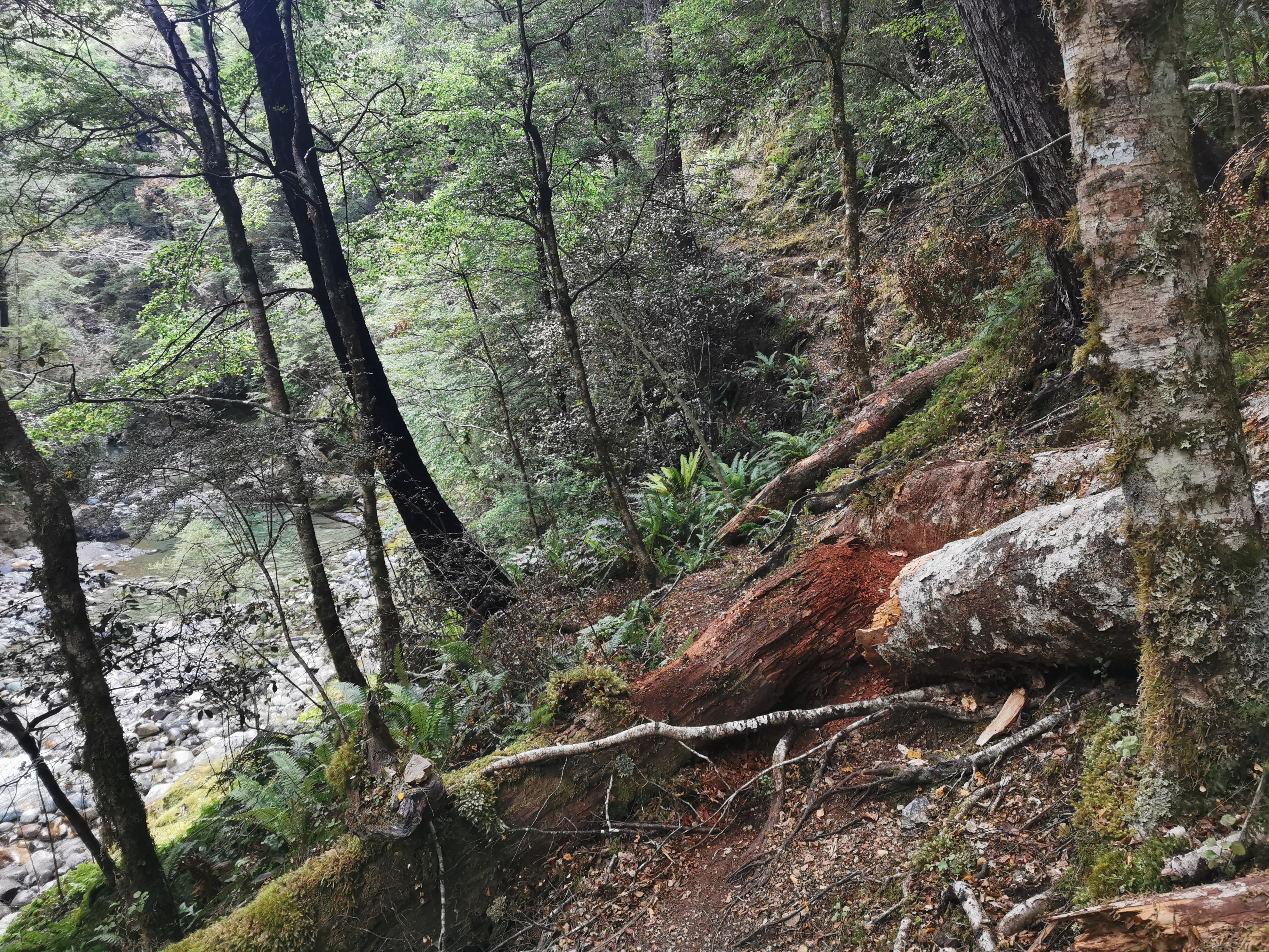
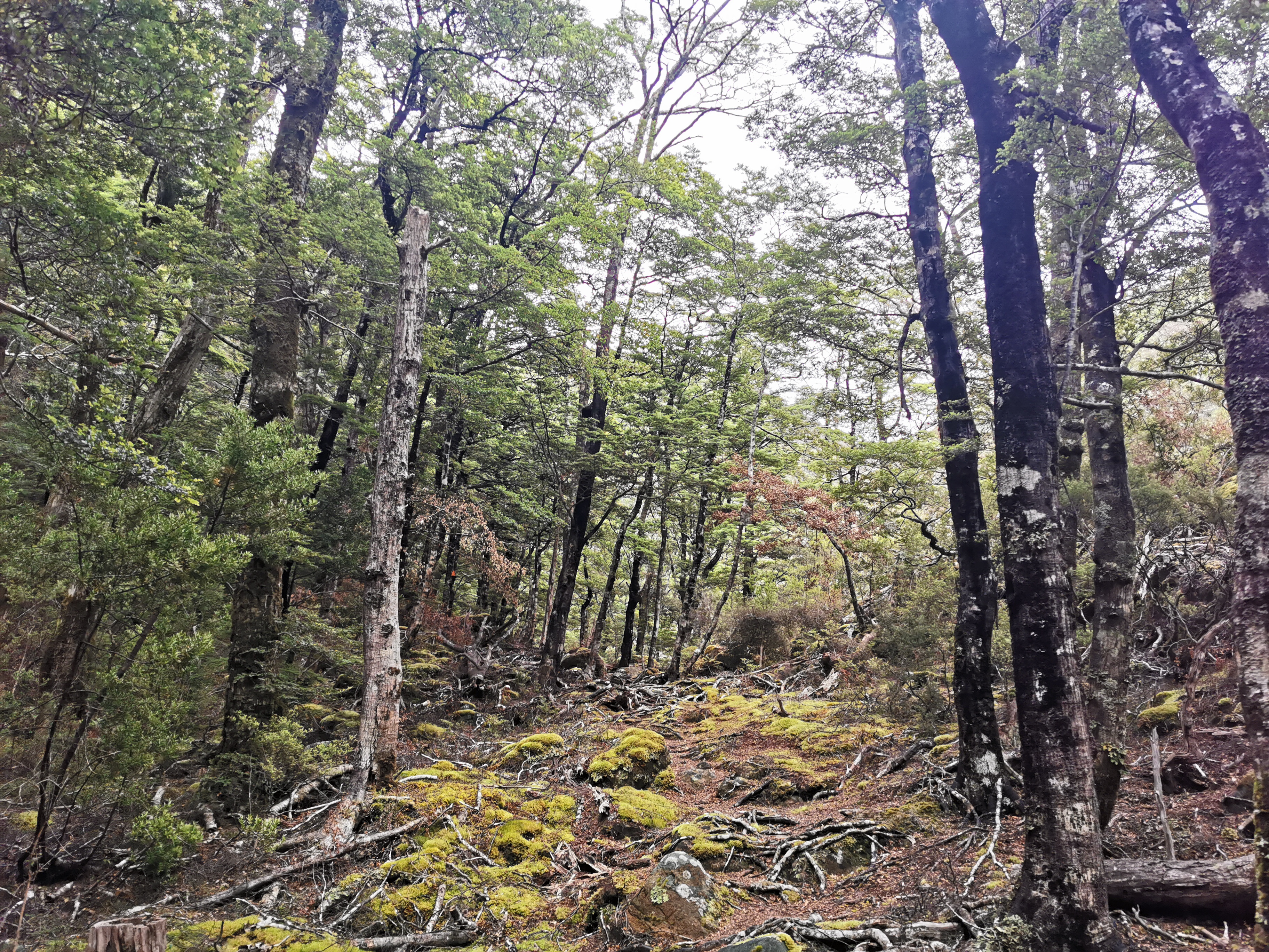
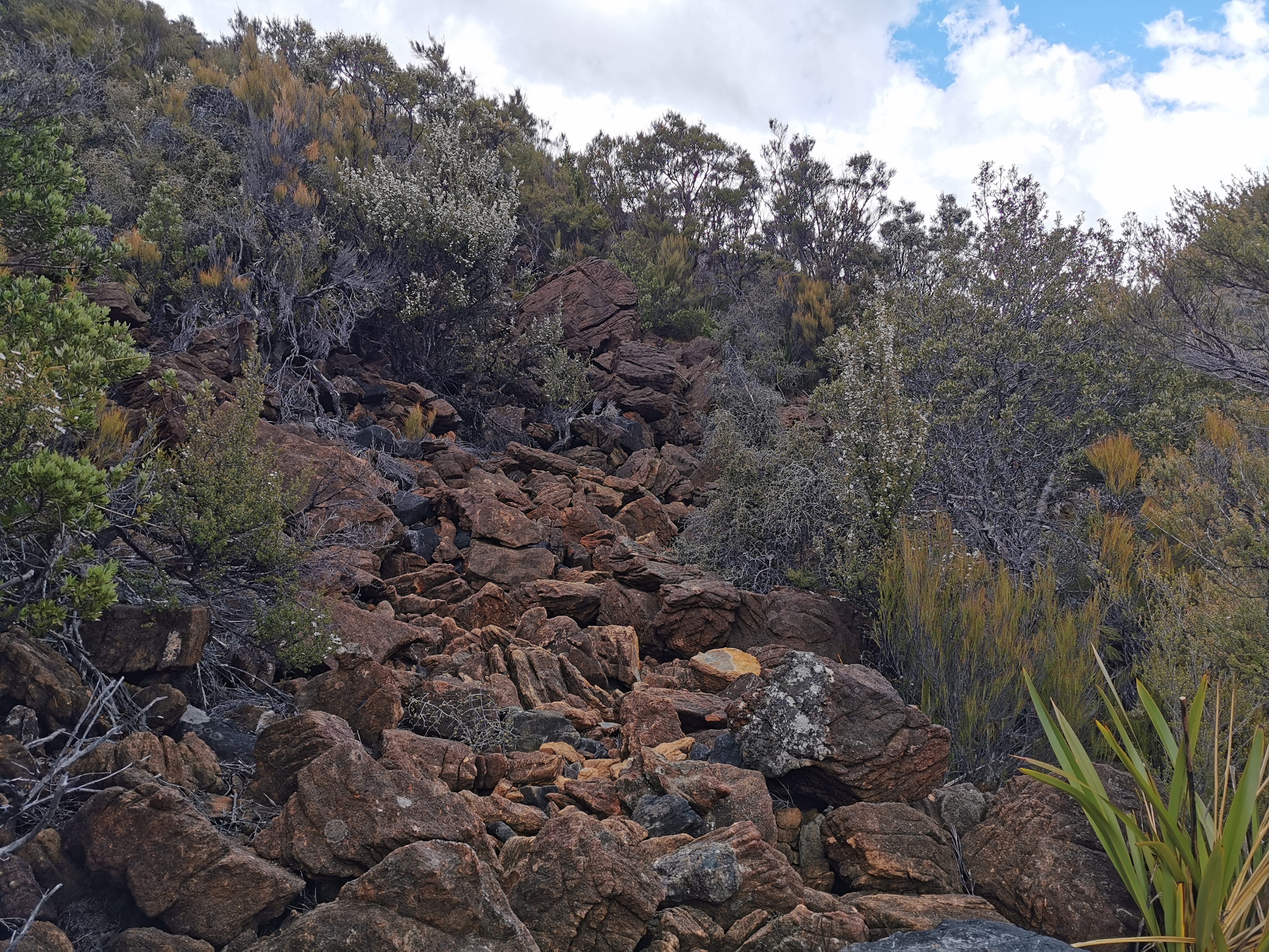
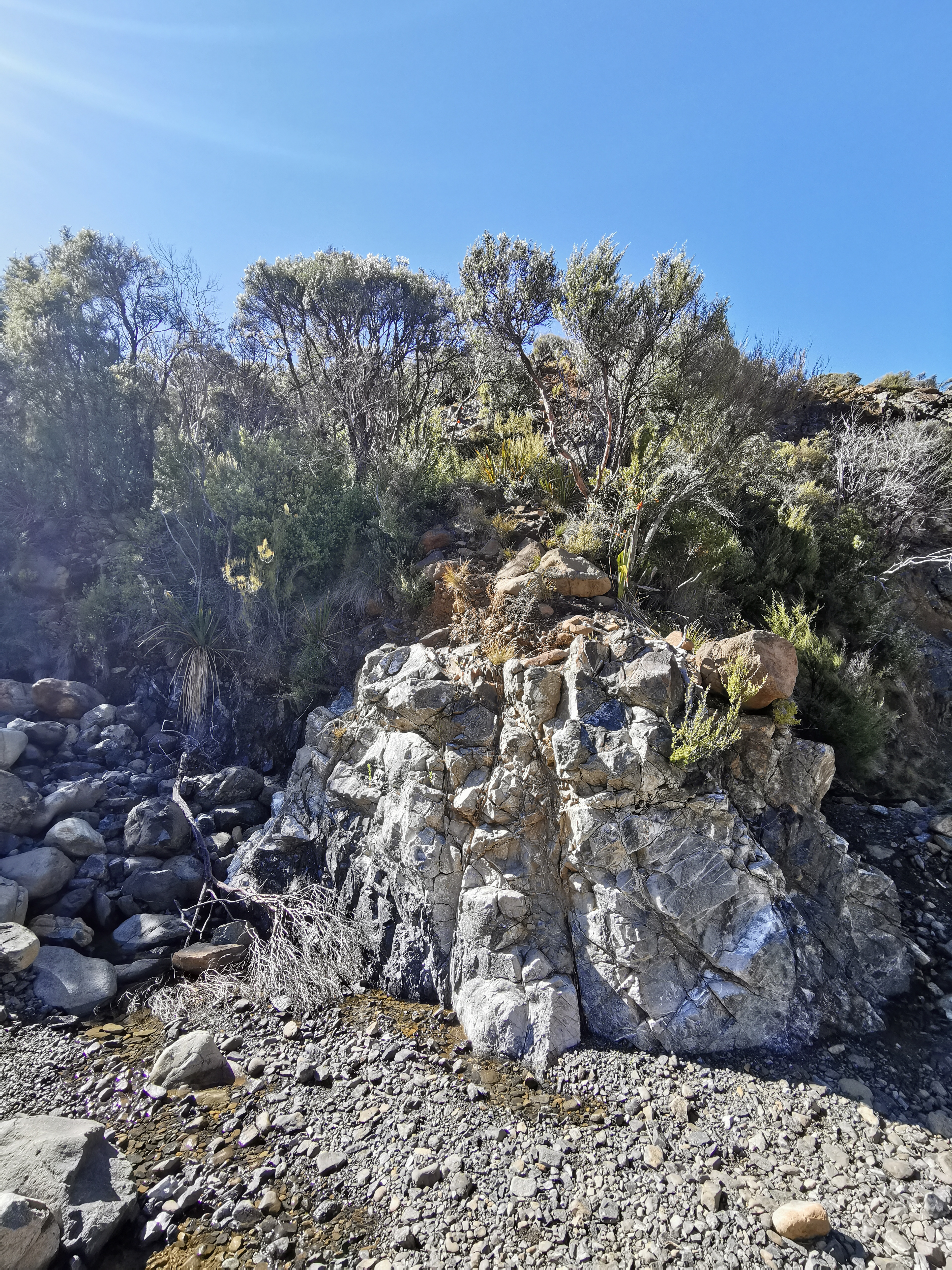
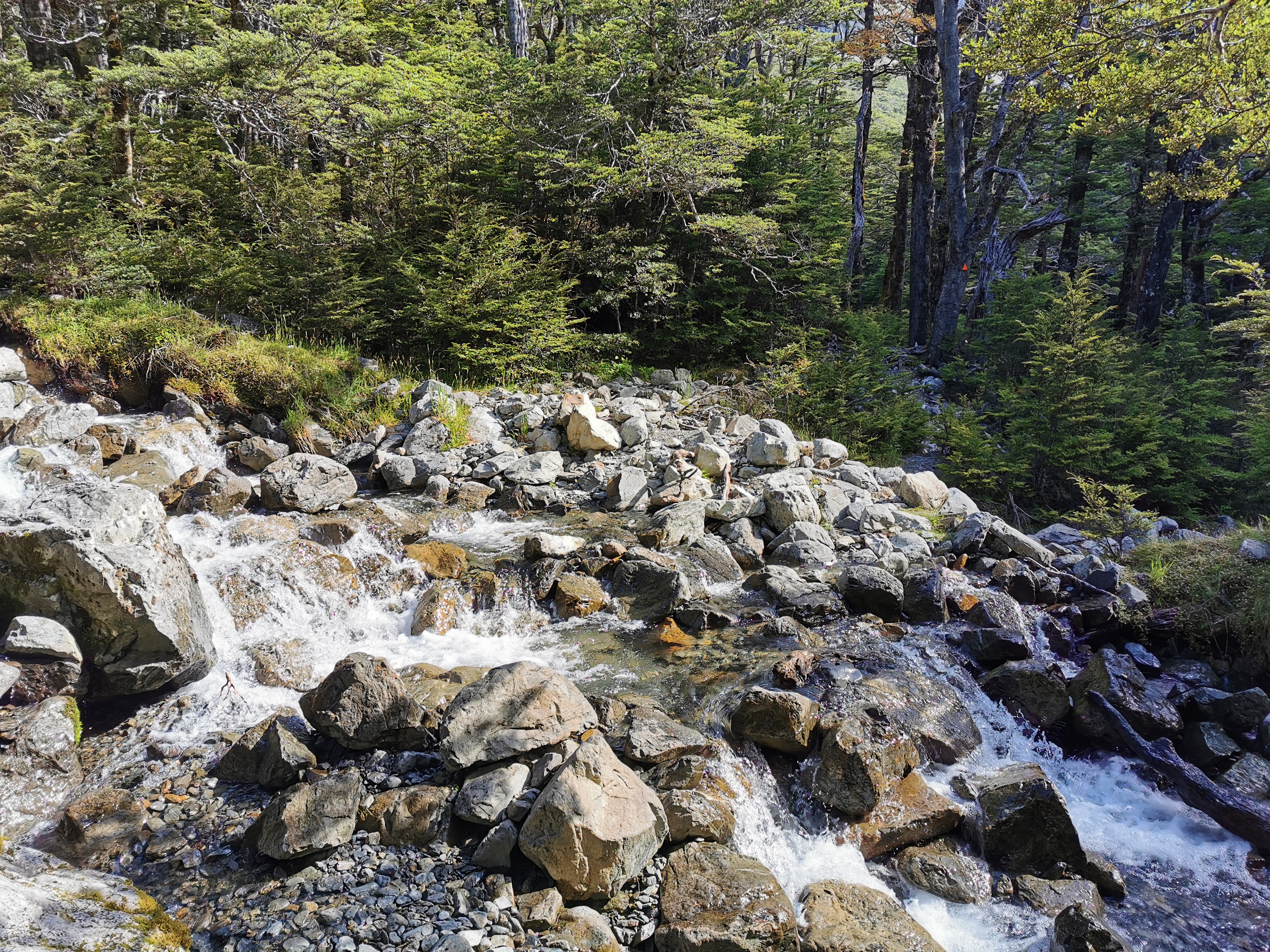
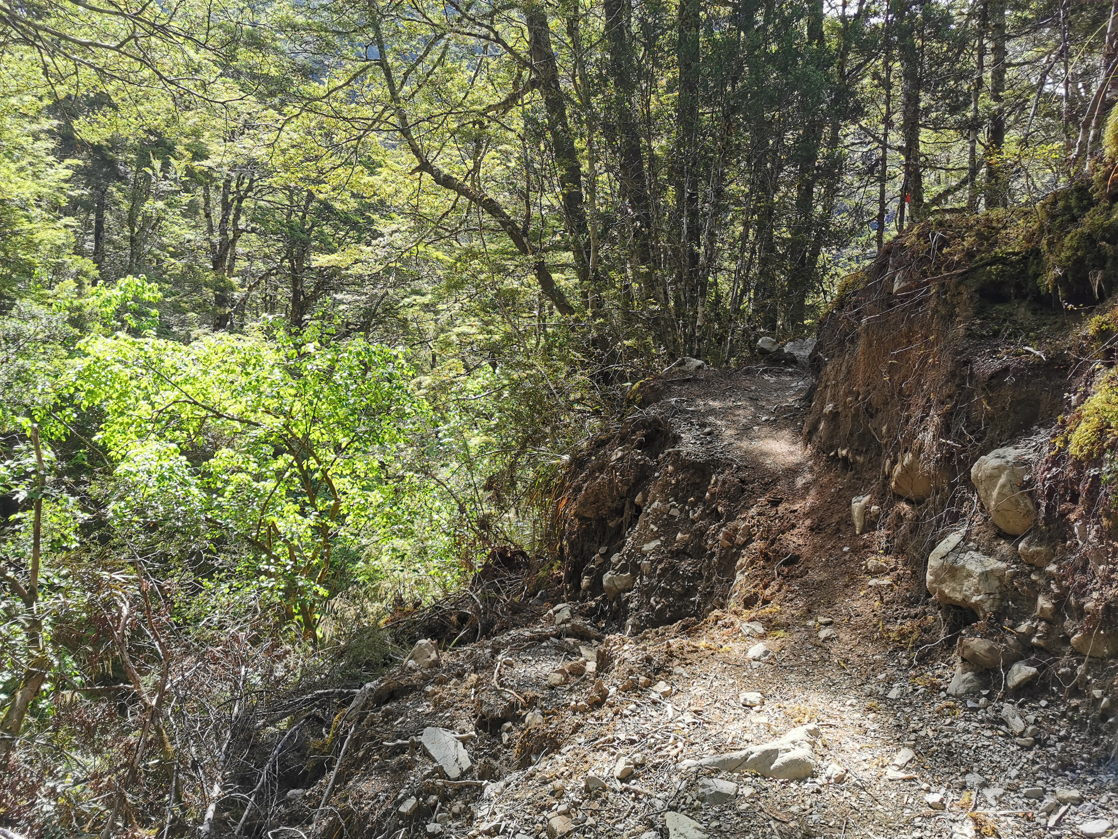
The river walk was fairly easy with a fairly well-defined path, although there were a few slippery sections over rocks.
Like this
The path got a lot closer to the river than the road did, and you could see just how beautiful it actually was.
Even though it wasn’t raining any more, because the trees were all wet water kept falling on me as I was walking any time I touched a tree. I ended up quite wet. Lucky I’d put my rain jacket back on when I first noticed this happening.
One section of trackThe view out to the left
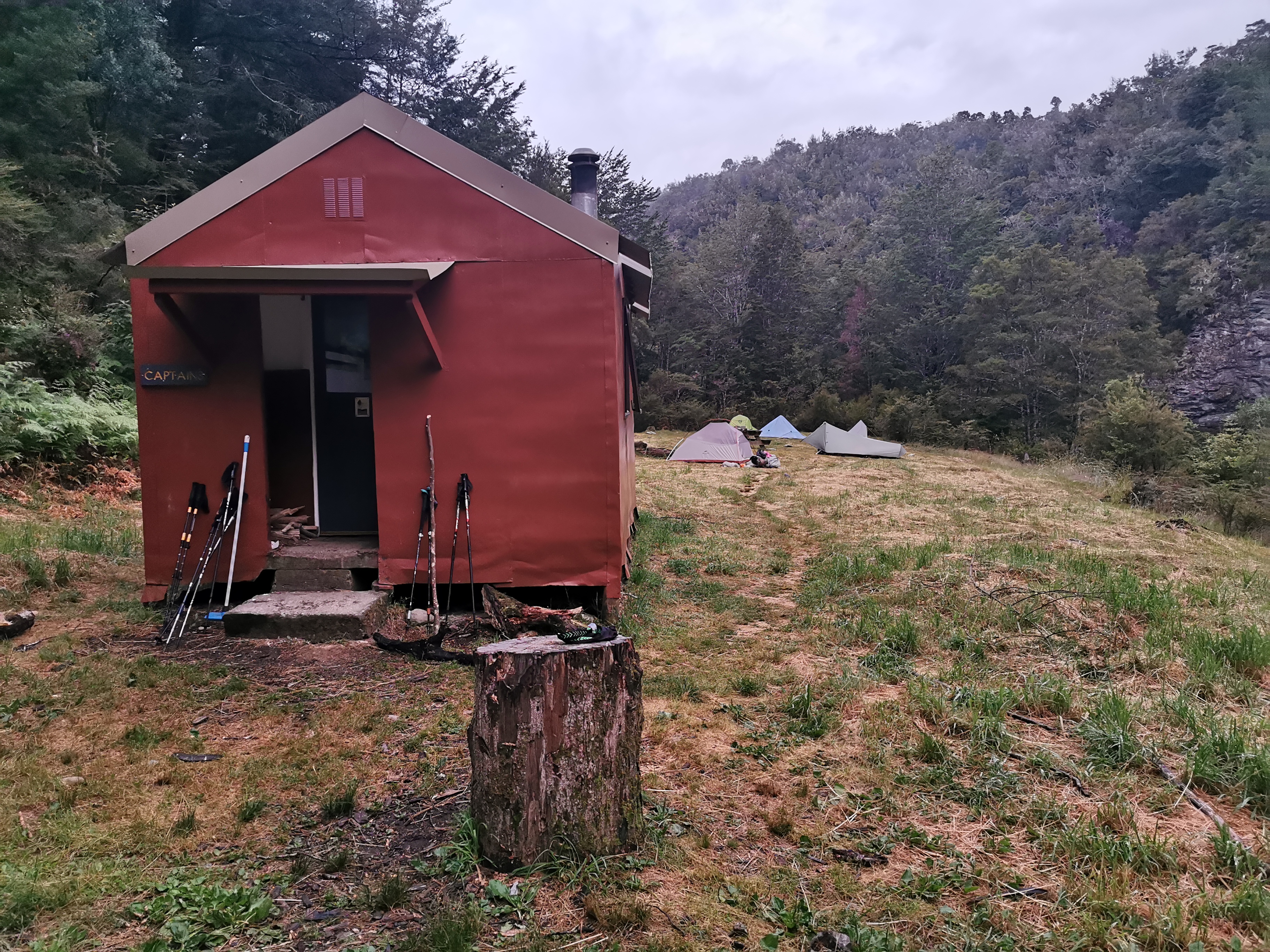
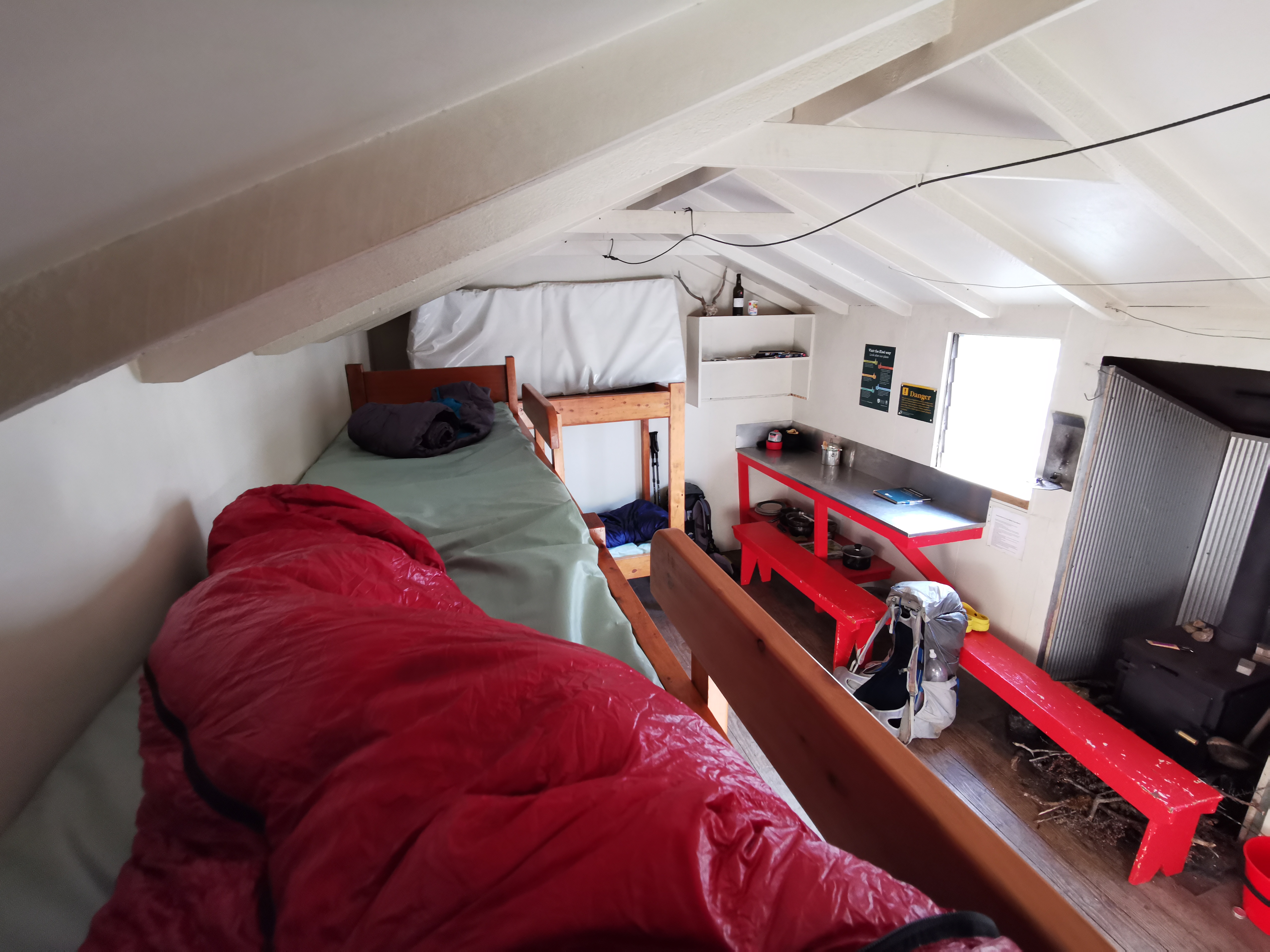
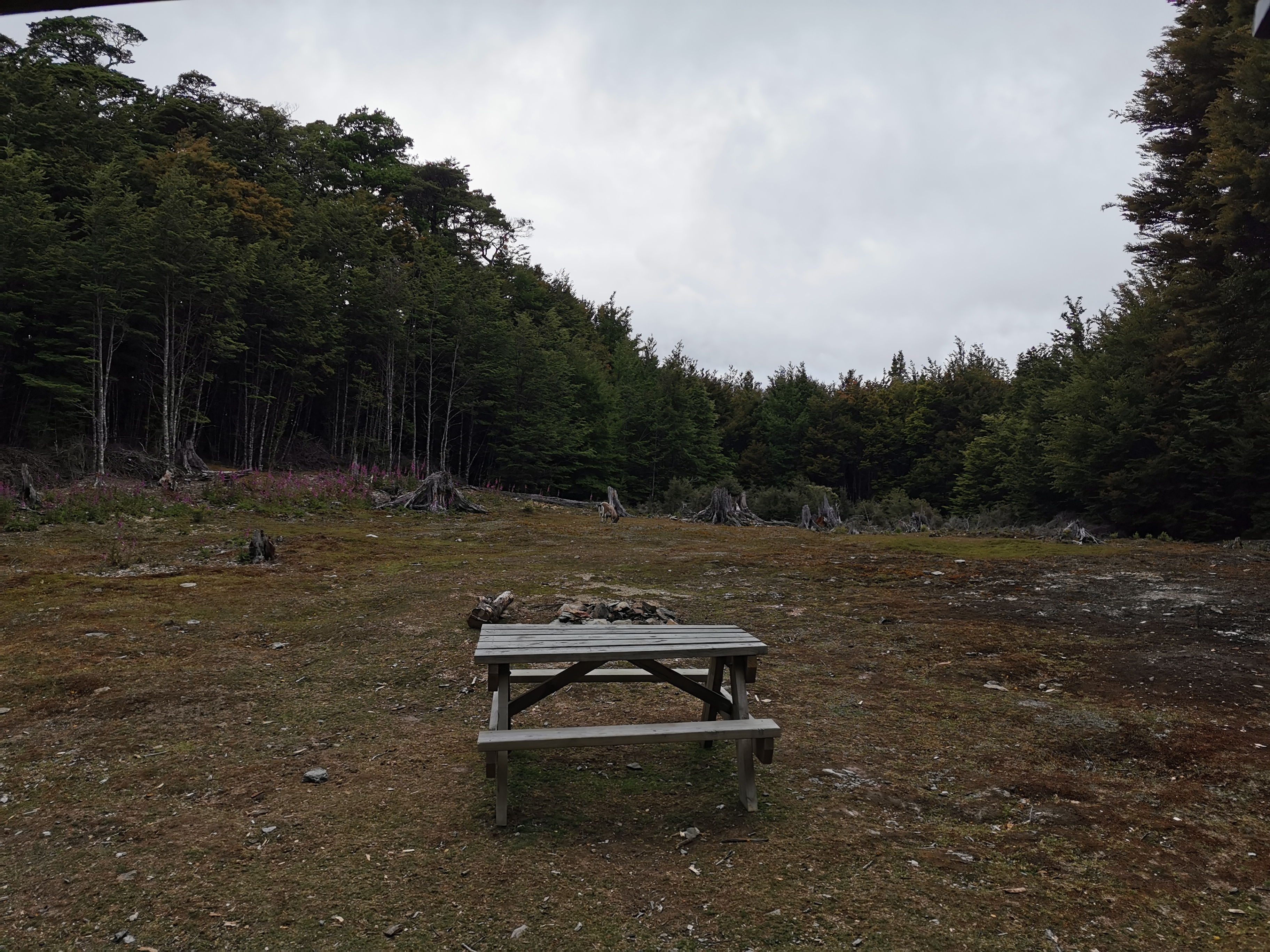
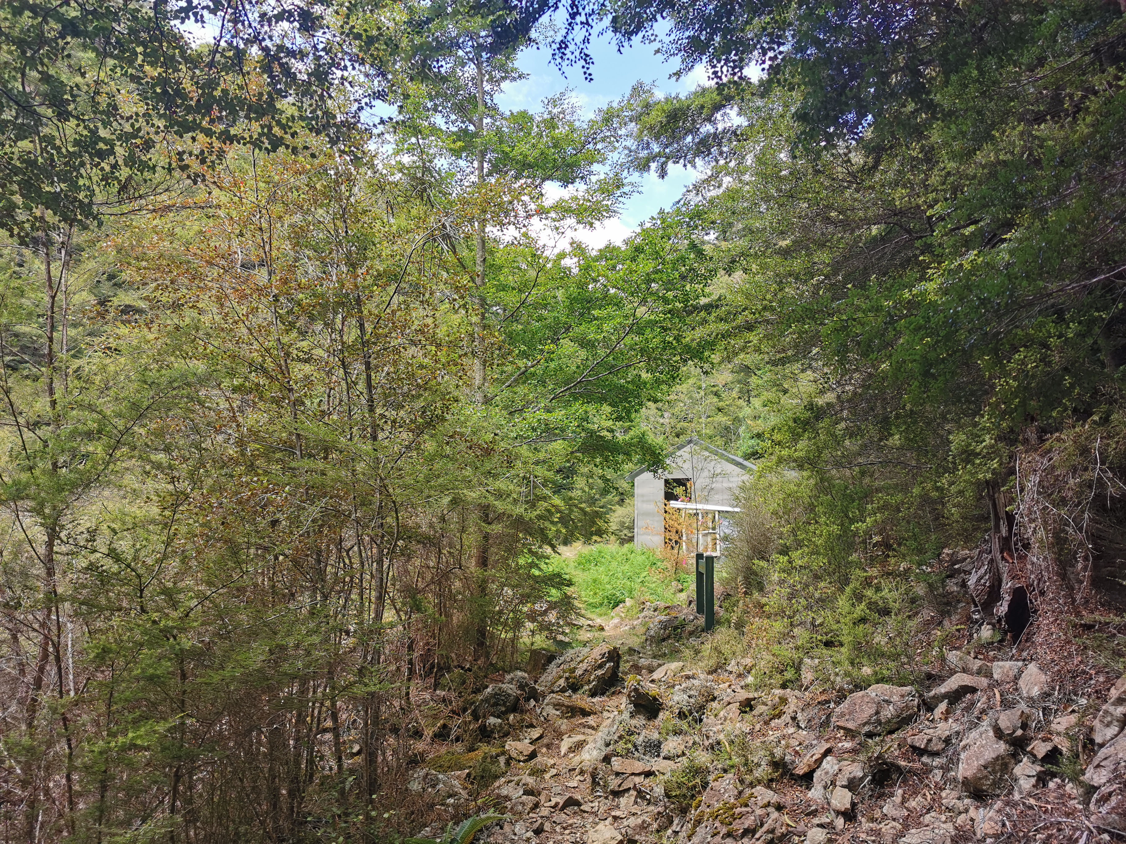
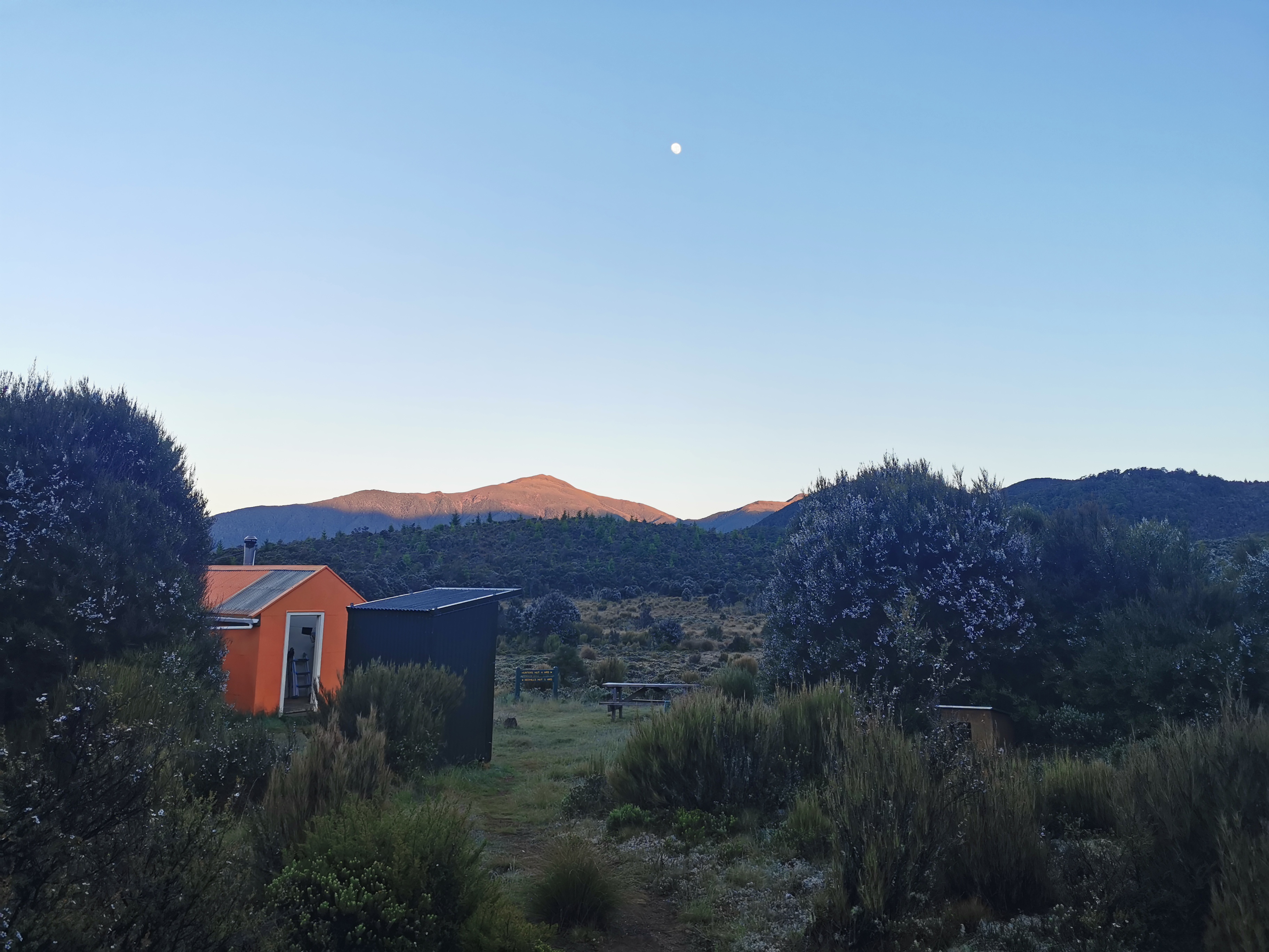
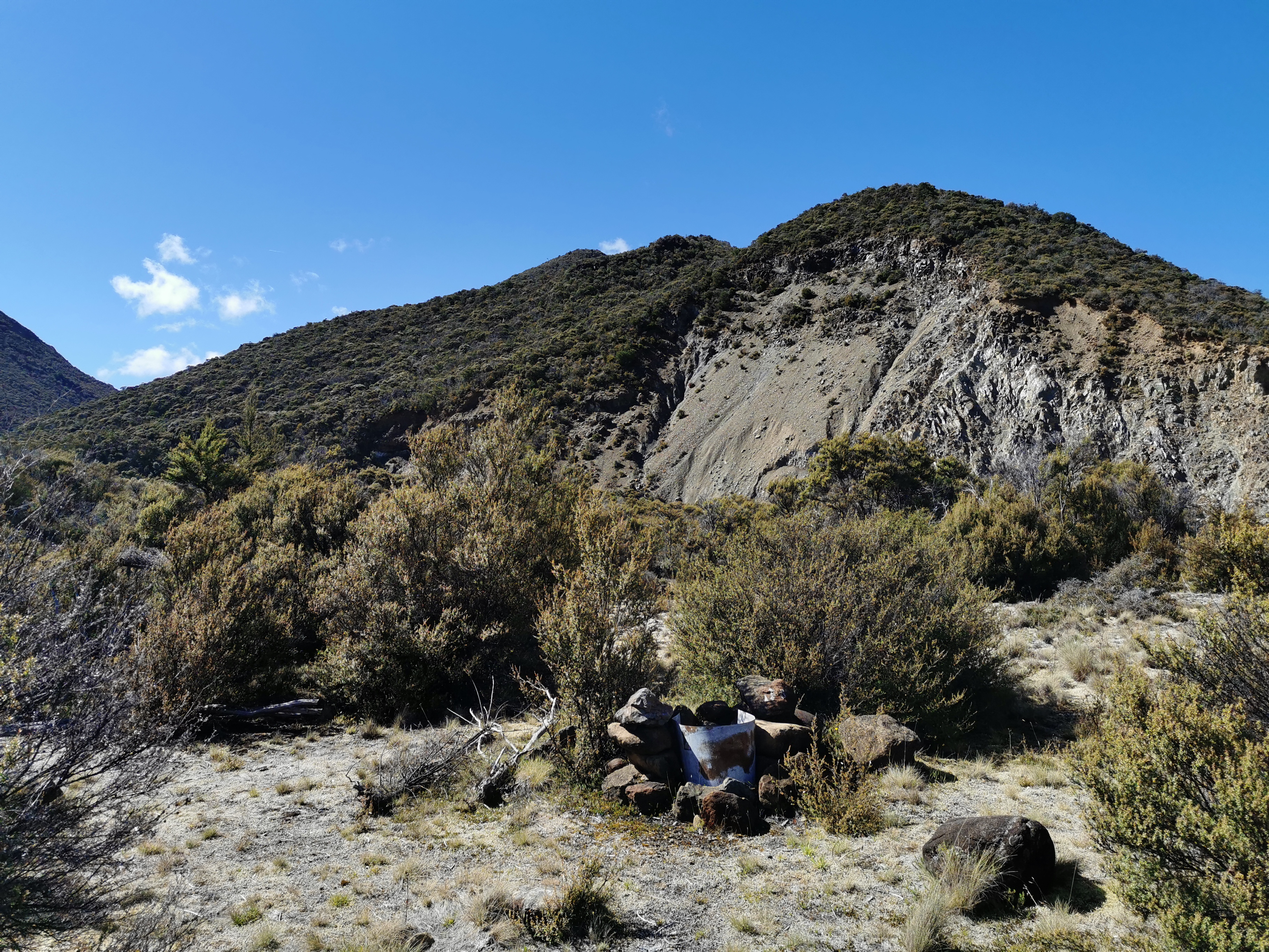
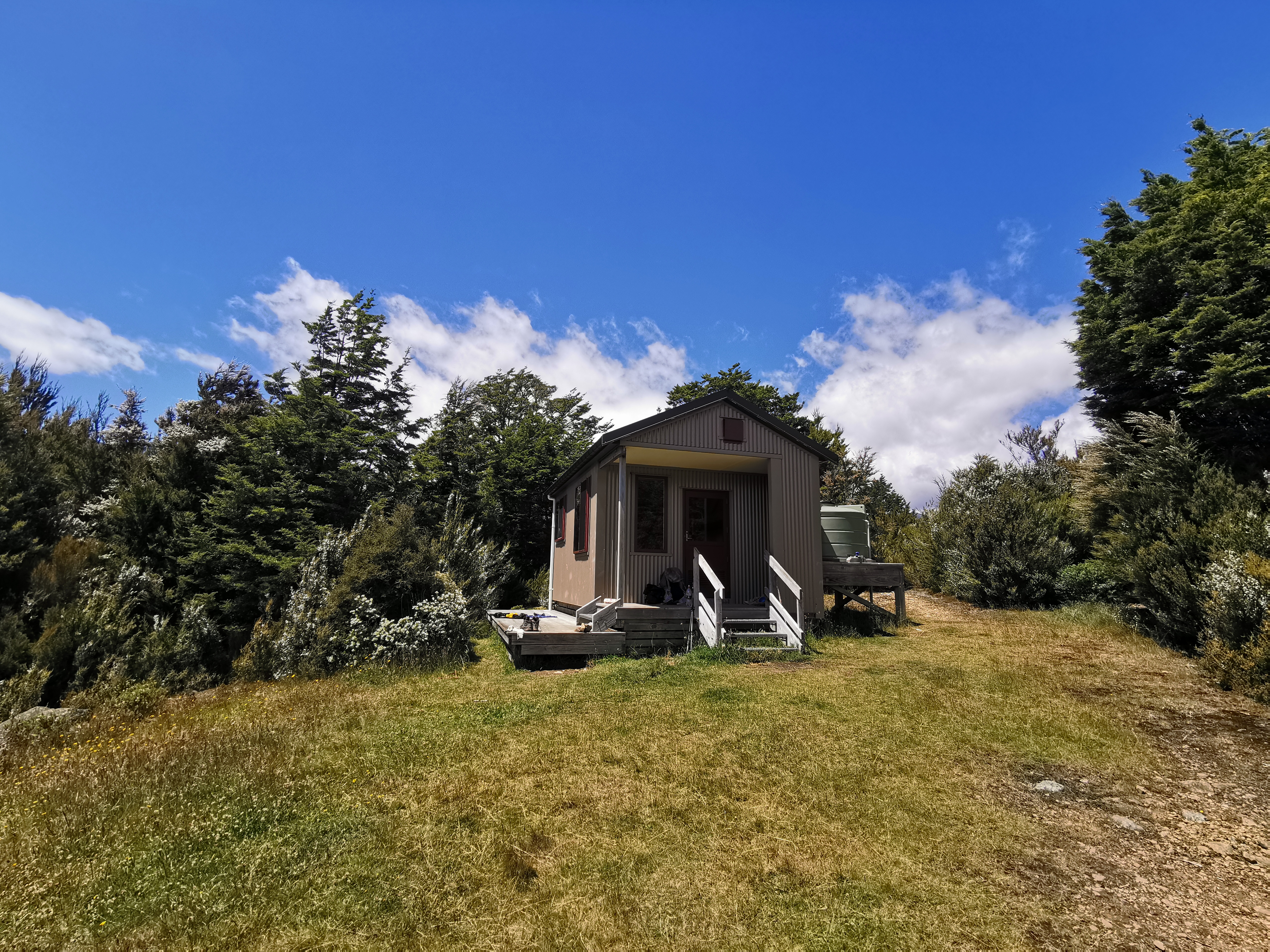
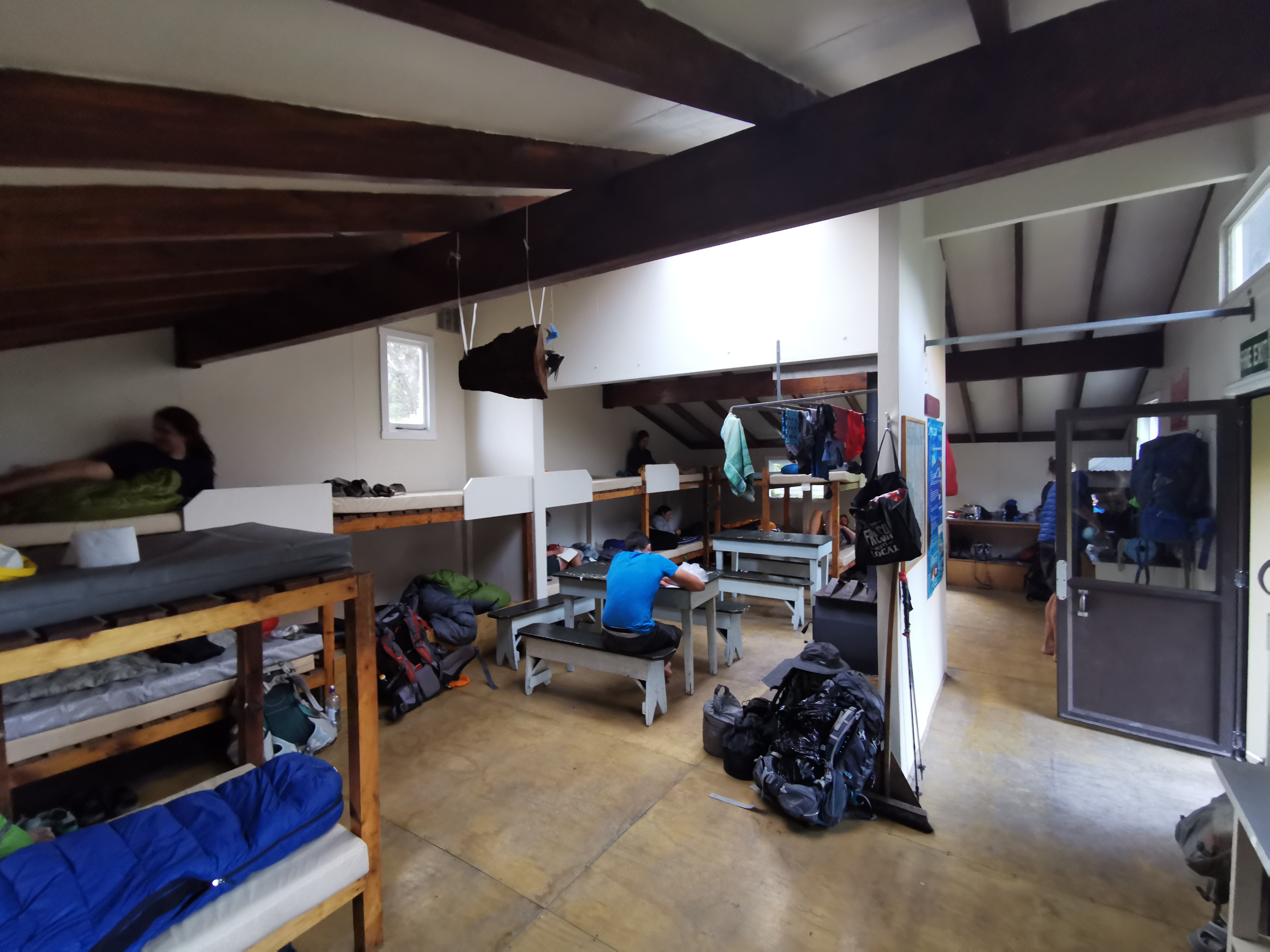
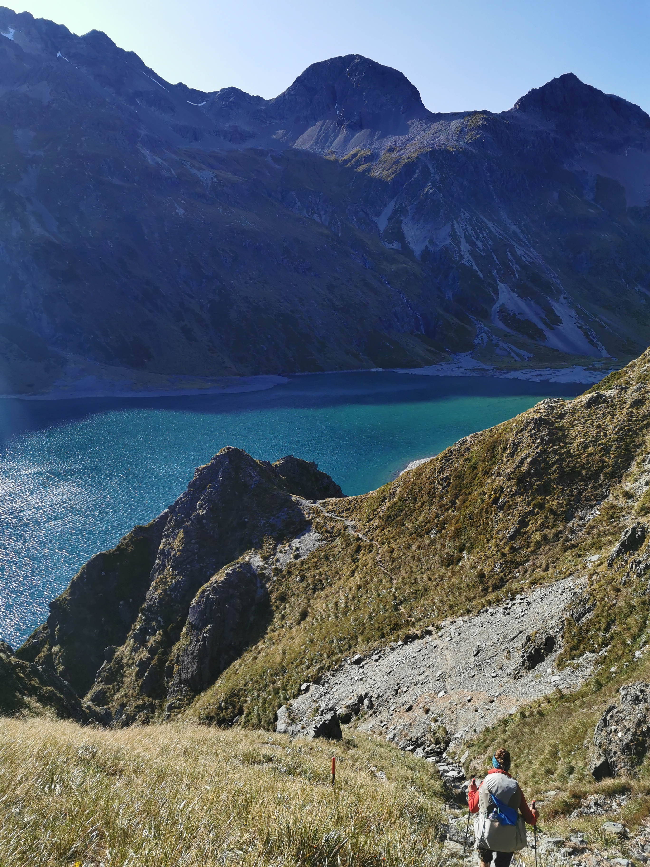
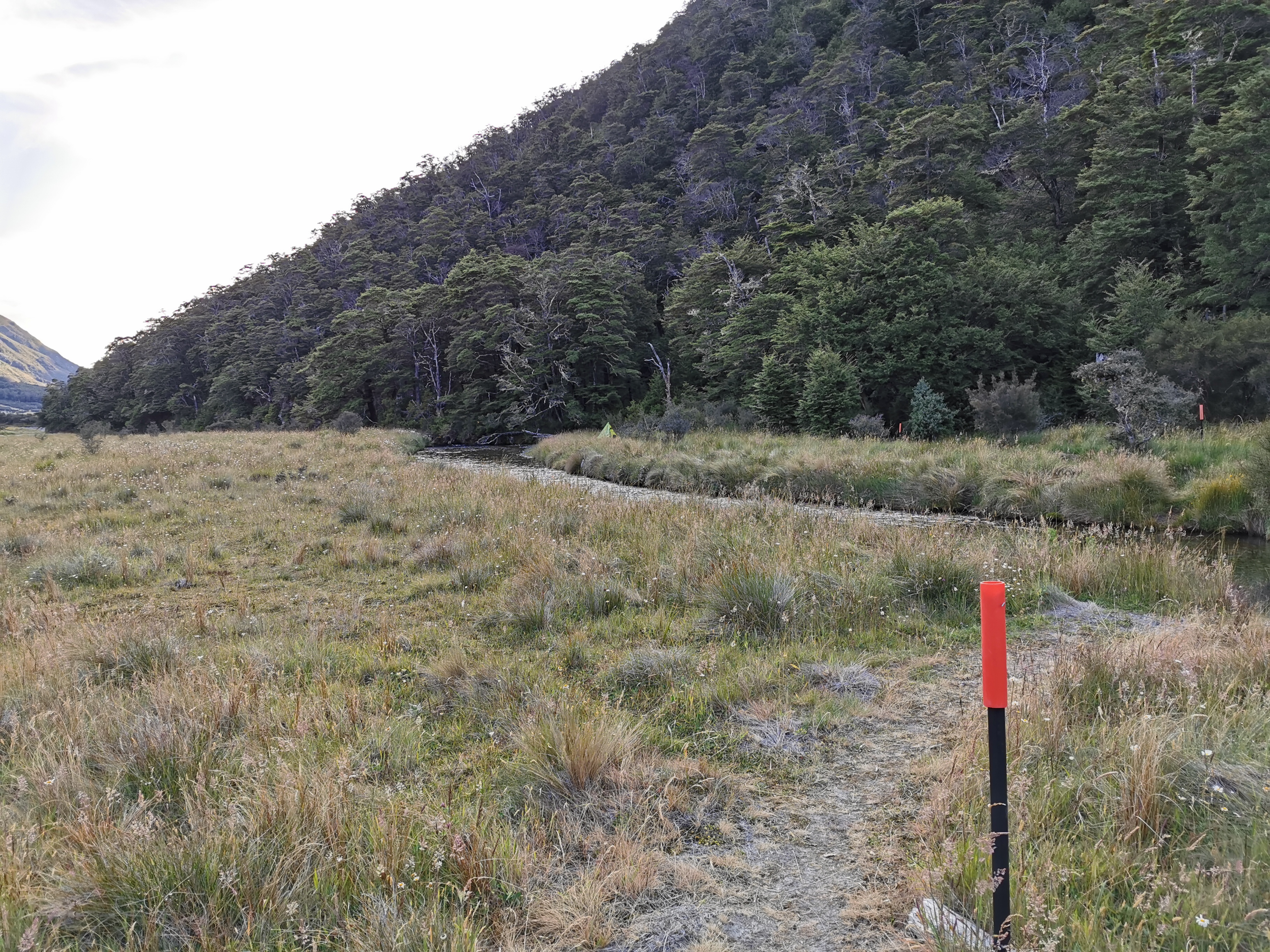
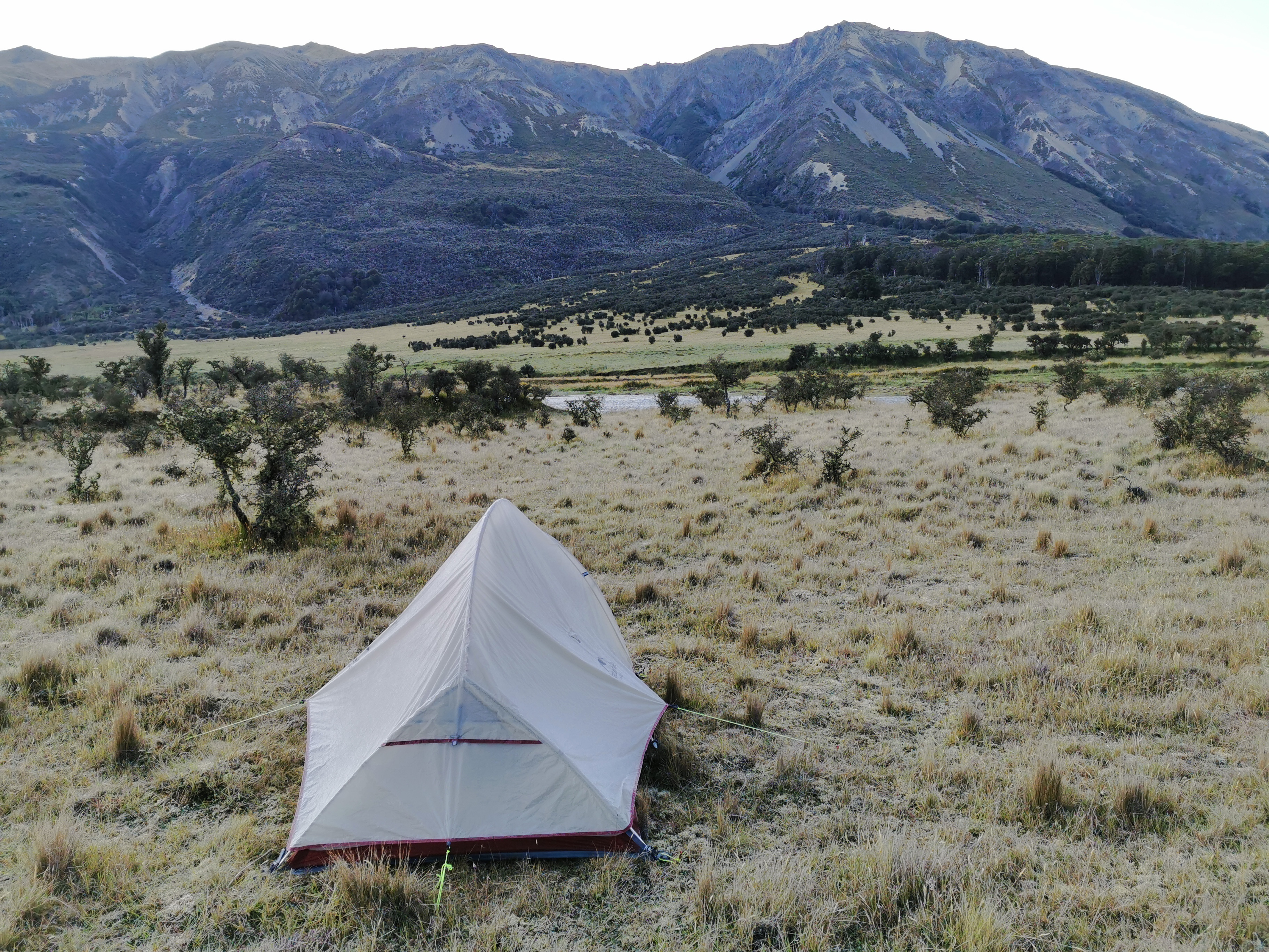
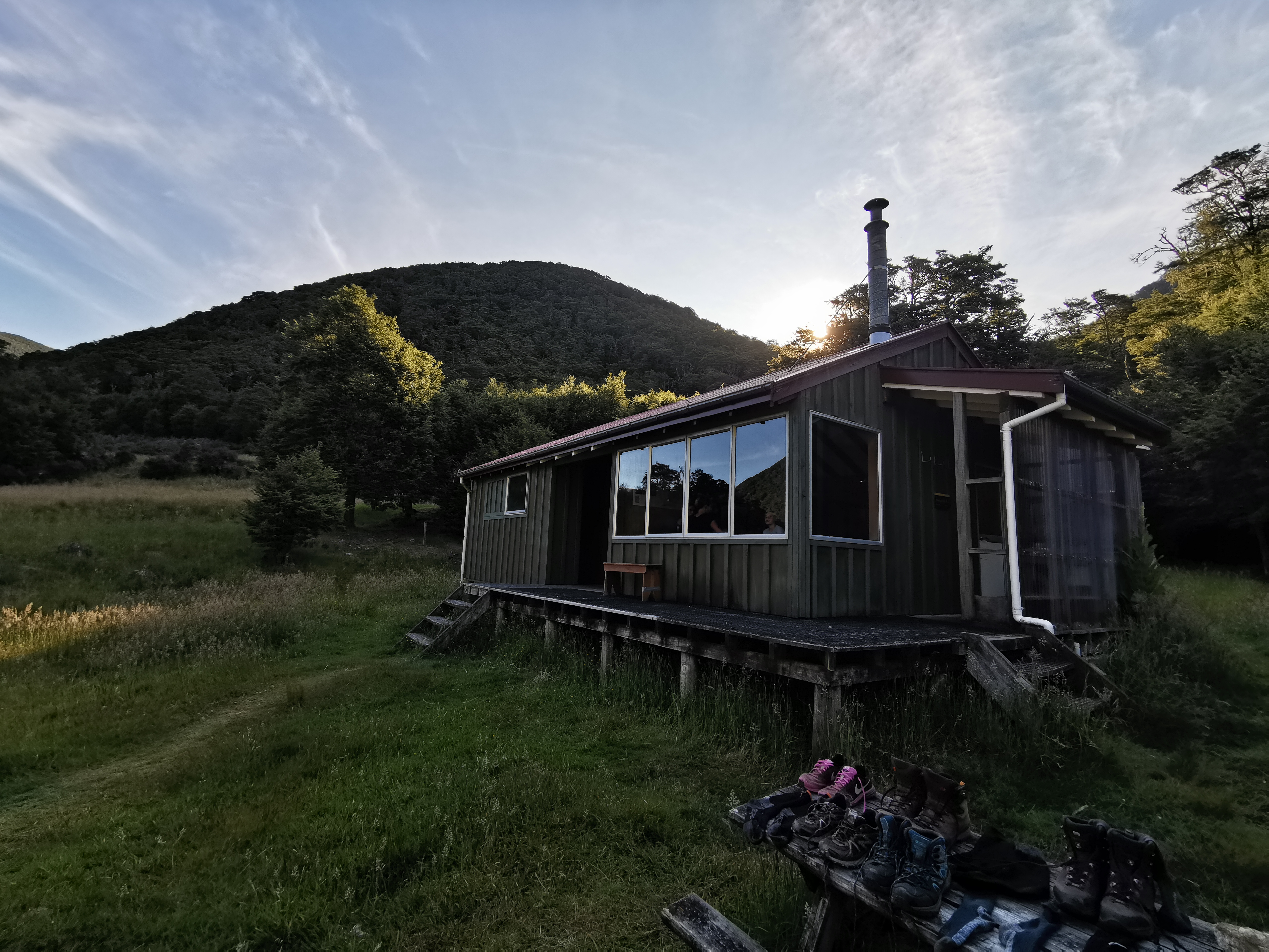
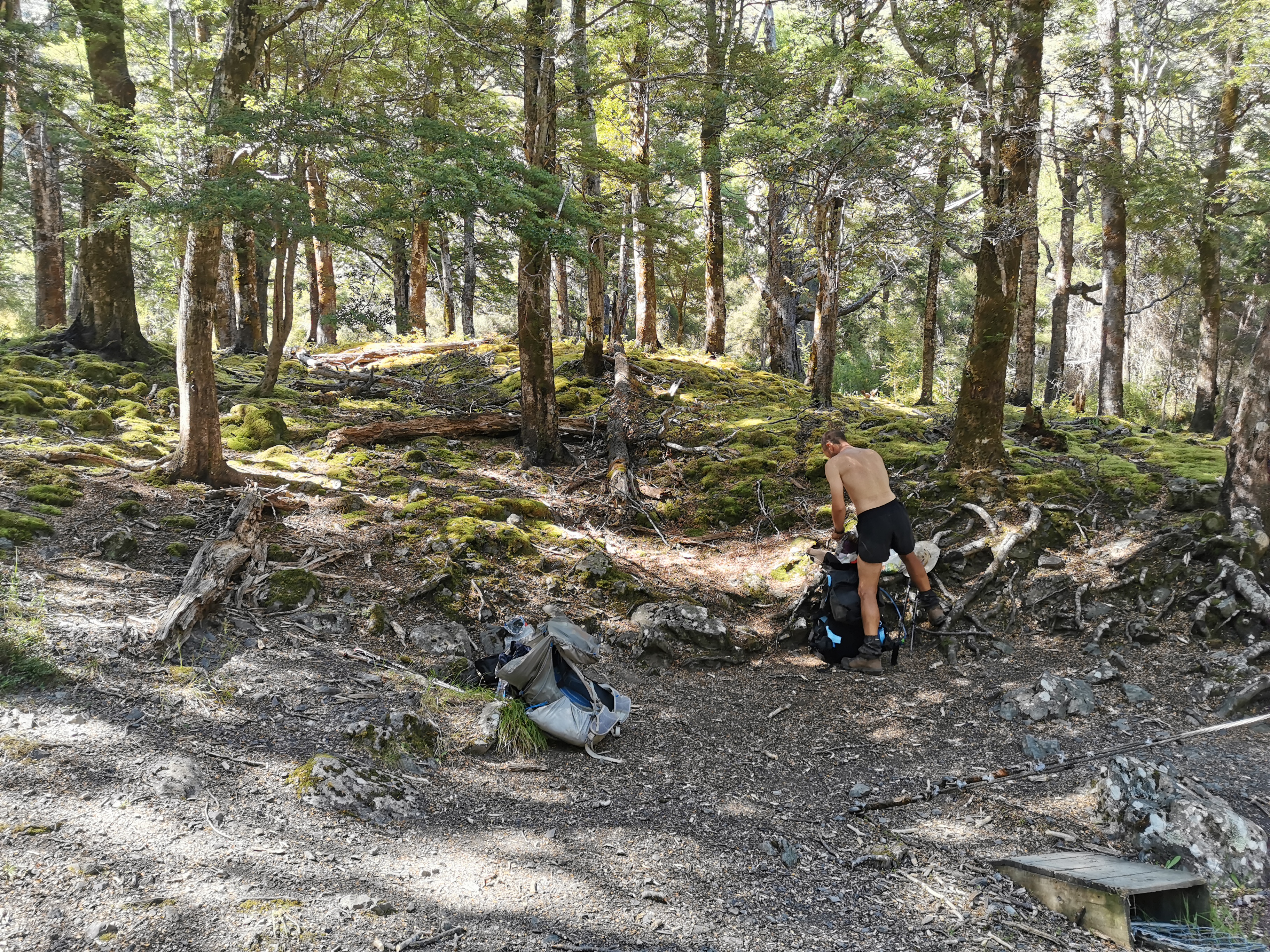
After some walking I looked to my left and saw some tents. I knew exactly what that meant – the hut was nearby and full which meant I’d be sleeping in my tent after all. I walked to the hut entrance and poked my head inside, and somebody in there immediately said “there’s floor space”. But when I had a proper look, there were already seven people in this small six bed hut and so I declined their offer and went and set up my tent outside next to the other four tents that were already there.
Captains Creek Hut with five tents
My pack cover had a done quite a good job at keeping the rain off my bag – it was much drier than I expected. Excellent!
I had a little bit of time to make some dinner in the hut before it got dark and so I talked to the new people briefly. It was hard to see people’s faces and I couldn’t see who was resting and who was wide awake, so I didn’t try and find out everybody’s names. But it was nice to meet a bunch of new people. No doubt I would see some of them again over the next few days.
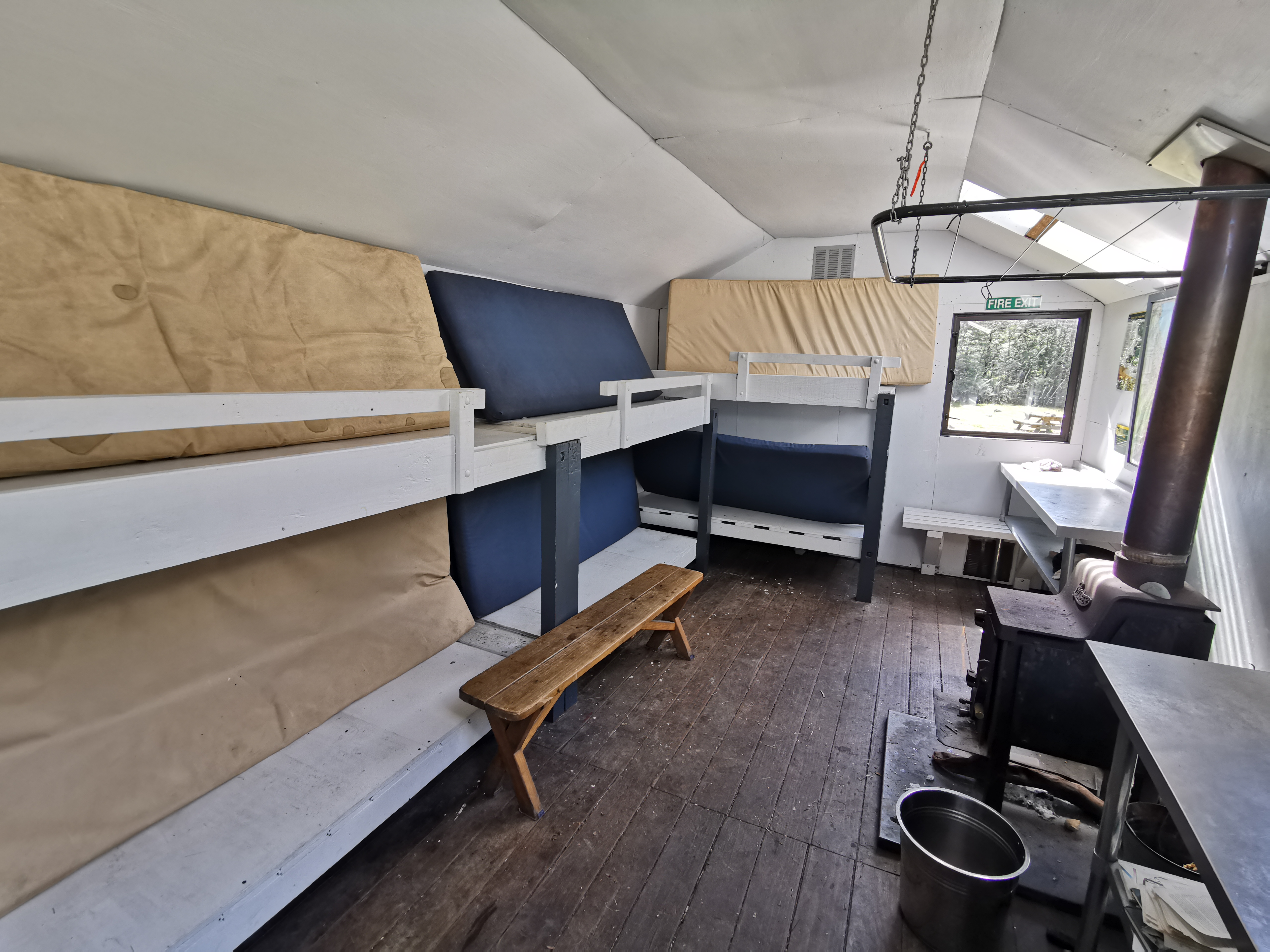
Inside the full hut tonight
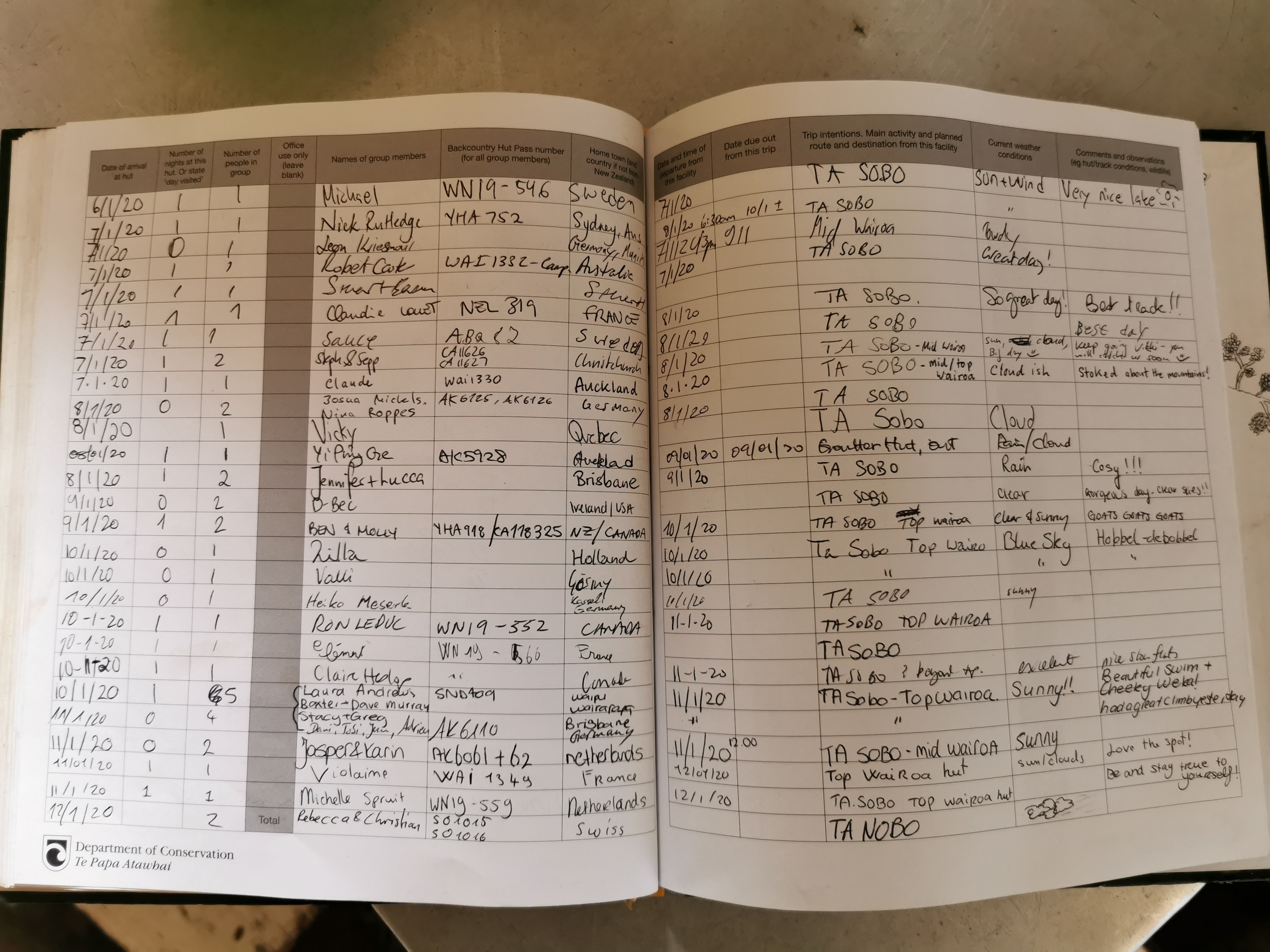
Apparently there were also eight people in the intentions book from today who visited the hut but didn’t stay. That’s a lot of people passing through. The area is definitely very busy!
The intentions book also showed Rhydian was through here four days ago. I wonder how long it’ll take me to catch him, or if I manage to catch him at all.
I went into my tent and soon realised that I need to do a better job of keeping the sandflies out of my tent. They’re really bad here. It’s impossible to keep all sandflies out of the tent because you need to unzip the tent to get in it. I just need to keep the door open for as short a time as possible.
One thing I did notice though is that my silk sleeping bag liner smells nice because I washed it during the Christmas break. Normally when I pull out the silk liner I immediately smell a sweaty smell. This time it smelled like laundry detergent.
Tina and Matthew who I met earlier on on the road surely won’t make it here tonight. I hope they camped while they could. The last 4km or so of the river track was quite steep and had no good camping spots.
I realised that I had no water and so I had to get out of my tent and go and get water. When I looked at the river while I was waiting for the water to filter, I just sat there admiring the view and I thought to myself “man it feels good to be back”.
Now I’m back in the tent I have a bit of stuff to work out. I have another wedding to attend which is on the 25th of January in Napier. I am one of the groomsmen so I have to attend the rehearsal on the 24th. That means I have to get to Christchurch (the closest airport to where I’ll be around then) by the end of the 23rd and that means I probably have to start hitchhiking from somewhere on the 22nd of January. That means I have thirteen full days between now and then.
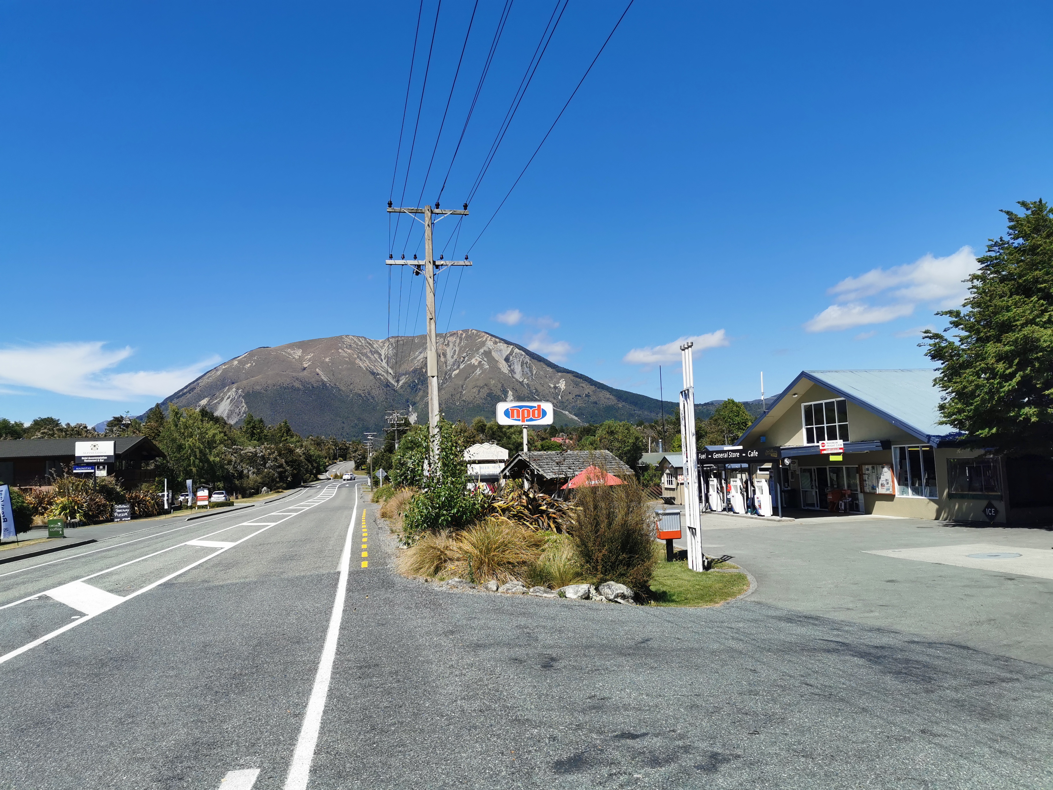
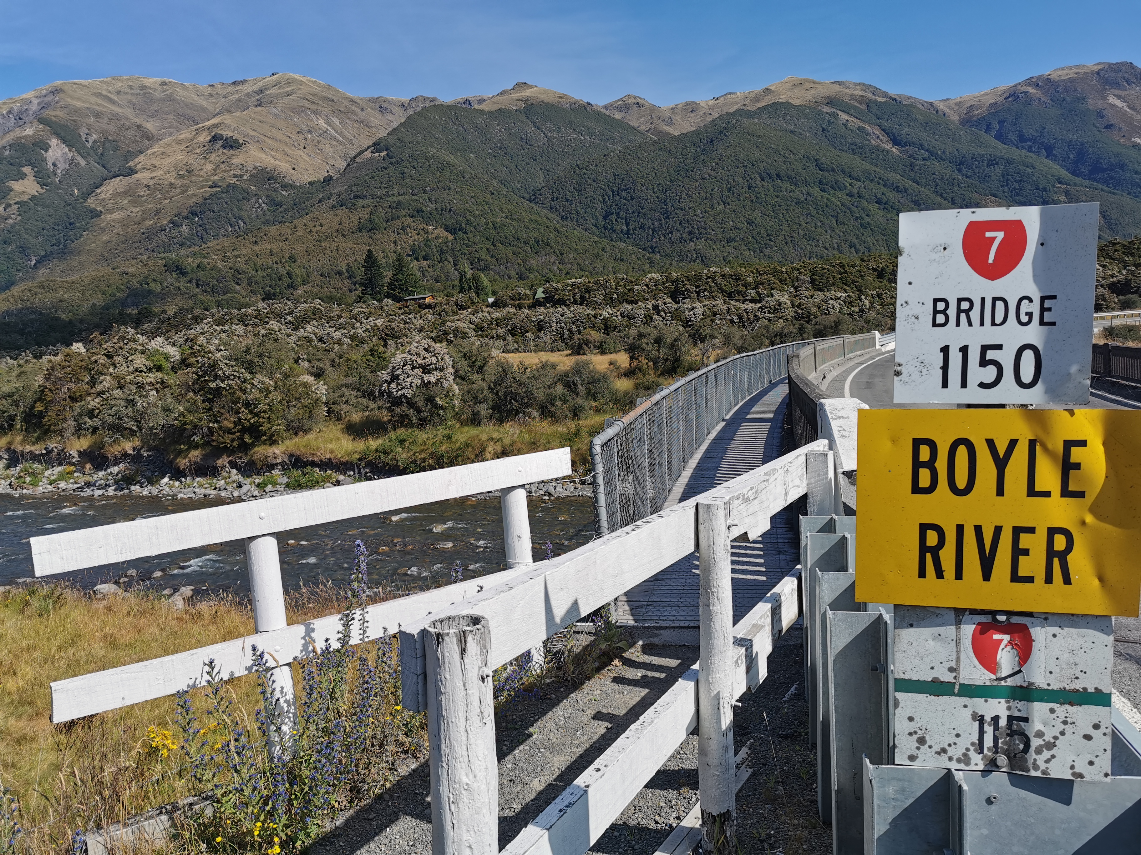
Because the South Island has such long stretches between towns, I need to investigate the possible options to get a ride to Christchurch from. These seem to be St. Arnaud, Boyle Village or Arthur’s Pass.
St Arnaud is 113km from here, and Boyle Village is 233km from here. There’s an access to State Highway 73 at 322km and Bealey near Arthur’s Pass is 353km. Given how mountainous the upcoming terrain is supposed to be, I think my best bet is Boyle Village. Although it will be a hitchhike from there to Christchurch because I don’t think Boyle Village has any kind of bus or other public transportation. Given that’s on State Highway 7 which from my understanding is a relatively major state highway, hopefully it won’t be too hard to get a lift.
Also I have to sort all my stuff out in my pack. Because I had to take my pack on the plane, everything is in a different place to where it normally is. Meh, I’ll do it in the morning. Right now I just want to sleep on my air mattress. Ooh I forgot how comfortable it is. And it’s a nice night outside despite the earlier rain and it’s a really nice temperature.
Everything feels really good right now and I’m happy to be back on the trail. Oh wait I forgot to bring a pee bottle…..
Date: 9 January
Trail covered: 9.6km, plus 1.5km to go and see a lookout (kms 1825.7 to 1835.3)
Weather: Beautiful
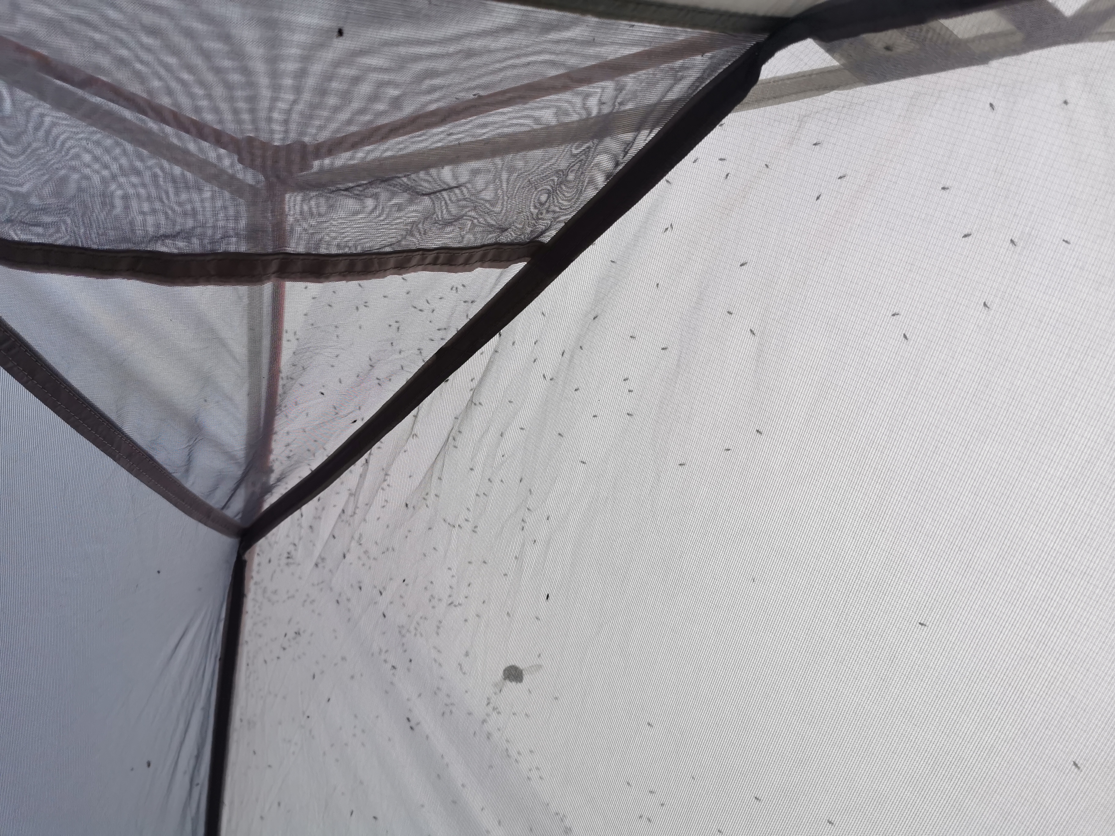
When I woke up this morning, I noticed what I called a “sandfly nightmare” at the top of the tent.
Just a few sandflies…
Ive never seen so many sandflies in one spot. To help with the commotion there was also a bumblebee stuck under the tent fly and it was making all the sandflies jump all over the place. The noise from all the sandflies sounded like rain.
I woke up to find every single other person had already left – this included all seven people in the hut and the occupants of the four tents. Yay – I have the morning to myself. I can dry and organise my stuff and there is absolutely no hurry.
The thing that struck me this morning is that the bumblebees here are more annoying than the sandflies. There are heaps of them and they follow you around and don’t leave you alone. And also there were little wasps in the toilet. They get into the toilet through the little holes in the loo that water is supposed to drain out of. Bugs and insects in the toilet while you’re using it are very annoying.
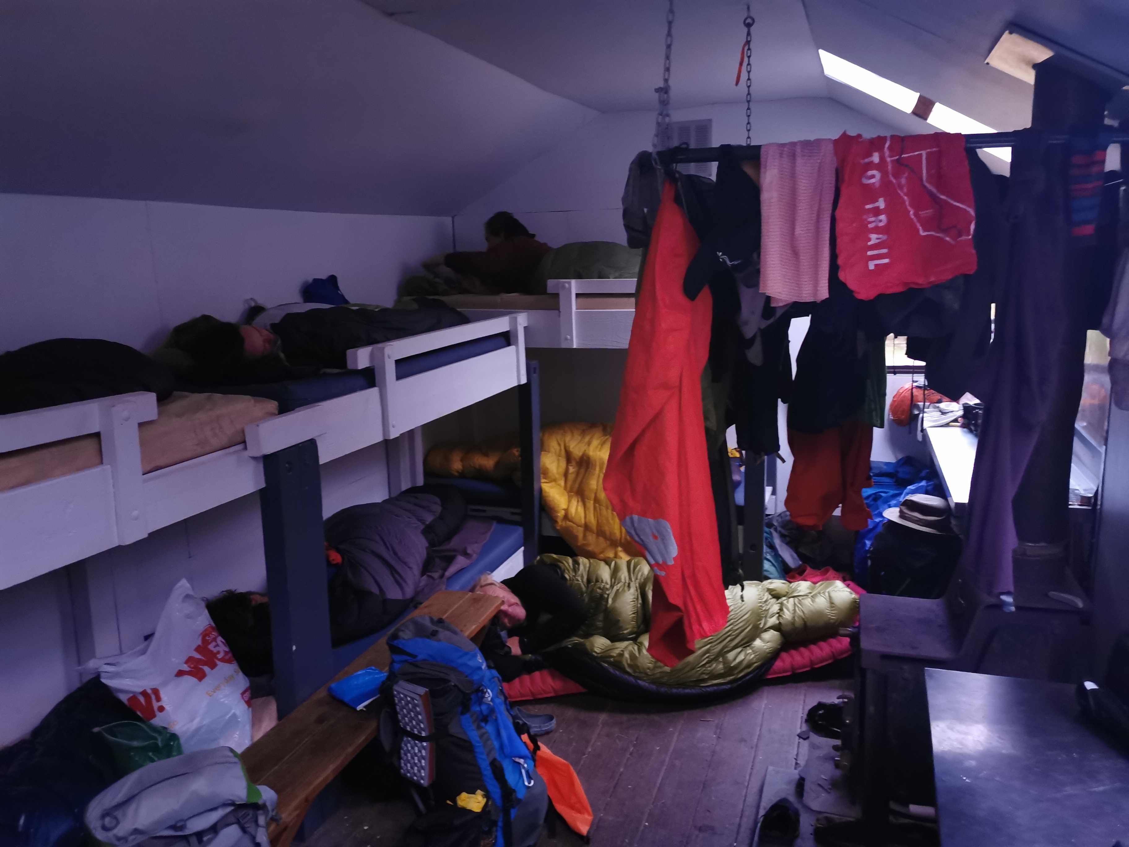
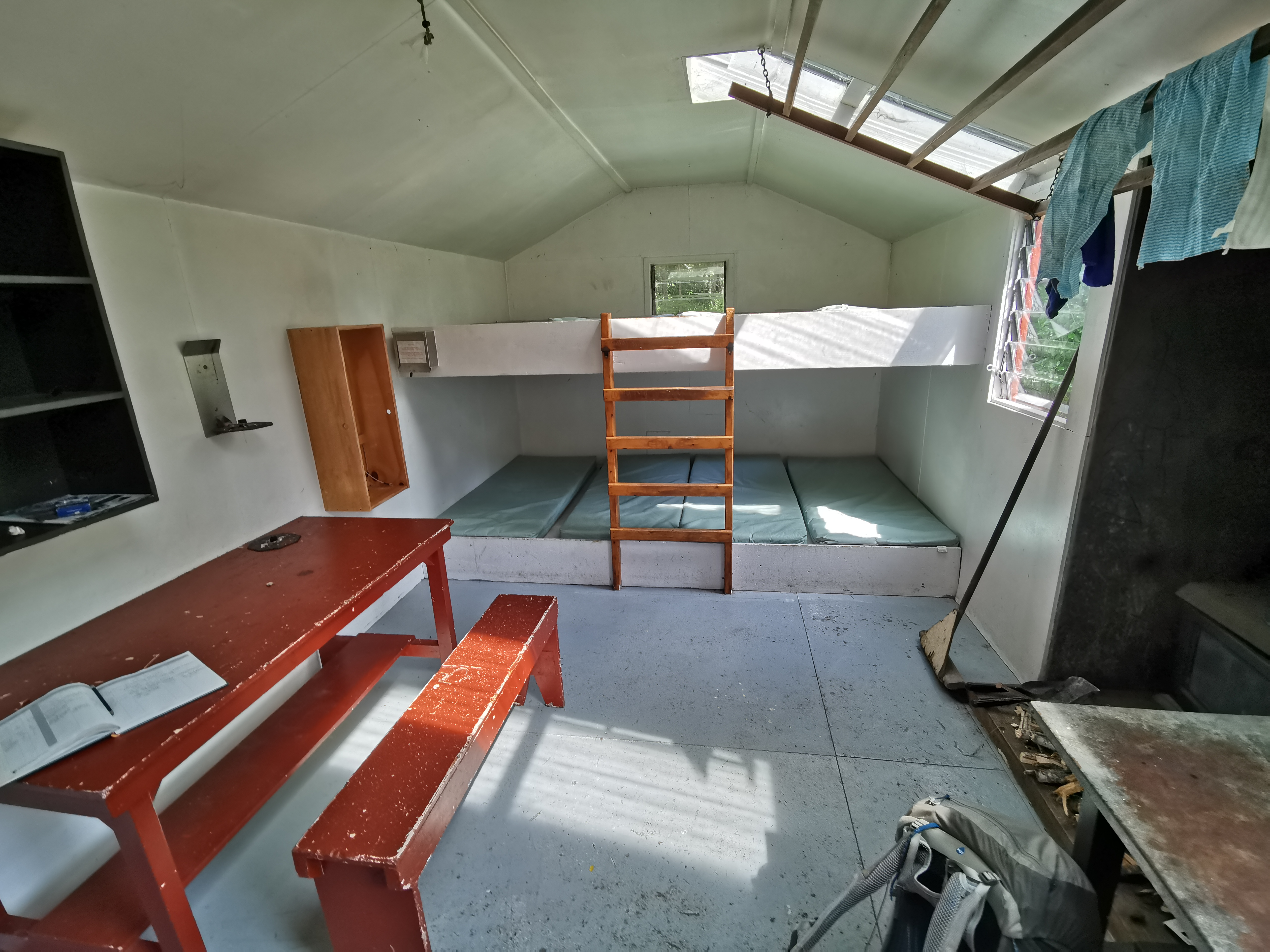
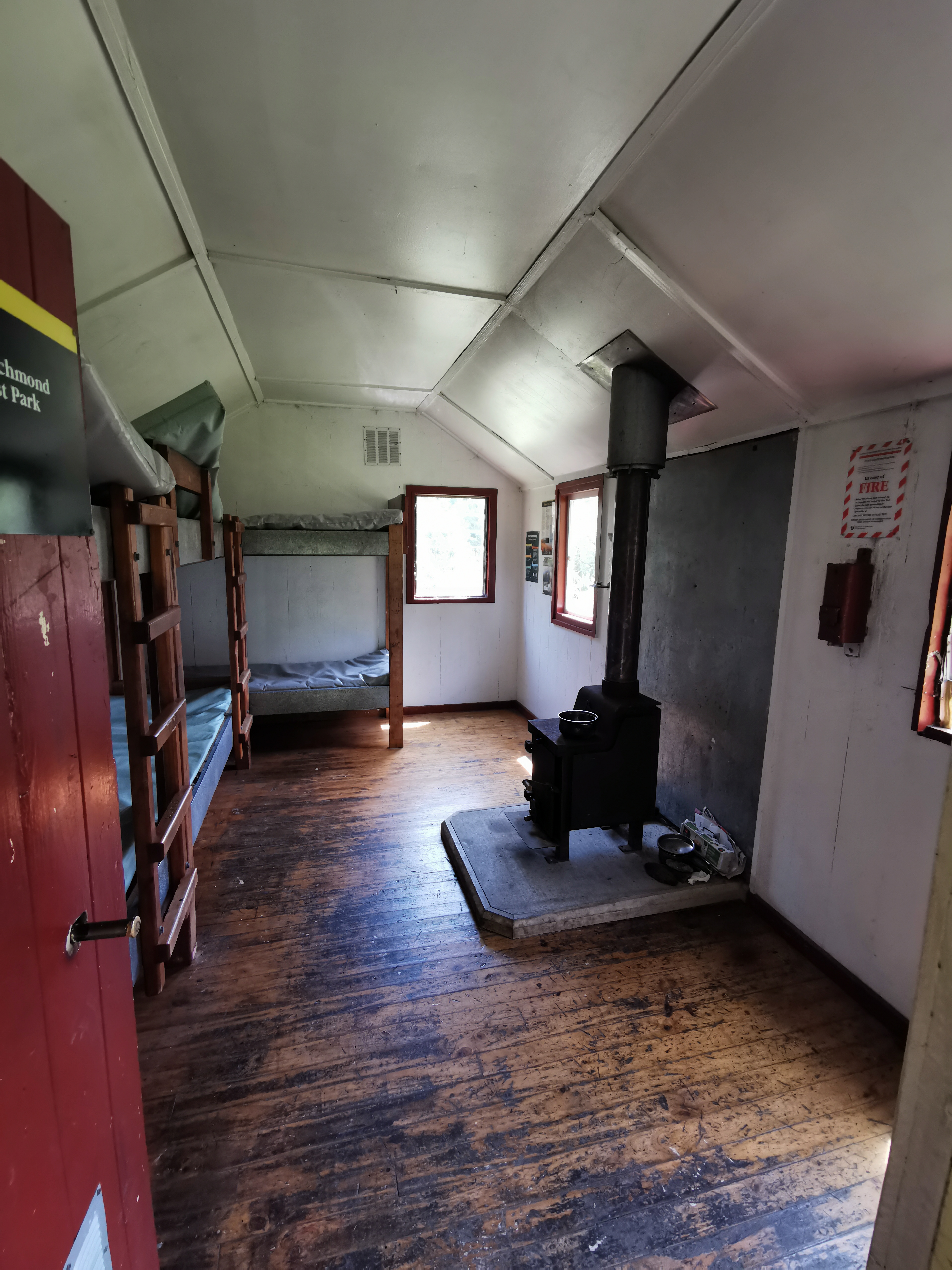
I discovered that my phone has a “wide angle” setting – very cool. I used it to take a picture inside the hut.
Photo of inside Captains Creek Hut taken with the wide angle setting
I took my time having breakfast and packing up. It wasn’t until nearly two hours later that I was ready to leave, at 10:35am. I noticed from the intentions book that Tina and Matthew from yesterday had come through this morning while I was asleep. I guess I would probably meet them again today if they went at their same slow speed.
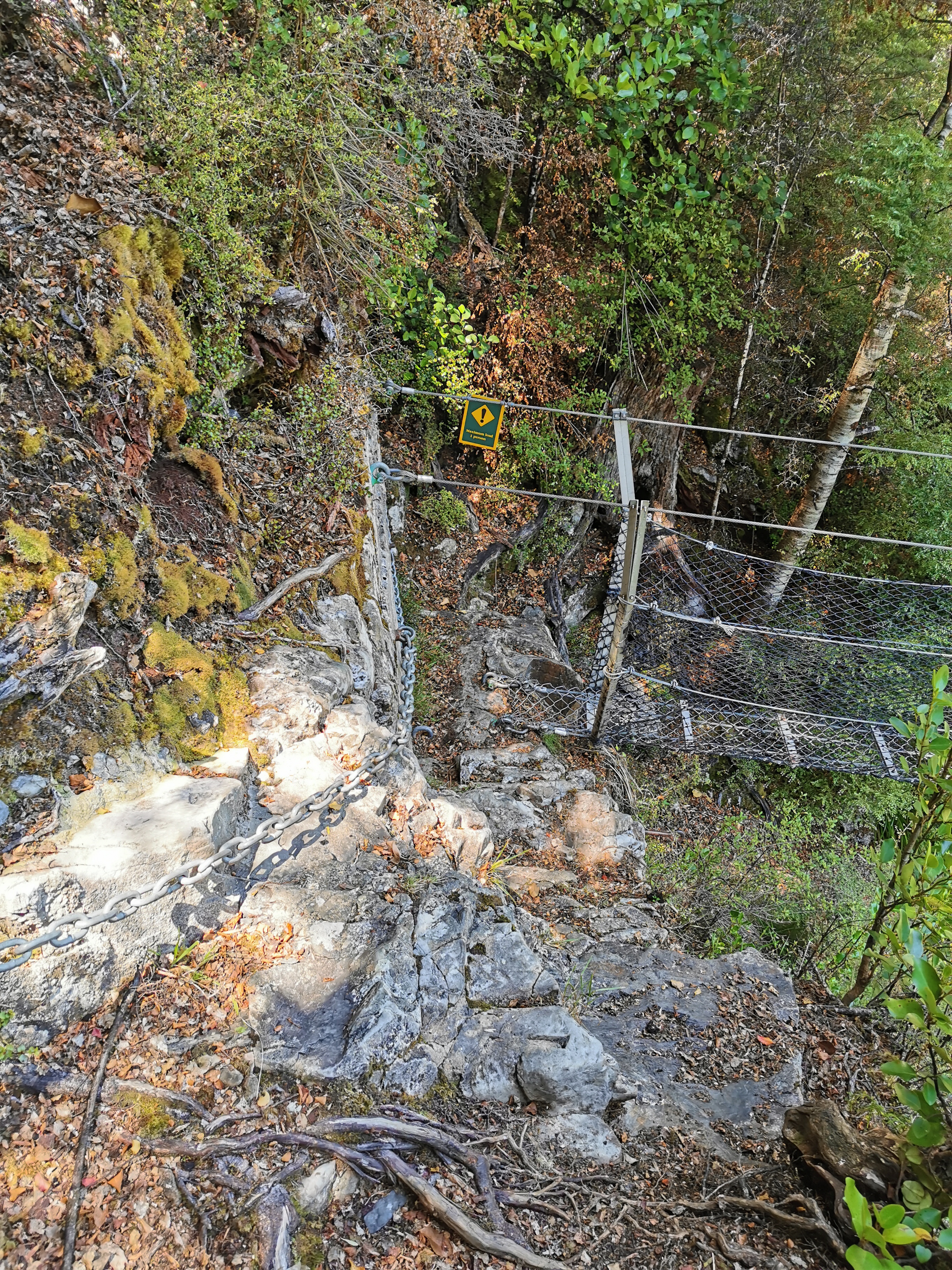
Just past the hut is another swing bridge. This was another scary swingbridge where you can see the river when you look down, and it wobbled a lot. Maximum 1 person as well!
Scary swingbridge #2
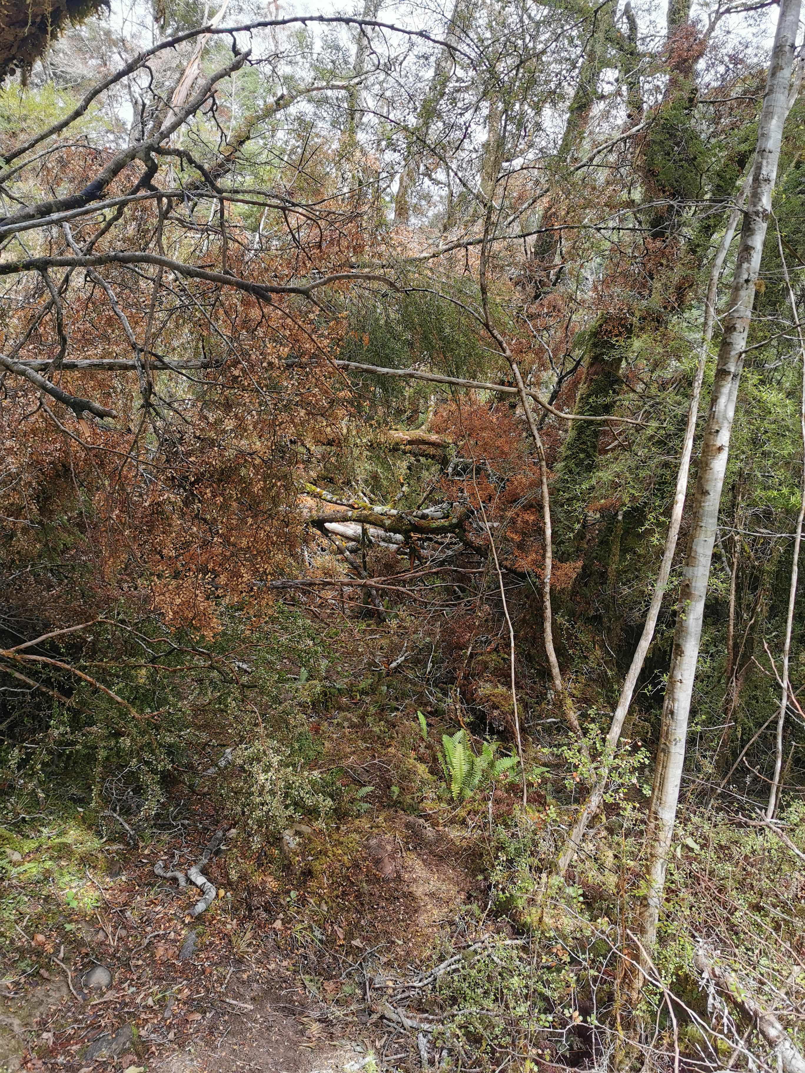
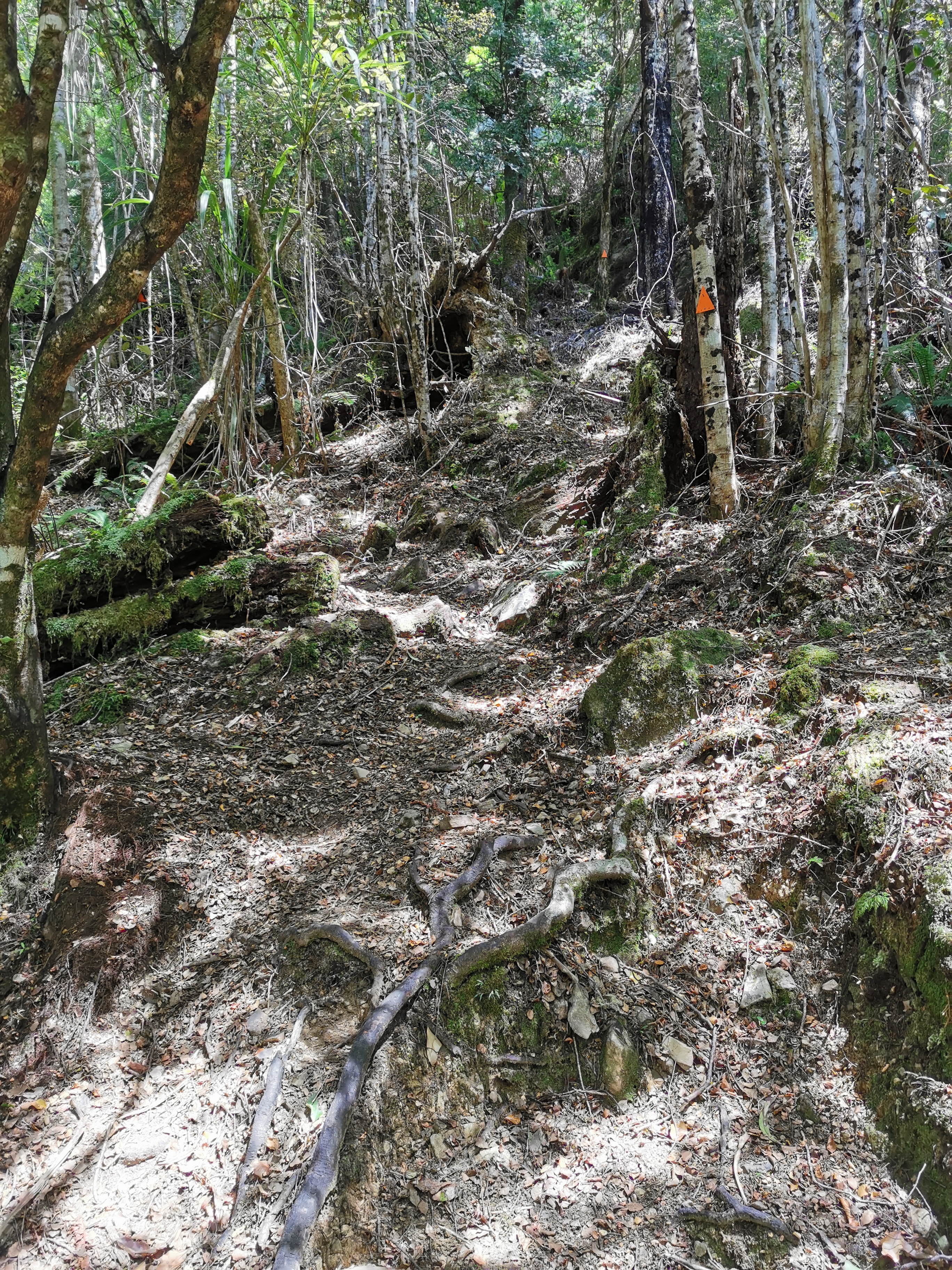
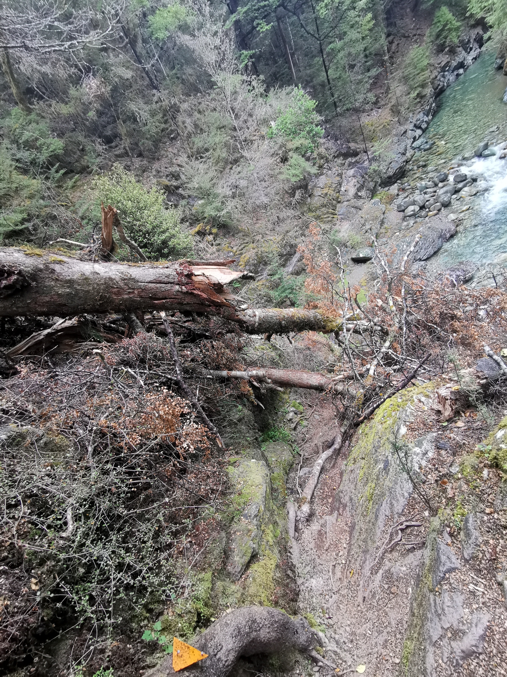
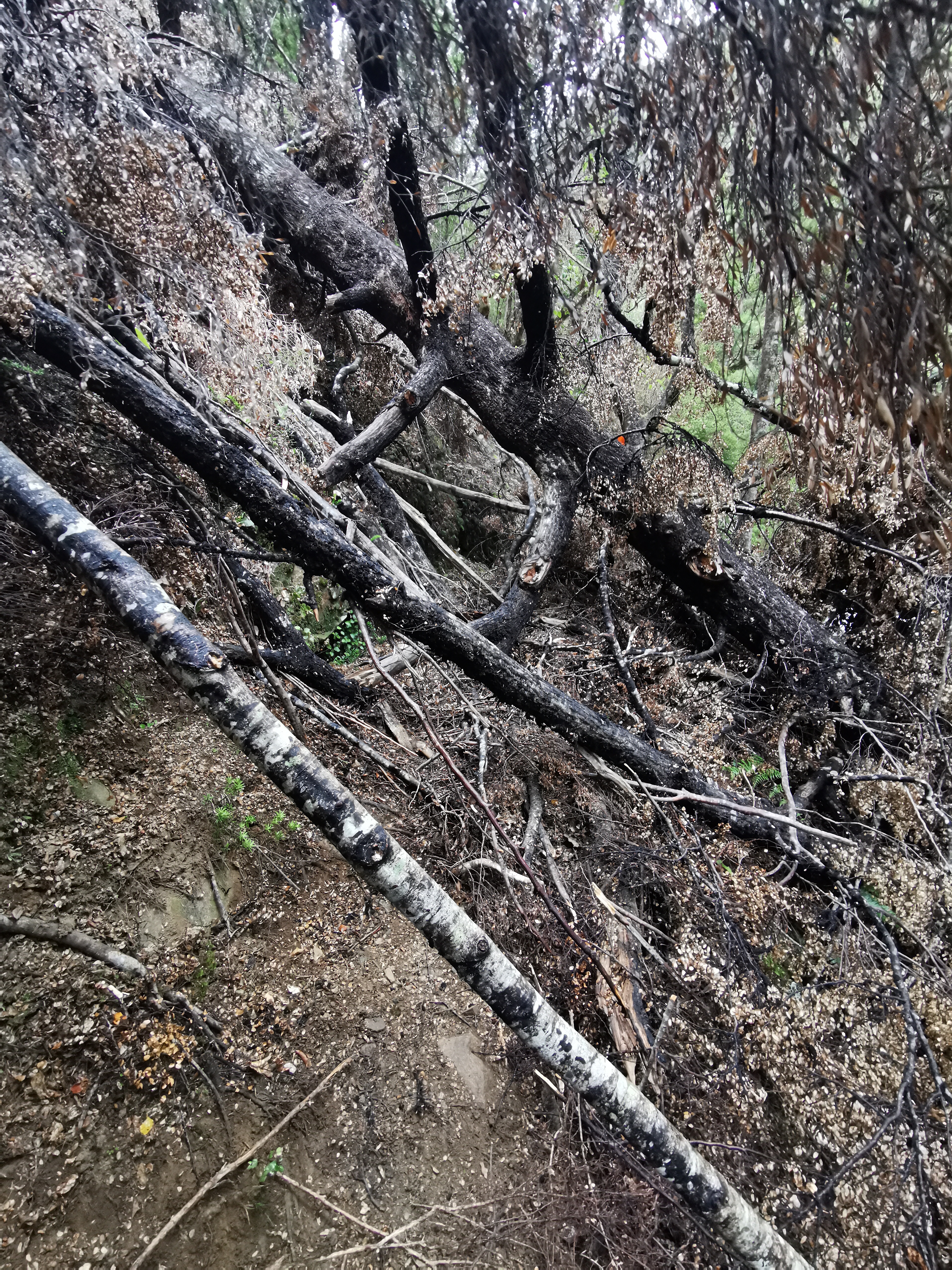
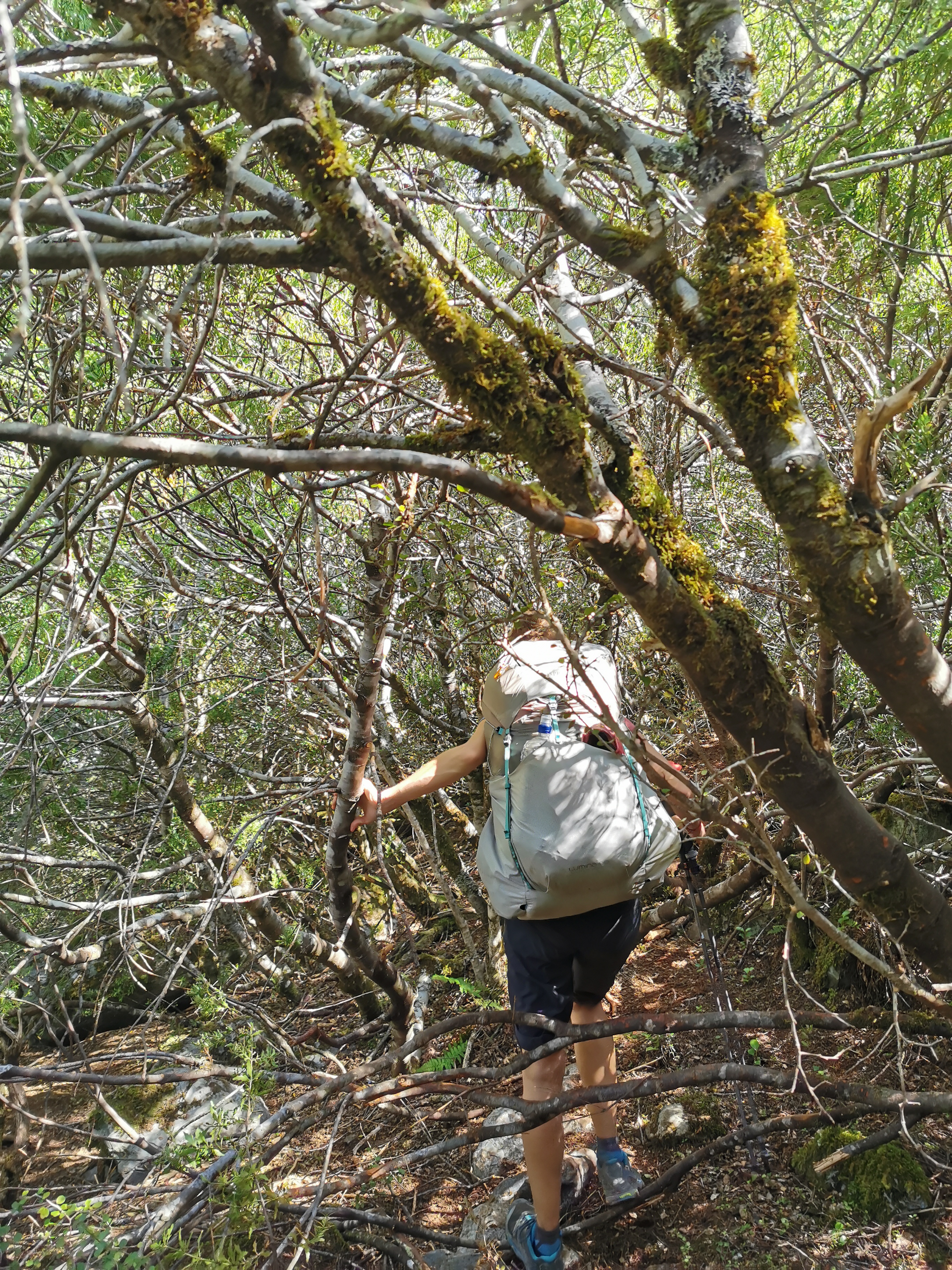
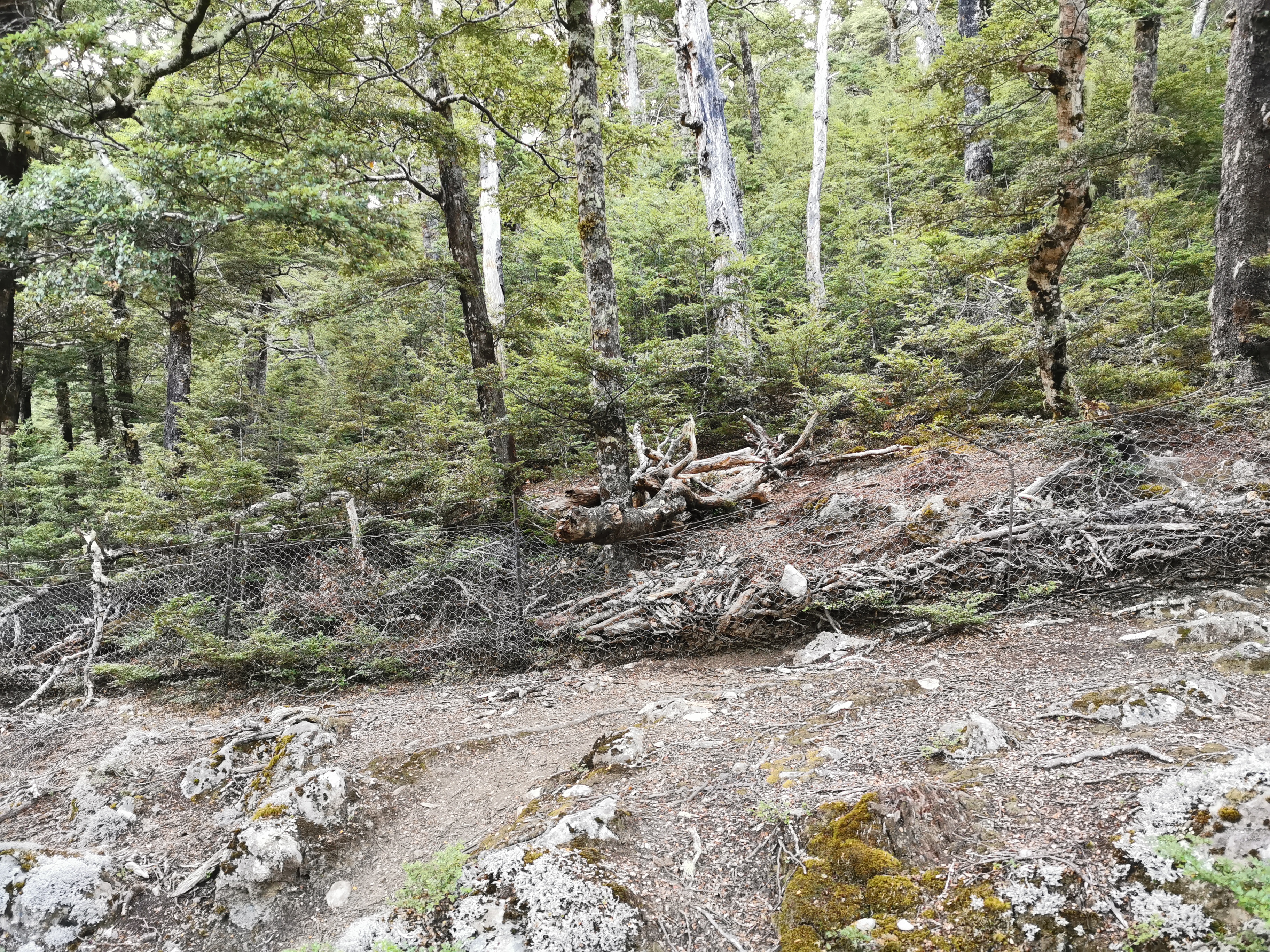
I remembered the 11am picture today. It was this particularly troublesome bit where trees were blocking the path and I genuinely couldn’t work out where to go.
11am picture – fallen trees
It took a fair bit of trying different paths before I found one that took me around the trees, as they were too big to climb over.
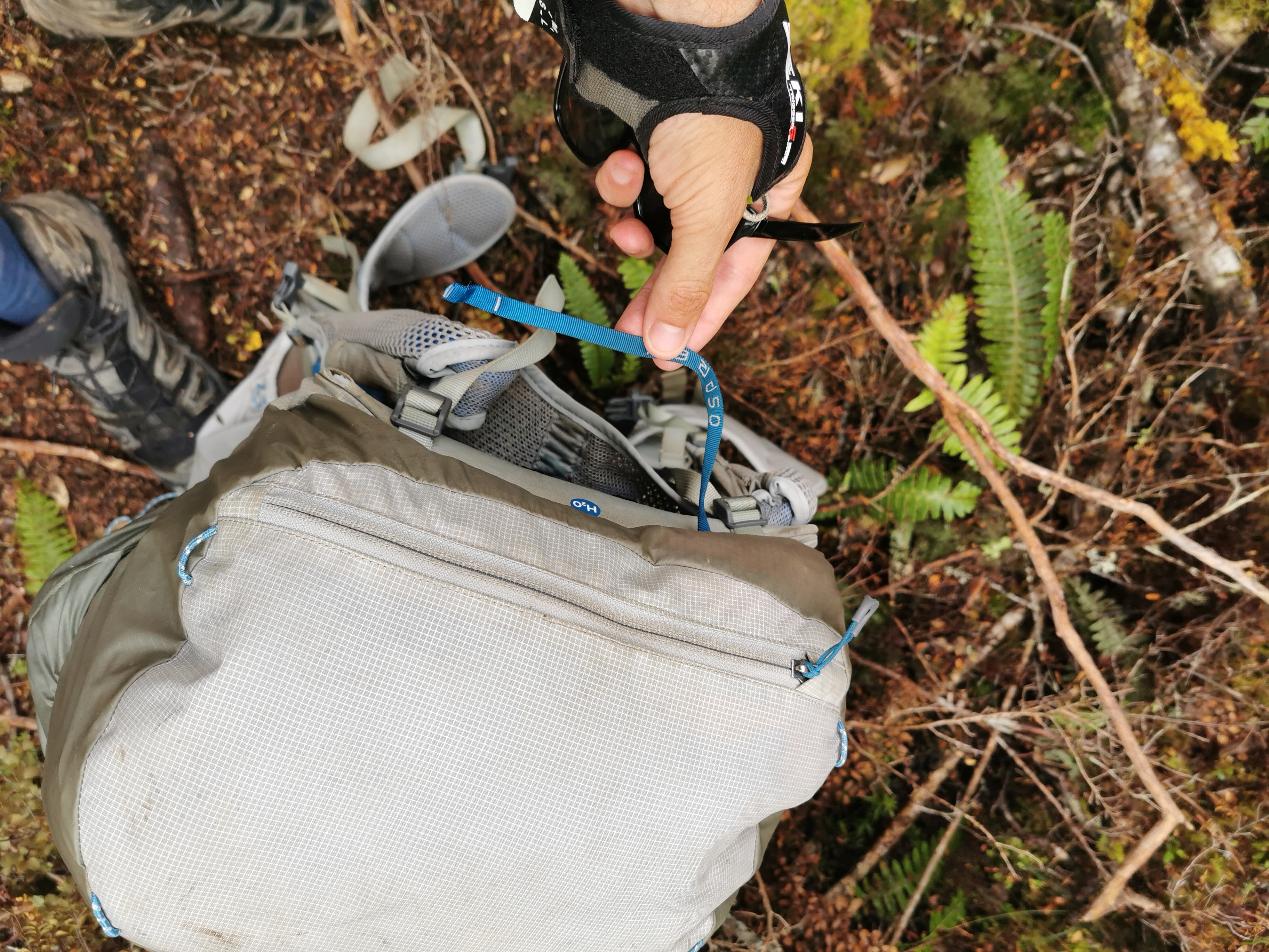
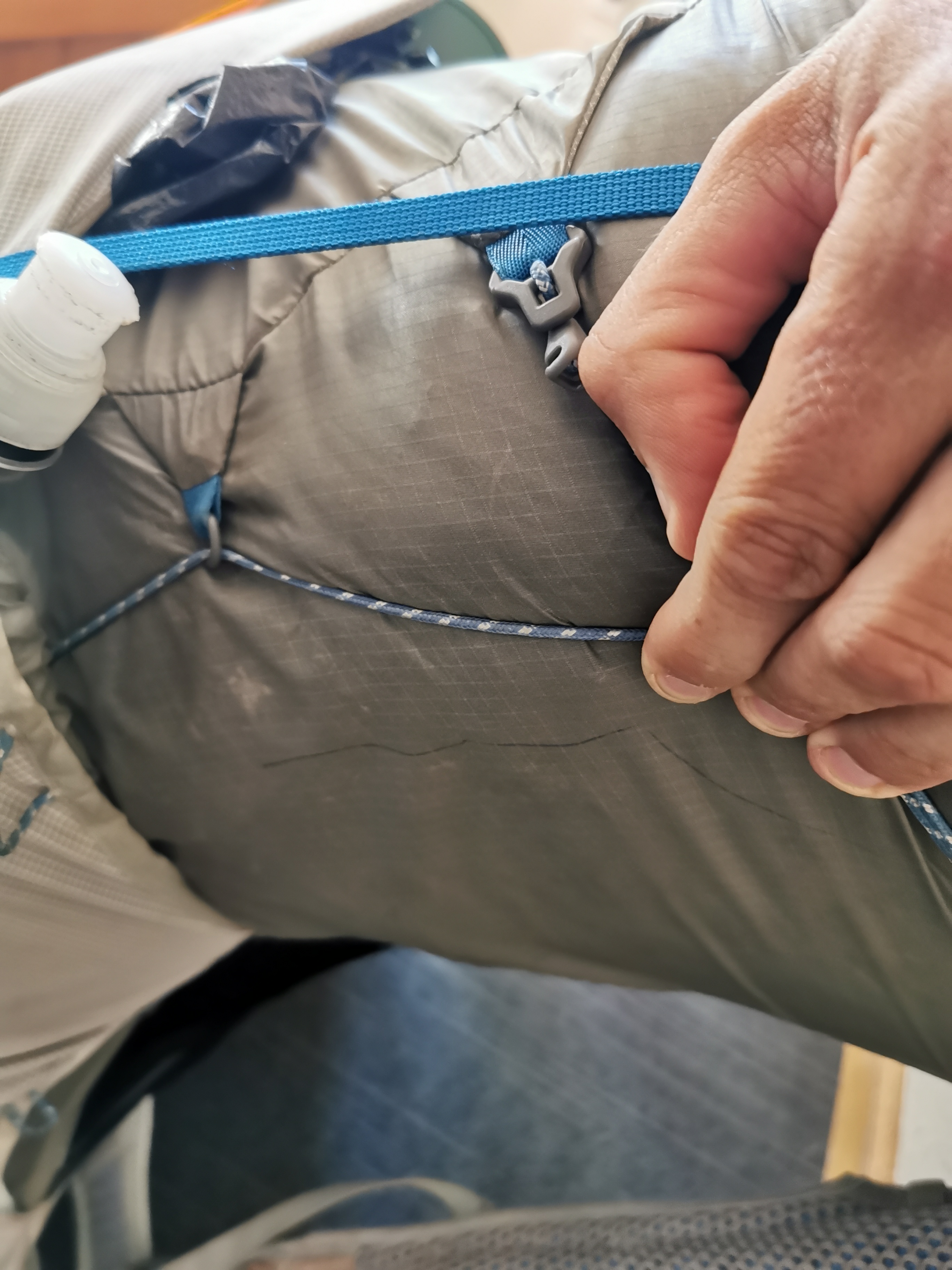
This was also the point where the little strap at the top of my pack broke off. This doesn’t affect the pack while it’s on my back but it is the strap I used to carry it around when it wasn’t on my pack. It’s annoying that it has broken. Now I have to carry it by the big straps which makes it fall to one side when I lift it.
Aargh
At least the pack can still be carried on my back just fine. What if one of the main two straps breaks? I’ll be screwed then!
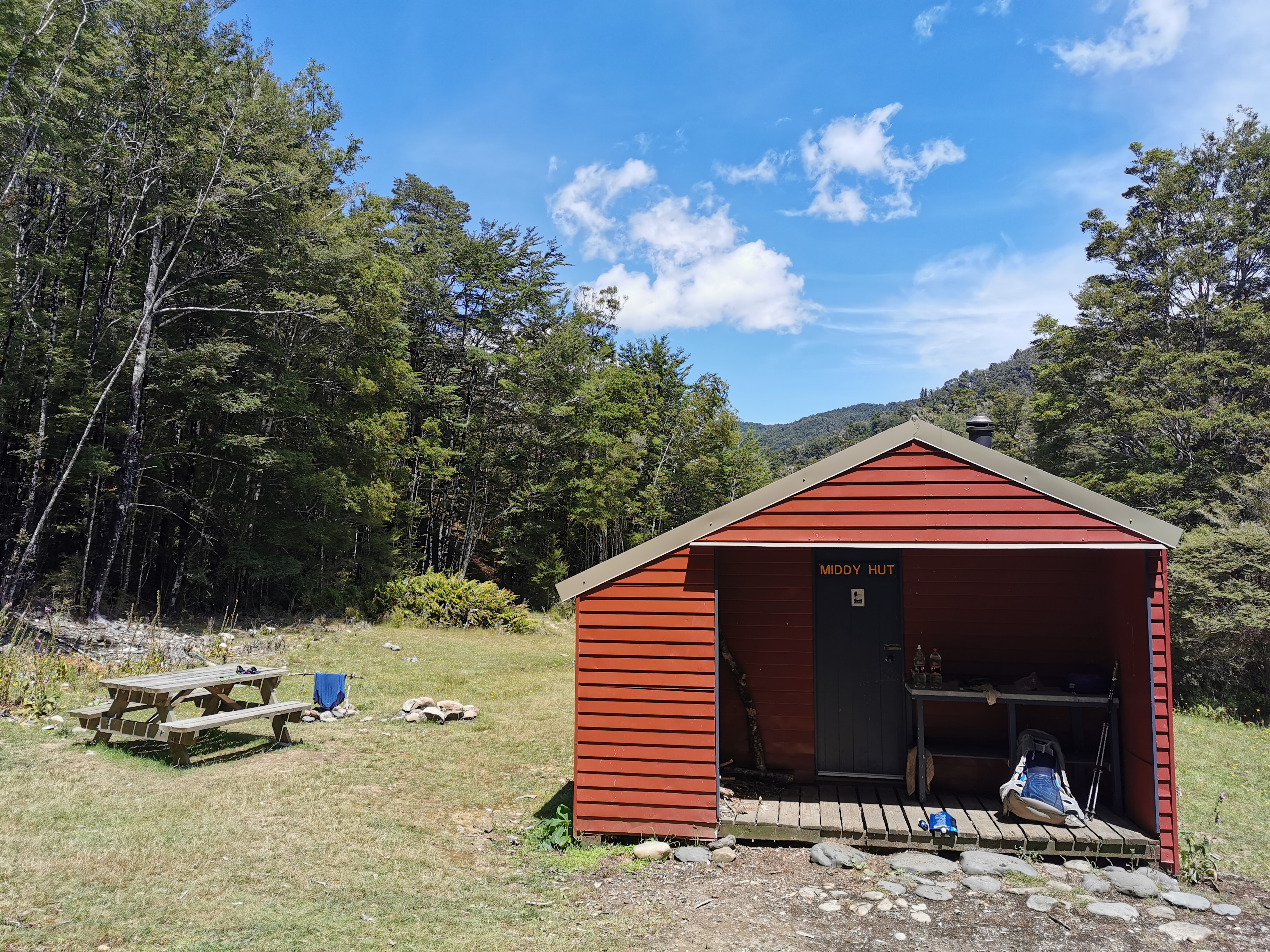
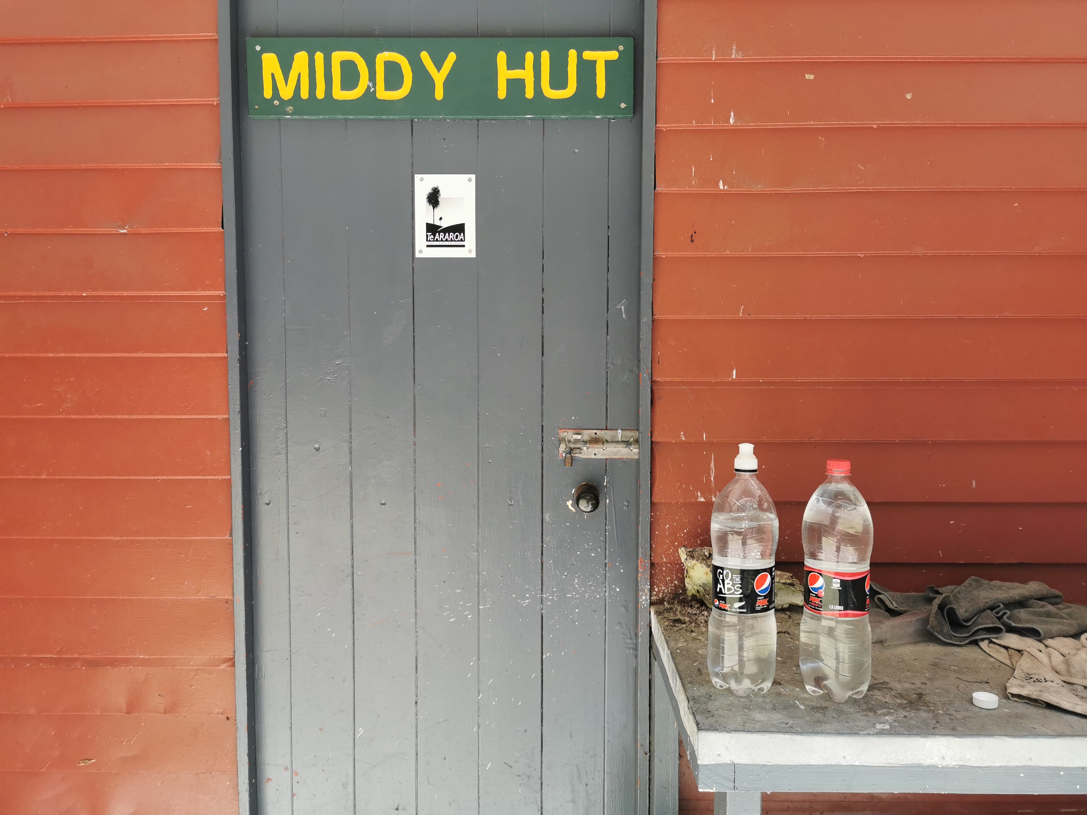
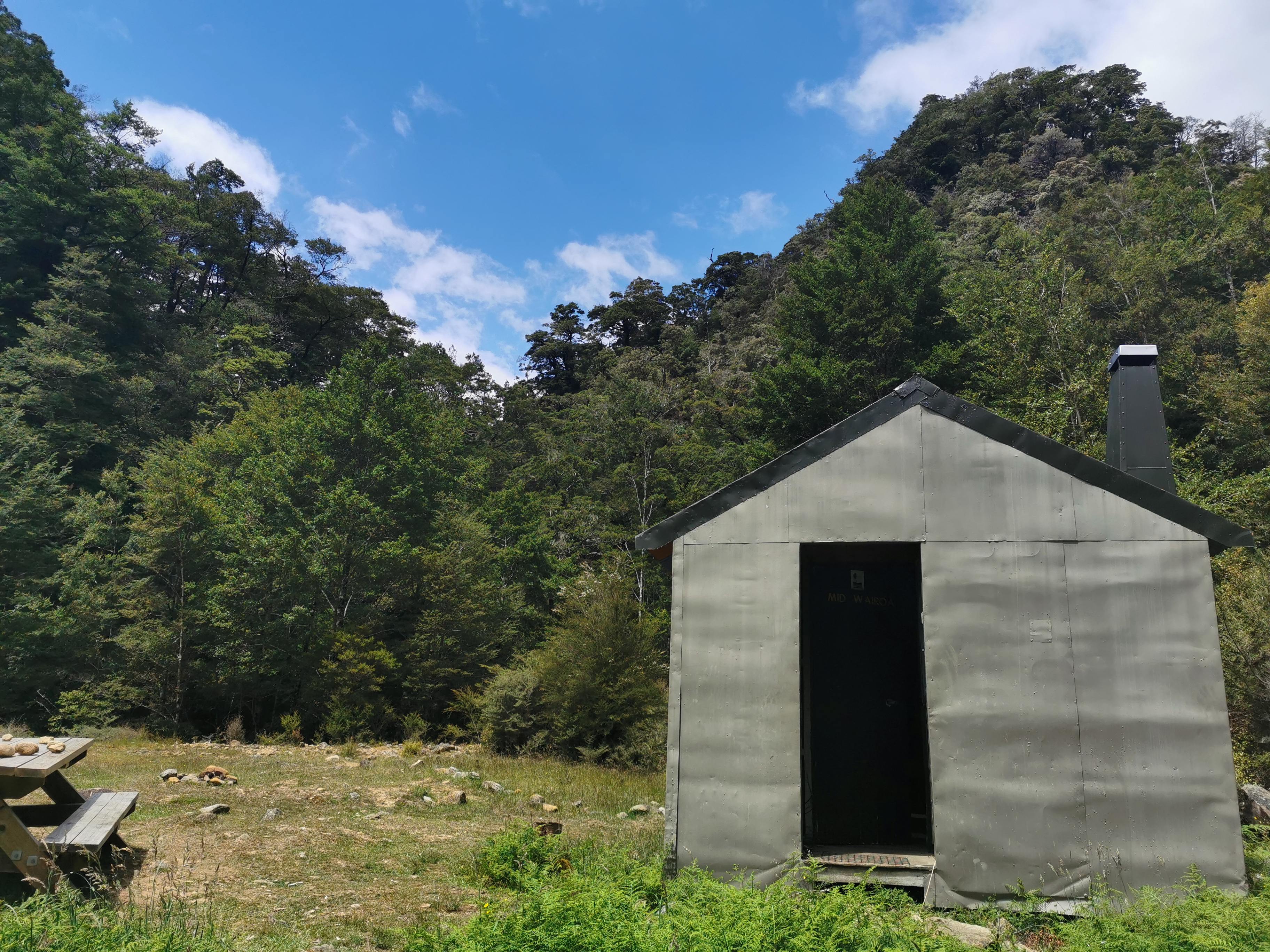
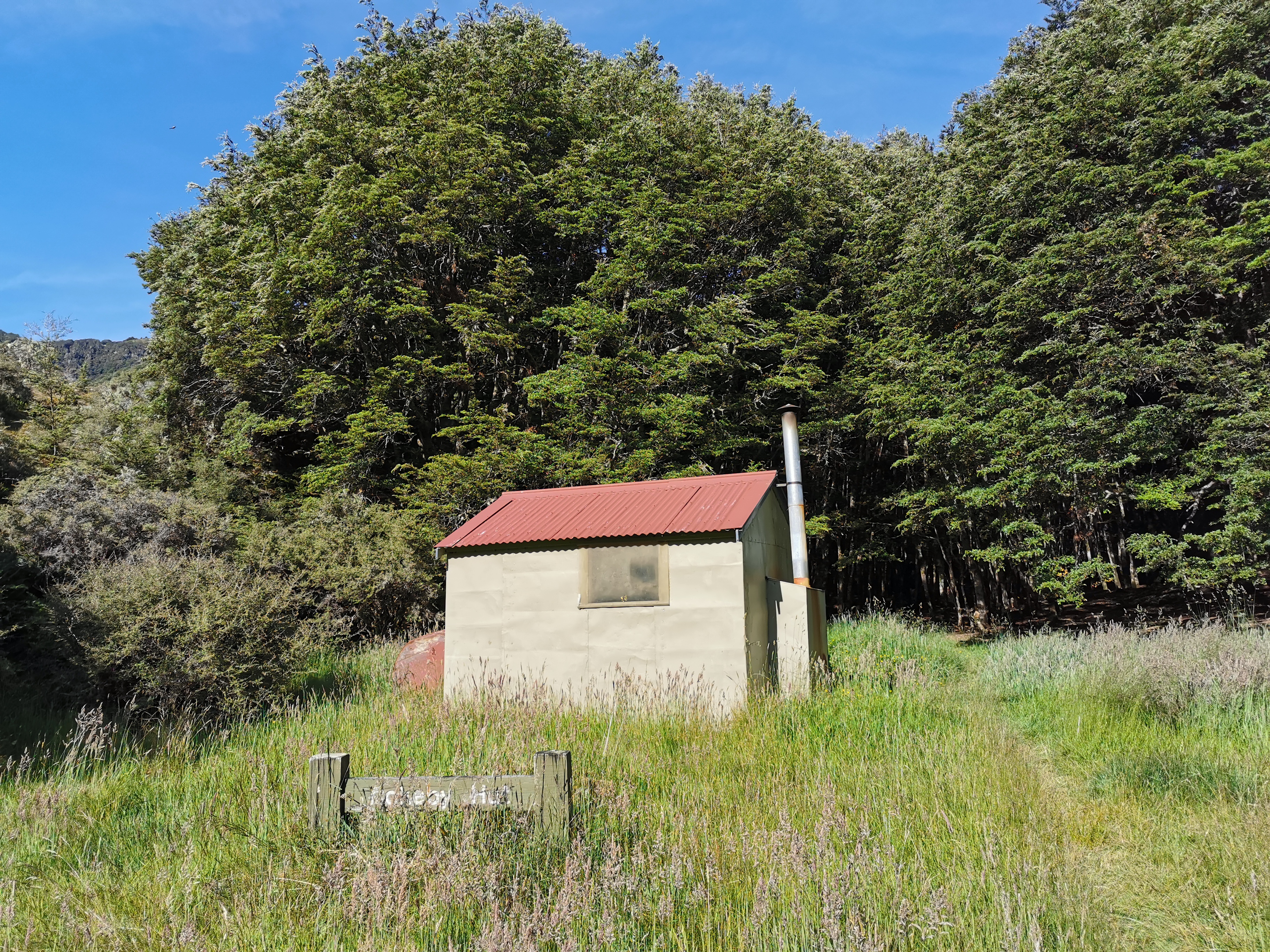
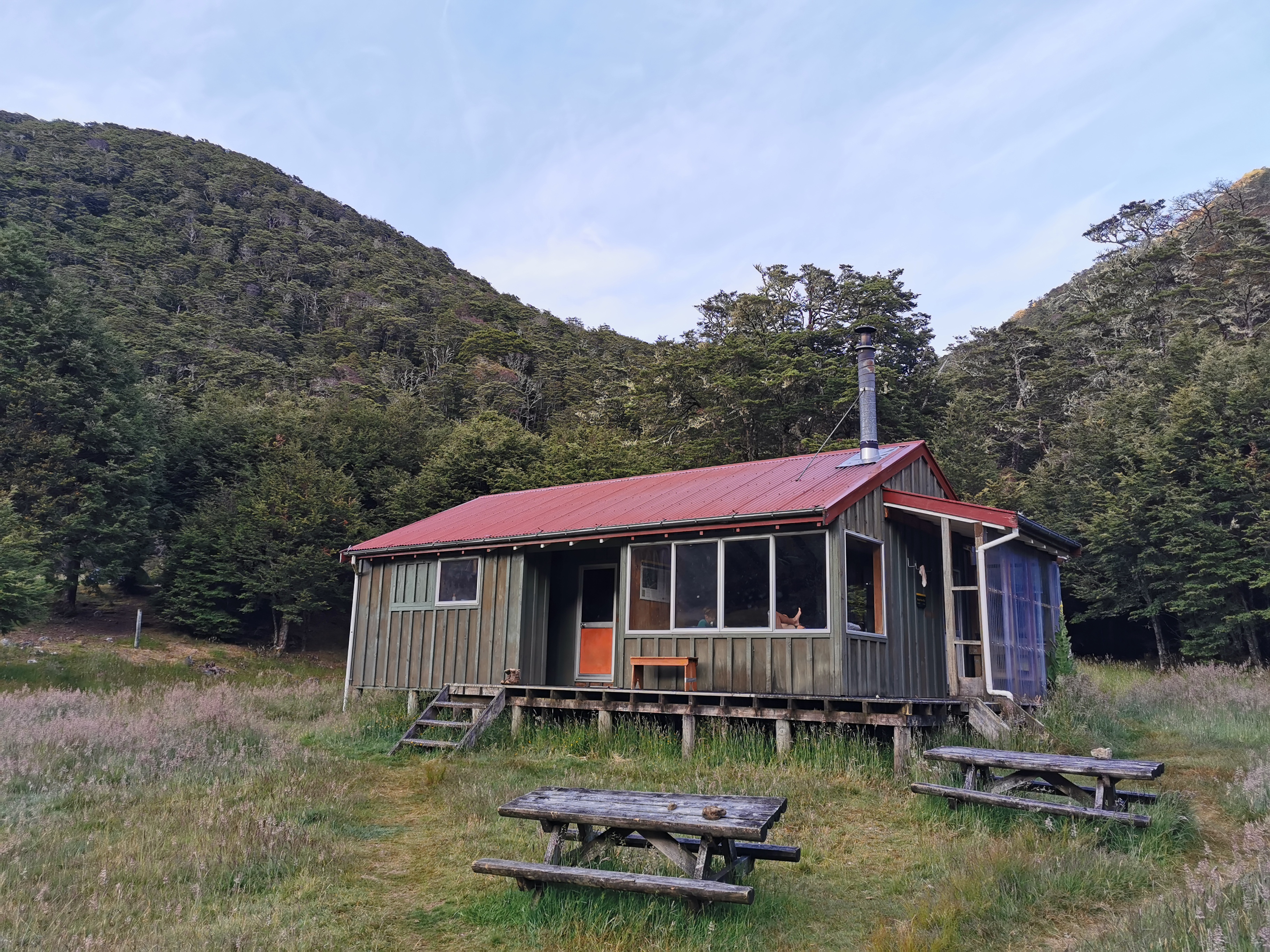
The first hut today is Middy Hut.
Middy Hut outside
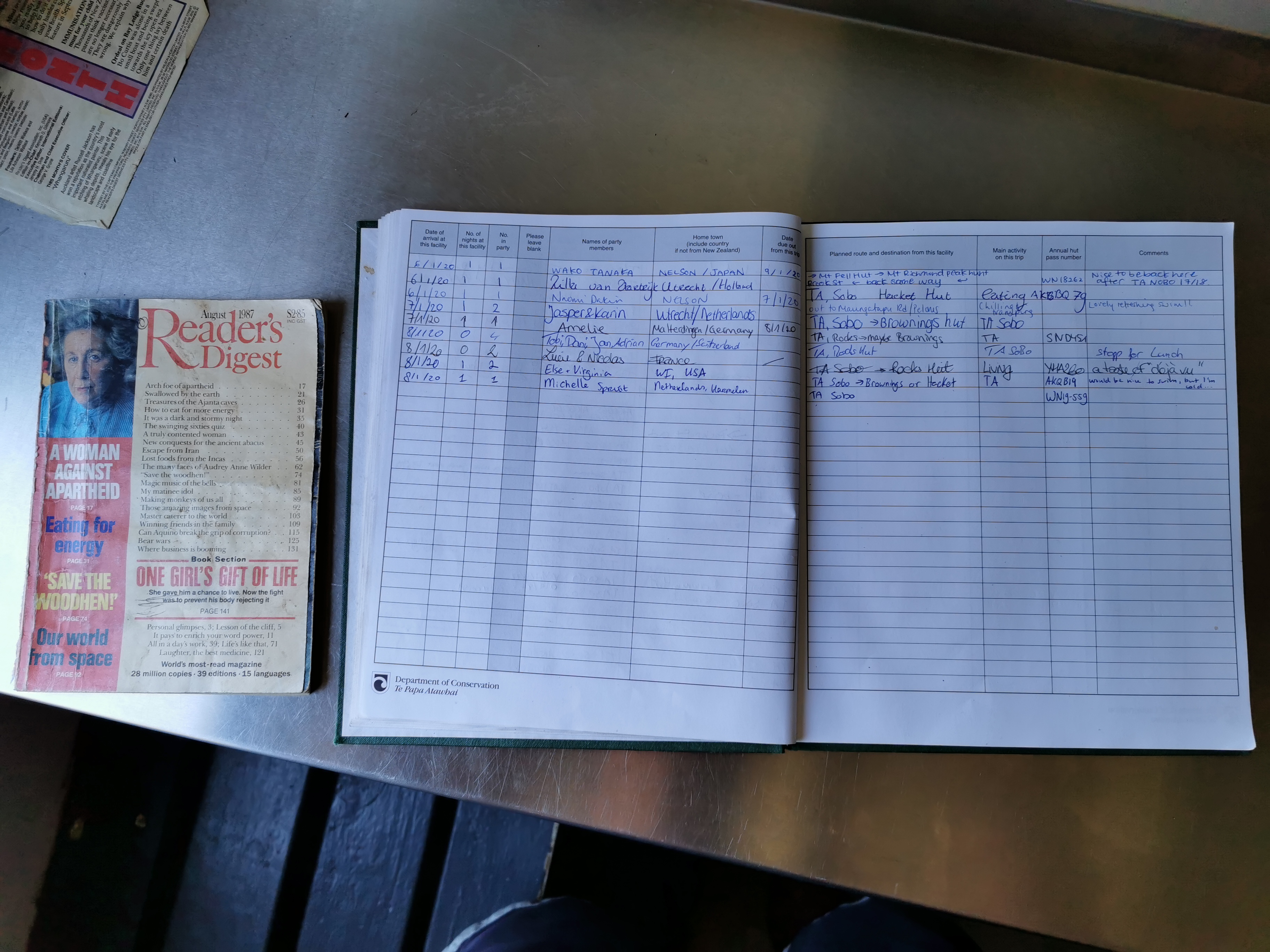
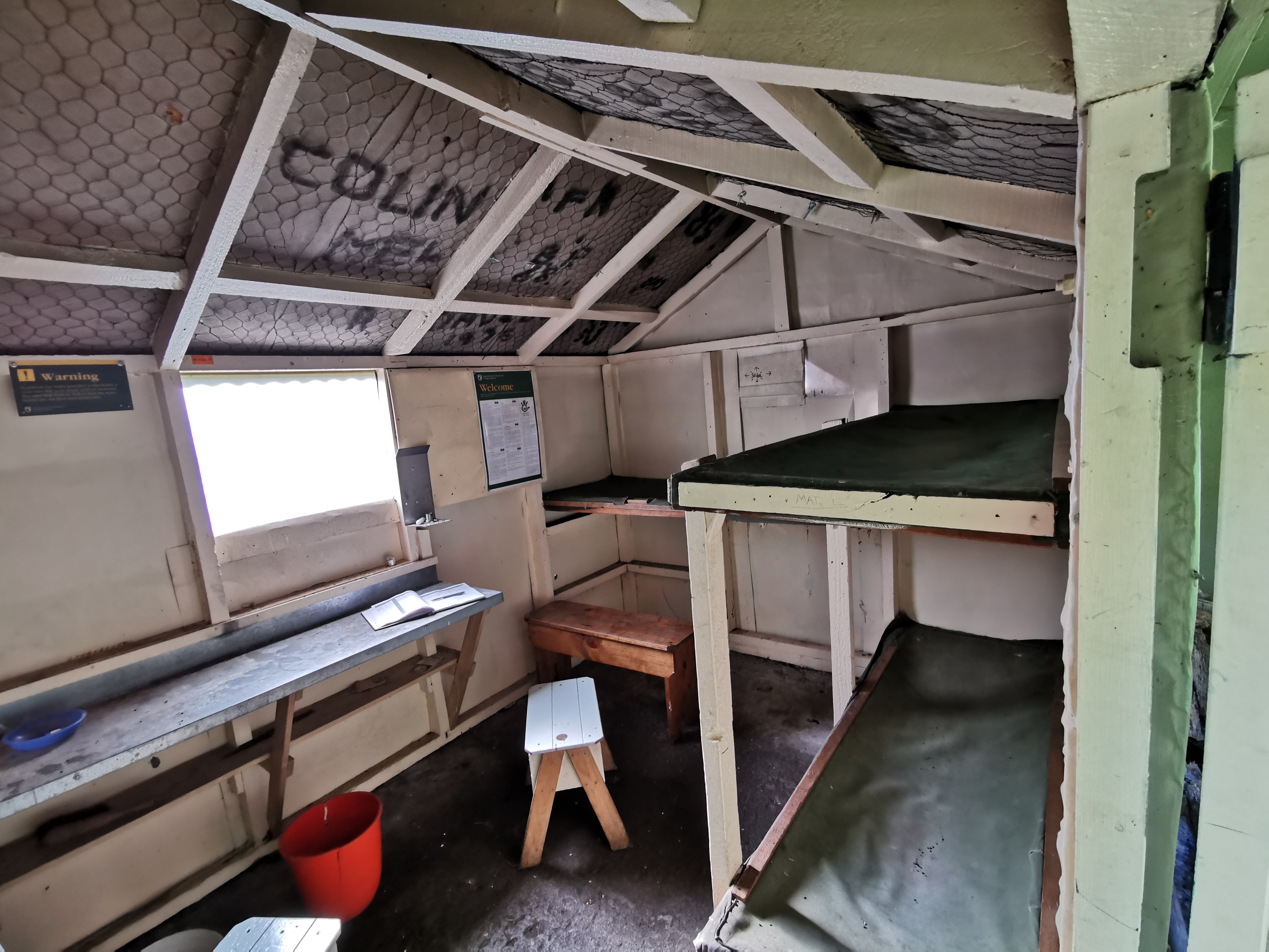
Inside it is an exact replica of Captains Creek Hut from last night – with one important difference.
A 1987 copy of Readers Digest as well as the intentions book
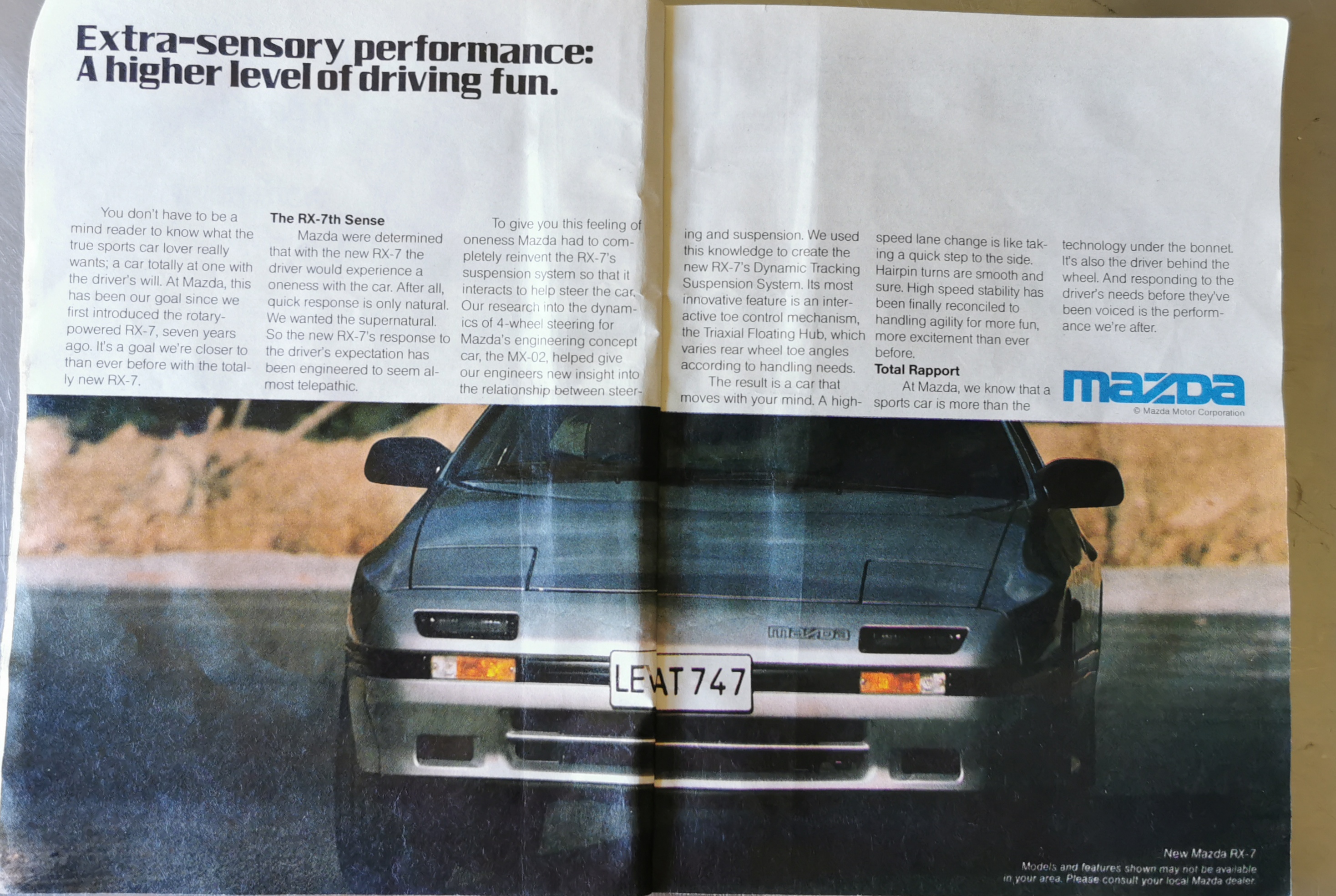
This hut has a copy of the magazine “Reader’s Digest” from 1987. Talk about nostalgia. And inside was this ad, which made me really smile.
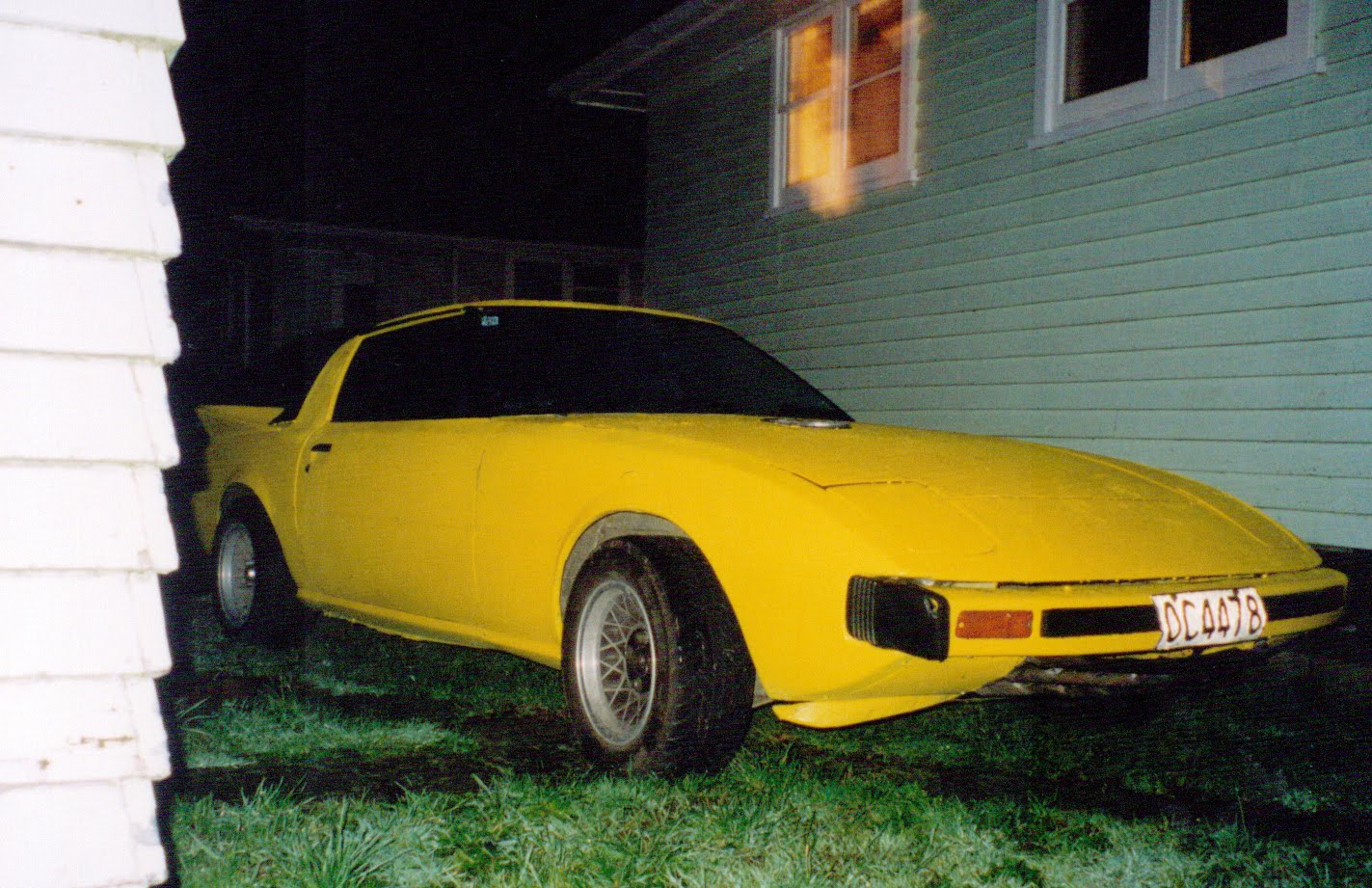
An ad for the new Mazda RX7. I am known for having ridiculous cars, and when I was 20 I had two of the very first RX7s – the “series 1”, which explains why my username on geocaching.com and other Internet sites is nzseries1. Here’s the first one I had…
Photo taken in 2000
It was a particularly troublesome car and when it blew up soon after I got it, I replaced it with this one, which was much more reliable and I had it for three years:
Photo from 2003 – my second RX7, being loaded onto the car transportation to be taken to the people who bought it off me who lived in the South Island.
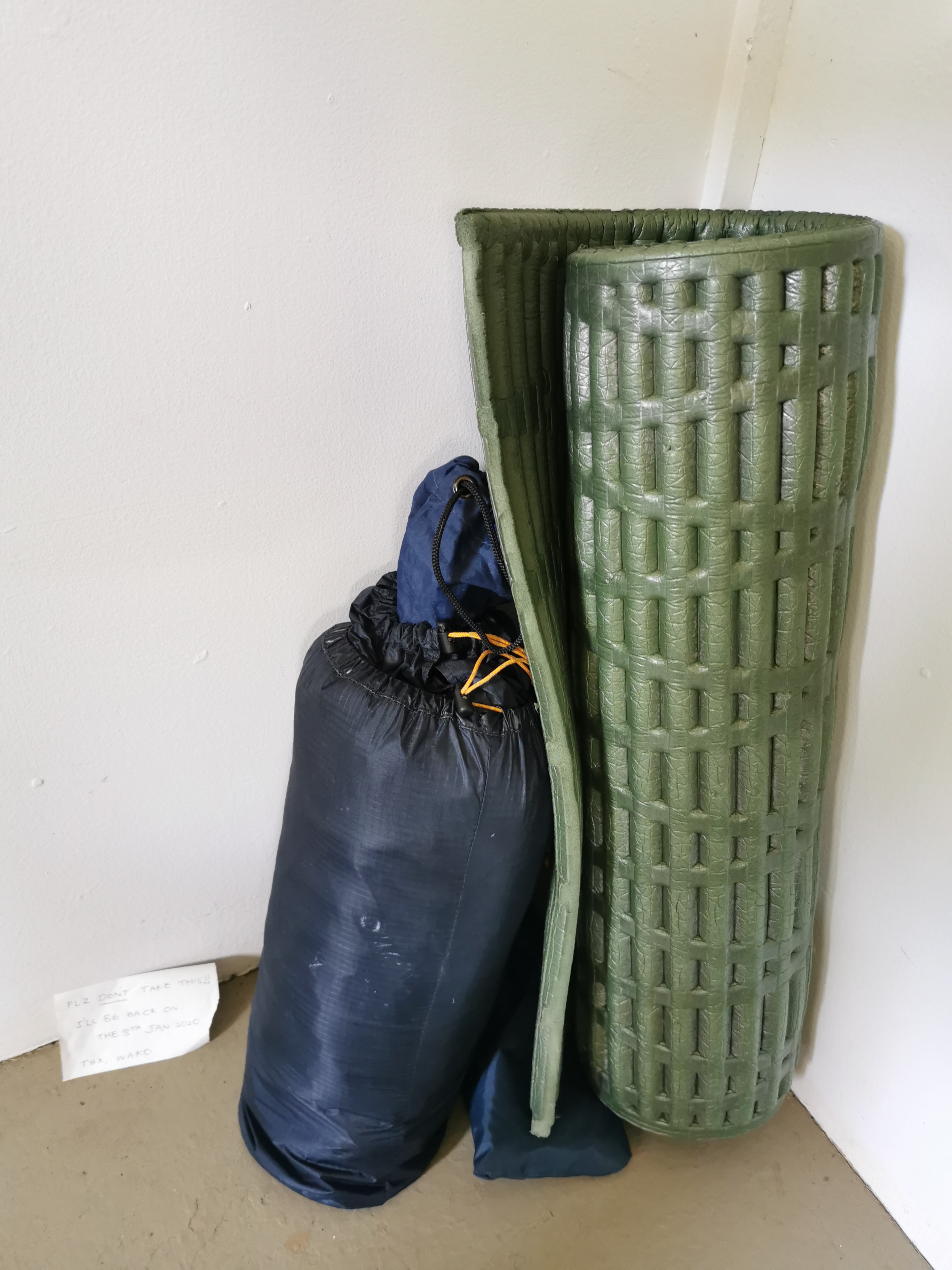
There was nobody else at Middy Hut, although someone had been there because they left this sleeping bag and mat there, along with a note.
“Plz don’t take this! I’ll be back on the 8th of January 2020. Thx, Wako” – given that it is now the 9th of January, Wako is late!
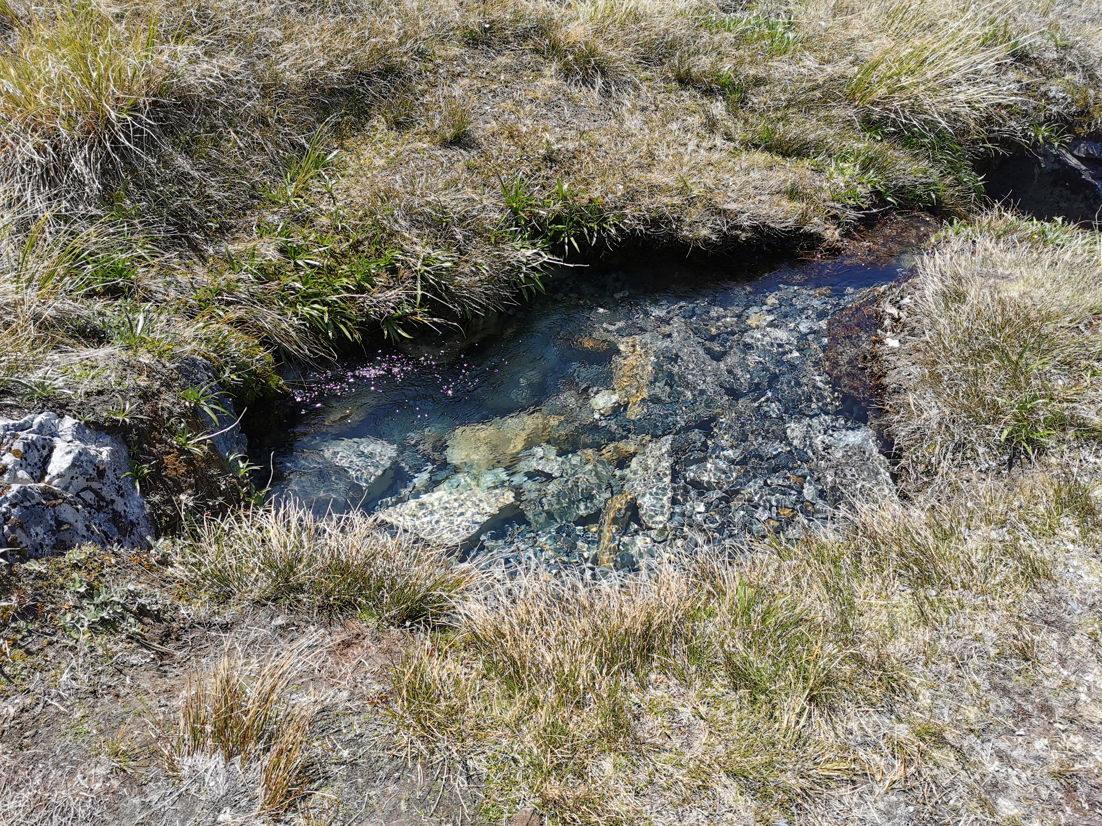
I took the time to fill up my two brand new water bottles that I got during the Christmas break. It’s nice to have new water bottles that don’t have all the crud that builds up in plastic bottles over time.
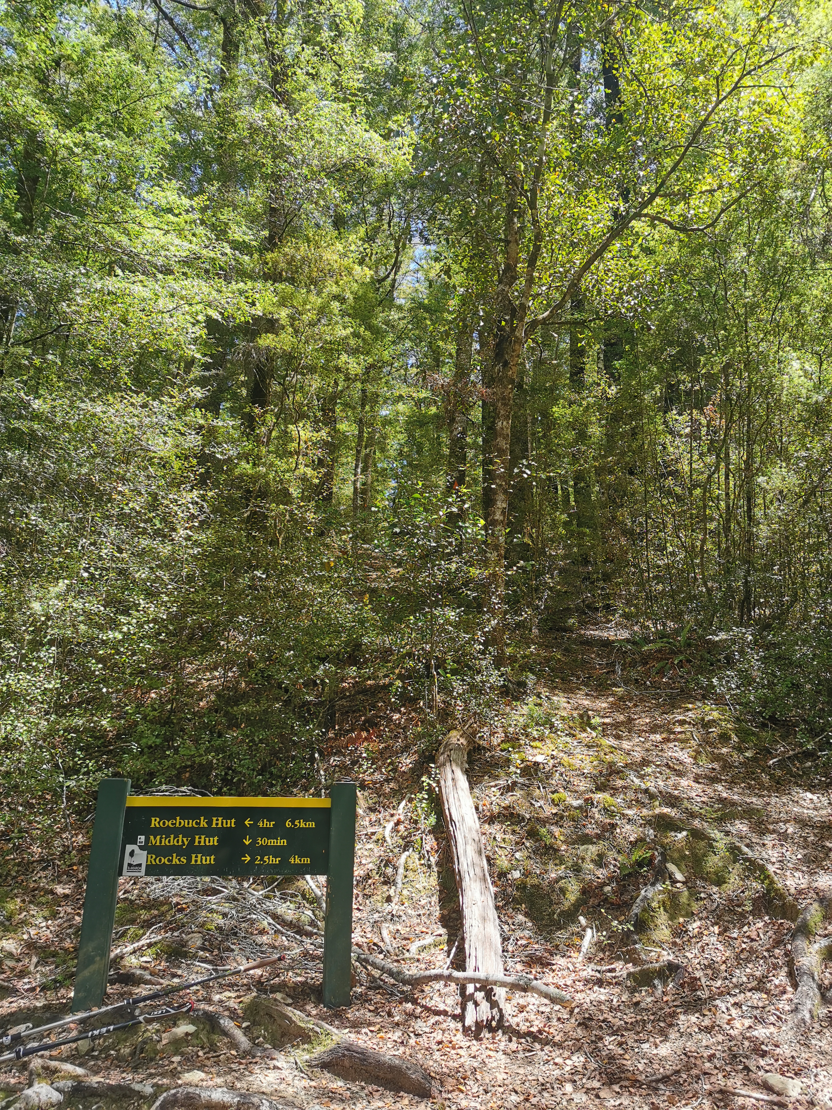
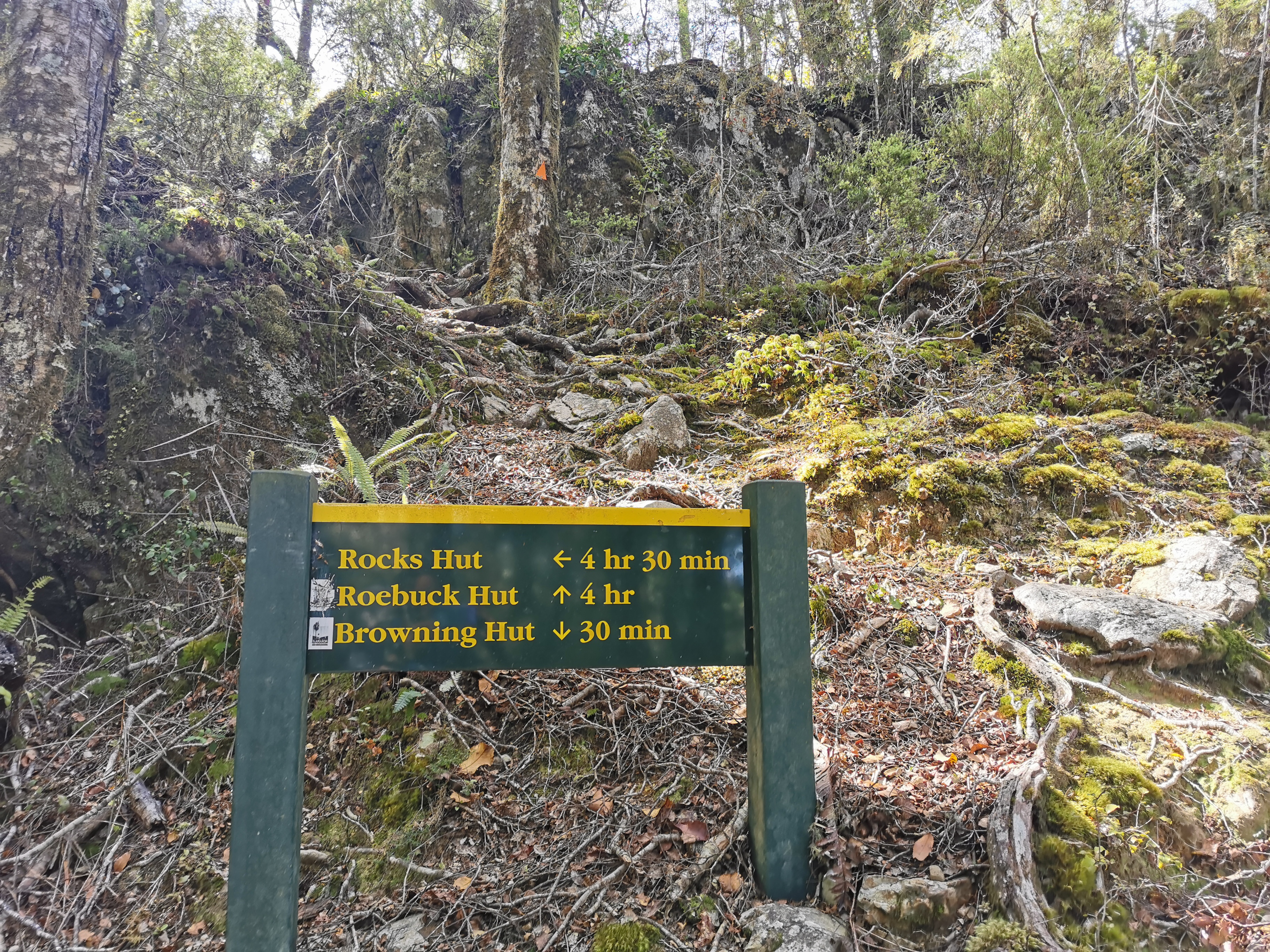
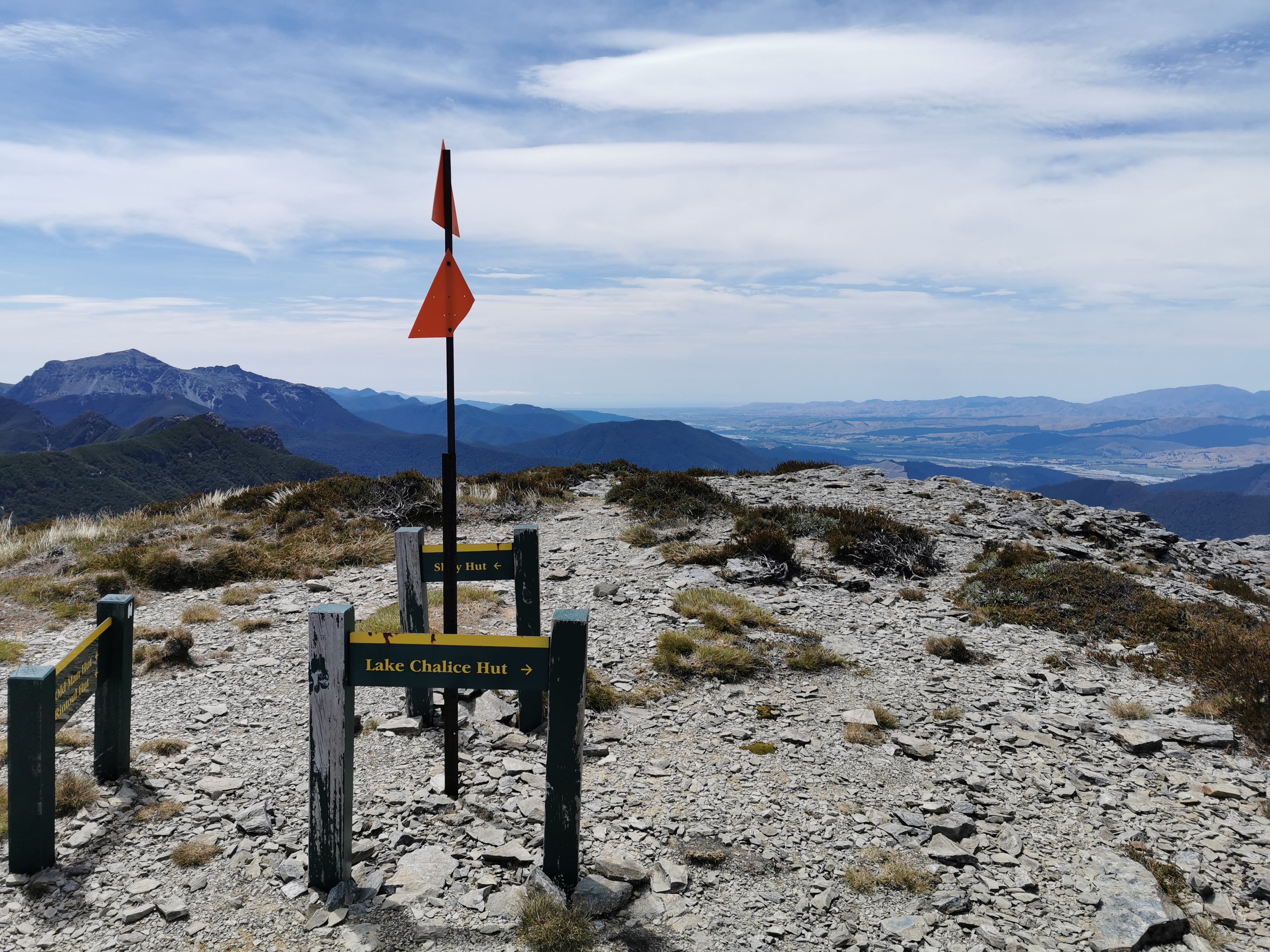
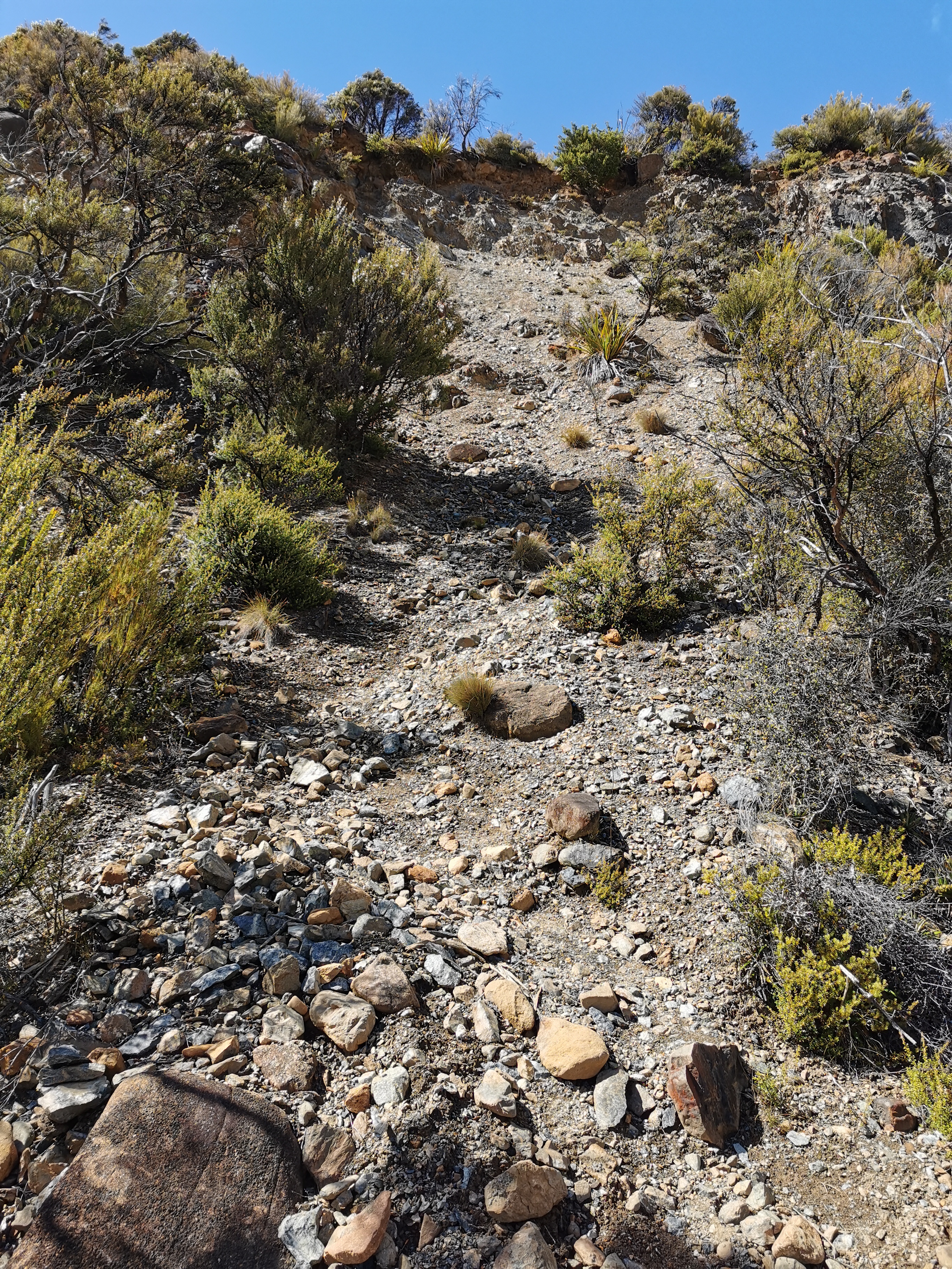
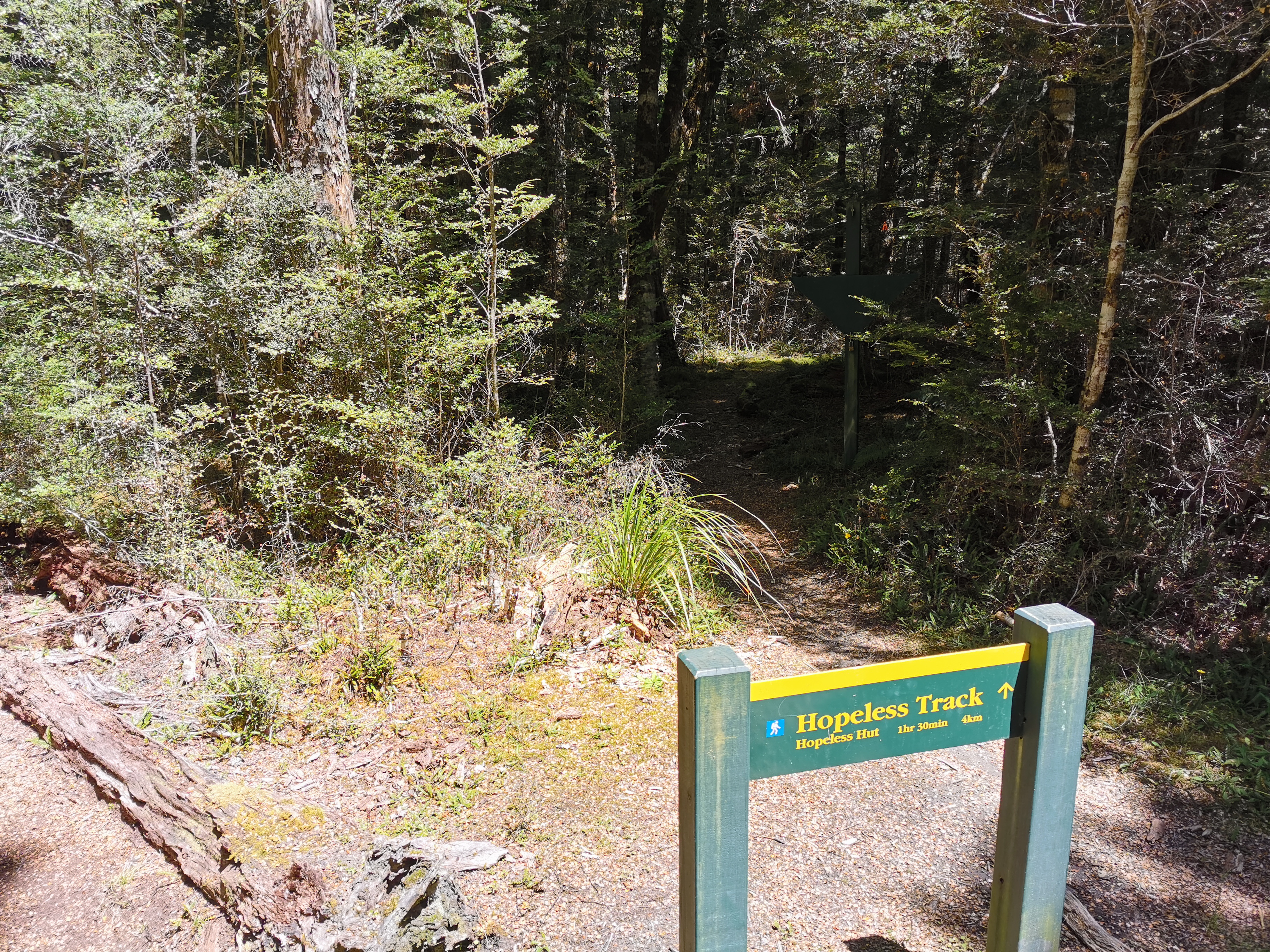
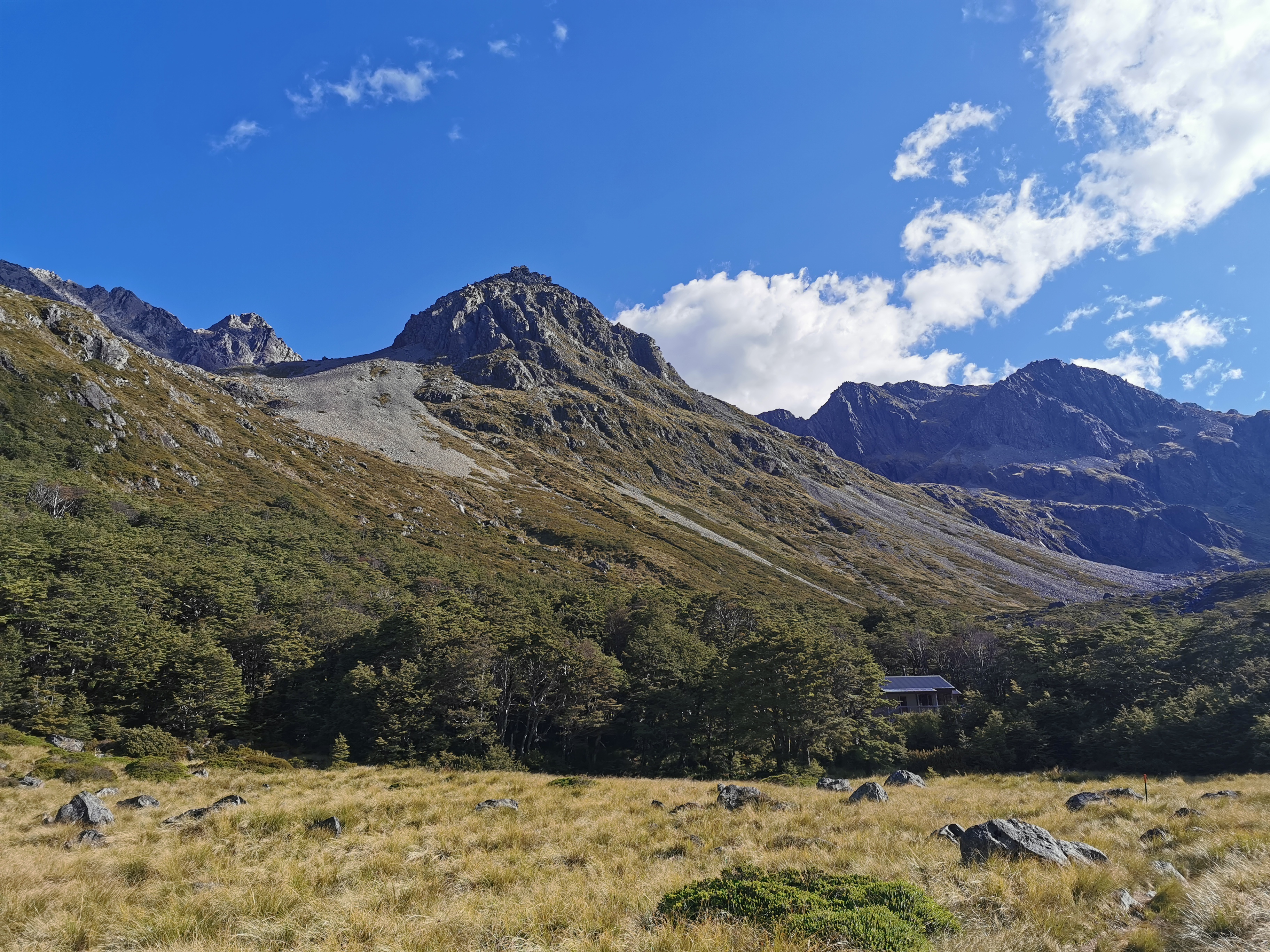
From this point the next hut is Rocks Hut and it’s all uphill…
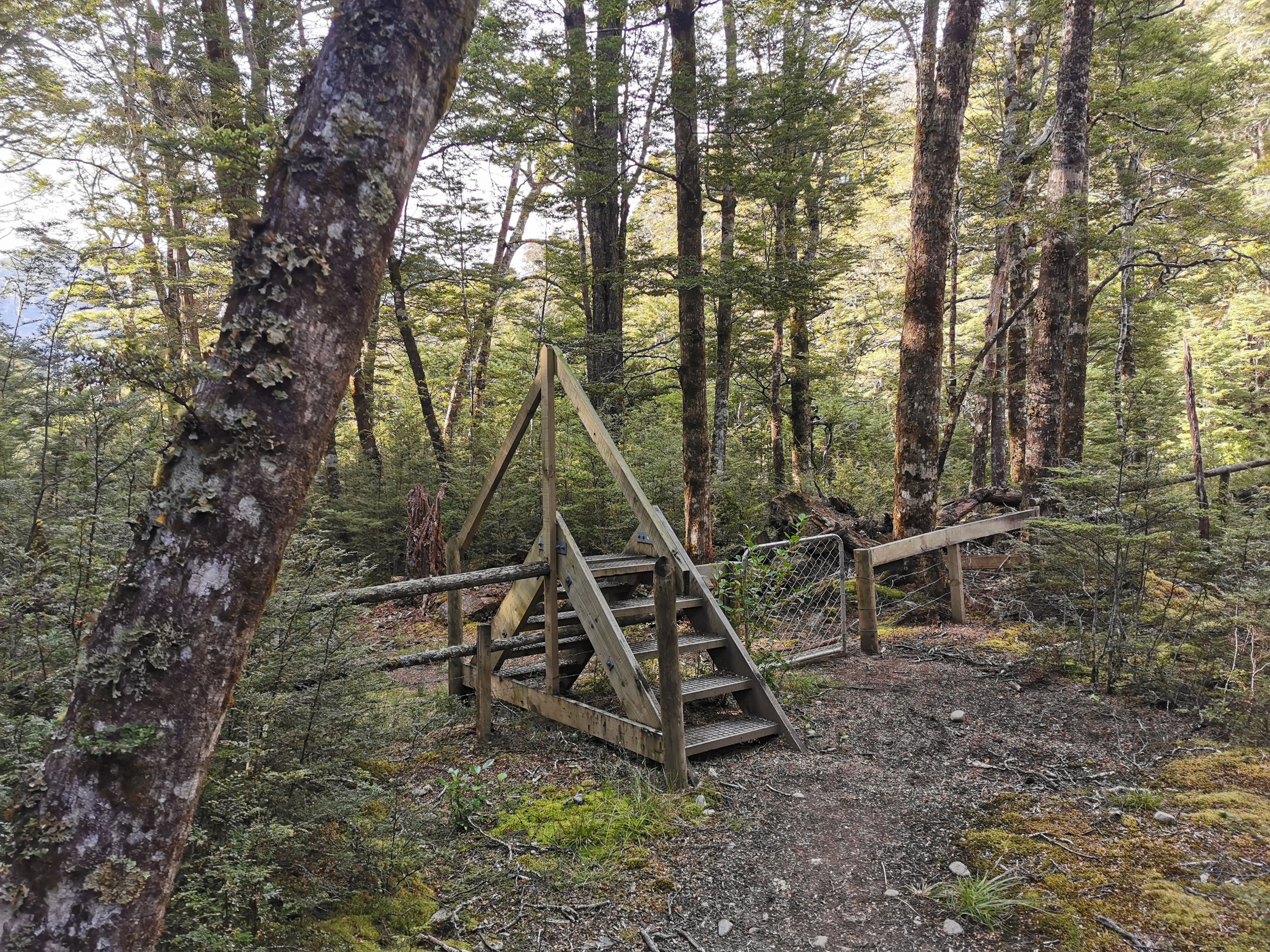
After another swingbridge of course.
Make sure you keep going up at this point (in the next picture) and don’t start heading left! I think the trail used to go left to Roebuck Hut but now goes via Rocks Hut.
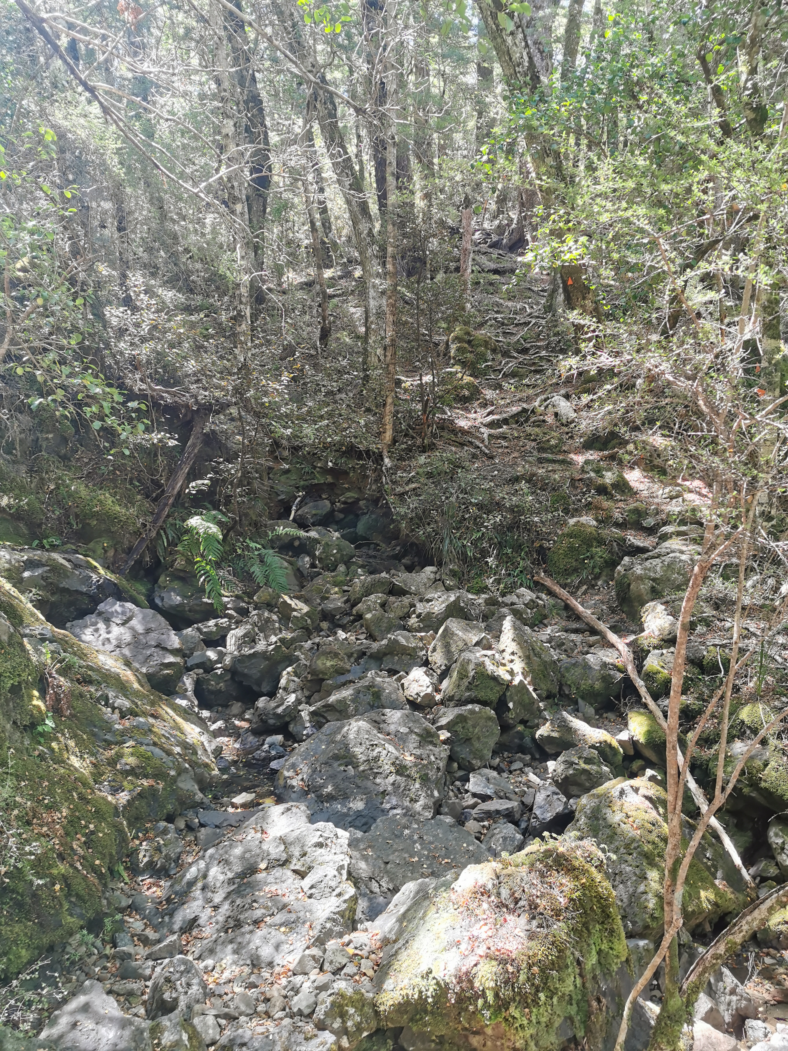
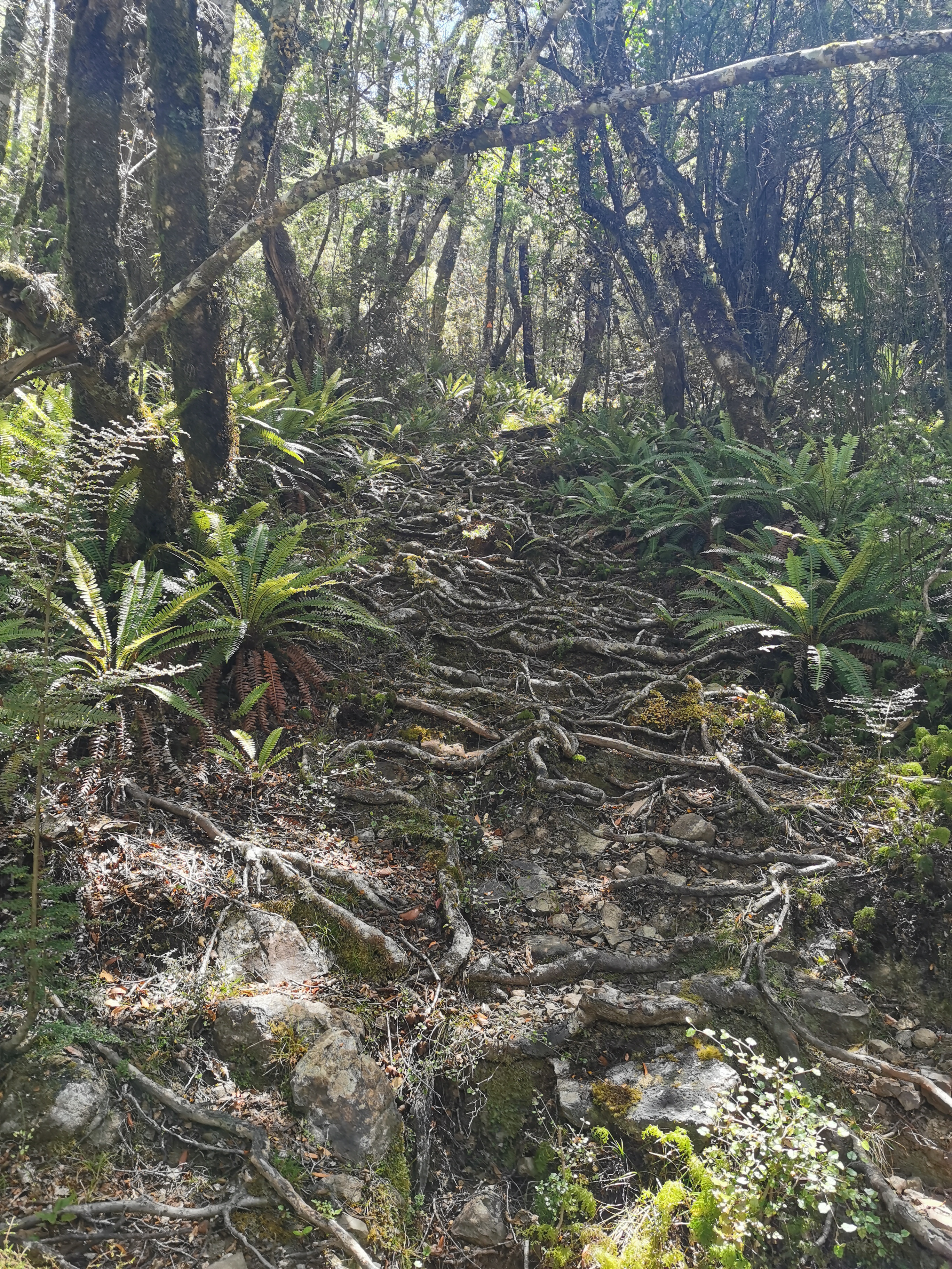
It was uphill the entire way but the path was mostly well formed again.
This bit was a bit rockyAnd this bit a bit “rooty”
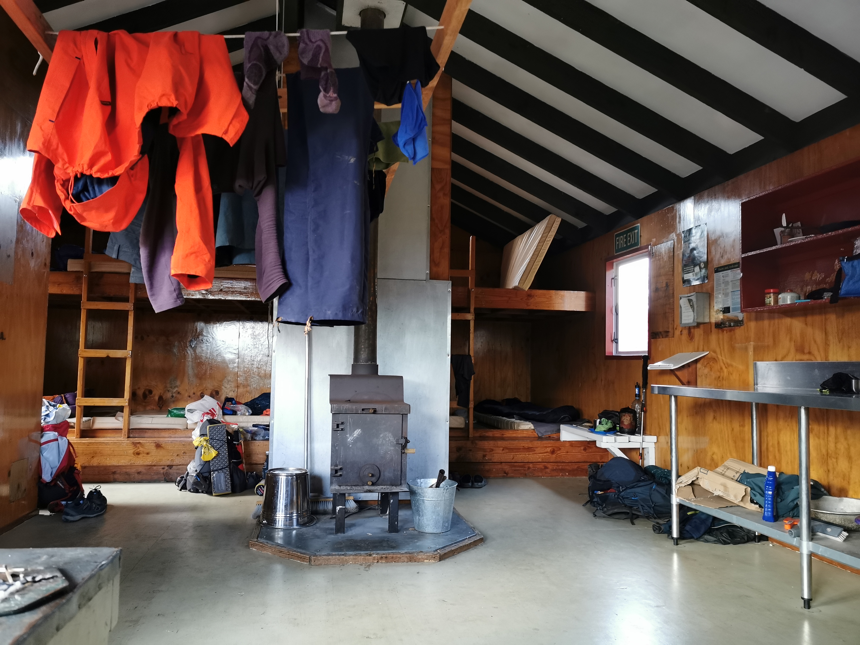
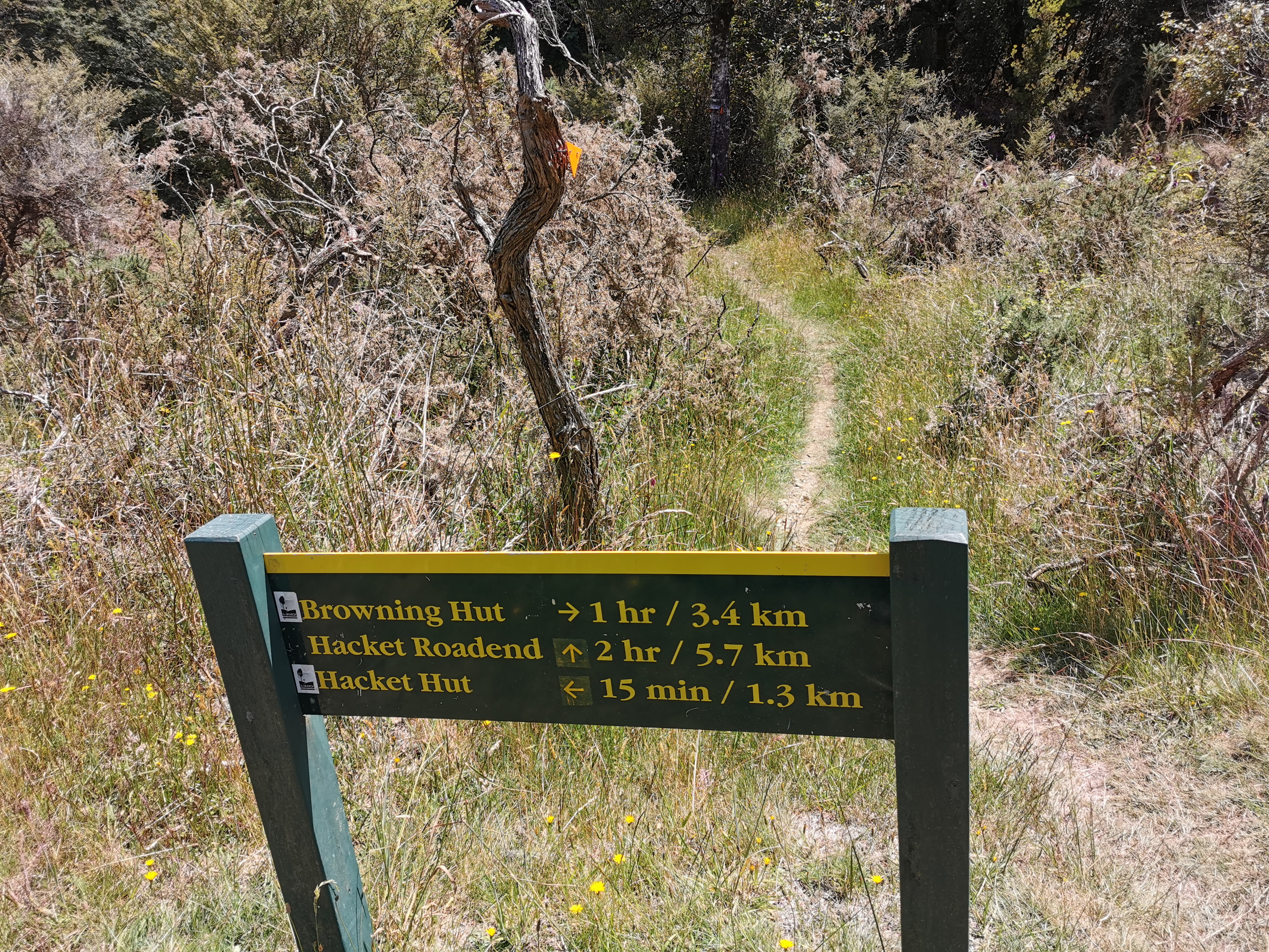
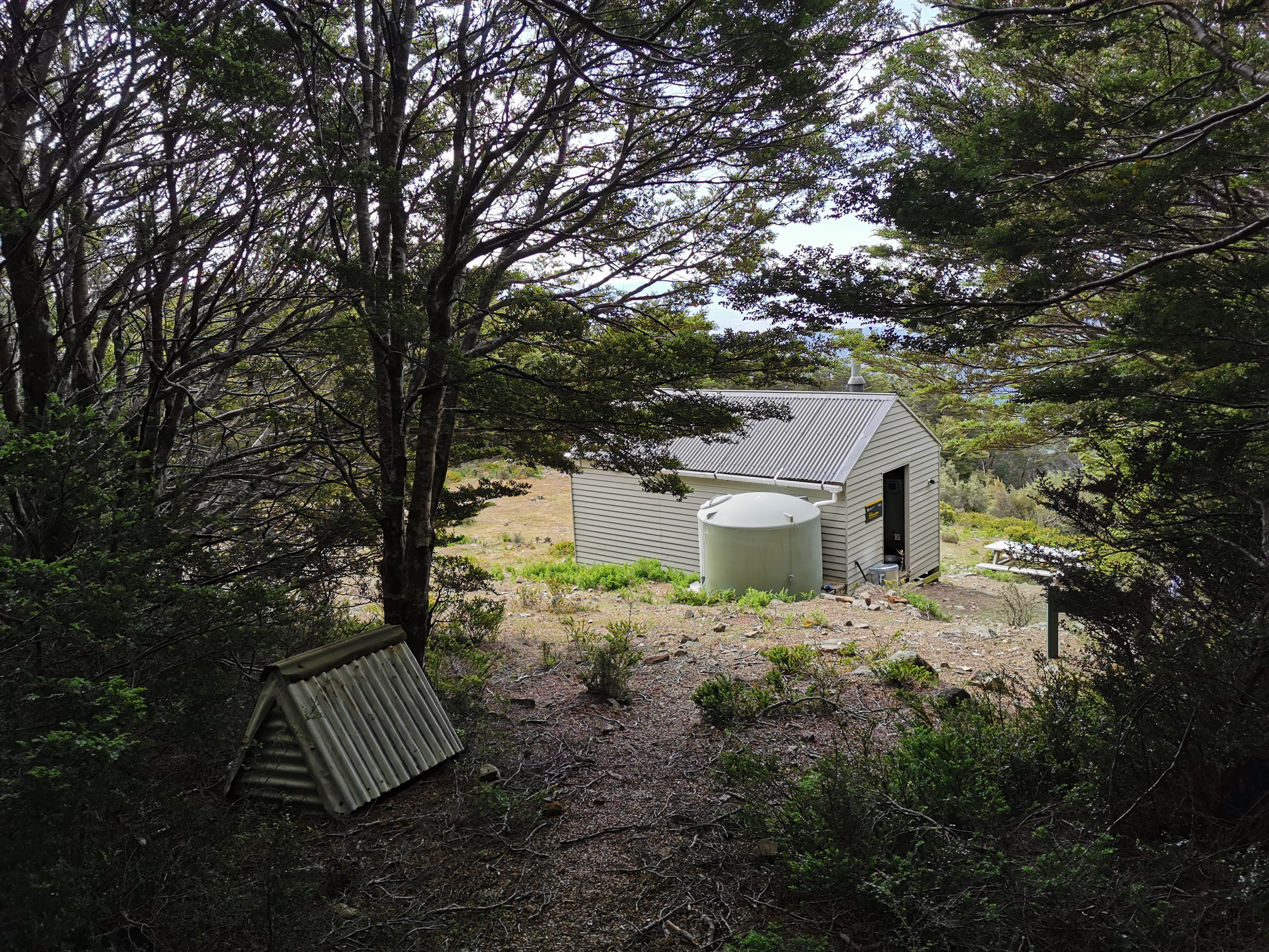
I reached Rocks Hut just after 3pm. About half the people from last night were around. There was also a Dad and his two teenage boys who had walked up from Nelson and another father and son duo who had done the same thing. Since Browning Hut (the next hut on the trail) is signposted as 11km/4hr30 away I decided to stay here for the night. I can have a relatively early night and have an early start.
Since there 16 beds in this hut we will all get to sleep inside tonight.
Inside Rocks Hut
If I want to reach Boyle Village on time I need to be doing more kilometres per day than this – I did less than 10km today! However I got my sleep-in this morning and I’m feeling really good and the early start will help tomorrow. Although Alex and Ethan would never have let me get away with a 10km day!
Last year I planned to get to this point and then get to Nelson and fly back to Auckland for Christmas, but if you remember the bad weather at Havelock made me change my plans. This is the route I would have taken:
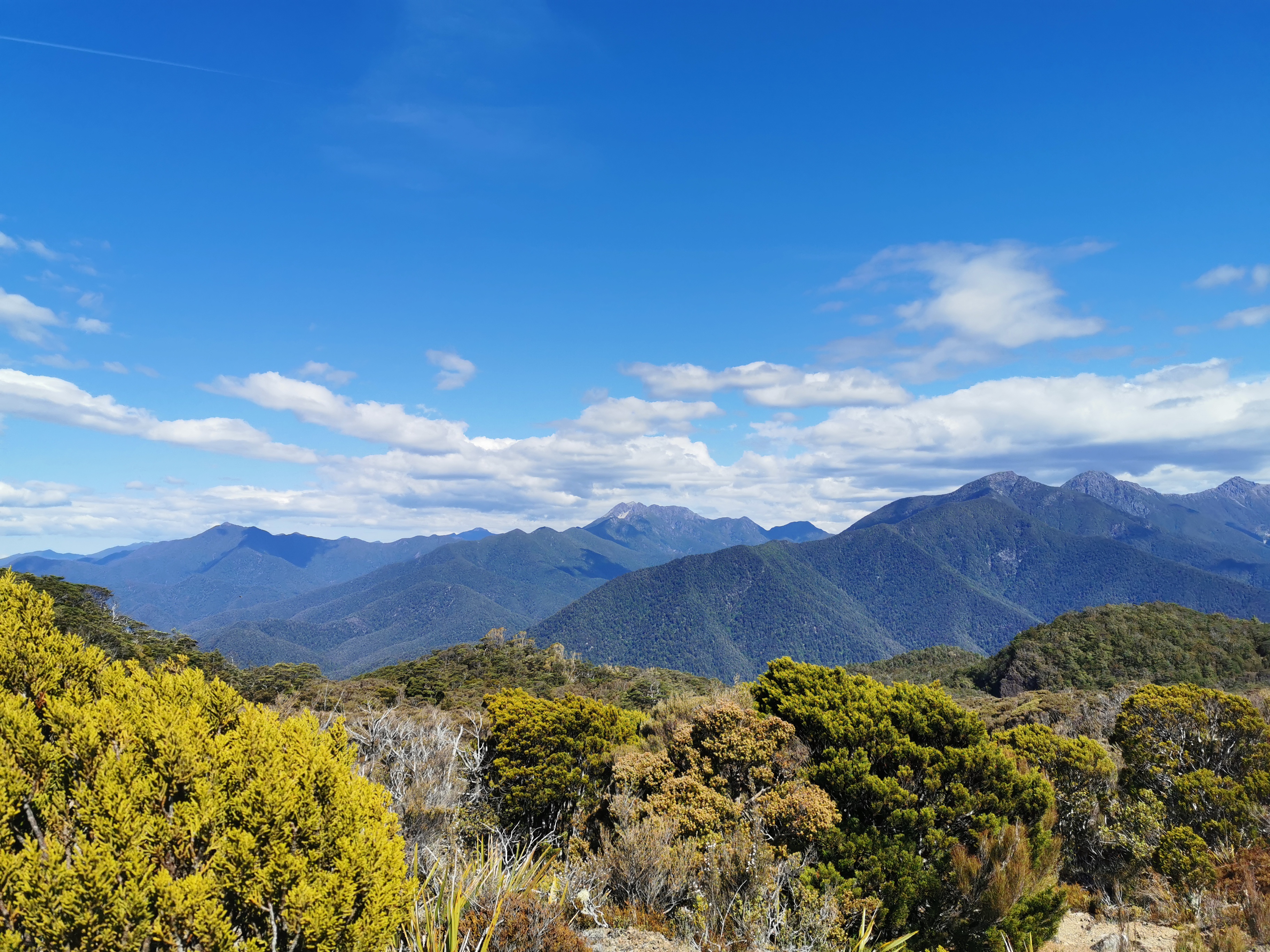
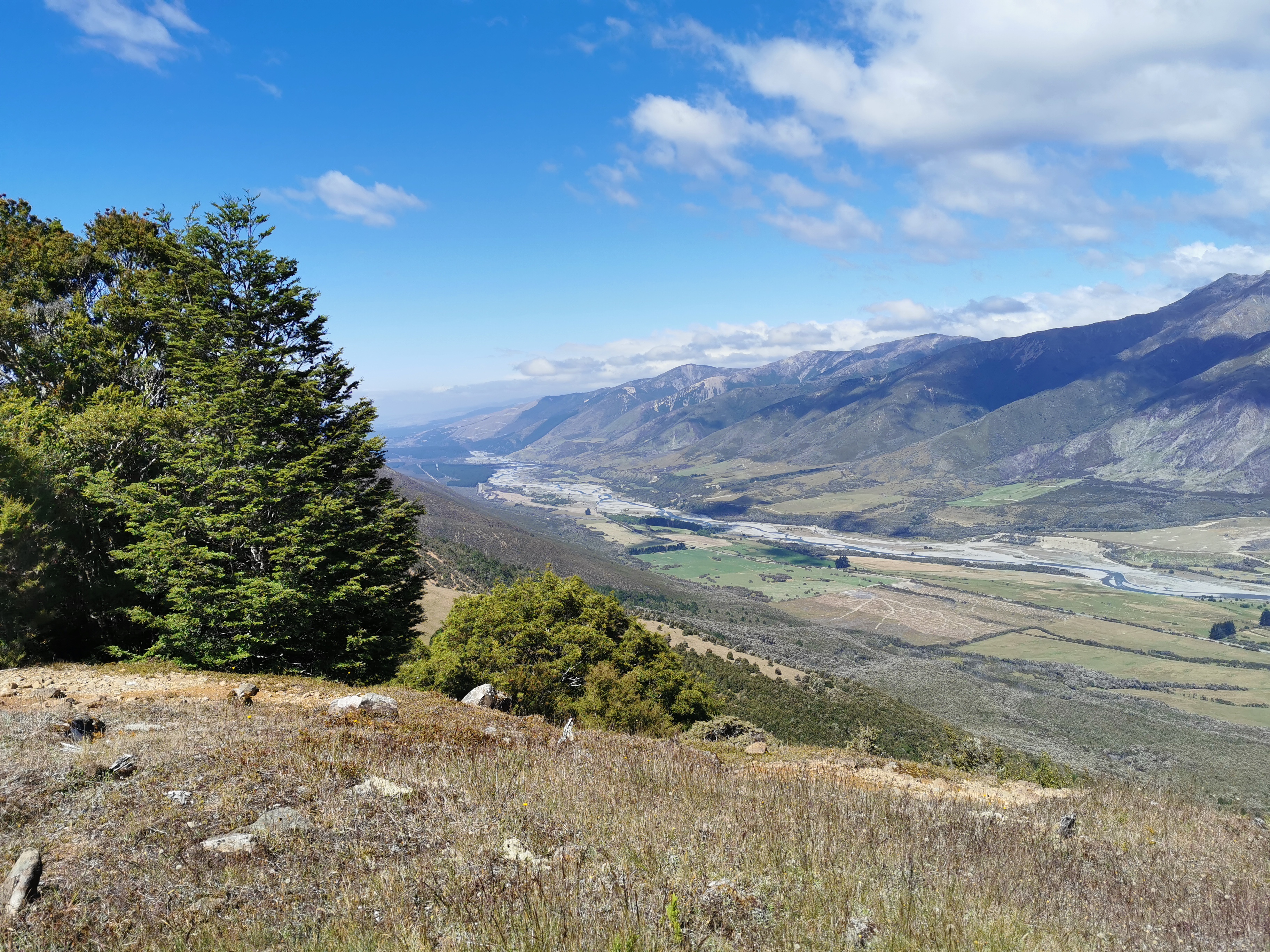
According to that sign there is also a lookout, so I thought I might as well go and have a look. It’s quite a nice view I have to say! And there was a geocache here!
View from the lookout
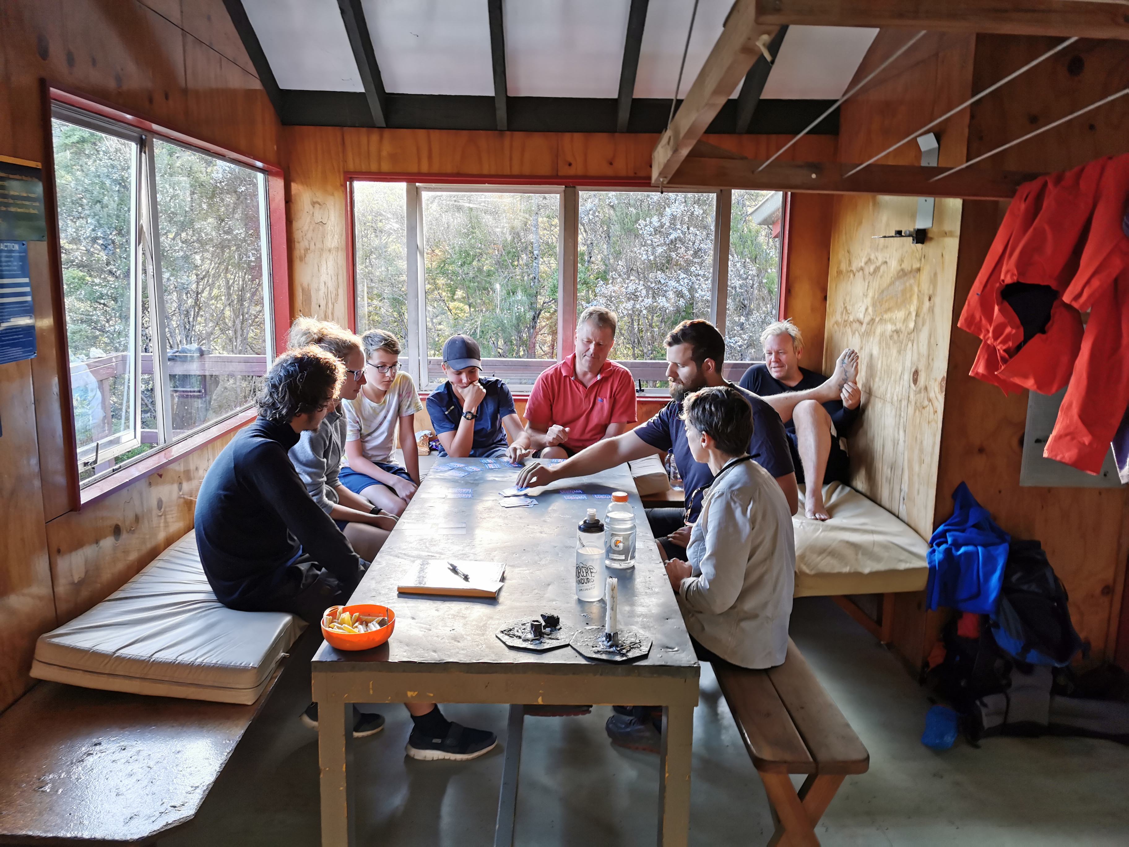
Back at the hut, almost everybody was joining in a card game called kaboo.
Kaboo
It’s quite a fun game but it’s stressful because it’s one of those games that requires quick reactions. I played a couple of rounds but then excused myself to go and make dinner, partly because I was hungry but partly because the game was stressing me out.
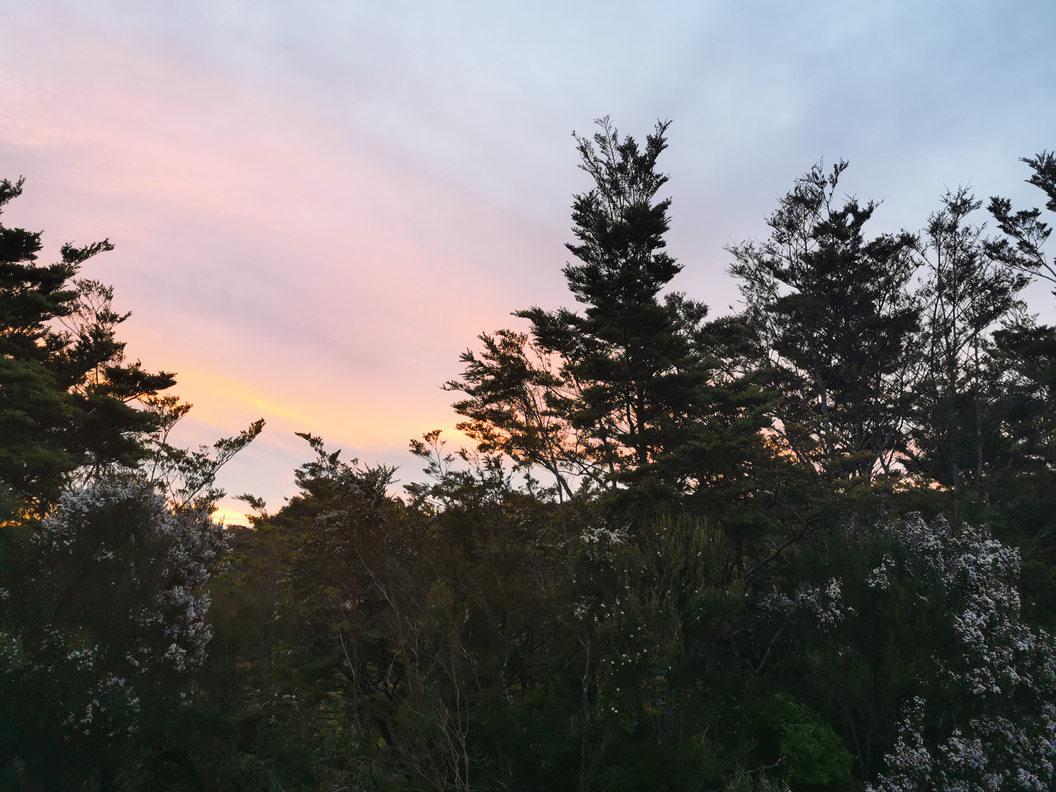
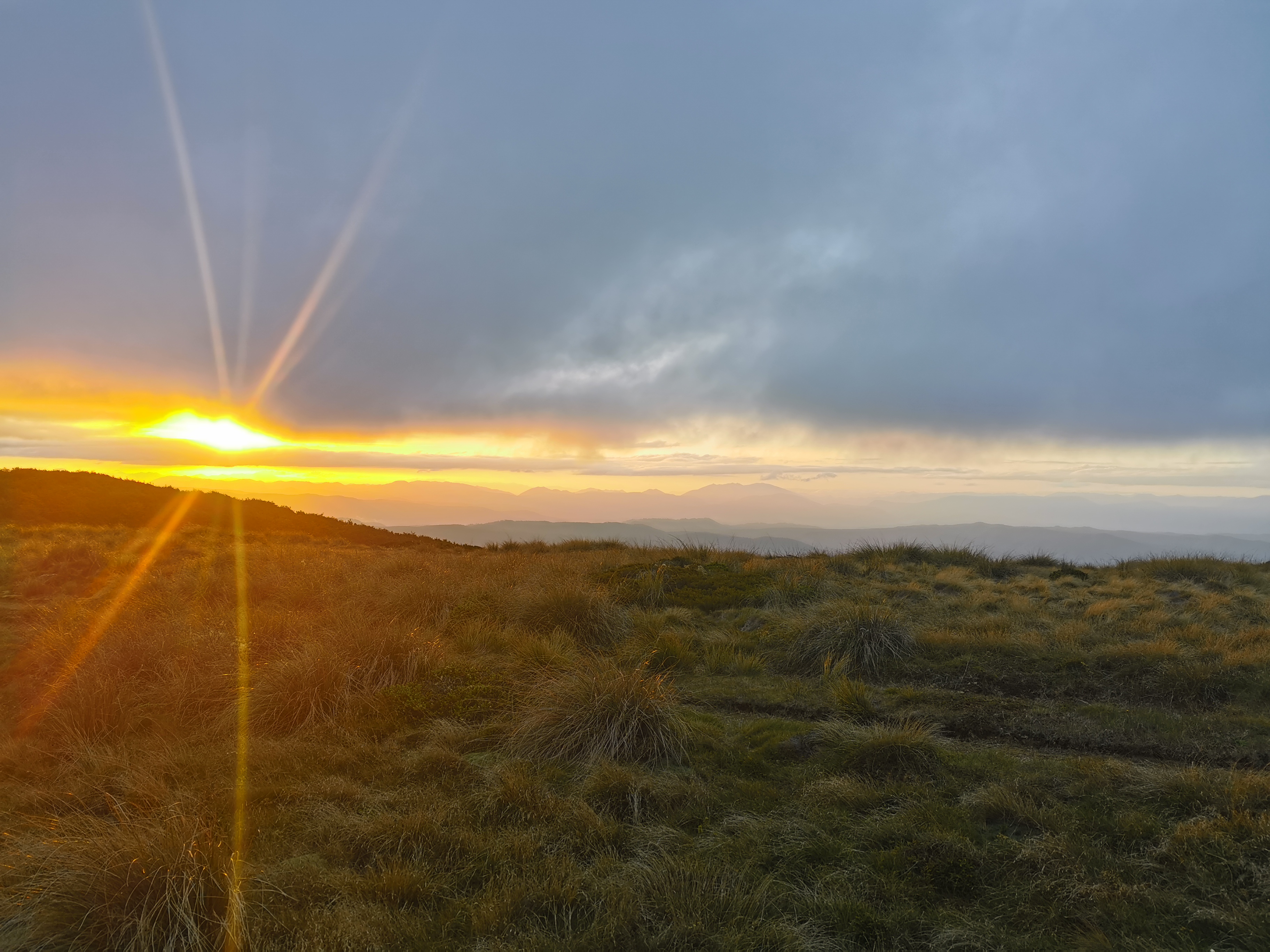
Most people were in their sleeping bags and in sleep mode by 9pm. Although not before most of us admired the not-too-shabby sunset.
Date: 10 January
Trail covered: 19.7km (kms 1835.3 to 1855.0)
Weather: fantastic
I woke up early in Rocks Hut since somebody had their alarm set for 6am. Given how long it took whoever it was to silence the alarm, I think it may not have been intentional.
I like sleeping in my tent usually but sleeping in the huts means I don’t sleep in too long, which is probably a good thing.
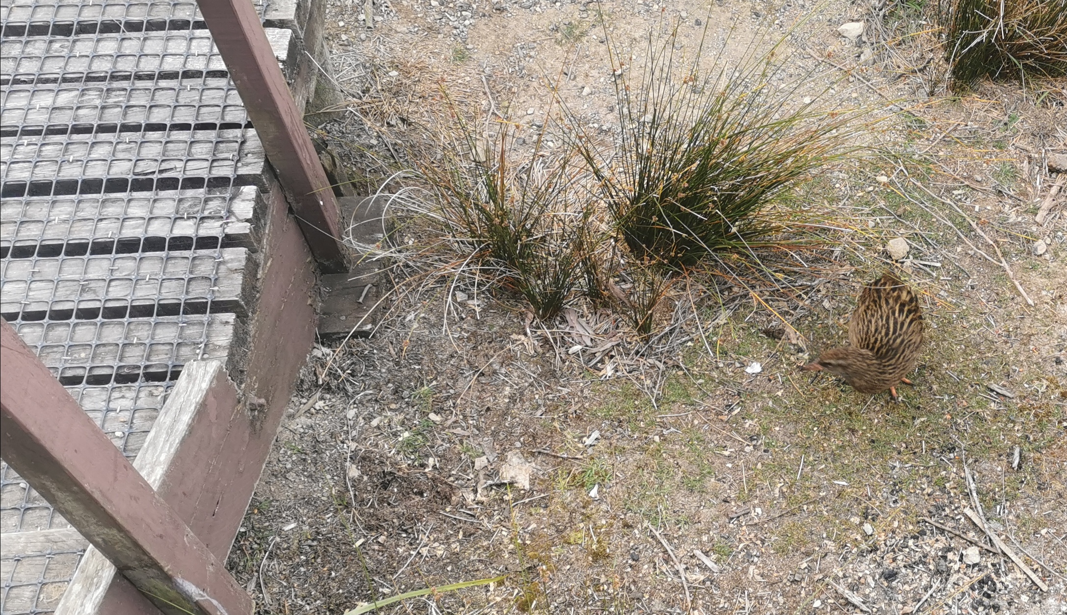
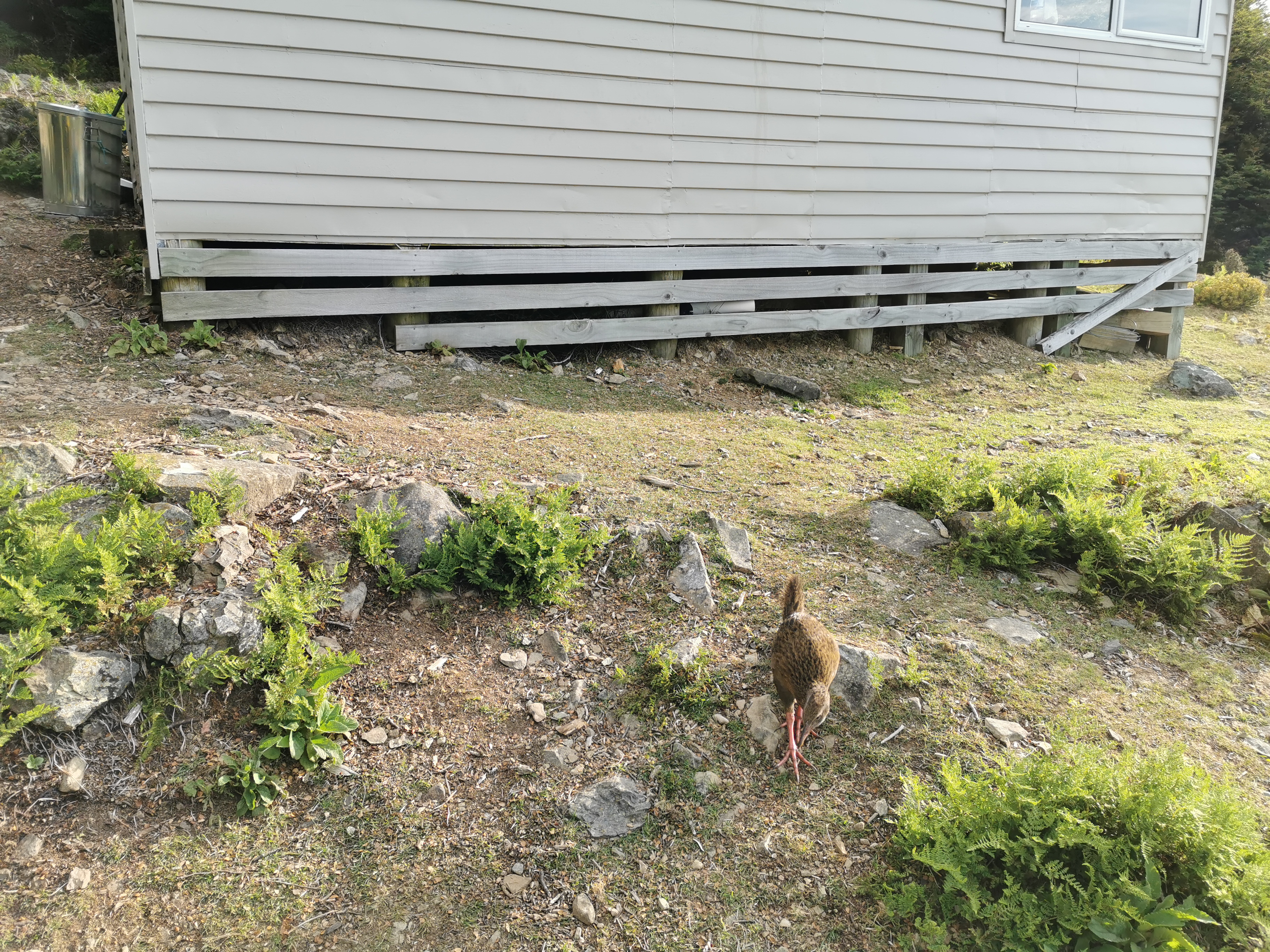
A weka outside this morning
It was quite cold this morning and so I made porridge and a mocha (instant coffee and instant hot chocolate with hot water). I admired the view from the hut while I was having breakfast.
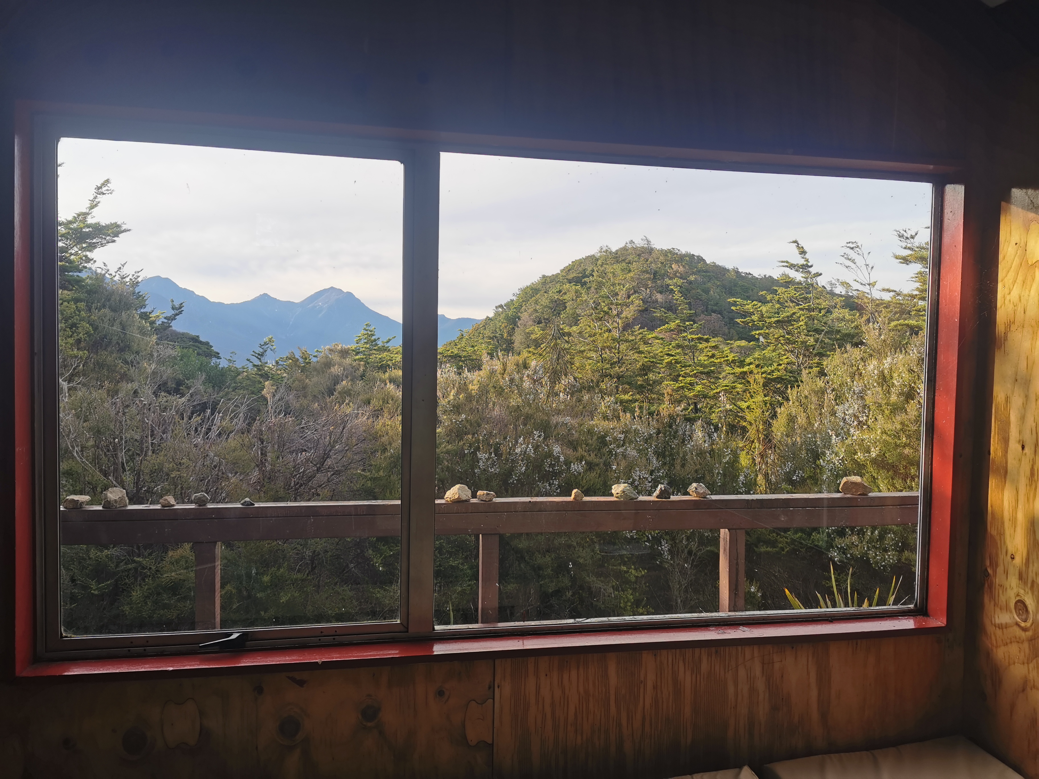
The view from inside Rocks Hut
I left the hut at 7:35am which was about 15 minutes after Ben from America and Susan from Austria. The aim today is Starveall Hut, which is about 20km or so away, but if things still feel hard or exhausting there are two other huts along the way I can stay at instead. Ben and Susan had the same plan.
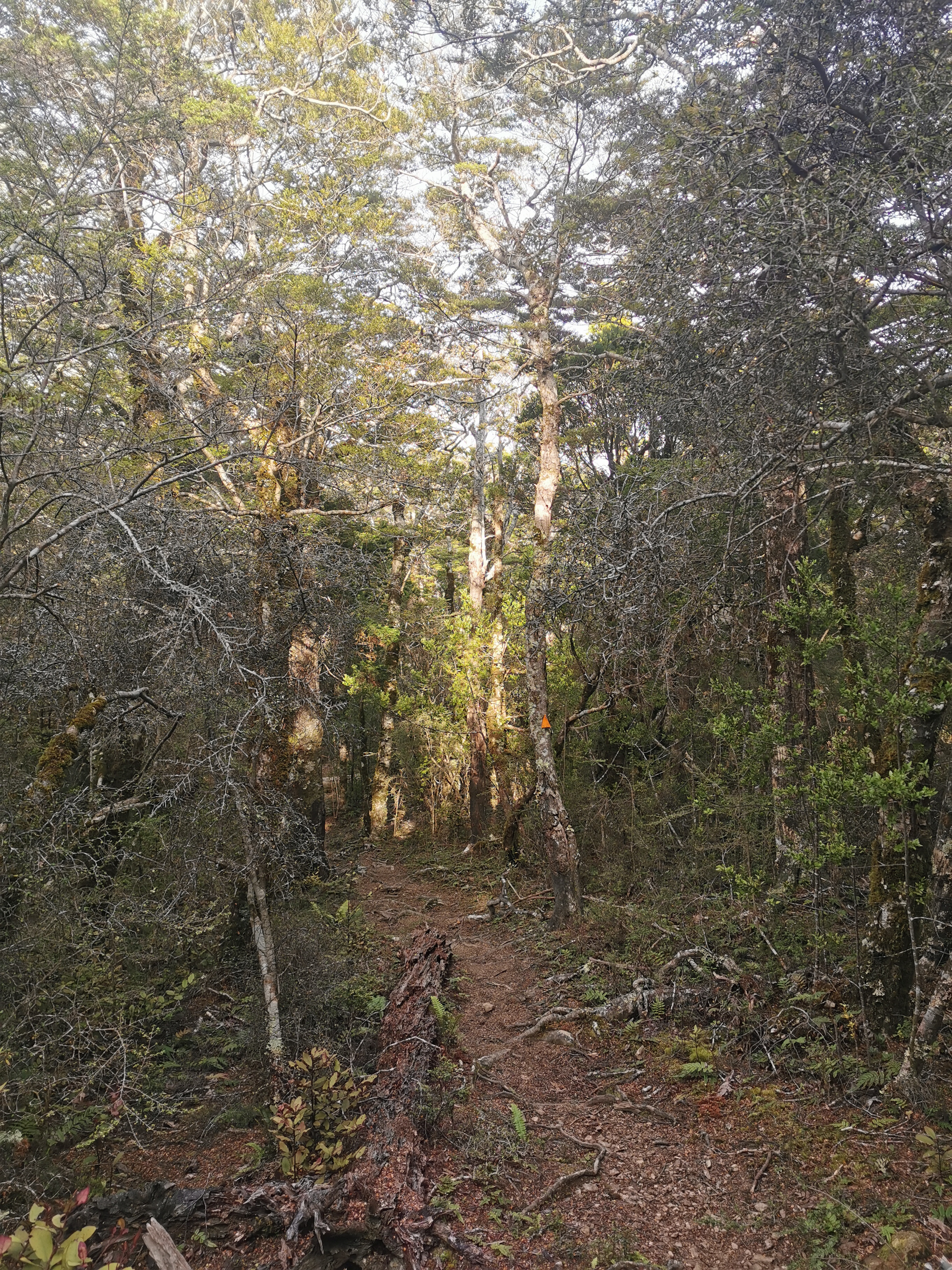
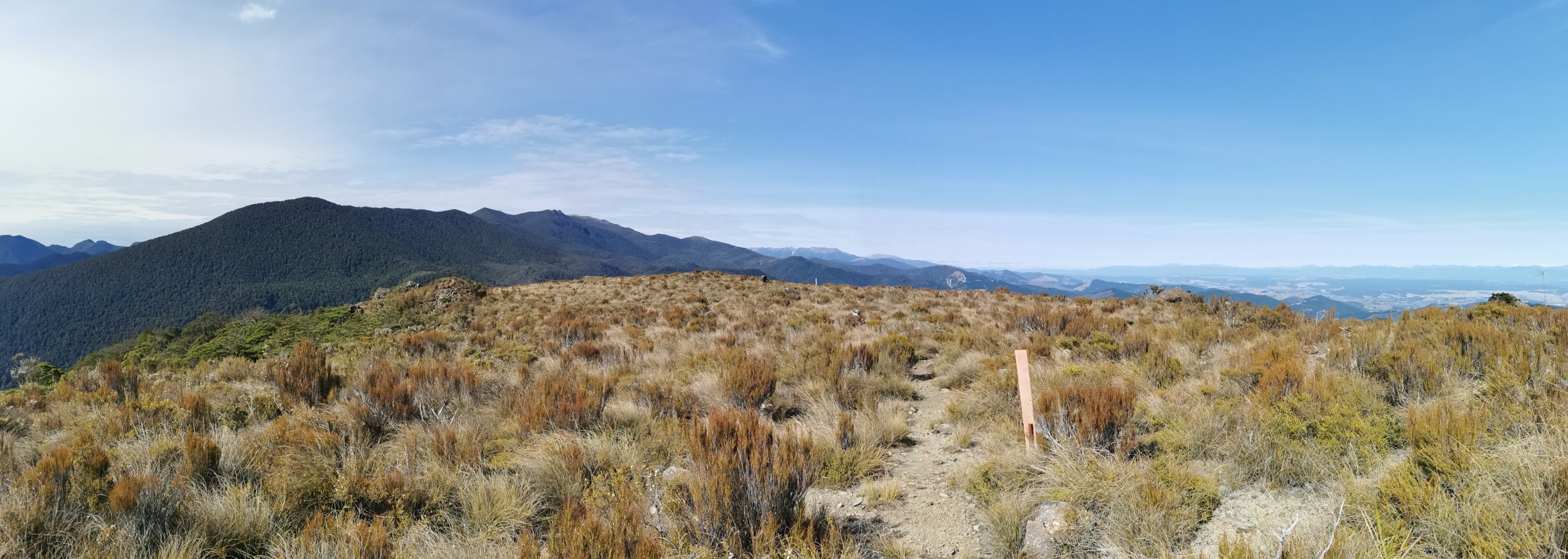
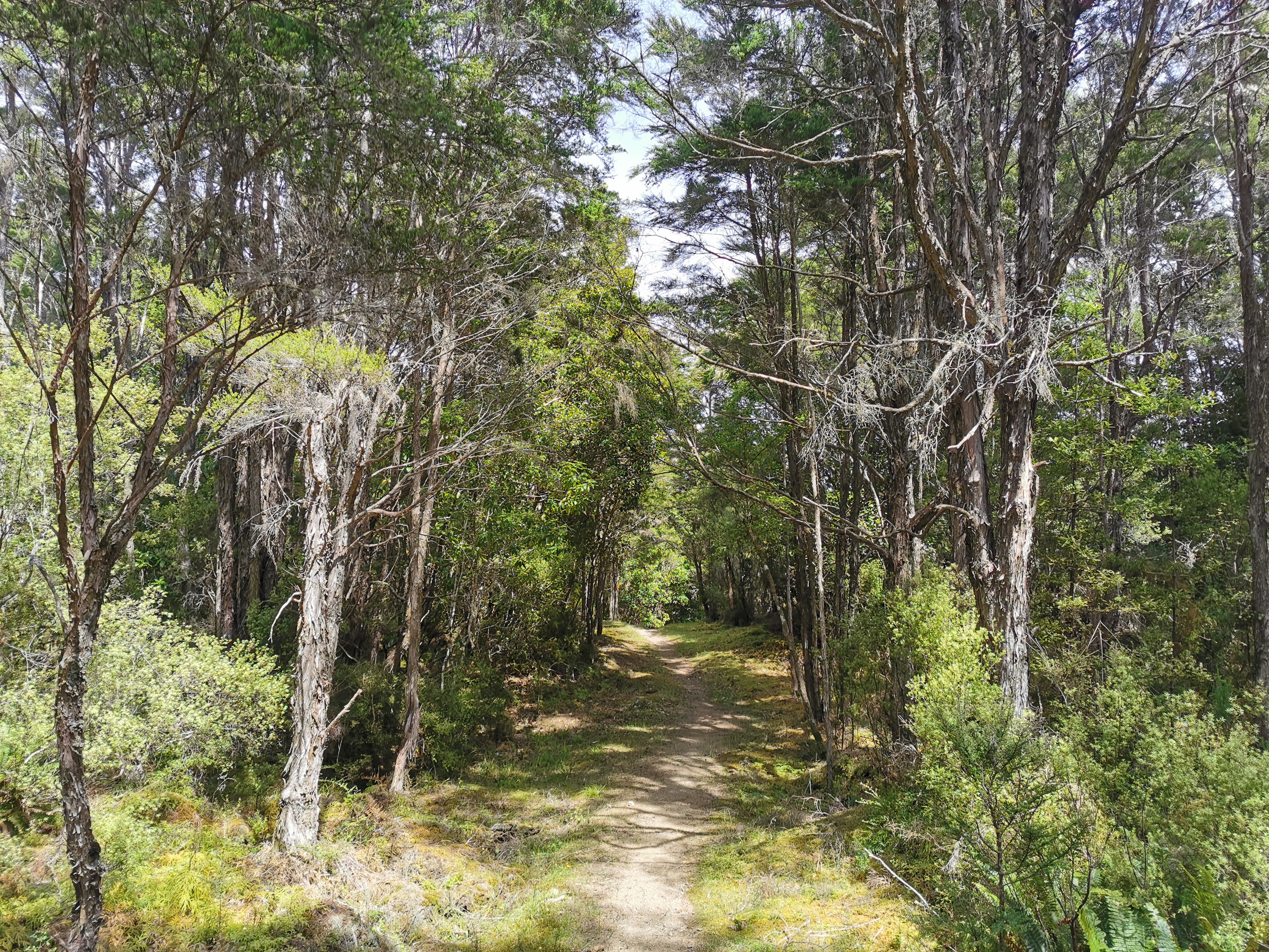
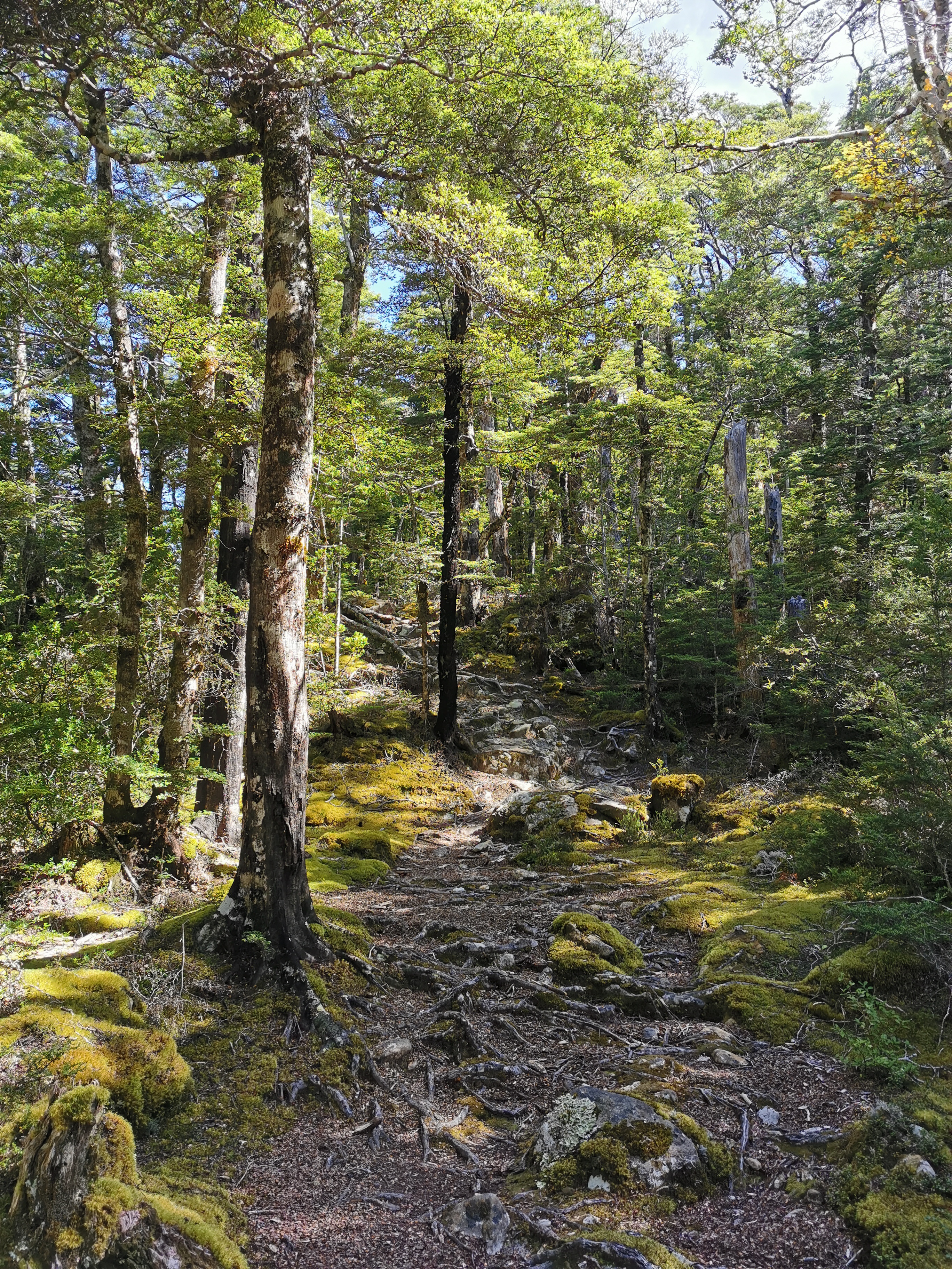
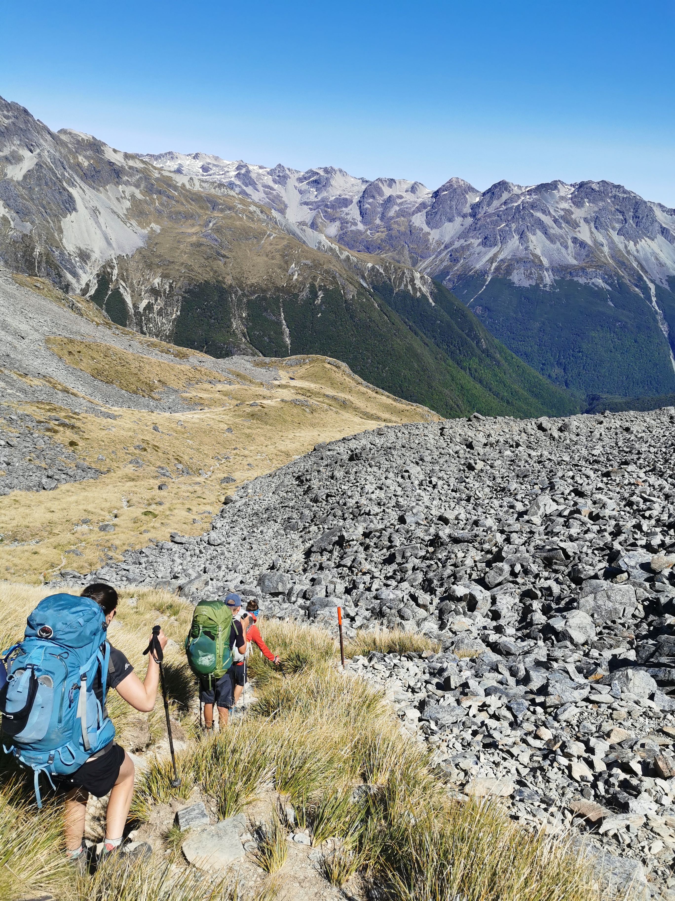
The track out of Rocks Hut is relatively easy.
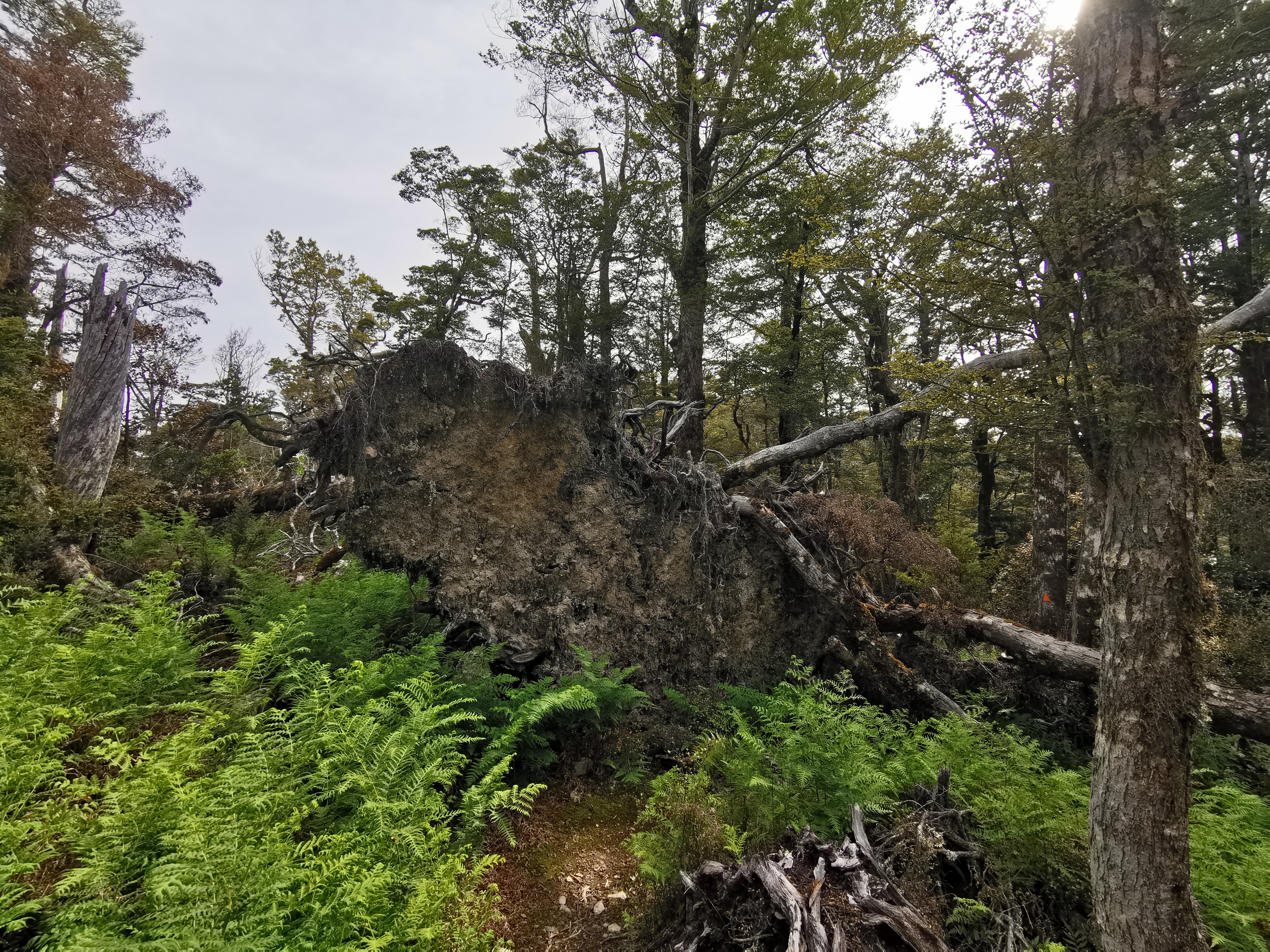
Around here there were a few of these big sections of roots and dirt pulled out of the ground when a large tree fell over. It must take some force to pull that out of the ground.
Big roots
I passed Ben and Susan quite early on. The speed they were going at wasn’t too bad but they stopped for a break quite early on and I didn’t want to so I continued on by myself.
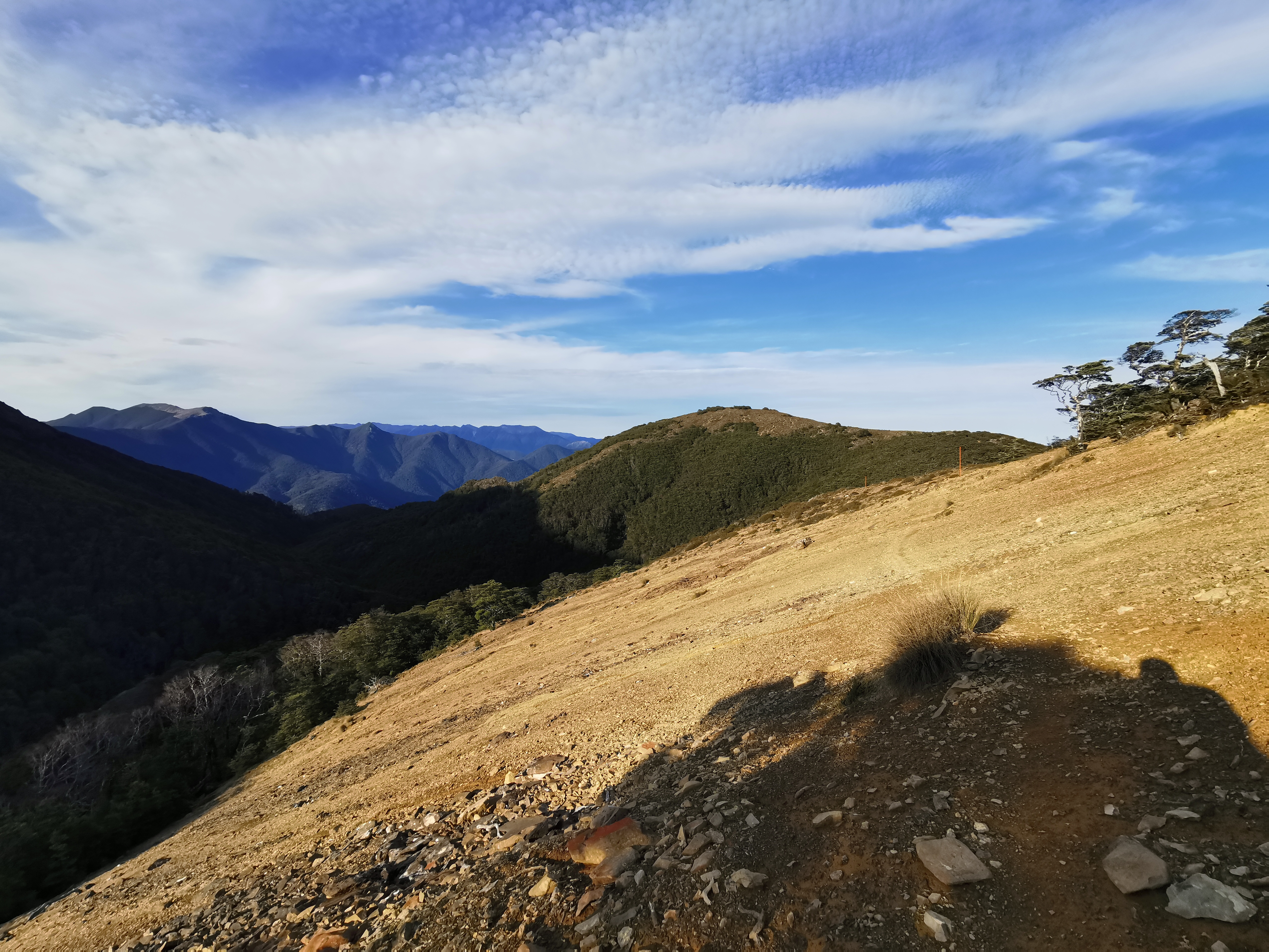
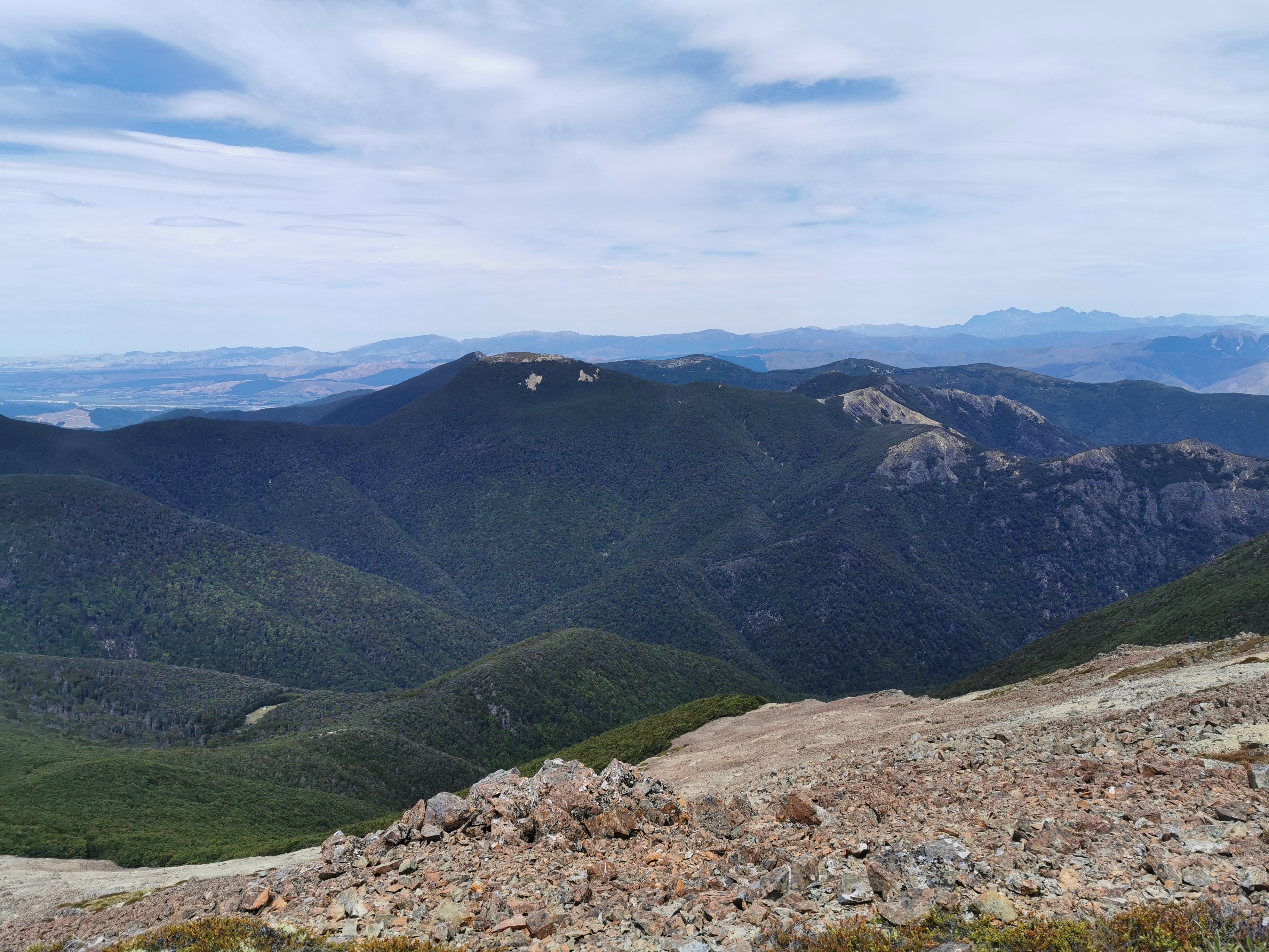
There hadn’t been a lot of views up until now but they came soon.
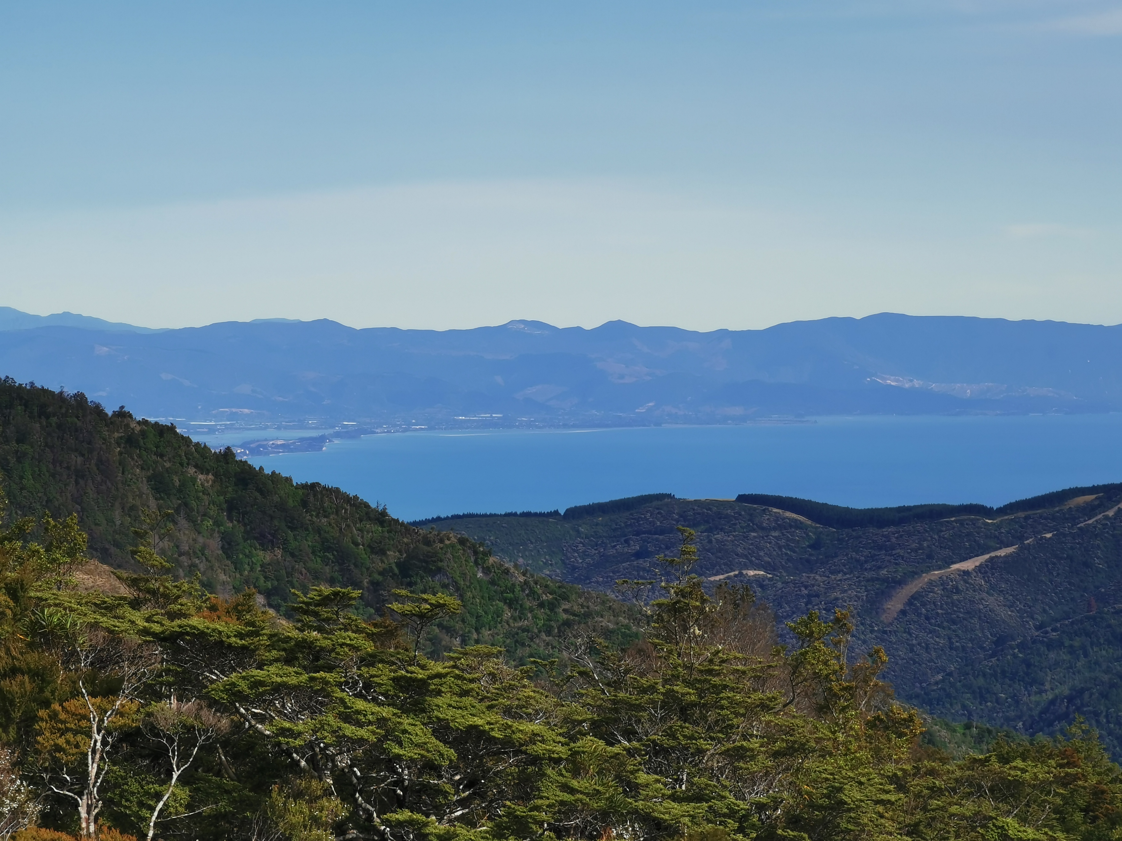
You could see the water and also a bit of civilization. I think this might be Mapua, just northwest of Nelson.
Mapua
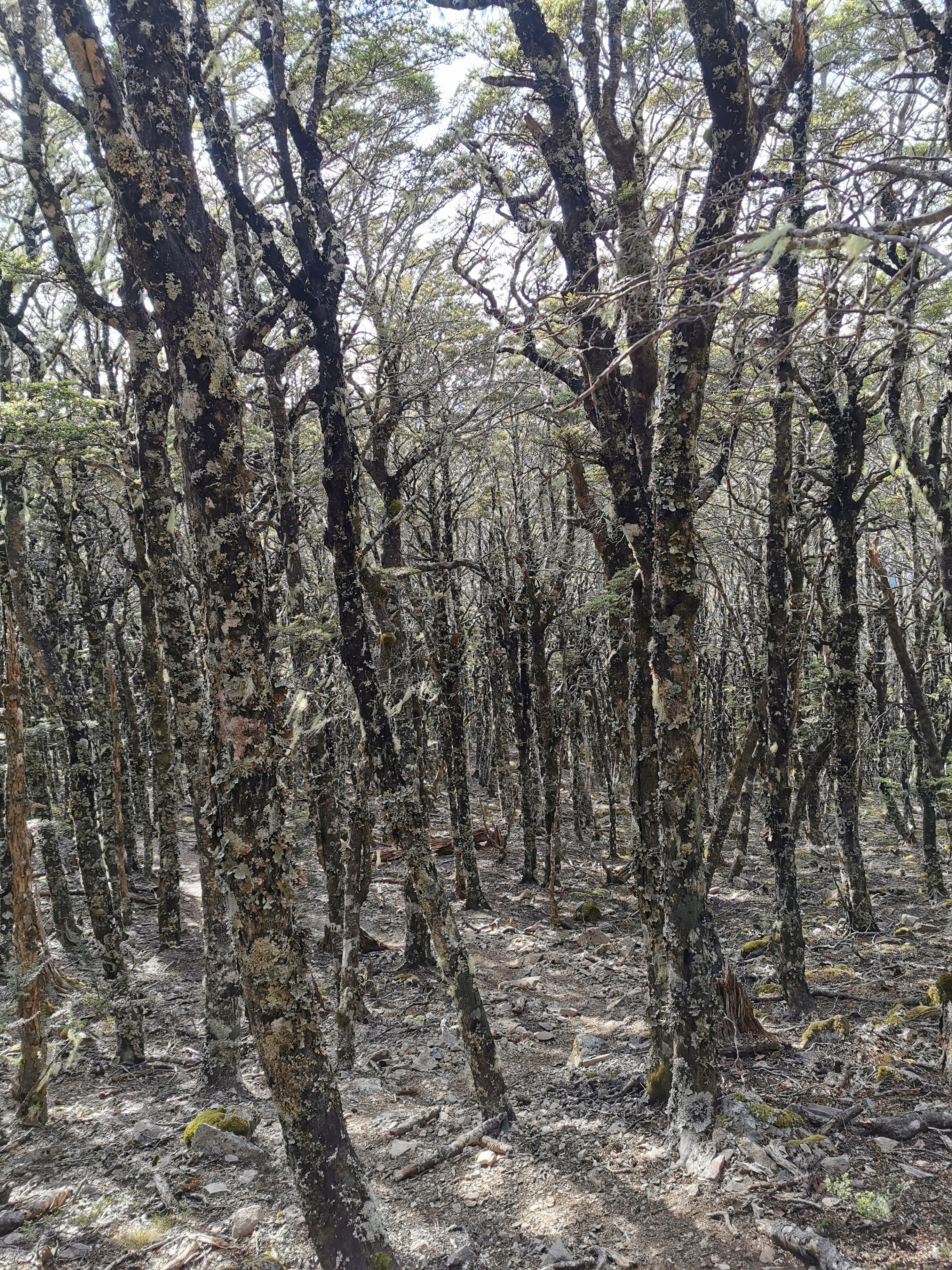
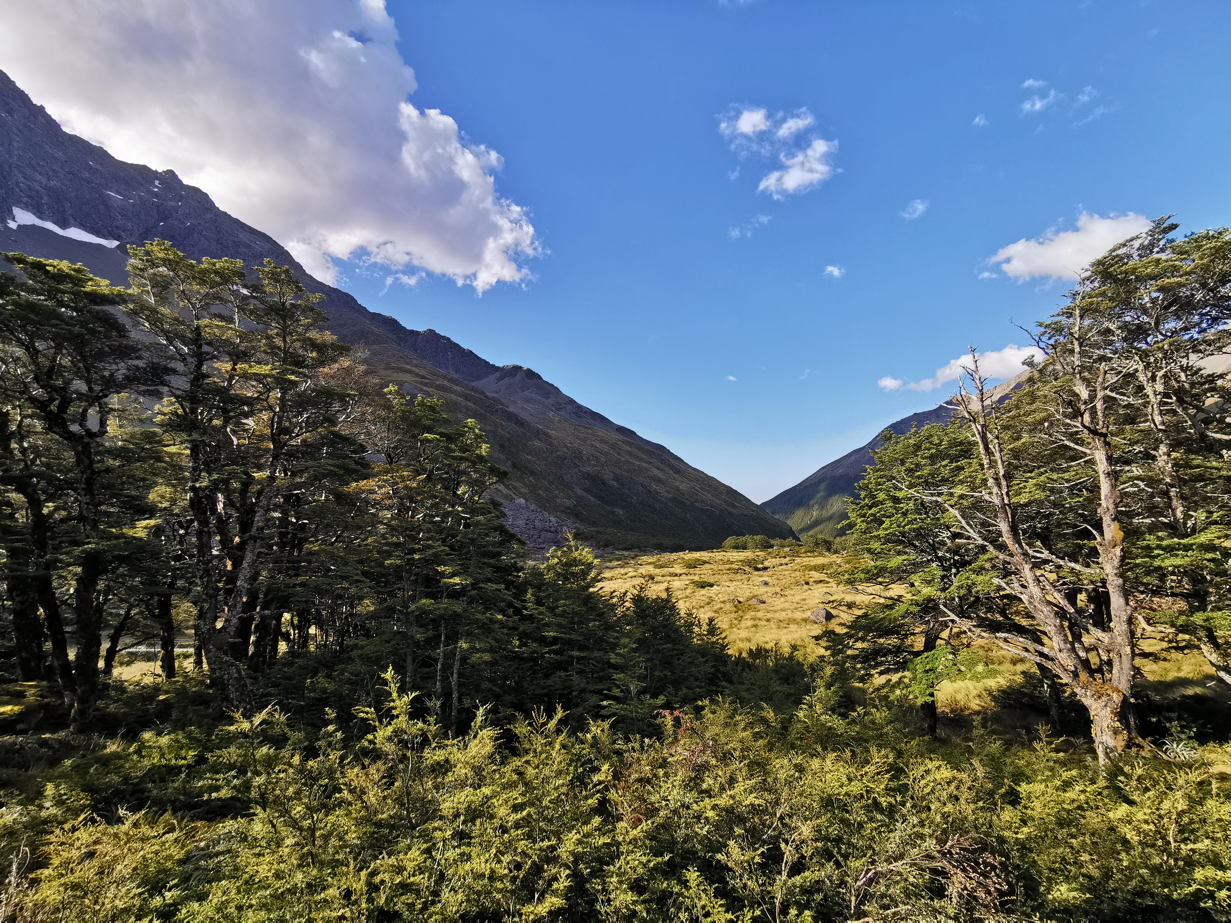
The landscape changed at this point for a short time before reverting back to bush.
There is cellphone reception here too!
I passed a few people going in the opposite direction and they asked me how busy Rocks Hut was. They also told me that Browning Hut (the next hut I’ll come to) was very crowded last night and there were lots of people camping.
I soon reached this sign and it proves that the TA definitely used to go via Roebuck Hut and not Rocks Hut. The TA symbol had been half scratched off.
Also from here I had read that it is quite steep down to Browning Hut, but it turned out to be not too bad.
I reached Browning Hut right on 11am.
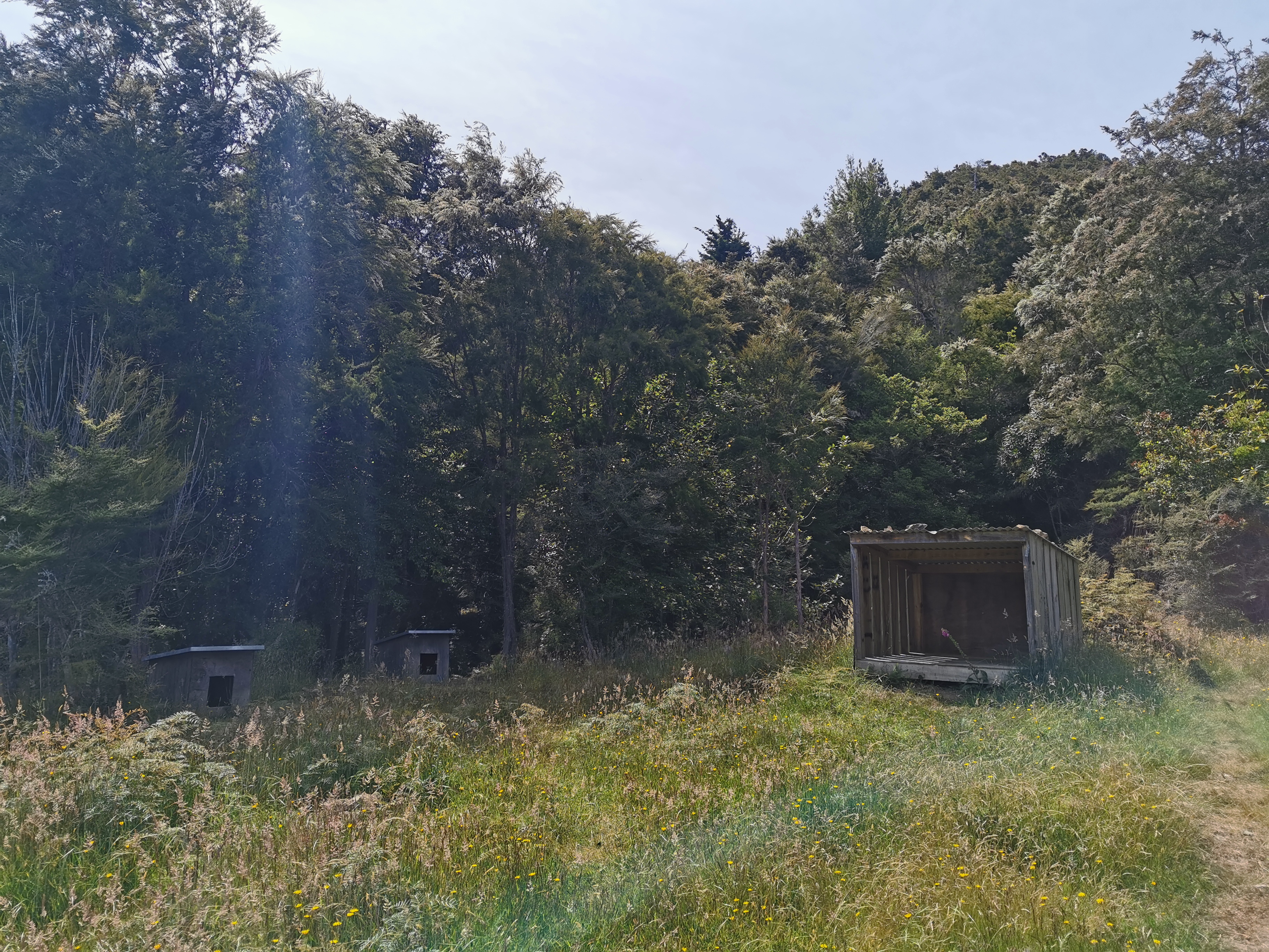
11am picture – Browning Hut is very green
It also has a little shelter and some dog kennels.
My new phone has a “wide” mode, which enables me to take a good photo inside the hut that takes in most of the hut itself. I’m really happy with this wide mode, it does a good job.
Inside Browning Hut
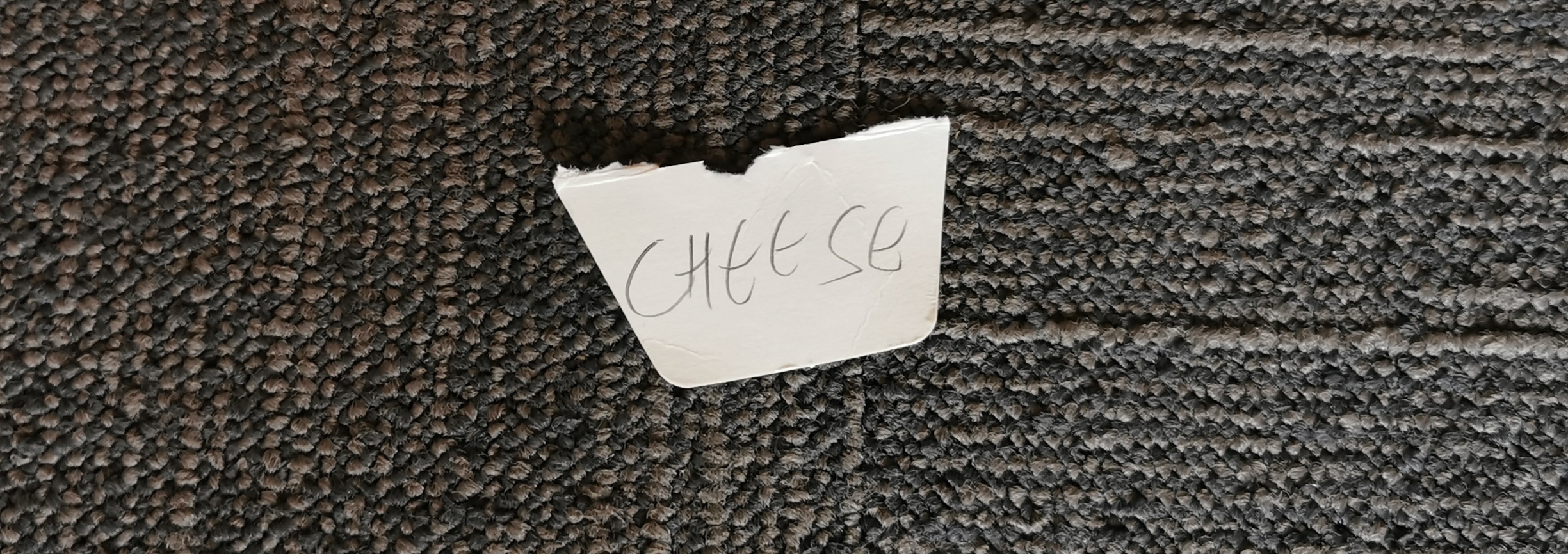
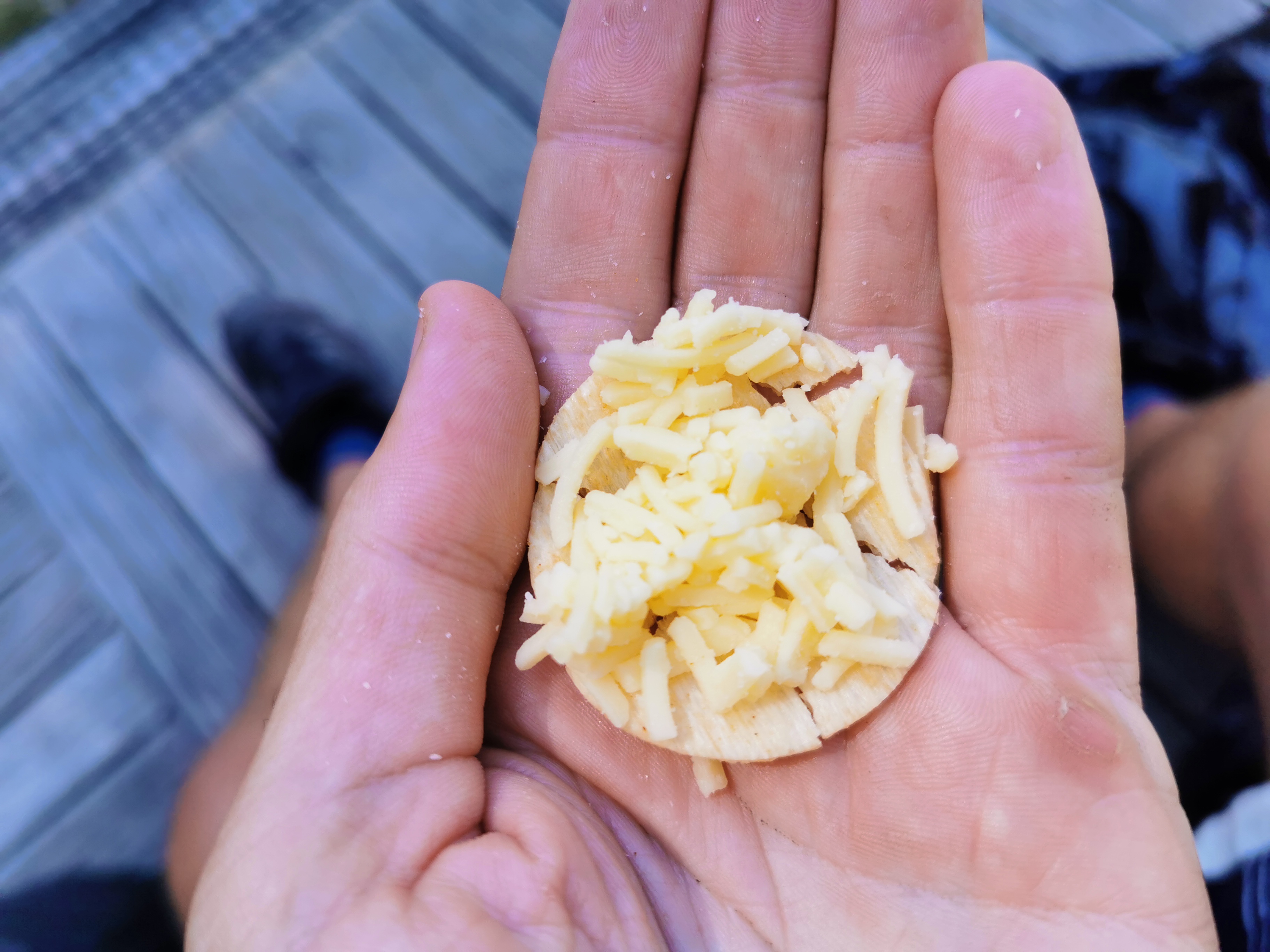
There was nobody else here so I just had some cheese and crackers and I was on my way again. Just as I was leaving, Ben and Susan turned up and so I said a quick hi.
It was nice being at the hut alone for my lunch break. It’s often nice to have people around in the evening but at lunchtime it’s often nice to have a rest. I like being first out in the morning too – nicer temperature, if I were to get hurt people are behind me and will discover me, and hopefully I’ll get the first choice of beds at the huts… hopefully.
I did notice from the Browning Hut intentions book that Rhydian is now 5 days ahead. He’s moving faster than me! Although that’s no surprise given that yesterday was only a 10km day.
I also noticed in the intentions book that it was indeed packed, but just three nights ago there’s an entry that says two people had the hut to themselves. It really is hard to predict how full the huts will be!
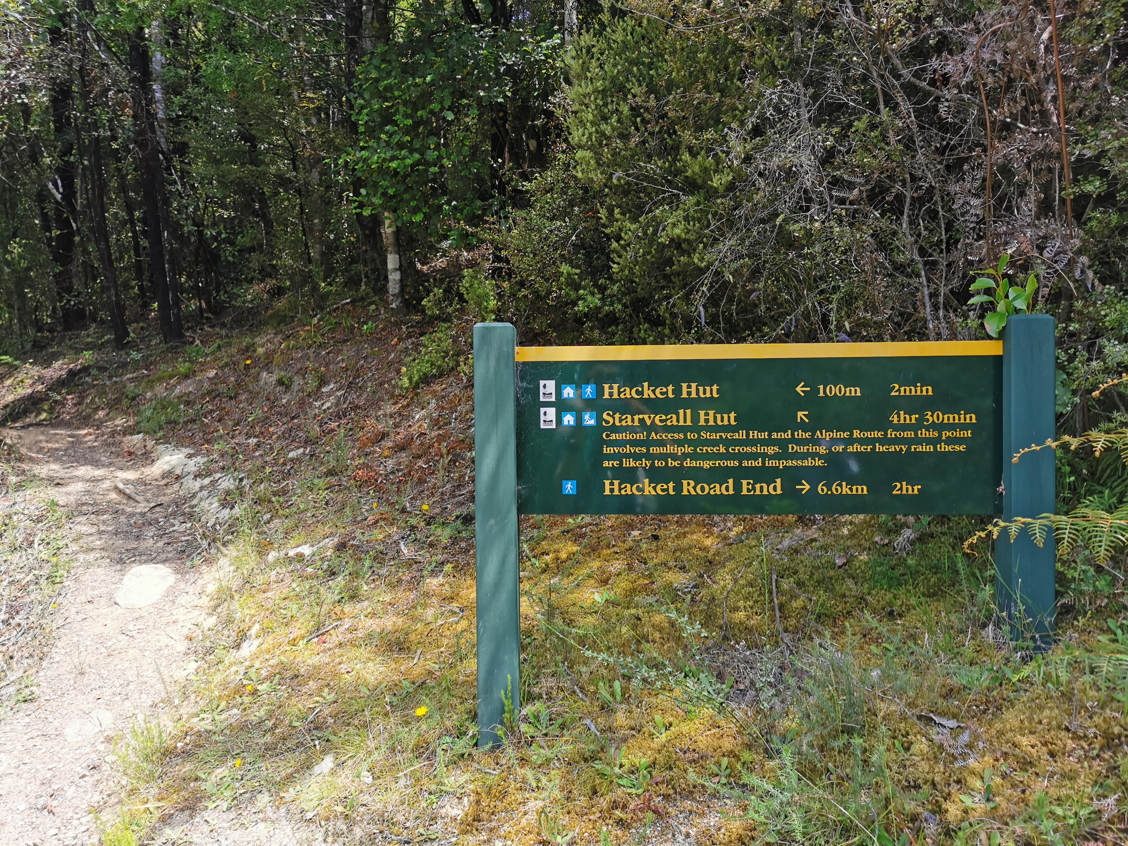
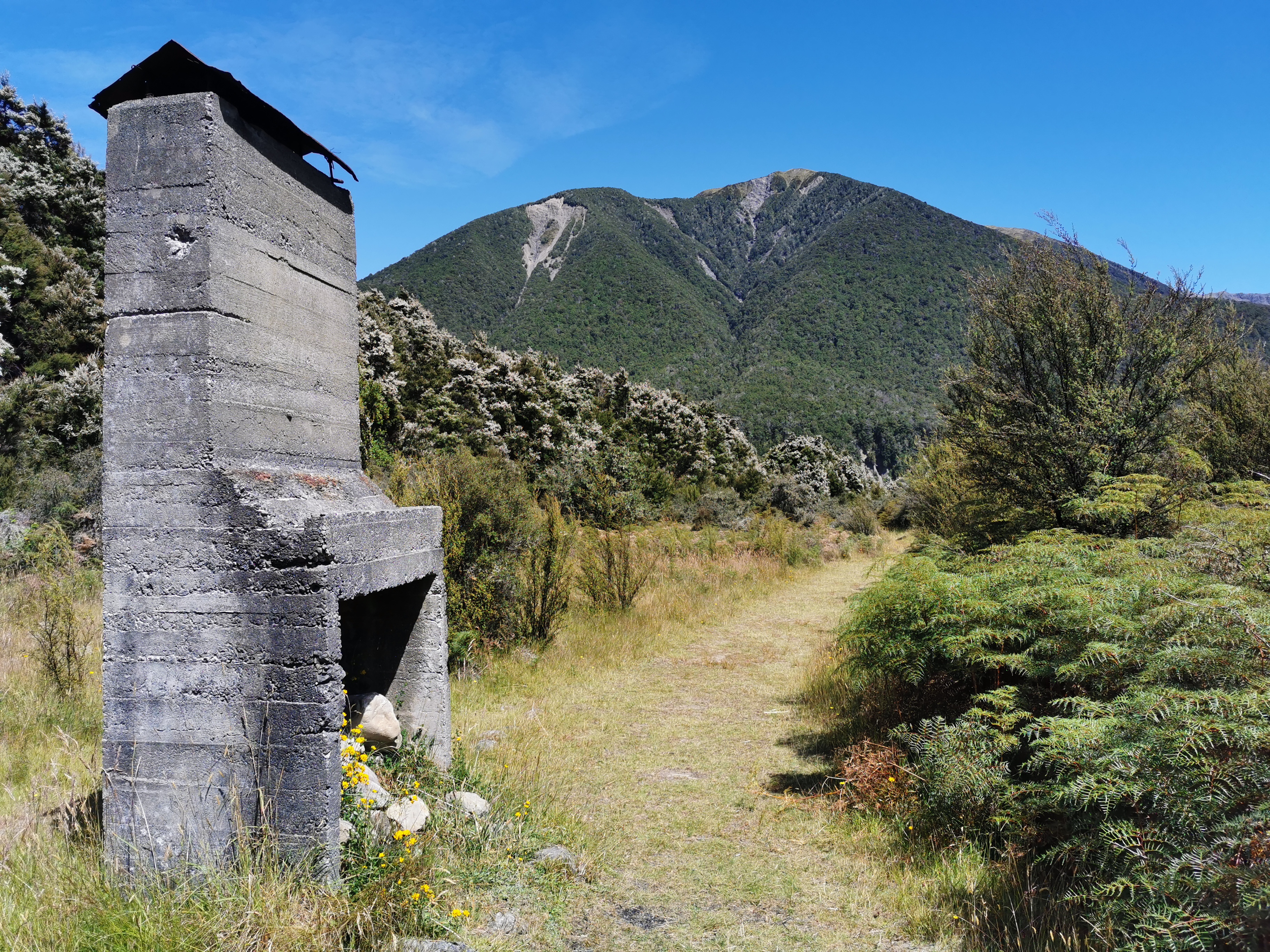
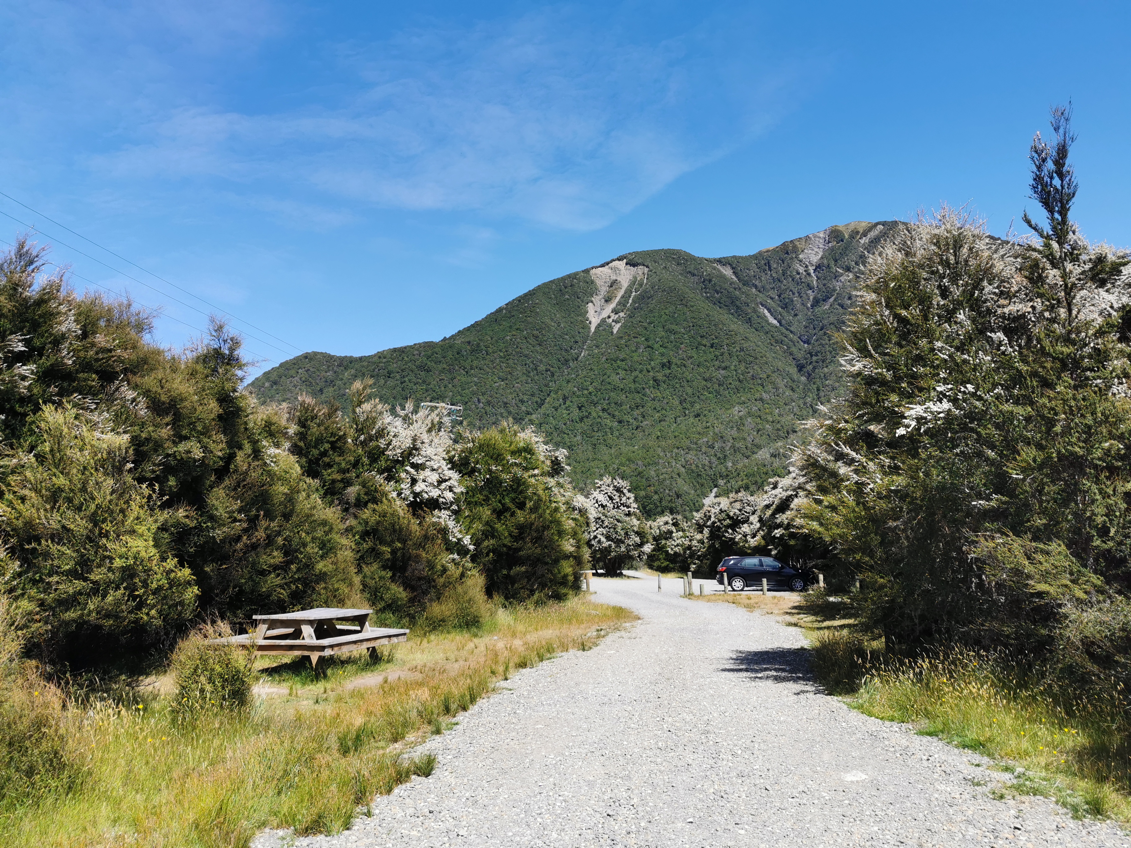
The next hut is Hackett Hut. As well as Rocks Hut, this is another spot where you can make a side trip to Nelson, and was another finishing option for me last year at Christmas before I decided to stop at Pelorus Bridge.
The path to Hackett Hut is pretty easy.
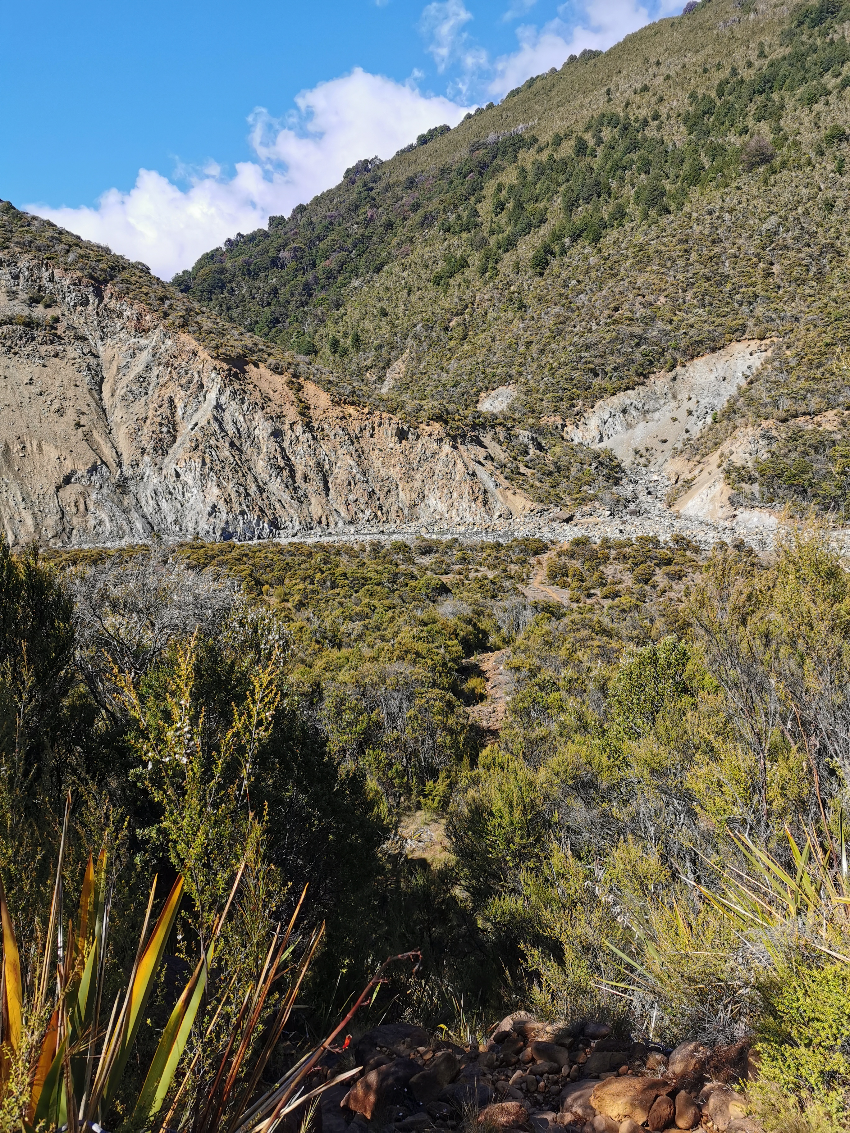
The only interesting bit is a “washout” sign which says to use the river route if the river is low and the “all-weather” route if the river is high. I decided to take the river route because the river was low, but that did leave me wondering what the higher route was like. I assume it must be a big detour because otherwise surely it would just be “the way”.
The “river route”
The river route was kinda fun, and I managed to not get my boots wet.
Navigating the big rocks on the river route was fun
If the river was higher, I can see why this way might not be a good option.
Here’s the junction you can take to get to Nelson.
What’s interesting is that it definitely was not 3.4km from Browning Hut to here, I’m sure it was less than 2km. Maybe that answers my question about the “all-weather” route described on the sign – it must be a fair bit longer.
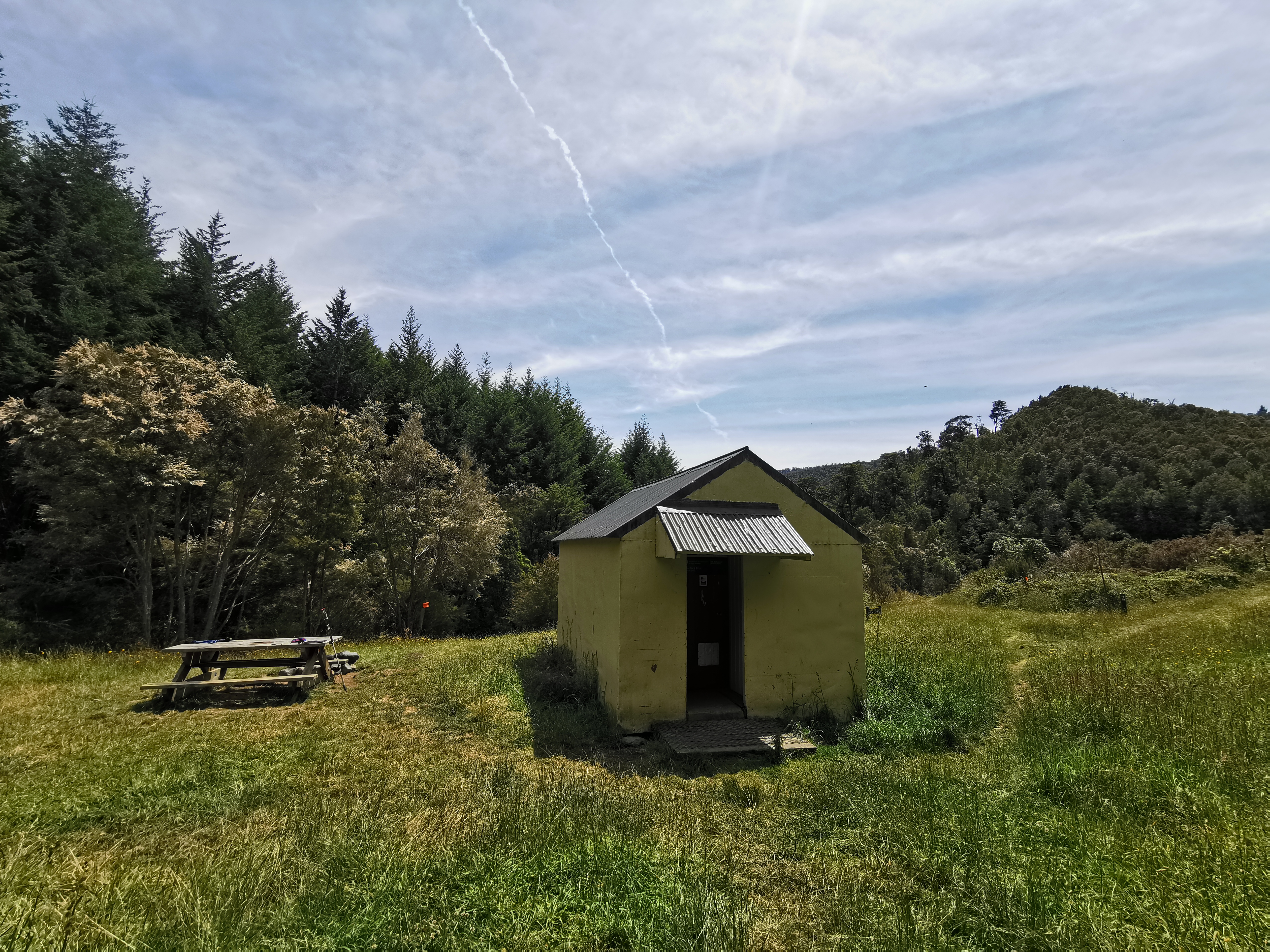
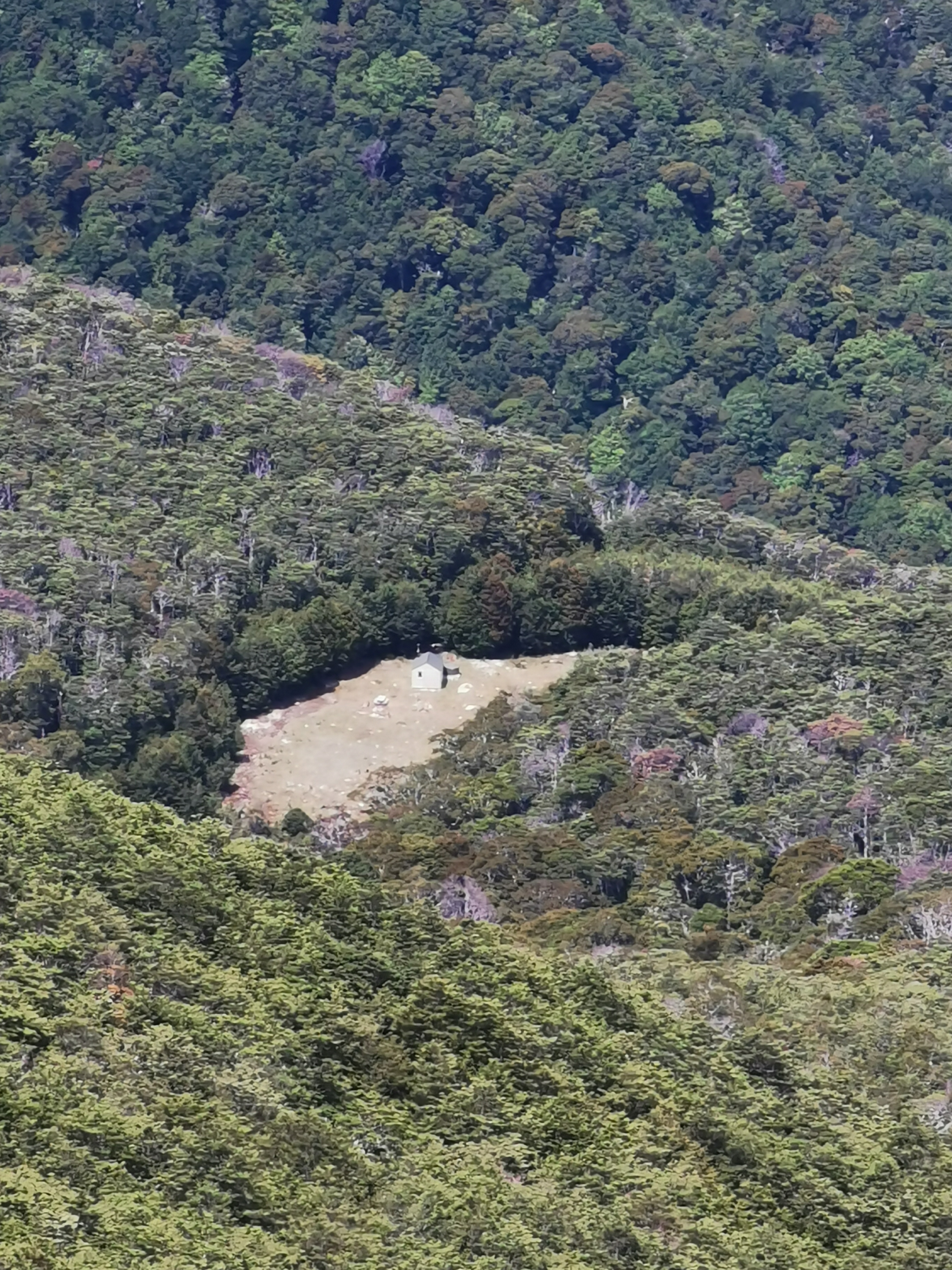
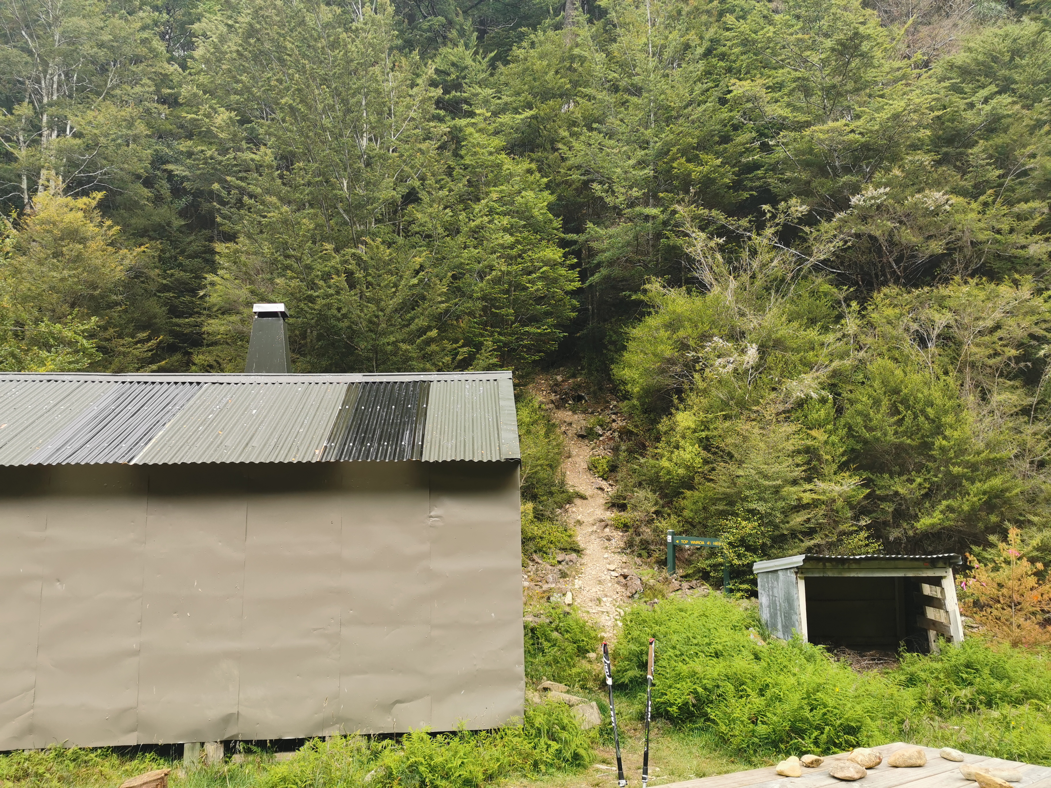
Here is Hackett Hut.
Hackett Hut – certainly not as nice as Browning Hut
There is nowhere to sit here. It’s weird.
Definitely not as nice
Also the intentions book in this hut was full. Partly because people take up entire pages in the books with their artwork and doodles which I wish they wouldn’t do. The intentions books are important and now I have no idea who is going to be at Starveall Hut (the next hut).
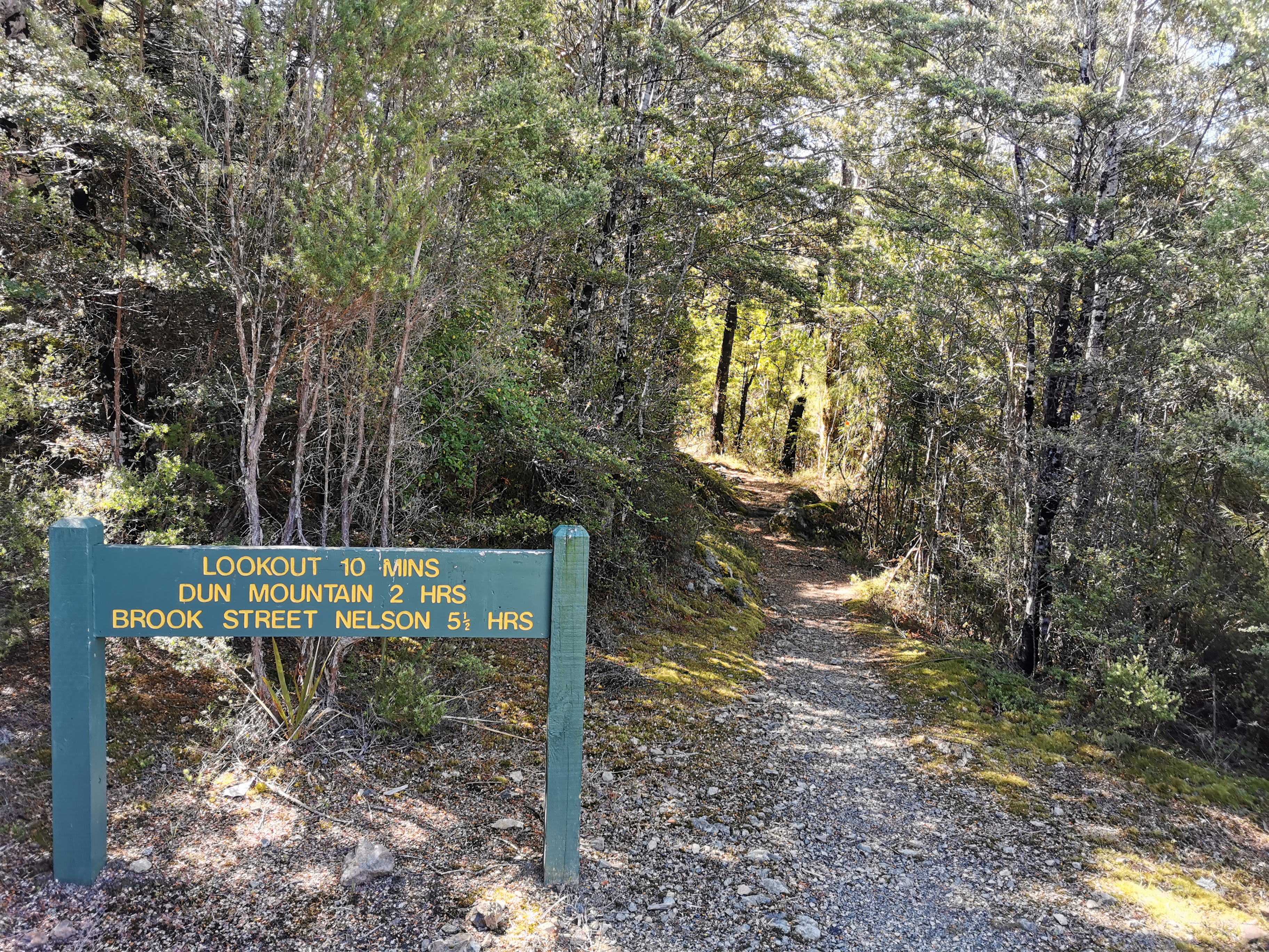
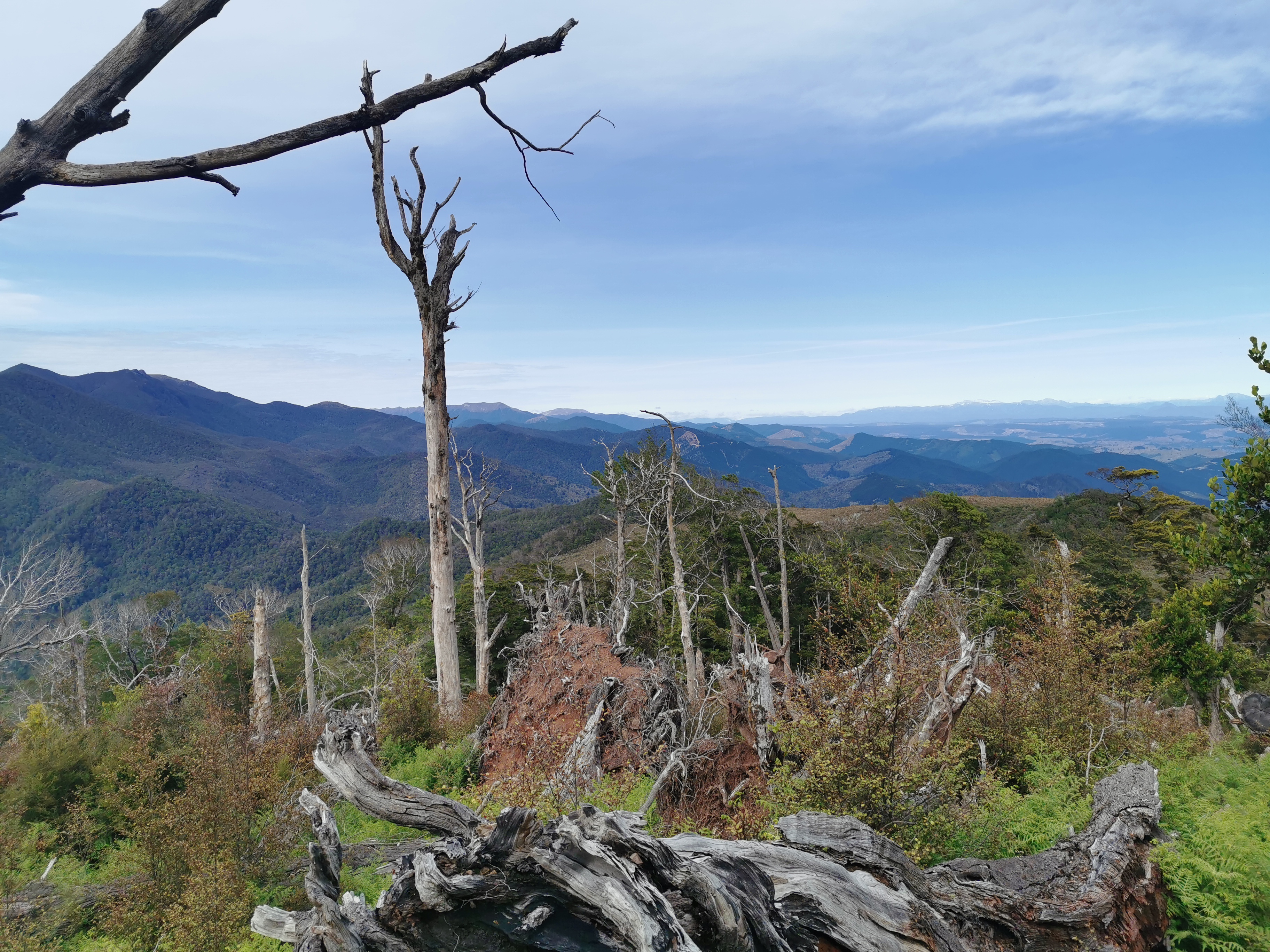
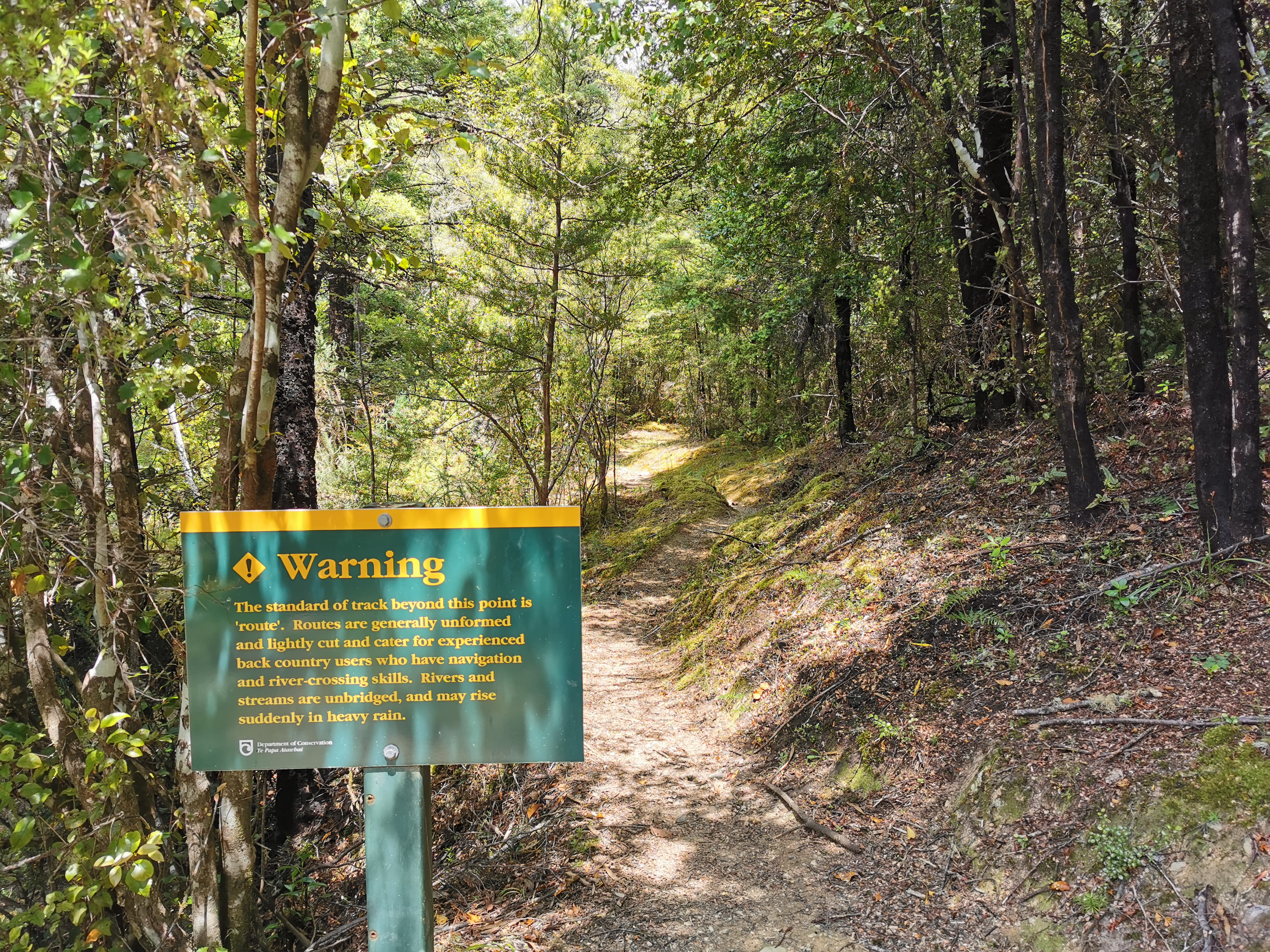
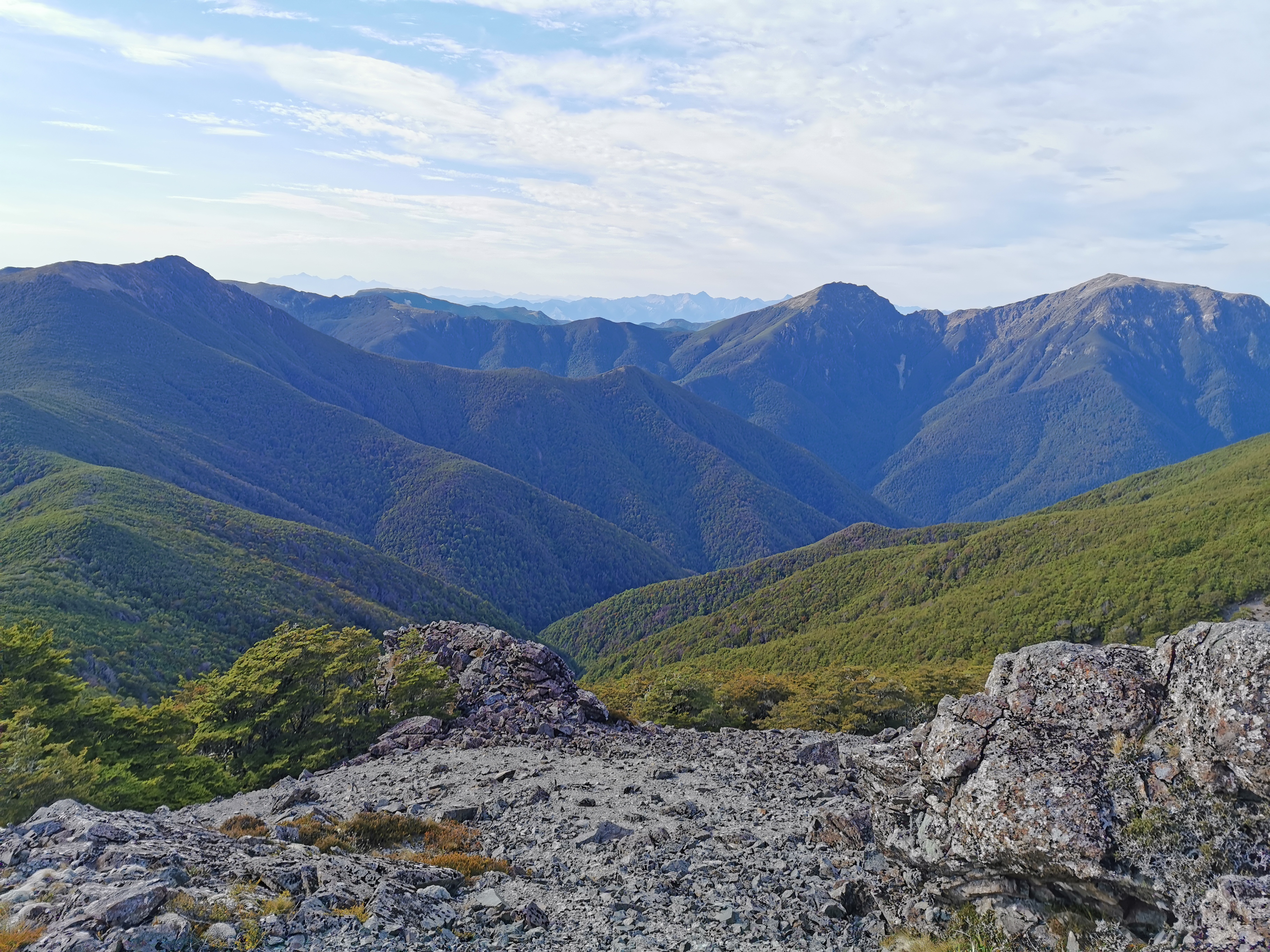
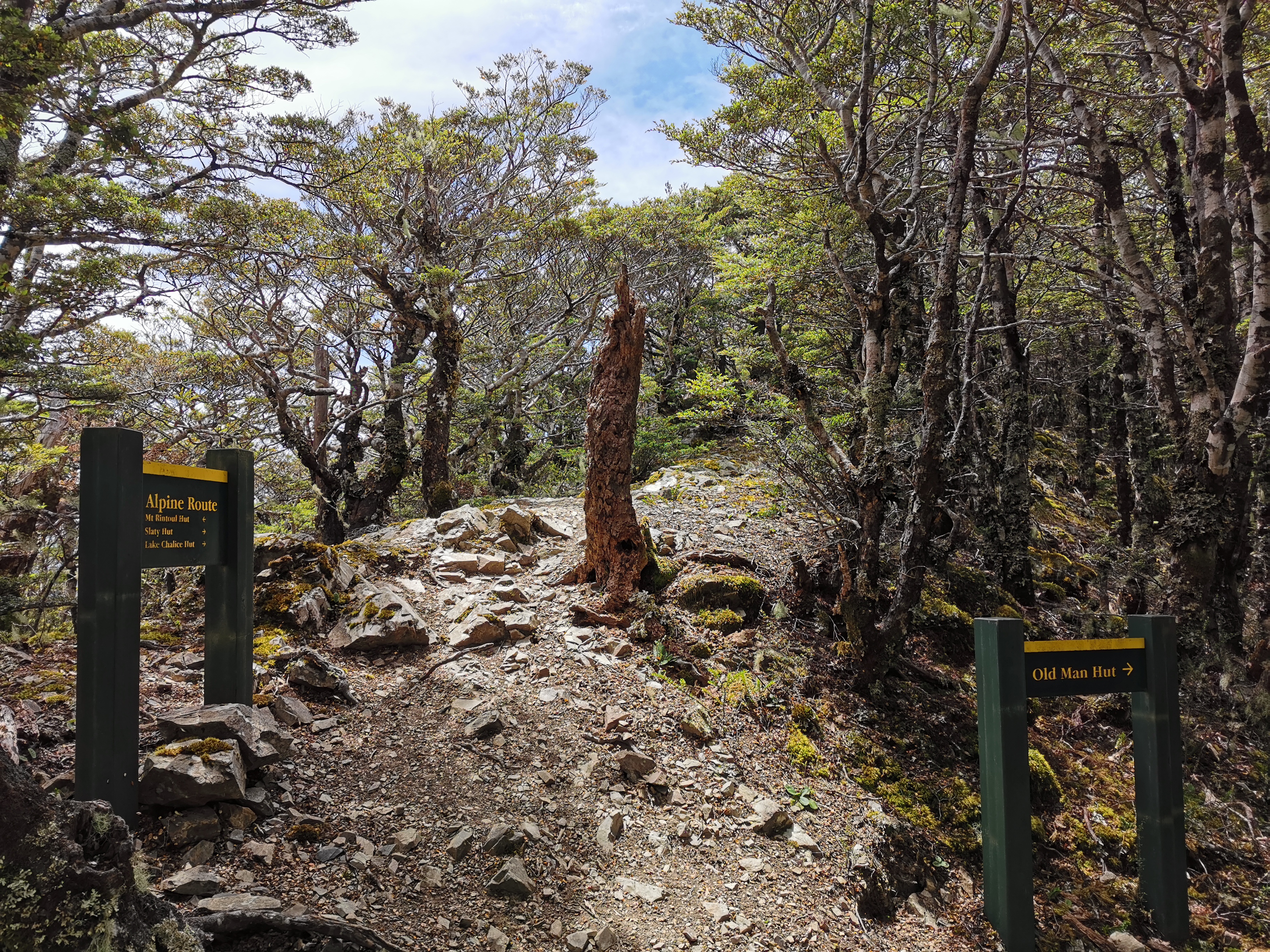
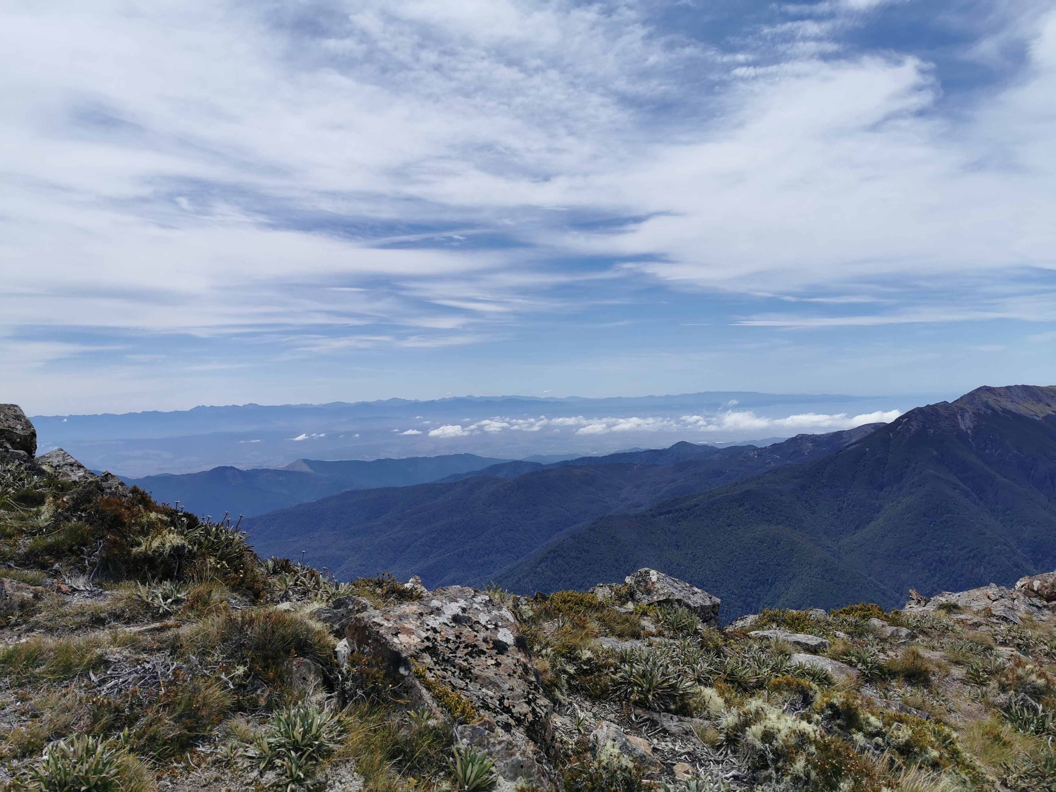
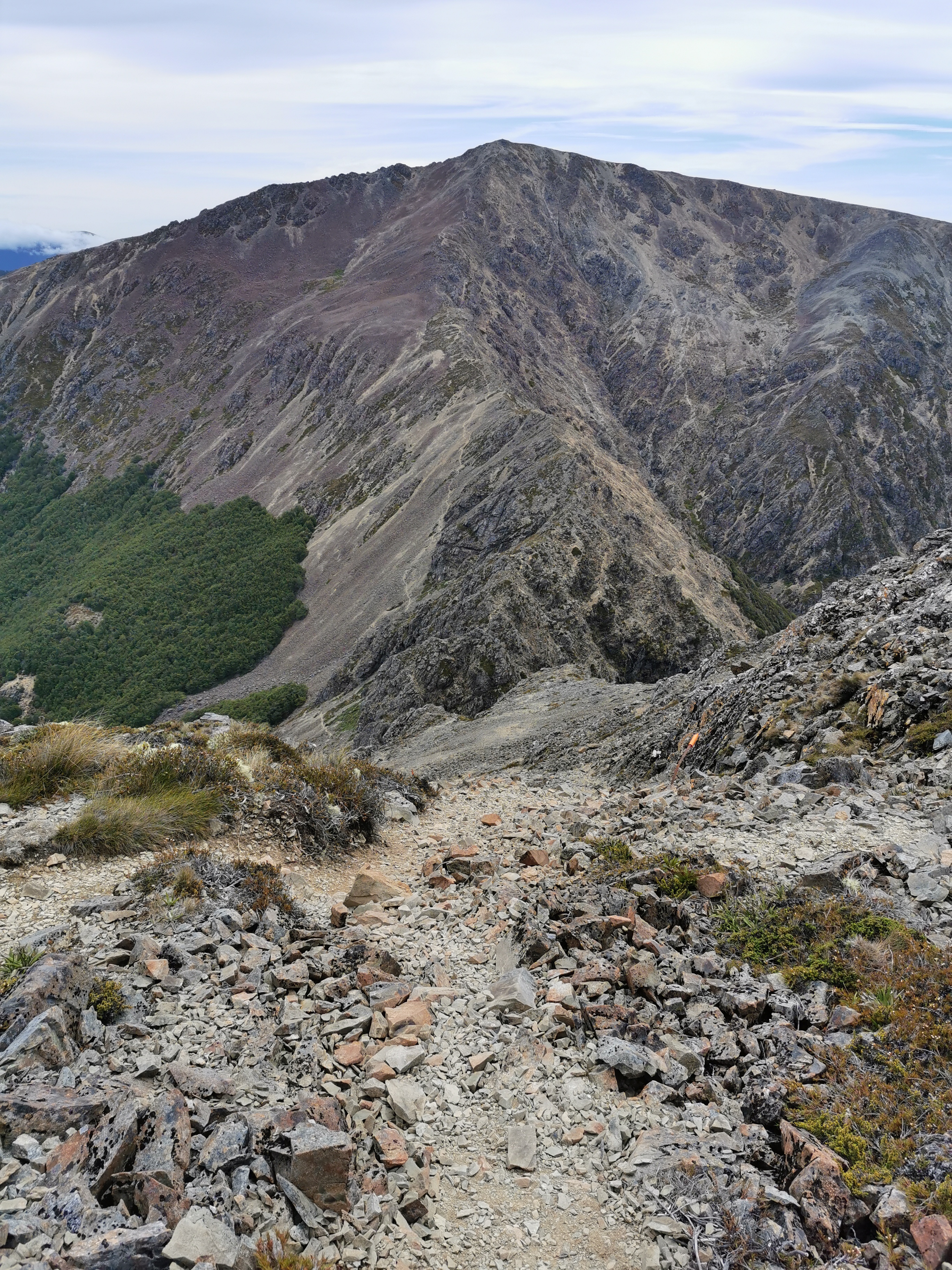
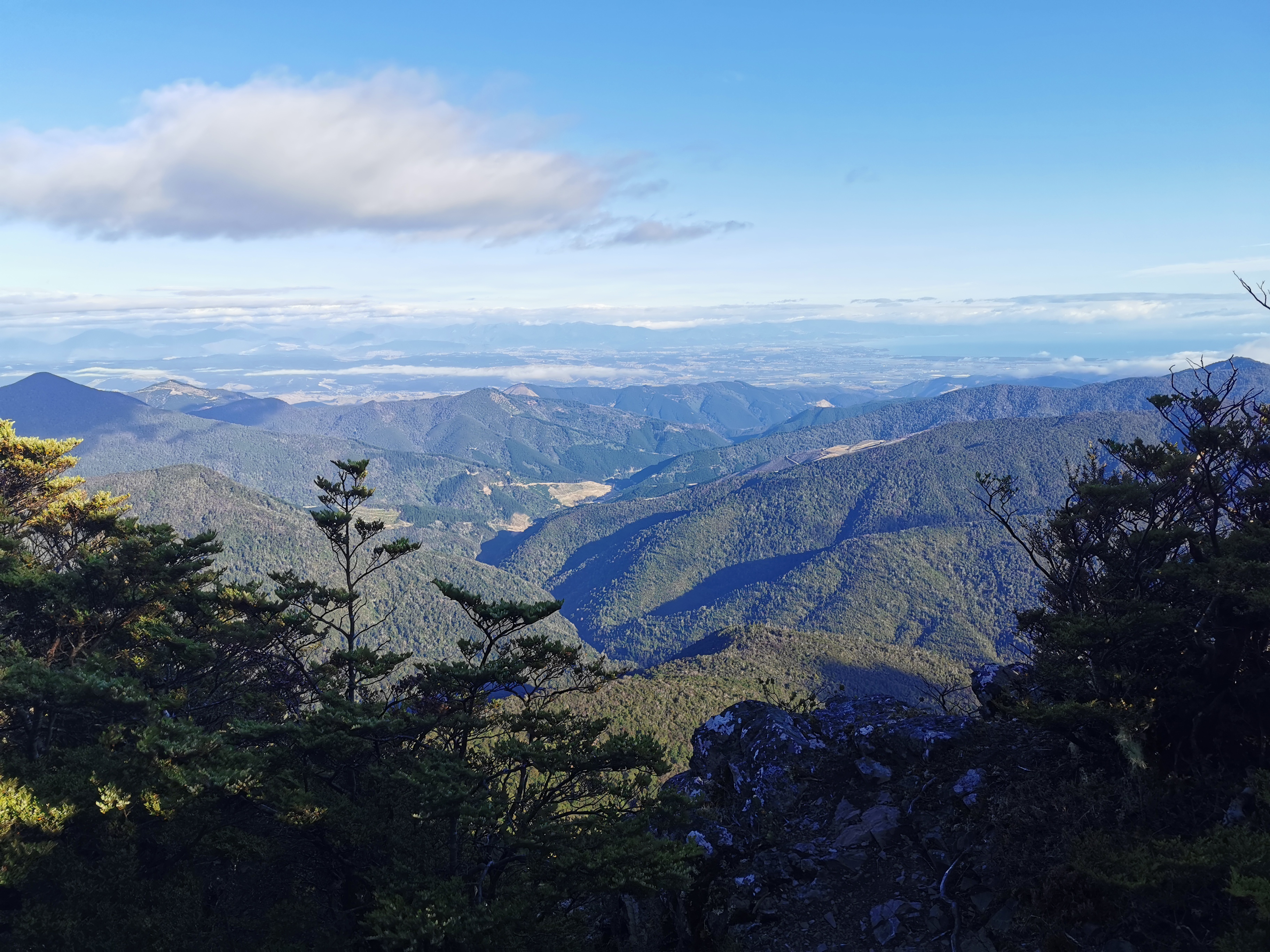
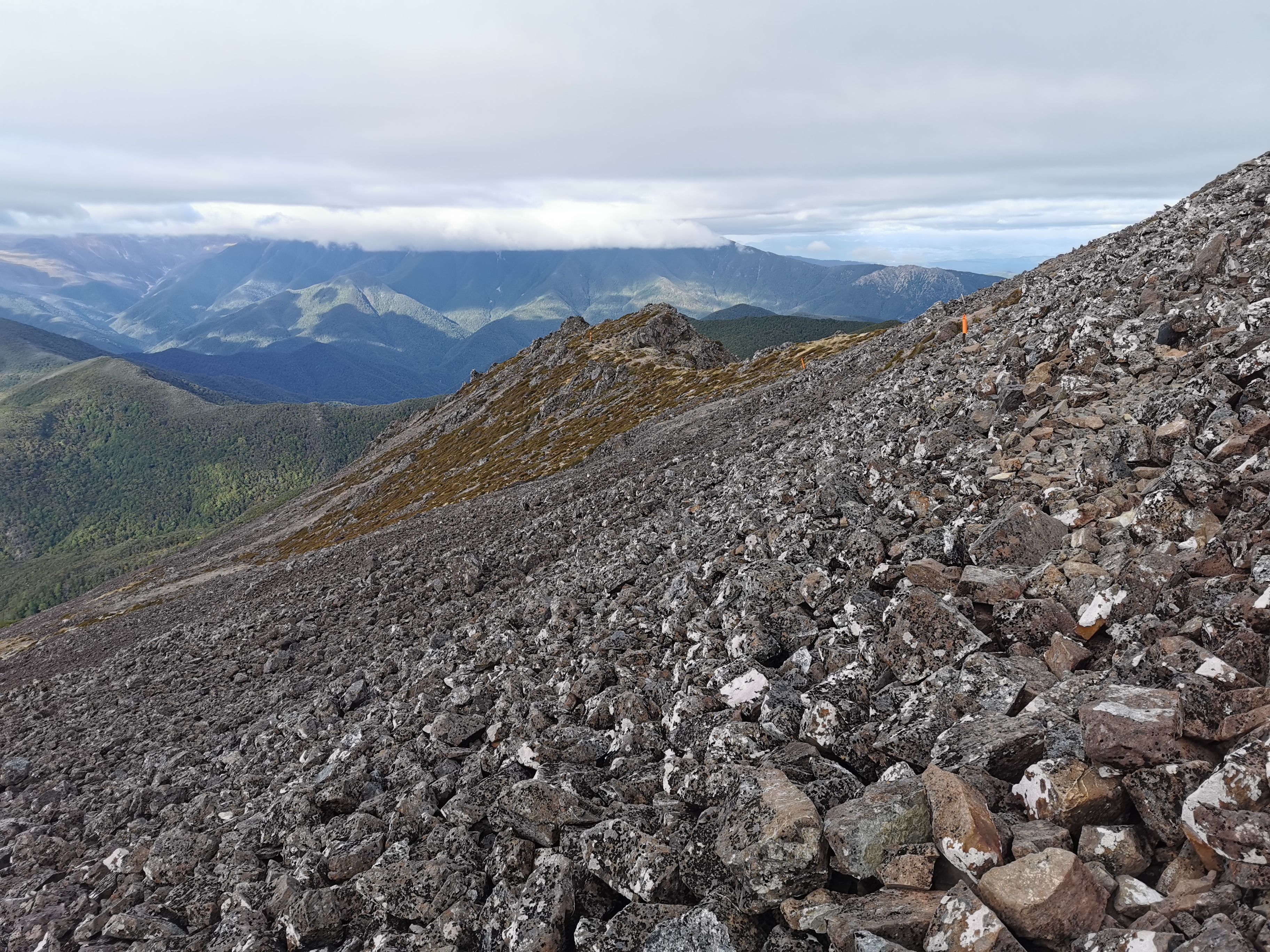
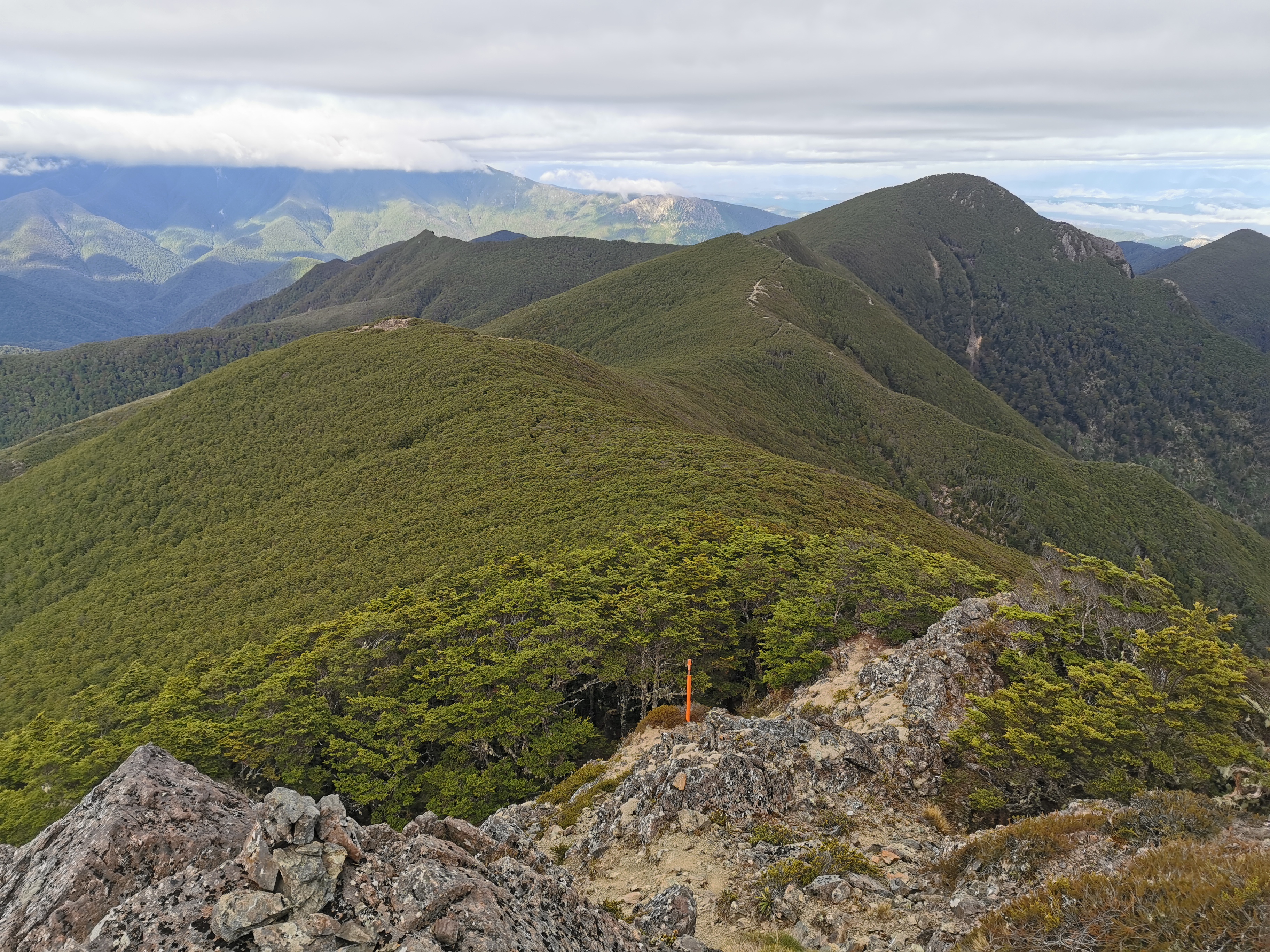
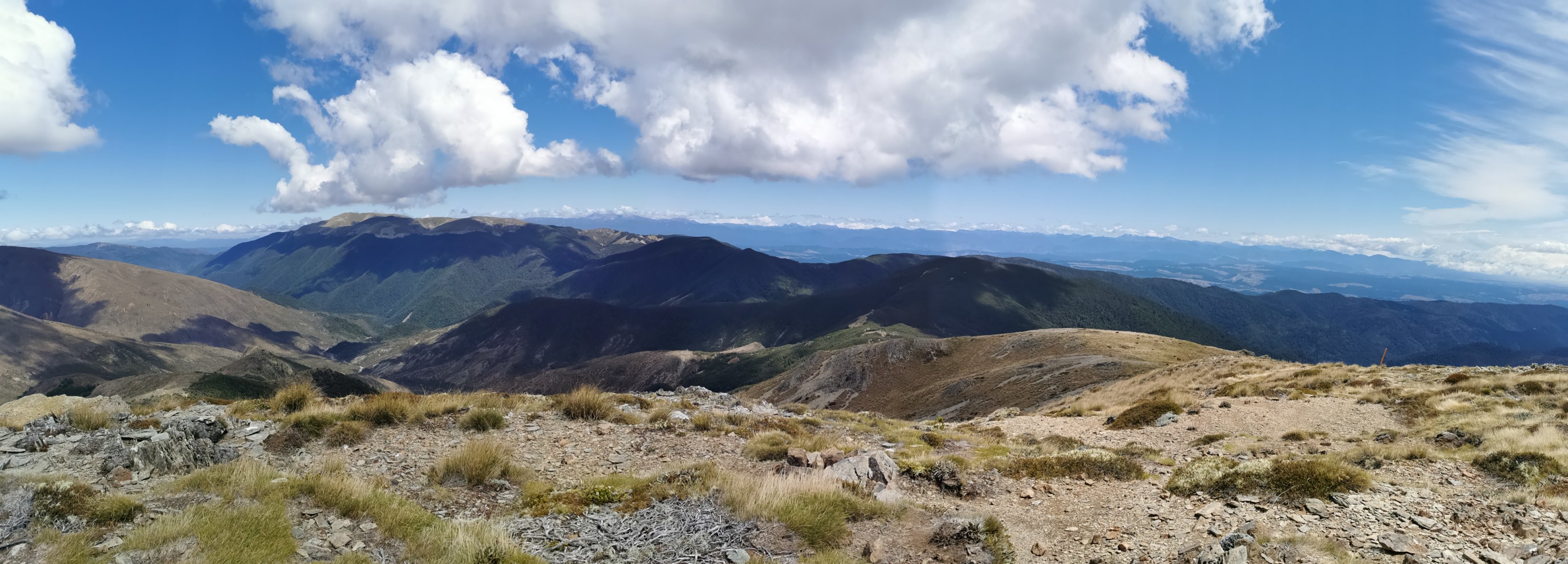
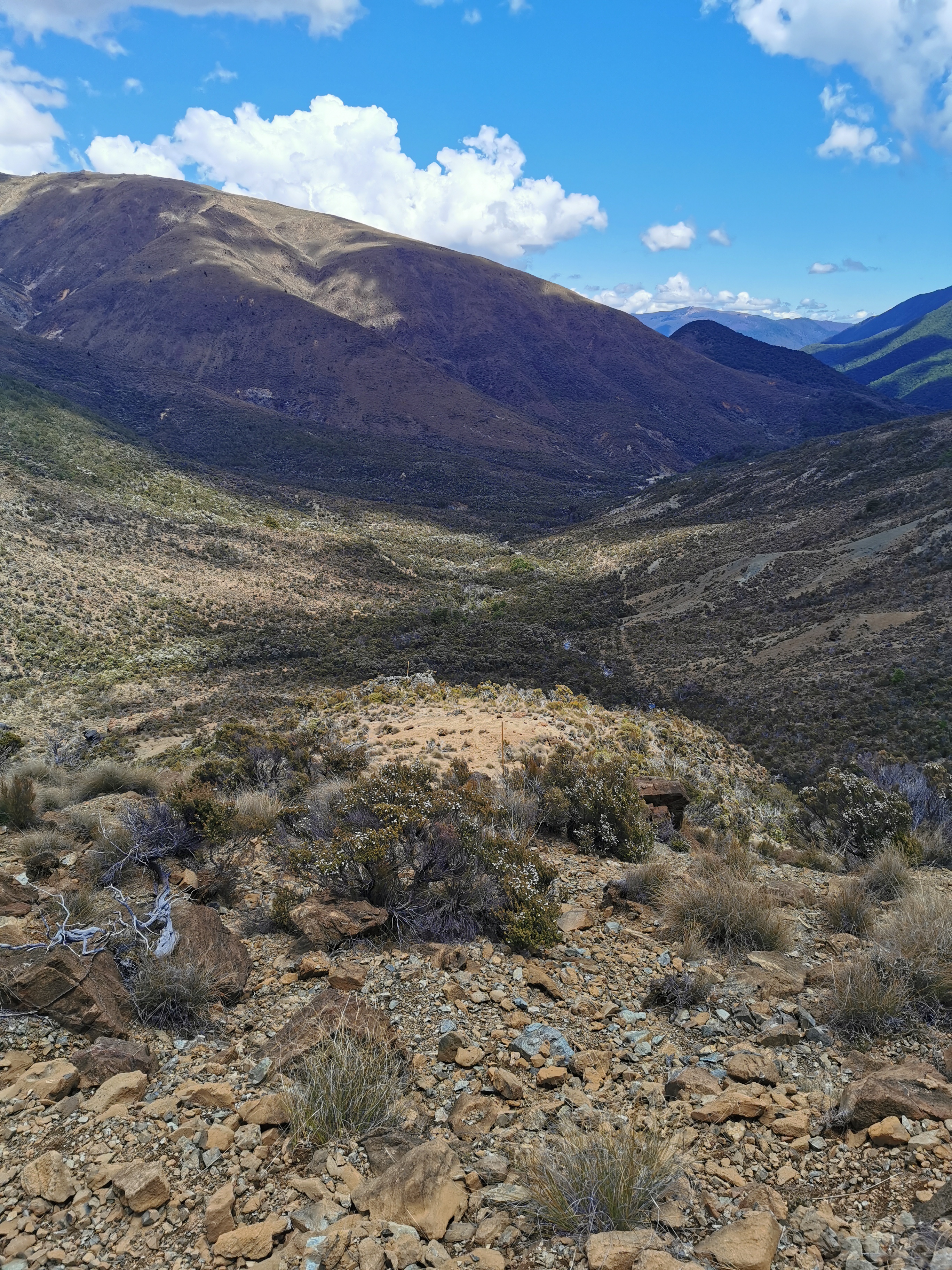
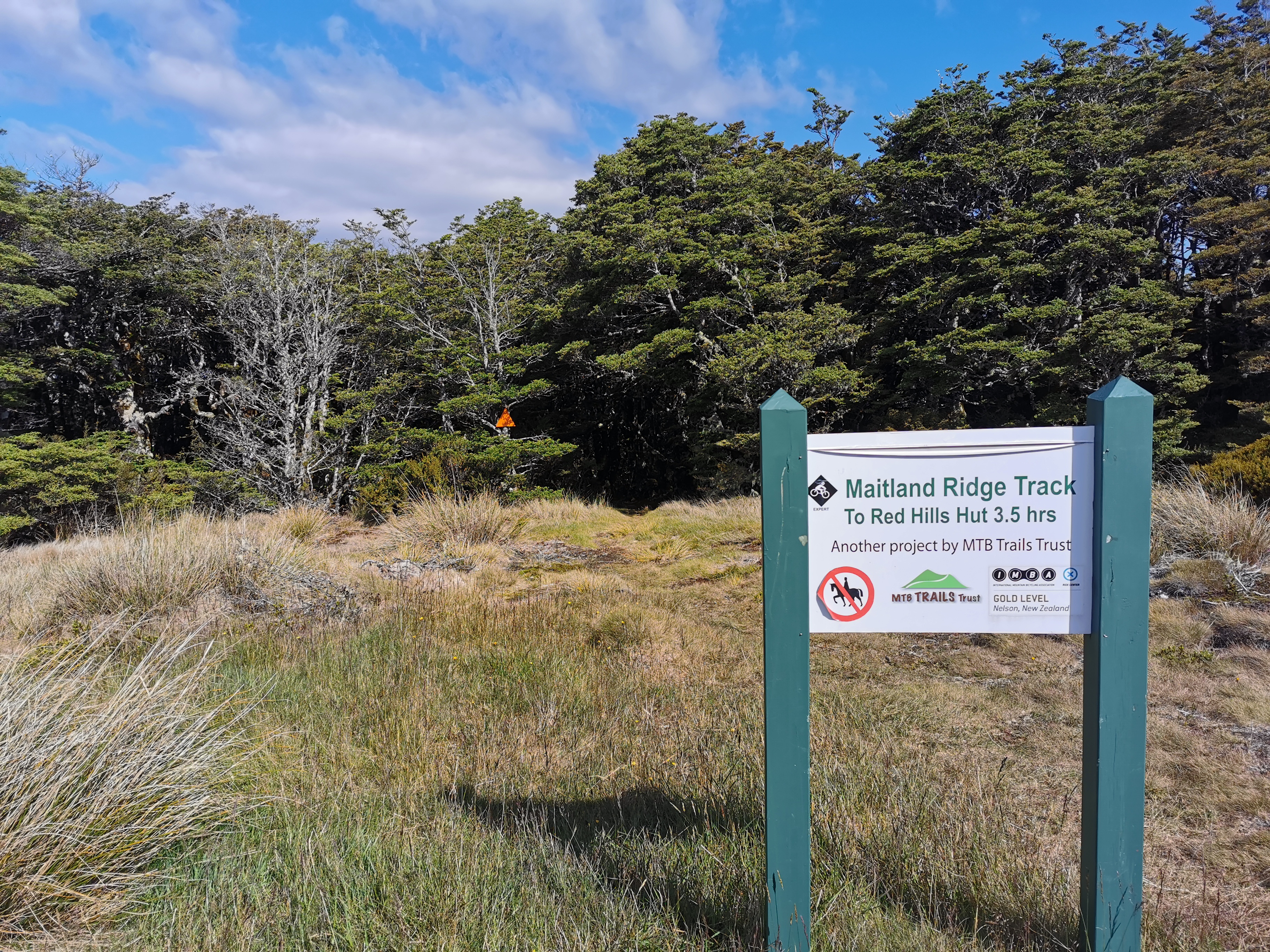
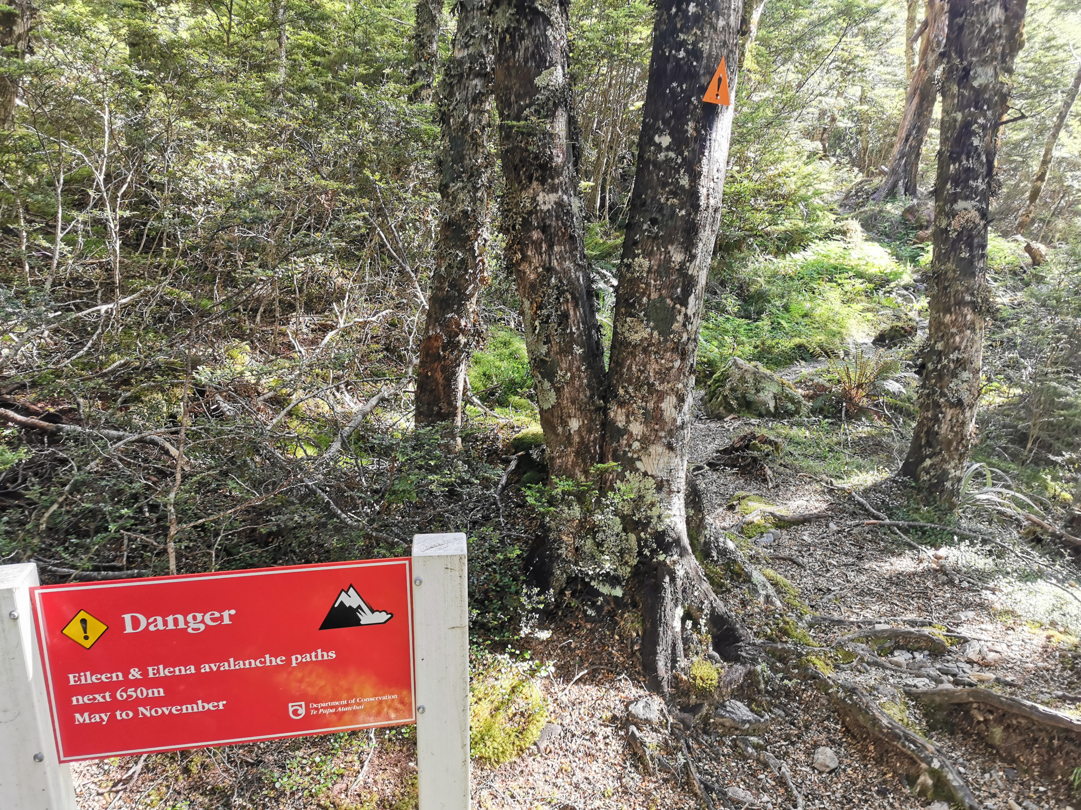
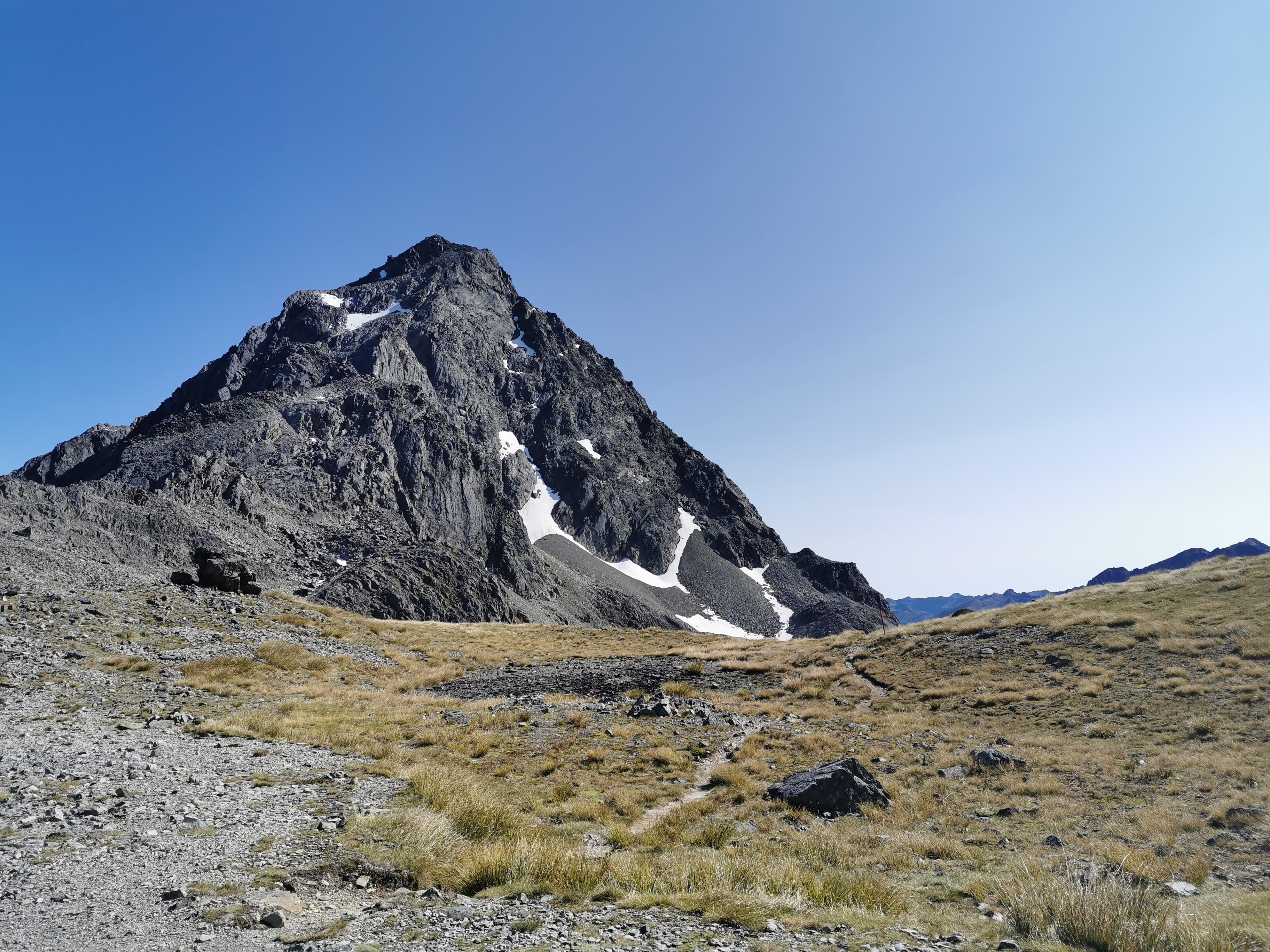
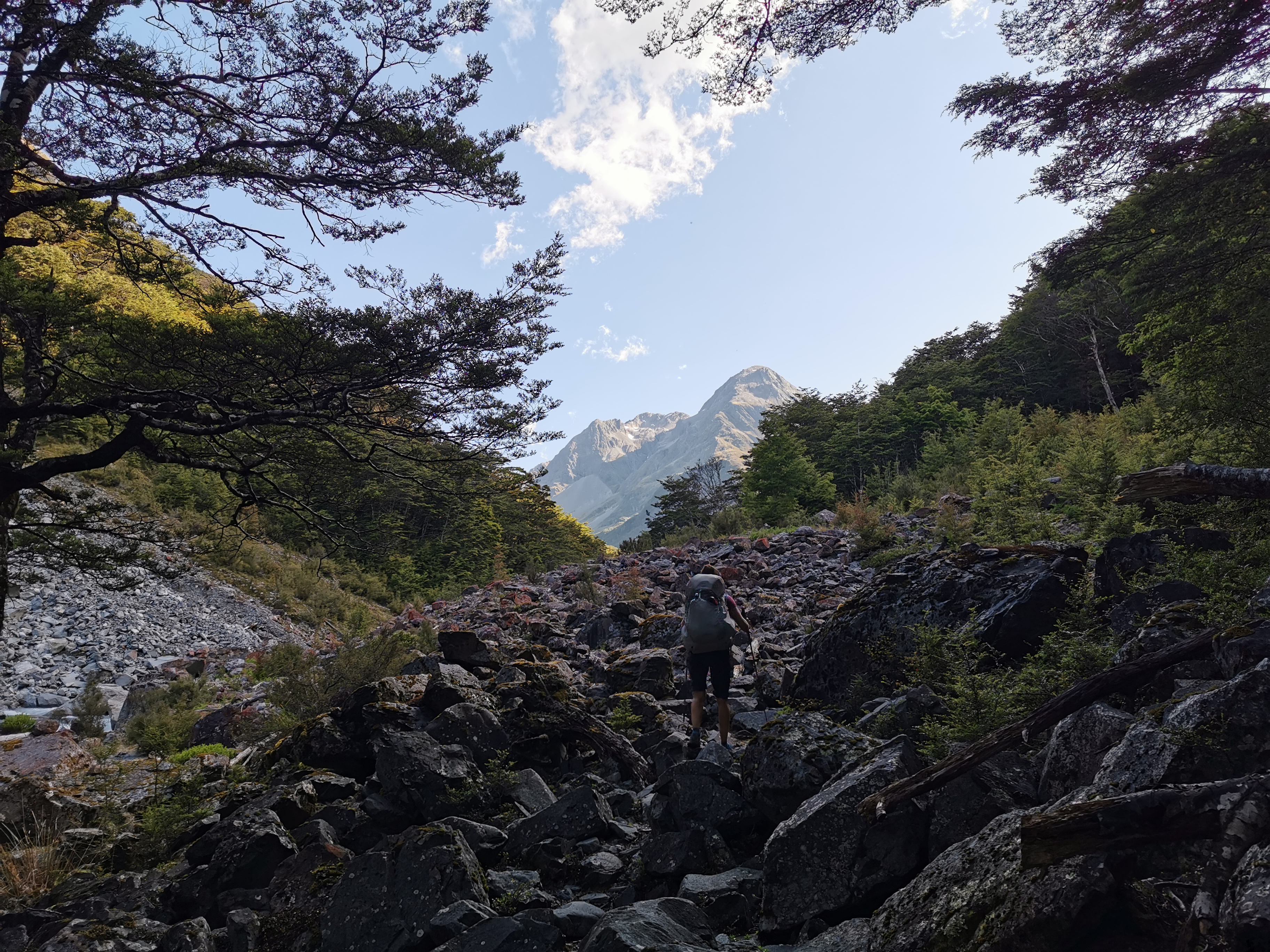
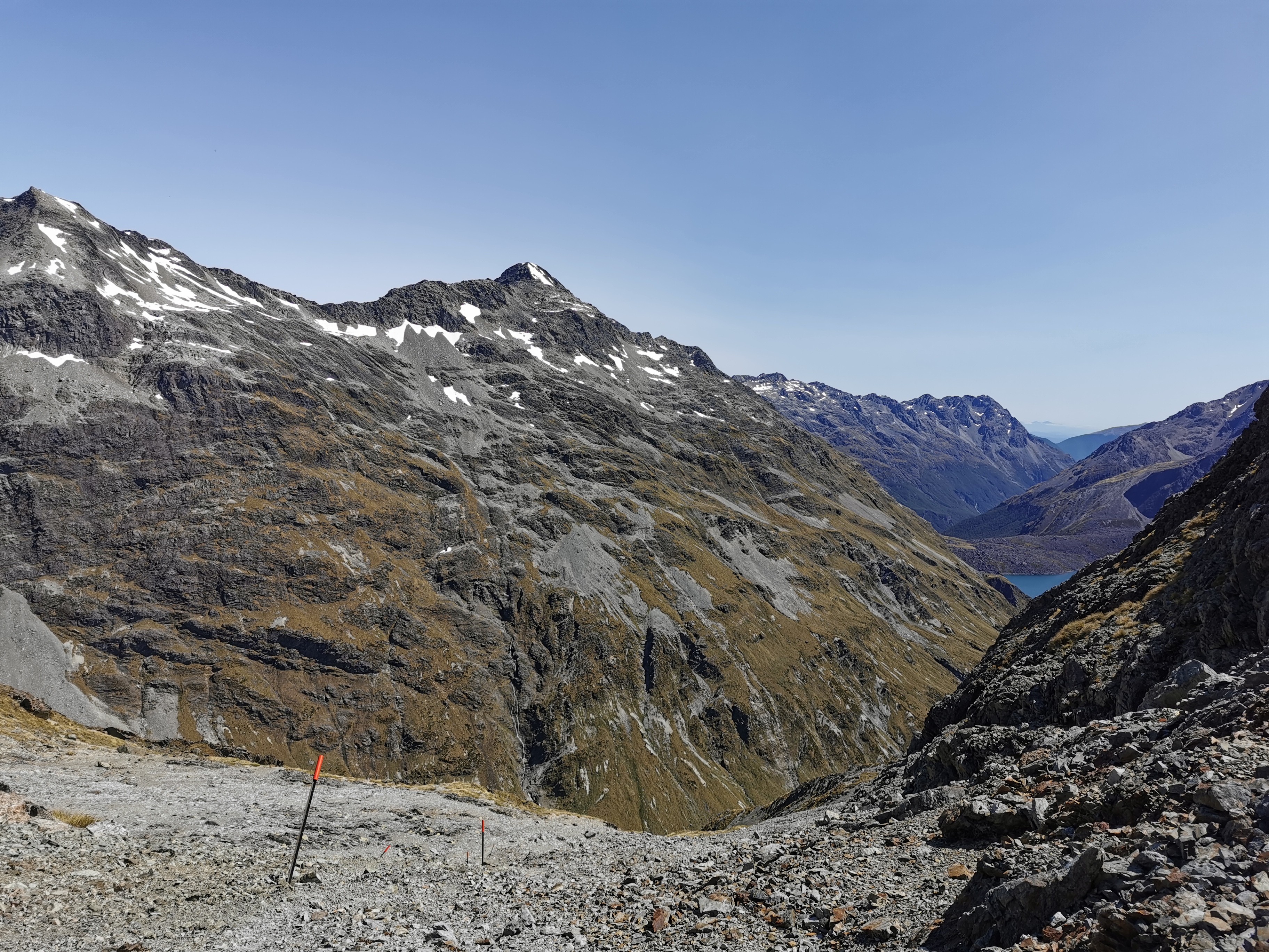
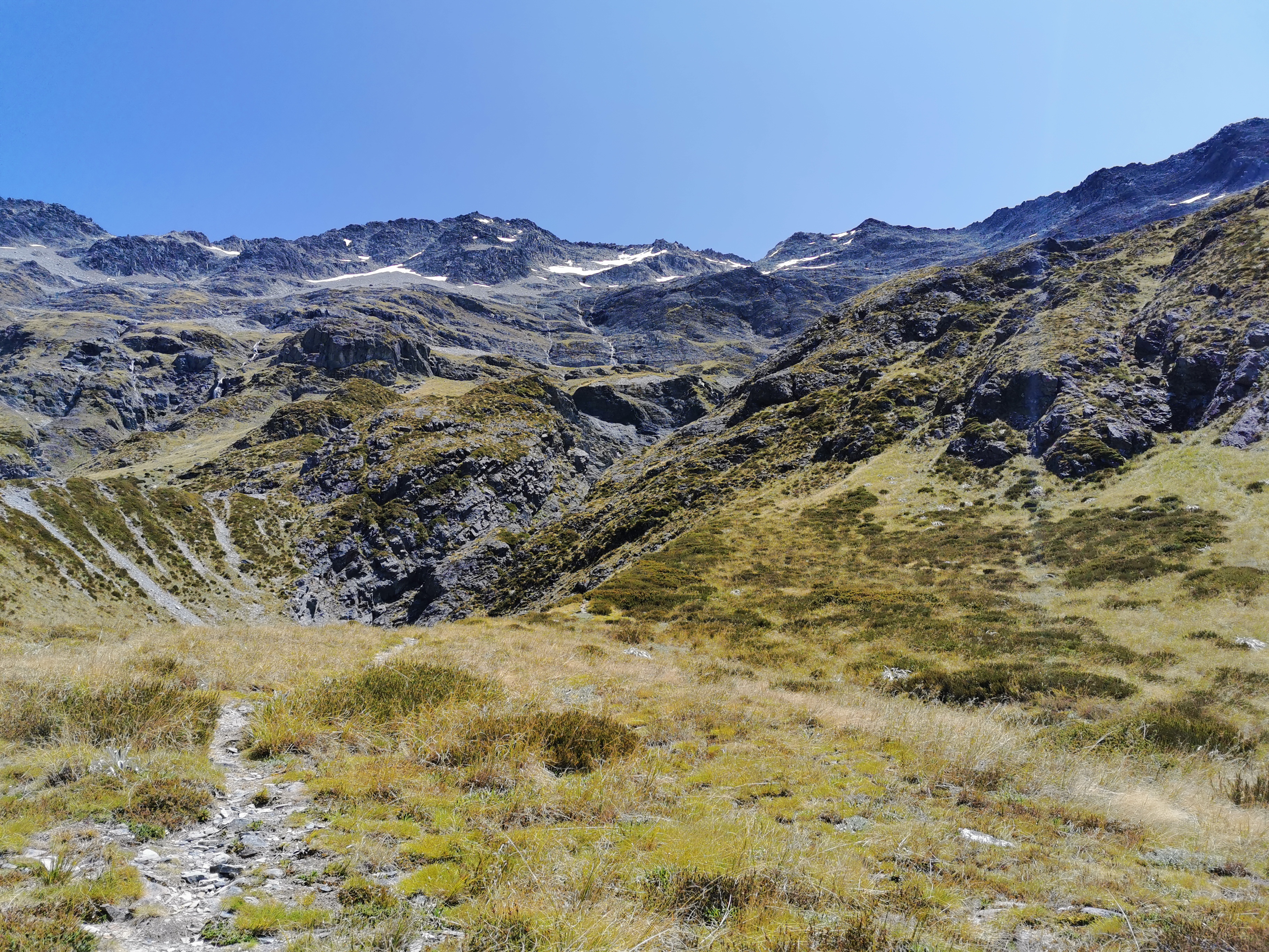
This is where the Richmond Alpine Track officially starts. I’m glad the weather forecast is excellent. From here it is supposed to be similar to the Tararua Ranges but longer, and has some of the best views on the TA, from what I understand.
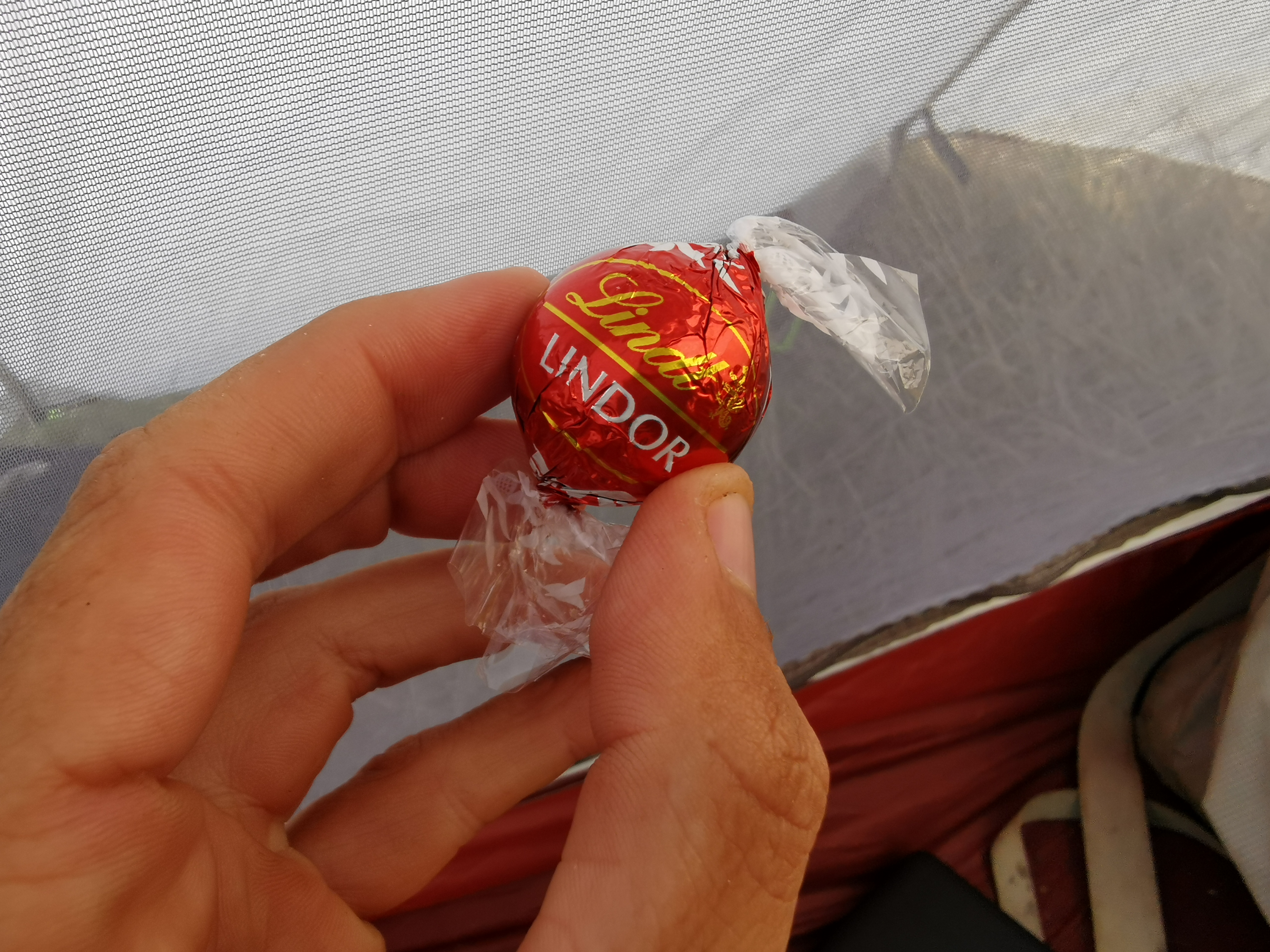
I had a second lunch here even though it was close to the first lunch at Browning Hut. I couldn’t resist having a little bit of chocolate, even though at this rate my chocolate will only last a few days and I won’t have any left for the last bit of the track to the next town which is St Arnaud, which is still 4 or 5 days away.
I think I might’ve worked out the mystery of why my pack was so light and was able to close easily two days ago despite having nine days of food. I have discovered I didn’t really bring any snacks. I brought chocolate which I would never forget, but I totally forgot muesli bars and nuts which is what I typically would snack on while walking. How could I forget those??
Just as I finished second lunch, two teenage boys turned up who were on a day trip – they had just walked from the car park at the road end. As I was leaving I also saw four “oldies” (their words not mine) and a family. This is obviously a popular local spot.
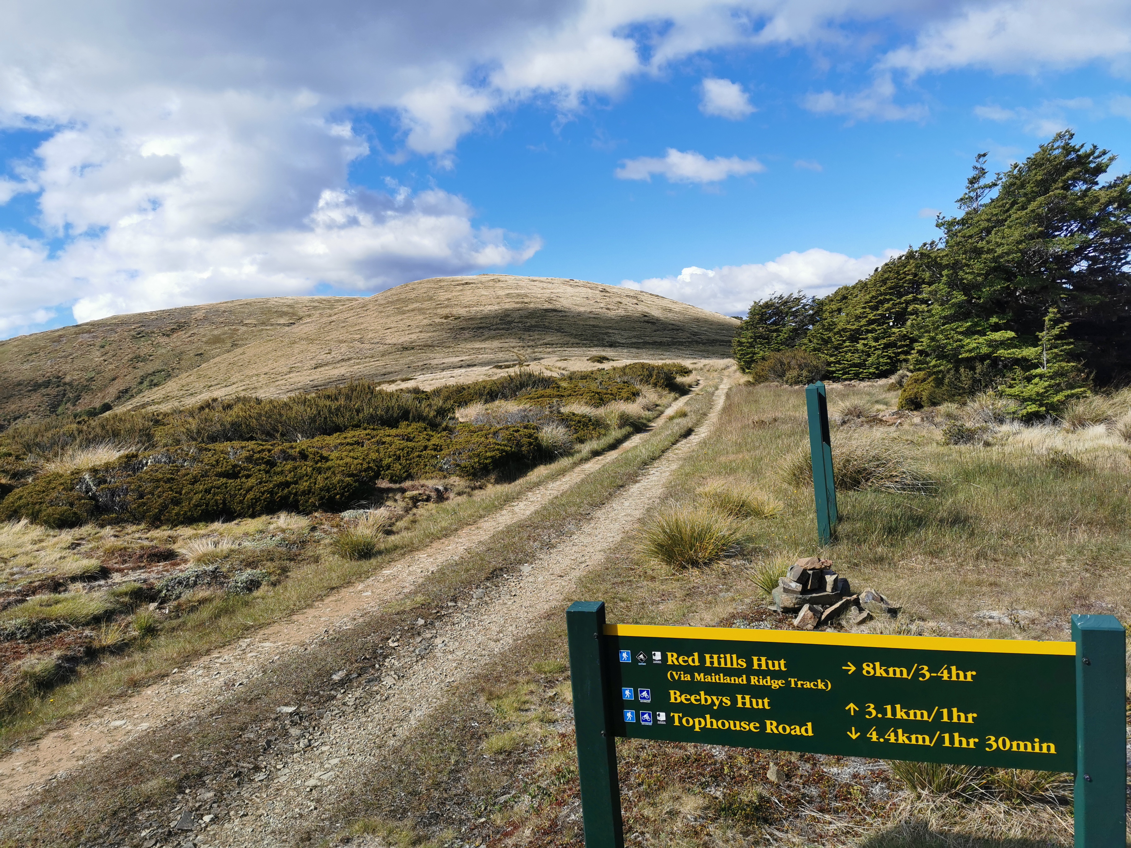
While I was in the hut I looked at the trail notes and it turns out that there is a daily shuttle from Boyle Village to Christchurch. Good, that means I don’t need the day’s leeway that I planned in case hitchhiking to Christchurch doesn’t work out. Now I don’t have to be in Boyle Village until the 23rd instead of the 22nd.
The notes also tell me that from here, the trail goes up 900 metres in 4 kilometers. Gee, that’s quite a gradient. Here goes!
Starveall Hut information signDon’t go this way unless you know what you’re getting yourself into
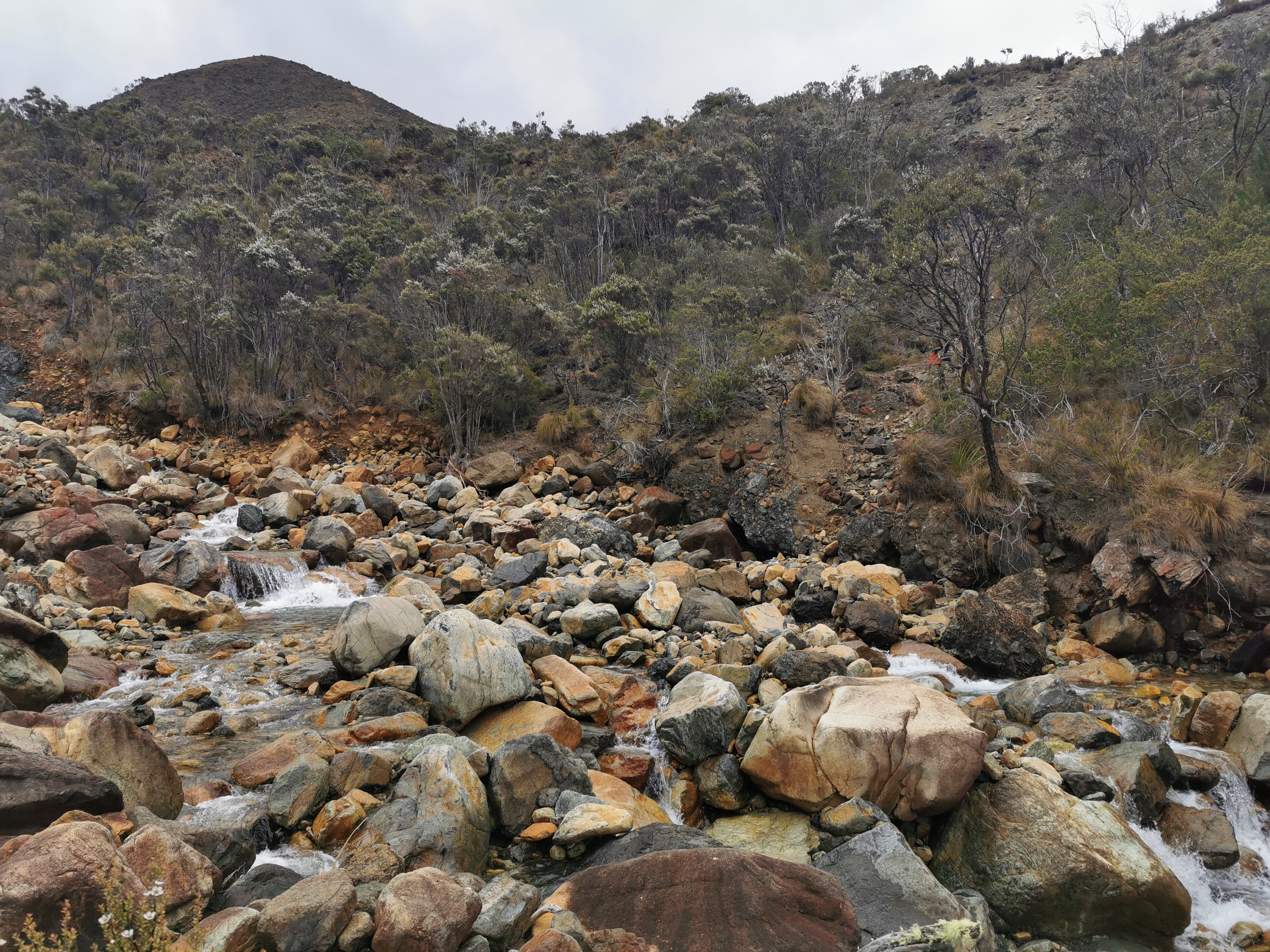
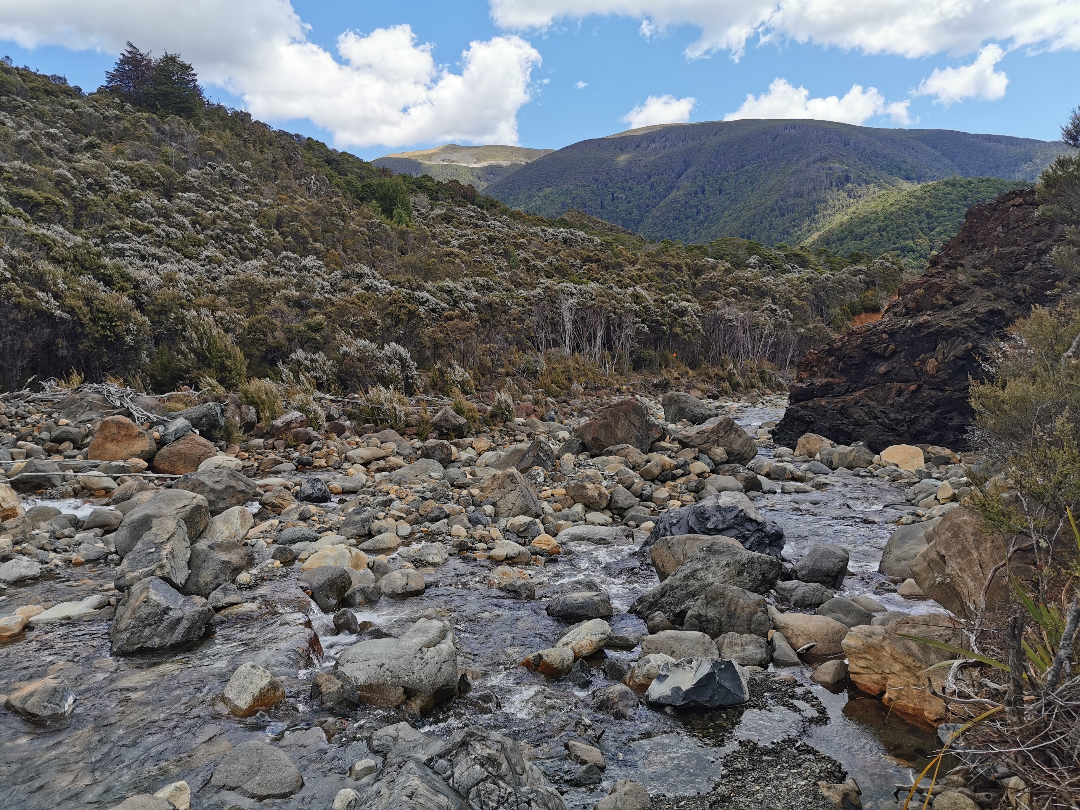
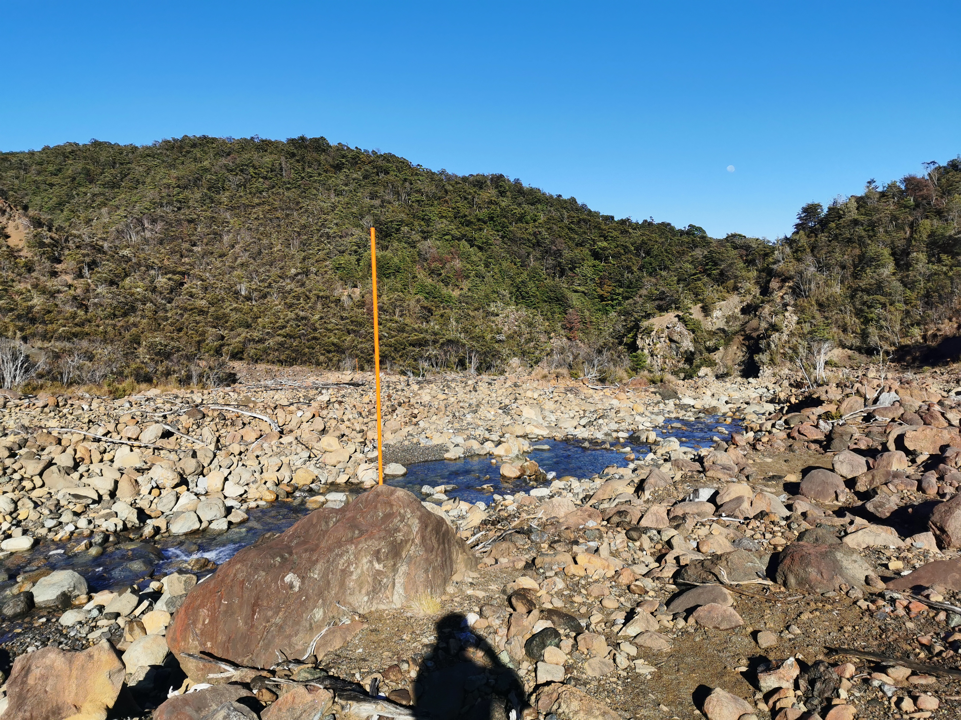
First though is a walk up Hackett Creek. Lucky the river is low, and it shouldn’t be too hard!
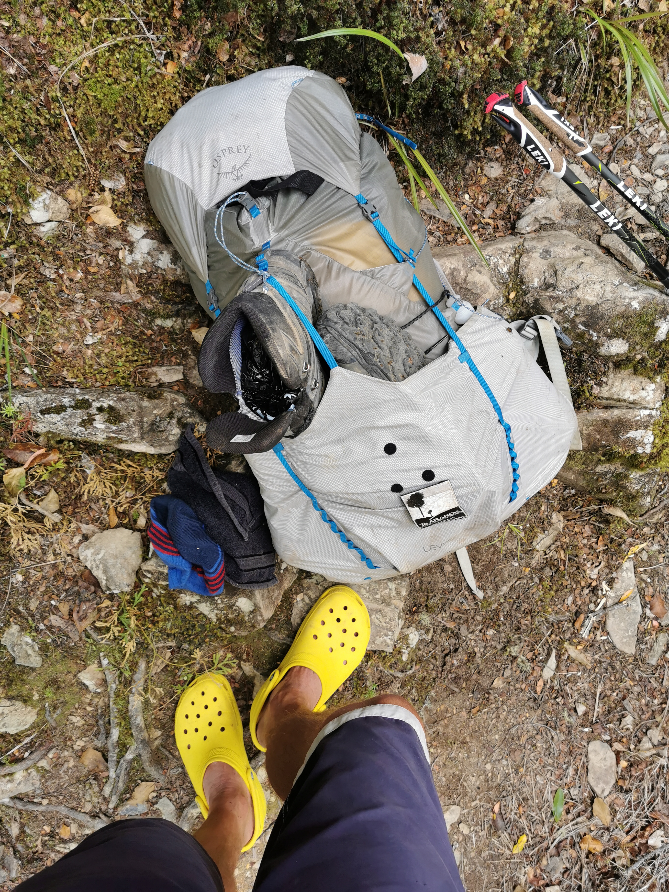
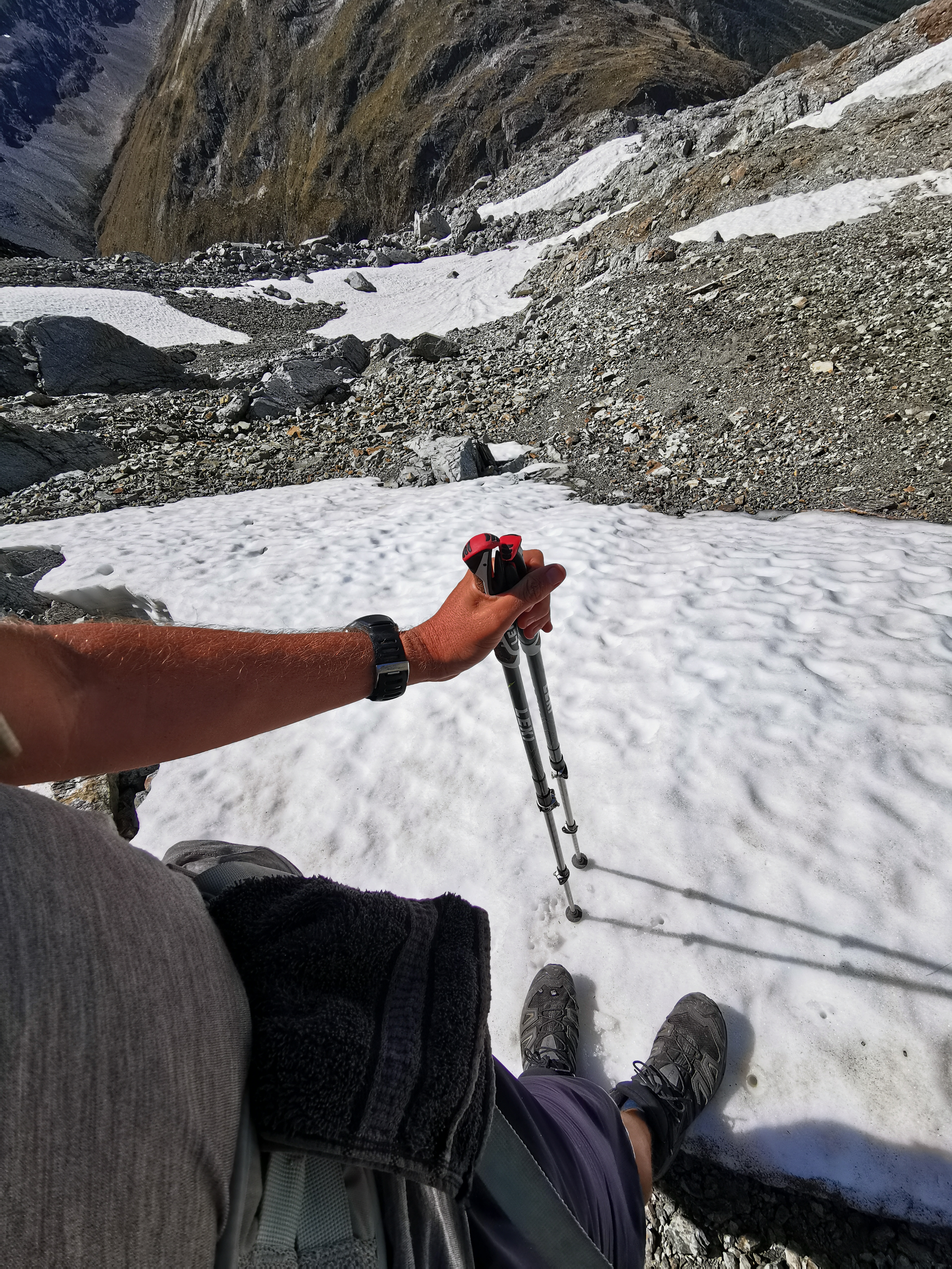
Time to change into crocs.
You cross the river multiple times.
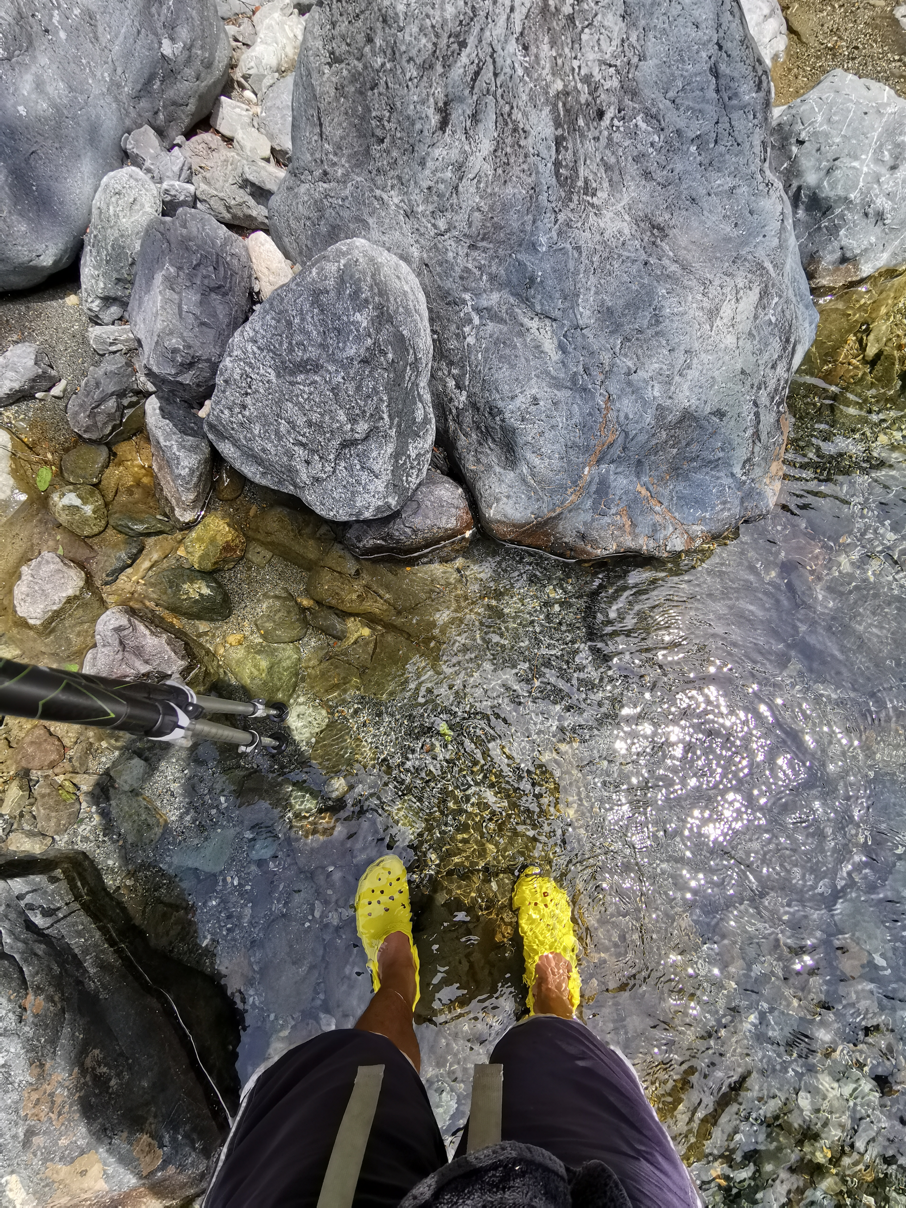
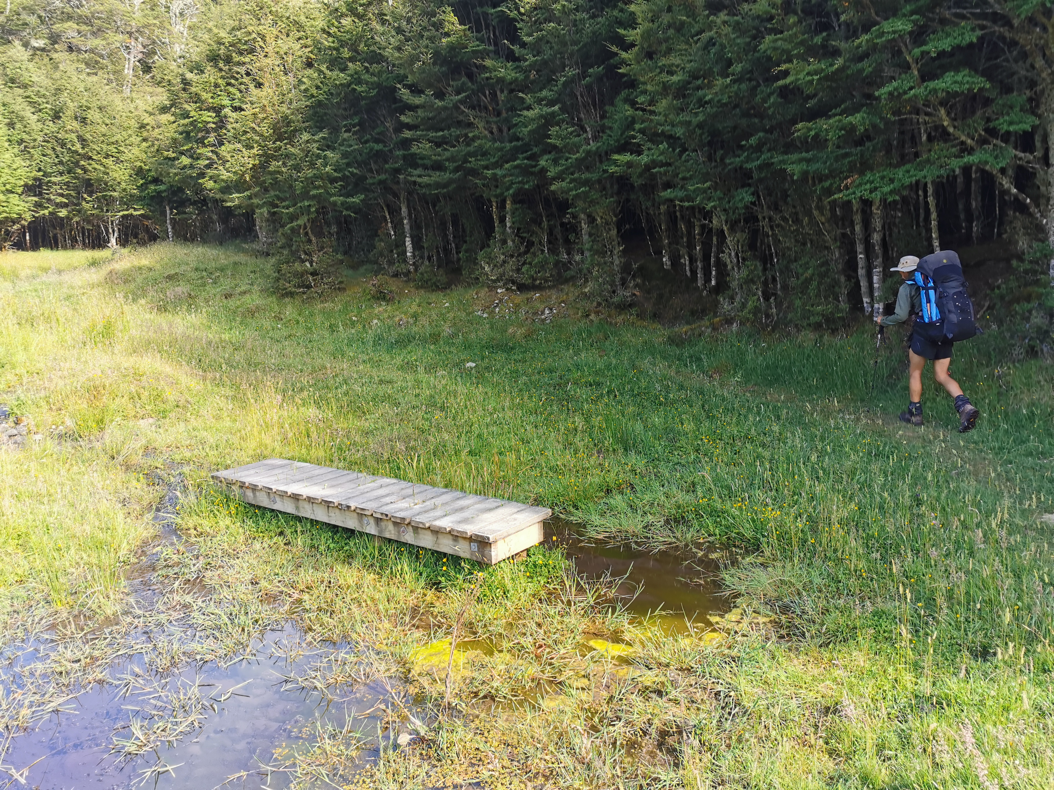
The water was so clear that if you wait long enough for the ripples to disappear, it looks like you’re not even standing in water at all.
While I was walking the river, an Aussie couple came the other way. “Wow, sweet kicks!” he said to me as I approached. Obviously talking about the crocs!
Another part of the river
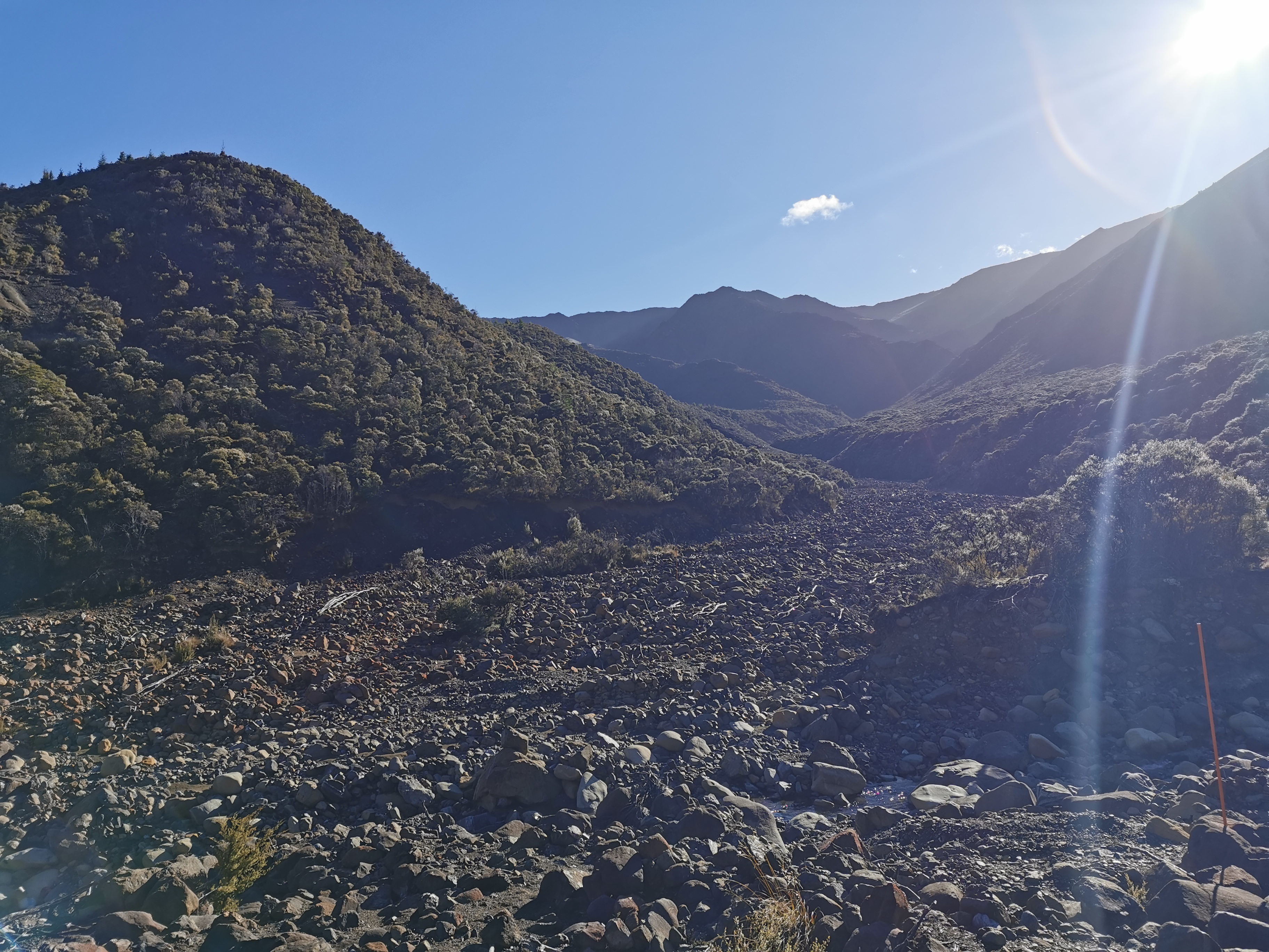
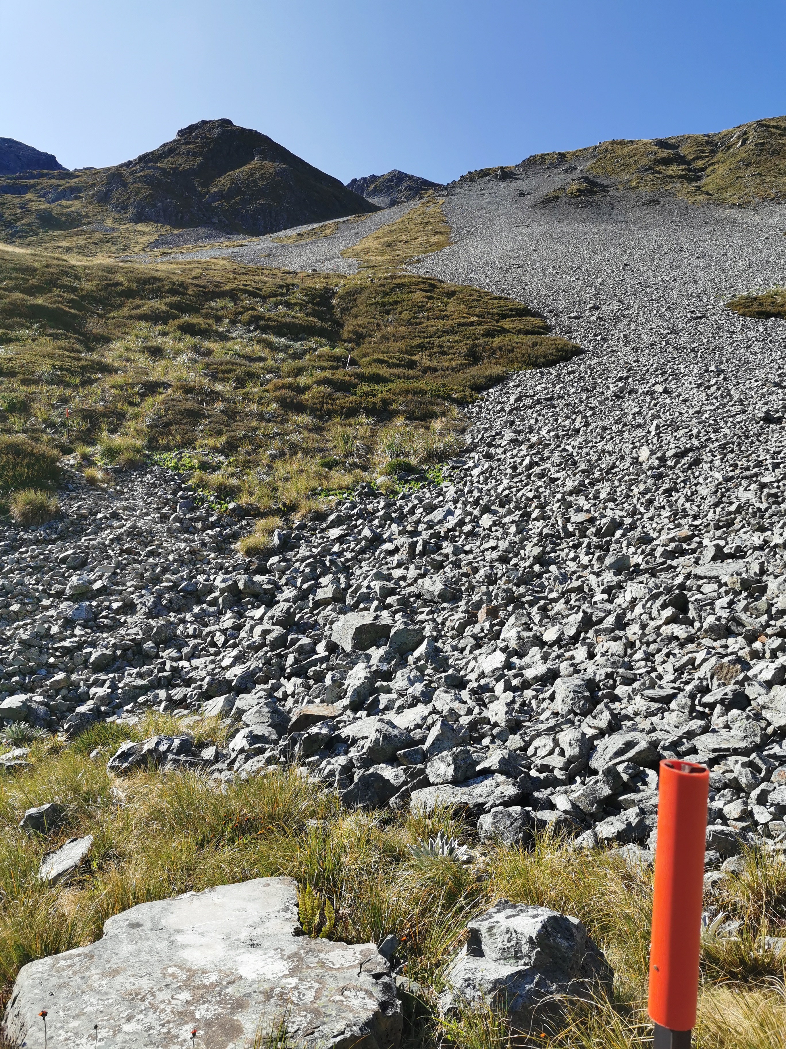
I was glad to be in the crocs. It made it so easy to criss-cross the river and my boots stayed dry. Although on the third crossing of the river, a big orange triangle appears to lead you up a massive steep path. Don’t go that way, it’s wrong! It’s actually written on the triangle – “follow the river bed”. I’m clearly not the first to make that mistake.
When I was certain I was at the end of the river walk, I dried my feet and changed back into my boots. I also filtered three litres of water. In the 10 or so minutes that took I got mobbed by sandflies. They don’t usually bother me at campsites much but here they got me good.
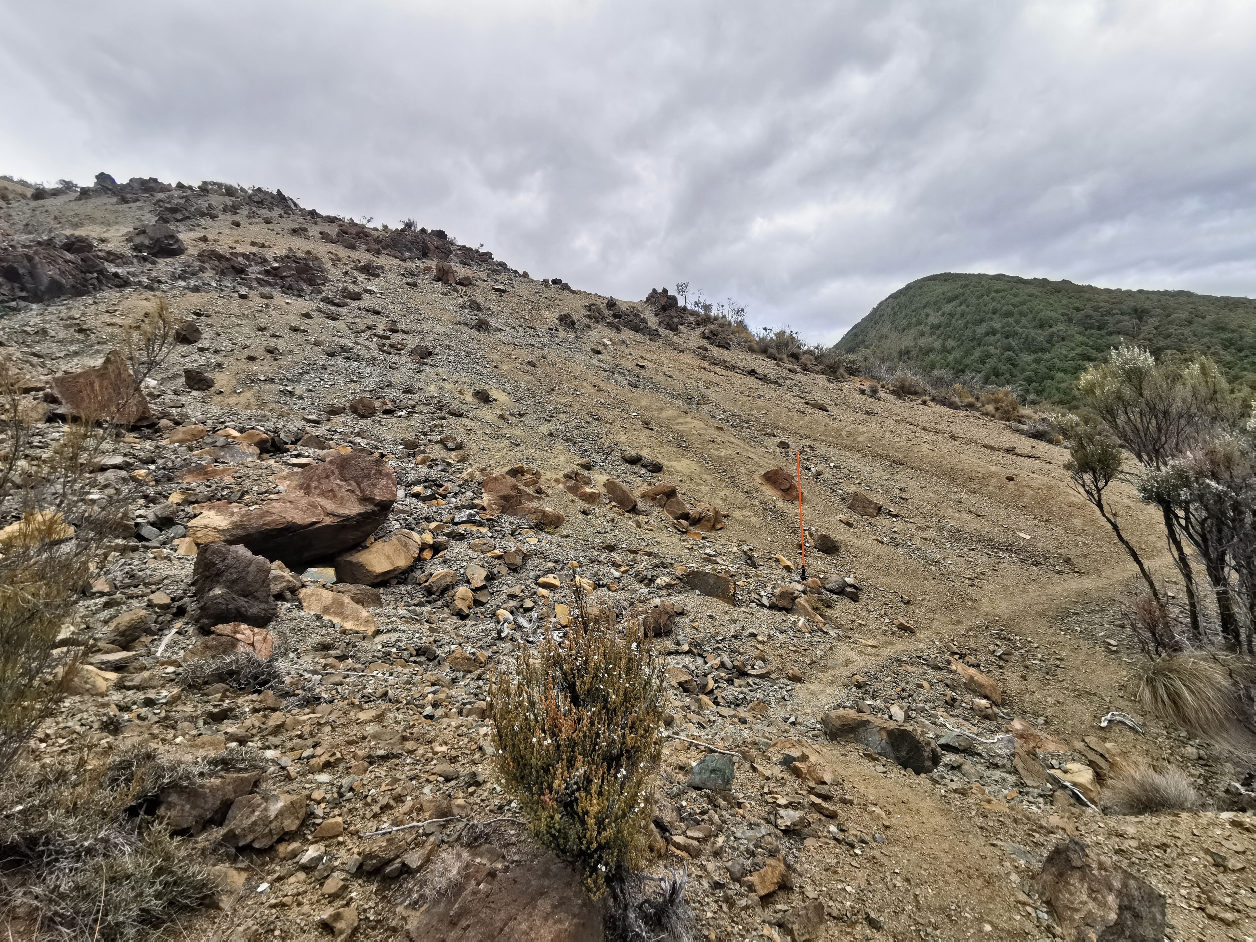
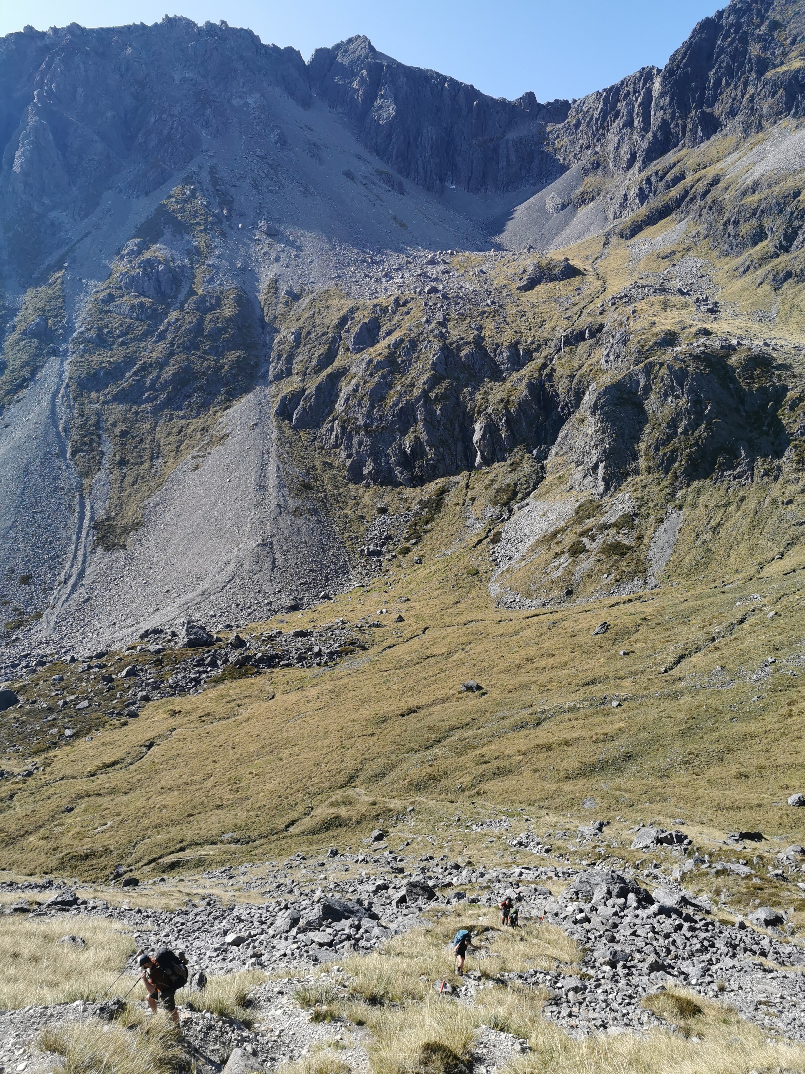
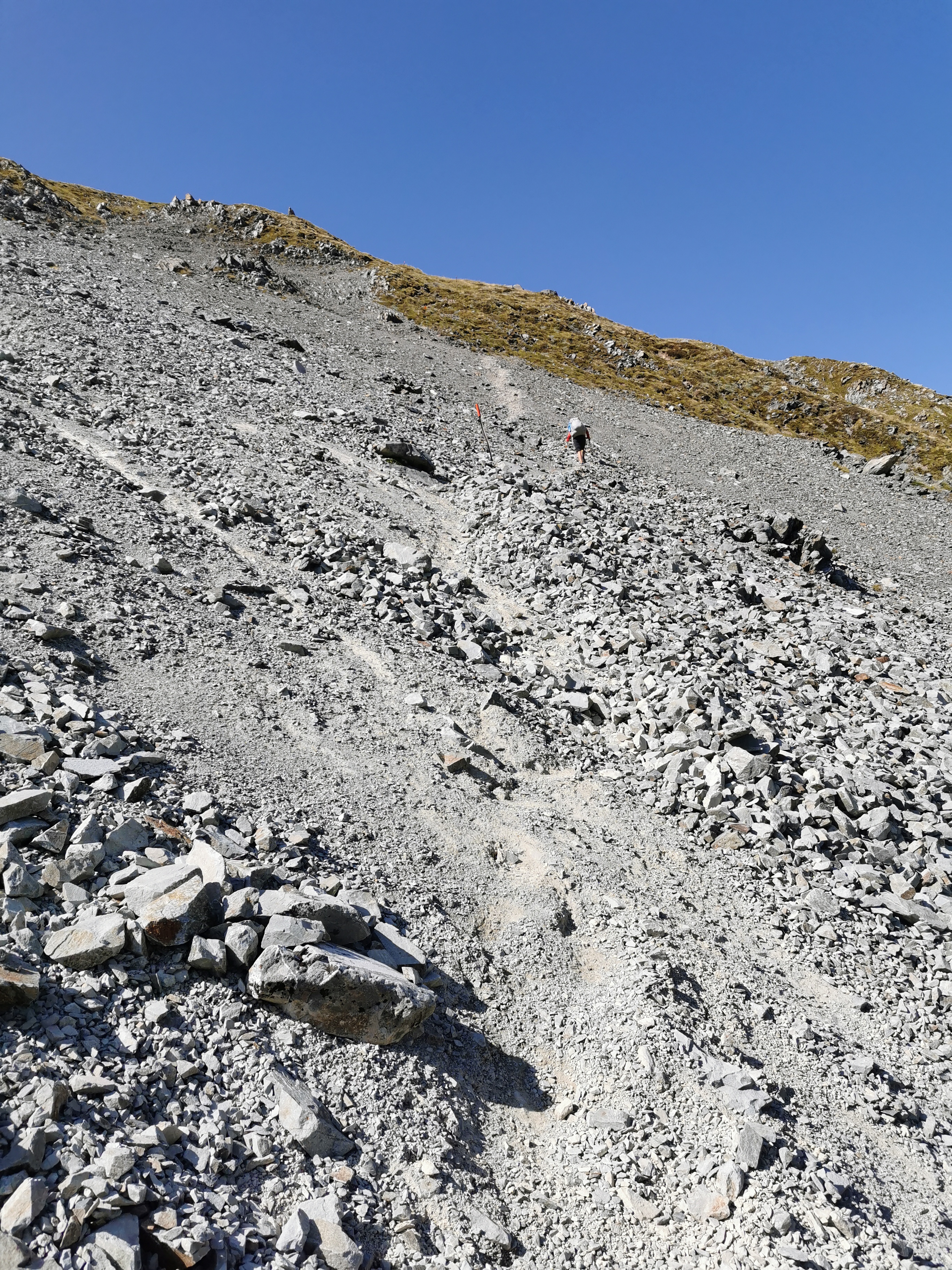
The beginning of the big climb
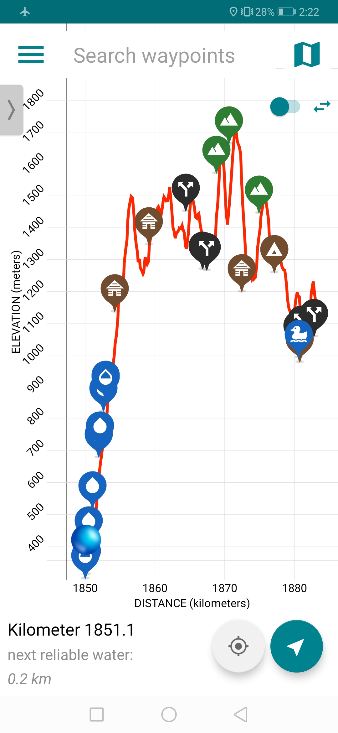
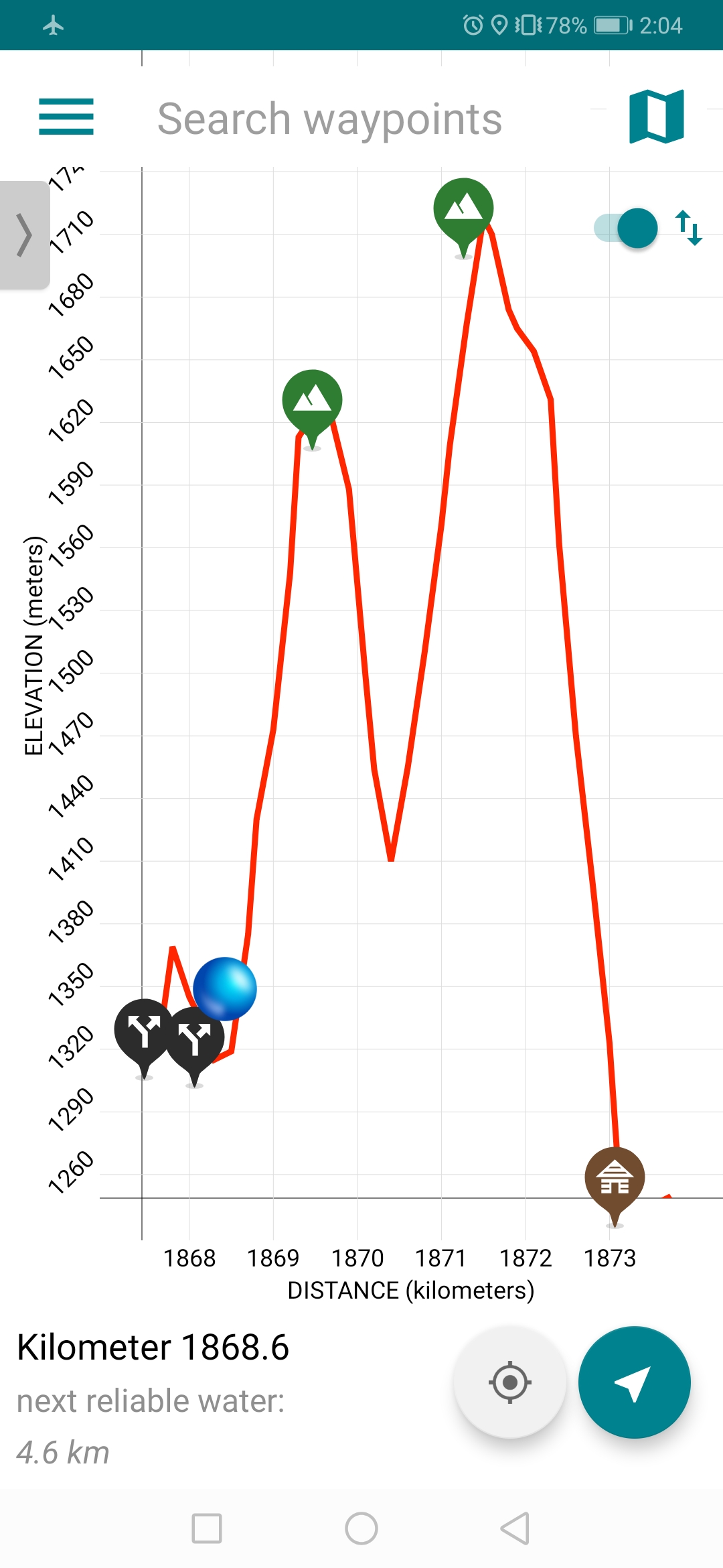
From here up to Starveall Hut was indeed up and up and up. It was absolutely unrelenting. Here is the Guthook elevation profile:
I’m the blue dot at the bottom and Starveall Hut is the first hut at around 1200m up. You can see that the next couple of days are going to be equally painful.
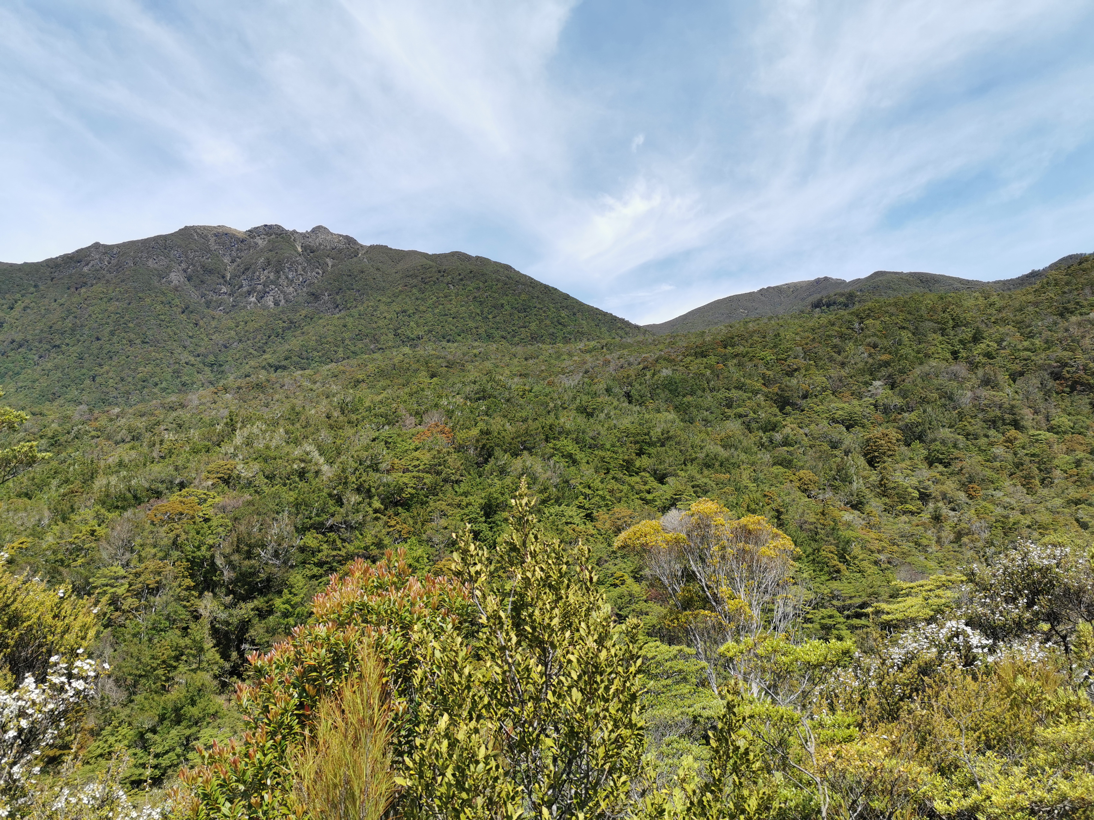
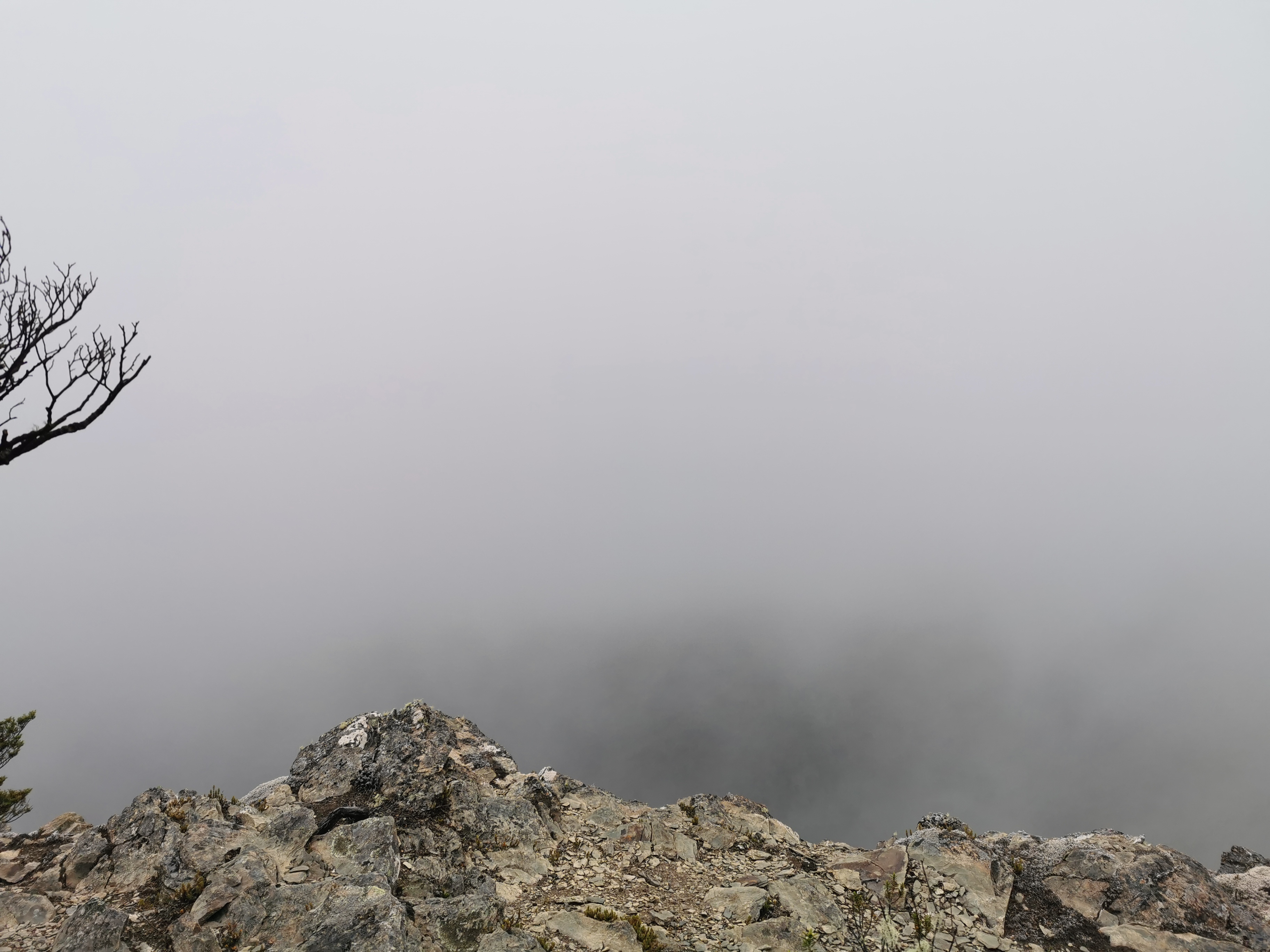
In all this uphill there wasn’t a lot to see other than bush, although at one point there was a clearing where you could see some peaks above the treeline. I wonder if that’s where I’m going tomorrow?
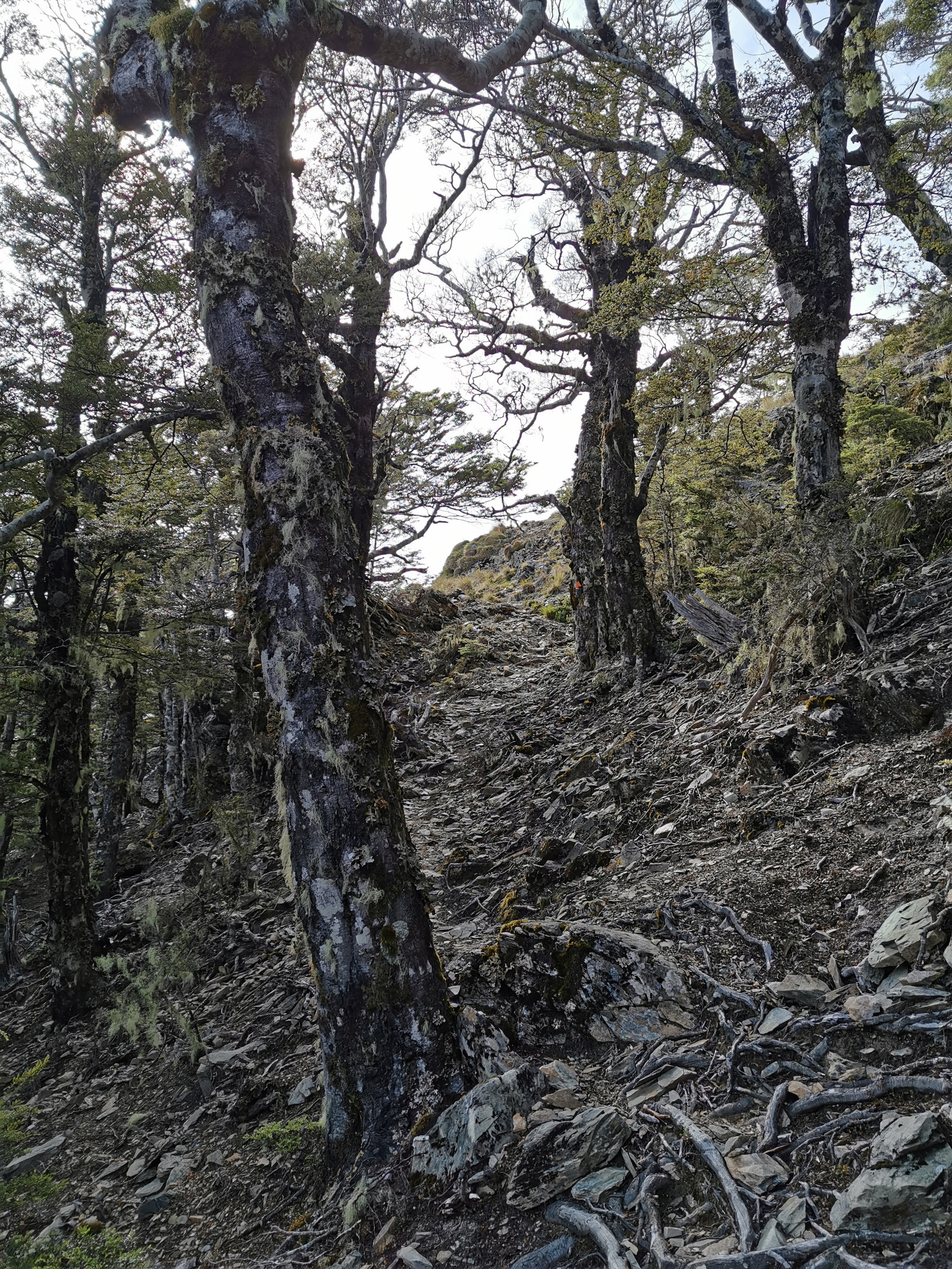
After all this climbing it got to the point where I thought surely the hut is around the next corner. Oh no it isn’t. Surely it’s around the next one. Nope. Grrrrr. I knew the hut was just above the treeline, but the trees showed no sign of stopping.
This bit was nice, at least they cut through the dead trees
Between Hackett Hut and Starveall Hut was less than 5 kilometers. The hard part of the climb was about 3 kilometers. Km 1 took me 36 minutes, km 2 took me 31 minutes and km 3 took me 30 minutes. For the first time since I restarted walking, I felt the familiar twinge in the upper left of my back that was really giving me problems in the Tararua Ranges. Darn, I was hoping that taking two and a half weeks off would stop that. It’s only really slight though, so hopefully it won’t cause me problems. The more severe back pain I had on the plane two days ago and the couple of days before that hasn’t reappeared though.
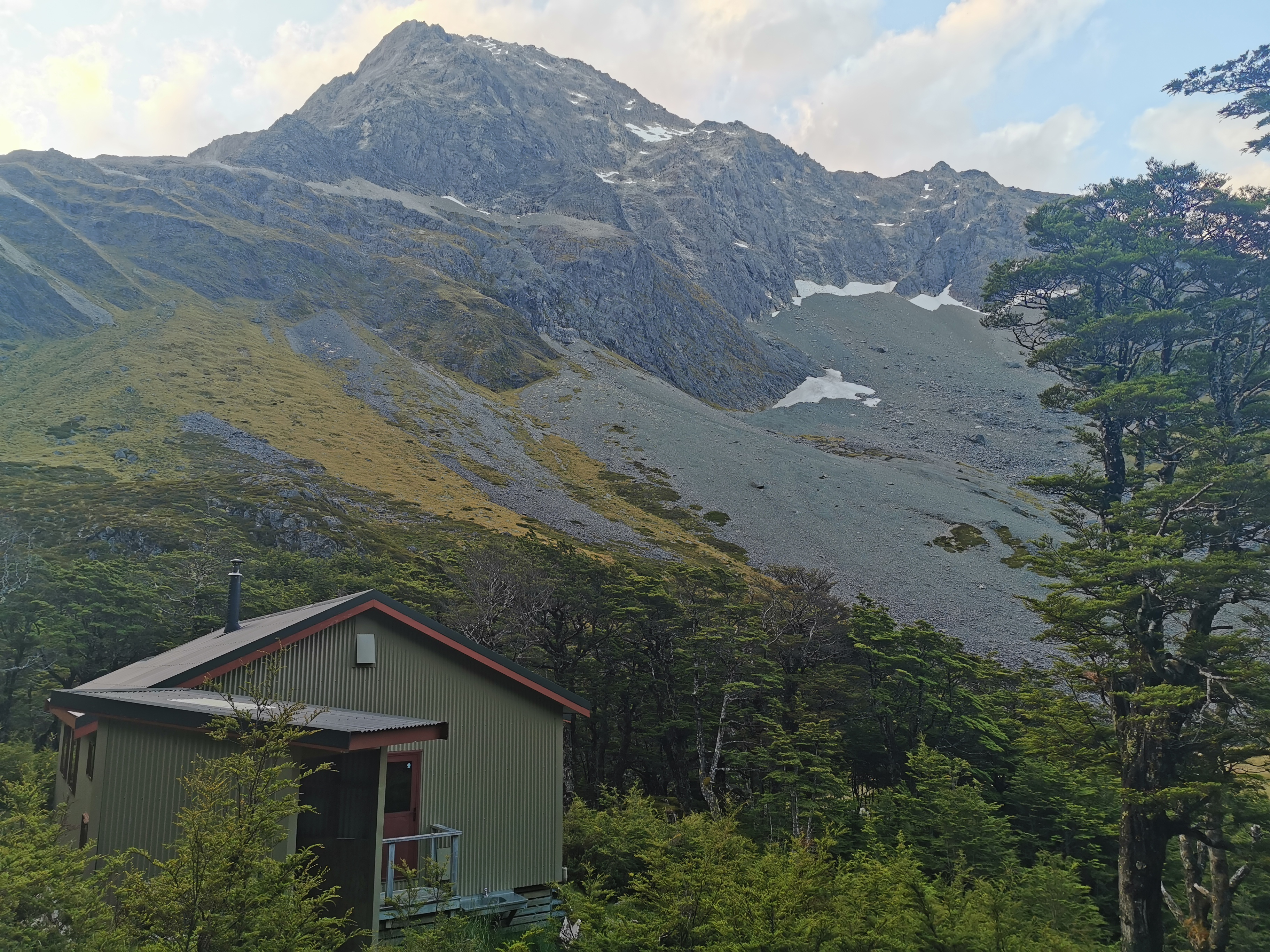
Eventually, there was the hut poking through the trees.
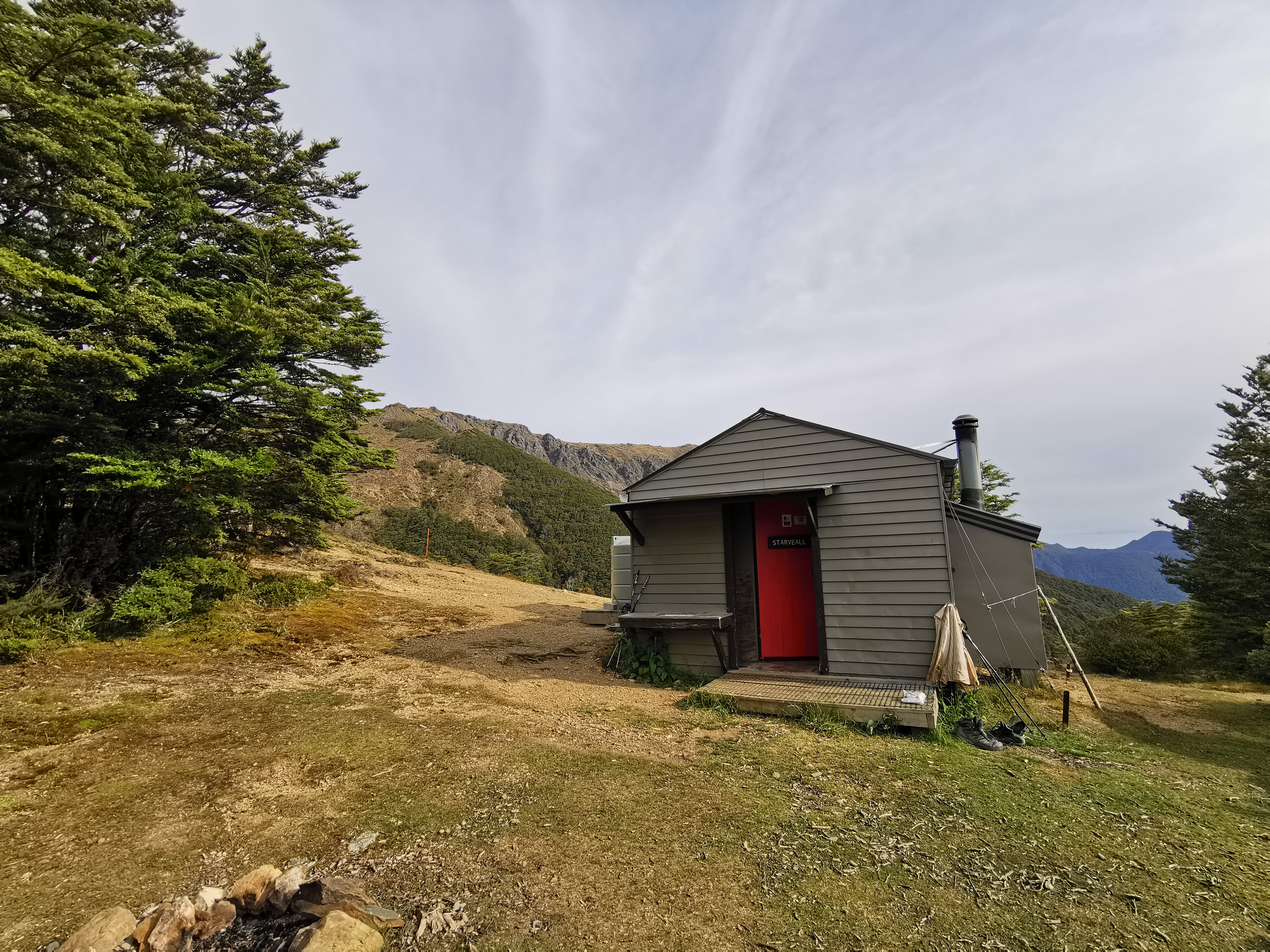
I can see it!Starveall Hut outside
I tried to find out the origin of the name Starveall Hut. Did people starve here for some reason? The name of the next peak is Mt Starveall but that doesn’t help.
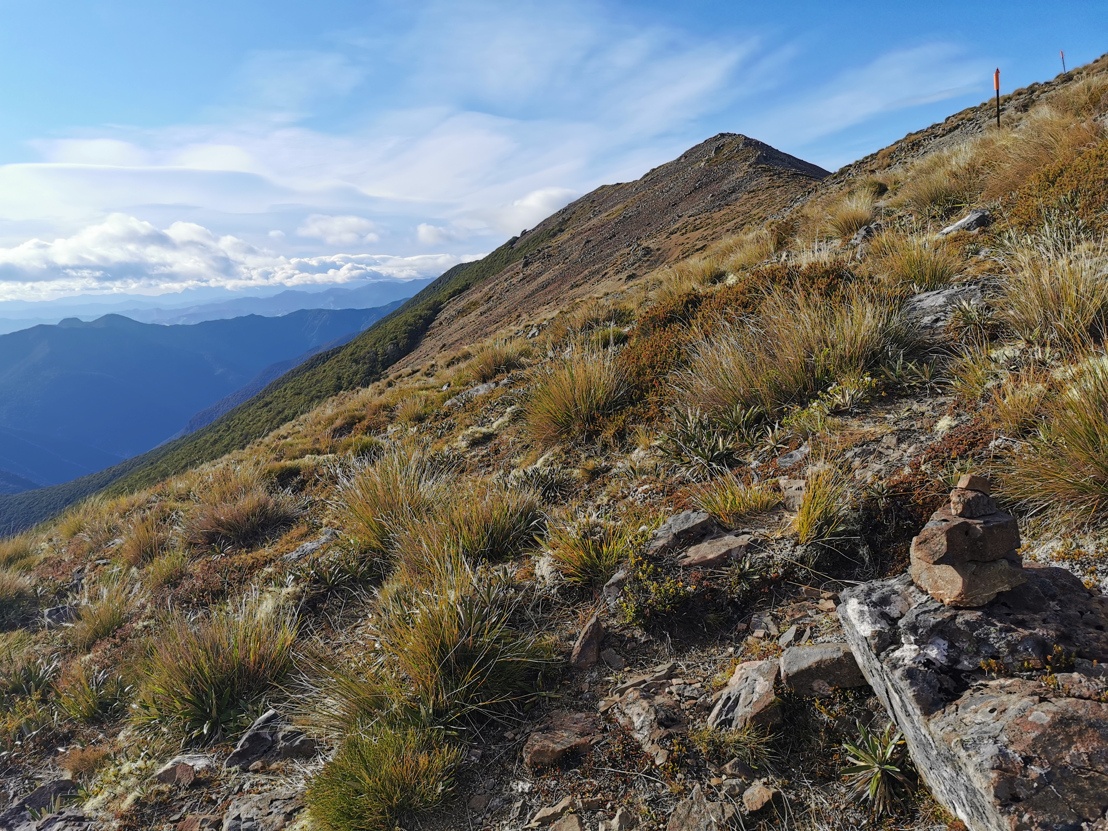
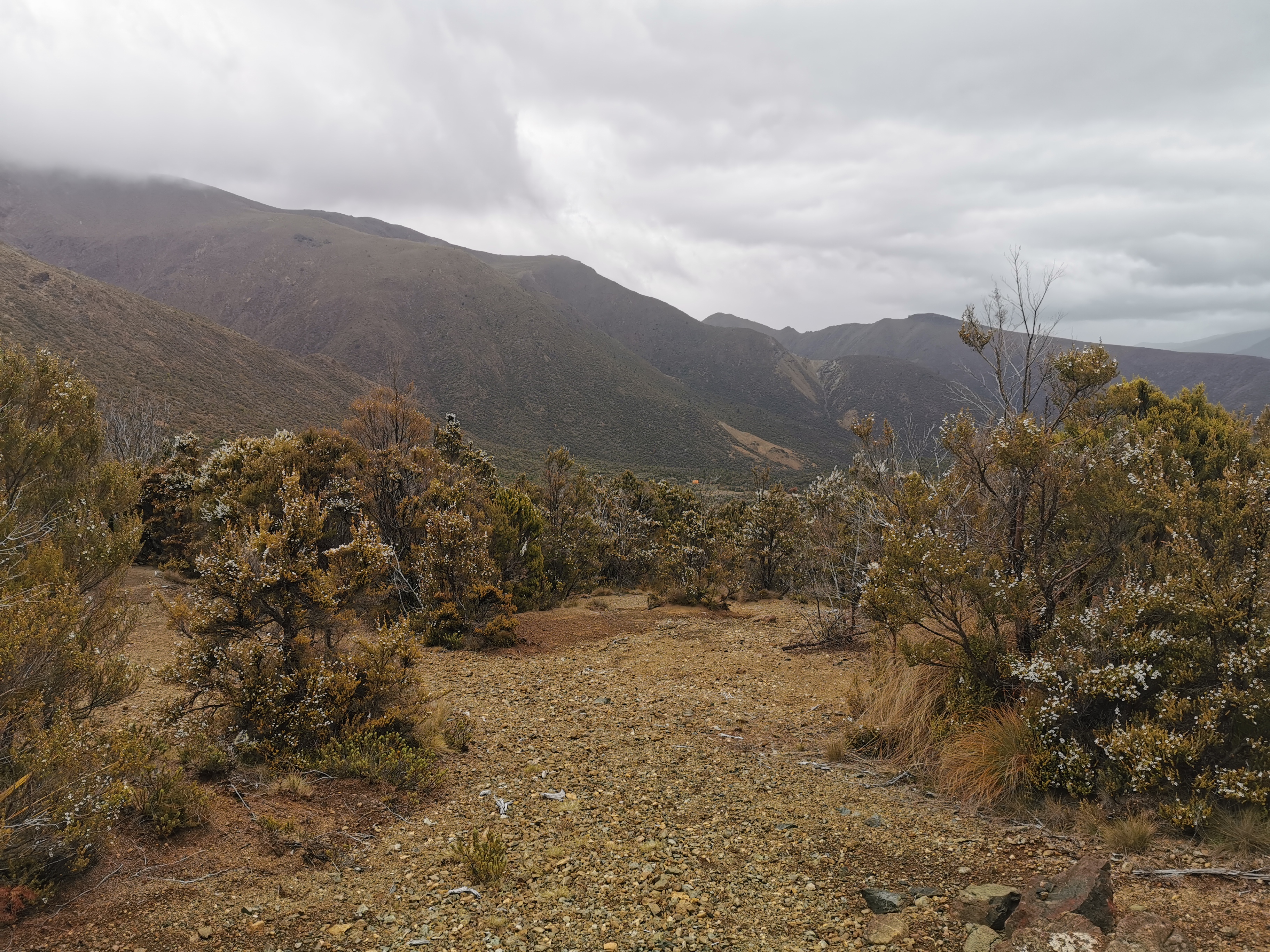
The landscape definitely changes here. Tomorrow is going to be a completely different type of walk.
It’s definitely different up here
This is a six bedroom hut and there were six people here already… But I did get a bunk because two of the people are in a tent. Hooray! It is a top bunk though, and the hut has a very low roof.
Starveall Hut inside. Watch your head.
I asked one of the girls who also had crocs if she changed into them to do the river crossings earlier. She said she didn’t have time for that.
There was 4G phone coverage and so I turned my phone on while I was here. To my surprise there was a voicemail from AA Insurance asking me to call them about my car insurance claim for my stolen car over Christmas. This stressed me out a bit because that was supposed to be all sorted. Of course when I did call the woman handling my claim was gone for the day and since it’s Friday I’m now going to have to wait until Monday to find out what they want… or probably even later, as I don’t know if there will be phone coverage on Monday. This is going to be playing on my mind until then!
It was cold here once the sun started going down. I guess we are 1200m up here. And Ben and Susan never showed up, I guess they must’ve stayed at Hackett.
We did get a couple of people turn up on a day trip from Hackett Junction. The lady was relieved that there was a spare bunk as she didn’t bring a tent. It’s brave not bringing a tent if you ask me! They even brought their dog up that massive hill. The dog did not like me at all. I got all the growling when I went to pat it. I think it thought I wanted to steal its food.
Most of us were in our sleeping bags by 7:20pm. I think the big hill took it out of most people. Now I get to catch up on my blog. There is a small amount of phone coverage here but not enough to upload all the blog pictures so I can write the blog entry but not publish it.
One bad thing about being on the top bunk is that if you accidentally knock something off onto the ground it might break, or at the very least you might have to get out of your sleeping bag and climb down to get it. That’s exactly what happened with my inflatable pillow, I bumped it as I was turning over and it flew off the bed onto the floor. I could have waited for somebody to come into the hut and ask them to give it to me but knowing my luck they wouldn’t see it there and they’d stand on it and burst it. So I had to go down to get it. I hope I don’t drop the phone from the top bunk onto the floor!
There were two birds making a loud noise outside the hut straight after I lay down in bed. They weren’t kiwi I was pretty sure, but I couldn’t work out what they were.
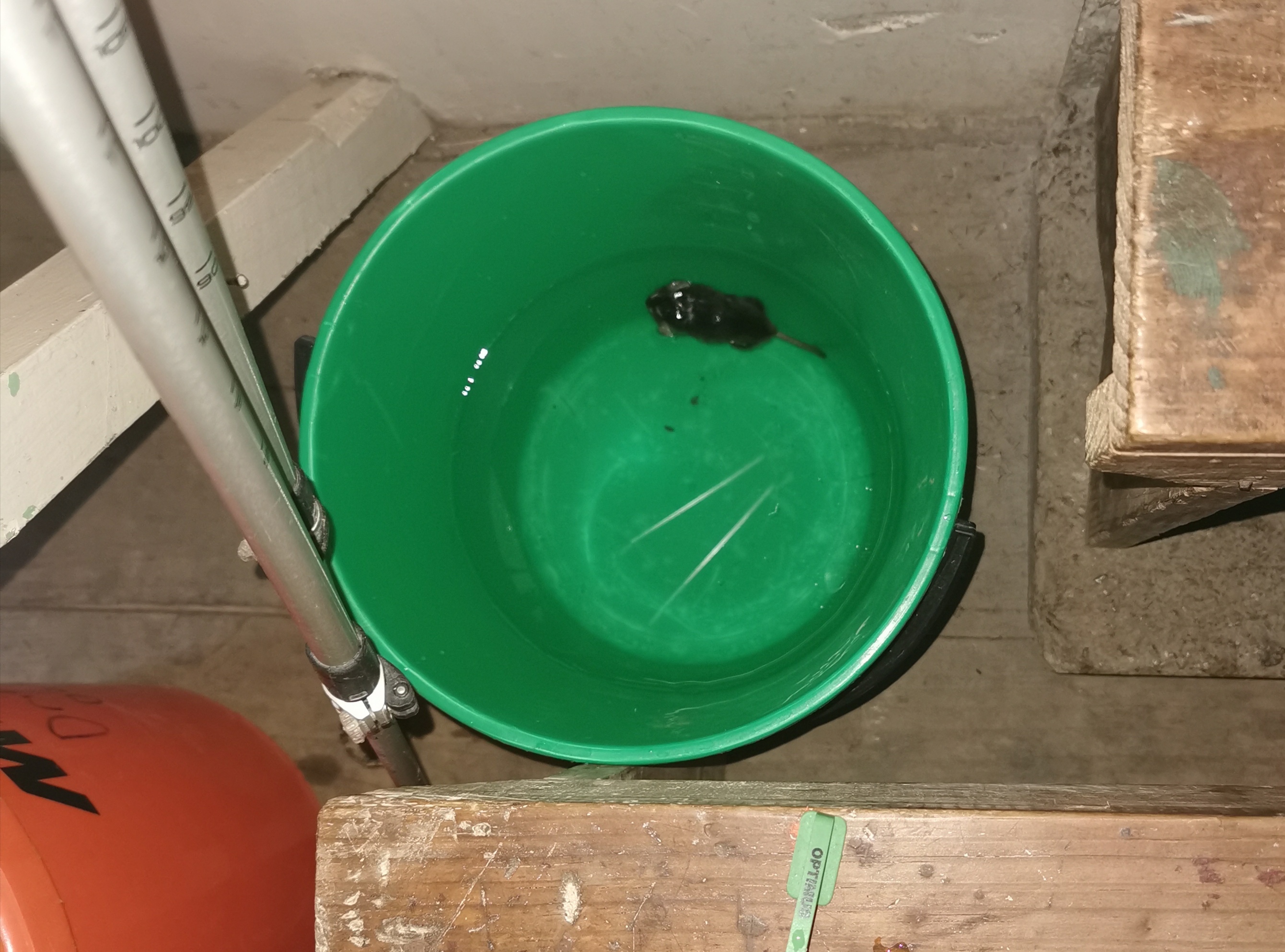
And then something else that kept us awake… something I haven’t encountered before, despite seeing numerous mentions of it. Mice! We started trying to spot the mice and we couldn’t, so we just put our packs up out of reach as best we could. After we did that we could hear a mouse running around the edge of the hut. At least that meant that it wasn’t inside one of our packs. Thank god for that.
Date: 11 January
Trail covered: 18.2km (kms 1855.0 to 1873.2)
Weather: nice and warm but windy on the summits
The noise of the mice in the hut resurfaced at about 4am but we still didn’t know exactly where they were. Someone thought he heard them running across the mattresses. Suddenly I’m glad I have a top bunk… I assume they are more likely to stick to the ground?
This morning once I woke up I managed to search the Internet and find out why the mountain is called Mt Starveall. According to the Nelson Trails site: “Mt Starveall is named after the experience of a stockman, who in the mid 1800s was searching the Richmond Ranges for a suitable route to drive sheep from Nelson to Wairau Valley. After leading his stock to the summit of Mt Starveall he found that they were unable to consume any of the alpine vegetation, and declared that the mountain would ‘starve all’ of his flock”. There you go.
This morning we had a discussion about who was planning to get to where today. I said I wanted to get to Rintoul Hut, three huts away. Others thought that was quite ambitious. One girl said “we have a name for people like you… fast fuckers”.
But it is hard to find people going the same speed. Everyone from the previous couple of huts has gone slower than me. I guess it makes sense when you think about it – you’ll never see people going the same speed as you because they’re either ahead of you or behind you and since you go at the same speed you never end up at the same place. You tend to only meet people going the same speed if you have a rest day or have a short day for some reason.
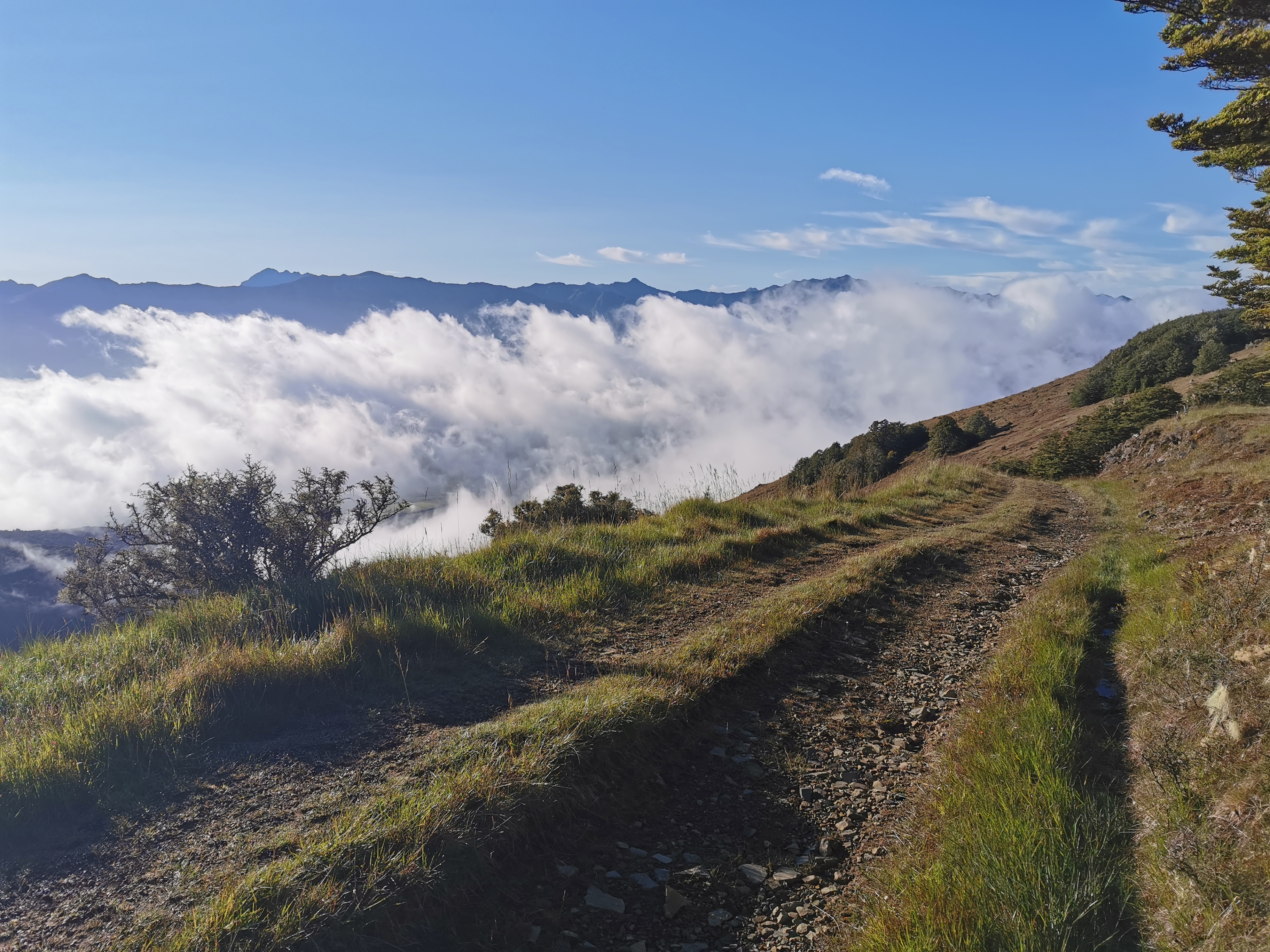
The view this morning at 6:45am
I had my jacket and gloves on this morning, and left for the hike at 7:45am still wearing them. No doubt though they’ll come off after 1km like most other days.
I chose Mt Rintoul Hut as my destination today because Mt Rintoul which is just before the hut is the most difficult section of the Richmond Ranges if you believe the trail notes. And the weather tomorrow is potentially not the best so I’d like to get the summit out of the way today, which has a much better forecast.
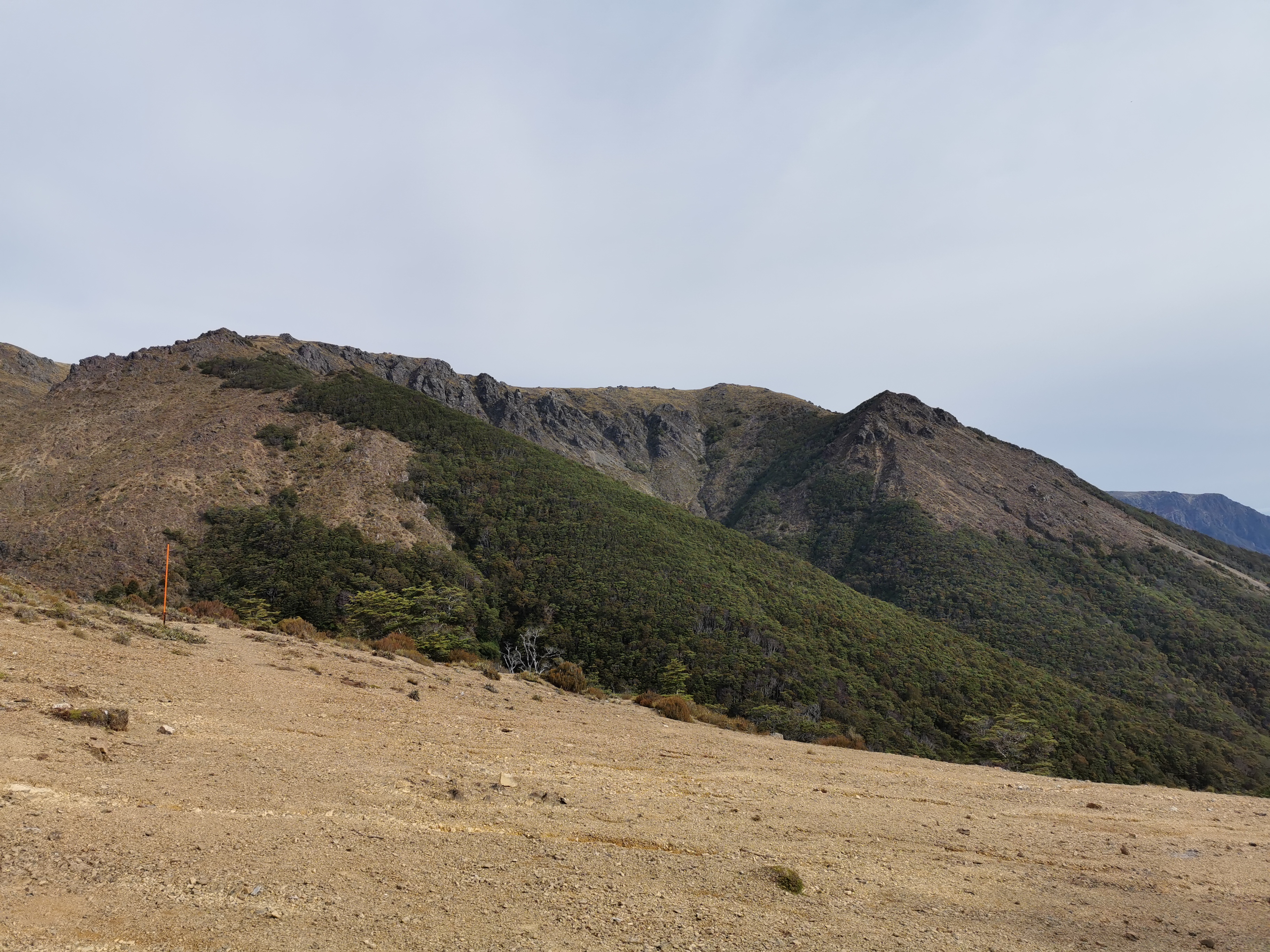
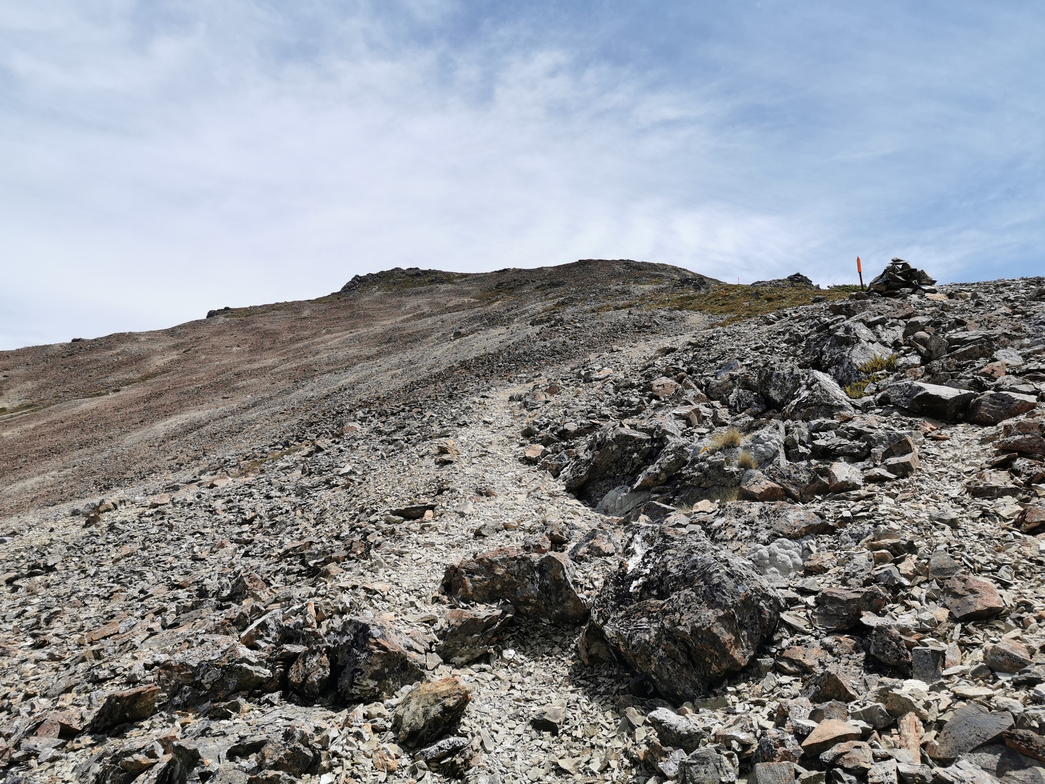
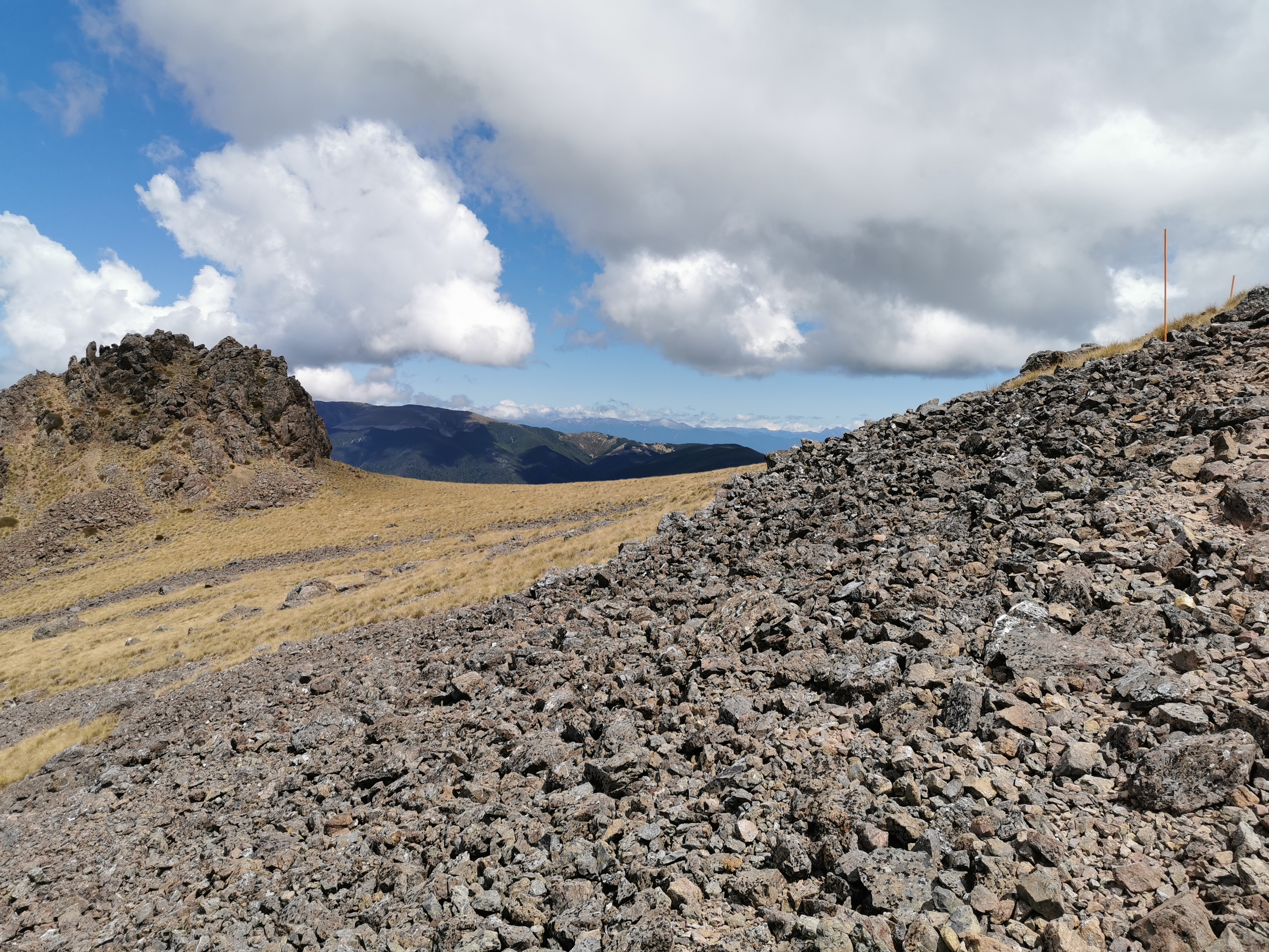
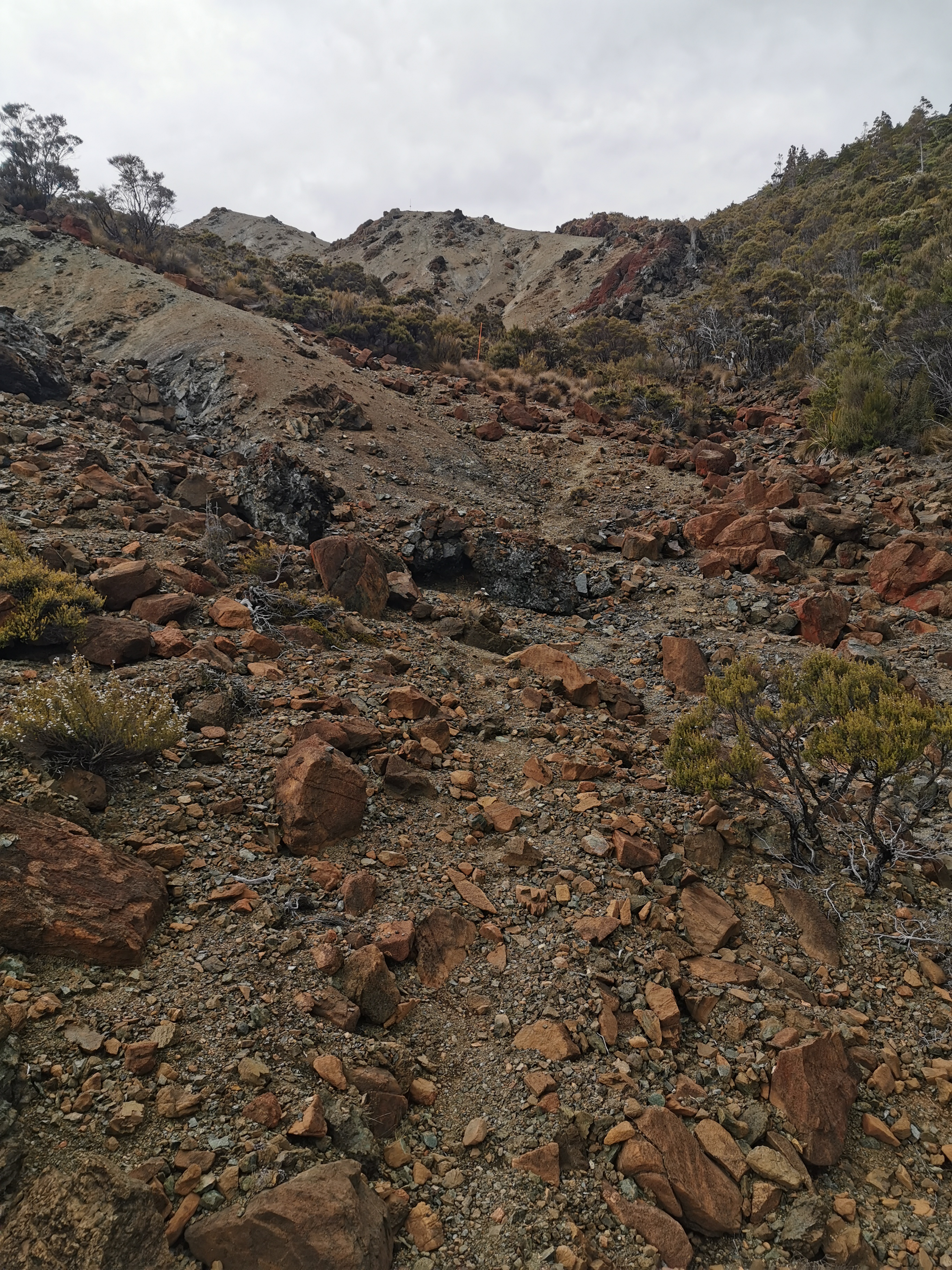
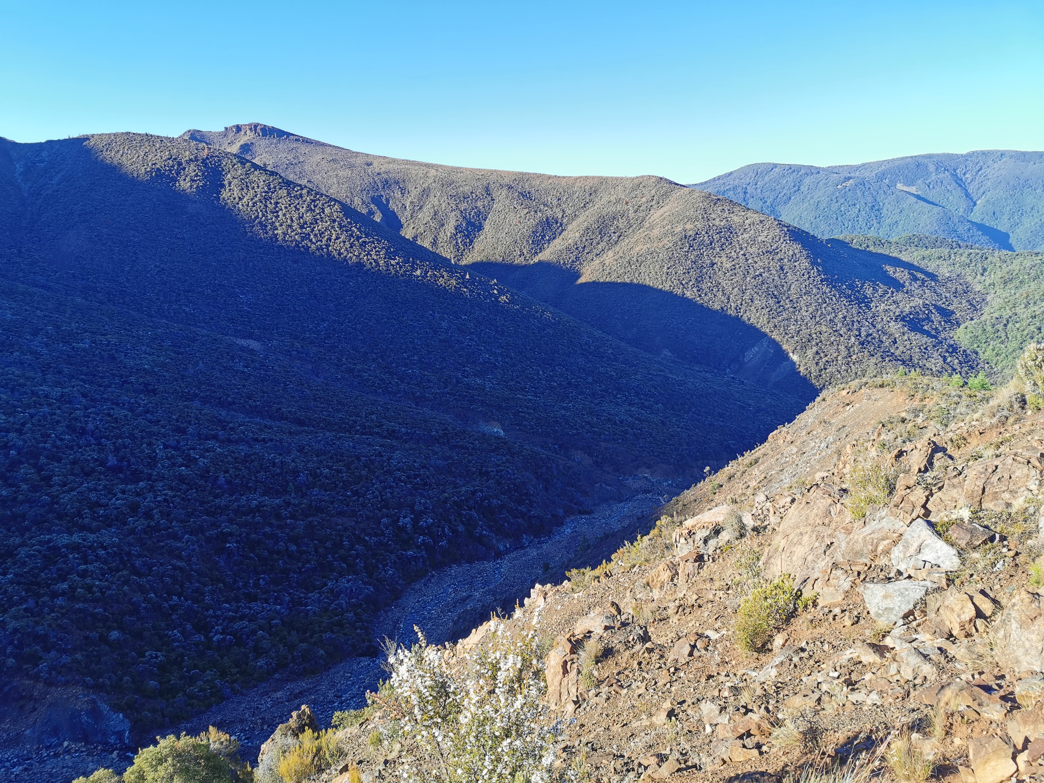
The first part of today’s walk was continuing the climb from yesterday, to the top of Mt. Starveall. The very first bit was “sidling” along these interesting brown rocks.
A new type of landscape
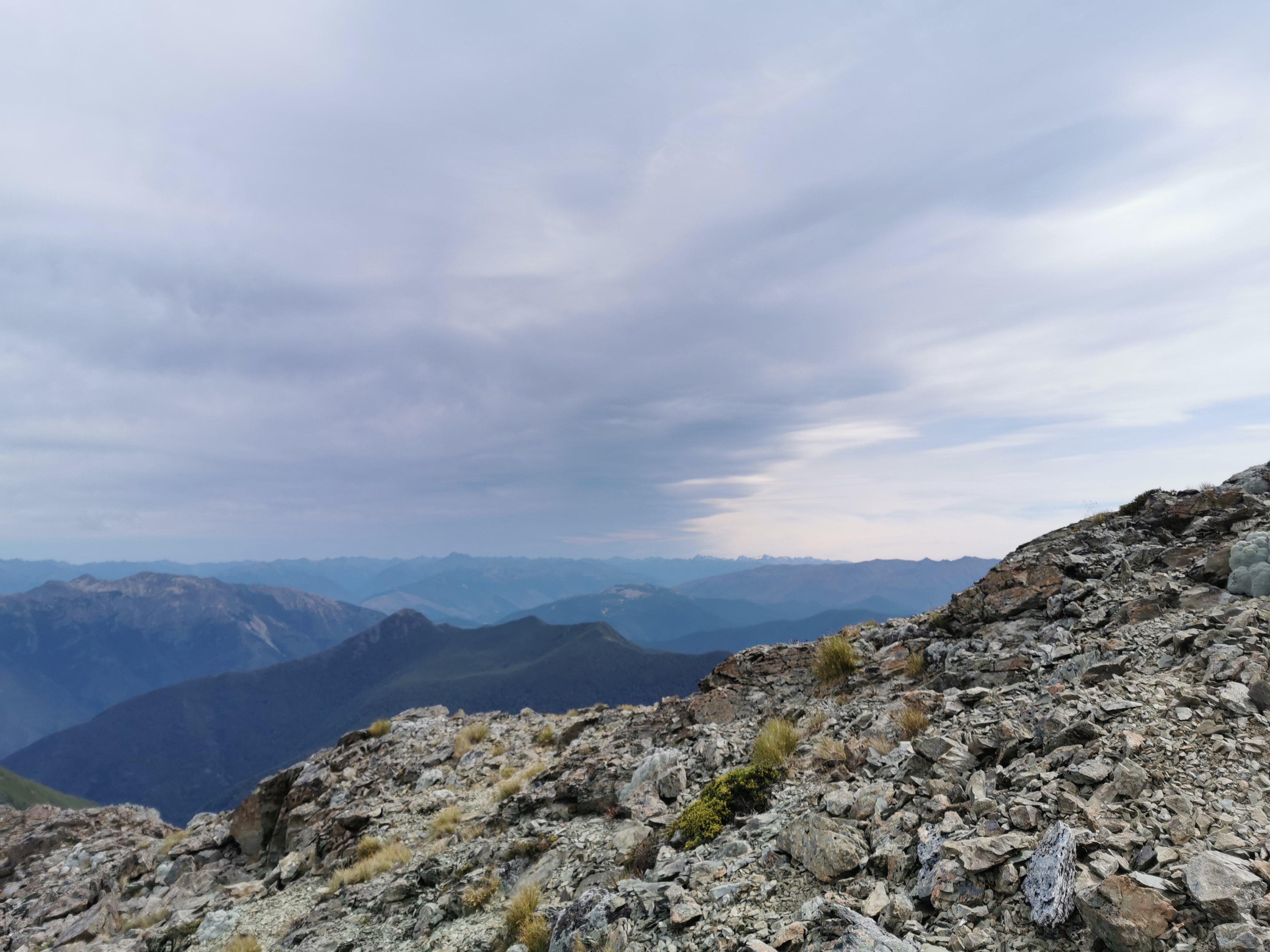
The view was pretty good pretty fast.
This was the sort of path for most of the rest of this part. Well formed and easy to follow.
Just how I like it
It was windy up there though. The jacket and gloves stayed on longer than I expected.
Another great view
I thought I was first to leave this morning but the couple with the dog were ahead of me. I remembered them saying that they are just going to the top of Mt. Starveall but then coming back down.
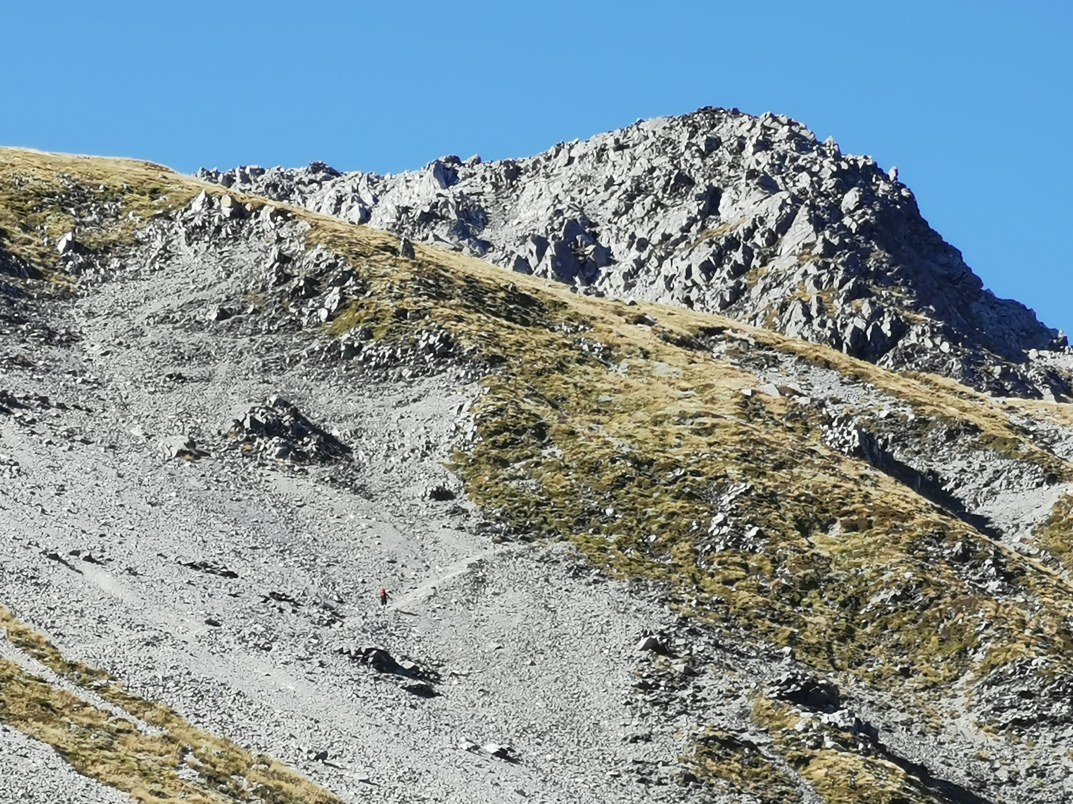
Id keep thinking I was at the top of the first peak when I saw the couple on top of a hill resting, but no, there always seemed to be a bit more to go.
I saw the dog make a mad dash after a couple of mountain goats at one point. The dog had no problem at all with the mountainous terrain, it seemed.
And another
Once over the first peak, the wind stopped and the trail went back into trees. That’s when I took off the jacket and gloves. From here it was a nice walk to Slaty Hut but I had the car insurance call on my mind from yesterday. What did they want? Have they decided not to pay out now? Do they need me to give them something, like the registration papers or something like that? I hope not. I wish I could just switch my brain off since I know I can’t deal with it till at least Monday anyway.
Back into the trees
This got me thinking of the Alanis Morissette song, the first one on her famous album, which ended up stuck in my head. The one where she sings “Why are you so petrified of silence? Here, can you handle this? Did you think about your bills, your ex, your deadlines? Or when you think you’re gonna die? Or did you long for the next distraction?” Some topics for me to think about next time my brain won’t shut off.
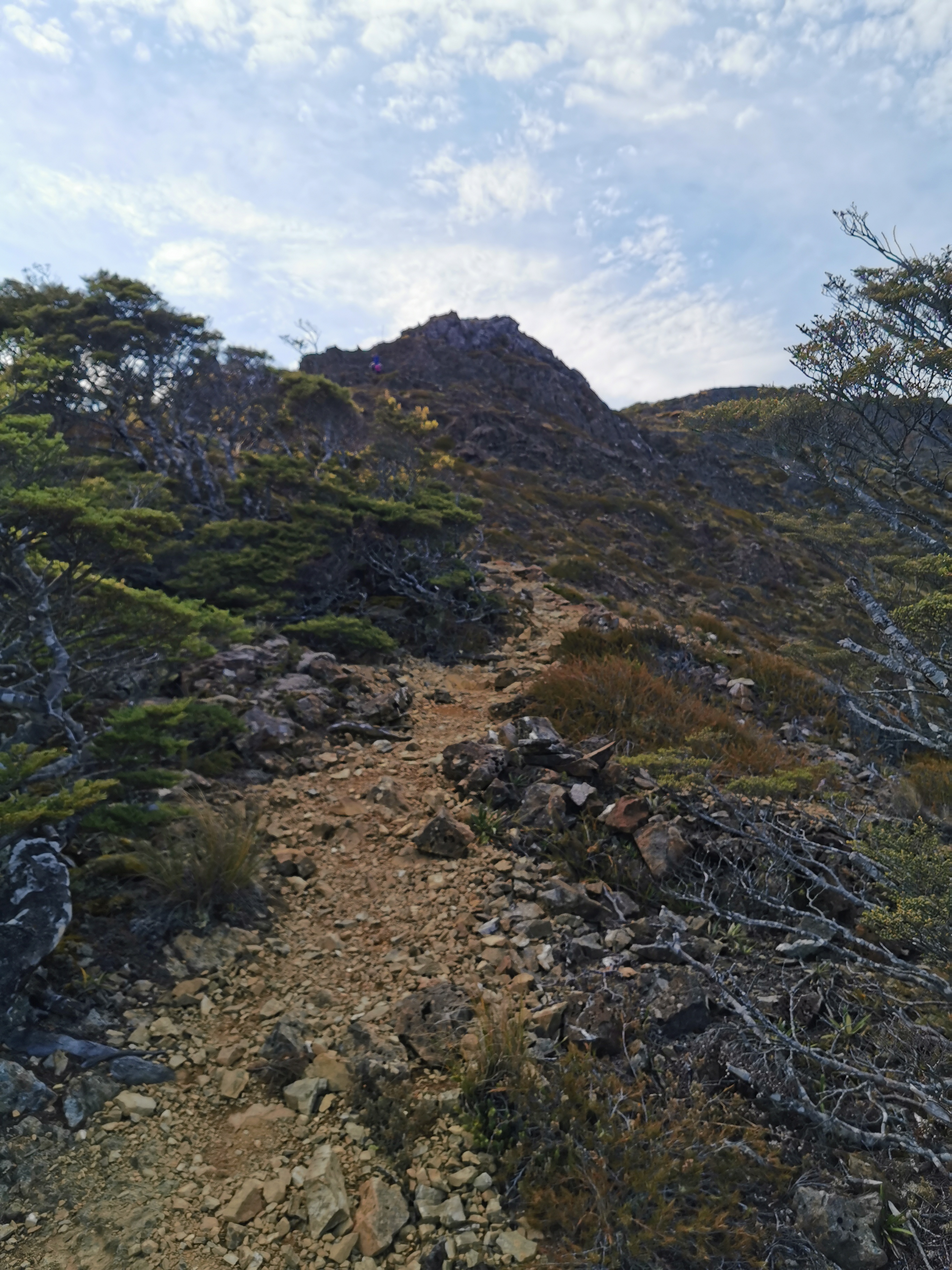
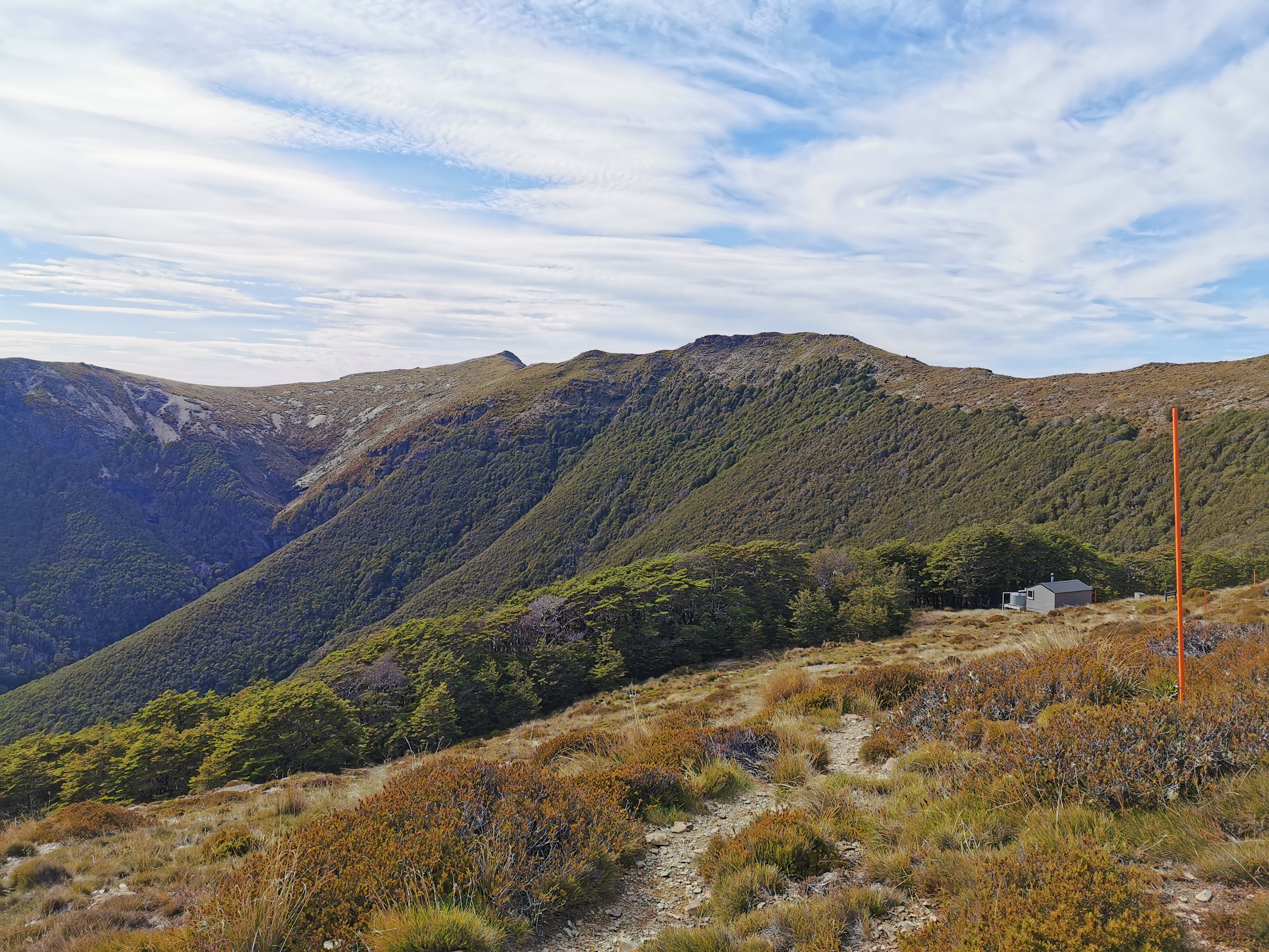
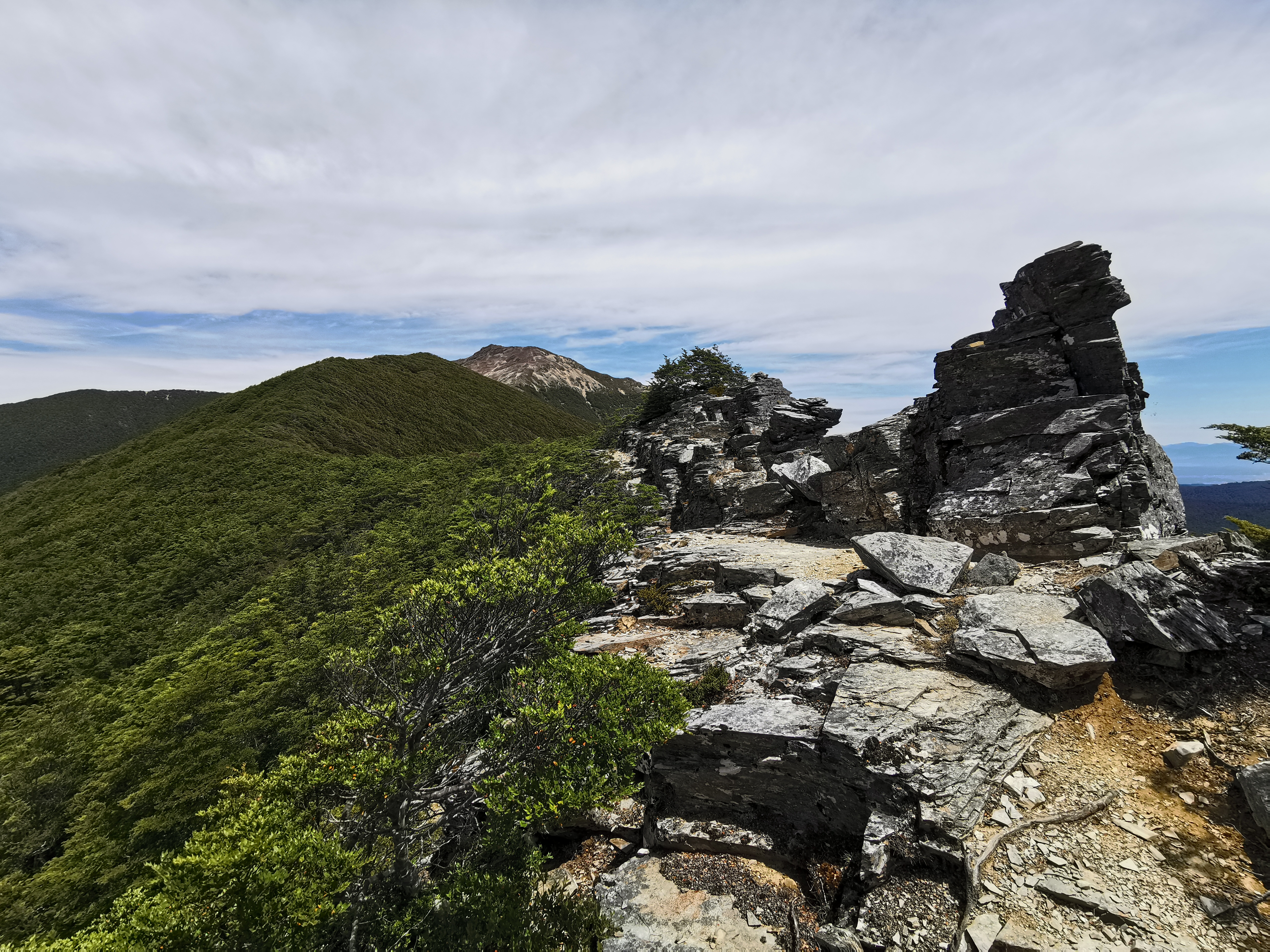
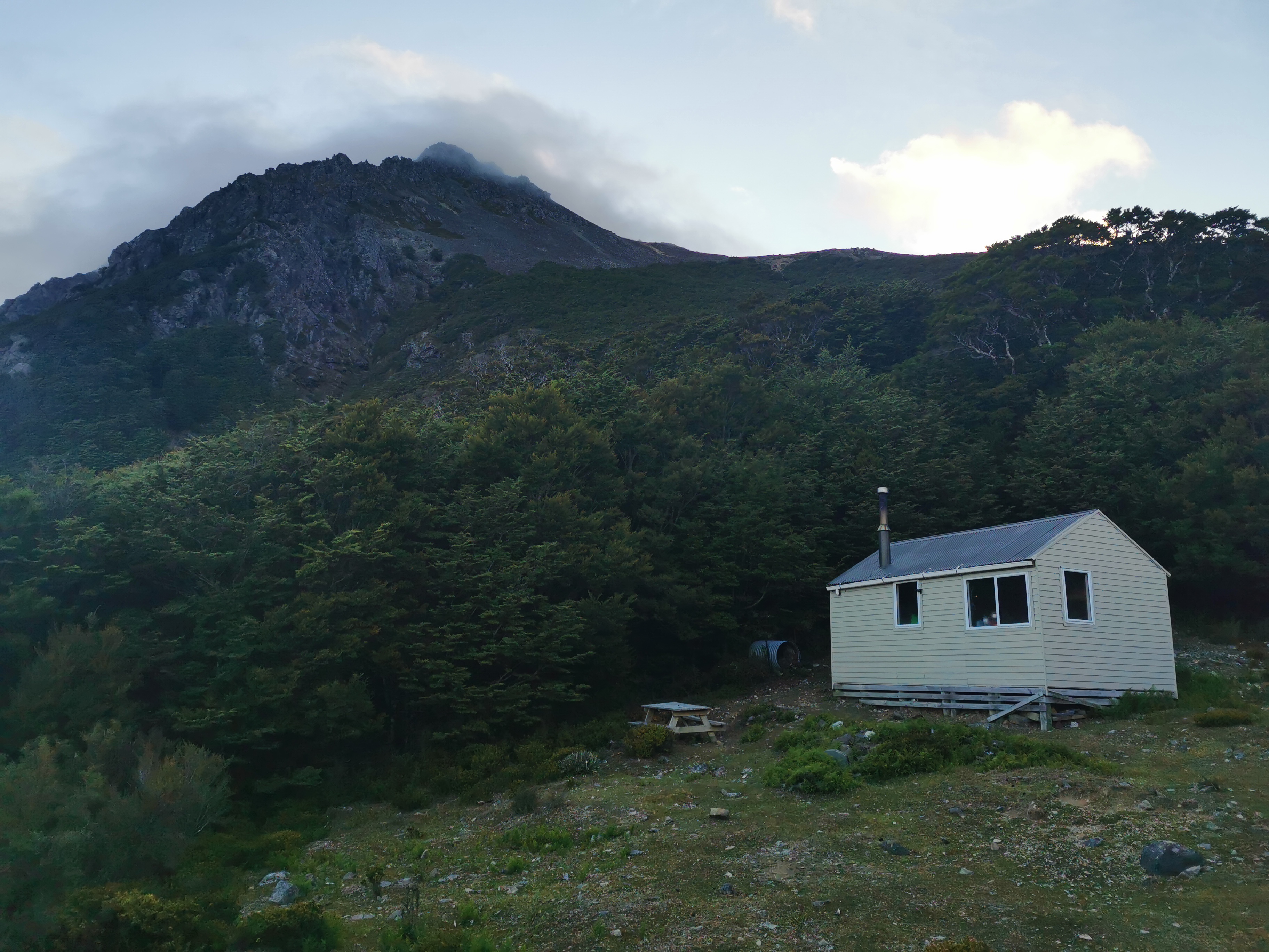
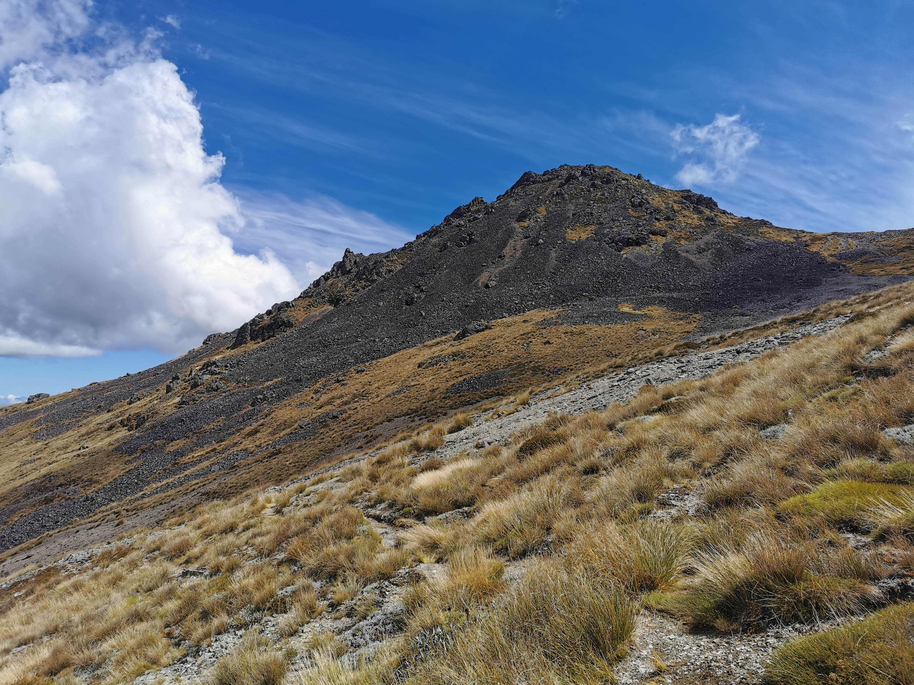
Just up over this is Slaty Hut
I didn’t have any music on at first, and I kept thinking that I heard voices. Twice I stopped to listen to what it was but heard nothing. I think it was either squeaking of my pack straps or goats. So to silence these “voices” and to try and get the song and other things out of my head I put on my iPod.
Slaty Hut is almost within reach
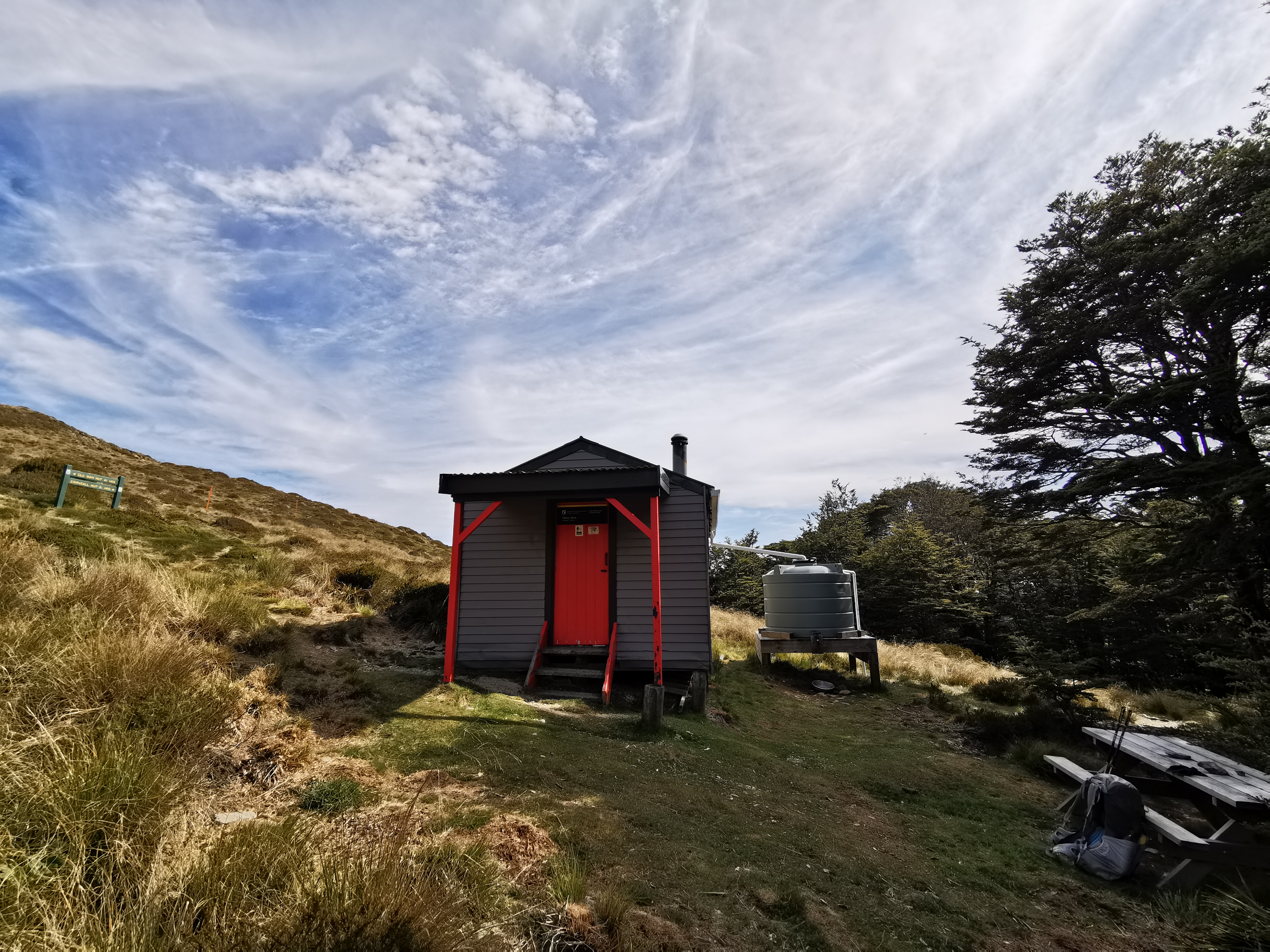
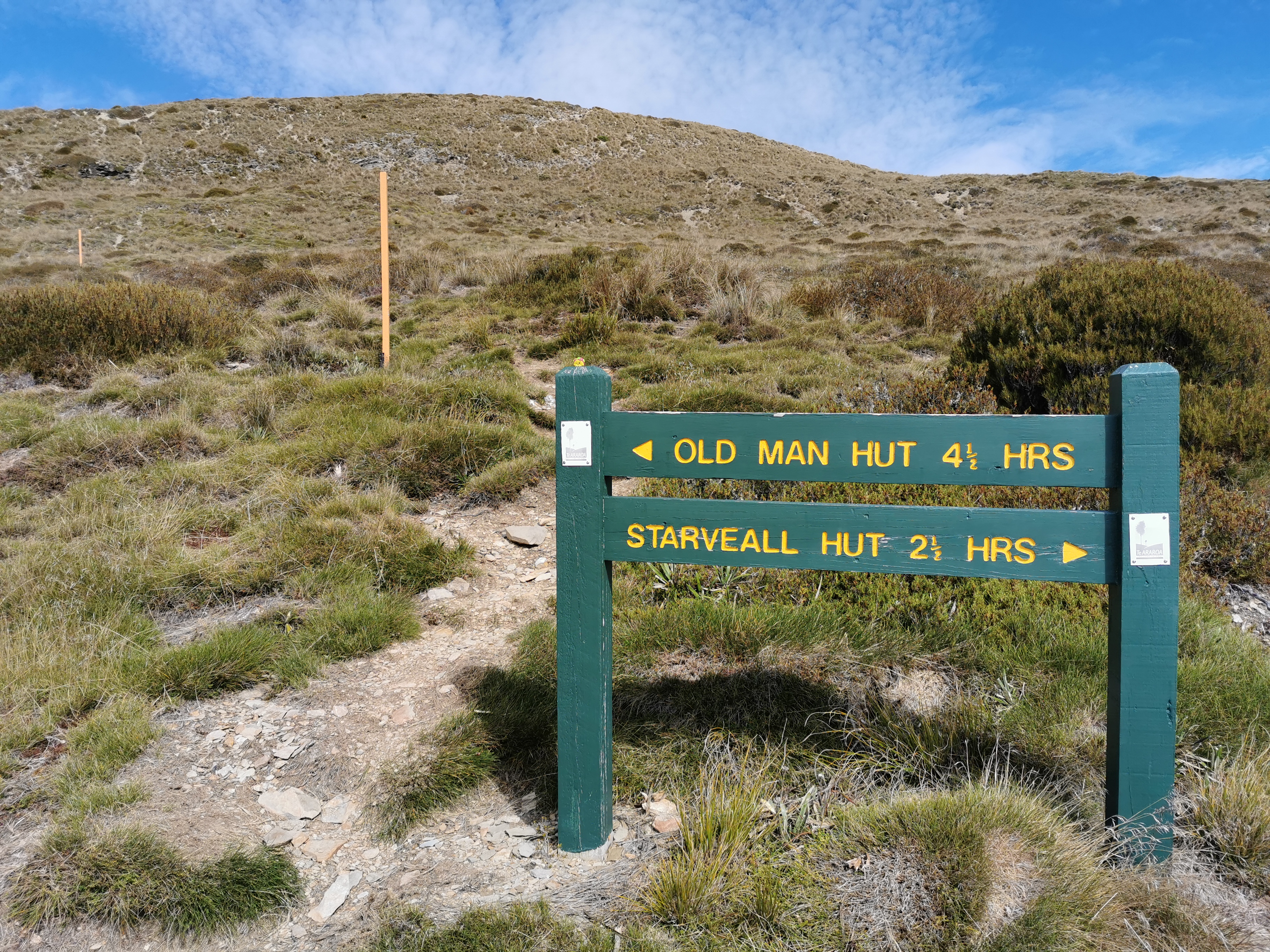
I got to Slaty Hut at 9:40am – just under two hours after leaving. I looked at the intentions book. Only Matt & Tina were here last night – that means that Rintoul Hut might be quiet, but there is still Old Man Hut between here and there. I also saw that Rhydian stayed here on the 6th – gee that means he is now 5 days ahead of me.
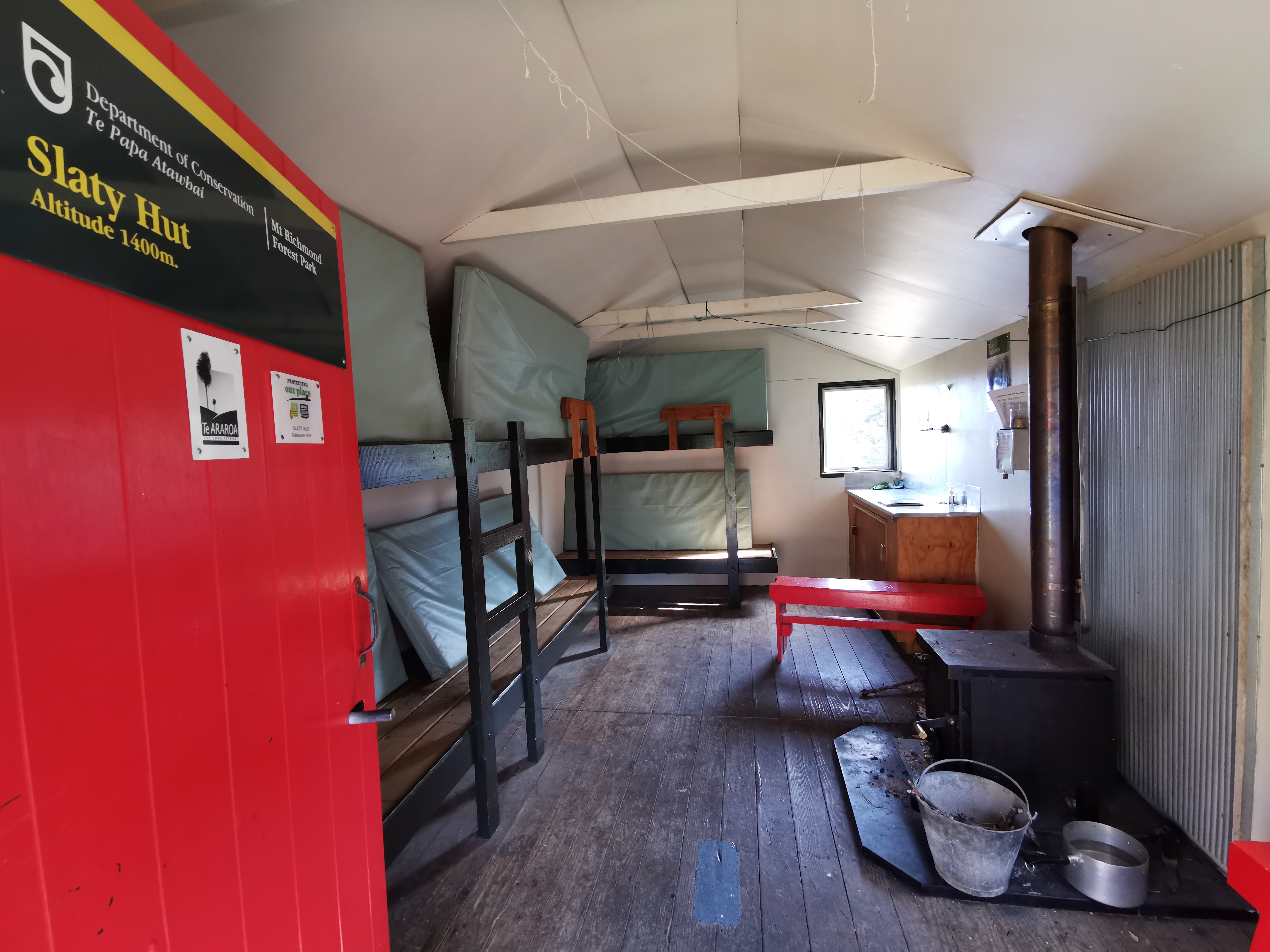
Slaty HutInside the hut
I had read reports that Rintoul Hut has no water, although they could be old reports. To be safe I filled up both my plastic bottles and also my 64oz Sawyer Squeeze filter container. That’s almost five litres of water – I definitely noticed the extra weight on my pack.
Can you see Taco Terry?
There’s a bit of a hill coming out of Slaty Hut. I really noticed my sore legs going up the hill. I’m not entirely surprised given the big hill from yesterday but there are more big hills today going up Mt Rintoul and so I bet my legs will be killing me tomorrow.
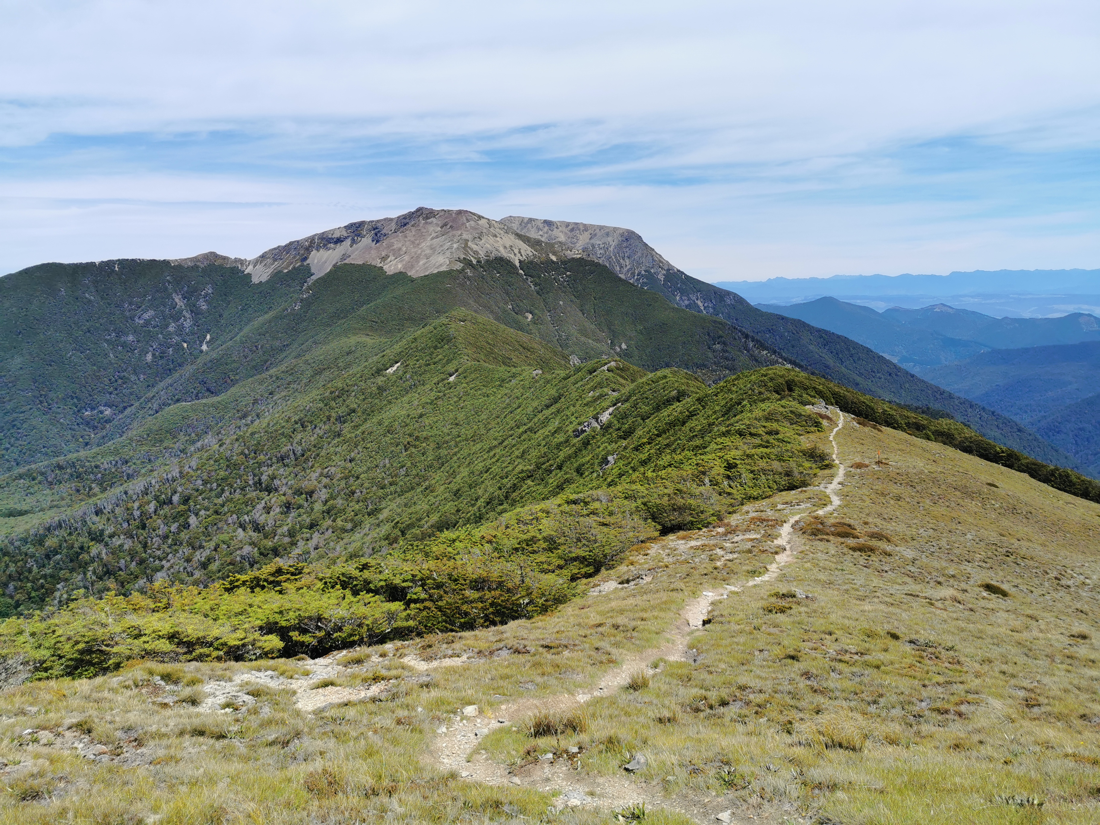
Walk along the side of thisLooking back at Slaty Hut in the distance Following a ridgeline
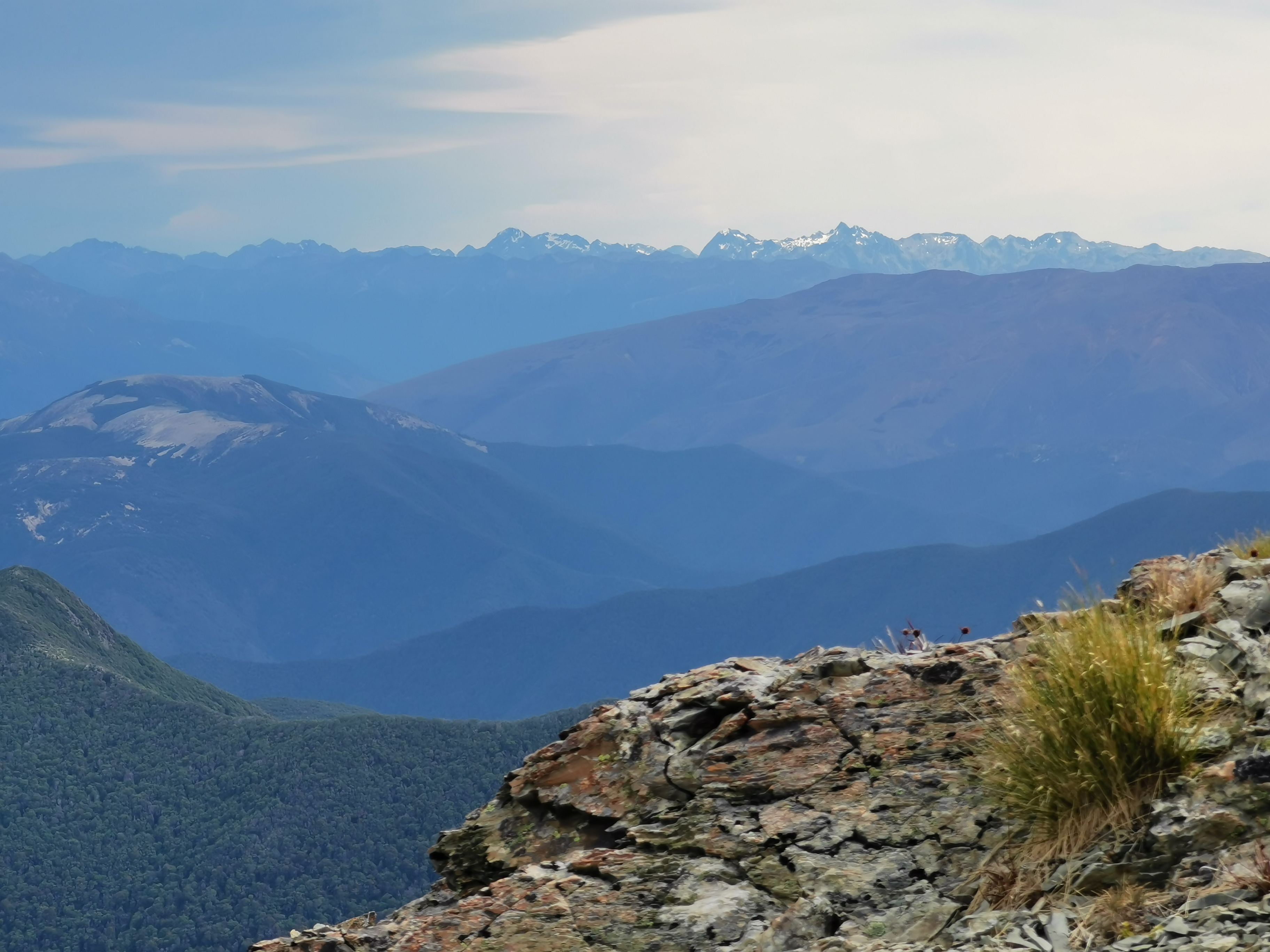
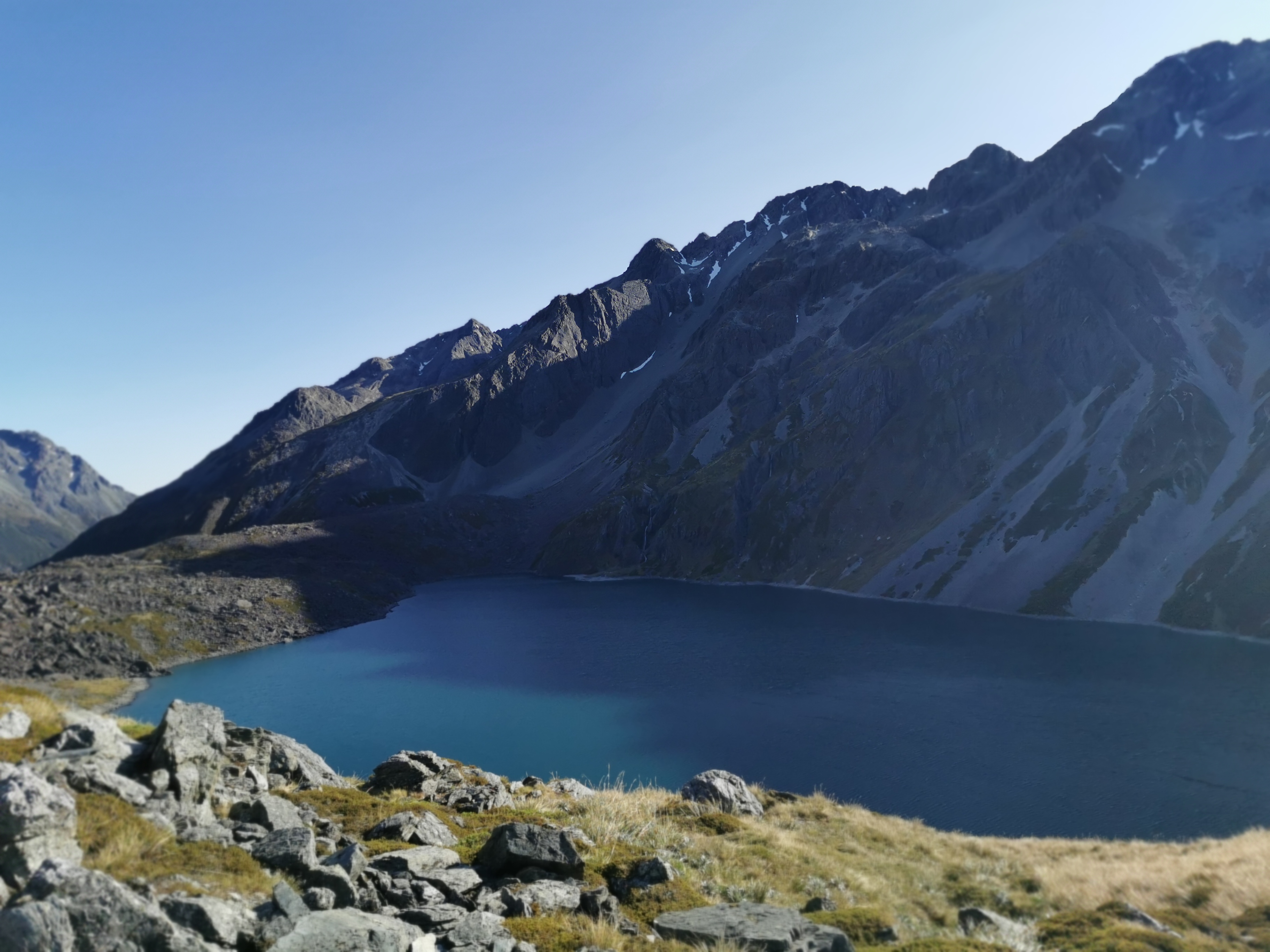
There are a few more ups and downs between Slaty Hut and the next hut which is Old Man Hut. I saw this view from one place, with a bit of water in the distance:
I tried to work out what I was looking at and based on the map and the direction I figured it had to be the East Coast, back out past Blenheim or somewhere like that. If that’s correct, we must be up really high to see that far.
This was the view I had today for my 11am picture, a bit further on:
11am view
The path went in and out of the trees as well. This photo makes that really obvious:
I stopped for a snack between the two huts as I was getting kind of hungry. I have no snack foods like I determined yesterday. So I worked out roughly how much food I need between here and St Arnaud, and ate a bit of the rest. That included peanut butter straight out of the jar.
Rest stop
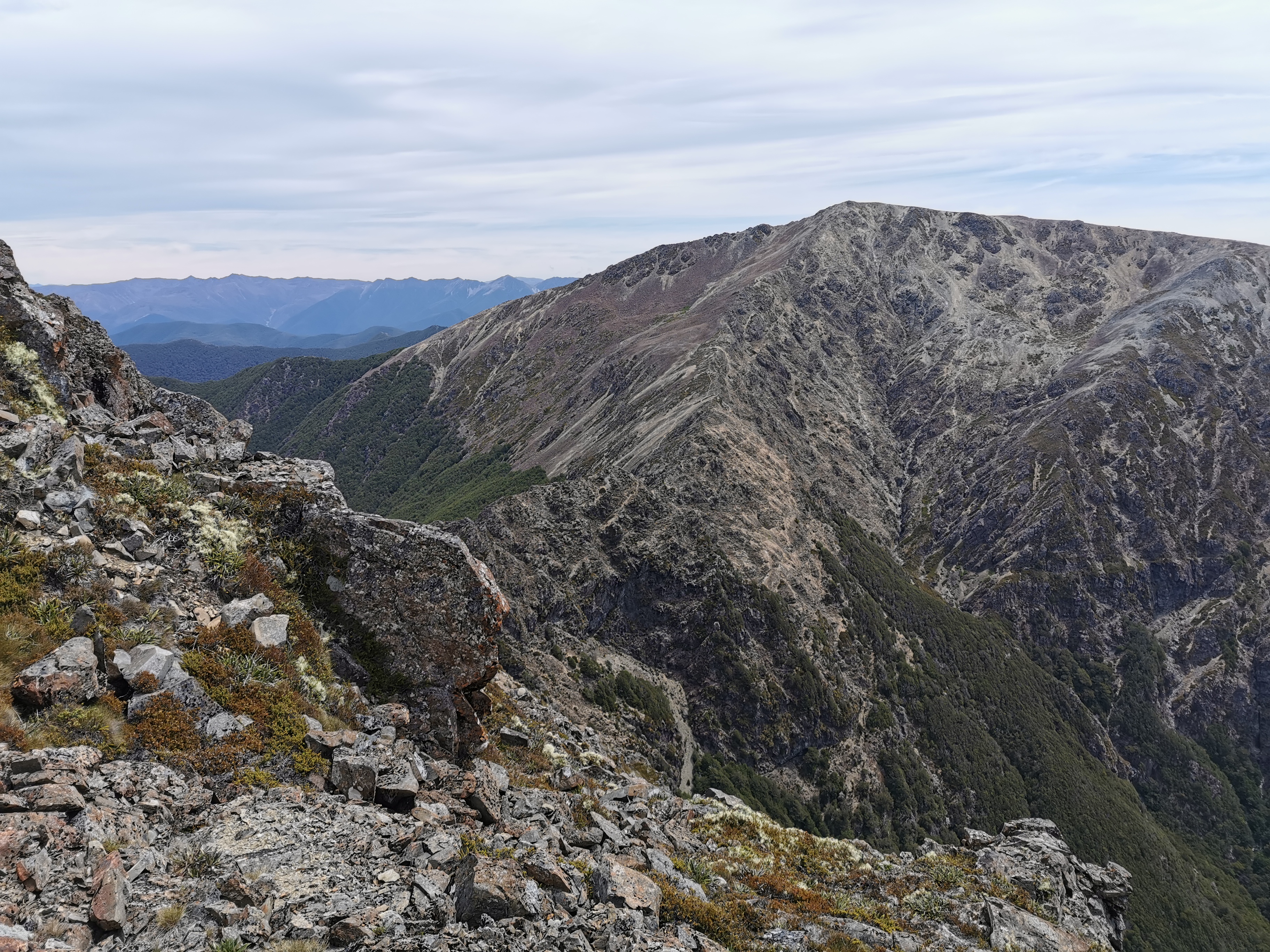
I then saw this view, which is another peak in the area.
The hut that is not far from here is called Old Man Hut so I figure this must be Old Man Peak or Mt Old Man but it turned out when I looked at the map to just be called Old Man. Another place with a fascinating story, no doubt, if only I knew what it was. Anyway, I now have to climb it. Fortunately not straight up the side of the rocks, but around to the side.
At this junction I saw a similar view to before, although this had a very familiar-looking river in the background.
I recognised this river from maps as the Wairau River between Blenheim and St Arnaud, so I must’ve been right in my guess as to what I was looking at. Although of course I could still be totally wrong.
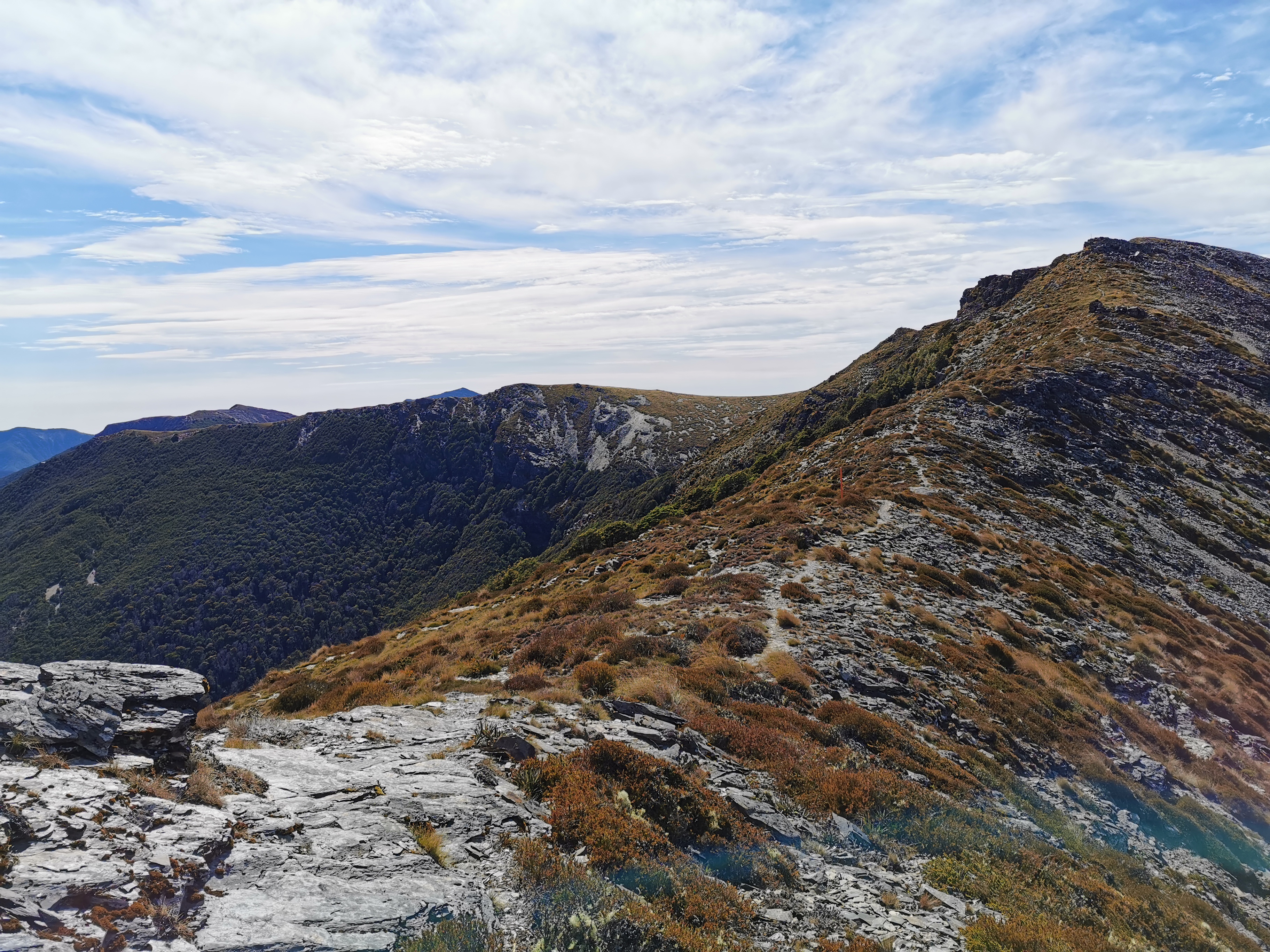
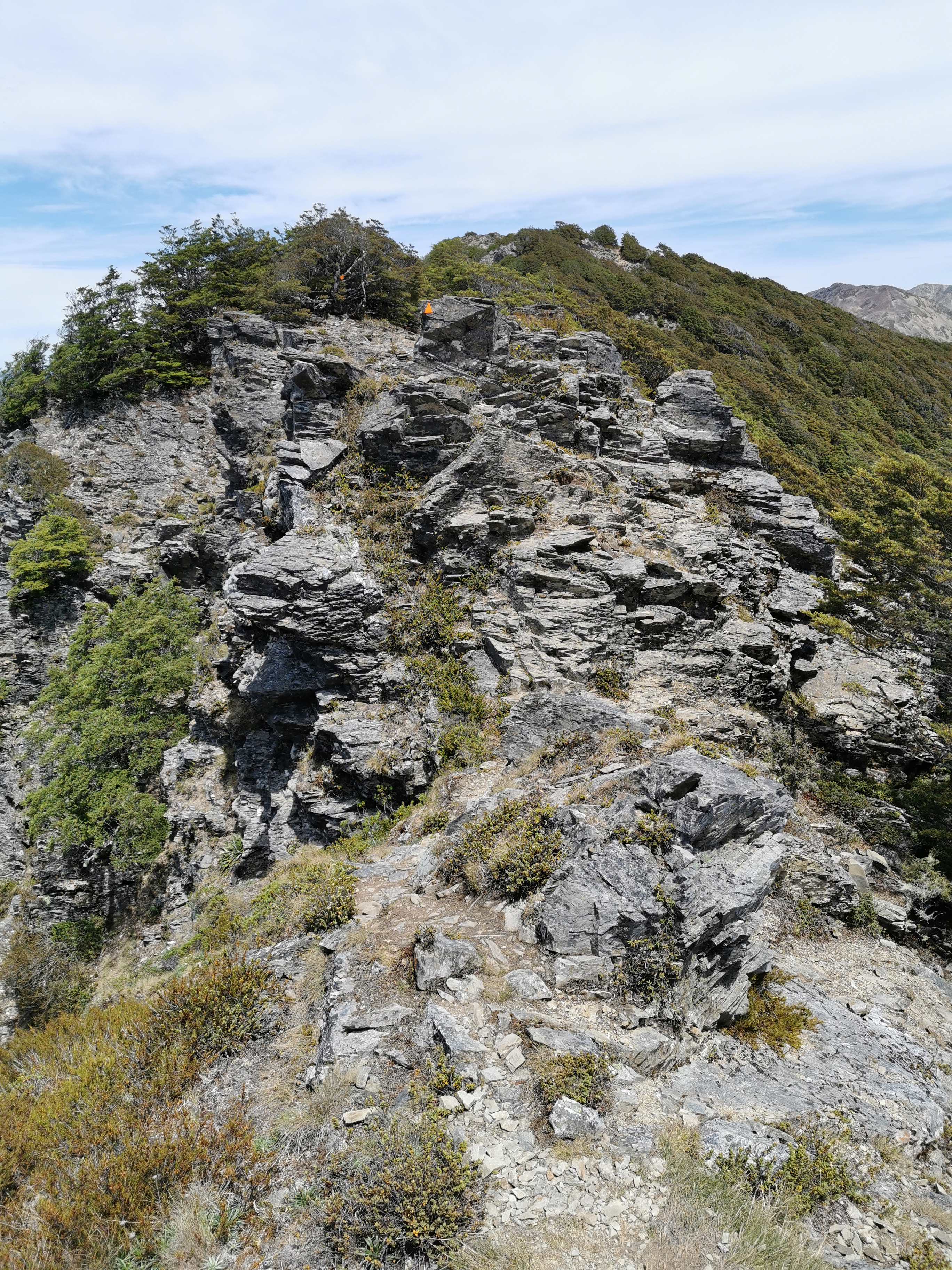
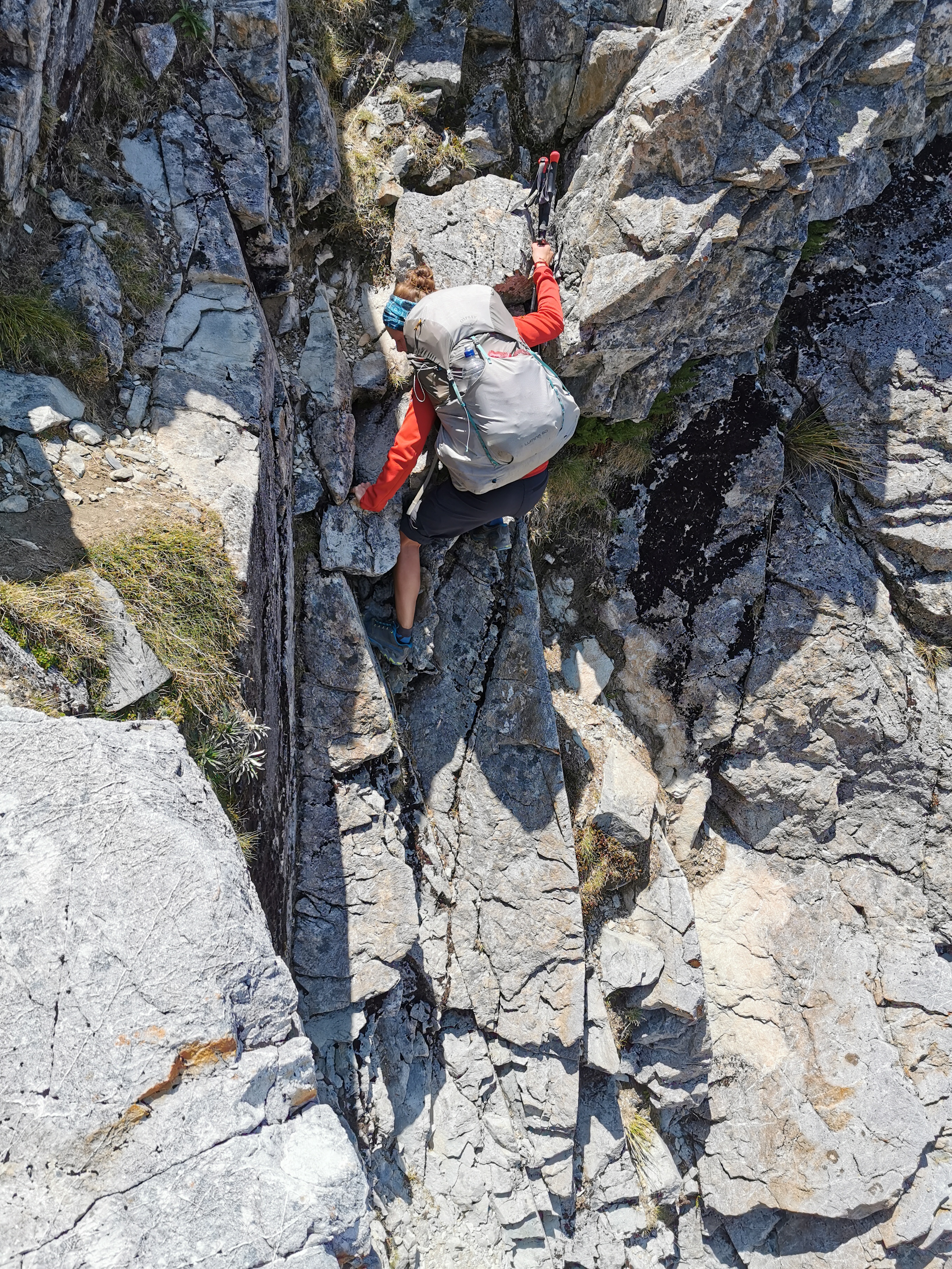
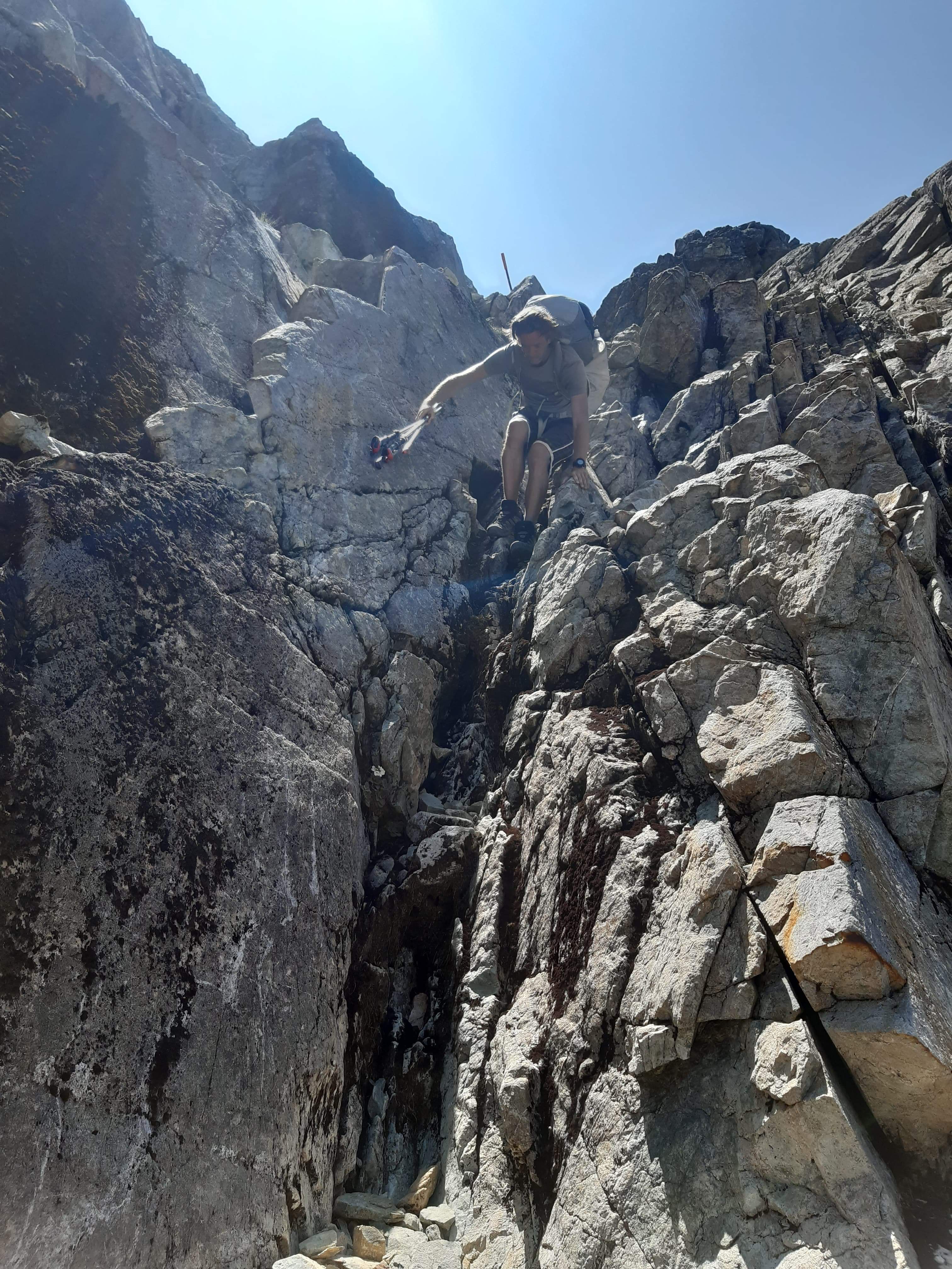
From here, the track gets a little, shall we say, “hairy”.
See the orange marker?
Yep that’s one pile of rocks that I did have to climb. And once over that, I soon got a glimpse of what I’d be climbing next.
The Rintouls
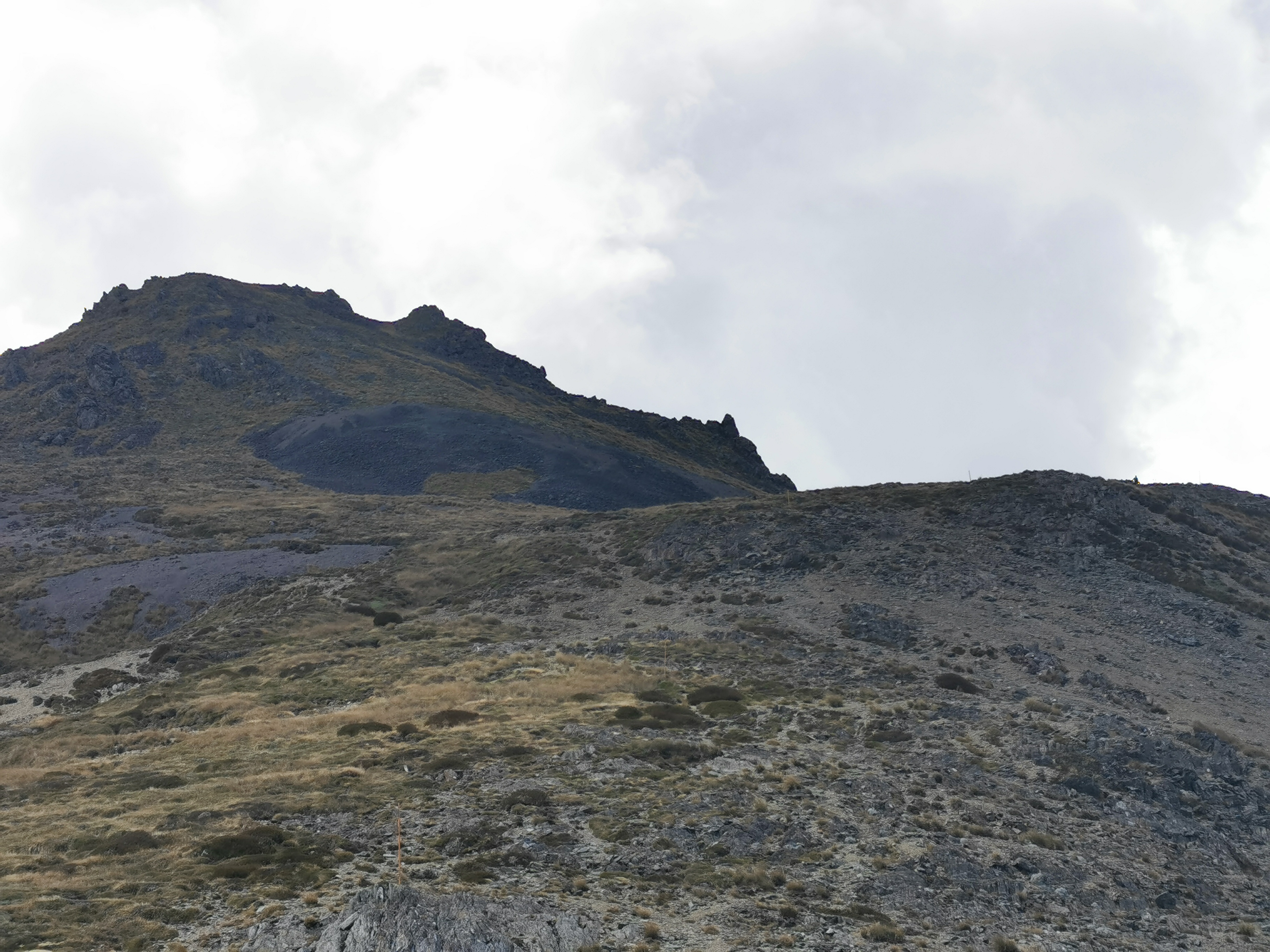
That there is Little Rintoul, a not insignificant peak immediately before Mt Rintoul which you go up to the top of and then descend a fair bit before starting up the next peak. The bit above the treeline looked just like dirt. That should be fun!
First though, another series of rocks to clamber over.
Old Man Hut is just after these rocks and after a bit more of a walk through the bush. Thing is, it’s a bit of a detour to get to it, and not an easy detour either, in fact it’s quite a steep 200m descent from what I hear. So I didn’t go and see the hut. I just had lunch #2 at the junction to it.
Lunch junction
I think now is a good time to show the Guthook elevation profile for the upcoming bit.
The way I’ve got it zoomed makes it look steep but it’s actually only two peaks of approximately 300 metres each over the space of four and a half kilometers. That’s not too bad – it’s apparently the terrain that makes it hard work. The first bit was fine – a well formed path through a bunch of rocks.
You could even see Old Man Hut in the distance.
Old Man Hut from afar
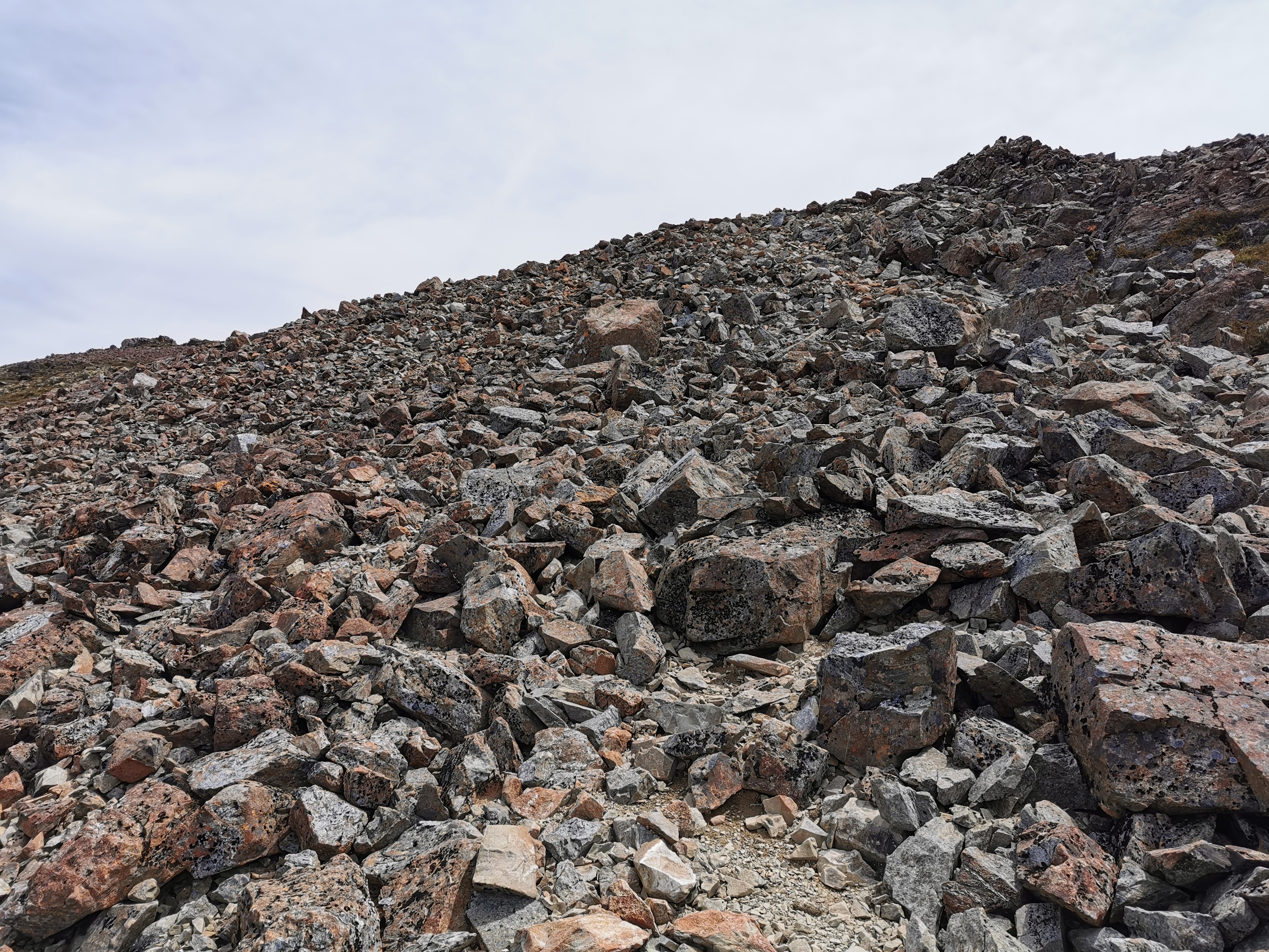
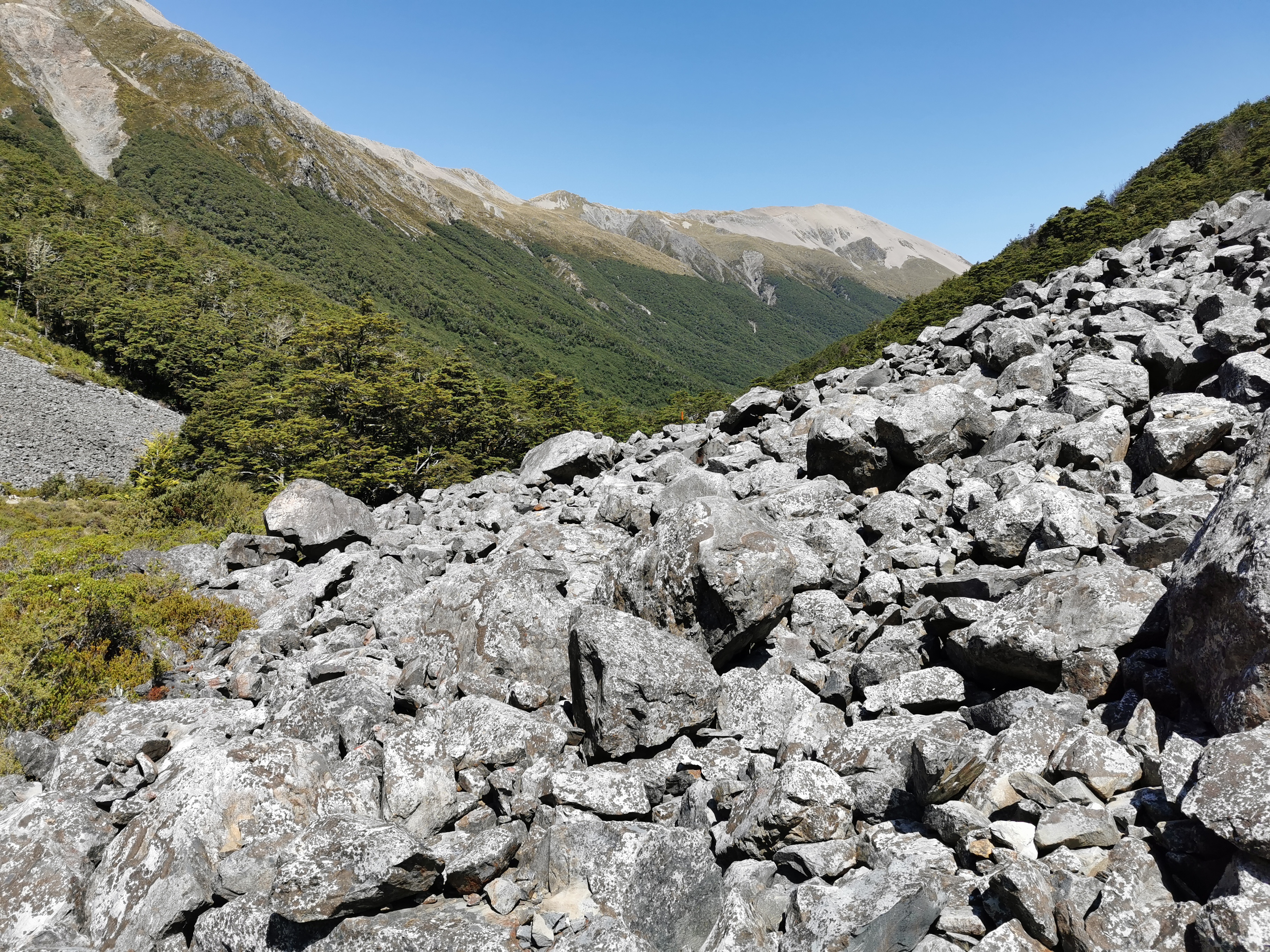
The top of Little Rintoul was just a lot of loose rocks. You had to make your way across them – luckily they seemed mostly wedged in place and none of them gave way when you stood on them.
Up Little Rintoul
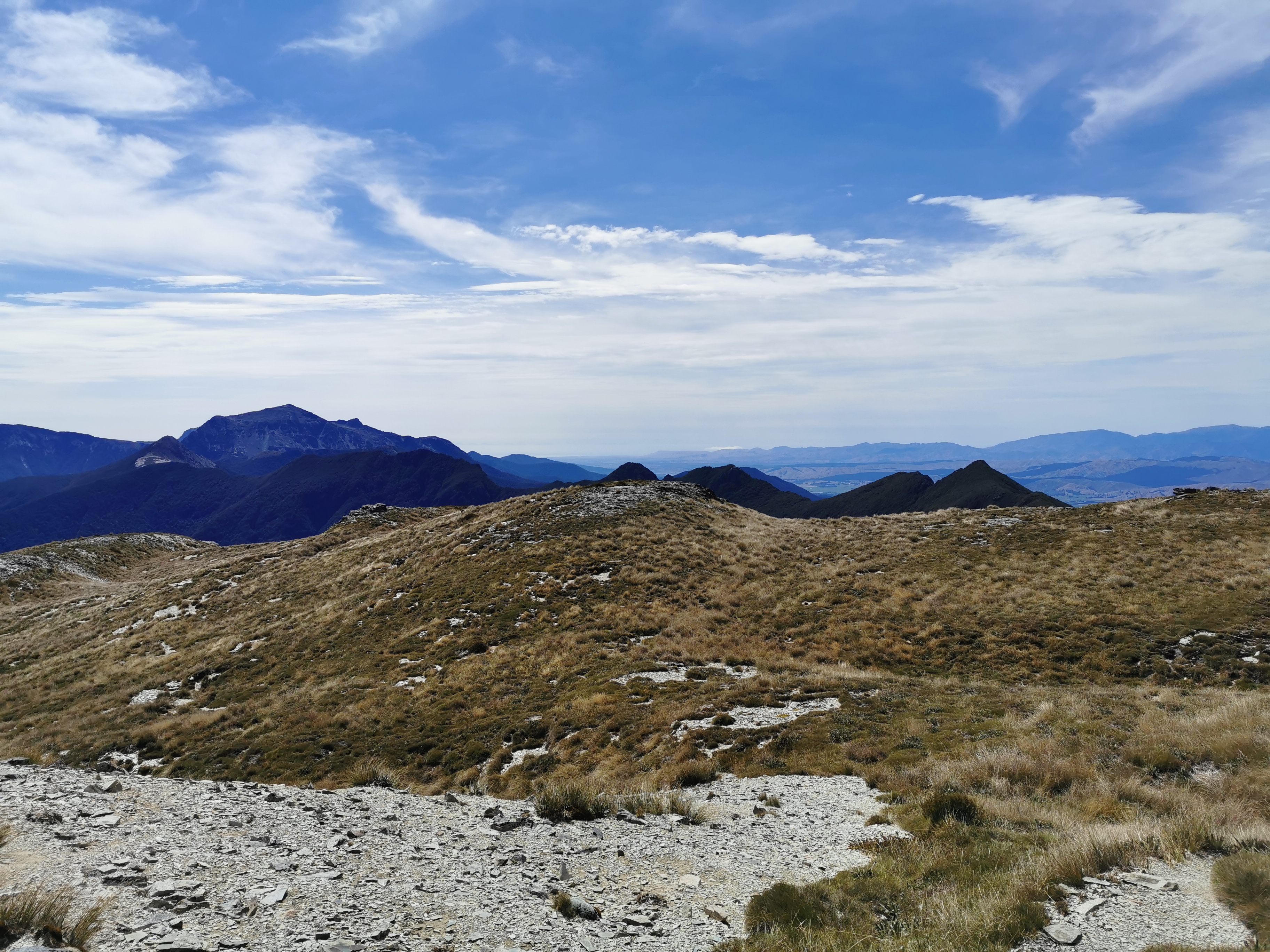
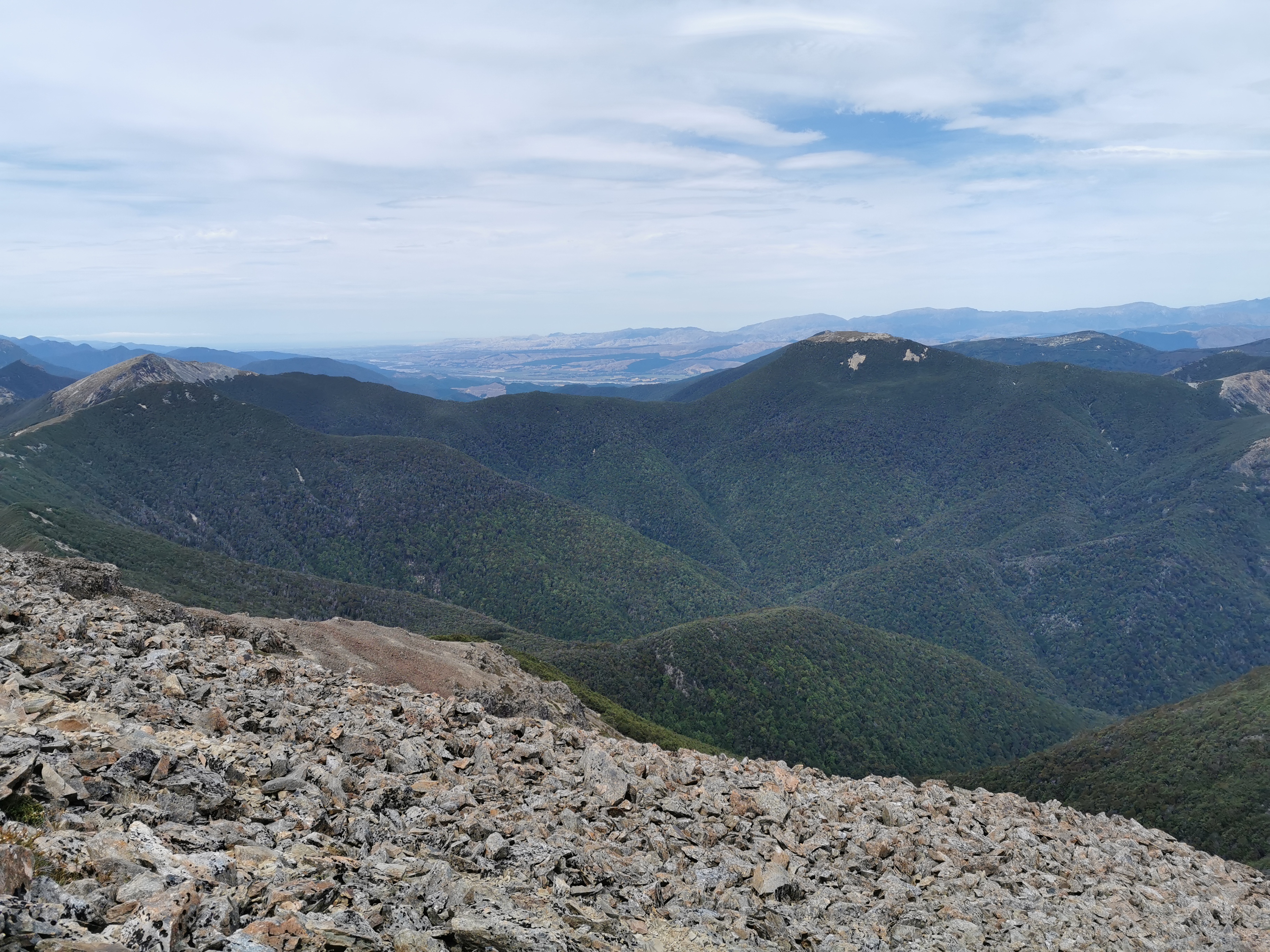
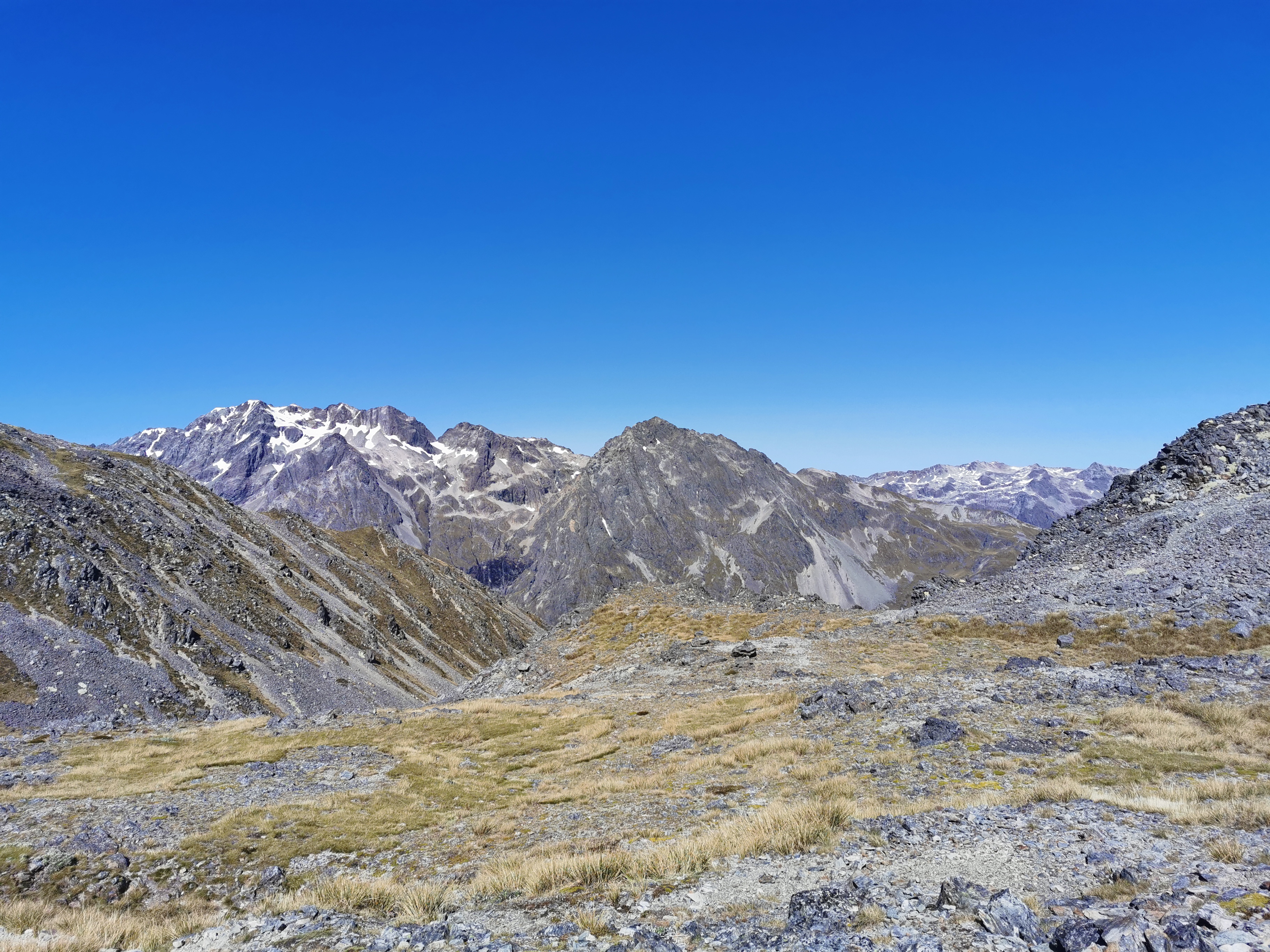
The view from the top was pretty good.
It was then clear where I had to go next. But how on earth do I get there?
Going that way…
Before going down here I found a spot out of the wind and used the excellent 4G phone coverage up here to upload a bunch of photos for the blog. I didn’t mind waiting for them to upload. This was the great view I had while I was waiting:
After this I continued on a bit and it was obvious where I had to go next.
Now that looks fun!
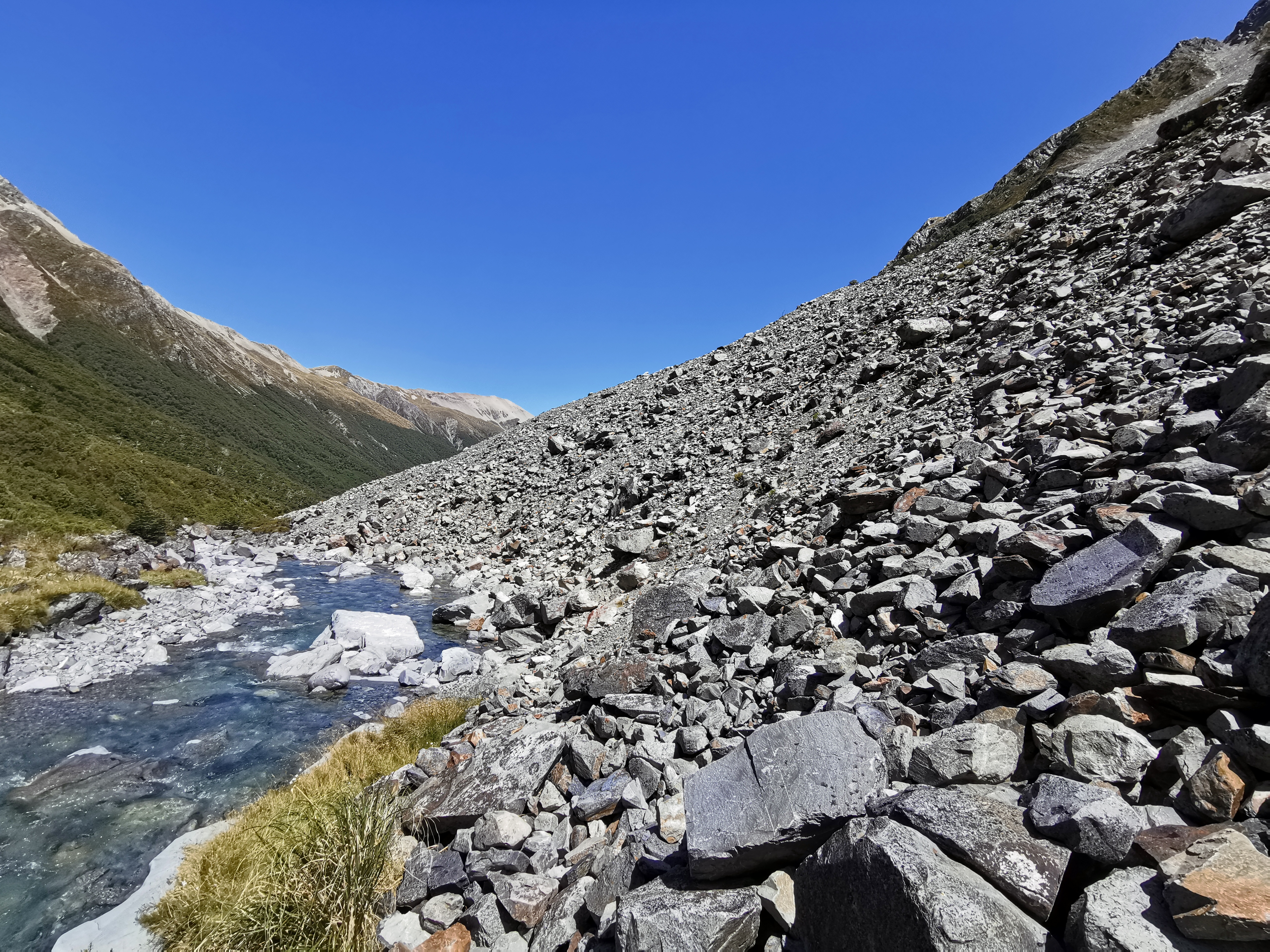
Going down here was interesting. The rock was a lot smaller and looser here – “scree” I believe it’s called. With each step lots of rocks tumbled down the hill. I had to be careful that I didn’t go with them, although when that happened it did make the descent faster!
There were a few spots where overhanging big rocks meant you had to manoeuvre yourself around them, and a lot of times there wasn’t a lot of space. There were a few quite dangerous spots.
Once the descent was over, it was time to start up Mt Rintoul. It actually wasn’t too hard, mainly along a path like this:
Going up Mt Rintoul
In some places the rocks were looser than others, but generally there was nothing too challenging, you just had to be careful and patient.
I saw Matthew and Tina on the ascent of Mt Rintoul. I managed to catch them when they stopped for a break out of the wind near the summit. The wind was a problem at times but at other times it wasn’t, it just depended on which side rocks were shielding me. Well I say a problem, it was just cold more than anything.
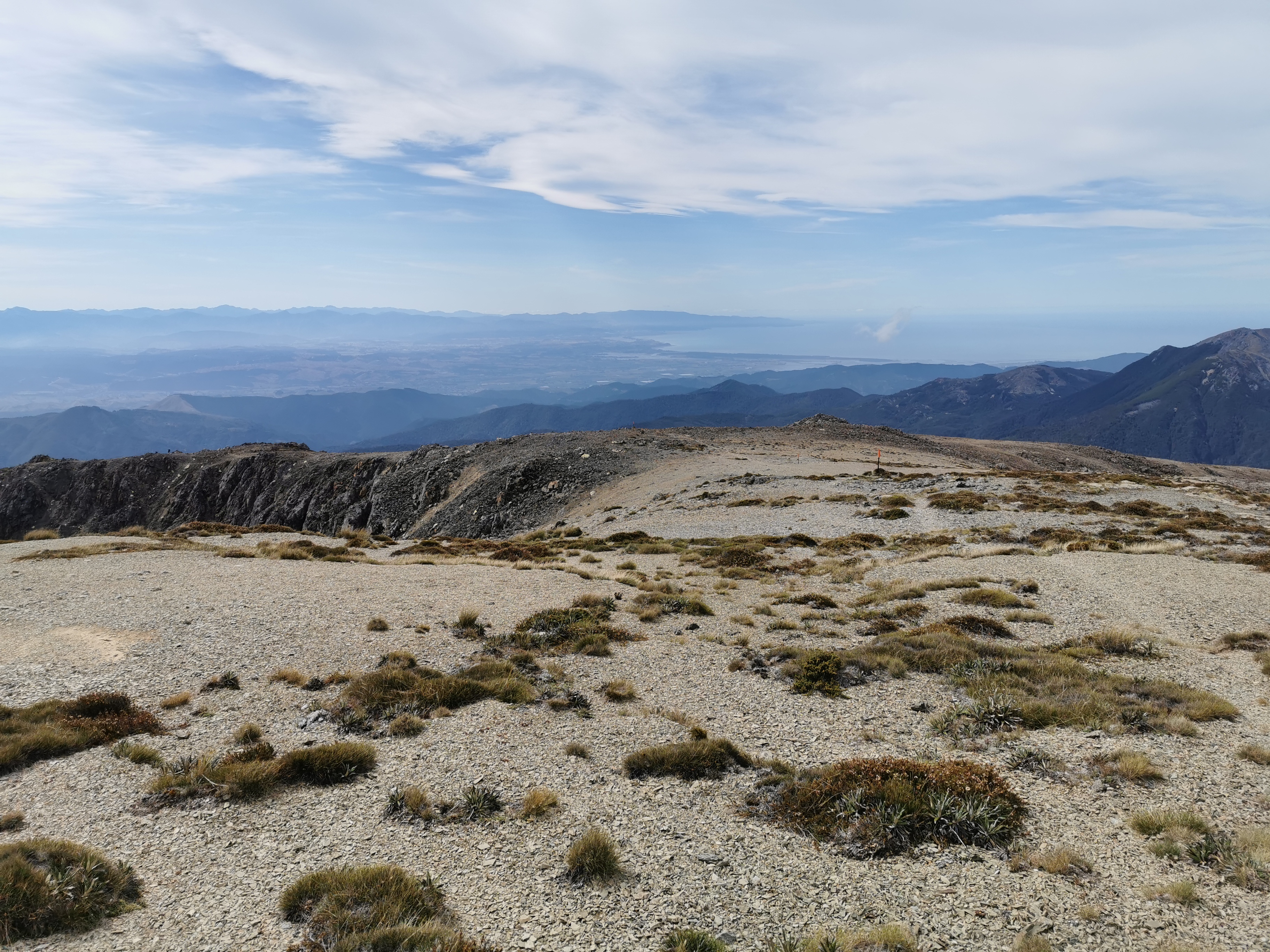
The view was good from the top.
Those peaks look like they have snow on them. Apparently my new phone camera has a really good zoom. Let’s try it out right now.
I like the 10x zoom very much!
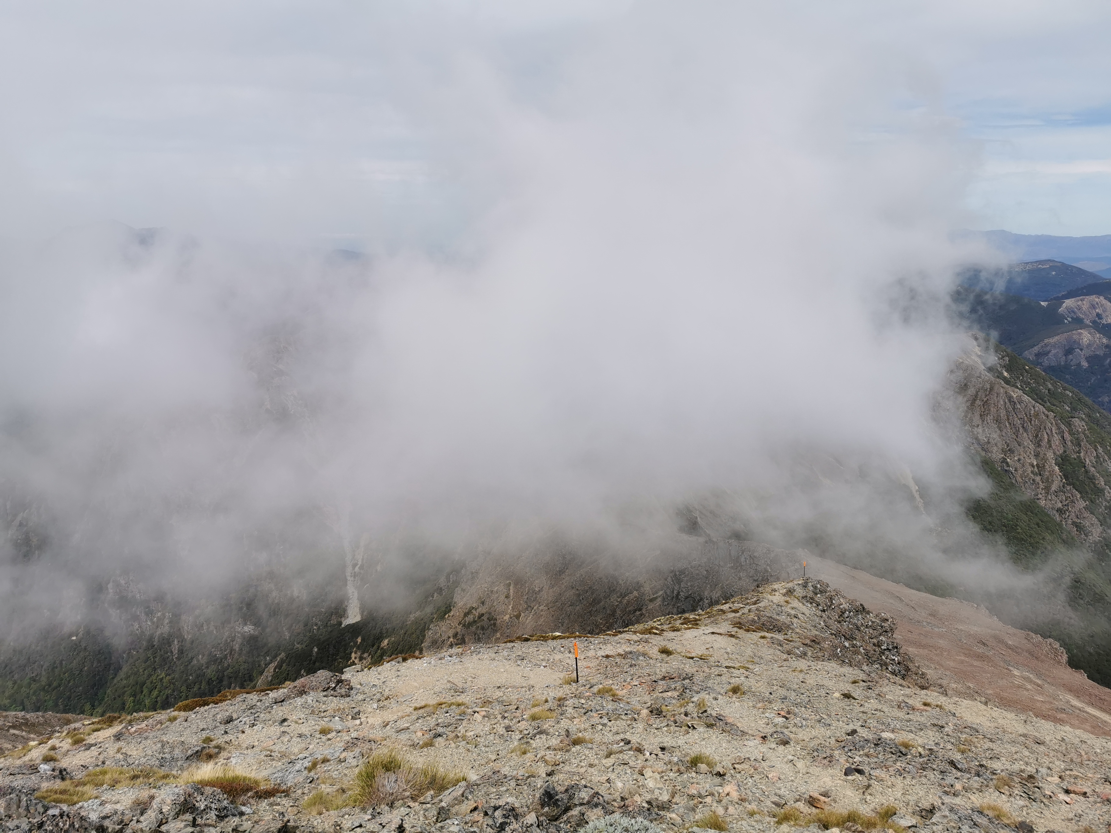
I’m glad I didn’t leave it much later to get up here. The cloud followed me up:
Views go bye bye
Here’s the view from the actual summit:
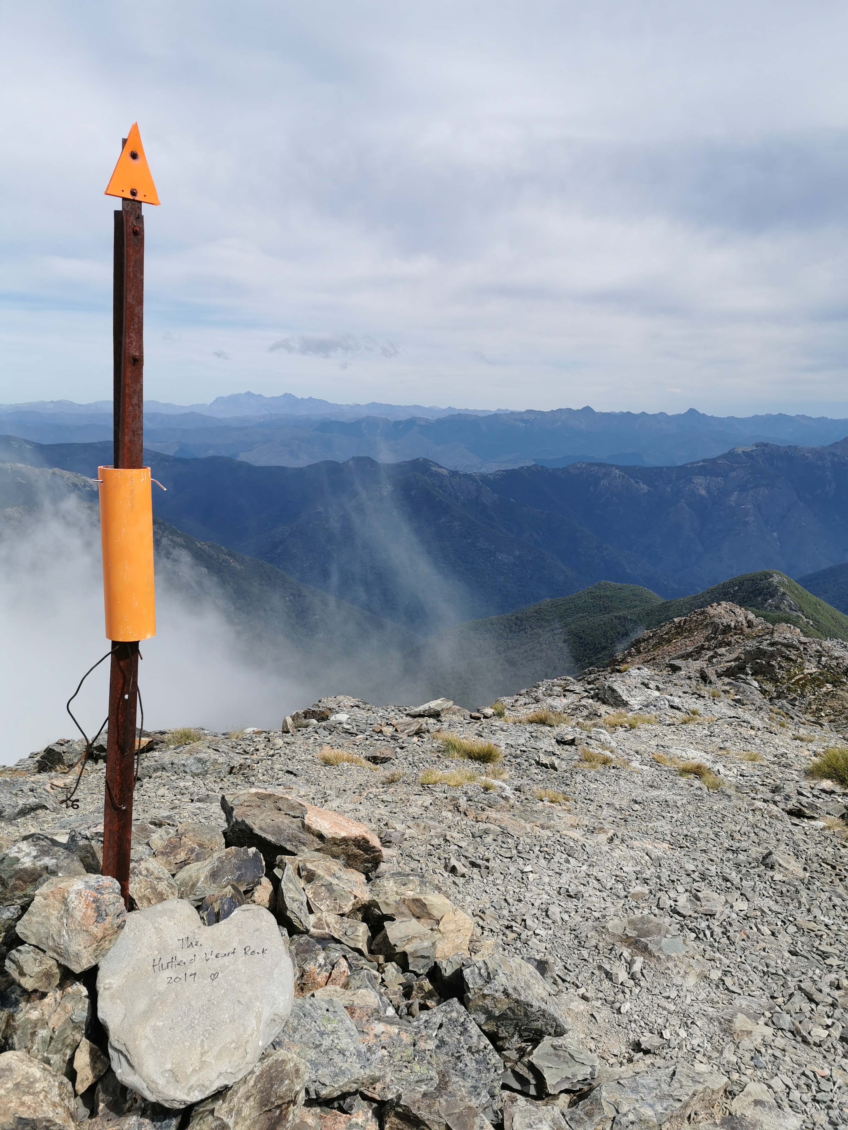
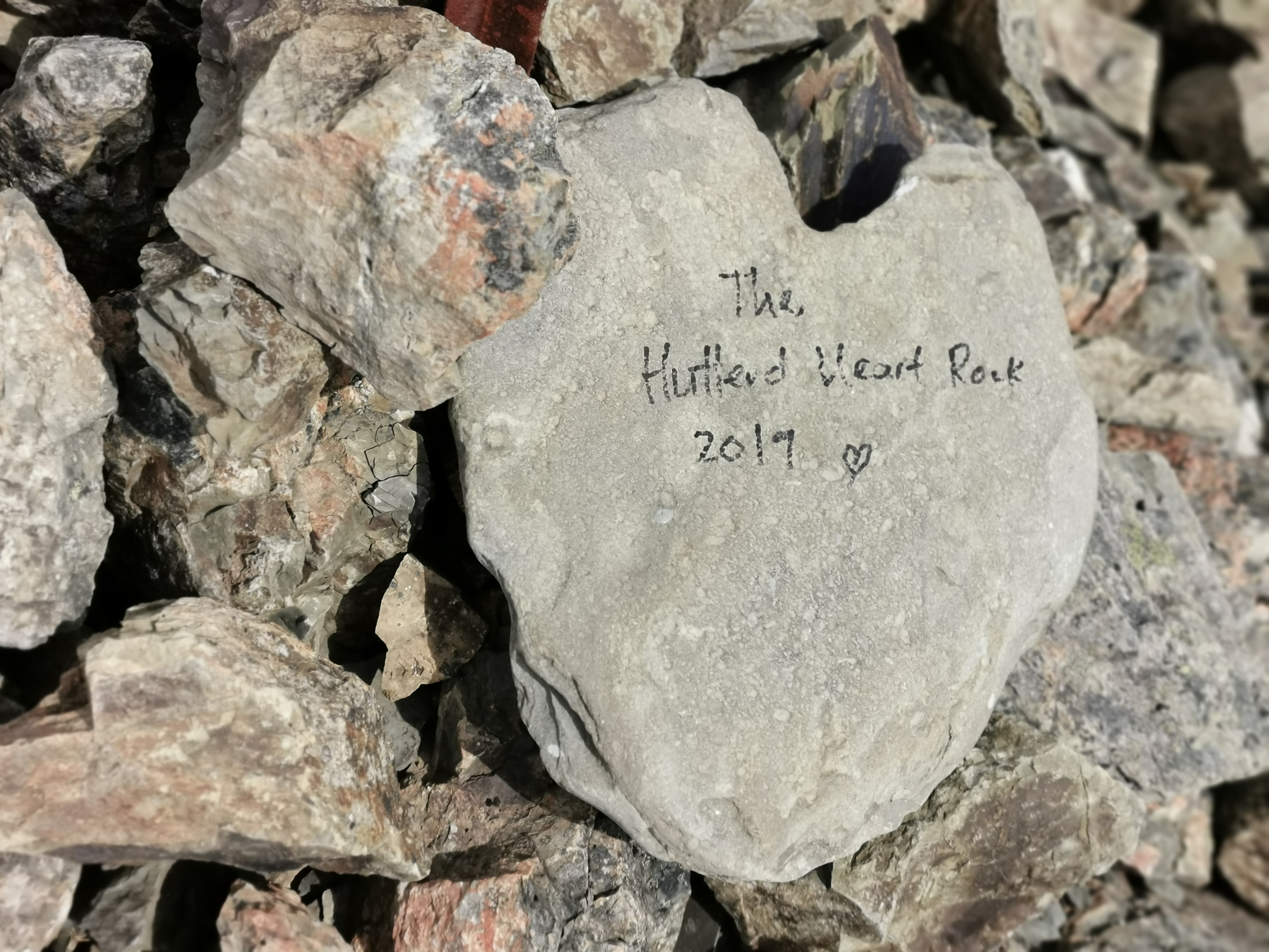
And here’s a close-up of the heart-shaped rock, just in case you’re interested!
“The Hutterd Heart Rock 2017” – I think!
After the summit there is quite an easy walk down for the first bit.
Starting down Mt Rintoul
And it didn’t matter that I had no snacks – there were plenty of space cauliflower up here to munch on.
Just kidding, you probably shouldn’t eat these
I had been doing a bit of calculation in my head as to exactly when I could get to St Arnaud, so I could check out accommodation there. Three days would be tough, they would be three big days, so four days was more realistic. Besides, if I’m gonna book somewhere nice I want to have the whole day to relax there and enjoy it. So while I was at the summit I booked the Alpine Lodge for Wednesday the 15th – four days from now. It is quite pricey, $195 for one night, but I couldn’t see any other options except for campsites. I want to do laundry and have a nice meal so I’ll pay it. I mean, it’s so far between towns here that it’s not like I’ll be spending that amount often. And it’s free cancellation if I change my mind.
I was really starting to notice my smell. I smell like an infected wound. I remember making that same observation about a month ago – day 54 in fact – where I noticed that the tent had the same smell. I can’t quite work out what causes that smell.
Just one final descent down some more scree and down past the treeline to the hut. Matthew and Tina got away from me before but I caught up to them again.
Matthew and Tina making their way down, with the toilet of the hut in the background
The last bit was a standard walk through trees…
Standard walk, standard trees
And there’s the hut!
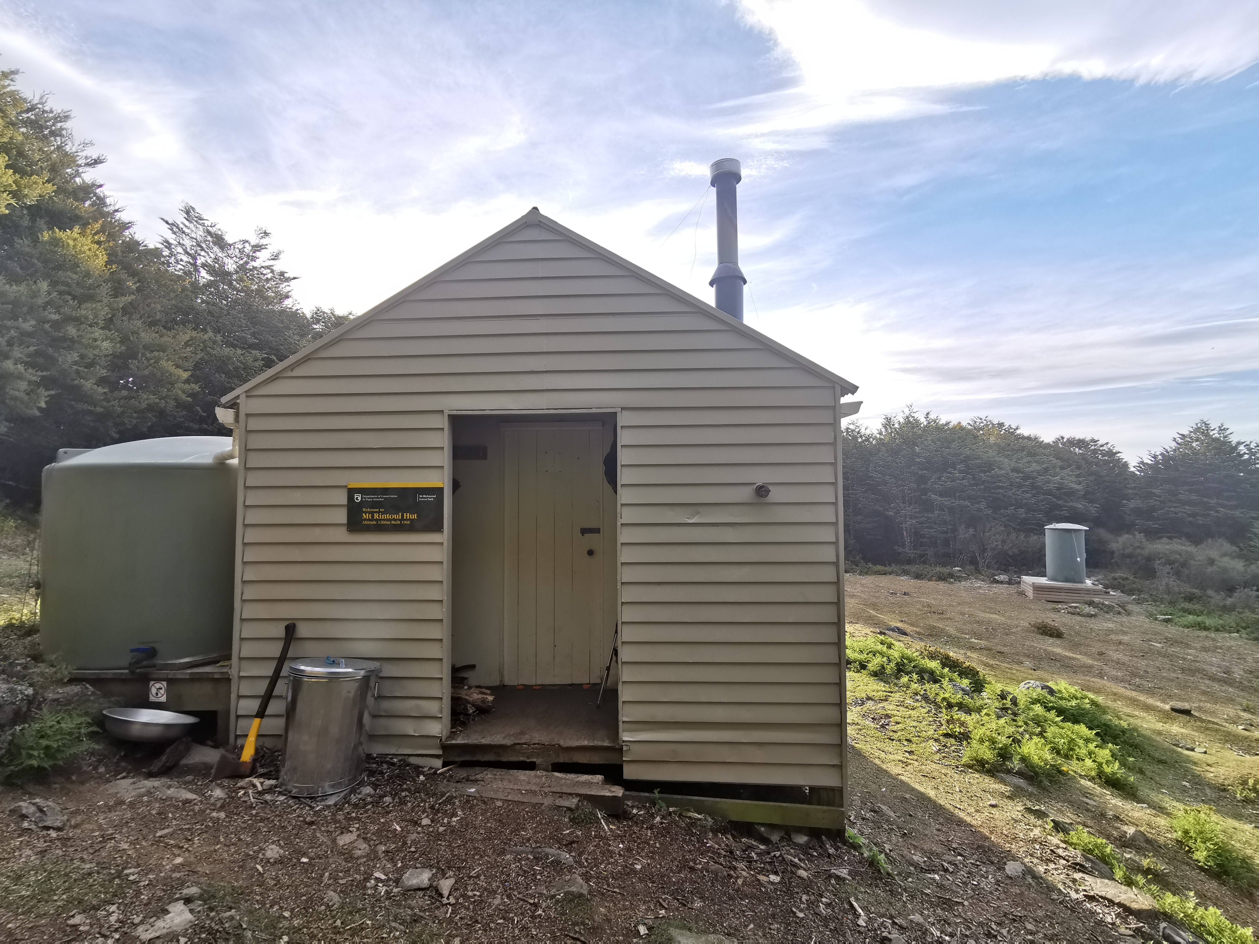
Mt Rintoul Hut
Two women were there already – Astrid and Barbara. I’d seen their names in the intentions book at the previous huts. They were currently the only two here so there was room for Matthew and Tina and me, which left one bunk behind, although I wasn’t expecting anyone else. Nobody else from Starveall Hut said they were aiming to get this far.
Matthew and Tina turned up a short time after me. I saw Matthew taking his shoes off and his feet were wrinkly and white. I asked Tina if they considered taking their shoes off to cross the river and change into crocs and she too said no. In fact she seemed to think the very idea was crazy.
There is 4G at the hut too. I used the time to upload some blog posts and also do a bit more research into the Alpine Lodge. Turns out they also have backpacker accommodation – it just doesn’t show on booking.com that I booked through. So I cancelled my $195 “queen room” that I booked earlier and rebooked into a $75 “private room with shared bathroom”. Much better.
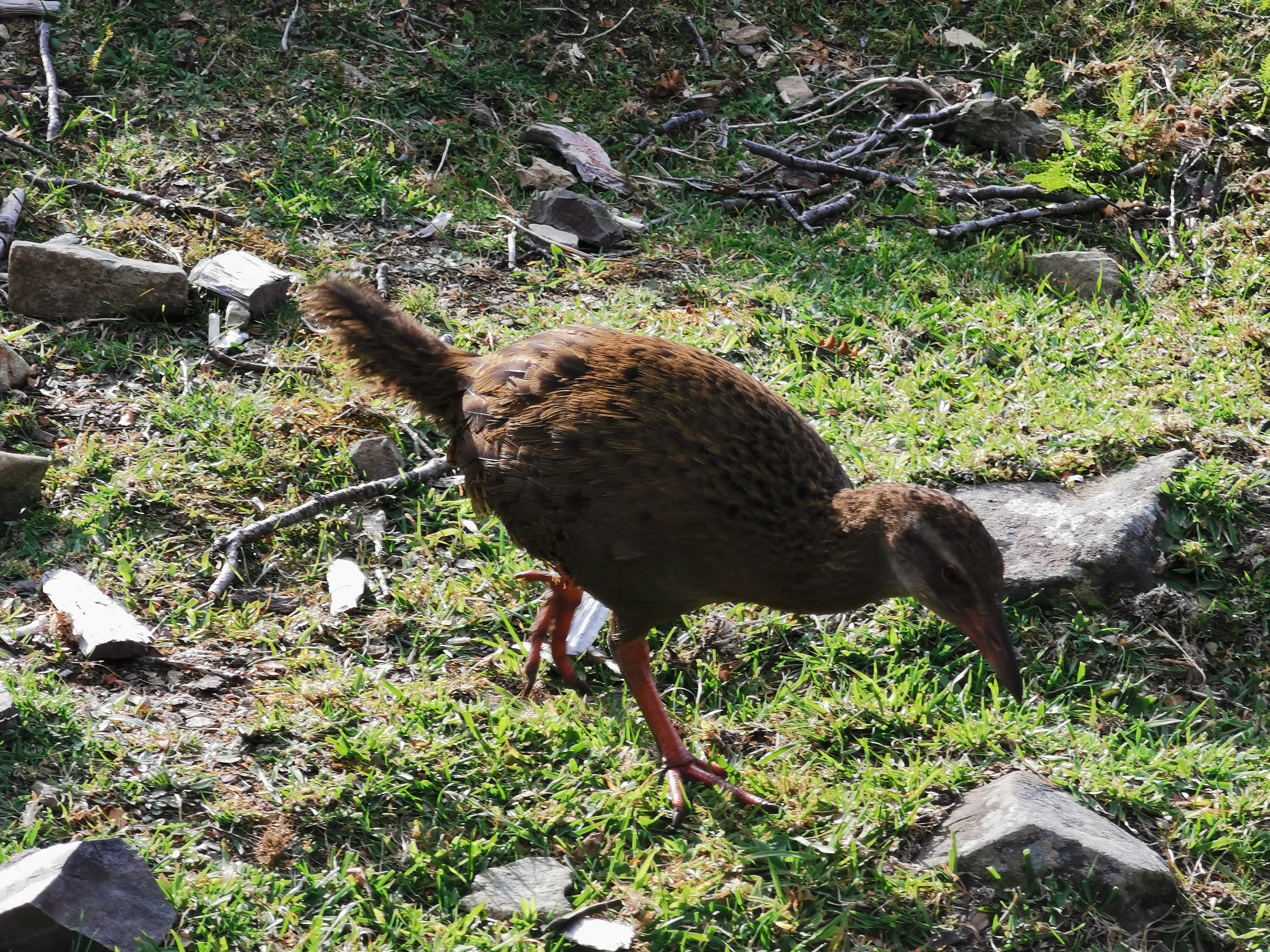
After the sun beating down on me all day I was feeling very hot. The hut was like a sauna so I had dinner outside. There were quite a few weka hanging around here.
Weka
Man I love the zoom on this camera.
Weka close up
I read Alex’s blog for this section tonight. I’m surprised to see how he thought it was the “scariest” day so far. Sure it was challenging, but I thought the Tararua Ranges were harder and scarier. His blog post on this section is worth a read too, for a different perspective.
We all had a relatively early night. Although just as I’m trying to go to sleep… someone is snoring incredibly loud. I wonder who it is. There has been snoring at every single hut so far in 2020, but this is by far the loudest. I miss my tent! Luckily, the snorer seems to have woken themselves up with the snoring and that’s made it stop.
Date: 12 January
Trail covered: 21.9km (kms 1873.2 to 1895.1)
Weather: rain threatened all day and drizzle started at 3pm
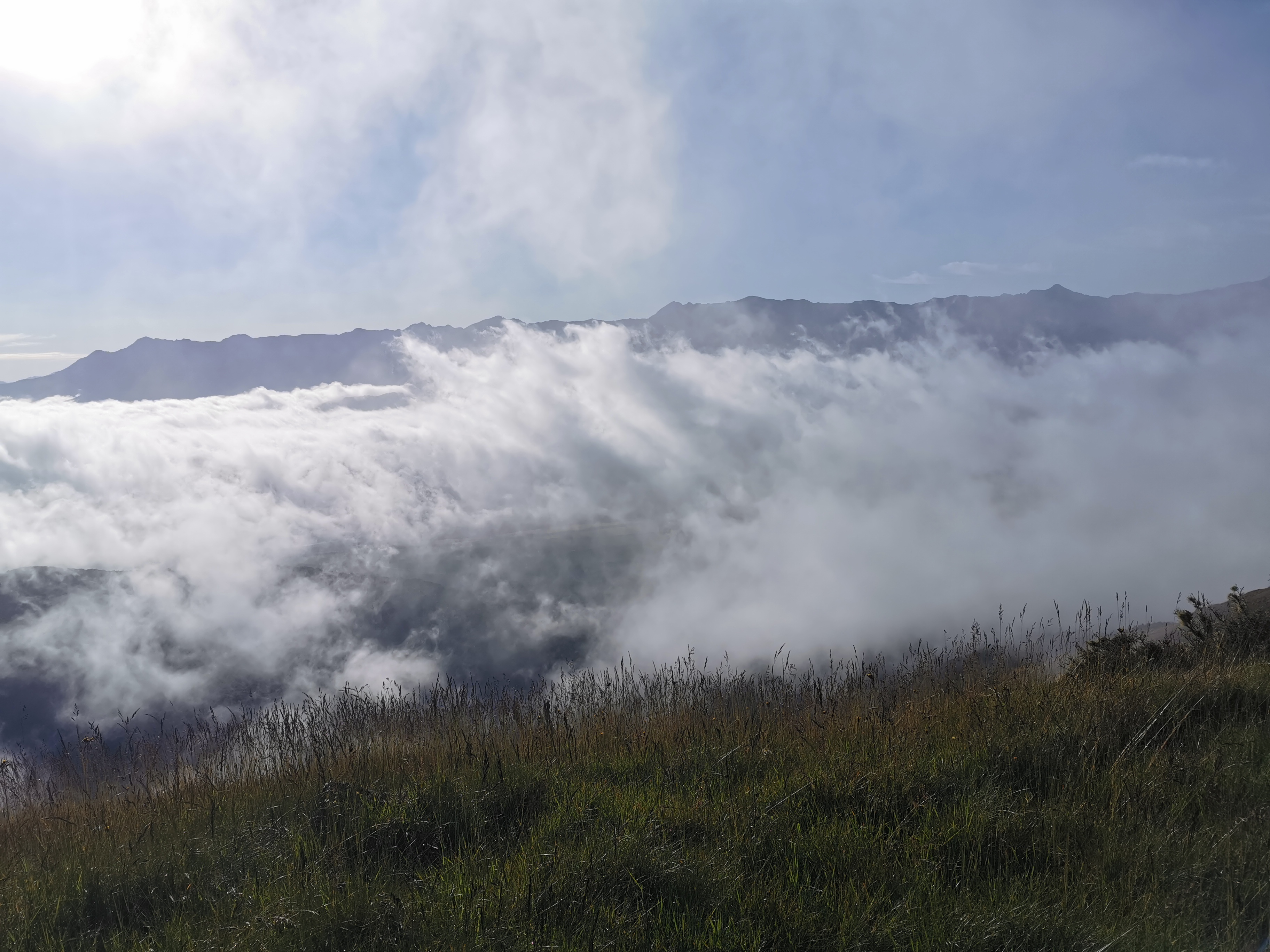
This morning when I did my usual wake up and race straight to the loo, I admired the view on the way back to the hut. It gave a clear idea of the sort of thing we descended yesterday.
Mt Rintoul at 6:45am – just one of the many peaks from yesterday
While I was having breakfast I was playing with my phone and I got a notification, and it occurred to me that it didn’t vibrate when I got the notification. Come to think of it, I’m not sure I’ve ever heard my phone vibrate ever since I got it just before New Year’s. I checked all the vibrate settings – all turned on. I did the Huawei “vibration test”, and still nothing. How annoying. I probably won’t need the phone to vibrate while I’m on the trail but in day to day life that’s gonna be annoying. Hope the phone doesn’t have to go in for repair.
Today there are three possible huts as destinations. First is Tarn Hut which is too close. Second is Mid Wairoa Hut and third is Top Wairoa Hut. There are apparently eight river crossings between Mid and Top Wairoa Huts and it would be nice to do those after the sun has been shining on the water all day, instead of first thing in the morning tomorrow when it’s cold. So my aim was Top Wairoa Hut but can always stop early and reconsider if it feels too far. The trail notes estimate 13 hours for that journey.
I didn’t waste any time and left at 7.15 am, before everyone else. Again the gloves and jacket were on when I left.
The first peak today is called Purple Top.
View on the way up
It was similar to the terrain from yesterday but a lot less steep so it was no problem at all. The sun was shining on the hillside and so it warmed up fast. The gloves and jacket came off at 7.45.
Rocks on the way up Purple TopNearer the summit
I’ve noticed over the last few days that sometimes you see little piles of rocks – cairns I think they’re called. Can you see the one in the photo above, in the bottom right? I don’t know why they’re there, perhaps they help you find the way but maybe people are just building them for fun when they have a rest. This one at Purple Top summit is worthy of a photo though.
Monster cairn
Coming down, there were more rocks to scramble across.
Seemingly never-ending loose rocks
Over the summit on the non-sunny side of the peak, it was windy and cold. Thankfully the treeline appeared quickly. Ahh, I’m warm again.
It was mostly a nice walk to Tarn Hut but there was the odd rock scramble.
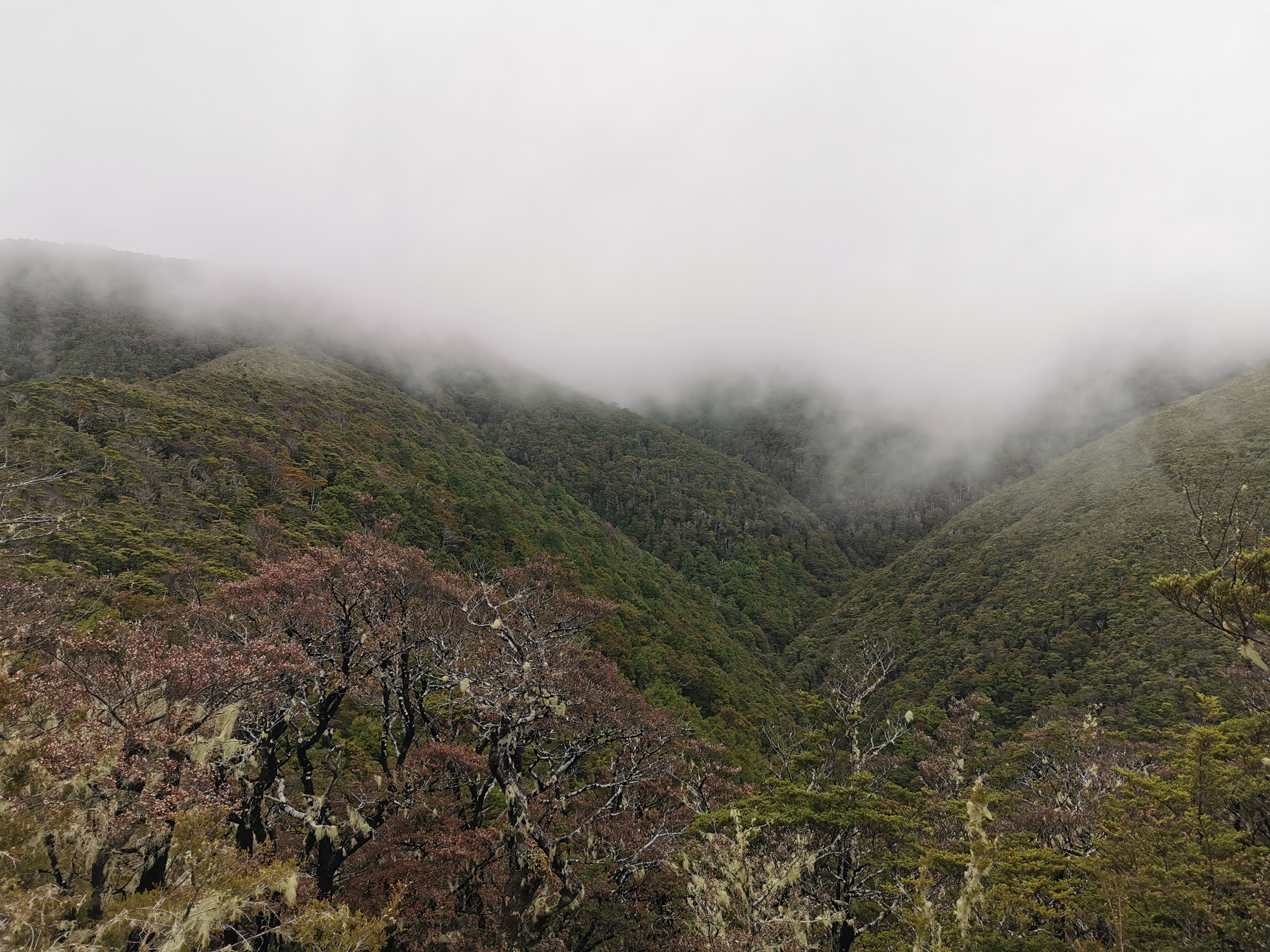
The clouds were coming over now too. The weather forecast today called for isolated showers in the Western ranges (wherever that is).
Views going
I wonder if any rain would hit? The clouds have really come over now!
Views gone
It was a 500m descent down into Tarn Hut. I tripped quite a few times on the way down. Not fully tripping over, just stumbling. I’m not entirely sure why, just fatigue I guess.
A bit of uneven terrain
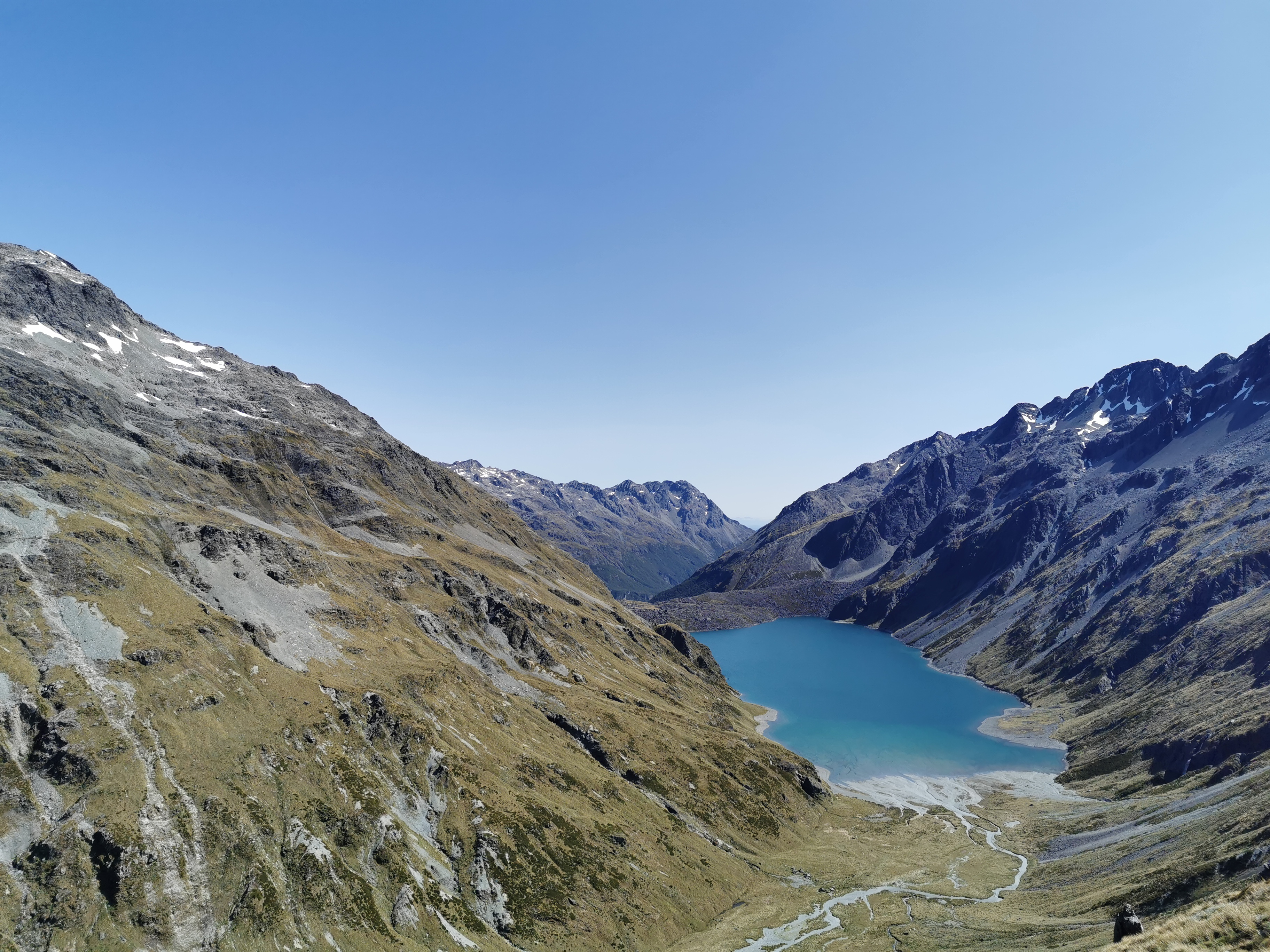
It was three hours to Tarn Hut from Rintoul. For the first time in a while I arrived to find other hikers there, which was a surprise. They were Rebecca and Christian from Switzerland. They were real nice to talk to and I learned that they were northbound hikers who started at Bluff. Exciting – I’ve just met my first proper NOBOs!
There they are, right at the bottom!
Apparently I remind Rebecca of her brother in the USA. When I pressed further it’s apparently because we both have shaggy hair and are easygoing. I’ll take that!
Encountering northbound hikers meant we could exchange information. I asked them about the upcoming river crossings, they said they’re nothing to worry about. I asked about future sections and they said this is definitely one of the longest. They asked if I had the weather forecast because they were unsure if they should go over Purple Top in what appeared to be deteriorating weather, but I told them it’ll be fine. They also said that they are just starting to find the trail busy – they’ve been passing “a flood” of southbound hikers in the last few days.
Almost everyone I talk to, including these two, seemed to be going into Nelson to resupply at Hackett Hut or Rocks Hut. That seems like an unnecessary use of an entire day. In saying that I would have a lot more chocolate right now if I had done the same thing. I haven’t found carrying 9 days worth of food that bad, although apparently I’m fast so maybe some people are carrying 10 or 11 days food.
The two NOBOs left and I had the hut to myself for a while. Here’s my 11am picture: a goat outside the hut which didn’t seem bothered by me.
11am view. At least I’m out of the clouds now.
Hmm, that’s weird. When the alarm on my phone went at 11am, the phone vibrated. So the phone does know how to vibrate after all. Strange! So why won’t it vibrate when I get a notification?
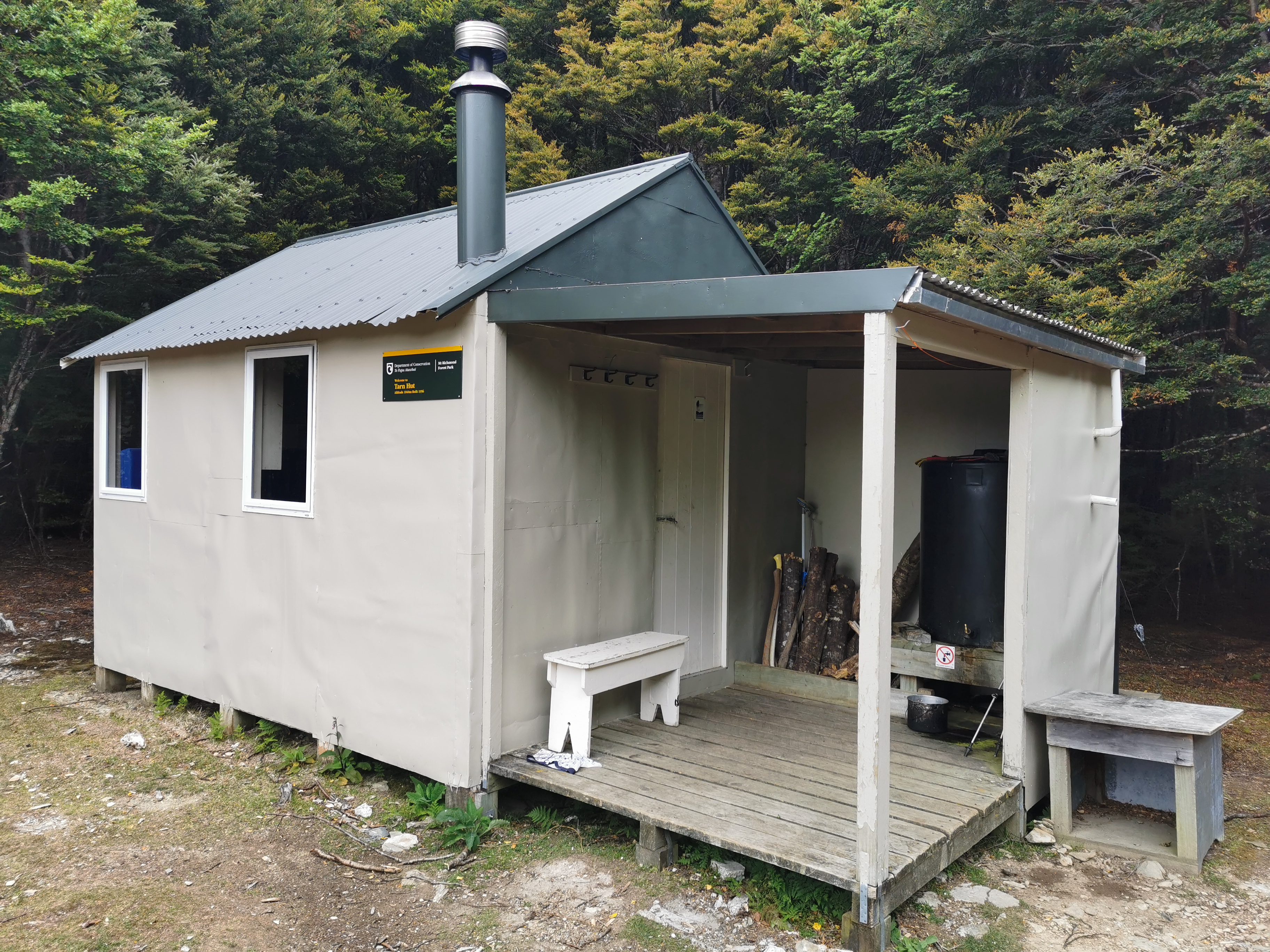
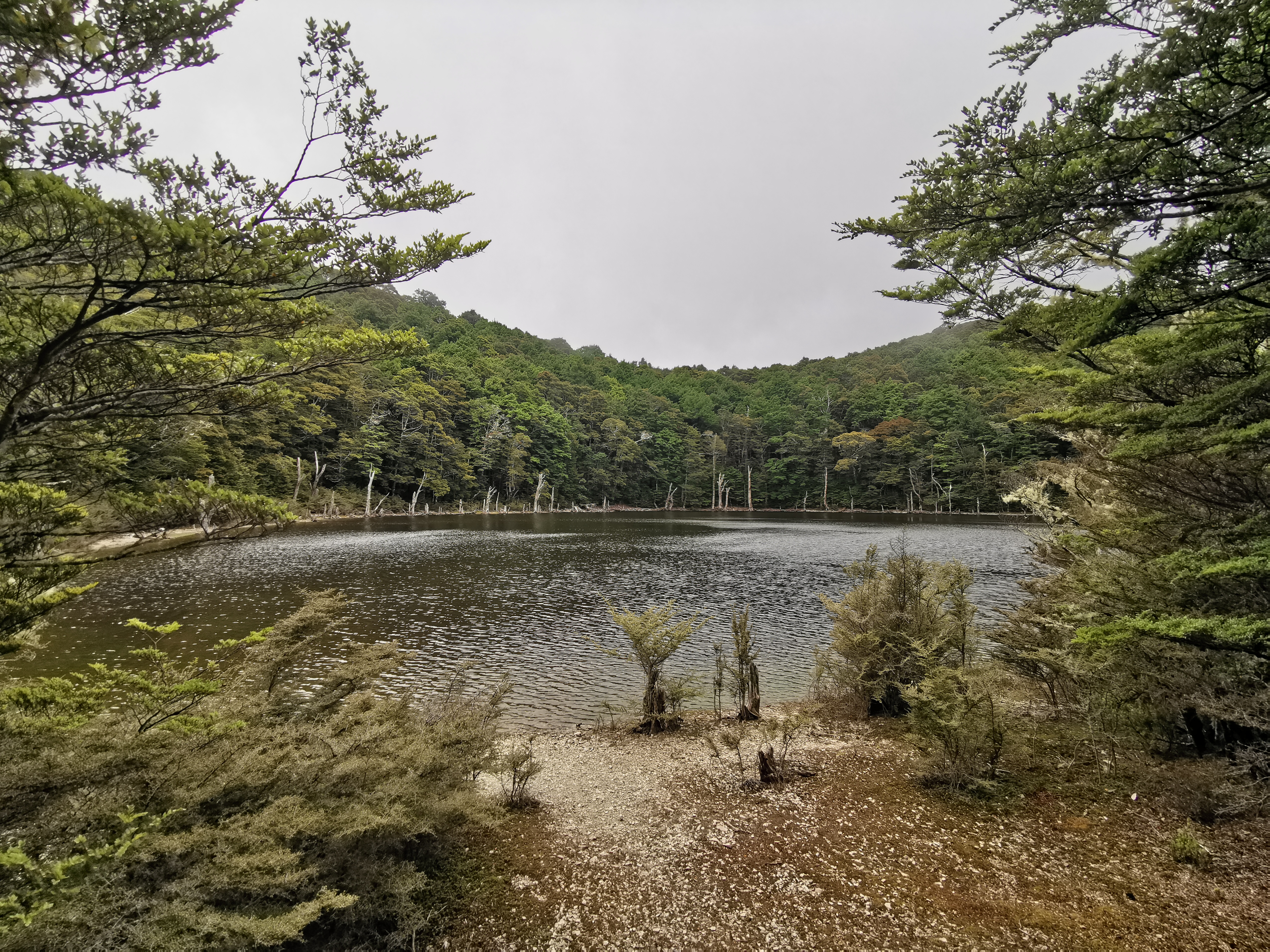
Outside Tarn HutInside Tarn HutThe tarn itself. I didn’t know what a tarn even was until I looked it up.
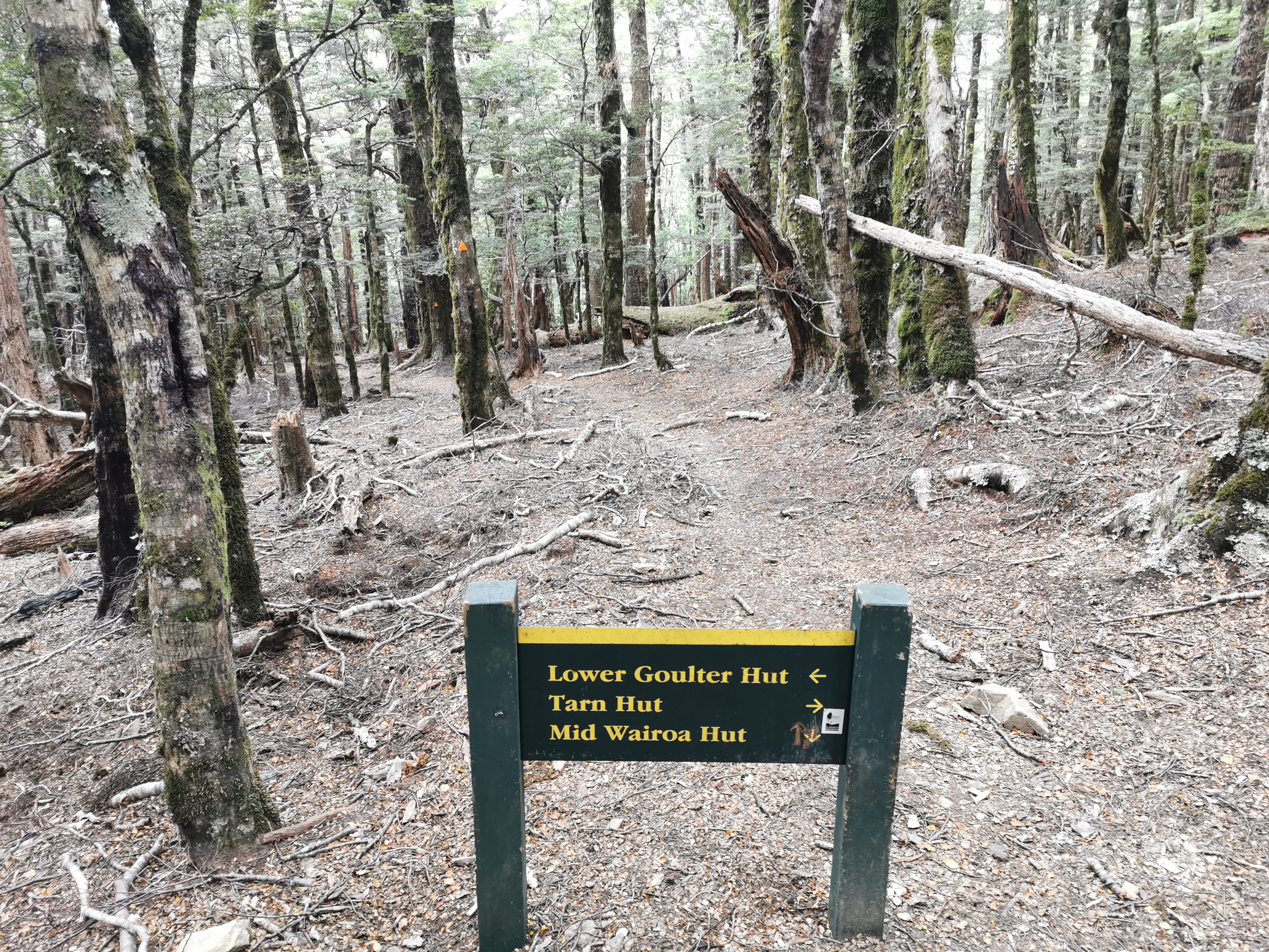
After Tarn Hut there are a couple of places where you need to make sure you go the right way. This one here was confusing – thankfully someone has etched in an arrow for Mid Wairoa Hut in the correct direction. It’s most definitely ahead, not behind!
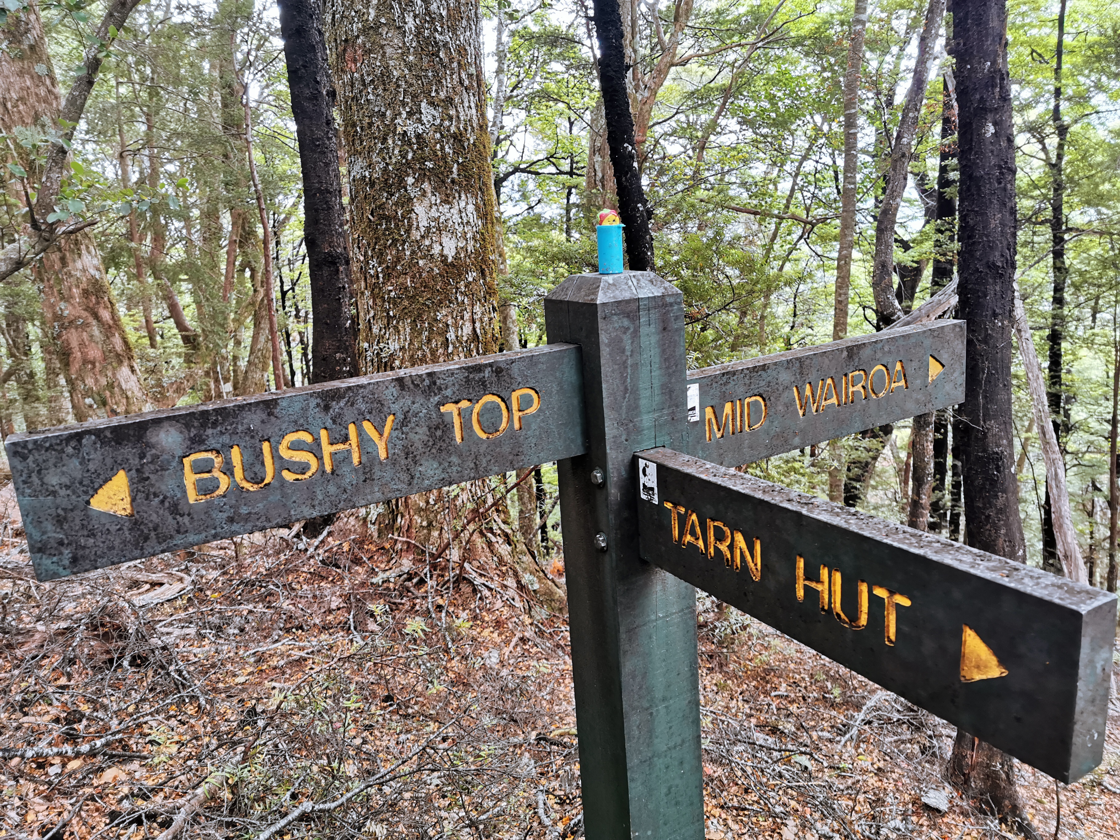
And then a bit further on there’s another intersection. This one has a geocache and it was easy to find.
Taco Terry on top of the geocache on top of the sign post on top of the world
Similar to before there’s a bit of a climb out of Tarn Hut and then a big big downhill all the way to Mid Wairoa Hut. This must be the reverse of the big Starveall climb from two days ago.
Going down…
1230m down to 395m.
These orange poison stations all have odd messages written on them.
I thought the descent seemed quite easy but I did manage to slip over onto my butt half a kilometer before the hut. So I took it a bit slower at the end.
Another swingbridge. This one wobbled a lot and if you didn’t keep your body weight in the middle it felt like it was going to tip.
There’s Mid Wairoa Hut! It only took 2hrs15 for me to get here from Tarn Hut instead of the posted 4 hours.
Approaching Mid Wairoa Hut
This hut was a bit older, and not as nice as others. And I noticed on approach that the door had been left open. Uh oh, it’s gonna be full of bugs.
Mid Wairoa Hut
Yes sure enough it was filled with bumblebees – there were about 8 of them inside. I methodically removed them one by one out the windows with my hiking poles. People, please close the hut doors when you leave!
The ascent I’ll have to undertake when I leave here
As you can see from these photos it really looked like the weather was clearing – there was beautiful blue sky. So I went and hung my wet things outside to dry. I was instantly mobbed by bumblebees and so had to retreat into the hut.
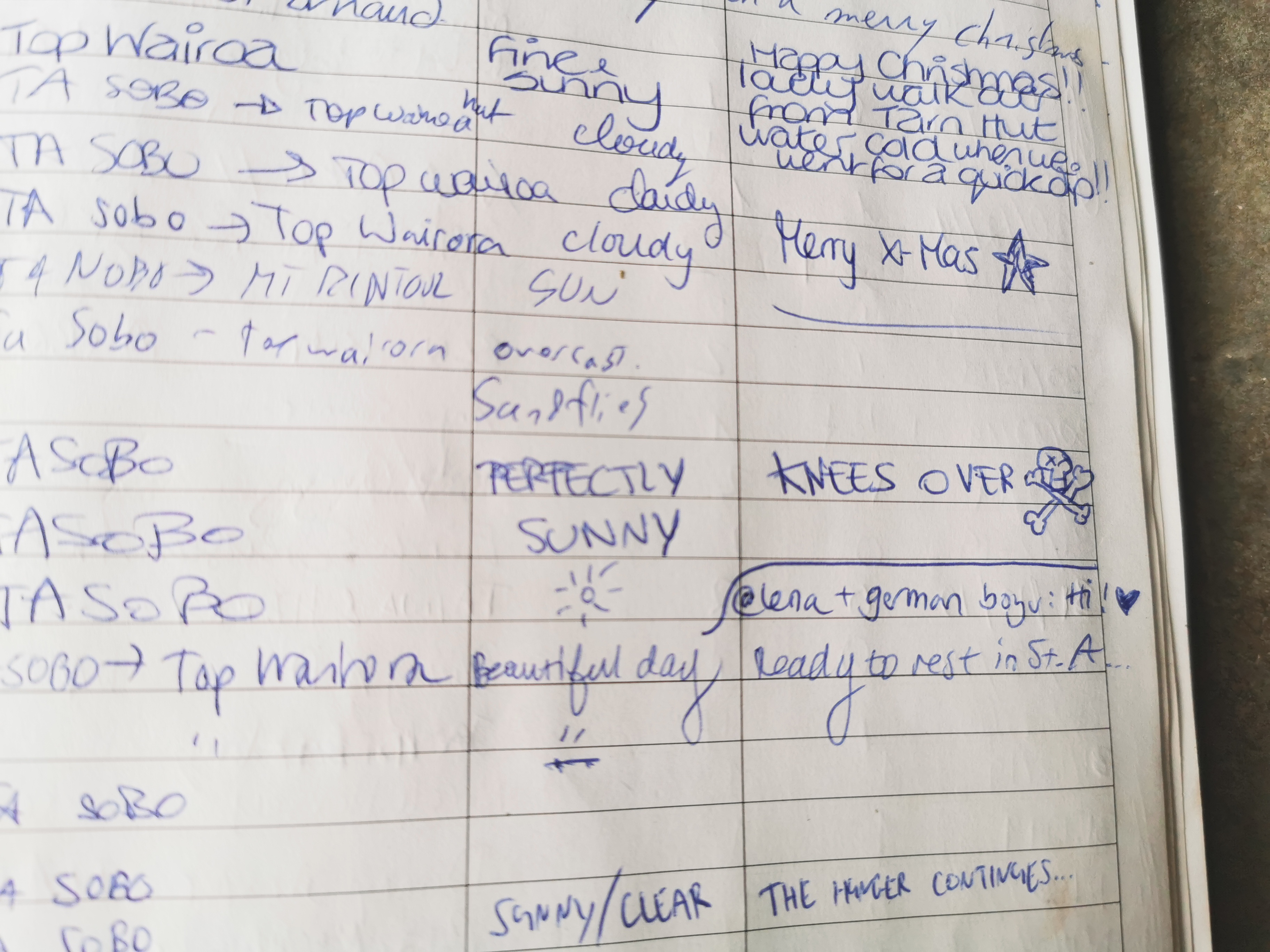
This comment from Alex two weeks ago in the intentions book sums up the big descent quite well.
Knees over ☠️
Also from the intentions book I noticed that my company tonight will most likely be Michelle and maybe Jasper and Karin, all from The Netherlands. Although now with northbound hikers on the trail, it’s harder to predict who will be at the huts.
A lot of things seem to be called Wairoa. As well as this hut and the next, it’s also the river nearby, the name of a reservoir in the Hunua Ranges in Auckland where the trail used to go past, and it’s also the name of a town near Gisborne where my friend Luke is from (one of the two people whose wedding I’m going to later this month).
Despite the nice-looking weather it did start to rain slightly just after I left the hut. I had a brief thought of “do I turn back and spend the night at the hut” but I decided to keep going as I was already wet from sweat and humidity. I did put the pack cover on though.
Here’s a little spoiler. The section between Mid Wairoa and Top Wairoa is “sketchy” (I think that’s the word the Americans would use). It was much more difficult than Mt Rintoul from yesterday, and I’d class it as one of the two most scary bits on the entire trail so far – tied with what I called “death ridge” in Puketi Forest.
Let’s have a look at some of the scary bits.
This part, where you need a chain to pull yourself aroundThis part, where you have to cross a stream next to a cliff on slippery rocksAnd this part, where you have to get over a tree on an eroding hill
I knew there were eight crossings of what is apparently known as the “Wairoa River Left Branch”. At the first one I changed into my crocs because, well, I always do that.
The first crossing of this river is coming upNot yet though, first go up there to the rightThe actual first river crossing
Once on the other side, the track didn’t seem so eroded and scary at first. I tried to keep my crocs on as long as I could because there are seven more crossings of this river to come. But wait, here’s a big steep drop with a big fallen tree to navigate around. Crocs aren’t gonna cut it here, so I changed back into my boots.
Going down here is gonna be a riot
It’s hard to see from that photo exactly what I had to climb down. Looking back at it from the other side makes it a bit more obvious.
It was not enjoyable, coming down that path on the right under that tree
At this point, it looks like the trail goes around to the right of this rock, but it doesn’t! There’s a marker pointing up the rocks which I missed. Too distracted by the orange poison station, I guess. If you miss it, you’ll end up at what looks like a path but it’s actually a scary narrow ridgeline to nowhere! So don’t miss this turn!
Go up, not right!
This bit is scary because of the big rock with no handholds and a big drop to the right if you get it wrong.
Whose idea was it to put a rock there?
And I don’t even know how I got past this bit.
Fallen trees for everyone
Halfway between the two huts, the sketchy bit stopped, where the second river crossing was. It was nice from there on. You often had to walk up the stony riverbed.
From crossing number 2 I changed into crocs and kept them on for the rest of the day. There was a light drizzle all afternoon and I did put my rain jacket on but it came off again quite fast. This little bit of drizzle I was sure wasn’t going to affect the river crossings.
The rain though did make me think about the fire that was somewhere near here (I think) in February of last year. There had been no rain in this area for six weeks and so there was some kind of bushfire, although I can’t remember the details. I know I mentioned it before – my friends and I were walking the Queen Charlotte Track and we could see the smoke from the track. I wonder what you’d do if there was a bushfire while you were walking this big nine or ten day section of trail. Scary.
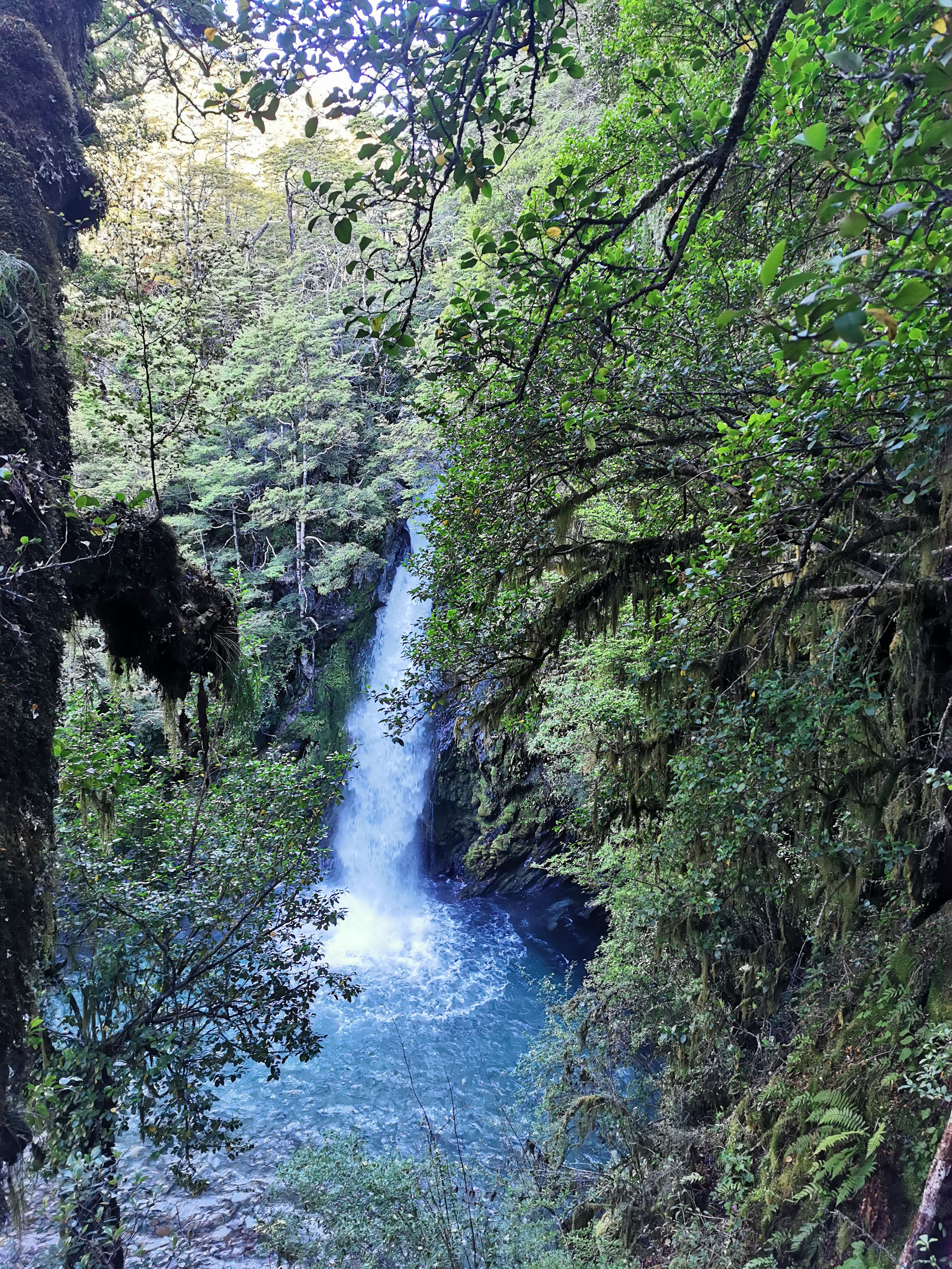
During this whole walk there was quite a noticeable uphill and I wondered how the elevation was increasing so much but I still remained beside the river the whole time. Well, the seventh crossing had the answer – there were big waterfalls!
And can you see the orange triangle up the top? That’s where the crossing is! Honestly though this photo makes it look bad, but once you walk through the trees a bit you reach a fairly flat and calm piece of water. I definitely wouldn’t want to do this crossing in bad weather though.
One last bit of uphill through trees…
And then suddenly the landscape changes again.
The river now flows through a different type of rock
This is the last of the river crossings. Look at the gigantic hill that is on the other side! The hut is just at the top of that hill. I’m not going to change out of my crocs just for that bit.
That’s a steep hill to end with…
First I got some water just in case this was the water source for the hut as I didn’t want to have to come back down this massive hill again. In the 5 minutes I was doing that I got totally mobbed by sandflies.
I started on up the hill a bit and looked back. The river looked so tiny and insignificant from here.
Doesn’t even look like the same river I just crossed
It was tricky going up the massive hill in Crocs, but one I did the hut was indeed right there. The three I mentioned earlier were indeed at the hut, plus Violaime from France.
The notes said four and a half hours from the previous hut to here and that’s exactly what it took me. That’s in stark contrast to the previous section where I did it in half the time. You never know what you’re going to encounter!
There are no more photos today. I will take photos of the hut tomorrow. Tonight, even going outside for 90 seconds I get mobbed by mosquitos so no photos!
I’ve now had three relatively big days in a row and my legs are getting sore. I’m going to reward myself with two average days instead of another big day tomorrow and take my time. Besides, I don’t want to get to Boyle Village too early.
The four people at this hut were really cool and we talked about all sorts of things. But once we were in bed there were mice again. We thought that this hut had no mice reported. But we hear them in the corner.
And I saw them this time since they came out before dark. One in the middle of the hut floor and another one up on the bench. There’s at least two in here. At least they’re small mice and not big rats.
Heres another exciting bit of news, I’m going to have to manually remove my dead toenail in St Arnaud. It’s really loose now and I’d rather have it come off gracefully than have it torn off when I trip or something. Watch this space.
Date: 13 January
Trail covered: 17.3km (kms 1895.1 to 1912.4)
Weather: warm at first but then it rained
During the night we were again kept awake by mice. I swear that I heard one of them in my food bag despite the fact that I hung it on the back of the door and I also swear I heard another one in the bucket of water that’s in the hut. Surely not.
When I woke up though, I inspected each item of food and couldn’t find any evidence of nibblage. Although the mouse in the water turned out to be true.
I think maybe it was on my pack which was beside the bucket and then something startled the mouse which caused it to drop. One of the others suggested we hid our food so well that the mouse committed suicide when it couldn’t find any food.
We disposed of the mouse and then I did my usual thing where I head out to the loo and while outside try to determine where I’d be walking today. As usual it’s another day of a large peak immediately after the hut. I think that’s it there, in the distance near the top right corner of this photo.
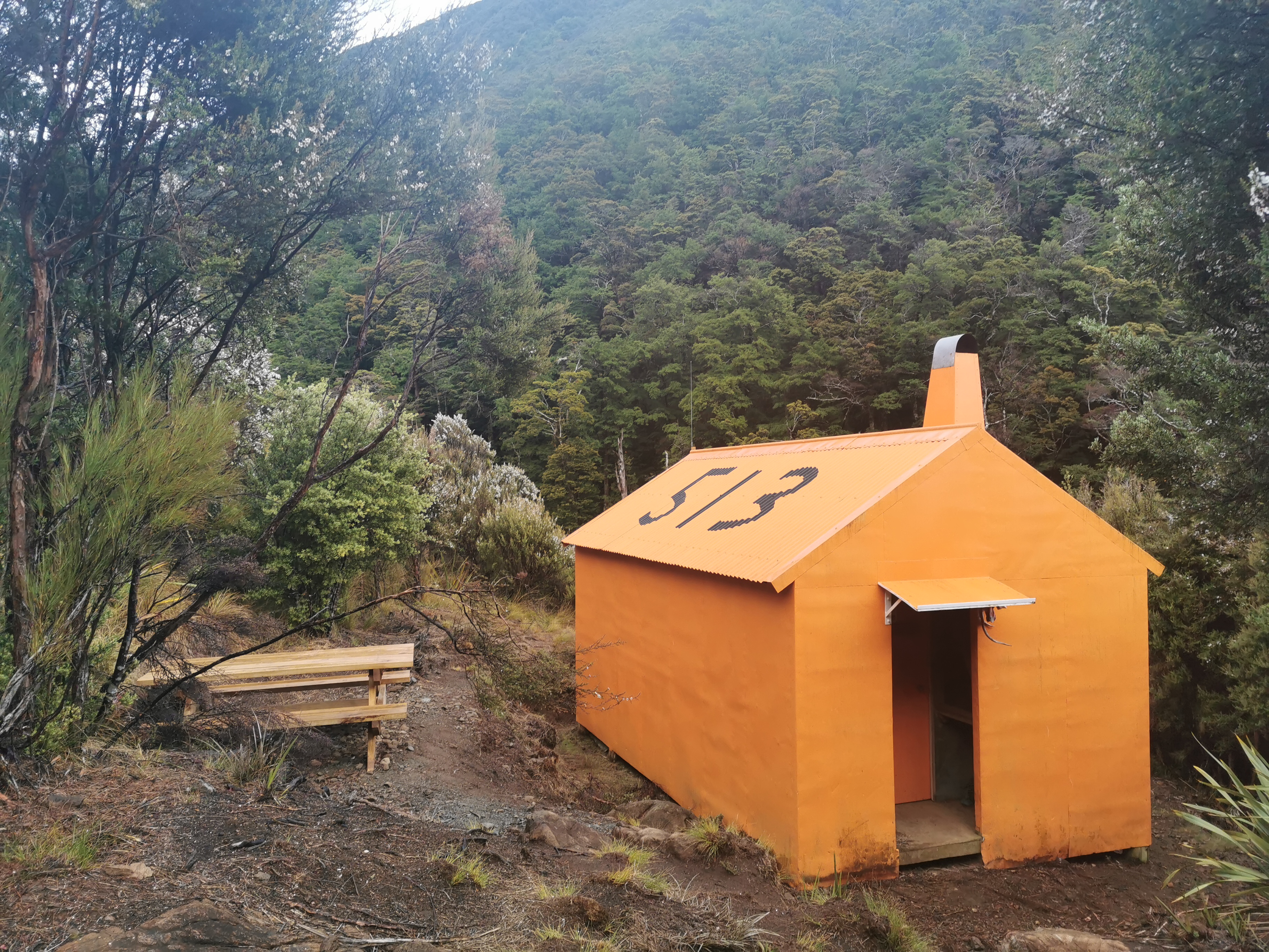
And I made sure I got a photo of the hut.
513 Hut is rather orange
Looking at hut options today – Hunters Hut is the first hut but its estimate is five hours away so probably too close. Looks like the destination will be Porters Creek Hut, estimated at four hours past Hunters Hut. In saying that though, the first big peak is Mt Ellis – I’m about to head from the hut at elevation 840m up to a 1590m peak and back down to 730m. I might not feel like walking any more after that workout.
I didn’t set out until 9:15am today, long after everyone else had already left. In a way it was nice to laze around a bit after everyone else had gone but in another way it felt like an inefficient use of time. I made porridge for breakfast since I had a bit of time and didn’t have much cereal left.
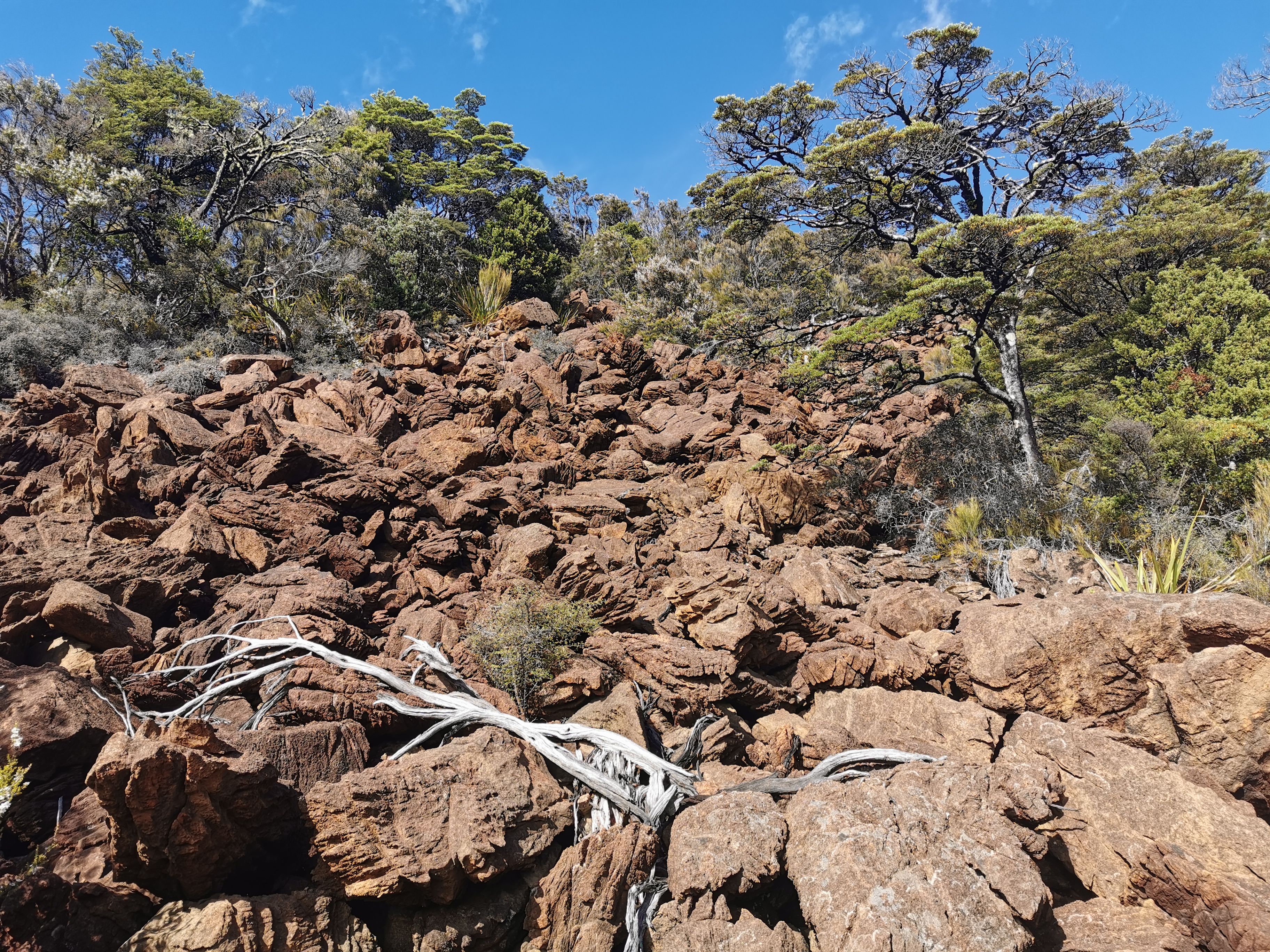
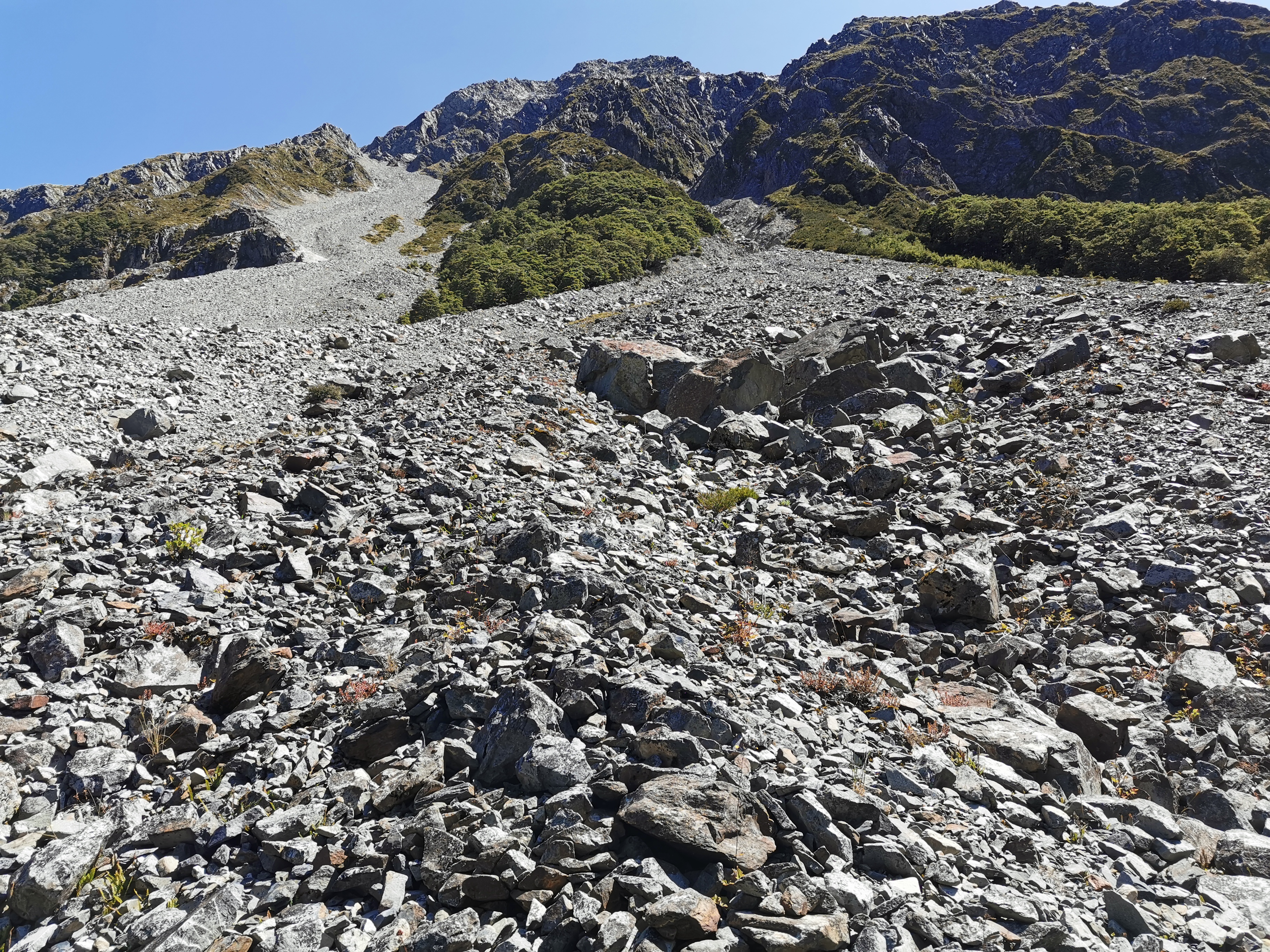
Like expected the trail wasted no time going straight up the hill from the hut. Although this time the terrain is different. It’s big rocks. Not the little rocks of Rintoul, these are big big chunky rocks.
Kinda like being on Mars
It’s also not very well marked. It’s the first section of the whole Richmond Ranges so far that I’d say needs more markers. I walked up to the top of the rocks in the photo above and then backtracked once I learned you’re supposed to go to the right hand side once you’re halfway up them. They’re steep too. Making your way across them takes it out of you.
It may be only 9:30 but it’s scorching hot. The sun is shining right on this side of the hill. There were a few clouds coming over but they were few and far between at this point.
It’s at this point I’d like to have a little gripe.
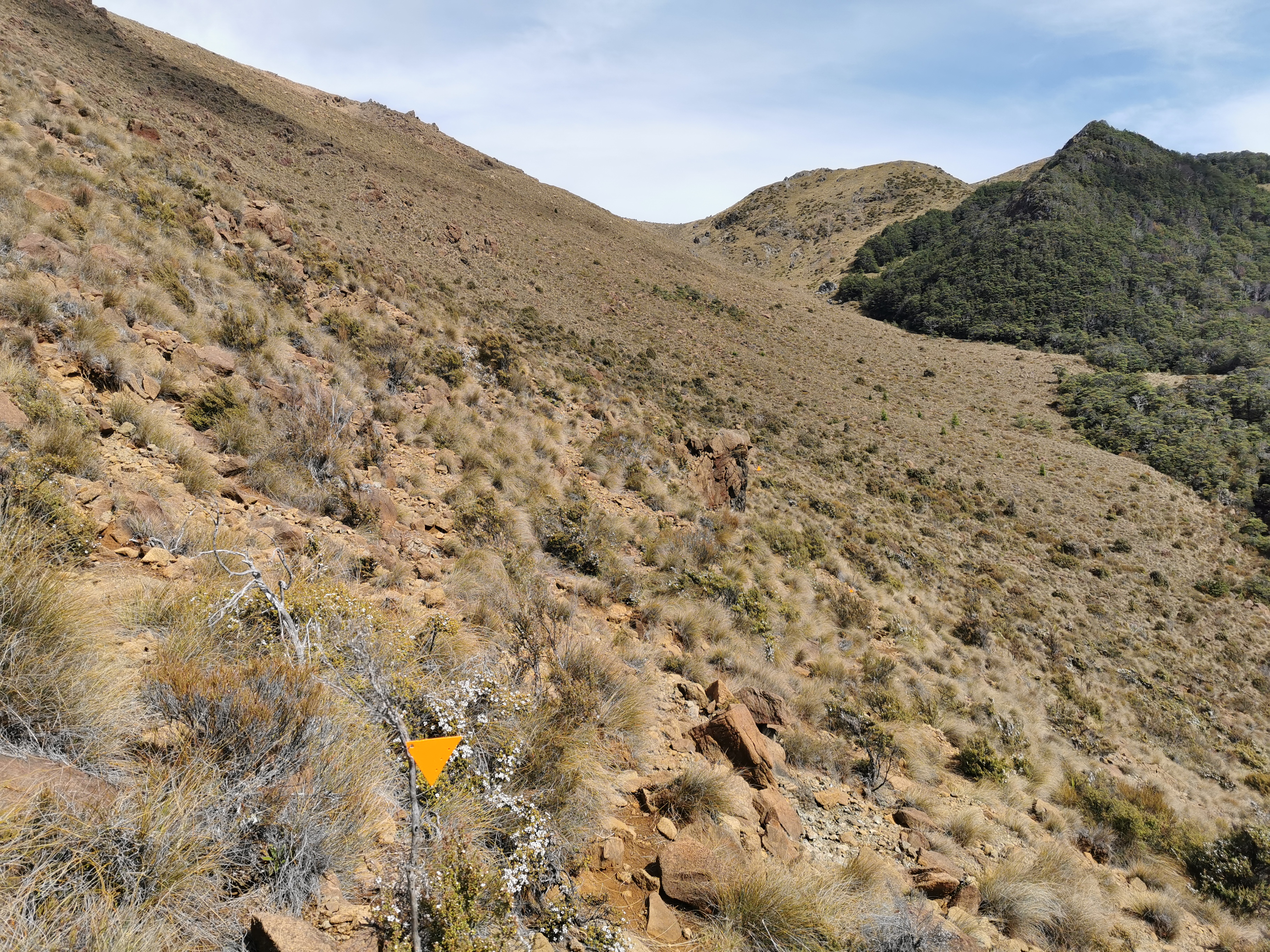
Stupid triangle
Who’s idea was it to use equilateral triangles as markers? You can’t tell which way they point because each side is the same. Take the photo above for instance. Which way is the triangle pointing? Who knows!
Most DOC tracks use the isosceles triangles which have two sides longer than the third and those ones are much easier to tell which way they’re pointing. The track here though uses the stupid triangles (well, they’re still better than no triangles at all).
It wasn’t too long before I heard my stomach rumbling. It’s not a sound I hear often – on every other part of the trail I have snacks which I would eat whenever I felt hungry. Here of course I forgot my snacks… and I’m often hungry soon after when I have porridge for breakfast. Even two sachets of oats doesn’t keep me full for long.
Also unfortunately I felt the familiar twinge of my usual back pain and so I really had to stop for a bit.
So I stopped at this point and tried to look for what food I could eat and still have enough left over for tomorrow. I decided I could spare a protein bar and one piece of chocolate, and a bit of peanut butter from the jar.
This was my view while I was having breakfast #2:
The flies were annoying up this side of the hill. While I was eating especially but also on the way up the hill.
While I was here I had a thought, I think the “infected wound” smell that I have smelled like the last two days is my socks. I noticed it more today because my nose is closer to my feet on steep hills… And also in the evenings when I’m not wearing my socks and boots I don’t smell it. In the intentions books people in the “comments” sections are beginning to write how bad everything smells. One guy in the book yesterday wrote how he smells like a goat – lovely.
The rest of the way up the hill is tussock and small rocks. It’s easier going and you can step largely anywhere, but there is a river running down here between the rocks and so you have to be careful not to step in a big hole that is hard to see.
At 10:55 I was nearly at the top of this section. I could see an orange pole at the top:
I thought to myself, can I make it to the top of this hill in 5 minutes? If so, my 11am picture will be whatever’s on the other side. Of course… let’s go. I raced up the hill and took this photo as my 11am picture from the top:
11am picture… More mountains…
At this point there is phone reception so I got to call my car insurance company and see what they wanted to talk to me about three days ago. Apparently when I gave them the keys to the car last week they noticed it had an immobiliser and so they sent my case to review, and were asking me all sorts of questions to try to determine how a car with an immobiliser can be stolen. They seemed to accept my story because they said the claim is definitely accepted now. Good, I can stop worrying about that.
I also checked the weather forecast. “Fine except with periods of rain this afternoon in inland areas, possibly heavy” it said. Hmm, this is pretty inland I’d say. But no dark clouds yet.
There was still more up to go yet.
It definitely wasn’t as steep as earlier though. In the picture above is Mt Ellis which I have to go right over the top of, and then it’s all downhill after that to the next Hut.
To my surprise though, the track didn’t go over Mt Ellis at all – it sidled alongside it.
More sidlingMt EllisAlternating between rocks and tussock
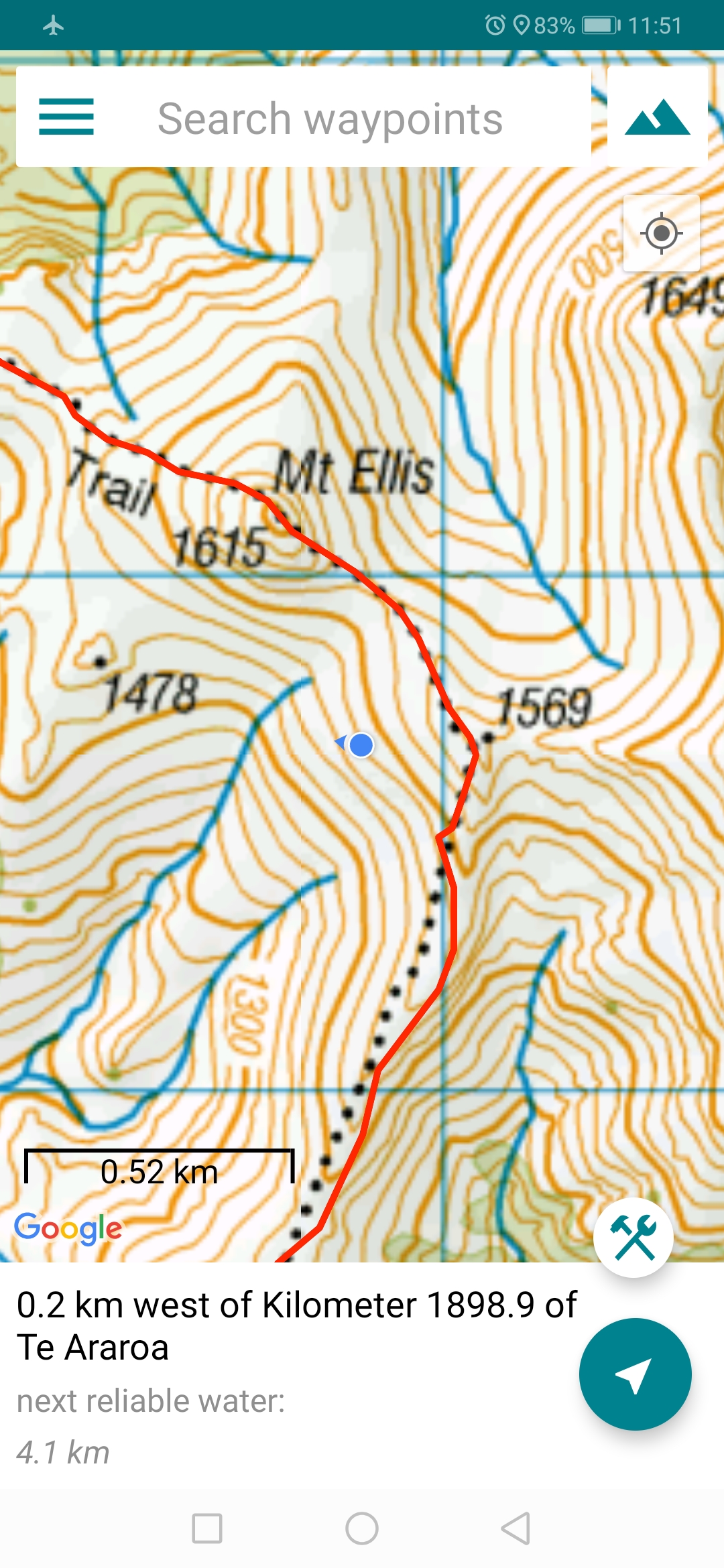
I had a look at the Guthook app. It showed me quite far off course.
I’m the blue dot
I had a quick look at the trail notes and it clearly states sidle alongside the west side of Mt Ellis – nothing about going over the top of it. Cool, that’s exactly what I’m doing. This is one of the rare times that Guthook shows the wrong path. And I’ll be honest, it was a nice surprise to realise that I was now at the highest point and I don’t have to go the extra 100m up to the summit.
The 4G was even better a bit further on. And the view was absolutely stunning. So I took some time to upload all my photos for the blog. I didn’t mind that it took a while, I wasn’t getting sick of just taking in everything and admiring where I am.
Panorama
While I was here someone came up the hill from the other direction looking very exhausted and weary. Another northbound hiker perhaps? Once he arrived he introduced himself as Franz from Germany. We had a talk about each other’s upcoming sections but then the clouds came over and it started to get quite cold, so I continued on. I never got to publish any blog entries because it’s kinda rude to sit there on your phone while there is someone there with you.
We also took each other’s pictures.Looking back at Mt Ellis with Franz the little dot on the right
It’s amazing how out here there seems to be just days and days of nothing. No 4wd tracks, no fences, no signs of civilization at all. It’s quite breathtaking to think about it. So when I come across something as simple as a discarded sign, I had to stop and think.
Right Branch Wairoa it says
I read in the previous hut that the “Right Branch Wairoa Hut” has been removed because the landowners have rescinded access from the road to the hut. So I assumed that this was the hut’s original location. But it’s quite close to the upcoming Hunters Hut, and I learned later that the hut that got removed was nowhere near here. So why is the sign here? What a mystery!
It was a nice view going down here but very slippery because of all the little rocks.
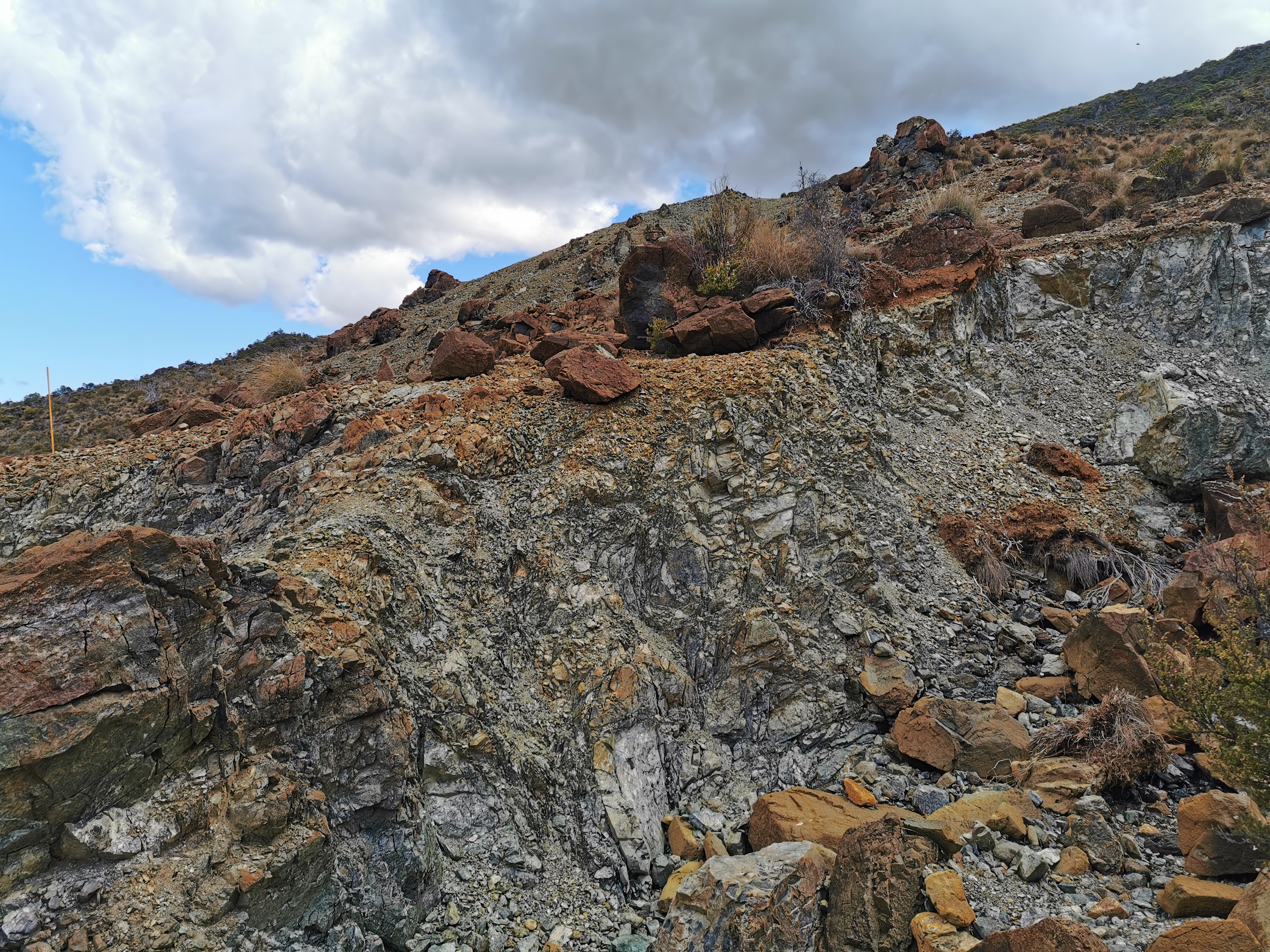
There were also different layers of rocks. They were clearly different separate colours.
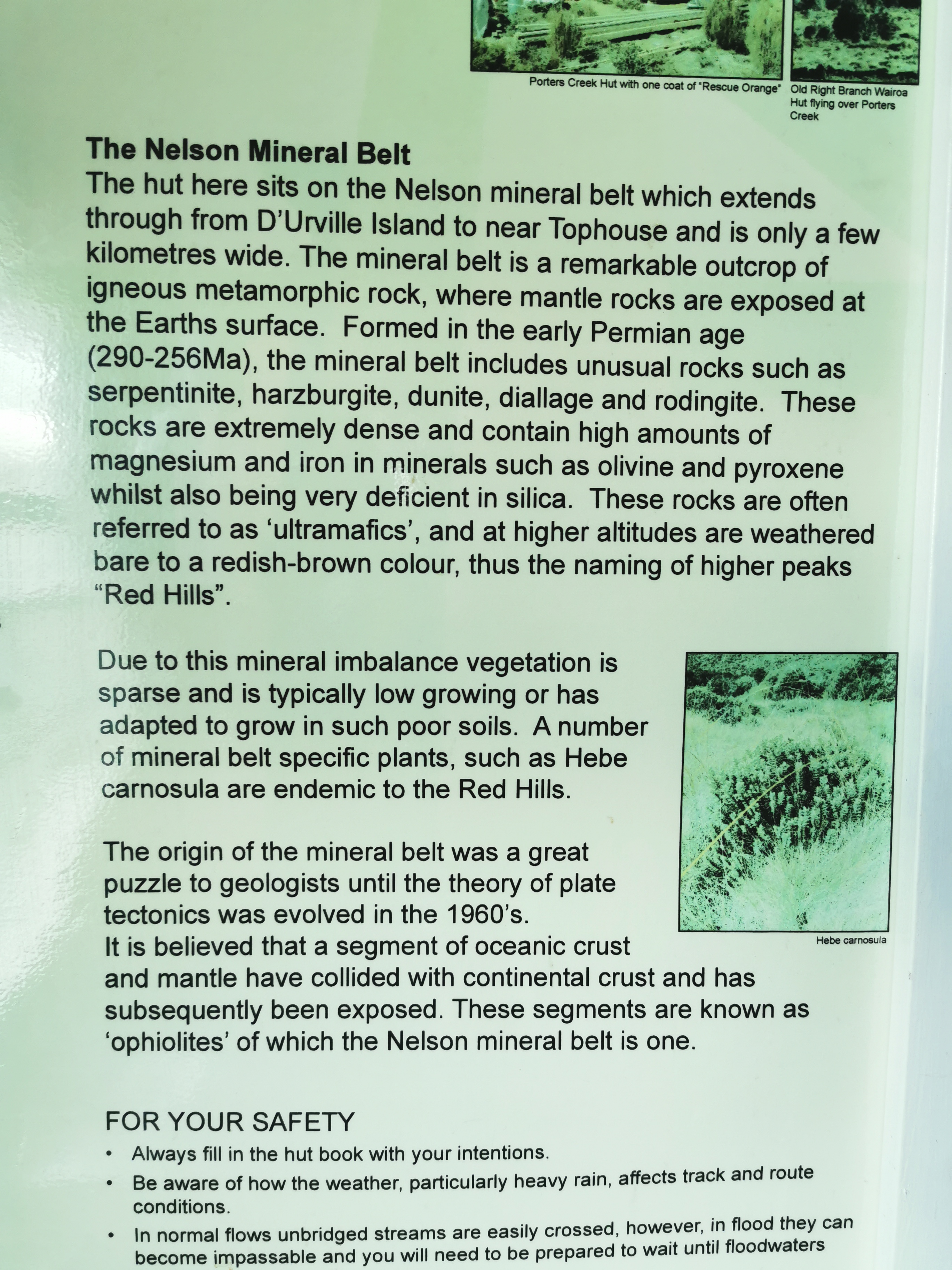
I think this information board is interesting that explain the different types of rocks.
There was one river crossing which required the crocs…
And one fairly large uphill:
It went for a lot longer than just this bit
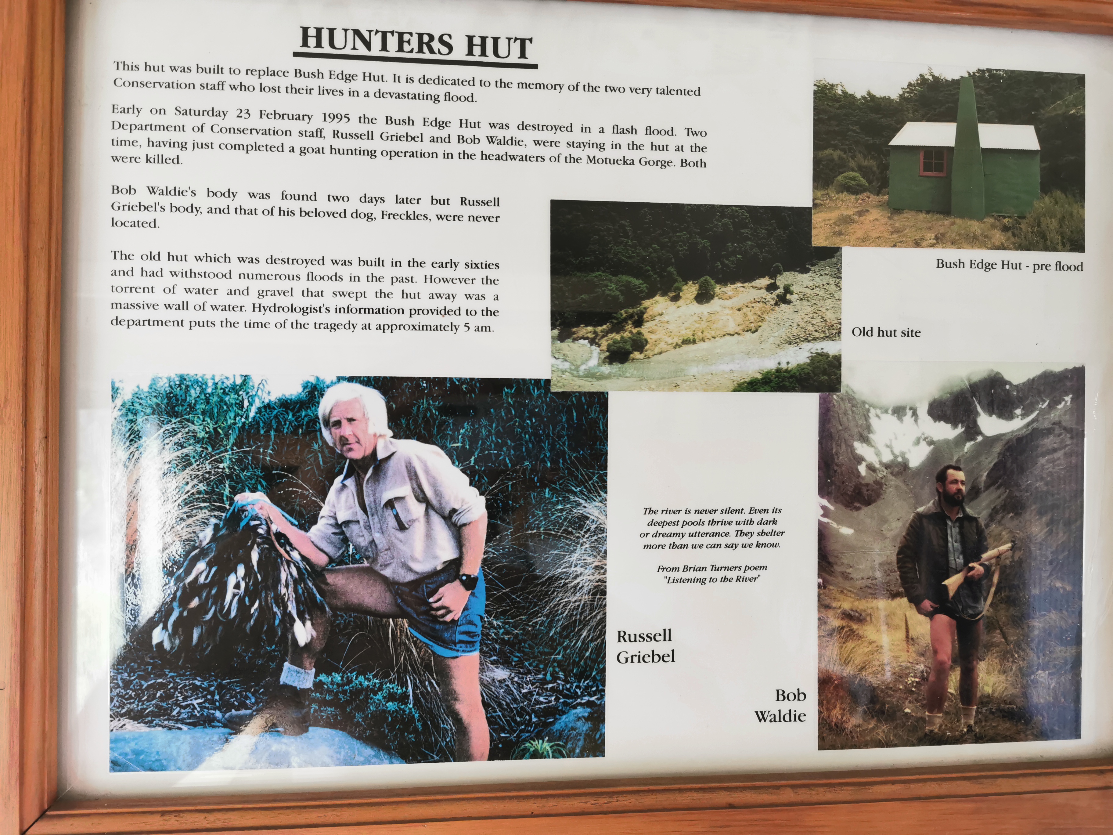
And then I was at Hunters Hut. Inside the hut is the story of two guys who got swept away and died when the original hut got destroyed in a flash flood. Very sad.
I can’t imagine how 25 years later nobody has found the body of one of the guys. That must mean it’s still there somewhere.
It took me five hours and fifteen minutes to get here, which isn’t bad given that the estimate was five hours and I spent so much time just hanging around at the summit and having snacks.
I didn’t photograph this hut for some reason… but I can tell you it’s an 8 bed hut instead of a 6 bed like most of the others along here. It also has a nice view from the little balcony:
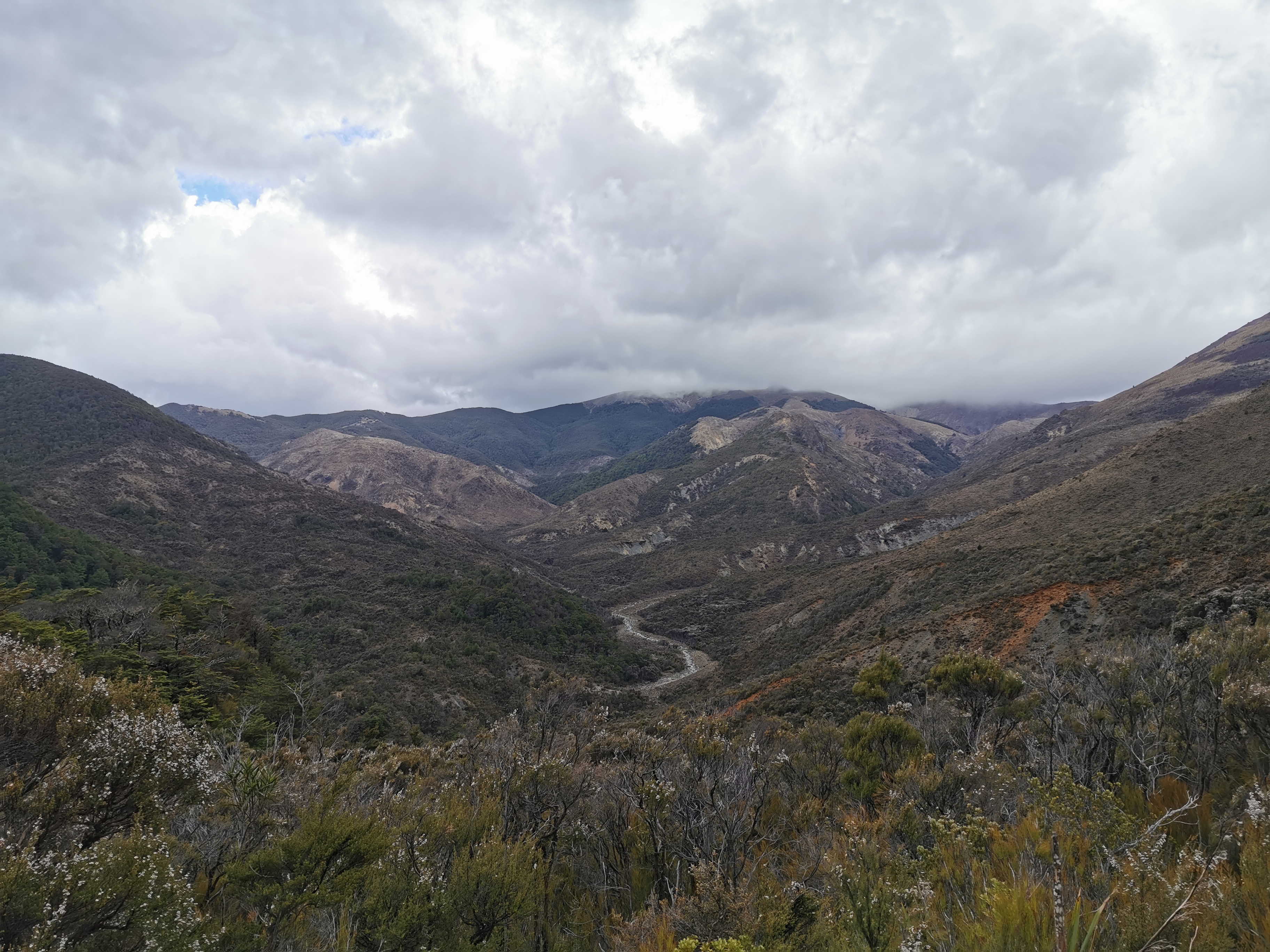
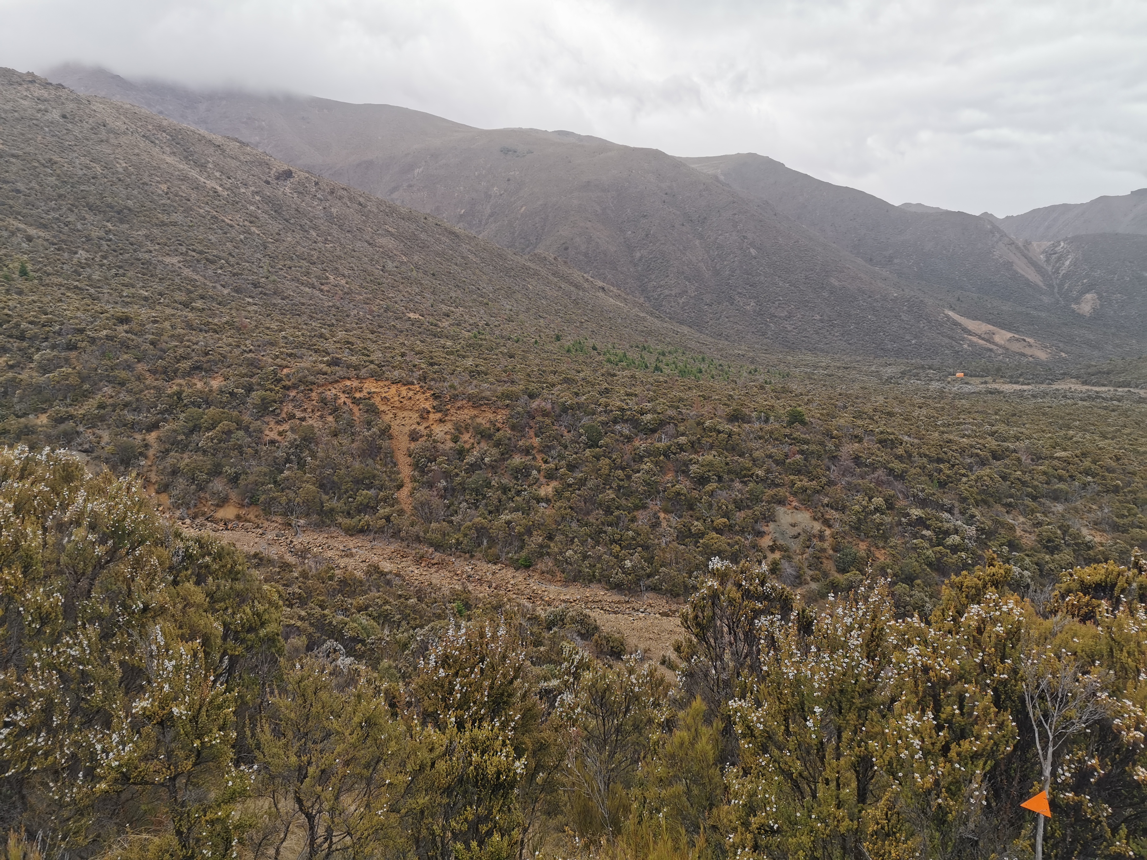
As you can see the clouds were starting to come in now, but they still didn’t look too bad. I remembered the potential heavy rain mentioned in the weather forecast and that made me just about stay here the night but after some deliberating I decided to keep going to the next hut – Porters Creek Hut, advertised as four hours away. It’s now 3:30pm but hopefully it won’t actually take four hours. I’m going to walk fast to try and beat the potential rain anyway.
It was more of the same landscapes between here and the next hut, but everything was just a bit easier. More following orange poles through tussock and rocks:
More big brown rocks to clamber over:
Mars again
And more sidling across scree and dirt:
There was also a not insignificant 300m elevation hill which was fairly steep. I was still trying to beat the rain which looked like it was getting closer so at the bottom of the hill I put some “chase music” on my iPod and hauled myself up there as fast as I could. If it was going to rain I wanted to at least get to the top of the big hill first so I don’t get too sweaty and gross.
There is the top of the hill, the highest point in the photo above. There had been a few spits of rain ever since I left Hunters Hut but it was at this point where there was enough rain to put on the rain jacket. At least I got most of the way up the hill first.
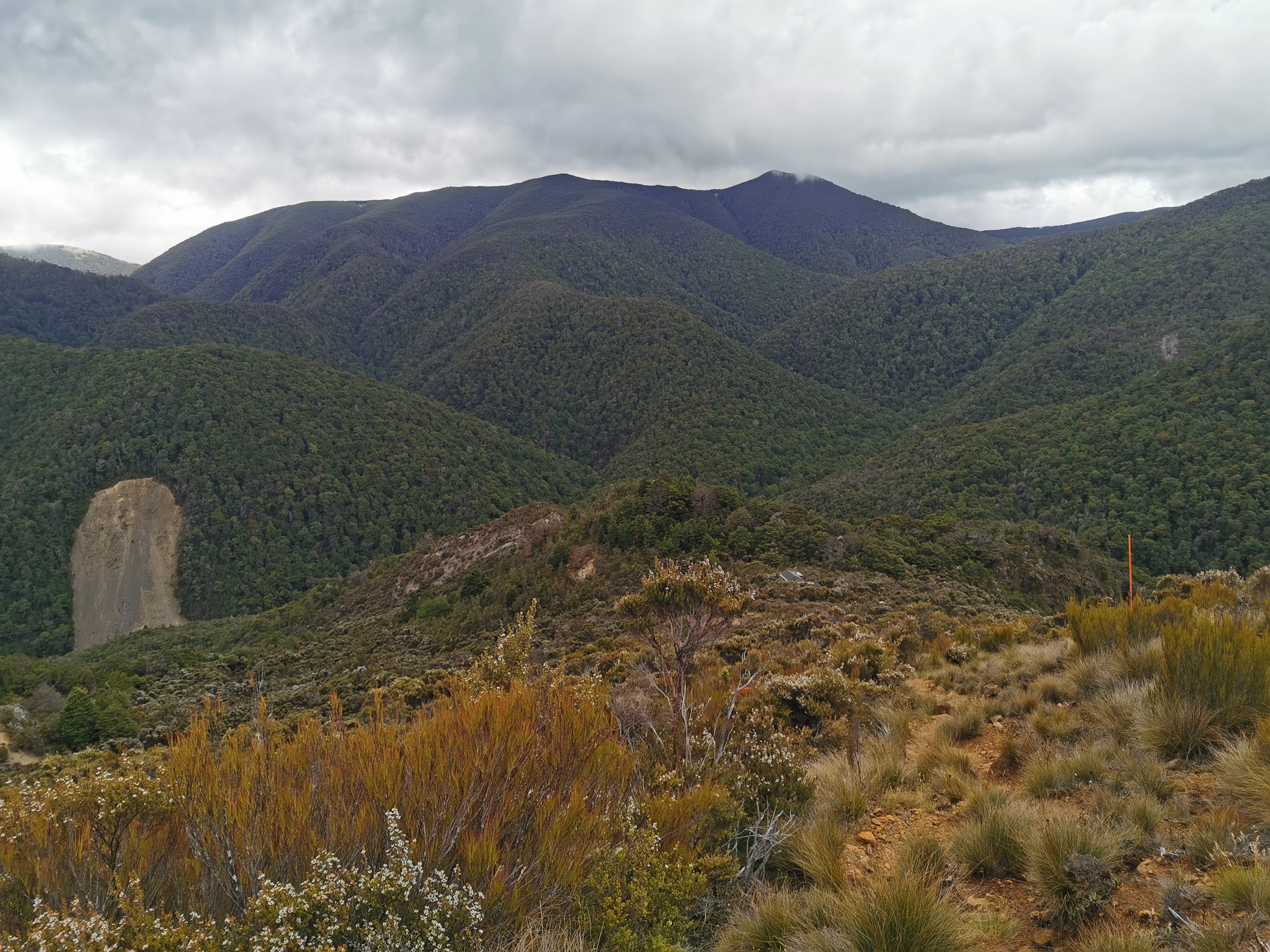
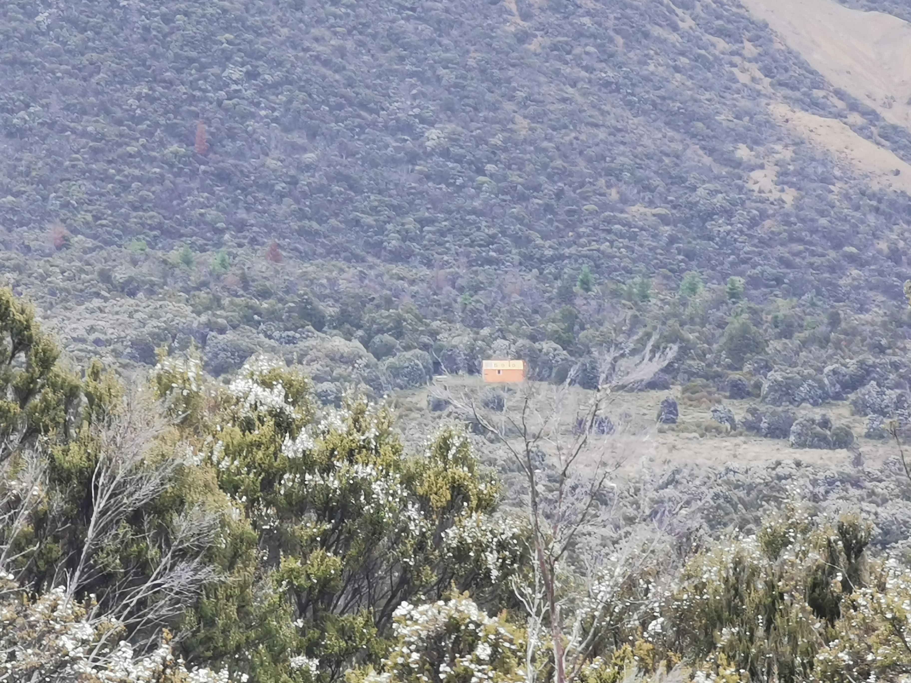
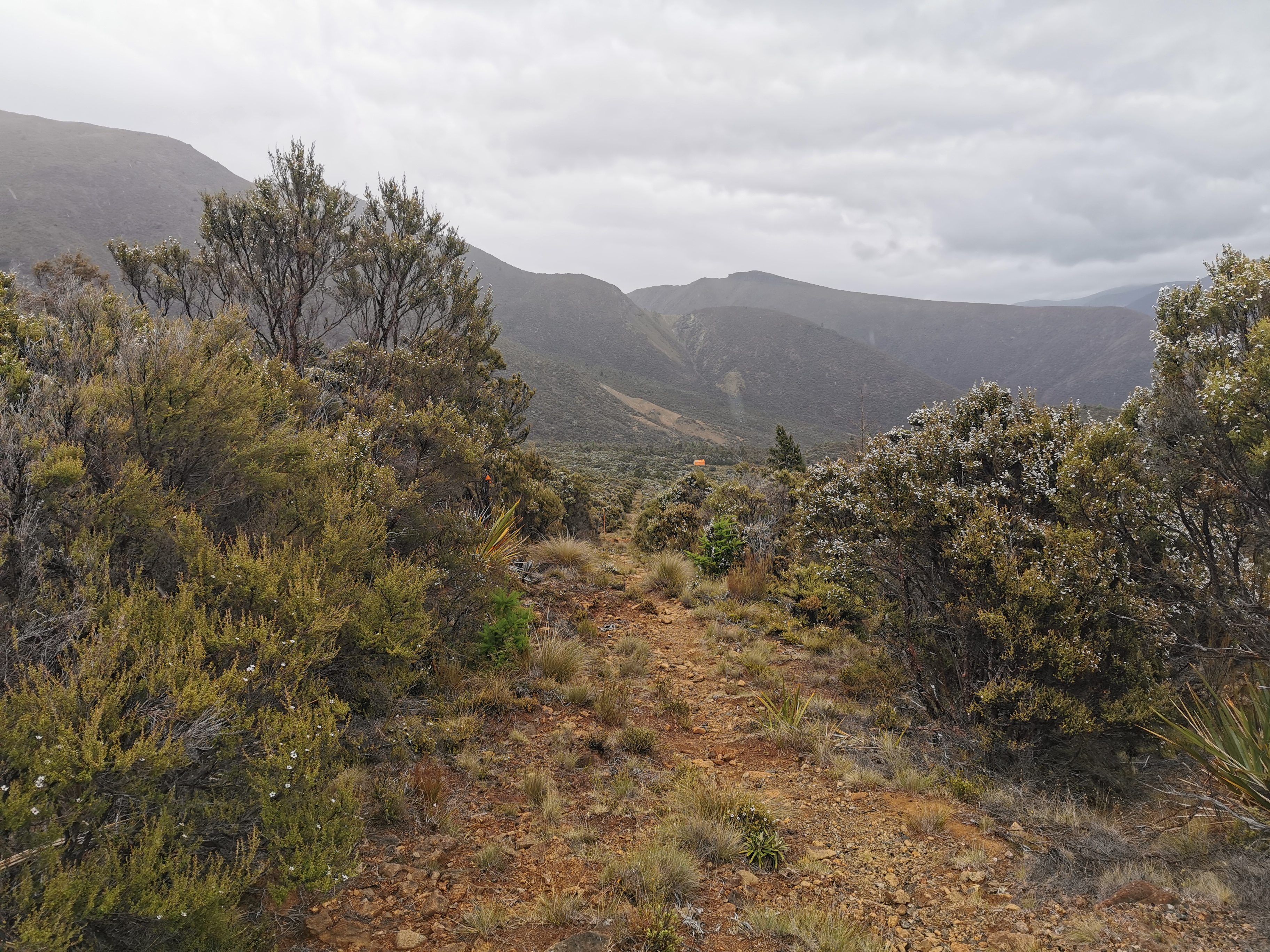
From the top of the big hill to Porters Creek Hut is an easy and gradual descent. The hut is orange and you can see it a mile away. In this photo, it is still 1.7km away:
Can you see it? No? Let’s try out the 10x zoom mode again.
Colour’s not great but not bad for a photo of a hut that’s 1.7km away
As I got closer I saw a big ravine in the way.
I assume the triangle is pointing me around to a place where I can actually get across and don’t have to scramble up a giant bank. Yes, that’s exactly what it was doing.
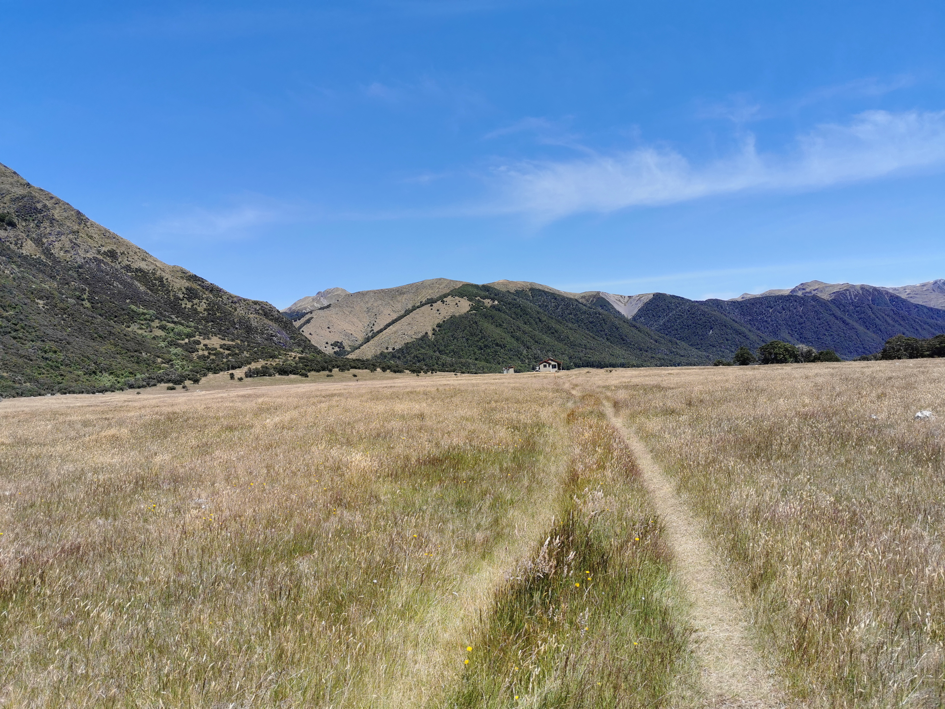
Then, just follow the big long straight path to the hut.
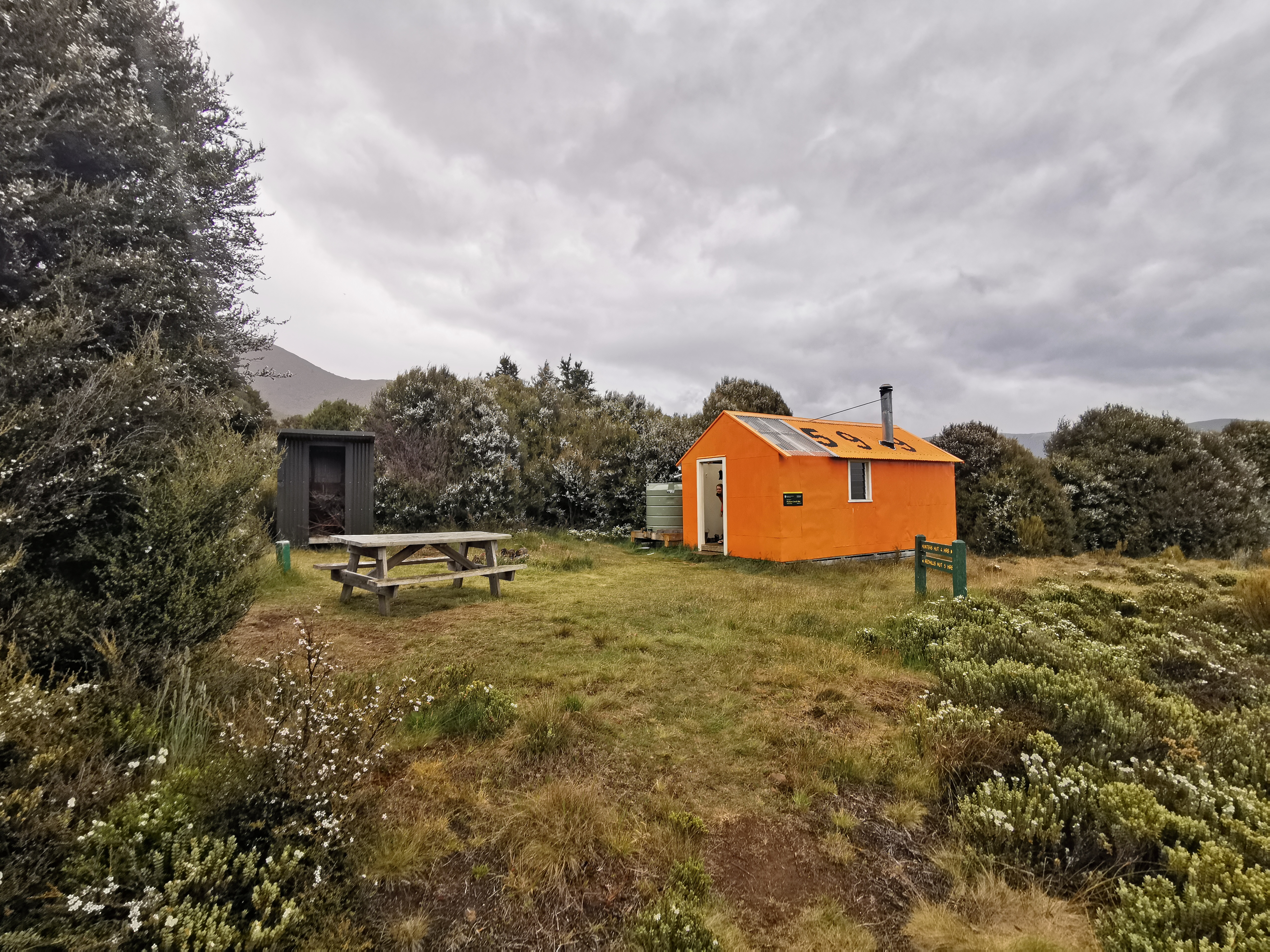
The hut is 800m away now.
I was walking really fast down here because the end was in sight and the rain had picked up. At one point I pulled out my phone and on the display it said “Fingerprint unlock disabled. Enter password”. And then when rain fell on the screen it said “Password incorrect. You have 2 more attempts, after which your phone will be locked for 30 minutes”. Umm, what? I don’t want that! Don’t you dare lock my phone for that length of time! I wonder if I can turn that behaviour off somehow. I bet I can’t. I’ll Google it next time I’m able but if I can’t turn that off then Huawei will be getting a strongly worded complaint. If I’m stuck in the wilderness somewhere and can’t unlock my phone to look at the map for 30 minutes, that could be the difference between life and death in an emergency situation. Very not cool.
Fortunately I dried the phone screen and managed to unlock it to take one last picture:
599 Hut is also bright orange. Apparently its official name is “rescue orange”.
This hut is a very standard 6 bed hut, and I was pleased to see the same four people as last night. We had a good chat but the rain never really let up so we were all in our sleeping bags by 8pm. I commented that the rain is the universe punishing me for taking my time and having a late start. Even though I was quite wet I felt really good because it had been a great day with great walks and views and I had dry clothes to change into.
There’s no ladder up to the top bunks in this hut either which is weird. If you are stuck with a top bunk here I hope you’re tall or good at hoisting yourself up!
When I went outside it felt so cold in the rain, even though there wasn’t that much wind. Jumping into my sleeping bag after that felt like heaven.
There is a mousetrap in the hut, and I can see mouse poo on the windowsill so there are obviously mice. We tried to set the mousetrap before going to sleep but none of us knew how – it looked broken. Let’s see if the mice bother us tonight.
Tomorrow there is only one more hut (Red Hills Hut, five hours from here) before a 4hr final track and then 8km of road walking into St Arnaud. I’m booked at Alpine Lodge in St Arnaud in two days’ time. That means the next two days are either going to be two easy days or one big day and one rest day. I wonder which it will turn out to be. I might try and walk with this group tomorrow and do whatever they do because they seem pretty cool.
Date: 14 January
Trail covered: 18.8km (kms 1912.4 to 1931.2)
Weather: hot
Again during the night mice had been making noise. They had been swarming around Violaime’s pack, we think because she had oats soaking beside it. When someone shone a light on them in the middle of the night, they all scattered.
Everyone except me was out of bed at 6am and making noise. I wish I could’ve slept in longer today. But that’s hut life for you.
The view outside this morning was great, but boy was it cold.
6:28am – the moon is still out
I was last to leave again today. A 7:45am start today for my last day in the Richmond Ranges. And it appeared that at first, I was going down here:
River #1
Indeed that was correct. And walking along the riverbed too.
I couldn’t help remember the story from yesterday where the two guys got killed when the hut they were in was destroyed in a flood. I took a moment to look behind me and tried to imagine what it would be like to have a wall of water rushing down here.
Imagine if this was suddenly all water.
The next bit was up a bit of a hill, only to see a similar sort of view again.
River #2
And yet again, I was walking down there to cross the river. But first, there was a point where you had to climb a “gnarly” cliff.
Gnarly, dude
People had mentioned this cliff on Guthook. It was a bit daunting and definitely the biggest piece of rock I’ve had to climb in the trial so far, but it wasn’t too scary, there were footholds and grips on the left of it.
Soon you approach the river that needs to be crossed.
Closer to river #2
But at this point, if you turn to the right and walk off-trail a bit (at the bottom of the hill, where there aren’t many trees) you encounter the remains of a hut that used to be here, called Maitland Hut. There’s no sign to it or any indication from the trail that it’s here, I only knew about it thanks to geocaching. I wonder if they moved it because it is close to the river and also had the potential to be washed away in a flood.
After I’d found the geocache I changed into crocs to cross this river. It turned 11am while I was changing back into my shoes so my 11am picture is looking back where I just came from.
11am picture – looking back where I came from
Next the trail appeared to go up a very steep and treacherous hill. Surely I don’t have to go up there?
Do I?
Turns out, yes!
Yup!
Although you don’t need to scramble up the loose gravel, the arrows actually take you around the side of the hill and you take a slightly less steep way up.
I had a look at a big landslip across the river.
This whole area seems to be a lot of landslips, and I have to walk across a bunch of them. I wouldn’t feel very safe if there was an earthquake right now.
The next bit of trail is steep. I’m not a morning person, and that seems to extend as far as not having a lot of energy to climb big hills in the morning. Yesterday afternoon I was able to do it just fine, but today I’m hurting and going slow. A rest day tomorrow will be great. I’ve already dubbed tomorrow “stuff your face with all sorts of goodies from St Arnaud and don’t feel even the slightest bit guilty about it day”.
There was one more small descent which was a bit hair-raising.
This is looking back at it
Then along a big tussock field where you can see Red Hills Hut at the end. It looks beautiful but it’s actually very muddy.
Red Hills Hut is right at the far end
Jasper, Karin and Michelle were just finishing up lunch at the hut. It’s a nice hut, recently built in 2009, but surprisingly there is nowhere to hang wet clothes outside nor any picnic table.
Red Hills Hut
From here the other three said that there are two ways of getting to St Arnaud – the “short way” and the “TA way”. The other three are taking the short way as they intend to hitchhike once on the road. I’m of course taking the real TA route.
Whichever way you go though, it looks like it will be easy going.
Which way will you turn???
The other three didn’t stick around long and disappeared down the short track.
It’s supposed to be mountain bike tracks from here into town. It looks like it might be quite steep in places but at least if it’s designed for bikes then I should be able to move quite fast.
While I was filling up my water bottles, a spider raced over (quite quickly, might I add) to introduce himself. He was quite colourful and hairy, and I know how much my Mum hates spiders so you’ll have to click here if you want to see it.
I moved away though, I don’t know anything about spiders so I just assume they’re all poisonous until proven otherwise!
By the time I had food, rested a bit, caught up on blog posts and packed up it was 2pm. I didn’t really feel like hanging around here with nobody else around despite the beautiful weather, and there’s also no phone coverage. So I might as well keep walking. There are no more huts between here and St Arnaud which is 20km away, so I might end up camping somewhere. So I made sure to fill up my water bottles.
View from outside the hut
Here’s the short way and the official way signposted. Those that want to hitchhike into St Arnaud can take the Red Hills Rd route and get to the main highway quicker.
Those who are following the proper TA route should go towards Tophouse Road! Where it gets steep very fast…
Here we go again…
There are three peaks between here and St Arnaud. The first is quite a rough track and I’m surprised that mountain bikes could navigate some of it. No wonder it is marked as an expert track.
Roots going up the second peak
Below is the view from the second peak. These trees are really beautiful and there is both phone reception and a geocache here.
This was a nice spot, except for all the flies
If the third peak is as beautiful as this then I’ll be setting up camp there. My legs are really aching and they hurt now going up these surprisingly steep hills, but I have made it my mission to at least get to the top of the third peak because that’s the last hill before St Arnaud.
Here is the view from partway down the second peak. It’s the Wairau River and also State Highway 63 that hikers have to walk down to get into town. This is the first time I’ve seen cars in six and a half days!
Wairau River and State Highway 63
Wow, six and a half days? Is that really all? This section takes between 8 and 13 days if you believe the trail notes. And I had nine days worth of food in my pack supposedly… Although once I realised I forgot to buy snacks I started getting through the food faster.
Another view going down the second peak
The third peak was not as steep, but it was taller and so it felt like forever getting up there. But as always, one foot in front of the other and I eventually got there.
I really liked these mossy trees
You reach the intersection of a couple of mountain bike tracks.
Maitland Ridge Track – where I just emerged fromLooking towards Beebys Knob. The TA goes back the other direction from here.
As you can see this area is quite open and beautiful. And if you walk towards Beebys Hut for a minute or two, off the trail, there is again great phone reception (if you’re with Spark). So that’s where I decided to set up camp.
The wide angle lens gives an interesting effect on a photo like this
The rest of the day tomorrow looks like it’s all downhill on that easy track and then 8km of road walking so that shouldn’t take me long. I’ll be in St Arnaud just in time for breakfast.
I made some couscous and spices because that’s all the dinner I have left. In fact the only food now in my pack is a tiny amount of cereal, a protein bar, milk powder, a bit of peanut butter, and this one lonesome chocolate.
My last piece of chocolate 🙁
So I’m gonna be hungry when I get into town in the morning. I hope St Arnaud has a decent café, aw heck I hope it has a café at all!
It could be cold up here tonight exposed on the ridge 1300m above sea level… But there’s no wind forecast and hey, that’s why I bought a $700 sleeping bag. Time to test it out…
First though I had to put my little garbage bag at the back of the tent, buried deep inside my other two food bags. After 7 days, it stinks. But not outside, I don’t want it to attract any wildlife.
I was sitting inside the tent when suddenly the walls of the tent went bright red which I figured meant a great sunset. So I raced outside to take a picture.
I was in my t-shirt and within thirty seconds of being outside of the tent I was shivering cold. So I raced back inside the tent and inside my sleeping bag as quickly as possible. No way was I getting out of it again.
Date: 15 January
Trail covered: 12.7km (kms 1931.2 to 1943.9)
Weather: perfect
It was cold as predicted during the night. No problem though. Each time I felt cold I just pulled the sleeping bag more over my head and if it got too hot then I’d just put it back. No dramas.
My legs hurt during the night though, I would lie on one side and then if my legs start hurting on that side then I’ll turn over to the other side. That’s not specific to tonight though. In fact that happens most nights. Tonight I could also sleep on my back, which I normally can’t do in a hut because when I sleep on my back I have a feeling I snore quite loudly. Doesn’t matter now though, there’s nobody around for miles!
I had weird dreams during the night, and they were all not very pleasant. One I can remember is that prisoners were in my town beating people up quite badly and another one was part of my neighbour’s house falling off and destroying part of my house. Plus several others that I can’t fully remember.
I woke up at 7am. Since I’ve been staying in huts the last few days, that feels like a real sleep-in! I made myself my small breakfast consisting of all my remaining food (except for the emergency couscous).
I checked out the view when I finally ventured out of the tent.
The tent fly was very wet. I kinda hoped that it would be dry but it was not to be. I had to pack the tent away wet knowing I’d have to dry it at the Alpine Lodge.
Also my power bank was now empty, which was surprising – it was showing half full just two days ago. I do hear that they lose their charge if they get very cold. At least I know I can make the batteries on my devices last 8 days if I need to.
Time to get moving. The track is 4WD track all the way down to the road.
My pack has virtually no food and very little water, so it was very light, and the terrain was easy. I had to resist the urge to run down the hill.
I noticed I was above the clouds. It was quite a weird feeling. I’d forgotten that I had camped 1,300m above sea level last night.
Its lucky I did camp near the high point. Just down from the high point there was a sign saying that Beebys Knob Road (great name for a road) is private property and there is to be no camping.
Soon I saw a house!
First I’ve seen in ages… In there through the clouds
And then a few more houses. Wow I’m almost back in civilization.
Uh oh, a locked gate. I guess now I have to go all the way back to Pelorus Bridge – there’s no way out.
I’m doomed
Of course, you can step over the fence to the right. Then there’s a big sign. With a sign this big, I definitely know I’ve just completed something special. Goodbye Richmond Ranges, it was nice knowing you.
I had a chuckle at this yellow mountain-biking sign. I know I was complaining about how steep the track was but it wasn’t as steep as this!
And also yay, the isosceles triangles are back
On the road now. I was now in the Tasman region, which felt weird because I was just here two weeks ago between Christmas and new years eve.
Welcome to Tasman
And apparently there’s a skifield here. The South Island must have a lot of skifields that I don’t even know about, compared to the North Island which really only has two (plus a couple of other very tiny ones).
Rainbow Skifield sign
I noticed on the signs that they signpost the street addresses starting at zero.
House numbers 0-49
I wonder if there really are people with 0 on their letterbox in the South Island. I can just imagine the phone conversation:
Where would you like your pizza delivered?
I live at Zero Beebys Knob Road in Tophouse.
Yeah sure ya do. And I’m the prime minister of Timbuktu. [hangs up]
The highway signs were interesting. I clearly don’t know the geography of this area. I thought getting to Nelson from here would require going all the way back to Blenheim but I guess I’m wrong.
And I was really surprised to see a sign to Christchurch below that sign. I really thought Christchurch was in the other direction. I have a feeling though that it’s signposted here because when there was an earthquake in Kaikoura in 2016 State Highway 1 got closed for a long time and so people had to go this way to Christchurch.
Another sign
During the road walk I booked my shuttle from Boyle Village to Christchurch with East-West shuttles for 22 January. It was very easy.
The view coming into town
Coming into St Arnaud I had in my head one of those alpine towns you see in movies, with big A-frame houses in front of big snow covered mountains. But then I remembered we are in New Zealand, not Switzerland, and it’s summer. But it was still quite a nice town anyway.
Now I’m in town I’ve finished the walk for the day. My first stop was the Dine Hard café to get breakfast #2 (and as it turned out, breakfast #3 also).
Dine Hard café and restaurantFirst real coffee in a long time
At 11am I’d finished breakfast but not left the café and so my 11am picture is my view from my table outside.
11am view
I think this is the first time that 11am has come around and I’ve finished walking for the day.
I had a stroll past the Alpine Lodge on the off chance they’d let me check in this early but no dice, I was sent away. So I had a quick walk to the Nelson Lakes information centre to check out the weather forecast (great). I got a brief glimpse of the lake I’d be walking past tomorrow.
Lake Rotoiti
Then on to the St Arnaud General Store. I knew the store was small but I didn’t realise it was a tiny store inside a petrol station.
St Arnaud General Store, also a café and petrol station
I had to buy 6 days worth of food from here to make it to Boyle Village through Waiau Pass. Lucky I’m not too fussy. Everyone else I have talked to has either posted food here or is hitching to Nelson or Blenheim to get a better selection of food.
“Small enough to be charming, big enough to be a surprise”. In fairness it was a surprise that it had a charming area to sit out the side.
Surprisingly I managed to get everything that I wanted from this tiny store except pretzels and Berocca tablets. I also bought some new sunnies. The 5th pair of sunnies I’ve had on the trail. Let’s see how long they last.
How do they look?
Here’s my entire resupply, everything except the sunnies and 500g of Tasty cheese.
Might still buy some more snacks tomorrow
And here is the damage…
People have said that this store has a small selection and is expensive, and that was true, but I still think it’s less hassle than posting a box of food here. The postage costs at least $10 and the Alpine Lodge charges $15 to receive such a box so by the time you factor that in, unless you really want something specific, I can’t see why people bother posting boxes.
I had 90 minutes before I could check in at the lodge so I just used the time to chill out and relax. During that time I worked out the deal with the phone vibration. Each app has its own vibration settings it seems. Gmail was turned off, hence no vibration when I got a new email. Weird! On top of that, the phone itself has a weak vibration motor and so I can’t even feel it when it vibrates in my pocket. That sucks but perhaps there’s an app that makes the vibration longer or something.
I checked in at the Alpine Lodge right on 2pm.
Alpine Lodge
The first thing to do was laundry, as well as dry out my tent and everything from this morning.
One of the other hikers wasn’t happy that my gear took up all the sunlight
I looked at the weather forecast. Not even a cloud in the forecast until 22 Jan, and even then its only “partly cloudy”. Amazing!
I put my cheese in the communal fridge. If anyone touches it I am going to hunt them down. Hopefully I don’t leave it behind, but I have a high-tech way of ensuring I don’t.
I had dinner at the lodge, and I had a nice view by the window.
View from my dining spot
During the meal, a couple came in and asked the waitress for a table by the window. She said that sorry the last one is reserved. I probably had a smug look on my face because the couple gave me the evils. And they got seated next to the crying baby – lucky them. Although as I was sitting by the window, I got treated to the pleasure of flies buzzing loudly trying to get out the window. Gross – I get enough of those out on the trail.
Also during the meal, at the table next to me, was another couple, a big guy and a small girl. When their food came out it was a “nourish bowl” with kale, avocado, greens etc and a lamb shank. I expected the girl to get the nourish bowl but no, she got the big lamb shank and the guy got the nourish bowl. I thought that was very funny for some reason.
There were at least three other TA walkers at the lodge tonight but I seemed to be the only one in the restaurant. I got a black beer, a gigantic soup and some gnocchi.
Stoke darkThe large soup lived up to its nameThe gnocchi was okay
And of course, this.
Chocolate Lava Cake
After all that I needed to walk off some of those calories so went for another walk around town and managed to find a geocache near a church. It’s lucky I did because I saw my towel on the clothes line on the way back. I would probably have completely forgotten to take it if I didn’t see it.
So far I can’t complain too much about the Alpine Lodge backpacker accommodation, except if you’re in a ground floor room like me, you can hear every footstep from the people in the kitchen which is on the first floor. It’s very loud.
And the wind sure is howling loudly outside. Odd, since the forecast said light winds!
The Richmond Ranges were great but I’m looking forward to the Waiau Pass which is the next bit. 5 or 6 days to Boyle Village and apparently it’s one of the highlights of the whole trail.
I think the mice of the last few days have made me nervous. After going to sleep I kept hearing rustling in my newly-packed food bags. I told myself it was nothing but then I heard a big rustle. I shone the torch on the bags and had a look, and saw one of the bags move. So I quickly got dressed, and moved the bag to out in the hall. I unpacked every single thing in the bag but there was nothing there but the food. It must have just been the way I packed all the things in the bag, with everything settling or something. Stupid mice!
Date: 16 January
Trail covered: 29.7km (kms 1943.9 to 1973.6)
Weather: not a cloud in the sky for most of it
Because of the noise from people upstairs I woke up earlier than I hoped.
View of the lodge
The café at the general store didn’t open until 9am and the Alpine Lodge was doing a buffet breakfast which wouldn’t be good for walking so back to Dine Hard it was. Again the coffee was good but the food was average, and this time I was the only one there.
I’m very glad they have Bruce Willis’ image at Dine Hard!
First, a toenail update. If you don’t want to hear about it you can skip this paragraph! As much as I tried, I didn’t manage to remove my toenail in St Arnaud. I tried and it is very loose but it’s still very much connected on one small bit of one corner. There is a nice shiny new toenail growing underneath which I figure is going to force the old one out soon. I just have to be very careful not to pull on it before that happens (and very gingerly put on my socks each day). If you are a bit sick and twisted and want to see what it looks like, click here (but be warned, it’s pretty gross).
I went back and packed up (ensuring not to forget my cheese). Surprisingly it was a real struggle to fit everything into my pack. At Pelorus Bridge when I had eight days worth of food it seemed easy but here I only had six days worth and it just wouldn’t fit in. That can only mean one thing, that I bought too many snacks.
After unpacking and repacking everything a few times this was the best that I could manage.
Everything jammed in there
It was at this point I noticed a huge pen mark on my pack. How did that get there? I was a bit annoyed about it, I mean the only pens around are the ones in the huts with the intentions books. Someone must have done it, although I’m sure not on purpose.
Pen mark – grrrrr
Oh well, I decided that if that’s the worst thing that happens to me on this trail then I should count myself lucky. Besides, my pack is pretty dirty now.
Dirty pack
Especially when you compare it to at the beginning.
My pack back on day 13
The trail today goes around the back of the Alpine Lodge:
And through this little walkway:
I went a bit off trail to take a photo from the little jetty. It’s very beautiful here.
Lake Rotoiti
I saw a sign back in town saying no freedom camping anywhere in St Arnaud. Here’s another one that says no freedom camping within 200 metres of this sign. Seems some people didn’t get the message.
Oi, you lot, be gone
Here’s the usual information about the track I’m about to undertake.
Lake Rotoiti – Travers Valley information
There are also alerts about washouts due to heavy rain in December. Both of those alerts seem to affect where I’m going so I will look out for the washouts.
Alerts!
There are avalanches to watch out for too, with big red signs. Luckily that’s only May until November. There’s no snow around now.
Avalanche warnings May – November
Today there are three huts I’m going to try and get to. The first is Lakehead Hut, oddly enough at the end of this lake, and it is advertised as 2hr30 away. Then there is John Tait Hut which is a further 4hr30 and finally Upper Travers Hut which is 3hr further. I’m hoping to get all the way to Upper Travers because it makes the following days more convenient – there are a few sections coming up advertised as 6-8 hours.
A lone boat on the lake
The path went right beside the lake all the way to Lakehead Hut but you couldn’t see much because of all the trees most of the time.
A beautiful view, behind the trees
However at one point you could get a good view of the mountain that dominates the skyline above St Arnaud. I’ll be honest though I never bothered to ask anyone what the name of it is and can’t work it out from the map.
Mt. Something-or-other
I took a wrong turn soon after this and ended up on the lake’s edge, but I wasnt really complaining.
If I was hungry, this would have been a great spot to just chill out and have lunch
My 11am picture is further down this track.
11am picture – the typical view for this first section of today
There were a lot of people going the other direction. One lady with kids asked me to tell the people behind her that all the kids are okay and accounted for. I bet there’s an interesting story behind that. Another guy said “you look very professional, like you’re going a long way”. I’ll take that as a compliment.
Two hours after leaving St Arnaud I was at Lakehead Hut, where there were just two day visitors who arrived by water taxi and started the walk back to St Arnaud shortly after I arrived. No photo of the hut this time but here is the inside.
Fairly standard
The huts are much bigger on this section of trail. One of the upcoming huts tomorrow has 34 beds. I’m not sure how many this one had but it is at least 25.
The view from the balcony and where I’m going next
I wrote in the intentions book and noticed Michelle has been through. Nobody else I know was nearby. I was the first one to write in the book today.
I briefly had Lunch #1. The problem was that I didn’t want to take all the food out of my bag in case I couldn’t pack it in again. So I just had what was on the top, which of course was the Russian fudge and the raspberry licorice. Not a very healthy lunch… I must remember to pack better after dinner tonight.
Then it was time to set off down the grassy flats.
I was in a good mood today. I found myself singing out loud to the music playing on my iPod. It was “Sight for Sore Eyes” by M People. “You’rrrrrrreee… a sight for sore eyes. Mmmmmm hmmmm!”
That is what I think huts are after long days of walking – sights for sore eyes.
There were quite a few places where people had set up logs across little streams. Hope my balance is good. Here is one such log:
Time to test your balance
And this looks like the first of the washout mentioned on the earlier signs.
Washout ahead
Although I’m not sure. I got to this point and it looked like the trail just stopped. There was evidence of people just hauling themselves directly up the bank so I did exactly that. It was tough going but it brought me out onto a well groomed path where the markers continued – maybe I just missed a marker somewhere. Not sure.
Here’s the first swingbridge of the day.
It’s the usual scary wobbly variety. This one even has a scary approach, that requires a chain to pull yourself onto it.
Lots of fantails here. I always tried to take photos of them but never could with my old phone. Even with my new phone with the good zoom I didn’t get a great picture.
See the piwakawaka in there somewhere?
Here’s another potential washout – this one has a clear sign.
Caution – rock fall hazard, detour available
This one though, I ignored the sign and just kept walking on, since the detour was once again straight up the side of the hill. It was clear that you can still get around. Just don’t dilly-dally.
I can see two snowy peaks now
Here’s a sign to the Hopeless Track and the Hopeless Hut. Great names.
There’s also a closed-up diamond shaped sign in the background. I really want to know what it said, but it was locked and I couldn’t open it.
And normally I don’t take photos of the waterfalls but this one was nice.
Coming up to John Tait Hut I finally saw the first cloud for today. It’s been so hot so I’ve been thankful that most of the walk today is under trees. Most of the walk tomorrow will be above the treeline. I better remember to put on sunscreen since it is supposed to be the same kind of day tomorrow.
John Tait Hut, and some clouds
It took three and a half hours to get to there from Lakehead Hut. There I met Sabine, who is the first person I’ve seen with the same pack as me! I’m really surprised it has taken this long to spot another Osprey Levity!
Hers is actually the “Osprey Lumina” – the Women’s variety of the same pack
She showed me how the mesh on the back of hers had a hole in it, which she fixed with floss. I showed her how the blue handle broke on mine a few days ago. But we said we were both happy with our packs.
This time I dug down and got the cheese out. Grated cheese on crackers really doesn’t work. I possibly should’ve bought the big 1kg block of cheese instead.
Still tastes the same, just not as convenient
Again at this hut there were lots of people on short trips. It was just Sabine and me doing Te Araroa.
There haven’t been any notable hills so far, except for the one around the first washout. The next bit though has a 500m climb over 6.7km. Doesn’t sound too bad. This path is definitely more touristy than the paths in the Richmond Ranges.
A typical mossy path
There is a two minute detour to see the Travers Falls. I wasn’t going to do it because the path was quite steep but a comment on Guthook said it was worth it, so I did.
Travers Falls – very beautiful
The path briefly exited the trees and the view changed.
It was soon back into the trees though. And you know a path is touristy if the rivers are bridged!
They’re making it too easy…
Oh wait, there’s now an unbridged river crossing. I guess I jinxed it.
That crossing looked quite dangerous at first but just walking 15 metres up the hill meant there was a much easier place to cross.
These peaks are getting closer now. I also like the “Kiwi Ingenuity” way this triangle has been jammed onto the tree, although it feels a bit like desecrating the Holy Parchment
There were signs around for avalanche zones. You’re not supposed to dawdle through here during avalanche season. Lucky it’s summer so I can dawdle and dilly-dally all I want.
Danger – Eileen & Elena avalanche paths
They seem to name the zones too. And they always seem to be women’s names. I figure maybe they have the same names as the peaks above but then they name hurricanes after women too. So who knows.
The trees suddenly change at this spot
No way am I using this log to cross. It looks sketchy.
It is crossing a beautiful waterfall though, it looks like it is coming all the way down the mountain.
Here is the last bit to walk down before arriving at the hut – the left side of this river.
And once across this field, there it is!
A sight for sore eyes, as somebody said once
It had a nice view from the front:
View from the front of the hut
And a nice view from the loo:
At Upper Travers Hut there were a lot of people. Michelle was here as well as Sabine and also Dave and Baxter, a father and 14-year-old son walking the trail together. Here’s their Facebook page. There were also a lot of people just doing shorter walks.
We divided at first while eating dinner into the TA table and the non-TA table. But after a while most people talked to most others.
It has been a while since I walked a 30km day. Oh wait, my watch says that I walked 30.2km… but Guthook says I only walked 29.7km. That’s not fair – my watch normally under-reads but not this time! I don’t know whether I walked 30km today after all.
Date: 17 January
Trail covered: 15.4km (kms 1973.6 to 1989.0)
Weather: hot again
I don’t usually have to go and pee during the night but this time I did. While I was outside I thought I’d test out the night mode in my camera. It didn’t turn out too bad, I must say.
Taken at 3:55am
This morning I noticed everyone was packing up but nobody was rushing to leave. It seems that one group were all leaving together.
Ready-ish to go
I thought I’d join them – Dave and Baxter, Sabine, and Greg and Stacey.
Yes we are prepared, thanks very muchOff we go
We first went over the Travers Saddle.
I got to see what my pack looks like from behind
I wasn’t feeling so well today. Yesterday my nose was running a bit and today I’m feeling a bit stuffed up. It’s probably a good thing that they walk a bit slower than me, so I can take my time a bit more today.
We met a guy coming in the other direction quite early on. He said he had left his campsite at 3:30am, although I can’t remember which one he stayed at. It is hard to imagine that when I was up just before 4am going to pee that somebody was already out there walking. He said the huts we are going towards might be busy tonight as there are a lot of people on day trips.
That looks like the top of the saddle, but I bet it’s not.The others following up behind
It was a bit of a climb up the saddle, but there have definitely been harder climbs, and there was not a bad view from the top of the saddle.
The view from one wayThe view from the other way
When nobody was talking, it was completely silent up here. For a change, there were no flies here and there was no wind either.
We had a fairly long stop for food, even though it only took us a couple of hours to get here and we were here not long after 10am. It was just a great spot to be at.
Everyone taking a rest break
Despite being a relatively steep uphill, because the hut was already halfway up the mountain last night, it didn’t take long to get up. Getting down on the other hand took forever. It was just as steep but we had to go down in elevation nearly one kilometer. My 11am picture is just starting the descent.
11am descent
It was quite steep all the way down. It wasn’t quite as frustrating as descending the Tararua Ranges though – it was steep but not as annoying as that was. Maybe we were just fresher this time.
This bit brought back memories of the Tararuas though, with its steepness and its roots
There was no phone coverage at the top of the hill but sometime during the descent I must have got coverage because at one point I looked at my phone and a lot of emails had come through. And because my new phone has very weak vibration, I didn’t even feel it vibrating in my pocket so by the time I noticed I was out of the coverage area again.
Dave and Baxter were cool to walk with. Baxter is 14 and doesn’t ever seem to complain. He likes to tell us all his jokes that he knows. He had a lot of cheese jokes (did you hear about the explosion at the cheese factory? There was nothing left but de-brie) and also a few slightly less tasteful jokes that his Dad Dave seemed to get embarrassed when they were told.
Despite walking what I considered to be quite slowly, and having a big snack break, we got to West Sabine Hut in just over six hours, when the trail notes say 6-8 hours.
I didn’t photograph the hut but this view was nearby
The hut wasn’t busy, in fact there was only one other person there. It was a bit of a sauna inside though. Normally I always find huts empty on my lunch breaks but there are a lot of day-trippers to Blue Lake apparently and some of them will be staying here.
Baxter had a lot of fun pointing out many times that Sabine had the same name as the hut. I think she might have been tiring of hearing it after a while.
The fact we were making good time meant that after lunch #2, Sabine and I had plenty of time to press on to the next hut which was Blue Lake Hut. It was apparently only three hours from here, but there was a sign on the hut wall about a damaged track and that hikers should allow “significant extra time” (and it was also mentioned on a sign from yesterday at St Arnaud). Hmm, how bad can it be. The same notice was up about the bit between St Arnaud and Lakehead Hut and that wasn’t bad at all. We left the other four behind and set off on our own.
Turns out it was quite hard. Big sections of the track from here had been completely washed away and to get through here required some serious bush-bashing and clambering over rockslides.
Rockslides to scramble overForcing our way through trees and branches
I was glad Sabine and I were walking together so that we could decide together how to get through some of the hard bits. Luckily we encountered a lot of day-trippers coming the other way and they told us the best ways to go to avoid some of the harder bits. And luckily people were building cairns to show some ways of getting through.
Maybe best not to always blindly follow the orange triangles. This one is in the middle of the tree in the middle of the river.
Its quite weird walking when you know there aren’t any markers – most of them had been washed away. You had no idea if you were going the right way or not. At least we knew that we had to follow the river so that was a big clue to the general direction to go.
Climbing rocksAlong the river
The hut yesterday was halfway up the mountain we would be crossing today, and Blue Lake Hut was the same – halfway up the mountain we will be crossing tomorrow. I thought the walk up to the hut today would be a bit like yesterday – a flat well groomed path with a gradual incline up to the hut. No, it was actually quite steep in places and a rocky path instead of a flat path. And today my pack just seemed really heavy, I’m not sure why.
Another nice waterfall coming down the side of the mountain
One thing that made me feel better is that I will be passing the 2,000km mark tomorrow as I come down the Waiau Pass.
With the washouts and the fact we were both quite tired, it took us over three and a half hours to get there, instead of the estimated three hours.
Blue Lake Hut
I had to take a two minute detour from the hut to go and see Blue Lake itself.
Blue Lake from near the hutTaco Terry at Blue Lake
It’s supposed to have the clearest freshwater in the world. It was a nice lake, and you definitely can clearly see the reflection of the mountain, it’s just a shame there was no lookout point down here. I bet we will have a better view of it tomorrow when we start going up.
Inside the hut
Including me, there were 14 people at this 16-bed hut tonight. Joshua and Nina were here who I shared Te Matawai Hut with in the Tararua Ranges, which was a nice surprise, as well as a couple of people I recognised from earlier huts but didn’t talk to.
We all got a visit from the volunteer hut wardens, which was the first time I’ve encountered any (except at Waitomo which was a privately run hut). They gave us a standard talk about leaving the hut clean and clearing all food away so mice don’t get it. They then checked everyone’s hut passes. I didn’t stick around to see if everyone had a hut pass or not, as I needed to finish my dinner.
They also said you’re not allowed to swim in the Blue Lake (or wash your dishes in it). According to them, the Maori used to use it to wash the bones of their dead ancestors in it and so it’s sacred to them.
They also did a quick survey to establish why people are using the hut. Turns out all 14 people are doing Te Araroa, which surprised both me and the hut wardens. This was opposed to the last few days where hardly anyone was doing the TA. I guess I caught up to the big group I’d been seeing in the previous intentions books.
The door of the hut wouldn’t close, and we kept needing to close the door with somebody’s shoe. What do these volunteer hut wardens do exactly, other than give safety briefings? And it’s supposed to be a serviced hut, as opposed to a “standard” hut – these huts cost three times as much to stay in (if you don’t have a hut pass). I feel like DOC should be fixing these kinds of things.
The next hut has only 6 beds, so unless I rush I might be camping tomorrow.
Date: 18 January
Trail covered: 21.9km (kms 1989.0 to 2010.9)
Weather: same as every other day recently, scorching and not a cloud in the sky
It was a patchy sleep last night. Unlike some other big huts which have the bunks in a separate room to the cooking areas, this one is just one big room. So when people started fidgeting and making breakfast at 5am and 5:30am, it was hard not to be a part of it, whether you wanted to or not.
Hut sweet hut
One thing this hut did have that other’s didn’t were these little decorations and nice touches.
A mobile of birds made out of strapping tape
Everybody today was sure to put on sunscreen. It was supposed to be yet another blindingly hot day and there will not be any tree cover today.
Sabine and I left shortly before 7:30am. The sun hadn’t reached us yet, it was trapped behind the mountains.
Today our aim is the Waiau Pass. It’s the second-highest point on the whole trail and the most likely point to be blocked by snow, but that shouldn’t be a problem mid-January. It’s also apparently one of the “highlights” of Te Araroa, if you believe the trail notes.
Once you’ve crossed Waiau Pass, there is an “informal campsite” at the bottom of the other side, then Waiau Hut a bit further on. However Waiau Hut is only a six-bed hut and we know thirteen people left from Blue Lake Hut southbound this morning, and Sabine and I were last to leave. So Waiau Hut is likely to be full when we get there. Maybe we can pass some people.
As we were walking, we got slightly better views of Blue Lake from slightly higher up. It actually even looked blue.
At 8am the sun still wasn’t much closer to reaching us. I was still in my jacket and gloves.
We passed Michelle early on, as well as a guy called Ben who she was walking with.
The sun just started to appear above the mountains as we got our first view of Lake Constance.
I think I was so busy admiring the lake that I started to lead us both the wrong way. Instead of going up this great big rock slide at an angle, I led us across the bottom of it which meant that we then had to climb directly up it.
Oops, we were supposed to go up there
Lake Constance is a beautiful lake. Sabine said it’s a “famous” lake because it appears on all the TA hikers’ Instagram feeds. I wouldn’t know because I don’t look at the feeds or stories of anybody that’s ahead of me. I don’t want to ruin the surprise of what’s coming.
Lake ConstanceWalking down to Lake Constance
You do actually walk along the edge of it for a while, but apparently it’s not easy to walk right around the perimeter.
The southern end of the lake
I saw from Rhydian’s Instagram later on that he camped at this exact spot a few days ago. It looked like a beautiful place to camp.
It was about this point where I realised that I left one of my two water bottles at the hut, which was annoying for two reasons – one is that we had just been given a lecture by the hut wardens not to leave rubbish behind (and I hate it when people do leave their rubbish in the hut) and two, I now only have one water bottle. I’ll survive with only one water bottle but I feel bad about leaving behind what is now essentially litter.
Also another thing that I lost somewhere was the orange triangle that was attached to my pack – the one that I found buried in the mud in Puketi Forest on day 10. It might have been for the best. I know that the triangle I took was buried deep in the mud and nobody would have missed it if I took it, but I think its presence was encouraging people to steal their own triangles off the trees on the trails, which I don’t encourage.
Walking along the next bit of track, Sabine noticed way up on the ridge that there is a sidle path, and she asked me if I thought we had to walk along there. Naaah, I said.
Can you see where I mean? Let’s zoom in 10x.
Oh wait… There’s somebody walking up there. I guess that means we are going all the way up there. Wunderbar.
From Lake Constance, in typical TA fashion, the path suddenly goes straight up the side of the mountain.
Yep, all the way up there
And then across the sidle that we saw from the ground.
From here though the views back to Lake Constance were amazing.
Lake Constance from further away
At the sidle came the familiar Facebook Messenger “ding ding ding”. That means phone coverage. So the first thing I did was update the weather forecast. Surprisingly, it was very short and sweet.
That pretty much sums it up.
Sabine and I took each other’s photo.
Might as well at least add my photo to the piles of Instagram photos of this lake…This rock sitting precariously scared me a bit. Another bit of me wanted to go up and try and push it.
From the sidle, it’s still a bit more uphill to the top of the pass. At 11am we were nearly there.
11am picture – more climbing
It felt like a major achievement making it to the top of the massive Waiau Pass. The views on the other side were more mountains… And some snow!
View from the top
From St. Arnaud I had booked a shuttle to Christchurch for the 22nd of January. I now realised I was making quite fast time through this section so while I had phone coverage I decided to call the shuttle and move the date to the 21st instead. Unfortunately the reception wasn’t very good. The conversation kind of went like this:
Hi, I’m Matthew and I have a booking for the 22nd which I’d like to move to the 21st.
Did you say the 21st?
Yeah.
Oh here it is, are you Dan?
No, I’m Matthew.
Ah I found you… So you want to move it to the 20th?
No, the 21st please.
[She got distracted by something] sorry Matthew, did you say the 20th?
No, I need the 21st please!
I hung up the phone thinking for sure that she had got it wrong. Great, that means I’m going to have to call again to confirm once I get to Boyle Village.
Sabine wanted to take a photo of the two of us with our identical packs. I asked her how she was going to do it, and she pulled out this attachment for her camera which was able to cling to things. Apparently it is called a Gorillapod. I’d never seen it before, and I want one. She attached it to the top of a marker pole and set the self timer.
The result
After a bit of food it was time to head down.
Looks easy at first…
But I had to at least set foot in the snow once.
Snow!
One thing I noticed up here were a lot of crickets. All the way up the hill they were there, jumping all over the place. And they were different crickets to the ones I see in the North Island. Sabine and I wondered what they live on up here.
One such cricket
Coming down was hard. It was very steep and the rocks were big and jagged. A lot of it felt like rock climbing.
This bit was steep, but not quite as vertical as it looks hereSabine was happy to get to the bottom of it
Here I am attempting the same section.
I went down facing the other way, but I can assure you I didn’t jump… (thanks for the photo Sabine)
The weather really was “a fine day”. The sun showed no signs of relenting, and since I only had one water bottle now I had to refill it often. There were plenty of streams flowing down the mountain though. Here’s one I got water from:
Very clear water
I filter the water every time because I said I always would. Here though I don’t know exactly why I did. This looks like the cleanest water in the world.
The big descent here and the big steps down onto rocks meant my knees hurt, and in fact my right leg was hurting quite a bit. I got a bit worried. I couldn’t wait for the descent to be over.
I don’t know how we got down from way up there but we did.A nice waterfall on the way down
We eventually found the impromptu campsite talked about in the trail notes. It was the first shady bit all day so it was a good place to stop and have lunch. There were two other people there, a couple who were at the hut last night but I didn’t make an effort to talk to.
Because my legs hurt so much I had it in my head that I was going to camp here the night, but I asked the two that were already here if they were staying here tonight and they said yes, most likely. I really would have felt like a third wheel if I camped here with them. Also, I wanted to pass the 2,000km point which was a bit further on. And also I looked at the map, and Boyle Village is still 62km away and I have only two and a half days to get there now since I’ve changed my shuttle booking, so probably wise to press on.
The next bit was walking alongside the river, so it was no longer a steep downhill, but it was still along rocks.
Lots and lots of rocks.
I looked up, which was a stupid thing to do. The rocks go right to the top of the mountain.
These ones look perilously close to falling on me.
I was worried about how stable they were. What if somebody sneezed at the top of the mountain? Would it start a chain reaction with all the rocks suddenly hurtling towards me?
The rocks seemed to go on forever. The landscape alternated between rocks and then a bit of walking in the trees. In one such tree bit, we saw where somebody had made a “2000” out of rocks.
2,000km of Te Araroa done!
What was surprising though is that this point was only 1999.1km. Perhaps it was from a previous year or something, although it was in very good condition. So of course I had to get a photo beside it. The actual 2,000km point for this year is at this pole:
Now actually 2,000km done!
As often happens, once you are over the halfway point of a section of track, it starts getting easier as you get closer to the road and closer to civilization.
This sign showed how far we’d walked.
“Blue Lake Hut 7-9hr behind, Anne Hut 9hr ahead”
Interestingly, Waiau Hut was not listed on there. That’s most likely because it’s a fairly new hut, built in 2017.
First though, you pass this:
Caroline Creek BivvyInside Caroline Creek Bivvy
This place also wasn’t on the sign, I think because it’s officially classed as abandoned. I’m not sure I would want to stay there, it looked haunted, and besides, I don’t even think the beds were six feet long. I’d never fit on them.
It was here that we ran into another German hiker, who Sabine knew. He’d set up camp here and was cooking food.
As we walked to Waiau Hut, Sabine and I did the maths to see if there would be any space at the hut for us. There were 14 people at Blue Lake Hut, all were doing the TA, but one was going northbound. We have passed five people, so that meant six of the people were still ahead of us. Given that it’s a six-bed hut and we know of at least six people who will be there already, we resigned ourselves to not getting a bed there.
There are a few river crossings between Caroline Bivvy and Waiau Hut. They require getting wet feet or changing into crocs. Sabine went for the first option and I went for the second.
Waiau Hut, new in 2017
Sure enough, when we got to Waiau Hut it was indeed full, in fact there were already eight people there. Joshua and Nina were there and they had already set up their tent. They’d set up a long way from the hut itself because there was not a lot of flat land around.
It’s interesting that the hut is only two years old but it’s already over capacity. I will point out though that it was apparently donated by a generous TA walker who didn’t like the big distance between Blue Lake Hut and Anne Hut, and so handed over a bunch of money for a new hut.
Sabine went and set up her tent while I went into the hut to cook dinner and chat with people.
After I finished dinner it was 7pm. I thought to myself “my knees are no longer hurting now that the terrain is flat, there are still two more hours of daylight and there’s no flat space here to camp, so I might as well head on”. Plus as often happens, Waiau Hut was a sauna, and I would never have been able to get any sleep there anyway. And the sandfly level at the hut was over 9,000.
So I left Sabine and everyone else here and kept walking.
Saw some oystercatchers. They look different in the South Island.
It was really nice walking at this time of day. The sun is no longer shining directly on me and the temperature is very pleasant. I wish my right leg would stop hurting though, then it would be perfect.
There were more river crossings after the hut and the ground was getting a bit muddy now, so I walked in my Crocs for the rest of the night. Here’s one particularly bad section:
Ewwwww… mud
There was also one steep bit between a fence and a big rock. It was hard to get up here in Crocs but I managed it. I couldn’t be bothered changing out of them again.
Then suddenly I found myself on the wrong side of the fence. It seemed you had to climb over the fence, and this big log on the fence made for the perfect spot.
Who needs a stile anyway?
About 3km past the hut I saw a tent set up.
A green tent in the distance
Lying outside admiring the view was Clem, short for Clement, who was from France who I had seen at Blue Lake Hut but didn’t get the chance to talk to since we arrived so late. He had the same idea – saw Waiau Hut full and just decided to keep going. We had a chat about stuff, and in particular I commented on his interesting tent. He said it was an ultralight tent which weighed only 700 grams. It looked like there was nothing to it. My tent is about 1,800 grams but it’s double-layer and fully enclosed. I like that even though it may not be the lightest.
Clem was dressed head to toe in thermals, despite the warm temperature outside. That was a clear indication that the sandflies here are just as ravenous and if you don’t cover up completely then you’ll get eaten.
I continued on further, along a track which got relatively narrow in places, at least compared to the wide open valley I’d been walking down for the last few hours.
Feeling a bit more claustrophobic here
The landscape then turned into lots and lots of this type of tree.
Spiky formidable trees
I don’t remember seeing this type of tree in the North Island, and right here at least it’s all over the place. It looks very formidable. Is it the South Island equivalent of gorse? Actually, when you touch it it’s nowhere near as spiky as it looks.
On the other side of the river I saw some tents and also some cars. I don’t know exactly what was going on there. The topographic map just says “carpark”. I don’t have phone service so I didn’t know any more about it than that.
Across the river
I decided that since it was 8:40pm by this time and the sun was probably going to disappear soon, that this was a good place to set up camp, where the people across the river can’t see me. I was now 6km past Waiau Hut.
Unsurprisingly, in the two minutes it took me to get my tent out of my pack, the sandflies found me and were brutal. I changed into my thermals to cover up my exposed skin and then set up my tent. I also had to go down to the river to get water. While I was doing that, it was like a big black cloud was following me – a big black cloud of evil biting sandflies. I got my water quickly and ran back to the tent. If I can get into the tent really quickly then hopefully not many of the damn things will follow me inside.
First though, I did find this thing on the way to the river and I left it beside the tent door. I hoped it would ward off the sandflies.
Wishful thinking…
I got into my tent quickly and zipped it up. I think probably about thirty sandflies managed to get inside so I spent fifteen minutes killing the ones that did. One particular one that I squashed on the main mesh door to the tent left a big spattering of blood in the mesh of the door. Gross.
After I’d been in the tent five minutes there were already hundreds of sandflies trying to get in. It sounds like rain on top of the tent. It was much wore than camping outside Captains Creek Hut just over a week ago where I thought the sandflies were bad. At least I was satisfied again that new sandflies weren’t getting into the tent – I don’t think there are any holes they can get through. They can only get in when the door is open. And that means I’m not going outside tonight again.
It was a long day. I looked at the map again and noticed that there were quite a few places today where the Guthook line didn’t match the actual path. The base of the Waiau Pass was one such place, and right here as well I appeared to be off the path somewhat. But I’m following the markers and I trust them.
Once the sun went down it got very cold. I was asleep by 10pm. To get to Boyle Village, which is still about 50km away, I’m going to either have to do two medium sized days or one big day and one small day. It would be nice to get to the village before 5pm on the 20th when the shop in the Outdoor Centre is still open, so I’m going to aim for a long day tomorrow.
Date: 19 January
Trail covered: 36.3km (kms 2010.9 to 2047.2)
Weather: blistering hot all day and no tree cover
All through the night I could sense something was different than usual. I couldn’t stay warm unless I pulled the sleeping bag right over my head. I woke up fully enclosed in the sleeping bag. When I opened it after waking up, I realised it was more of a fart cocoon than a sleeping bag.
The view this morning
After emerging from the tent it was clear what was different. The tent had actually frozen overnight. No wonder it was so cold. And to think, last night I had considered sleeping without the tent fly. Luckily I didn’t because I would have been an icicle right about now.
Well at least it was only the tent fly that froze, so I could laugh about it. Yesterday evening I didn’t want to sleep in Waiau Hut because it was a sauna and so instead I ended up with an igloo. One extreme to the other!
It wasn’t too long before the sun started appearing over the hills. It felt amazing.
There were just as many sandflies this morning but I was fully covered, so they weren’t too much of a pain. The sandflies are definitely bigger and more resilient in the South Island. In the North you could almost just look at them and they died. Here, they seem to survive being slapped against a wall. And they’re impervious to the “Goodbye Sandfly” product I have. Looks like I’m getting some more Deet when I’m in Christchurch.
While I was packing up, Clem came past. He told me he had the same problem, his tent froze too. But because he has a tiny one-man single layer tent, a lot of his stuff froze too. His shoes looked like they’d just been through a washing machine. At that point I was very glad I was carrying additional weight in the form of a bigger tent.
Clem walked ahead and I finished packing up. I put the little skull I found on top of a nearby marker in the hopes that it would ward off the sandflies for future hikers.
A guardian angel, of sorts
There were still cars and campers doing something across the river. I still didn’t know what they were doing.
Today my plan was to get to Anne Hut which was 20km from where I set up camp, and then a further 17km to Boyle Flat Hut. A long day in what was forecast to again be bright shining sunlight, but that way it will be a shorter day tomorrow. At least I’d walked 6km from Waiau Hut last night, so today would be a 37km day instead of a 43km day.
There were just as many river and stream crossings as yesterday.
Two spots of yellow in an otherwise green and blue landscape
As expected the water was ice cold. At least Clem would be able to walk right through them with his saturated shoes.
Waiau Pass Track informationA rabbit on the pathSnowy mountains passing through
The first past of the walk was easy. It felt like a 4WD track. But parts of it just disappeared when the rivers appeared. Surely vehicles can’t get across here.
Or maybe they can, I don’t know…
I was just thinking about Guthook comments I had read saying that it’s swampy and muddy before Anne Hut. Maybe that was in December when there was more rain, as the track seemed okay to me. And then of course this happened.
Spoke too soon
Although I do see vehicle tracks. Some vehicles are definitely coming through here.
And another thing is my legs feel good today. No pain – hooray.
Slowly, signs of civilization started to reappear, like fences and animals.
I think this is the Ada Homestead
And then I got a shock as a runner came up behind me. He said there was a big race yesterday in this area. There were running and cycling options and various distances between 55km and 160km. He also said he’s never seen this number of people walking through here before. The TA is clearly getting more popular.
The runner ran away to continue running his run
My 11am picture is a fairly uninteresting section of this track.
11am landscape
I could see Clem in the distance for a lot of the morning, but I lost sight of him after a while. I also passed a Polish girl going northbound, but she didn’t say much. I think the northbound hikers are getting sick of talking to the droves of southbound hikers – they see so many of us but we hardly see any of them.
The second half of today follows the southern half of what is called the St James Walkway. At first it was a regular, well groomed 4WD-ish kind of path. But there are a few points where it isn’t clear where to go – make sure you look for the markers and follow the map.
This swingbridge is quite hard to find and I nearly missed the turn to it.
Then after that you walk along here.
In the Richmond Ranges this path wouldn’t even be noteworthy
But then again it’s easy going to Anne Hut.
There it is!
There were a couple of people here already, including a couple who were doing a few days’ walk.
Closer to Anne Hut
Also Clem was here and he was making a gigantic bowl of pasta complete with vegetables and all sorts of nice looking things. I was a bit jealous. He was nice enough to share some of his Cadbury Crunchie chocolate with me though, which was nice since I had no chocolate left.
There was a nice sheltered side to this hut and not a lot of sandflies, so I spent an hour and a half here having lunch and just relaxing and drying out my tent from this morning.
Clem was taking a nap before moving on, and I don’t blame him because man was it getting hot out there. I almost decided it was too hot to go on, but all I had to do was think of the ice cream I’d be buying from the Boyle Village shop and again that was the motivation to keep going. Not before replenishing the sunscreen though. And not before having a quick squizz at the intentions book. Seems there weren’t many people staying here last night. That’s good – Boyle Flat Hut should be quiet tonight.
Okay, time to keep walking. From here it’s a 400m climb over five or six kilometers over Anne Saddle. That’s a nice and gentle gradient. The sun was beating down though, and sunscreen kept mixing with sweat and going in my eyes. Luckily I had my facecloth handy so that I could wipe off the sweat before it got into my eyes.
I also passed Clem after not too long. He was just lying in the shade and he told me that he’d eaten far too much lunch and was too uncomfortable to continue. I definitely know that feeling.
As expected it wasn’t too difficult to get to the top of Anne Saddle.
Anne Saddle selfie
I was in trees at the top of the saddle which meant no nice view but it meant protection from the sun which was more important.
The descent from here was more eventful. At first was a little bit rocky, but then quite pleasant. It was “average” steepness. I could feel a little bit of pain in my knees like yesterday but not much.
The first part of the descent – just like any other path
But this is where I got very confused. I came to a junction where there were orange triangles and yellow/lime-green triangles. We have been trained to flow orange markers as they are the “public walkway” markers and to avoid pink and blue markers as they are “trap lines” for predator control. But nobody has said anything about lime green triangles. I needed to look at the Guthook map.
The section of trail South of Anne Saddle, the confusion is where the red line diverts from the dotted line
Okay, so it appears orange triangles are the red line on the map and the lime green triangles are the dotted line marked “St James Walkway” on the map. That doesn’t help. I walked on the orange triangle path for a minute or two but it became very dicey very fast, with massive fallen trees and this washout:
I would call this dicey, wouldn’t you?
So I went back to the intersection of the markers and had a proper look. On the Guthook map there is a water waypoint off the trail down at the river where the lime green triangles point saying “continue south down the Boyle River”. So the green triangles are definitely some kind of known path. But Guthook is not known for its clarity. There’s a waypoint there but am I supposed to follow it or not? There’s a comment on the Anne Saddle waypoint on Guthook saying “thanks for the nice new track cut through here, DOC!” so maybe the green triangles are the new track. Or maybe that comment refers to the Northbound track I took to get here. Who knows.
Not wanting to walk on the dicey orange path I took the green path.
A colour of triangle I’d never seen before
This involved walking down to the river and then actually following the riverbed for a kilometer or two. It involved multiple crossings of the river, but because the river level was so low that wasn’t a problem. There were hardly any markers so I was relying on the topographic map which indicated that I simply needed to follow the river downstream. There was a very faint track through the grass beside the river but I kept losing it.
To make things more confusing, there were one or two orange triangles on this side path.
What is up with that
When I rejoined the orange path I was still none the wiser if I’d gone the right way or not. This didn’t help:
Either way I was back on trail. I’ll talk to others at the hut tonight and see what they did.
One annoyance about the green path is that I seem to have lost my facecloth somewhere along it. I don’t know exactly how that happened and I don’t like the spate of losing things recently that I seem to be going through. On such a hot day I like having my facecloth. Another thing I’ll have to buy again in Christchurch.
The view from this point
A notable landmark on the way is the small two-bunk Rokeby Hut.
Rokeby Hut exteriorRokeby Hut interior
It’s classed as a “basic” hut (as opposed to the “standard” huts which are most of them and the “serviced” huts which are supposed to be the popular ones). This is the lowest of the three rankings which means it’s free to stay in. I think I would only stay here in some kind of emergency – I mean it’s a free hut, you get what you pay for. Boyle Flat Hut is not far from here.
This explains what is leaving great big number twos on the trail…
There were a few spots after here that again were confusing. The straightforward parts of the trail were clearly marked but as soon as anything out of the ordinary happened, the markers just vanished. I have a feeling that the St James Walkway was shiny and new once upon a time, but that was a long time ago and it’s falling into disrepair and nobody cares. Nobody replaces the markers when parts of the trail are washed away.
Getting to Boyle Flat Hut requires a diversion from the main trail across this swingbridge.
Yet another swingbridge
As I approached the hut I saw a lot of gear outside.
Boyle Flat Hut (or is it Boyle Flats Hut? I’ve seen it referred to as both)
I also saw the same couple outside that were at Anne Hut. They said there was a family staying here. Oh no, I thought. They’re gonna be loud. Sure enough, there were three kids in the family and not only did they not have an inside voice, they simply didn’t stop talking. Yikes. There is zero chance of getting any blog writing done tonight.
The couple also mentioned there was one other TA hiker, so at least I’d have someone to talk to. I wondered who it was… And who it was was a nice surprise.
Rhydian ol’ buddy ol’ pal
I figured Rhydian was at least a day ahead, but I forgot he likes to take rest days in huts. It was good to see him again and we caught up on all the latest developments. Plus I was happy I’d have a walking partner for the easy day into Boyle Village tomorrow.
Rhydian mentioned that there’s no water here since the tap was leaking, so a trip down to the river is required. He also said the intentions book is full. Gee, this is supposed to be a “serviced” hut! I said the same thing about Blue Lake Hut two days ago, didn’t I… Maybe my expectations are too high. At least there are bunks still available.
One thing I did learn from the father of the family that was staying is that the green triangles are for horses. You’re not supposed to follow those. At least now I know. Horses are able to walk up the river path even when the river is flowing higher, apparently. The dicey track with the big washout and the fallen trees was indeed the right path.
Clem arrived a bit after me, but he spent a lot of time outside before coming into the hut. He said he also took the orange path and that there were ways around the fallen trees if you looked.
Like many of the previous huts, this hut was also a sauna. I thought at the time that it is such a shame I was stuck in the hut with the heat and the incessant noise, and I can’t just go and sit outside in the wonderful temperature with the lovely view… because the sandflies will just immediately swarm me. Rhydian and Clem braved them though. Maybe they will succumb to the sandflies and won’t come back in the morning.
Date: 20 January
Trail covered: 12.2km (kms 2047.2 to 2059.4)
Weather: another scorcher
I woke up at 7am today. It was nice knowing that I could take my time this morning. The one last section of trail before I reach Boyle Village is a 12km section which is supposed to be easy-going. So I cooked some oats, made some coffee, and then had a bit of cereal. It was pretty much the only bit of food I had left except for a wrap, peanut butter and a few chips that I could have at lunch.
One of the many lovely long drops I encounter on a daily basis. I like the sign someone has attached here though – the sign you see on all the swingbridges – “maximum load 1 person”
I left about 20 minutes after Rhydian, but it wasn’t long before I caught him. We walked together from the 4km mark all the way to Boyle Village.
Leaving Boyle Flat HutThe hut in the distance
It was definitely an easier path than any of the previous four days.
Nice and leisurely
However I stand by yesterday’s view that the walkway was built a while ago and is starting to fall into disrepair and nobody cares. I think this photo of a crumbling boardwalk proves my point.
This has definitely seen better days. Maybe a horse walked on it.
It was also clearer that the yellow/green markers were pointing down a horse trail. I wish the ones from yesterday had that written on them!
“Horse trail only” it says. Now you tell me.
Although I don’t know how horses are supposed to cross over trees like this.
There is a gate here for them though.
It was shaping up to be yet another hot day. Walking 37km in the scorching heat yesterday was tough, and I’m sunburnt today. Today is mostly in tree cover and a much shorter distance so that’s nice.
Rhydian avoiding the “bridge to nowhere”
There was one last swingbridge before the village.
We stopped just over the swingbridge to have a snack at 11am. I had the very last of my food.
11am – one last snack on the trail
It was only another 2km to the village now, which went fast.
The last 2km got more “touristy”, as it often does as you get close to roads and towns
There was an old chimney stack just before the village. Did there used to be a hut here?
Soon, there were a couple of cars in the car park.
Cars! Back in civilization!
At this car park there is a “micro-transmitter” so that there is cellphone service at this exact spot (but nowhere else in the area). I used this chance to ensure my shuttle for tomorrow was booked correctly – it was.
I think this is the “micro-transmitter” here…
Rhydian then got a ride to Hanmer Springs with the couple who stayed with us at the hut last night who turned up just after us. He said he was looking forward to beer and pizza.
We got them to take a picture of us just before he left, thanks guys
I felt a bit sad once I got to the end of the car park and Rhydian had gone. I didn’t want to stop walking. I also would have liked to go to Hanmer Springs and get a beer and pizza too! It’s okay though, I’ll catch him up again before he gets to Bluff.
I had a quick glance at Alex’s blog while I was here. He said that he, Charlie and Peter failed to get a lift back from Hanmer Springs to Boyle Village for the whole day, so it might not be as easy to hitchhike there as people say.
The “village” was not the bustling metropolis that I assumed it would be. In fact the only thing here is the Boyle River Outdoor Education Centre. I wandered down and booked into the last bed they had available in their little cottage.
I couldn’t buy any ice cream from them sadly, but I did get a king-size block of chocolate and a frozen pizza to cook later.
It has potential…It was worth the $6
They did have a box of “Free TA Food” which was nice.
Free TA Food
I didn’t take much because I’m going to Christchurch tomorrow and can resupply while I’m there, but I did grab a little zip lock bag containing an unidentified cereal for tomorrow morning.
During the day I watched as other hikers arrived and picked up their food boxes that they had sent here for collection – the centre provides that service also. One such hiker was Sabine. It was good to see her again, and we exchanged pictures and blog addresses. Since Sabine is from Austria, her blog is in German, however Google Translate does a good job of translating it to English for me. She is a teacher so I bet her German spelling and grammar are excellent, which will help with Google’s automatic translation. Here’s her blog (in the original German), and here is her entry where we crossed Waiau Pass together automatically translated into English with Google Translate.
Once the immense power of the sun went away a bit, I went to try and find a geocache. I couldn’t find the one in the carpark just outside the building so I went for a walk down State Highway 7 to find the next-closest one.
It made me happy to see I had left behind the “6” highways and I was now onto the “7” highways. Just the “8” and the “9” highways to go, and I’ll be at Bluff!
Looking back towards Boyle Village
I found the geocache, which was near a trig point. It gave me a view back to Boyle Village, which as it turns out does have a few houses after all.
It was supposed to be a full dorm of six but only two others turned up, and they had their own little room off to the side, so I kind of had my own spot to myself.
One thing about the accommodation here is that they give you a big list of chores to do, including detailed instructions on how to clean the toilet and shower, change the sheets and vacuum the place. They also say that you can’t dispose of any rubbish here (so why do they provide a rubbish bin?) – this proved to be really inconvenient for the other two staying who were continuing the trail and didn’t want to carry their Coke cans and frozen pizza boxes with them on the trail. They said they were going to talk to the staff about disposing of their rubbish. I don’t know how they got on.
There are a few trail stories posted on the wall here. One that caught my eye was a photo of a guy who said that he left Boyle Village on 14 February 2017 and made it to Bluff on 16 March. I don’t know this guy obviously or how fast he walks but at least it gives me some kind of date for when I might finish. It took him 31 days to do the rest of the trail from here and assuming I can do it in the same, that gives me an estimated finish date of around 29 February. It would be very cool to finish Te Araroa on a leap day.
People in the South Island often ask when I expect to finish. Nobody in the North Island asked that – that must mean I’m getting close to finishing. At least now I can give them a date – 29 February!
Well, that’s it from me again for now. It’s the end of the Nelson/Marlborough section of the trail notes and the end of the trail for me for a week while I attend a wedding. See you on or around the 28th for the 100th day!
The morning after I stayed at Boyle Village the other two staying in the outdoor education centre realised they have way too much food. They joined an apparently large number of hikers who give away their food for free. Again I didn’t take any of it.
More free hiker food given away
Now I’m on my way from Boyle Village to Napier via Christchurch to attend my friends’ wedding!
The shuttle arrived as expected to take me to Christchurch, although there were supposed to be three others getting on from Boyle Village too according to the manifest. None of them turned up. I talked to most people who passed through the Outdoor Centre and none of them mentioned taking the shuttle. That probably means it was TA hikers who were still out on the trail and perhaps didn’t make it in time. I wonder who they were supposed to be. Would’ve been quite a full van if they were here, there were only four empty seats.
I was told when I booked that I had to pay $46 to the driver in cash, but he was expecting $48. That was a bit awkward. Although he admitted later that he was wrong – it was $46.
In Christchurch, I bought some important supplies, to replace the things I lost over the last few days and to get a big bottle of Deet because of the vicious sandflies.
Facecloth, Nuun electrolytes, hand sanitiser, Berocca, Deet-based sandfly repellent and water bottle once I drink the PepsiA new case for my phone. $75 for a small piece of plastic… although it is very solid and well built. However after four days the case was already turning brown, which made me unhappy.
I reluctantly got my hair cut so that I would look presentable for the wedding. My hair might have been a bit shaggy before but at least it gave me some hiker cred.
Outside the Christchurch Town Hall
Now I just look like an aging member of Justin Bieber’s backup dancers.
The next day…
I saw the “185 Empty Chairs” installation. It represents the 185 people who lost their lives in the 2011 Christchurch Earthquake. It was quite moving. 185 empty chairs (that you were allowed to sit on) on 185 square metres of grass. The installation is temporary, “as is life”.
I last came to Christchurch in 2013 or so. Back then they had made no progress on rebuilding the Christchurch Cathedral after the quake. It appears from the outside that not much has changed, although signs say that a lot of work is taking place inside.
Here’s the temporary “Cardboard Cathedral” used in the meantime.
I spent a couple of days walking around Christchurch and I also met up with my friends Michael and Lynda who drove me around. It was good to catch up.
The first thing I bought in ChristchurchThe secondKayaks on the river, looks funCan somebody tell me… what on earth are “vinlys”??You got it, Mr. Number Plate, I will HIKE NZ.Christchurch Central City tram ride. It costs $25 to get on this for a one hour ride. Yet it was full.A guy cycling backwards down the street with his dog while juggling.Here’s the same guy the next day busking.Nandos, my first dinner in ChristchurchThe bridge of rememberanceKiwiana table markers in a caféHere’s the Gorillapod that Sabine was using the other day to take selfiesA view of Christchurch from the top of the Adventure Park… unfortunately it’s quite hazyGoing down the chairlift. The Adventure Park is mainly a hill for mountain biking, hence the bikes going up the chairliftMilk and cookies at the dessert barAn interesting piece of art. There’s a geocache in there.A great quote on the board
I remembered the food boxes people were sending to themselves at Boyle Village and I thought I’d do one for myself. It will be like getting a Christmas Present!
There are almost no shops between Boyle Village and Tekapo which is a long way… in fact it is over 320km. So I decided to send a food box to myself care of the Bealey Hotel (120km from Boyle, 2km from Arthur’s Pass) and then a few days after that I have to get a shuttle around the Rakaia River which will pass through Methven, so I can get food there also.
Can I just say I absolutely love the Christchurch City Centre Countdown.
Look how wide the aisles are! Why aren’t all Countdowns like this?
I got four or five days worth of food and my box was ready to go. It was 4.4kg and cost $8.80 to post from Christchurch to the Bealey Hotel. I’m happy with that because once it goes over 5kg the cost of posting it doubles.
I’ll be happy picking this up in early February
During my down time this week I have been looking at the visitors to the blog and I can’t tell much about them but I can see where people are visiting from. I know who some of the people are… Auckland, Oamaru, Arlington, Newcastle-upon-Tyne, hi to you guys! But one country which is high up in the list is Sweden 🇸🇪. Who is visiting from there? Please leave me a comment!
The night before my flight to Napier I got an email from Air New Zealand saying that fog is forecast the next morning and therefore “there is the potential for your flight to be disrupted”. Oh great that didn’t help me sleep well. I looked at the forecast and sure enough, “low cloud” was forecast. Oh well, whatever will be will be!
The next morning I stood on the balcony of the motel and looked towards the airport. There is a small bit of cloud but it doesn’t look low and definitely doesn’t look like fog.
Will this be the cloud that derails the wedding plans?
On the bus to the airport, the cloud increased, but it still didn’t look low.
Or maybe this?
At the airport I went and got some coffee, and the café had lolly cake but with icing on it! If you’ve read some of my previous entries you’ll know I like to seek out lolly cake. Never though have I seen one with icing. I approved.
What I didn’t approve of is the woman behind the counter with the deep, throaty cough making coffees and handling food.
There was also this interesting sculpture outside.
It is the subject of a virtual geocache, where you need to take a silly picture of your reflection to claim the geocache “found”.
As you can see by now there was no sign of fog. And sure enough the flight took off without incident.
Move it or lose it, other planes
I met some of my friends on arrival at Napier Airport who flew in from Auckland. My first task as groomsman was to taxi a bunch of us, along with a ton of supplies, around in this massive van. Luckily I can drive a manual.
You should’ve seen me trying to reverse it out of this spot and down the driveway.
The wedding was great, and it was a wonderful chance to have a bit of fun and excitement for two days. I’ll be honest though, it was a shock to the system after all the peace and quiet of the trail to have so many people in such a small space! (mostly drinking too)
Giant Jenga, one of the many outdoor games set upOn the way back to the airport. I got out of driving this time.
On the last day on the way back to the airport, I used the Air NZ app to check on my flight and I happened to glance at the weather. Looks like it’s much the same as when I left, but a fair bit warmer.
That is rather hot.
I also looked at my boarding pass and noticed that there are three 8s in both my flight number and my bag tag number, which is lucky (if you believe in Chinese superstitions).
But one friend joked that the single digit 4, which is unlucky, cancels out all the luck from the 8s.
The flight back to Christchurch involved a stop in Wellington but was otherwise uneventful.
I saw the Tararua Ranges from the plane… They look smaller from up here!
I have always liked Wellington Airport, not only because I got a “mousetrap” bagel (grilled Swiss cheese and Marmite) from Best Ugly Bagels but also because it always has cool big statues.
Wellington Airport birds
I had an hour and a bit layover so I wandered out of the airport to get the nearest geocache. It was about a ten minute walk from the airport and it was disguised as a butterfly.
Geocache near Wellington Airport
Once back in the South Island, after a dinner of McDonald’s I did a resupply at Pak’n Save in Riccarton in Christchurch.
I wasn’t exactly sure how many days I was buying for, but it was at least six. The kilo block of cheese I’m hoping will last longer than six days, so that I will still have some after I pass the Bealey Hotel and pick up my food parcel. But 1kg of cheese is heavy! So are all the snacks I bought!
I read that the Coast to Coast bike slash kayak slash run is being held just north of Bealey and Arthur’s Pass on Friday and Saturday, which is about exactly when I plan to pass through there. It isn’t clear whether things will be closed or just really busy. I might have to work around that.
I did some thinking. On day 50 when I arrived in Te Kuiti, I said that the second fifty days were going to be very different to the first fifty days. How right I was. The first fifty were walking through parts of the North Island I knew well and meeting lots of new people, and staying at my friends’ houses when I passed near them. The second fifty were walking the rest of the North Island that I didn’t know so well, almost entirely with Alex, Ethan, Charlie and Peter, as well as the Richmond Ranges and Waiau Pass in the South Island. That was definitely an unforgettable experience.
And since tomorrow is Day 100, it seems fairly clear that the next fifty days will be very different again. Firstly, there probably won’t be another fifty days. That in itself is weird. Secondly, I don’t have any more obligations or planned breaks in the trail. This really is the home stretch now. And lastly I’ve got no idea who I might meet up with.. hopefully I catch Rhydian again, hopefully I see Henry because I have a feeling he is very close by, and hopefully I meet a bunch of new, cool people (who walk the same speed as me).
Info
Distance walked is the distance I walked according to my GPS Watch (Suunto Ambit 3 Run).
Trail covered is the number of Te Araroa virtual “km markers” I have passed.
Distance walked may be higher than Trail covered if I deviated from the trail, or it may be lower because the GPS Watch often under-reads the actual distance walked.