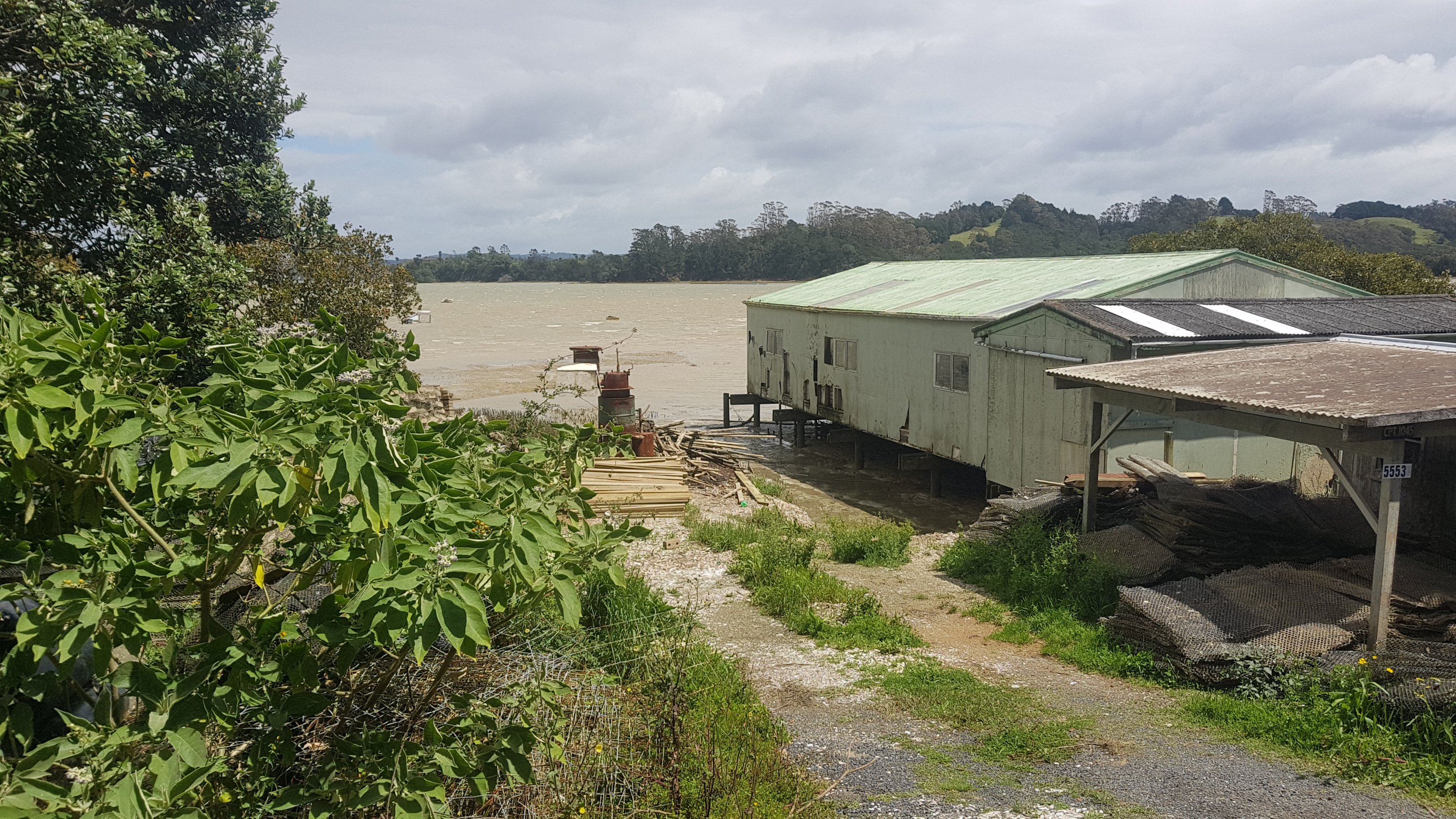
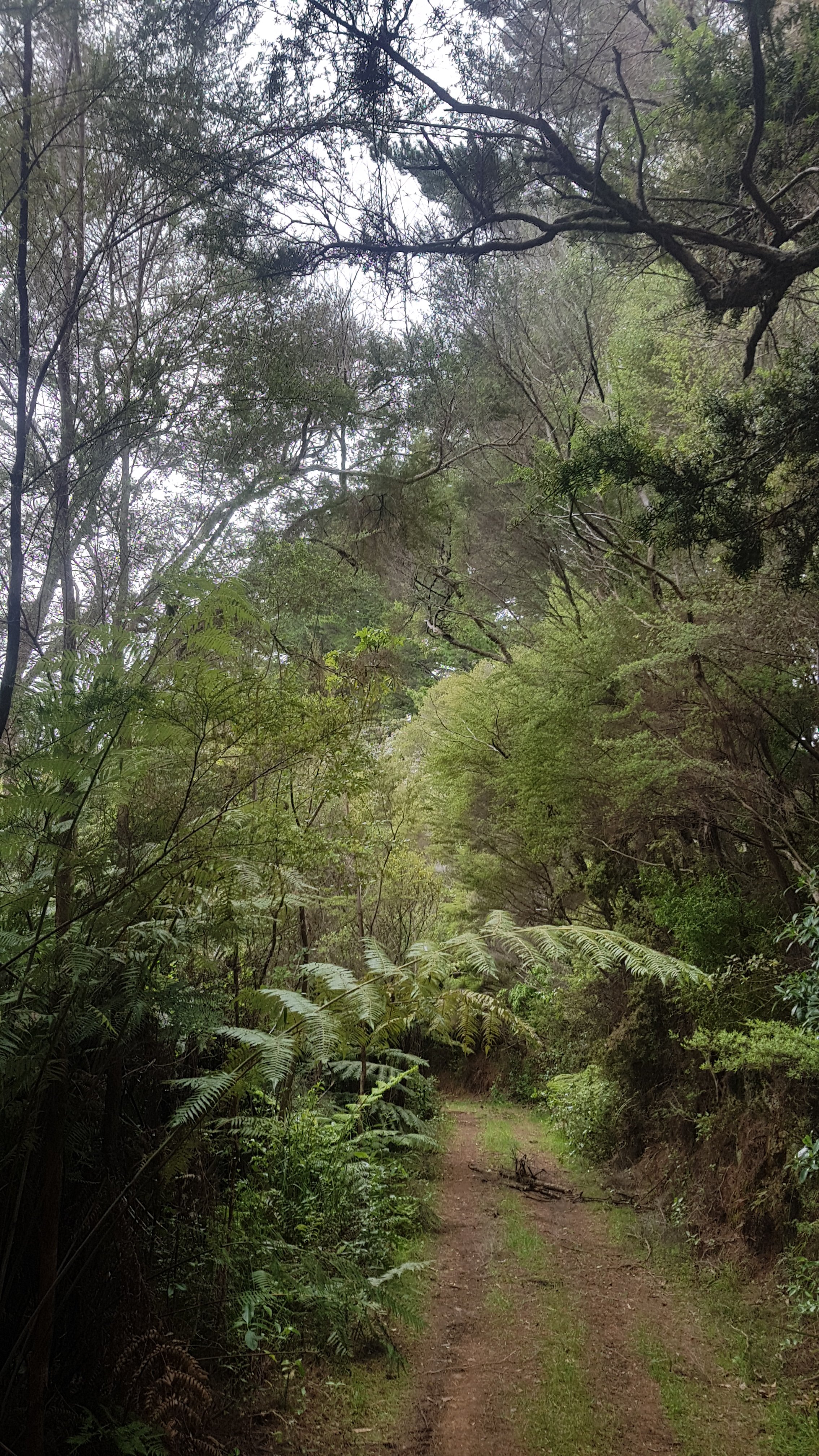
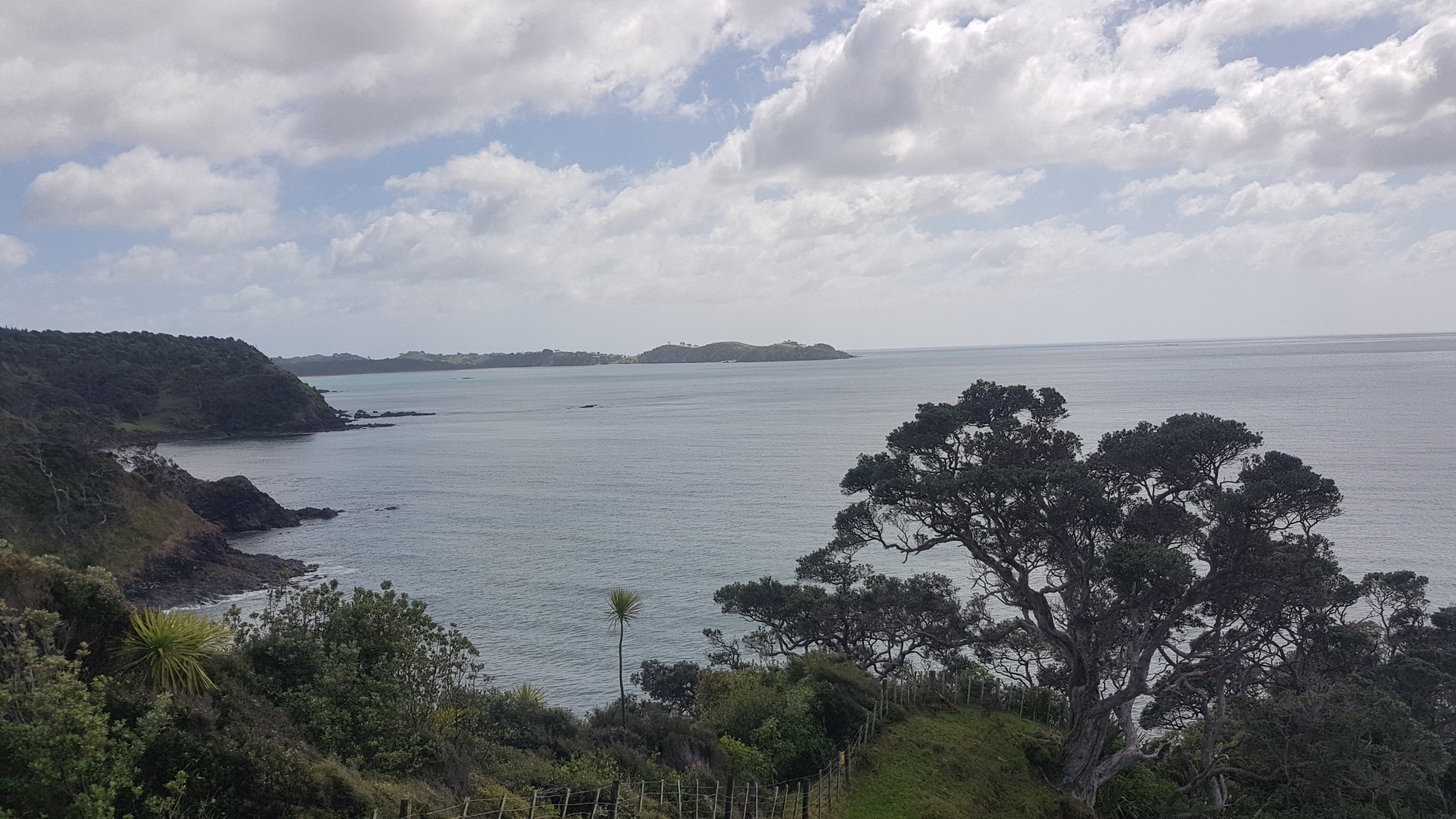
Despite walking around Kaitaia yesterday afternoon pain-free for 5km, the next few days of the trail are through forest with a 750m elevation so I think it’s best I take a day off and hopefully the swelling on my left foot will go down and I can actually fit into my shoes again.
I slept pretty well last night, although at 11:40pm the Civil Defence siren went off which set off all the neighbourhood dogs.
In the morning I had the biggest breakfast put on for me by my AirBNB host. Porridge, toast, coffee and 6 different fruits. While I was eating I was treated to his opinions on all sorts of topics from deer hunting to AirBNB hosting and more conspiracy theories like how 5G cellphone technology shortens your lifespan by 30 years and he doesn’t want it in Kaitaia.
Thunderstorms are forecast for today and so that’s another reason to stay put in Kaitaia for a day. However I can’t handle another day at this AirBNB, truthfully the host is just a bit too chatty so I moved down the road to the Beachcomber Backpackers. It used to be Kaitaia Main Street Lodge but after the owner of that was convicted of sex crimes after drugging young male guests, it’s had a rebrand. The woman at reception was really nice and let me store my bag there as I arrived at 10am.
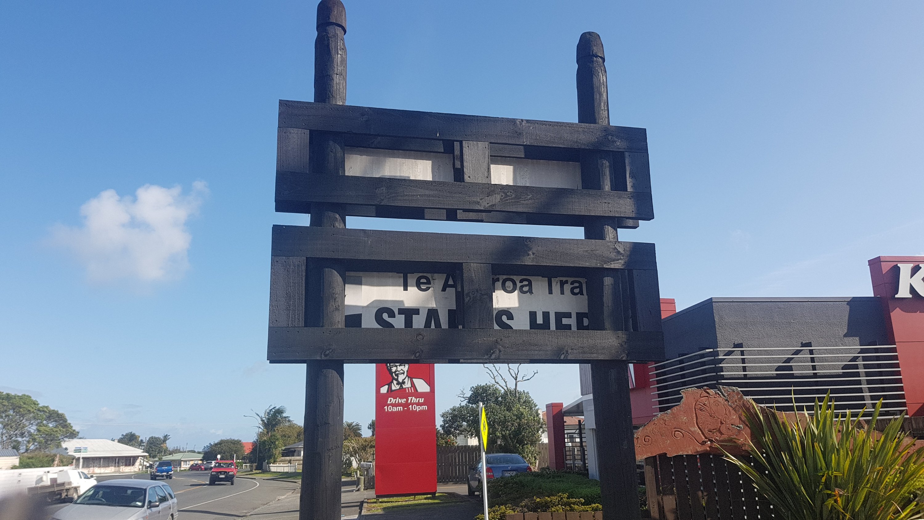
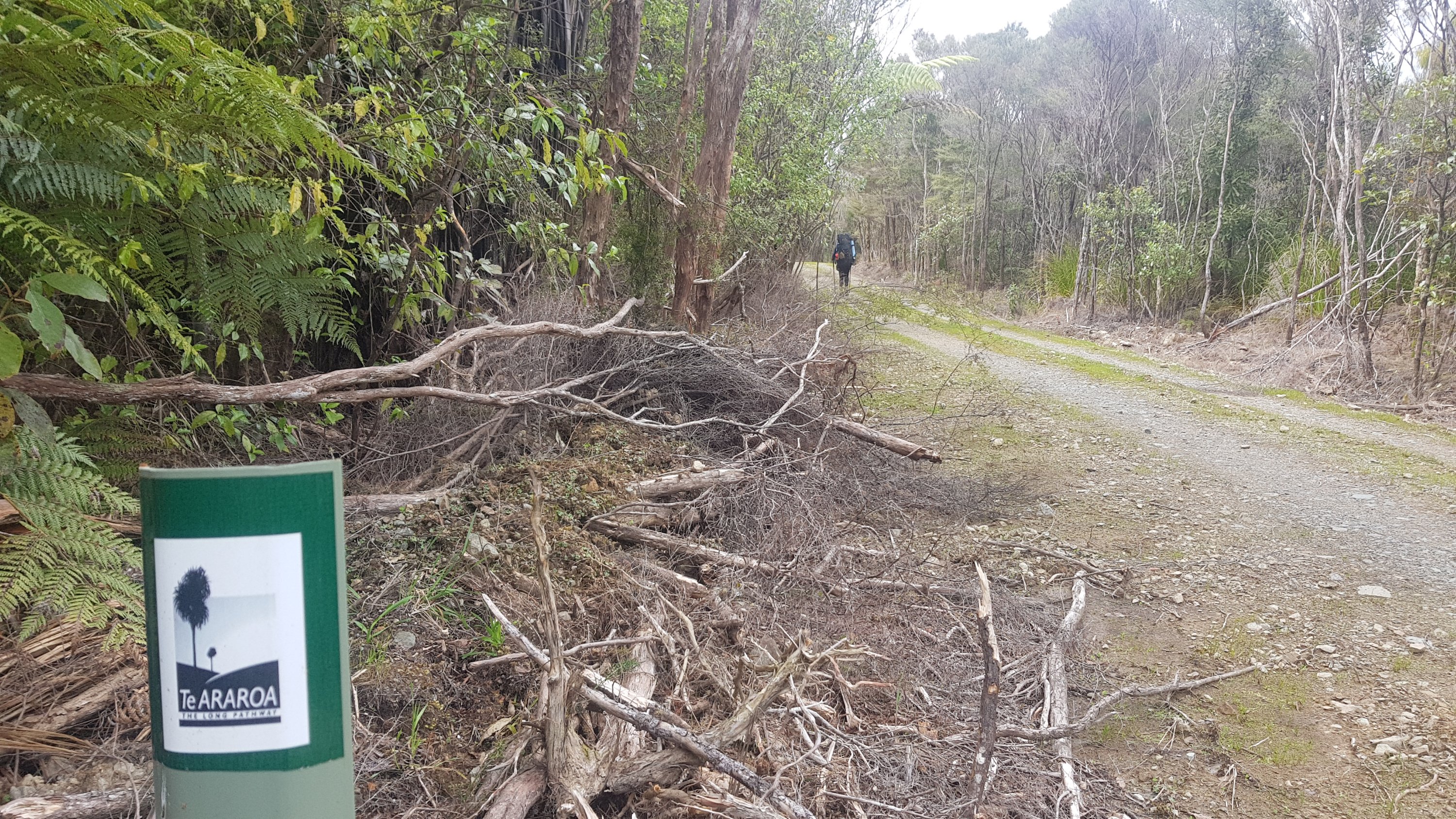
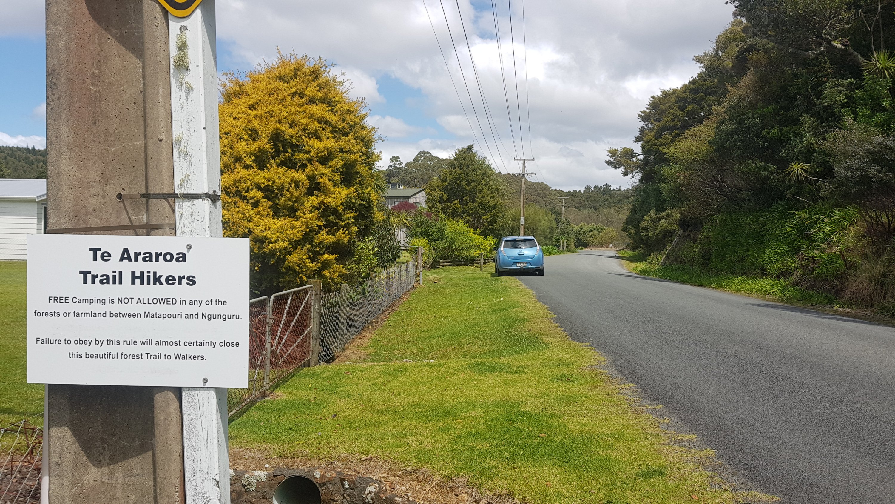
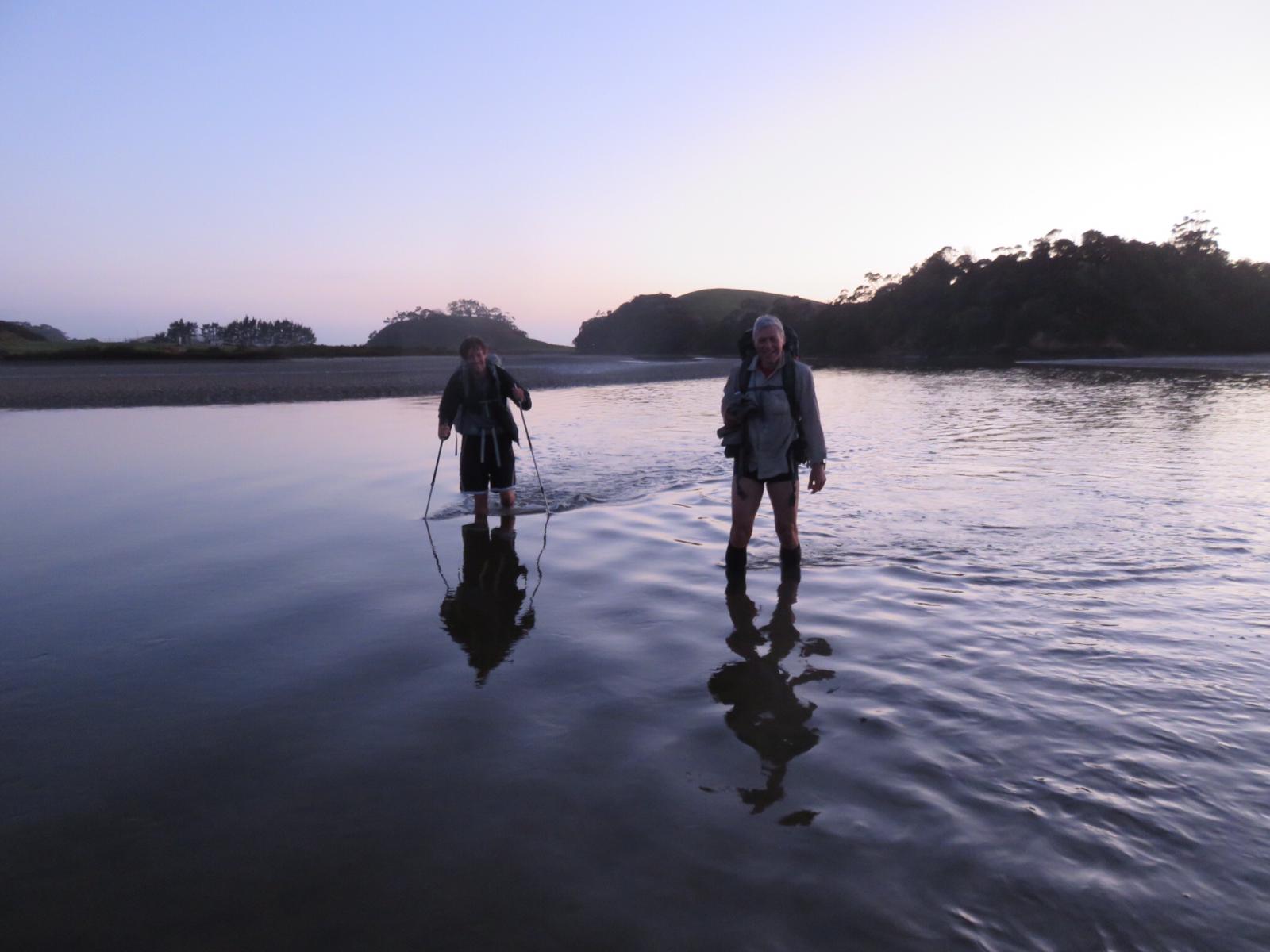
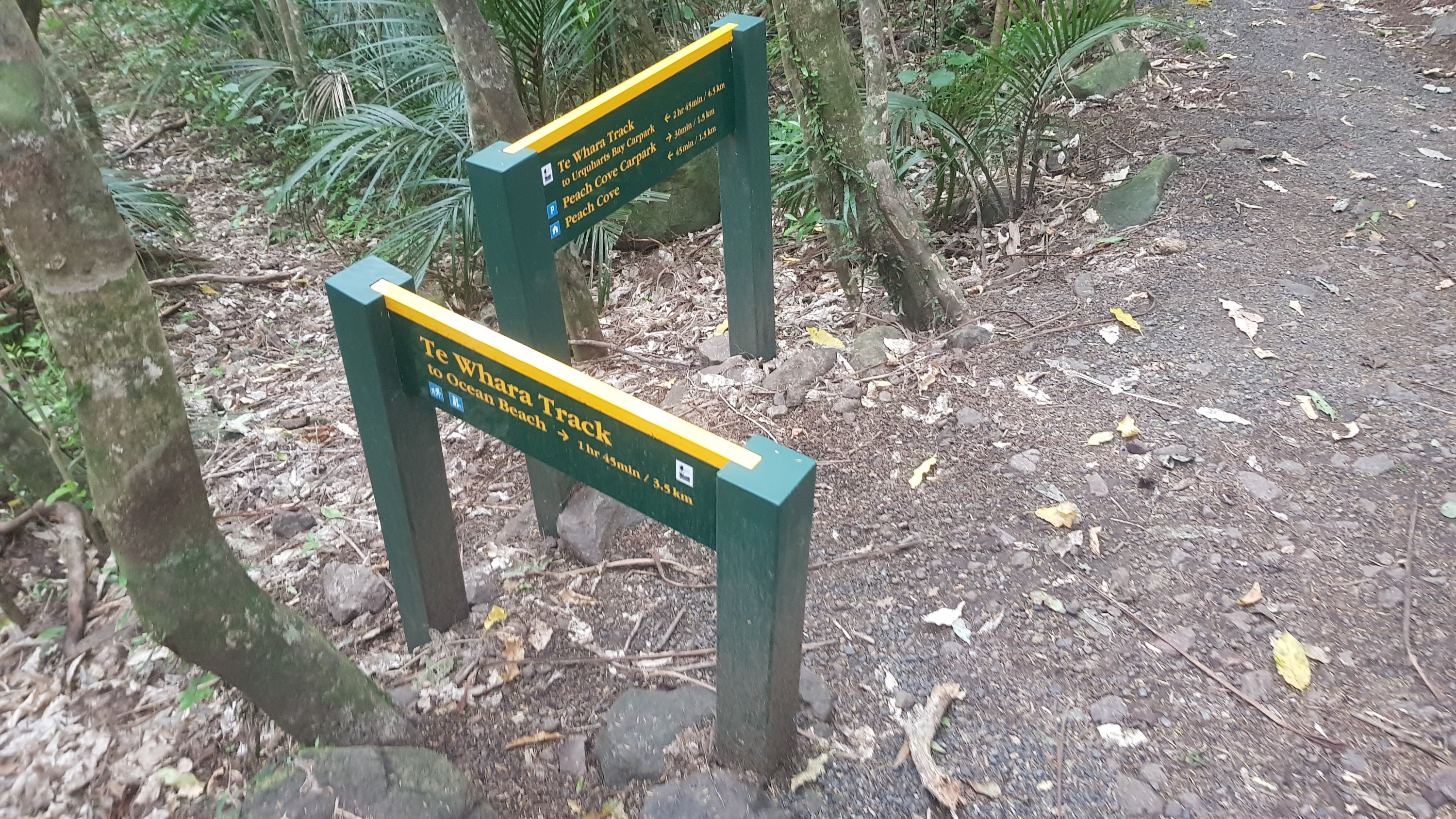
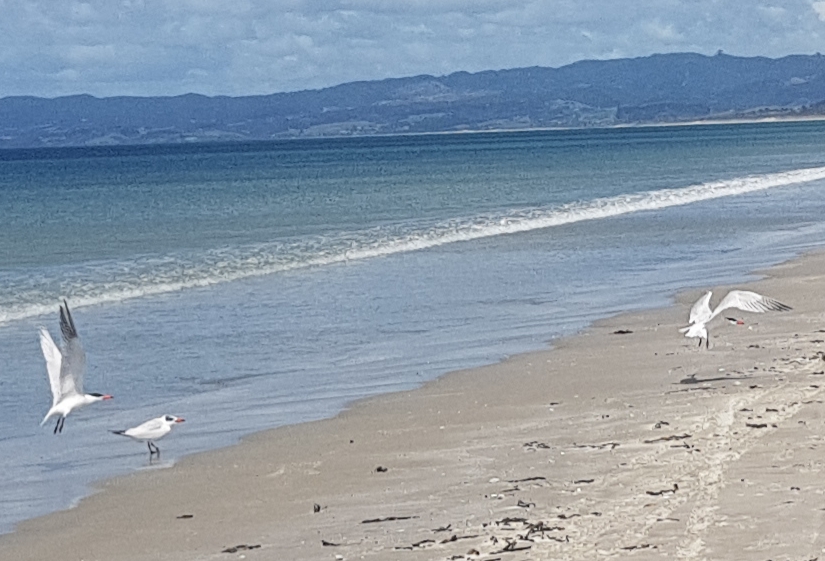
There was this interesting sign on the reverse of the backpackers entrance. It seems to say “Te Araroa trail starts here”. The trail runs close to here but not actually right past here – weird. In fact there wasn’t any sort of “trail starts here” sign at Cape Reinga, I feel like there should be. Or maybe I just missed it.
Te Araroa trail starts here?
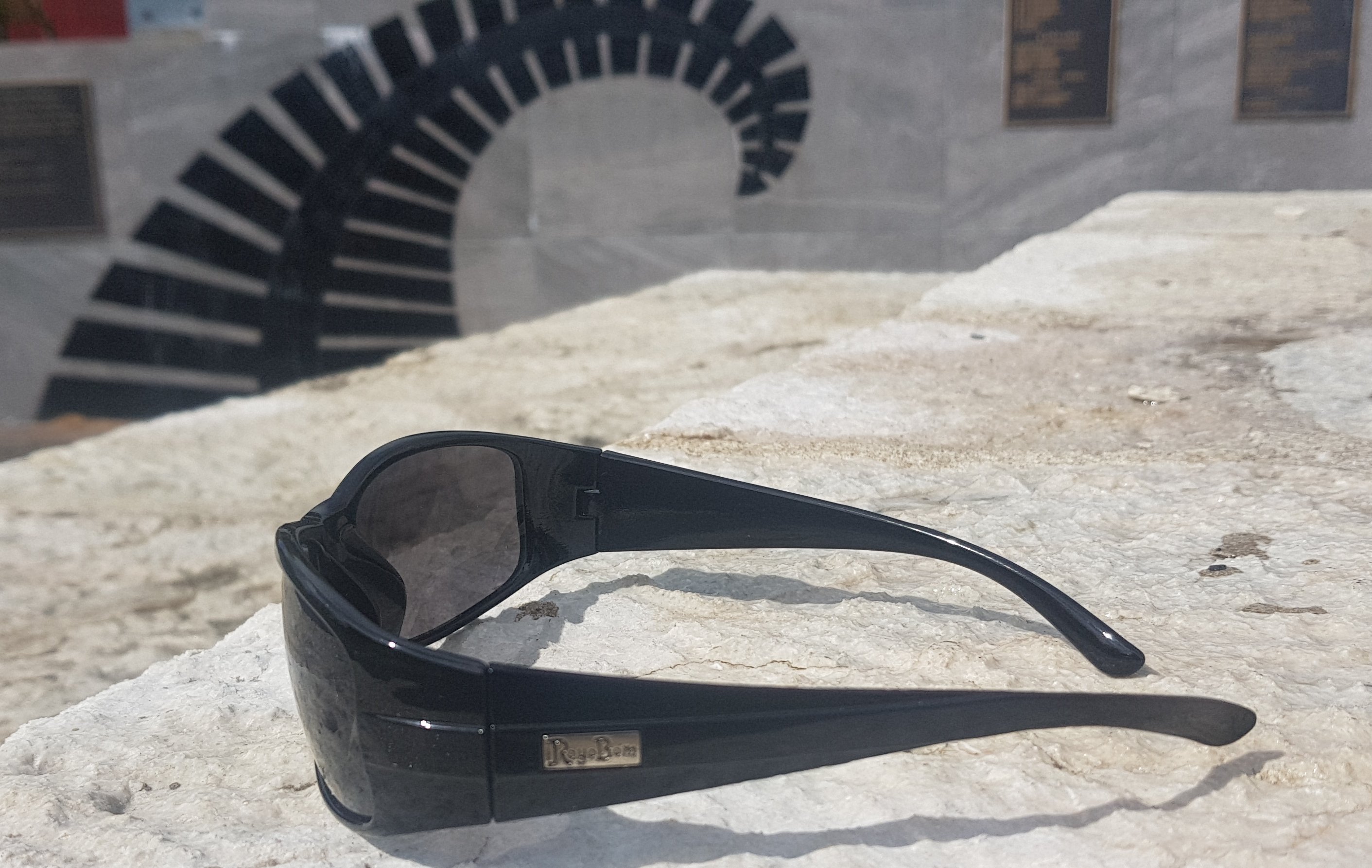
I also bought a new pair of Ray Ban sunglasses from Coin Save to replace the ones that broke on Day 4. Oh no wait, they’re Roy Bom.
Famous “Roy Bom” sunnies
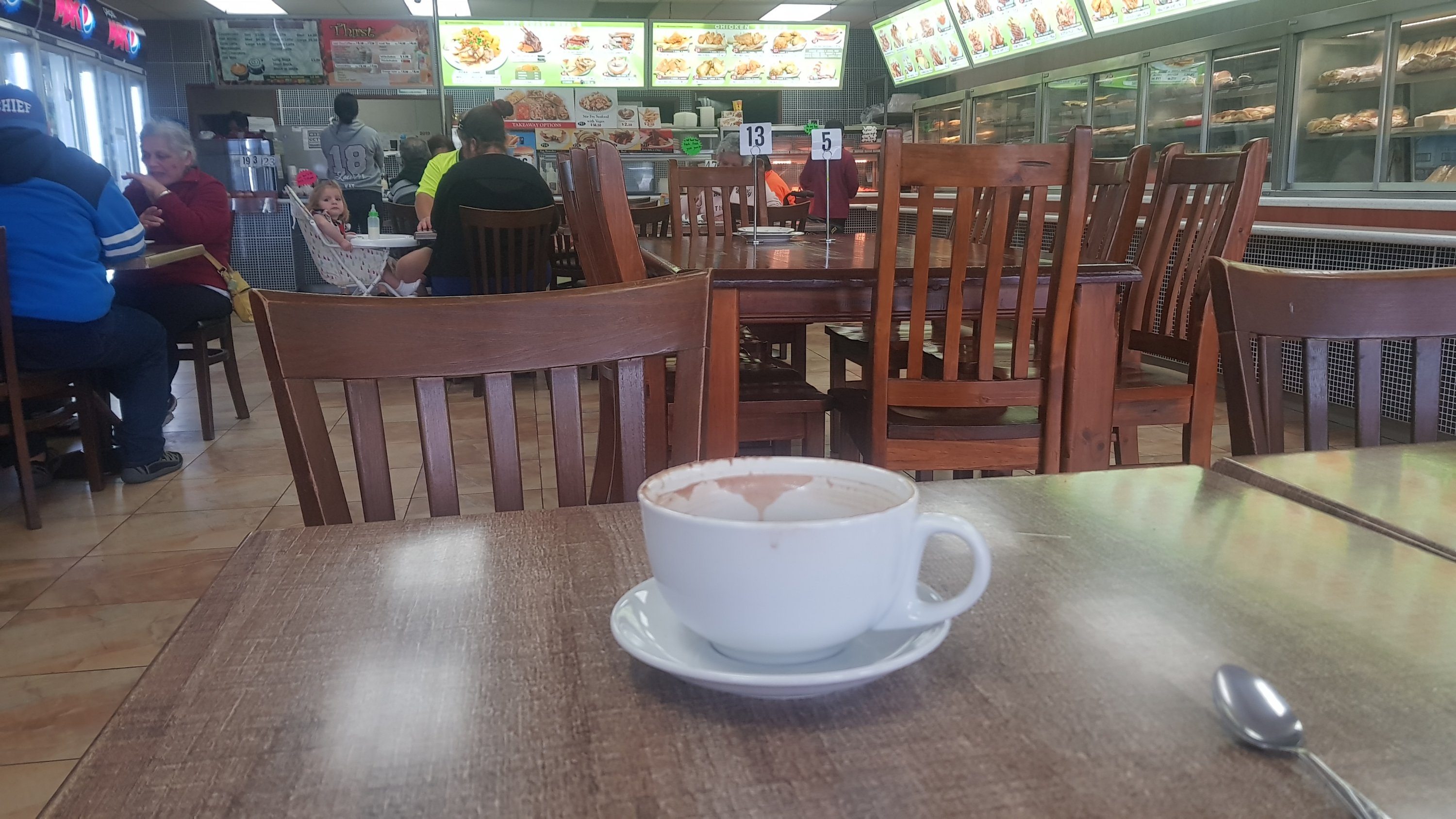
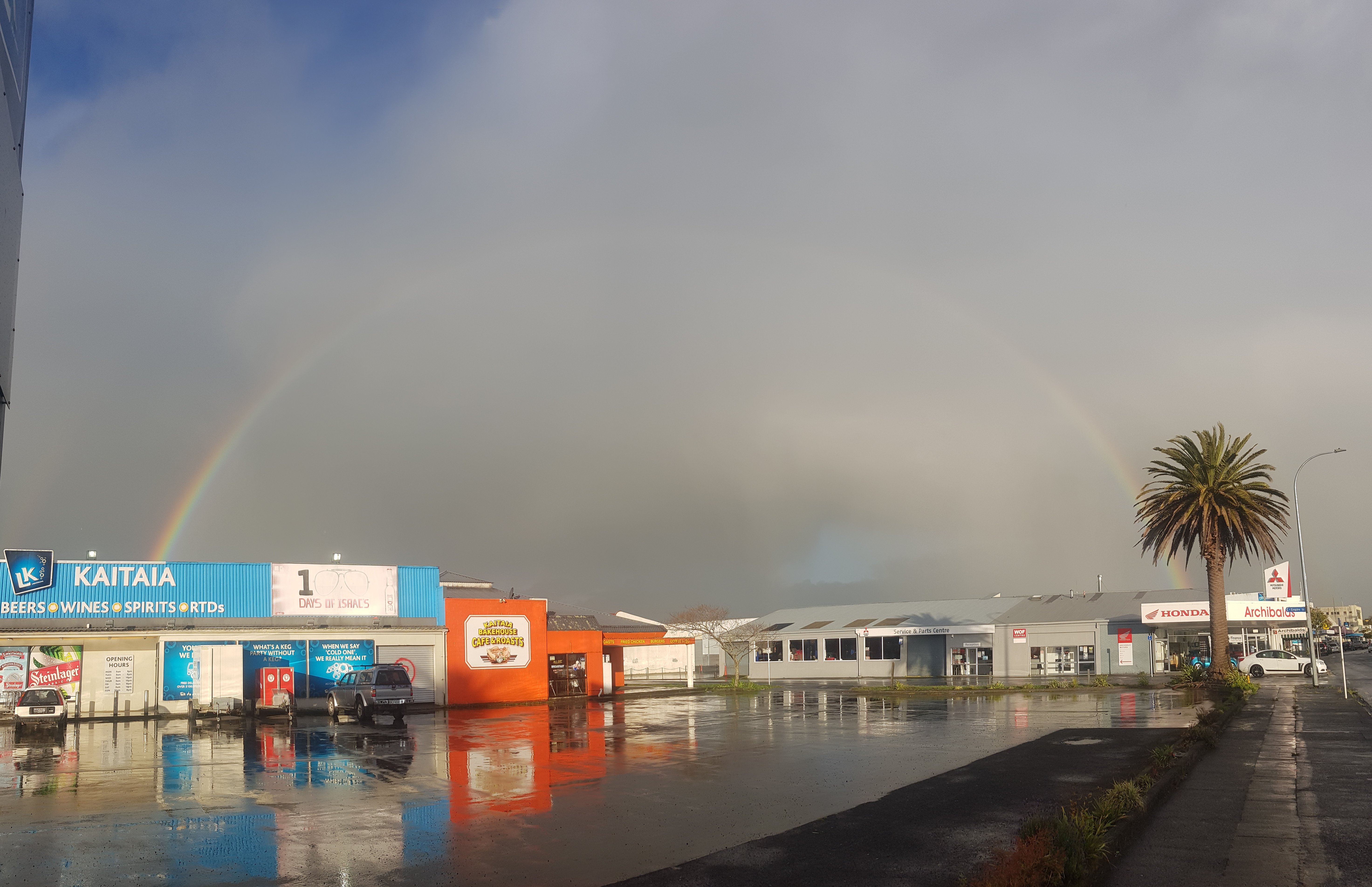
The rain started pretty early so my 11am picture is in the Bakehouse Cafe while I wait out the rain. Apparently I can check in to my room at midday.
11am picture, good old Bakehouse Cafe
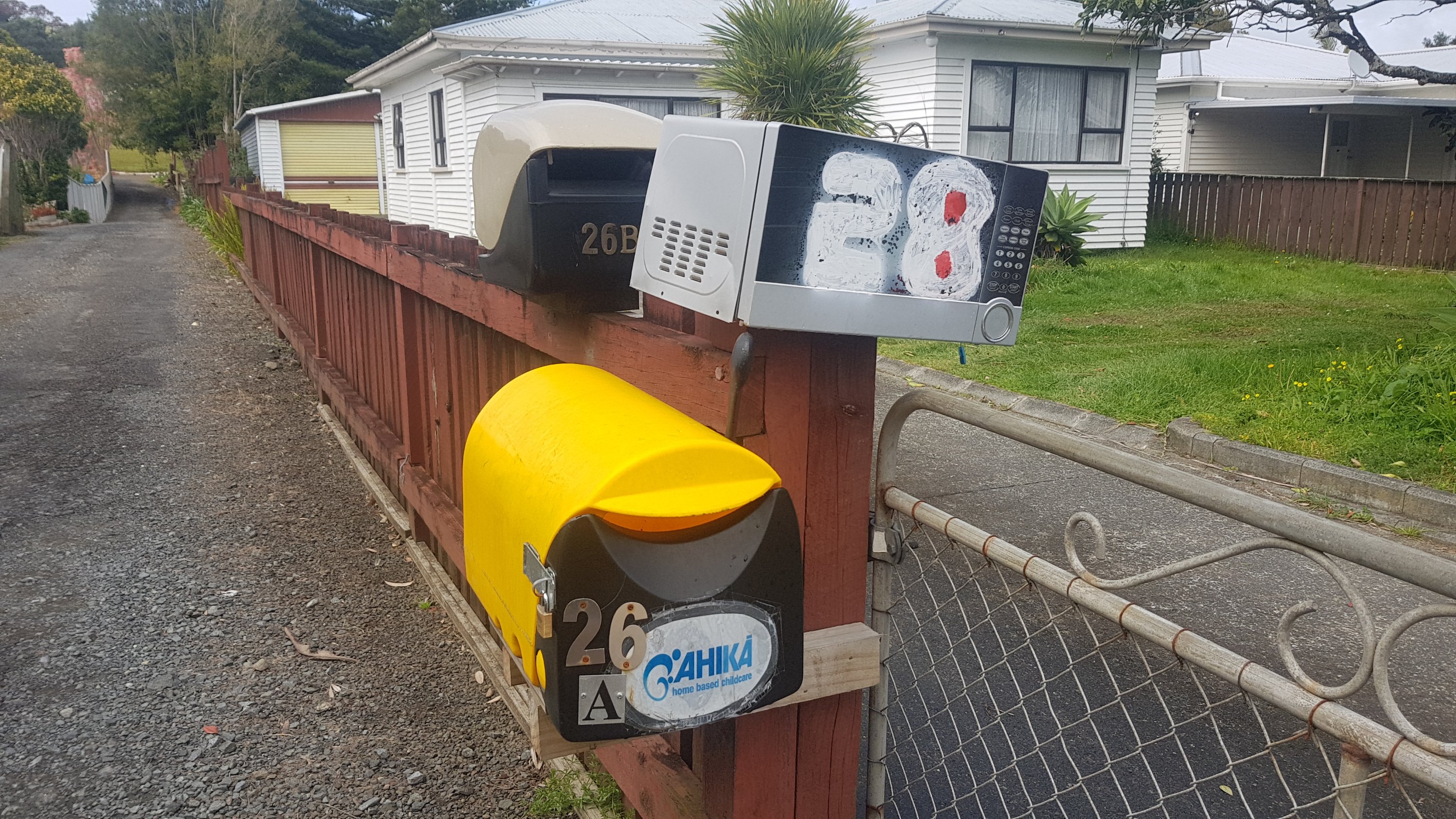
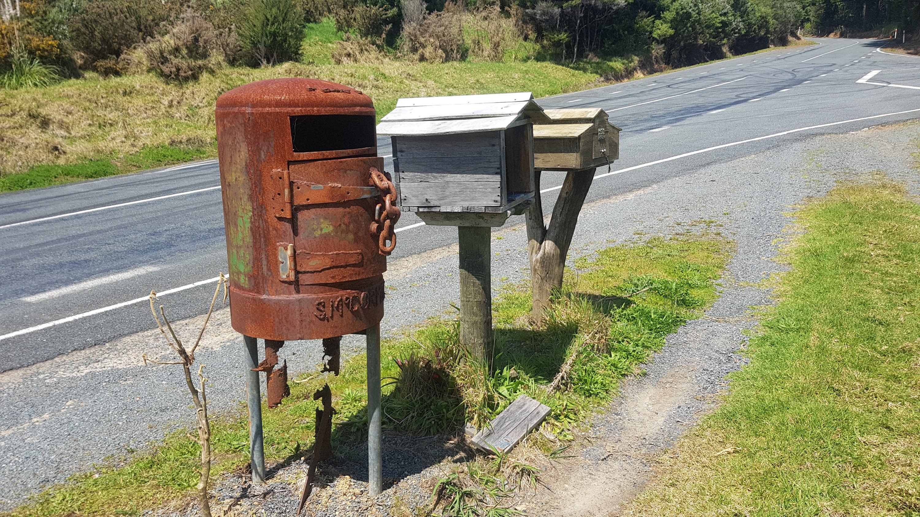
I’m 80% sure I saw Kelvin Davis filling up his red ute at the BP. That was mildly exciting. So was this microwave mailbox I saw:
Number 28 microwave
Even though I was supposed to be resting I managed to walk 9km around town just exploring. Then I just sat around all day in the hammock when it was sunny, and inside when it rained, and chilled. It was good.
I had my dorm room at the backpackers to myself initially but after a while I was joined by Karl from Germany (seriously, everyone is from Germany). He is cycling the length of New Zealand and showed me the path he is taking. Apparently he was going to do a unicycling tour of New Zealand but thought he’d start off small. He does “unicycle hockey” back in Germany. You definitely do meet some interesting people on these sorts of expeditions.
Date: 2 October
Distance walked: 27.6km
Trail covered: kms 115.6 to 142.9
Weather: the rain won’t make up its bloody mind, is it coming or not??
Highest altitude: 744m
Litres of mud in the Raetea Forest: 744,000,000,000,000,000
This morning as I left the backpackers, my roommate Karl told me “try something new”. I thought that was odd at first but given that he is a unicycle-hockey-playing saxophonist who is cycling the length of NZ and is also a dancer, it’s okay to hear that from him.
Originally I had the dorm to myself but Karl was perfect roommate. He was very chatty as well but it was ok because we had stuff in common, unlike me and yesterday’s AirBNB host.
He said that he came to nz for a holiday and when he got here he didn’t know what to do so he just decided to go cycle the whole country. But it did mean he had a *lot* of stuff with him.
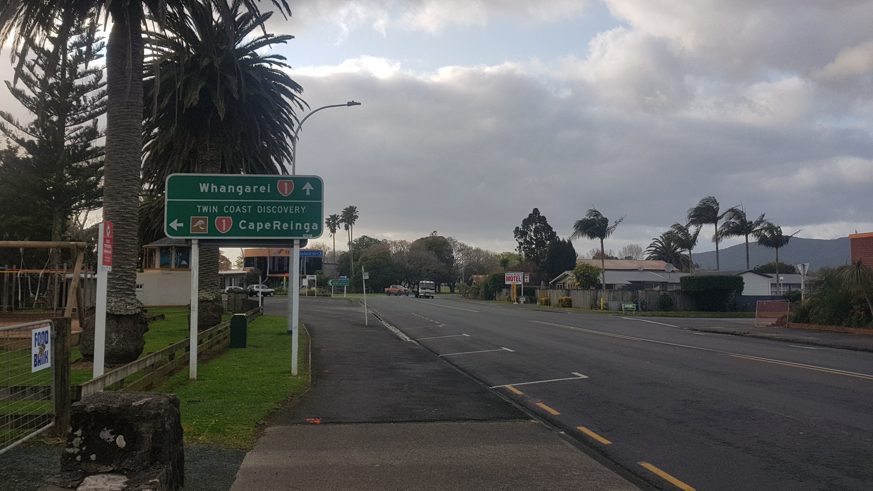
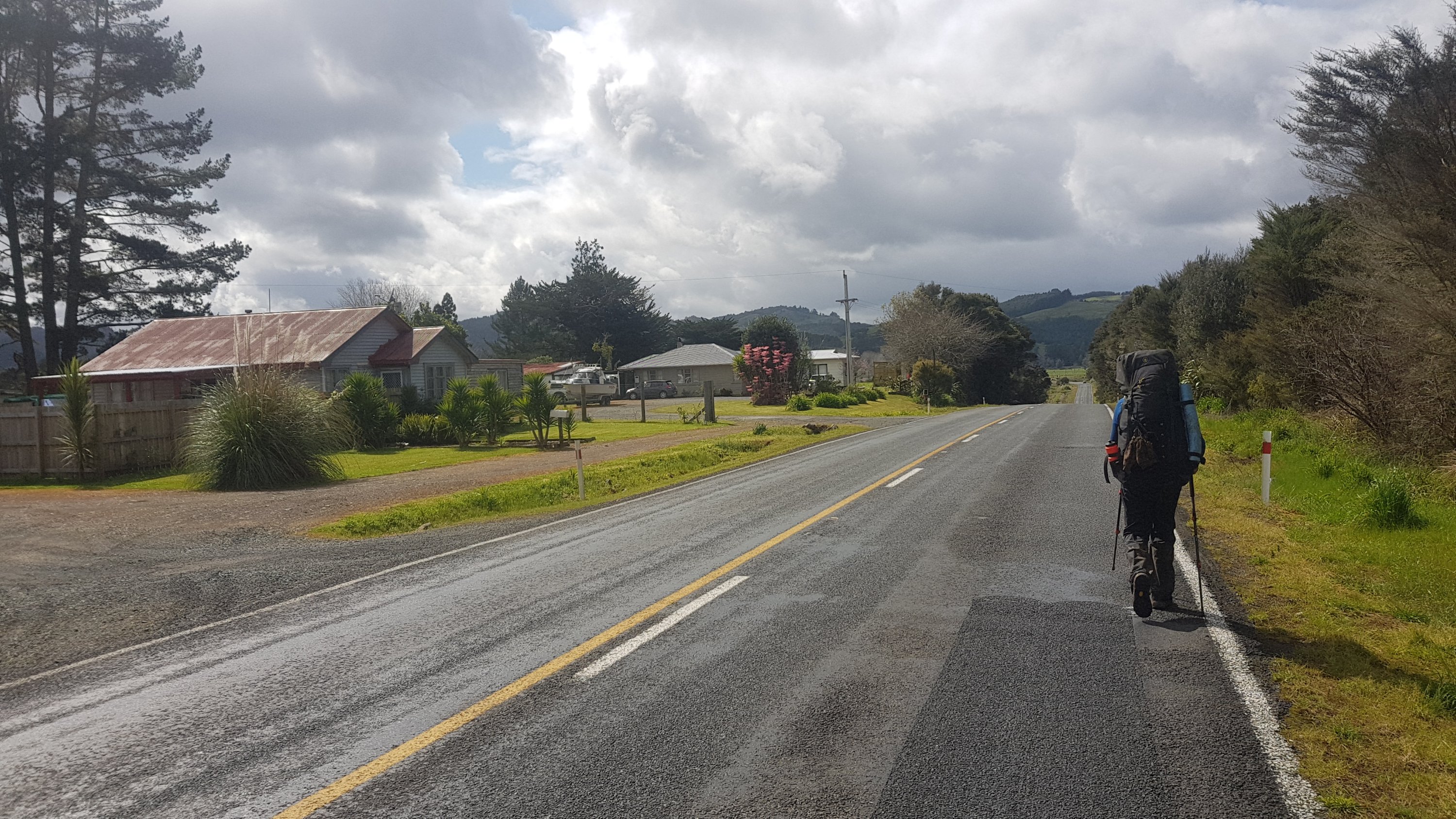
I had breakfast at a cafe and set off on another road walk. This is listed in the notes as dangerous but it seems 8:30am in Kaitaia is not rush hour.
Definitely not rush hour
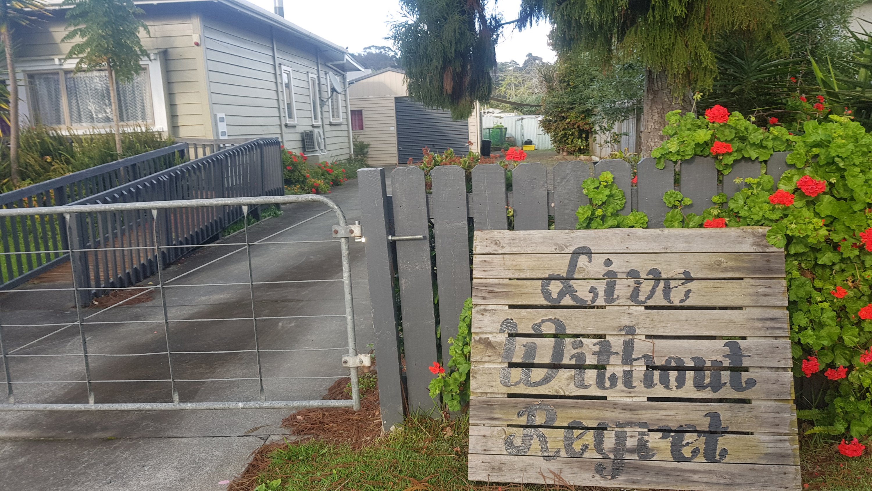
Saw this outside one house:
Live without regret
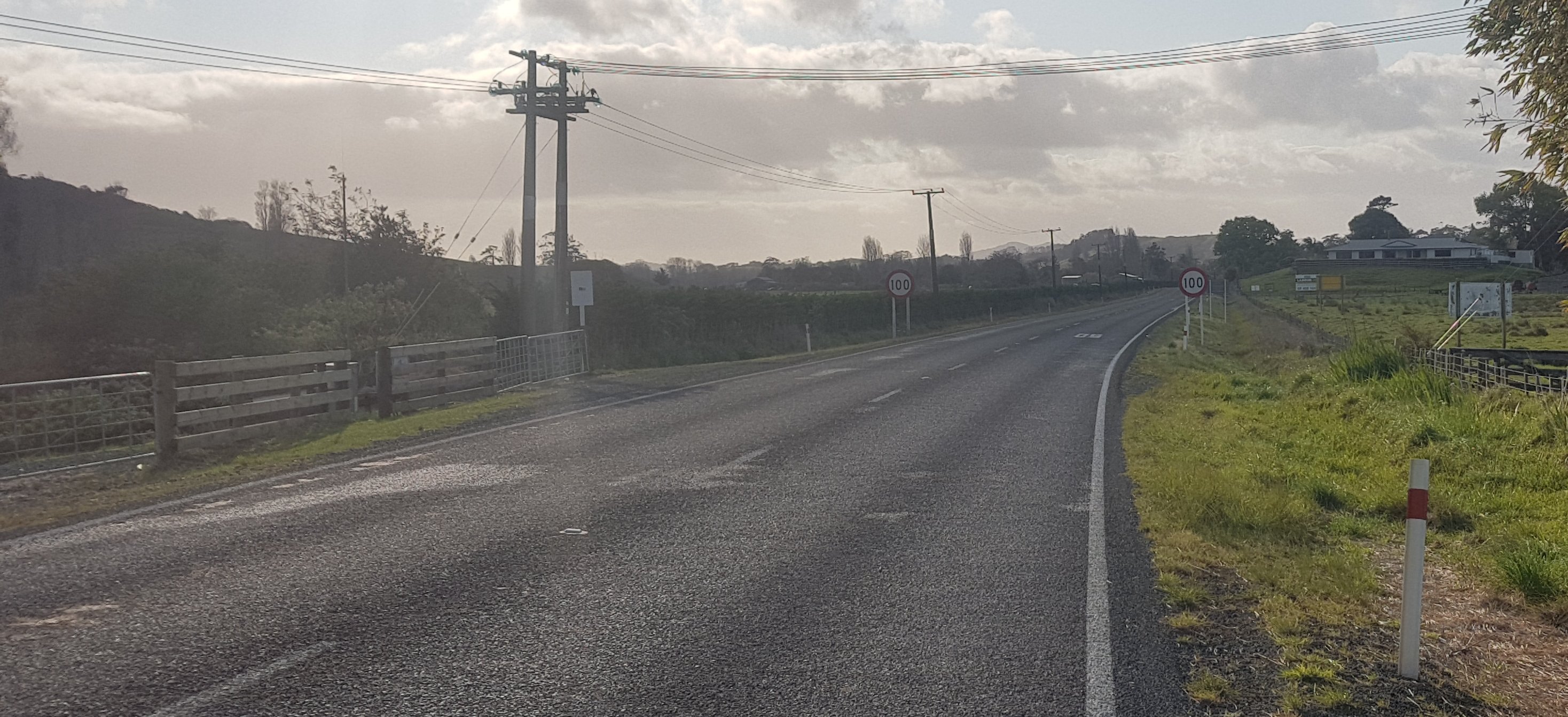
Wasn’t long before I had deja vu after seeing a 100k sign that I was about to walk past.
Oh yay, more walking on a busy road
This wasn’t as bad as the road from Ahipara to Kaitaia. This had a bigger shoulder and a less steep bank to move into when the cars came. And there were fewer cars, but that’s probably because I was earlier.
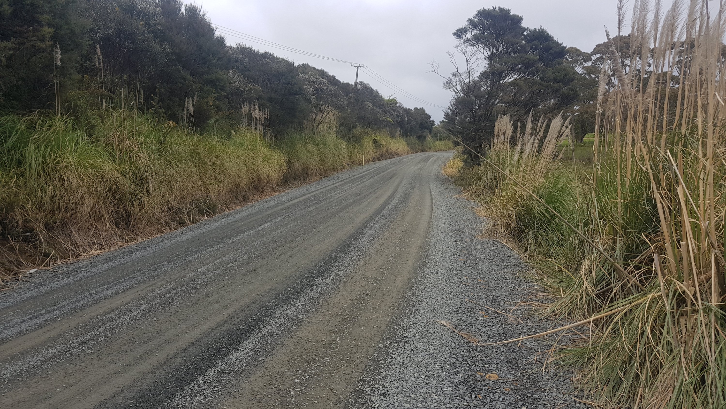
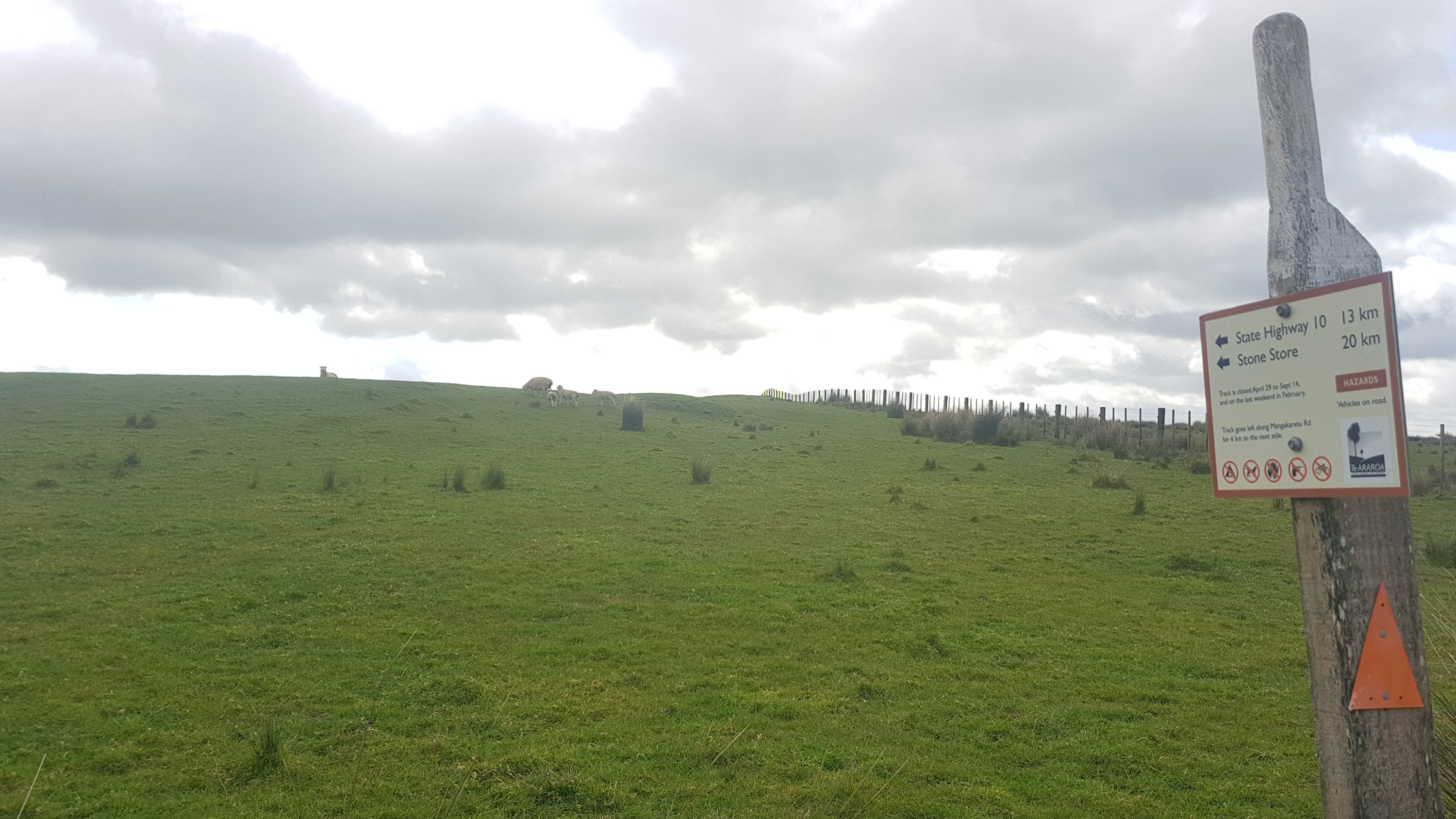
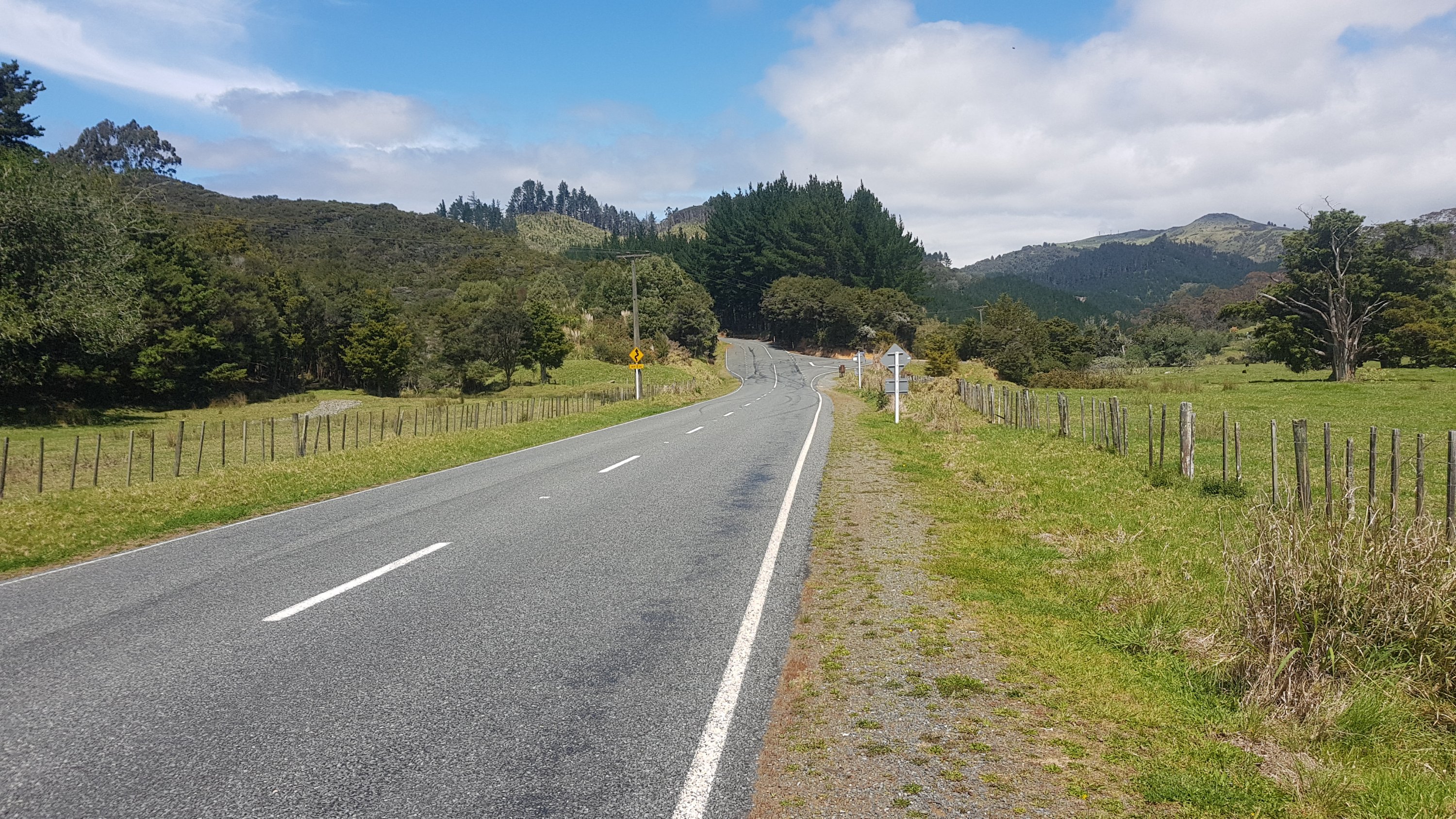
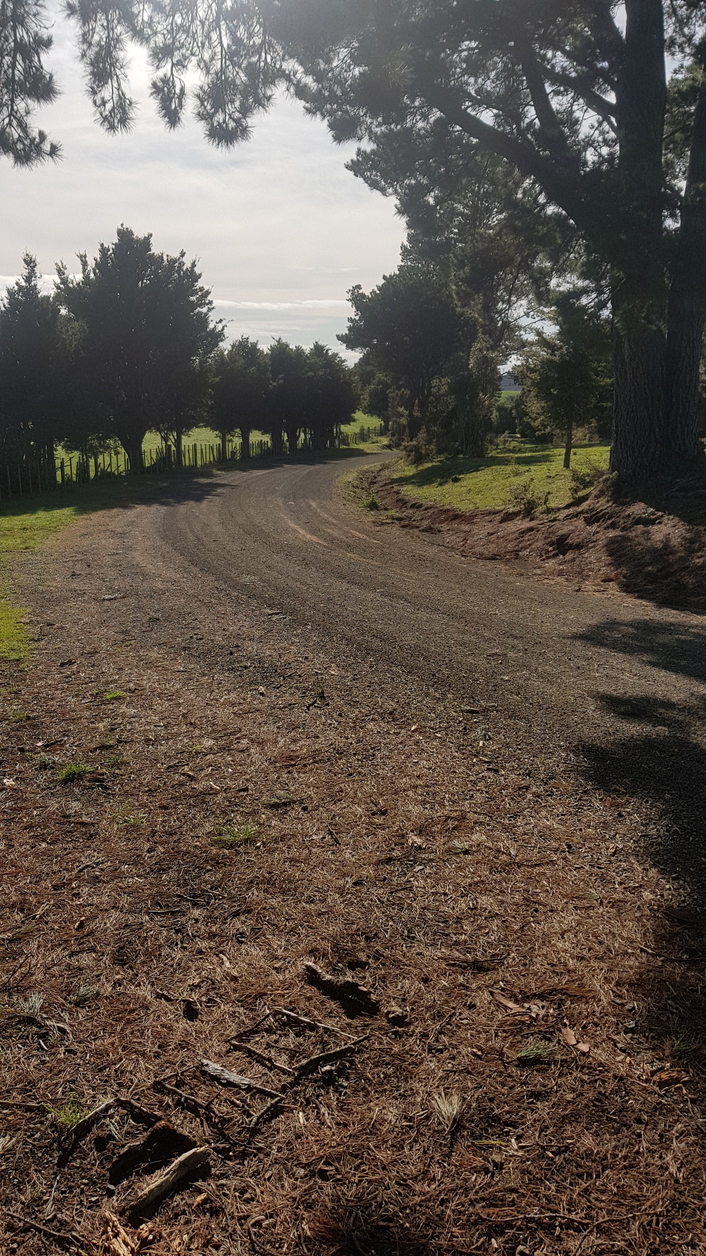
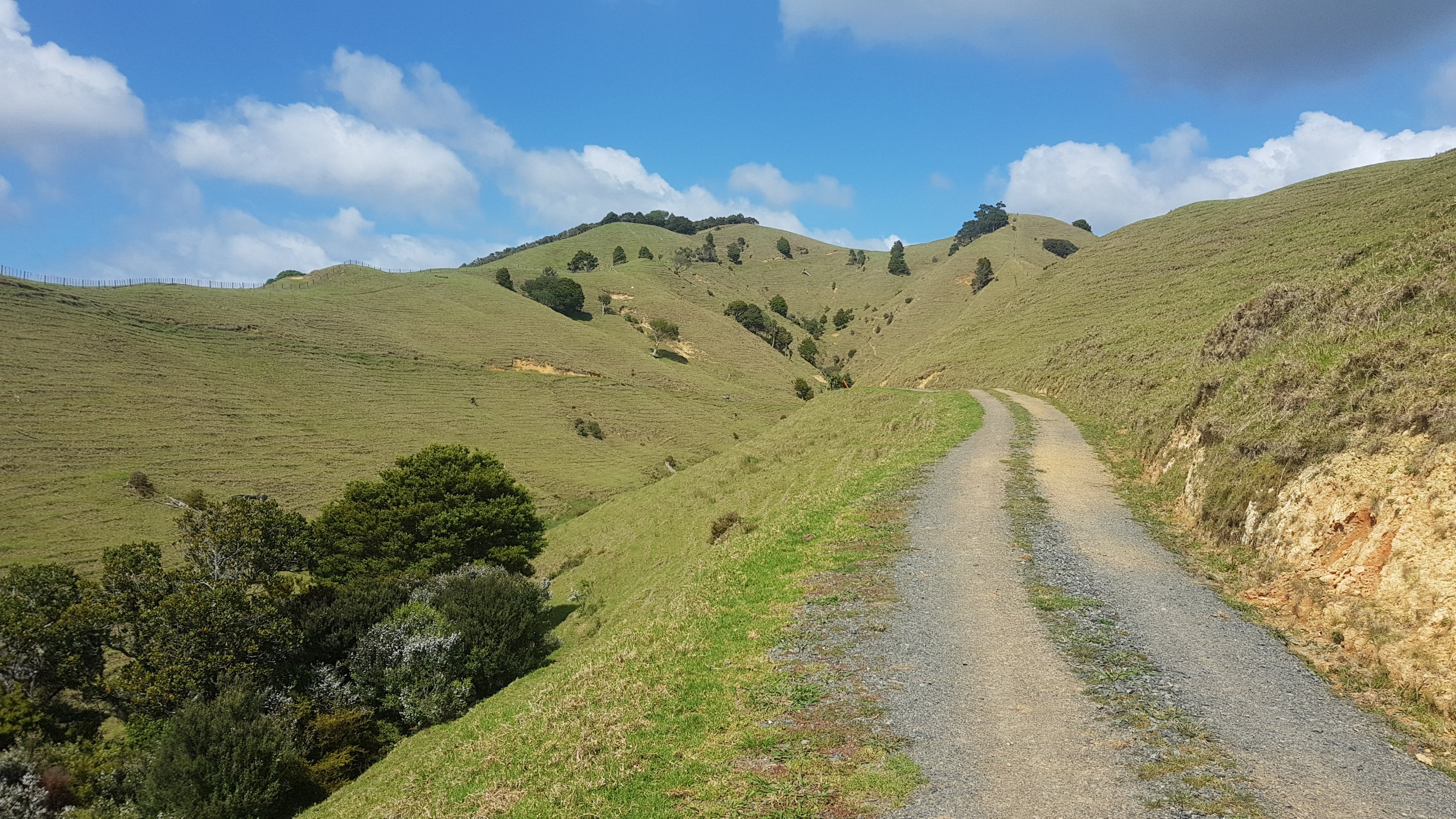
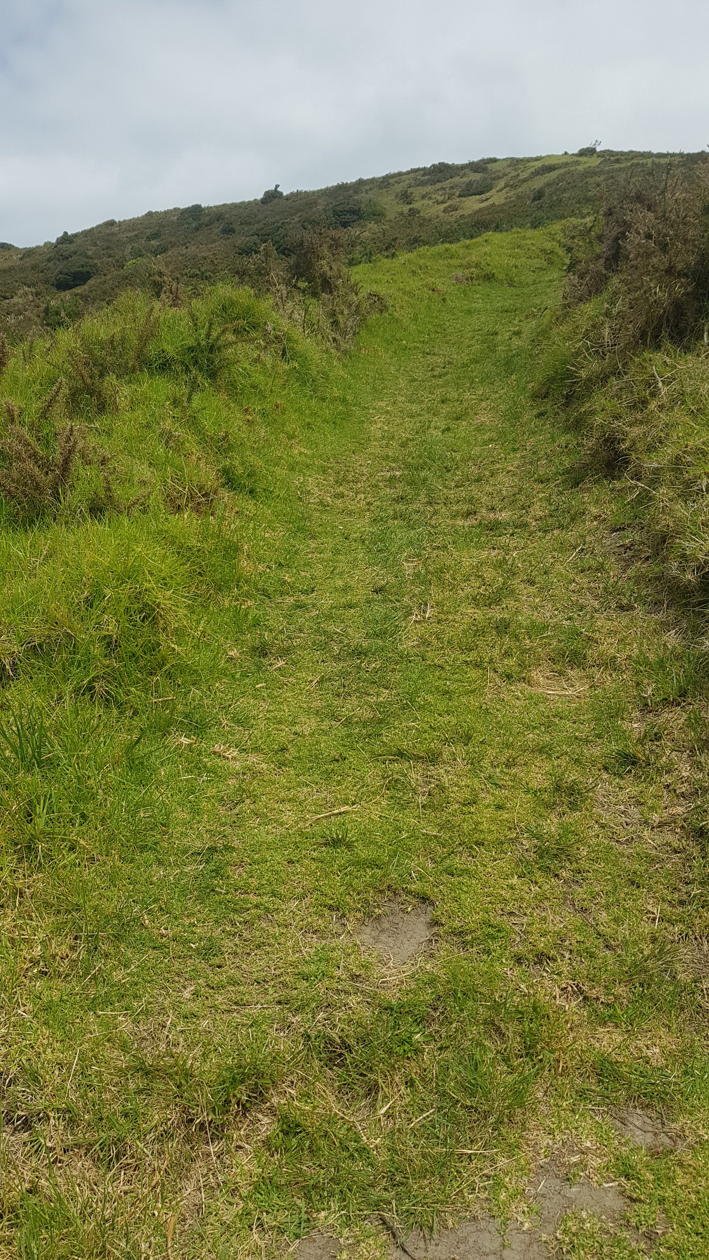
I wasn’t on this road for long. After 5km I turned into Ruaroa Rd which is a gravel road. Sadly the 11am picture today is a rather uninteresting section of that road.
11am picture – the worst one yet
I had been road walking so didn’t have music on. I had Robbie Williams’ Millennium in my head all morning. I hate that song, but just couldn’t get it out of my head.
When I passed some silage that didn’t smell nice, this clip from The Simpsons started playing in my head (to the tune of Jingle Bells):
Sherri smells, Terri smells Stinky all the way Stink stink stink, st-stink stink stink One horse open sleigh
Here’s the youtube clip if you don’t know it. I couldn’t have that in my head so I did end up putting music on. But I just played it through the phone quietly so I could still listen out for cars.
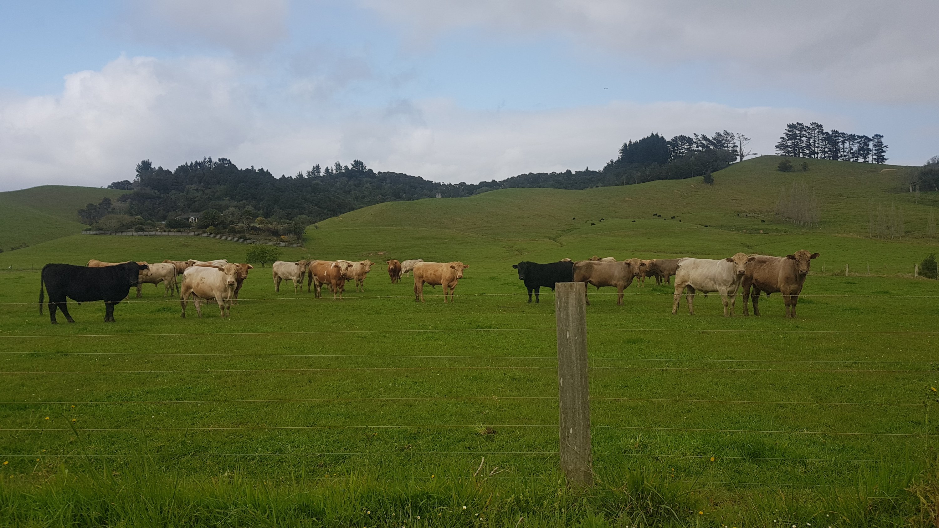
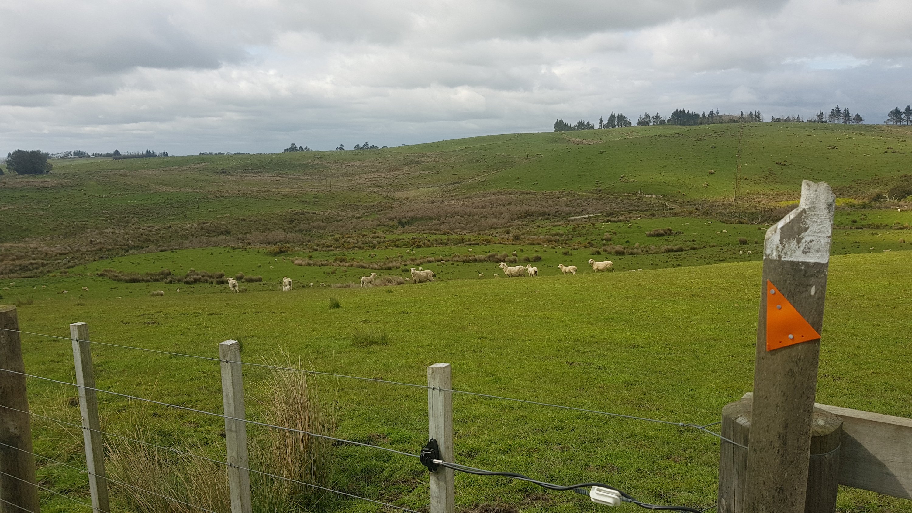
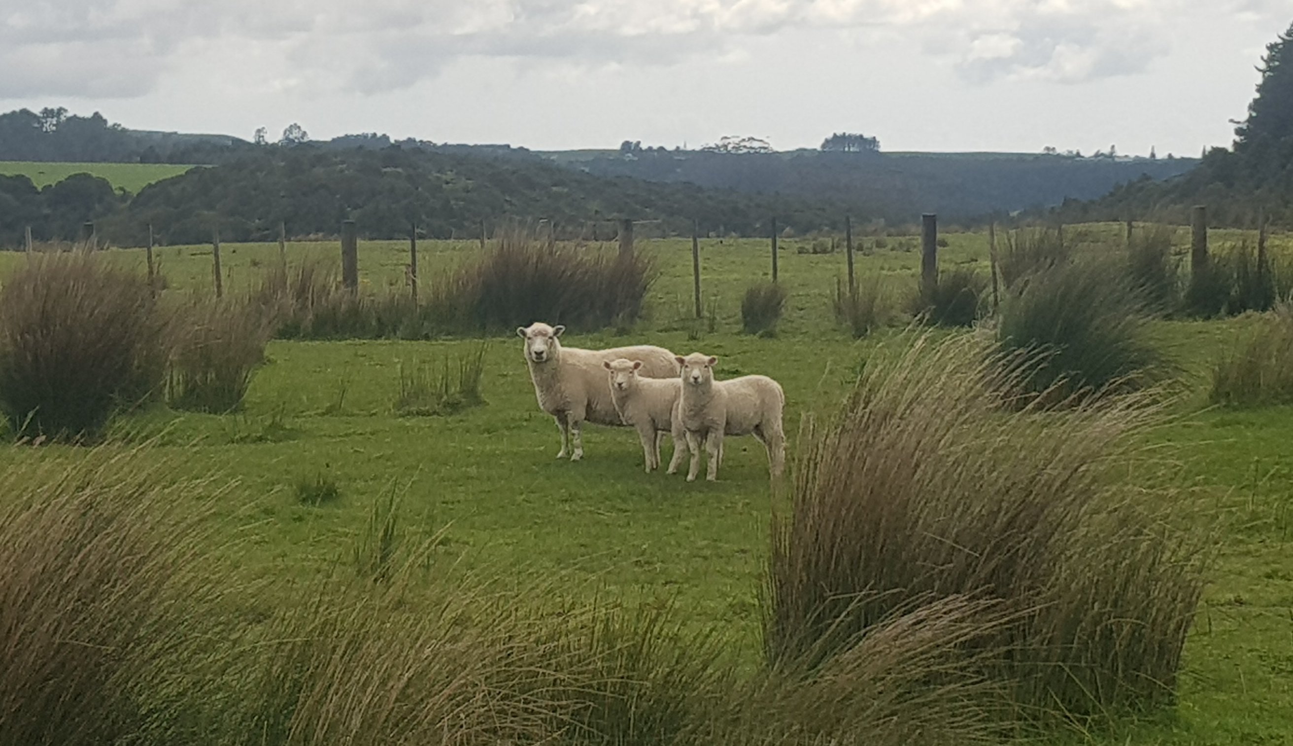
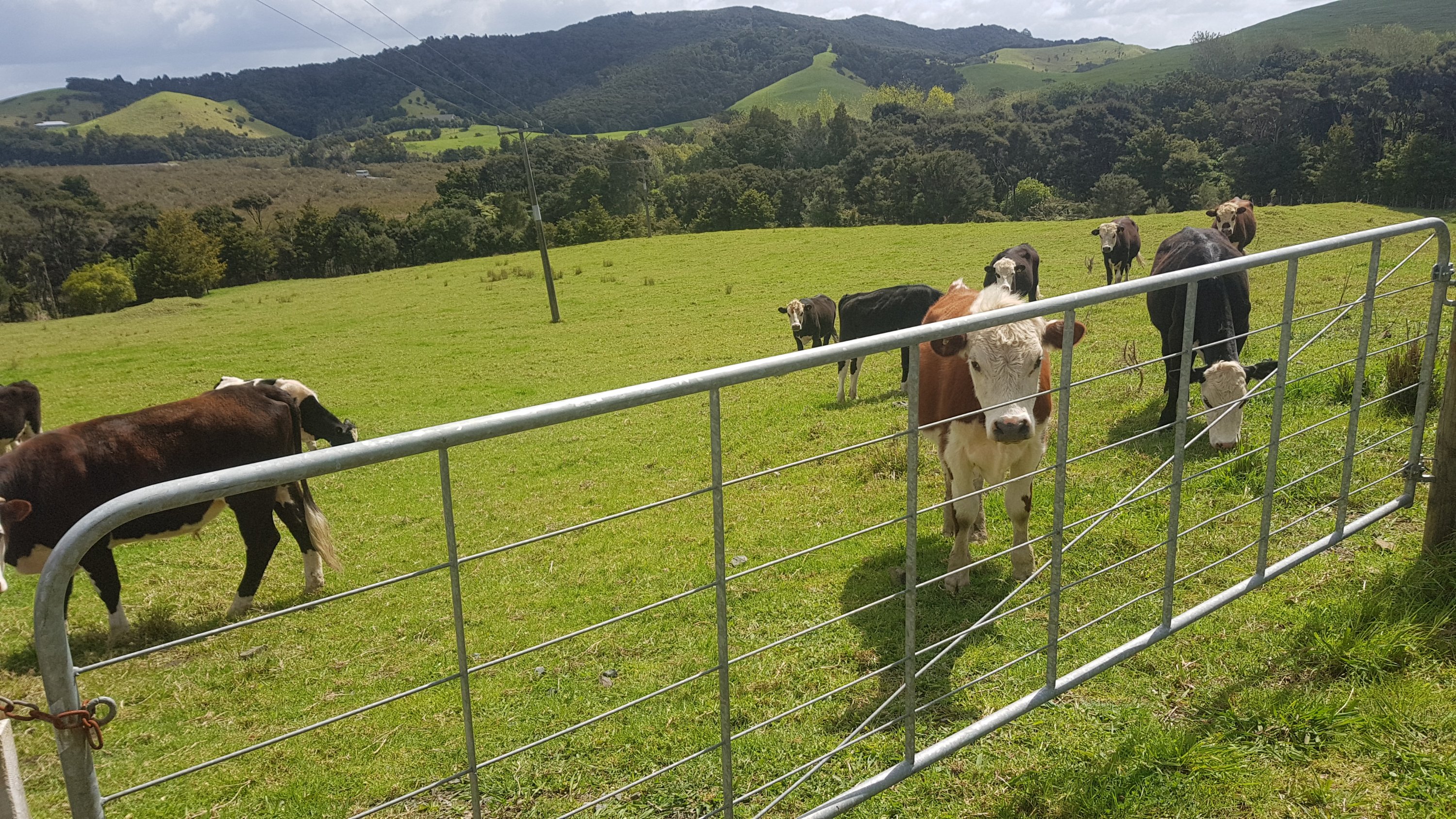
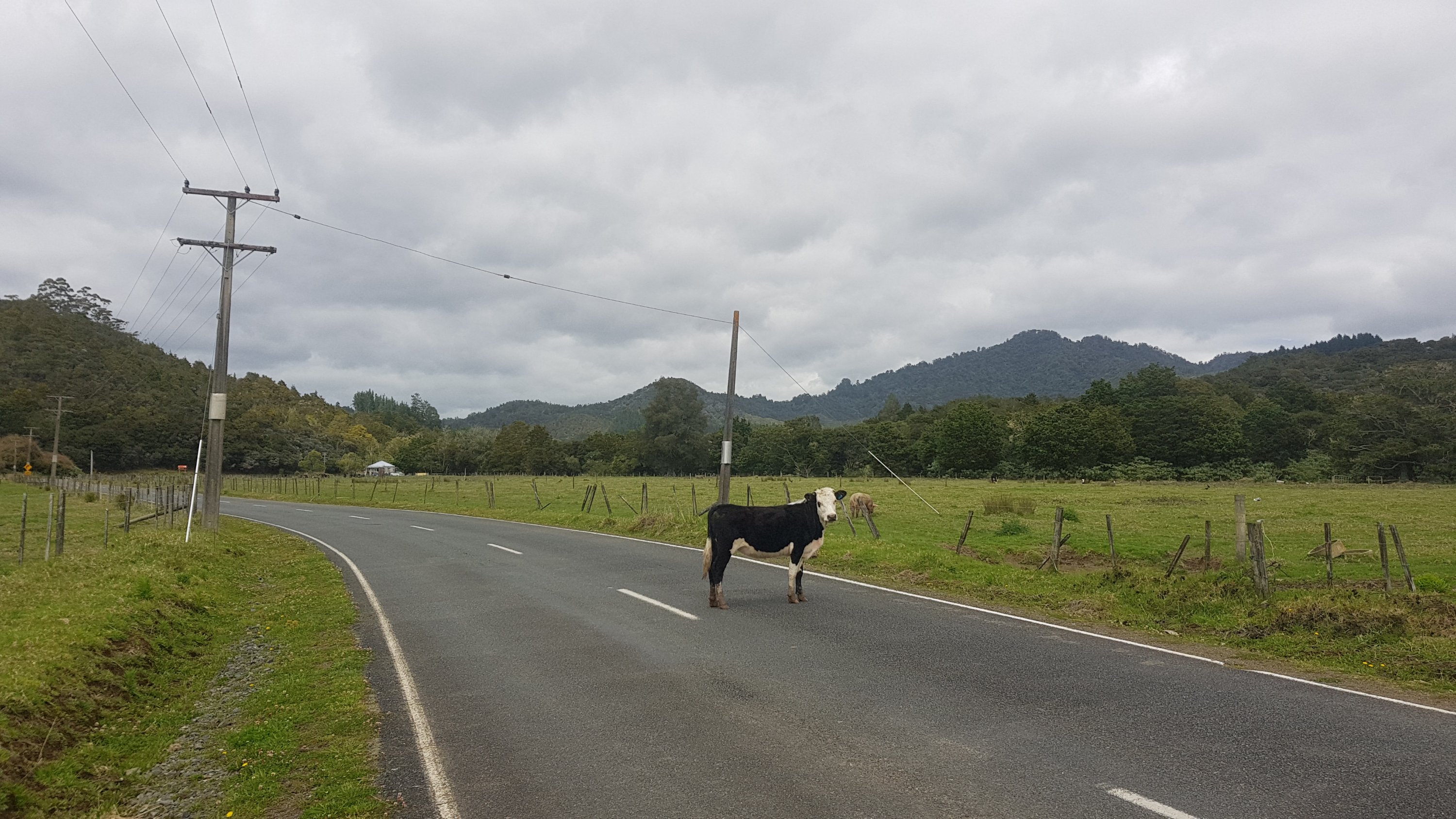
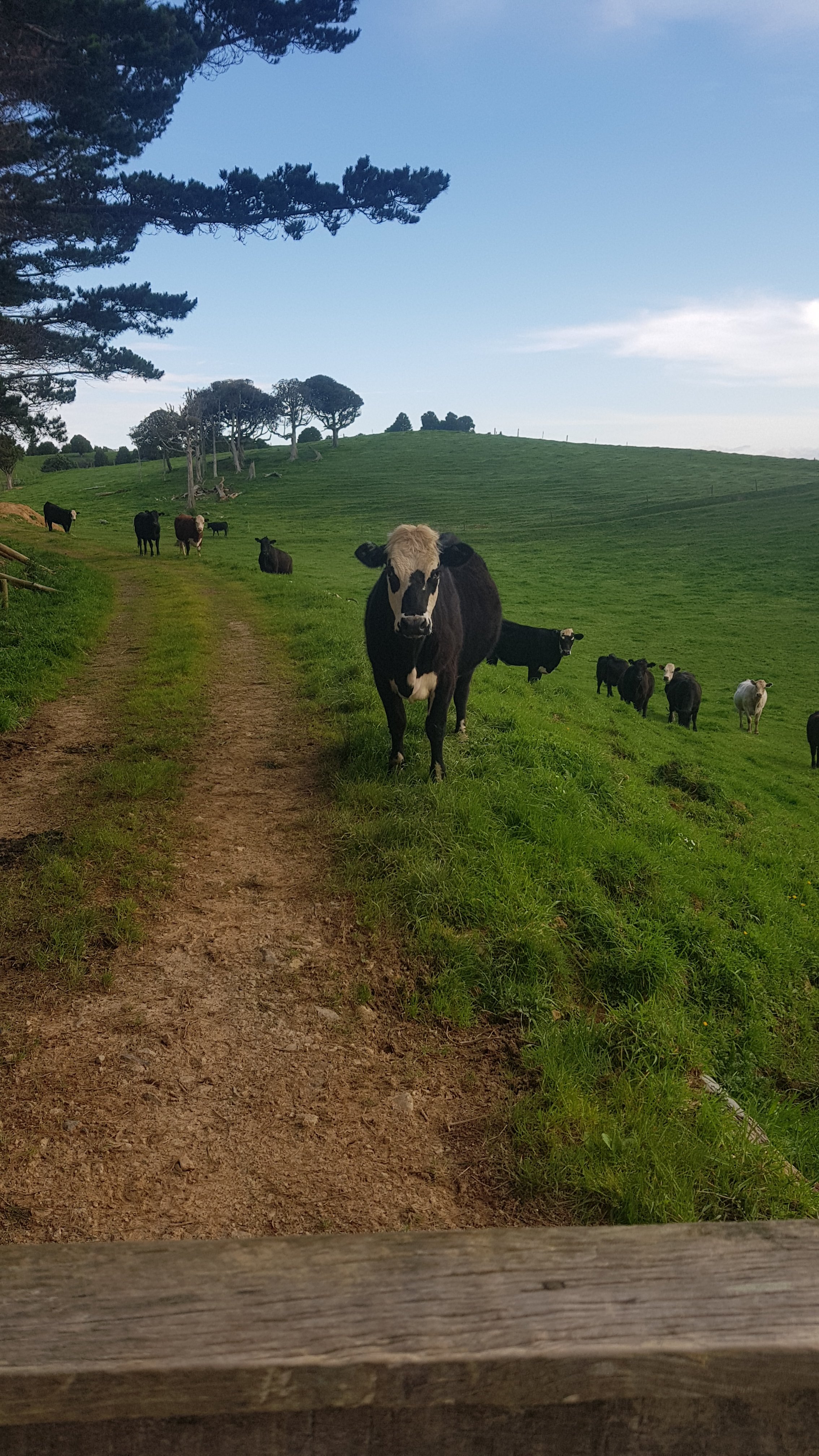
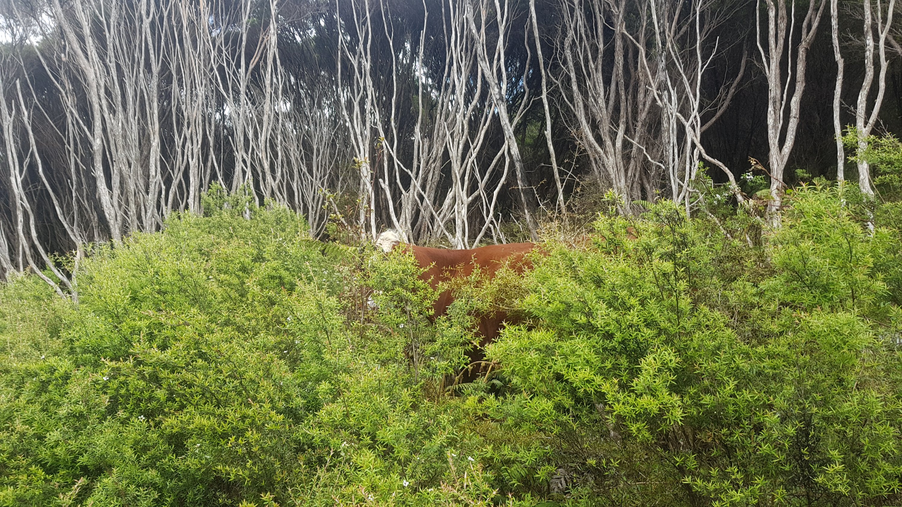
I said hi to some cows…
And a special hi to this cow…
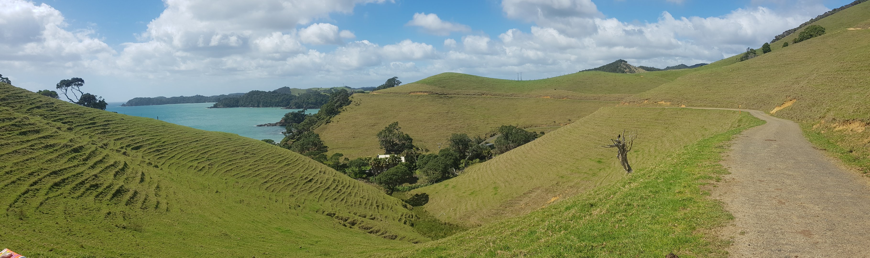
It really was 20km of uninteresting road walk, although I spotted Yan going the other way by Takahue hall. He said that he realised he had a very sore throat when he had already started his ascent into the upcoming Raetea Forest and so was walking back to Kaitaia. I hope he hitched and got a ride.
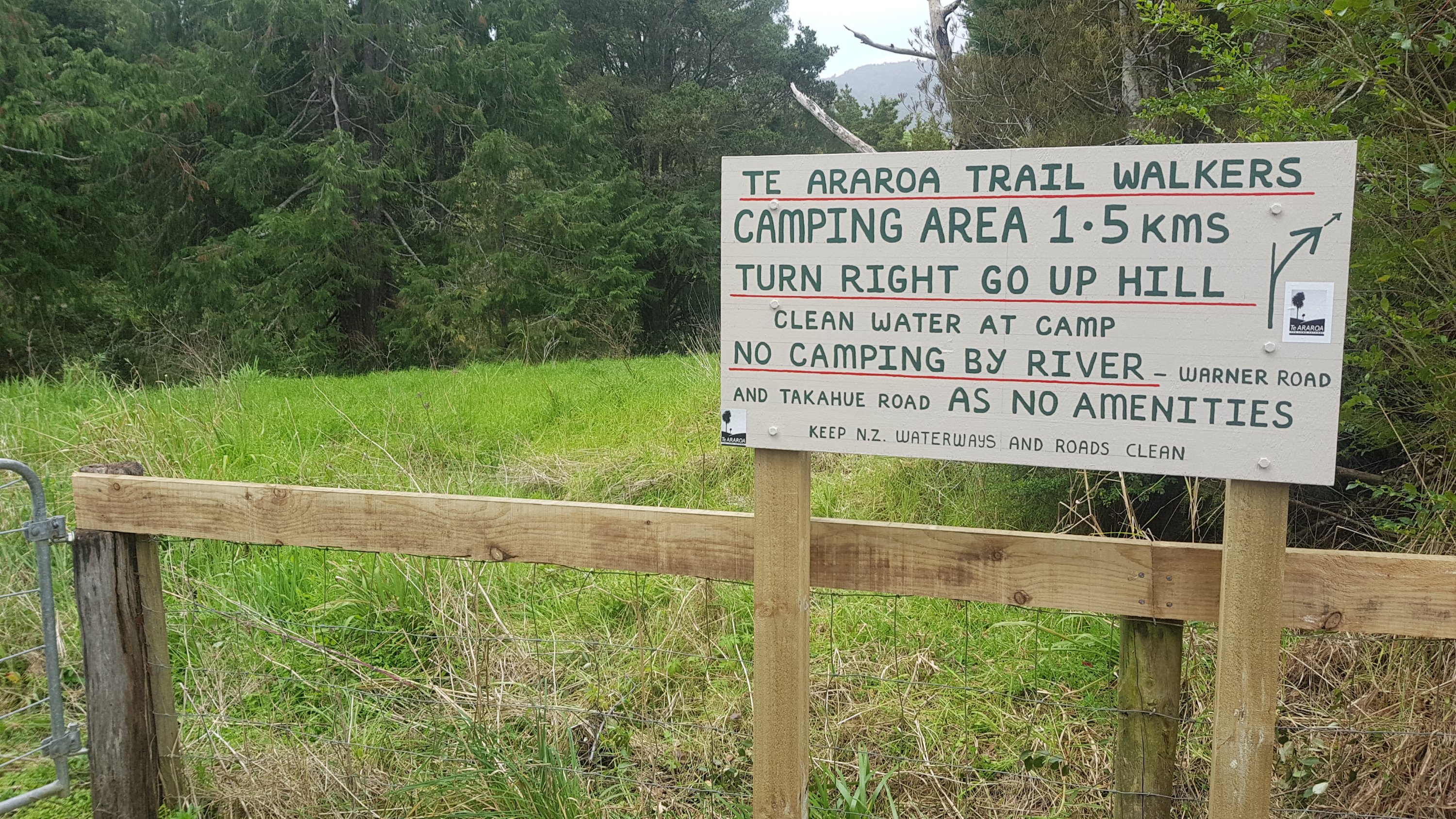
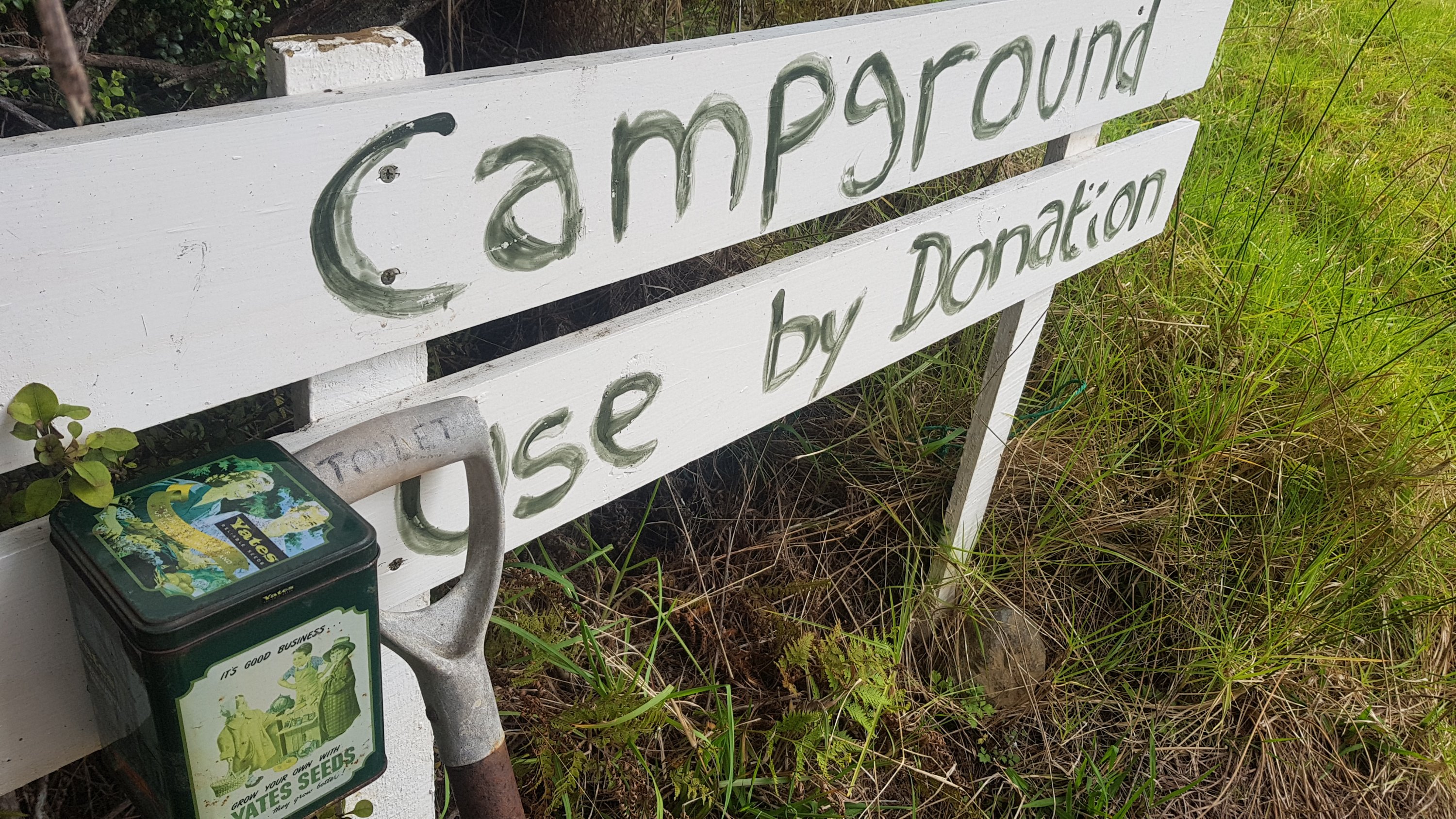
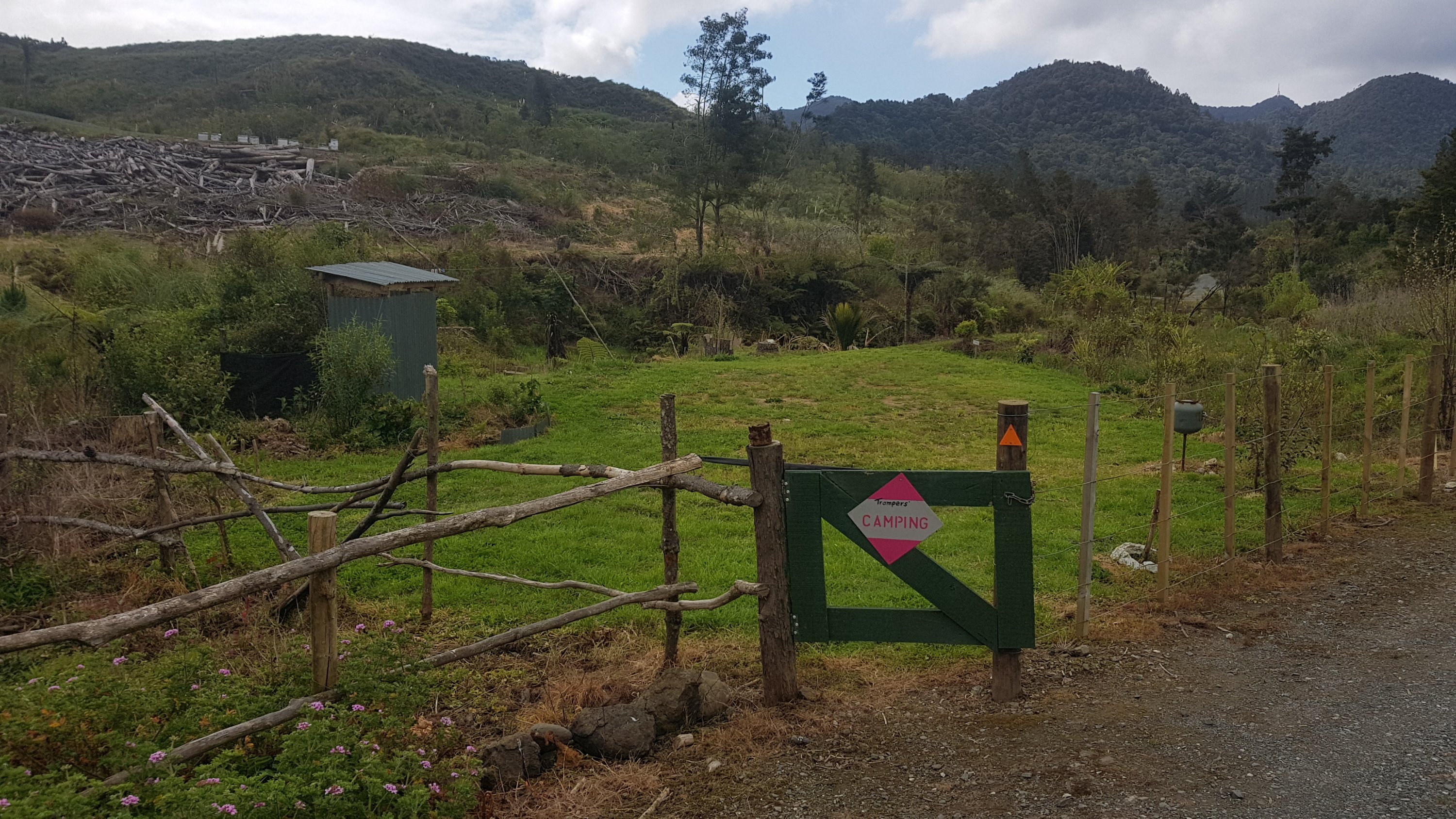
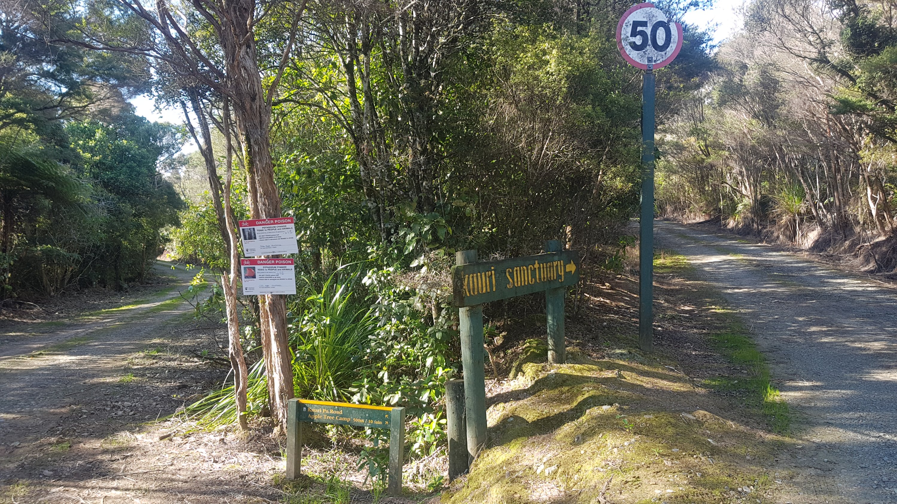
I soon saw this sign which I knew was coming because I had seen it on facebook:
Don’t camp here
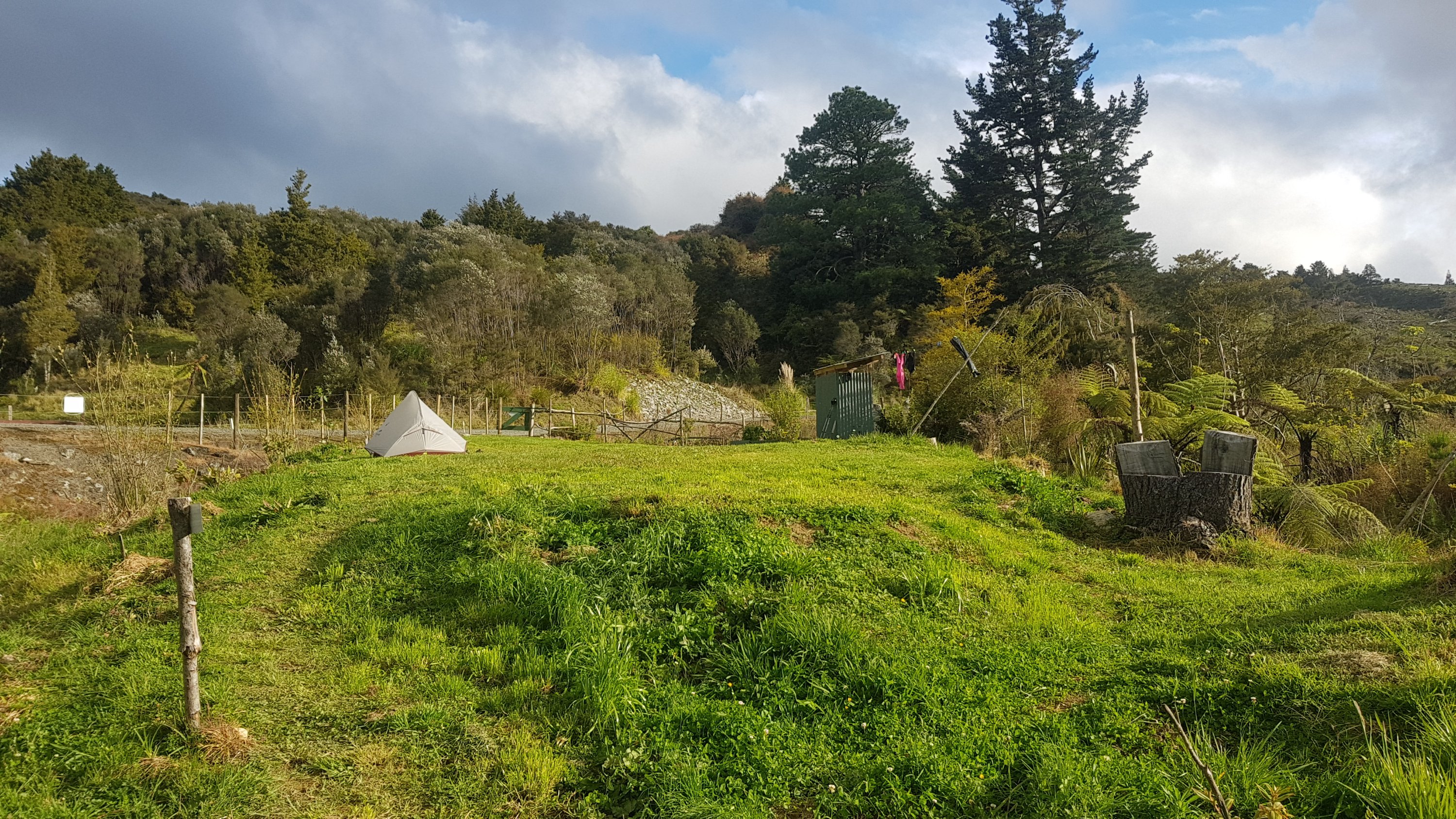
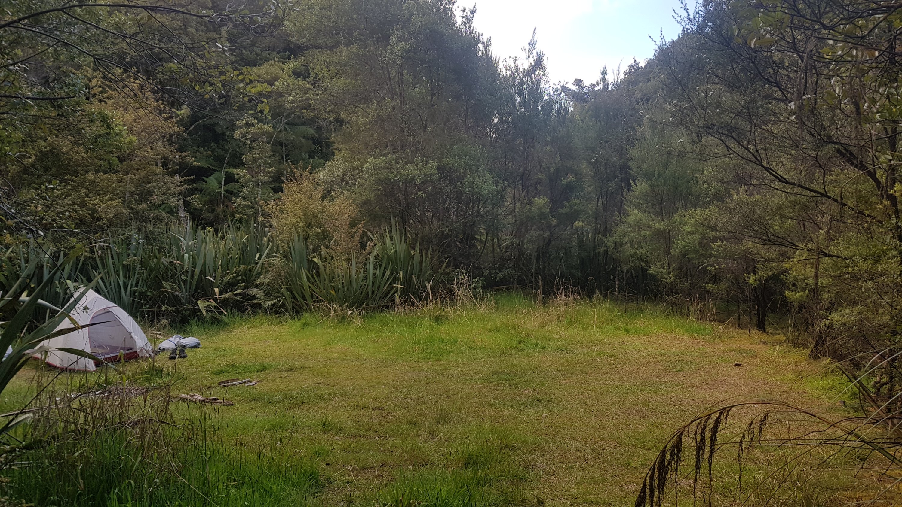
So I went on the 1.5km like it said. Here’s the campground:
The whole campground
I saw a spade and wondered what it was for. It had “toilet” written on it. Nice.
There’s your toilet right there.
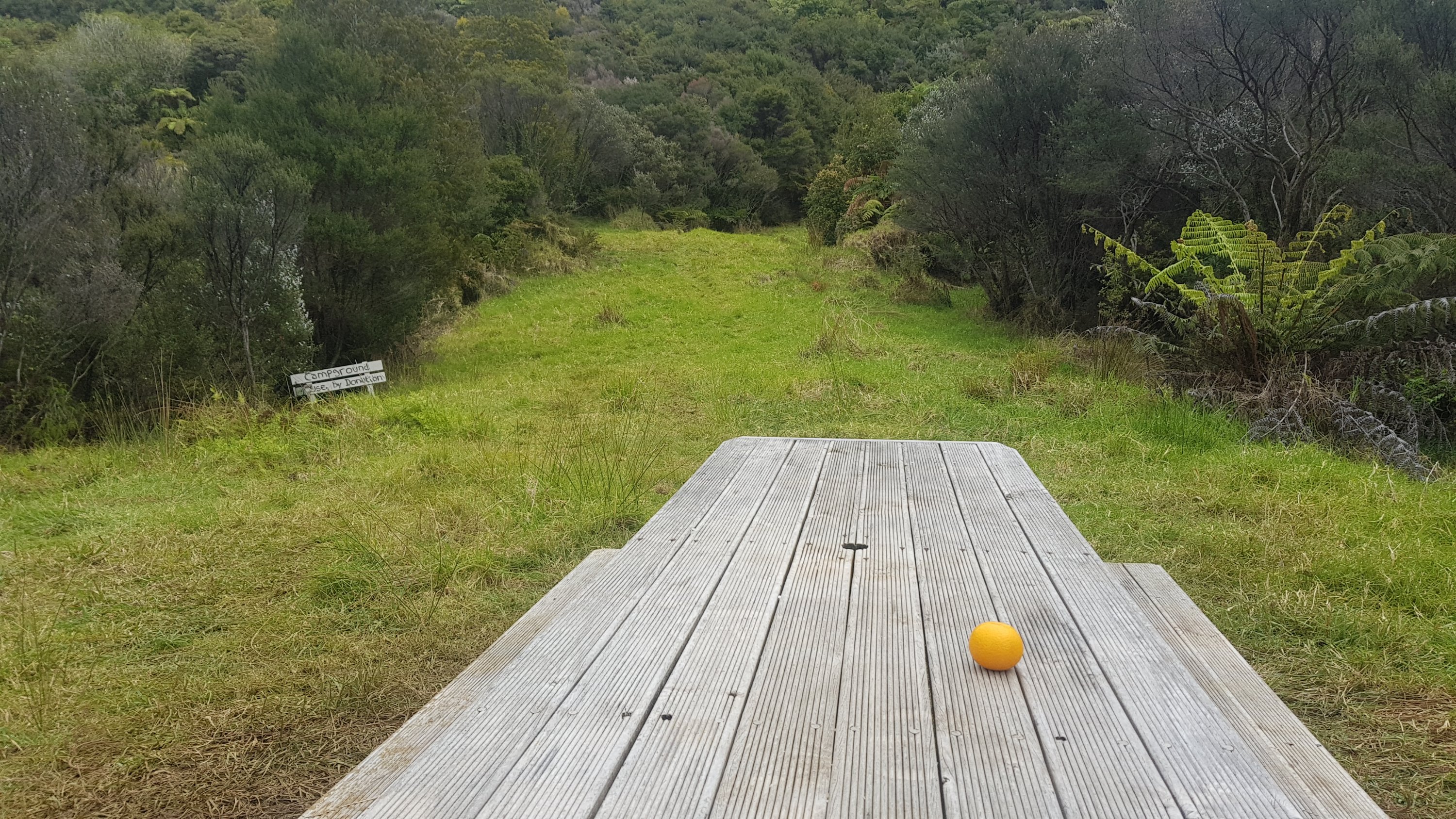
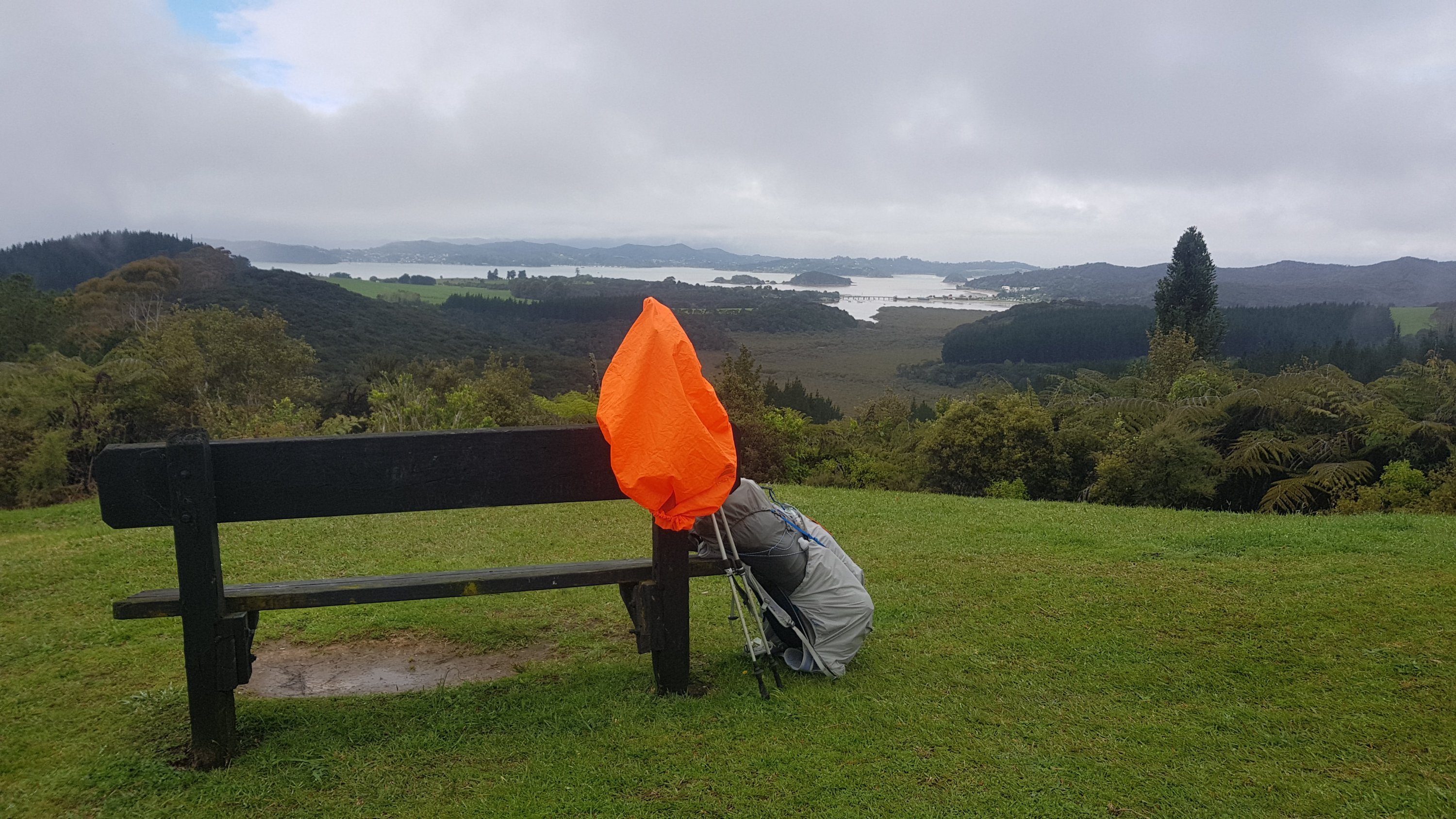
At least it had a nice table with a nice view. However, the rain came and went while I was eating my lunch here every few minutes, which was so annoying after it had been sunny all morning.
I was originally planning to camp here but since i already got wet and since it was only 1.30pm I decided that I’d just stay for a break and continue on. I paid only a $2.50 donation since I only used their table and a little of their water (they had set up a tap).
I knew there was another campground at the summit. I knew that the summit was 6 km away but it was also up 744m in altitude. I also knew of the mud and the steepness. I hoped 4 hours would be enough time. But i had a light and full charge on my battery pack so no worries.
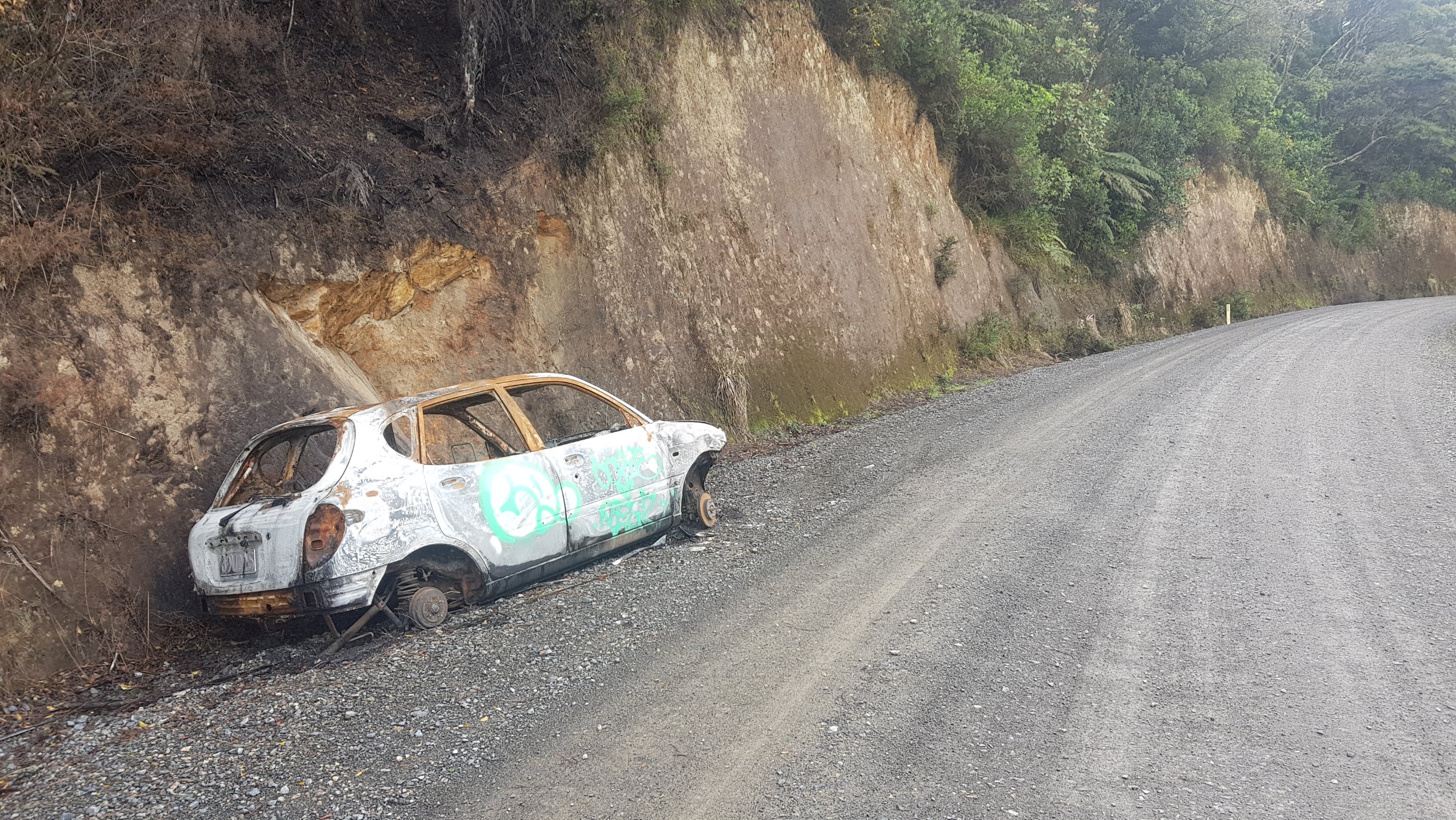
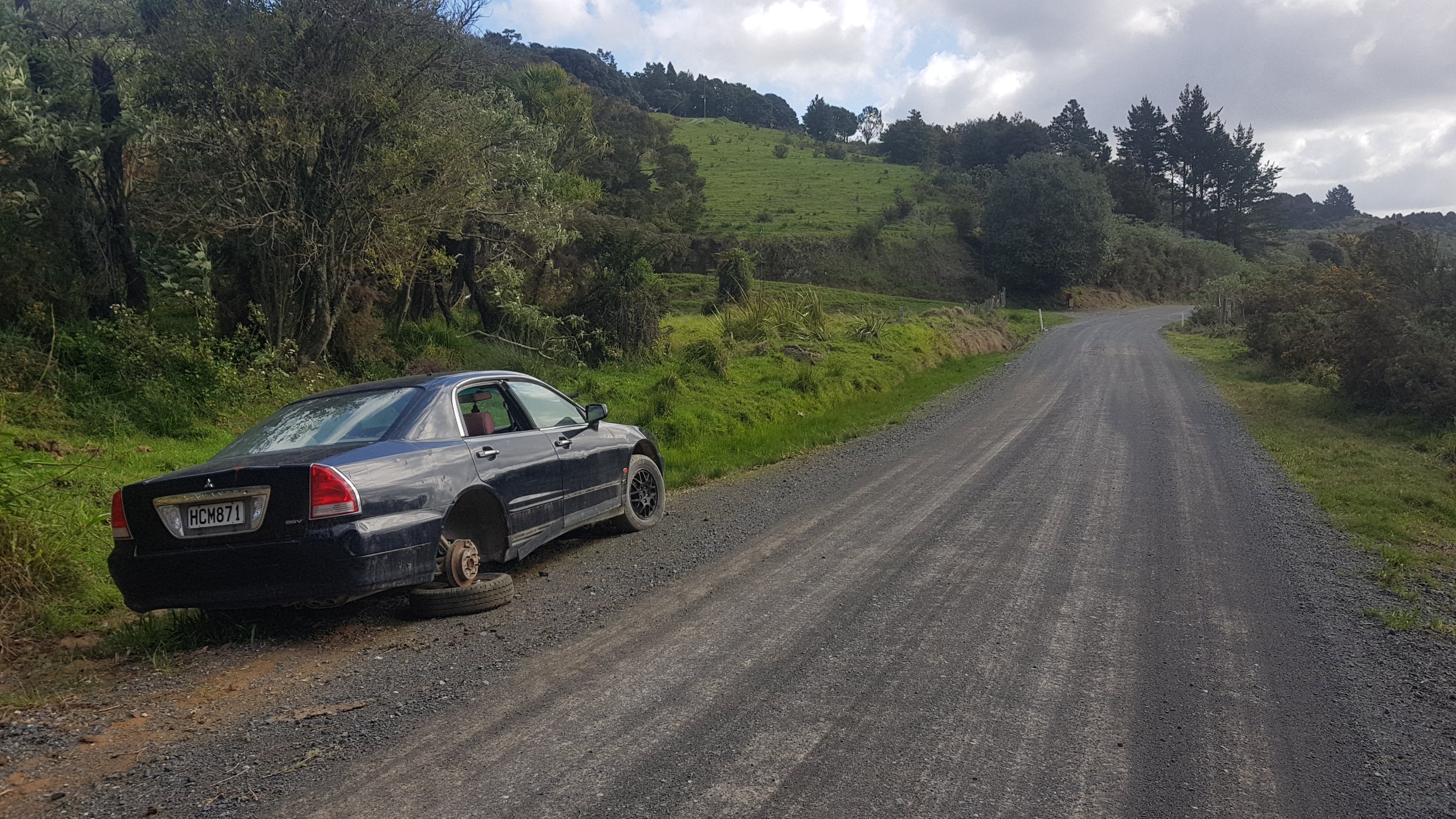
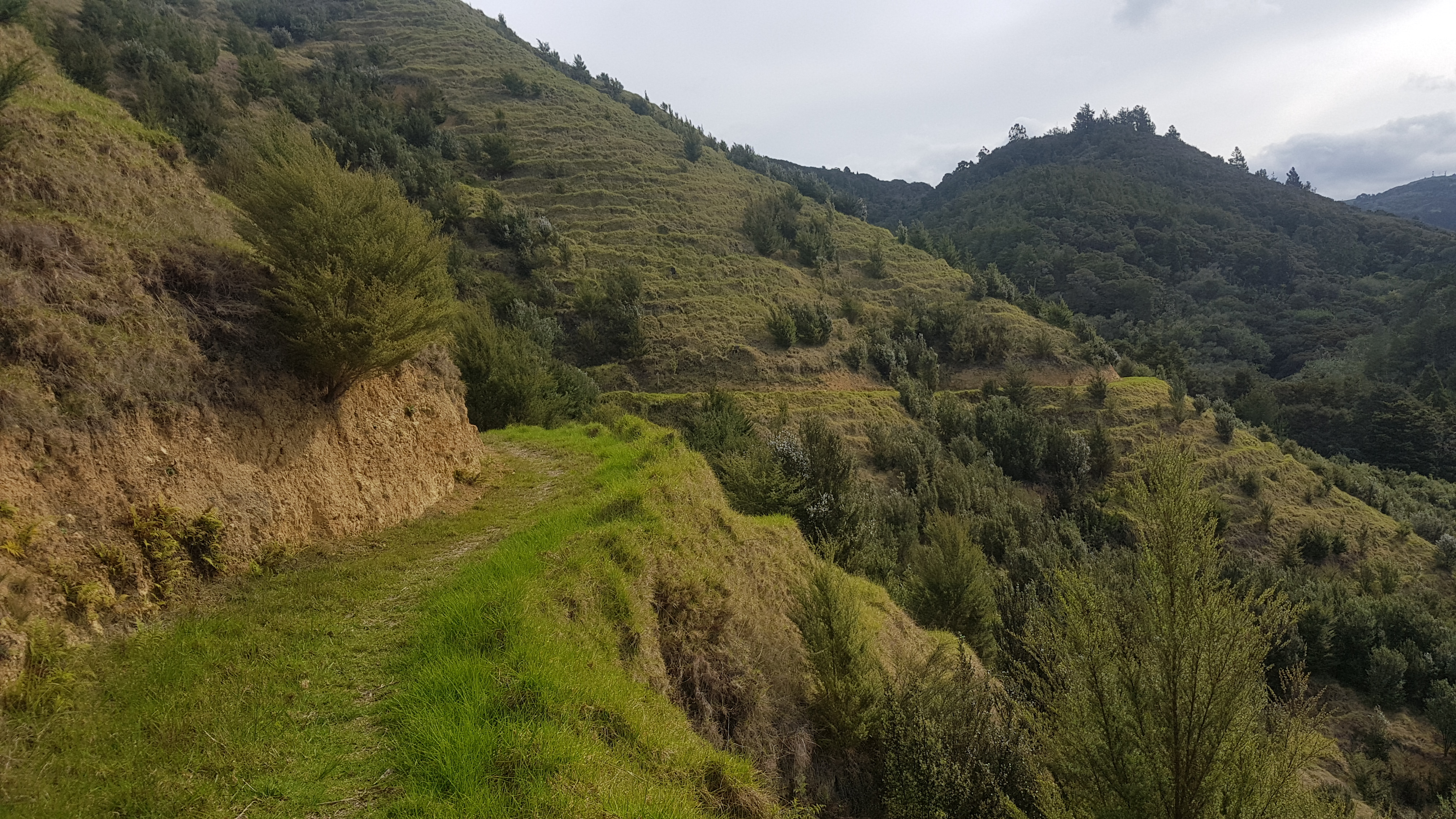
The path started out easy enough. I’m fairly sure it doubled as a road.
This road looks like it claimed a car
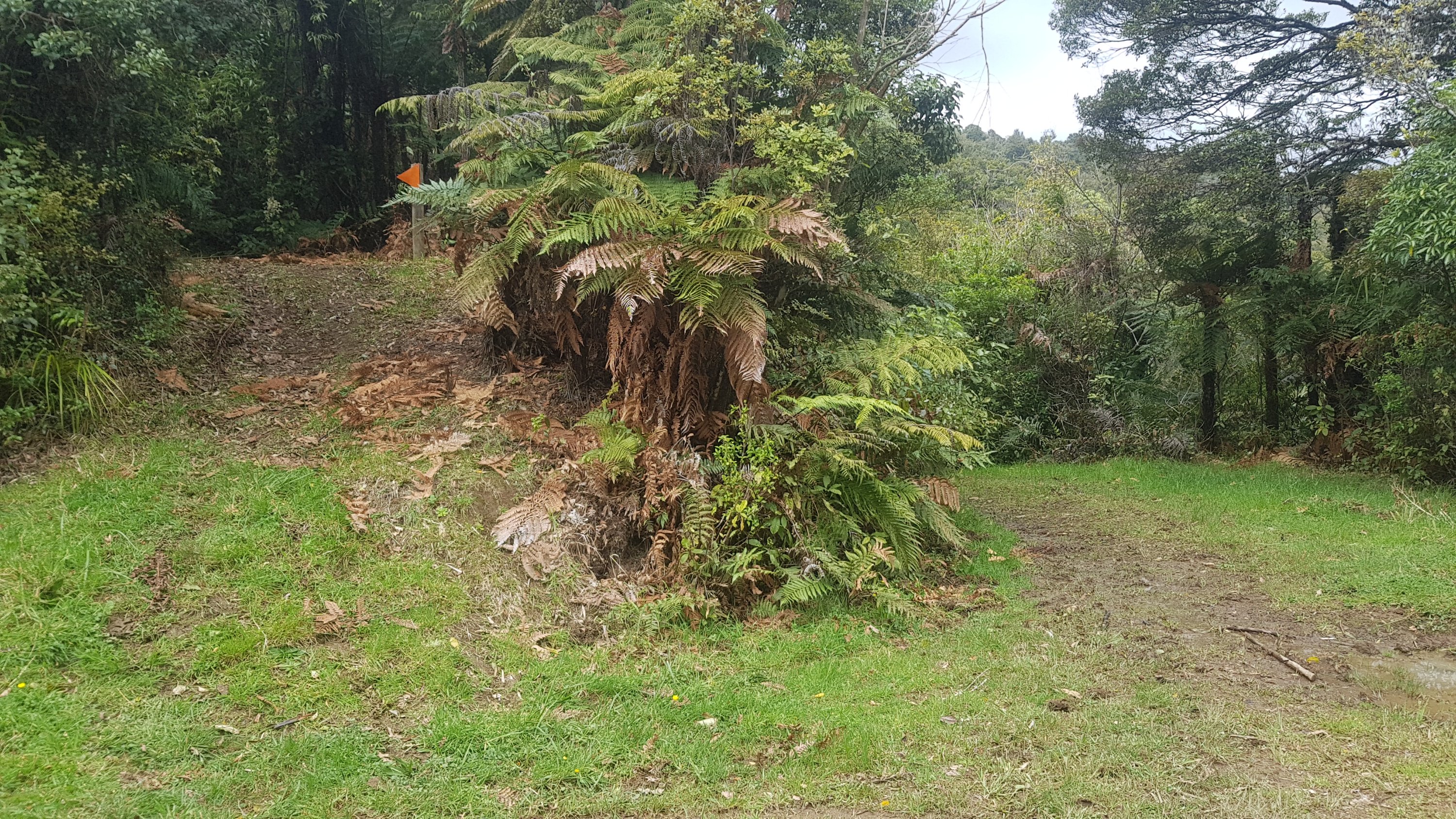
There was an eco-village up there, whatever that is!
Eco-village
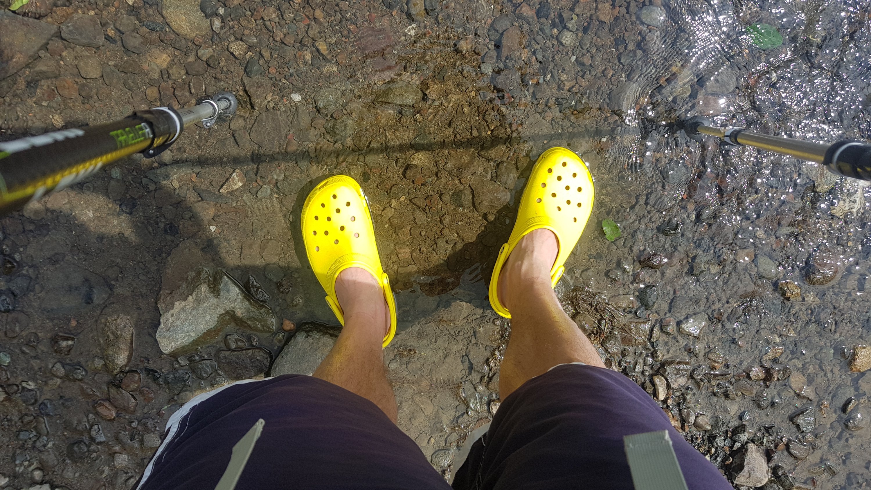
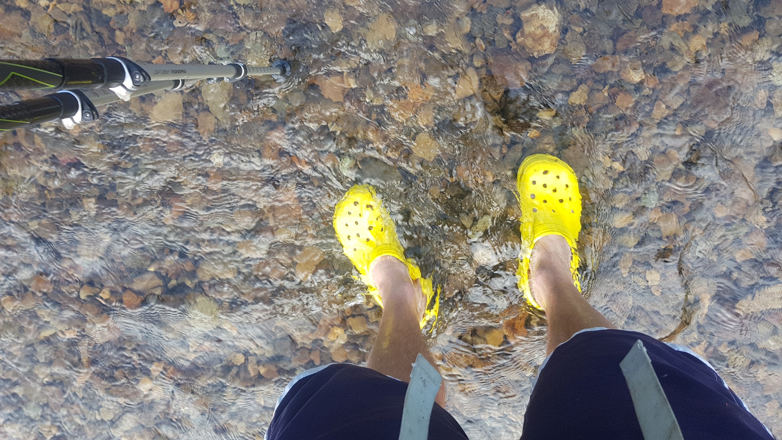
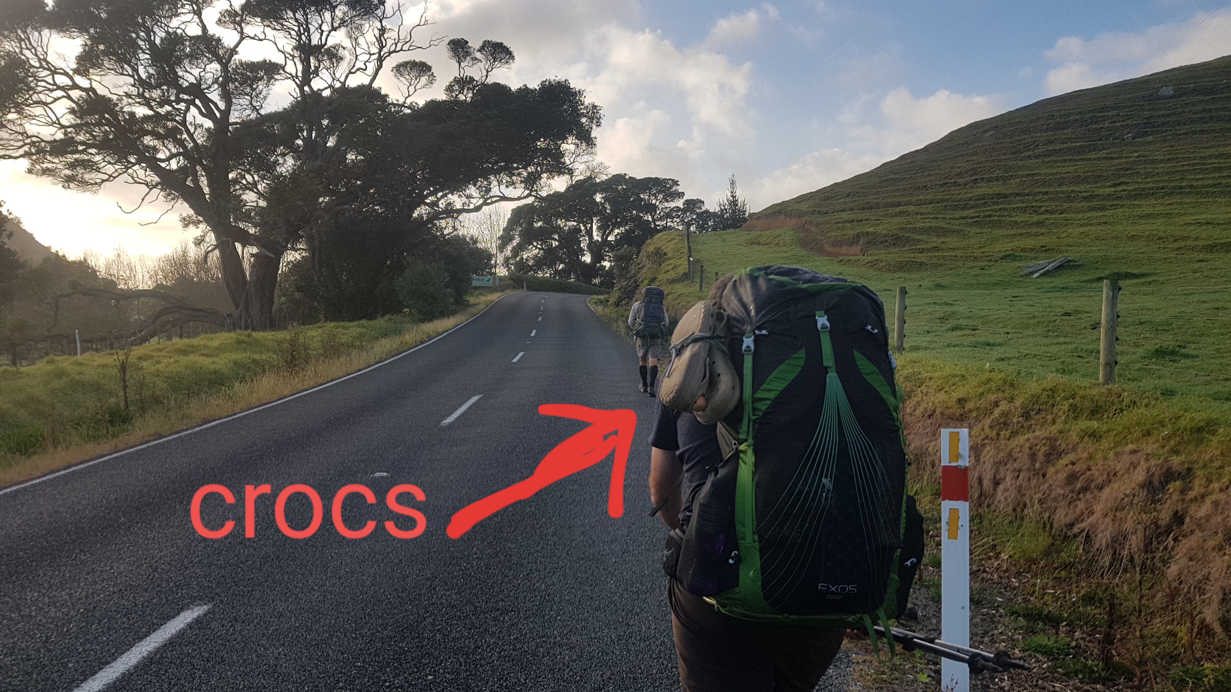
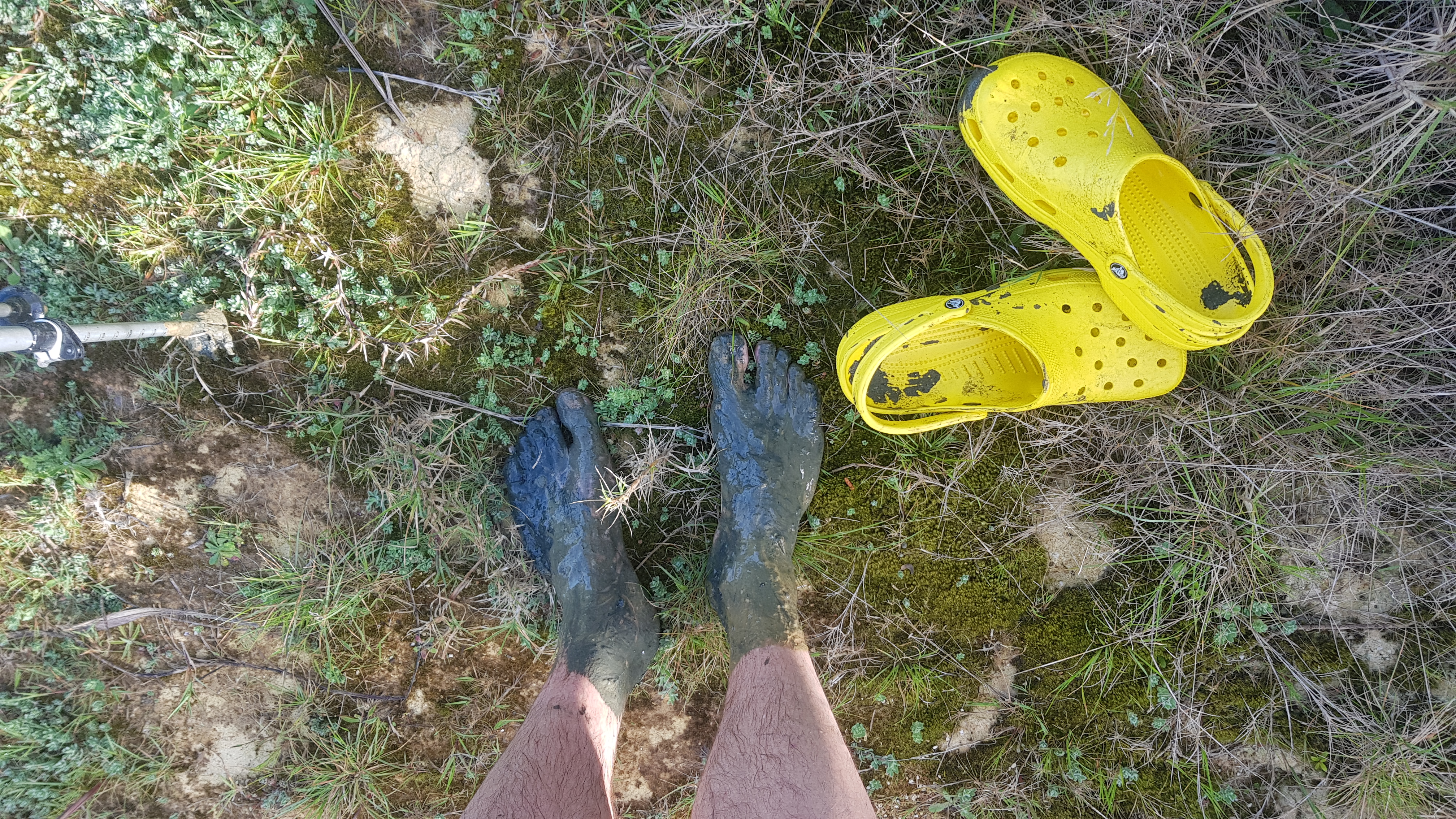
There was a stream at one point. I’m happy I was in my crocs. No socks to get wet! I had been in my crocs all the way from Kaitaia because my feet had been hurting in the morning. I had walked 20km in them and they were awesome. In the last few days there were a few times where I wished I had brought jandals instead, but today I know the crocs were the right decision.
Go crocs
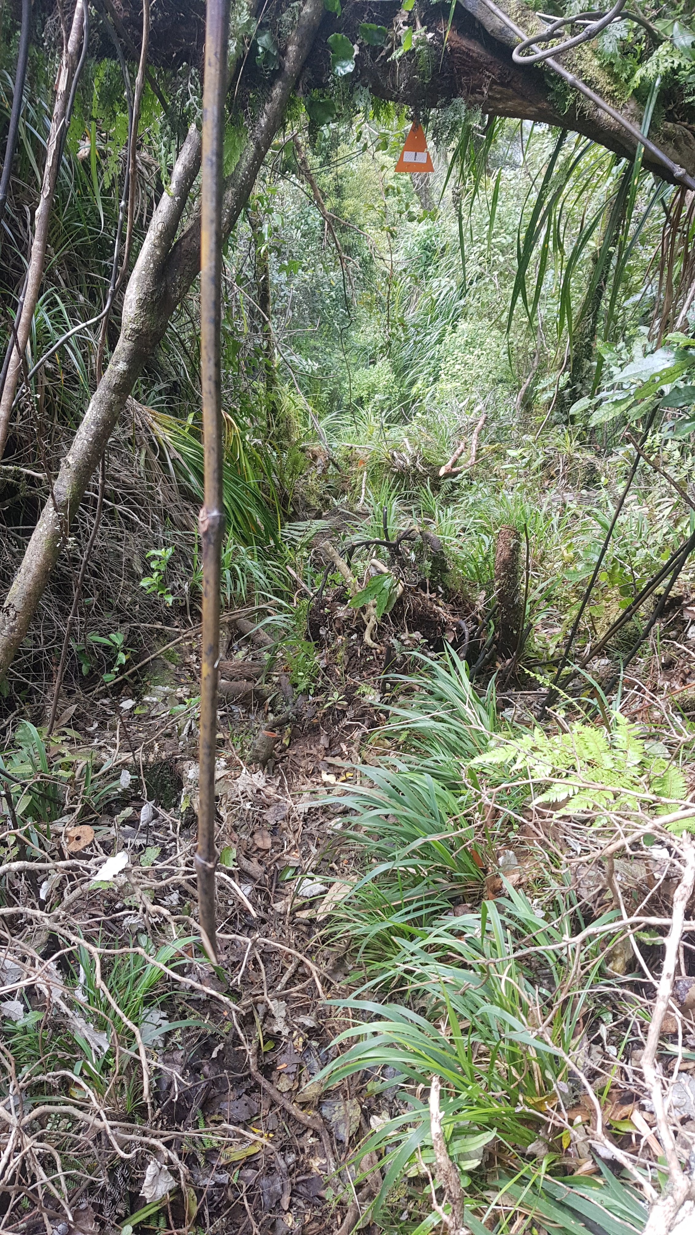
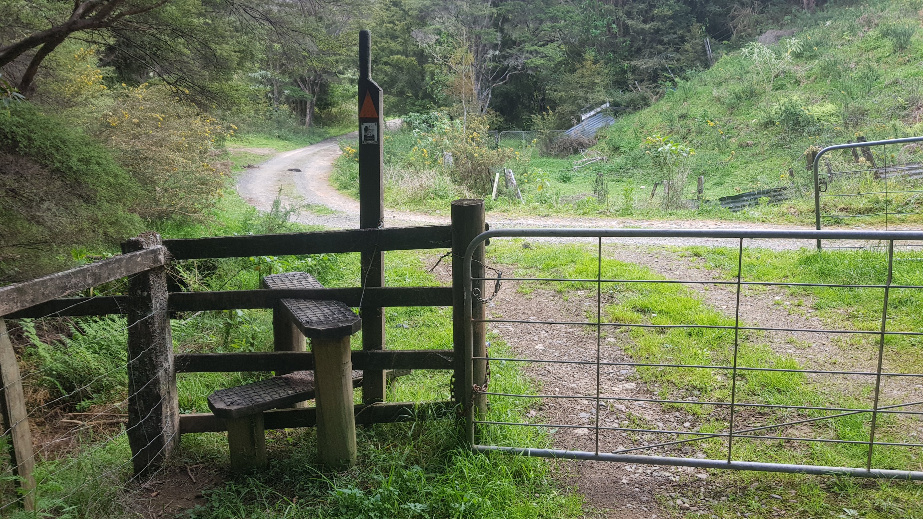
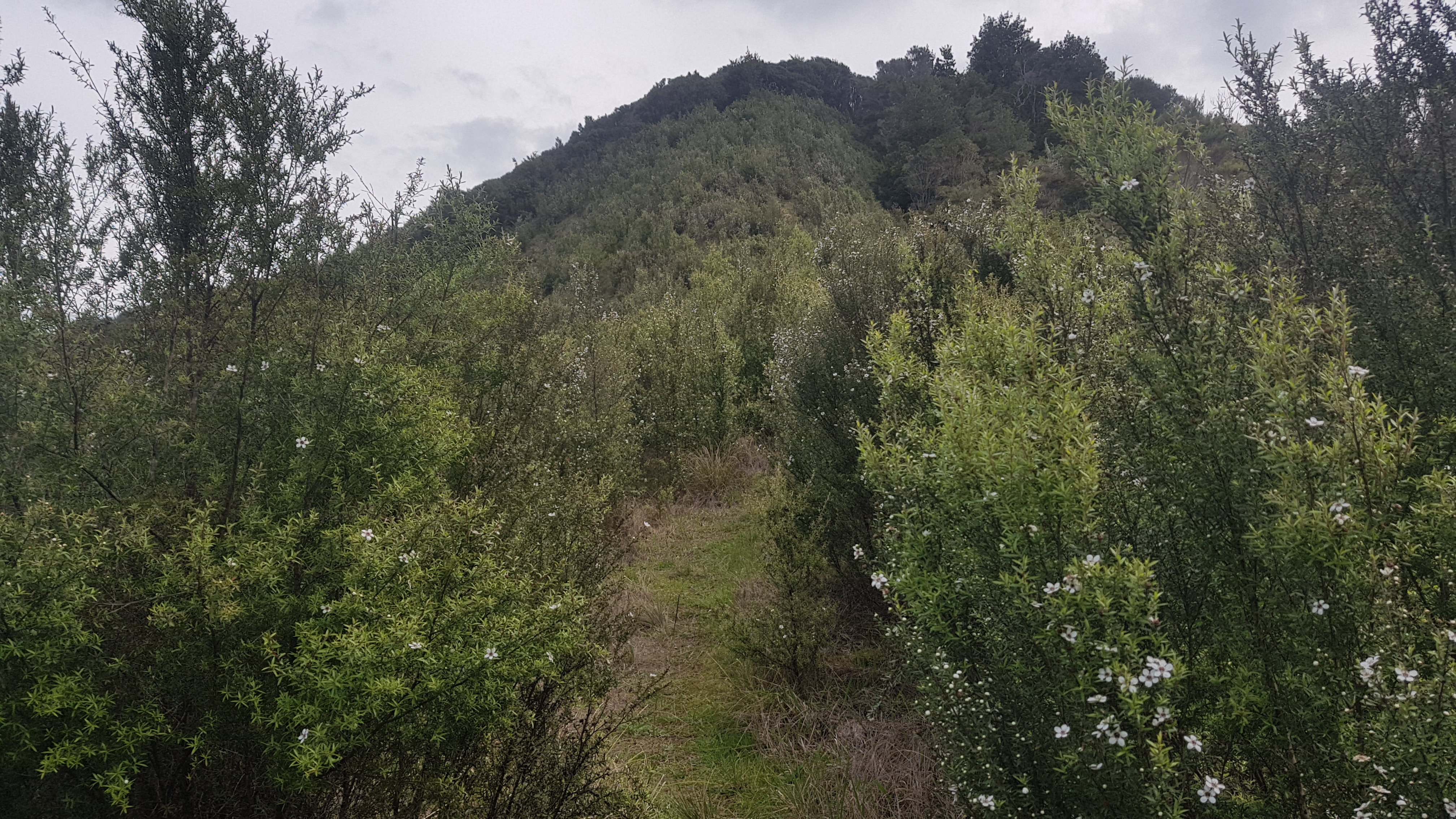
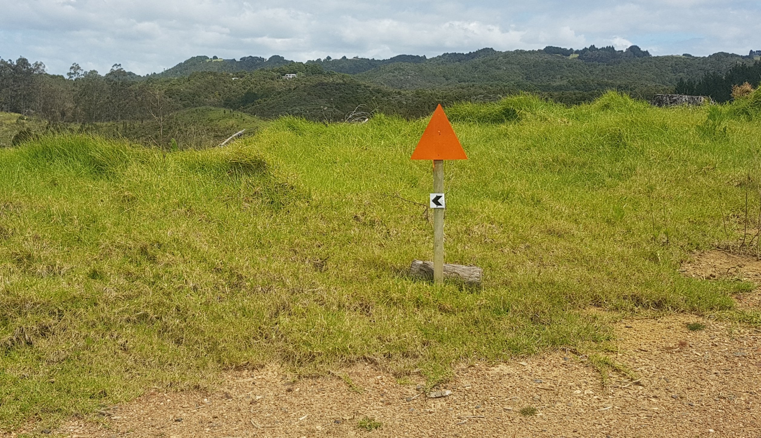
Soon there was a big orange triangle at a junction, so i went that way.
Over there
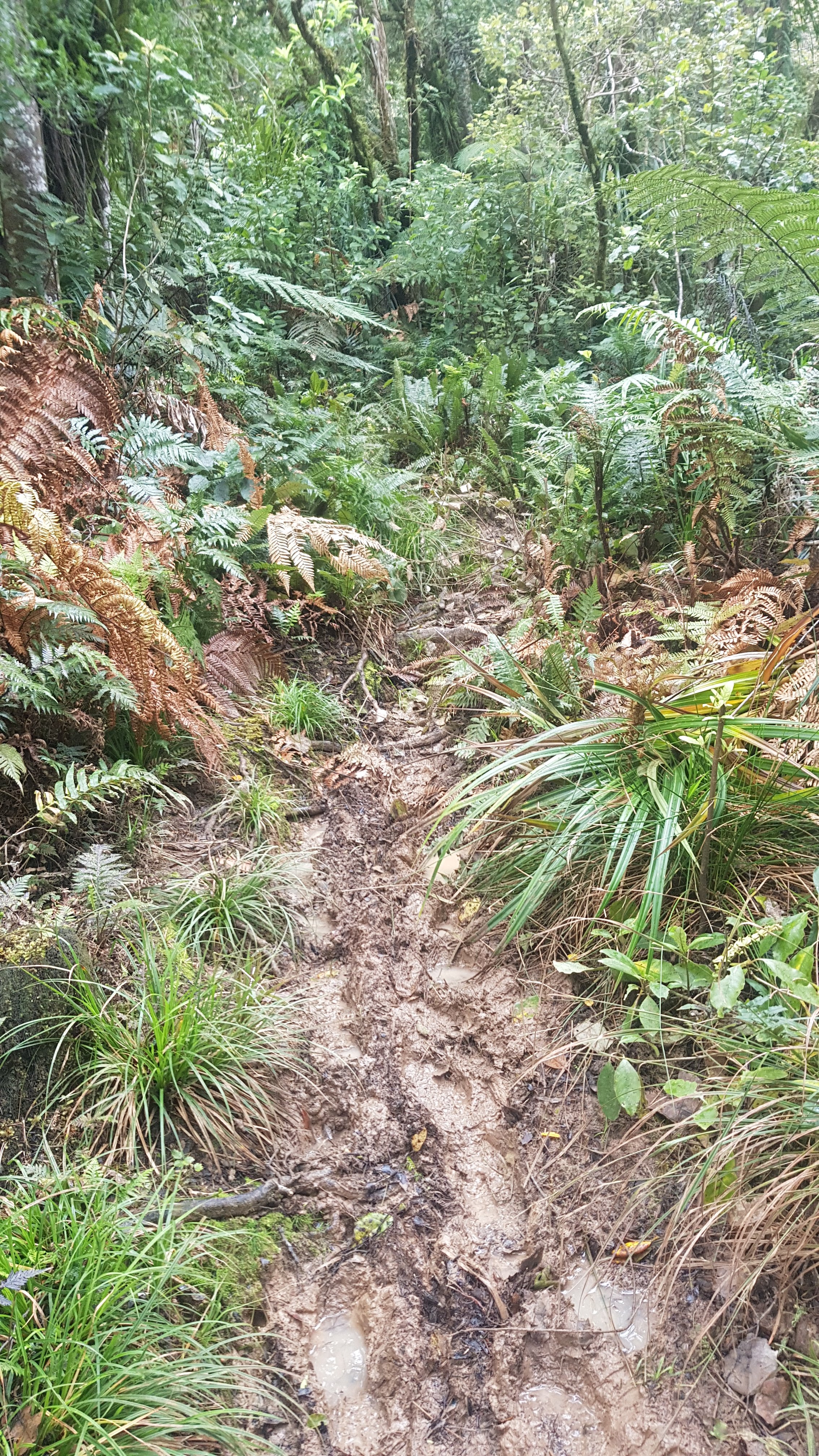
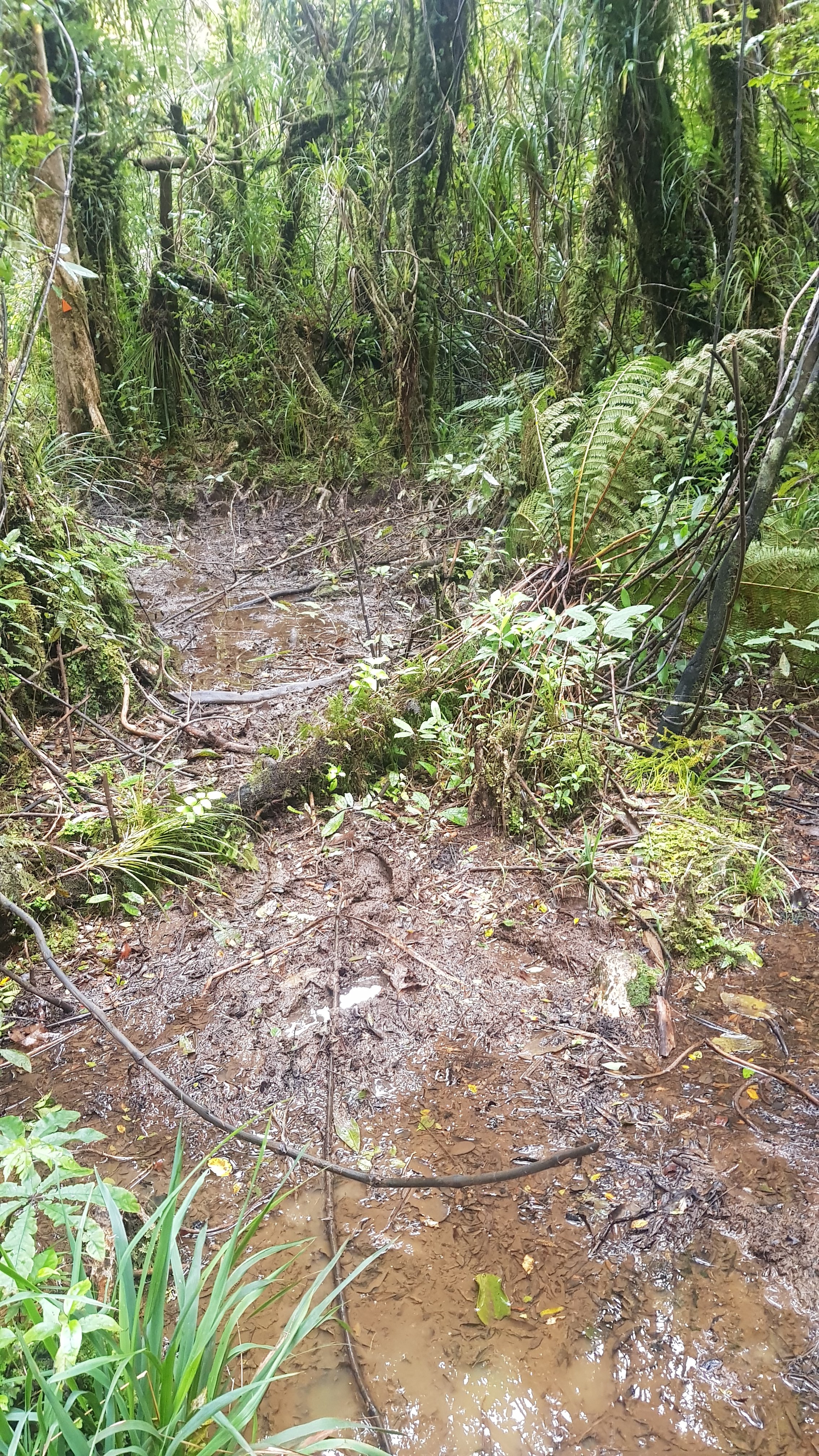
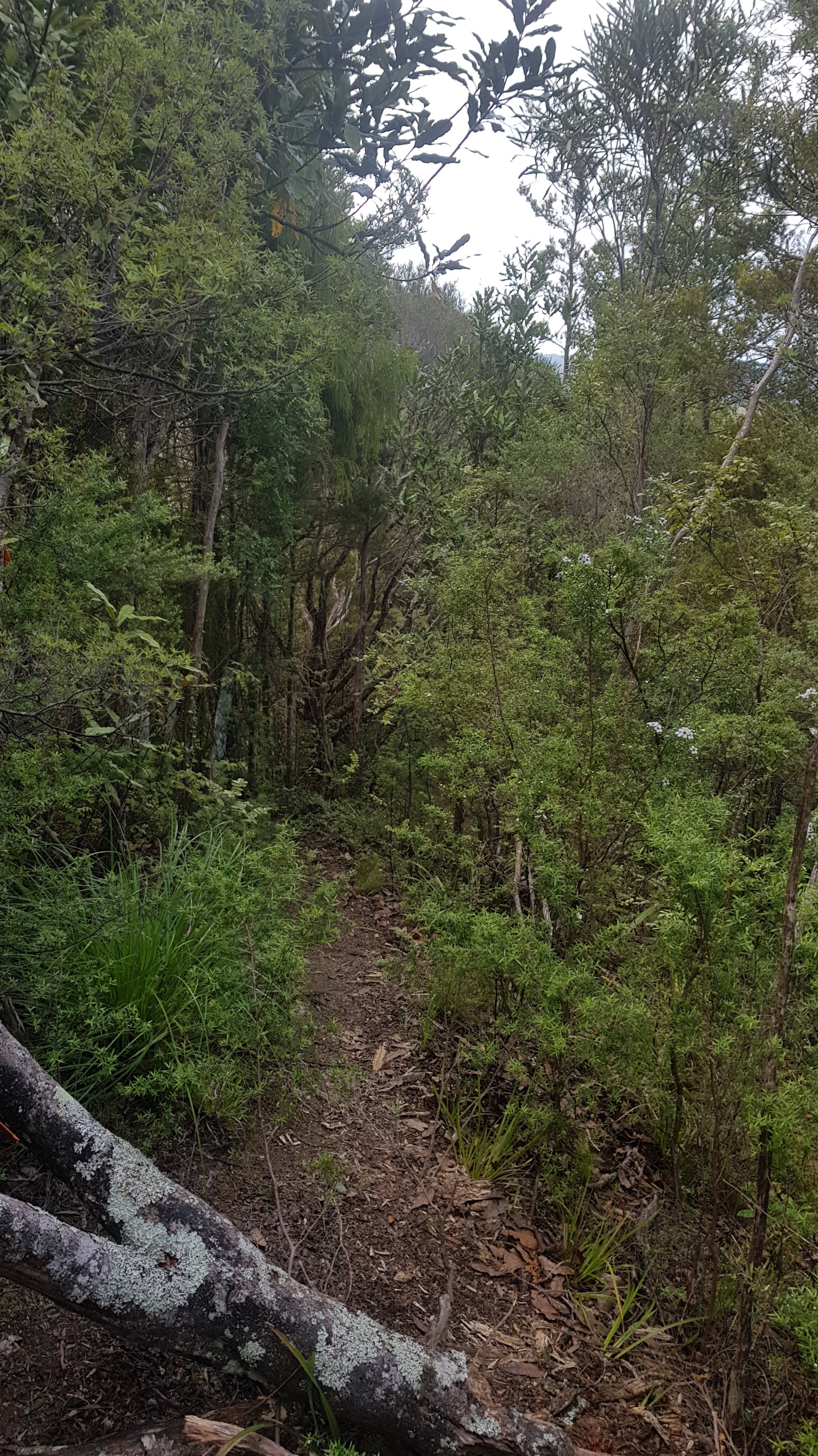
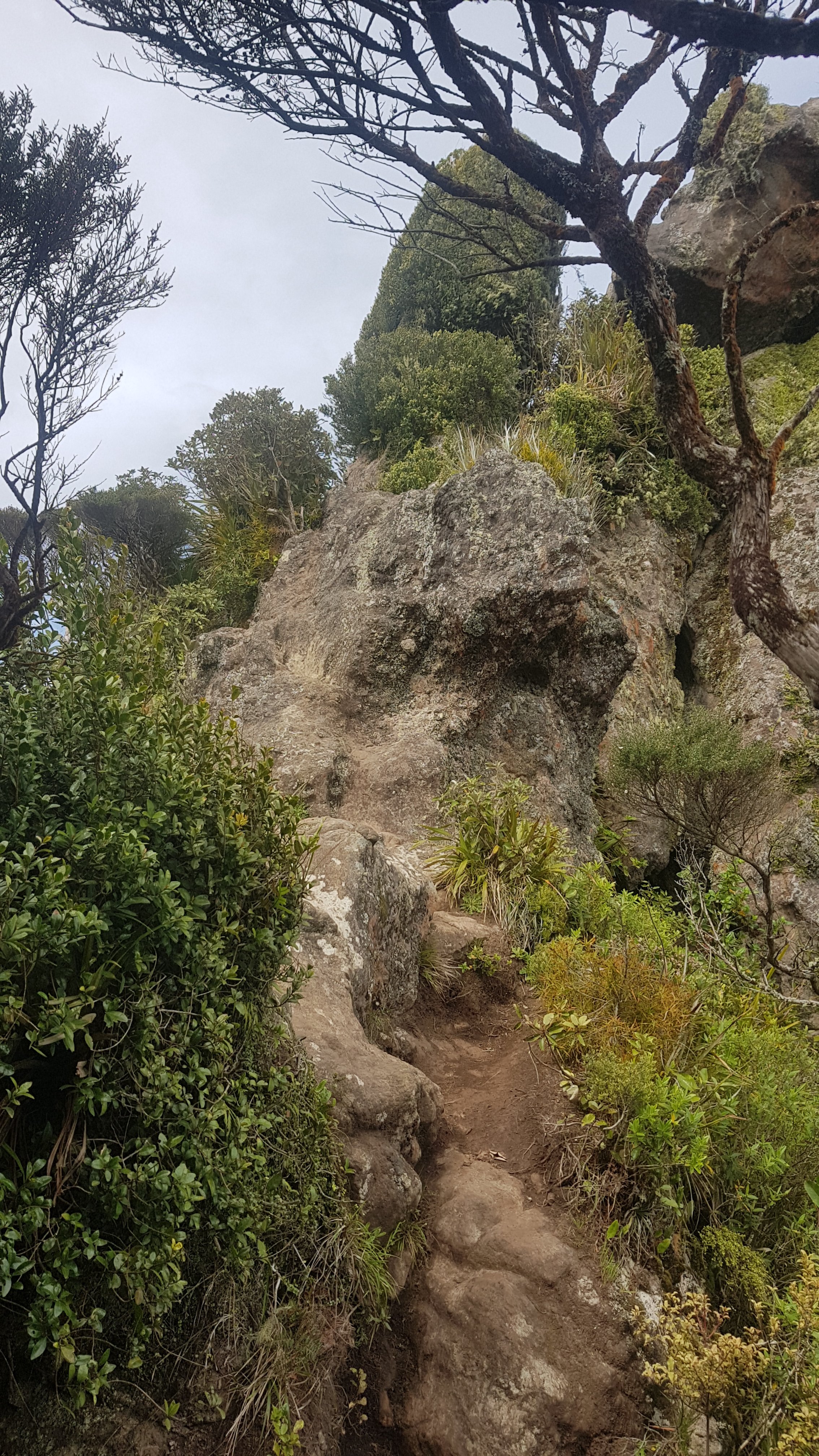
Well that is when the fun started. Did I say fun? I meant mud. Lots of mud! I had to take the crocs off here and switch to my trail runners.
Mud. For eternity.
I had heard the mud was knee deep in places, but I didn’t encounter that today. I felt lucky.
It was a very hard slog up the hill though. There were little orange triangles relatively frequently but near summit they became very hard to find and path was not clear.
I started to get a bit delirious. I went around a corner and thought this was someone waiting for me.
Hello?
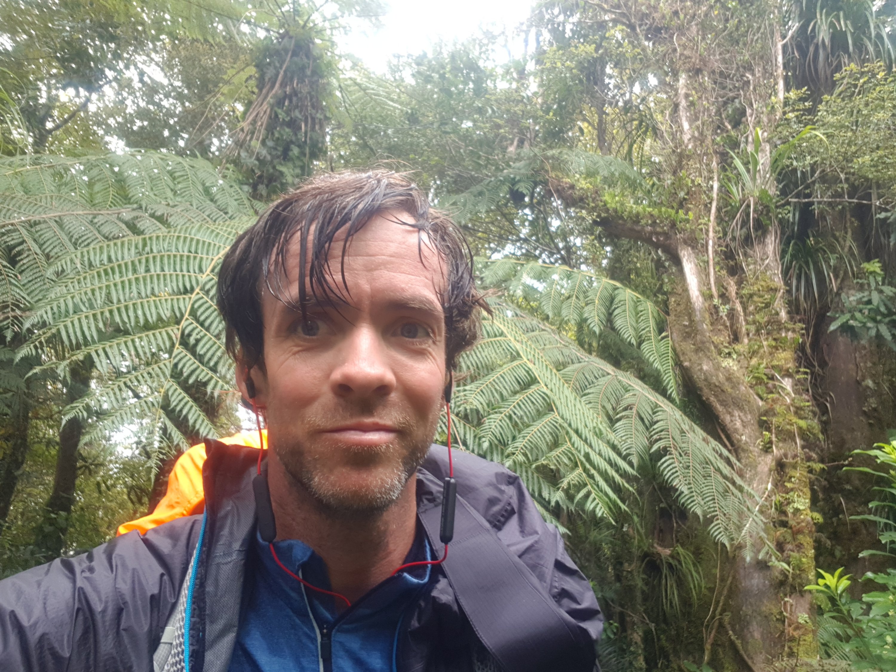
Here is me trying to put on a happy face.
I’m loving it (not really)
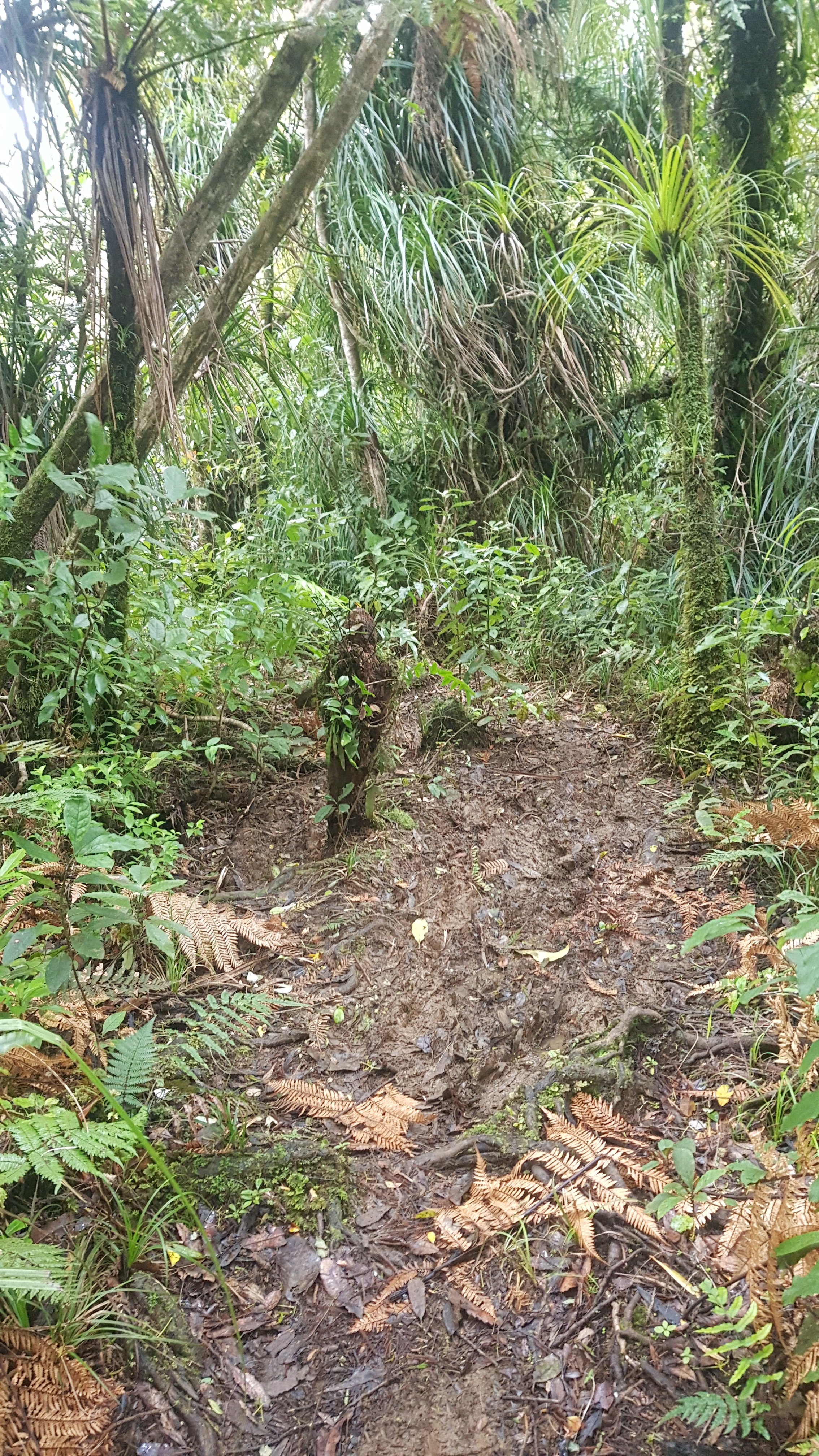
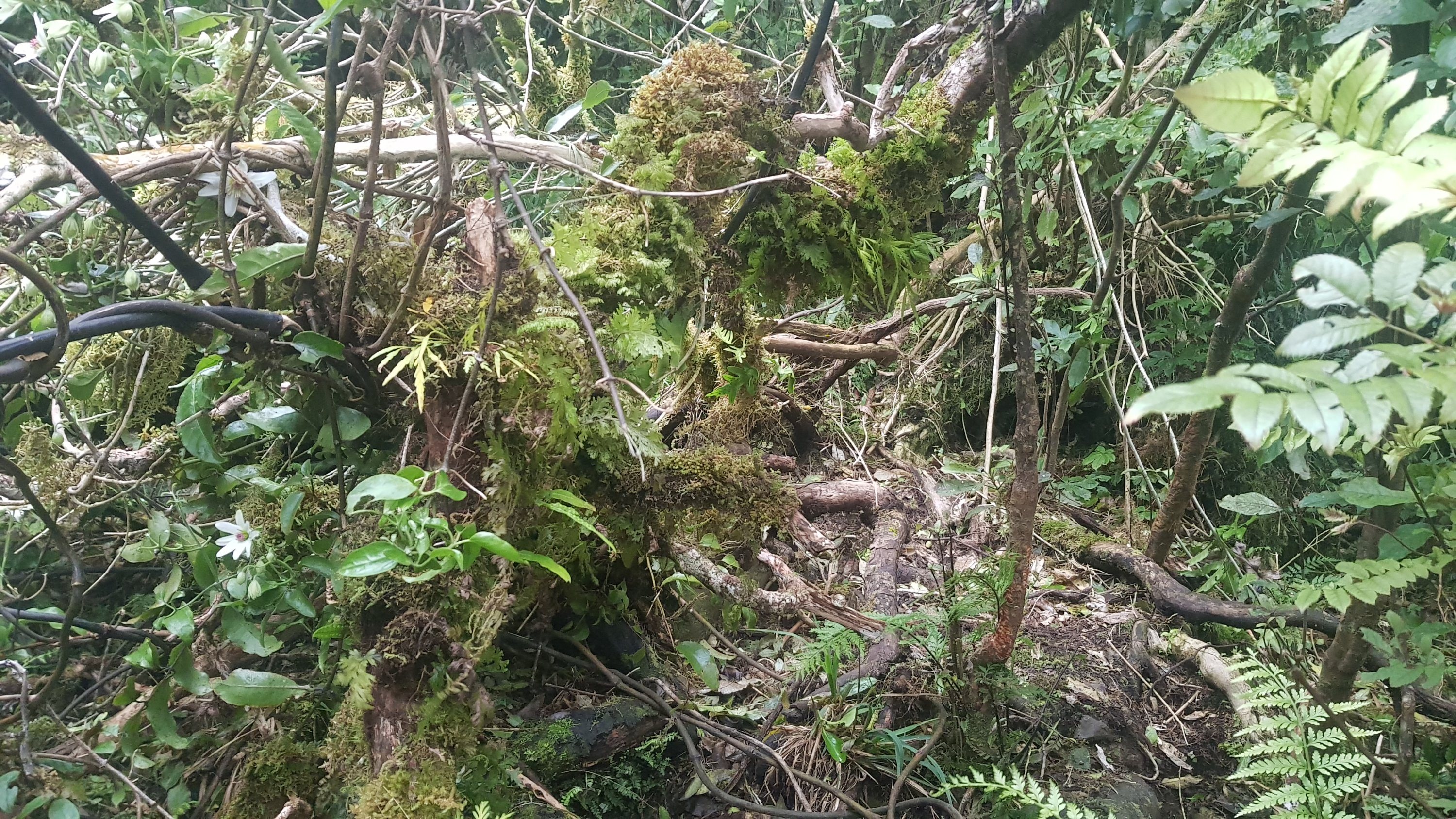
This was the track at one point. Not very well maintained. And still super muddy.
Yes, this is the track
By 6.30pm It was getting quite late and I considered setting up camp in the middle of the forest. You could see a few little spots along the way where people had done that – there were a few flat patches just big enough for a tent. But soon I came to an intersection where a sign had been knocked down so I didn’t know what it said, but luckily the map showed that the “Raetea Peak Camp Site” was right there. Good thing too as it was almost 7pm and slowly getting dark.
Truthfully I may have overdone it. 9 hrs total of walking with such an ascent. For my Waikato friends that is like walking from Te Awamutu to Hamilton and then climbing Mt. Pirongia after a storm. The rest day helped yesterday though.
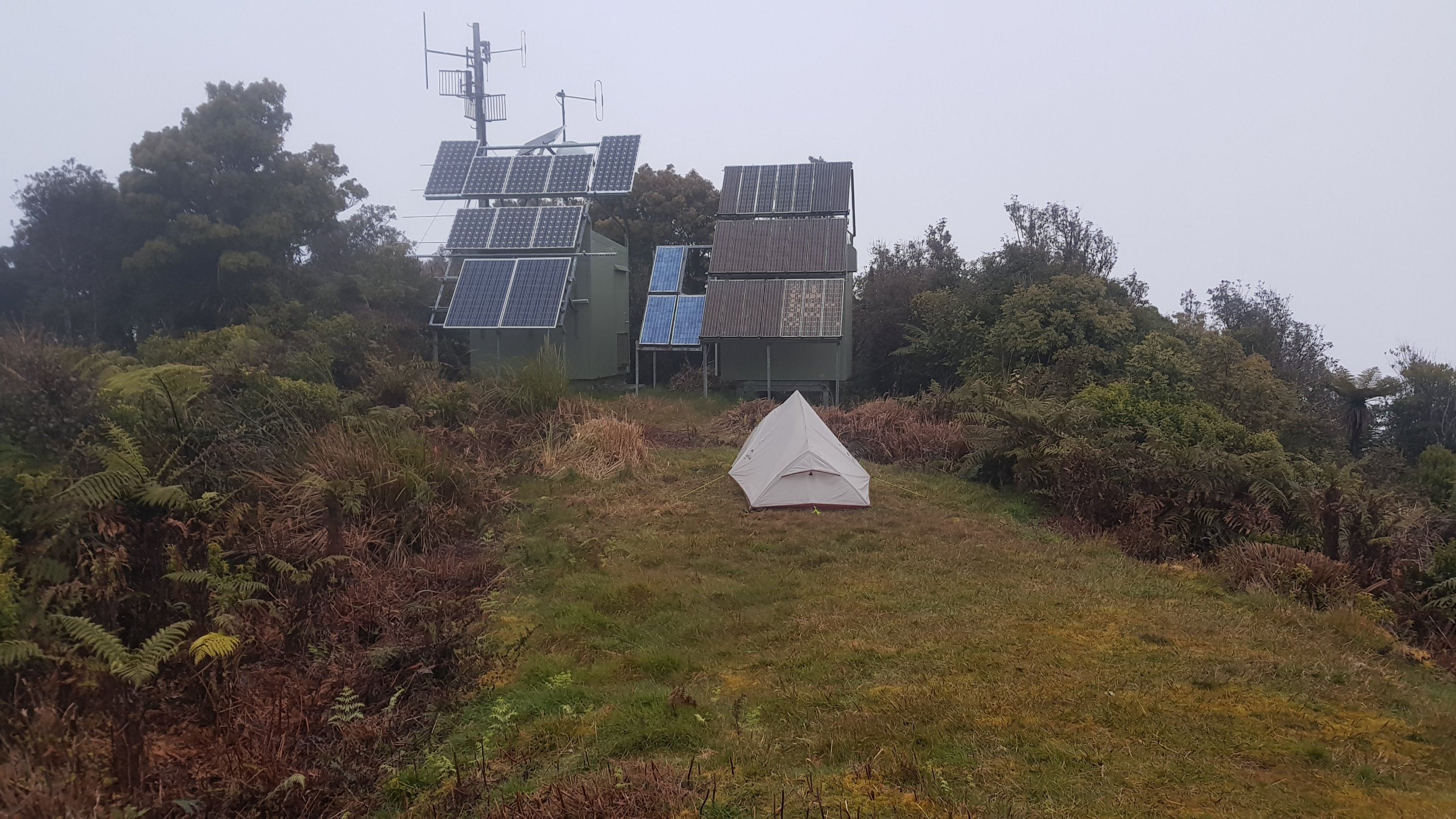
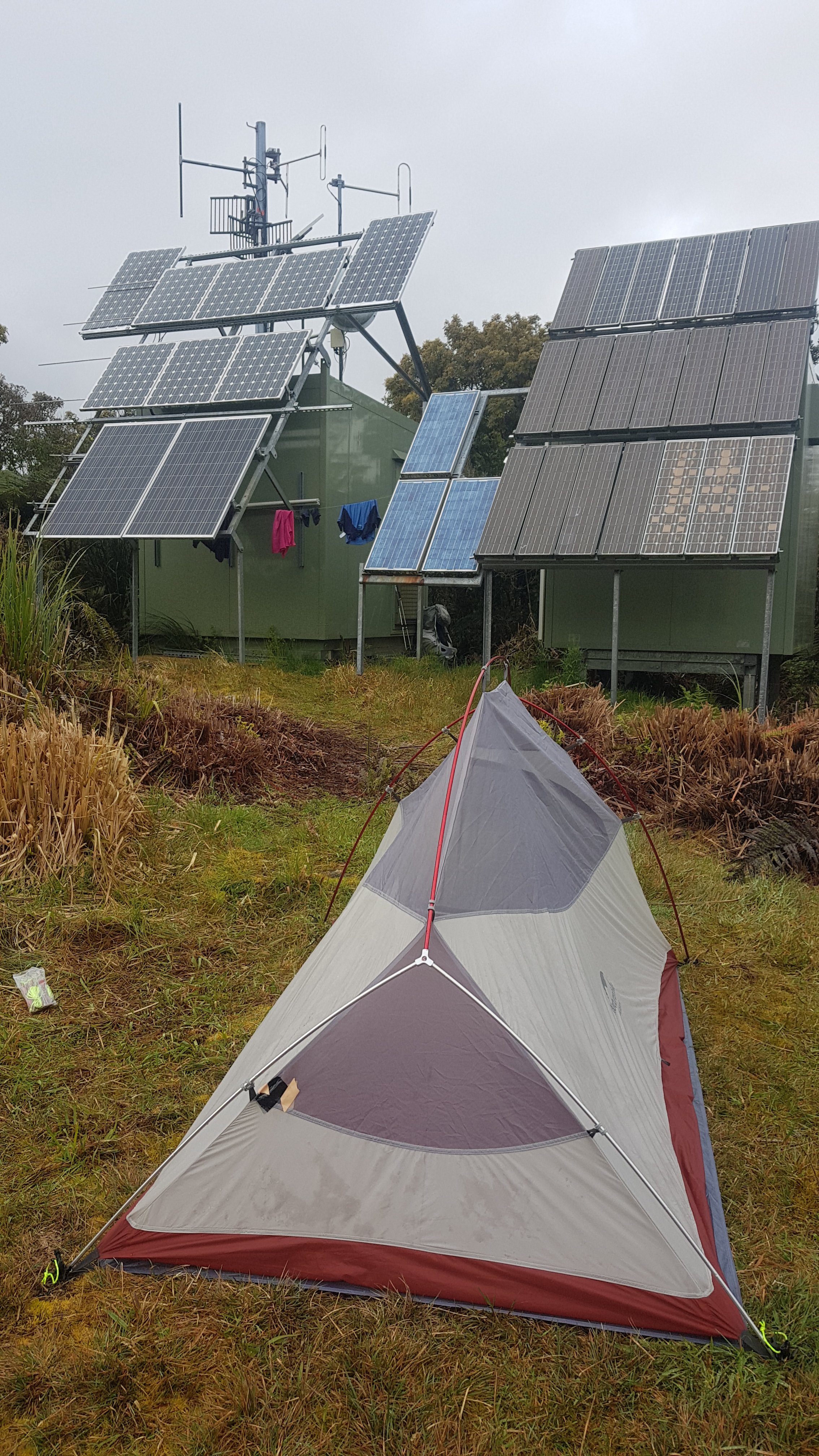
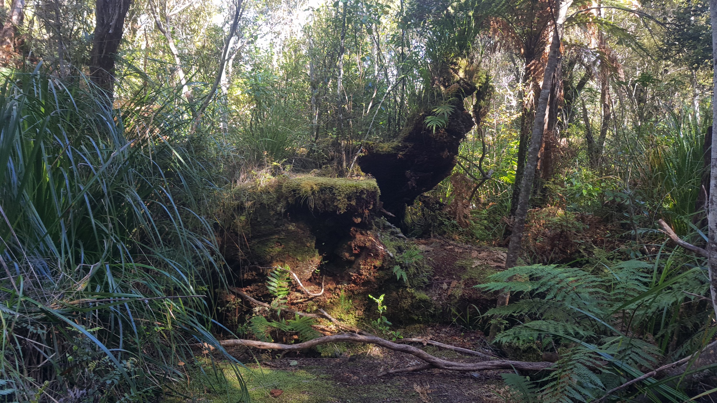
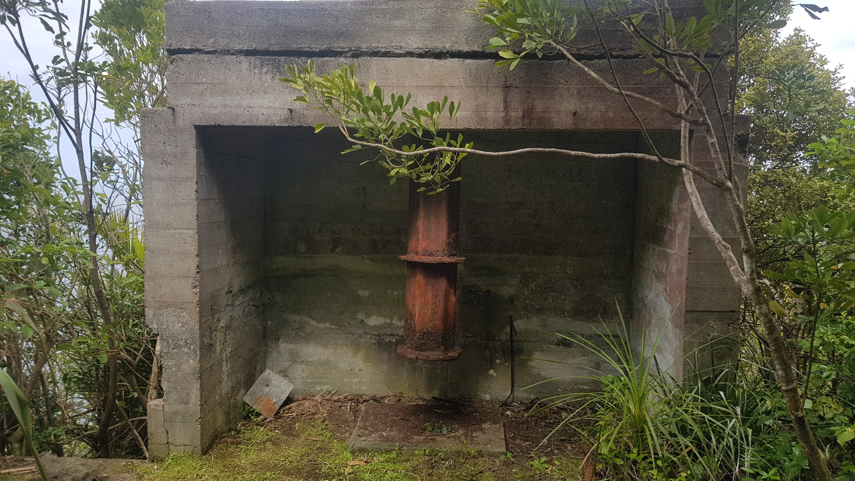
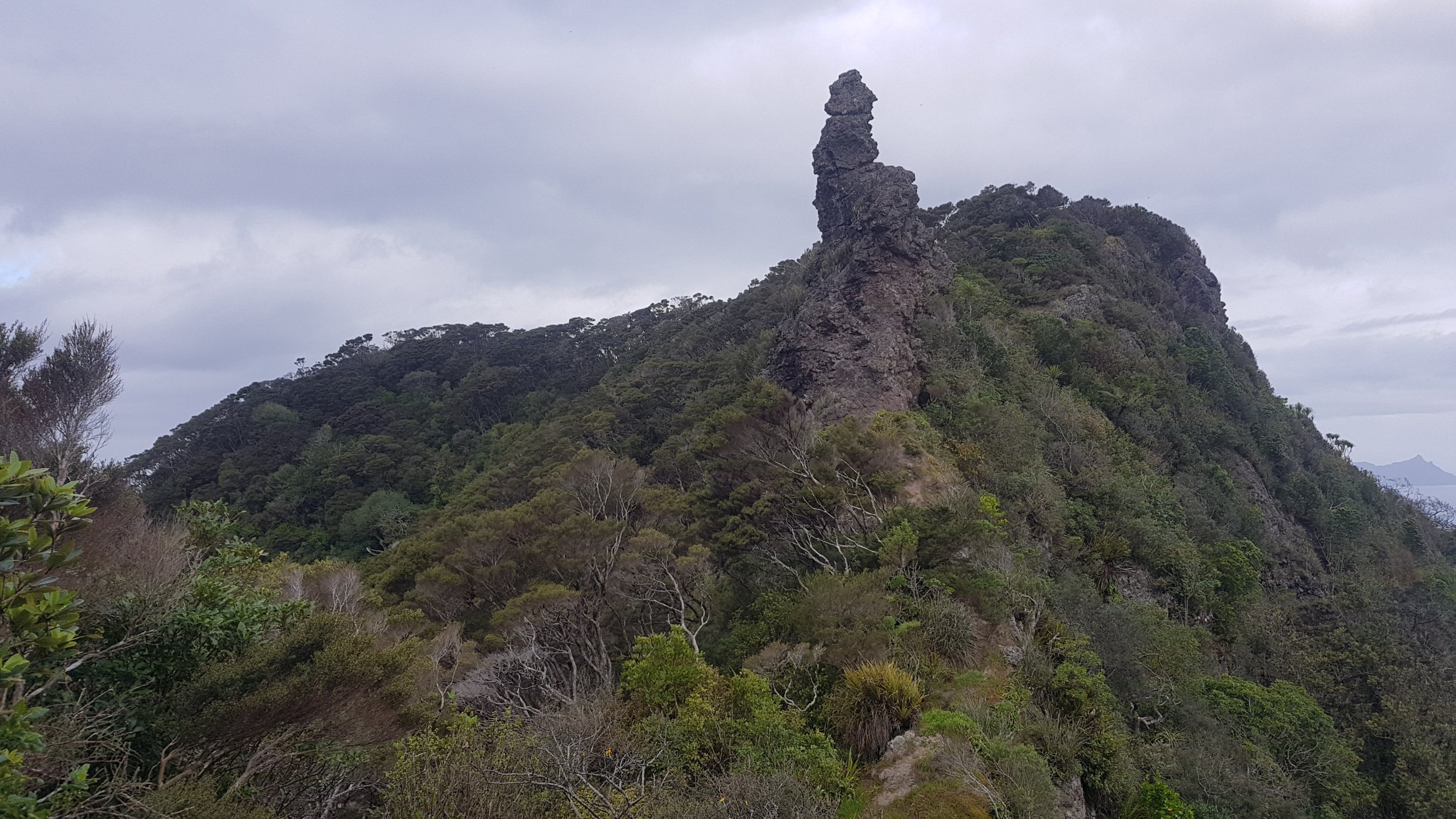
I found a radio transmitter at the summit, by the camp site, at least that’s what I think it is.
Raetea summit
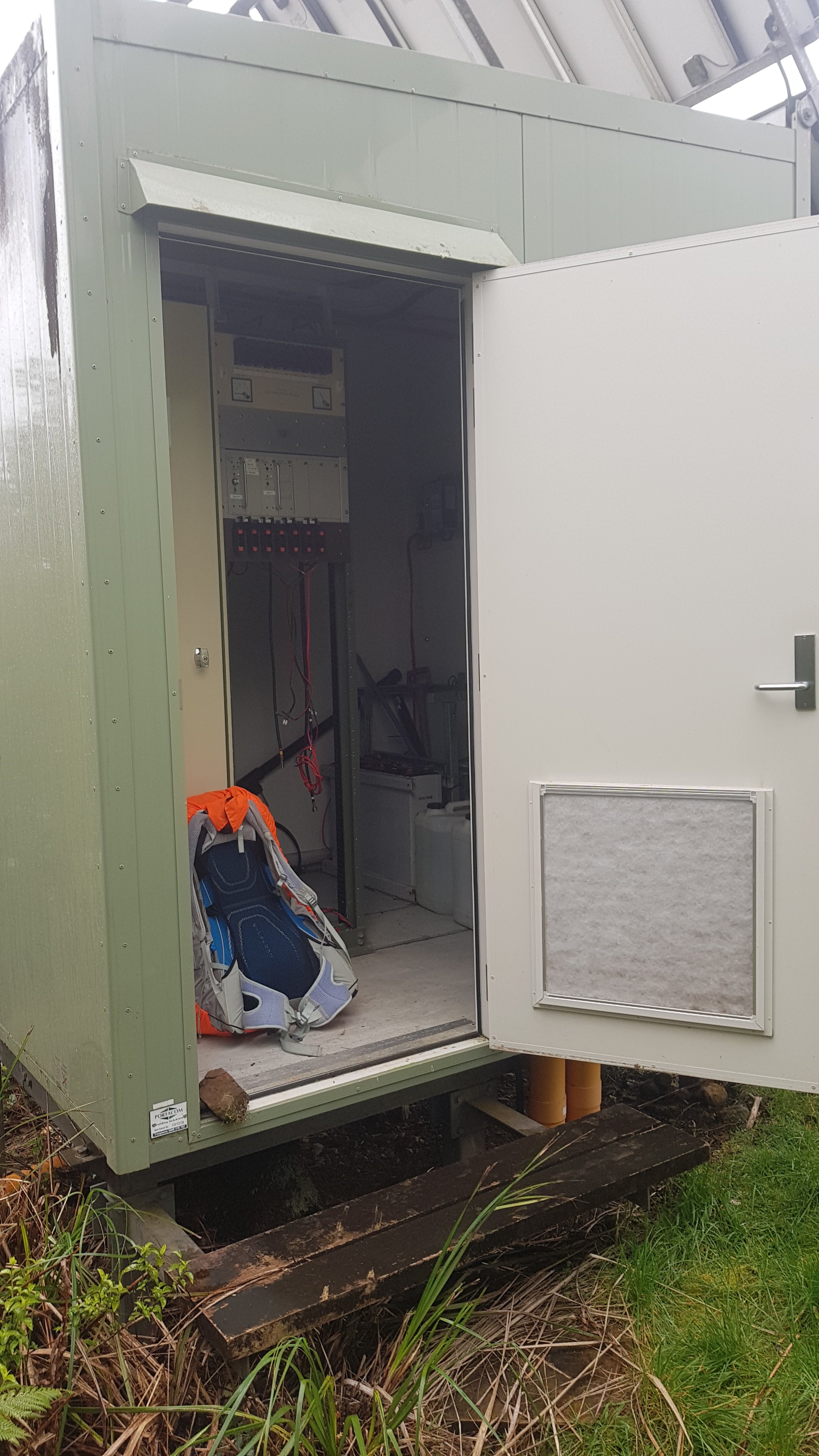
Someone had been nice enough to leave its door unlocked so I had a nice place to put my stuff out of the rain, and to not track dirt into my tent. Not big enough to sleep in, sadly. And besides I was worried the door might close and then lock and I’d be stuck inside.
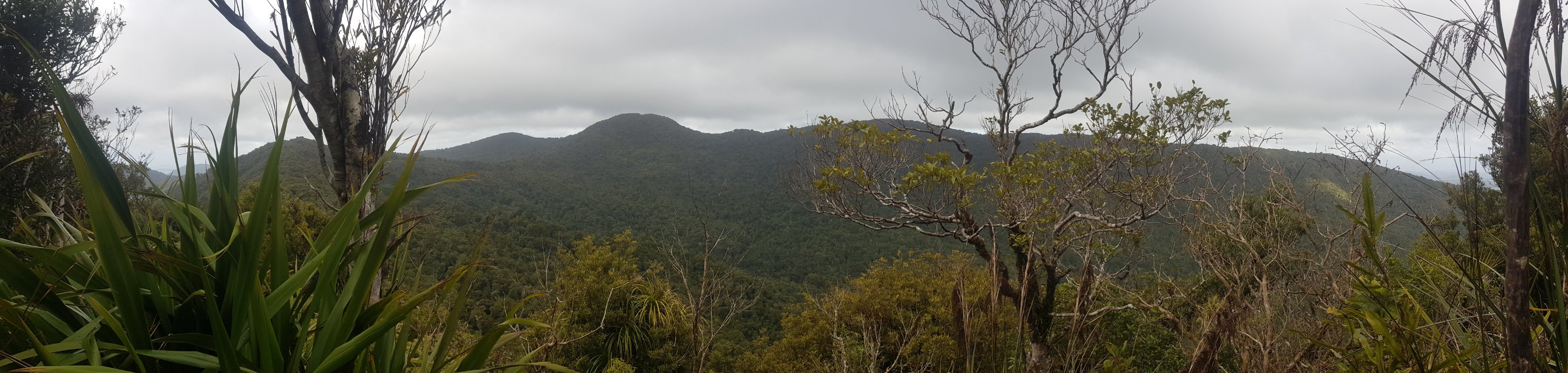
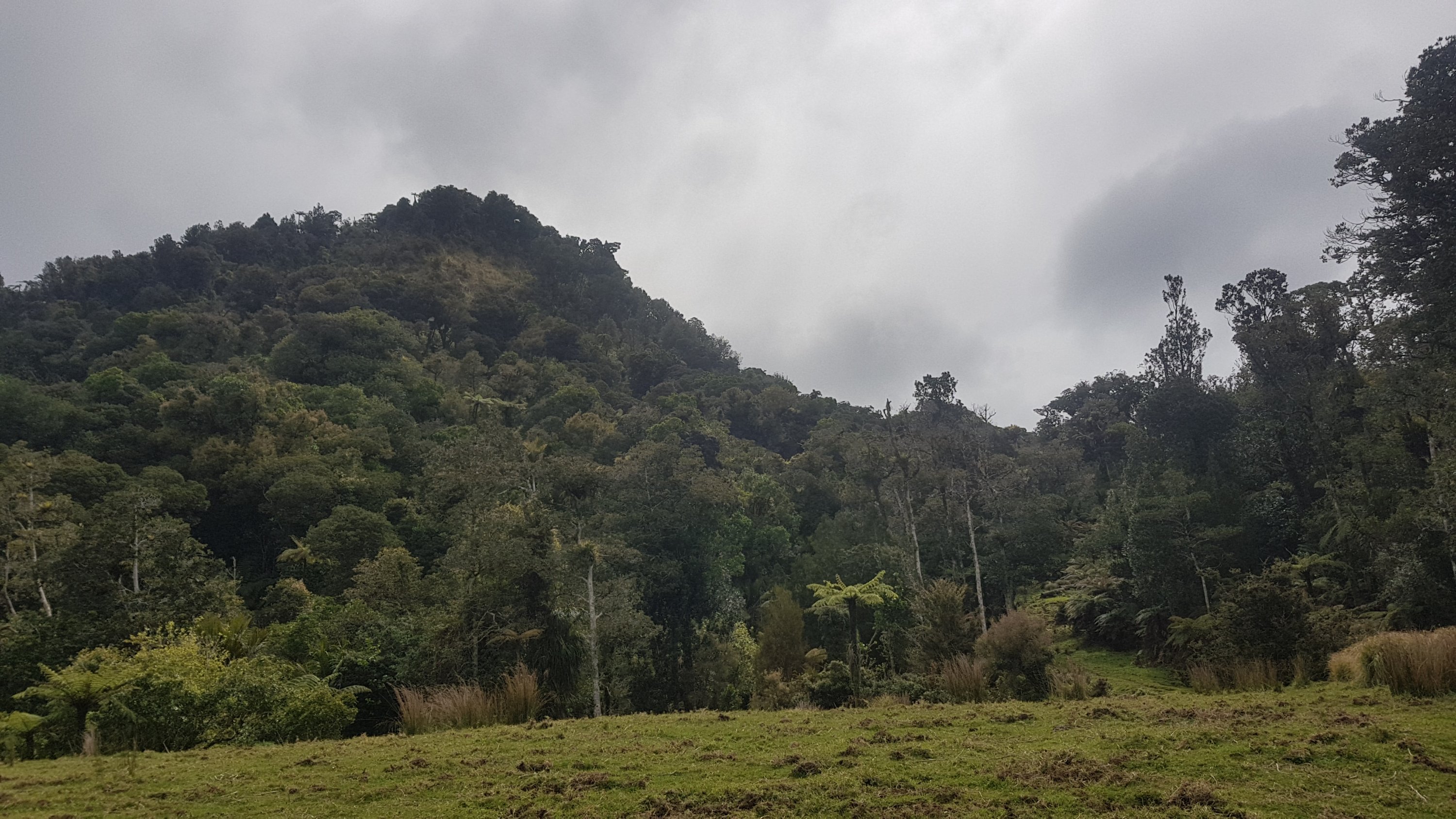
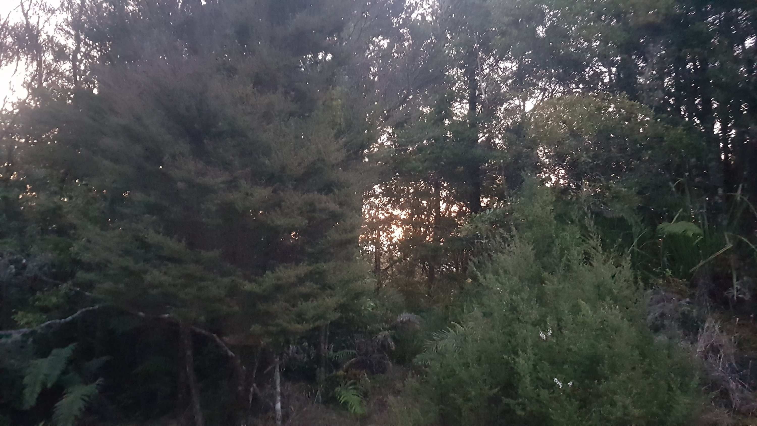
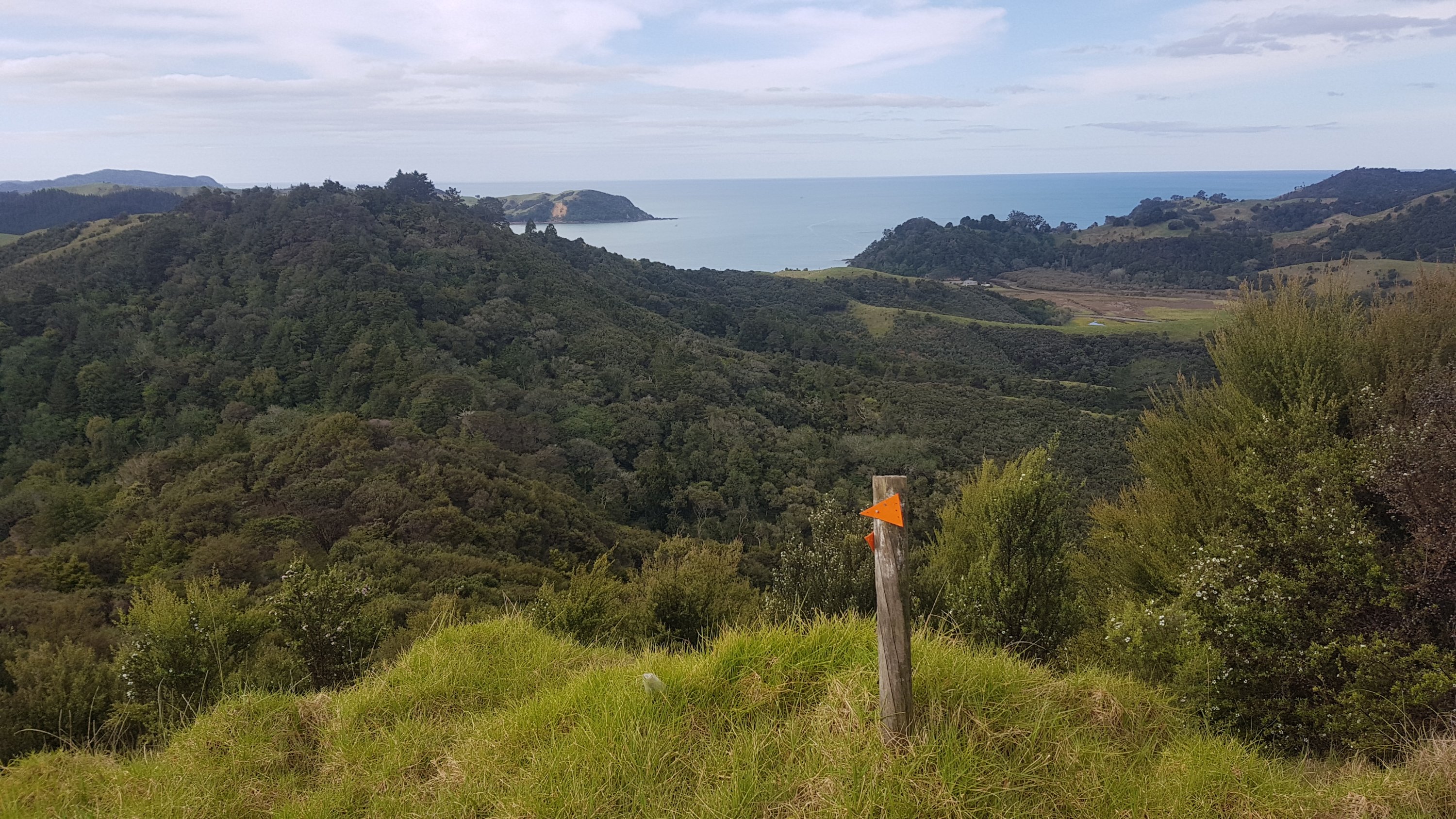
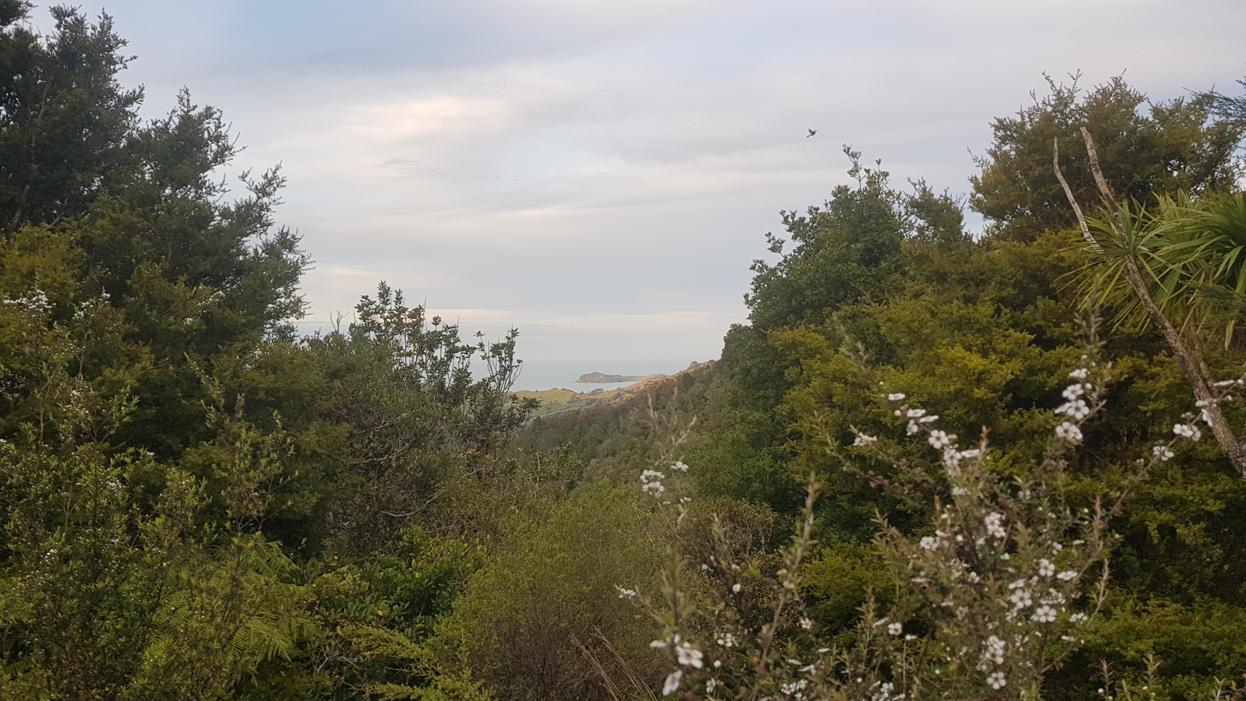
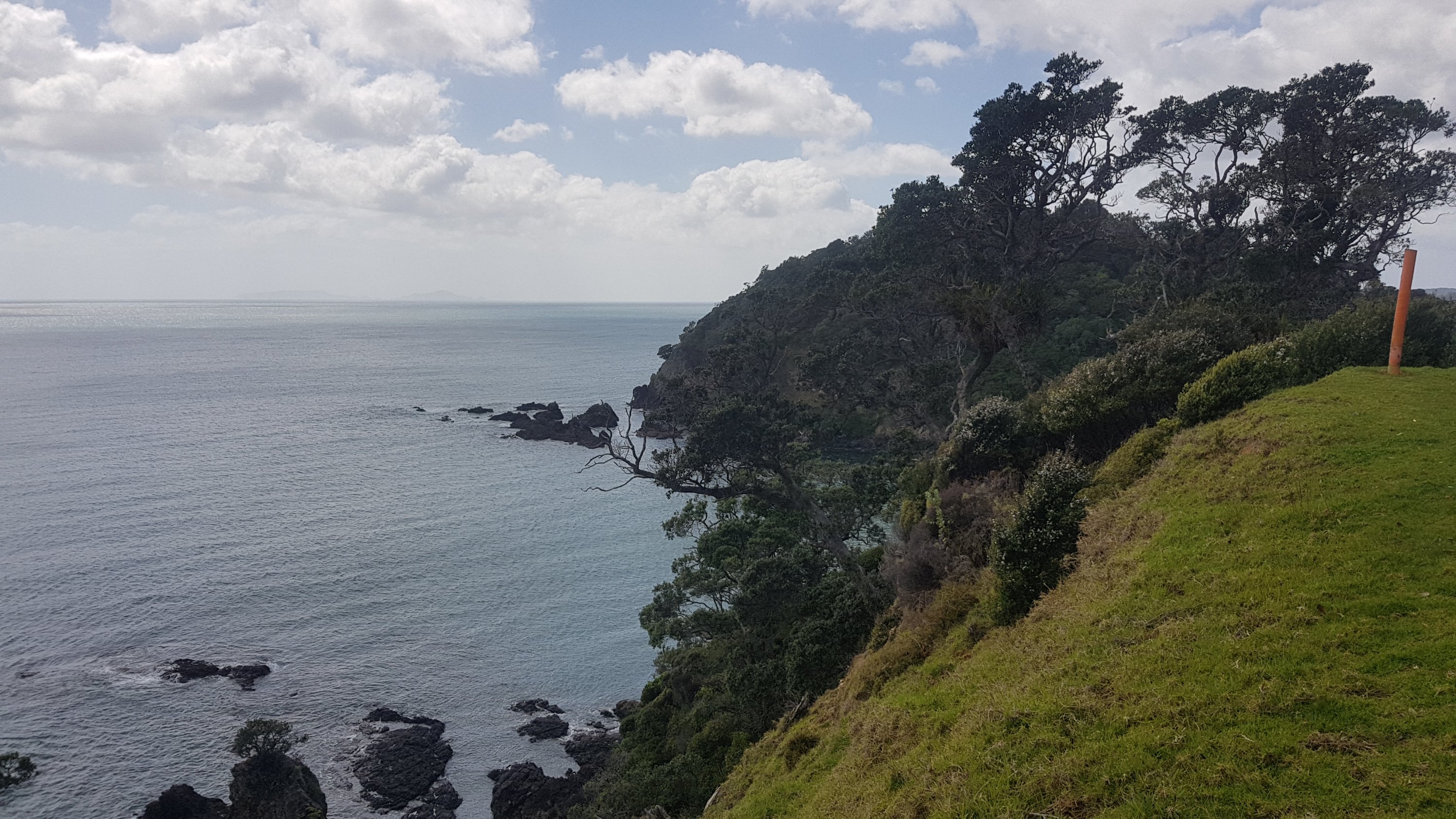
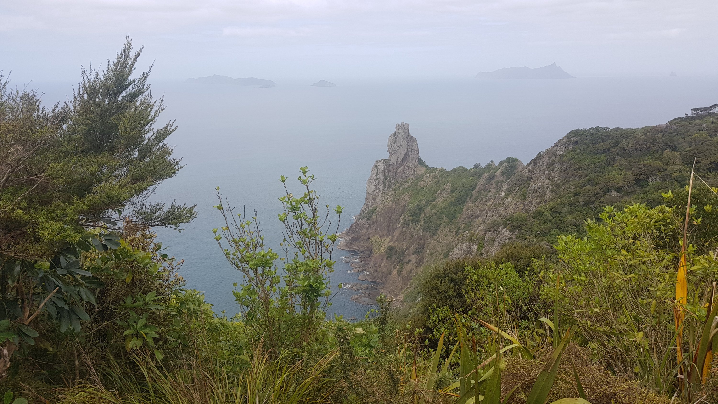
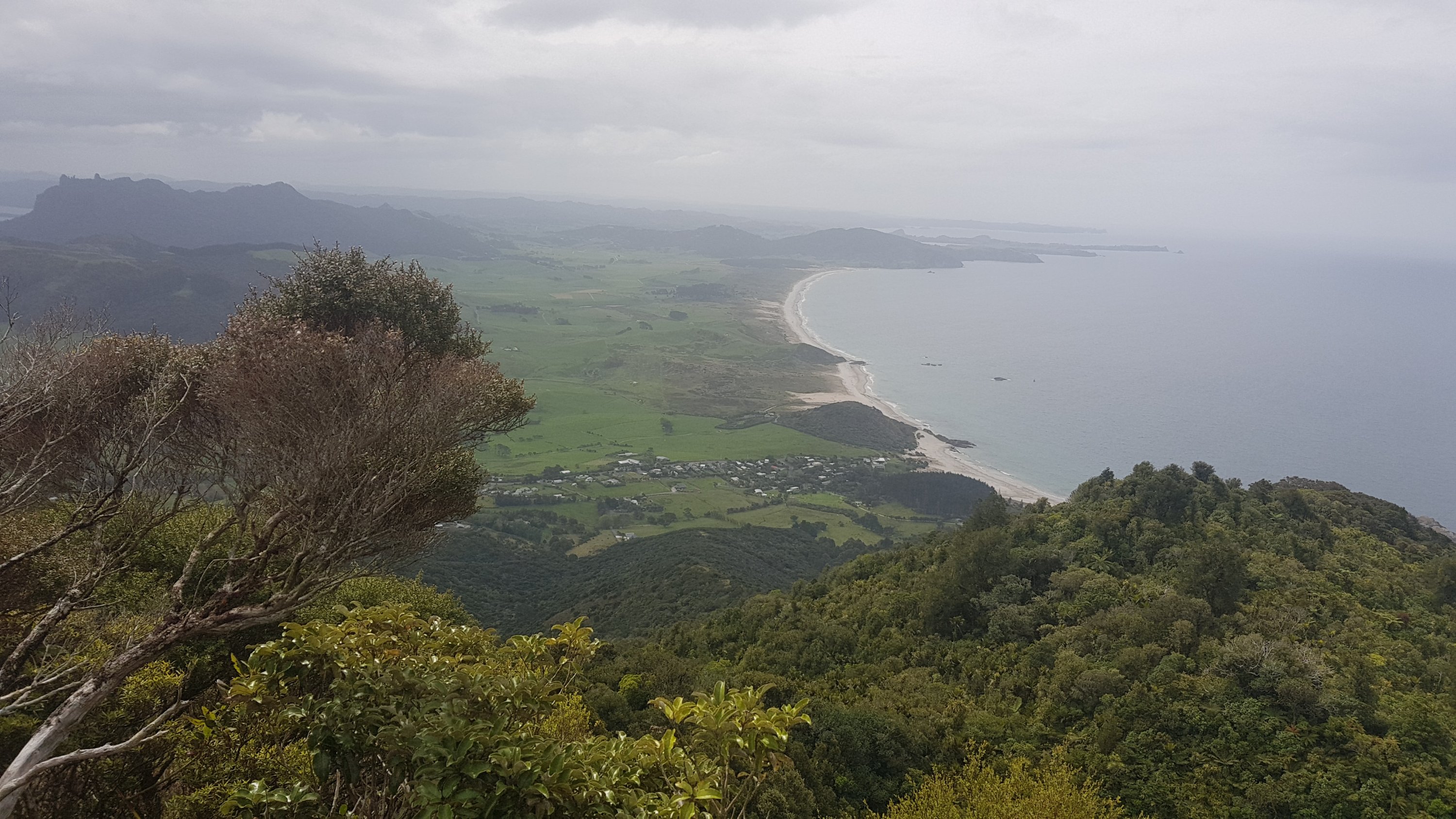
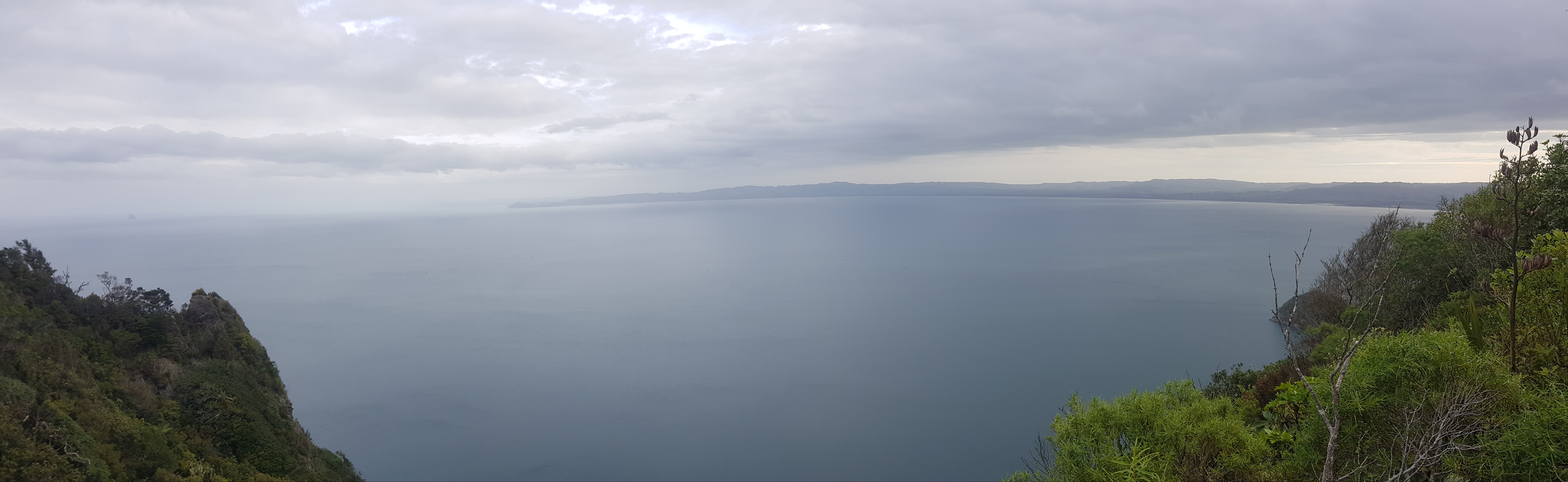
You couldn’t see a lot because it was so misty, but I took this photo earlier.
View from near summit
Because it was such a long day of walking, all I did was just walk, set up the tent, eat, and sleep. But that’s good in a way. I covered a lot of distance. I’m not sure I’d recommend walking all the way from Kaitaia to here though like I did, unless you leave early and are at least a bit fit. It’s a long day.
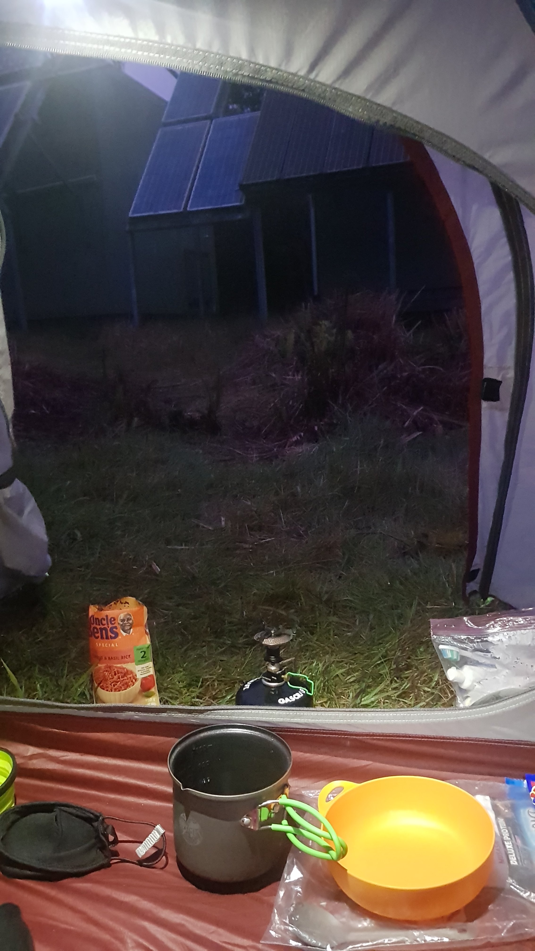
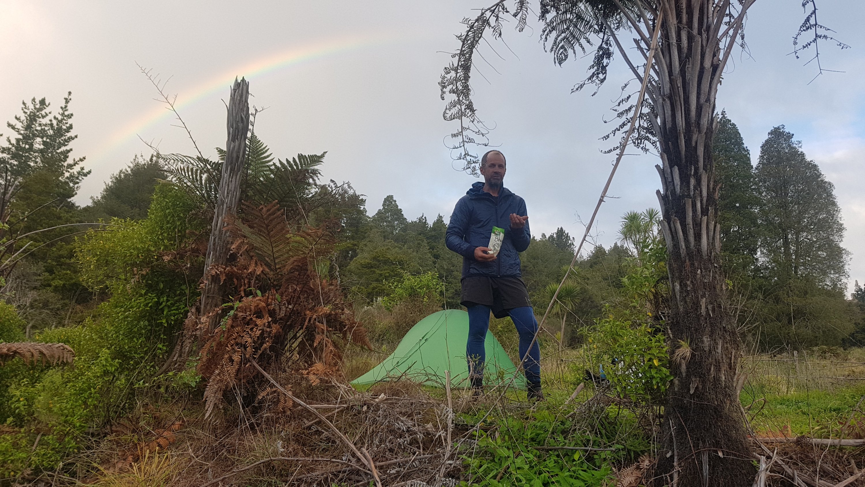
Because it was late and cold and windy, I cooked from inside the tent for the first time.
Yummy
As well as being grateful for my crocs earlier, I was also grateful for my trail runners and walking poles in the mud. How anybody can get up here without walking poles I’ve got no idea.
I was feeling surprisingly good… but I’m gonna be sore tomorrow. It was steep. I hope I can do the remaining 11km to get out tomorrow. I’m not looking forward to it.
I am surprised nobody else was here. Rhydian is nearby, we were communicating by Facebook messenger, but don’t know where exactly. The Germans must be ahead a bit but I hope to catch them.
As I was lying in bed, the wind was howling which kept me awake. Luckily only over the trees and not through the tent. Another thing that kept me awake is how much i stank. I wish I could have a shower.
Date: 3 October
Distance walked: 11.6km
Trail covered: kms 142.9 to 154.1
Weather: no idea, was stuck in the thick forest all day
Number of times I plan to go back to Raetea Forest again: 0
Amount of money I would need to be paid to do that again: 100 billion dollars
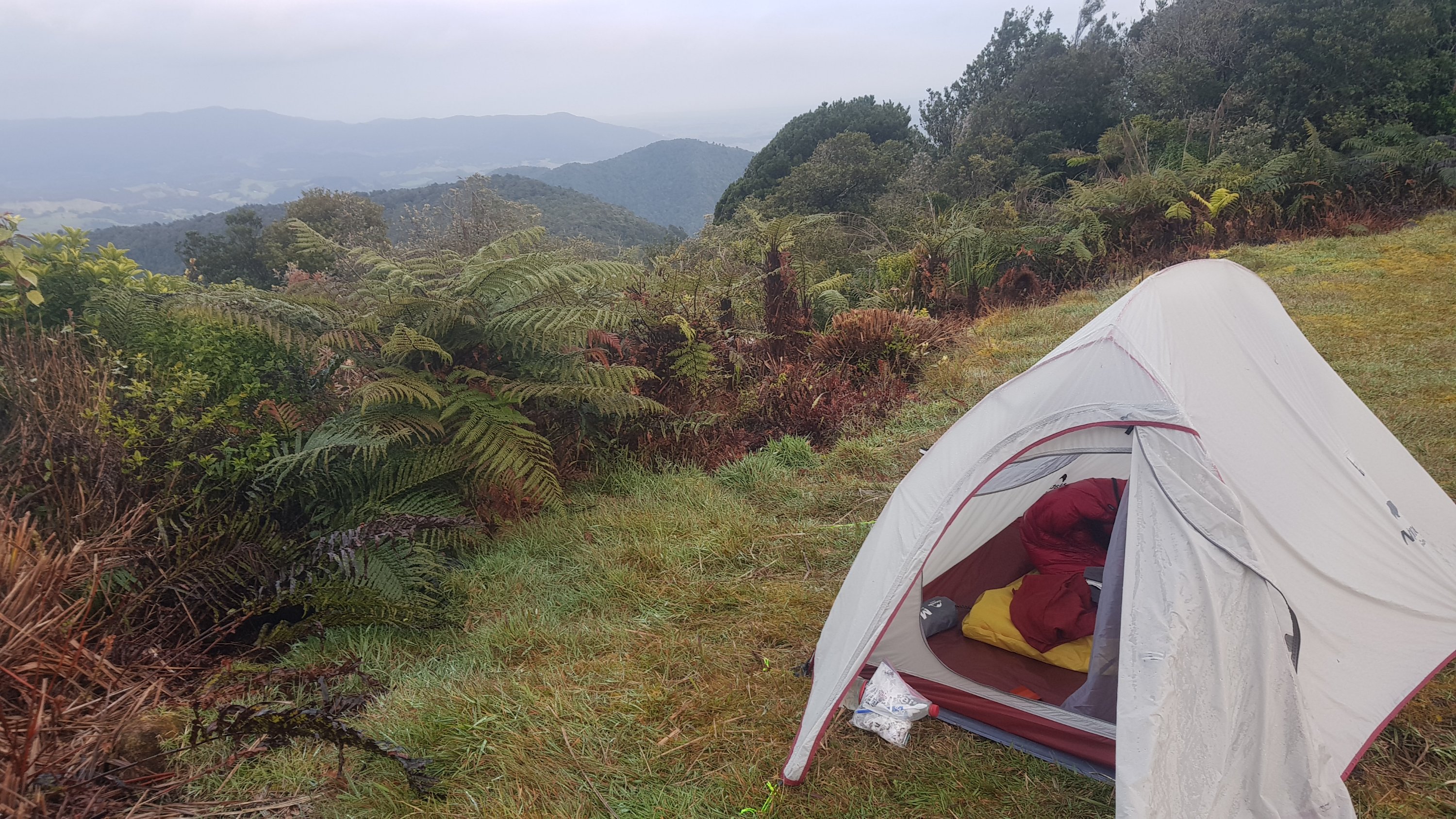
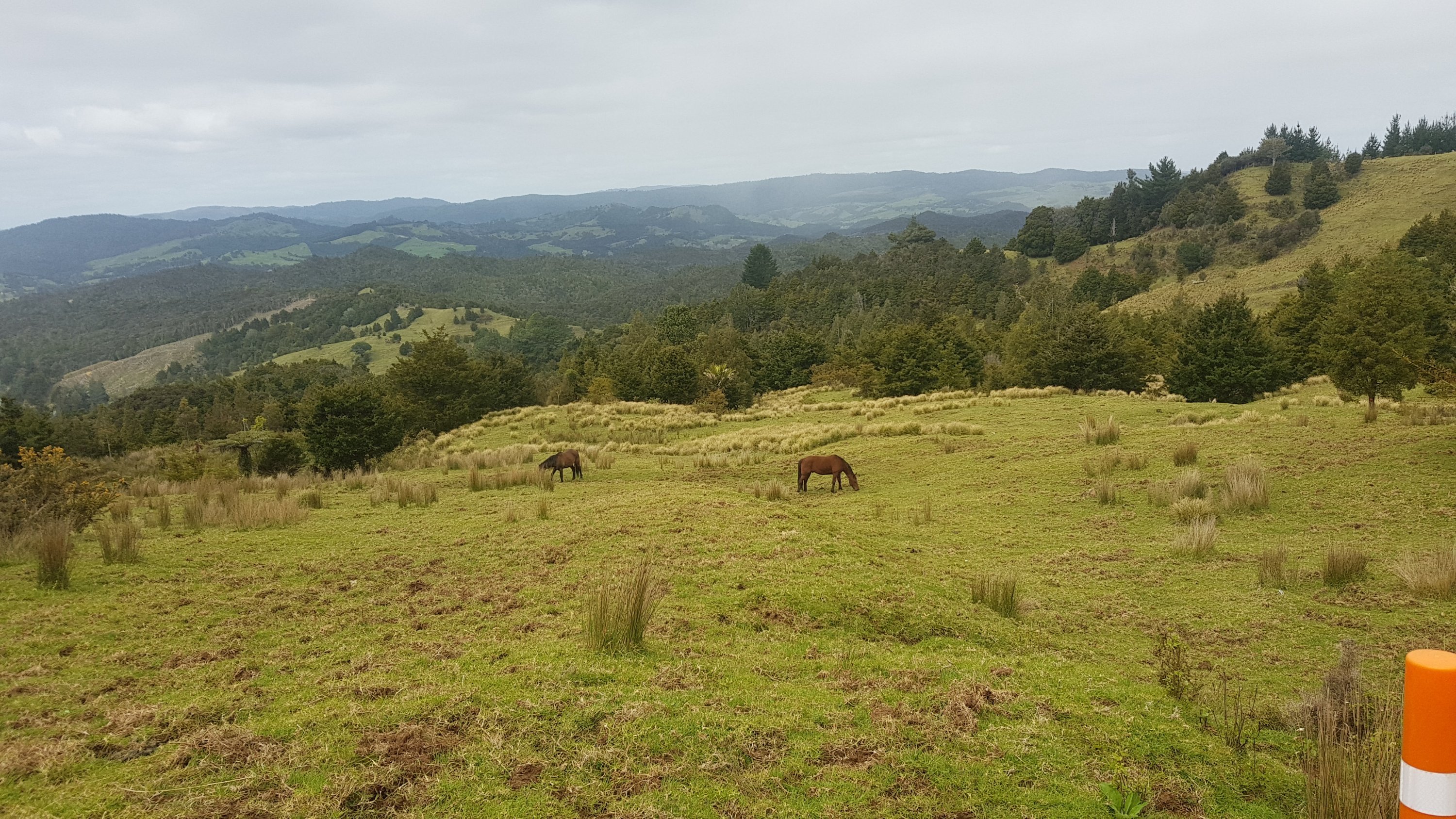
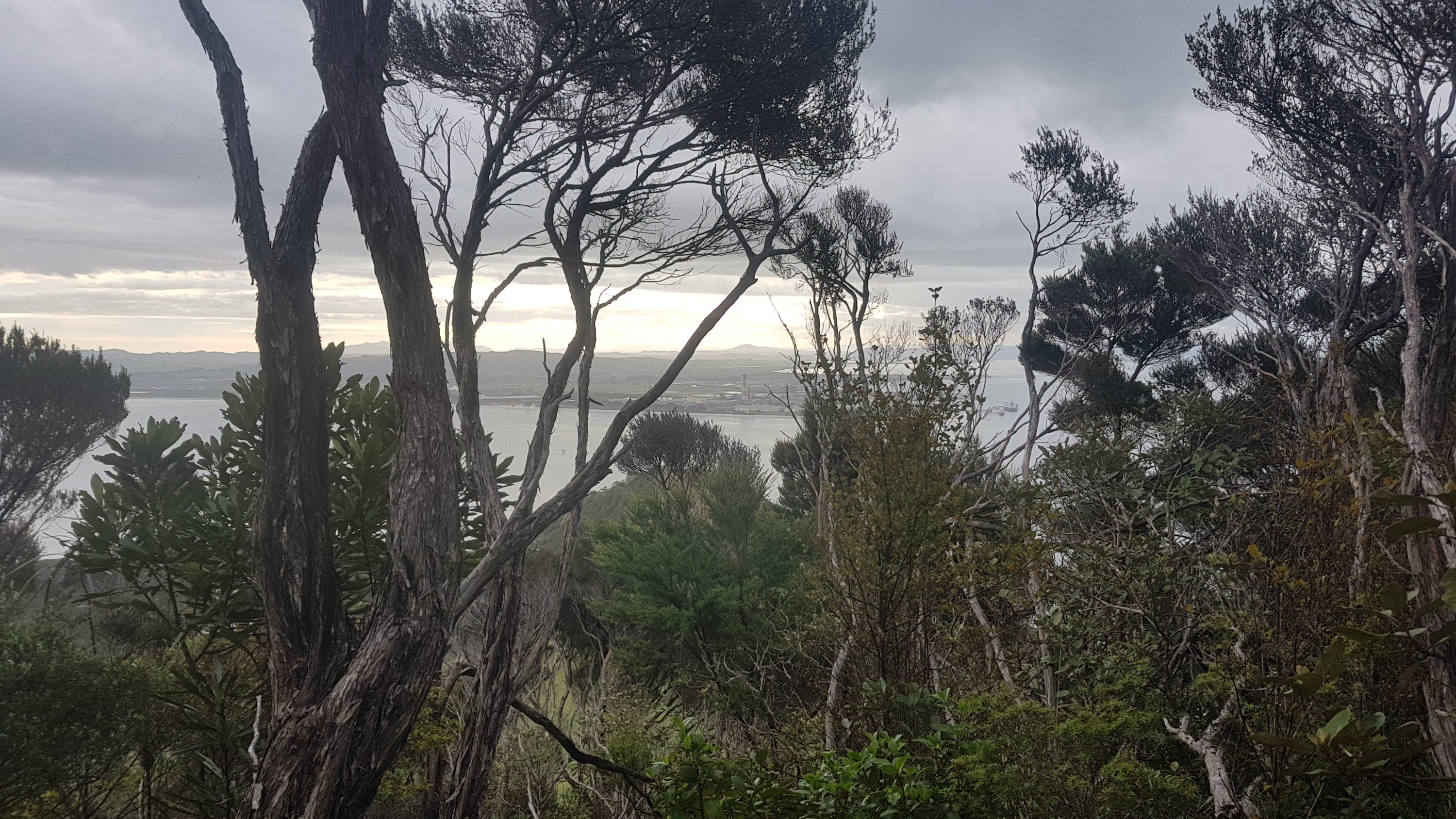
Woke up this morning at about 7am and was pleasantly surprised that I wasn’t sore after the big day yesterday. And the mist had largely cleared, so I got to see the view for the first time.
The view, now the clouds have gone
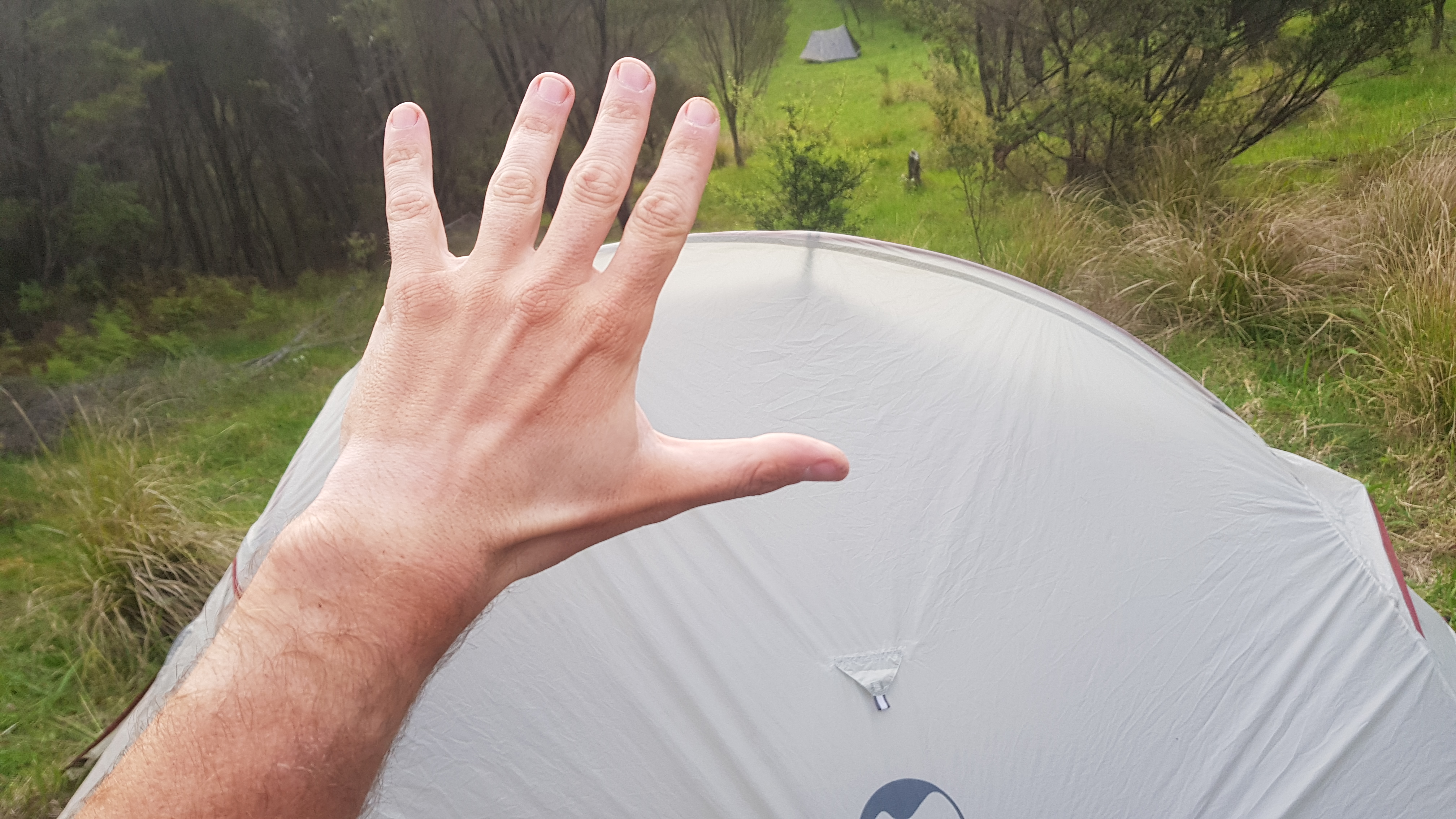
I noticed that the tape that I used to cover up the hole in the tent mesh was holding well. This was the hole that formed in the mesh during Day 1 at Twilight Campsite.
Tape on the mesh is holding
However because of all the mist my tent fly was very wet. At least the tent itself stayed dry. But it meant putting away a wet tent for the first time as I wanted an early start and didn’t have time to attempt to dry it. I put the wet tent fly in the front of the pack with the intention of drying it out once I got to the next campsite out of the forest.
I packed up and continued on in the mud. I wondered if there would be more or less mud on the way down? Surely it is not physically possible to be more mud! Although I still hadn’t seen any “knee deep mud” that others had talled about. Maybe it does get worse.
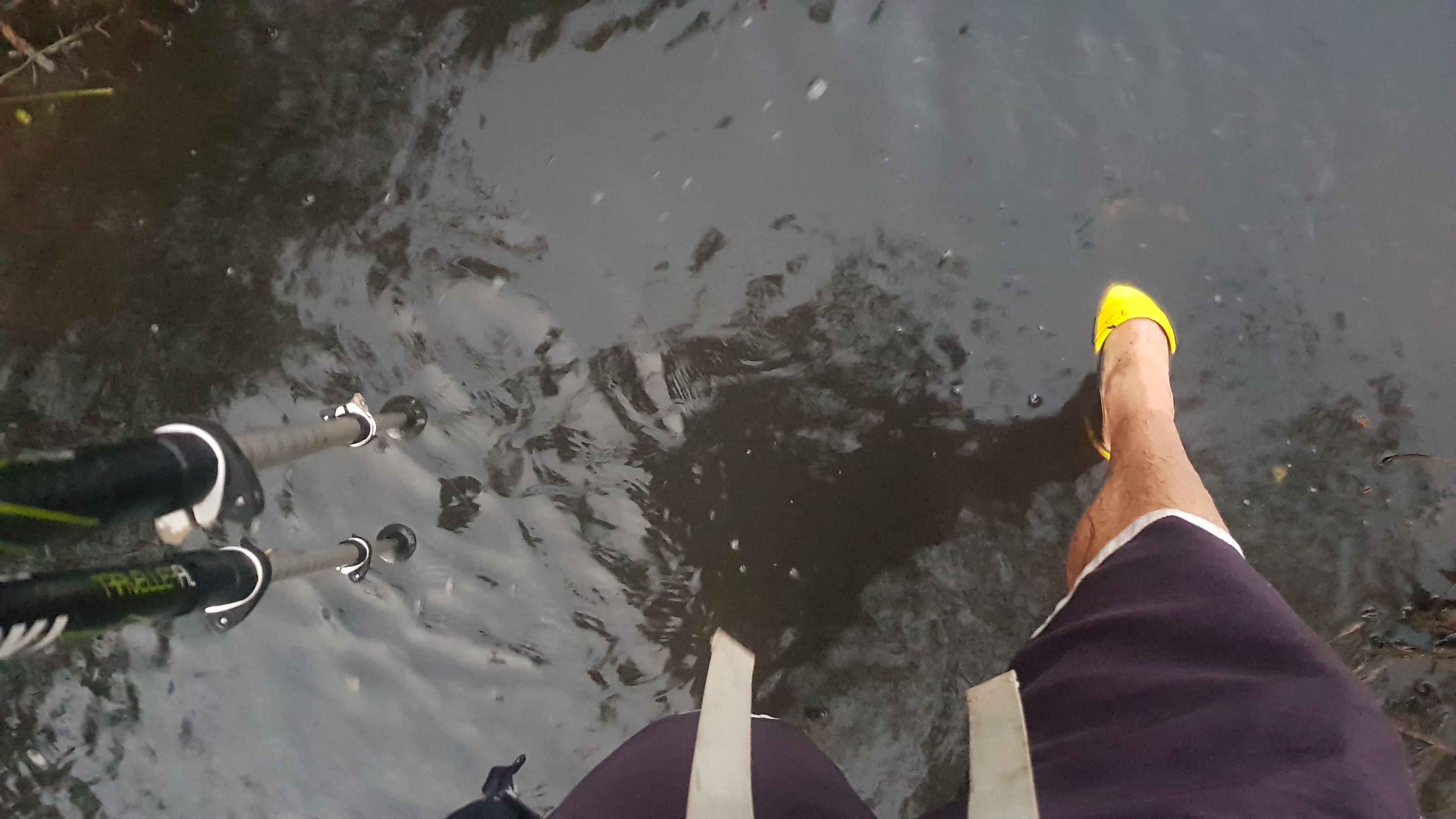
At 10:55am I stepped in a particularly deep piece of mud:
More mud. Your life is mud in here.
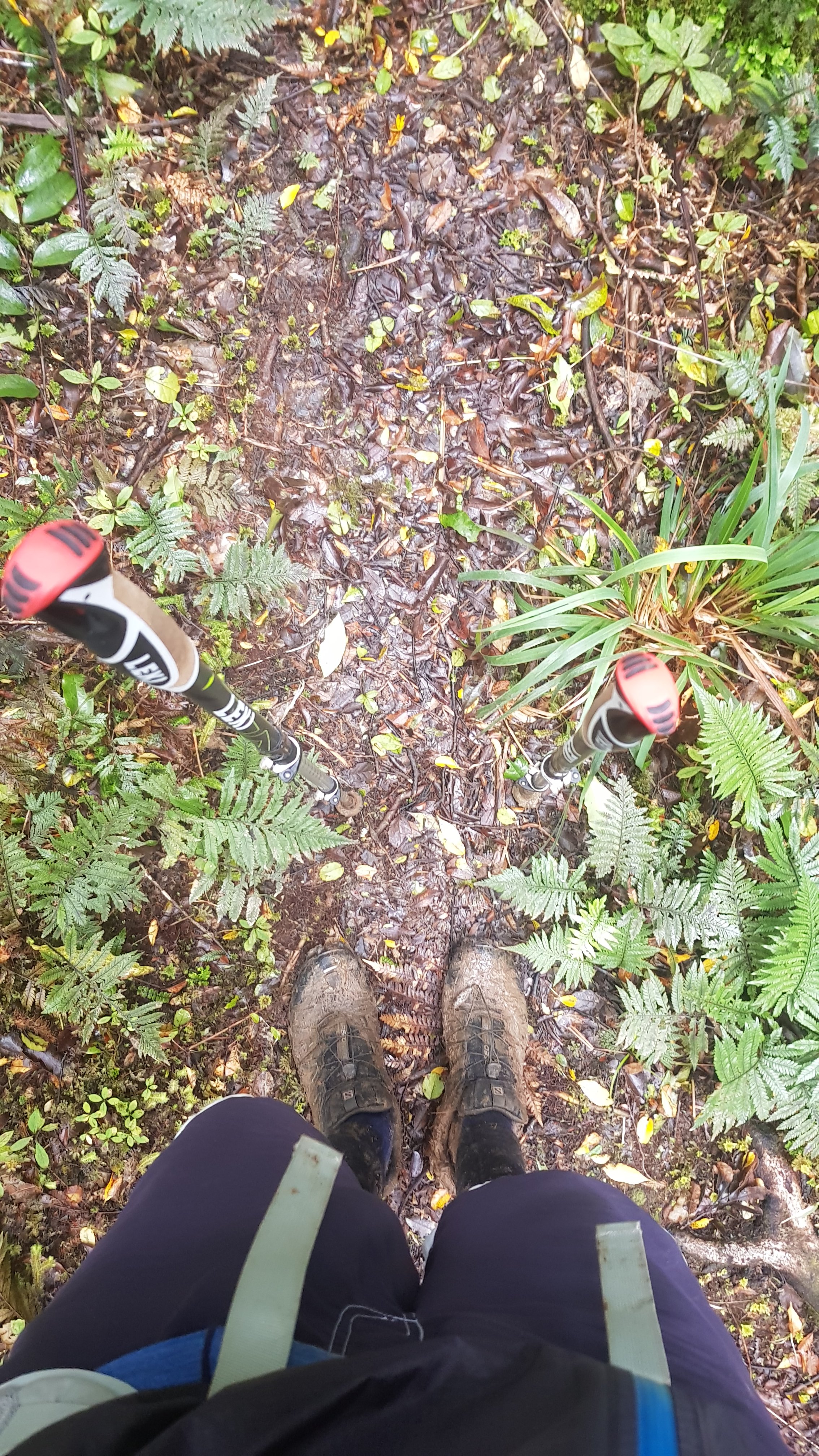
So my 11am picture is my muddy shoes.
They will never dry again
The downhill was about the same as the uphill from yesterday, but in reverse of course. Everything started to hurt after a while, unlike yesterday where I generally felt pretty good. At first it was just mud, but then there was this section where it was lots of annoying trees which were blocking the path. I kept getting caught in them and so did the walking poles.
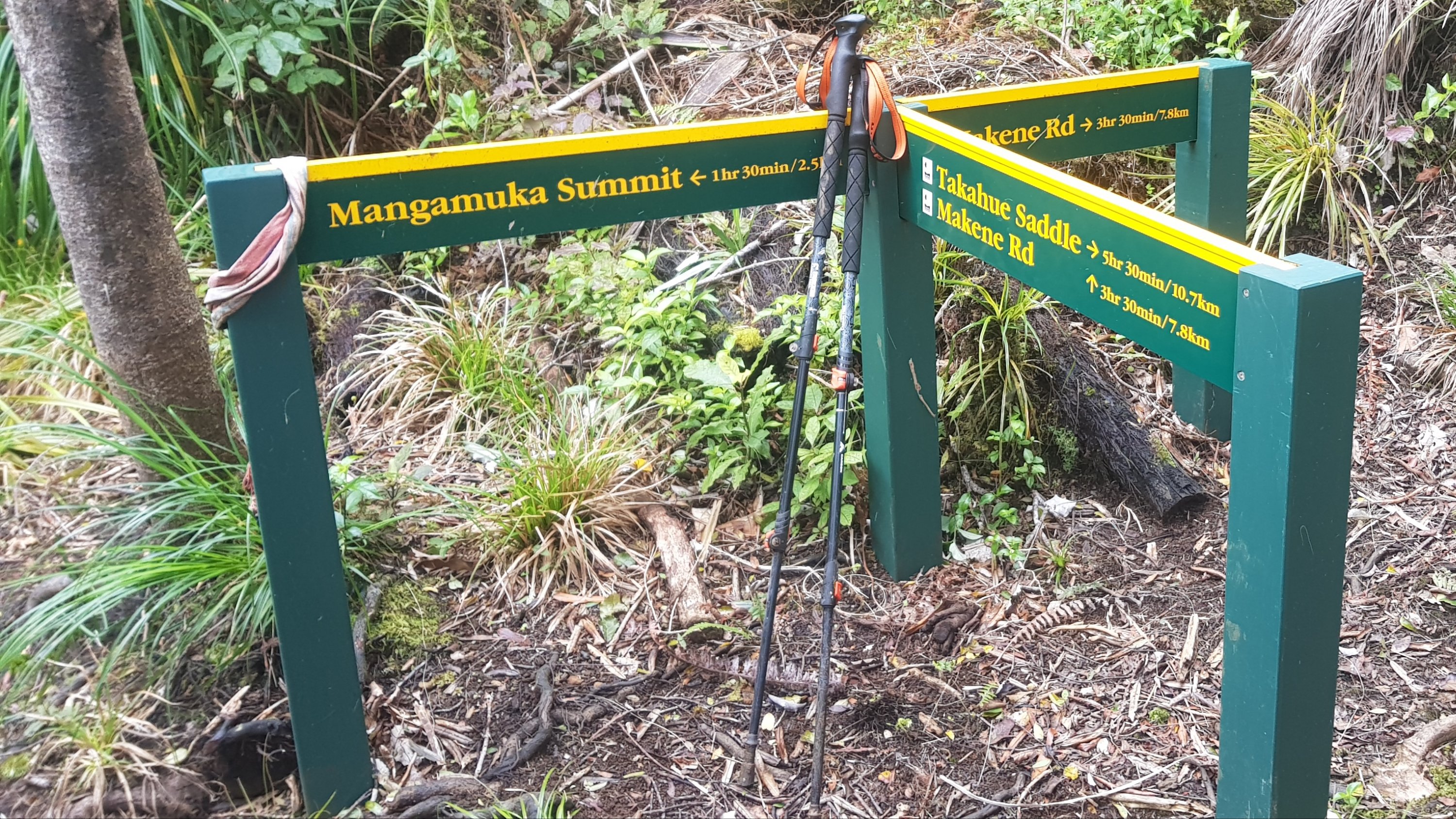
I met up with Rhydian after a couple of hours at this junction. The sign says 3 hours and 30 minutes out. Often DOC signs such as this one are conservative but the 5hr30 time posted for the way we had already gone was very accurate. So that meant I had to endure another nearly 4 hours of this forest. Oh no.
Rhydian walked faster than me through this section. I think his big hiking boots made it easier to walk through the mud. Whereas me with my trail runners had to be careful each step because if the mud was deep enough, which it often was, I might lose my shoe to the mud, never to be seen again.
I passed Rhydian when he stopped for a break, because I just wanted out of the forest. The track didn’t get better. It just kept finding new ways to make me hurt. And somehow, the mud still got deeper in places!
You know what would be good here? A Starbucks.
Eventually it came out onto farmland. What a sight for sore eyes!
Where I came fromThe way now
To go out you had to walk right past the farmhouse, and down the driveway otherwise known as Barking Dog Boulevard.
The gauntlet of devil dogs
At least the trail notes warned us about the farmland and the dogs. Not much later, I encountered another campsite that I assume the locals put together. This was nicer than the one I found yesterday. This one had a clothes line, long drop and small shelter.
Makene Rd campsite
Maybe I overdid it today. It was about this time that I noticed my left knee hurting. I wasn’t very happy because I have had knee injuries before from running and I know how annoying they are and how long they take to heal. I’ll have to keep an eye on it.
I set up my tent in a light rain but after that it was a sunny evening and pleasant to just sit and have a chat once Rhydian turned up an hour or two later. The fact that the tent fly was wet wasn’t a problem, it soon dried. And boy was it good to get my wet shoes off. I tried to clean the mud off in the stream but the tough mud wouldn’t move. Now they’re soaking wet and still muddy. I’ll wear my crocs tomorrow for a road walk and then the day after there is a stream to walk down. Maybe that will clean them and maybe even dry them.
I had to replace the plaster on my blister yet again. The plasters I got from Kaitaia were supposed to be “heavy duty”. Heavy duty, my sweet patootie.
There were sandflies here. The first time I really had encountered sandflies. So I got out my Bushman “deet based” insect repellent and they didn’t bother me again.
I know today was hard because my little airbed took 35 breaths to blow up. Every other day it takes exactly 24.
I haven’t seen any of the Germans for a while. Rhydian knows the names of 5 or 6 people ahead of us, but I can’t catch up. That’s okay because I started a day after everyone else. And I’m not going to try to catch up because I need to go easy on my knee. I don’t any more injuries.
My walking mate most days
Injuries, or just feeling sore in general, are a real pain. Some days (today was not one of them) you just really want to keep going but you’re too sore. It sucks. But hopefully soreness will go away and I will get more conditioned and can go further in the future.
But more than once today I said “I’m not cut out for this” – this being nature and outdoors in the rain.
Date: 4 October
Distance walked: 18.4km
Trail covered: kms 154.1 to 172.4
Weather: Stunning
Number of green things I had at the Mangamuka Dairy: 2
Number of the State Highway I don’t have to walk down again: 1
Woke up this morning to a sunny morning. Only an 18km road walk to Apple Dam Campsite today, so I could take my time in the morning. That meant everything could dry out that was wet from the forest… except the shoes of course. They’re never going to be dry again, I’m fairly sure.
The crocs went on because it was road walking. Another win for the crocs, they were so comfortable! The destination was Apple Dam campsite because it is one of only two “allowed” campsites in the Omahuta and Puketi forests. So unless we were prepared to walk 43km to Puketi campsite (not bloody likely), Apple Dam it was.
I was looking forward to a milkshake from the Mangamuka Bridge dairy, which I thought was just around the corner from where we were staying. I had also heard from the New Zealand Herald that their bacon and egg burger was famous. So I was very excited about that.
Rhydian and I walked together almost all day. Here’s my 11am picture. I thought would be at by dairy by now but read the map wrong. Turns out I had completely the wrong idea where the dairy was, it was 5km away from camp, an hour’s walk.
11am picture – alongside State Highway 1
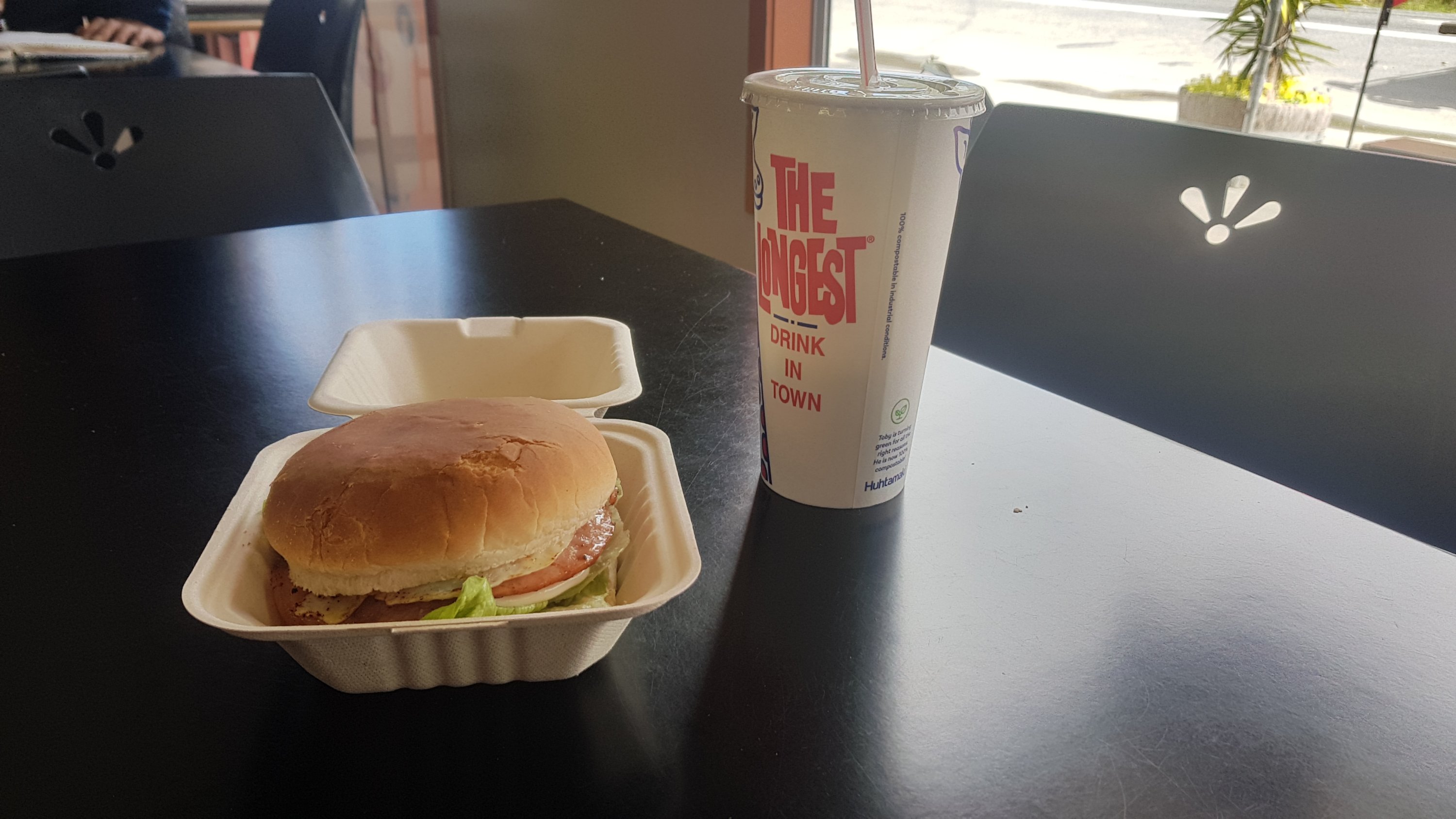
When we got to the dairy, turns out it is closed on Saturdays except in summer. As it was Friday today… luckily I did go fast through Raetea Forest! If I had’ve taken an extra day to get through the forest like I originally expected to, I would have missed it. Not to worry. Got my burger and milkshake and they were both excellent, and then I got an ice cream too. 1 scoop for $2! It is so good to know you can still get an icecream for that price in small town New Zealand. And it wasn’t small.
My milkshake brings all the boys to the yard
I don’t see my own face much due to spending so much time outside. When I do see myself, I get a shock. I am almost always clean shaven so I don’t even recognise myself at first.
The beard looked bigger in the shop window reflection…
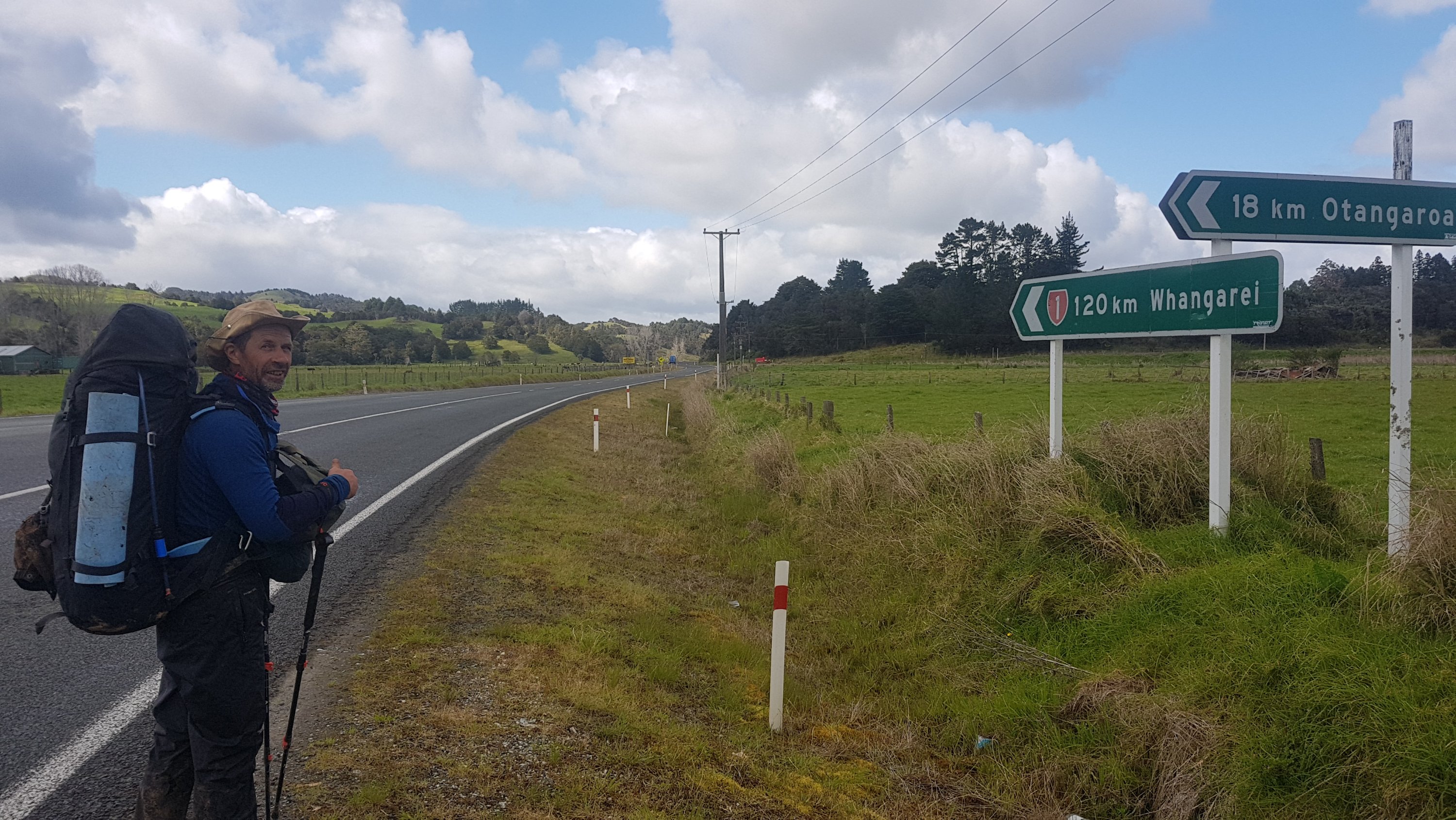
It was also a shock to see that we were actually closer to Whangarei now than to Cape Reinga where we started. I actually felt like I was making some progress when I saw this.
146km from Cape Reinga……and only 120km to Whangarei
Just after the dairy we turned off SH1 onto Omahuta Rd. I believe this is the last road walk down State Highway 1 until Wellington (maybe a bit near Huntly and maybe a bit near Puhoi I’m not sure). Goodbye, I won’t miss you!
Bye SH1… don’t call me I’ll call you
We walked almost 4km down this dusty gravel road. We got covered in dust whenever a vehicle drove past, and there were a surprising number of these. It made me cough.
Weird and interesting tree we saw on this road
At this junction, we saw cows. I left Rhydian here when he had a break.
Cows on the road again
From here, another 6km down Omahuta Forest Road, which was all uphill like this:
More road walking
It was a gravel road like before but on this section I never saw a single car.
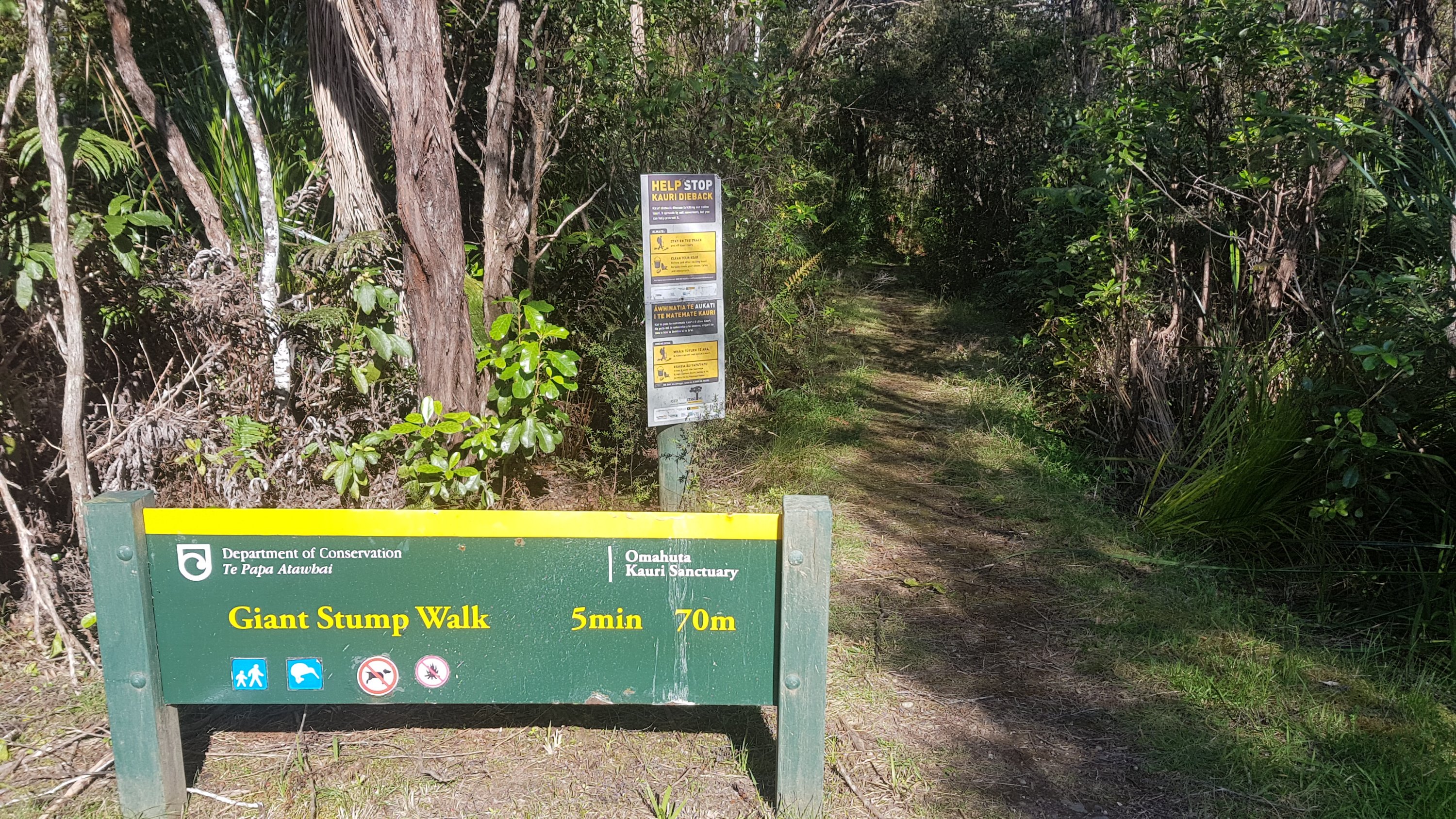
Just before the campsite was a sign for a Giant Stump.
Great stump walk
Yep, that’s exactly what it was.
Great Kauri Stump
I found out later there is a geocache very near the stump but I didnt notice until I was too far past it to go back. Oh well.
Turned right here to get to the campsite. This was technically off-trail since Te Araroa goes left. But that’s fine.
Apple Dam turnoff
Eventually got to Apple Tree campsite (or is it Apple Dam? I’ve seen it referred to as both). It was the most basic of all campsites so far, it appeared to be just a piece of grass.
Just grass… and lots of possums, but you can’t see them here
Set up my tent, wrote a blog post, got some water, and started cooking. Night was falling, and Rhydian hadn’t turned up. I got a bit worried but I know he can handle himself. I did hear some shouting soon though so I shouted back. Then he showed up angry because had come almost all the way to the campsite but at the last minute assumed he was going the wrong way and turned back. He said that cost him an hour.
Then we worked out there is a long drop here at least, back further up the trail. Just don’t look into it. It’s a few visits short of overflowing.
And right now its 10pm and I can’t sleep because there is something moving around right outside my tent. This is the first time I had heard anything like that. I wonder what is. It’s eating the discarded apple core that I saw earlier I think. I was gonna shine my light on it to see what it was but I think I’d rather not know. Oh god it’s just made a loud screaming noise. Even Rhydian got startled. But he went and had a look and it was just a small possum. It must have tripped over the tent rope. Then it started making different and louder angry sounds so there must have been more than one.
Wow then later on in the night the possum tried to climb up Rhydian’s tent. He swore at it. I’m glad that didn’t happen to me. I bet I’m not gonna get much sleep tonight…
Date: 5 October
Distance walked: 24km
Trail covered: kms 172.4 to 197.5
Weather: stunning
How worried was I when I thought I had to swim across the deep river: very
Today was an epic day. Epic is a word that is overused a lot these days but today truly was.
It didn’t start that great, I didn’t get a lot of sleep last night but it wasn’t because of possums. It was really cold during the night and that wasn’t pleasant. And also my knee really hurt during the night. Every 30 minutes I had to change position because my knee was so sore. Plus I was camped on a very slight hill and that meant that every time I did change position I kept sliding down my inflatable mat into the back of the tent.
I’d planned on an early start because it is a 25km day today, but when I saw the sun coming up I didn’t actually end up leaving until Rhydian left, at 10am. Today there is a bit where you walk down a stream for a few kilometers so it will be good to have him there for that. I haven’t really done that kind of thing before.
And there’s no escaping it, I now have to change into my extremely wet shoes:
Uh oh there’s no escaping them now
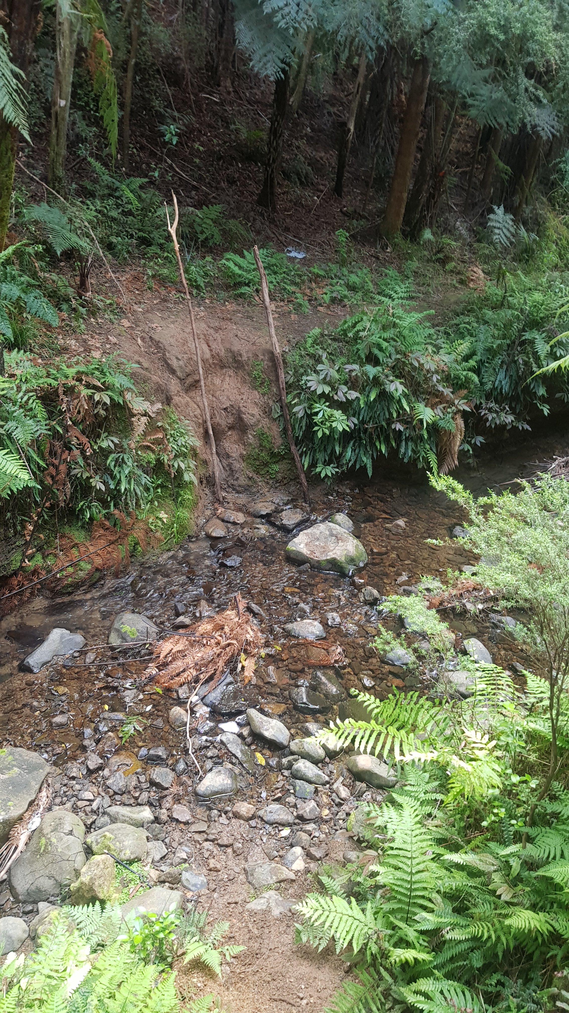
Walked out from Apple Tree camp and past the almost overflowing outhouse.
Took a while to find this, hidden away up there… no sign or anything
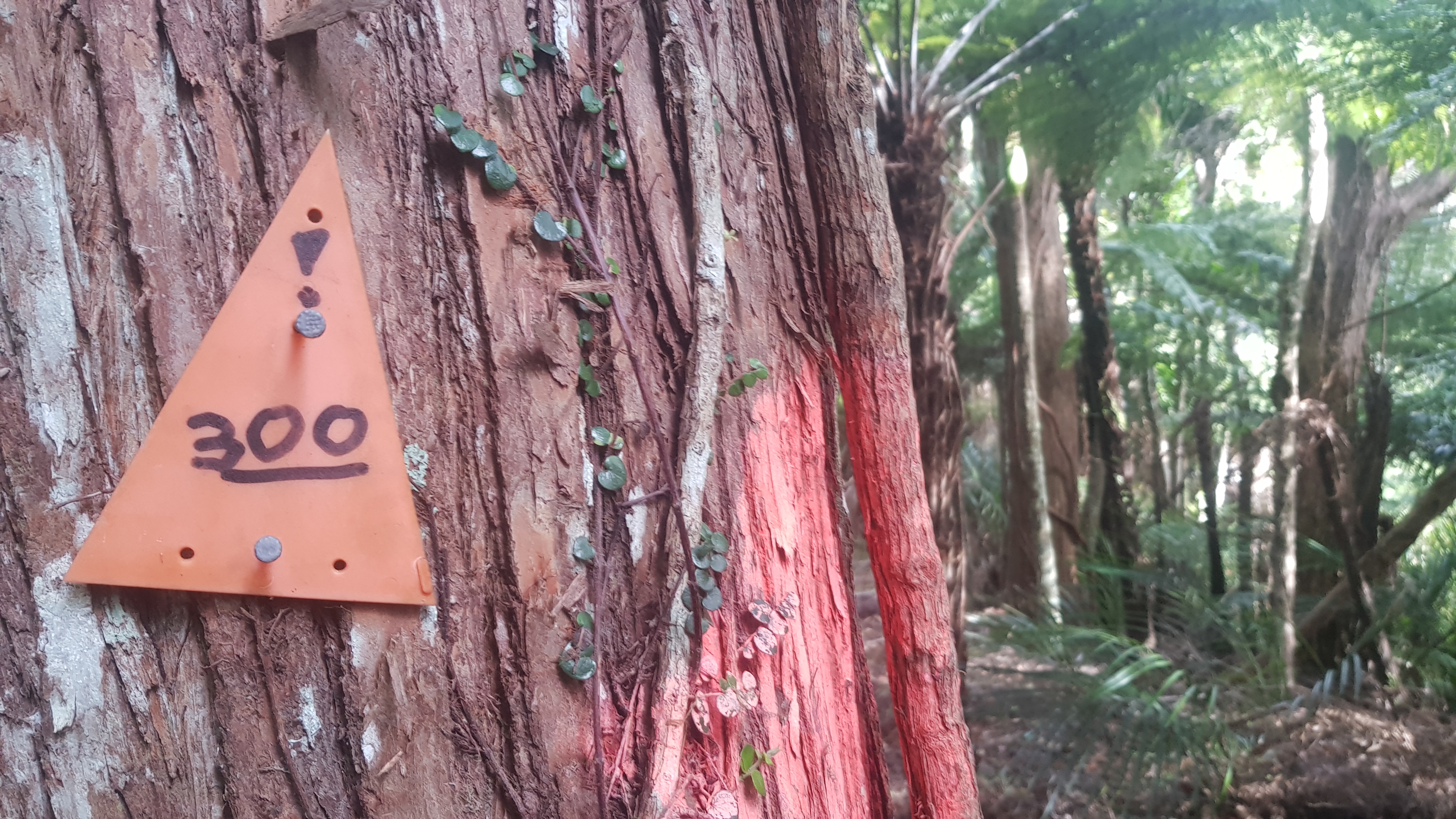
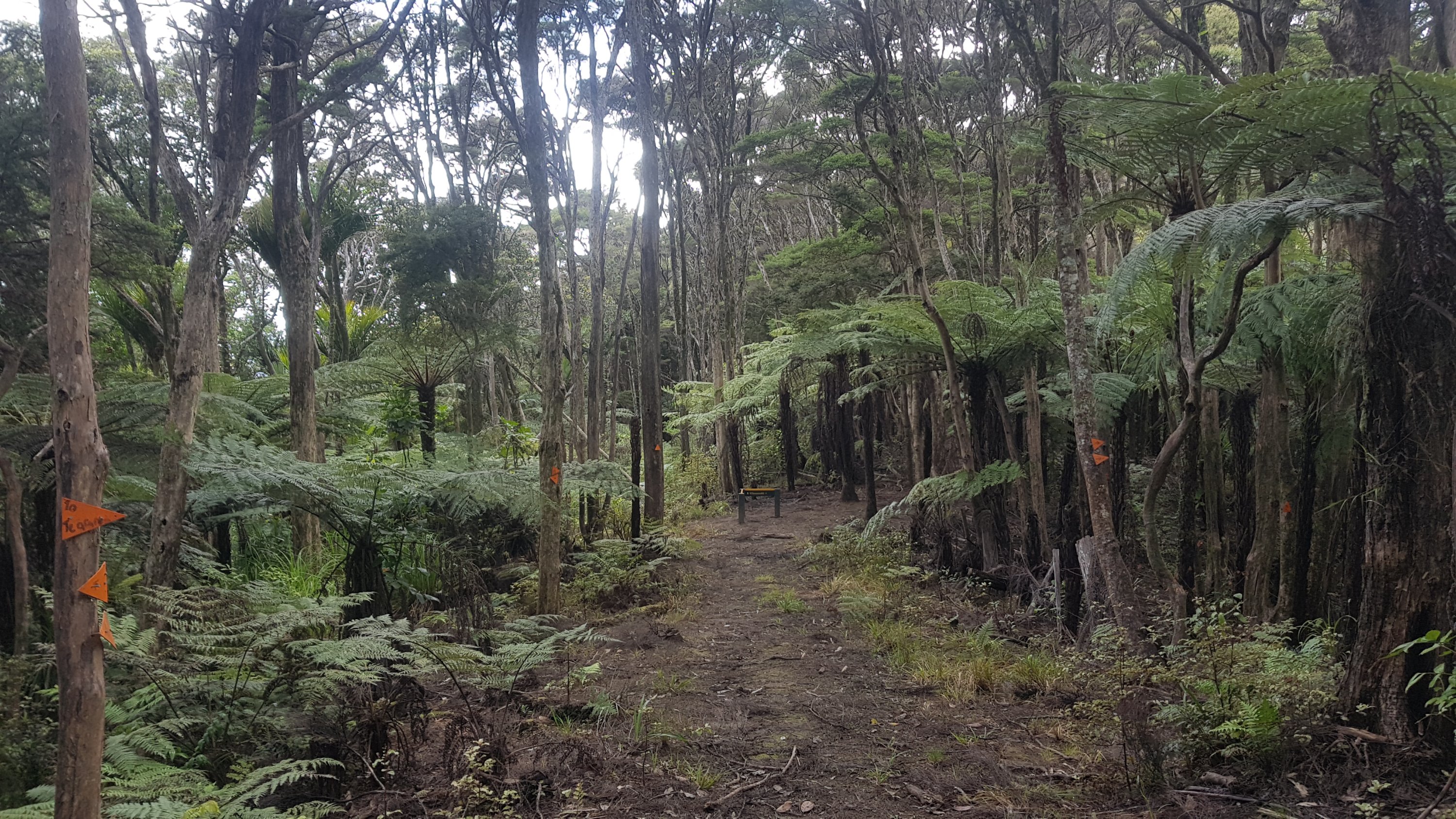
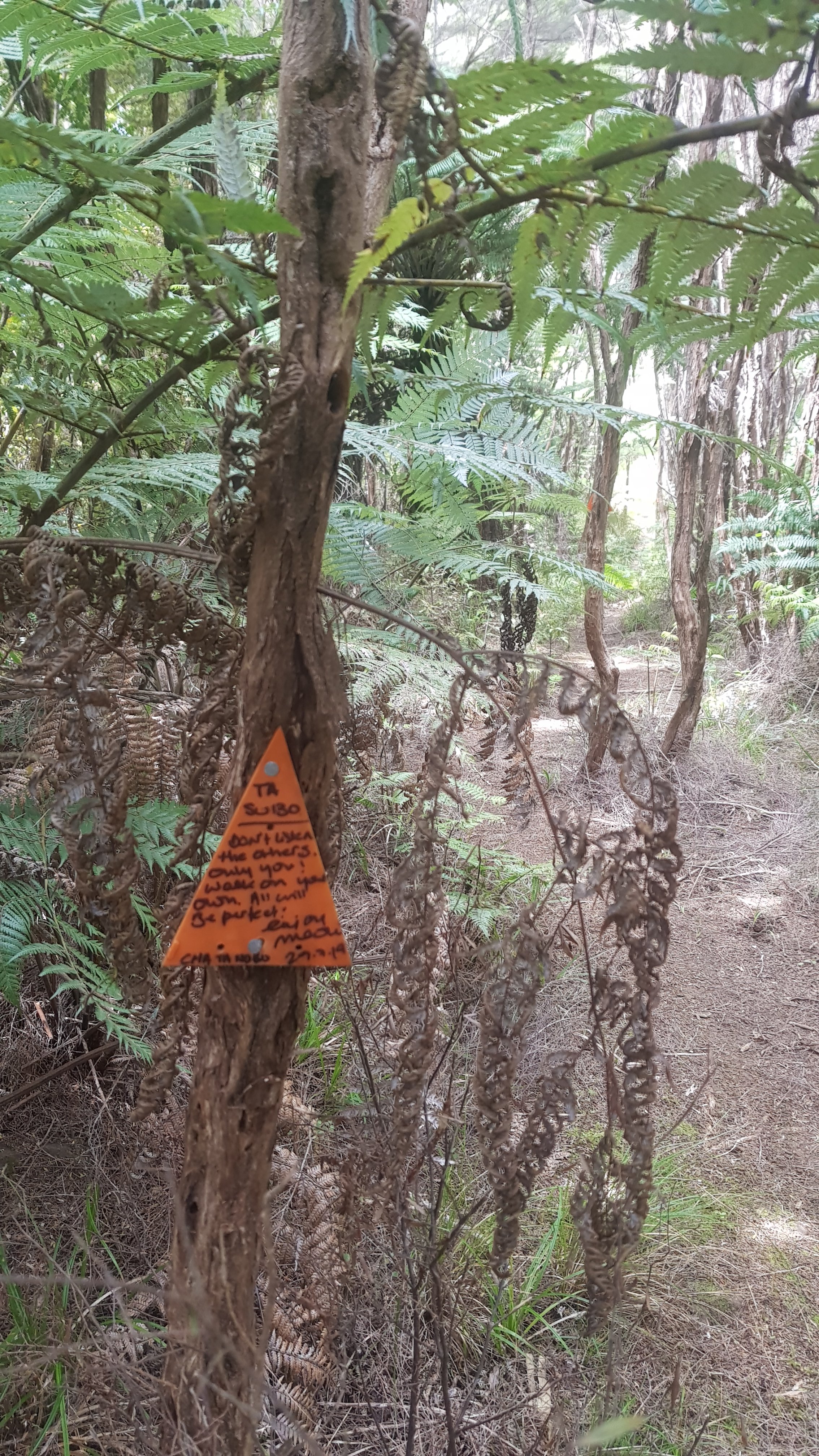
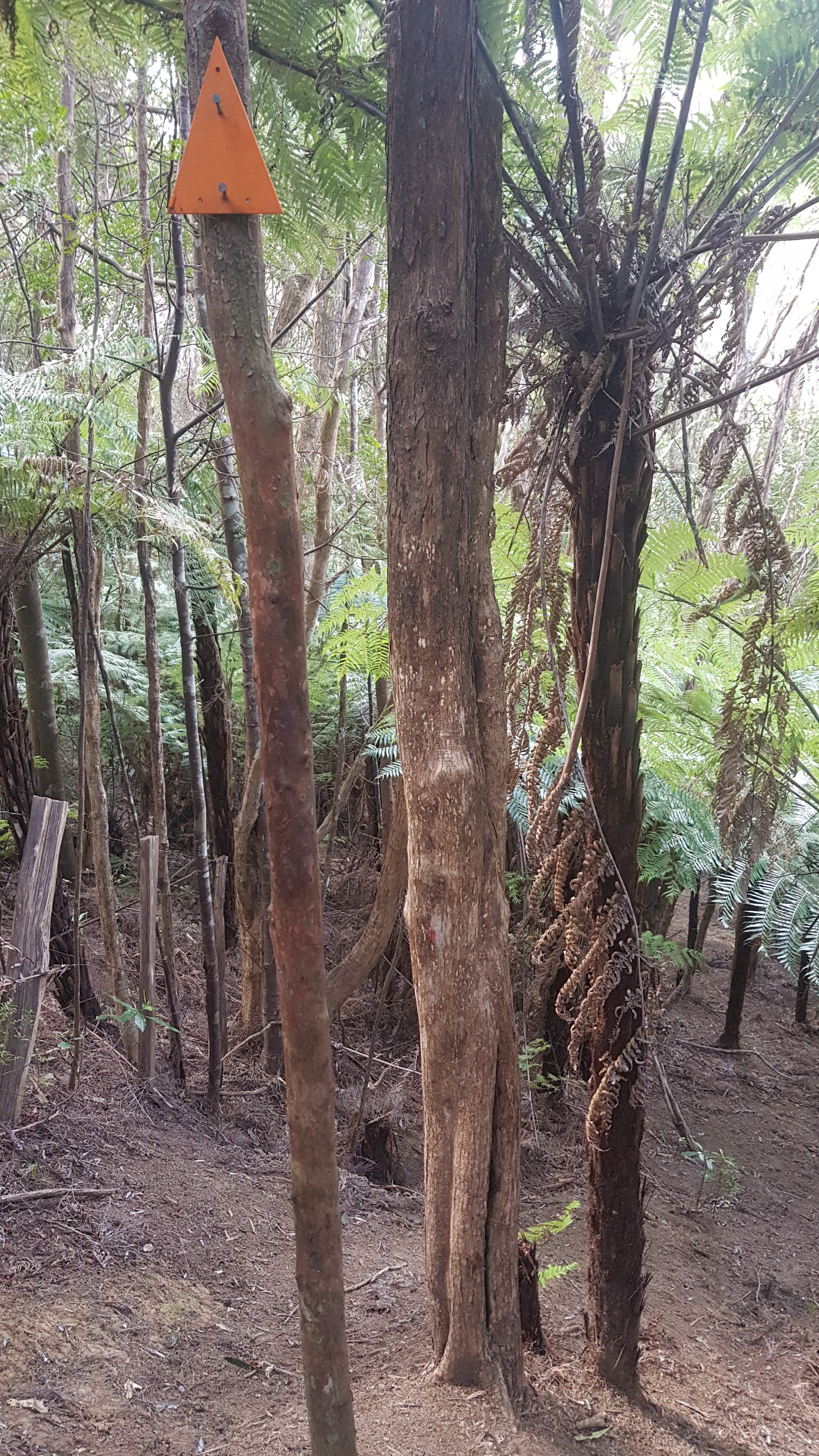
Started seeing these Te Araroa markers which I hadn’t seen before. There really wasn’t a lot of TA signage in general to be honest until today.
TA sign
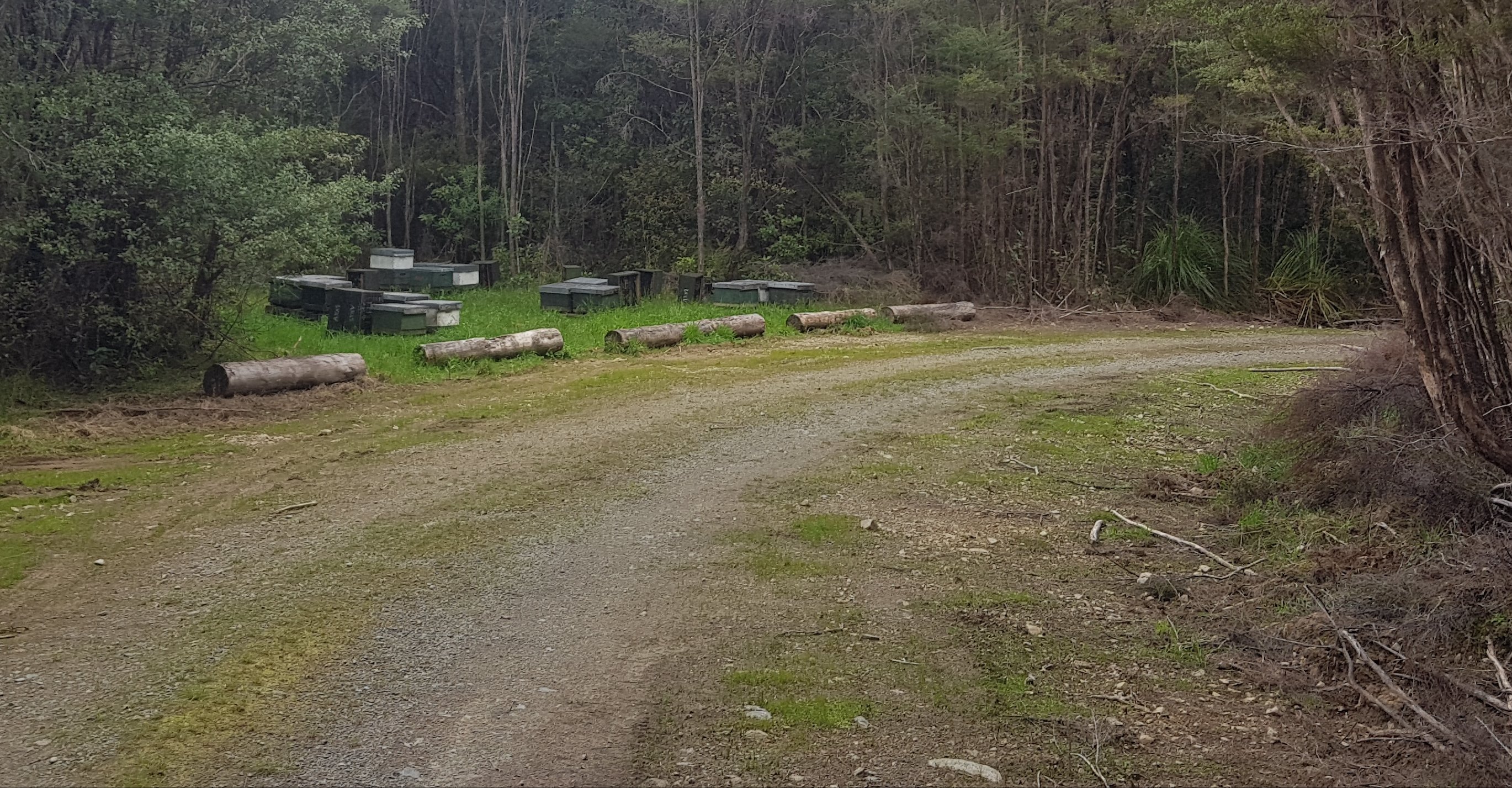
Saw a bunch of beehives around. They were everywhere along this road – yesterday too. Really close to the road, when you walked past them, you could see bees everywhere and hear them too, and often walked through a bunch of bees flying around on the road.
Beehives
Here’s my 11am picture… another particularly uninteresting piece of road.
11am boring road
This boring road eventually turned into the type of track that I was used to seeing. You could see the forest and it was beautiful.
Beautiful view walking down here
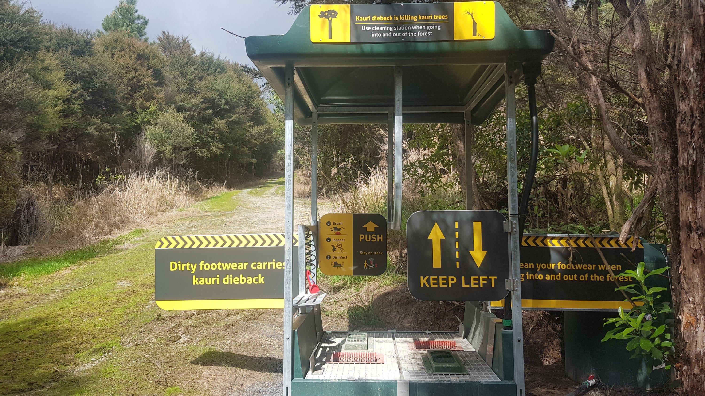
There was a Kauri Dieback cleaning station at the start as we were going to be walking into the Puketi Forest which is full of Kauris. I was looking forward to seeing those.
Use these!
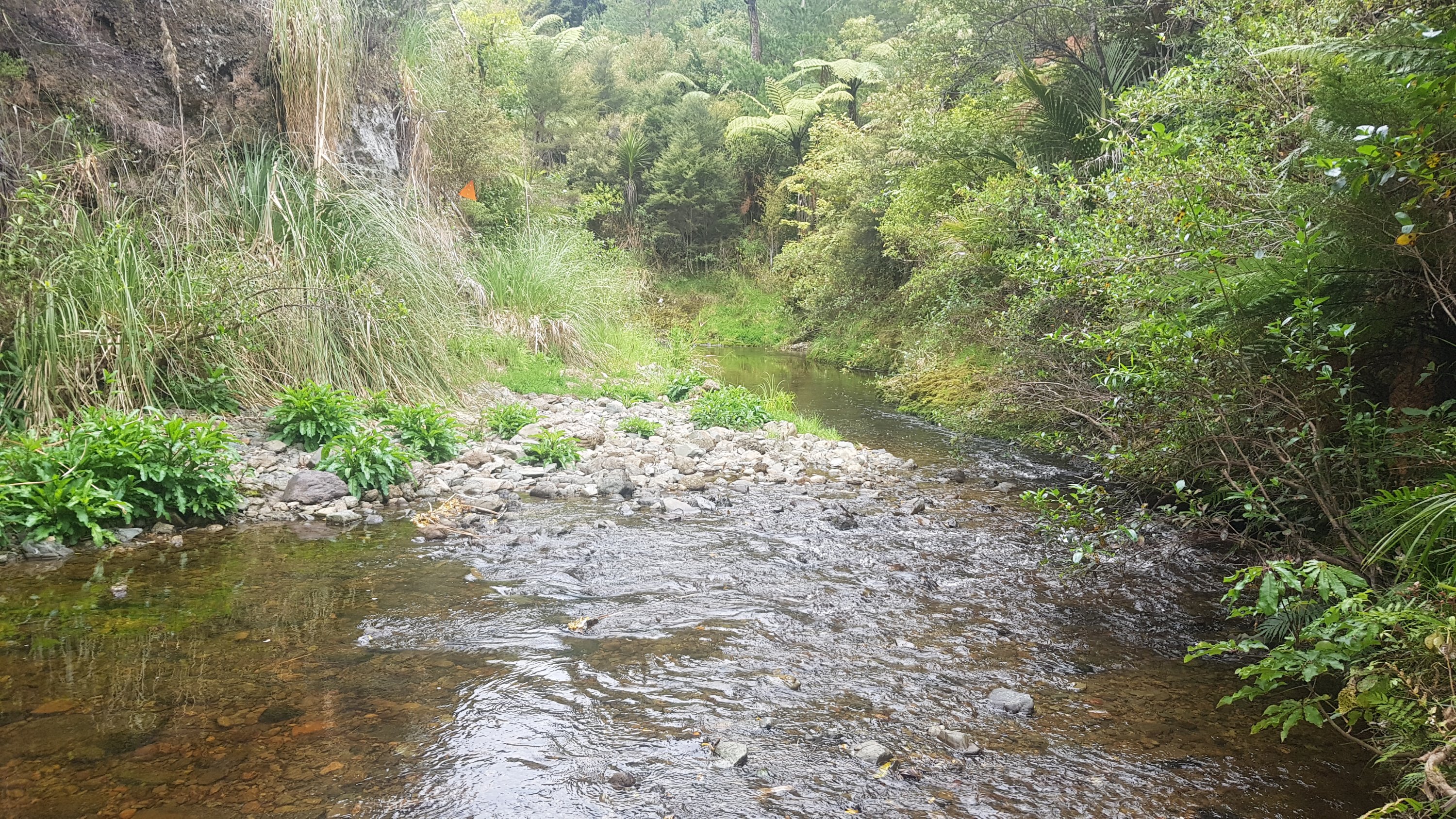
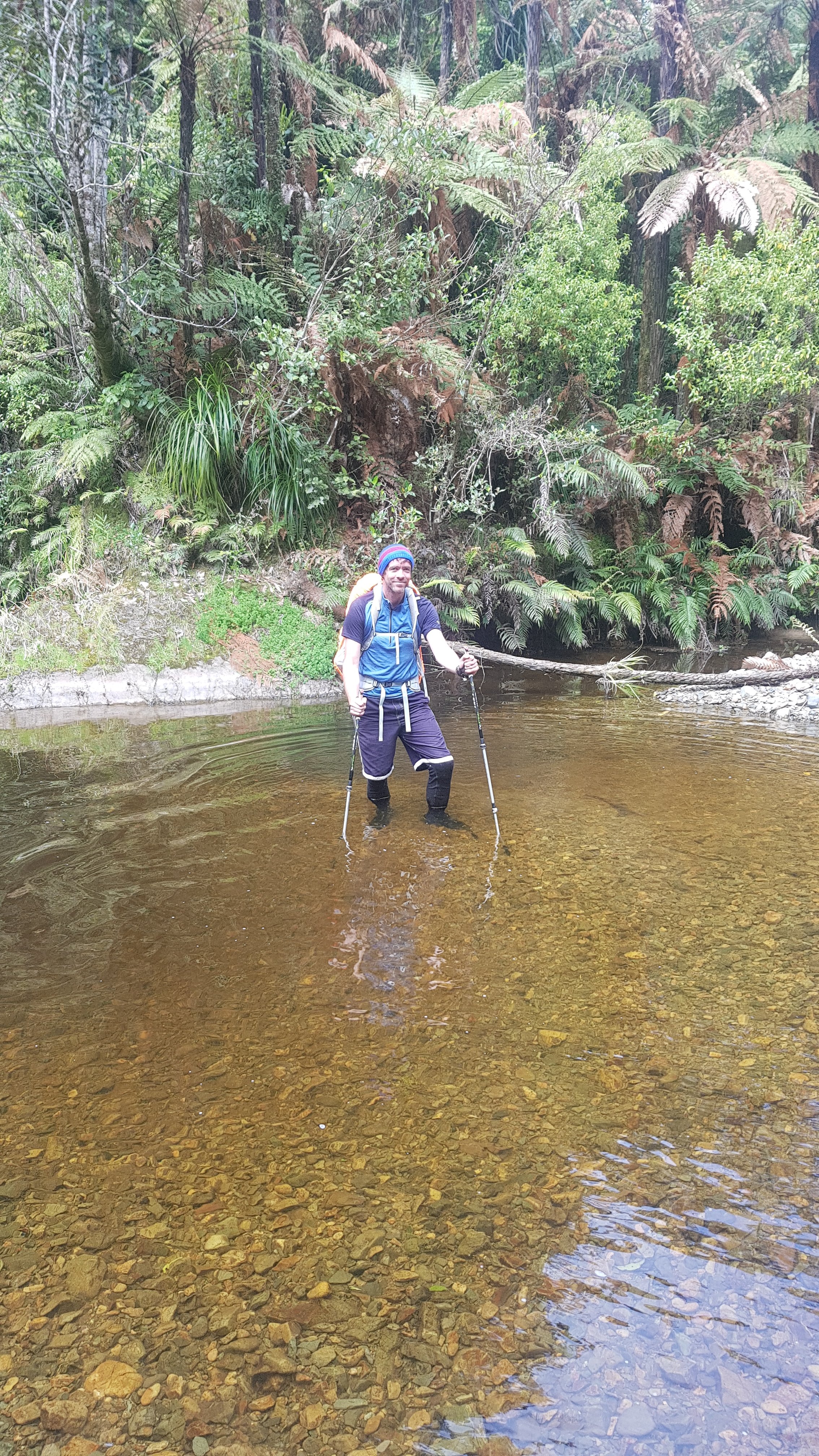
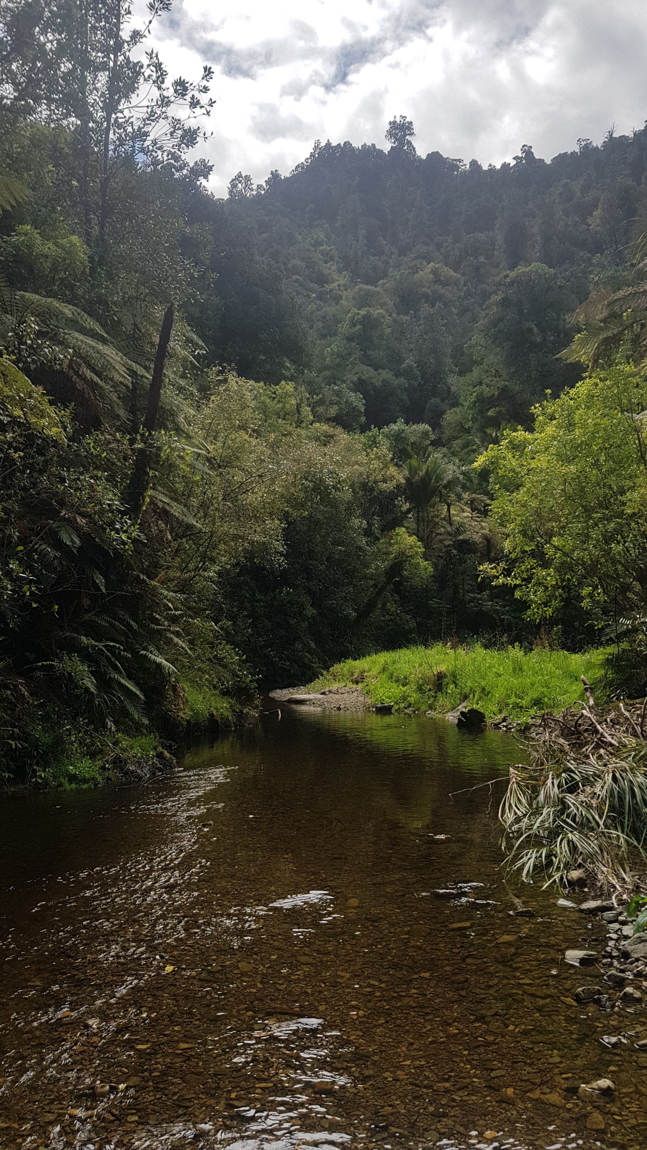
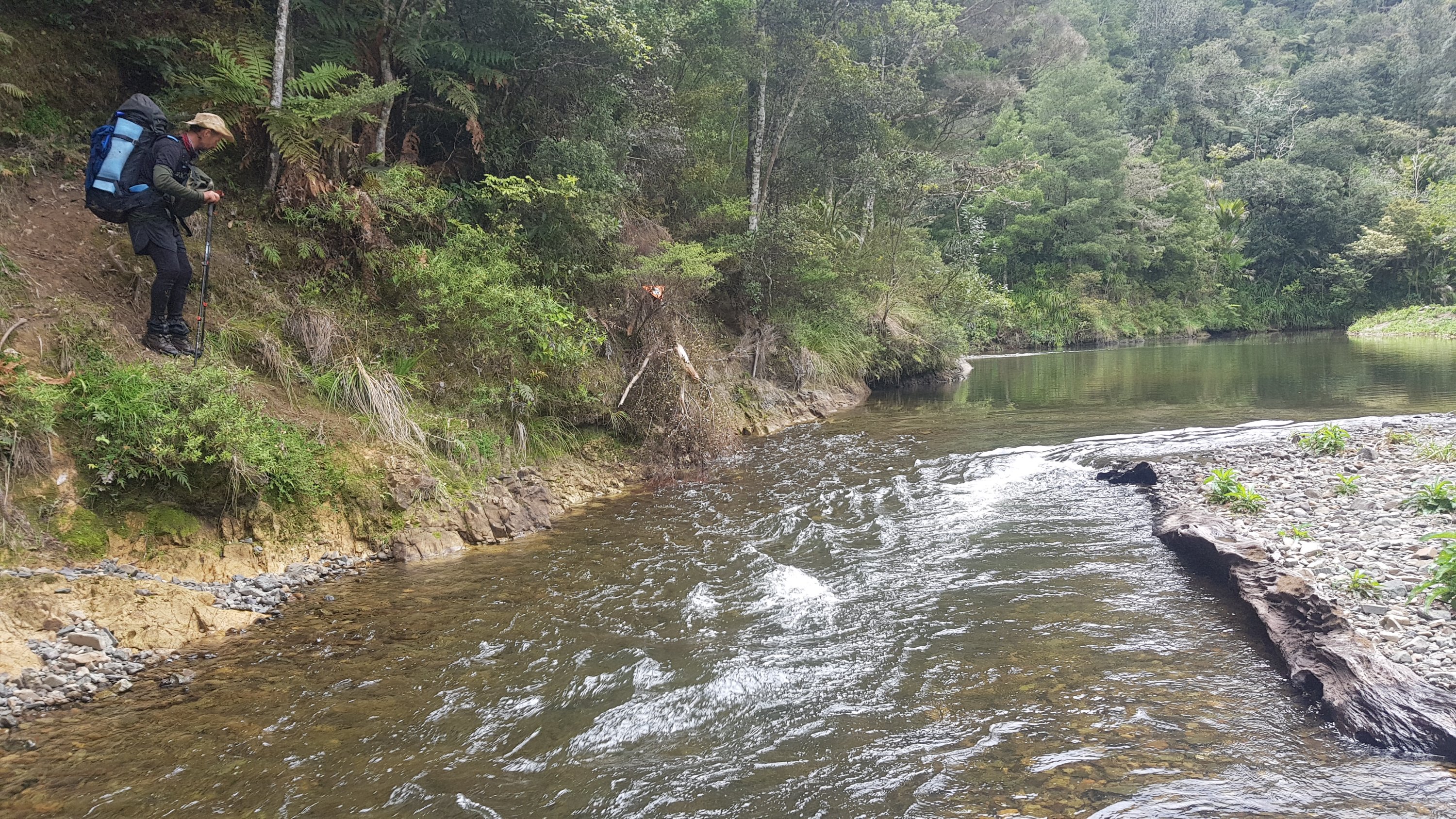
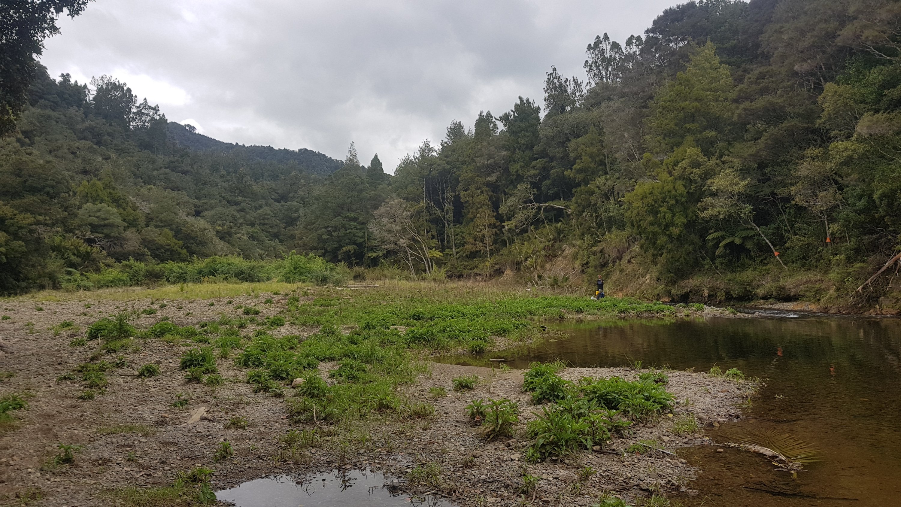
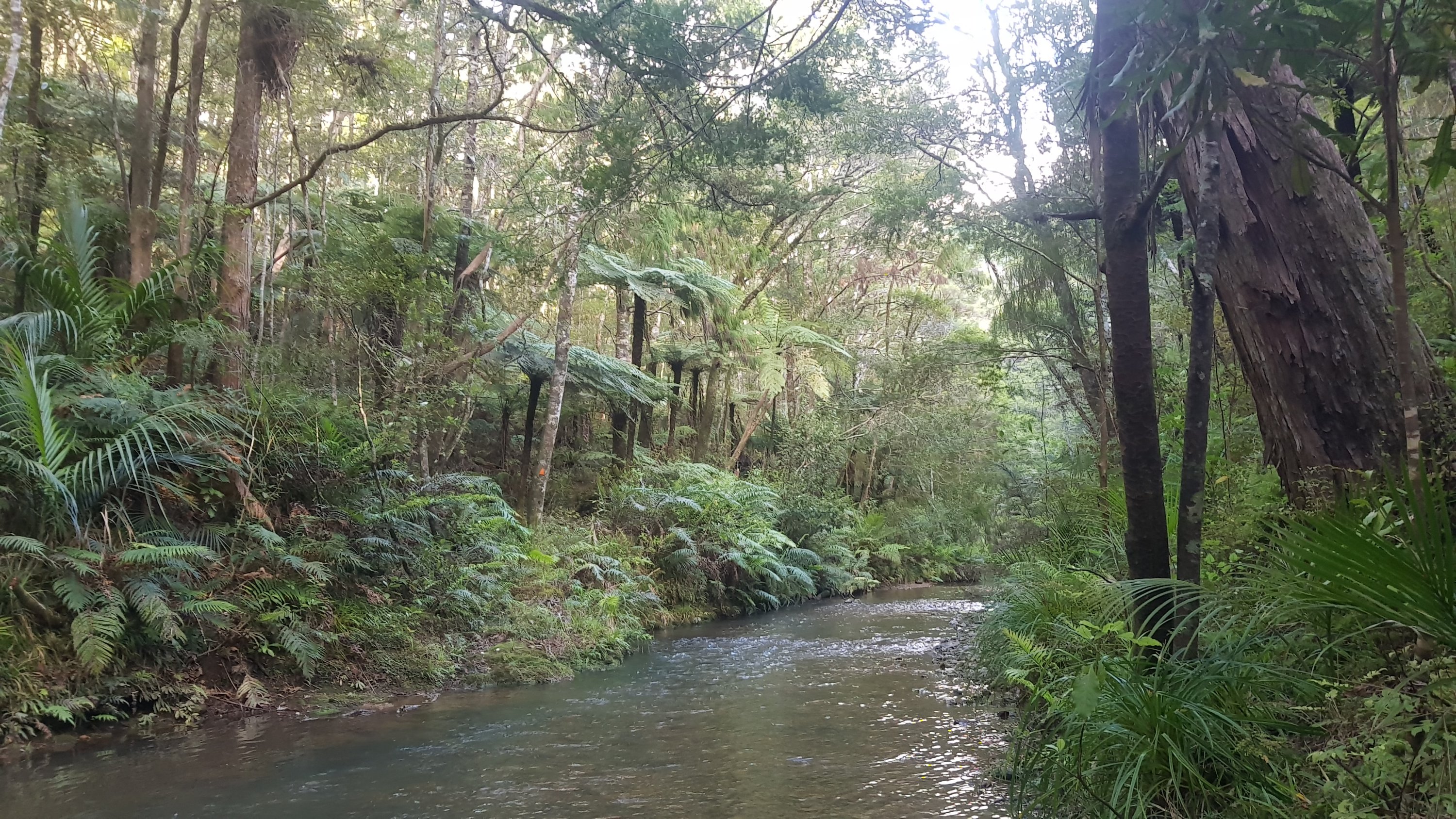
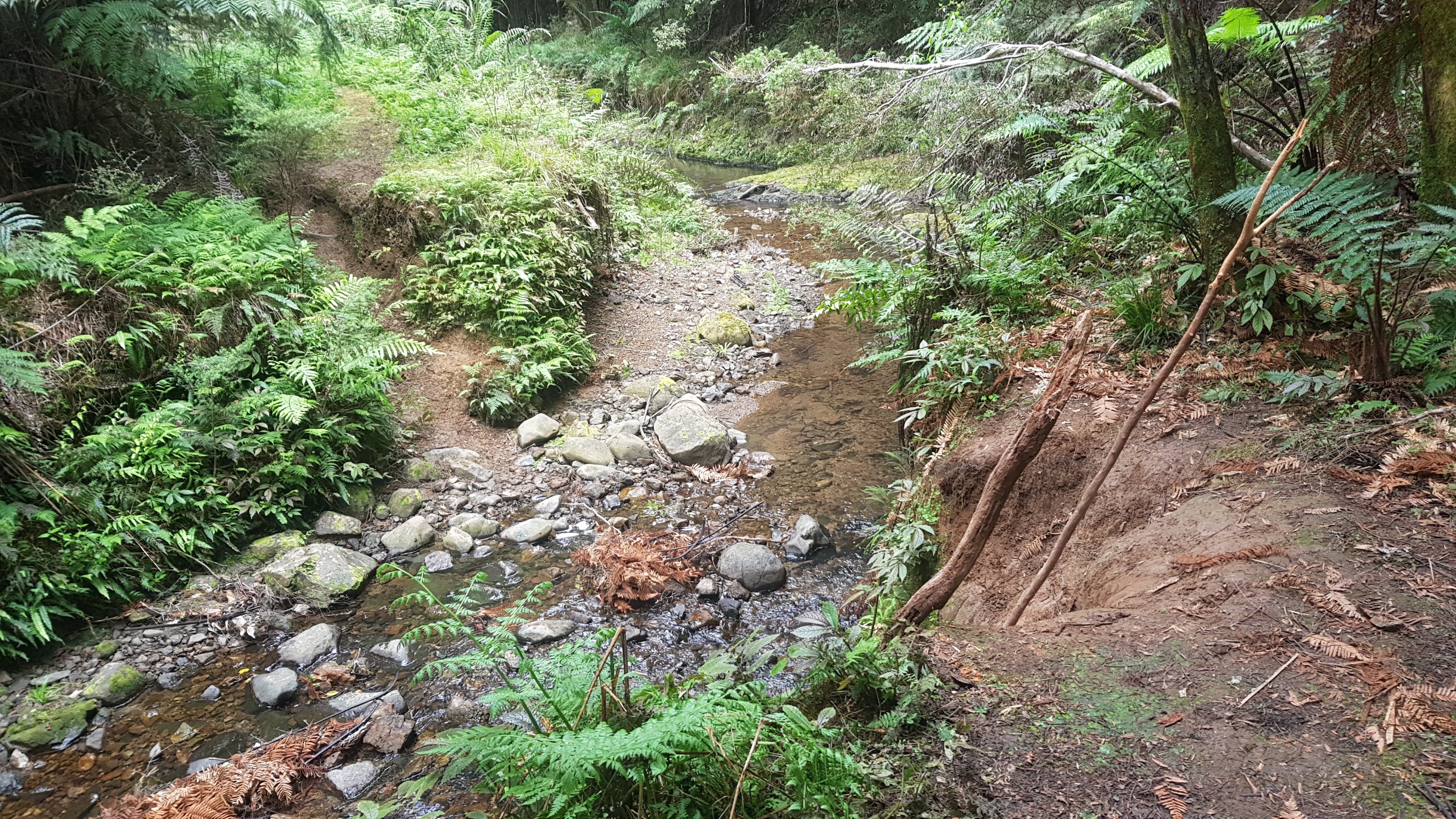
This track went down a steep hill and then eventually stopped at Mangapukahukahu Stream (what a great name). I heard there was stream walking today. I was excited. There had been very little rain recently so I wasn’t worried about water levels.
Start of the stream
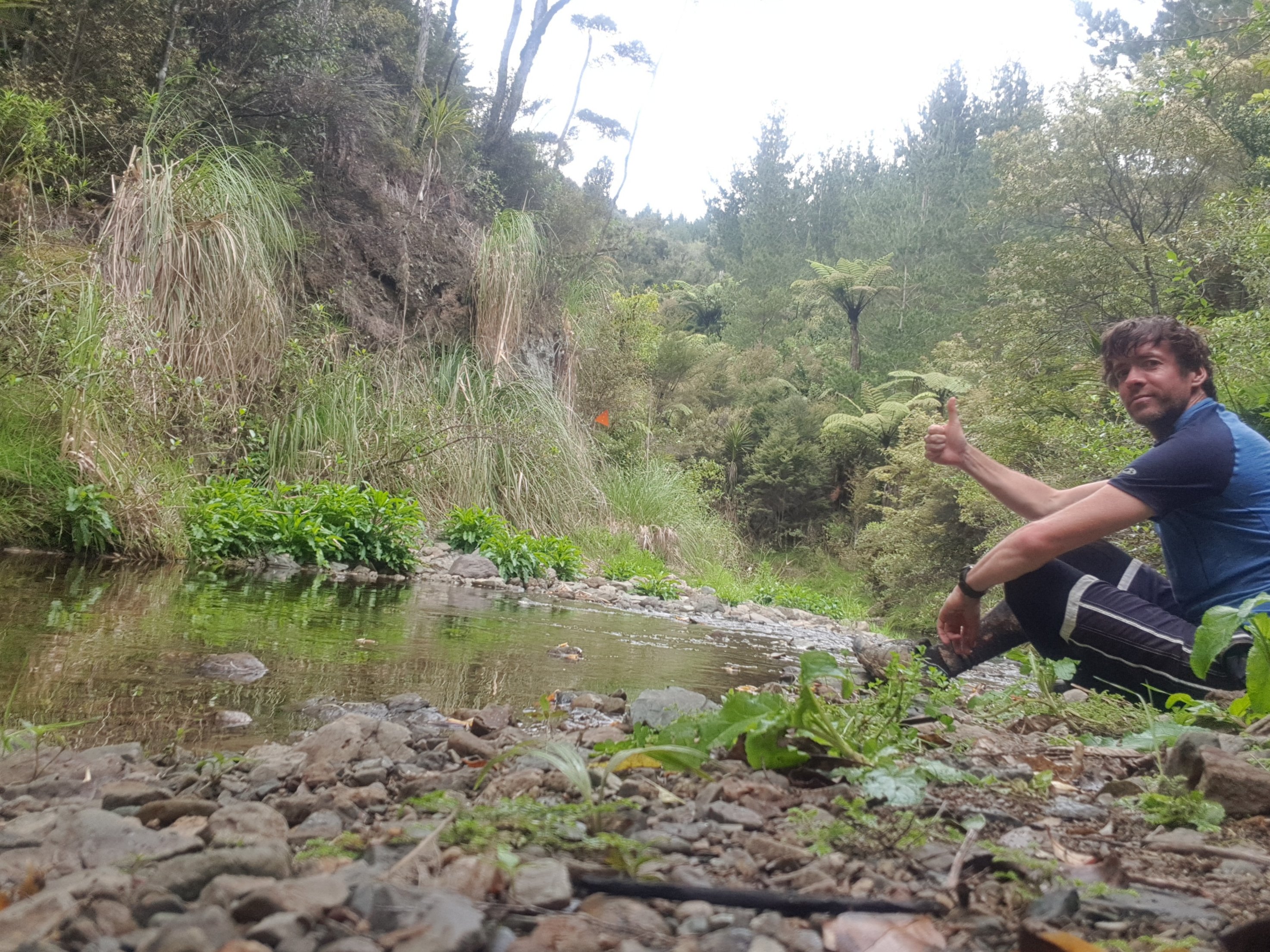
This was a great place to sit and have lunch while I waited for Rhydian who had stopped earlier. I was excited about this bit but didn’t want to do it alone.
Great spot to just sit and admire the view
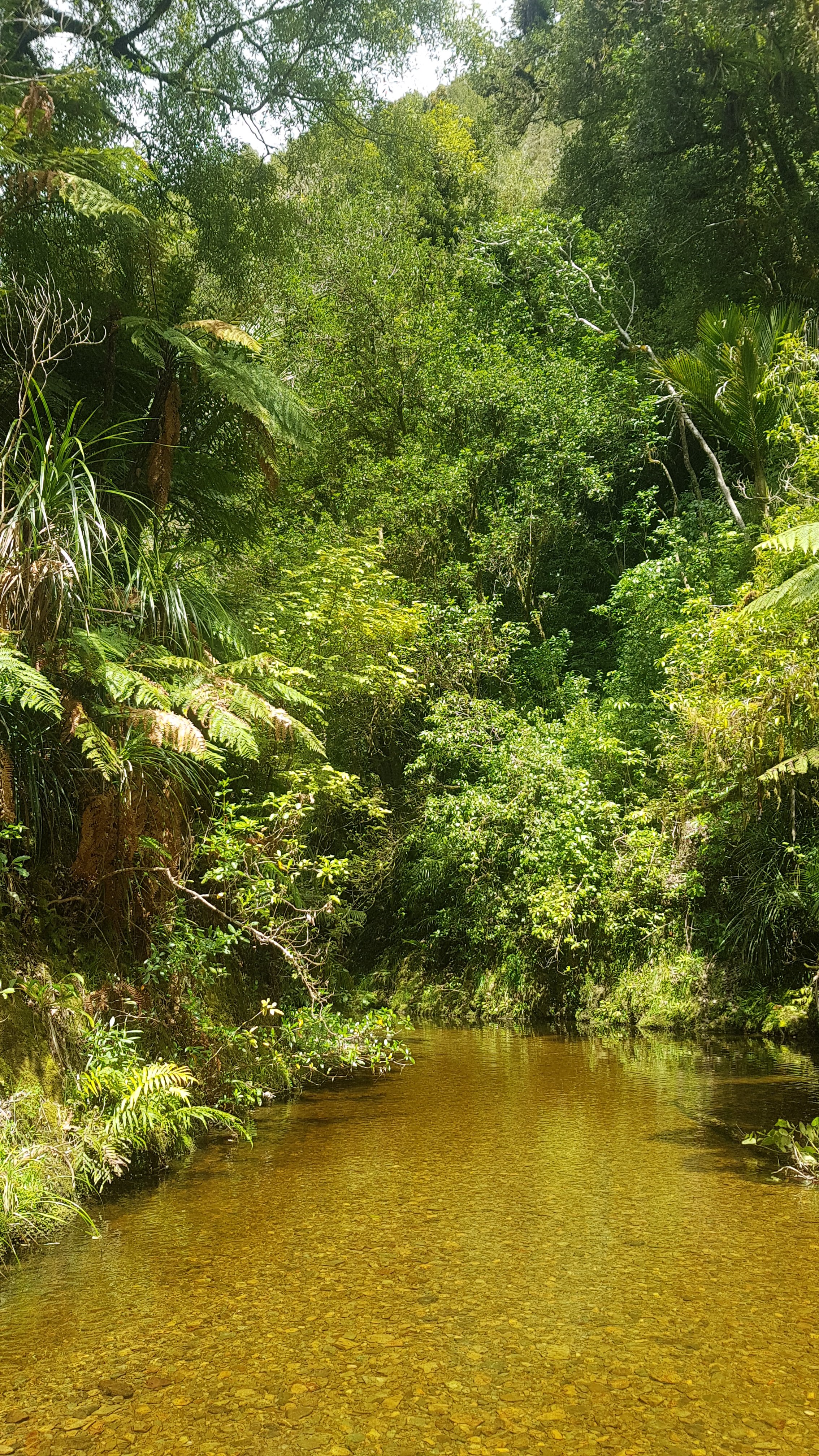
I loved walking down the stream. It went for a few kilometers and the scenery was great the whole way. I thought how most people would never get to do this. In fact, last season’s TA walkers didnt get to do it either as they had closed the Puketi Forest so they could build boardwalks and steps that keep people off the Kauri roots. So I felt honoured to be here.
Beautiful
Rhdyian didnt want to get wet and went to some lengths to avoid the deeper water but I didnt mind.
In the water
I never got sick of the views.
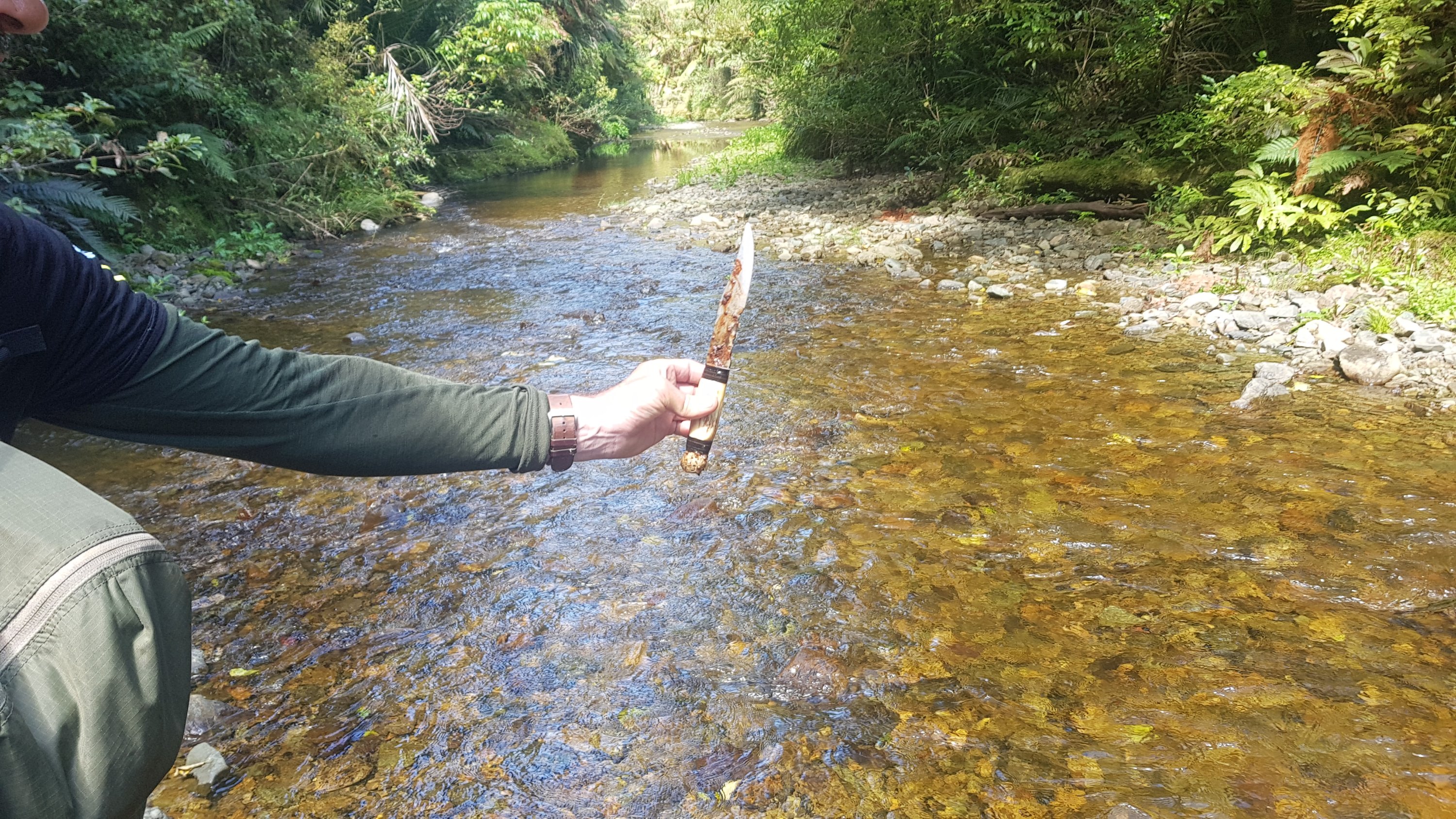
Rhydian must have been paying more attention to the water than the scenery. He found this…
Ouch
I even did two YouTube videos. This was the first time I thought I needed a video to show what I was seeing.
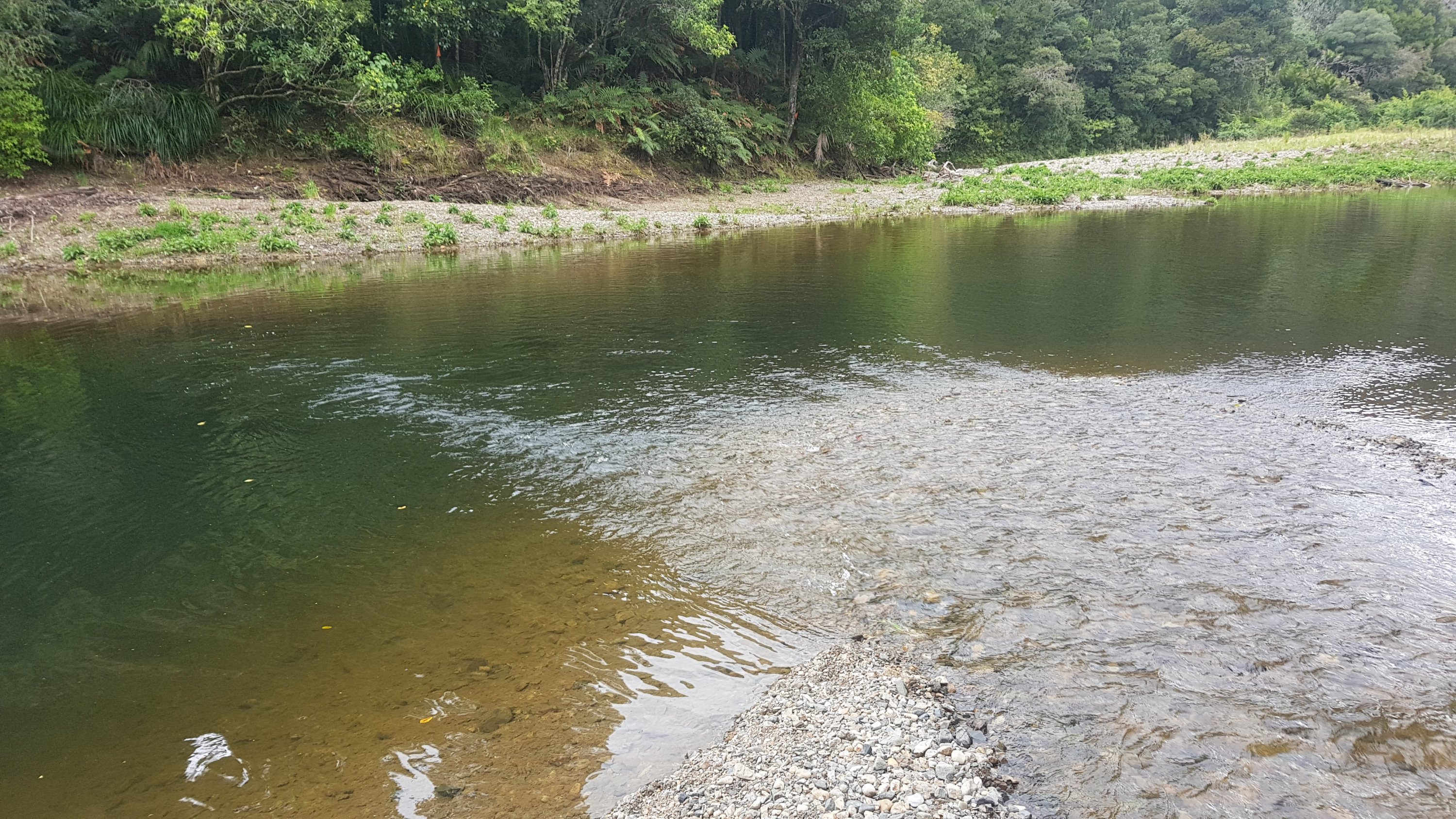
Like I said at the end of the video, the stream eventually came out into a bigger stream which definitely did not look crossable on foot. I wasn’t expecting to have to swim. And honestly I didnt think I’d be able to. And I didnt want to get everything I owned wet – I wasn’t prepared for that.
Now what the hell do I do?
Luckily Rhydian spotted little orange arrows that led over a small hill on a treacherous pathway. It lead to a better place to cross, unless you slipped down the bank, which both of us almost did.
Better crossing point
This was the end of the water section and a great place to have a bit more food.
And a selfie, why not!The scenery at this point
I left Rhydian here as he wanted to chill out a bit longer but I wanted to get going.
Departing point – Rhydian in the background
I put on my headphones and said goodbye. Up here was the next bit:
Where does this go?
This is when it kind of dawned on me. We had done about 11km by this point, and it was now 3pm. We were supposed to be doing 25km today. I’d better get a move on. I thought that we would be okay because I had been told that Puketi Forest was easy.
Or had I? Let’s think… what I had been told is that Puketi was *different* to Raetea. I was never told it was easier. Hmmm….
And along this bit made me nervous. In fact, I was terrified of what came next. It was a walk along the side of a hill, where there was barely a path at all, holding onto trees if there even were any, pulling myself along with whatever tiny thing I could grab onto. There were even a few places where you had to jump gaps.
I called this bit “death ridge”. This was a bit dramatic because if I fell, it was no more than 10 meters down the hill back to the stream, however it still would have hurt a lot. I quickly removed my headphones as it was clear that I was going to need all my concentration for this section. I didnt even take any photos because no photos could do justice for what I was walking through. And I didn’t want to drop anything, because you’d never get it back.
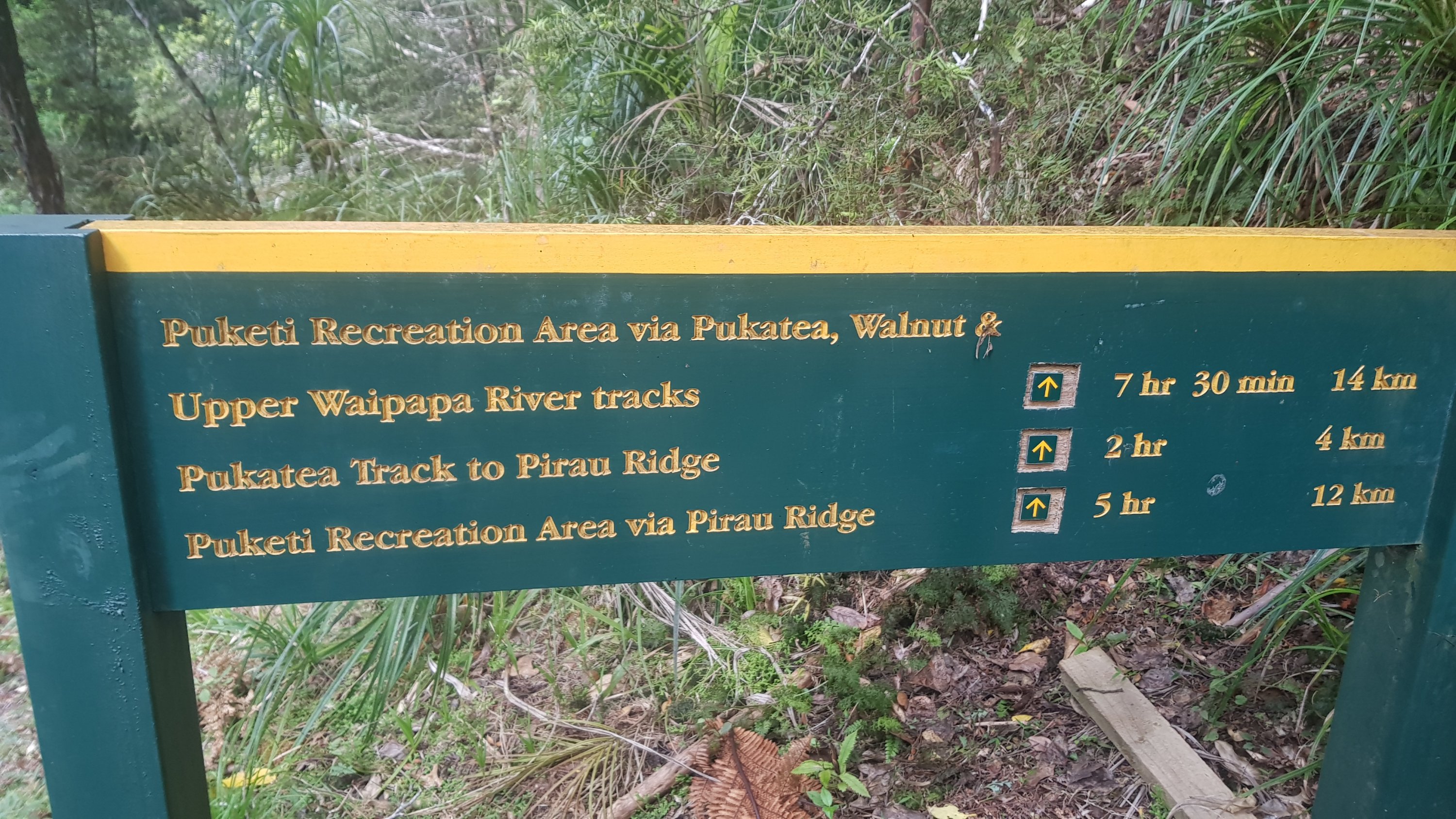
Needless to say it was very slow going. After another hour and a half I had reached sign and had only walked 2km since last time I checked. It was 4:30pm and it was apparently 7 hours 30 to my destination – Puketi Recreation Area. Oh boy. At this rate I’m scheduled to arrive at midnight. And I still have 450m of elevation to climb too. Shit.
Uh oh
It was at this point my whole attitude changed. It changed to one of “this is how a through-hike is meant to be”. I walk as far as I can and then camp for the night. I have food, water, a phone with a full charge, a headlight and there is no sign of rain. I’m set – what’s the worst that could happen? Preparing for an unexpected night in the forest I filled up with water so that I would have enough.
Now you’re not supposed to camp in the Kauri Forest. Kauri Dieback and all that. So I didn’t want to if I didn’t have to. Besides I was looking forward to getting to Kerikeri where I could wash my clothes. But given my complete underestimation of the difficulty of the Puketi Forest I might have no choice.
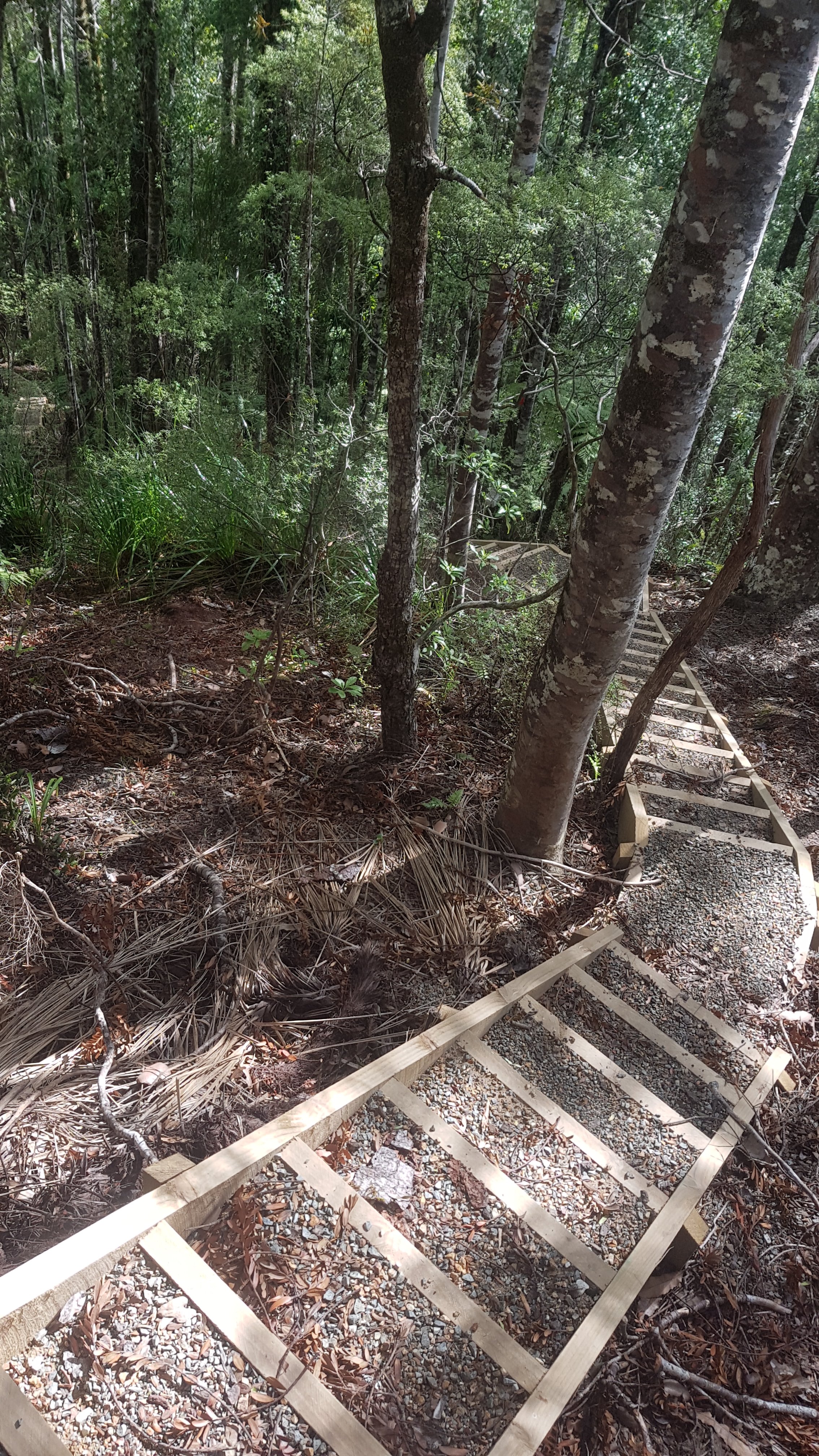
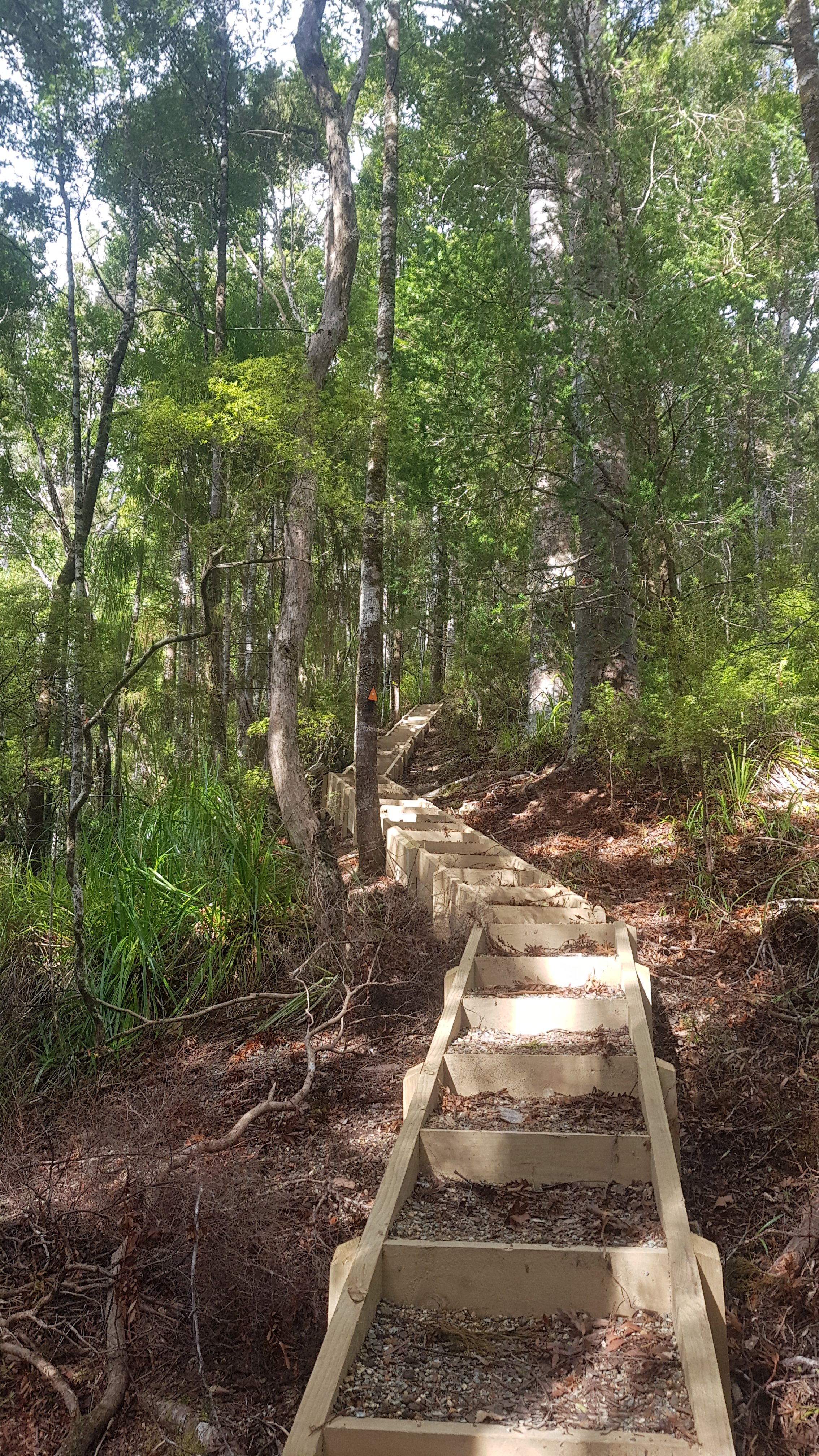
After this sign was stairs. Lots and lots of stairs. Zillions and zillions of stairs. But that’s okay, I like stairs. And they went through the most beautiful patches of Kauri ever.
Stairs behind meStairs ahead of me
This was a breathtaking section. Both literally, and figuratively. I was worried about Rhydian as there were not a lot of spots suitable to pitch a tent and those that were were often specifically fenced off to try and stop you camping (but you still could have easily done so if needed). I’m sure he is fine though, he has been telling me stories on our days of walking and he is clearly more experienced than me.
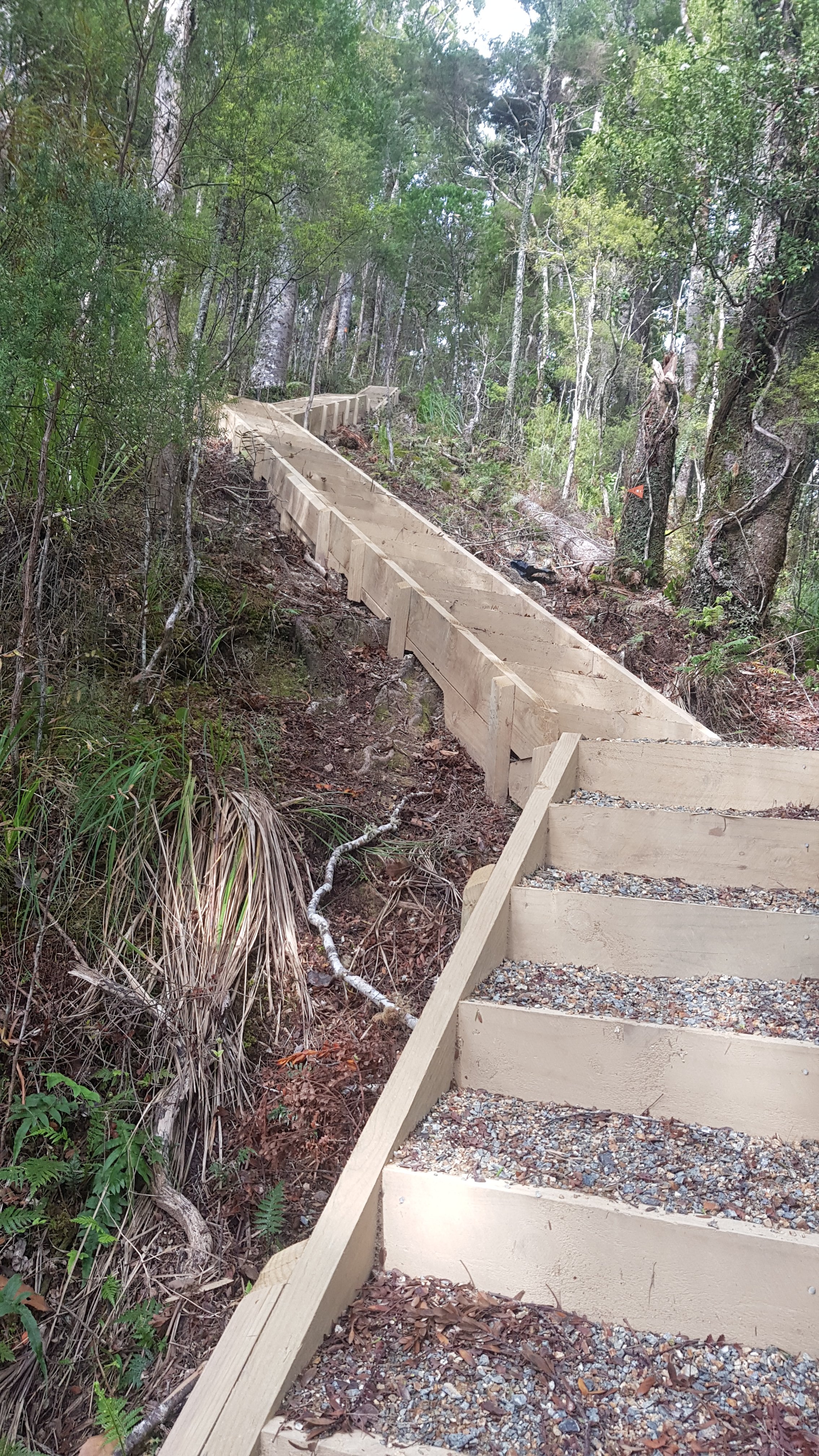
Even more stairs
Of course the whole time I was walking I was looking for potential camping spots for myself as no way was I walking until midnight. I wasnt worried about the lack of hours though. I even stopped to find a geocache that hadn’t been found since early 2017. It was an easy find.
One of the many fine specimensSomething else cool that I saw
But then suddenly I found this!
Not far to go!
It’s suddenly only 2 and a half hours from here to the campsite, and by this time it was just past 6pm. Oh wow, I must have misread the original sign! I should be at camp around 8.30pm. That’s still dark, but a much more respectable time. I had read that at Puketi camp it can be busy on weekends with weekend day trippers, so I didn’t want to get in real late and annoy people.
So I just hoofed it down this gravel road as quickly as I could. I was hurting a bit but I didn’t care. I just wanted to get there.
It was a typical gravel road. I did see this though…
That’s gotta hurt!
And as the sun went down, I hoped for a nice sunset. But this is all I could see because of trees:
The sunset
By the time I turned up it was 8.30pm. An added bonus was that because my GPS watch is on “low accuracy” mode, it was showing that I’d walked a shorter distance than I actually had. So I turned up at camp 10 minutes earlier than the watch said I would.
The Puketi Recreational Campground was a big place. I had a wander around with my torch but couldn’t see anybody there. I came across two people with a campervan and asked them if anyone was here. They said “no, and we are just leaving too” and they then did exactly that. So yet again, I have arrived at a campsite being the only one there.
That was good. After a long day I could just relax and take my time. I spent some time looking at the stars. They were beautiful. I’ve seen some great star displays while I’ve been walking. I know I’m never going to be able to capture it in a photo, but I wanted to try.
Night sky – view from my tent tonight
Heard lots of bird noises that I haven’t heard before. Given the signs around, I’m guessing at least some of them were kiwi.
And again it is surprising that not much hurts. Very little knee pain. Again though I bet that will change in the morning. But I’m happy with the state of my bumps and bruises.
I wondered what Rhydian was up to and if he would turn up. I didn’t expect him to given he normally walks slower on the uphills than me. If he turns up it won’t be until real late. He wasnt there when i went to sleep at about 11pm. But I knew that he would just be enjoying himself camping in the forest. Just as I was, alone again in a campground for the first time since Raetea Peak, but this time without the wind and the rain.
Now this is the *real* TA. It was a hell of a slog and terrifying in places but I would happily do this day again in a heartbeat.
Date: 6 October
Distance walked: 22.3km
Trail covered: kms 197.5 to 218.1
Weather: sunny with clouds
Number of oranges I got handed by strangers: 9
Got woken up at 7am to a cacophony of birdsong. I didn’t mind at all, there are definitely worse things to wake up to.
I finally got to see what was around at the Puketi Recreation Centre since I arrived after dark last night. There’s a hut with mattresses and a fireplace and 6 or 8 beds, but you have to book that. There’s a camping area and clothesline and sink and a few picnic tables, one under a shelter.
I haven’t sat down on a bench to eat my breakfast in a while now. It’s so nice, you really start to appreciate the small things when doing Te Araroa.
Just like last night’s attempt at photographing the night sky, I’m never going to get a good sunrise photo with just a phone camera, but I attemted it anyway.
I was still the only one here. Rhydian hadn’t turned up, which I expected, I hope he’s alright, I’m sure he is, I just remember how scary “death ridge” was between the river and the kauri stairs yesterday.
This is a wonderful spot. If there was a shop anywhere around I’d probably stay here all day. But I’m very low on food now, so need to get on to Waipapa. I have an AirBNB booked there.
Not long to go before i pass the 200km mark. That will be exciting. I think it’s across farmland somewhere.
As I was leaving I saw there was actually another tent set up near the entrance. Weird, given that I didn’t see or hear anyone all night. Nobody used the bathrooms during the night that I could tell, and nobody was around in the morning. It’s not Rhydian’s tent, his was green.
A tent hiding away that I never saw at first
I was looking out for the 200km point. It occurred to me that the 100km point from Day 4 was unlikely to ever change, but this one would. Last year when the Puketi Forest was closed, the detour would have caused the 200km mark to be elsewhere. But for me, this is where it was today. It was just before the farmland I had to cross. It was on an otherwise uninteresting piece of gravel road. Still, I tried to etch 200 on the ground to mark the occasion.
200km mark passed!
The Puketotara Landcorp farm was soon after. It forms part of Te Araroa and is signposted as such. Lots of sheep in this farm.
Entrance to Puketotara Farm
My 11am picture was coming up to one of the many gates and watching the sheep run away. They are much more timid here than the ones on One Tree Hill in Auckland where you can go right up to them.
Cross at gates like these
These three sheep just stared and stared:
Whatchu lookin at
I got a bit lost at one point in the farm. There weren’t many orange markers and at one point I crossed a swampy stream, only to realise I had gone the wrong way. So I had to cross a second swampy stream, but then didn’t know where I was. After crossing two more streams, I finally got out of the farm. I have no idea if you actually needed to cross any streams or not. They were covered in grass so you couldnt see how deep they were. The first one was almost up to my waist. On the plus side they did clean my muddy shoes!
After the farm was more seemingly-never-ending gravel road. This particularly monotonous bit is called Mangakaretu Road and was where I lost the will to keep walking and so sat on the right hand side having lunch.
Another never-ending gravel road
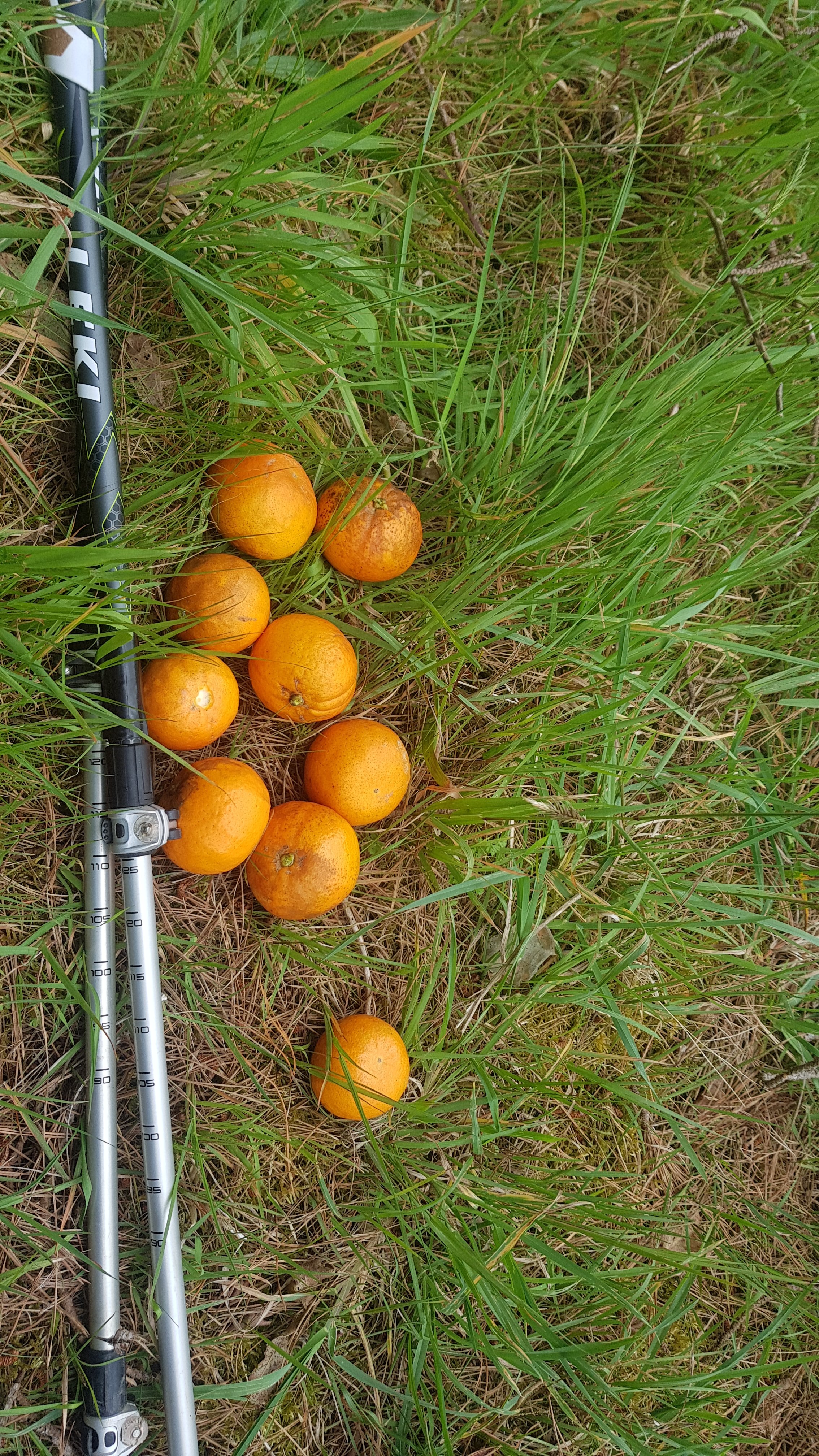
Further on Mangakaretu Road, outside a house I ran into Hana and Rachel who lived at the house. They were really nice and offered me some oranges from their tree. I sat down to eat them on the next corner but I couldn’t peel them without making a giant mess so I ate them once I got to the Airbnb. Thanks girls, they were very sweet and juicy and I loved them.
Oranges given to me
The path through another farm was closed, and so a small detour down State Highway 10 was required. This was a busy road, much busier than State Highway 1 from last week but it was mostly okay except for one bridge which had no bit to walk on at all, only the two traffic lanes and that’s it… and there were a lot of cars. I had to basically walk up to the bridge, wait until no cars were coming and run for my life to the other side.
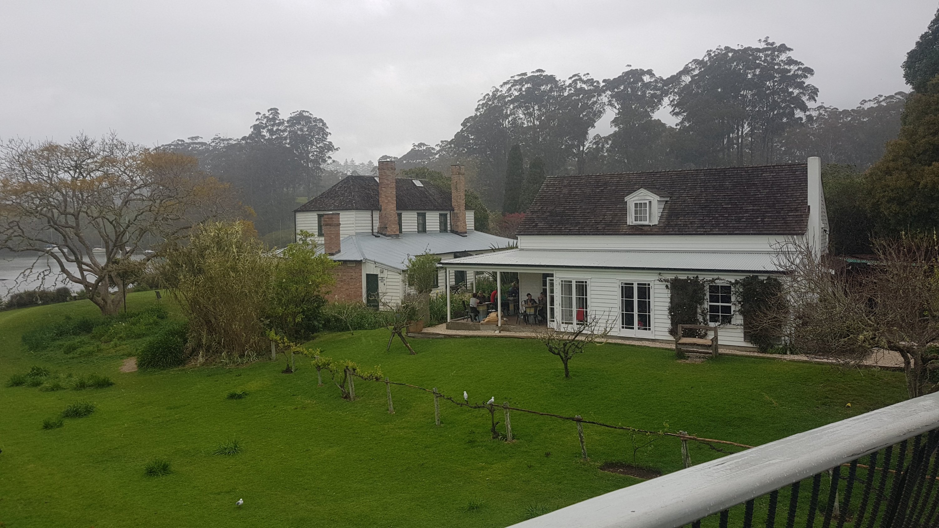
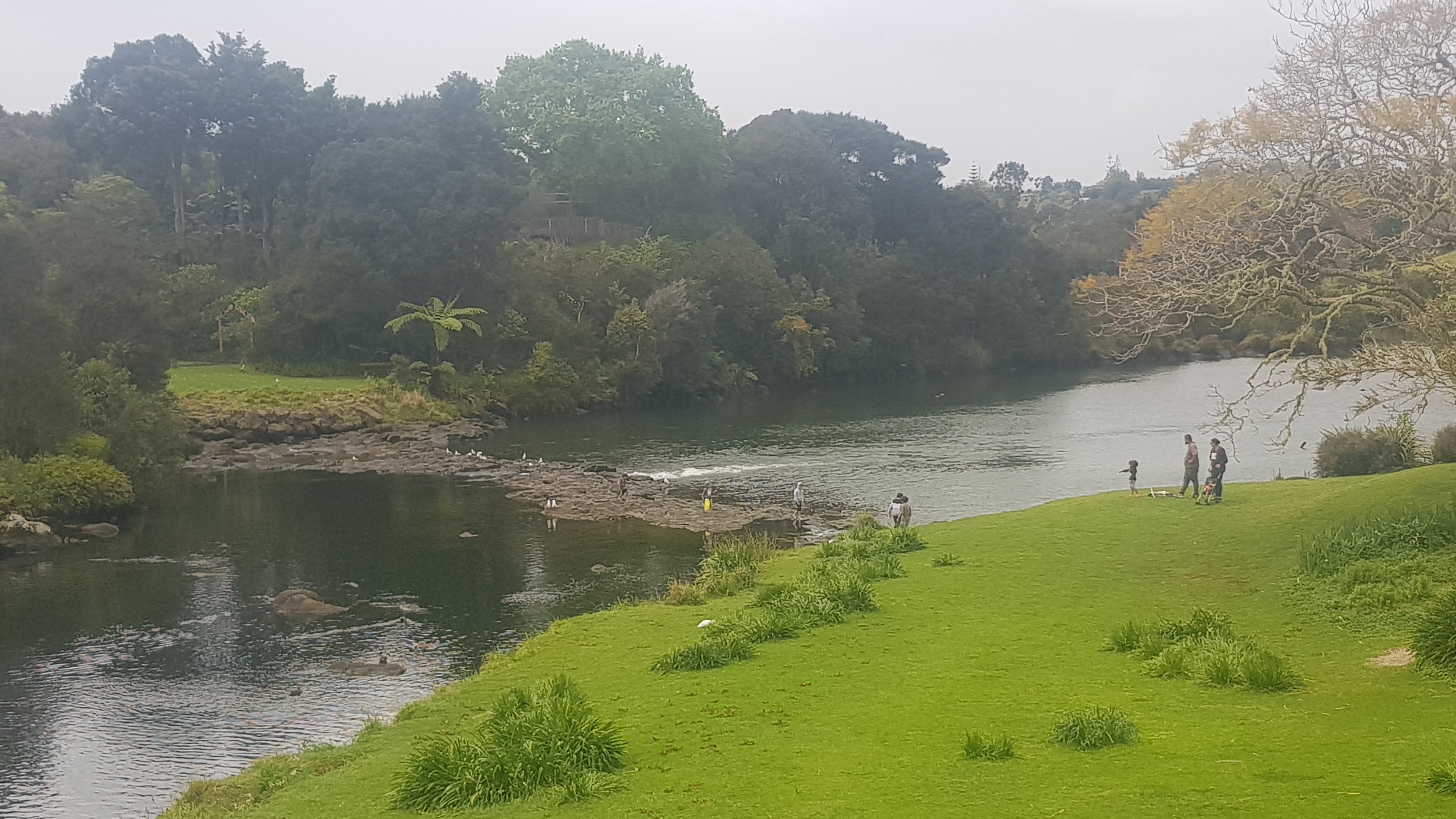
But then it was a short stroll by the river to my Airbnb. The owners took me into Kerikeri to go to Countdown and after that invited me to have a roast chicken dinner with them, which I did. People up here are so nice.
So this day was a fair bit less epic than yesterday, but I made some good distance. I might walk a short distance tomorrow but I need to rest my sore knee and both my feet. They really hurt now, and one of my little toes has a blister on it almost the size of the toe itself. I didnt even notice until I was bandaging up other cuts I got from the farmland grass. I took a photo but I will spare you the details 😁
Date: 7 October
Distance walked: 6.3km
Trail covered: kms 218.1 to 223.1
Weather: raining a lot but I missed most of it
Decibel level of the kid yelling “Muuuuuuuummmmm” at the cafe: 179db
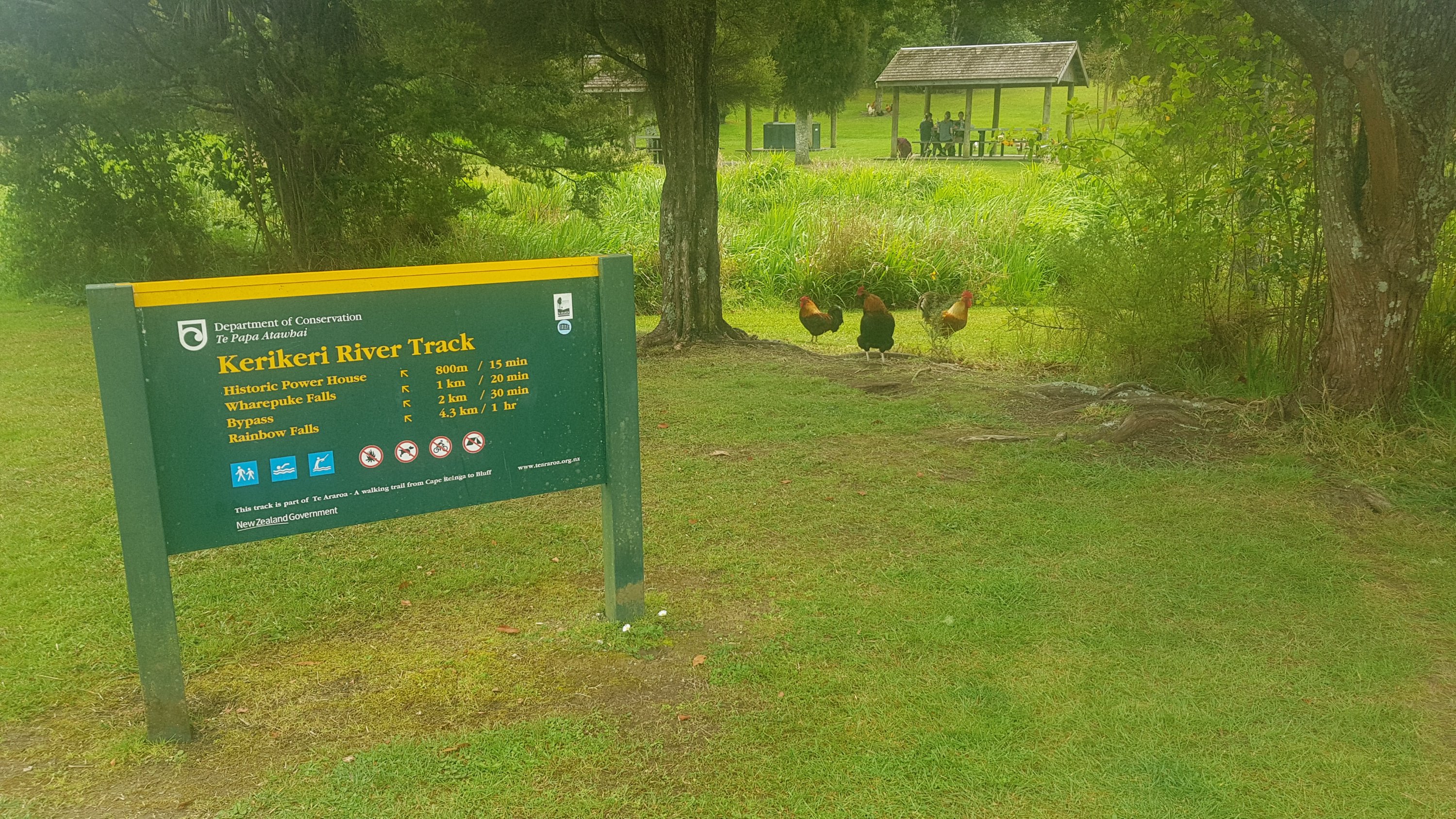
This was really supposed to be a rest day, but I wanted to walk to a place that had a few more amenities around, and a cafe or something. I continued down the trail a bit, heading to a very cheap Airbnb that I found last night.
At first I thought I was walking through somebody’s backyard…
Start of the trail today
Okay now I’m definitely walking through someone’s backyard.
Actually it was walking through lots of people’s rear sections. It was a very interesting pathway. It was also along the river and very beautiful.
A nice part of the track
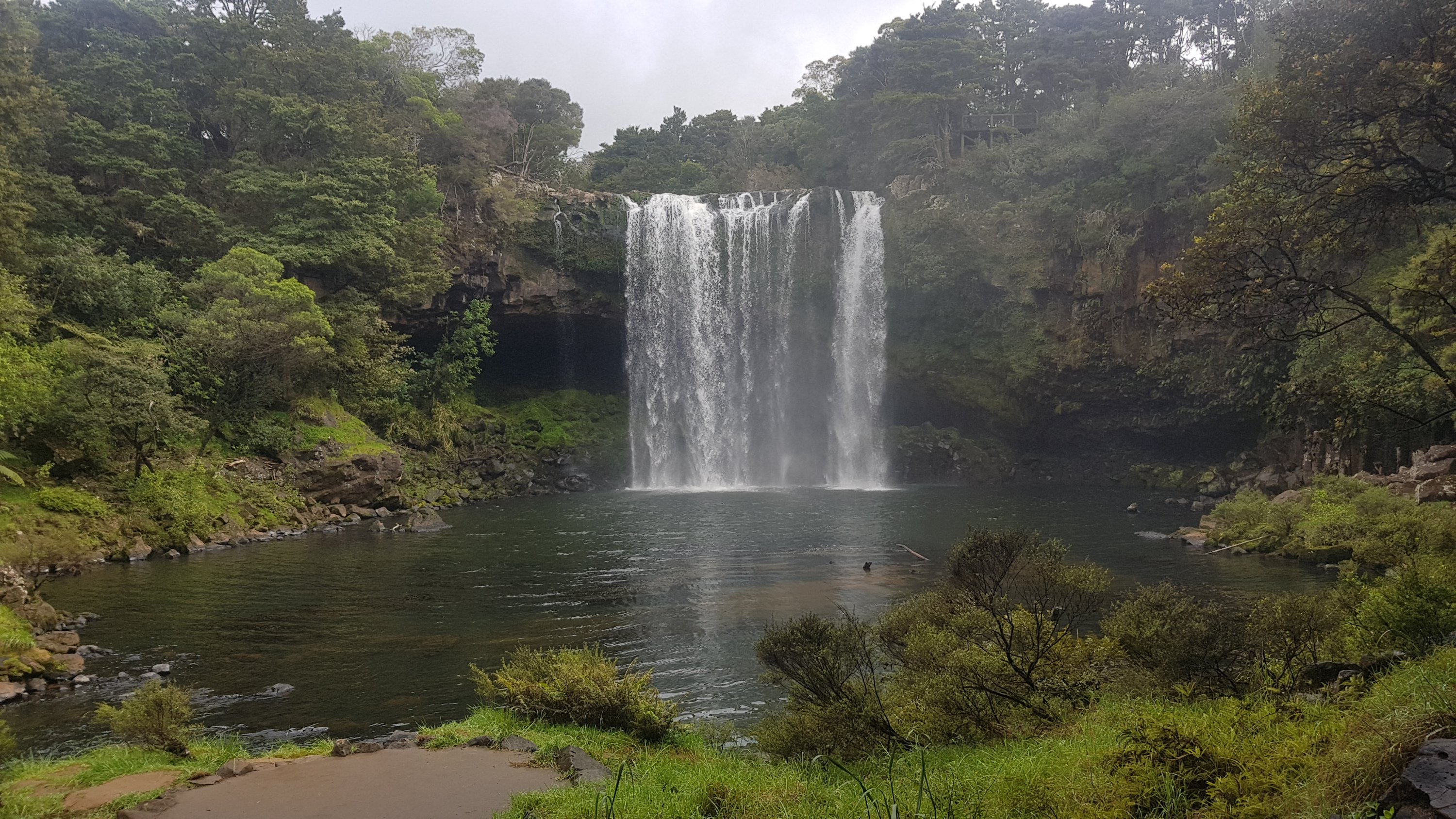
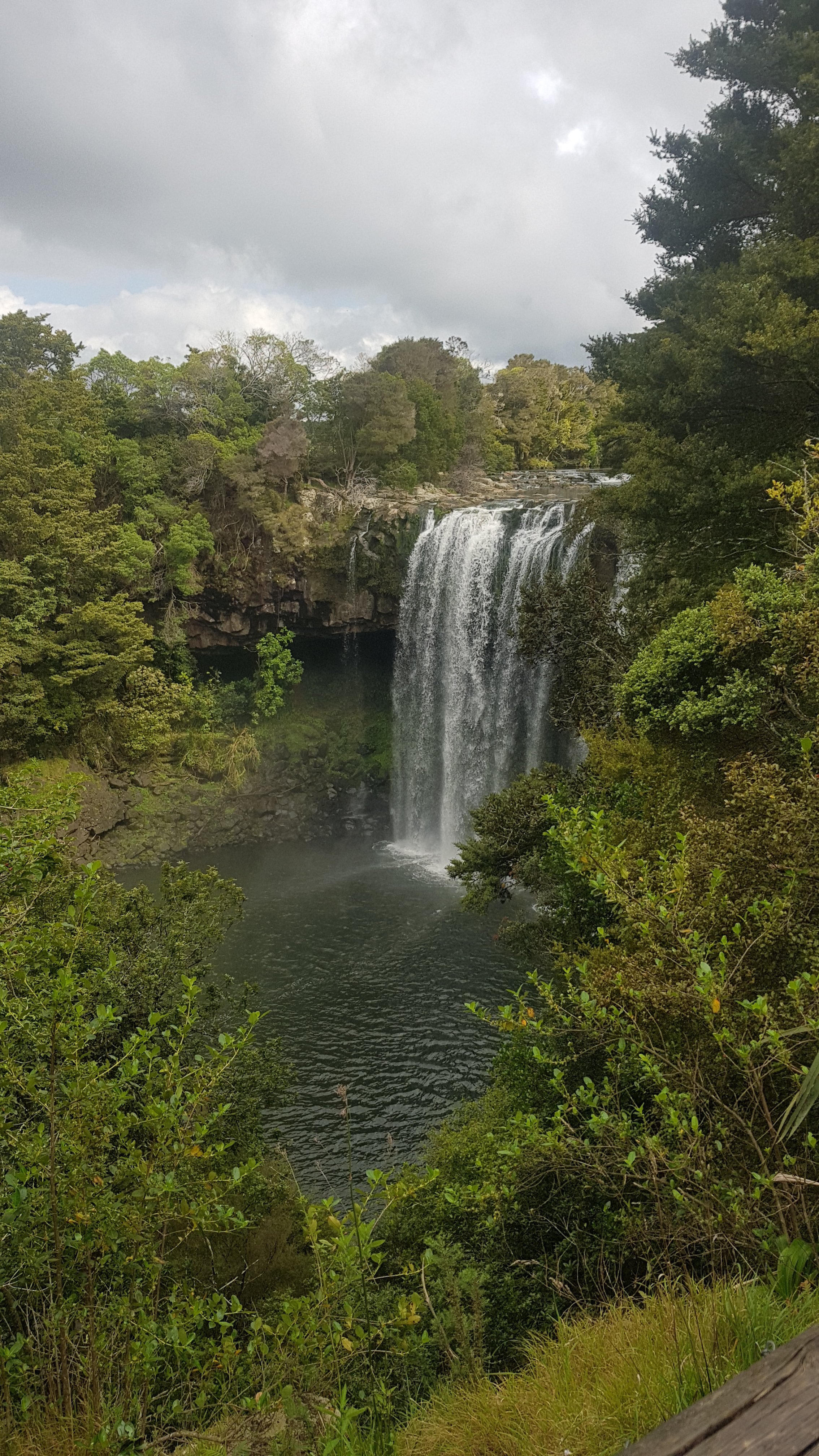
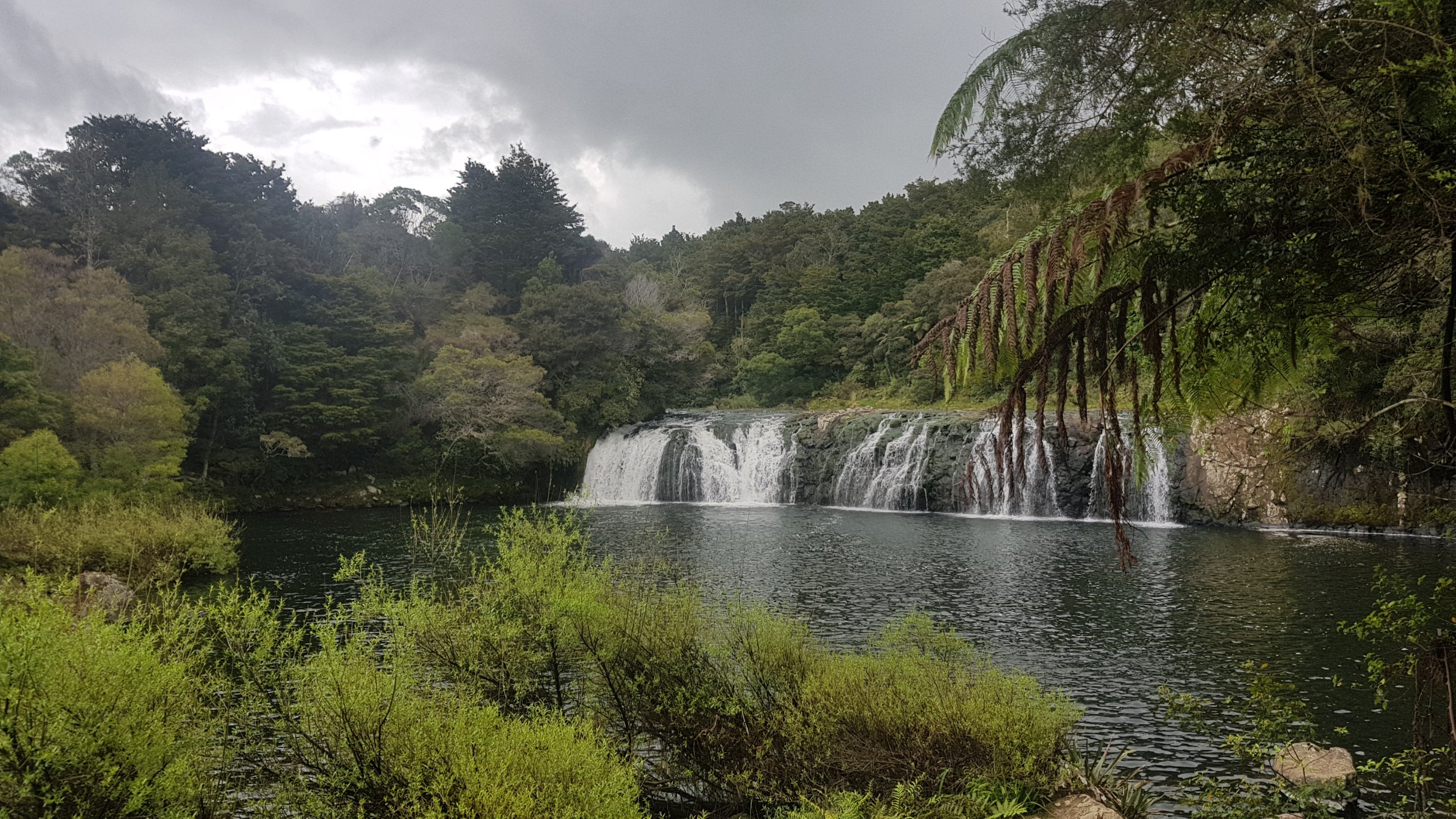
Then it turned into more of a forest track. At one point I passed the Rainbow Falls. I’d honestly never even heard of these before. Very beautiful and hardly anyone else around.
Rainbow Falls
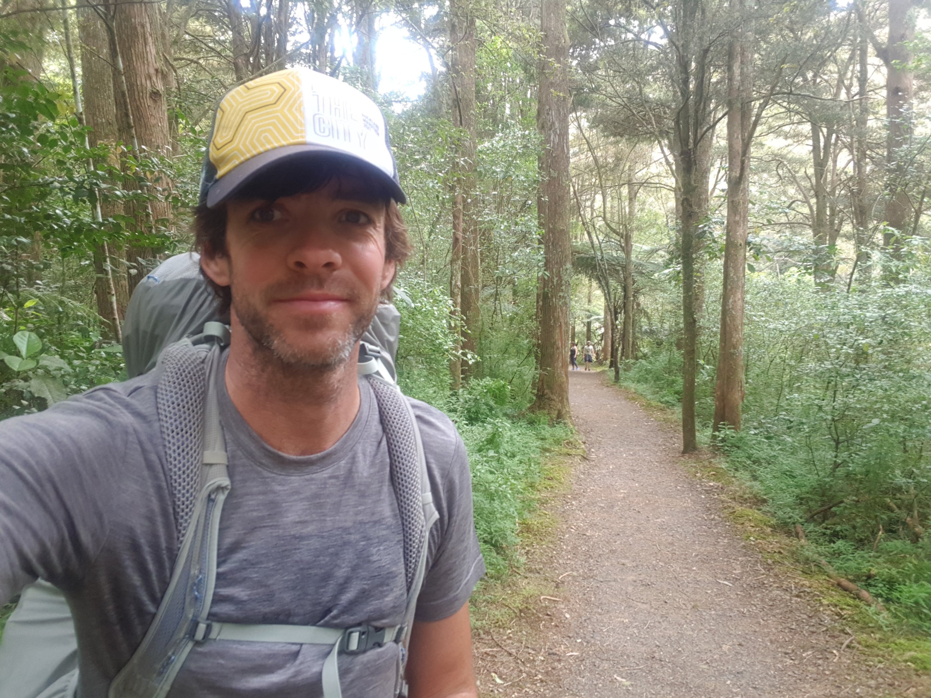
Here’s my 11am picture, walking through the trees. I thought I’d include myself in the picture because for the first time ever, I’m wearing a different shirt! This shirt is normally my spare in case my main shirt gets wet or unbearably stinky. But since I was wearing it yesterday while doing laundry I thought I’d keep it on.
11am picture, and a different outfit for once
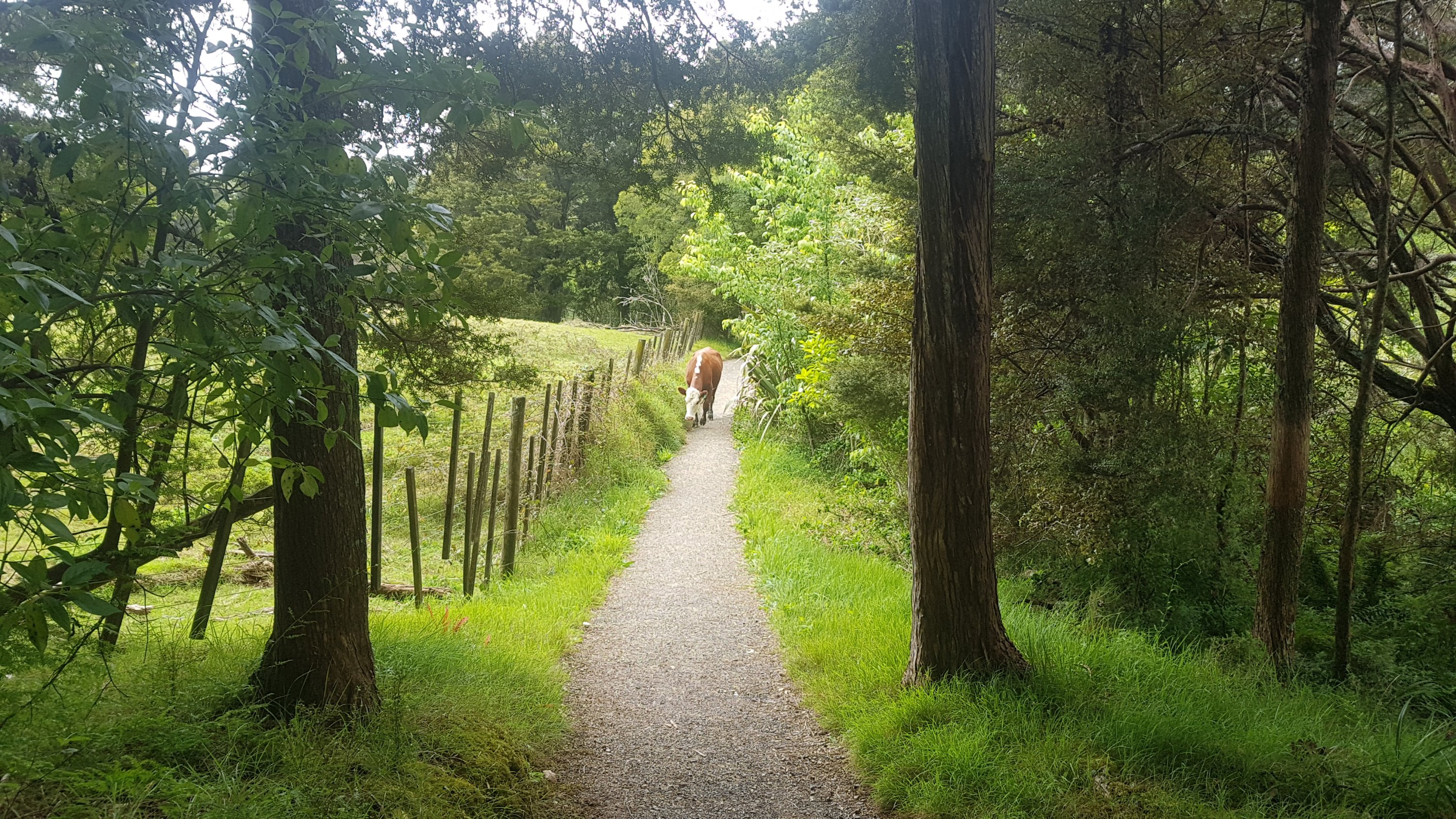
Then there was this guy on the path.
Cow in the road
I was very surprised to see a cow on the path. And it was approaching me quite quickly. There definitely wasnt room for us to pass each other on this small pathway. So now what?
As soon as I said “hello” though it turned away and ran off in the other direction. I didn’t know where it would go though. There was no exit off the path. Saw it again just up the path. It ran off down a side bit and so I got past.
Saw another set of falls, just as it started to rain…
Wharepuke Falls
I’d reached the end of the river trail. There were a lot of roosters around here. The people sitting at the table up there were surrounded by them.
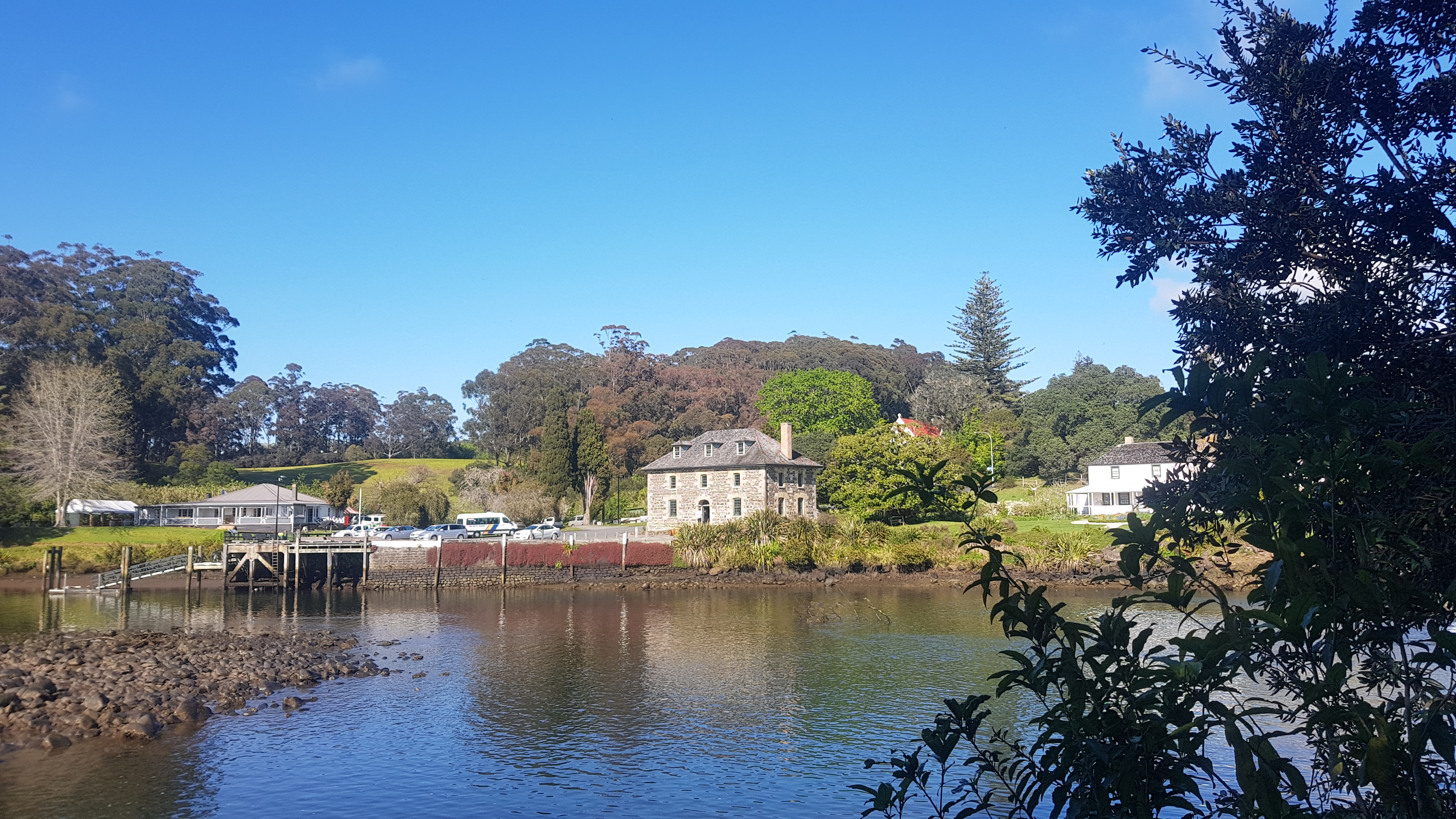
Then I made it to the Kerikeri Stone Store. This is as far as I was walking today, my Airbnb is very close to here. So I had lunch in the cafe and then luckily I got a message to say I could check in any time. This was great because it is school holidays and the roar of children in the cafe was astonishingly loud.
The Kerikeri Stone Store (taken the next day when it was sunnier)The cafe next to the Stone StoreThese people look like they’re having fun
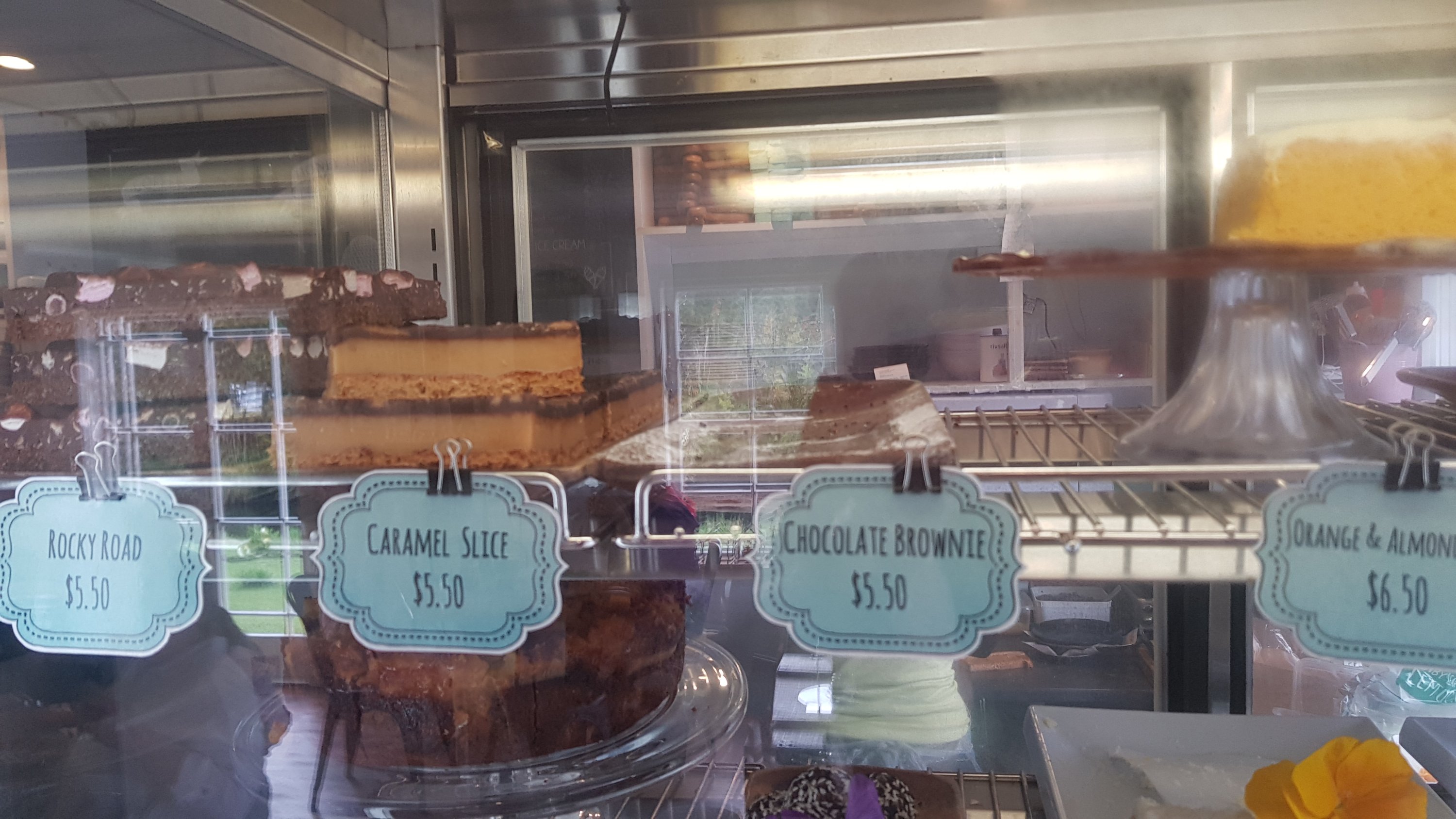
My stepdad knew I was here and he said “try the chocolate brownie, it is excellent”. It must have been excellent as it was sold out by midday!
No more chocolate brownie
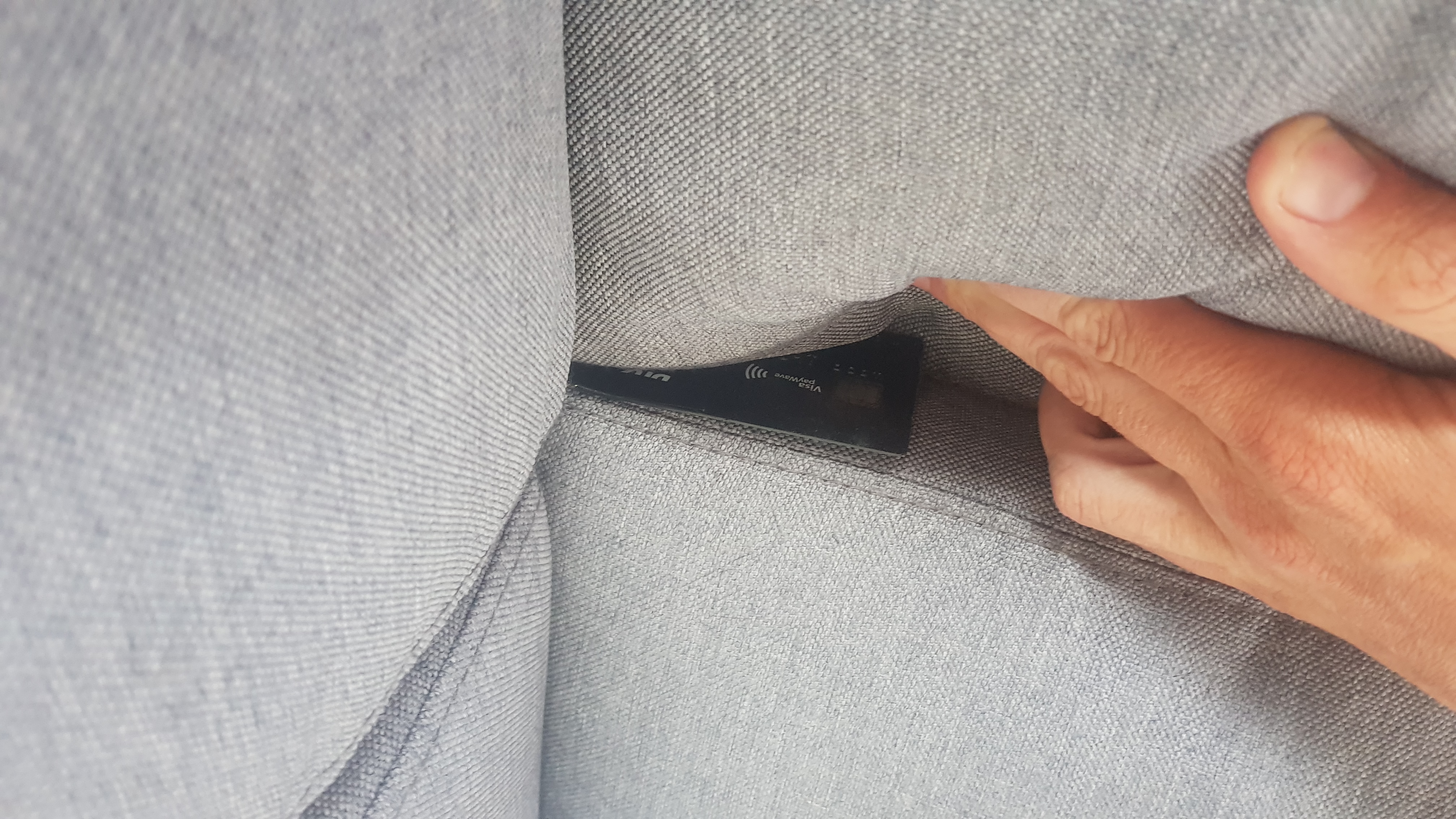
I wanted one of these cakes, so I went to the counter… but where the hell is my credit card? It can’t have gone far between the counter when I ordered last time and my chair. I spent a bit of time looking for it, and found it down the side of the comfy chair I was sitting on before. Oops – lucky I actually went back for some cake, because otherwise I would have left the cafe without knowing I was missing my credit card.
There you are you little blighter
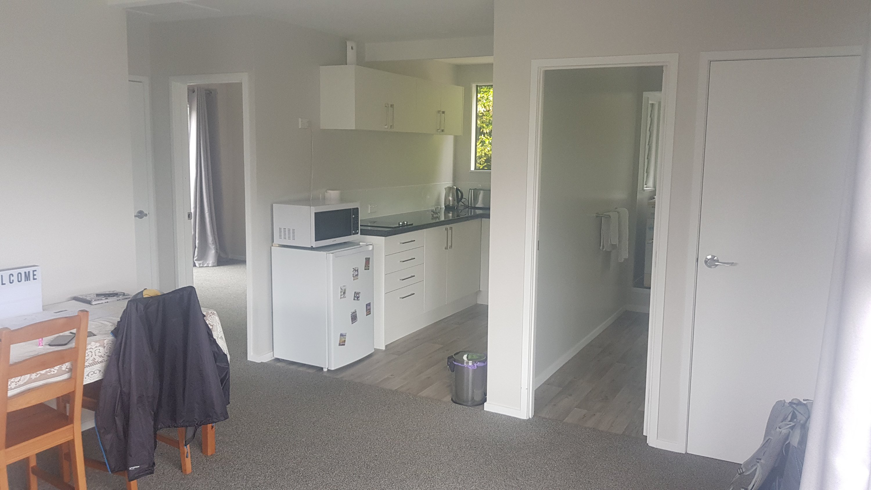
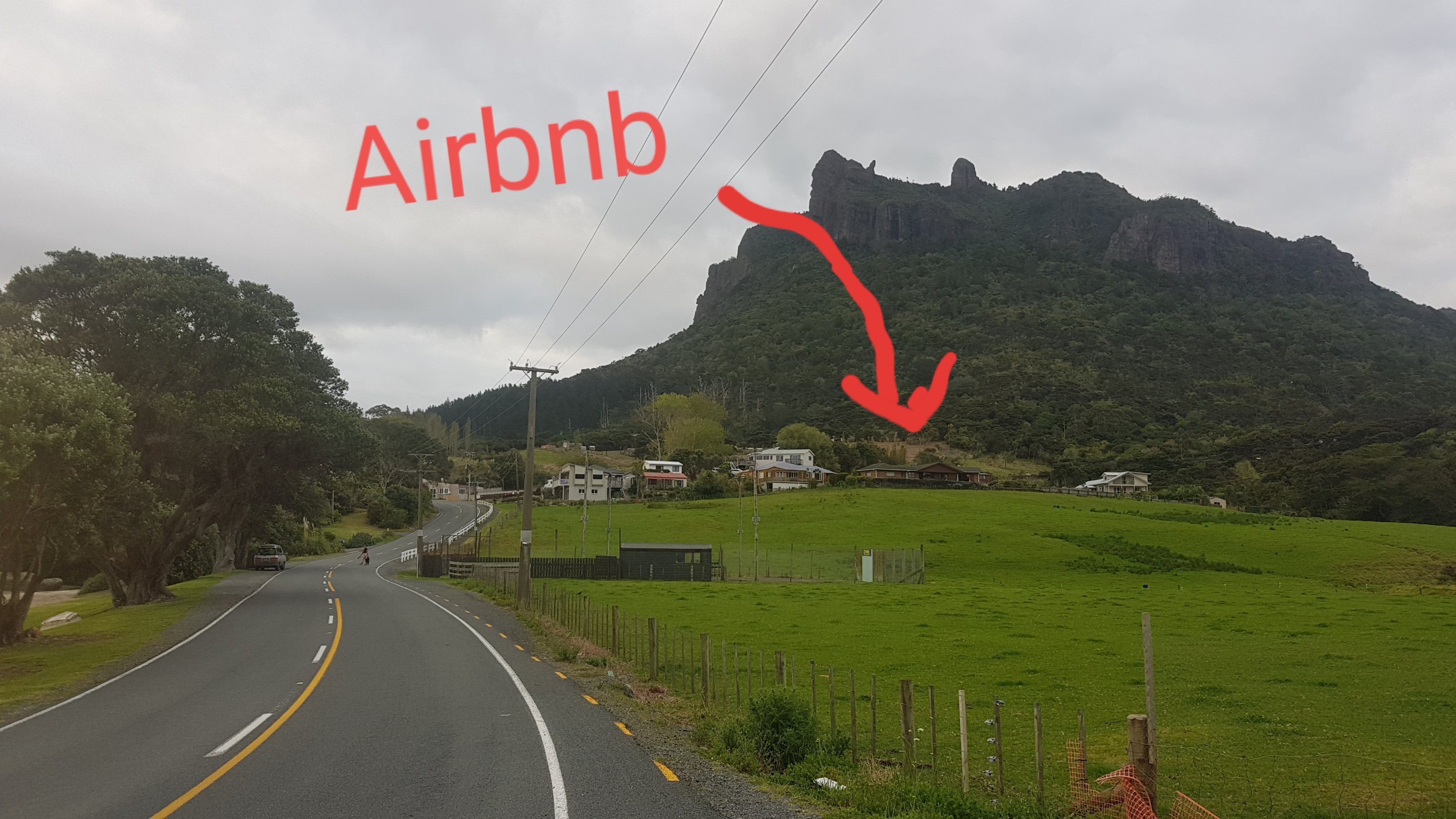
I walked to my Airbnb 10 minutes away. I can’t believe I found this Airbnb for $50 a night, and I have it all to myself. I’ve booked in for 2 nights to get a bit of rest for my sore foot and knee. 2 days is also all they had available. If you’re walking this way, and want your own cheap place for a night or two, I’d highly recommend it. It’s 3 minutes walk from the trail. Here’s the listing. If you are new to Airbnb and sign up with this link you apparently get between $19 and $69 off your first booking.
Airbnb
It’s near the stone store but a fair walk from town, and the weather forecast sucks. “Chance shower” yeah right. It’s raining hard now.
Bad weather
Now the bad news… I have realised that my sore foot is getting worse not better. Today I only walked 6km but I was hobbling along like a 90 year old granny. In fact I think a 90 year old granny passed me. I’ve booked in to the physio tomorow. Gonna see what the advice is. I really don’t want to have to stop the trail here as it’s been a blast so far but I also don’t want any permanent injury. Hopefully best case scenario is they say a bit of rest and a bit of strapping tape and I’ll be good to go. And if not, hopefully the worst case scenario is that I have to take a month off but then I can keep going.
I won’t post much more until I know for sure. Thanks to all of those who have been reading so far. I loved all of your comments.
I visited the physio on my first rest day. She said that my injuries could have been a lot worse. A bit of strapping tape and a bit of rest and with any luck I’ll be ready to go again in a few days was what she told me. However as the week went on I felt like I needed a whole week to rest. Partly because I was in more pain than expected, but also the weather forecast for 13 and 14 October was bad, and my friend Nick was in Kerikeri on the 14th so that seemed like the right amount of time to rest.
After the physio I went and saw Rhydian who was at a nearby campground and had a quick chat. He’s gonna be way ahead now. It was nice walking with him up until now, hopefully I’ll catch up to him again. But I won’t be rushing anymore, being injured sucks and I feel like I was lucky this time so I will be taking it easy.
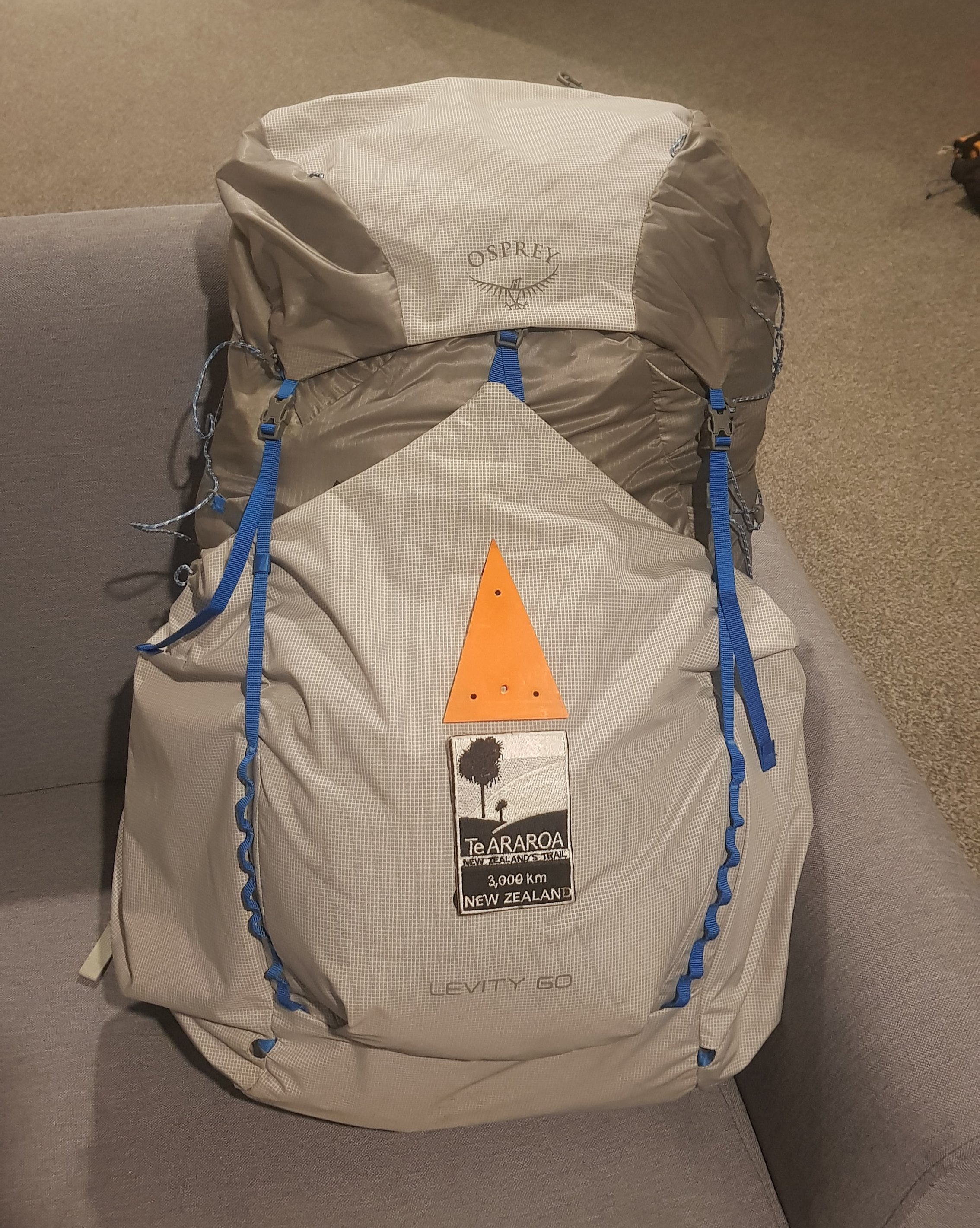
Back on Day 10 I found an orange DOC triangle in Puketi Forest, buried in the mud and no help to anyone. So I took it, and now it adorns the front of my pack along with my TA patch.
Nobody will miss this one orange triangle that I took. There were heaps of them that had fallen off trees. And the best part is that now people will always know the way if they are right behind me. “Trust me, I know what I’m doing!” Unless I look lost of course.
Osprey pack with natty triangle
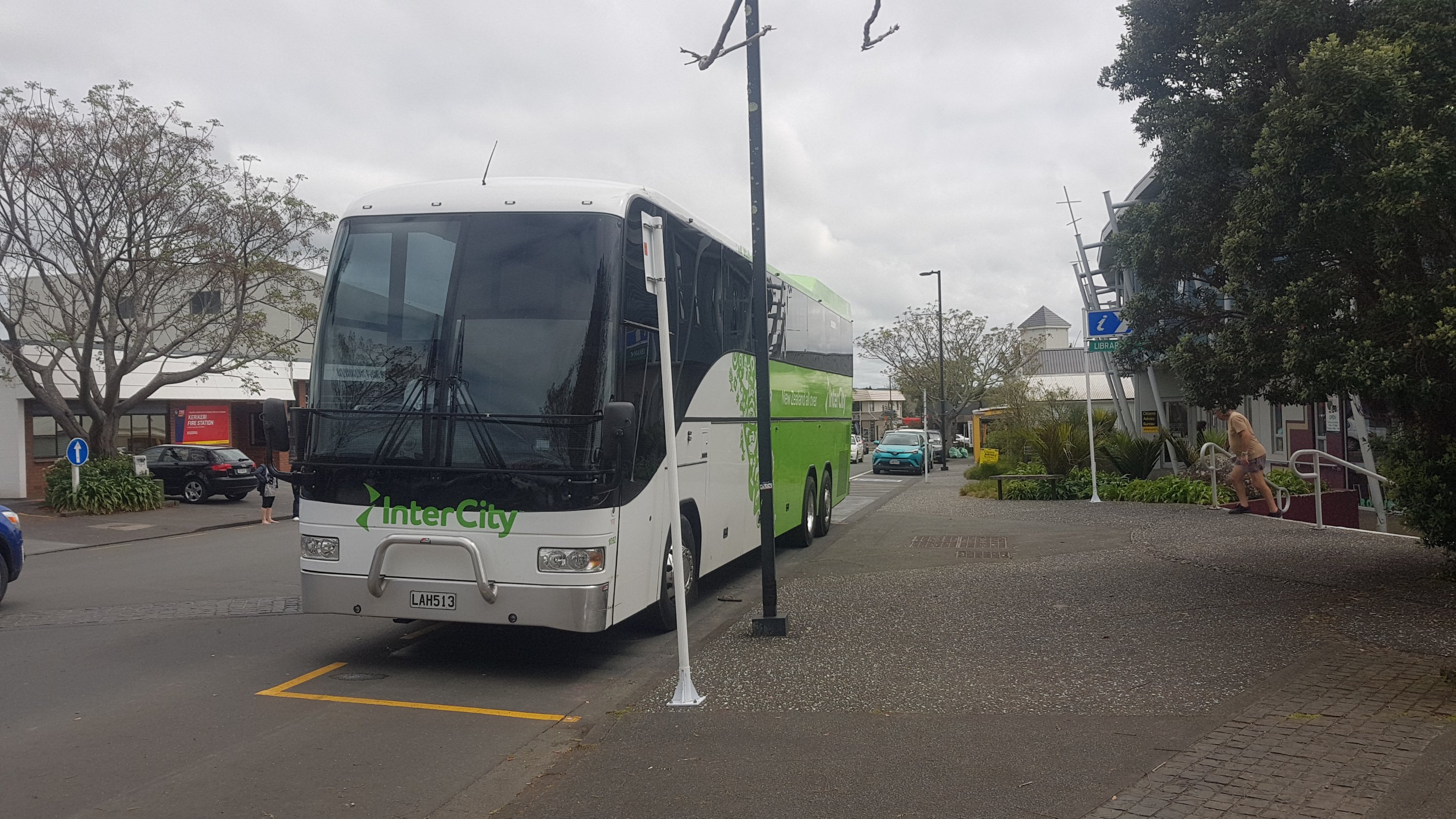
Ran into a guy called Etienne from France who was on his way to Cape Reinga to start the trail. It’s funny that I ran into him at the Kerikeri bus station but he had actually been hitchhiking up from Auckland. We had a chat and he too (like every other hiker I seem to meet) was hoping to discard some things from his pack before starting. His pack was surprisingly heavy when I lifted it given that it was only 48 litres (compared to my 60).
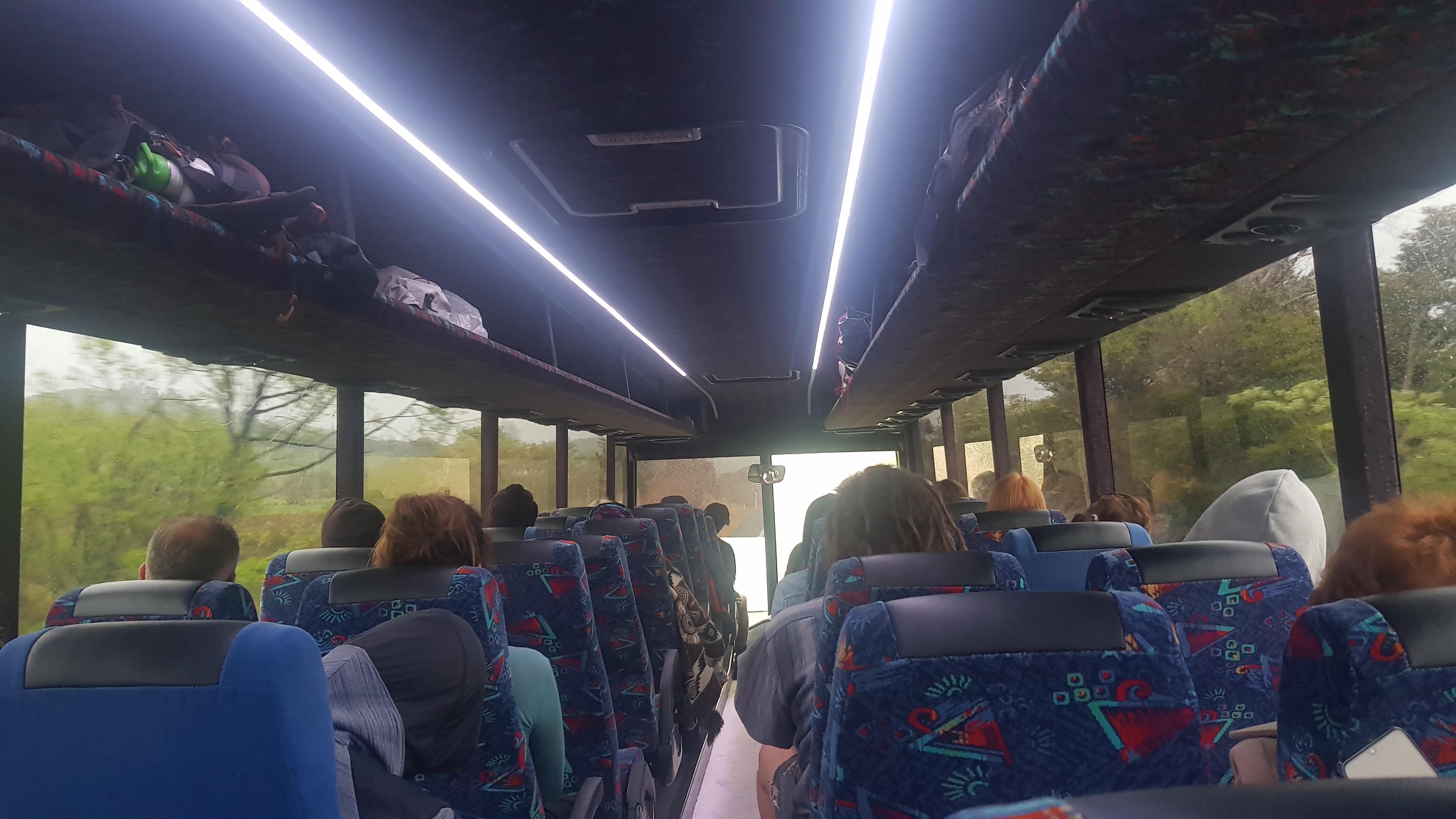
On the bus again
I took the bus to Whangarei because I know a couple of people there and more stuff is happening. I couldn’t stay in Kerikeri for a week. It’s nice enough, but it is pretty dull and the reactions I got from the people there were interesting. When you look all ragged like me, but you’re carrying a pack and walking poles, everyone is real nice. When you look ragged and don’t have your walking stuff, people actively avoid you.
“Excuse me!” I said to an older couple walking by. No reaction at all. I think perhaps I look homeless and stinky and generally like somebody to be avoided. I guess that would probably happen anywhere. I probably do it to people in Auckland who I don’t want to talk to.
My home for 5 daysInside the room
This was my home for 5 out of the 7 rest days – this room in the Whangarei Central Holiday Park. A nice enough place with nice enough staff and a comfortable bed. There was construction going on which started each day at 8am (grrrrr) and twice I turned on the tap to find no water. But it was somewhere to sleep, not too expensive and walking distance to town… just not for the first two days when I could barely walk. I spent 23 hours a day in this room each day and did start to go a little stir-crazy. At least I had a little bit of human interaction down here when my friends visited.
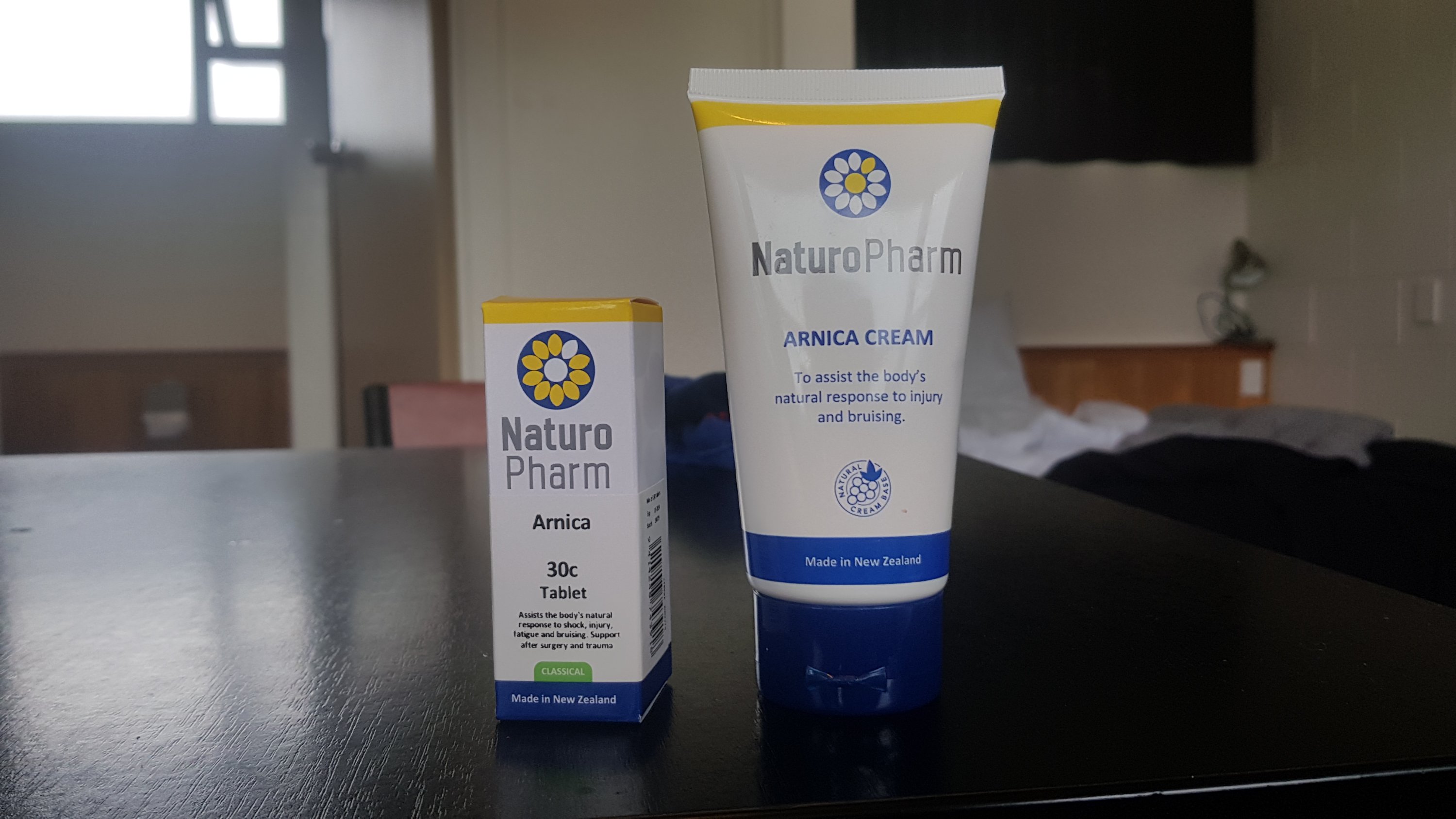
Arnica cream and tablets
Someone suggested I get some Arnica cream and tablets. I’m not normally a big believer in homeopathy but given how much I’ve invested in the TA I was prepared to try anything and so I got them. It’s hard to say if they helped or not. Arnica certainly smells a bit unpleasant. And two days after buying these all these little red ants found the cream. They seemed to really like the cream as they were all over the place.
It was hard watching Facebook posts about people who were looking for kayak buddies from Paihia, as that’s the next bit I have to do. I really wanted to join them, it would be so much better than being stuck inside. I am looking really forward to the kayak. However I stuck with my rest days, because by Rest Day 4 I was able to walk without hurting too much and I was actually optimistic that I might be able to continue if I waited a bit longer.
On Saturday I was feeling good so I went for a walk into the centre of Whangarei to buy some new shoes. I have liked my Salomon Speedcross 4s but wished not too long after wearing them that they were a size bigger. When my foot started hurting last week they were uncomfortable and by Day 12 I was dreading putting them on and was walking everywhere in my crocs because of it. Plus the physio said it would be better if I had boots to support my ankles. So I went into Kathmandu Whangarei to see what they had. I was worried their selection would be small, especially after going into the new Kathmandu Newmarket in Auckland and seeing how small their selection was, but the Whangarei store was huge and had a big selection of shoes.
There were some Salomon Speedcross 4s in the clearance that were the size that I wanted, but I ended up going with the Salomon X Ultra Mid 3 hiking boots which were double the price but felt nice to walk in and didn’t hurt my feet. They were US size 12 rather than size 11 which my shoes were.
New hiking boots – Salomon X Ultra Mid 3
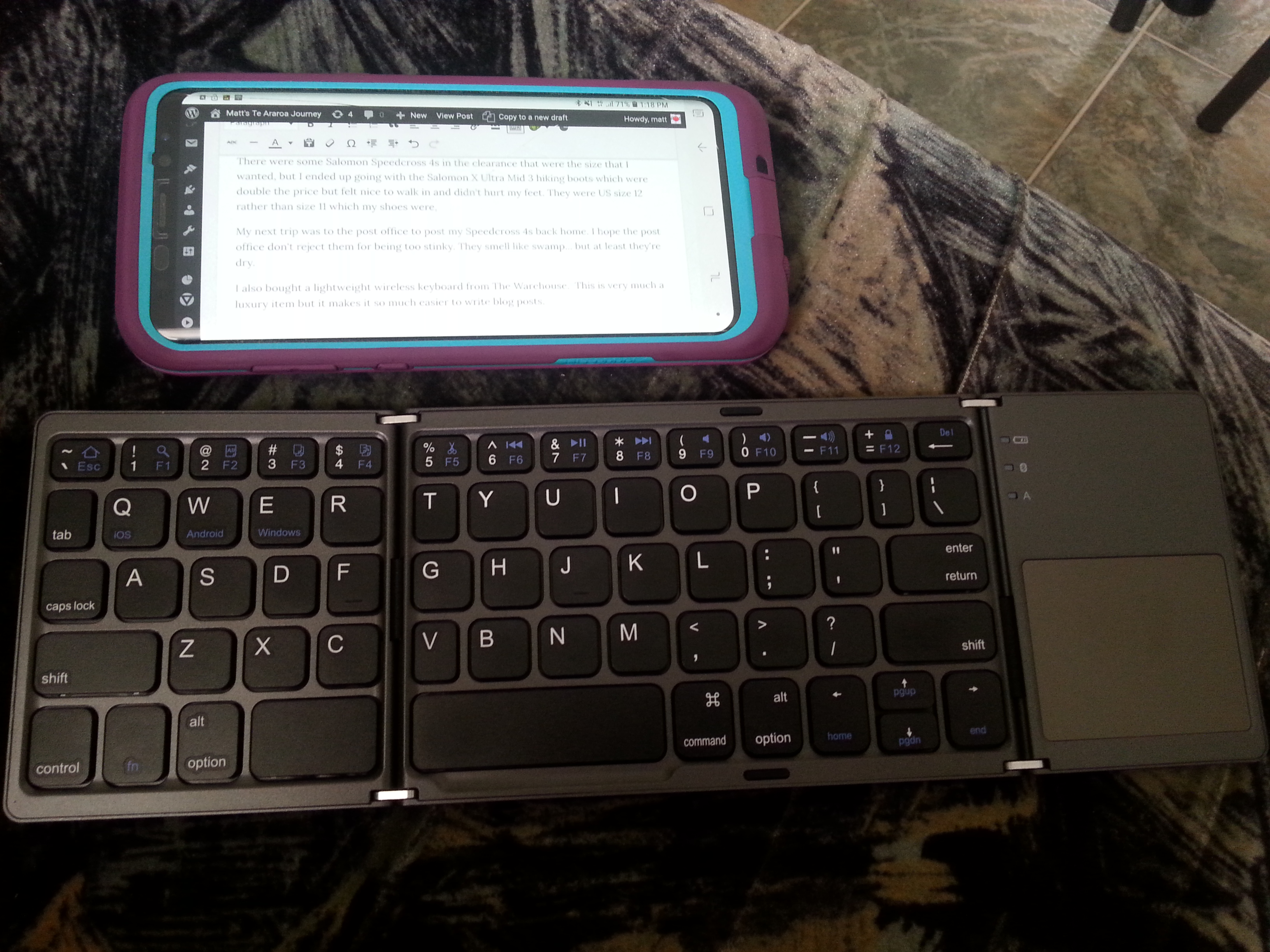
My next trip was to the post office to post my Speedcross 4s back home. I’ll still be able to use them in future, just not on long hikes. I hope the post office don’t reject them for being too stinky. They smell like swamp… but at least they’re dry, so they shouldn’t go mouldy.
Wireless keyboard with my phone for blog posts
I also bought a lightweight wireless folding keyboard from The Warehouse. This is very much a luxury item but it makes it so much easier to write blog posts. I don’t know how much it weighs but it is less than my phone. It seems to work quite well but the T and the V are small because they are on the fold and I often mistype them.
Monday I was on the bus again to Kerikeri. The weather was dismal outside so I’m glad I’ve got one more night before restarting walking.
Here we go again
Met two more people on the bus who were headed to Cape Reinga to start their Te Araroa journey, Roy and Sirkka. In fact I had seen them camping opposite me last night at the holiday park, but I didn’t approach them there because Whangarei is not on the trail and so I figured they were just regular tourists, not TA walkers. But it was good to chat to other people and hopefully I could give them a tiny bit of my knowledge. They didn’t actually know how to get to Cape Reinga so I told them about the options that I knew about.
Turns out they went into the information centre by where the bus stops in Kerikeri and they managed to get a deal with one of the sand dunes tour companies to transport both of them from Kaitaia to Cape Reinga for $60, even I’m surprised how cheap that is. So if you get to Kerikeri and haven’t sorted your transport to the Cape then it looks like it’s worth taking a quick visit to the information centre.
My blister has largely gone but the skin that remains after it has healed is a bit of a nightmare. You can click here if you really want to see it 😁 it’s very bumpy and itchy.
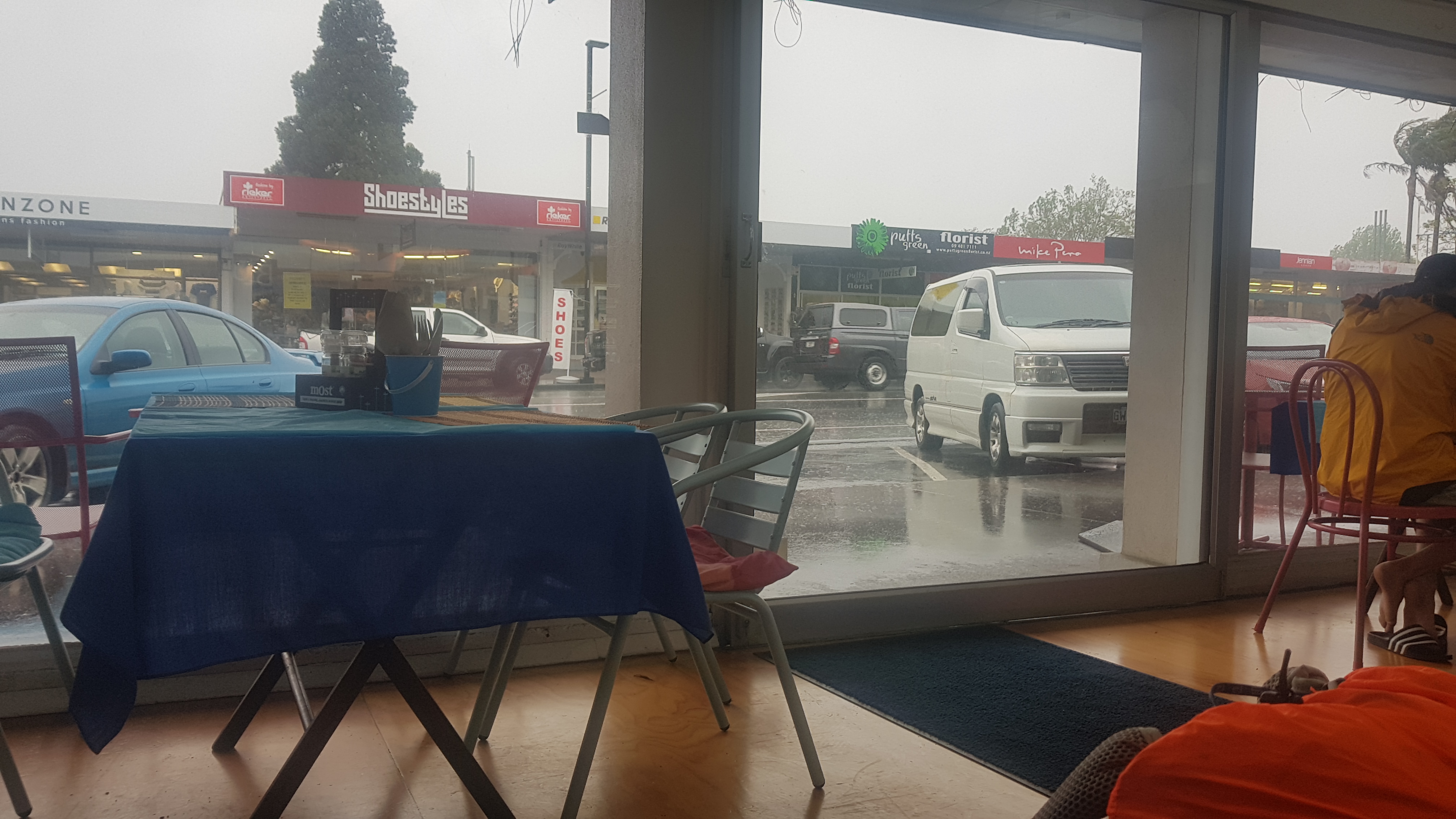
Waiting out the rain in The Blue Cafe
I spent the few hours between when the bus dropped me off and when my friend Nick arrived in Kerikeri in The Blue Cafe because of the rain, and once that closed, in the pub across the road (Rocksalt Restaurant & Bar). I read on Facebook that no kayaks were being rented out to people from Paihia today because of all the rain, and I can see why.
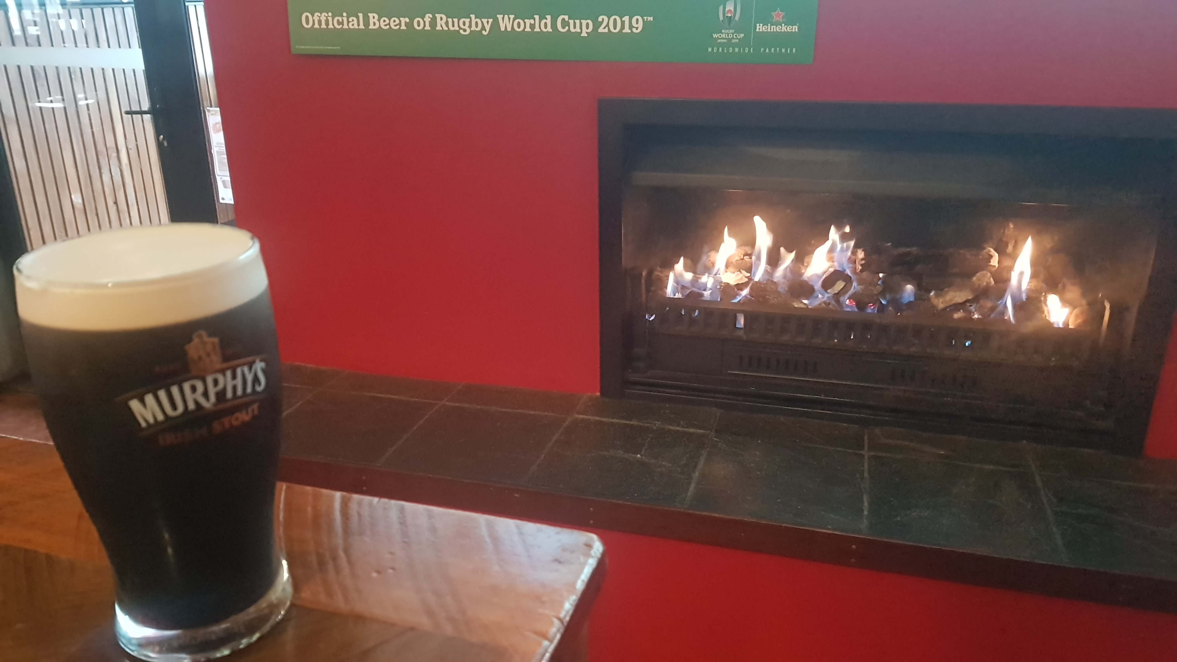
Before the pub I went to Countdown to get 5 days worth of food and that’s when it really started pouring with rain. I got drenched in the short distance between Countdown and the pub, just a few hundred meters. Luckily I was wearing my rain clothes, and when I got to the pub, they turned on the fire for me and I had my pint of stout so I was happy. It was Murphy’s and not Guinness but as they say, beggars can’t be choosers.
Bliss
Nick turned up eventually and we had dinner. It was the first time I had seen anyone from my “old life” since the first day and I was happy (maybe the three pints of beer made me a bit happy too). He was looking forward to his big stone grilled steak. I was very happy with my satay chicken burger.
Big meat
Nick’s motel room had an extra bed so I got a free night’s accommodation tonight (thanks I owe you one!!). The crazy weather continued into the night and I went to sleep wondering how the weather would be when I woke up in the morning for the anticipated restart of my Te Araroa journey.
Date: 15 October
Distance walked: 24.9km
Trail covered: kms 223.1 to 246.8
Weather: light rain all day
Chances of taking a kayak out tomorrow: Slim to bupkis
Gloomy start
Woke up this morning, and this was the view from where I was staying. I had to decide if I was going to start walking again today, or wait until the weather cleared and maybe go tomorrow. After yesterday’s storm today had the potential to go the same way. It looks gloomy outside, however I don’t want to be stuck inside all day for another day – I just had 7 rest days! So I was gonna be out of there – only another day of storms would keep me inside. And right now it was just a light rain.
I spent some time talking to my friend Nick who was sharing the room last night. He was reading me the weather forecast, I don’t know exactly which forecast it was, but it had some interesting predictions. Apparently the “allergy index” is moderate, the “mosquito index” is “not biting” and the “sweat index” is comfortable. I found that last one very hard to believe, given how wet and humid it has been and still seems to be. No doubt I’ll find out very soon.
Once I had walked back to The Stone Store to rejoin the trail, the first part of the walk was quite nice.
Then this was followed by a short walk through a little forest.
This didn’t last long. It soon turned into road walking which would become the theme of the day.
As it got to 11am, I started to feel very warm, because I was wearing my rain clothes and it was very humid. I had to stop here and take off my rain jacket. It was at this point where I got undeniable proof that the “sweat index” was not at all comfortable. In fact I was far more wet than I would have been if I didn’t wear the rain jacket at all. Maybe Nick was accidentally reading the forecast for Kerikeri, New Mexico instead.
Wrong, sweat index, very wrong
Not long after this it was 11am, which coincided with where the road walk turned onto a forestry road:
11am picture – forestry road begins with lots of signs
It was all road walking still but at least it was forestry roads for most of the rest of the day with no cars. Here was my view for most of the walk:
Road walking view
There was lots of signage in here, it would be hard to get lost. It seems the TA has been diverted from its original route as these signs suggest.
Big diversion signs
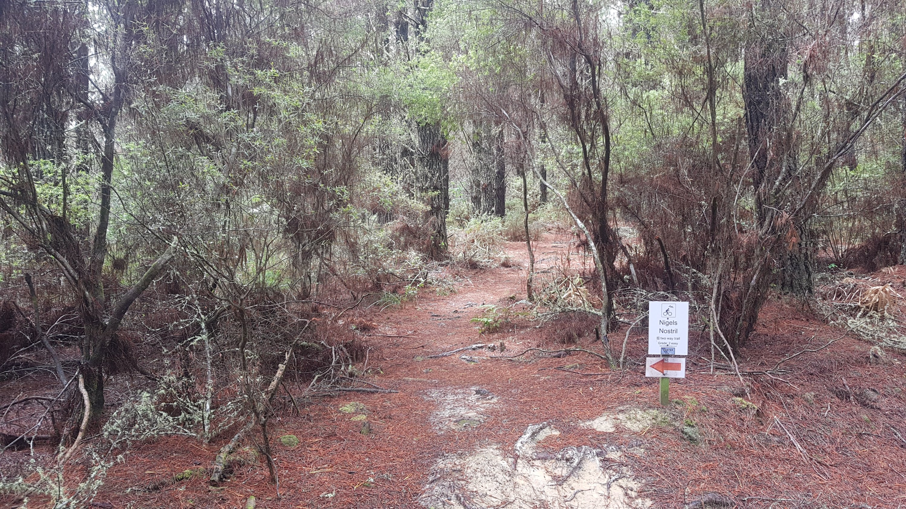
There were also lots of mountain bike trails, although I didn’t see any bikes. They all had interesting names, like this one – “Nigel’s Nostril”. I felt like I was in a ski field where all the runs have a difficulty posted and a funny name.
Nigel no-mates’ nostril
There was also a track I passed called “Wasn’t Me”. This of course paved the way for “It Wasn’t Me” by Shaggy to be stuck in my head all day.
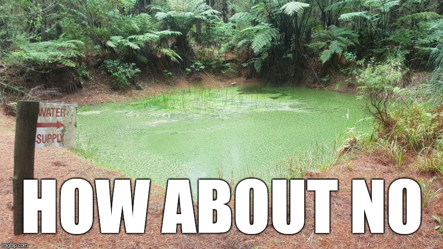
I also at one point passed a sign for a “Water Supply”. I was going to let the picture speak for itself, but I thought this water supply was worthy of being converted into a meme.
Yeah, nah
I posted the picture above on instagram and to my surprise there is somebody out there who did drink from this. I wonder if they now have superpowers.
There had been light rain all day today, ever since I left the house. At one point when it got slightly heavier, I did stop with the thought of putting my rain jacket back on, but the light rain didn’t seem to be really getting me wet. Certainly nowhere near as wet as the sweat from the humidity when I had my jacket on earlier. So I left it off. I’m not really sure when I will use the rain jacket. It feels like something I need to have but when it’s humid it just seems pointless.
I passed this interesting thing, and couldn’t work out at first what it was.
Interesting setup
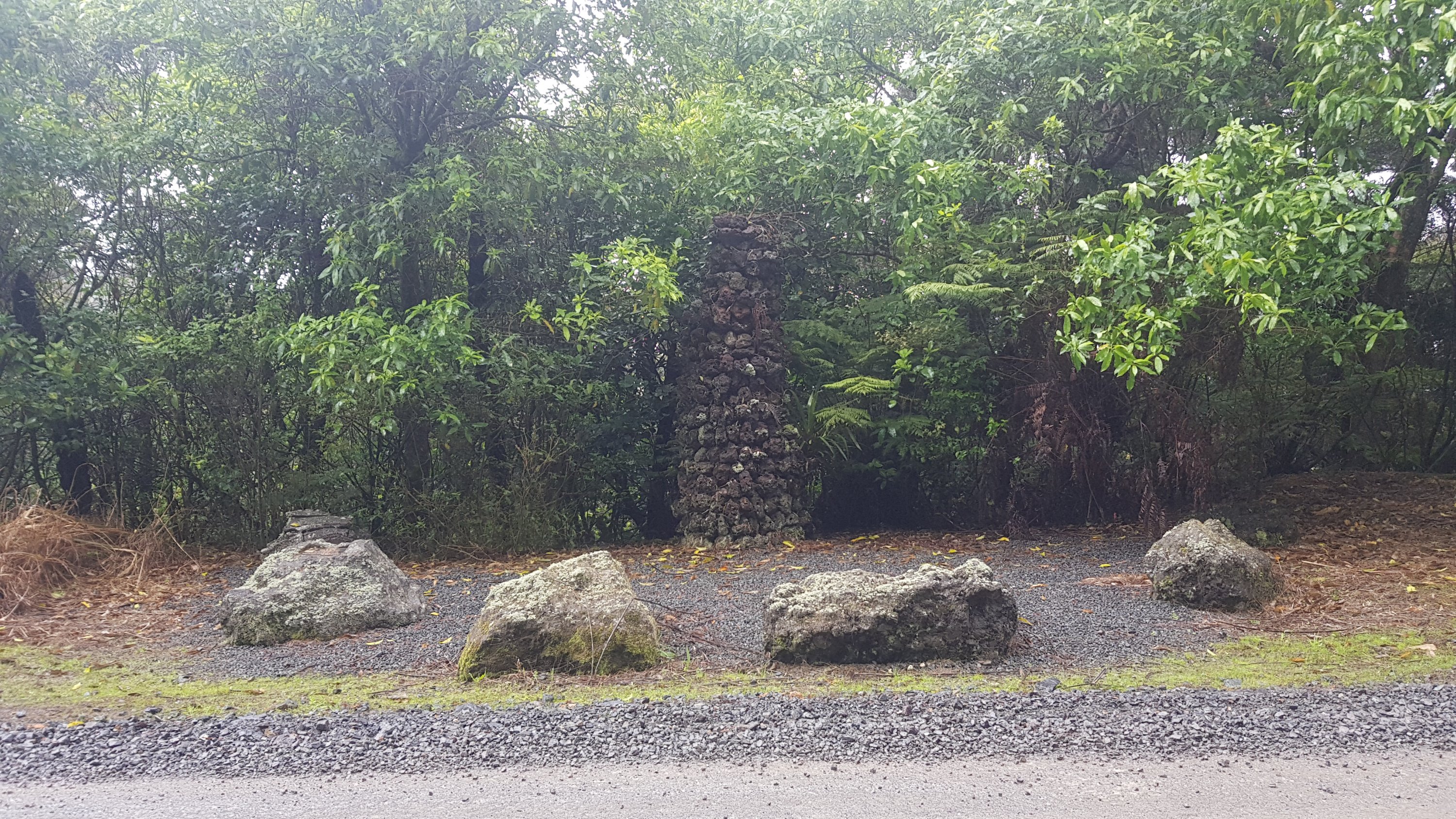
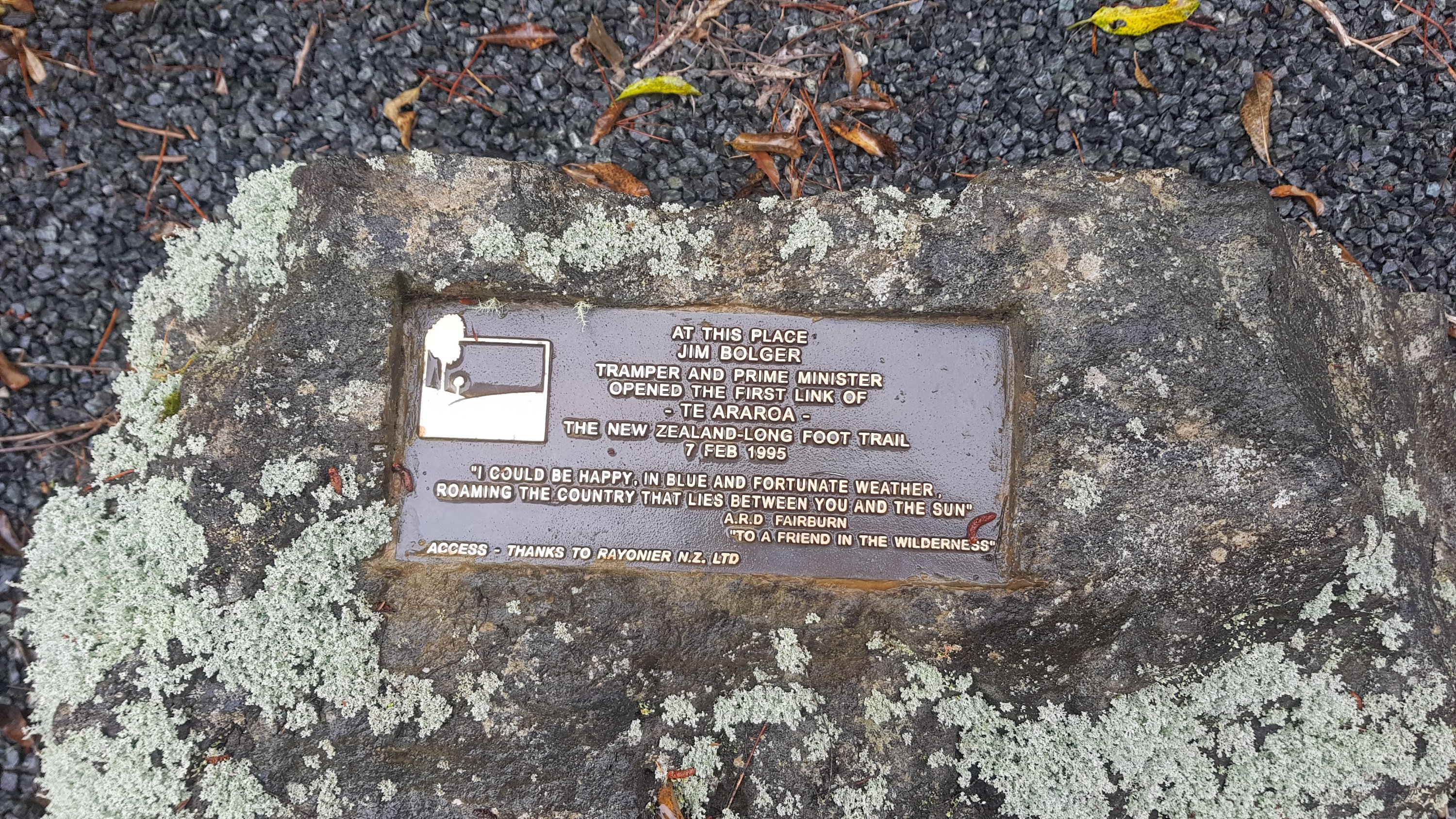
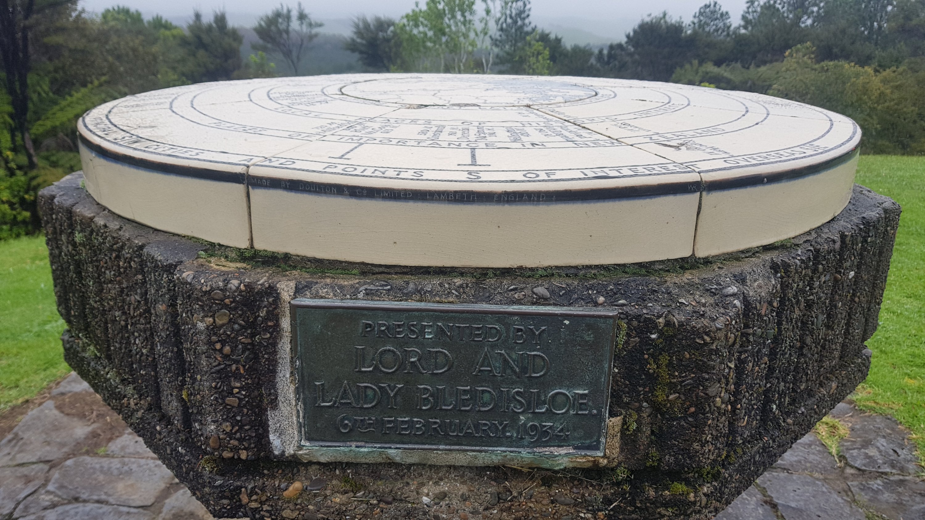
On closer inspection it is apparently where Jim Bolger, former prime minister opened the first section of Te Araroa track in 1995.
Jim Bolger waz ere
From here you could do a short diversion up a hill to the top of Mt. Bledisoe, which apparently had a great view of Paihia and the harbours. I wasn’t optimistic about the view because of the weather but I hadn’t had lunch yet and also there was a geocache up here, so I didn’t mind the detour which was posted as 5 minutes up this path.
Thanks, Mr. Sign, that was really helpful.
It was quite nice up here. No table but at least there was a seat to sit on and admire the view.
This looks like fun… a bench!
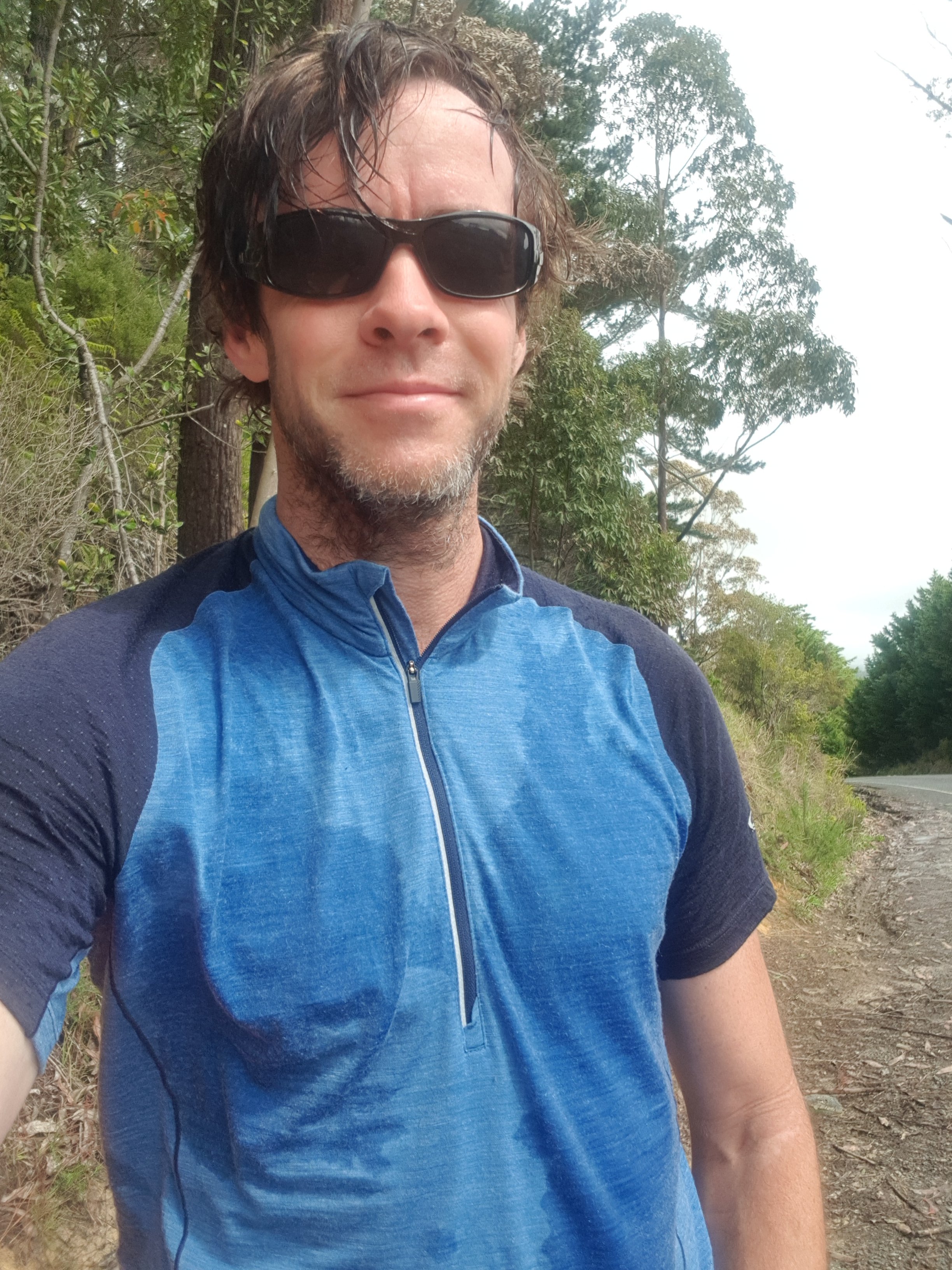
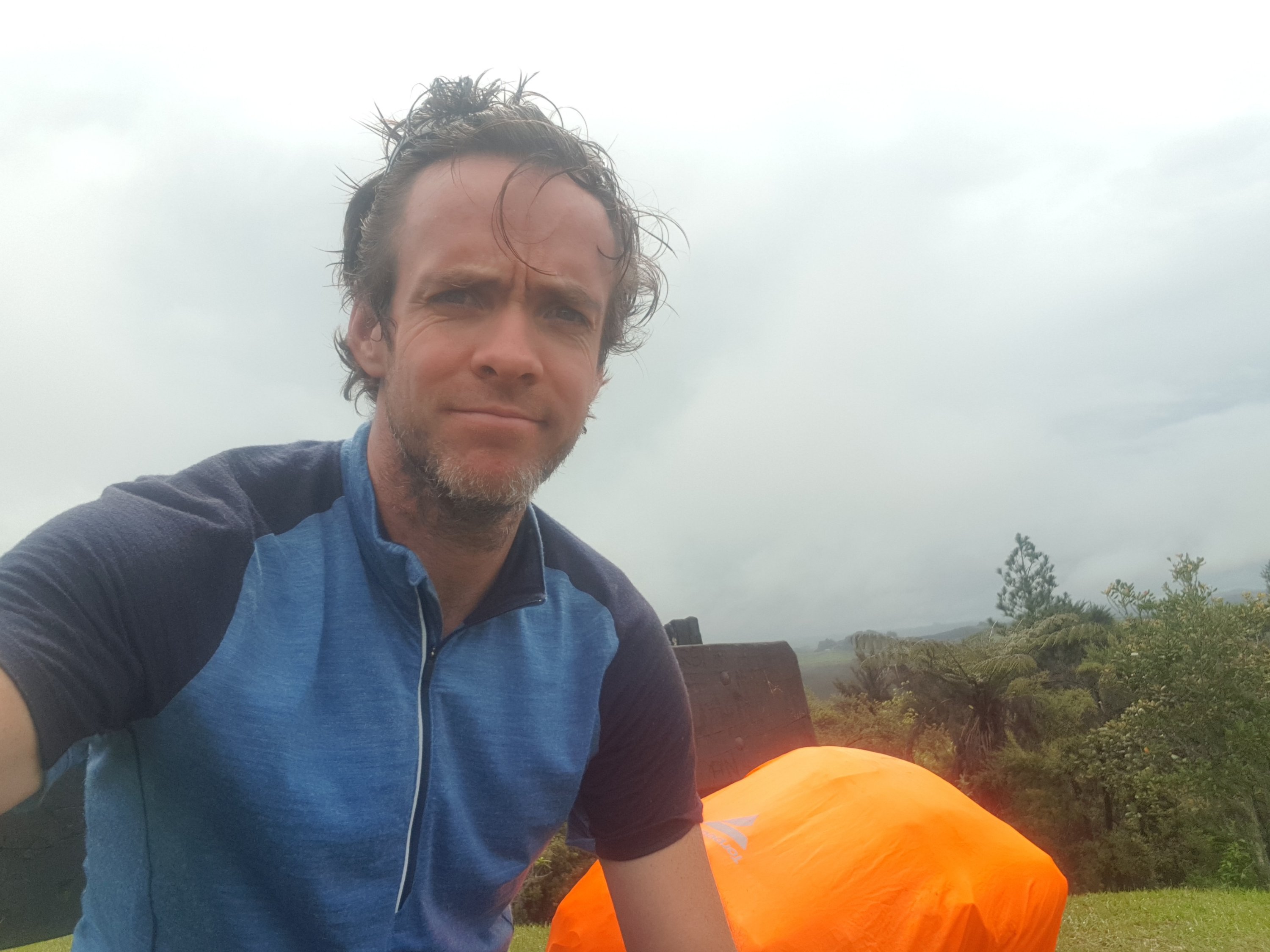
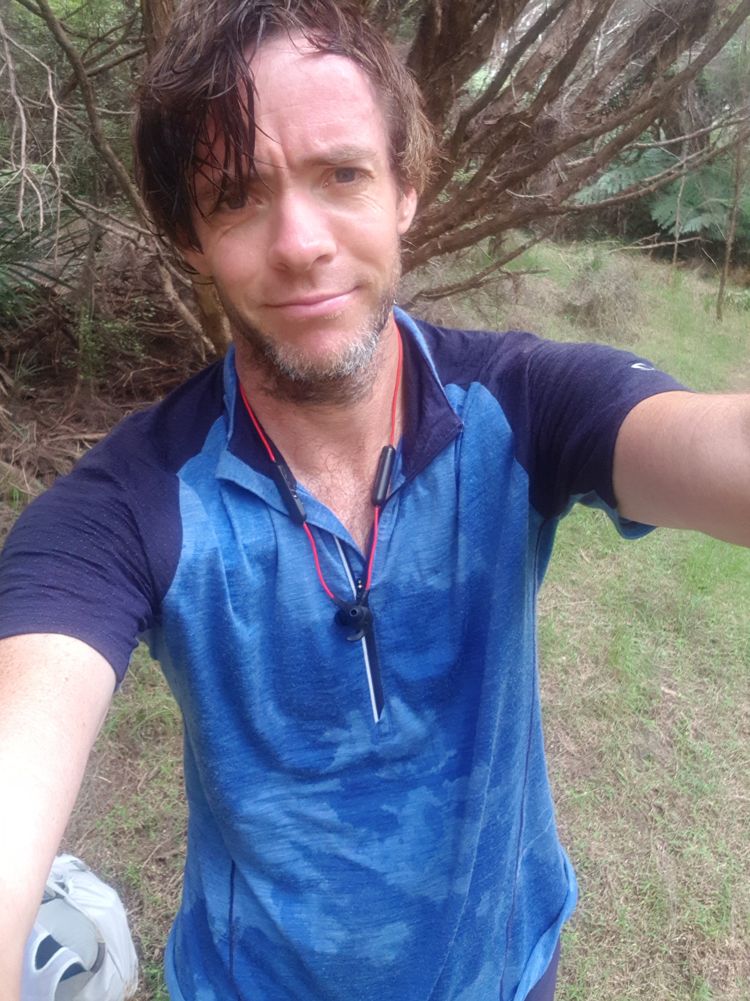
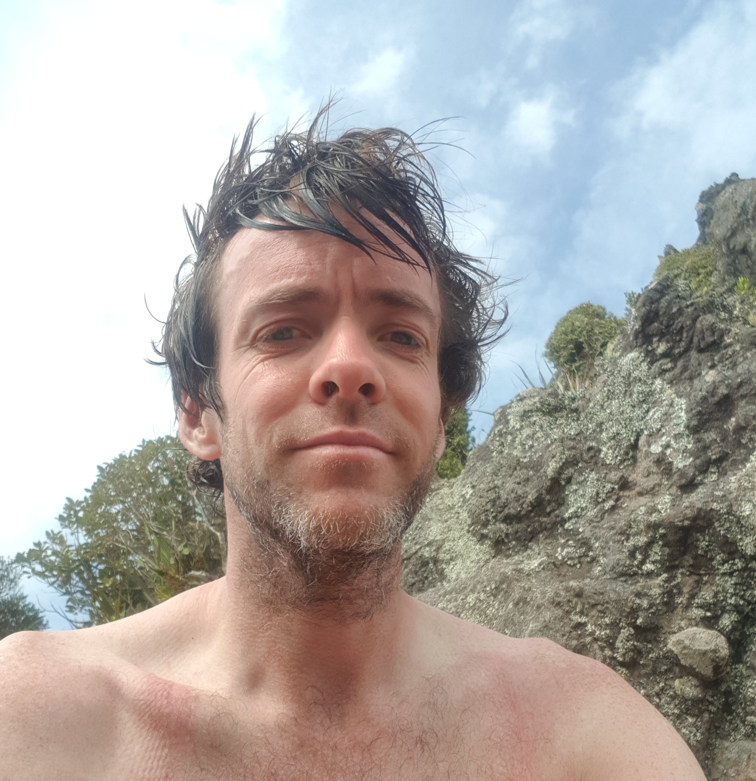
And also time for a selfie. I’ve never seen my hair like this, must be the rain and the sunglasses.
Hello!
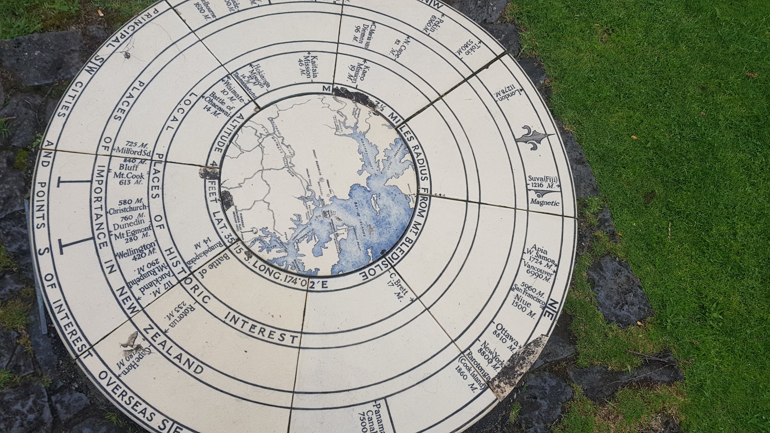
The geocache took a few minutes to find but I managed it. I also found this thing (I forget what it is called). Mount Eden in Auckland where I live has one too. Apparently Bluff is only 840 miles from here. Is that all! Seems positively nearby!
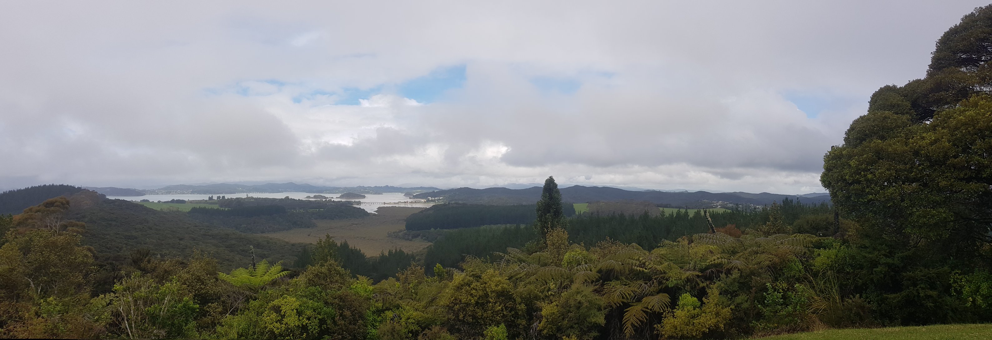
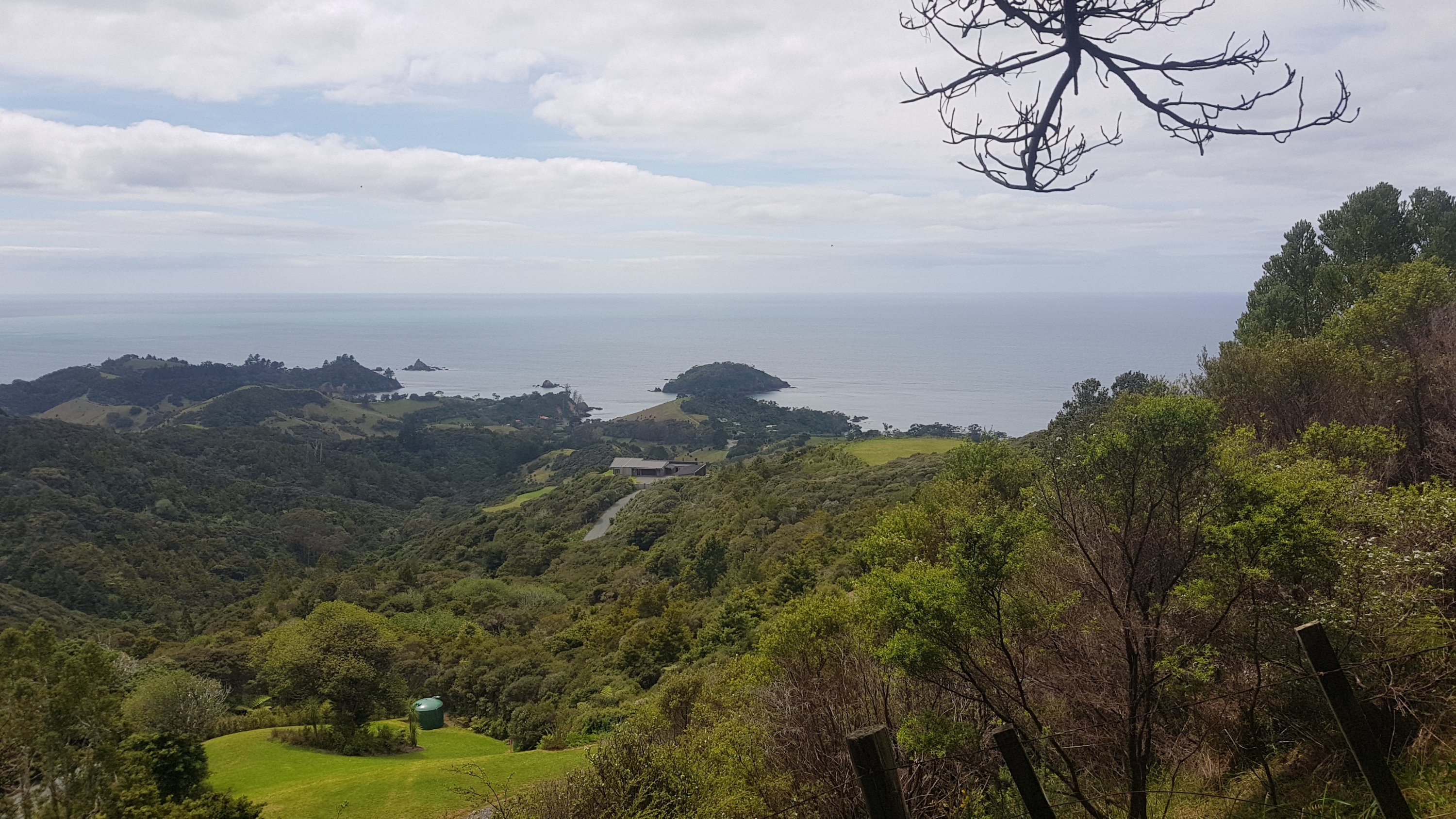
The view from here was actually quite reasonable gven all the rain. Actually the rain stopped while I was up here eating lunch, which helped.
The view from Mt. Bledisloe
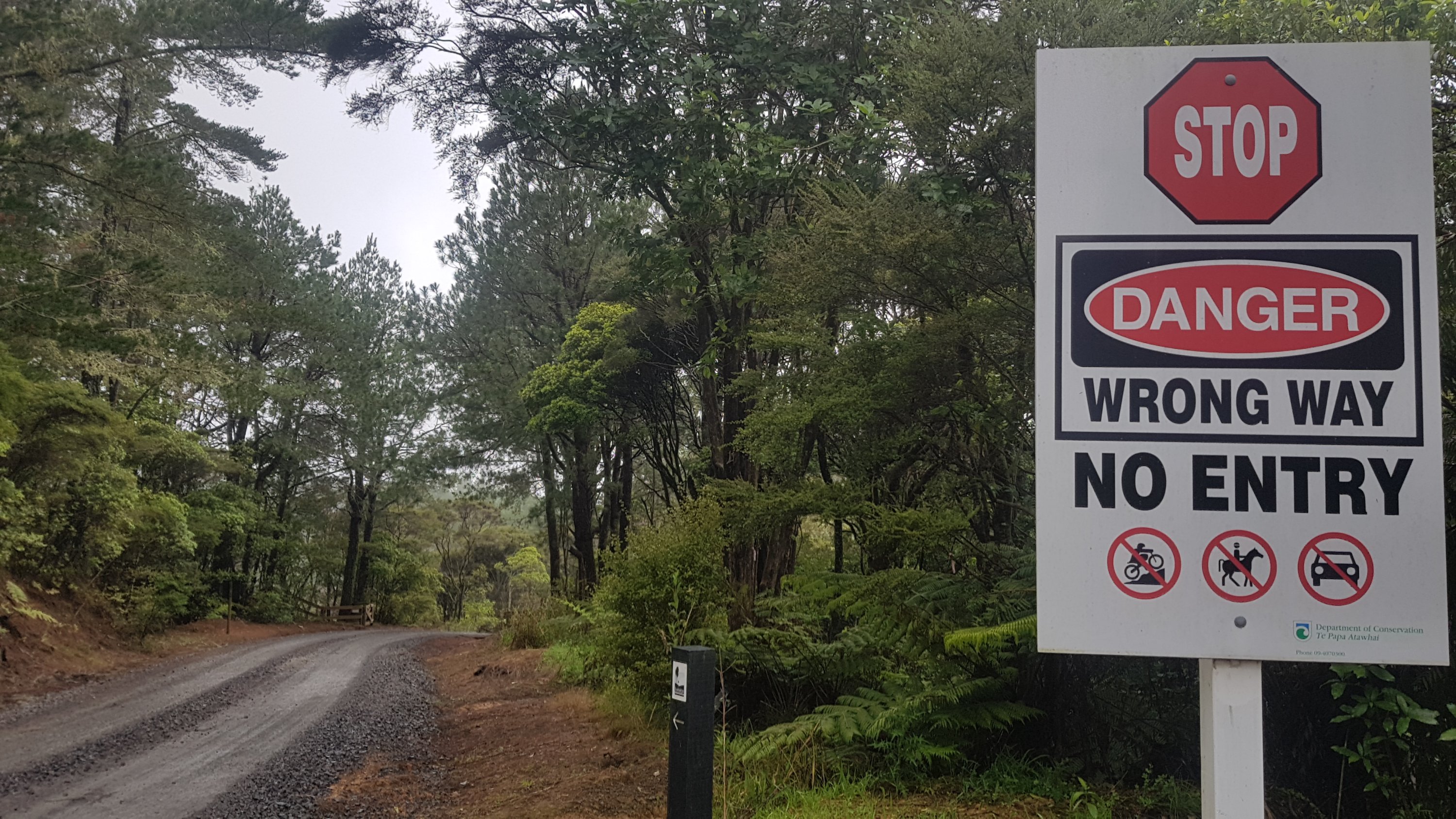
Past here there were a lot of closed roads. I’m glad there were the little TA signs as well to reassure me that I was in fact allowed down here.
Stop! You, yes you! Oh no wait, you’re a TA walker. Carry on.
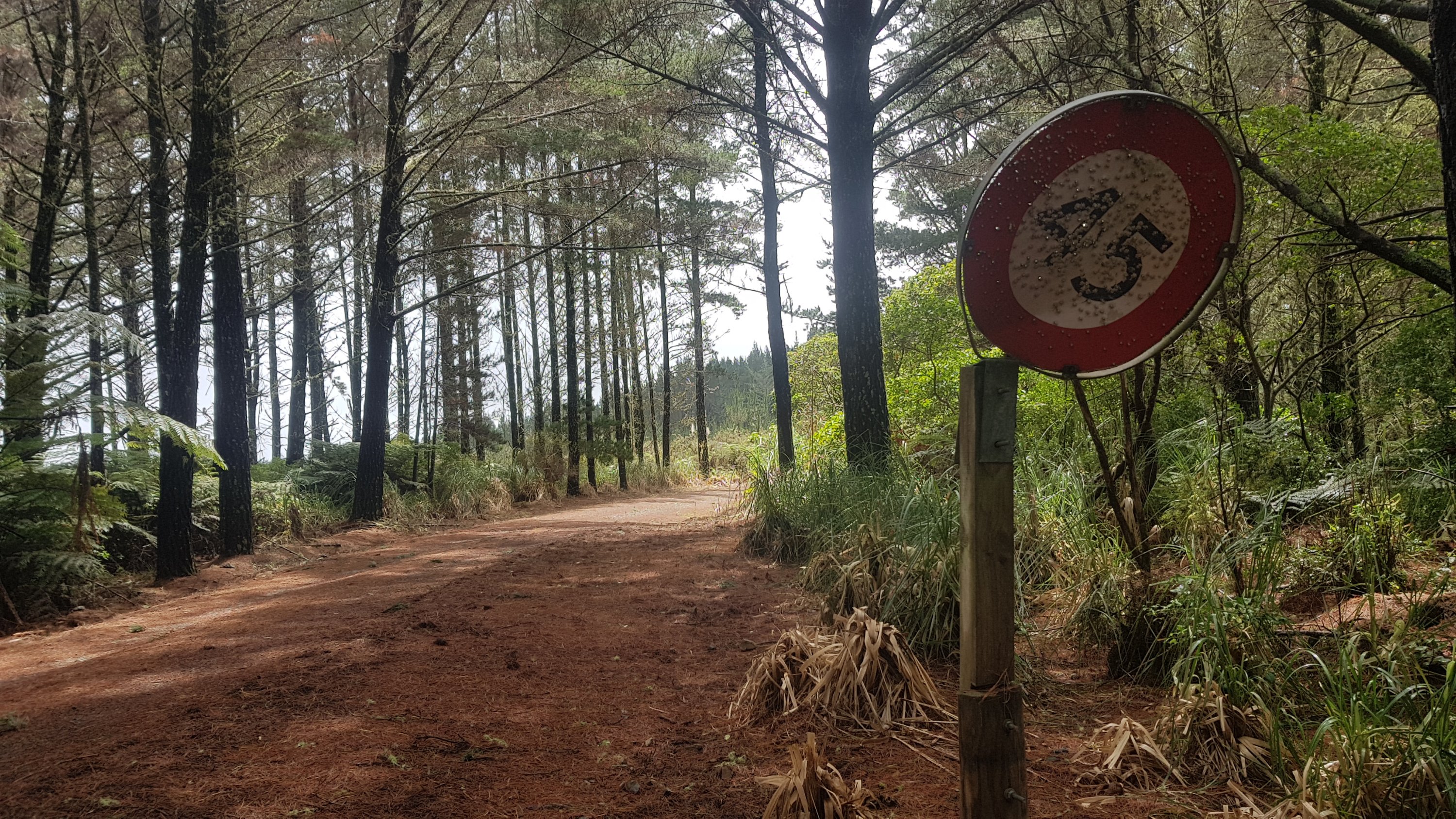
I also saw this in the forest. Most people would probably think nothing of it, but the nerd in me knows that you never ever see a speed limit sign that ends in a 5. They just don’t exist. So this was very exciting! But I’m not sure what use it is. People seem to have been using it for target practice.
I also saw this car. Normally I would see this and think “gee I better be careful on this road” but because I’m hiking my first thought was “can I sleep in this tonight?”
Wasn’t long before I was out of the forest and walking through Waitangi, which had great views towards Russell.
What do you call a man in a pile of leaves?
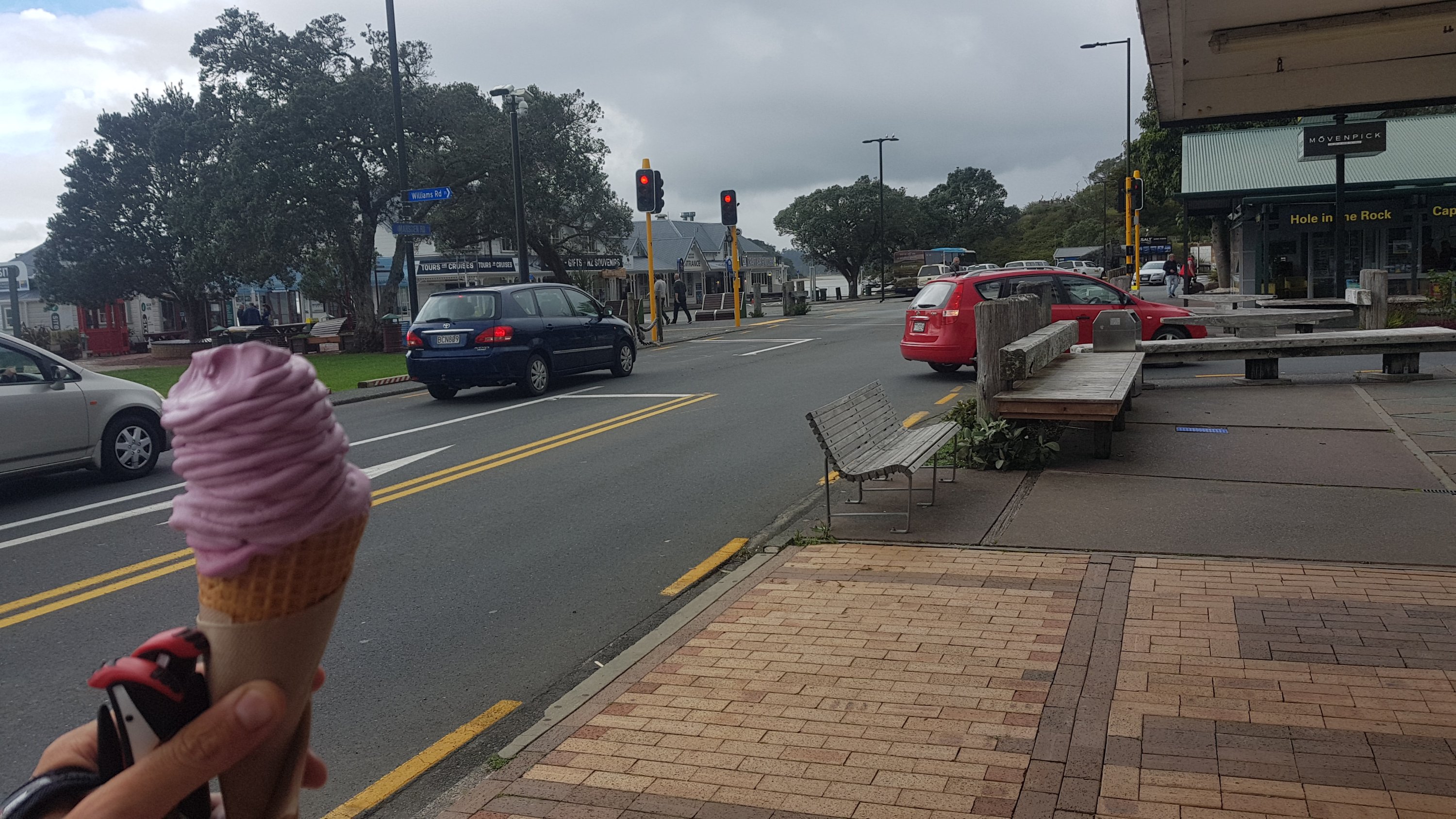
Not long after this I was in Paihia. Like I often am as I arrive into a town I was craving a milkshake. I went into the Rainbow Dairy and while I did get a milkshake, I wasn’t allowed to pay by card which I thought was strange given that there was an EFTPOS machine right there and the guy before me paid with card. And I will admit, I also got a real fruit icecream just down the road.
Boysenberry real fruit icecream. They also sell kebabs. Isn’t that a weird combo.
And shortly after…. here’s bay beach hire. This is where the majority of people hire a kayak and kayak to Waikare next. But… oh no! No kayaks will be going out in the next few days because the tides aren’t favourable. Apparently you have to arrive at Waikare at high tide which would mean a 4.30am start tomorrow.
Bay Beach Hire across the road
I knew the tides were not ideal but I wasn’t sure how big of a deal that was. Turns out very. Dan who runs the place said that there are a few people with the same predicament and he is going to drive them to Waikare tomorrow. I didn’t take him up on that offer because to me it feels like cheating. I said I’d never skip a section. So I’ll walk the road detour.
I could wait a few days for favourable tides but I’ve just come out of 7 rest days and the last thing I feel like doing is taking more rest days. There is a kayak section from Puhoi to Wenderholm in a week or so, so I have that to look forward to. So because of that, I will live with not being able to do the kayak from Paihia.
As I was walking down the main street of Paihia I met Ralf. He introduced himself as one of my followers and I felt like a minor celebrity! He is apparently joining the others tomorrow for the ride to Waikare, as he was hoping to kayak tomorrow also but can’t.
This morning I booked a private room with shared bathroom at Bay Adventurer Backpackers, and I arrived just mere seconds before the rain poured down. I know it doesn’t look like it here but it started raining hard. Again, I feel generally I have been very lucky with the weather.
Rain, rain, go away
And one thing I discovered about my new Salomon hiking boots… I was walking in light rain almost the whole day but when I took my boots off, my socks and feet were bone dry. Incredible. That was a very unexpected and happy surprise.
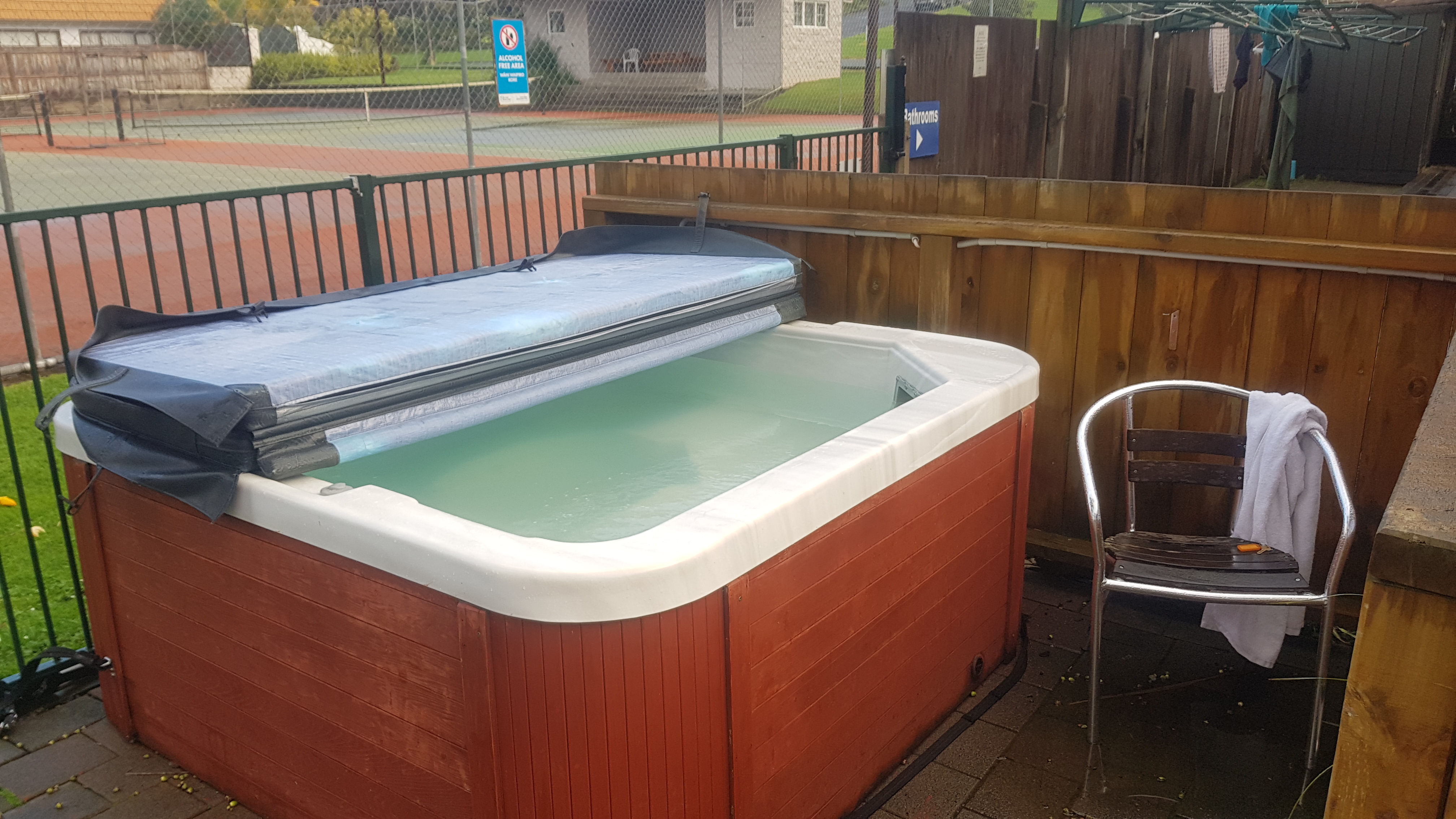
The backpackers is alright. Not a bad room for $50. The dorm rooms were $24. There was a spa which was still excellent, despite not being very warm.
Spa pool
That’s about it for my first day back walking. I don’t really have any pain at all which is very nice. I’m very optimistic now about at least making it back to Auckland. I miss having my walking mate Rhydian, he will be far ahead now. Walking by myself it seems harder to think of interesting things to write about. Hopefully I will meet up with other people at the campsites in upcoming Russell Forest.
Date: 16 October
Distance walked: 33.2km
Trail covered: kms 246.8 to 272.8
Weather: mostly sunny but with several bouts of heavy rain
Number of lost dogs: 1
As I learned yesterday, no kayaks would be going out today because to get to Waikare at high tide would require leaving at 5am in the dark, and “Dan the Kayak Man” as he was called by the backpackers staff is very safety conscious. So that’s why the distance walked today was more than the trail distance covered.
Kayaks at Paihia sitting idle. At least the weather is good.
Despite this, I feel like I made some good distance today. And as a bonus, I got to walk the Paihia to Opua coastal walkway which I wouldn’t have seen if I did the kayak.
Part 2 of the walkway starts down here to the left
I couldn’t do the first bit of the walk because that was low tide only, but the rest of it was a beautiful walk around the coast.
The first section of coastal walkway – can’t be done at high tide
The views from the walkway were always amazing.
Views from coastal walkway
And there were boardwalks across the water.
It went close to private property – between people’s houses and the ocean. I’m guessing these people had enough of people walking through their back yard.
I’ve never seen these weird things before. When the wind picks up, they blow off the trees and into your face. So watch out.
Weird alien life forms that have taken over this tree
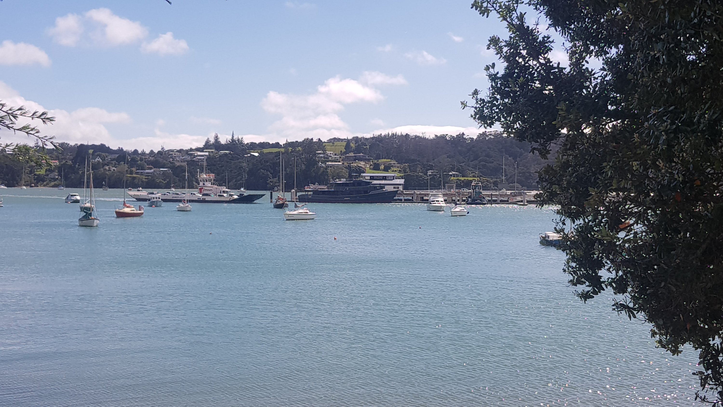
While I was walking, I could see the car ferry pulling in which I needed to get across the harbour to do the road walk diversion. I sped up because I didn’t want to miss it.
Car ferry pulling up
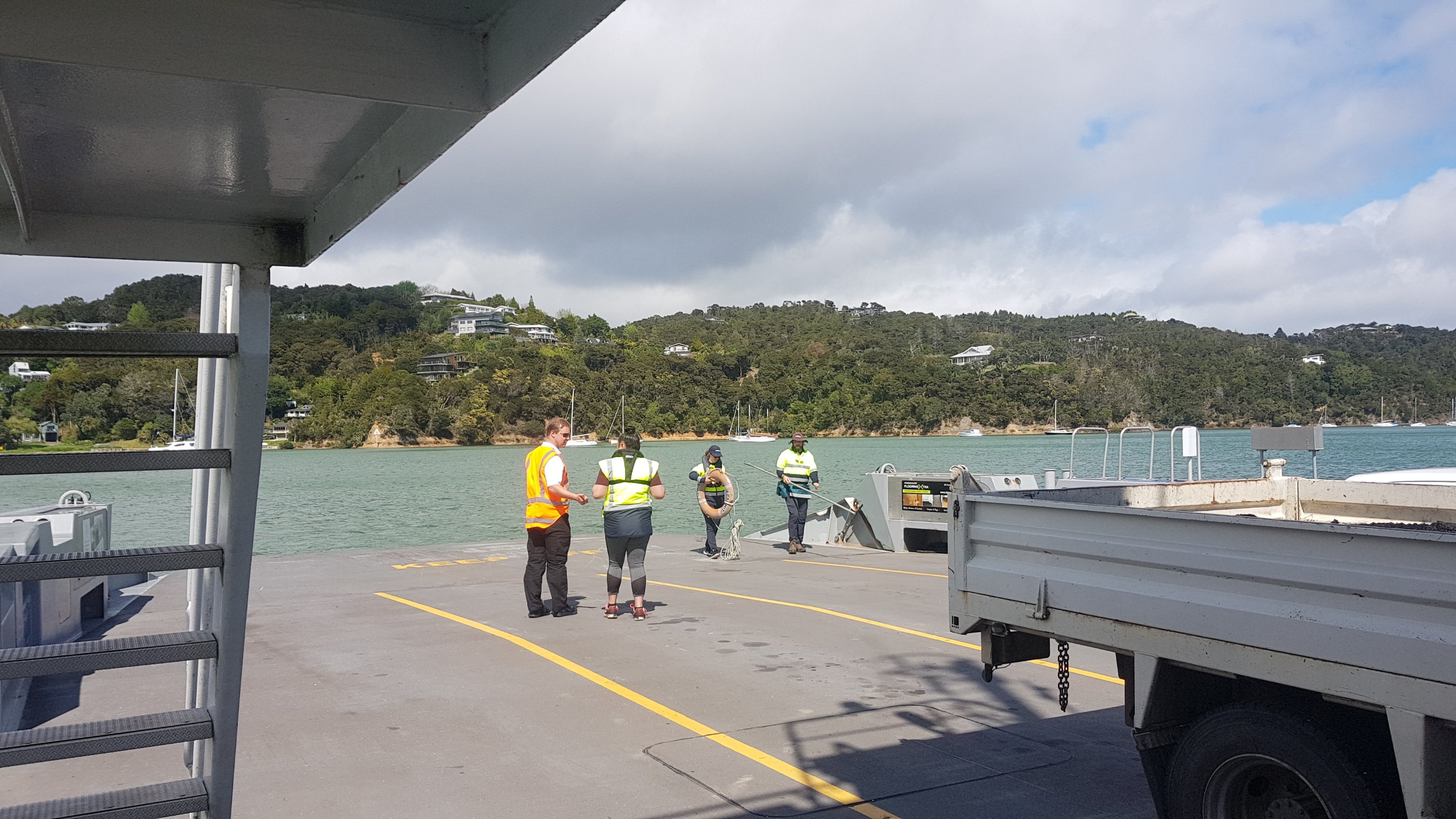
But not to worry, the cars still had to unload and new cars had to load and so there was plenty of time.
Onboard I met a man from Ireland (I guessed Scotland, and was corrected, oops) who said he had seen a few hikers earlier this morning on the ferry when he came over. He said that they had hiking poles and packs like me. I wondered who they were.
As we pulled into Okiato across the harbour, someone yelled out “man overboard”! Wow I thought, who could it be? There were only four foot passengers on the boat, me, Irish guy, and the two staff. We went to have a look over the side of the boat but it turned out it was just a drill.
Never fear – the invisible man has been rescued
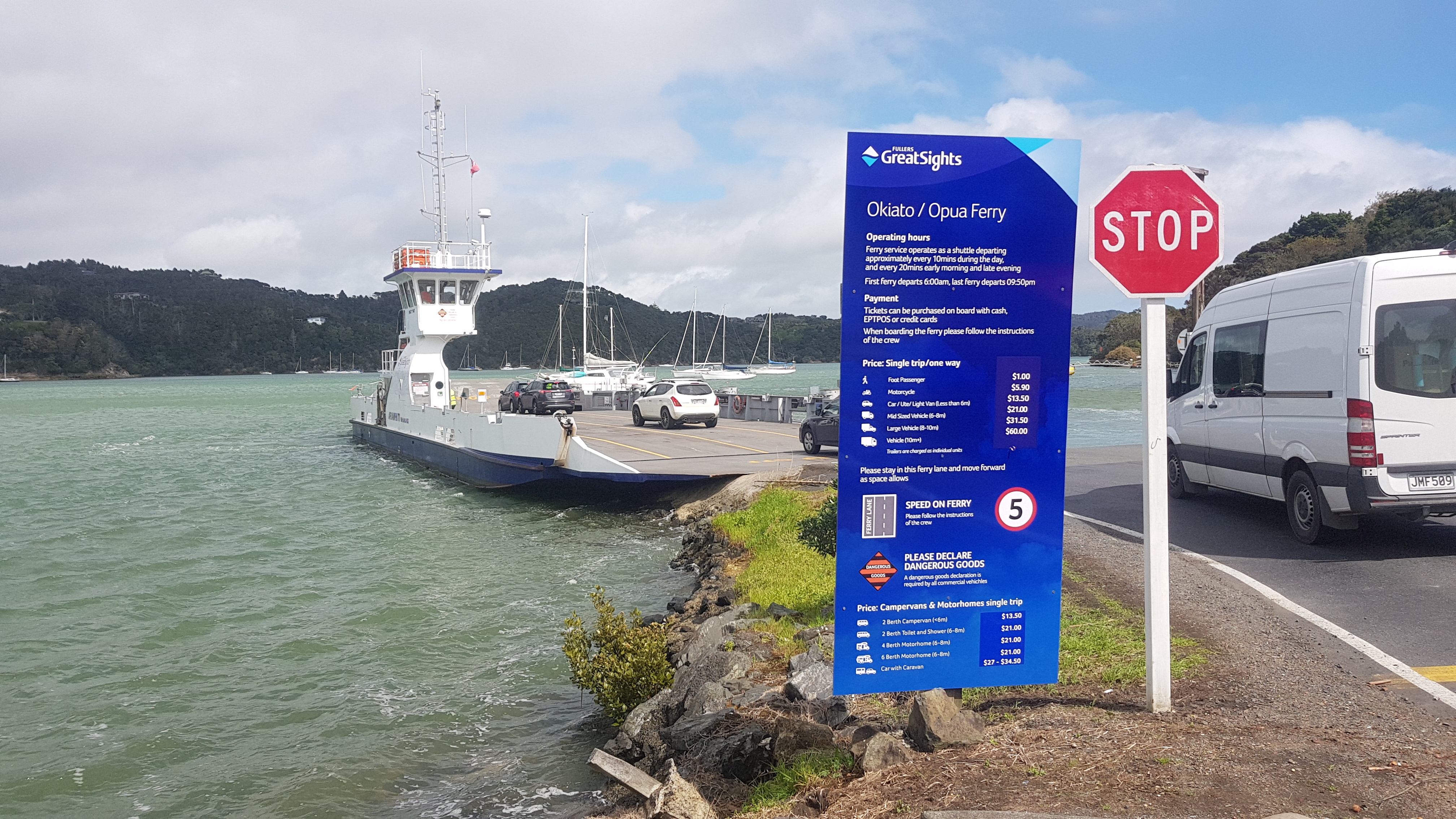
As I got off the ferry, I turned back to check out the price list. $1 for a walk-on passenger is amazing. I know it’s not Cook Strait we’re crossing here, but The Interislander, you could learn something from this service.
Opua Ferry prices
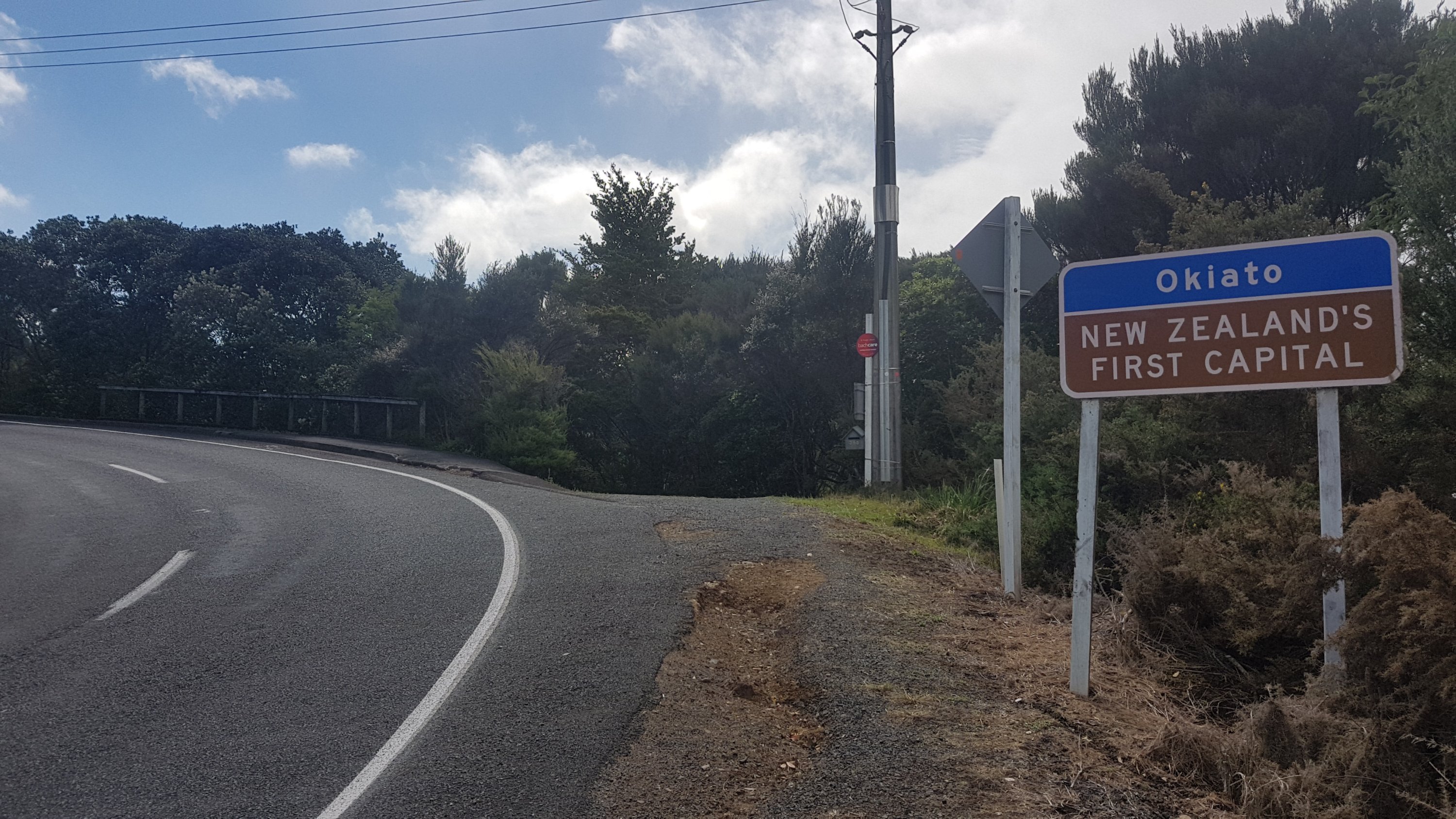
My 11am picture is this road sign just up the hill. I really thought it was Okaito, I had been saying it wrong for days. I also learned that it was New Zealand’s first capital. I didn’t know that, in fact I hadn’t even heard of the place before this week.
11am picture: Okiato – New Zealand’s first capital
I was sad to see there was no shop at all in Okiato. I really felt like an L&P. I have heaps of food but drinking only water gets tiring.
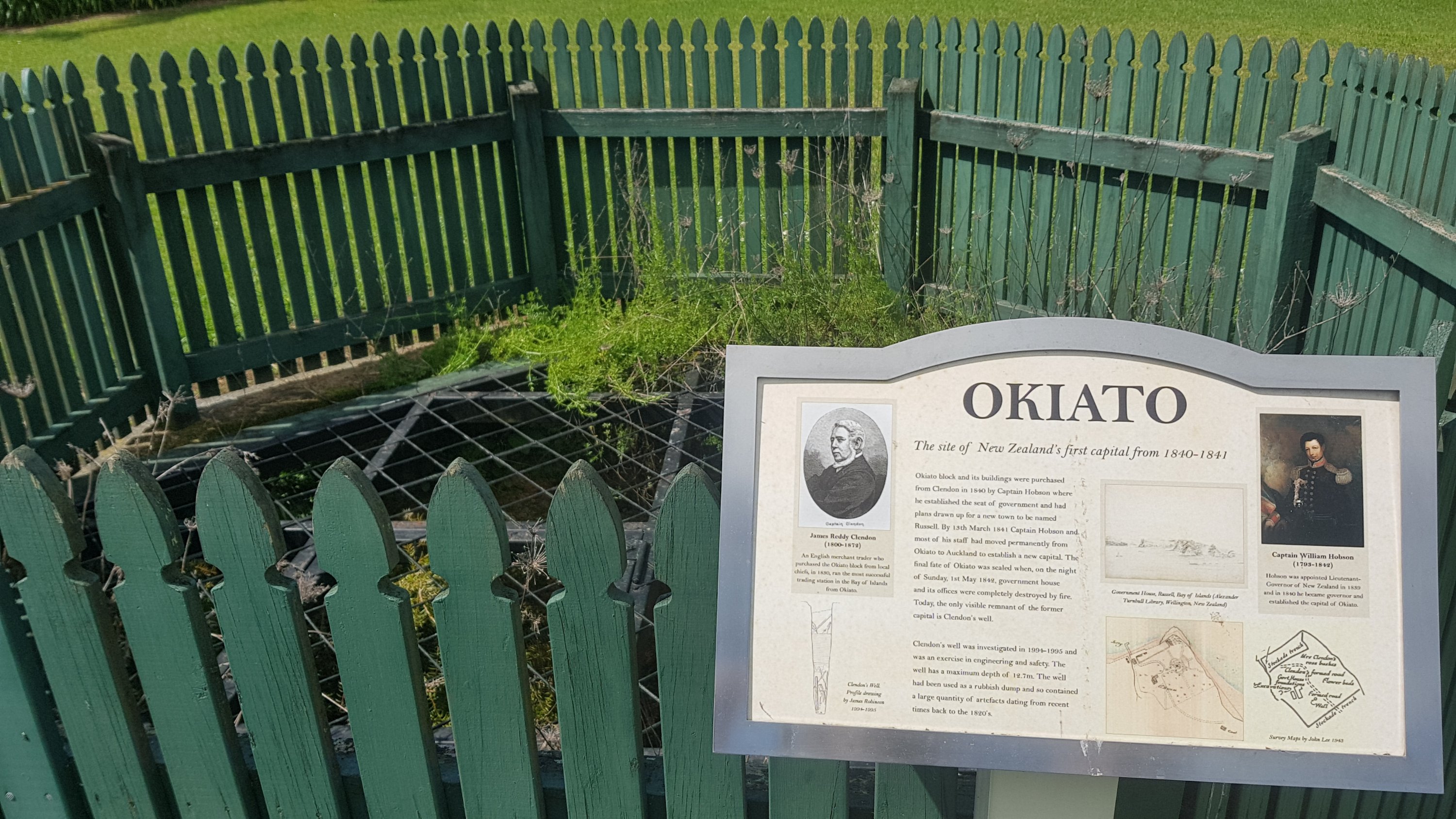
I took a small diversion to go and see the site of NZs first capital. It was nothing except a sign and a well, which is apparently all that’s left of the original buildings. But I’m glad I got to see it.
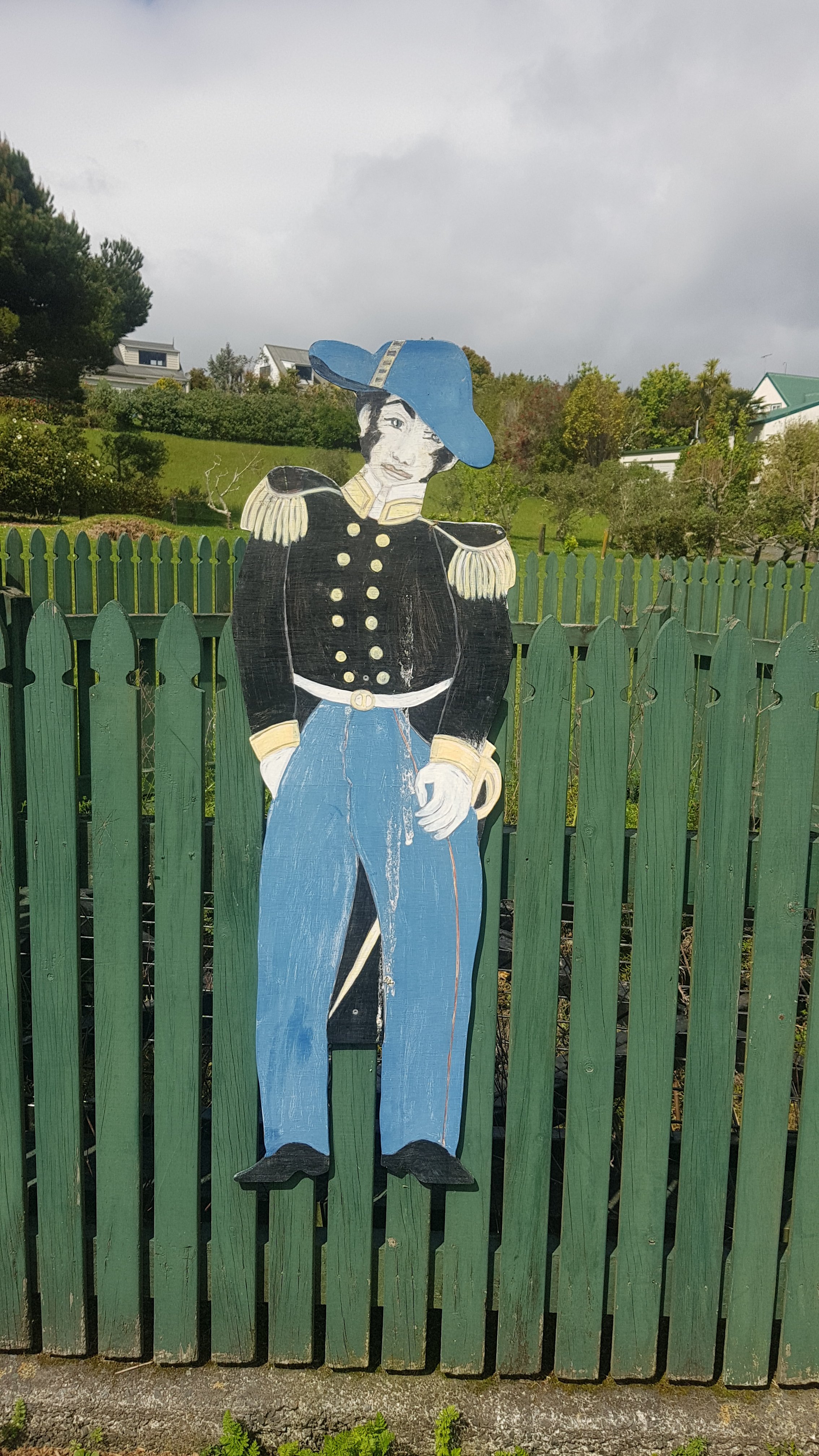
All that remains of the first capitalSaw this chap. He didn’t say much.
There was a lot of road walking planned today, but at least the first bit was a forest track – it was Stage 1 of the Okiato to Russell walkway. I ran into a woman on this bit of the track. She asked me if I was doing Te Araroa, I said I was and we had a bit of a chat about it. She had done sections of it, she said. I’m surprised by the number of people up here who have heard of Te Araroa. Maybe lots of people start the trail, but a lot have dropped out by the time you get further south?
Okiato to Russell walkway
After this was the road walking… and it was about this time that I got the song 500 Miles by The Proclaimers stuck in my head. It’s an okay song, certainly one that I used to jump around to and sing to loudly in my drunken university years some time back. But I’m not sure I wanted it in my head the whole day. So even the road walk wasn’t the best, I stll put my headphones on and listened to music, quietly of course so I could still hear cars coming.
Besides… The Proclaimers say they would walk 500 miles. Is that all? Lightweights. Even if they did walk “500 more” as well which they go on to say, that’s still only 1000 miles. The TA is almost double that. Maybe I should write a song. Although “I would walk 3000 kilometres” doesn’t quite have the same ring to it. What I can say though is that if I haver, then I know I’m definitely gonna be the man that’s havering to you.
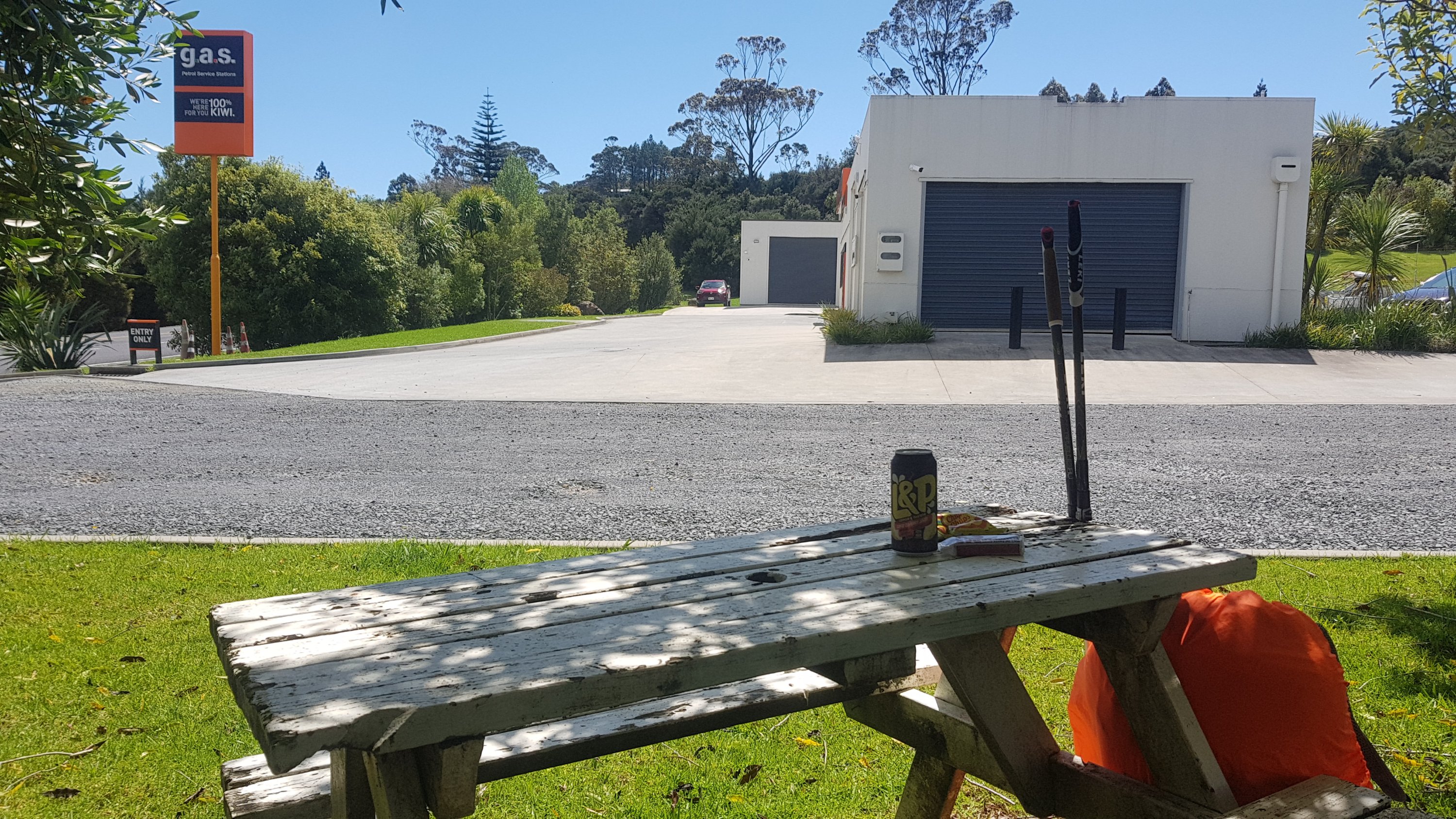
One good thing early on is that there was a GAS station on the corner where the turnoff is to Whangarei, after 5 or 6km from Okiato. I finally got my L&P and some other sugary junk.
G.A.S. Russell
The kayak would have been 13km, but the road walk from Okiato to Waikare is over 19km – long. After the GAS station not a lot happened. I did find these though…
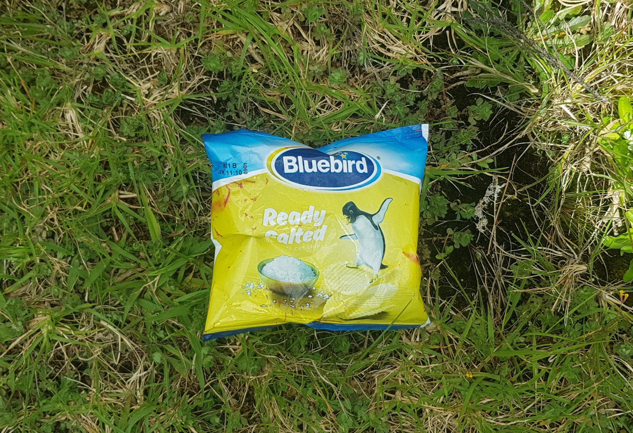
Bag of chips lying in the ditch
They were just lying on the side of the road. At first I thought they were chicken flavour, which comes in a yellow bag. But on closer inspection they are Ready Salted, which normally comes in a red bag. That meant they had been here a while. And there was no visible expiry date. But they were sealed. I ummed and ahhed as to whether I should eat them or not. For about half a second. Of course I ate them.
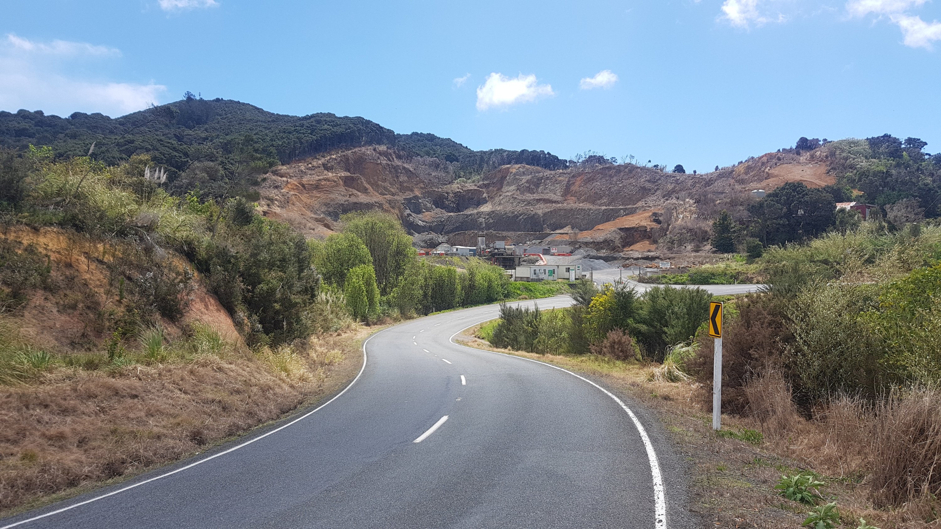
There was a quarry…
Quarry
And this shed over the water…
Hope this is constructed well
I haven’t yet been asked if I wanted a lift yet, which is something a lot of hikers report happening.
The views this house must have…
Towards Waikare a guy in a white van did pull up beside me, and I thought maybe he was going to ask me if I wanted a lift, but no he asked me if I had seen a dog roaming around as his was missing. I said no and he looked dejected and drove off. If he had’ve asked if I wanted a lift I might have been tempted to say yes, because I had already done 13km of road walking and so I was telling myself that getting a lift to Waikare wouldn’t have been cheating. But I’m glad I didn’t.
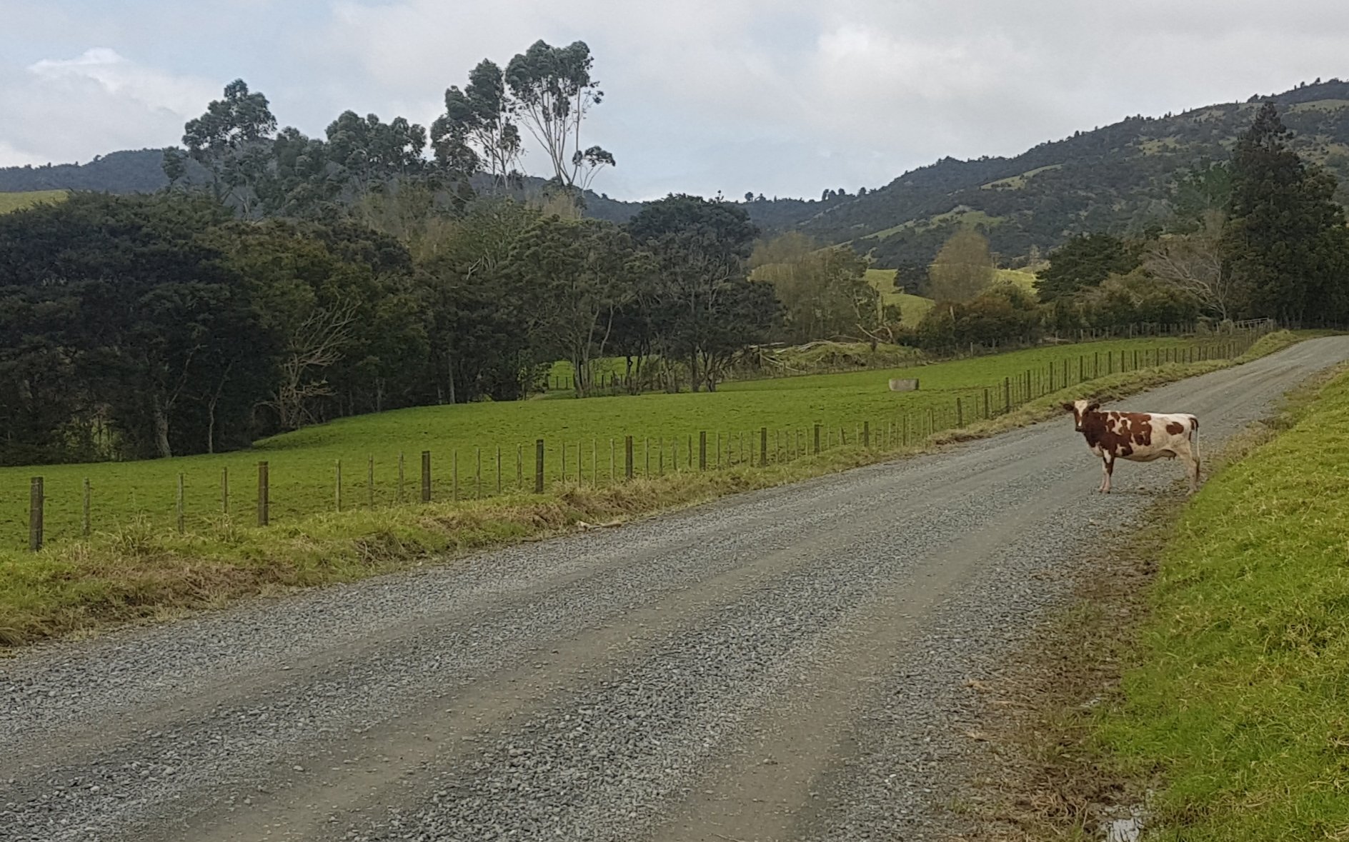
And there’s always time for a cow photo.
More moo cows
The “low accuracy” setting on my GPS watch nearly caught me out because I nearly missed the turnoff onto Waikare Valley Road, because I thought I still had 700 meters to go. Here’s the turn here…
Don’t miss this turn
If you turn 180 degrees from here, you can see the Waikare Landing where you would leave your kayak for the hire company to collect. It’s not particularly beautiful and I can see why it needs to be high tide.
Waikare Landing – I’m sure its mother loves it
These little buildings were interesting. I couldn’t see if they were for rent or why they were there.
Interesting buildings up on the hill
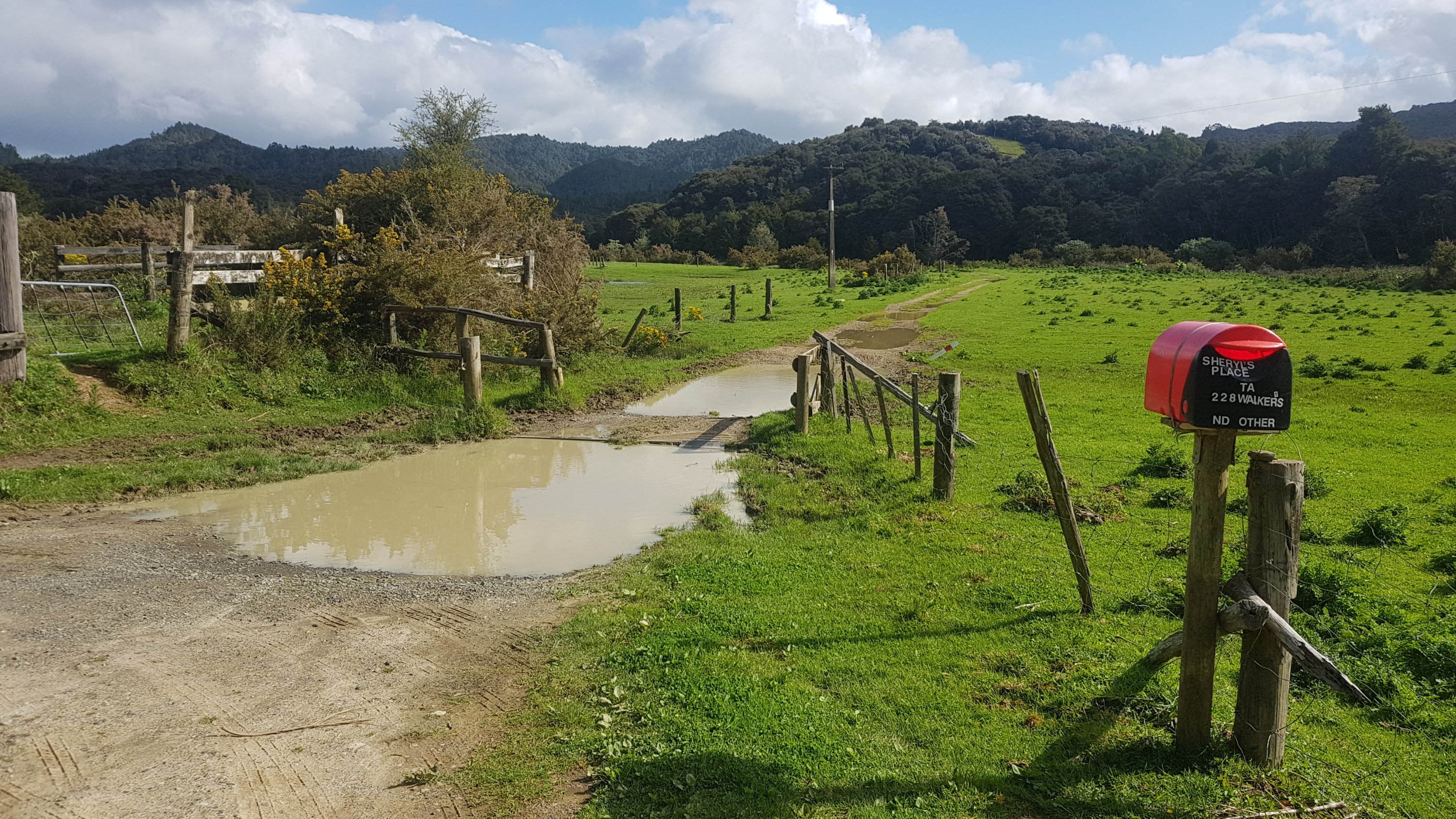
I was on the lookout for “Sheryl’s Place” which I knew was on this road. She’s frequently mentioned on blogs as being a good host who would let you camp in her garden and provides a composting toilet. I soon heard loud thumping bass on the street and thought that must be her place. Gee, I don’t really want to stay here, it sounds like a real party house.
But Sheryl’s place was further down the road than I thought, and so the bass wasn’t coming from her place. Here’s her entrance:
Entrance to Sheryl’s
I didn’t want to stop though. I wanted to make it to the shelter in Russell Forest which was only another 6km on. There was still a few hours of daylight, and there was an unfound geocache at the shelter which I was excited to be first to find (that’s a big deal in the geocaching world). So I pressed on.
I had some food at the first little river crossing, and got attacked by sandflies almost immediately. So I looked for the Deet insect repellant which I always kept in the top of my pack, but shock horror, it wasn’t there! How can that be, I always pack the same way every time! I had to pull apart everything out of my pack and there it was, right at the bottom. Grr, I won’t be doing that again… it’s good to always pack the same way so you know where everything is if you need it in a hurry.
Once you reach here, you’re finally off the road
Plus my Deet was running low. It’s really expensive and so maybe I shouldn’t be spraying so much. But it works well. Although if you spray it on yourself and then touch your skin where you sprayed it, and then eat food, the Deet ends up in your mouth. Gross. Note to self – try and avoid that from now on.
Changed into my crocs. I’d walked about 28km by this point and it was so nice to get out of my hiking boots. I like my new boots but as you all know I love my crocs more. They’re so freeing!
Another crocs photo
When I got here, I realised this was the first stile I’d seen since before my rest days. And I remembered how much they hurt and how hard they were to get over when I had my sore foot. This was the first real test of how my foot had recovered. But I’m pleased to say there was no pain at all.
My old nemesis – the stile
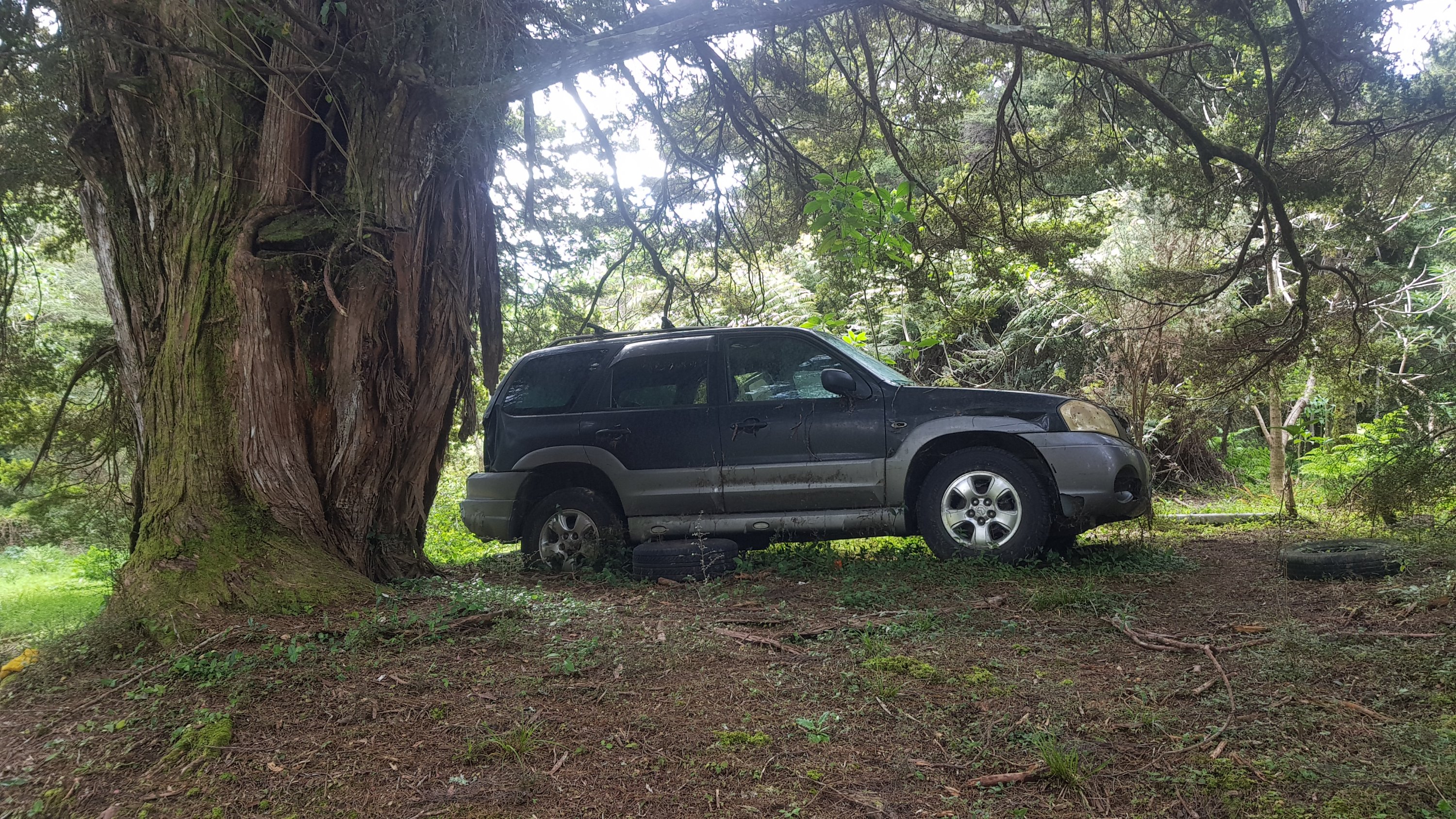
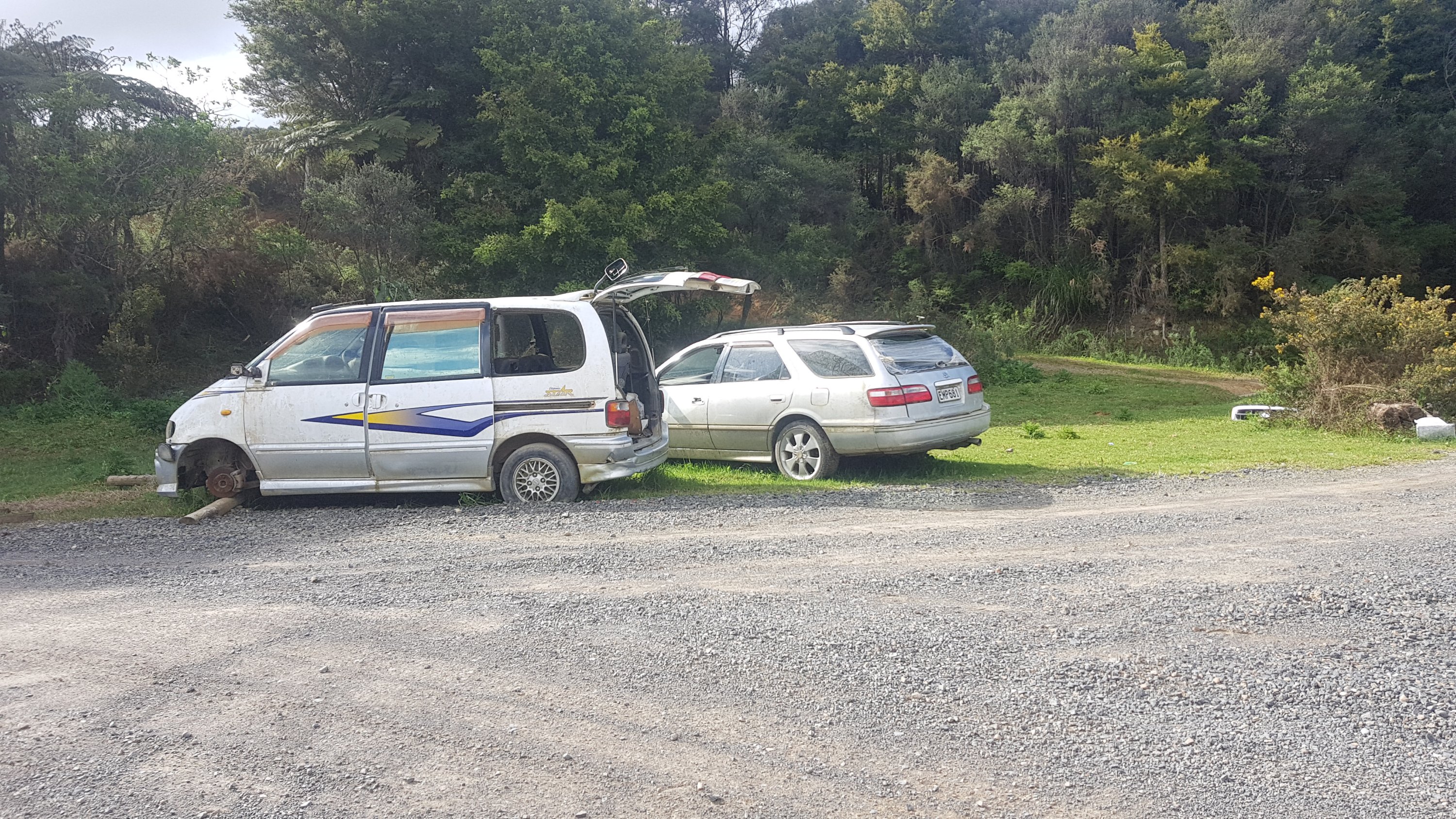
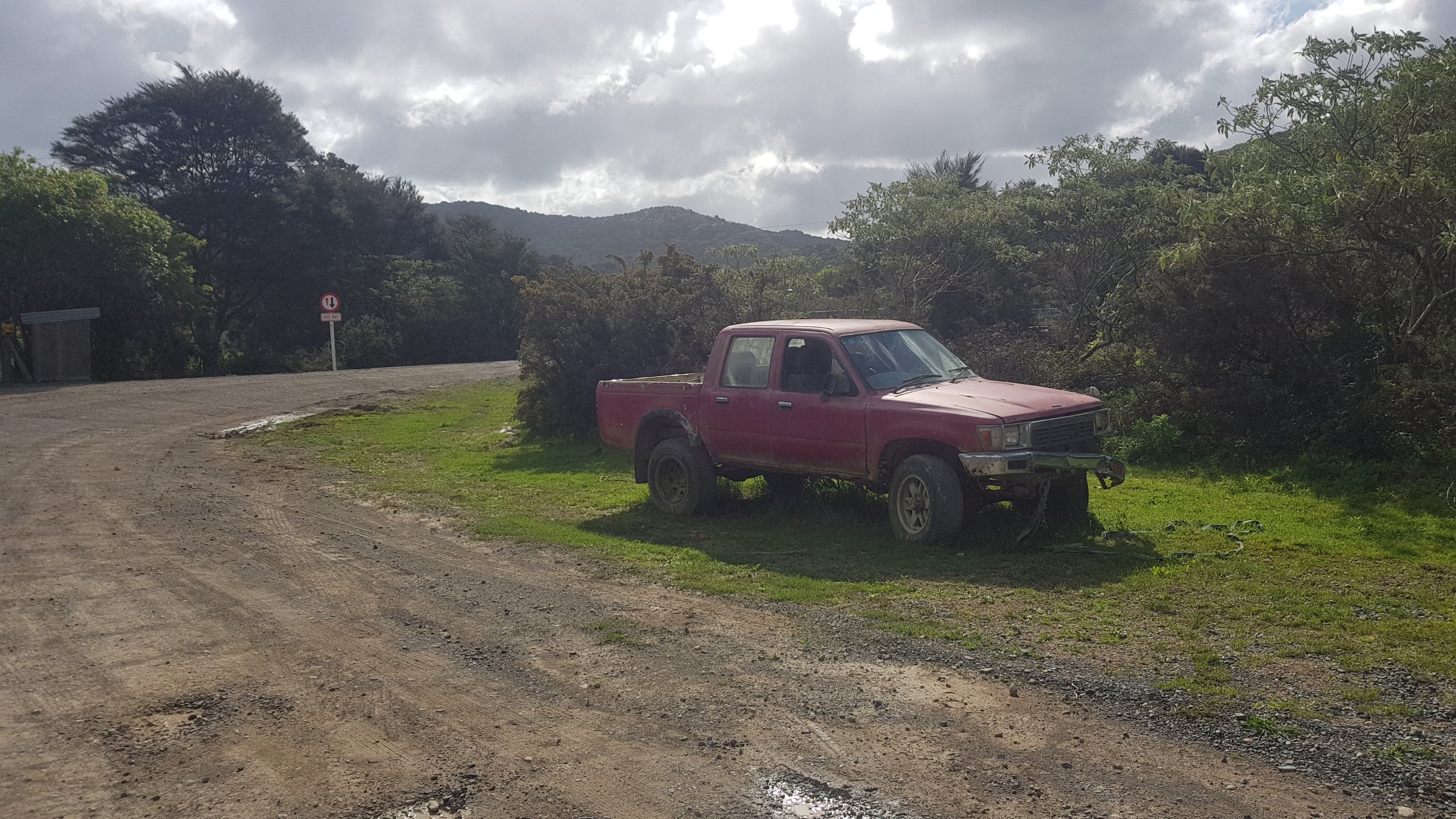
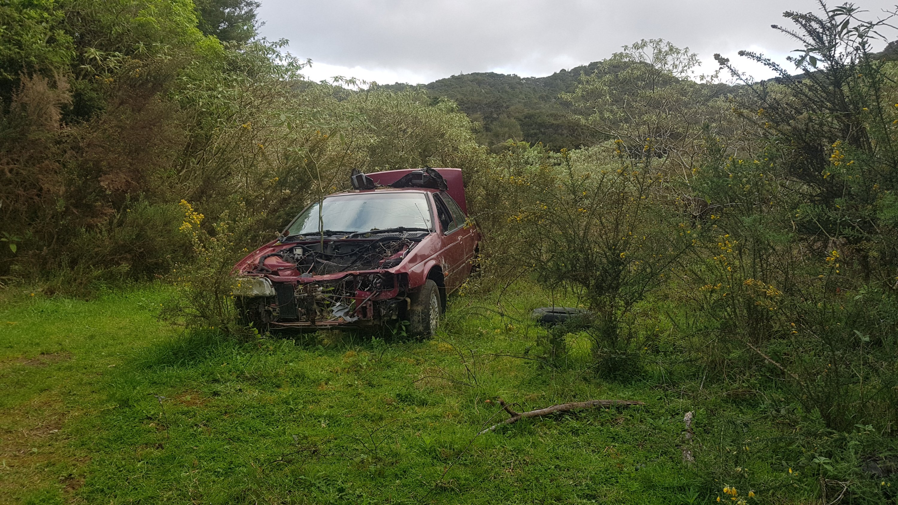
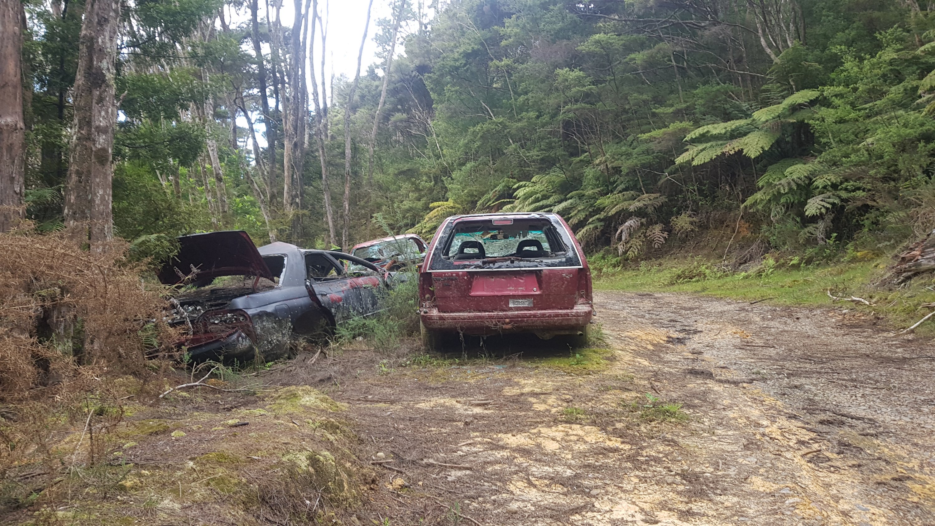
From here on the road turned into “Abandoned Car Avenue”. Look at this collection of abandoned cars. This wasn’t even all of them.
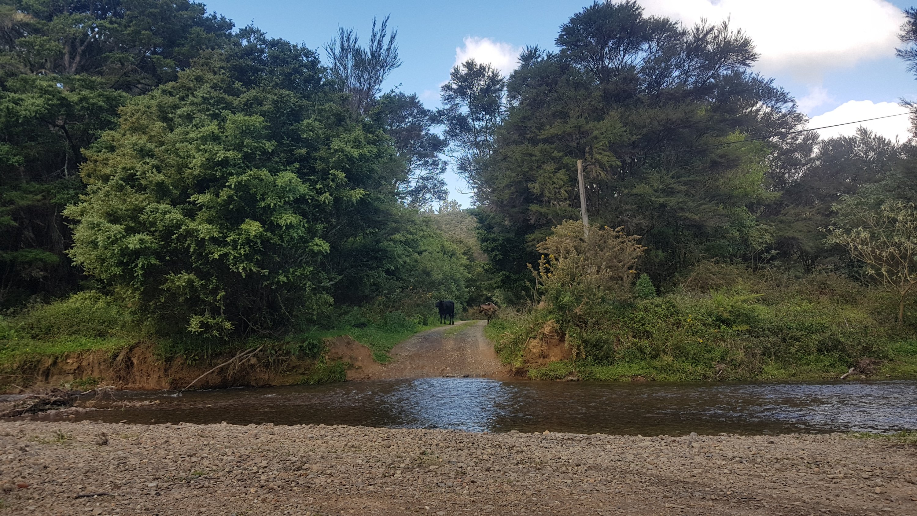
Next was another stream walk. Hooray, I loved the Puketi Forest stream walk so I was looking forward to this one too.
Stream to walk down
It looks deep, and in places it was, but at the points where it would have been deeper than thigh-deep, there were marked paths out of the water and along the forest. So if you are walking this, and the water gets deep enough that it wets the stuff in your pocket, then you’ve missed an orange marker.
Getting darker now
I took a while to have food before and I was aware that daylight was running low, so I tried to be hasty, and therefore I didn’t fill up my water bottles from the stream, even though I had none left. I knew the camp was not far away so I wanted to wait until then.
And there were footprints! People must be ahead!
The stream was nice and clear but the views weren’t as nice as those in Puketi… but still pretty good.
Last stream walk I was in my shoes but this time I was in my crocs the whole time. They were excellent, they gripped almost as well as the shoes and they dried out really fast. I know people say that shoes dry out fast too, but they don’t, they just get “less wet”. Crocs are dry within minutes of exiting the water, and your feet are dry not much later.
Even when I saw a massive eel and jumped like a girl, the crocs didn’t let me down and I didn’t slip.
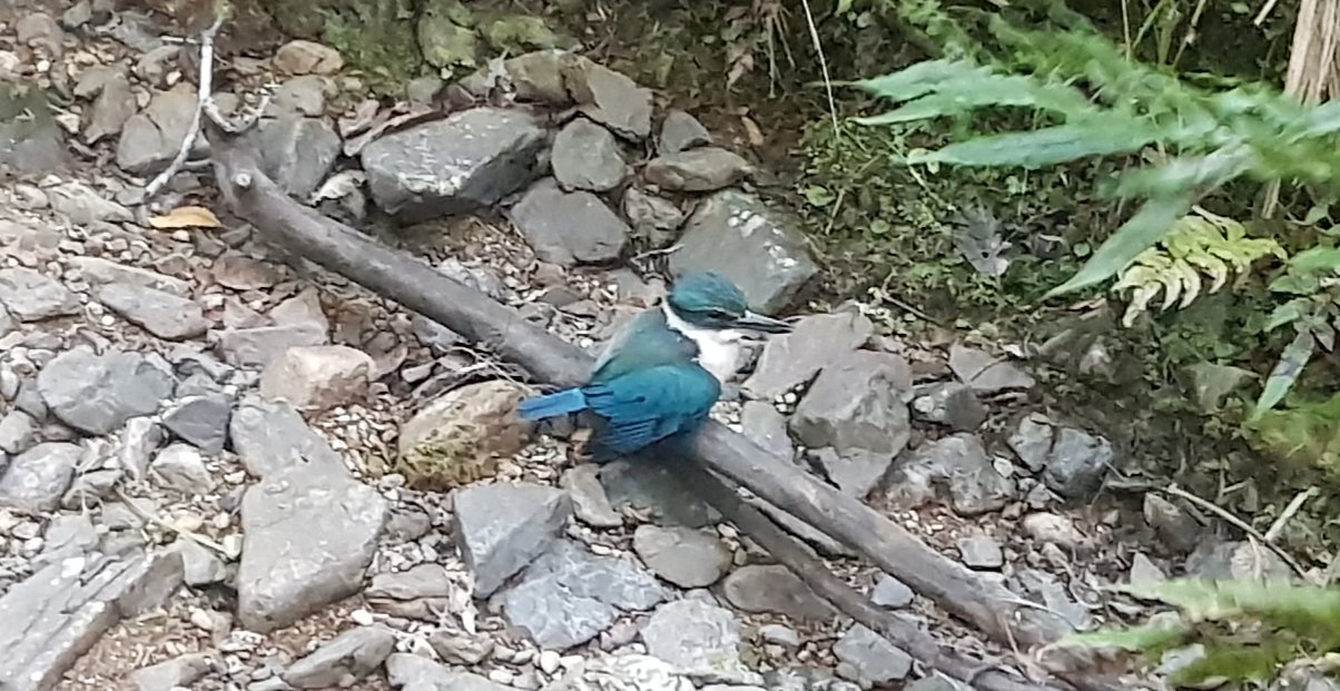
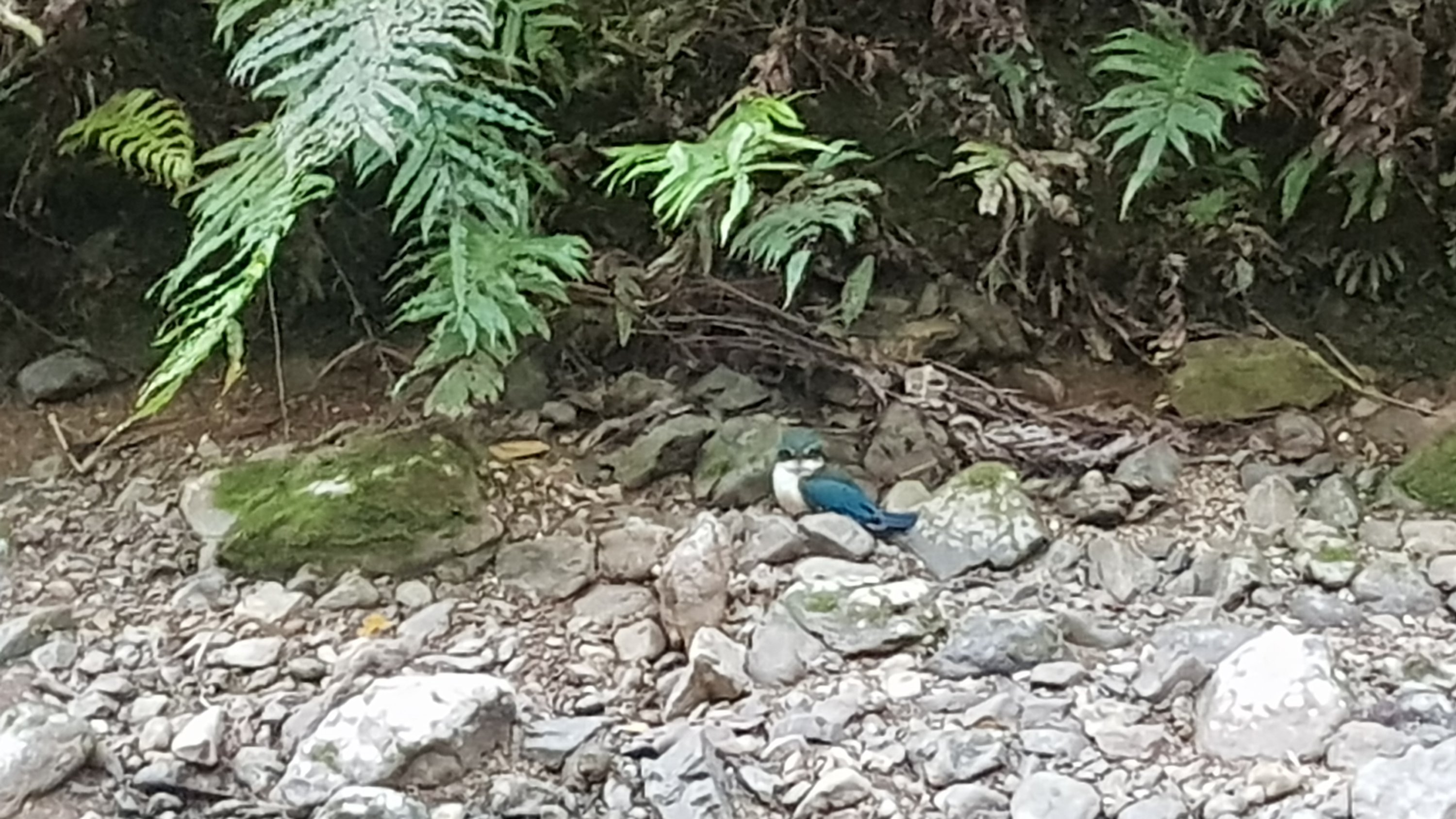
And I saw the coolest bird that I’ve ever seen in the wild.
Awesome bird
I eventually arrived at the camp to find four other tents already set up, and one guy there sitting at the shelter table called Frederick. Amazing! First time I’d seen anyone at all upon arriving at a campsite since way back on Day 2. When I introduced myself to Frederick, he said he already met me in Paihia. But he can’t have, in Paihia it was pouring with rain the whole time so I didn’t talk to anyone. I was confused… but after I havered some more we had a quick chat. Maybe he didn’t meet me in Paihia and he just saw me at the backpackers… I’m still not sure.
But it was a shame that once I had set up my tent it was fully dark, so there wasn’t any time to talk to anyone. The occupants of the three other tents didn’t emerge so I didn’t meet them, and I didn’t recognise the tents so I knew none of them were Rhydian.
And I had no water… and didn’t want to go get water or cook dinner because I wasn’t sure where the water was and I didn’t want to disturb people by cooking dinner. It’s ok, I had a fair bit of food at Waikare before crossing the river, so I just had a protein bar and went to sleep. I was thirsty though, I wish I had at least got a bit of water from the stream.
I also couldn’t get first to find yet on the geocache. I had a quick look but nosing around in the trees late at night right by the other tents would have made me look weird. So I’ll look for it in the morning. It’s not going to be found between now and when the others leave in the morning.
It was warm during the night. I don’t think it was just because I had walked so far. I just slept in my sleeping bag liner at first, and didn’t get into the sleeping bag itself until quite late at night. I hope these warm temperatures keep up at night, they’re awesome.
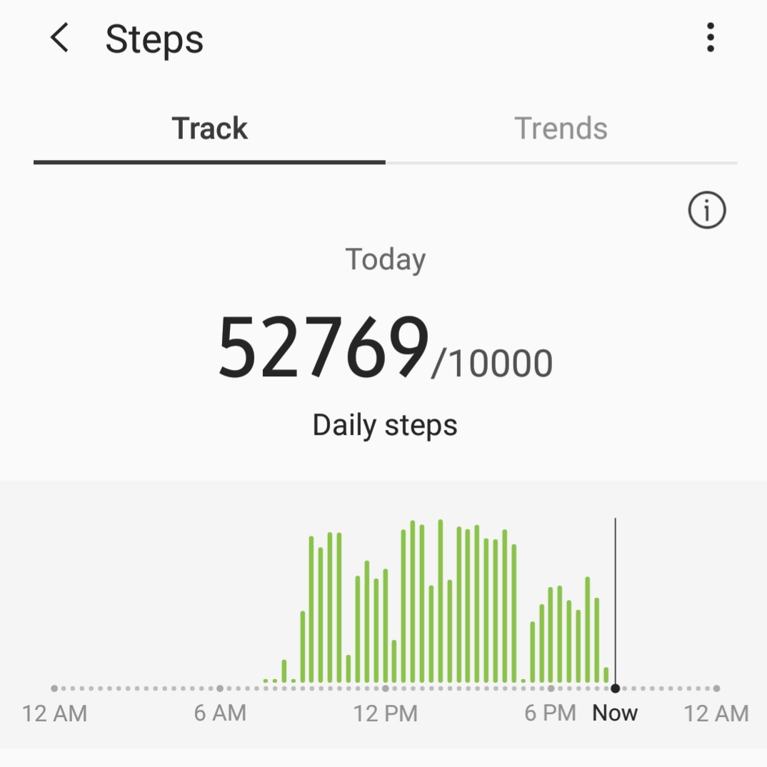
And today I set a record for most number of steps in one day. Not sure if it is a record for the most steps on any day in my whole life, but probably. Certainly as long as I’ve had this phone.
Date: 17 October
Distance walked: 25.7km
Trail covered: kms 272.8 to 297.9
Weather: hot
Number of piglets seen: too many to count
This morning I learned that the occupants of the other tents in the campground were Nick and Robert who were from Sydney, Olivia who I think was from somewhere in North America and Frederick who I saw last night when I arrived.
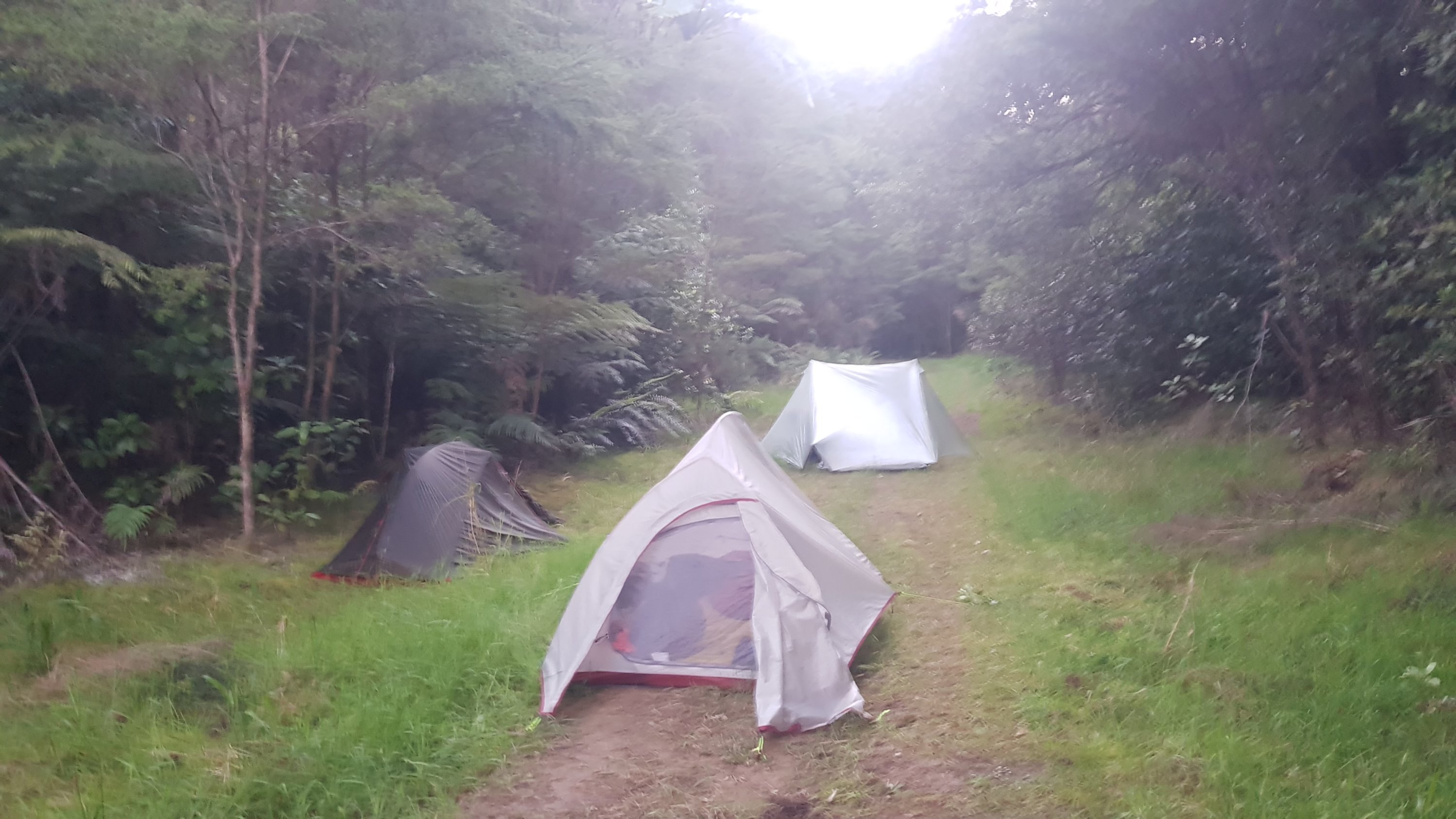
Camped right on the path. The other tent did it first so I followed suit.
I also found the previously unfound geocache! I should have waited until everyone else left because they were already packing up when I woke up. But I was too excited. One of the campers was using the spot near the geocache as a urinal just before I found it – gross. But I bet that happens more than I would like to imagine.
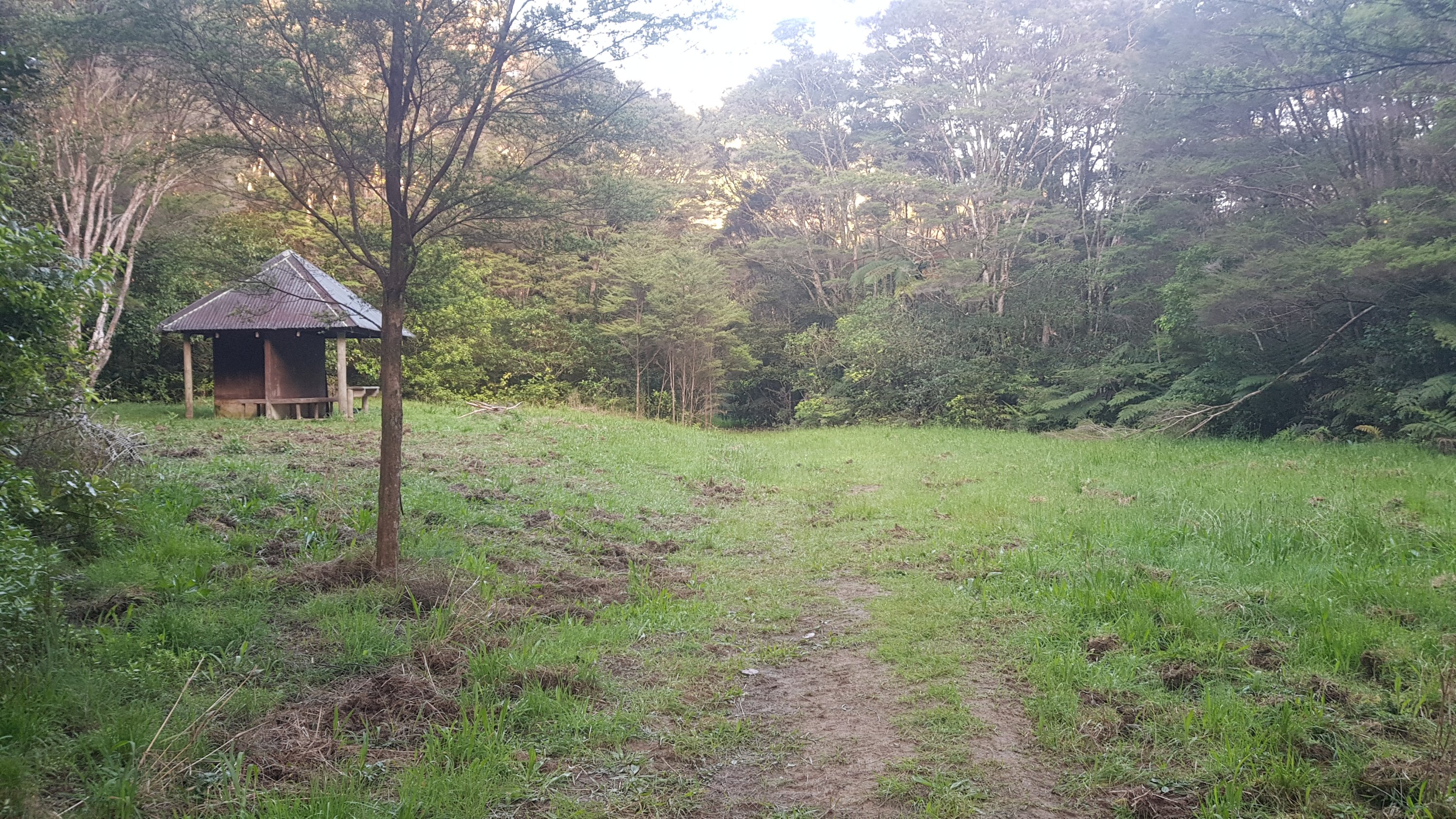
The shelter once the rest had left
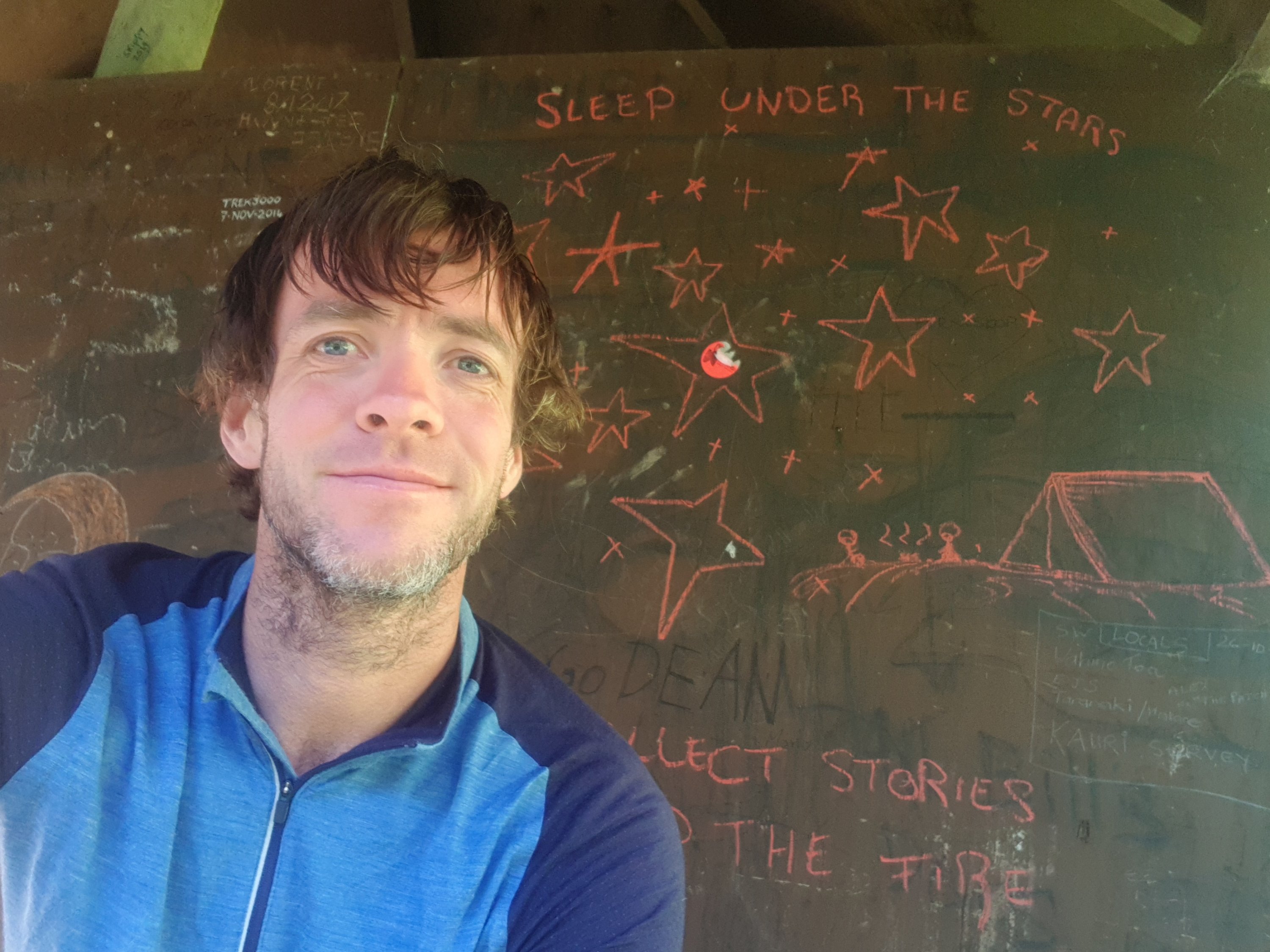
Everyone else left early, they had all gone by 8am. I bet it was because I was getting very stinky by now. Of course I was definitely not leaving that early. I could have left early because it was a beautiful day and my tent was dry but I was in no rush, like always. I sat down at the shelter and had breakfast. I took a selfie while I was there. I don’t normally like to encourage people graffiting the walls of huts and shelters, but I liked the stars someone had drawn.
Selfielicious
And there was a toilet, which was a nice surprise. The notes for this place said no toilet.
A loo!
There were these bugs on the tent though. Vamoose bugs.
Take your dirty and perverted act elsewhere please.
The song in my head now was Metallica – Wherever I May Roam. Very appropriate, although I have no idea how that got there. “Roamer Wanderer Nomad Vagabond call me what you will” – seems appropriate.
I eventually left at 9am. I had no idea what accommodation was to come today or even where I’d be walking. The notes for this section are long and rambling and the accommodation part was a bit lacking. All I knew (well I thought I knew) was that there was one more walk in the stream.
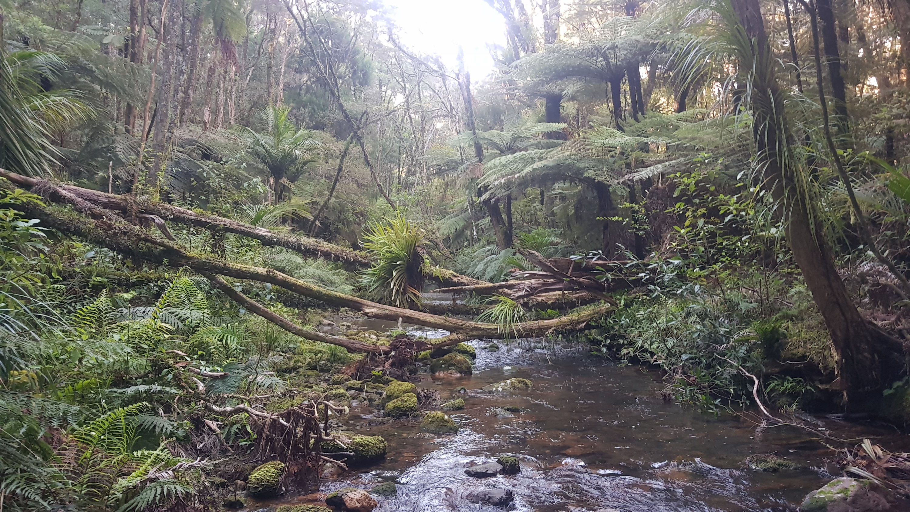
From the shelter, I ventured into the stream again and continued upstream, just like yesterday. There were lots of fallen trees, like this one:
Lots of fallen trees in this stream compared to the last one at Puketi
But wait… soon I was at the junction of two streams, both looked too deep to navigate. No orange markers anywhere. Uh oh, what’s going on. Looked my app and I had gone way off course. I had taken a wrong turn at the very beginning – I was supposed to cross the stream, not walk up it!
NOTE: From the shelter, continue straight across the stream, don’t walk up it like I did! If you see the tree in the photo immediately above, you’ve gone the wrong way!
So back to the shelter I went. That cost me about 25 minutes – it was now 9:25am and I was back at the start. Bah. My first major wrong turn, although it didn’t set me back too much. You can see it on the map at the end of the post, if you zoom in. This was the type of road I was supposed to be on:
The correct way
I stopped at the 2km mark to have a second breakfast. The porridge I had earlier just wasn’t enough. I had some muesli and some trail mix. Partly because I was hungry but also because I need to eat some of the food in my bag. It was ages ago that I was in Countdown in Kerikeri but it still felt like I had 5 days worth of food in my bag. It’s so heavy.
Since I’m not actually walking upstream after all, it was crocs off and boots on. The boots are still dry of course so it was no problem. I was also going to put on sunscreen, but it had clouded over at this point so I decided not to. This turned out to be a bad idea.
The way out of the forest was a fairly standard forest road. My 11am picture was where this road met the main road. It was also where a local Maori guy stopped and chatted with me about the area, forestry, and the fact he sees a lot more walkers now but a lot less cyclists. It was quite intereting actually.
11am picture – the end of the forestry road and now on the main road
A lot of road walking now between here and Helena Bay. And really not a nice road – lots of twists and turns and sharp corners so you had to keep crossing from one side of the road to the other and back again. It wasn’t too busy but every now and again a big truck would come down the road and use up the entire lane.
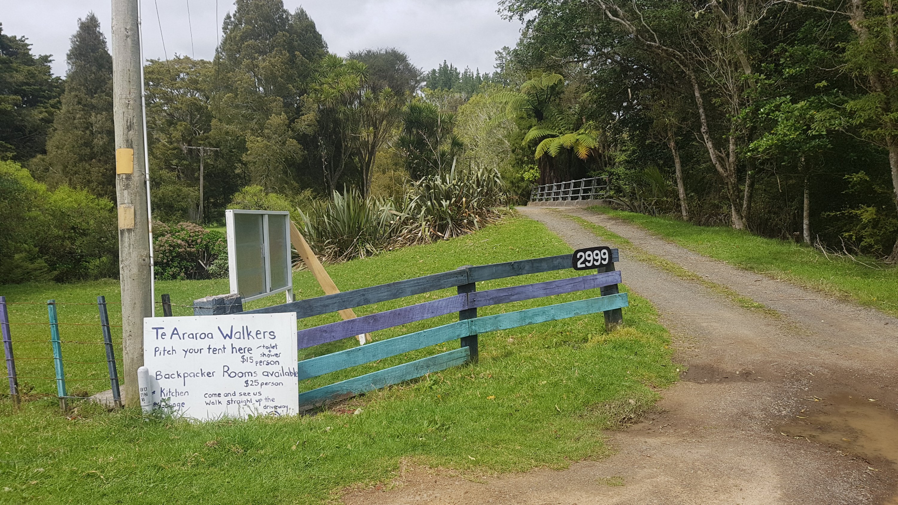
Just a small distance down the road was 2999. I know Rhydian stayed here and I’m fairly sure he said he liked it… so that’s an option if you don’t want to stay at the shelter where I stayed last night.
2999 Helena Bay Rd
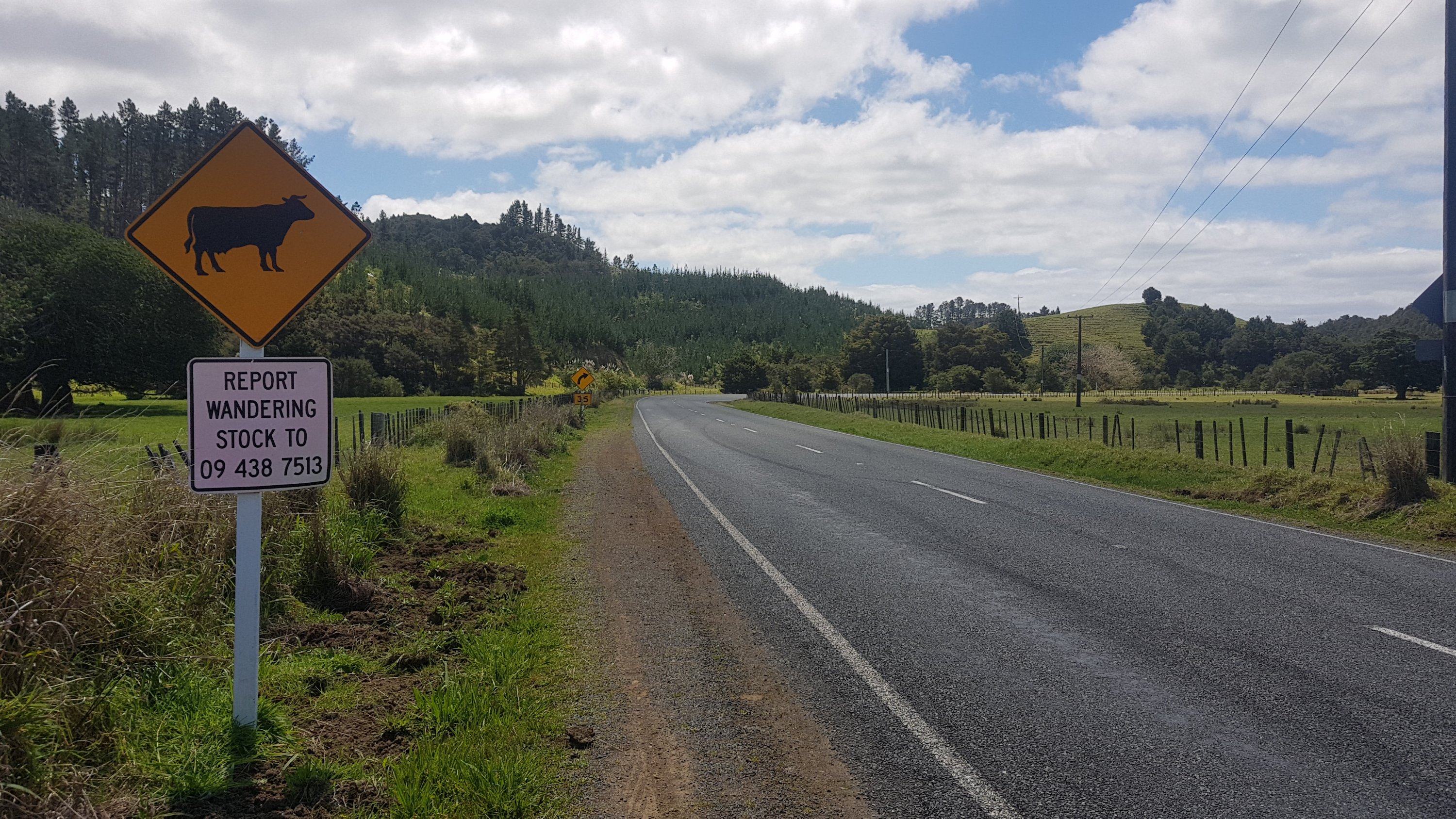
There was a sign to report wandering stock:
I thought this was a bit odd but literally one minute later was this guy:
Cow just hanging out on the road
And then a bunch of other cows on the road further up.
Really felt like a shop again to get a drink. I don’t know this part of the country and so I thought Mokau (which I saw on the map) might have a shop. But no, this was all there was:
And then up the road was a pig which had escaped from the paddock.
More wandering stock
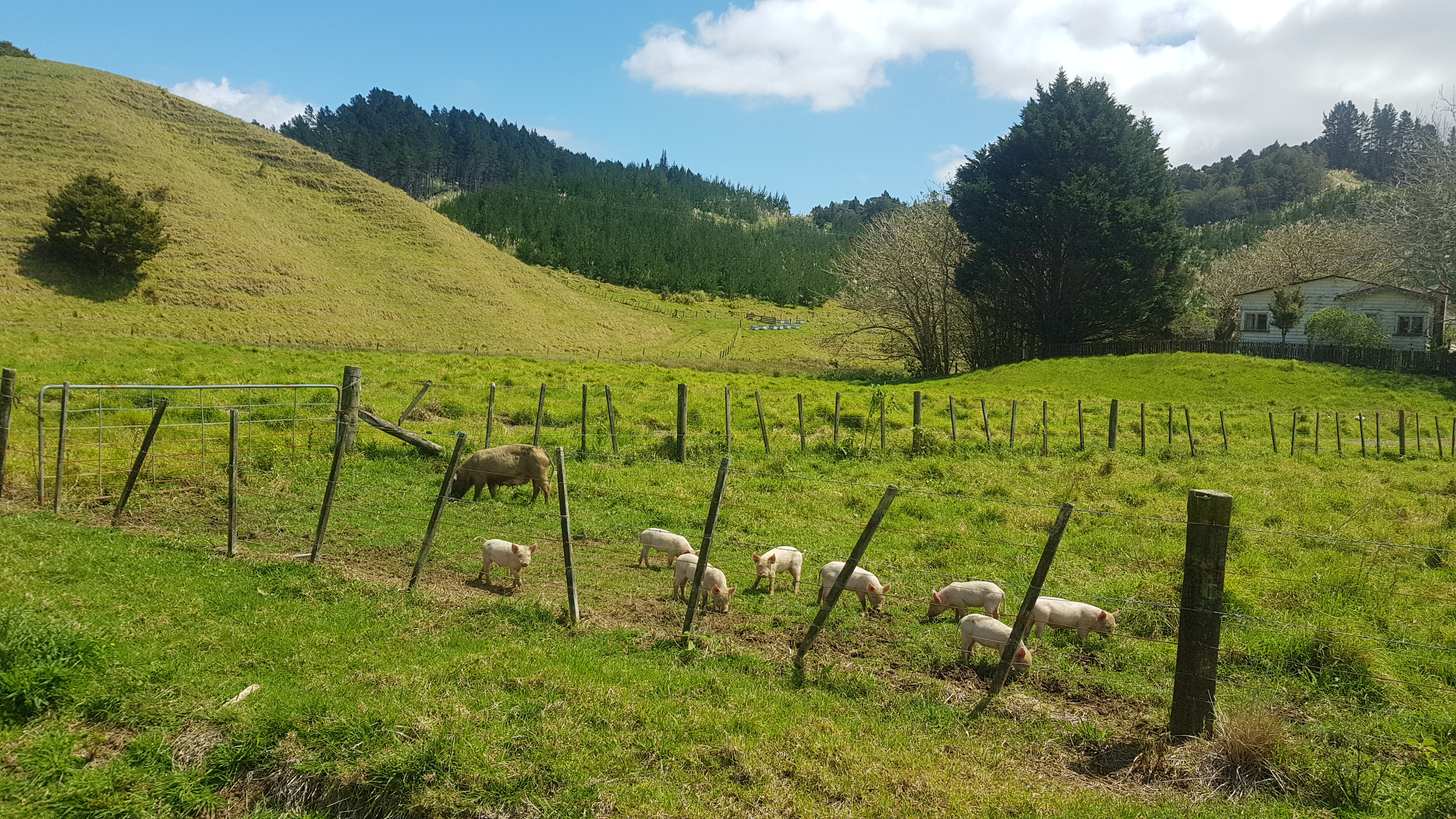
And then just past that… piglets!!! I’ve never seen so many piglets in one place. They were so cute.
Huge number of piglets, even more were off-camera
The road walking started to play tricks on me. At first I thought this was a cow on the road in the distance:
Cow on the road in the distance?
But it was actually just mailboxes:
What sort of cow is this…
It was at this point that I got asked by a woman driving a car if I was lost. First time I’d been asked that! She still didn’t offer me a lift though.
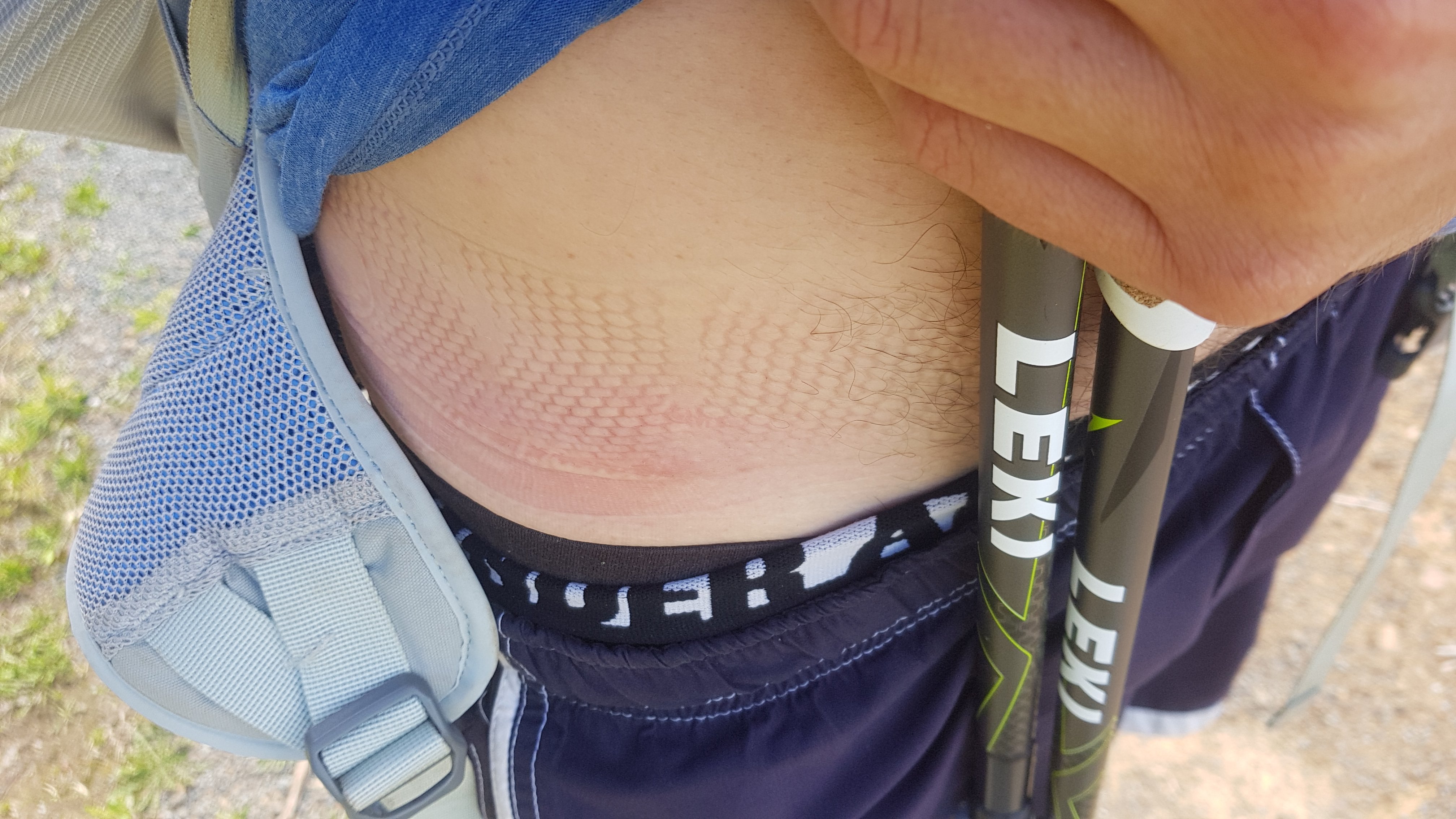
It was also at this point that I realised my bag strap had gone under my shirt and onto my bare skin. Didnt hurt too much but looked ugly.
Don’t let this happen to you
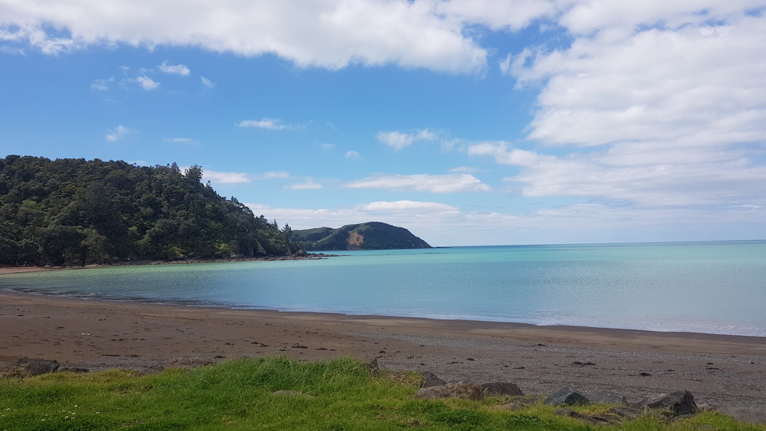
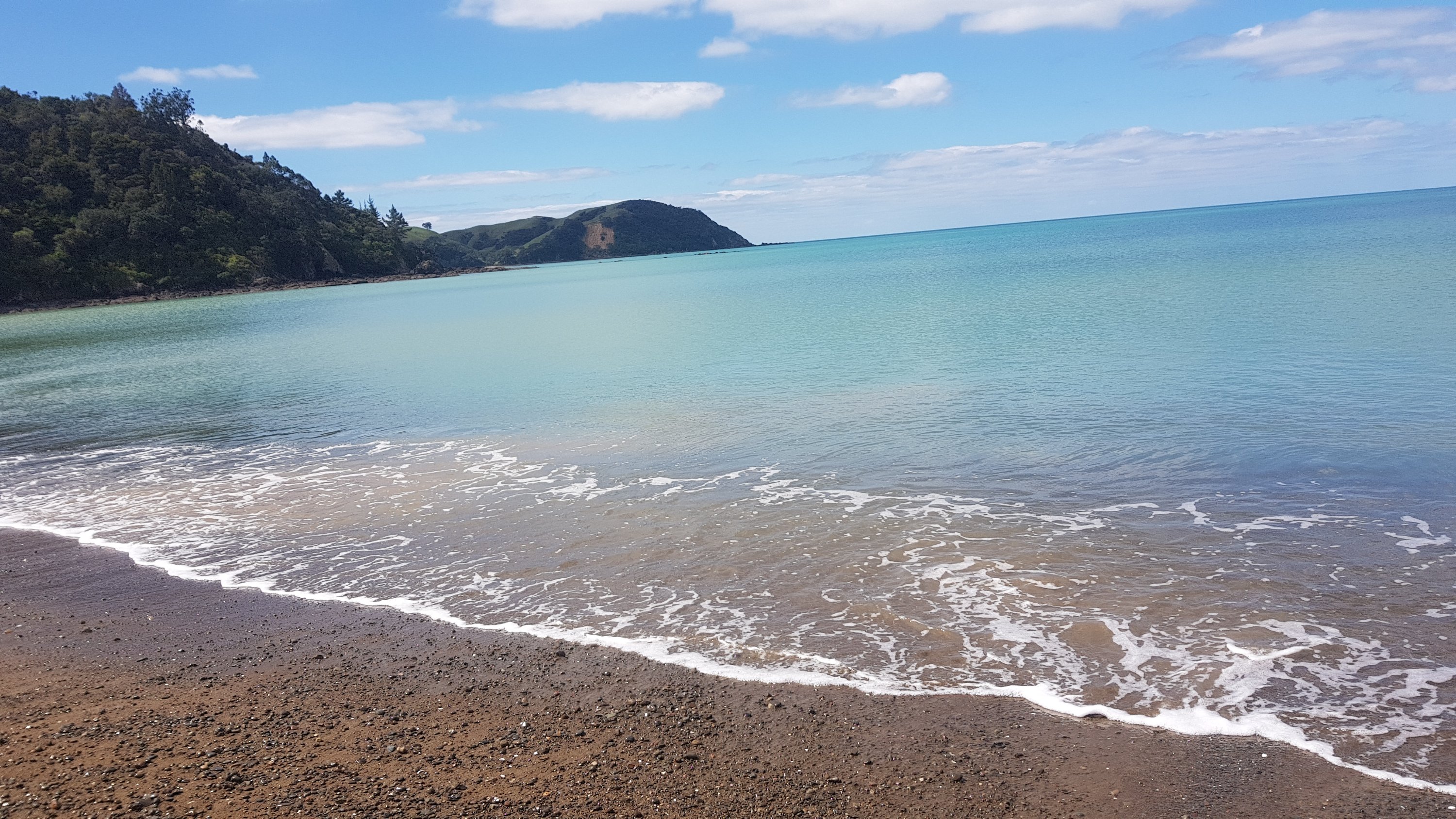
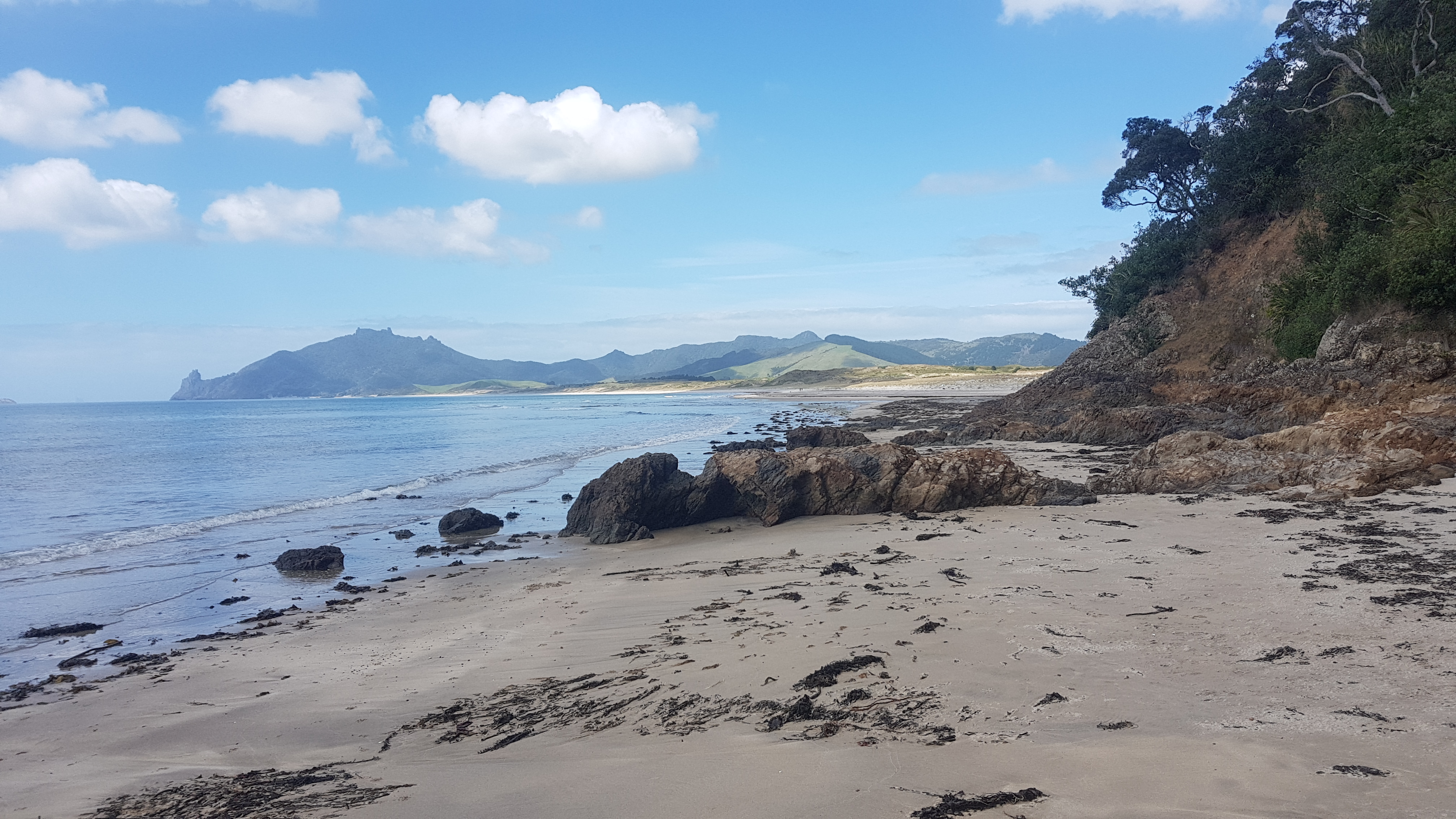
Finally found the turn to Helena Bay. It was a beautiful little bay with very blue water, and it was the first time I had touched water on the east coast since I started walking. It was a great feeling.
Beautiful blue water at Helena BayNice to touch water again
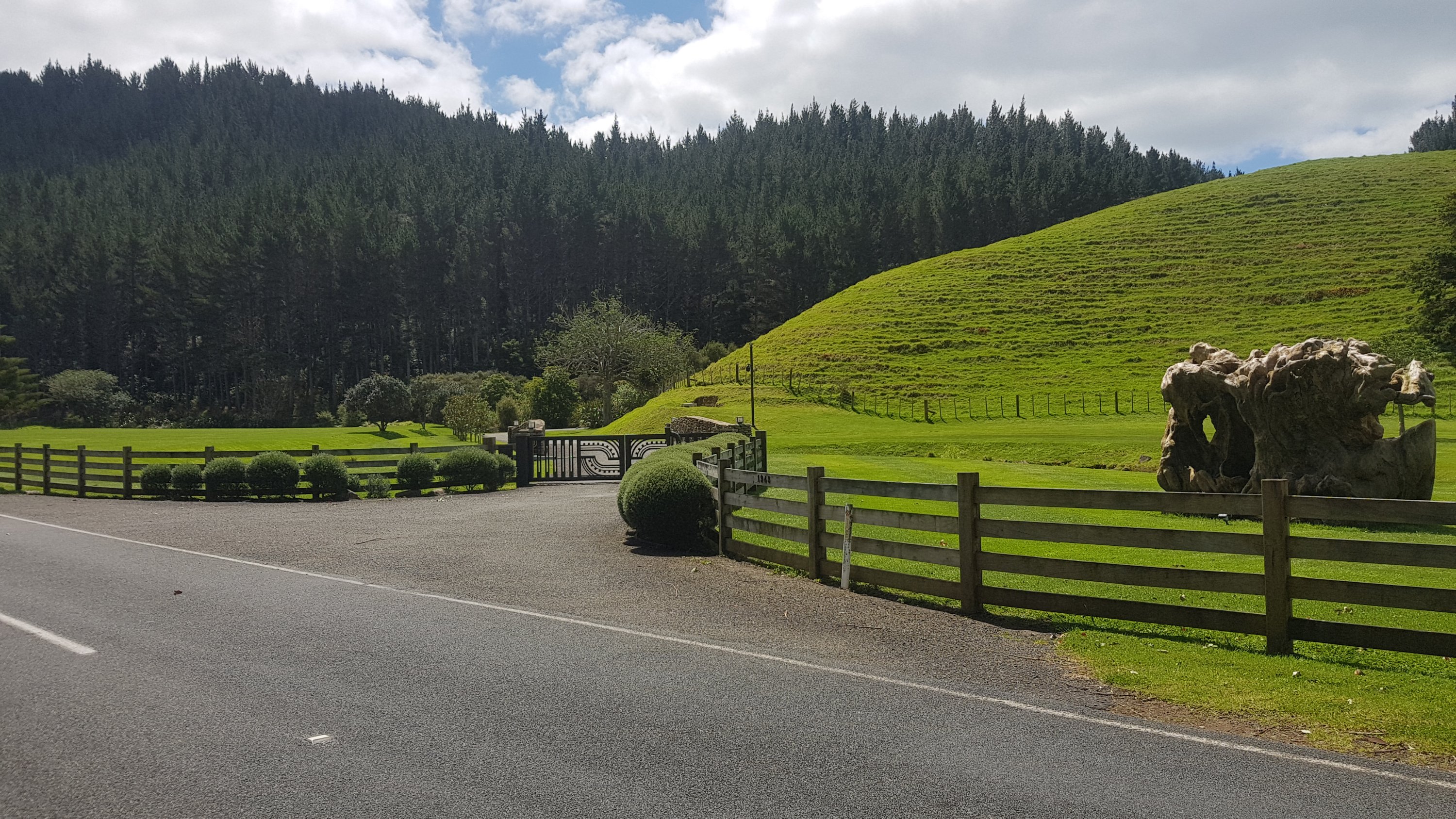
I was really sure that this was going to be a big place, and that there would be somewhere to stay. Turns out no. There are exactly 7 houses here, and not one of them showed any signs of life. All holiday homes for rich Auckland people perhaps? I don’t know. There was the Helena Bay Lodge less than a kilometer back from Helena Bay itself, but it looked far too posh with it’s perfectly manicured grass and odd-looking sculpture and gates. And with no actual sign I think they want to keep riff-raff like me out.
Helena Bay Lodge
I met a girl in a campervan who had seen me walking. She gave me roast vegetables, I think she felt sorry for me when I pulled out my wrap, peanut butter and pretzels. The roast veges were amazing. Whatever seasoning she had put on them was awesome.
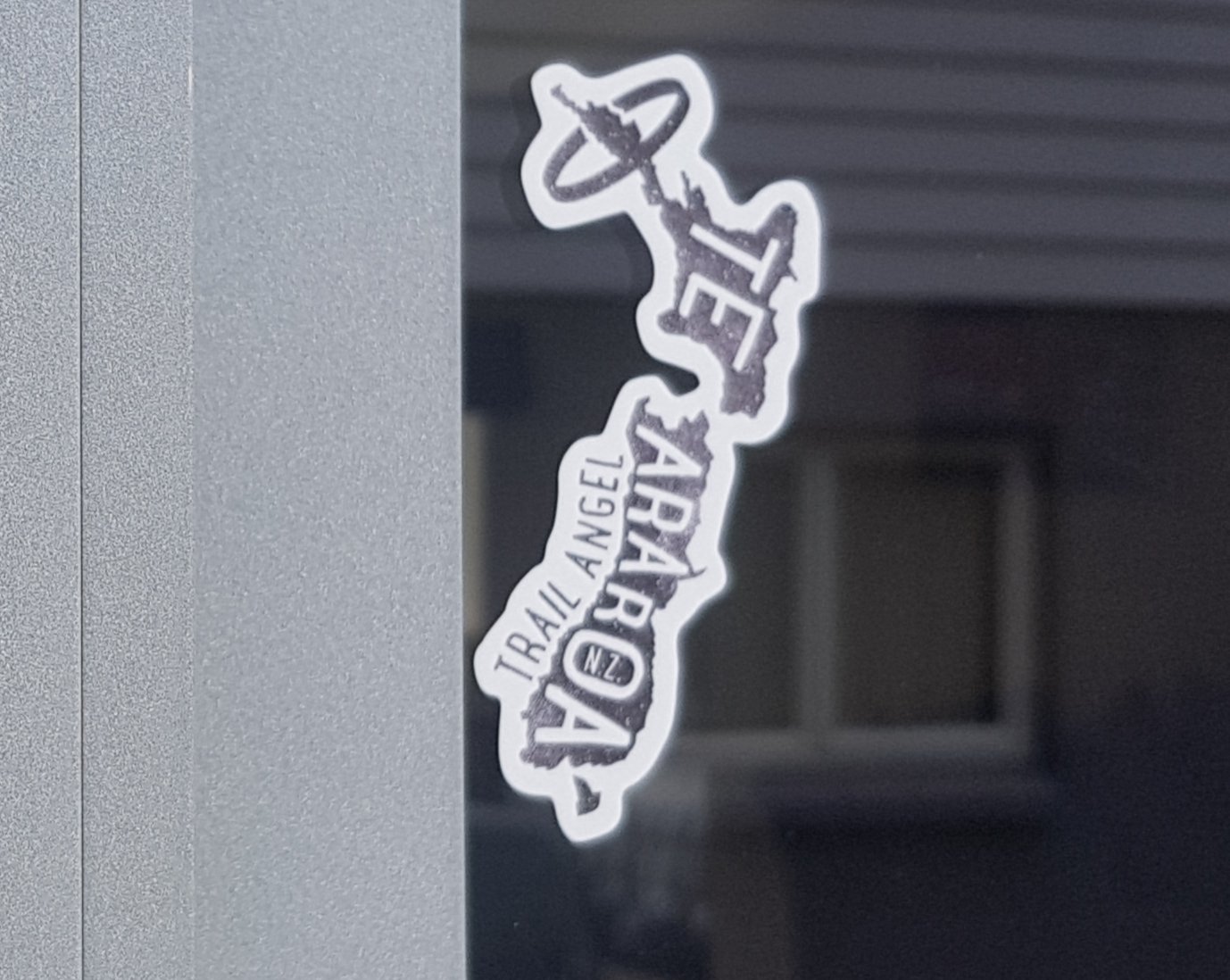
I had heard there was a guy by the name of Jock who lived in Helena Bay, who let people camp in his yard. I had looked at all seven houses for signs of life but didn’t find any. I was sure I found the right house because I saw this sticker. But the house didn’t looked recently lived in.
Didn’t know that “trail angels” have their own sticker until now
It was also a super hot day and I had run out of water. Since it looked like I was going to continue walking, I first tried to get some water from the stream that fed into the ocean, but the sides were too muddy and I was getting more mud than water into the water filter. So I gave up on that idea. Note to self: if the days are always going to be this hot from now on then I need to start bringing more water or stopping at suitable streams more often.
I continued on the trail since I couldn’t find Jock and all of Helena Bay had No Camping signs everywhere. I took a walk down the length of the bay first and then continued up the road to Helena Ridge. This was the entrance to the Helena Ridge Track.
Big gates indicating the start of the Helena Ridge Track
I was still really thirsty and contemplated knocking on the door of the house opposite here and asking them for water, and if they didn’t answer, just using their outside tap anyway. But when I heard barking dogs, I decided against it. I guess it was going to be like last night where I turn up without water and just live with it until the morning. But I wanted a proper meal tonight. Hmmm, what to do. Hopefully I’ll find something.
Helena Ridge track was nice at first (just don’t fall down the sides):
Start of Helena Bay Ridge track
But wasn’t long until it got steep and bristly.
Nice views to be had though!
View from what I hoped was the summit, but wasn’t
After this… it went up. Up and up and up. The up seemed to be never ending. It probably wasn’t that bad, but I was tired, it was hot, and every time I paused a river of sweat ran down my face. I changed the name of the track in my head to Helena Handbasket Ridge, which seemed more appropriate.
On this steep bit I saw 300 written on a triangle. Maybe last year this was the 300km point but since they reinstated Puketi Forest and removed the large detour around Day 12, this year it was only 294km.
300km down? Last year it would have been…
Also at some point on this bit something brushed up against my arm. I looked down, and suddenly there was no doubt as to which country I was in.
Silver fern leaf
Eventually the forest stopped and I came out onto a farm. There was suddenly a breeze, which felt like the best thing in the entire world. More of that please, I thought. And after going up 320 or so metres of elevation I was really thirsty now. Luckily it was a farm, so there must be a water trough somewhere. And sure enough, there was. Complete with little floaty things in it, but I didn’t care.
Plus it came with a great view!
I had trouble though getting the water from the trough into the Sawyer Squeeze water filter bag though, which was a surprise. So I only got a little bit of water, but it was better than nothing. I was ready to continue again.
Now that I had a bit of water and I was thinking better, I looked at the Guthook Guides app which tells you what is coming up. It talked about an area that people used for camping and apparently the farmer even filled up a tank there with water for you to drink. This was at odds with the official trail notes which say “no camping along this ridge at all”. I hoped that the campsite existed and was legitimate. It was only a few kilometers away so I’d find out soon.
I approached this gate, and noticed that this time I would have to walk through cows. I just figured as I approached the gate they’d all scatter. But this guy wasn’t having any of it.
Guardian of the paddock
As I walked through, the cows gave me the minimum amount of space possibe, and then they started following me. It was a weird feeling. I took this video, and I love the point in the video when one cow walks into another cow and then they have a fight about it.
The farm was nice. These cows had a nice view, but they were too busy looking at me.
Cows with a view
This was the view from the other side at this point.
The view the other way
And there were lots of these. I didn’t like these very much.
Double electric fence
After that the terrain changed again. It was now a little overgrown track around the side of a hill. I found it odd how first it was steep forest, then easy rolling farmland, and then suddenly gorse city.
Just walk through it, you’ll be fine.
Not long after I found the campsite that the app talked about. It was everything that it said… an open grass area with a water tank but no toilet. It did seem that someone was filling up the water tank manually. Thanks to whoever does that, it was awesome. It was even labelled as “drinking water” so I didn’t filter it.
Legitimate campsite on the ridge
It was 6:45pm, and Nick and Robert were already there. I said hello but they were both locked away in their tents and there was a chance I woke them up. They asked me if I had seen Frederick and I said I’d seen no other hikers. They said okay and I left them alone because they wanted to sleep early.
I went and found a nice spot further up the hill so that I wouldn’t be annoying. It was a good spot because I had a nice view just a few metres away.
View from by my tent
Also because it was at the top of a hill I had a kind of a seat where I could sit and make a proper dinner. The fact that I had a water supply and at least another hour of daylight really helped with that.
Dinner at sunset
I noticed that I was starting to get hiking pole tan lines. It’s not that clear here but it is when you see my hands.
Hiker pole tan lines
I took some time to put a plaster on a new blister forming just below the toenail on the big toe of my left foot. I took a picture but it’s really not pretty so I’m sorry, you won’t get to see it. It was a bit red and quite painful.
Went to bed fairly soon after having dinner, as it had been a long day. It was much colder tonight and I had to wrap myself up in my sleeping bag. I could hear a possum around but it wasn’t being too annoying and didn’t bother me. How kind of it.
Date: 18 October
Distance walked: 15.1km
Trail covered: kms 297.9 to 313.8
Weather: hot
Calories from sugar consumed after a visit to the dairy: at least 1,200
I woke up at 1:30am this morning due to huge blister pain from my new blister. It was so painful and it felt like it had its own heartbeat. I’d never felt that kind of pain from a blister before. Fortunately I took some Voltaren and it calmed down after half an hour.
I don’t know if it was related to the blister pain or not but I had really bad dreams overnight. Firstly for some reason I was back in Kaitaia and there were a bunch of scorpions in my bed. Then there was a guy running around shooting people and I got shot in the arm. Then I rented an apartment which first caught fire, then got flooded, and finally to top it off the key broke off on the lock. Plus there were many other weird bad dreams that I couldn’t remember clearly.
Taco Terry, the toy my niece gave me so I wouldn’t be alone, hadn’t made an appearance for a while so I thought I better show him the view this morning.
Morning view with Taco Terry
I also checked the 5 day weather forecast. Apart from scheduled rain overnight tomorrow, it’s looking really good. Excellent.
Nick and Robert left before 7am this time. I’m definitely not going to fit in with them since I’m hardly even awake that early. Oh well.
This morning there was lots and lots of condensation – the tent fly and all the ground around was absolutely soaking wet (but the tent was largely dry). So that meant packing away a wet tent fly and hopefully finding somewhere on the way to stop and hang it up in the sun.
Corner where the 300km point is
I passed the actual 300km point this morning. It was on the one small section of road walking required this morning. I thought about it – it took me 4 days to walk the first 100km, a further 7 days to walk the second 100km, and 12 more days to walk to this point. I hope this trend doesn’t continue! I did arrange a little pile of sticks to mark the occasion. I wonder if anyone else saw it.
300km down!
Coincidentally this was the spot where there was supposed to be a turn to the right, but I couldn’t see it anywhere.
A right turn that I can’t find
But the mystery was explained when I switched from Google Maps to the topographic map.
Mystery solved – there is no turn at all
Google Maps shows the wrong road alignment – the path follows the road and there is actually no turn at all. Rare for Google Maps to be wrong!
After this helpful sign…
Come on Whangarei District Council, you had one job…
It was onto the Morepork track. The sign shows it was 4km / 2 hours which surprised me because the notes say this is an easy track and an “easy track” shouldn’t take this long.
Morepork track sign
It only ended up taking one hour, though. It was an easy track.
Morepork track
At the end of the track I found this:
Morepork-themed geocache
It’s a geocache so you have to know where to look for it. It hadn’t been found in nearly two years.
A bit further on, it wasn’t too long before I found a place to dry out my stuff. Here is my 11am picture – having a snack and taking over the whole place with all my drying.
11am picture – me taking over this area
There was another easy-to-find geocache at this point too.
After the Morepork track was over, it became more like a typical tramping track – not too difficult though.
Next bit
However I think somebody was taking the piss with this huge number of orange triangles.
Are all these triangles really necessary?
This triangle was particularly inspiring, although I wouldn’t want to come here in the winter like this person. It would have made the tracks so muddy. There had been no rain so there was no mud in the forests today.
Inspiring triangle
Yesterday was uphill most of the last bit of the day and that meant that today was going to start off mostly downhill.
Hard to show downhill in a photo…
You had to cross this stream five times. I managed to keep my feet dry by crossing on large rocks each time – but the fifth of the five times required a bit of manouevring down a small but steep dirty riverbank.
How to get down here?
There were poles there in case you wanted to polevault – well that’s what I thought at first, but they were excellent for lowering yourself down the bank and not getting *too* dirty.
View from the other side – those poles certainly helped get down the bank
I encountered this amazing set of trees, but got a bit lost in the process. When you see this view, turn right!
Looks like it could double as a jail!
After this, it was up again. Up and up and up, an elevation of 200 metres in a very short time. Although being the start of the day and having just had a lunch stop, it was no problem.
Just as hard to show uphill in a photo!
I was still sweating buckets every time I paused though.
I’m a sweaty guy, it seems…
At the top of the hill were more cool trees. I really liked walking through here.
Awesome trees
And also another house which has amazing views.
I could wake up to this view every day.
Then you had to come down again. On the way down the hill the second time I was sure I went off the trail, because there were only pink markers and no orange triangles. On Facebook I saw that pink means “trap lines” and we shouldn’t follow them. So I turned back and went back up the hill a few minutes to the last known orange triangle. But it seemed to point into a fence and a big area of impenetrable scrub. You’ll know the bit I mean when you encounter these stairs cut out of the hill.
Helpful stairs
You can see from map at the end of the post that I diverted from the trail a bit. I continued down the pink markers trail even though I was certain it was the wrong way. I had the topographic map open and knew that as long as I kept on the left side of the stream, I would rejoin the trail at some point. Sure enough that is exactly what happened. I never knew for sure whether I went the wrong way or not but I just couldn’t find the right way.
The sign at the exit to the forest. Apparently the Te Araroa hasn’t been built yet.
After this, a short road walk and then a short walk through a farm and along an estuary, and I encountered the Whananaki Foot Bridge, the longest pedestrian bridge in the southern hemisphere at 395 metres long.
Whananaki footbridge
I didn’t cross it today though. I was exhausted and there was a shop near here. They don’t do milkshakes, so instead I bought a Mammoth iced chocolate drink, licorice, peanut M&Ms, a V energy drink, a Calci Yum strawberry milk and possibly even something else I can’t remember. Perhaps I should have bought some fruit or something healthy. Oh well, what are you gonna do.
I decided I was too exhausted to go any further for the day. Right next door was the Whananaki Holiday Park where I set up my tent for $16. Nick and Robert were there too, and I saw from the visitors book that Frederick and Olivia, the two others at the Russell Forest Shelter two days ago, had been through yesterday. So they had done in one day what had taken me two. Nice work, although Olivia is an experienced hiker who only carries the minimum of what she needs to, so I bet that helps. And Robert mentioned that he thinks Frederick hitchhiked yesterday’s long road walk.
Later on a new hiker called Jeremy checked in, who had also walked from Russell Shelter in one day. I’m impressed.
I finally managed to wash my clothes and have a hot shower – it was long overdue. The shower was 50 cents. The best 50 cents I ever spent. For that you got four minutes of hot water. Lucky I only had one 50 cent coin or I could have been in the shower forever and spent all my cash.
Sign in the holiday park. I found it hard to argue its point!
Two young German guys joined the campsite later who had a car and were doing a road trip around the upper part of the North Island. I sadly didn’t get their names but they did show me a bunch of cool videos they’d made from GoPro footage about their travels. They also showed me their matching tattoos that they got just the week before in Auckland, which featured a Maori design. I must say I’ve never seen two people with matching tattoos before.
They also showed me their car that they’d just bought. A Volkswagen – “fine German engineering” they told me. When I pointed out that it was missing a hubcap on the front driver’s side, they seemed surprised and argued with each other in German, I think trying to decide whose fault it was.
The only two tents in the holiday park. Everyone else was in a motorhome or a shared cabin.
Lots of chats and stories tonight, it was really good. I got to catch up on my blog posts and have a good rice and pasta dinner. If I get a good sleep I should be ready to walk 26km tomorrow where you need to get a guy to take you across the water on a boat (the first of two such crossings coming up soon).
Date: 19 October
Distance walked: 25km, plus a bit on a boat
Trail covered: kms 313.8 to 340.9
Weather: pouring with rain overnight but sunny during the day
Milkshake satisfaction level: extreme
The wind and rain were very strong overnight and that made it hard to sleep. Nick and Robert left early again. But before they left we confirmed we would meet at Nikau Bay Campsite which was just past Ngunguru. The owner of the camp will pick you up in his boat and take you across the water.
I left a bit later so that I could catch up on blog posts and dry out the tent fly. Luckily the tent itself remained largely dry.
I walked with Jeremy all day, the other hiker who arrived at Whananaki late last night. He told me that he had also hitchhiked a lot of the roadwalking because he had a time limit which doesn’t allow him to walk every kilometer of the trail.
Our first mission was across the southern hemisphere’s longest foot-bridge which I saw yesterday.
Footbridge information. Apparently it was built to allow schoolchildren from across the inlet to get to school.
It was interesting when you were right out in the middle of the water. I hope whoever built this had some qualifications.
Whananaki footbridge
It was narrow and so when people came the other way, someone had to wait in one of the little passing bays they had available.
Jeremy, my walking buddy today, on the footbridge
I liked some of the baches on the south side of the inlet. Some of them were quite rickety.
Baches on the south side
After the bridge was the Whananaki Coastal Walkway.
Coastal walkway
It was mostly through farmland.
The first section of coastal walkway
Here’s today’s cow picture. I don’t know if this will become a regular thing, but we did see this cow trying to stealth camp. We think he was trying to get out of paying the DOC camping fees.
Stealthy cow
Here’s my 11am picture – we were partway along the coastal walkway by this point.
11am picture
There were lots of nice views from here.
Jeremy and I talked a lot the whole day. He is from California and he went to the California Institute of Technology, which is the same place the characters in the TV show The Big Bang Theory work.
Panoramic view of the coastal walkway
Once off the walkway, I came across this interesting series of “road edge marker” posts. How clearly does one need to define the edge of one’s driveway? I assume it’s to stop people driving in the garden, but then it kind of ruins the garden!
Some kind of art installation, perhaps?
There was a bit of roadwalking to get to Matapouri, one of two towns with stores we would pass through. I was looking forward to getting a milkshake again. But first we had to get there down a standard winding road with no shoulder. At least we could pass some beaches on the way.
Beach
At a few of these spots you are allowed to camp for a maximum of one night. I had planned to camp in one of these spots yesterday but I was exhausted and stopped at Whananaki Holiday Park, I was glad I did, because I got to charge my devices, do my laundry and have a shower.
We even got to walk down two of the beaches. It was nearing high tide but that wasn’t a problem.
Beach walk
Matapouri was 12km from our starting point today so it didn’t take too long to get there. The milkshake was one of the better ones. I got orange today. It had the right amount of flavouring, was not too runny and was cold. Jeremy got a milkshake too and agreed with me. He also got a battered hoki which he said was great.
The only other thing I was looking forward to was some fresh fruit. It’s normally too heavy to carry and so it was a special treat today.
Fresh fruit on one of the kiwiana-themed tables outside the dairy
Their selection was limited so I got two bananas and a tomato. I’ve never eaten a big tomato by itself before, but it tasted excellent. I think I really need to make a rule that when I stop at shops, if I have food in my pack already then the only thing I’m allowed to buy from the shops is a drink and fruit. And maybe one treat as well – although no treat this time.
If you didn’t camp in one of the spots by one of the bays, then that was the last chance you have before Ngunguru, as this sign just out of Matapouri told us.
No camping from here on, lest you ruin the trail for others
Most of the rest of the way was a forest track. I did encounter this though. Normally the orange markers are directional and they point to where you’re supposed to go. So what do I do here?
Error. Does not compute
I guess the trail ends here for me then. Lucky Jeremy was there today, to guide me the correct way. Actually he was good at spotting markers while we were talking, whereas I am not good at doing two things at once.
A fairly typical forest track
The track was a fairly standard forest track, a little bit of up and down, up to a 130m elevation. I liked it, it was just what I felt like today. We also met up with a local at one of the stiles, who walked with us for a bit of the walk.
Tane Moana information
At one point it was a quick 30 second detour to see Tane Moana. There wasn’t a lot of information about this tree at the site but the local who was with us told us that it’s slightly smaller than Tane Mahuta, the largest Kauri tree in New Zealand. Although this one looked a lot bigger because you could walk right up to it.
Tane Moana – a pretty impressive Kauri tree
From here it was a nice easy 4WD track walk down to a gravel road.
It went through a bit of farmland before the road, where I saw a horse eating next to an interesting light fixture.
Another good looking horse, also worthy of a tax break
While walking down here we were talking to our local friend about how to pronounce the next town, Ngunguru. He wasn’t sure, he lived elsewhere apparently. My understanding is it is noo-noo-roo. At the campsite last night Robert called it nun-garoo, like a kangaroo but the “nun” version. I thought that was a very Aussie way of saying it. Some signs in the area just shortened it to “Ngu”.
As we walked into Ngu-nungaroo, I was fascinated by this huge house up on the hill. I had no idea what sort of building this was or why they needed so many rooms and levels.
One very large house
The town had a fish and chips store and a general dairy. It even sold Lotto tickets which I haven’t seen since Kerikeri. Jeremy bought some cheese and some bread. I was very jealous, but I don’t want to carry those bulky and heavy items. All I bought was a Whittakers sante bar and a Blue V.
While he was doing that, I sent a text message to James, the owner of the Nikau Bay Eco-Camp which is across the inlet. He said if we text him when we’re at the store, he will come and get us in his boat at a spot 1km further down the road.
The boat launching spot (low tide)
It’s official, it’s even got the Te Araroa badge on the little jetty. The cost is $10, or for $30 you can get the transport and a room in a cabin. I opted for the second option as we have an early start tomorrow as the next section of trail is only passable at low tide, unless you want a massive road detour.
On our way
It was a short but nice boat ride across the inlet. I had to take a selfie to mark the occasion, however it’s hard to look good when the wind is blowing in your face and the sun is shining so you can’t see the phone screen.
The best selfie I could get
Turned up at camp at 5:30pm, and true to their word there was Nick and Robert.
Now on the other side
Jeremy left us at this point, he wanted to get some more mileage in. By 6pm Nick and Robert were heading off to bed. They had their tents set up so that meant I had the cabin with at least 8 beds all to myself.
This place is quite nice, it has a few buildings, a shower and toilet and gas for the kitchen, but no electricity.
Looking out towards the fireplace
There was also this cool dog whose name was Rusty. I tried to get him to look at the camera but he would not stop staring at this corner, for what felt like hours.
No idea what’s up there!
Here’s the little room with the beds:
And here are the beds themselves. It’s a nice little cabin but it’s very small and cozy so hard to get a good picture.
8 beds – all to myself
If you need to pee, you do it against a tree. Hey, that rhymes.
Hey boys!
Coming up tomorrow is a crossing that can only be done at low tide. It is 5km from the camp and low tide is 6am tomorrow so that means a 5am start… or we wait around until 5pm. I’m looking forward to getting some decent mileage tomorrow and Nick and Robert are early risers, and it would be good to have them there for my first real estuary crossing. So a 5am start it is.
There are a couple of other water crossings too. Luckily James has a massive wall of information covering all the crossings in great detail.
Here’s a closer version of the text if you want to read it. Click on the image for a larger version.
One thing that is good is that we’d heard that it costs $100 to get a boat to cross the upcoming bit of water between Whangarei Heads and Marsden Point… although that must be outdated because there are two guys who will take you across for $10-ish. They’re retired apparently so don’t even need too much notice. Amazing what a bit of competition can do, I suppose!
I didn’t sleep that well last night due to the wind and rain, so I better get an early sleep tonight. It’s now 9pm and I’ll be sleeping very soon.
Date: 20 October
Distance walked: 41.4km
Trail covered: kms 340.9 to 381.6
Weather: pleasant and then cloudy and cold
Number of TA walkers walking together at one point: 9
This morning I had set my alarm for 4:20am because we were scheduled to leave Nikau Bay Eco-Camp at 5am exactly. This is the only way we would be able to do both of the two upcoming river crossings at low tide. I also didn’t want to hold up Nick and Robert because they start early on a normal day and I didn’t want to be doing these crossings by myself. I’ve never done a “real” river crossing before, one that needs to be planned, and I won’t lie I was quite nervous.
I woke up at 1:30am, then again at 2:15am. I managed to sleep right through until 3:55am when I saw the light on in the main kitchen area and also needed to pee. So I got up. Had a small breakfast of muesli with milk and a muesli bar, because that required only minimal cleaning up.
We left at 4:50am since we were all ready ten minutes early, and made our way out in the dark. The other two had quite powerful headlamps but I only had my $4 KMart headlamp. It was good enough though. The path to the river was mostly a gravel road and as long as you could see the path then there wasn’t anything to trip over or watch out for.
Although at one point we did detour 400 metres in the wrong direction. We followed the markers but didn’t realise they were leading us down the detour path (the path you would take if the tides are wrong which adds at least 11km to the journey) instead of the main path. So we had to backtrack. That cost us 10 minutes, and I thought that wasn’t ideal but low tide was around 6am and we were okay to walk the 5km to the first crossing in that time – the Horahora River.
It was hard to see much in the dark but we did start seeing “private – Maori Land” signs around. Luckily we were okay as we had each paid our $5 for the right to be there. At one point we did also walk very very close to a house, “Violet’s” house, right down the side of it. But she knows why we’re there.
There were no photos up to this point because it was so dark. But I did get to see my second sunrise of the trip so far – the only other one being the morning of Day 2 of Twilight Campsite where I had oriented my tent towards the sunrise without even realising.
Only my second sunrise
A short walk through a tiny bit of bush and a bit of mud and here we were at the Horahora River. I started to get nervous at this point. I remembered back to when I first considered even doing the trail and I had said to myself “I’d do it if there weren’t so many river crossings – I don’t like the water!”, well here was the first real test.
Locating the marker that indicates the shallowest point
I’d been preparing for this – I had even rearranged my pack differently so that if the water turned out to be chest height, which apparently was a possibility, that the things in the bottom of my pack wouldn’t get too wet. But honestly, the river didn’t look too bad once we found the marked place to cross.
Nick preparing to cross
And, well, with all the anticipation it turned out to be a bit of a fizzer. The water barely even reached the bottom of my shorts.
This was about as deep as it got… (thanks Robert for this picture)
The sunrise across the water was beautiful.
A look back at what we just crossed
The mud at the south end of the river was quite intense. I couldn’t even see my bright yellow crocs.
Disappearing crocs
I was glad that the low tide wasn’t any earlier. It was only just getting light at the end and if low tide was 20 minutes earlier I wouldn’t have been confident that I could see – even though the bottom of the river was just sand and mud.
We started walking to the next crossing. It was 7km through the small settlements of Pataua North and Pataua South. There was a footbridge connecting these two places, so no risk of getting wet there.
Pataua North – South footbridge
While crossing the bridge, the sound of seagulls was deafening. Can you see the two “islands” of seagulls here? We could certainly hear them!
Devil Bird Islands 1 and 2
These were very small settlements. This series of signs does a good job at describing all the local landmarks.
Pataua Landmarks
The one behind says “nut house”. And I don’t think I ever saw the pub. But what I did see were Robert’s crocs.
CROCS
In fact crocs were a lot more prevalent than I expected – 50% of people seemed to have them. Although they were always grey or black or brown. I haven’t seen another yellow pair. Good too, because they won’t get mixed up.
Also, I think this settlement, or at least Pataua South, might be Maori land, because there were gates blocking the road:
Can anyone just close these gates? There’s no lock!
And this sign:
Private Access
Anyway, we pressed on. It was an hour and a half after low tide when we reached the second crossing – the Taiharuru River. Although James from the camp last night had said this one was real shallow. Of course his definition of shallow and my definition of shallow might be diferrent.
The first bit was muddy, and I took my crocs off and walked in bare feet, as did Nick. But Robert soldiered on through the mud in his boots.
The first section of the second crossing
This crossing was different. The first crossing was “walk 200 meters across this river and you’re done”. This one you had to walk in and out of the water and across bits of sand which were varying degrees of muddiness. The total distance of this crossing was about 2km.
Turns out that this crossing was even more of a fizzer. The water barely got higher than my ankles. In fact the deepest part of the whole crossing was the mud at the end. There was a lot of thick mud at the end of this crossing, as you can see.
Eww, this looks like I have some kind of disease…
I was worried for nothing about these river crossings! I had read comments on Facebook about people who experienced deep water. Obviously by following the advice on James’ big information board from yesterday, we had it sussed.
At one point we could see a group of people out in the distance, who were also doing the crossing at a different point. It was hard to see who they were, I thought at first they were a family playing on the sand but then they started crossing the water.
Turns out it was another group of TA hikers, who had stayed the night at Tidesong B&B, located between the two crossings. It was Olivia and Frederick, who I hadn’t seen since Russell Forest, Ralf who I last saw at Paihia, and three new people – Kay from Putaruru, and Tina and Agneta who I think are Swedish (apologies if I’m wrong!)
The other group that turned up, being led by the owners of the B&B (who knew a better way through the mud and they got a lot less muddy than us)
We walked together for a short time but it became clear that we all had different skill levels. Olivia is a speedster and she disappeared fast, however that was okay, Nick, Robert and I had already walked 19km by this point whereas the rest were just starting out.
Our little group of 9
Before she took off, Olivia mentioned that she had organised a boat between Whangarei Heads and Marsden Point for tomorrow at 9am. I really wanted on that boat so I didn’t have to organise my own crossing. But that would mean either a big day today, or an early start tomorrow. Actually, an early start isn’t so bad. I actually really liked our 5am start, and hope to do it again sometime.
She also mentioned that all the accommodation around Whangarei Heads was full. She said that she and Ralf spent two hours trying to find accommodation for everyone in the group. Interesting. I’m not going to worry about that now. Surely there must be a place to camp on the upcoming Mount Lion.
We all went different speeds over something called Kauri Mountain. Interestingly, we didn’t really notice any Kauri. It was gravel road followed by a short bit through the forest. It was quite steep in places. Some of the group went slowly and didn’t speak as they were puffed.
Kauri Mountain Road
Nice views though. Although they would pale in comparison to the views that came later in the day, although I didn’t know that yet.
Views from up on Kauri Mountain
We finally got to Ocean Beach on the eastern side of the peninsula. Not a very imaginative name for a beach really, is it.
The northern end of Ocean Beach
Looks innocent enough, but after climbing over the first few rocks, the beach just seemed to go on forever. We walked for a short while before deciding that it was time for a lunch break. The 11am picture is Robert and I having lunch on the only seat around, while Nick decided for some reason to have his lunch up in the dunes.
11am picture – early lunch
It feels weird as I write this that the 11am picture today features so far down the blog post. Obviously we had an early start. I had already been up for 7 hours at this point, and walked about 23km.
The beach is long, obviously nowhere near as long as Ninety Mile Beach, but long after you’ve already walked such a long way. The only other difference is that this time the water was on your left instead of on your right, which actually was weird and often made me feel like I was heading north instead of south.
Gah! The beach is on the wrong side!
The beach kept going and going. Twice you thought you were at the end, but each time it was just a bunch of rocks and then there was more beach.
Even though not much is around, I don’t get sick of seeing the oystercatchers.
Ma and Pa Orangebeak
While going down the beach, we all discussed what the nine of us were doing tonight. After this beach walk was Te Whara and Mount Lion tracks, which are steep and hard and go up to 475m in elevation in a very short time.
Te Whara Track information
We already knew that Olivia was off and going over the mountains. Nick and Robert said they were going to stop at Ocean Beach Campground for the night and attempt the mountains tomorrow. Frederick is going to hitchhike to Whangarei because he needs new shoes. And I was surprised that the other four are simply skipping the mountains altogether for various reasons – injury, lack of time, or they just look too hard. I still didn’t know what I was going to do.
I was surprised at the number of people who decide to skip sections. Jeremy from yesterday and then four of this group too. But I understand people have different reasons for doing the trail. However I am not skipping any sections – I told myself that at the start.
I walked with Nick and Robert up to Ocean Beach Camp. It was a nice little spot which just seemed to be somebody’s back yard, but it had an outside toilet and shower – didn’t find out if the shower was hot or cold. The cost for a tent was $15 paid by honesty box.
After resting a bit with them I decided I had the energy to go on over the mountains. I’d done 31km by now but because of the early start I was feeling good after a rest. So I pushed on. The first bit was up a particularly steep bit of sand:
The south end of Ocean Beach with the steep sand path up to the walkway. Doesn’t look steep here but trust me, it is.
There was a young girl on the steep bit of sand who was screaming at her Dad, who remained surprisingly calm. I’m not sure what her problem was.
Then the next bit was not quite as steep, but it was long.
Steep grass
I did get a good view at what was coming up though. I’d be walking right along the ridgeline there. The left hand side and highest point is Te Whara, otherwise known as Bream Head Summit, and the right hand side is Mount Lion.
Panorama of what was to come
Up here was a table next to some information about the World War II installation that was up here. The table had a painted rock on it. I had seen these rocks in Auckland – people hide them and then other people find them and rehide them. I like moving them on but this was not the right terrain for me to be carrying unnecessary weight.
Painted rock #mangawhairocksWWII information
Not much further and I could start to see out the south side of the peninsula. It was very steep, like everywhere else in this area.
This was one of the parts of the WWII installation. I think it is what remains of the radar station.
Radar station – I think?
Then came the stairs – lots and lots of stairs. It reminded me of Puketi Forest and all its stairs. These were about the same difficulty.
Stairs!
Still, better than scrambling up a steep and muddy hillside. The difference here was that it was mid-afternoon and very hot and I was sweating buckets. I took my shirt off since there was nobody around! And I took a selfie at the summit. You can see how the straps from the bag were pressing into my shoulders since I wasn’t wearing a shirt.
At this point you could climb a bit further and grab a geocache at the top of the rocks. But it was a real climb. I didn’t trust that I wouldn’t fall, and anyone that did fall would almost certainly not live to tell about it. This is what you had to climb to get the geocache which was apparently under the shrub. Looking at it now it doesn’t look steep but it was windy and I was getting exhausted.
No way, Jose
It was hard to capture the sheer expanse of water that you could see from up here, because there was not a lot of space at the summit.
But I tried anyway.
What was easier to see is all of Ocean Beach that I had walked down, plus Kauri Mountain and beyond.
Where I’d come from
I continued on without finding the geocache.
View through the rocks
I did find this rock though, which if I’m honest is a bit suggestive.
Enough said about this picture…
Came to this intersection. This is where you can detour to the Peach Cove hut and campsite, but the problem is that it’s a 250m descent to it, and the same ascent tomorrow back to this point. So I didn’t go and camp there.
Peach Cove junction
From the summit down to this point then up to the Mount Lion summit was 475m down to 200m and then back up to 350m high, although the ascent this time wasn’t so steep. Not long after here it actually got quite cloudy and cold. It was a nice relief actually from the never ending sweating from earlier today. And it never rained.
I found a better spot to capture the big expanse of water that you saw looking south.
Great view from up here. Those guys who skipped this bit don’t know what they are missing.
The last section of this path had been closed until as recently as a few days ago. They were supposed to be doing Kauri Dieback prevention. It didn’t look like they finished – the stuff they put down to lay a new path was there but the path itself wasnt complete.
Diamond stuff
It was quite hard walking on this stuff, but people had clearly done it.
Down here I got my first glimpse through the trees at Marsden Point, which is where you start from after you get a boat from Whangarei Heads.
Marsden Point Oil Refinery through the trees
It was 6pm by now and so I really needed to start thinking where I was going to spend the night. There were a few flat spots along the way to pitch a tent but I wanted to wait until as far as possible through the mountain to reduce the earliness of my waking up tomorrow to a minimum. However the descent from Mount Lion was just stairs, stairs and more stairs. Not a single flat piece of ground to be seen. Plus I noticed once I got out of the mountains that camping isn’t actually allowed up there anyway. And once you actually came out of the forest, you hit farmland which had a surprising number of people walking on it, so it would be hard to stealth camp.
Looking back at the exit to the walkway
Because I heard earlier that accommodation was scarce I just went on Airbnb and booked the cheapest accommodation that was between my current location and where the boat launches at Whangarei Heads. It was a two-bedroom self contained guest house, but that’s all I knew, because I didnt even read the description. As long as it had hot water and a bed, how bad could it be.
I received an email shortly after acknowledging my booking which was nice. It can be hit or miss booking at such short notice on Airbnb but if you pick a “Superhost” then they are much less likely to cancel or have an inaccurate listing or calendar. It was in Taurikura, a place which didnt even seem to exist on Google Maps but I had the address and it was right on the trail so I just walked and admired the view. There are so many great views of mountains around here, they look amazing. You often see them between people’s houses.
It wasnt long before the sun started disappearing and the view changed. Lots of different views along the bays here of the oil refinery.
As I came around one corner, I had a feeling that I could recognize the Airbnb from the picture.
Taurikura Airbnb
Turns out I was exactly right. My GPS watch had not long before beeped at the 40km mark. That’s a lot to walk in one day, especially with the huge ascent and descent. Interestingly, today was the day of the Auckland Marathon which I did four years in a row between 2014-2017 before I injured my hamstring and wasn’t able to run much for 18 months. So I thought maybe today I should walk the marathon distance since I can’t actually participate. Sadly though, a marathon is 42.2km and I only did 41.4km. 800 meters short. However, I would have done 800 meters of ascent today… so I am very happy with the distance covered today.
Actually I may have overdone it… again… my right foot is starting to hurt again, although not in the same place that it hurt just before I took a week’s rest last week. I’d better go easy on it tomorrow.
And of course, I set a new steps record, eclipsing the record I set last week when I did 52,769 from Opua to Russell Forest.
I did 69,363 steps today – easily a new record
Another milestone was that I removed the “Kerikeri weather” bookmark from my phone and bookmarked the “Whangarei weather” page. Each time I do that I feel like I am progressing.
I got to the Airbnb and was sad that I didnt pass any kind of shop on the way. The “Taurikura store” was permanently closed – sad. But I got a surprise when I opened the fridge and discovered that they had left awesome food for me. A pot of yoghurt, a chocolate bar, honey, marmalade, milk and bread. It was great to see this kind of food after such a long walk. I didnt have to have another meal of Uncle Ben’s rice and a pasta snack.
I watched a bit of TV and wrote up a bit of this blog post but then I wanted a shower as I smelled bad. But oh no… no hot water!!!! Aaaaaaaaaaaaargh! How is that possible? I looked at the owner’s house next door and saw all the lights out, so I decided not to wake them, because I’m a nice guy. But I was gutted because all I wanted was a hot shower and a bed, and I only got one of these two things.
In a bad mood, I sent a quick email to the owners about the hot water saying that I would be calling them early and then I went to sleep all stinky. It wasnt a great way to end such a long day but ultimately it was a good day. 14 hours of walking and over 41km covered – can’t complain too much.
Date: 21 October
Distance walked: 19.7km
Trail covered: kms 381.6 to 399.1
Weather: perfect again
Cost of a very expensive lamington: $4.90
Was it worth it: damn right
First thing that had to be done today before anything else was call the owners of the AirBNB I was currently in and ask them why there was no hot water. This was as soon as I woke up at 6:30am. She said she had just read the email I sent her last night and her husband was on the way to change the gas bottle for one that actually has some gas in it. So 10 minutes later I did have hot water. It was good that it was fixed so fast but annoying because it was an entirely preventable problem. I spent much of the day deciding whether to give a 4 or 5 star review, because she was very nice and apologetic, and the food last night was awesome but I really feel like hot water is a necessity. But in these days of the internet, anything less than a 5-star review is basically a scathing indictment. I once left a 3-star review for an Uber driver in London and I got a phone call from Uber themselves apologizing profusely and telling me that the driver had been “dealt with”.
Anyway, the time was approaching to continue on. I had a shower finally and some breakfast and left at 8am to get the 9am boat across to Marsden Point. The boat leaves from Reotahi Bay at the end of Beach Road which according to Guthook was 3km away. However it ended up taking a fair bit longer than that, because the line on the map is a straight line but it didn’t accurately represent the path which went in and out from the coastline.
On the way I did see some more cool views in-between houses.
Love the rock formations
I also saw the name of the town on a street sign. So even though Google said it doesn’t exist, this was proof enough for me that this is the name I should be using in the title of my blog post today.
Taurikura it is
I also saw this. People dumping rubbish does indeed suck but I really loved the detective work going on here.
CSI Whangarei Heads
Here’s the bit of water we would be crossing on the boat shortly. Unfortunately I don’t know anything about the installation that is right in front of me. I was worried I wasn’t going to make the 9am boat so I didn’t stop to read any information.
Whangarei Harbour crossing
I got to the spot marked on the map to see Tina already waiting there… hooray at least I have the right spot. She and Kay and Agneta had stayed in their tents the front yard of the people who live right across from the boat ramp. The name of the owner of this yard was Graham. He, like Kay was also from the small town of Putaruru. Small world.
At 8:45 Kay received a text message from Ralf who said that he and Olivia had already met up with Peter, who was the owner of the boat. Oh no, does that mean they left without us? Surely not! Peter wouldn’t take two across when he knew that six wanted to go.
But soon enough we looked down the other end of the bay and saw a hand waving. And not long after the boat came around the corner. Olivia and Ralf were in the front seats of the boat. I hope they’re not driving!
Boat’s on its way
We all got on the boat. We did notice the lack of life jackets. But all part of the fun, right?
Thanks to Olivia for taking this picture and to Ralf for sending it to me
I did learn later that there were life jackets there if you asked. I probably should have.
On the way over, Peter told us all about the area and detailed the various options for how to progress from Marsden Point. He is clearly used to taking people who are section walking – I didn’t pay any attention because the trail is the trail, and I don’t deviate from it. I was also a bit concerned at the amount of time he spent talking to us as opposed to the amount of time not watching where he was going.
Unloading from the boat was an interesting chance to see who has the heaviest pack. Surprisingly, it seemed to be me. But I did have 3 totally unnecessary litres of water and some food in there.
Unloading
The boat left us…
Bye bye
… and not long after we got accosted by some guy. He claimed to be from some ministry, the Ministry for Primary Industries or Fisheries or Silly Walks or something like that. He wasn’t even in uniform. But he demanded to know who brought the six of us across the water and his number because whoever it was was operating illegally. We all exercised our right to remain silent.
From here, even though there were six of us I was the only one that started walking down the beach, everyone else went down the road. Tina was hobbling so I think she was going to hitchhike somewhere and the others were going with her to make sure she got a ride, or perhaps they were going to the cafe in the Oil Refinery.
There were a lot of quite vicious seagulls at the start of the beach. They were flying at me and squawking at me. Luckily I could wave my walking poles at them and that kept them away a bit from me.
I wanted to go down the beach because there was another unfound geocache about 2km down the beach. It had been placed five days before and nobody had found it yet, which would be unheard of in Auckland. I dropped my bag off where the Internet said the geocache was and headed up into the dunes. After 15 minutes or so, I found it.
Tammy the Tyrannosaurus
And the little logbook inside was blank so again, I was the first one to find it! I signed my name and the date and time, and replaced it where I found it. Interestingly, there is another dinosaur-themed geocache just a bit back up the beach which I was also the first one to find a few months back, which meant that I had already walked this bit of the beach before. So that meant this was the first section of the whole Te Araroa that I had already walked before.
I later found out that two people visiting from Wales were also hoping to be first to find on this geocache, but I beat them to it by an hour.
While I was walking I had a look back behind where there was a clear view of the mountains that I walked across yesterday evening.
Climbed these yesterday
There was also a stream to get water from, if you were desperate. I wasn’t desperate, in fact I was carrying far more water than I should have been.
Not long after it was 11am so time for my 11am picture. This girl had just gone past me. She is the only person I’d seen so far who had brighter shoes than my yellow crocs.
11am picture – Pink shoes… although they’re hard to see here
Soon there was a river crossing coming up that was only crossable at low tide. Since it was almost right on high tide, I had to detour off the beach and walk through Ruakaka. That suited me fine as again I wanted a coffee and a good lunch. I looked at the map and exited the beach at what looked like a path, but I ended up at the back entrance to the “NIWA Northland Marine Research Centre”, and whatever that is was clearly top secret as there was a huge fence right around it. Obviously I wasn’t the first one to make this mistake as the workers who were inside pointed out that I could walk around the perimeter of the fence to get back to the road. Just go around the big rusty gate, apparently.
Not long after I spied a cafe – the Country Bake bakery in Ruakaka. I was very hungry and ended up getting a coffee, bacon and eggs, a lamington, a Blue V and a caramel tart.
Yumm
The coffee was large and good, and the bacon was high quality but the lamington was $4.90 which I thought was pricey. While I was eating, Kay and Agneta turned up. We all had a bit of food together and then they spent some time deciding what to do next.
Round 2… with Agneta and Kay in the background. I love blue V but don’t normally drink it because of its high sugar content.
The other two were going to hitchhike to Waipu because I think they were meeting someone. That meant I couldn’t walk with them because I would cramp their hitchhiking style, apparently. I think that’s fair. I wouldn’t pick me up either!! So I left them, and walked down the road a bit to cross the river and rejoin the beach.
High tide river. Wouldn’t want to try and cross that right now.
There were lots of fish bones in the water. Another reason I am glad I am not walking through here.
Ewwwww
I thought this house in Ruakaka was worth taking a picture of. I can’t decide if I like it or not.
Would you live here??
And as soon as I got onto the beach, I saw this girl who I thought was taking a selfie. But she was actually doing a video chat with someone. Of course I walked right through the middle of it, and waved.
Video chat is going on
And there were more oystercatchers.
And these birds which I don’t know the name of.
What are these?
Down the beach I saw vans with dogs running alongside. I figure this was just a very Kiwi way to get your dogs their daily exercise. I saw the same thing on 90 Mile Beach a few times.
Eventually I got to Uretiti campsite. I was going to try and make it to Waipu but my foot was hurting a bit after yesterday, so I decided to end the walk here for today. I was less than one kilometer short of the 400 mark. Too bad, that will be something to look forward to tomorrow.
I didn’t actually stay at Uretiti. Someone I used to work with has in-laws who live not too far from Waipu and they kindly offered to pick me up from there and host me for the night. I’m glad I took them up on their offer because they were very kind and welcoming people who took me in and showed off their wonderful hospitality. They had a party in the weekend and so had lots of great food in the fridge also. And from their house I got another view of Bream Head.
View from where I stayed
It was nice to be able to rest my foot a bit and enjoy a wonderful meal and some nice chat. Thank you very much Ginny and Brian.
Distance walked is the distance I walked according to my GPS Watch (Suunto Ambit 3 Run).
Trail covered is the number of Te Araroa virtual “km markers” I have passed.
Distance walked may be higher than Trail covered if I deviated from the trail, or it may be lower because the GPS Watch often under-reads the actual distance walked.