For those of you that don’t know, Te Araroa is about 3,000km (1,860 miles), walking the whole length of New Zealand from Cape Reinga in the north to Bluff in the south (or less often, in the other direction). If you want to see the exact route, each day’s blog post has a map of the entire route along with what I walked that day – see Day 1 as an example.
I’ve been thinking about walking Te Araroa since I walked the Queen Charlotte Track in February 2019 with my friends (which was about 90km). We kept seeing that in the shelters we came across, in the register of people passing through, lots of people walking had written their destination as “TA SOBO” (and also occasionally “TA NOBO”) and we couldn’t work out what it meant.
Our group met up with a guy called Miguel while we were walking and he was walking the trail, and we heard a bit about it from him. Suddenly it became clear that “TA SOBO” meant Te Araroa Southbound. Clearly quite a lot of people were walking this trail, judging by the number of times we saw it in the registers!
I thought it was an intriguing idea, and after the Queen Charlotte track my friends and I were talking about it on the way back to the airport. My friends largely scoffed at the idea. But in my head I was thinking “I could do that”.
Since then I have been reading blog posts and planning it. But now with only two months to go, and now that I’ve actually started buying gear and planning to take time off work (and started a blog), I realise I actually have to go through with it… There’s no turning back now! Uh oh…
Scariest things for me… will there always be somewhere to sleep? Or go to the toilet? And river crossings… the trail has a lot of river crossings. I’m not much of a water person. Oh yes… you’re also stuck in a canoe for nearly a week down the Whanganui River. I’m kind of looking forward to that part, but mostly it scares the hell out of me. And I’ve only ever camped for two nights in a row before, and definitely never by myself. And I hardly ever do any cooking on a normal day… so what am I going to eat? I feel like I might be living off nuts and couscous every day.
But I love being outside with nothing and nobody around, it’s a great feeling. And it’s been a long time since I’ve been way out of my comfort zone. I’m sure I’m going to love it!
And I realised that I never answered the original question – why am I doing this? I guess the answer is… because I can.
If you would like to follow my journey and get emails about new posts, you can subscribe to my blog!
Up until recently, starting Te Araroa in September/October seemed ages away.
But now it’s almost mid-August, and I’ve started buying gear (some of it expensive), so there’s no going back now. Once you pass the “no going back” point, it’s actually quite scary. On a sunny day, I look outside and can’t wait to be on the trail. But when I’m curled up in bed on a rainy morning (and there have been a lot of those recently), I really question why I’m doing this.
I haven’t told many people at this point that I’m doing the walk. But now that there’s no going back I have started to tell a few people. I am keeping it a surprise from most of people though, and only telling family, close workmates and friends that I see regularly.
It’s funny to see that other people’s concerns are totally different to my concerns. Like my concerns are how I’m going to feel about crossing rivers and how I will cope when it rains for 24 hours in a row… whereas my family’s main concern seems to be the safety of people on the trail. And I don’t mean safety as in being stuck in the hills far from anywhere, I mean safety as in people walking past and assulting you or stealing your stuff. What’s funny is that I never gave my safety in that regard any thought at all. I mean, have you ever passed someone who looked like a homeless person in a tent and had any desire at all to steal their stuff? No, didn’t think so! I mean, Kaitaia is a bit of a rough place but still, it never crossed my mind!
This is the view from my workplace right now. This is Albany Lakes in North Auckland. The trail passes close to here but not actually right past here. Still though, I wish I was outside right now.
View from my workplace… before it started raining literally two minutes later
Annnnnnnnnnnnndddd… in very typical New Zealand fashion… two minutes after I took this picture, it started raining!!!
I want to be realistic when I am preparing for all this because while I know I can walk a long way and have done a lot of running, I haven’t done a lot of camping and I really don’t like getting wet. I’ve also never walked with a heavy backpack, well not for any great length of time anyway.
So while I’d love to say that my goal is to walk from Cape Reinga to Bluff, my first goal is actually to get myself up to Cape Reinga on 26 September and just walk back to my place in Auckland. And then, hopefully I will feel wonderful and want to continue. But Cape Reinga to Auckland (Mount Eden) is only about 20% of the whole trail and is a much more realistic and achievable goal for someone like me who is a long-distance-hiking newbie.
I’m lucky to be free to go as fast as I want or as slow as I want, and also to walk as far as I want or to abandon the walk at any time. So my second goal is just to walk however I want and not stress about anything.
But in saying that, my third goal is not to deviate from the trail unless absolutely necessary and not to skip any of it, not even one step. I understand lots of people skip the road-walking sections by hitchhiking them – I’m not going to do that. Short trips away from the trail are okay as long as I return to the exact same point to continue. River crossings are excepted. River crossings are apparently one of the biggest causes of death for long distance hikers and so I will not feel like I cheated if I use any alternative means to get across any river, or any body of water for that matter.
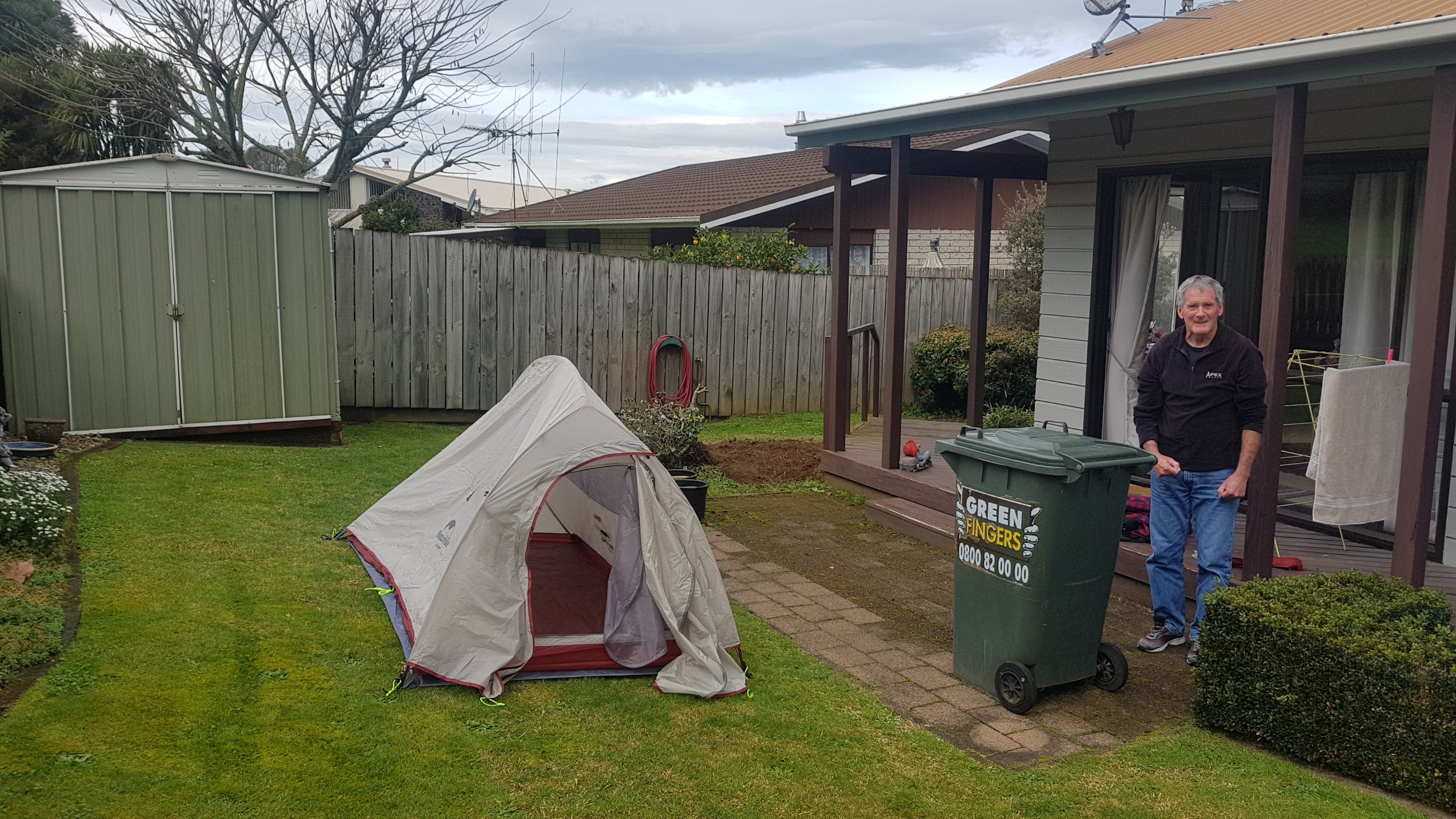
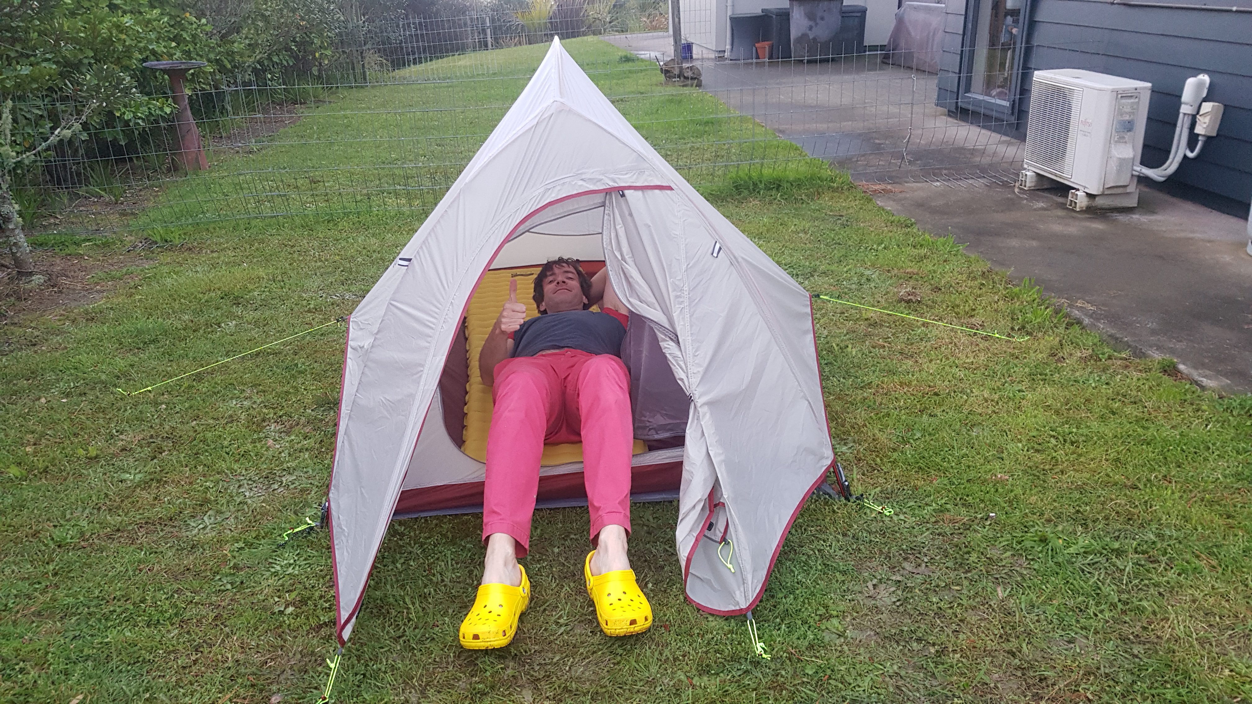
I’ve got most of my gear now – most importantly backpack, tent, sleeping bag, cooker and clothing. My NatureHike tent turned up from AliExpress a few days ago and so I set it up for the first time to make sure there weren’t any holes in it and that I could actually do it. There weren’t any holes, and it’s quite a nice looking tent and wasn’t hard to set up after I overcame the fear of snapping the poles while bending them. It’s supposed to be a 2-person tent but if two people were sleeping in there then there would be absolutely no space for any gear!
Here it is (with my Dad in the picture who helped me set it up)…
Unfortunately we couldn’t set it up fully because just as we got it to the point in the photo you could tell it was about to start pouring with rain (like it has every day for the last 6 weeks). We didn’t get a chance to put the stakes in so it looks a bit floppy in the picture above. But I got to lie in it and I fit in it okay which I was a bit worried about because I’m 6ft1.
I spent time deciding whether to take the groundsheet that goes under the tent on the trail because it’s an extra 300g or so and some YouTube videos say that it’s not necessary. But at this stage I think I will take it because I’m really worried about gear breaking on the trail and so anything to keep the tent in great shape has to be good.
Sadly I can’t spend a night in the tent yet because I don’t have my sleeping mat. AliExpress said that the tent came with a “mat” but what it actually meant was it came with a “groundsheet”. So I had to order an actual sleeping mat online (because I wasn’t happy with the ones I saw in any of the outdoor shops in Auckland). I’m looking forward to spending an actual night in the tent.
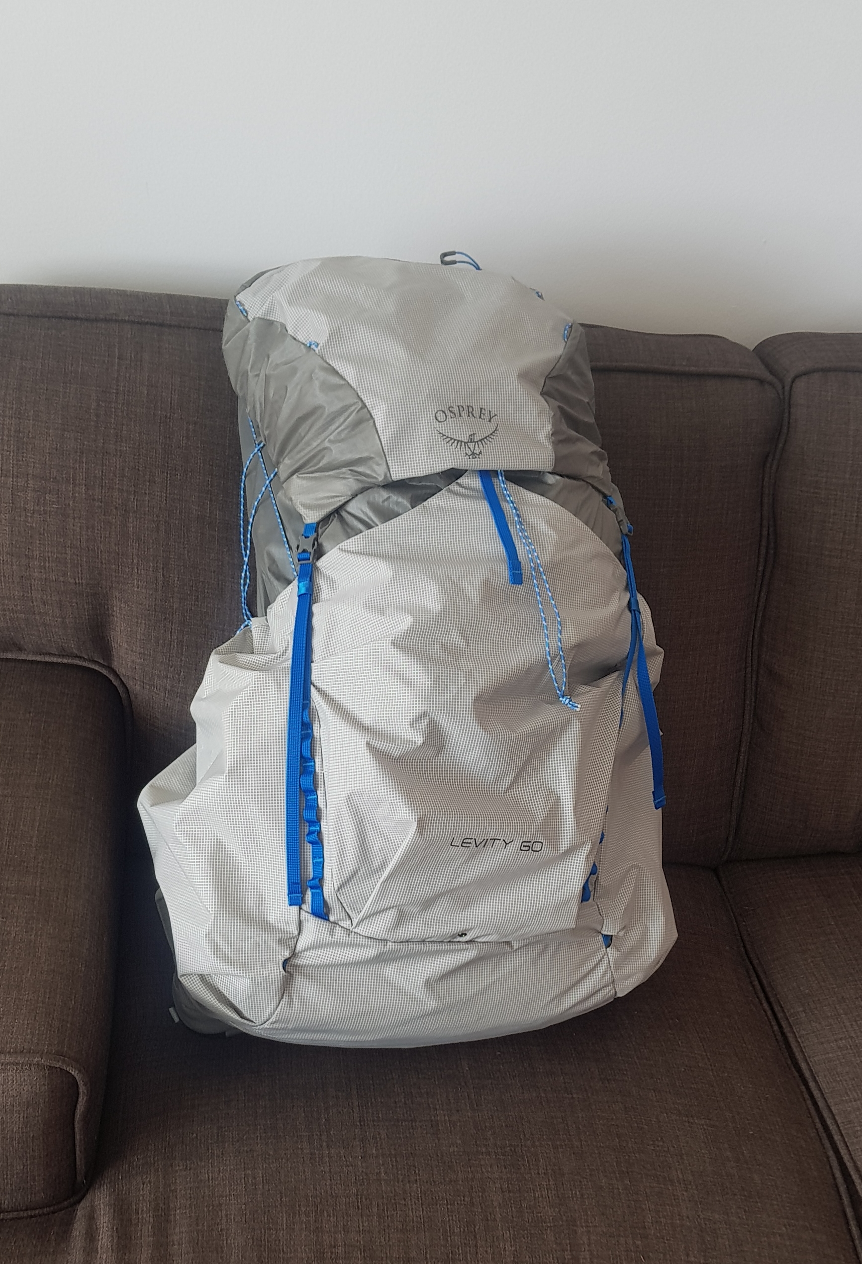
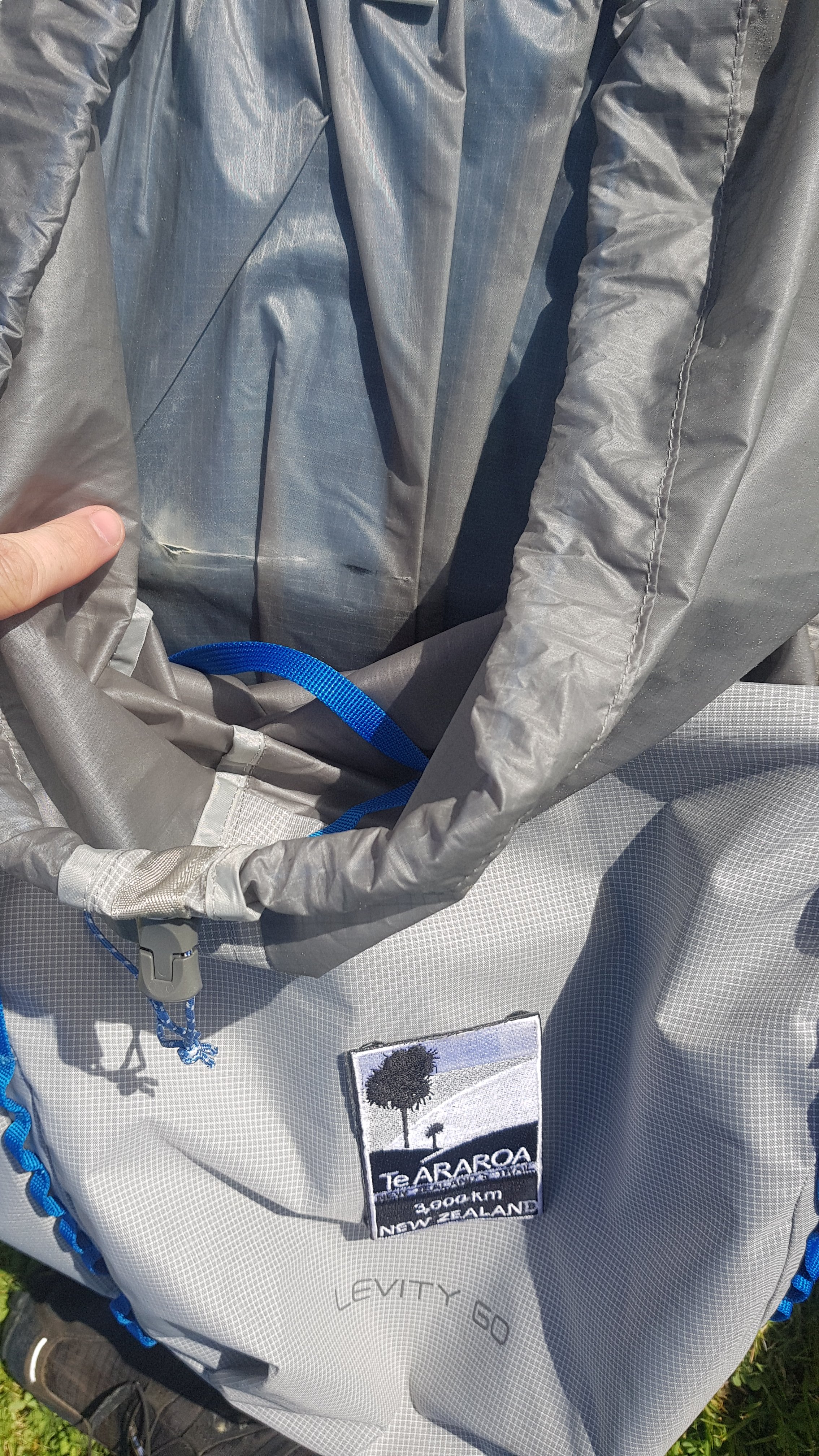
I also have my Osprey Levity 60L lightweight backpack so now I have to start doing some walks with it fully loaded. I live very close to Mount Eden, so my plan is to walk up and down there with ever-increasing amount of weight in the pack.
Anyway that’s enough writing for now. 39 days to go before I start!
Yesterday, a miracle happened. For the first time since June, it didn’t rain at all the whole day. At least not where I was. I mean I know New Zealand can be wet in the winter, but the relentless rain was just getting really tiresome. I remember at the start of the year during summer how much I was looking forward to doing the trail – back when it was warm and all the days were fine and you actually wanted to be outside. With all the rain recently I have very much enjoyed late sleep-ins and just generally staying indoors. Yesterday I actually started to feel again like I was looking forward to some long-distance walking.
Strange round glowing thing in the sky
There was also this weird bright round thing in the sky, quite an intense white, something that’s not usually there. I didn’t know what it was. When you looked at it you felt warm. I don’t remember seeing it before, and actually it was quite unsettling.
My workmates told me today that it was just this thing called “the sun”. I think I could get used to this “sun”. I hope it continues to grace us with its presence.
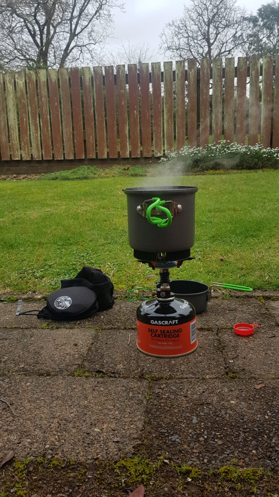
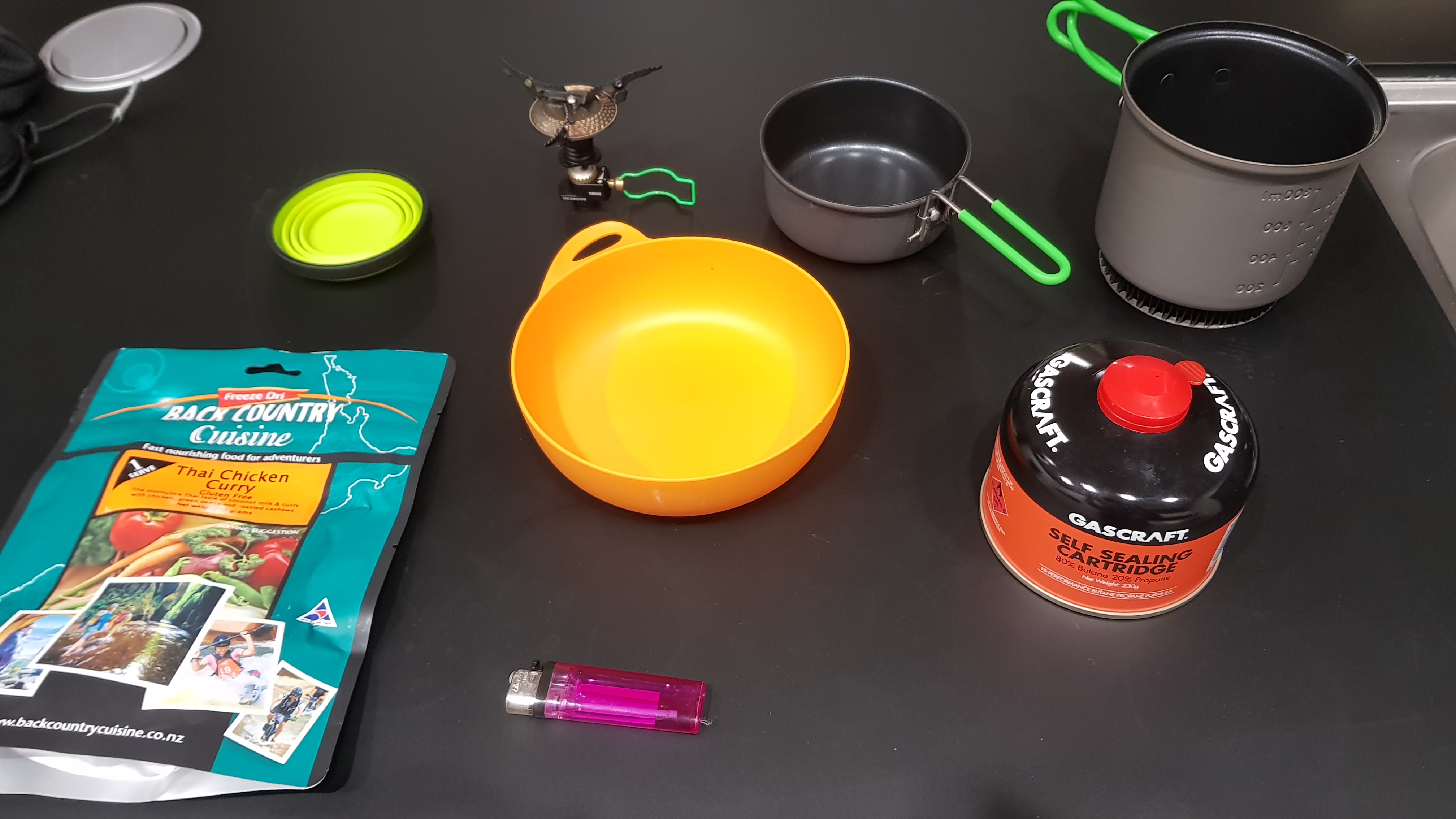
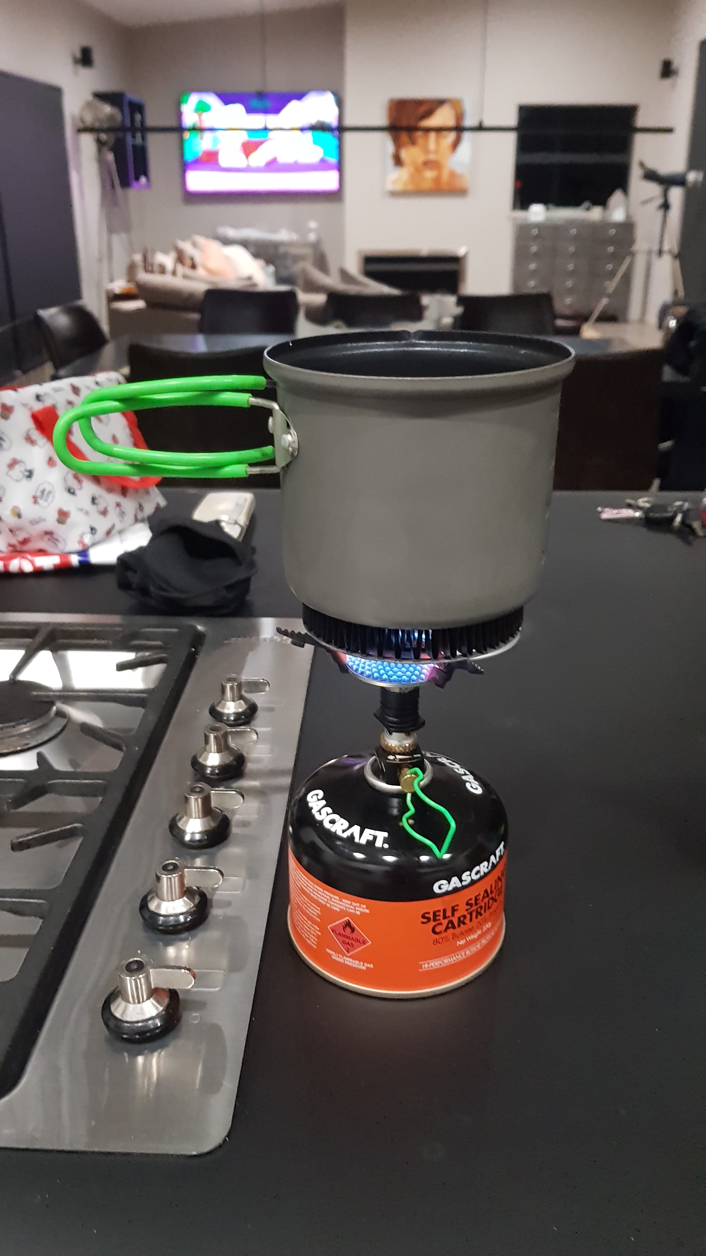
On a serious note, I tried out my Optimus Crux cooking system on Sunday. I don’t do much cooking on a normal day so I need to use it a few times before I start the trail so that I know what I’m doing. This time I just used it to boil water. We were all worried about how windy it was outside but when I turned the gas on and lit it with a match it was so easy. The flame was much more powerful than I imagined and it felt like the small amount of water I had boiled in only one minute. It was much easier than I expected!
Optimus Crux
I did expect to boil the water in the main pot and then put the instant coffee in the smaller pot and drink out of there. However this didn’t work so well because both pots got hot quite quickly. And the coffee seemed to cool down quite fast when I did that. So I think I’m going to have to take some kind of lightweight mug and plate on the trail.
Tonight I’m going to use it to make my first dehydrated meal dinner. Thai Chicken Curry by Back Country Cuisine. Despite the fact that these get relatively good reviews from salespeople I have spoken to in the stores, I’m apprehensive. But I need to get over any fears I have of dehydrated food otherwise I fear I will be living on nothing but couscous and nuts on the trail!
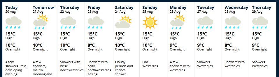
It seems the one fine day is going to be the exception. Checking out the weather forecast for the next 10 days shows that we’re back to the usual rain, rain and more rain. Although not every single day has rain forecast, which is nice. And it seems MetService have also noticed the unusual round glowing thing in the sky too, it’s scheduled to make another appearance in a few days.
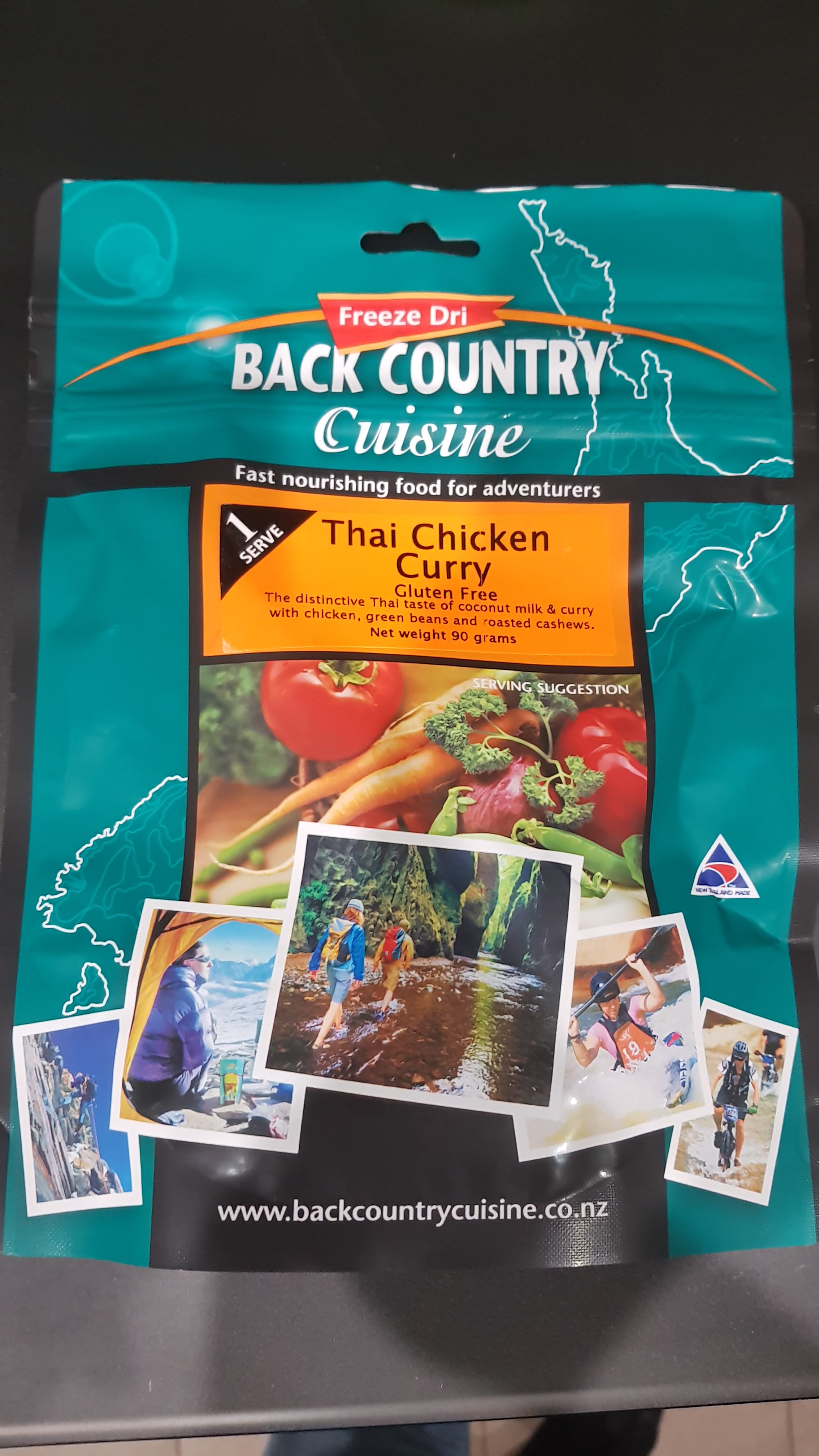
Last night I thought I’d have my second go using the Optimus Crux gas stove and I cooked a Back Country Cuisine dehydrated meal that I bought a couple of weeks ago from Bivouac in Albany. I wanted to try the dehydrated meals at least once before I started Te Araroa so I knew if I liked them or not – I’d never tried one before. Here’s what it says on the packet:
“Thai Chicken Curry (Gluten Free) – The distinctive Thai taste of coconut milk & curry with chicken, green beans and roasted cashews”.
Well they sure make it sound appealing. But I didn’t have high expectations. I expected it to be bland and chewy and have a kind of “mystery meat” taste that you often get with cheap cuts of chicken.
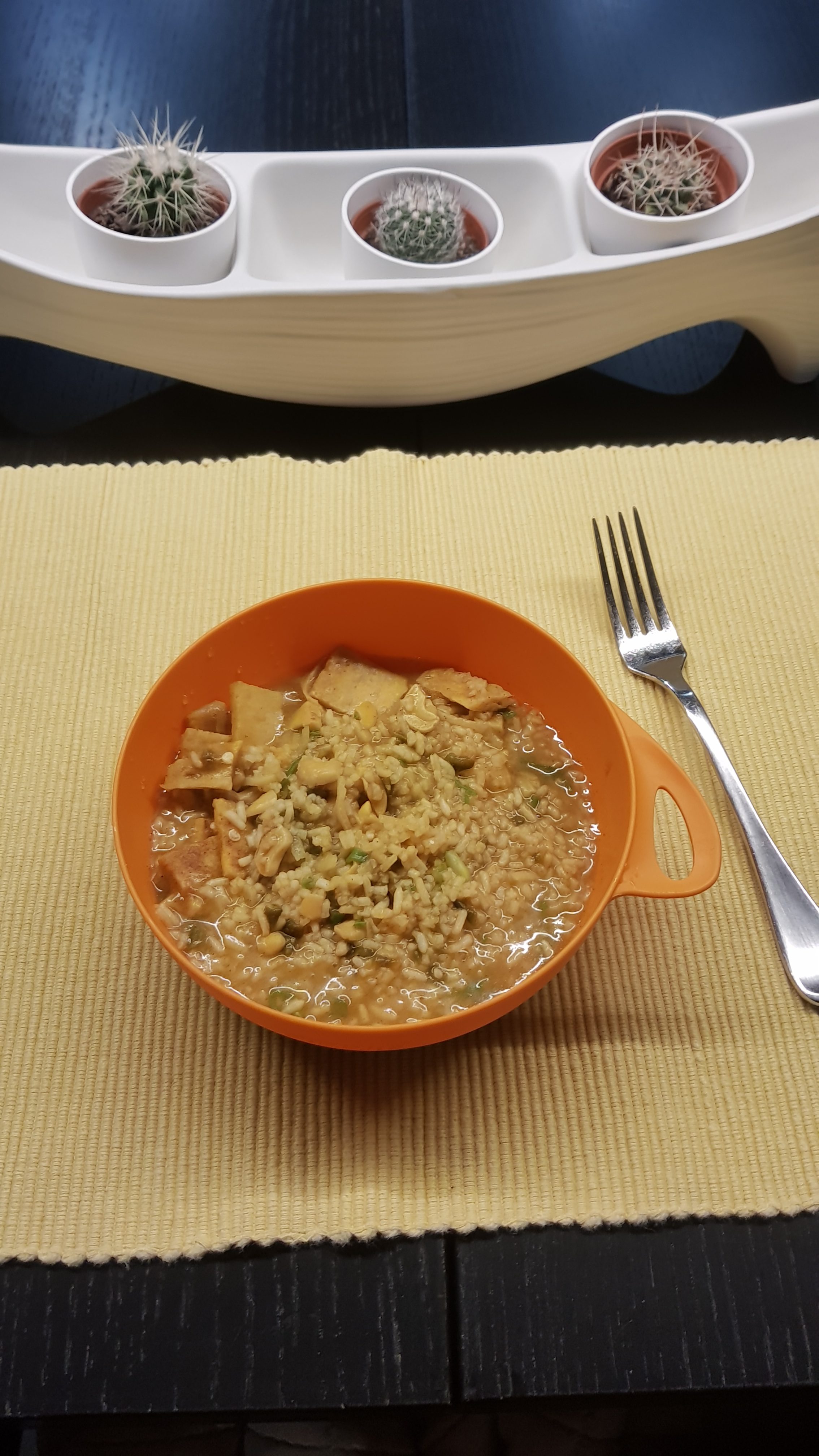
Boiled some water on the stove (easy just like last time, despite the fact I had the pot quite off-centre as you can see) and poured it into the bag, stirred it, sealed it up and left it for 10 minutes. Then, apparently you can rip off the bag at its midway point where the notches are and eat it directly out of the bag. But I wanted to put it into my plate so I could see it.
As you can see it doesn’t look too bad, and I’m pleased to say that it tasted good too! Spicier than I expected. Quite a lot of flavour. Although if I’m honest, I couldn’t identify the chicken. Is it the square pieces? That’s what I assumed, however the ingredients list contained “Soy Protein” as well as chicken, and this looked a bit like soy protein. I don’t really know if I’m honest. Although the rest of the ingredients were there and identifiable and tasted nice.
I’m not a foodie, so I don’t know good food when I find it. In fact, I’m quite fussy with food, I often won’t eat something if I don’t know what meat it is or if there are ingredients listed that I haven’t heard of or if I simply don’t know the ingredients. So the fact that I found this nice must be a good sign!
It was a small meal serve though. The 1 serve was only 392 calories and I imagine after a day of hiking that is going to be very unsatisfying, and I think it was $8.99. So I’d definitely be buying the 2 serve which was $12.99 for the amount of food I feel I’d need. And I feel like I used the amount of water it said and left it for the length of time I was told to but it ended up just a little bit too watery.
I’ve just looked up their website and realised that one of their Frequently Asked Questions is “why is the meat rectangular?”, so that answers that question. The square bits are the meat. Interesting. By the way, the answer is that it re-hydrates better and isn’t crunchy. They’re also made in Invercargill too, here in New Zealand.
Definitely next I’ll try one of the dessert range… and also there’s a Butter Chicken meal too, but another company make that one.
Osprey pack ready to go, minus the Te Araroa Trail patch which I want to attach to it
With exactly a month to go before I start, I realised I haven’t actually done any “training” yet. I always walk a lot, but I’ve never carried a full pack for very long before. I bought the Osprey Levity 60 pack two weeks ago when I was in Melbourne and carried it around Melbourne for a few hours with a 6kg or so weight, but I thought I better start walking on weekends with it fully loaded.
So yesterday rolled around, and since it was a nice Saturday with little rain forecast I piled a lot of cans and other things into the pack to make the load 11.3kg, and went out for a walk.
I live close to Mount Eden and that was my first stop – to walk up to the top of there. My calves were burning as I was walking up the hill but the pack itself felt good. I kept trying to pull the bottom of the pack down, but I think that’s because it’s a smaller pack than I’m used to carrying. I spent quite a while with the salesman in Paddy Pallin getting it fitted and learning about it, and also I got the Large version of the pack so there was nothing longer.
I’ve never had a bag that sits away from your back before. It was weird but very nice to finish the walk without a sweaty back! However it did mean I wasn’t used to the way the pack sat on my back – I could feel the things in the top of the pack on my shoulders and the things at the bottom but not the things in the middle obviously.
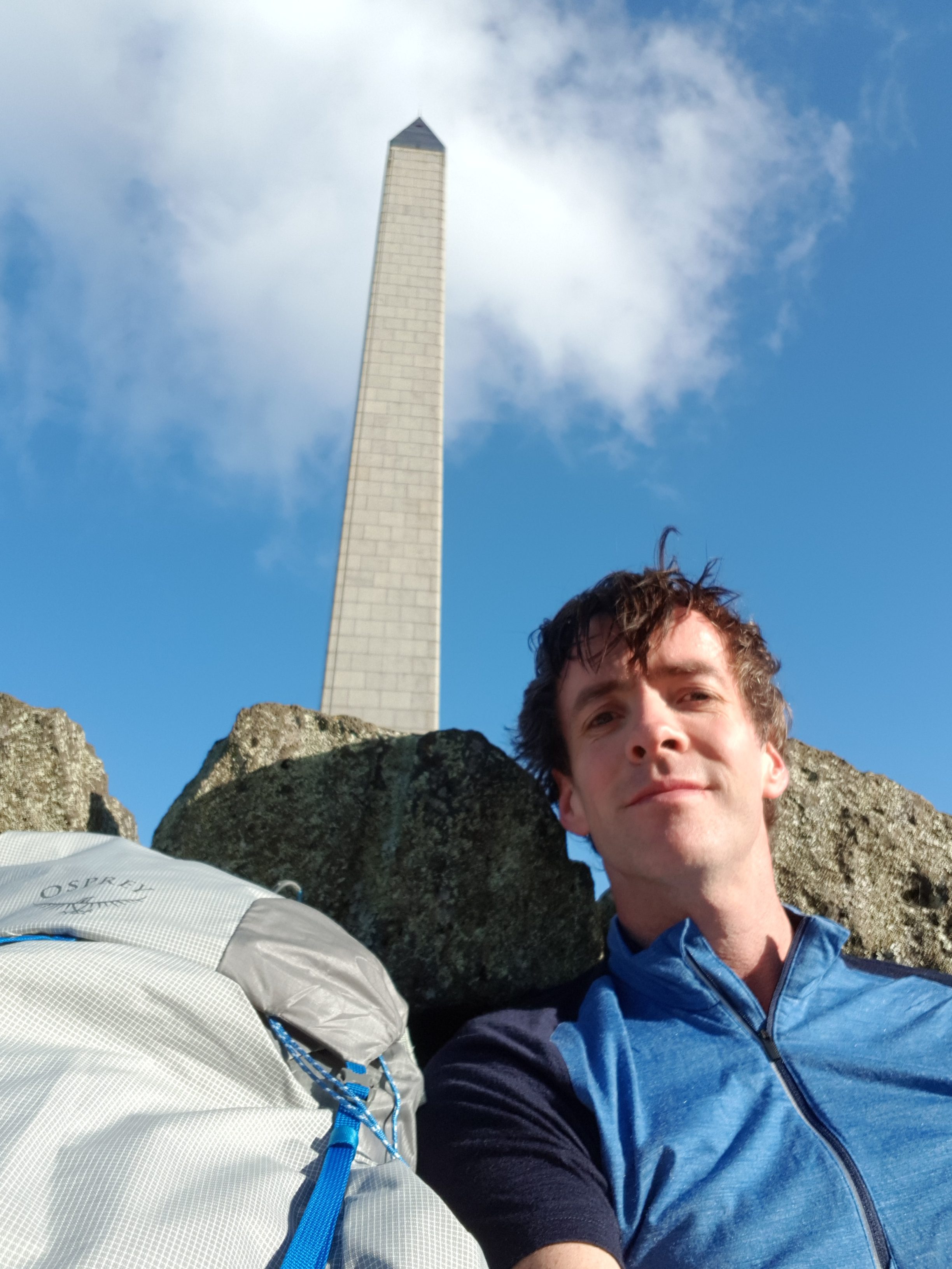
I was also trying to follow the trail route to test out my mapping app. So the next stop was Cornwall Park and One Tree Hill. This is where I noticed something interesting. The trail notes for the Coast to Coast Walkway (this section) say that you have to walk “up to One Tree Hill summit”, however every map I have seen shows the trail going around the edge of the park and completely bypassing the summit. The perfectionist in me was uncomfortable about this. Do I have to walk up to the summit or don’t I? I would hate to tell people in the future that I walked Te Araroa, and they say to me “cool! How did you like the summit of One Tree Hill?” and I’d say “actually I didn’t do that bit” and they’d say “hmmmmmmmmmm…..”
The council website for the walkway shows the path going to the summit. And you go to the summit of Mount Eden, so why not One Tree Hill?
Summit of One Tree Hill
I’m not going to pester the TA Trust about this sort of little thing though. They do a great job providing the trail route in different formats and all the trail notes. Well, maybe after I’ve given them my donation I might ask them 🤣 🤣
I did end up walking up to the summit on this occasion and I took a photo from the top. I was going to ask a tourist to take a photo of me and the pack and the obelisk all in the same picture, but I think it would have been unfair to get them to frame the photo exactly how I would want it. so I settled for a selfie 😁 I won’t post any pictures of the view from the top, because as a local I’ve seen the view a hundred times! But there are a selection of other photos that I took yesterday below.
At the summit it was very windy and the wind was very cold. But yet I couldn’t be bothered taking the pack off my back to get out my wind jacket. Not because it was heavy or awkward, but because the only access into the pack is via the top and I’d have to take everything out in order to find the jacket. Clearly the way that you arrange things in the pack is going to be important. Besides, I thought, I can handle the cold, the cold doesn’t affect me. So I just kept walking with my merino shirt and my shorts. Even when a few spits of rain started, I didn’t stop and take my waterproof pack liner out of the pack, again because I couldn’t be bothered, but also because the rain was just a few spots.
I really should have taken the time to find my jacket. I was cold to the bone once I got home. I turned the heater on and sat under it for a couple of hours. But it makes me glad that on the trail I’m taking a wind jacket, a rain jacket, thermals, and two shirts.
One thing I noticed about the pack is that the inner layer of nylon is very thin – to be expected for such a lightweight pack I suppose. I’m going to have to be very careful about spiky or sharp things inside the pack piercing the fabric. Which is okay, because I plan to keep everything inside in a rubbish bag or a dry sack anyway.
I’m not going to write a full-on proper review of the pack until I’ve been walking with it for a while. But my walk today was decent, it was 14km and I only had a very slight twinge of back pain after the 14km which went away after I took the pack off. This is why I’m doing these walks – to prepare myself for walking with a pack like this every day.
This time one month from now I will be on the bus to Kaitaia!
Cute lamb on One Tree Hill. The mother sheep paid me no attention at all.
Daffodils in Cornwall Park – it must be spring
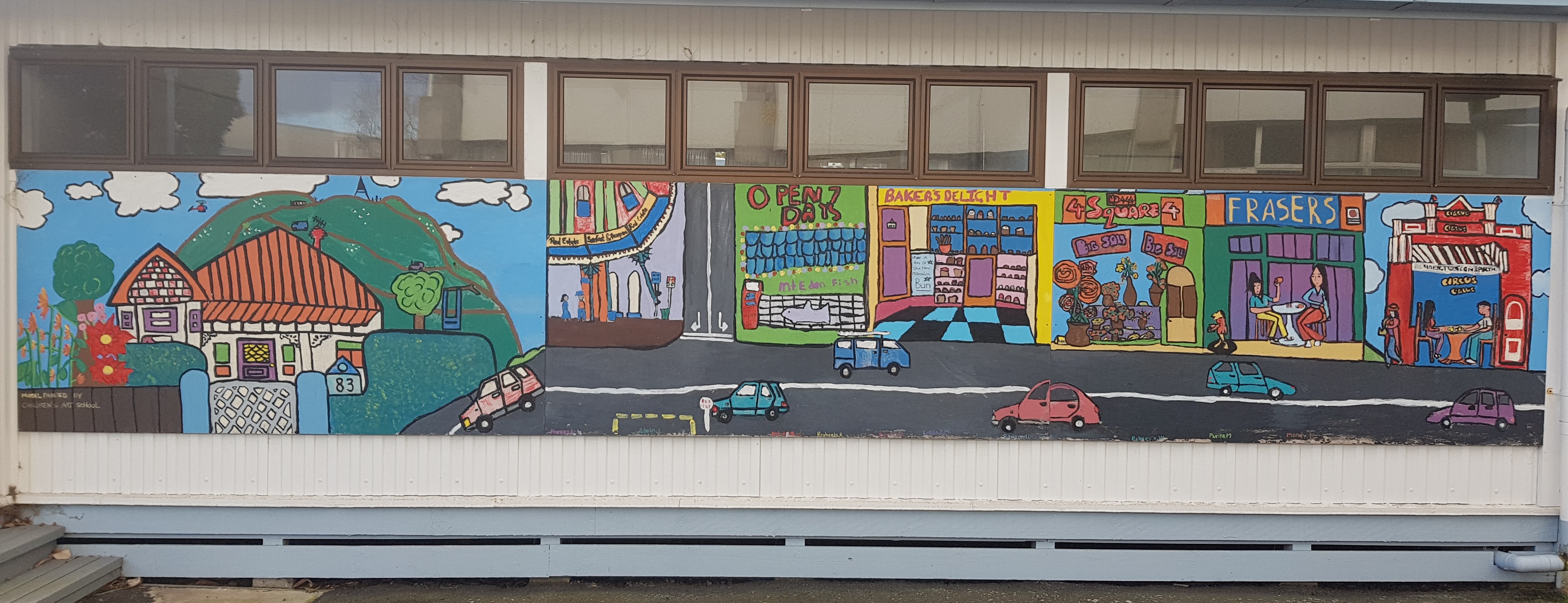
A mural at the nearby Intermediate School showing landmarks of Mount Eden
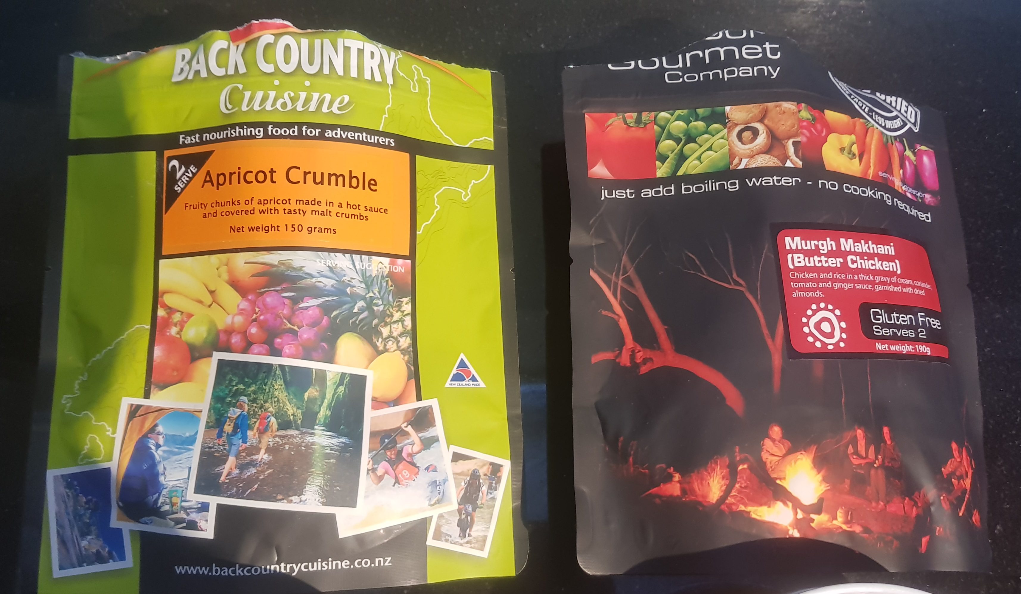
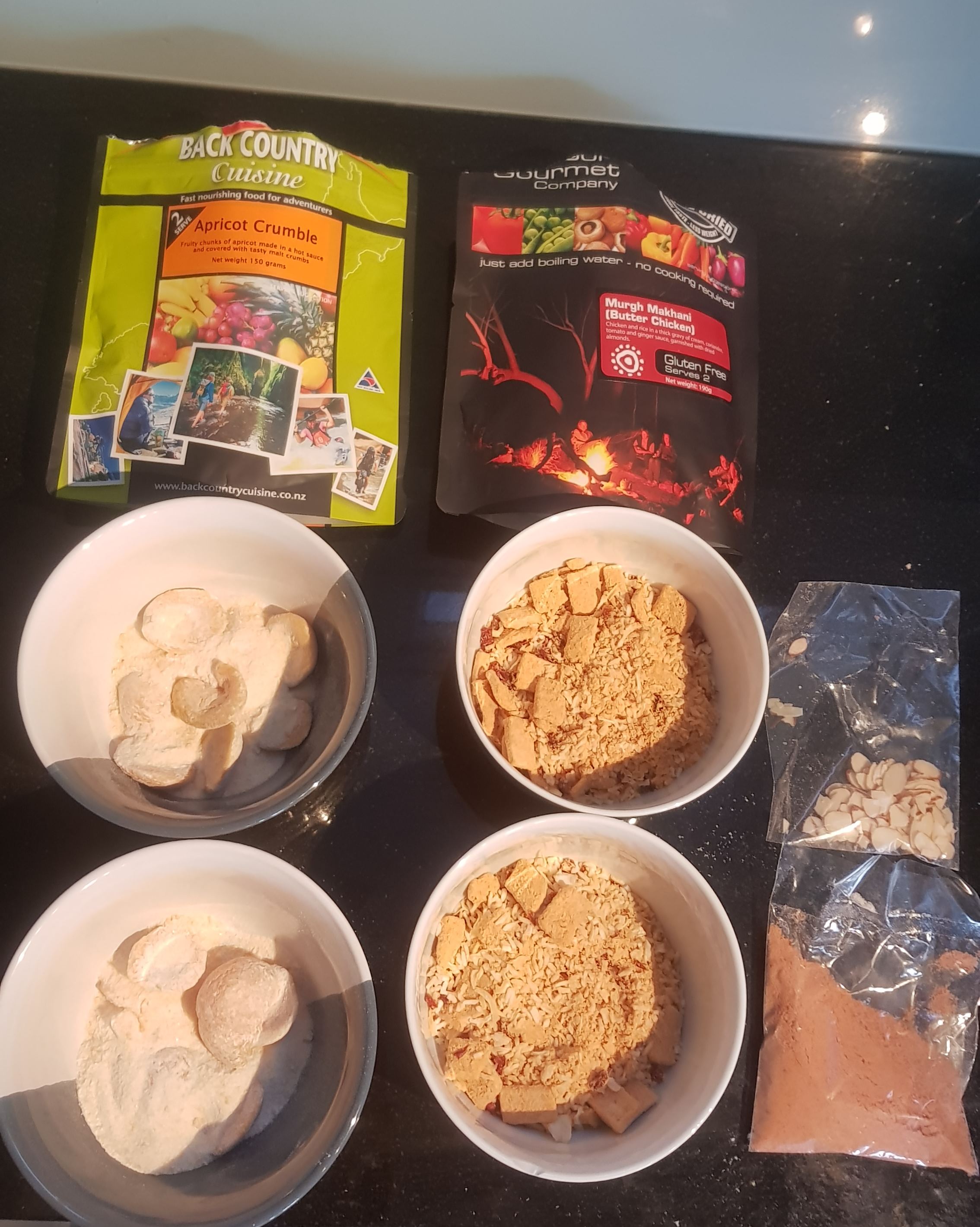
I tried a couple more of the Back Country Cuisine meals last night, in preparation for starting Te Araroa. This time it was:
Murgh Makhani (Butter Chicken) – chicken and rice in a thick gravy of cream, coriander, tomato and ginger sauce, garnished with dried almonds
Apricot Crumble – Fruity chunks of apricot made in a hot sauce and covered with tasty malt crumbs
I thought that the Butter Chicken one was made by a different company (namely The Outdoor Gourmet Company), and the packet suggests it is, but reading the back of the packet I notice that they have the same Invercargill address as Back Country Cuisine so they must be related in some way!
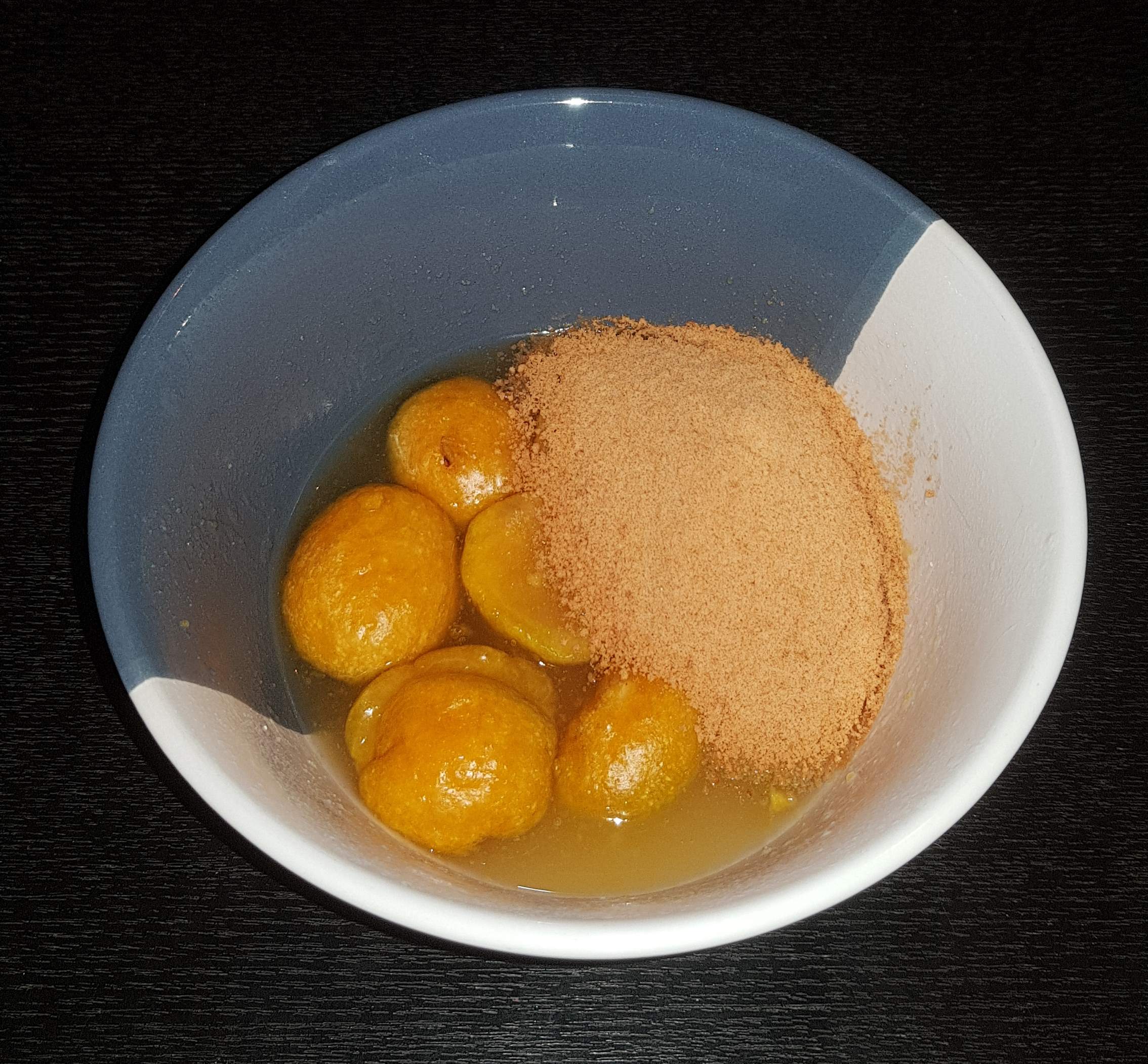
Each was two servings so at first I divided each one into two. While hiking I’m sure I would want to eat the whole two serves each time but since I’m not hiking yet I thought I’d stick to one serve. The Butter Chicken looked a lot like the Thai Chicken Curry I tried the other night, so I was optimistic that it would taste good. The Apricot Crumble on the other hand, just looked like apricots and sugar. There was a distinct lack of “crumble”, and the biscuit crumbs that it came with were very fine so I was surprised.
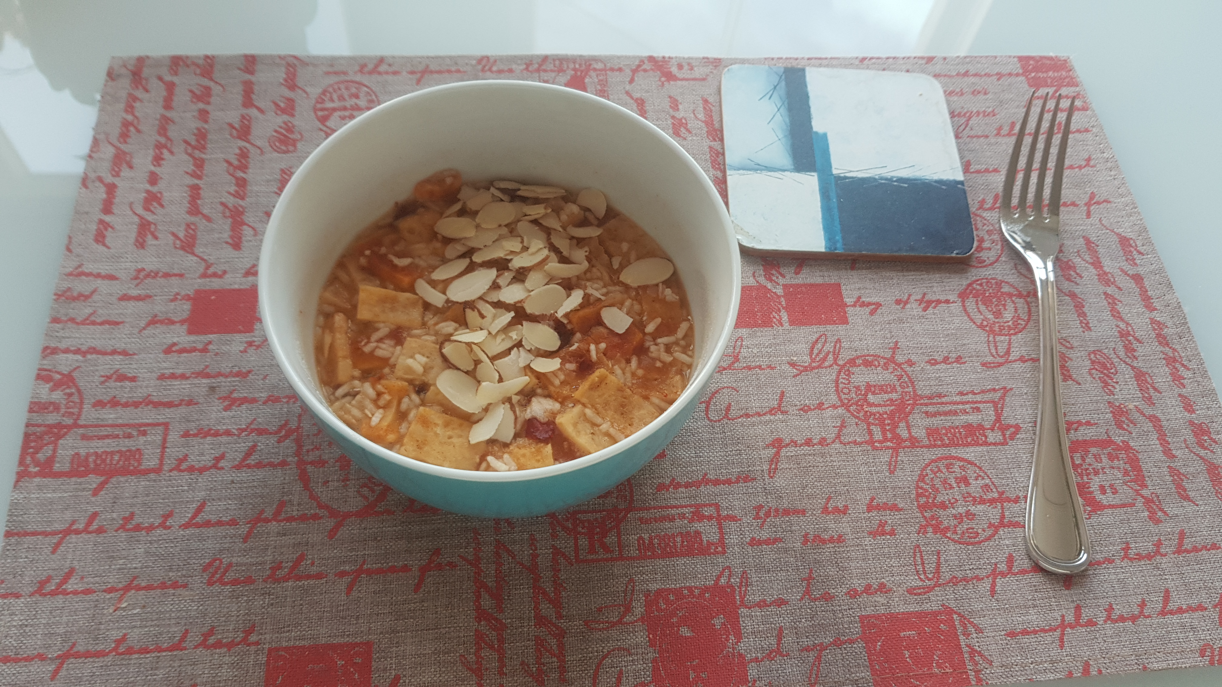
It’s so easy to make these – boil water, put the water in the bag, and leave for 10 minutes. This time though I made them in the bowls and put Glad Wrap over the top.
The Butter Chicken was quite nice. It’s not as thick and creamy as I’d hoped and as the label promised but I wasn’t expecting it to be – there’s only so creamy you can get when adding water. It didn’t look like a lot of food but actually I was surprisingly full afterwards. A little bit more spice would have been nice, but I know a lot of people like their Butter Chickens mild. It was no replacement for a real Butter Chicken from an Indian Restaurant but it will definitely do when you’re out in the middle of nowhere. It did make me crave a real Butter Chicken though. If I was hiking through Kaitaia right now I’d be having Indian food for dinner that’s for sure!
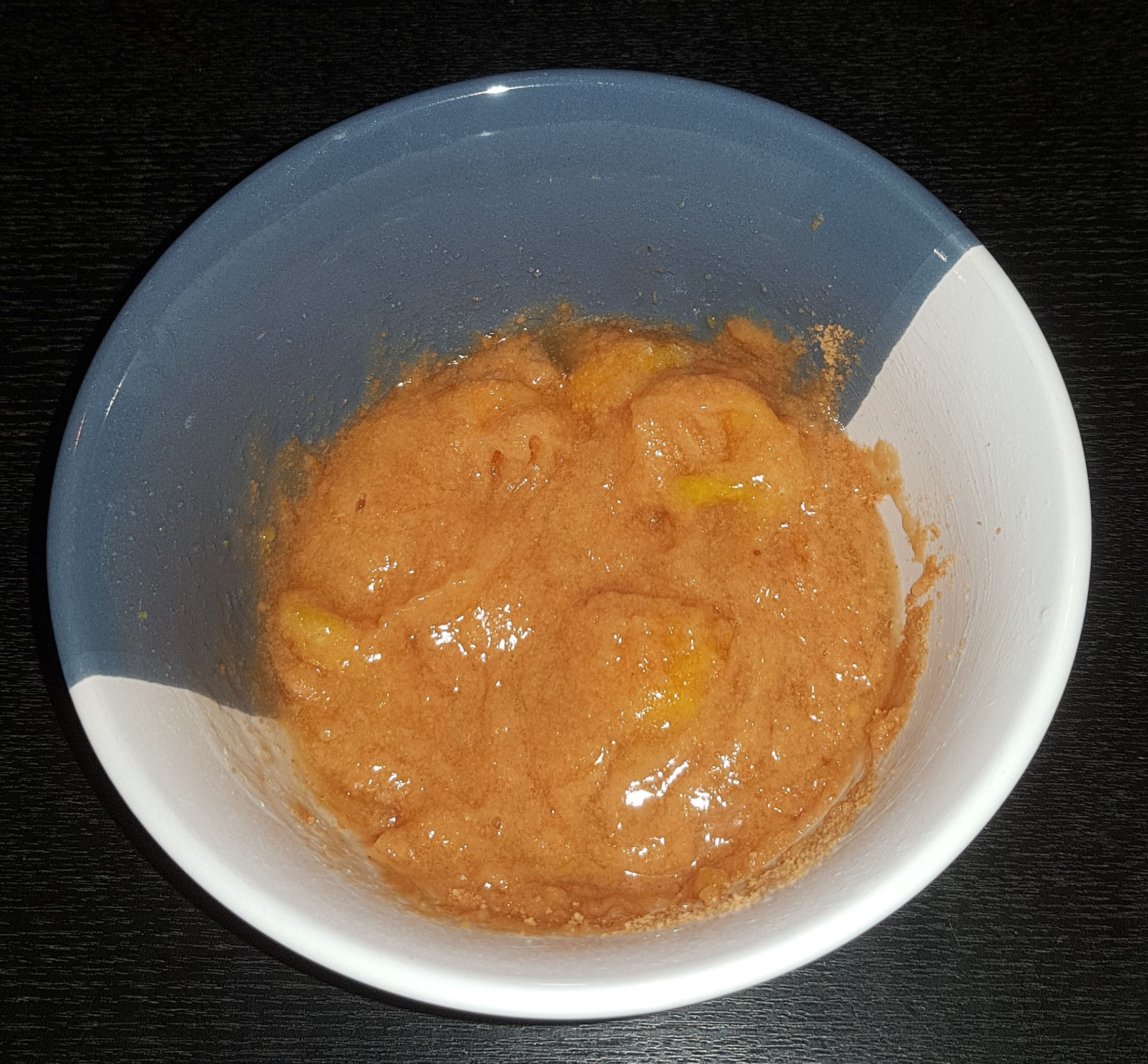
The Apricot Crumble on the other hand I didn’t understand, it seemed more like “apricots in a thick paste”. I feel like I would have got the same result if I took a can of apricots in syrup, crushed up a packet of malt biscuits as finely as I could and mixed them together – I’d have the same result for about 20% of the price. I didn’t really like the taste either, I mean the apricots were nice but the rest of it was a bit weird. Kind of a tangy sugary gloopy mess.
I’d definitely buy the Butter Chicken again but the Apricot Crumble I think I’d pass – for dessert I think I’ll just take a block of chocolate.
This is the last time I’ll be trying the dehydrated food before I start the trail, it’s pretty clear that I like the savoury ones and will be taking a bunch of them but I’ll probably pass on the sweet ones.
I’m a freelancer and my contract that I have been working on since January finished yesterday. At 5pm when I left work for the last time I joked with my friends that my mid-life crisis officially started at that point. I turn 40 next year and so I’m due for a mid-life crisis. However, I’ve decided to embrace it rather than fear it. Instead of buying some kind of ridiculous sports car or another typical mid-life crisis thing I’ve decided to walk Te Araroa instead 😁 😁 😁 and besides, I already have a ridiculous sports car.
After work I went to have a few drinks with some friends and like someone who is nearly 40, I was home and tired by 9.30pm.
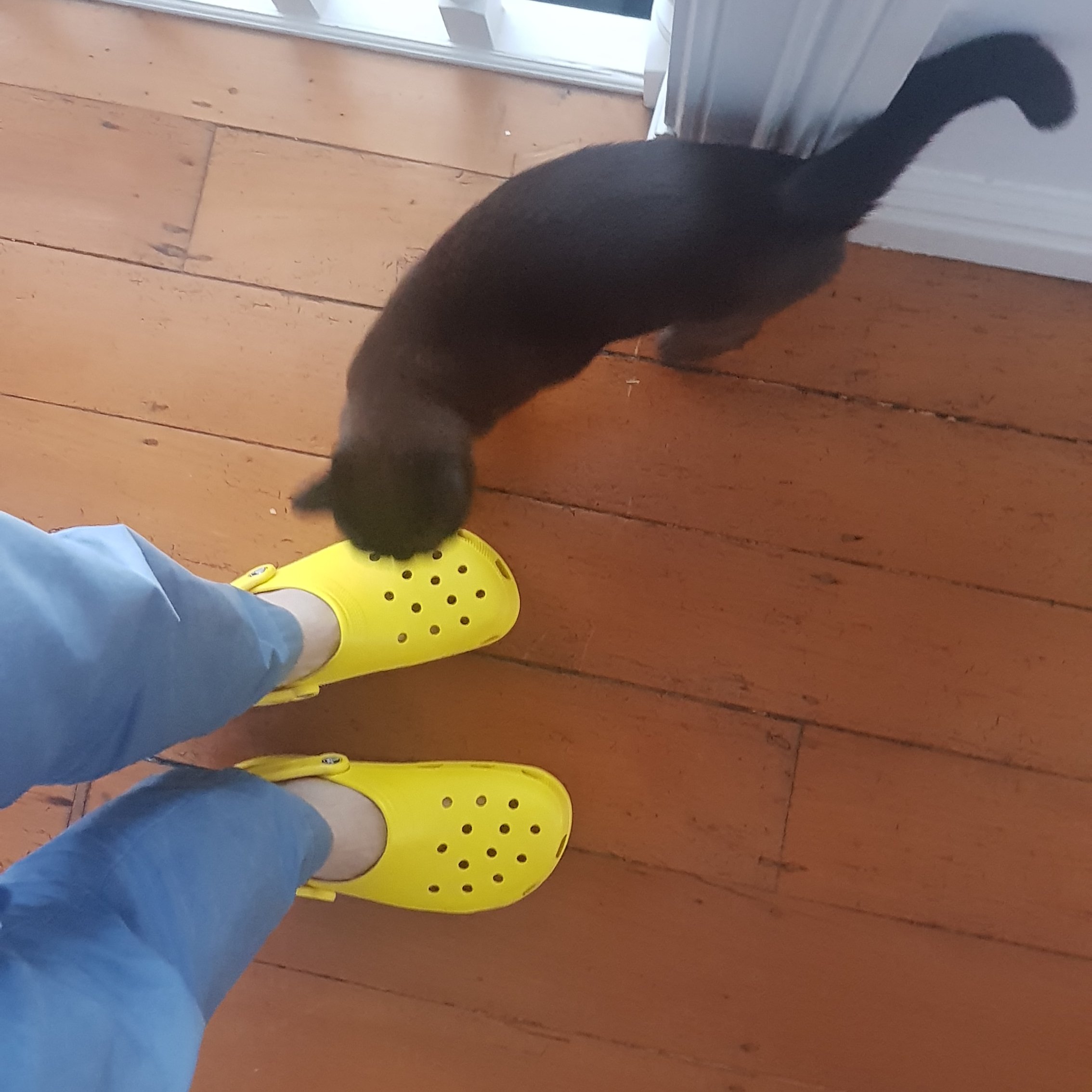
Yellow Crocs
I celebrated my final day at my contract by buying some Crocs, because once on the trail, after a long day of walking and getting wet feet and shoes the last thing I will want to do is walk around camp or wherever with wet shoes. I was going to just take jandals for this purpose but I like the idea of having another pair of shoes that can be used for river crossings. Maybe I might be prepared to take my trail shoes off and put the crocs on to cross rivers, but I understand there are so many river crossings that people get sick of changing their shoes too often.
I never owned a pair of crocs before and I think they look alright, but it seems the general consensus is that they are definitely not fashionable. You can see the cat liked them (the neighbour’s cat), or was intrigued by them at least, but the reactions from my friends who saw them yesterday were not positive. Oh well, I don’t care. I have a bright yellow car and am often teased for it and so since I won’t be driving my car for a long time, I felt like I needed a bit of yellow to take on the walk (although these are officially called “lemon”).
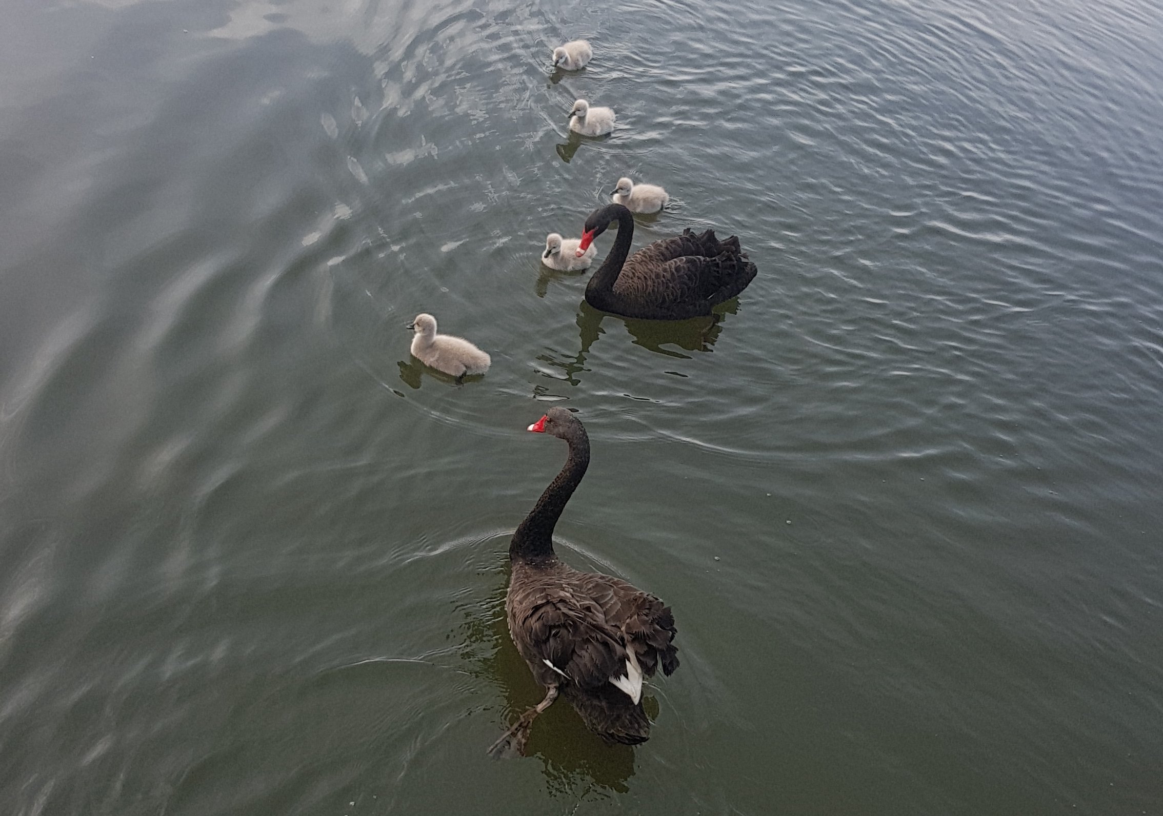
Geese and chicks
It is definitely spring, I could tell because in the last week I saw the local Albany Lakes geese with their young. And I could also tell because it is still raining all the time, despite the sun shining.
Today was a beautiful day so I went for a walk again with my pack. I loaded up my pack to a weight of 14.5kg which I would say will be the heaviest my pack is likely to get, at least in the North Island where there are lots of towns so I don’t have to carry too much food. The pack actually didn’t feel too heavy when I first put it on, but after 5km or so I could feel the pain in my back a bit. It never hurt a lot though, but I only walked about 9km this time because I had a bit of a cold last week.
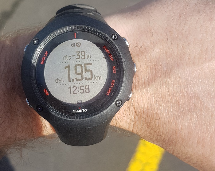
I’m underwater, apparently
I also wanted to try out my GPS Watch (Suunto Ambit 3 Run) on the “low accuracy” setting, which uses a lot less battery, but I wasn’t sure how accurate the GPS is on this setting. You can see the map below. The watch showed 8km, but when I measured out the course on Google Maps, it came up at 9.7km – quite a difference. I’m a bit of a stats geek so
this discrepancy bothers me a little bit. I was walking around and around the city streets not in a straight line so that might explain the discrepancy, lots of twists and turns which the low accuracy setting doesn’t capture correctly – you can see it cuts right across some of the roads. Maybe it won’t be such a big deal when I’m generally walking in a straight line. But I know when you have it on the high accuracy setting, the battery on the watch only lasts about 6 hours or so. With the low accuracy it is reported to last 100 hours.
Also, if you believe the watch, I was 39 metres below sea level at one point, as you can see from the photo!
Since my inflatable mat finally arrived in the mail from amazon.com, I finally was able to spend a night in the tent with the gear I’ll be using on the trail! Last night I took it out to my Mum’s place, because there’s nowhere to set it up at my house. I thought I’d report on how it went. Now keep in mind I’m definitely no expert here. I have spent very little time camping before, so I don’t know what things are supposed to do and what they aren’t supposed to do. But here’s my opinion after one night!
I’ll be honest, I didn’t get a good sleep… but that was primarily because earlier on that morning I had slept in quite late, and I wasn’t tired at all by the time it actually came to sleeping. It was mostly that, but also because it was a new experience sleeping on this new stuff.
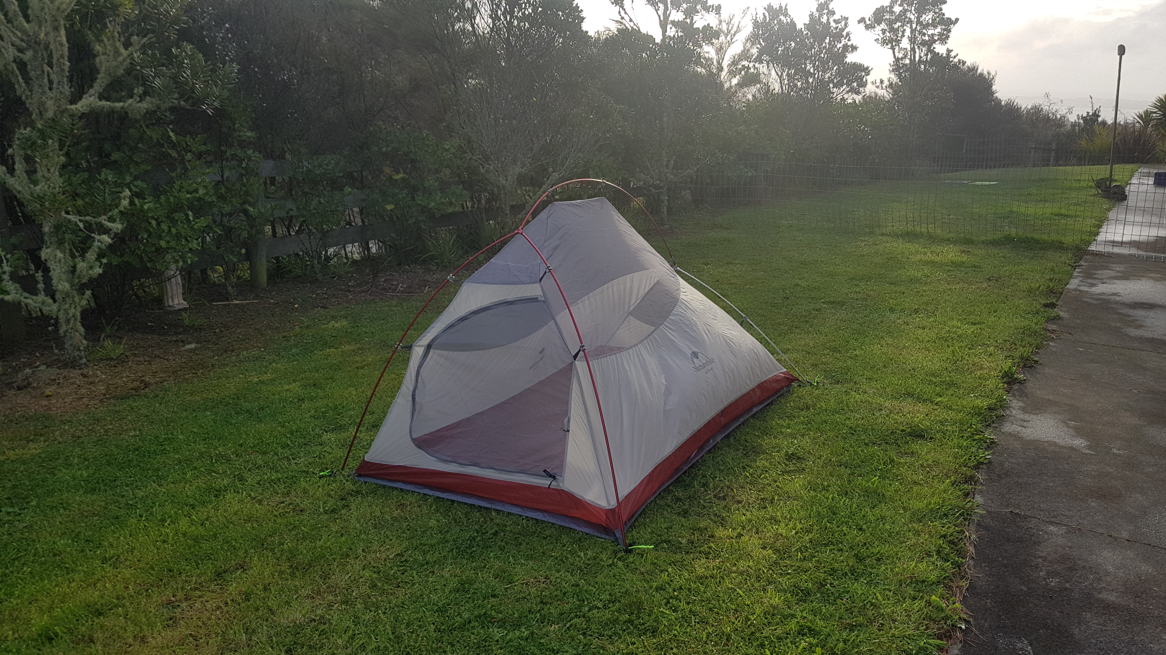
The tent in place without the rain fly
Between two of us we managed to get the tent (Naturehike Cloud Up 2 Upgrade model) put up, although the instructions provided were not particularly clear. We had to watch a Youtube video about the tent to work out where the last few ropes and pegs went. I’m still not completely sure we got it right. But despite there being an average amount of wind and a small amount of rain during the night, the tent held up fine, although the rain on the roof of the tent was quite loud and that didn’t help me sleep. The stakes looked small and lightweight but didn’t come out of the ground at all during the night. I am interested to see how this tent will handle really high winds. And the most important thing – the inside of the tent got no water at all inside (except a little bit I trekked in myself) and there was no condensation at all on the walls of the tent.
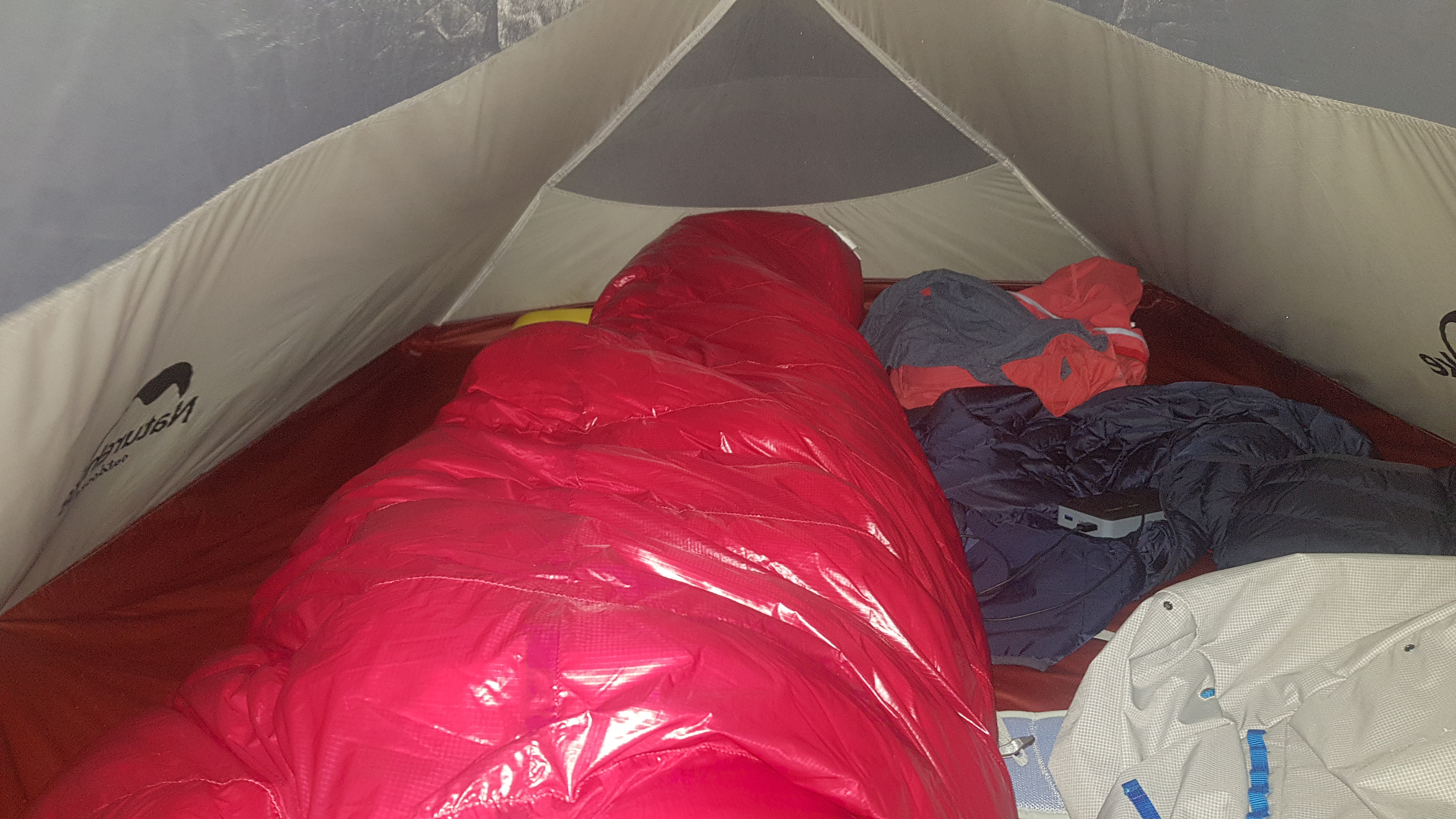
You have to sleep with your head by the door because the tent tapers down too much at the other end and if you’re 6ft1 like me then your head will be hitting the roof if you sleep with your head at the back. I think that’s bad Feng Shui, but I’ll live with it. I was glad to see I could lie down stretched right out and I didn’t touch either end of the tent… but only just. There was enough place to lie down and also have my pack and clothes next to me. It felt like heaps of space, and I could sit upright in the tent, but when it came to try and undress in the tent to get into my sleeping bag, I struggled a bit with the low roof (but not too much). I have no idea how two people would sleep in this “2-man tent” if they have any stuff at all.
After lying in the dark for just 15 minutes, a little slug started crawling up the mesh door right by my head, so I flicked it off. Then, another 15 minutes later, I spied a snail on the roof of the tent, between the tent and the fly. I made a mental note in my head to check for snails and slugs before I pack the tent away in the morning.
The tent has a handy little vestibule to store things outside the tent but inside the rain fly. I kept my Crocs out there, and they stayed dry despite the fact it rained.
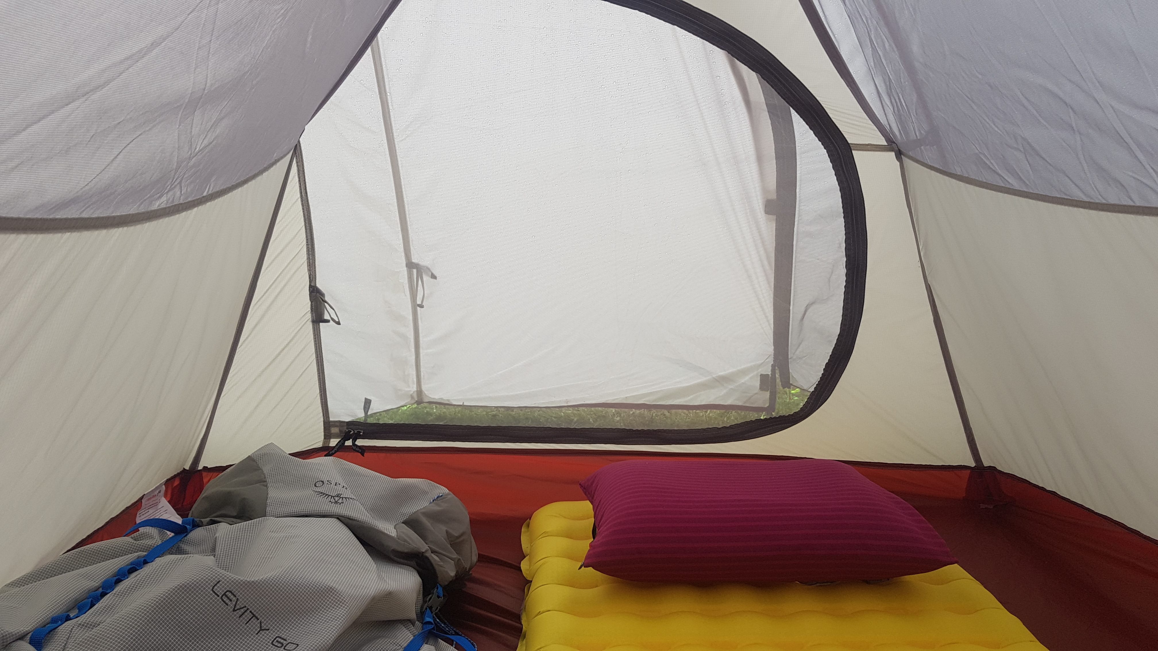
Ready for sleeping
The inflatable mat was the Nemo Tensor 20L – 20 being the width and L meaning “long”. It fit well in the tent and it seemed sturdy. It was quite “slippery”, every time I tried to turn over during the night, I felt like I was sliding around. It felt quite hard, I think maybe I inflated it too much. Next time I might deflate it ever so slightly. The good thing was is that it didn’t deflate at all by itself during the night. It wasn’t as hard as I thought it would be (and as people on the Internet had mentioned) to blow all the required air into the mat, and the valve seemed to hold well and was easy to close. I didn’t get the “insulated” version which is a bit warmer because I’m already worried that my sleeping bag and liner are going to be too hot.
On reflection the mat did its job quite well, I think I’m just going to have to not expect too much when I’m used to sleeping in a big king size bed every night.
I felt the same about the inflatable pillow, the Nemo Fillo Elite, quite hard, but I think that might be the nature of an inflatable pillow. Might try deflating that slightly next time too. The pillow has the same valve on it as the mat which meant it didn’t deflate during the night but this one seemed quite difficult to close. I’m sure I’ll get the hang of it. I think if I could bring just one luxury item it would be my big feather pillow. It would have felt so nice last night.
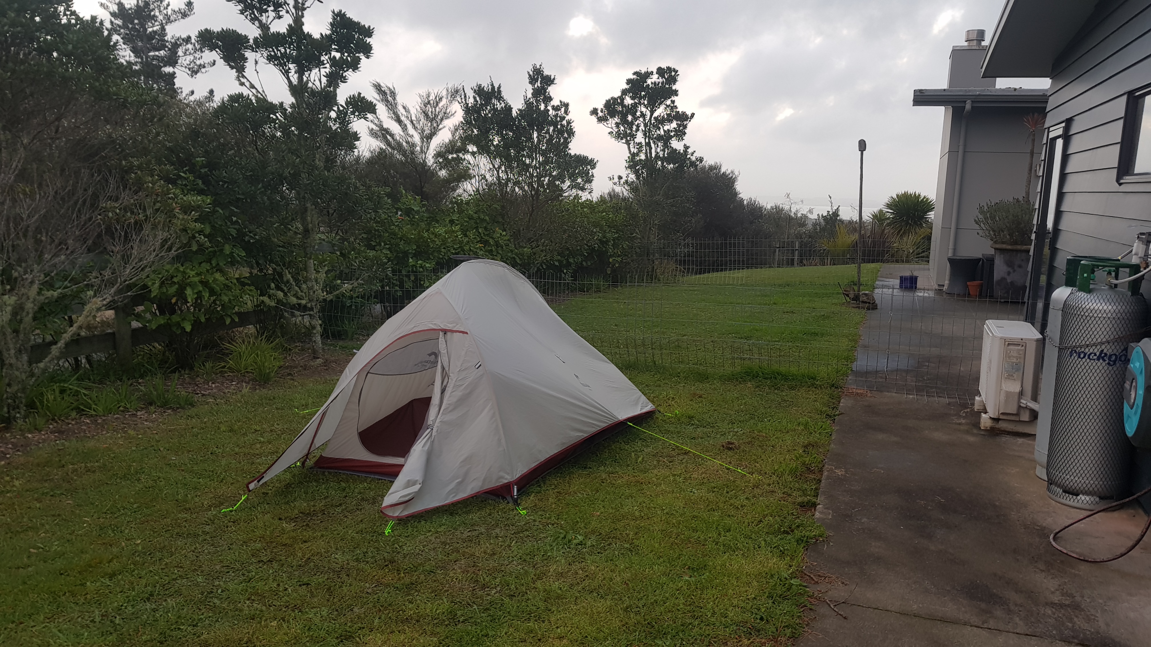
The tent fully set up
The temperature got as low as 10 degrees Celsius last night if you believe the forecast (and I do). However with five layers between me and the ground (sleeping bag, sleeping bag liner, mat, tent floor and tent groundsheet), I was never cold. Some people say that a sleeping bag can be quite constricting, but I didn’t find this – I think mainly because I am used to sleeping in the fetal position curled up on my side, rather than spreading out.
I think the biggest thing to get used to will be packing everything away when it’s wet, or even when it was raining throughout the night. Hopefully it will be fine and it will just take practice. This morning the tent fly was wet and the tent itself was dry, as it’s supposed to be…. however as I took the fly off the tent, I realised it was still connected to the tent with two clips, so I had to put the fly down to undo the two clips. This of course got the tent wet, oops. Also the groundsheet was very wet and dirty (and covered with slugs). I am going to have to watch Youtube videos before I go on how to pack away a wet tent.
During the night
Also I have to get used to getting in and out of the tent properly. When I put my hands on the muddy ground while getting out of the tent they get dirty, and then that dirt gets inside the tent when I get back in. But I guess after several months things are going to get dirty. Or maybe it just won’t rain at all the whole time. Let’s call that Plan B.
So overall it was an interesting night. I am looking forward to doing it again though. However I will make sure I don’t sleep in the morning before, so when it comes time to actually sleep, I will actually be tired.
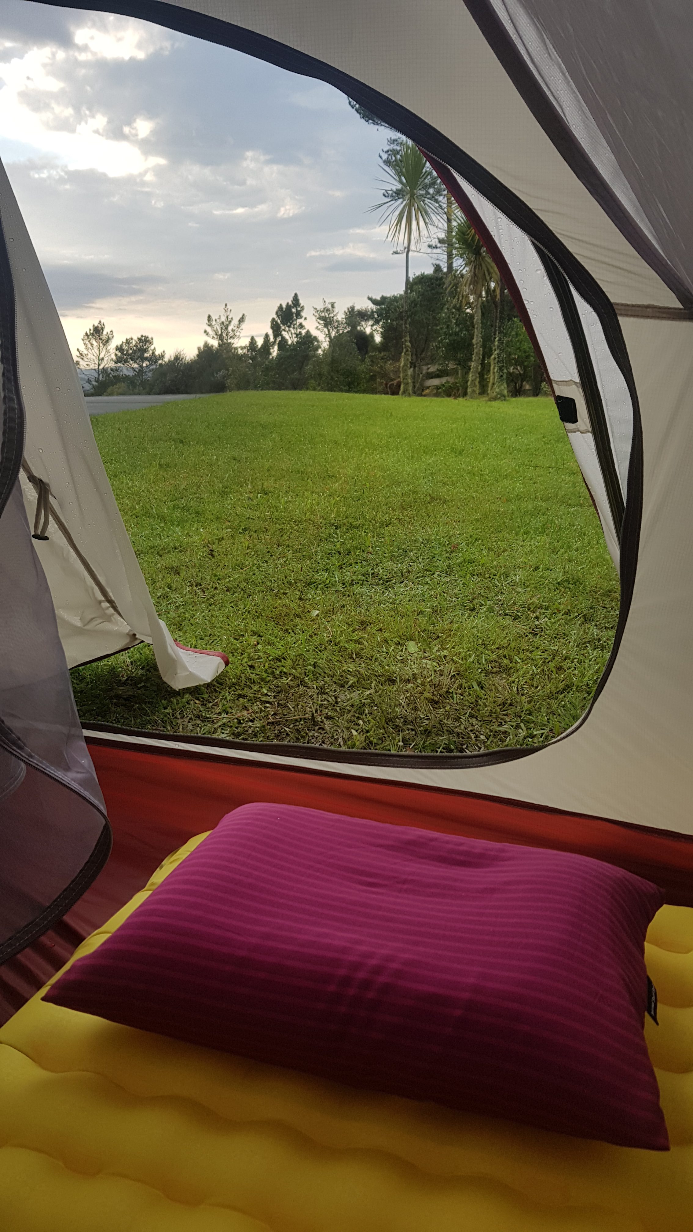
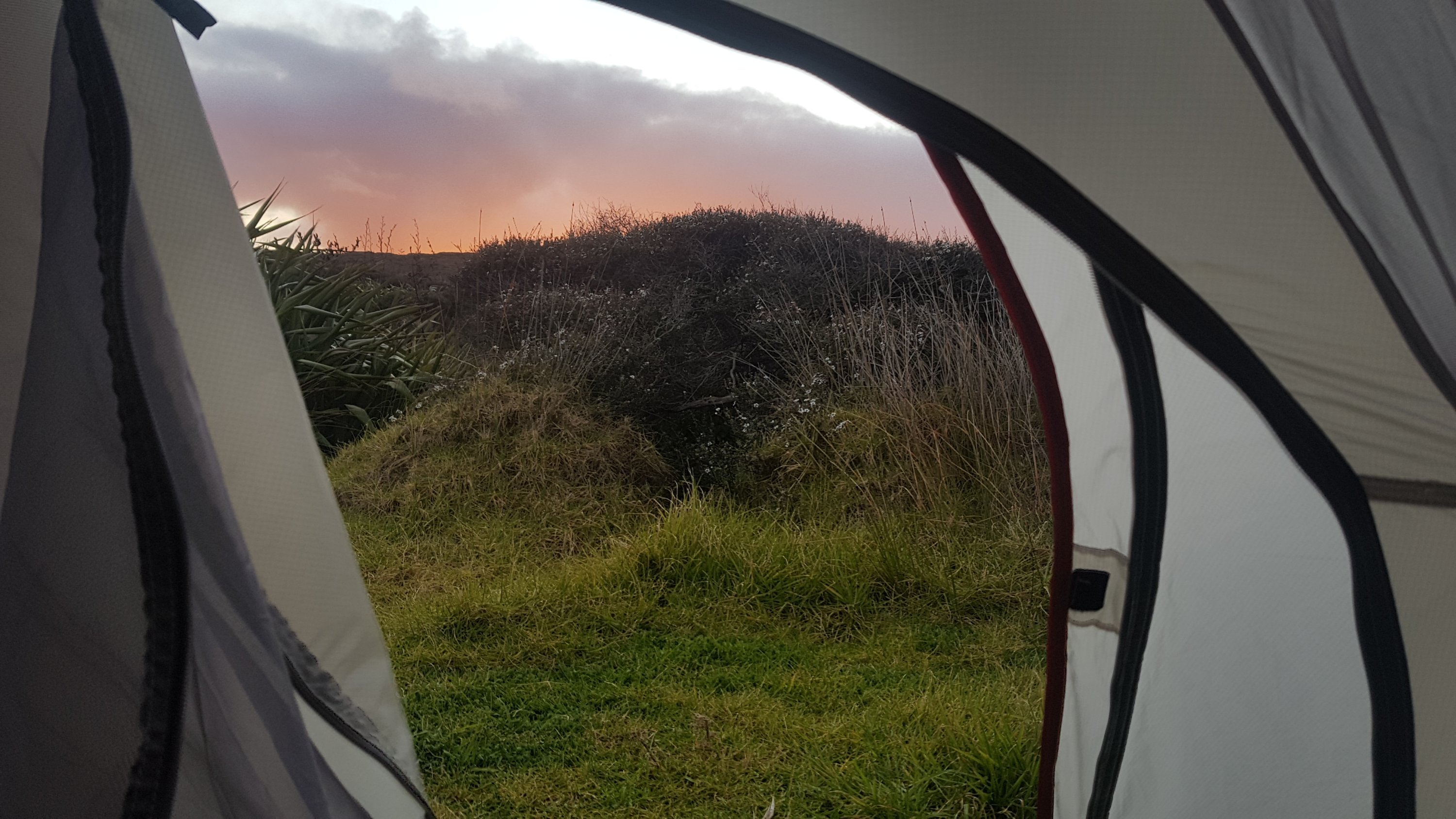
And I am looking forward to the varied views I will have from my tent door while on the trail. Here’s the view this morning, down my Mum’s driveway. At least it was sunny in the morning.
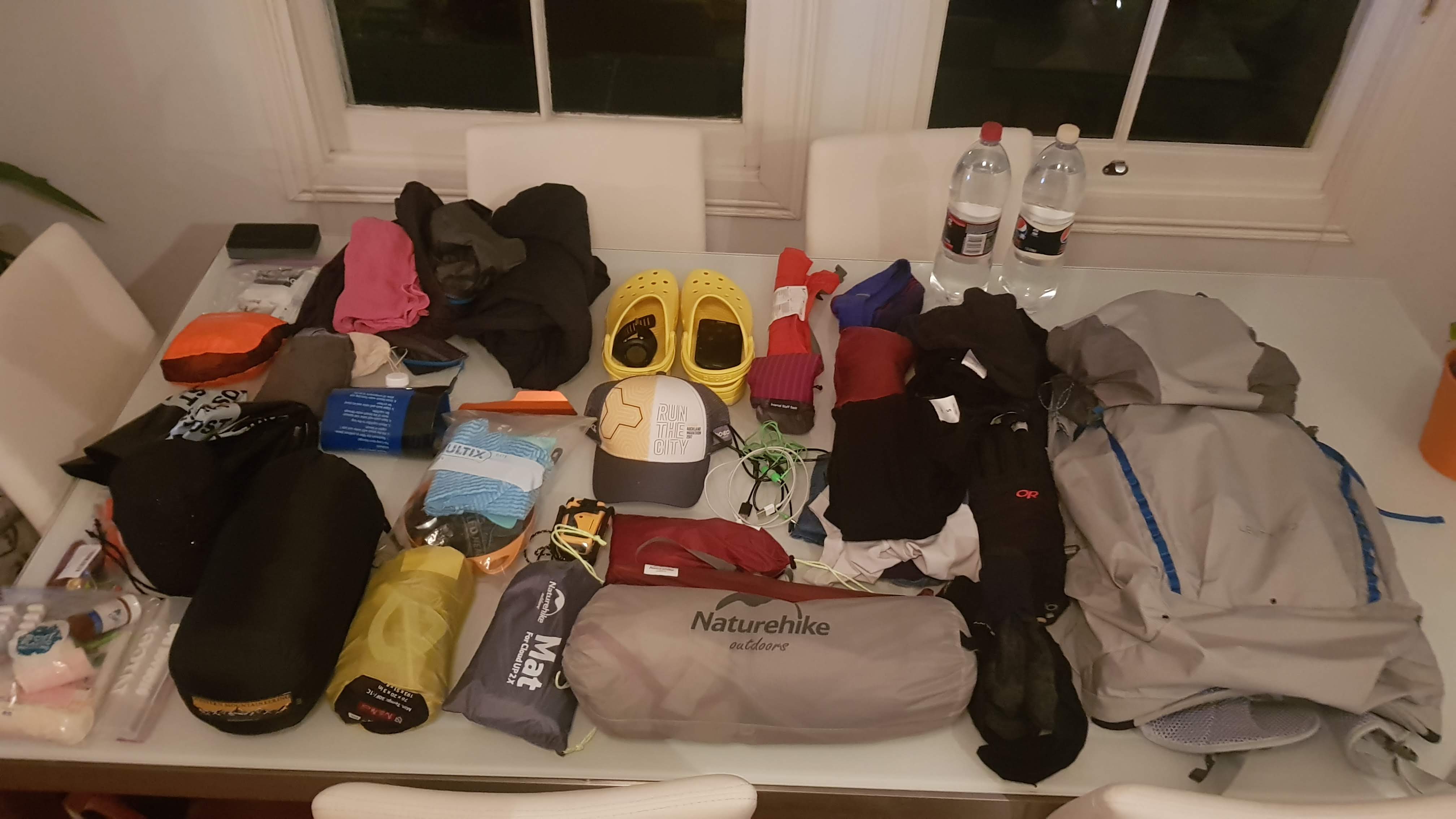
Less than five days to go now. Since work finished I have been doing various things, some just for fun and to get away from Auckland, and some in preparation for Te Araroa. I was waiting for my final piece of gear to turn up from overseas, my Leki walking poles. They were supposed to turn up between Sep 4 and Sep 9, but the courier tracking website always showed them “in transit”. I didn’t actually realise they’d turned up on Sep 13 until a few days after that. Still a bit late, but at least I have everything now. In fact, the courier tracking site still says “in transit” for them even though I got them a week ago!
Here is all my gear, except for the hiking poles and trail runners:
All gear except my hiking poles and trail runners
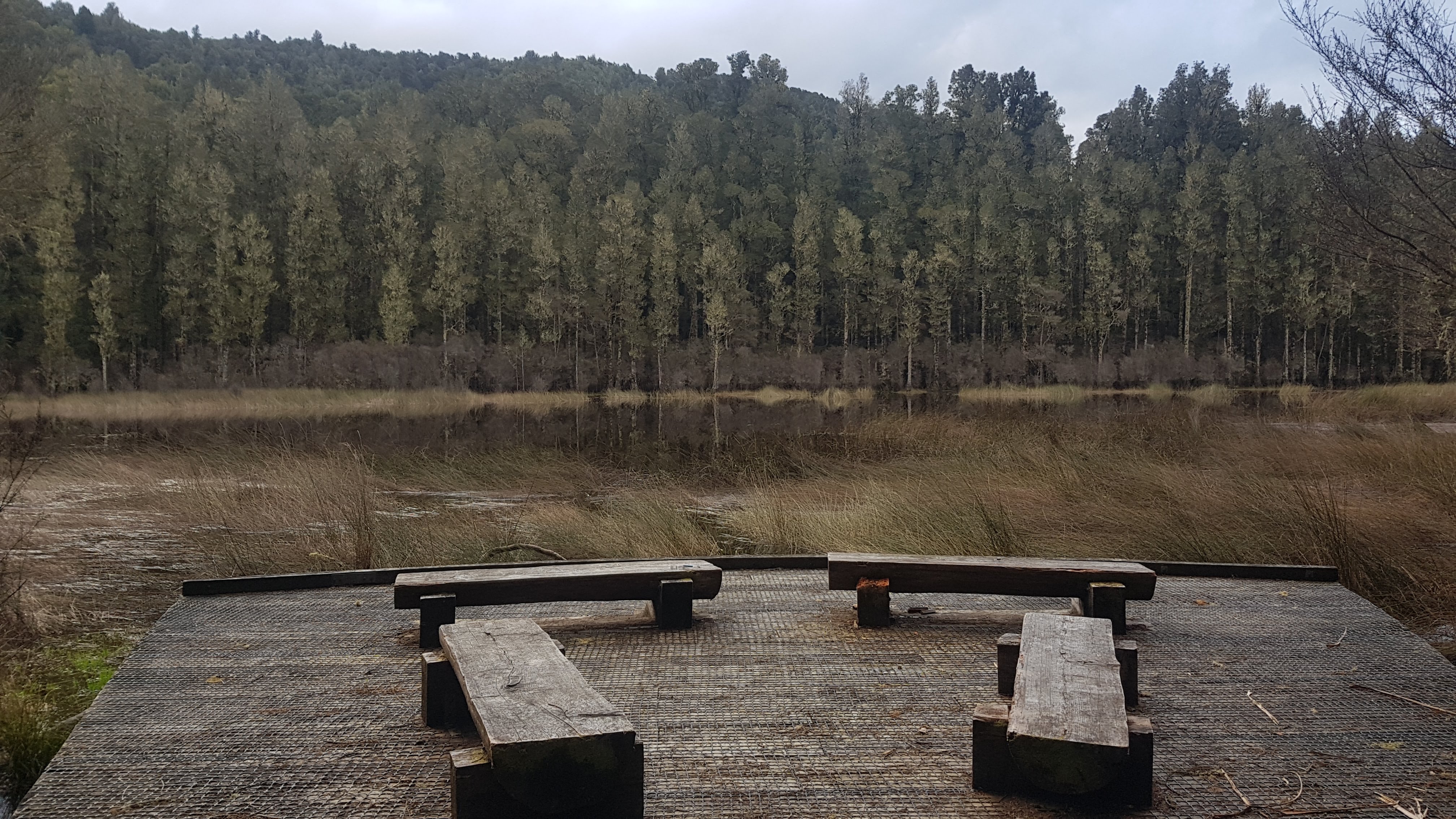
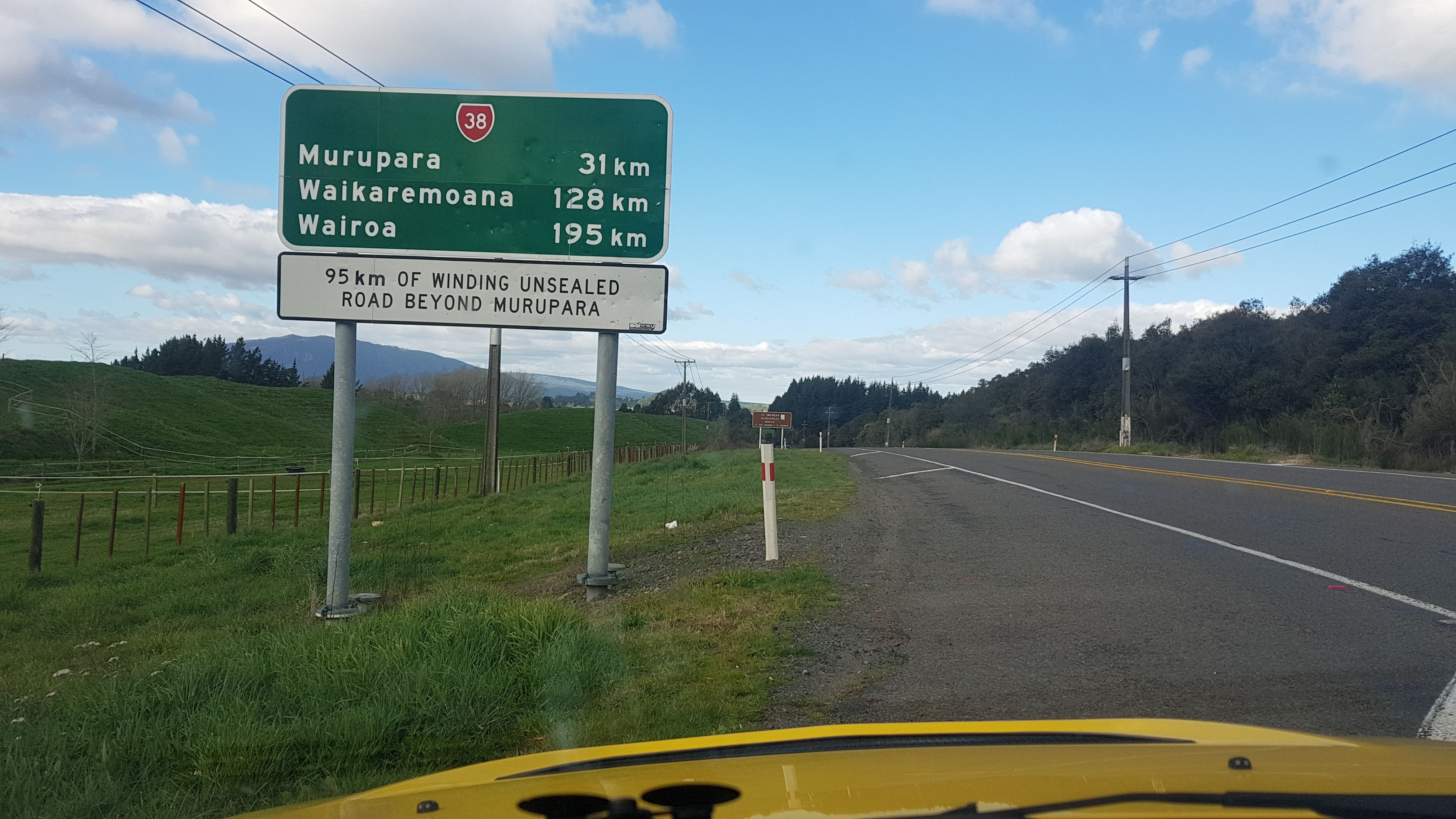
When deciding where to go for a hike, or even just a trip out of Auckland, I turn to one of my other hobbies, geocaching. If you haven’t heard of that, basically you get given the GPS coordinates of a box that somebody has hidden somewhere out there in the world, and you go to that point and find it. You then sign the log with your username to prove you found it, and log it on the website. One that I wanted to find was this one: The Lagoon, south-east of Murupara. One good thing about this one is that nobody had found it yet, which is relatively rare. You get a bit of kudos for being the first person to find a geocache.
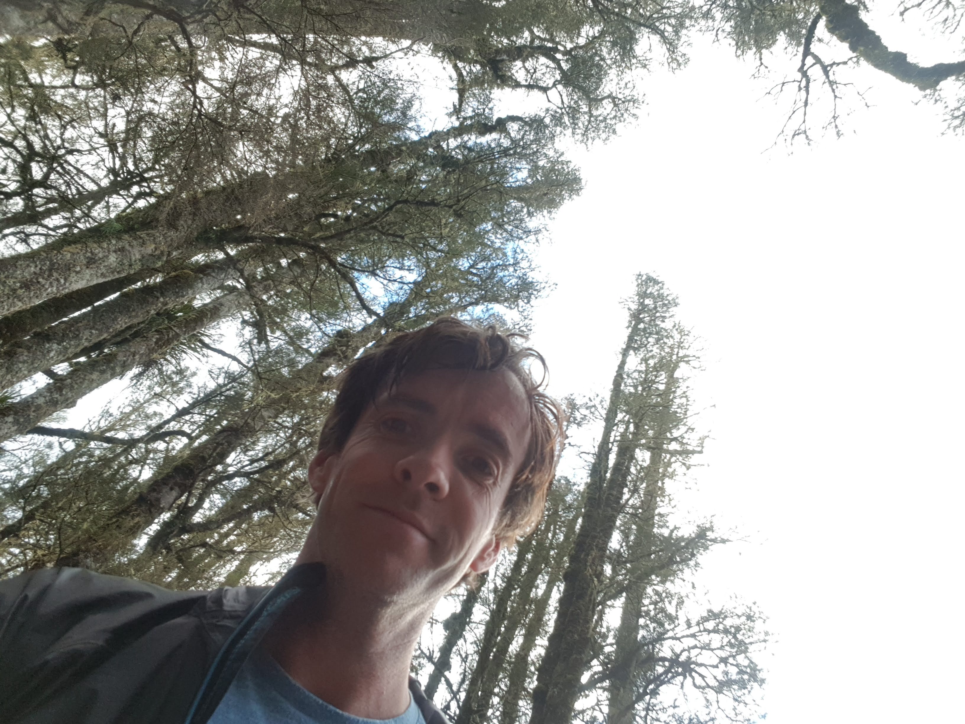
So last week I took all my gear and made the five hour drive there from Auckland. I found the geocache hidden in a tree beside the lagoon, which was great. Geocaching has taken me to many cool places that I would never have visited otherwise.
Arohaki Lagoon
Whirinaki Forest on the way to the lagoon
After this I drove out, and had a quick drive through the nearby town of Minginui. It really was a town that time forgot. Every house in the town of about 100 looked like it was minutes from falling to the ground. The two shops in the town were abandoned. It seemed that every single person in the town was in the park playing a game of cricket. I have a quite loud and very yellow car that you can’t miss, so as I drove past every person in the town stopped and looked at me. The town is on a bit of road that doesn’t go anywhere, so the locals knew I was just there having a look.
The “wop wops” as we say in New Zealand
My plan was to find a campground and set up my tent for the night. My first option was in the DOC land near the lagoon… I could see it on the map but just couldn’t find it. My second option was a little layby on the side of the road 5 minutes north of Minginui. I drove there and pulled in. There was another car there with one person in it who was just sitting there smoking, and did not have any camping equipment. I drove to the other end of the campground and waited for a while. The other car didn’t move, and I noticed a lot of rubbish around. While I was sitting there, some guys drove into the layby and drove right up to me. “You ok, bro?” and “Nice car eh” I heard. Actually I heard those two sentences a lot while I was travelling down that way… I clearly didn’t look like I belonged. They said they had seen me driving around and wanted to make sure I was alright. We talked for a bit and they said this wasn’t a very good place to camp. They said a better place is the DOC Campground – the first one I couldn’t find. They tried to explain where it was but were explaining it using a lot of local landmarks that I didn’t know and wouldn’t be able to find in the dark. Eventually they drove off and I drove off in the other direction.
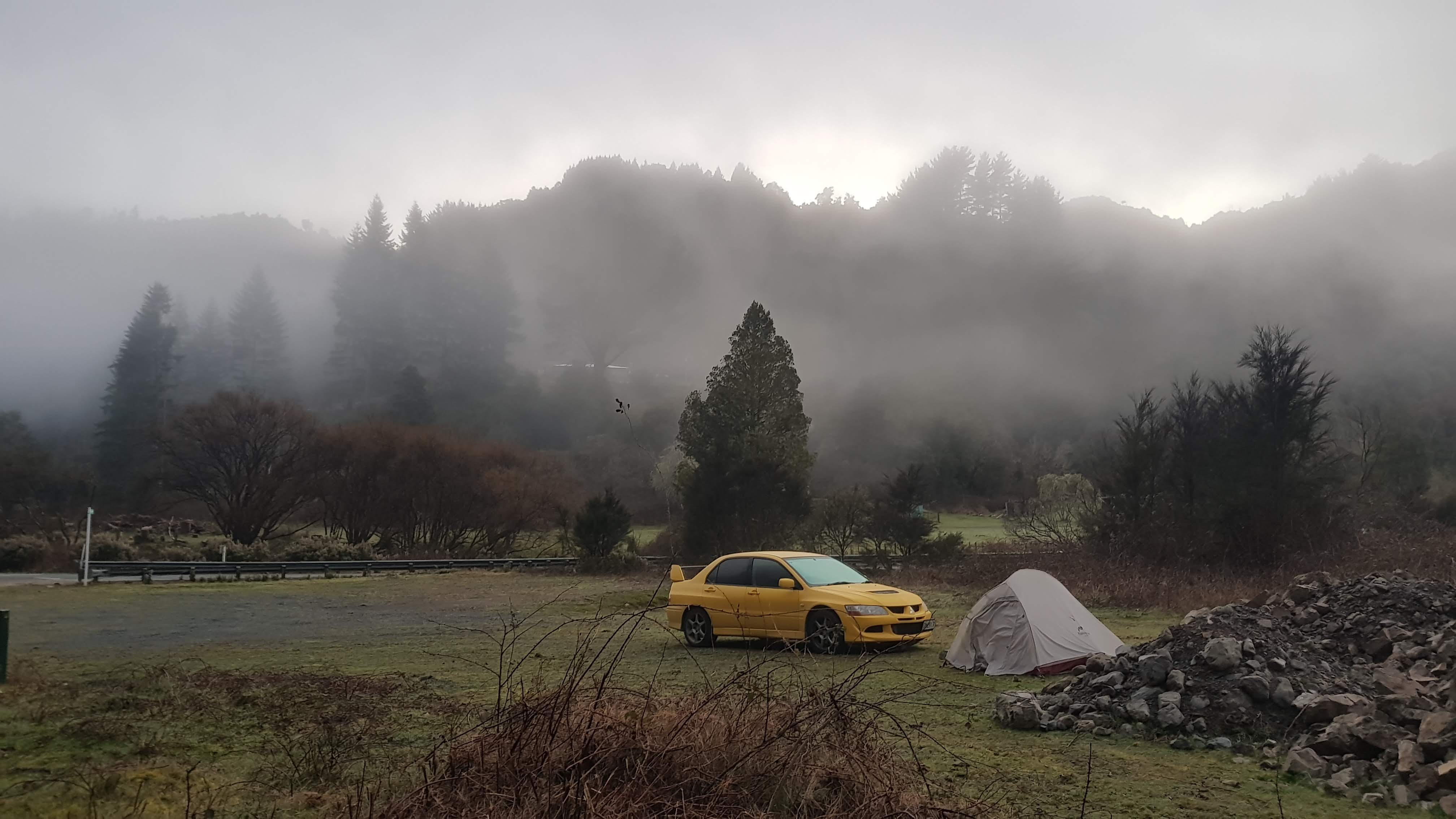
I looked on the “Rankers Camping app” which talked about a campsite on Okahu Valley Road which was a bit further down the road, down a real back road in the middle of nowhere. I drove down the road a bit but soon realised my car was not going to make it down this road which appeared to be for 4-wheel-drive vehicles only. I have a 4-wheel-drive car but it has a low clearance and can’t get over any real obstacles. And since it was dark by this point I just set up camp in a piece of land I found with a camping symbol on it. I am not sure if the camping symbol referred to the campsite down the road or where I was, but I couldn’t be bothered looking any further. Even though it was dark, with the full moon and my headlamp I had no problems at all setting up my tent in the dark, which was reassuring. The ground was quite rocky but there wasn’t even a breath of wind so I didn’t need to stake the tent down. There wasn’t a cloud in the sky either and I could see all the stars. I just put a couple of rocks on the ropes and it held up fine. Also it was apparently 2 degrees overnight, and I didn’t feel cold for most of the night except for one brief period where I just put on a bit more clothing. So I feel good with my choice of sleeping bag and other sleeping gear.
I hadn’t camped in those temperatures before, and sure enough because I hadn’t vented the tent fly it was saturated in the morning – despite the fact there had been no rain there was a lot of condensation. I hadn’t opened the back vent and I also understand I should have unzipped the fly a little bit. Oh well now I know. And it was also covered in mosquitos. There was no water or mosquitos inside the tent so the gear once again proved itself in that regard. And in the morning once the sun came up I could properly see where I’d actually camped. It was a beautiful spot, eerie with all the morning mist.
I am going to have to learn how to stop my tent getting wet though. At least while on the trail it should be warmer at night most of the time, so maybe there won’t be so much condensation.
My campsite in the morning
I spent some time in Rotorua to relax and unwind (and stayed in a motel). I forgot how stinky Rotorua is.
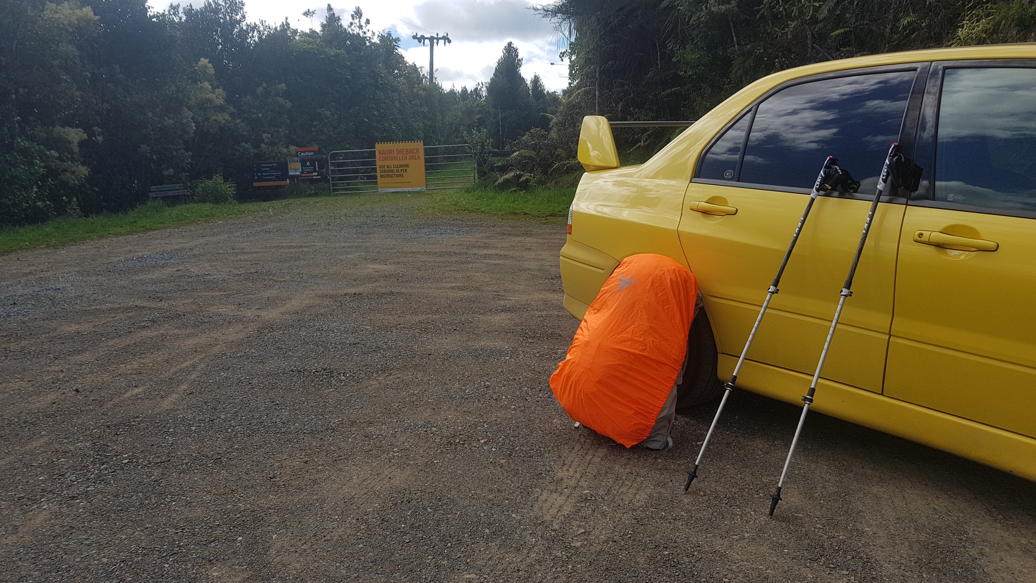
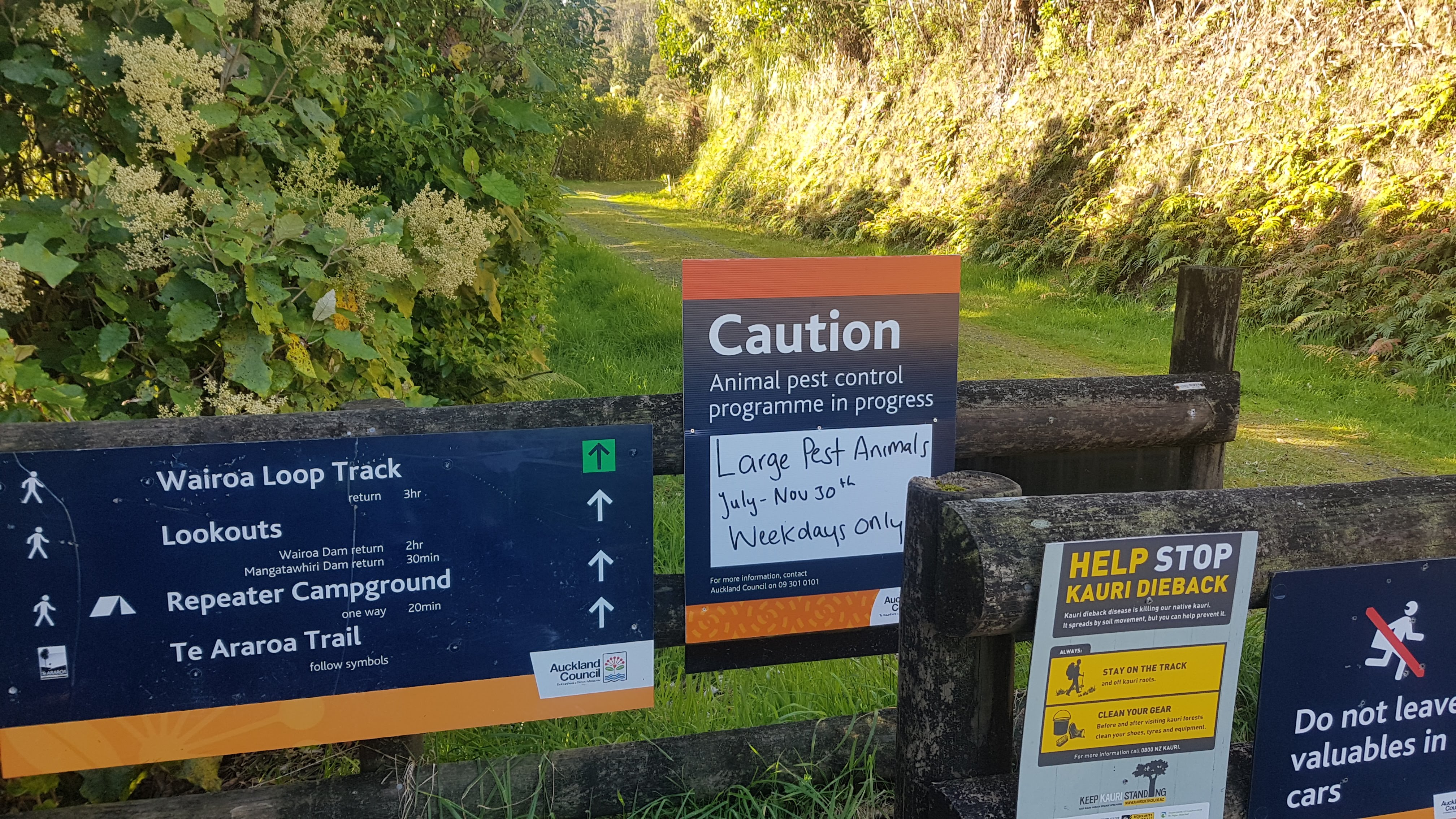
Today I wanted to try out my hiking poles, so once again I looked for a geocache that looked interesting, and I found this one – Challenge Track in the Hunua Ranges. It hadn’t been found in over six years, which is very rare for any geocache in New Zealand, and even more so for one in Auckland. The track was apparently quite challenging, so I would get a decent go with my poles.
Starting out. Also tried out my hi-viz pack cover for the first time. I think it might be slightly too small.
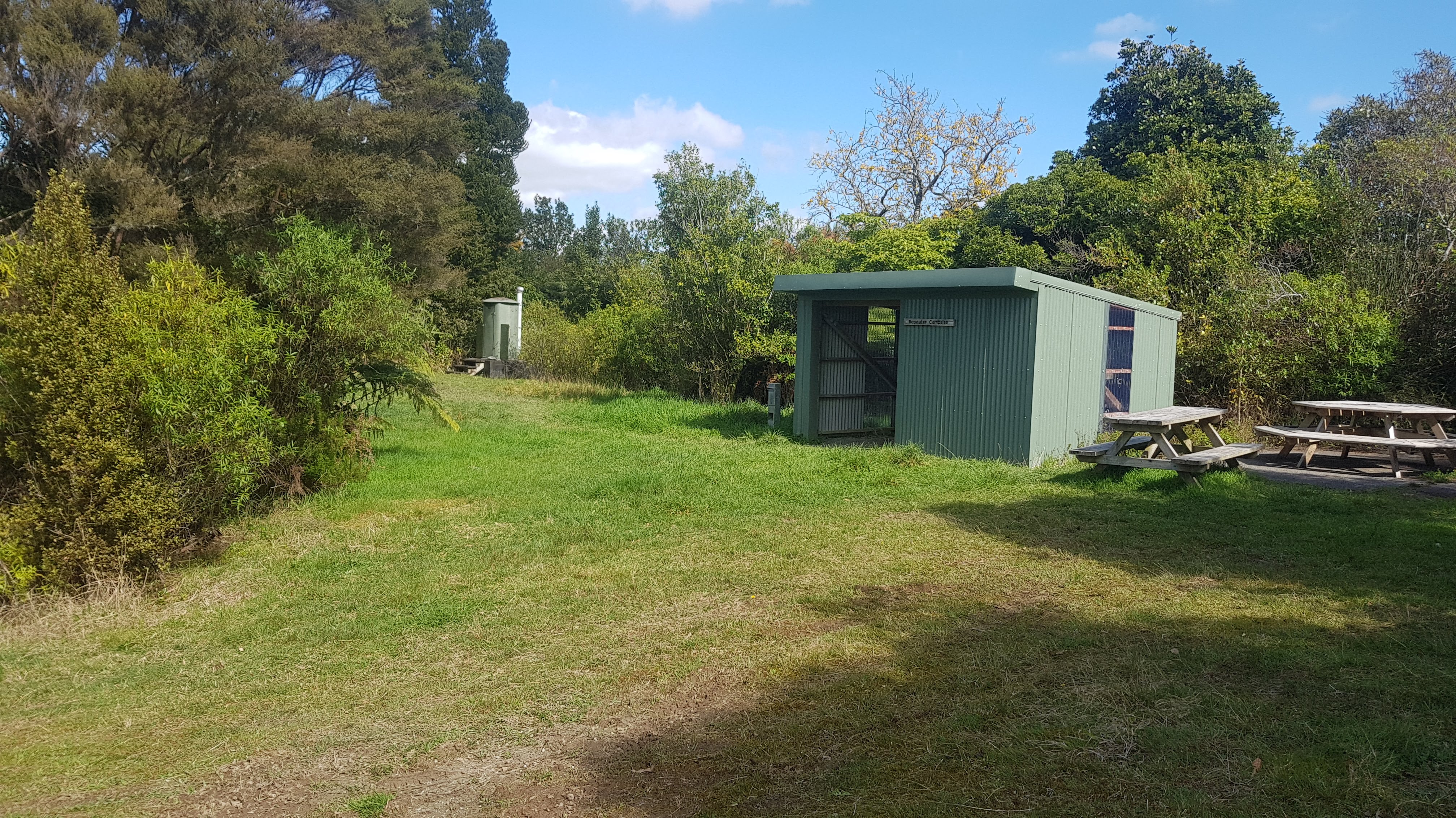
I didn’t realise until I got to the car park that this track actually used to be part of Te Araroa. I’m not sure exactly when, but graffiti at the Repeater Campground suggested that in 2014 it went past here. (side note – please don’t graffiti the huts and campsites. Nobody cares about your silly little messages!)
Entrance – Te Araroa is mentioned
The signage for Te Araroa was still present but last season the whole section between Manurewa and Mercer was on the road rather than through here. The track I walked on today was open but I think other tracks in the Hunua Ranges are still closed because of Kauri Dieback.
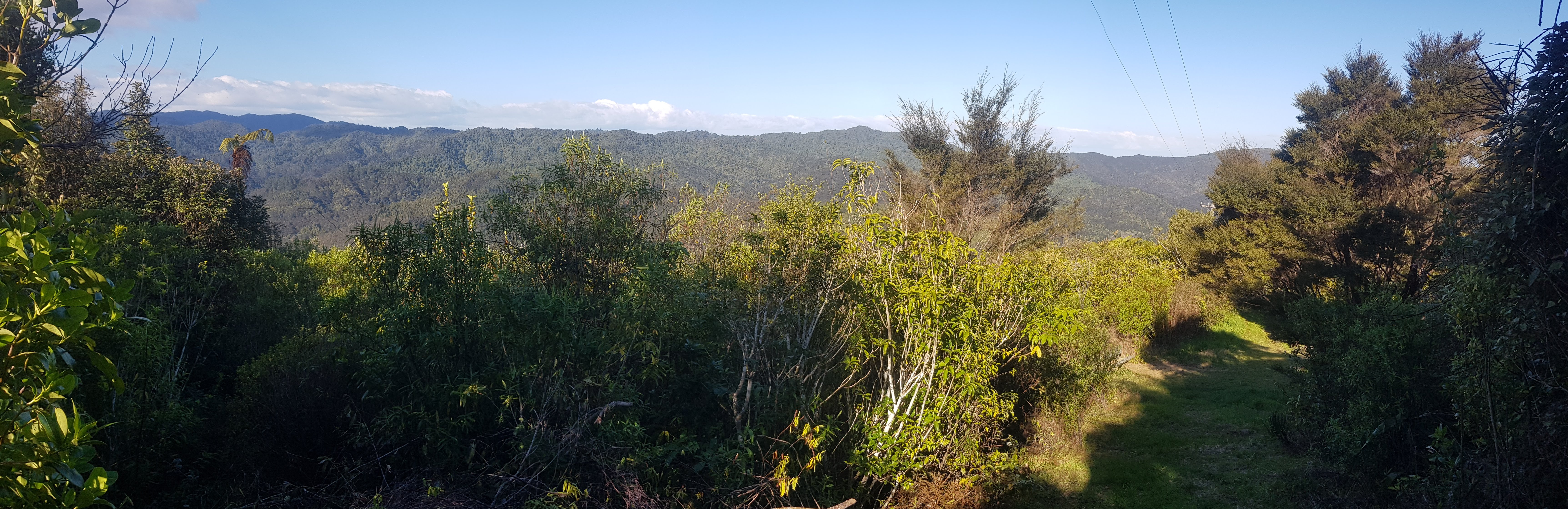
Panorama from the Repeater Campsite
The combination of Salomon Trail Runners and Leki Aluminium Walking Poles meant I had an easy time on the relatively muddy and sometimes steep paths. I was impressed with them, although the poles were vibrating sometimes so I need to make sure I am using them correctly. I’d never walked with poles before this walk. I’ve done snowboarding before but never skiing, so I’m used to balancing with my own body weight rather than relying on poles. It was an unusual experience, but the poles really helped going up and down the hills. I did slip once on the way down a slippery hill, and I didn’t know how to recover from it because I had two poles still stuck in the ground with my hands strapped into them while I had fallen on my butt in the mud. Fortunately nobody saw me struggle to get up… and I did manage to get up, eventually.
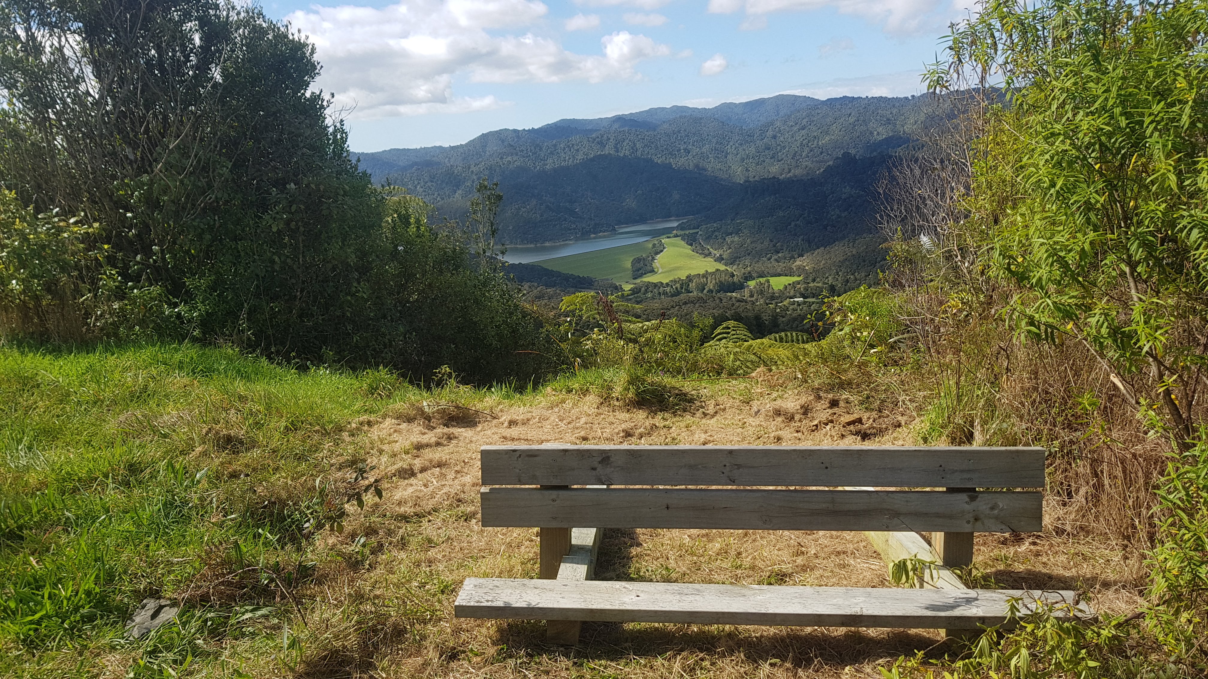
View from the Repeater Campsite
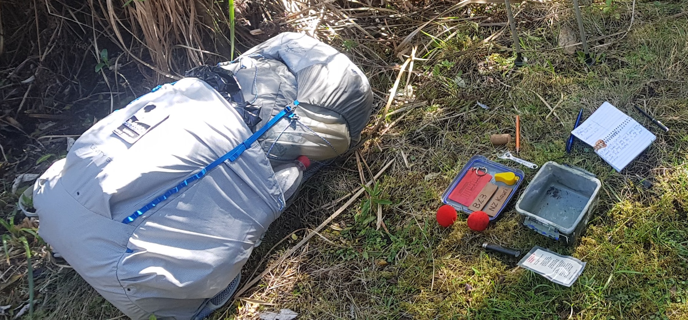
I did actually find the geocache! Two people had looked for it in 2014 and 2015, but failed. Nobody had looked for it since then (or at least, nobody admitted to looking for it and not finding it). But when I found it, the paper logbook inside as well as little toys inside it were pristine. If you want to read the full story on that, then go to the geocache listing and look for my log at the bottom from Sep 2019 (the one with the little yellow car).
Successful geocache find!
I thought about staying at the Repeater Campsite, but I didn’t want to be camped away from my car which was in the middle of nowhere. Also I didn’t feel like I would gain anything by camping in another random campground, I’m sure of my tent and sleeping gear by now. And after being in a great mood after finding the geocache, I wanted to go home and treat myself to a nice dinner. So I walked back to the car and went home.
Repeater Campsite
Anyway, that’s probably about it for now. You’re probably getting bored! Unless anything exciting happens between now and the 25th, you probably won’t hear from me again until I’m on the bus to Cape Reinga!
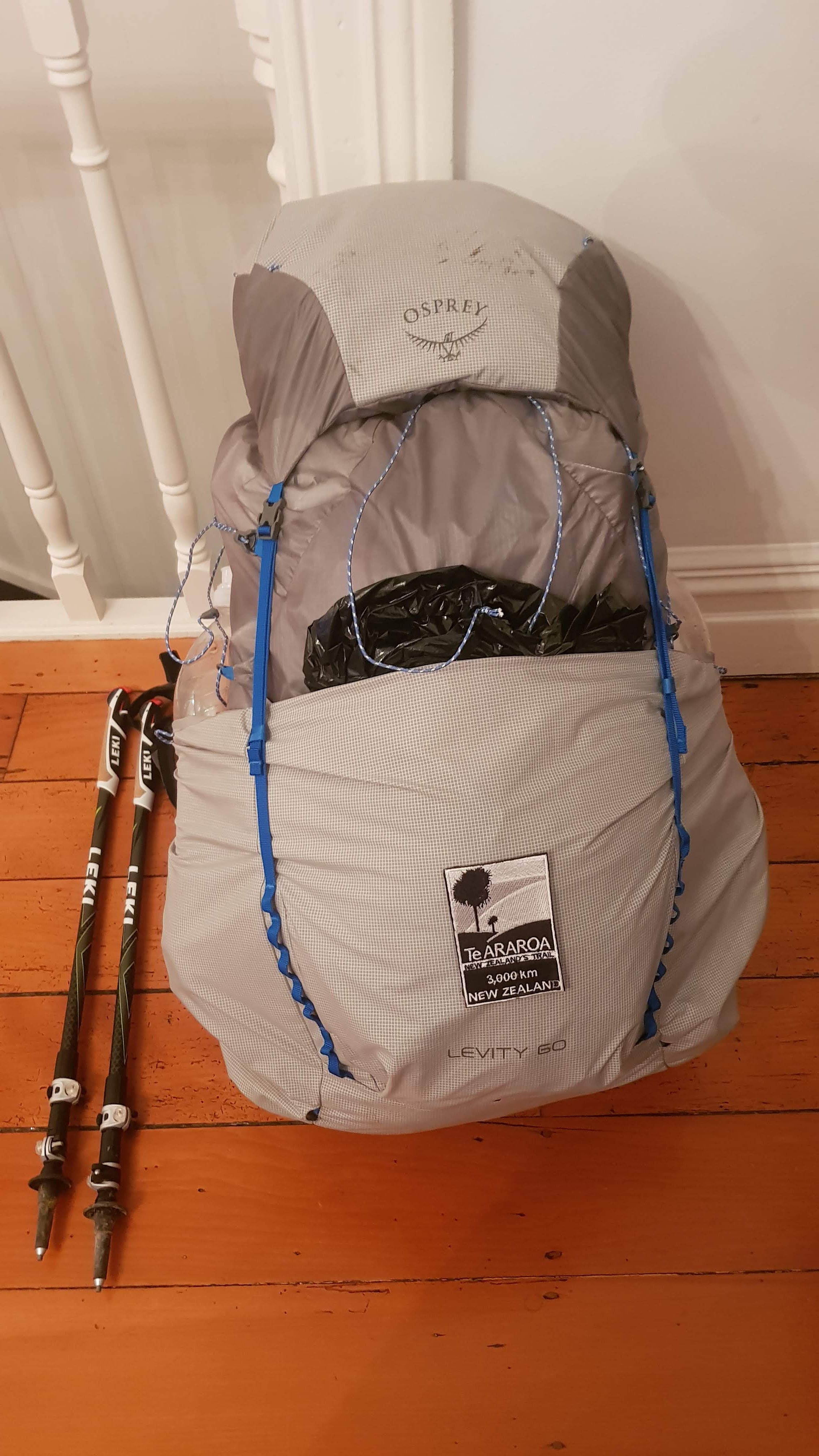
My fully loaded Osprey Pack with its first “war wounds” on the top from today’s walk, and with the Te Araroa patch now firmly attached
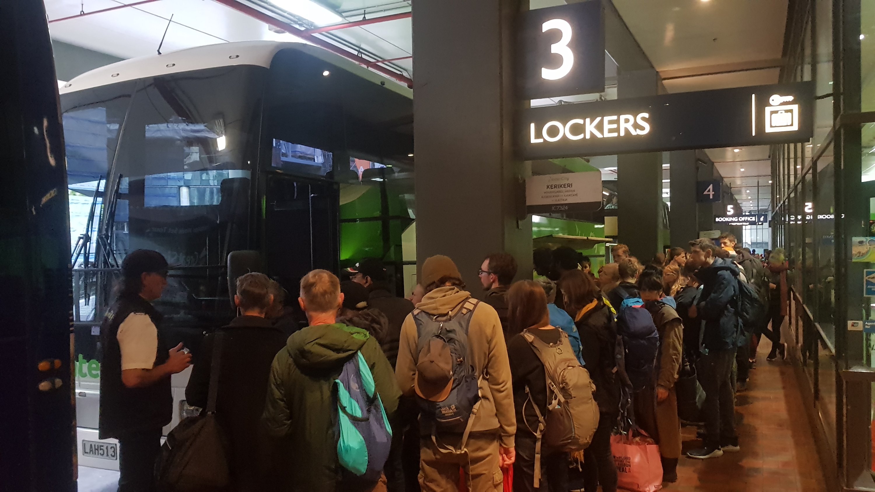
This morning I was on the chocka-block Intercity bus service IC7324 to Kerikeri from Auckland. It started off as I would typically expect from a major bus station. There was a woman yelling at everyone to make sure nobody steals your stuff because that’s what happened to her. And there were the usual people smoking where you’re not allowed to and the people who push onto the bus when everyone else is queueing.
Queue to get on the bus
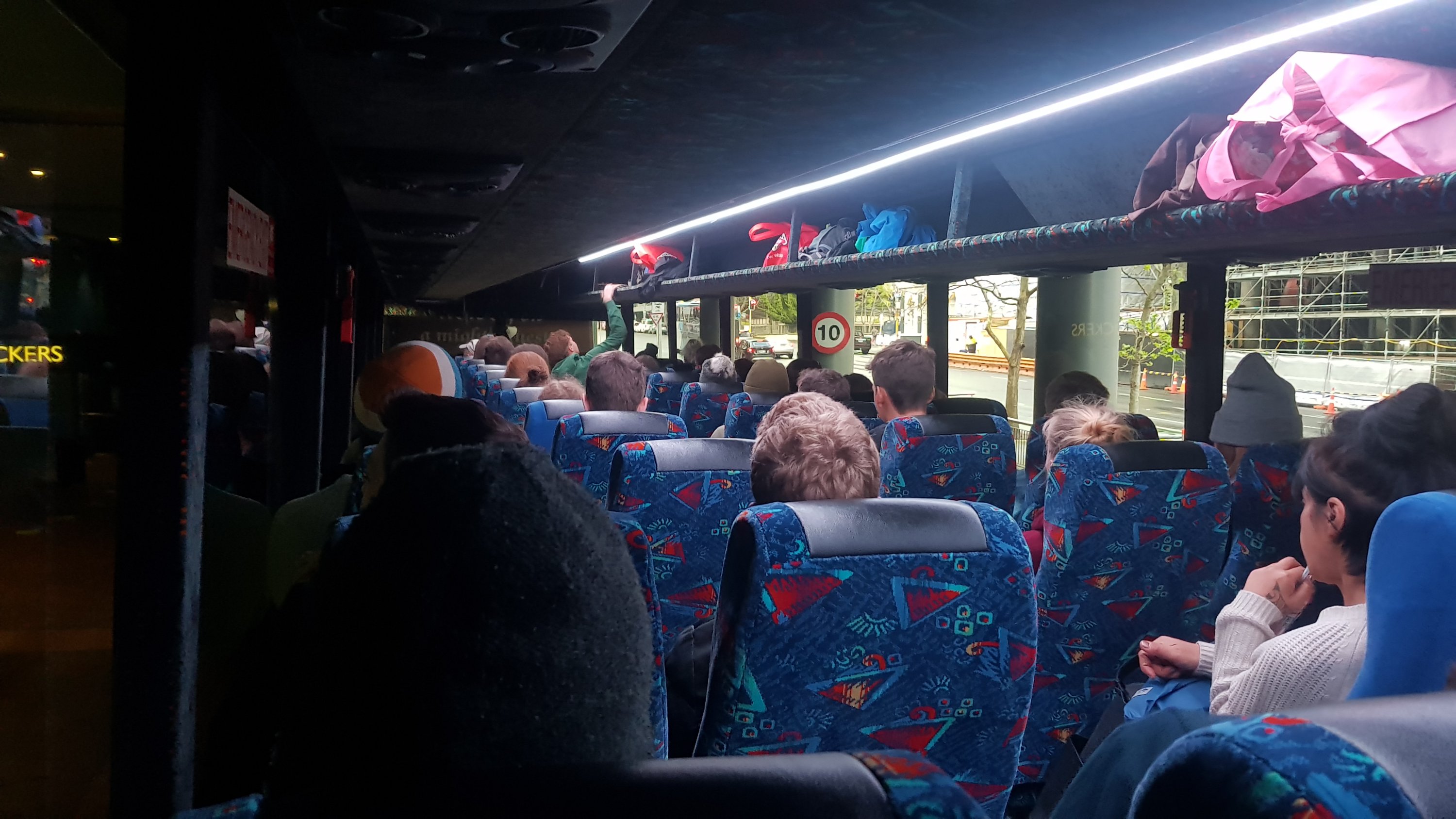
I knew the bus was going to be full because I’d looked at the Intercity website last night. I thought that would be good because there would be other hikers with me, but bad because it would be noisy and loud. Well neither of those were true, there were two people who looked like hikers but they were actually going to Taipa to do volunteering, and the bus was full of a large group of 40 or so young people on working holiday visas who had all been out the night before and so were deathly silent on the bus because they were all hungover.
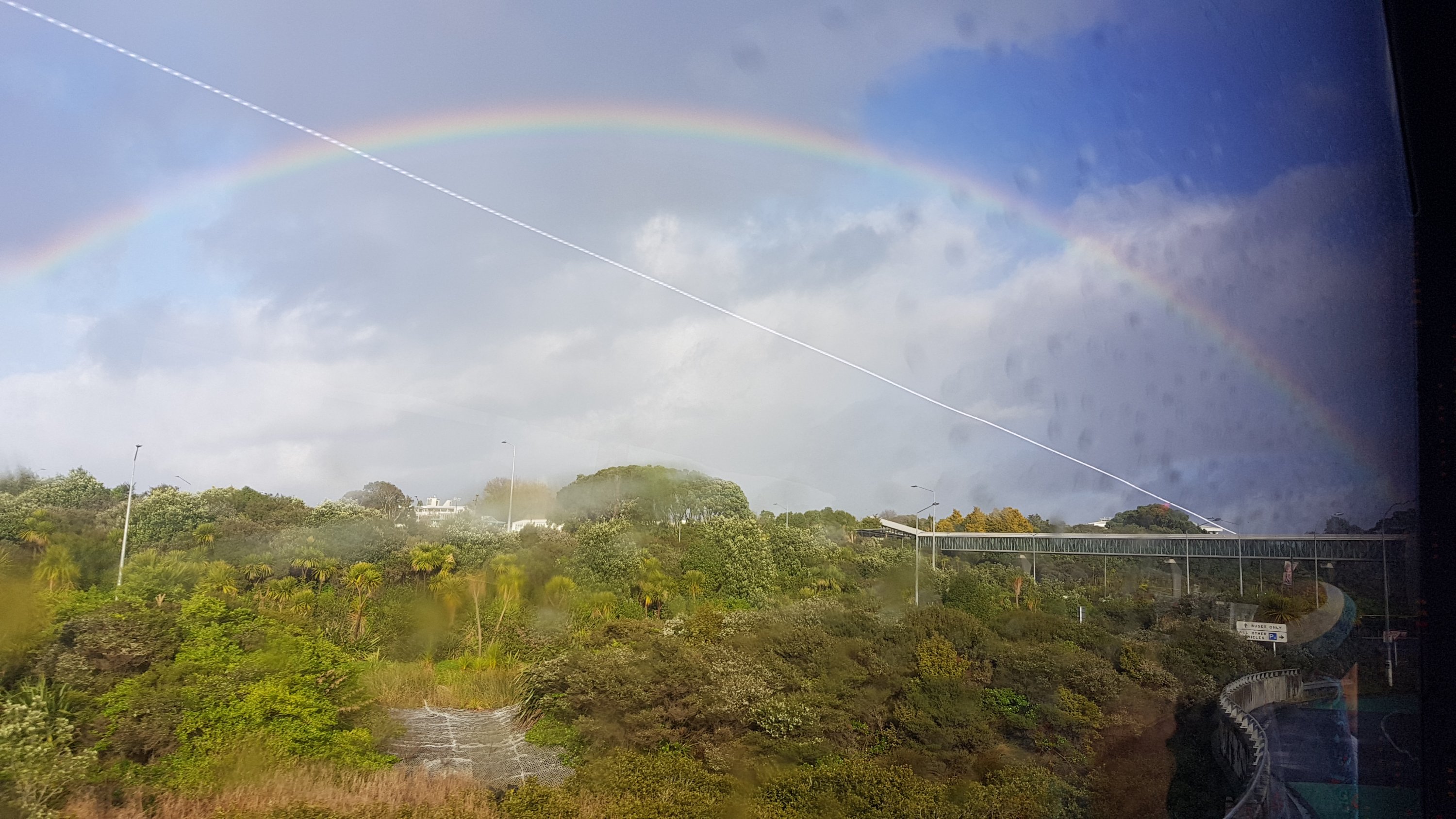
Not long into the bus ride we were greeted by a full rainbow at Akoranga Station. Hopefully a sign of good things to come.
We stopped in various places, one was Warkworth which I reckon is quite a nice town, I could live there because it is not too far from Auckland, and it has a chocolate shop and a pub by the river that sells Guinness. What else does one need.
I had been talking on Facebook to a girl that started a week or so before I did. She runs marathons and we had been chatting since we have started so close together. I heard yesterday that she only made it to Kerikeri where she saw a doctor and was diagnosed with shin splints and she isn’t able to walk any more, for at least the next couple of weeks. So that got me a bit nervous that something like that can happen to someone who is as fit as she is.
I’ve had a niggle in my shoulder for months now and I’m hoping that this isn’t aggravated by walking with a heavy pack. I guess once I start walking down 90 Mile Beach for the next few days I will have a better idea of how I feel. It would suck to have to end the walk early like this girl did due to injury but I used to run a lot and I know how easily injuries occur and often there is nothing you could have done to prevent them.
After we got to Kerikeri I then transferred to the Kaitaia bus. The ride was uneventful but at Kaitaia I knew that the final bus stop was a long way from where I needed to be to get my next pickup, but the driver was kind enough to stop the bus near McDonalds north of Kaitaia so I didn’t have to walk across town. I wasn’t sure if she would or not, because she told the two volunteers that she couldn’t drop them in Taipa despite driving right through there. But I worked out that that was because there were so many roadworks at Taipa while they widen the one-lane bridge that there was nowhere to stop.
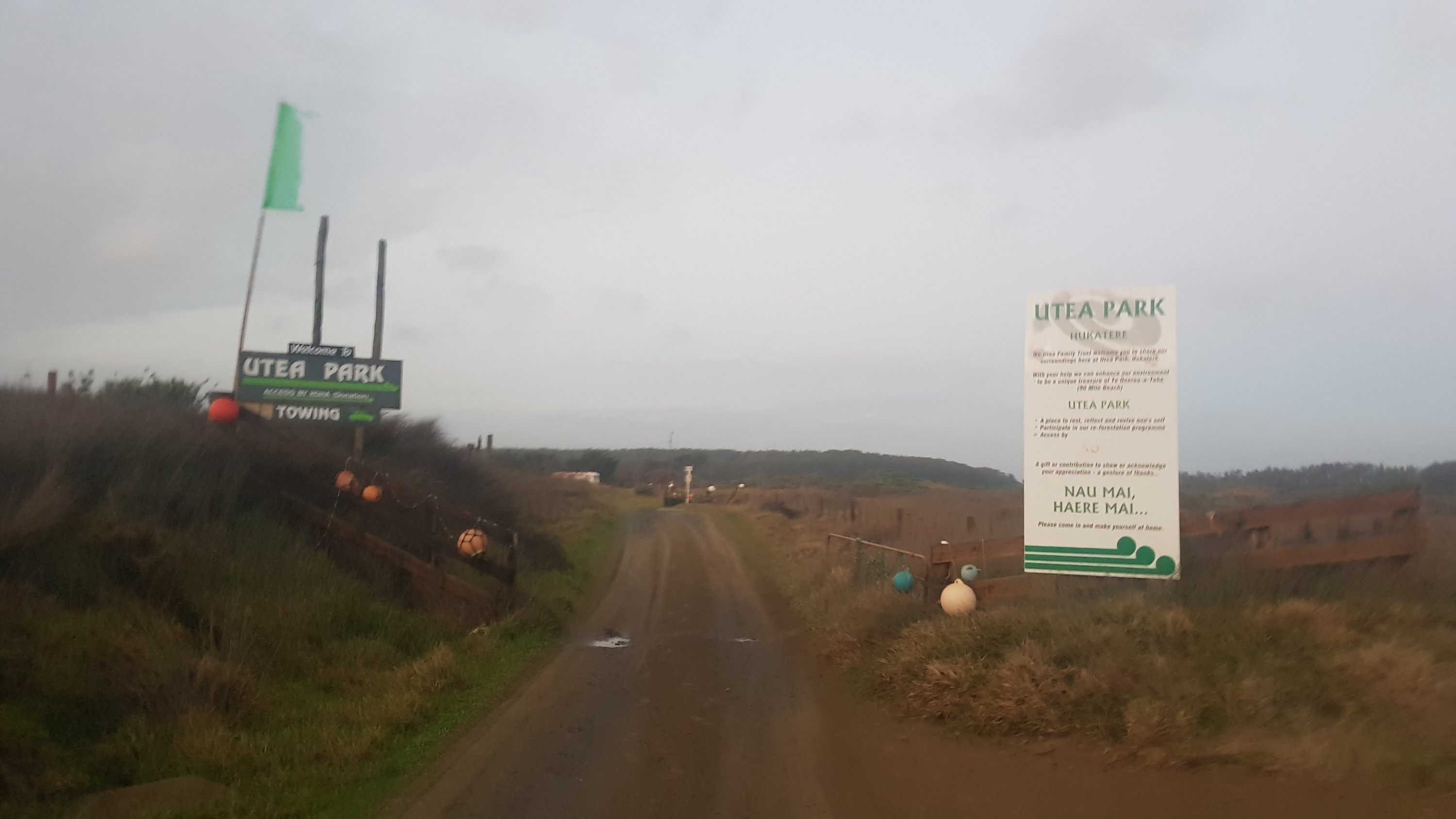
Utea Park entrance
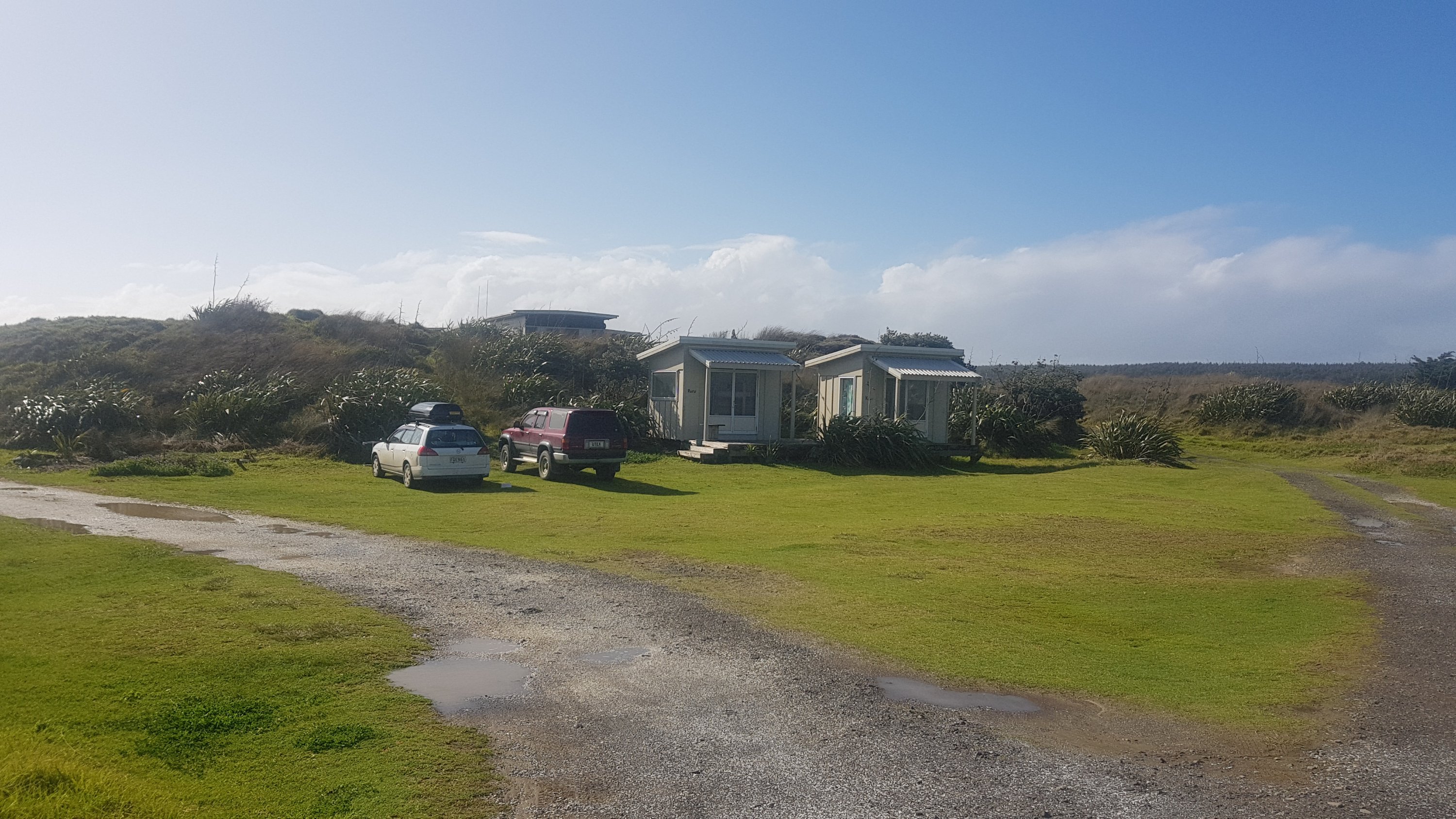
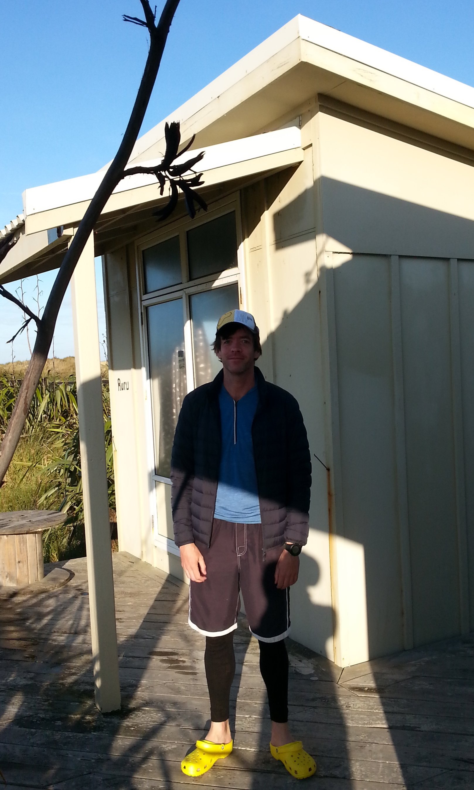
I had McDonalds for lunch and then Tania from Utea Park picked me up from there and took me to the Utea Park campground. She is going to take me to Cape Reinga in the morning. I’m in a cabin called Ruru – the leftmost of these two cabins.
I’m so glad I’m staying in a cabin tonight… The wind is blowing so hard I feel like the cabin is going to fall down. The cabin and even the kitchen are shaking. The rain was pretty bad too earlier but at least the rain is supposed to clear tomorrow, at least for a few days… Although the wind is not scheduled to die down.
Kitchen and common area
This seems like a nice place. I bet it will seem even nicer when I pass back through here on the 3rd or 4th day of the walk. People on the Te Araroa Facebook group always rave about this place. Sadly they’re closing down on the 30th of September because of disagreements with the Far North District Council. Because of my timing I could literally be their last guest in a few days’ time.
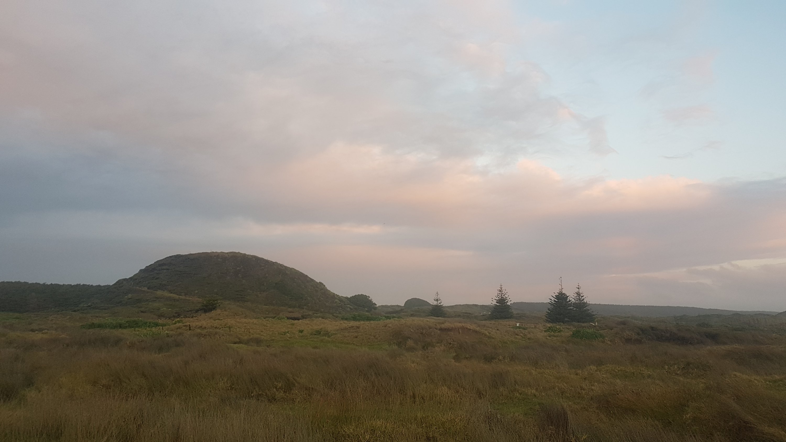
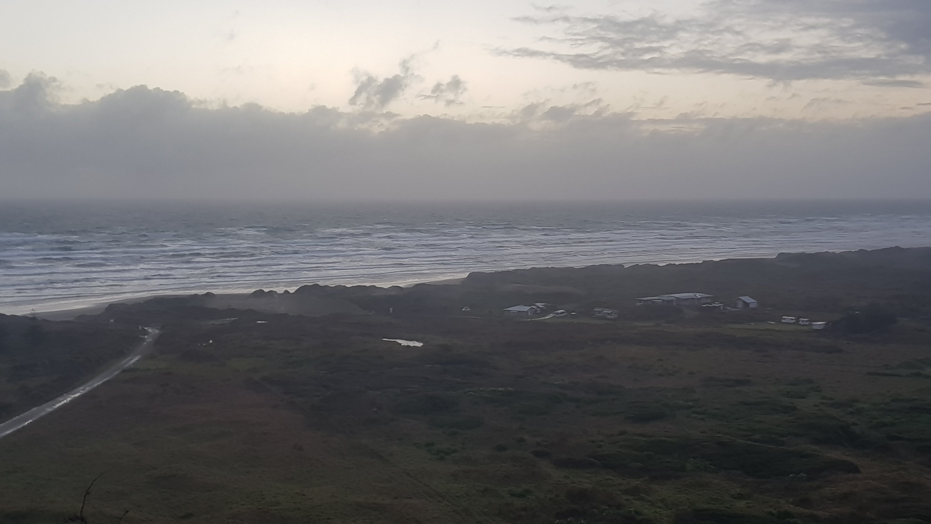
I went for a quick jog up this hill to find a geocache. The hill is apparently called Utea also. I saw the campground from the top of the hill. The sunset would have been wonderful if it wasn’t so cloudy, I understand.
Utea hill
View of Utea Park campground
I’m surprised that there is actually cellphone reception here so I can post this. I’m heading to bed now, its been a long day after 8 hours in buses and cars. I hope I actually can get some sleep with all this wind. 8:30am we leave for the Cape!
Date: 26 September
Distance walked: 12.1km
Trail covered: kms 0.0 to 12.2
Weather: Windy but sunny
Number of people seen since I left Cape Reinga: 0
Mangled possum carcasses: 1
Wow, I can’t believe it is finally here. My first day on Te Araroa. Back in March it seemed so far away.
The gale force wind from last night was still going in the morning. It woke me up at 5am and I couldn’t get back to sleep. But I had faith in the weather forecast which showed that at least the rain would stop.
Tania from Utea Park drove me to Cape Reinga at 8:30am to coincide with the outgoing tide. She told me all about the area which was cool. She dropped me off and suddenly I realised I was by myself, with no transportation, nobody I knew around and no cellphone reception. It was a bit emotional for a few minutes. The only people around were tourists in campervans. Just before she left, Tania said to me “kia kaha” which I knew meant “Be Strong” because it was the motto of the college I went to.
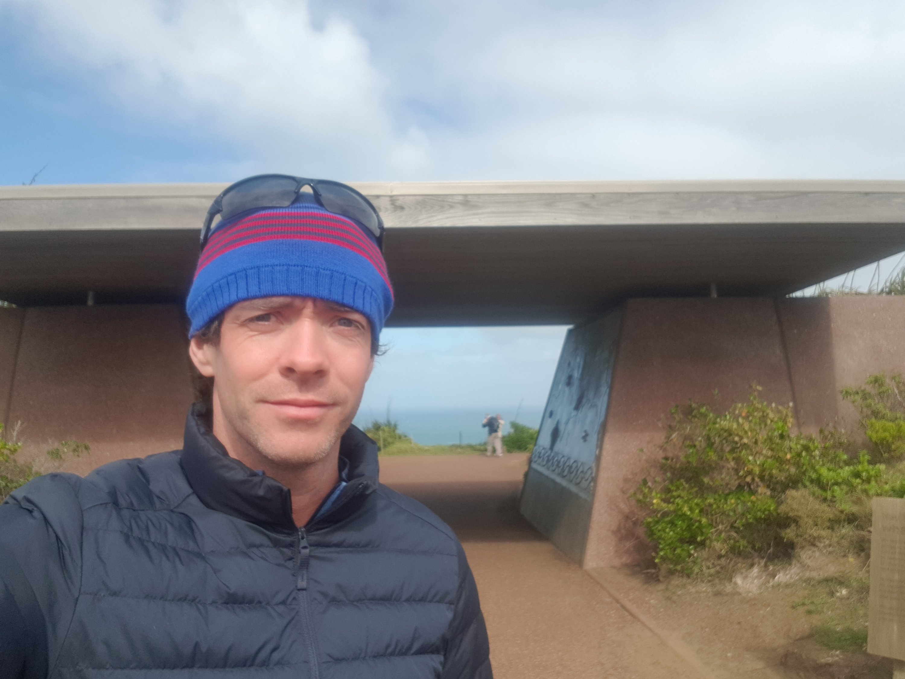
My ride to the cape
Once I go through here, there’s no going back
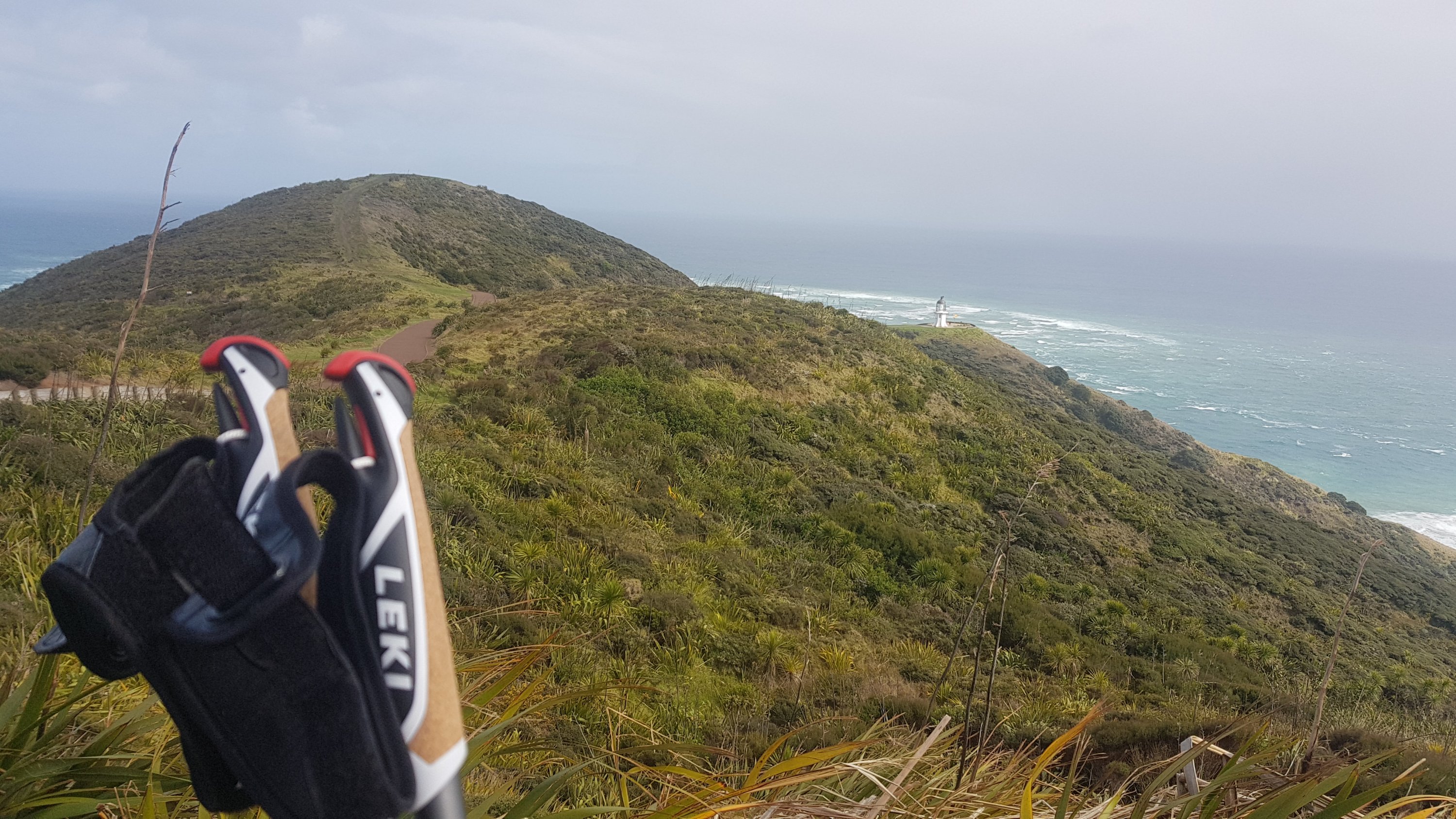
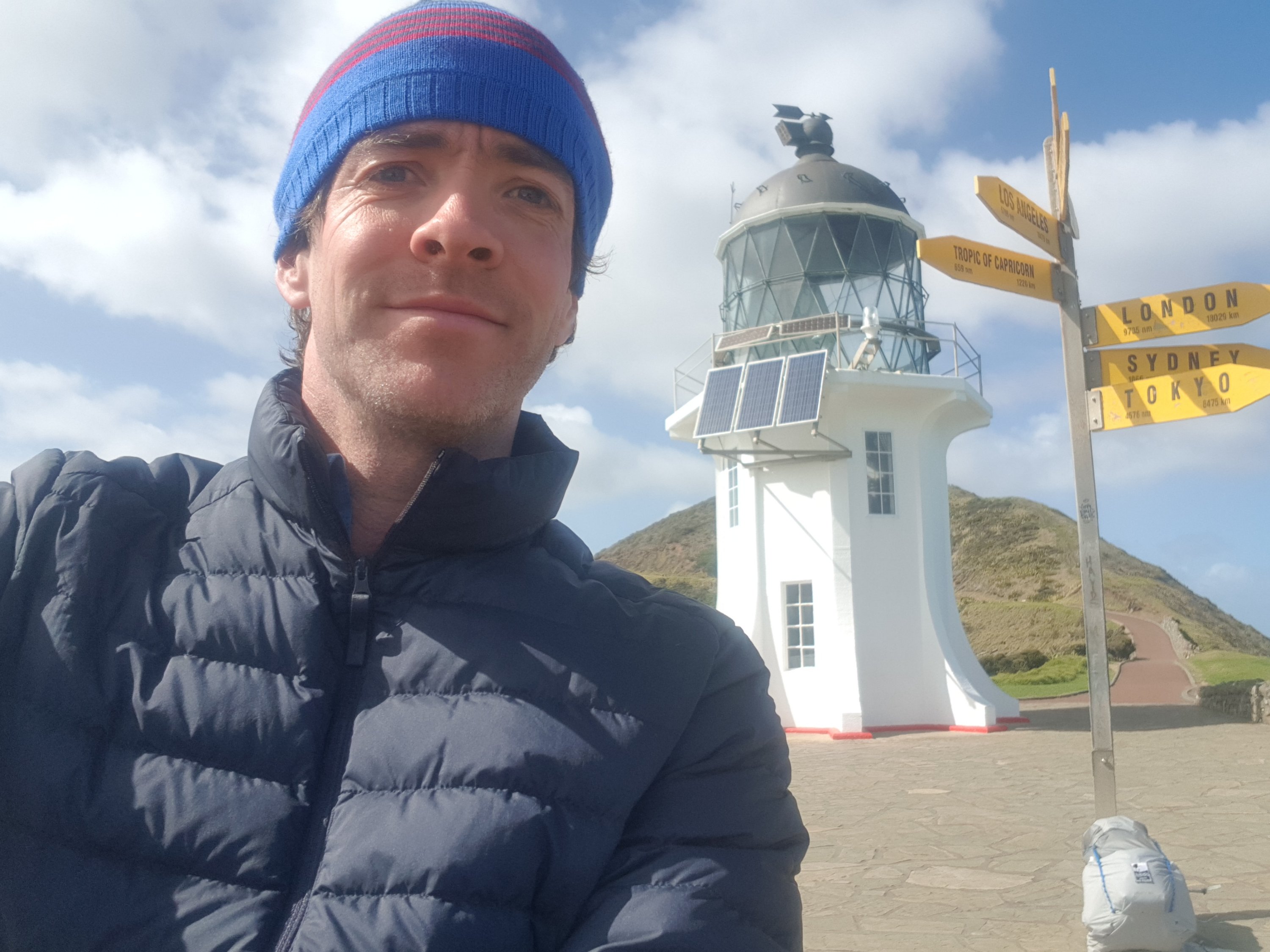
From the carpark I started walking down to the lighthouse which is the official start point. I had all these ideas in my head about what my “starting photo” under the lighthouse would look like. I mean everyone posts their finishing photos at Bluff on Facebook but I rarely saw any from when people started at the Cape.
There’s the lighthouse, I’ve seen it before but it felt different this time
I realised quickly that that was probably because there’s no phone coverage up here. And I couldn’t take any kind of cool photo because I was actually the only one at the lighthouse, and also, the wind was so strong that if I let go of the phone it would have blown away and ended up in the Pacific Ocean. And when a couple from Australia did show up, I didn’t ask them to take my photo because I didn’t trust them to hold onto the phone well enough. So I ended up with this:
km 0
Gee, the wind is going to make walking along the beach interesting, I thought. It is a southwesterly wind so it will be hitting me in the face, as well as possibly a lot of sand blowing as well. And yes the wind was bad, but I was walking on the wet sand so no sand blew on me. The wind was loud… All I could hear while I was walking was RAAAAAAAAAAAAA in my ears all the time. At times I expected to look to my right and see a shipping port, it was that loud. But no, just me around, and a few birds. There were no footprints anywhere – mine were the only ones. I guess I am the only one to have started TA today.
One thing I read on the blog called BikeHikeSafari was how Brad always posted a photo taken at 10am every day. Whatever he was looking at at 10am was the photo. I’m going to try to do that… but I’m not much of a morning person, so mine is going to be an 11am photo each day. Here is my first:
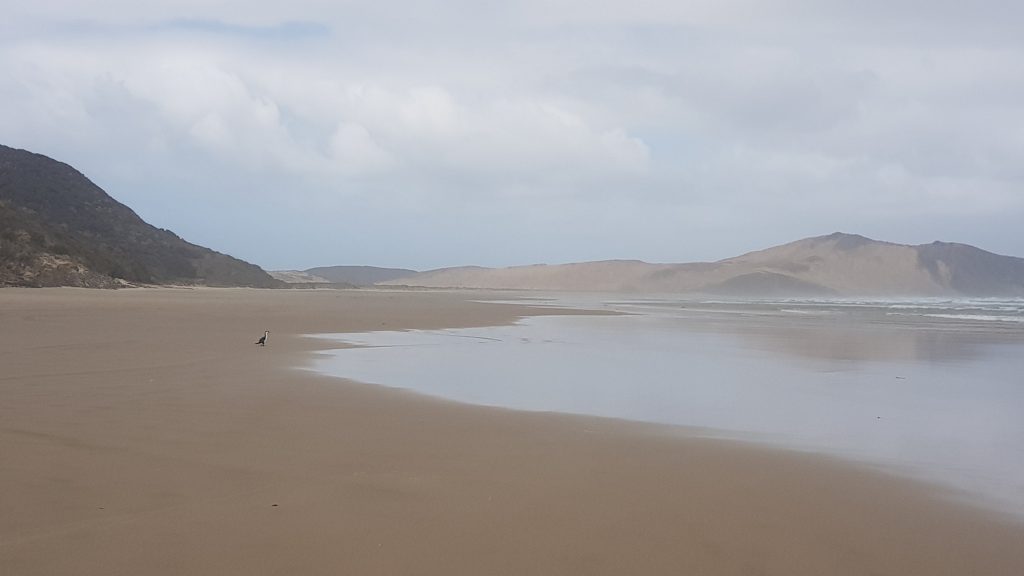
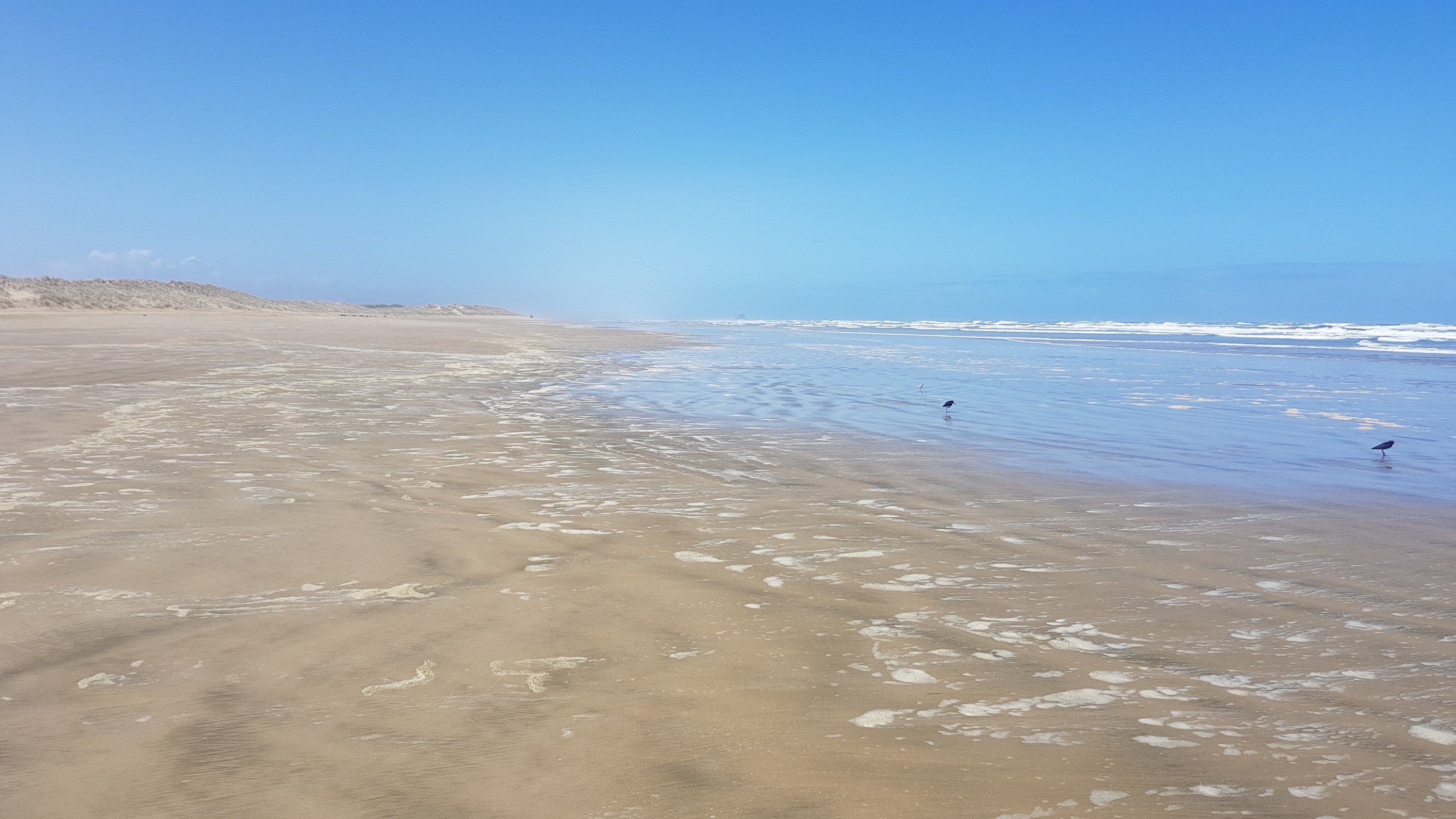
11am picture – one single bird on the beach
At the 3km mark I realised that I was 0.1% of the way through the entire trail. What a milestone! And then at 4.5km I had my first “river crossing”. It was just a small stream, but I didn’t want to get my feet cold and wet. I went up and down a bit trying to find a place I could hop across, but no – none. So walk through the water I did, and got my feet very cold.
First “river crossing”
Then at 5km I was starting to hurt a bit in my arms, so I stopped for a break as it wasn’t windy at this spot. I was surprised that I started hurting so soon – I never started hurting this soon in my training walks. But then I realised I hadn’t pulled the front two straps of my pack up tight, and after that, I was fine. I didn’t even stop again for a break until I made the 12km to Twilight. So far my shoulder that I thought might hurt hasn’t hurt even a tiny bit.
My first snack break
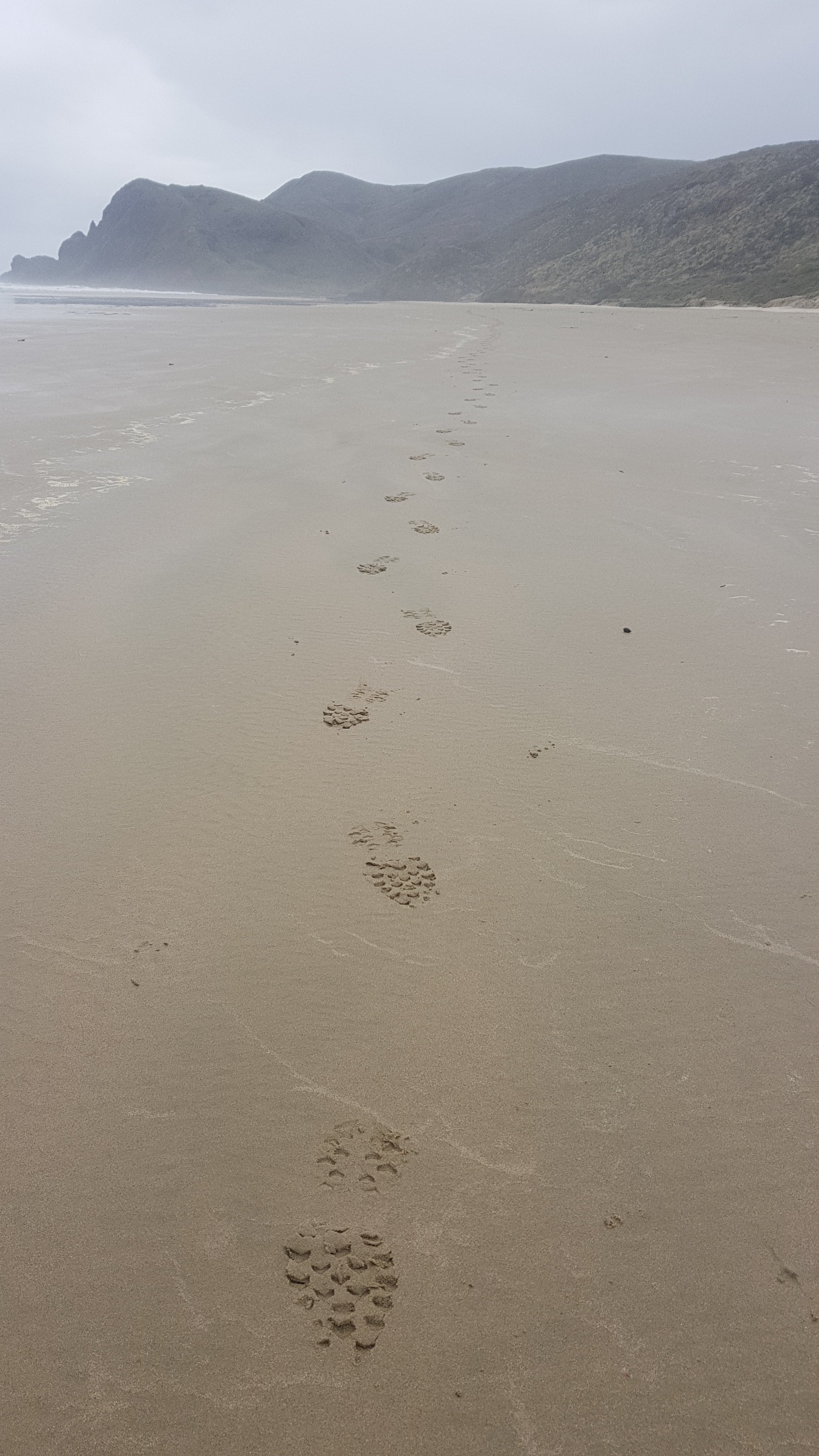
And my shoes and socks dried out in no time, because there was no more rain after that. Still didn’t see any footprints. When I looked behind me I could see only my own.
My footprints
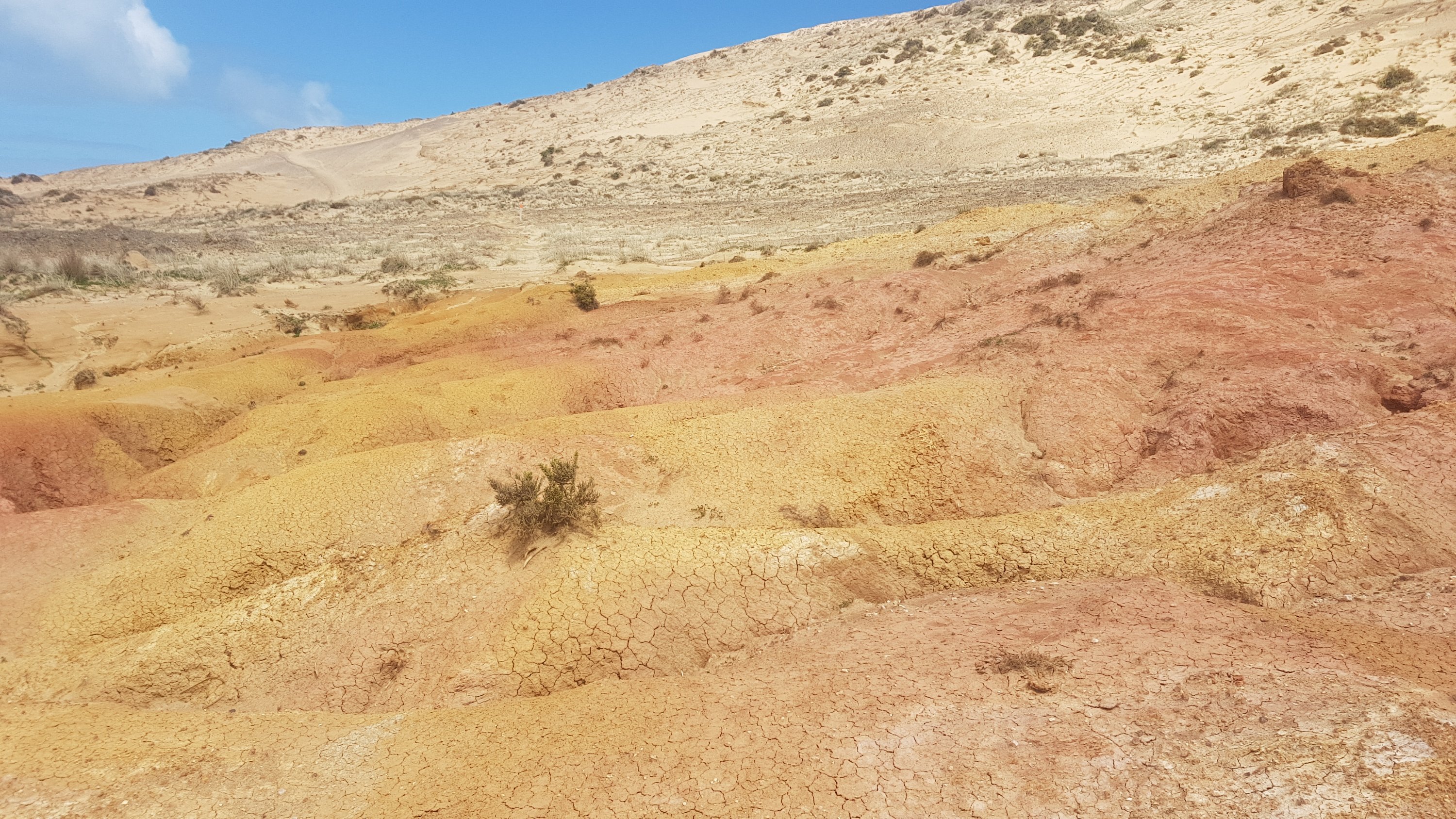
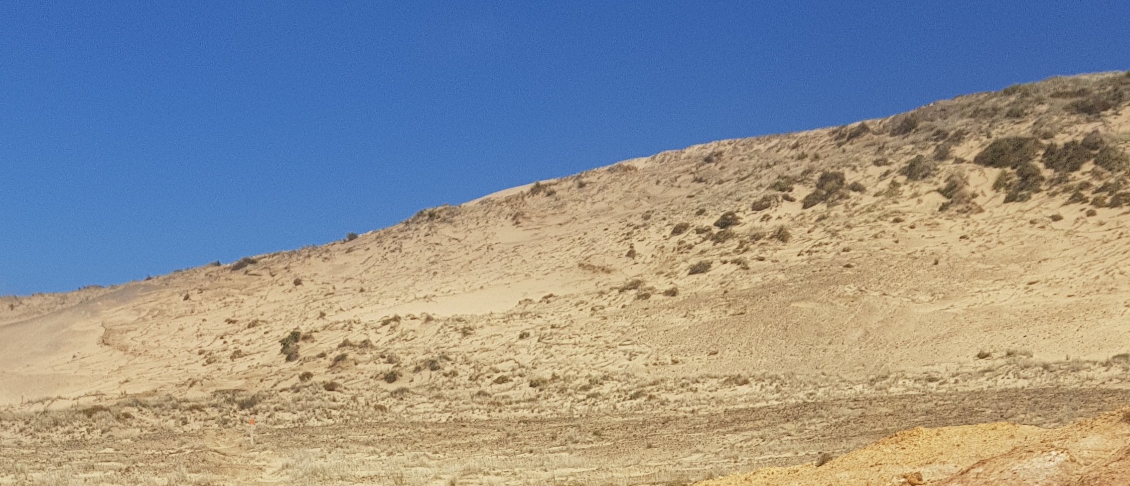
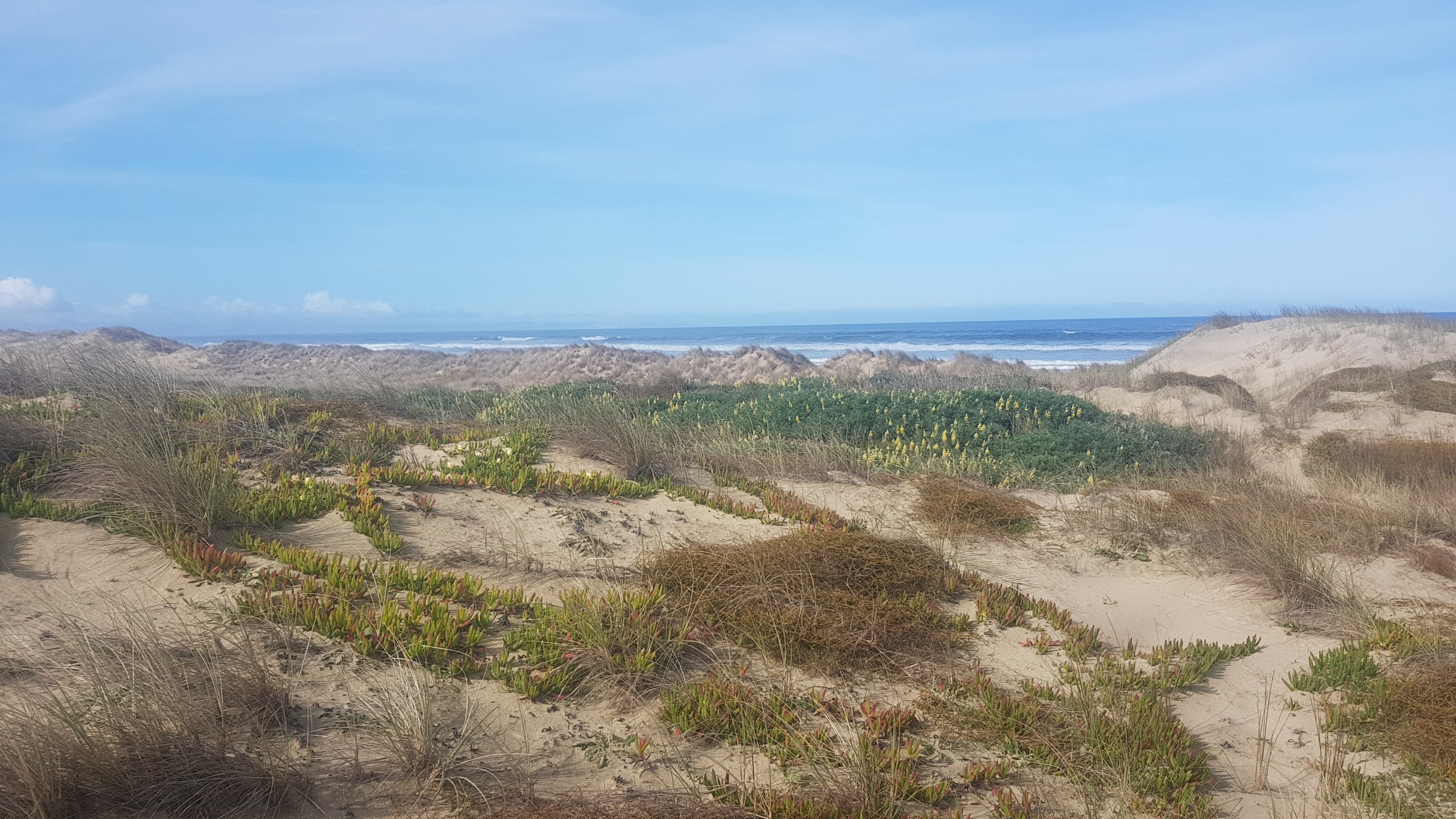
There was a point where you had to walk over a hill of sand. The wind was so strong here and I was really exposed so it almost blew me over. But it was a very cool landscape:
Love the colours
I know today was only a 12km walk but walking the beach still got a bit monotonous. Because there was nothing to think about, I started thinking about silly little internet video clips or bits from TV shows.
Whenever I wasn’t sure where to go and I eventually saw an orange marker “over there”, I would get Grandpa from The Simpsons singing “over there” in my head just before he realises the kids have trashed the house (can’t find a video for that one).
Over therrrrrrre – can you see the orange marker?
These kept playing over and over in my head but when I couldn’t think of any more, and I was away from the beach up in the hills, I just made up my own song. It went like this:
Ghost town, ghost town, it’s a ghost town Ghost town, ghost town, it’s a ghost town In here, in heerrrreeeeee
The first verse you had to sing it to yourself, and the second verse was the same but you had to sing it out loud. Then for the third verse you had to sing it in a Mr. Bean voice. Uh oh, I think maybe I’m starting to go crazy….
Once I was back down on the beach I was singing this out loud:
The tide is high but I’m holdin’ on I wanna be your number 1 I’m not the kinda girl, who gives up just like that… OOOOH NOOOOO!
It seemed appropriate even though it was low tide.
Okay that’s probably enough of that. I was lucky to only get one bit of rain and because it was so windy it was sideways rain… But I put my waterproof pack cover on and besides it all dried quickly anyway because of the wind.
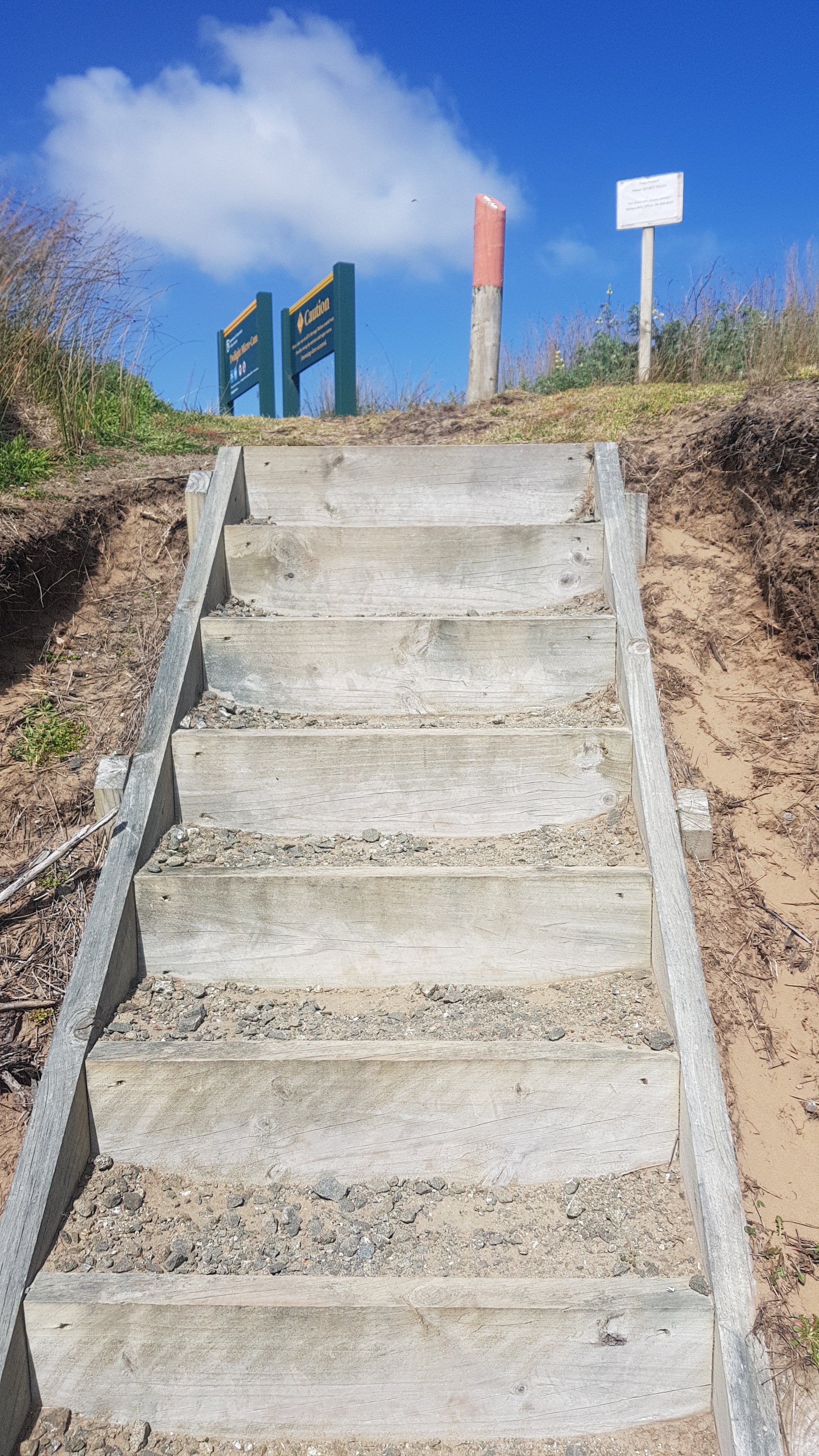
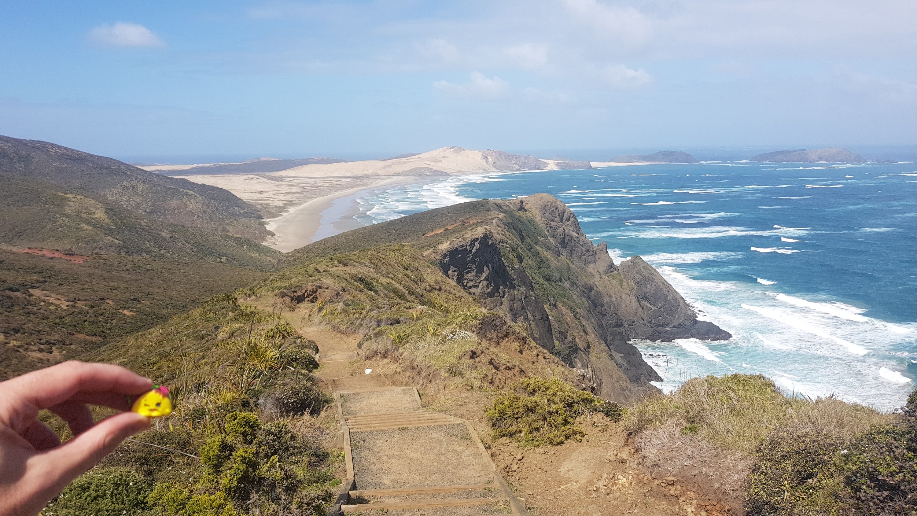
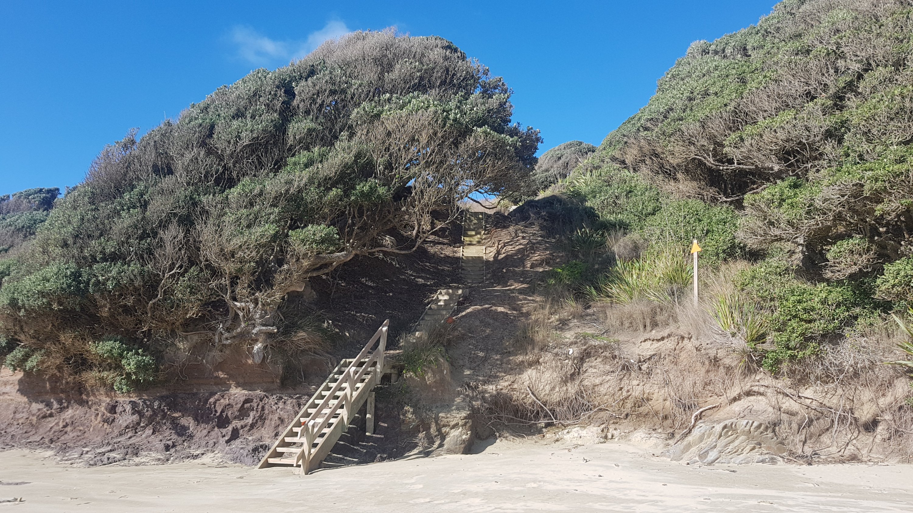
It took four hours to get to this set of stairs at the 12km mark. I had it in my head that at the top of the stairs would be a road with houses on it just as there would be on a North Shore beach. But no, it was just the Twilight campground. And since I didn’t see any other footprints all day, I wasn’t entirely surprised that I was the only one there.
Stairs to… where?
The walk tomorrow is 30km to the next campsite. If it took 4 hours to walk 12km I hope it doesn’t take 10 hours to walk 30km. I think I better get up early… Although I’ll probably go to sleep early too because there’s nothing to do here (except write this blog of course!) The tide is high tomorrow at 7am-ish so that facilitates an early start.
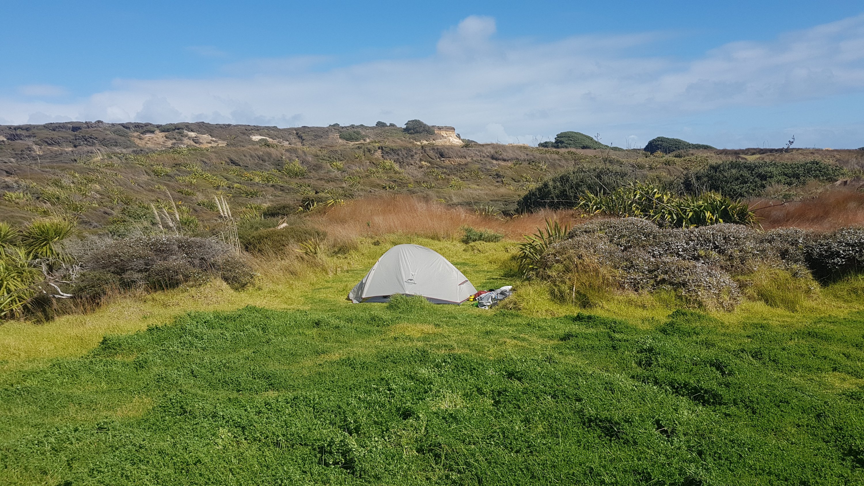
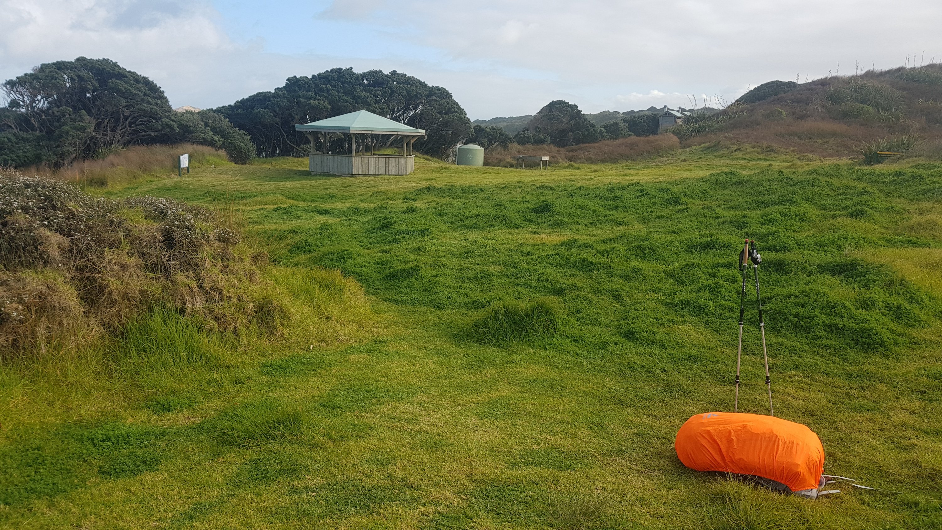
Twilight campsite with my tent in the background
I arrived at Twilight at 2pm and I really thought maybe somebody might join me in the campsite later in the day, but nope, nobody did. Today was the first sunny day in days according to the forecast so I figured maybe people would start TA today. Guess not. In fact I didn’t see anyone at all once I left Cape R. I wonder when I will see my first other hiker or other person of any kind. Apparently there is a guy walking from Ahipara north to Cape Reinga who started yesterday. If that’s true then we should pass each other tomorrow or the next day.
First camping spot
My niece gave me a toy called Taco Terry so that I wouldn’t be alone. Here’s his first photo (back at the start of the walk):
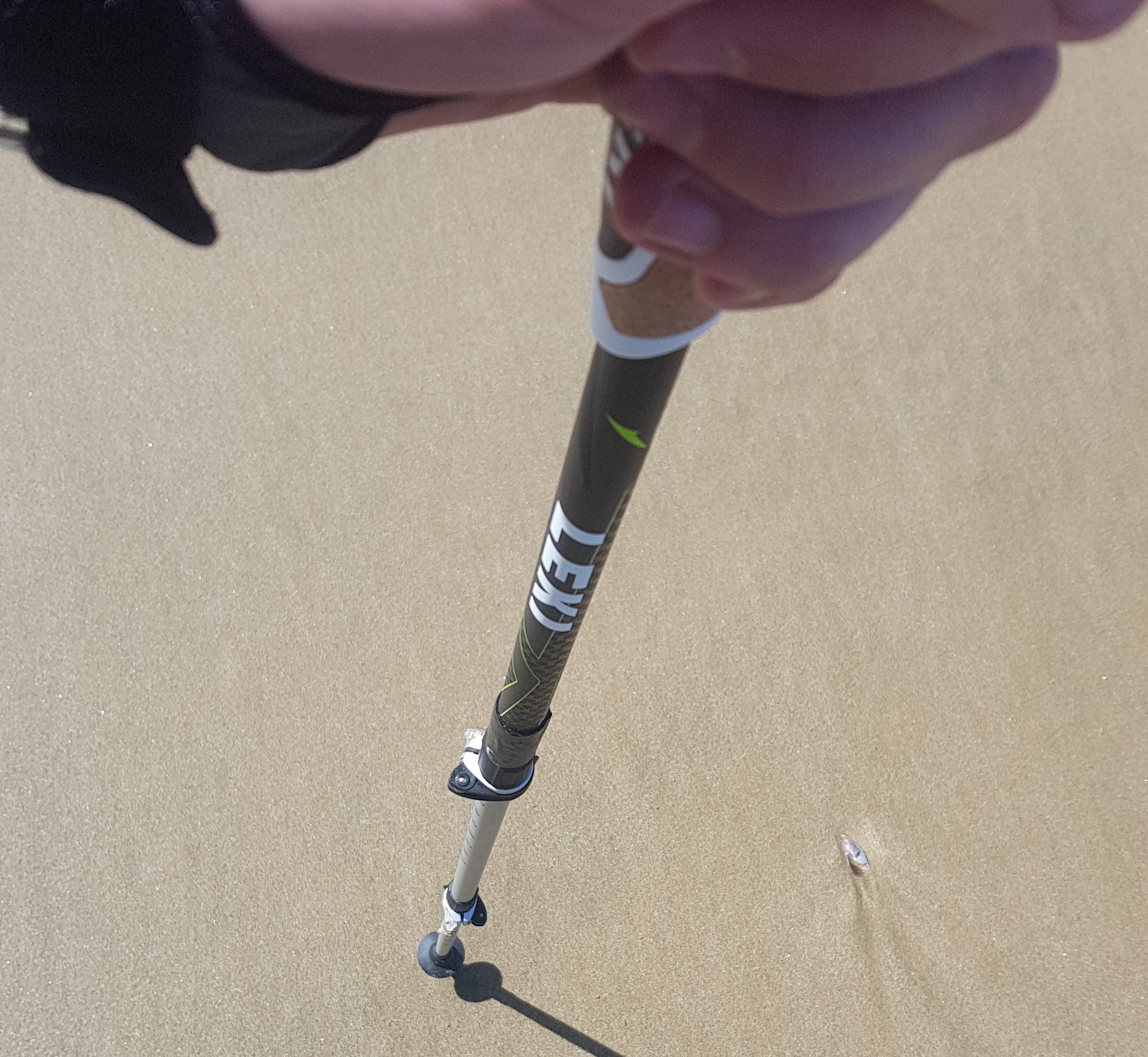
Every now and again I would look down at my hiking poles and see the Leki brand, which I often misread as “Lexi”. I had a grandmother who we called Lexi who died in 1993 and every time I saw the word I thought maybe she was watching over me.
Lexi (Leki) poles
Today was walking on other beaches than 90 mile beach, but starting tomorrow it is 3 or 4 days of walking on 90 mile beach so I will probably at least see people drive past me on the beach.
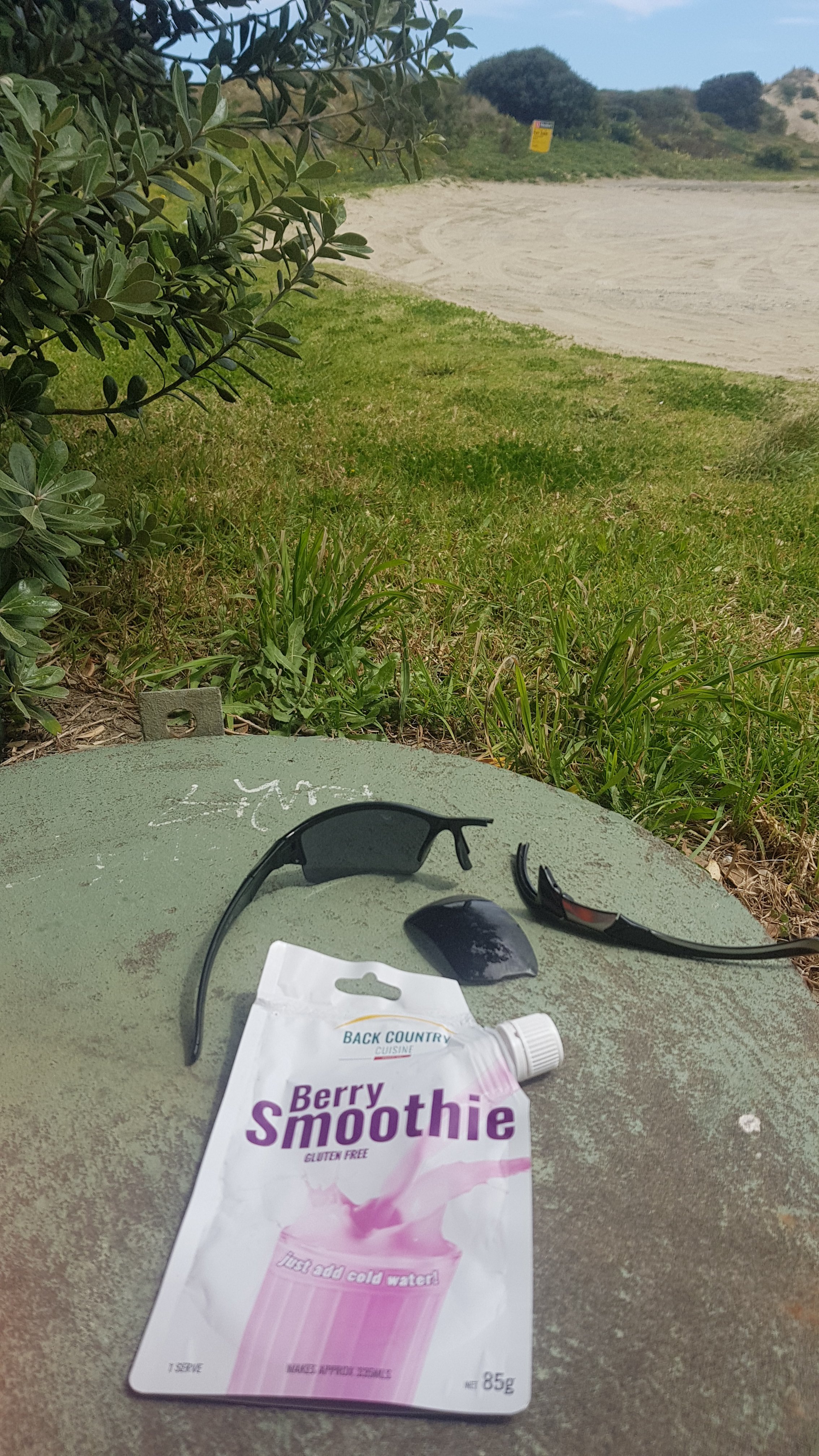
I have 3 good Back Country Cuisine meals but 4 or 5 days before I can resupply in Kaitaia or Ahipara so tonight I just had couscous, nuts and a protein bar for dinner. Plain but still tasted good. I’ll save the dehydrated meals for the next 3 days when the walks are longer. And I can’t wait for one of Tania’s famous Utea Park blueberry smoothies. They have rave reviews!
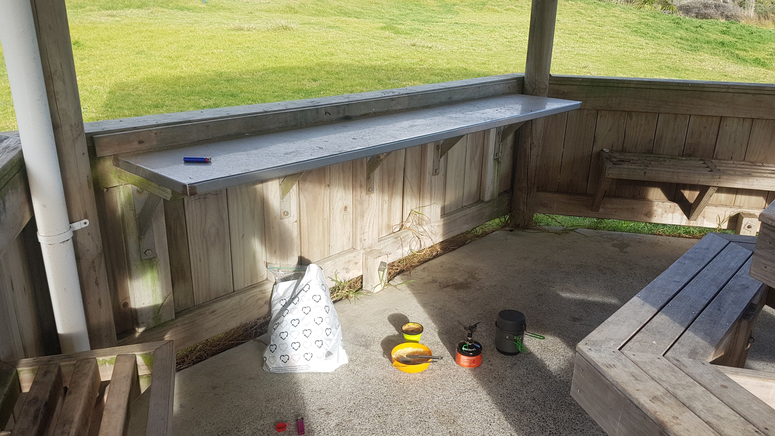
And boy was it cold once the sun went down. Bringing hot chocolate was the best decision ever.
My little cooking station, on the ground out of the blowing wind
My Osprey bag is already developing a rip inside. Its not important I don’t think because it just separates your stuff from any water bladder, which I’m not using. Will still tape it up though, and hope it gets no more rips.
Small rip in the Osprey bag already
Anyway if you look below you can see some other random photos, and also where I walked today, and how much I still have to go. Still quite a bit, it seems.
Date: 27 September
Distance walked: 31km
Trail covered: kms 12.2 to 40.1
Weather: mostly perfect
Tour buses that passed me: 2
From 1-10, how soul-destroying is 90 Mile Beach: over 9000
It’s harsh having the second place you stop at called The Bluff. It sounds so much like Bluff… which of course is where people ultimately end up if they’re crazy enough to walk the whole thing. But today I made it to the second recommended campsite – The Bluff. Maunganui Bluff to use its full name.
I didn’t get a lot of sleep last night. There was a fair bit of rain banging on the tent and the wind really picked up as well. At 1am the tent was flapping around so much I was worried about it… So I went outside and checked all the stakes. Fortunately they were all exactly where they were when I left them so that was reassuring. While I was outside I had a look at the stars. They were very beautiful, and there was no moon. It was a very quick look, the wind was blowing so hard I was freezing standing outside in just my shirt and undies.
I slept through until 6am. My view in the morning was right out into the sunrise. Although I hoped it was… or was everything on fire?
First sunrise – or is it fire?
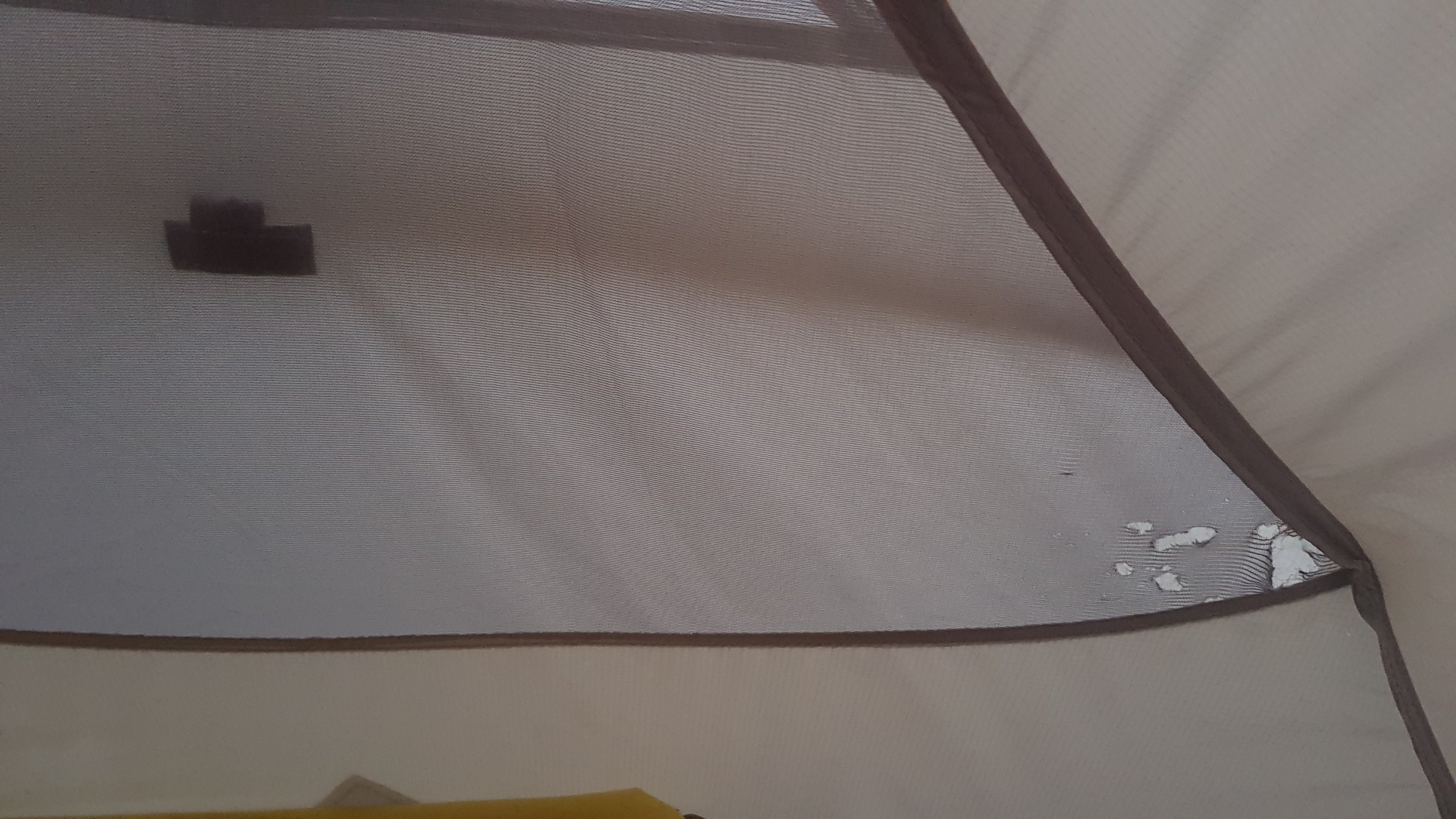
When I used the loo boy there were a lot of bugs… they took me by surprise. I thought they didn’t look like flies… more like mosquitoes, but it’s hard to say. Then I had breakfast (porridge which I burnt despite only cooking it 1 minute) and went to pack up the tent. One advantage of a real windy night is that despite all the rain, the tent was dry in the morning. Hooray! But one thing I wasn’t happy about… Holes in the mesh of my tent! On the first night! Come on… I expected things to go wrong but not on the first night. I put some duct tape over them but that’s not gonna hold. I hope it holds until I get to Kaitaia and and fix it properly (can it be fixed? I hope so!)
Rips in the mesh of the Naturehike tent
I packed up and said one last goodbye to Twilight Campsite. It was a bit emotional since as well as being the first stop on this journey it was the first place I’ve ever camped away from my car and really out of my comfort zone, and by myself nonetheless.
Goodbye Twilight campground
I knew that today was 5ks over a hill and then about 25km of walking down 90 mile beach to the next campsite. I wasn’t really looking forward to that. The hill was not too challenging, although there were lots of stairs going down. I even stopped to look for a geocache which was apparently hidden somewhere on the stairs, but I couldn’t find it. There were so many places it could be and I didn’t have the patience. And while I was looking, it dawned on me how long it actually would take to walk 30km. So after a quick snack at the actual start of 90 mile beach, I set off walking.
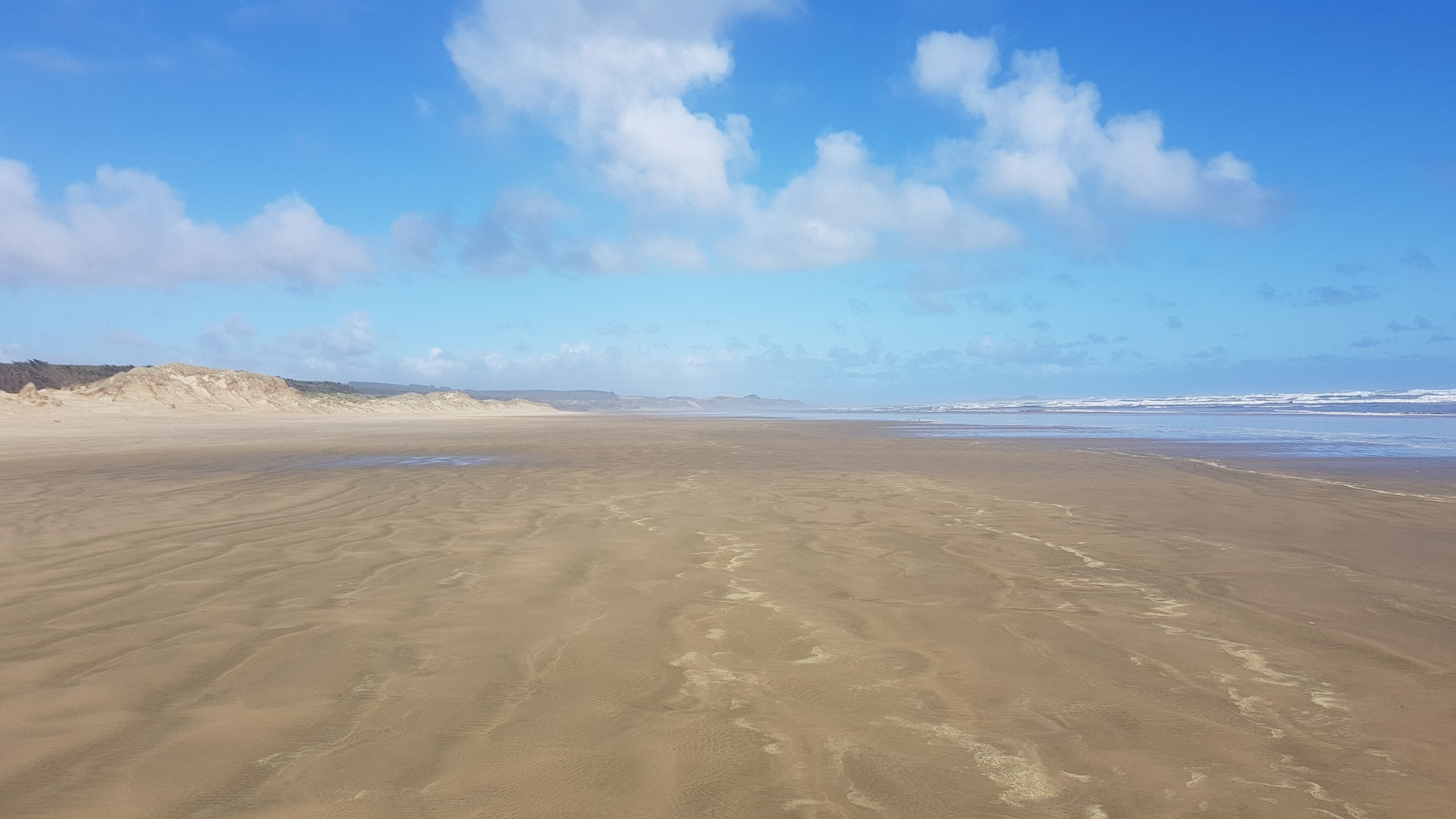
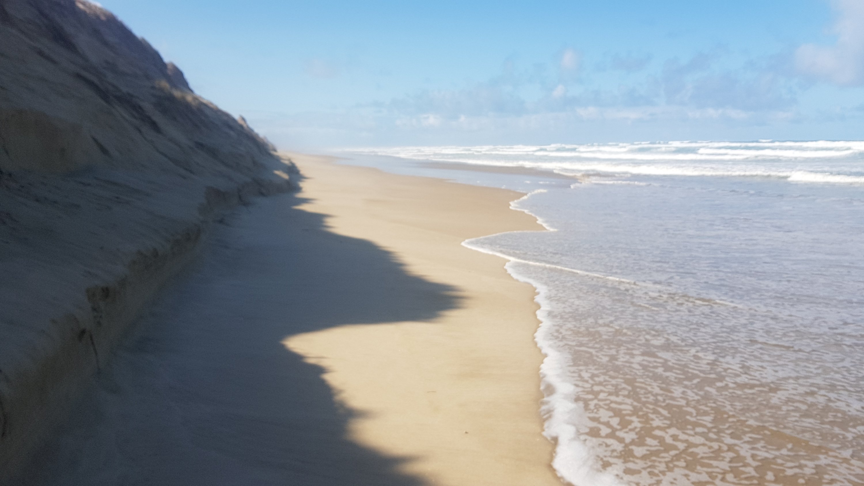
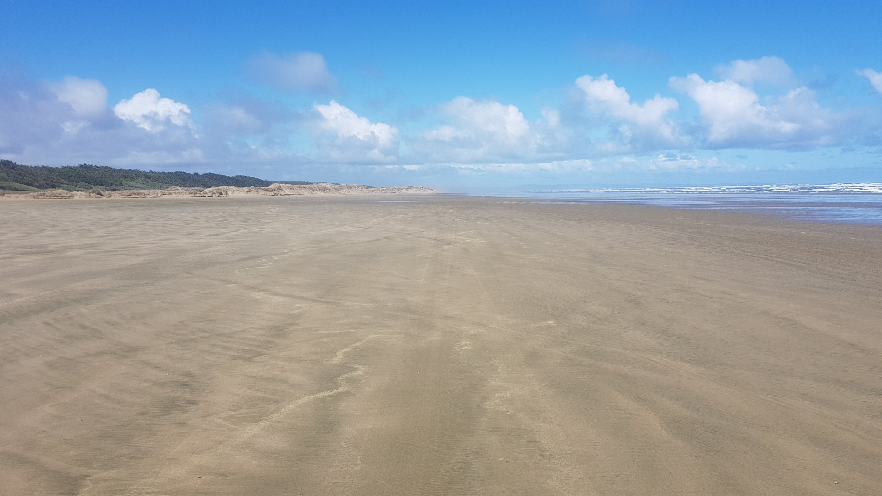
The northern end of 90 mile beach
It was pretty tedious. Not a lot happens on the beach. Here’s my 11am picture:
11am picture – birds on the beach (again)
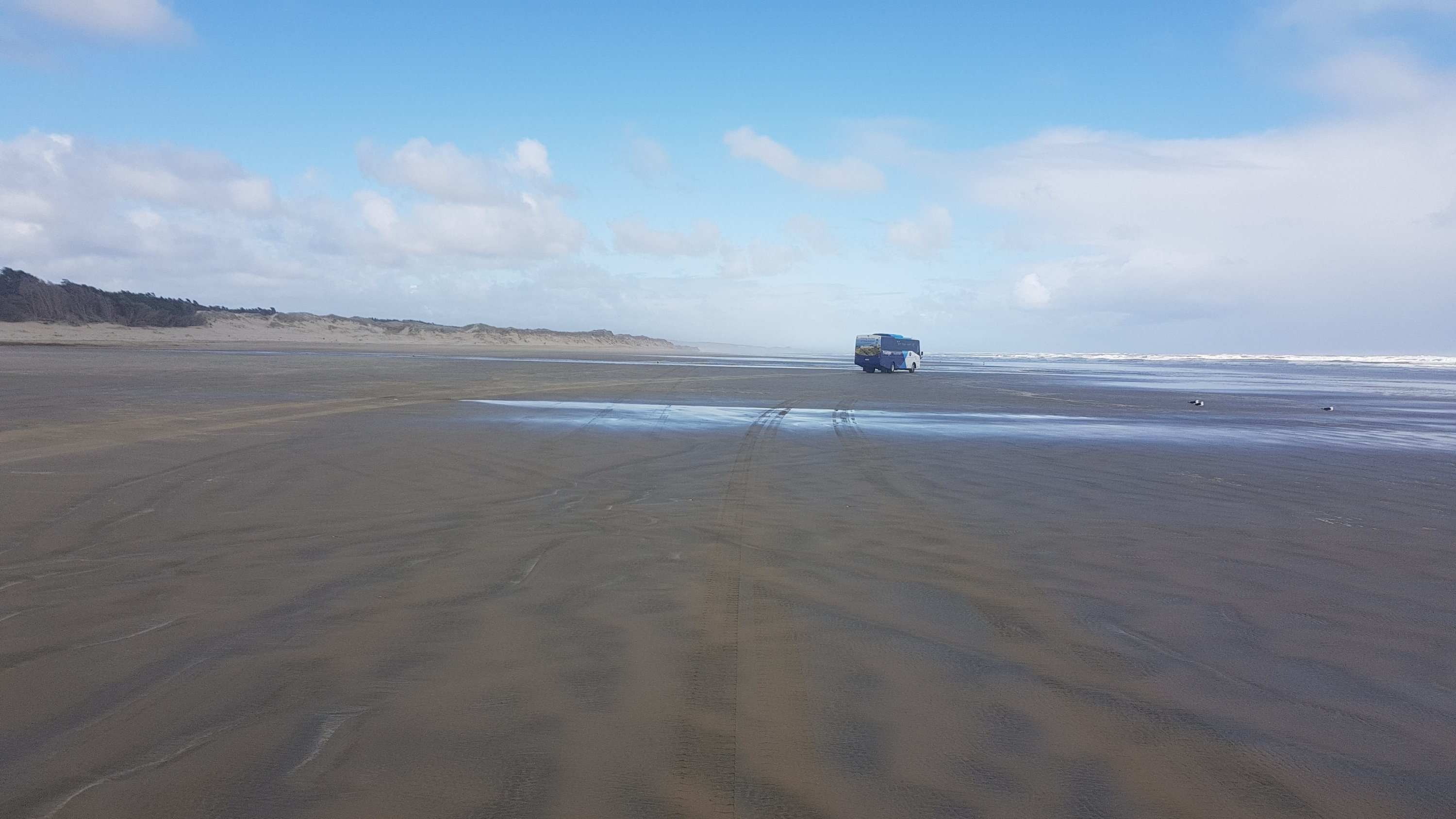
Even after all 30km, I still hadn’t seen anyone else. Well, a few cars went past down the beach (it’s an official highway) and two tour buses, but they don’t count.
Tour bus
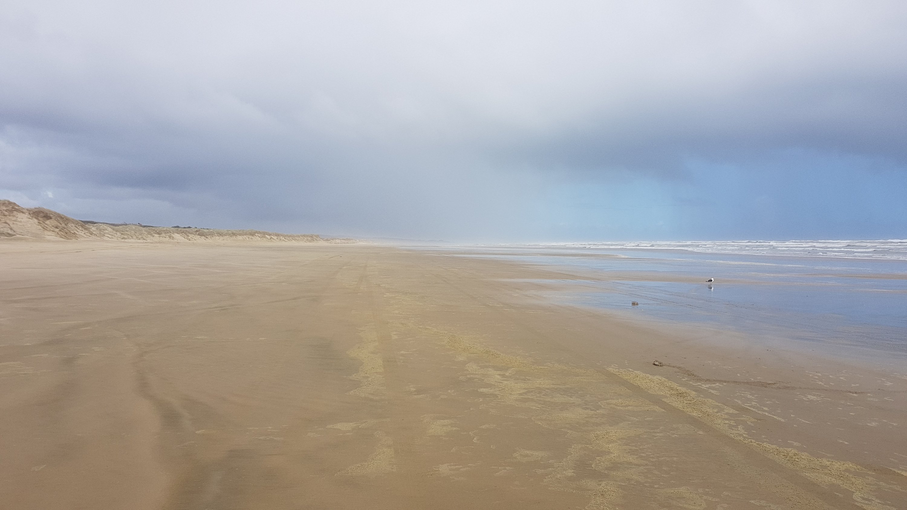
The view doesn’t even really change much, as you can see:
Another view of the beach a few hours later
I had originally set myself specific break times so that I would get to the campsite at a reasonable time. However, after a while i learned which things on my pack to tighten and which to loosen when various parts of my body started hurting. So I thought to myself that as long as nothing hurt, I would just keep walking. So I only actually stopped at 10km to look for another geocache (again unsuccessfully), 18km when I felt a blister coming on and 23km when there was a bit of rain coming and I put my jacket on.
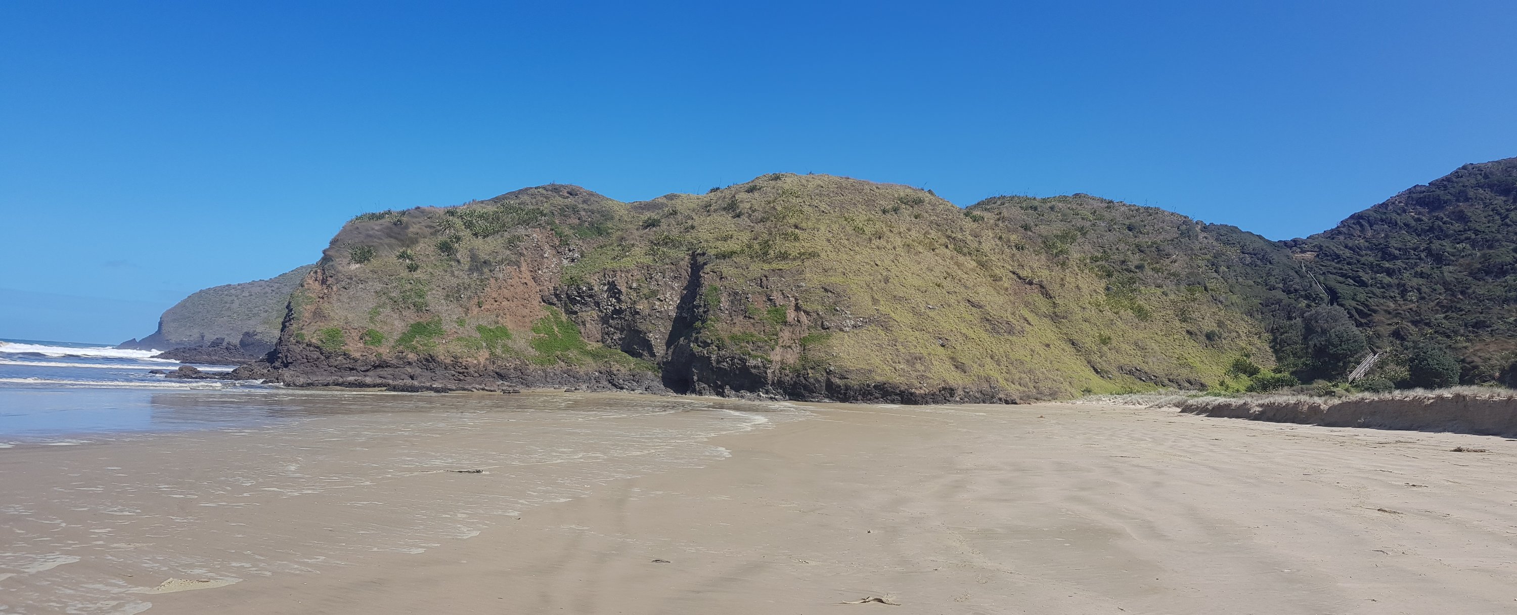
I could see The Bluff from about the 15km point, and it was in my vision the whole time from then on. It very very slowly got closer. It reminded me of the Auckland Marathon, where once you reach the 31km mark, you can see the city centre in the distance where it finishes, but it never seems to get any closer.
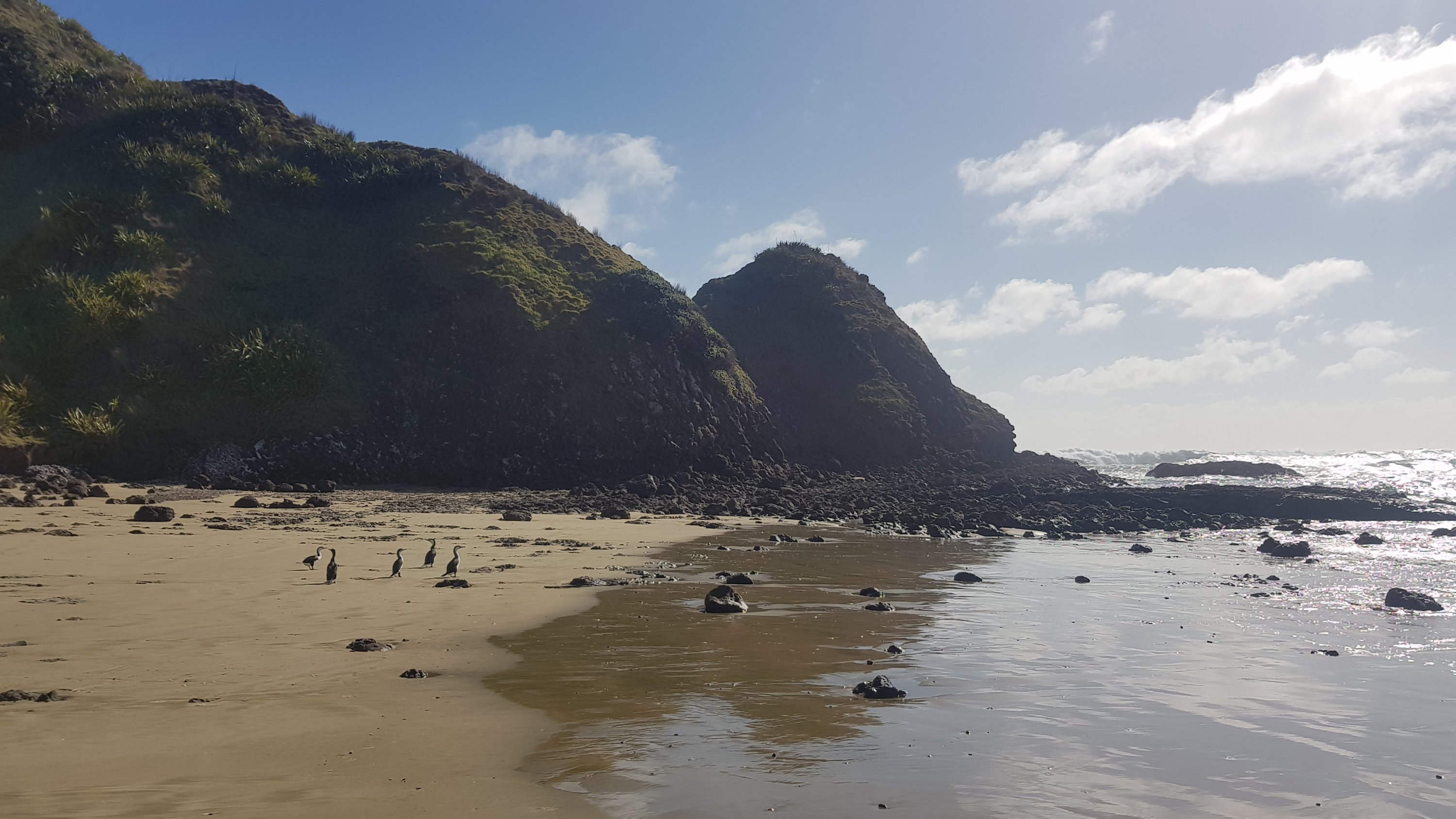
Maunganui Bluff – the little bit of land sticking out into the sand
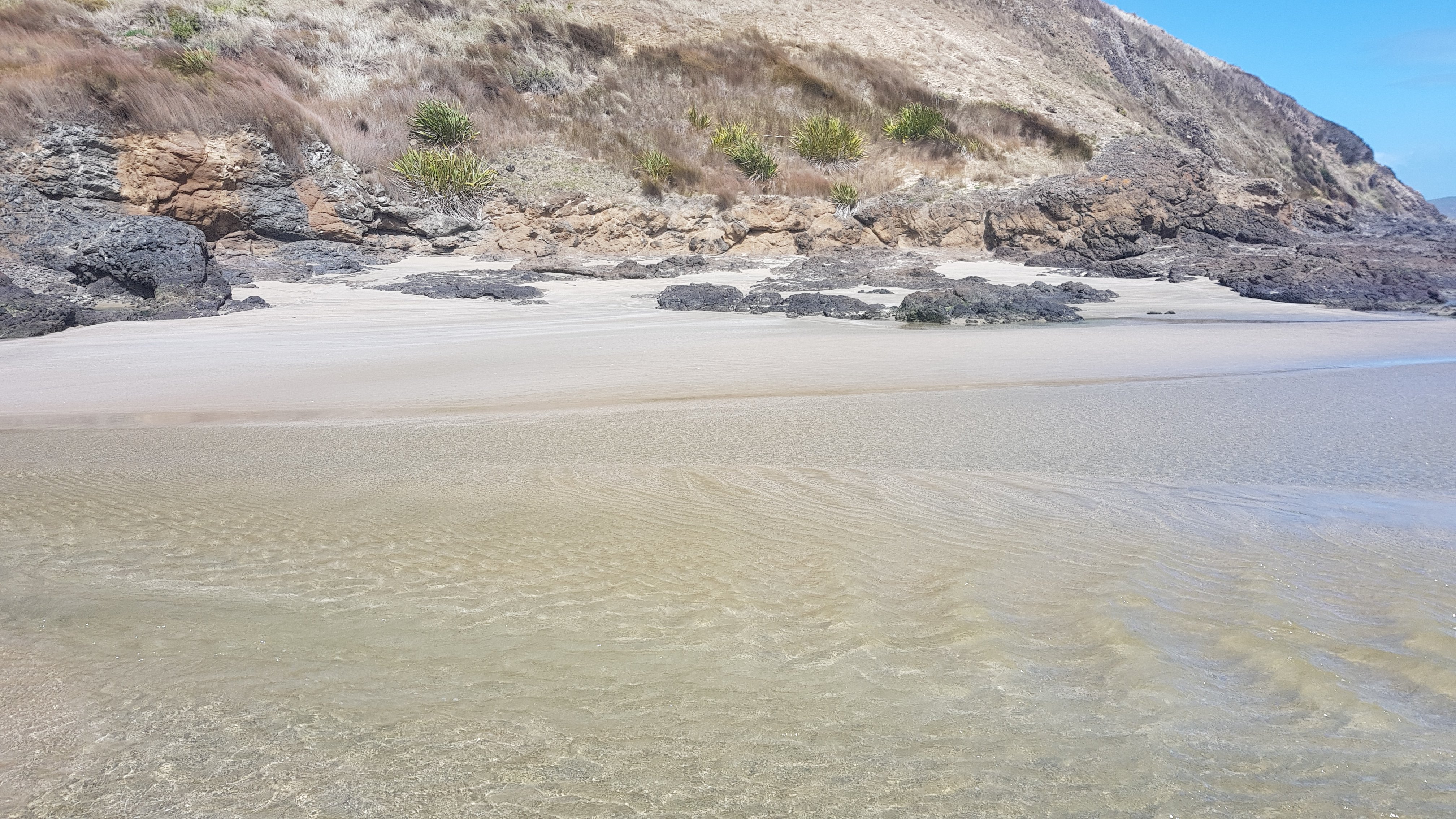
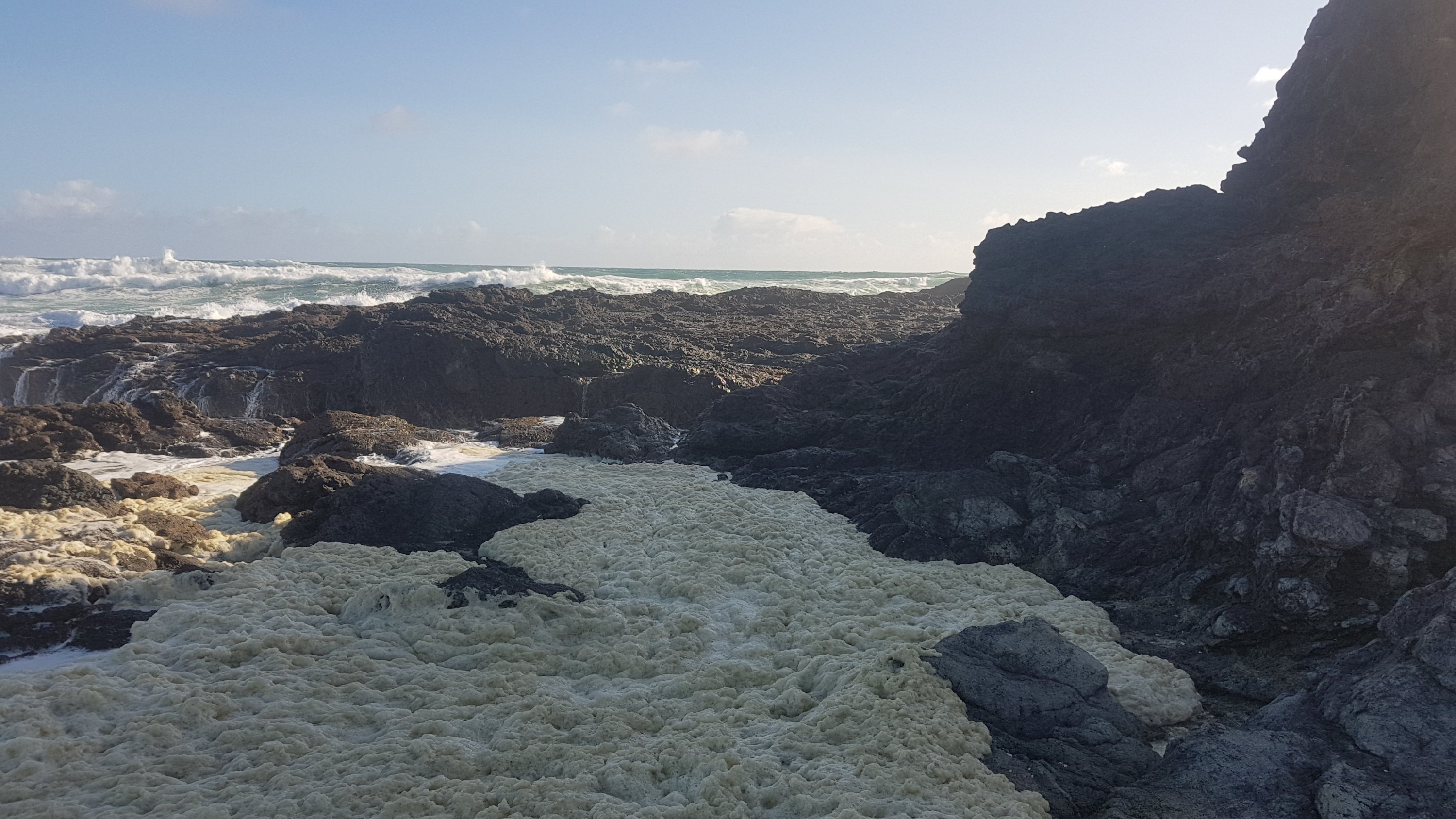
Despite having just walked 30km, I detoured off the trail a bit and walked out onto The Bluff itself which can only be reached at low tide, so I might not have another chance to go out there. I’m glad I did, the water there was really rough and there was this weird foamy stuff that looked like it was bubbling, like some kind of alien goo.
Alien goo. It wasn’t static like this photo shows, it was bubbling quite intensely.
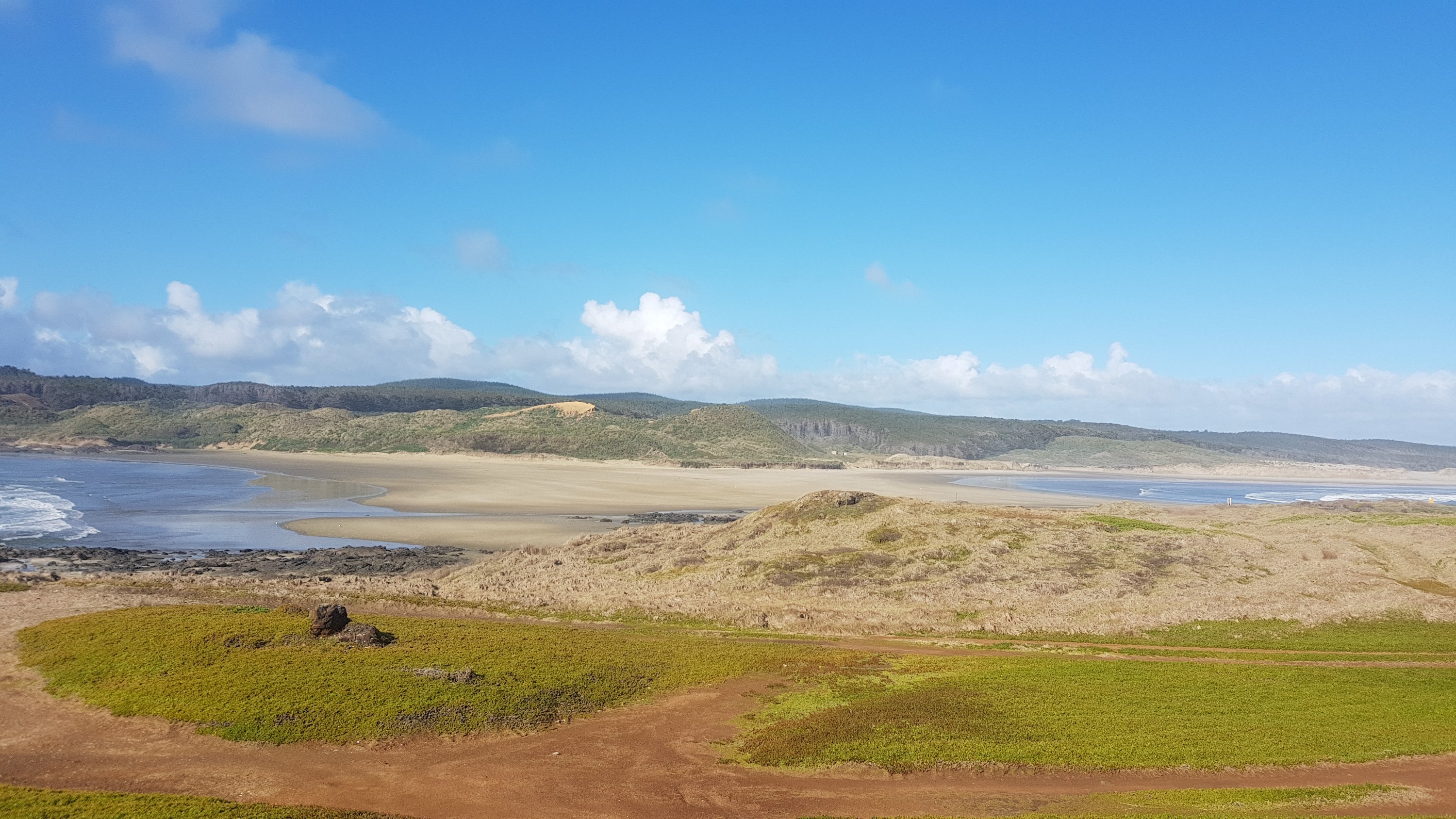
As the tide came in, you could see the water coming in from both sides across a thin bit of sand (a tombolo I believe it is called – thanks again, geocaching). There are three geocaches in this area and I found all three.
Looking towards the campsite across the tombolo
Onto the campsite, and there were lots of people on motorcycles – a big group of them who had a caravan set up. I went over to talk to them because I hadn’t seen anyone since I left the Cape, but on the way over I saw two guys who looked like hikers, so I talked to them instead. Finally, I get to see and talk to someone else! There was Ernest, who said he had seen me on the bus, but I hadn’t seen him, and there was Rhydian who recognised me from Facebook. Small community, isn’t it!
Ernest is the guy that I mentioned in the last post who was walking north up the beach from Ahipara to Cape Reinga because then the wind would be behind him. Not a bad idea yesterday, but today the weather was perfect except for just a small bit of rain. There was a little wind but not too much, a bit of cloud so the sun wasn’t too strong, and not too hot. Once Ernest gets to Cape Reinga he plans to hitchhike back to Ahipara and go south from there. Rhydian is walking south like me, he started a day before me but he took his time getting to The Bluff, so I caught up to him. So I am sure I will run into both these hikers again.
This campsite is quite nice, there is horse poo everywhere and apparently wild horses usually roam the campground but I didn’t see any tonight. I think all the motorcycles scared them off. There are 5 or 6 of these motorcycles and they are so loud, going round and round and round the campsite. I hope they don’t go all night.
I set up my tent as far away as possible from the big group of people with motorcycles and then the three of us made dinner together and had a good chat. I had a Back Country Cuisine Mexican Chicken which was pretty good. Nice not to have couscous three nights in a row.
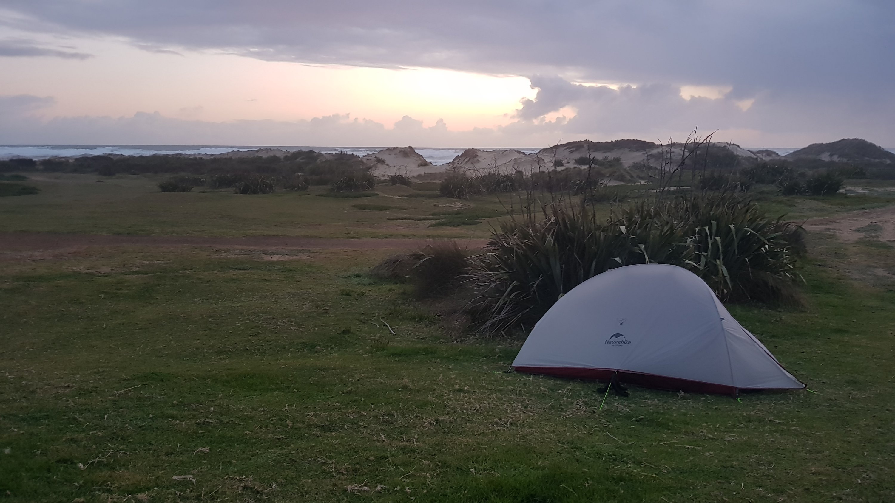
My campsite on day 2
And then when it got too dark to see and the wind picked up a bit and it became freezing cold, we all went to our tents, where I’m writing this now. Less wind should mean a better sleep but boy the bits between my shoulders and neck are sore. I don’t know how I’m going to carry that pack another 30km down the beach tomorrow. Hopefully some sleep will help with the pain.
At least I will have Tania’s famous blueberry smoothie waiting for me at Utea Park! And actually they also have a hot shower. Lying in the tent I am really starting to think I need a shower – it doesn’t smell nice.
Date: 28 September
Distance walked: 30.2km
Trail covered: kms 40.1 to 69.4
Weather: Perfect
Number of geocaches found: 1
Number of irritating campers with motorbikes at 7am: 6
I’m not entirely surprised this morning that all the people with the motorbikes started riding them around and around the campsite starting 7am. They have all of 90 mile beach, but no, around and around the campsite they went. And this was after they were playing hide and seek at 9:30pm last night with a torch which they kept shining into the tent so that didn’t help with sleep. Not a brilliant start to the morning. I’m going to have my breakfast and pack up and go even if it is high tide.
Rhydian left just after 7am, so I figured he was going to beat me to Utea Park campground today. I didn’t end up leaving until about 9am, which was only half an hour after high tide. It’s noticably more uncomfortable walking at high tide. The sand is softer, the waves keep coming up to you forcing you to run away or get wet, and when idiots drive down the beach they’re much more of a menace when they and I are both sharing a very small bit of wet sand.
Starting out today at high tide
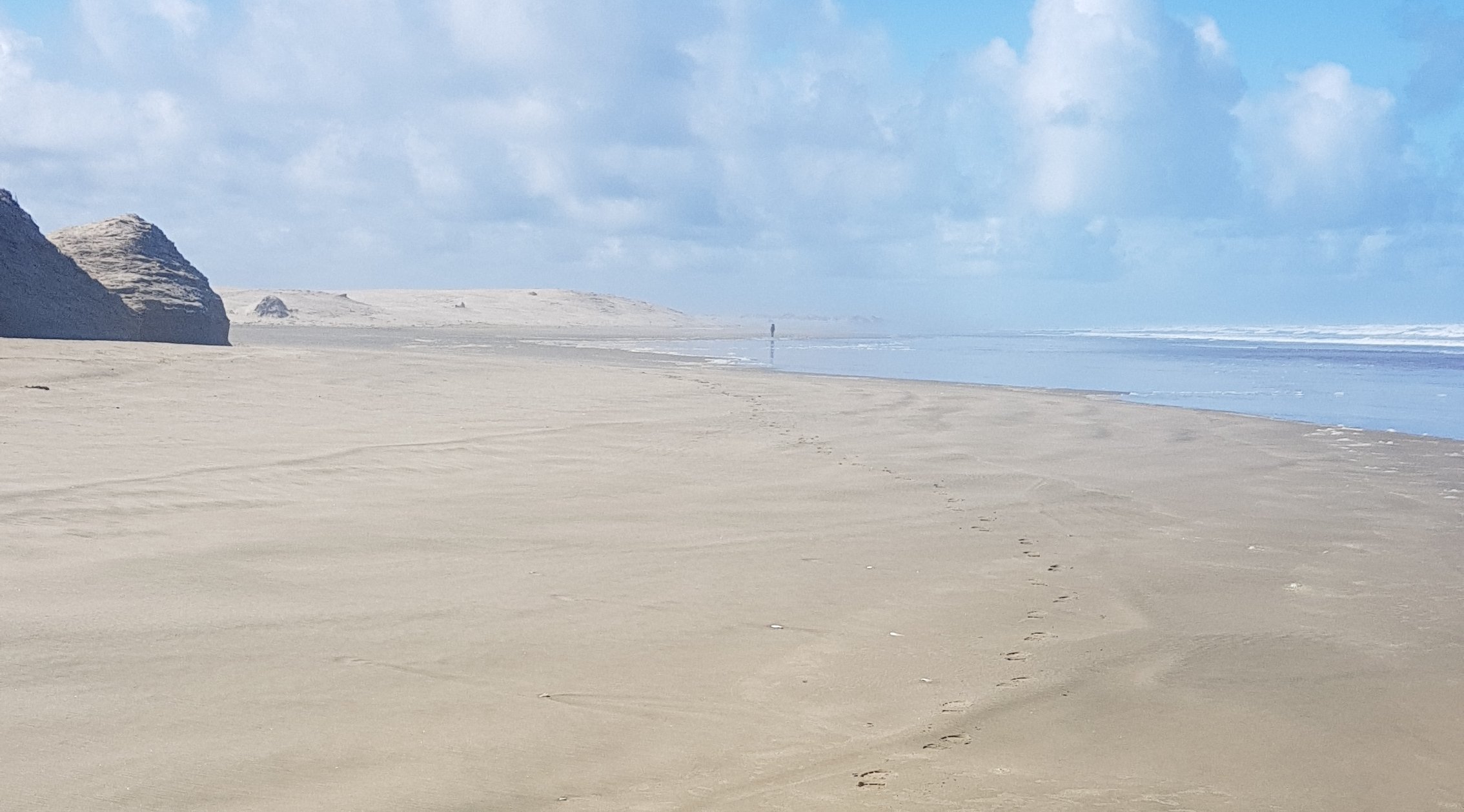
It was only an hour or so before I spotted a person in the distance. It had to be Rhydian, nobody else could have been walking that way without me knowing. He seemed to be walking slowly – I caught up to him fast.
Footprints… and competition in the distance
Despite that, once the tide fell away, I felt a lot better today while walking. Much better than yesterday for some reason, even though it is my second 30km+ day of hiking in a row. Maybe because it’s not raining, or knowing that there actually are other hikers out there?
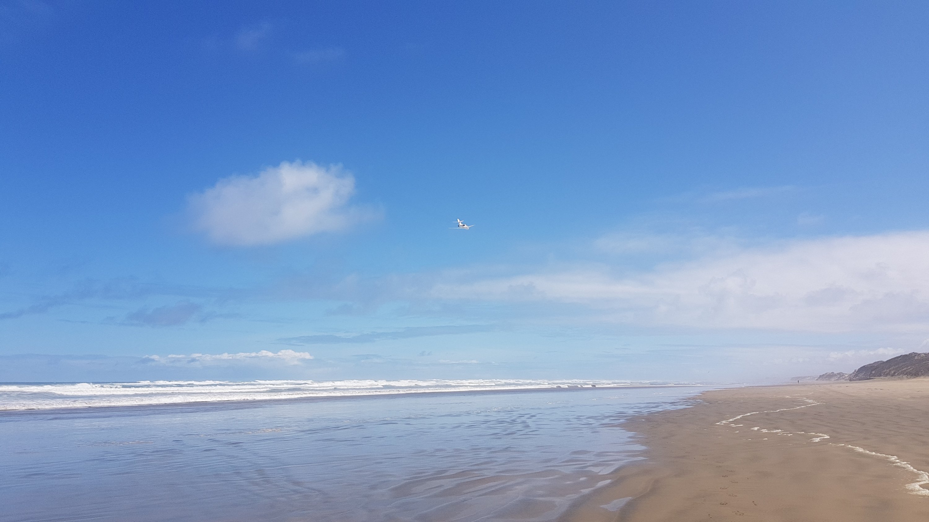
I went to get my phone for the 11am picture and literally just as I did, this plane flew down the beach, flying really low. I wish I got my phone out a bit quicker to catch the front of the plane, but I still got a picture of the back. I chose the shorts I’m wearing because from past experience wearing these shorts while running I knew my phone wouldn’t fall out of my pocket while I am walking on any future rough terrain, however that has the added drawback of it taking a few seconds to get my phone out of my pocket when I need it.
11am picture – a plane flew past at exactly 11am (click for larger)
I stopped and found a geocache only 100m or so inland from the beach at the 12km mark. It was my only break today because I was feeling so good and not hurting at all. I spent about 45 minutes resting and eating lunch. When I went back out onto the beach to continue my journey… was Rhydian behind me or in front for me? I had no idea! There were no footprints in front of me again, so I assumed he was behind me.
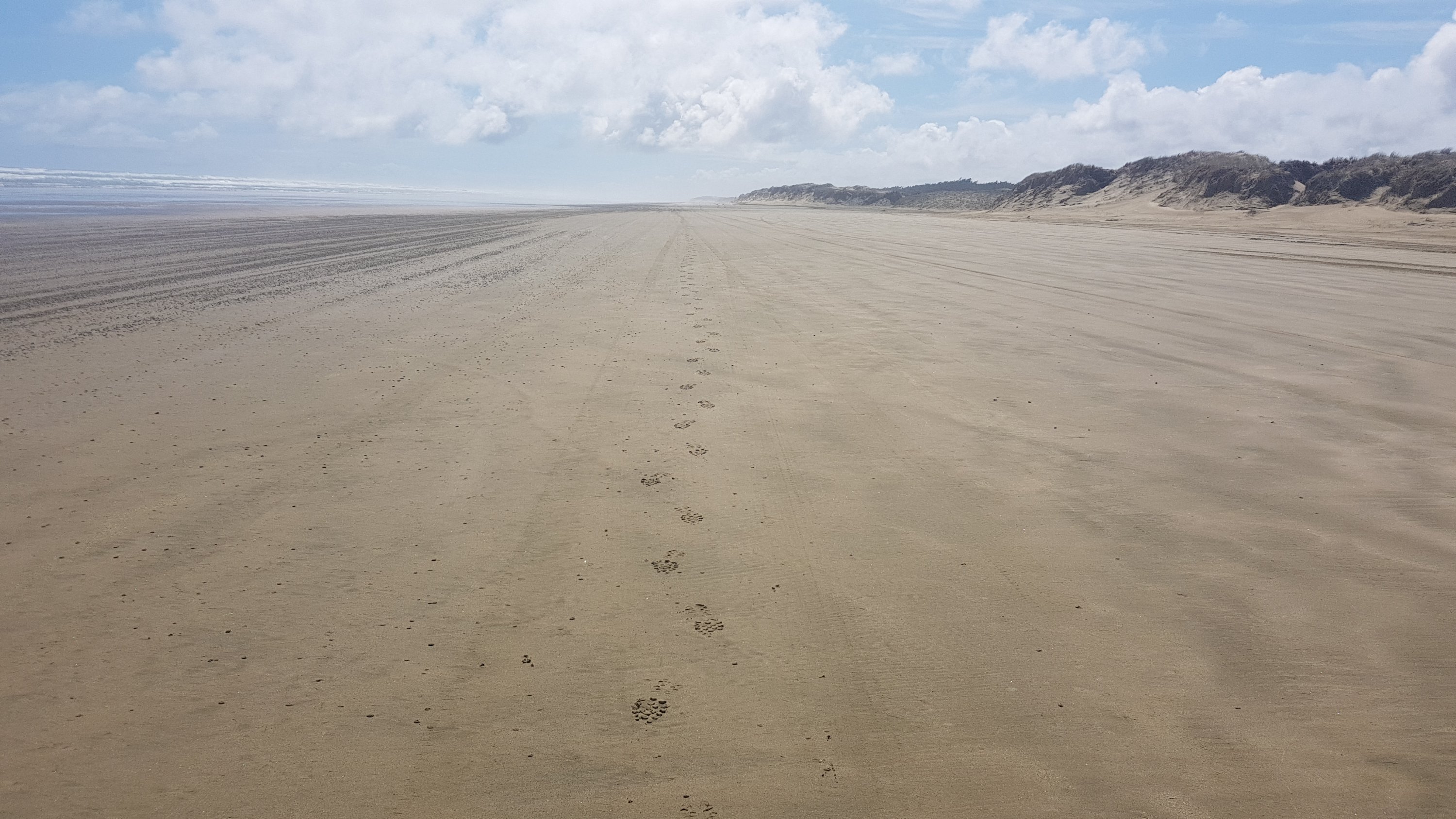
Only my footprints when I look behind me (again)
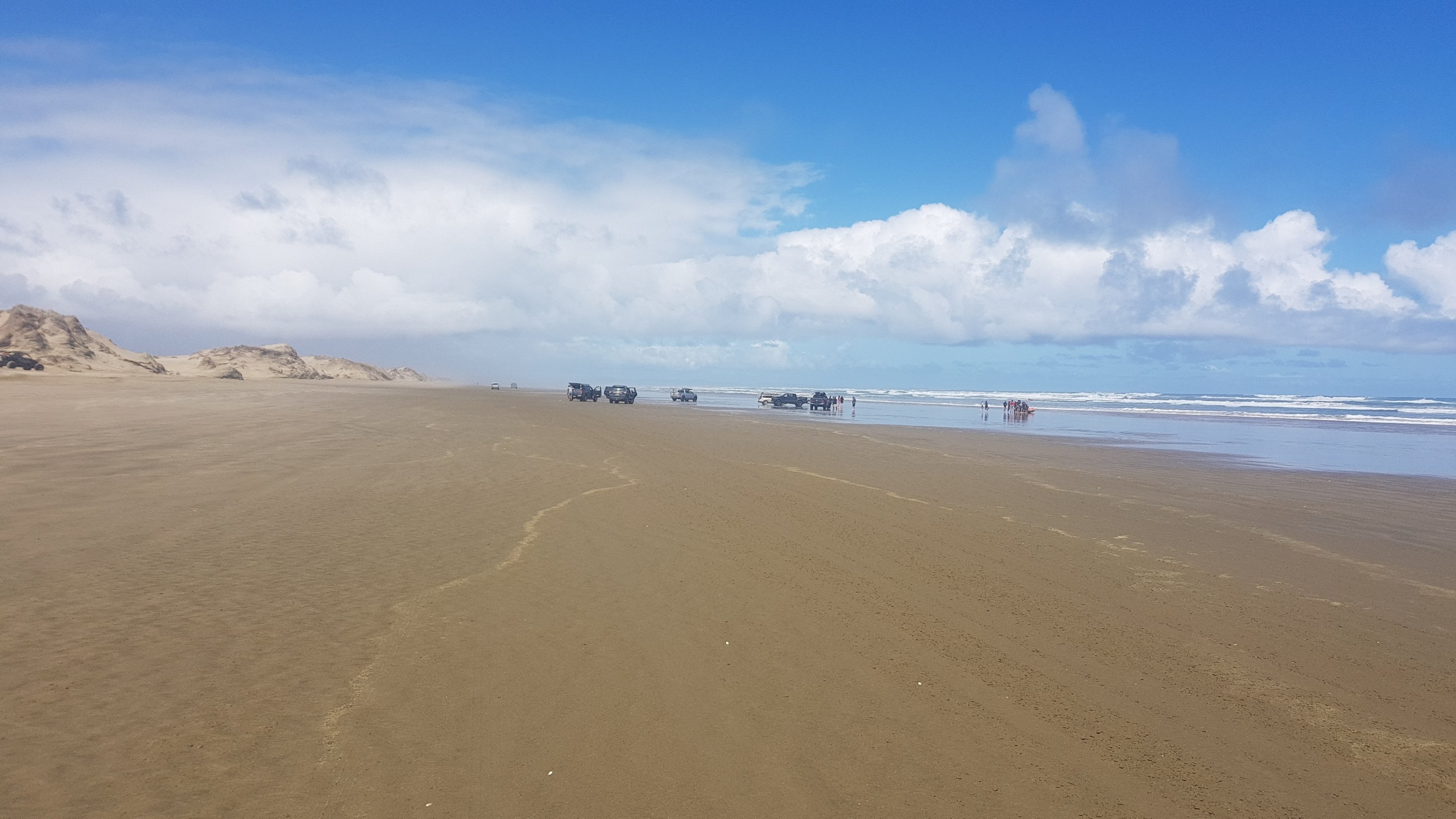
I knew I had another 18km of beach walking today, for a total of 30km, and I feared it would be highly monotonous. But at 13km I passed a lot of people parked around a couple of little lifeguard boats. I thought maybe somebody was in trouble as there were more people here than I had seen on all the rest of the beach put together. But no, there was some kind of lifeguard training on today. The commotion here was that one particular lifeguard boat had a bung motor and everyone was trying to fix it.
Commotion on the beach – well compared to the serenity up to this point
I talked to one of the women there as I walked past. She asked if I had just started the Te Araroa trail. Obviously some of the locals have heard of it and know that it goes down here.
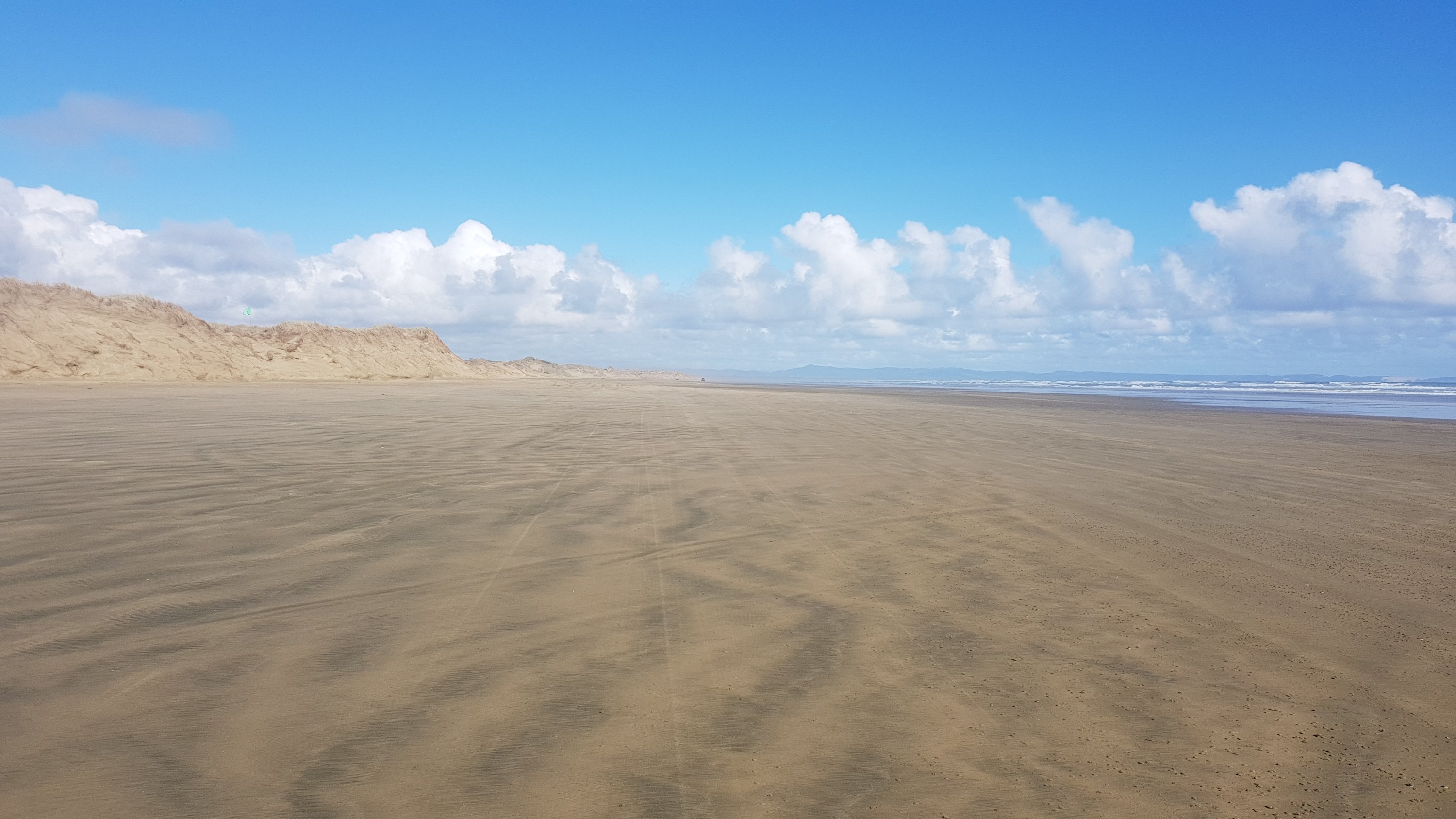
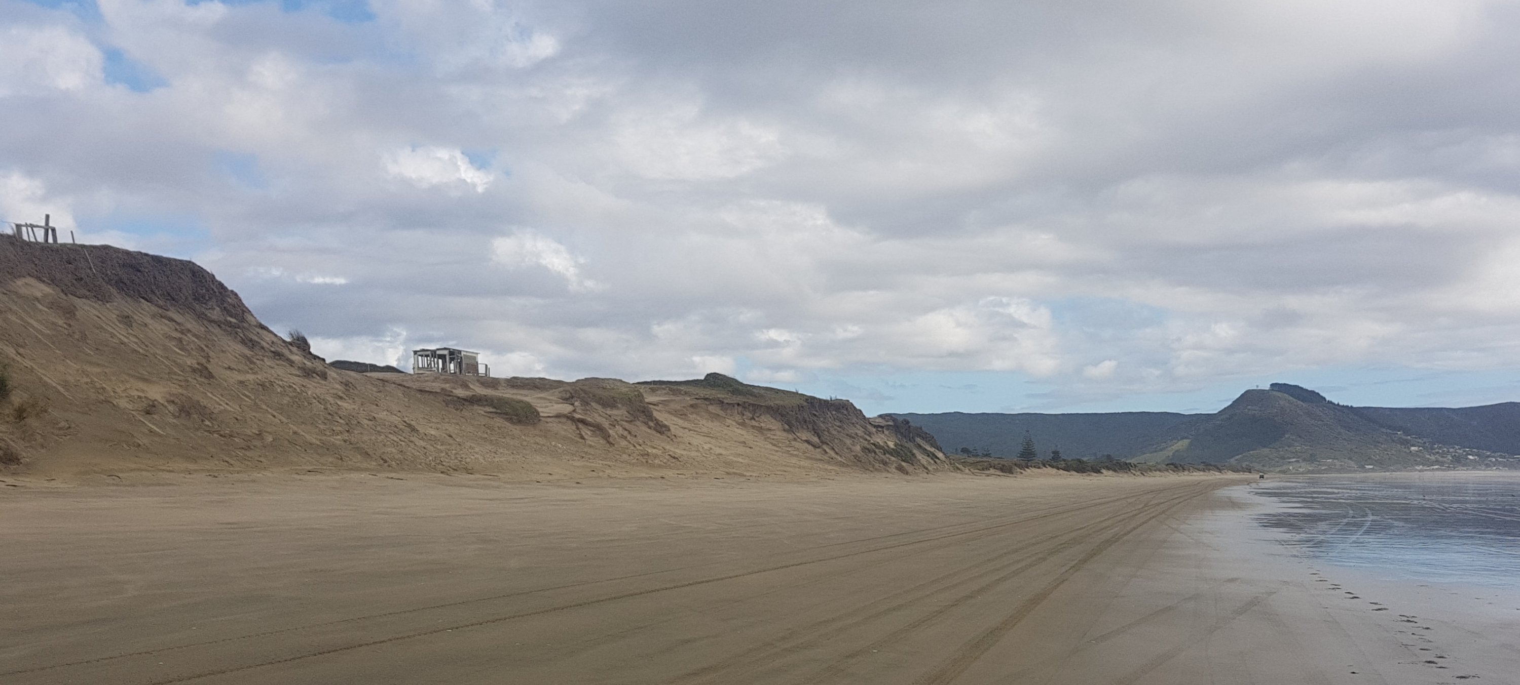
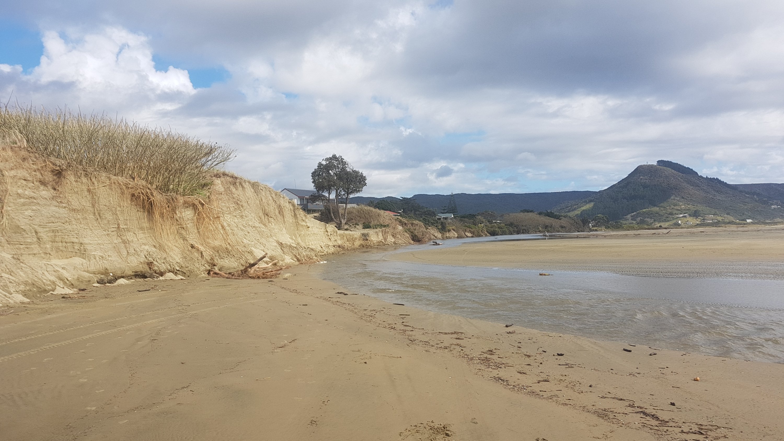
At the 15km mark I could finally see the Ahipara hills. I wasn’t sure exactly how far away these were, but I knew that they were at least another 30km walk tomorrow, or possibly even further.
Hills near Ahipara way in the distance
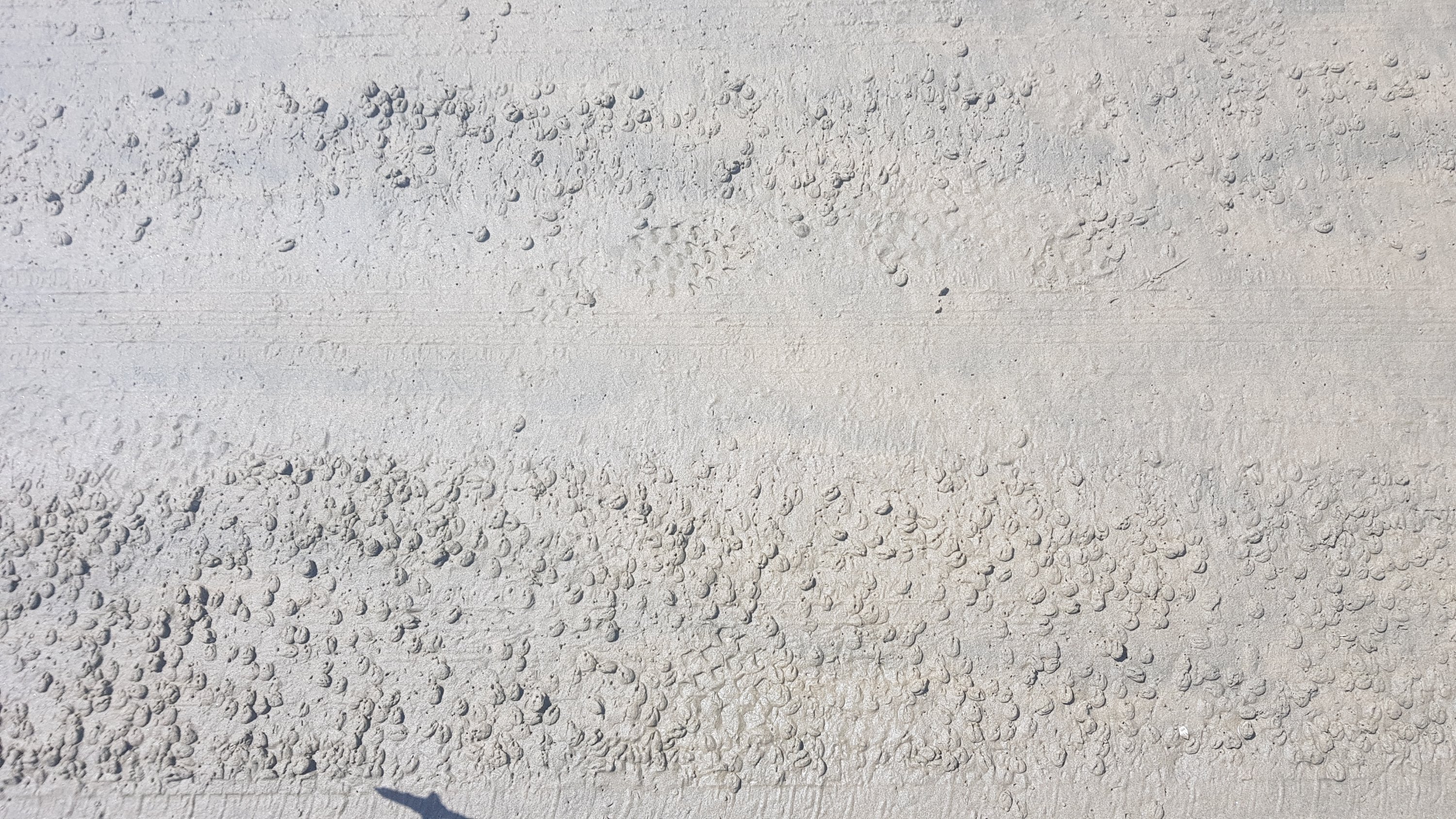
I also started seeing this weird formation all along the beach, which I hadn’t seen further north. Lots and lots of these little sand holes. They looked like big Honey Puffs (a breakfast cereal you can get here). When I put my walking stick into them, water squirted out of the holes. They were everywhere. I meant to ask someone local what they were, but I forgot. I may now never know.
Weird formation – what is it?
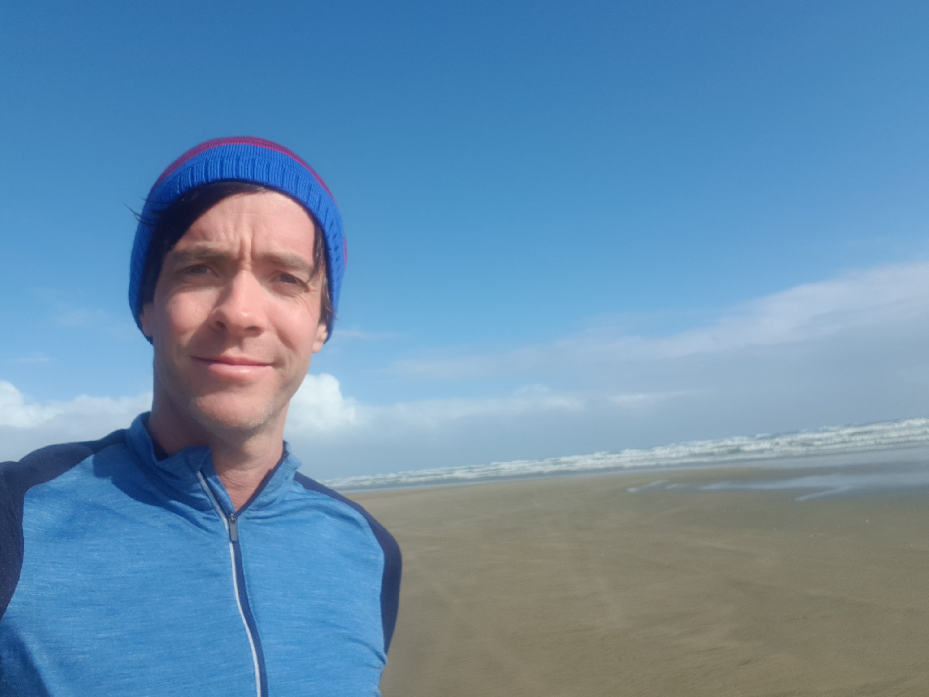
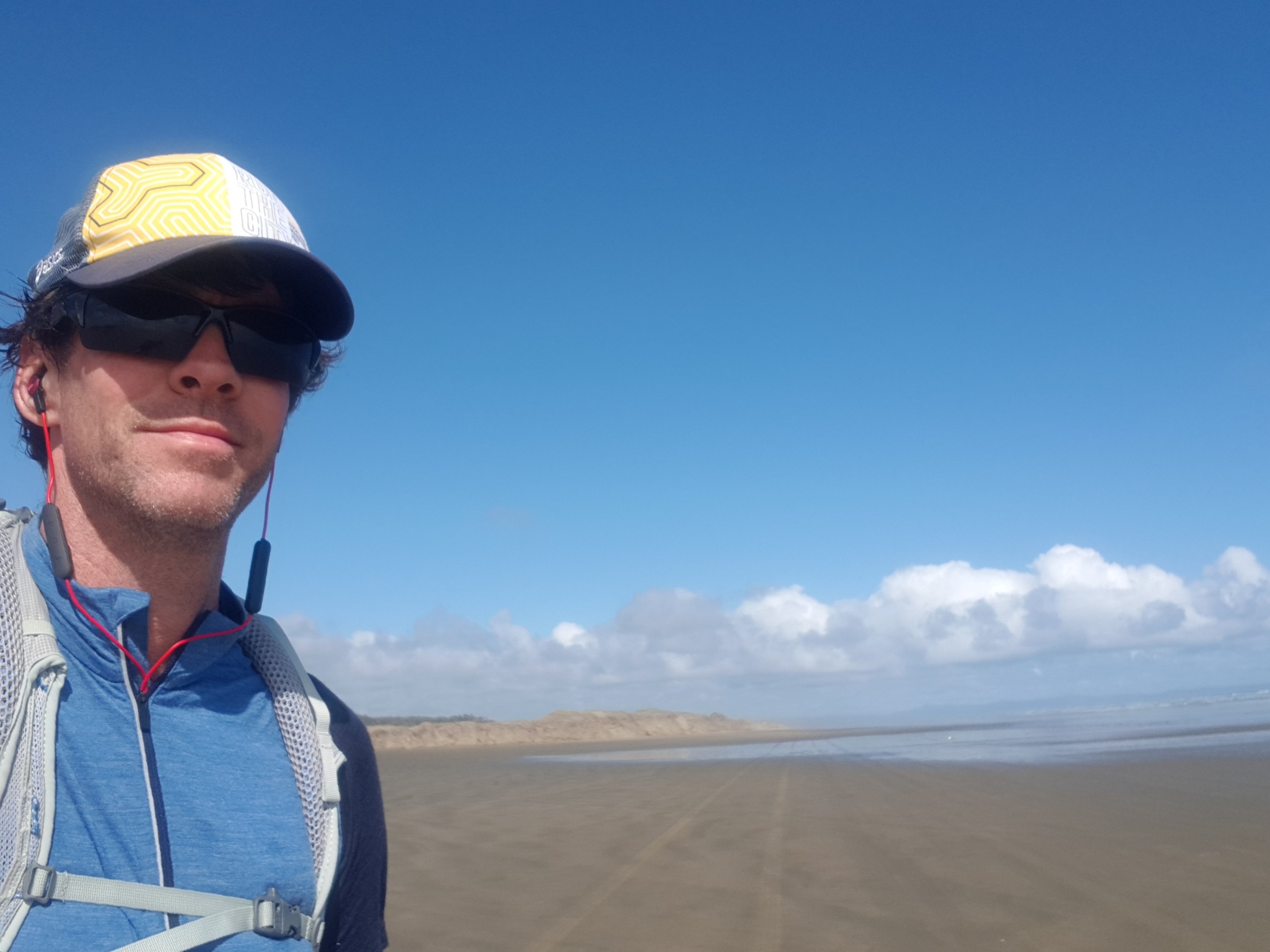
Reliable cellphone reception started at about 20km. I heard at this point from my friend Kelly that she was no longer coming up from Wellington to Auckland to go to the Metallica concert because they had cancelled. That was sad – she was almost certainly going to be in Auckland while I would be passing through so I could have seen her.
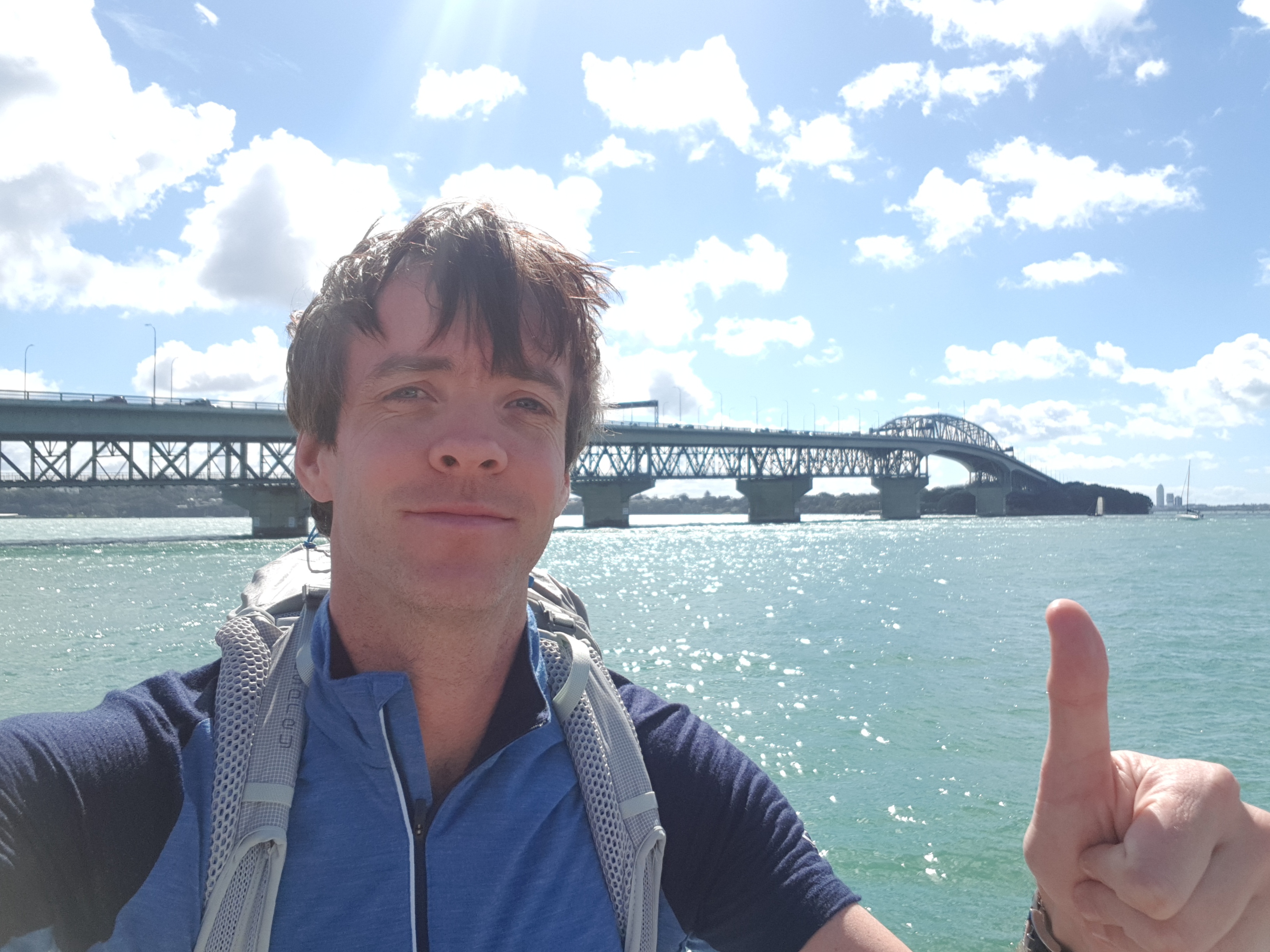
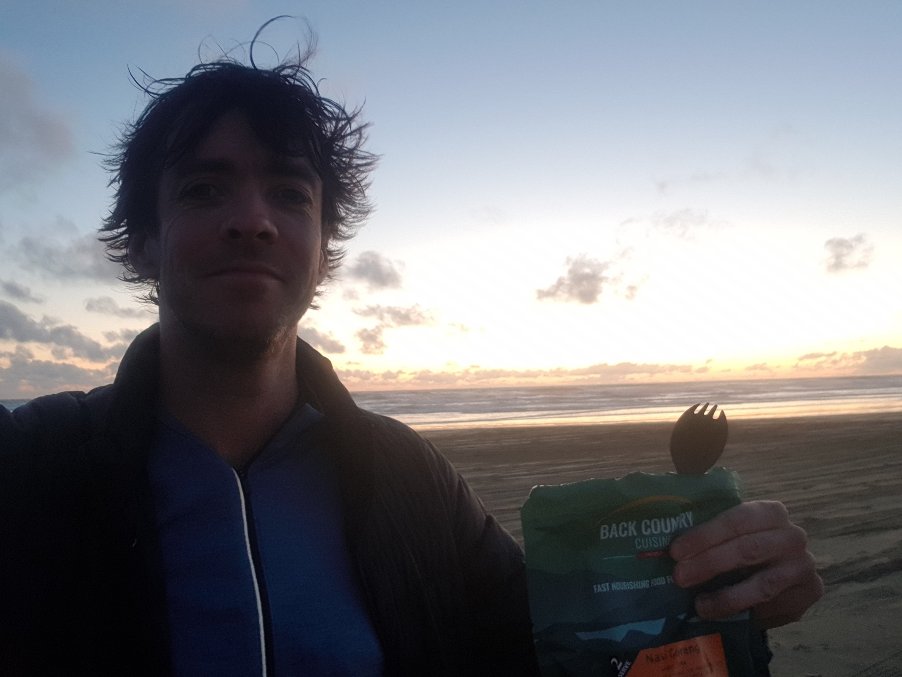
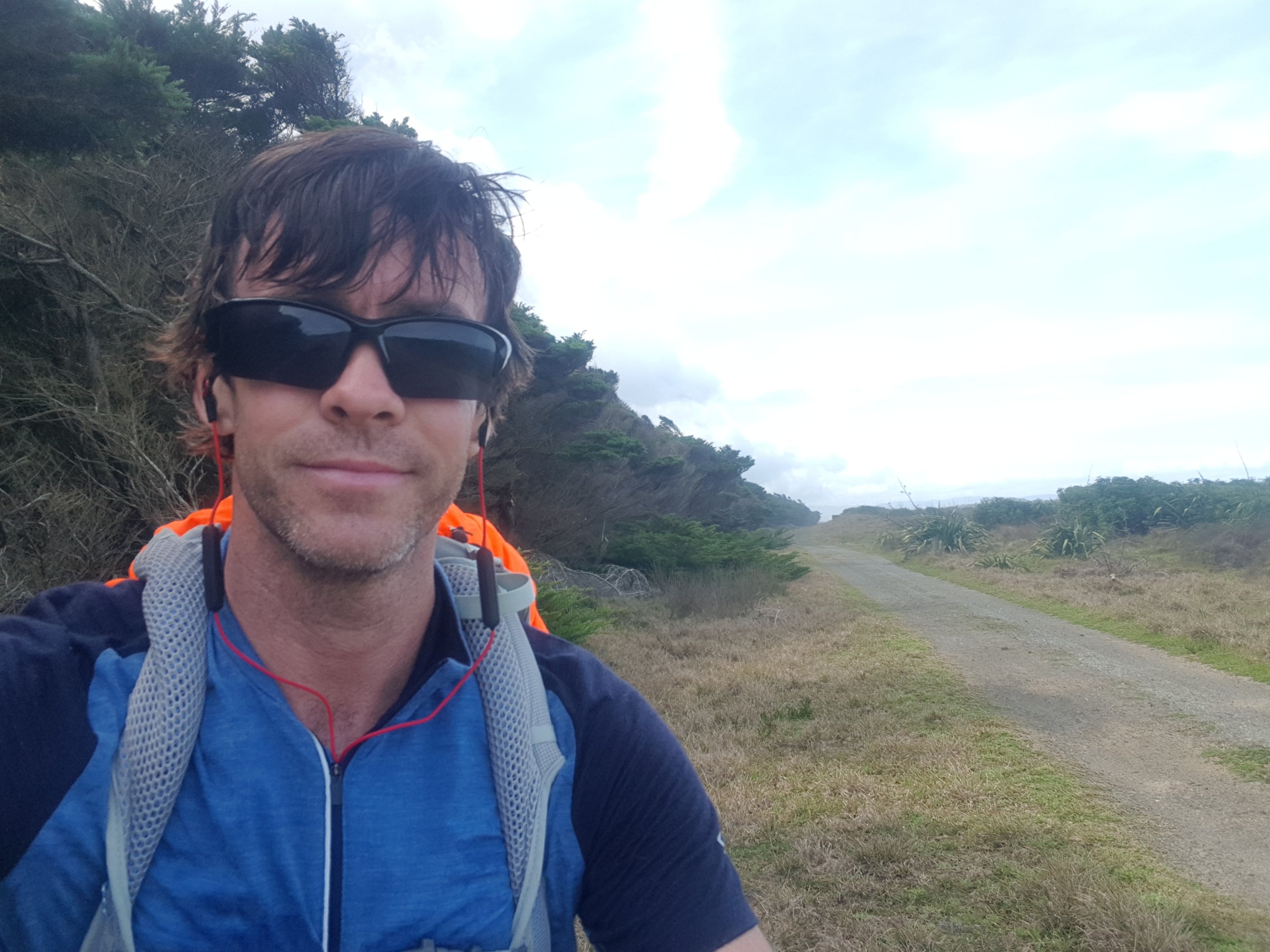
While we were chatting she also asked if I was walking to Bluff. “I might be!” was my reply – I hadn’t told many people by this point that I was doing the walk. I sent her this selfie from where I happened to be at that time.
Selfie
I saw a seal on the sand at 21km. I thought it looked healthy until I approached closer and couldn’t see it moving. Even walking right up to it and away down the beach I never saw it move. I hope it wasn’t dead.
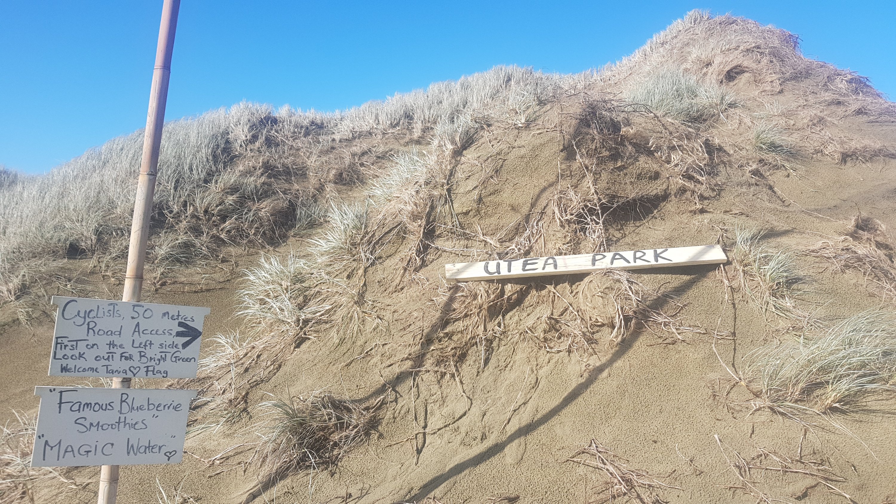
At the 27.5km mark I could finally see the green flag of Utea Park. Tania said that she would put it back up just for me – it had blown down in the heavy wind on Wednesday night. According to the Utea Park visitors book, a lot of people like seeing this flag because it’s the first thing a lot of people see after a long day of beach walking.
Can you see the green Utea Park flag?
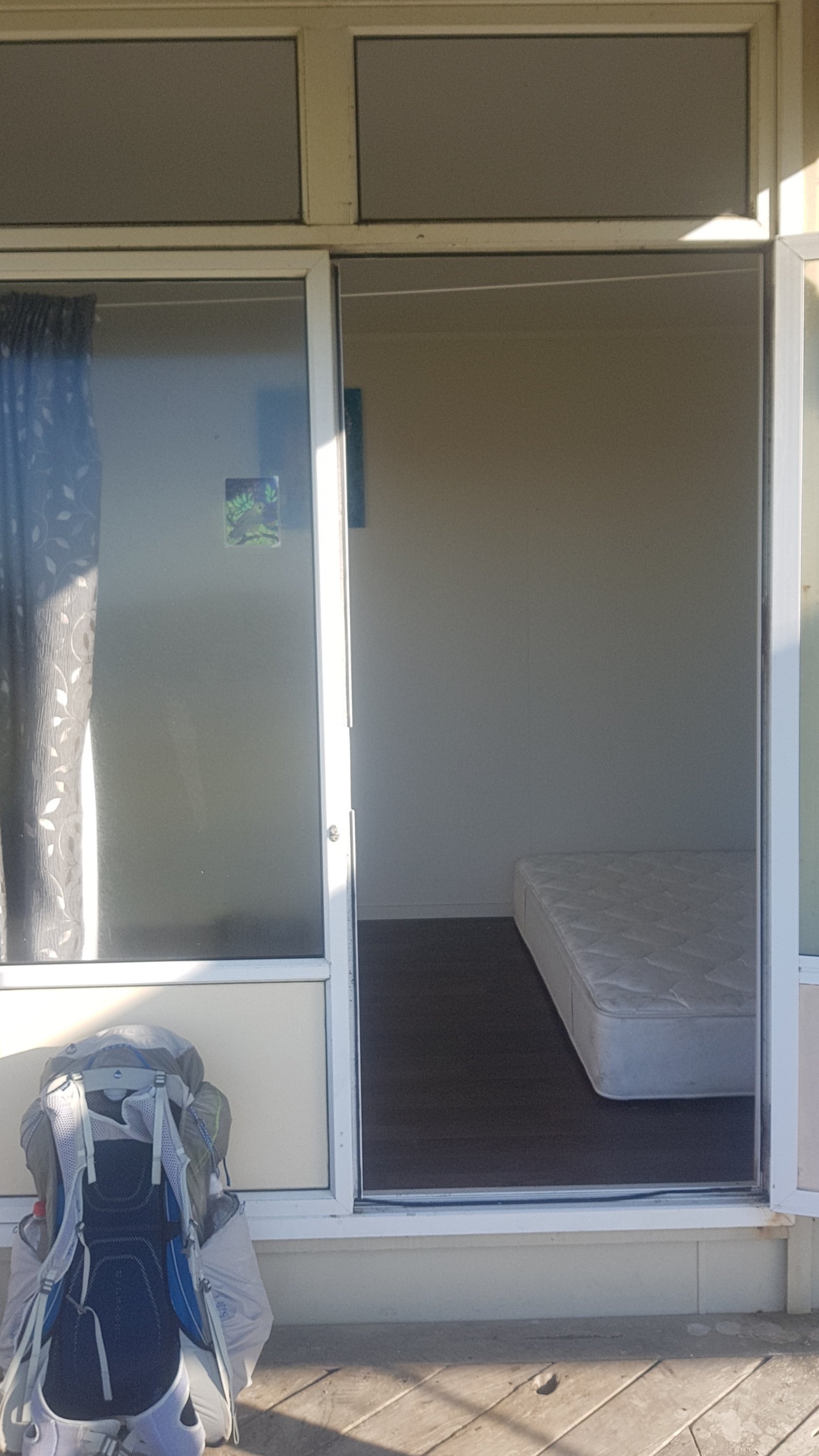
It wasn’t much longer until I got back to Utea Park, where this journey all began the day before my first day. It was good to be back. Although, I was advised, no smoothie would be forthcoming! Oh no, I had been looking for this since the first time I stayed here! This was because they had sold the fridge-freezer, as well as almost everything else. They had even sold the beds from all the units, in fact, the guy came to pick up the bed while I was sitting on it! Tania brought out a mattress for me and put it in the unit. Still much better than sleeping on a tiny inflatable airbed in a tent. I didn’t mind at all.
I felt really good when I walked into Utea Park at today’s 30km mark, however it was only 15 minutes or so before everything started hurting, literally everything. Much worse than yesterday. OUCH. At least it was all just aching. There were no stabbing pains or any sort of indication that any of my old running injuries were resurfacing.
I checked the trail notes, and it is another 32km to Ahipara. I don’t know if I can do it tomorrow with how much everything aches now. There is an intermediate campground at 17km tomorrow, however I really really have a craving for an icecream. A BIG craving, especially since I didn’t get my smoothie. Hopefully they have at least 8 flavours in Ahipara, and they can get a cone and put one scoop of each flavour on top of it. That would be sweet (literally).
Apparently they had just enough gas left at the campground to cook dinner but the showers had run out of their gas so they were going to be cold. However Tania, being the great host that she is, invited me into her house which is adjacent to the main camping area and allowed me to use her hot shower. That was very nice of her.
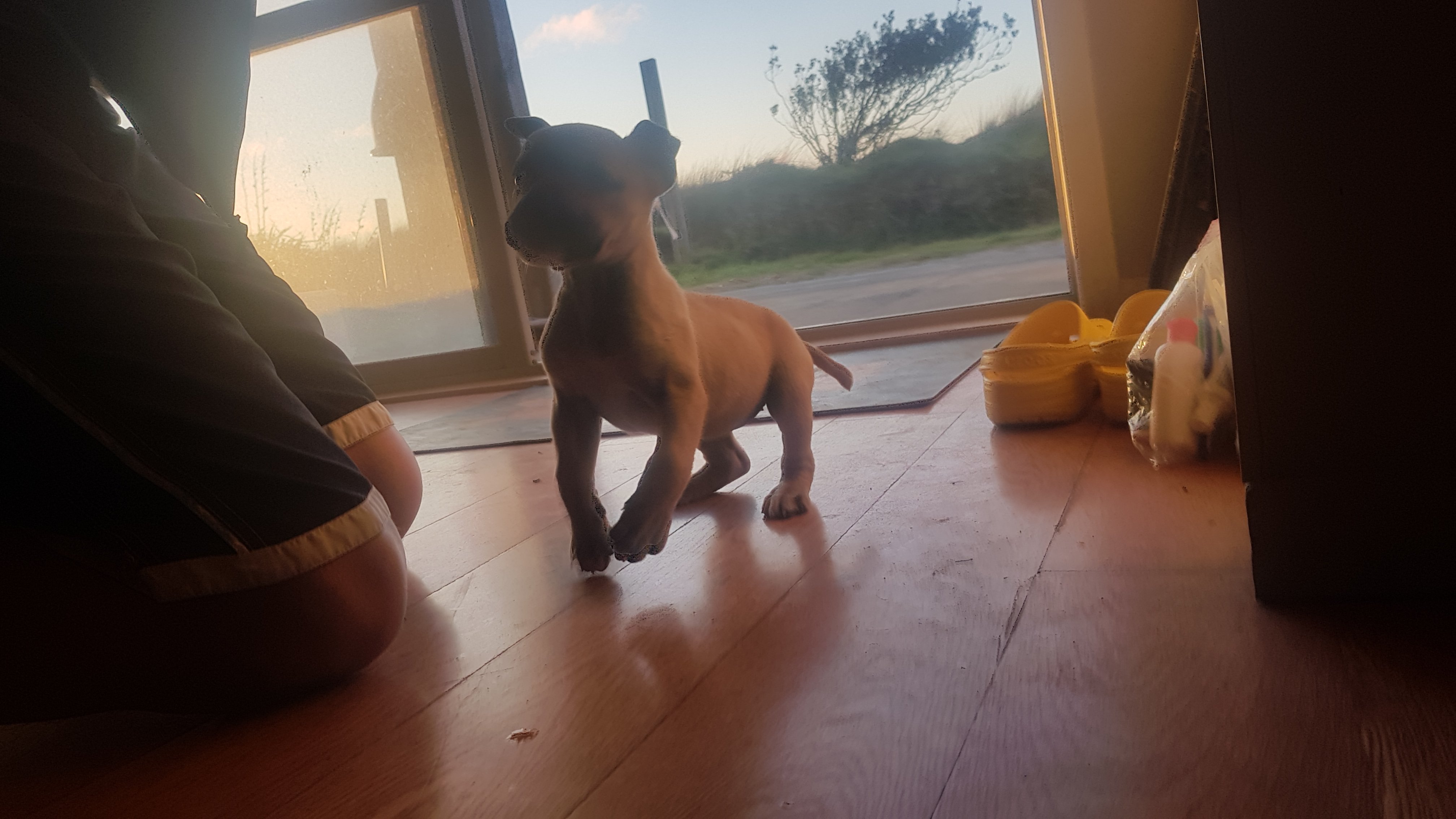
When I was coming back from the shower, I saw this adorable little puppy. I couldn’t get a good picture because it was so hyperactive.
Adorable puppy
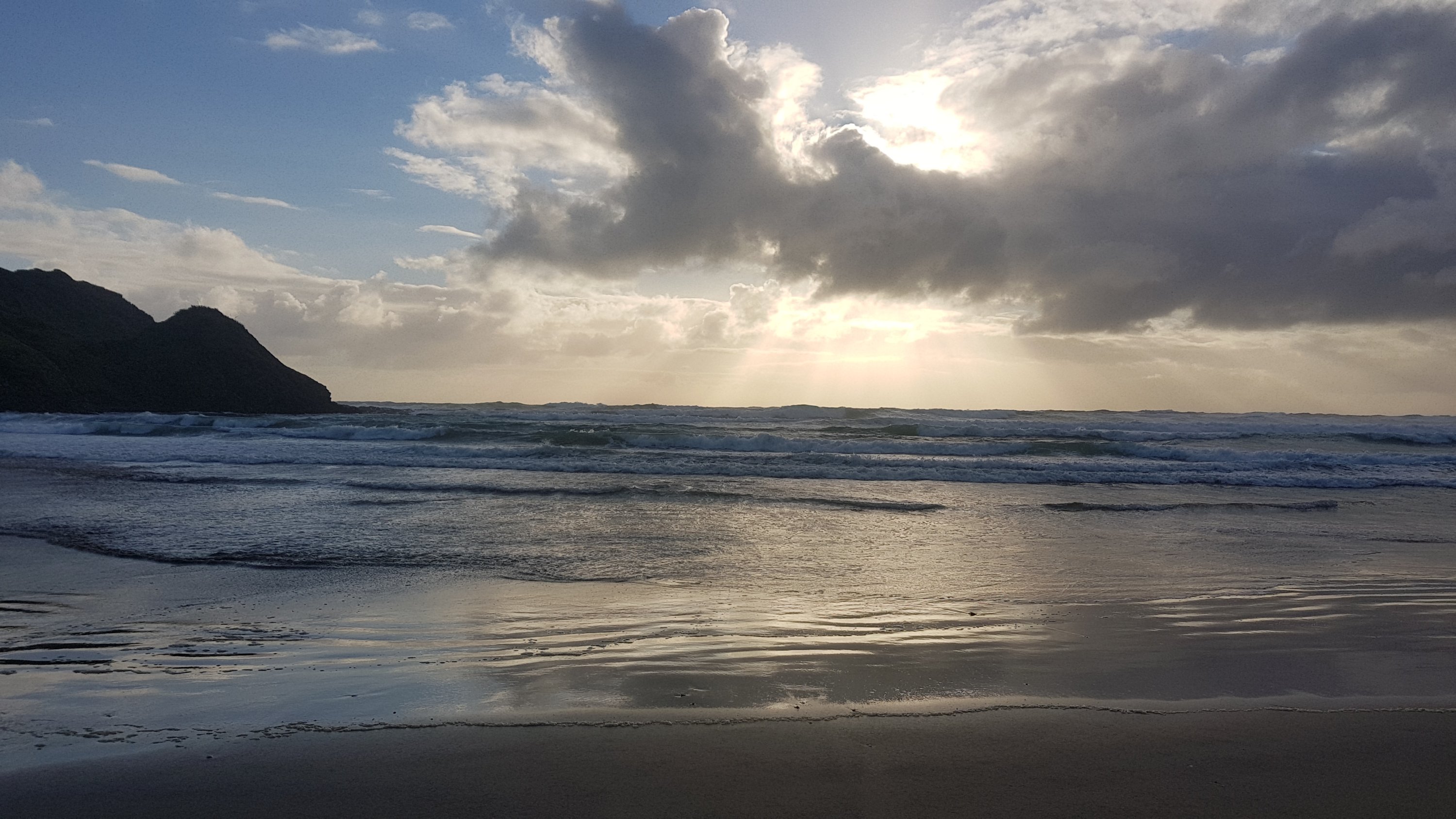
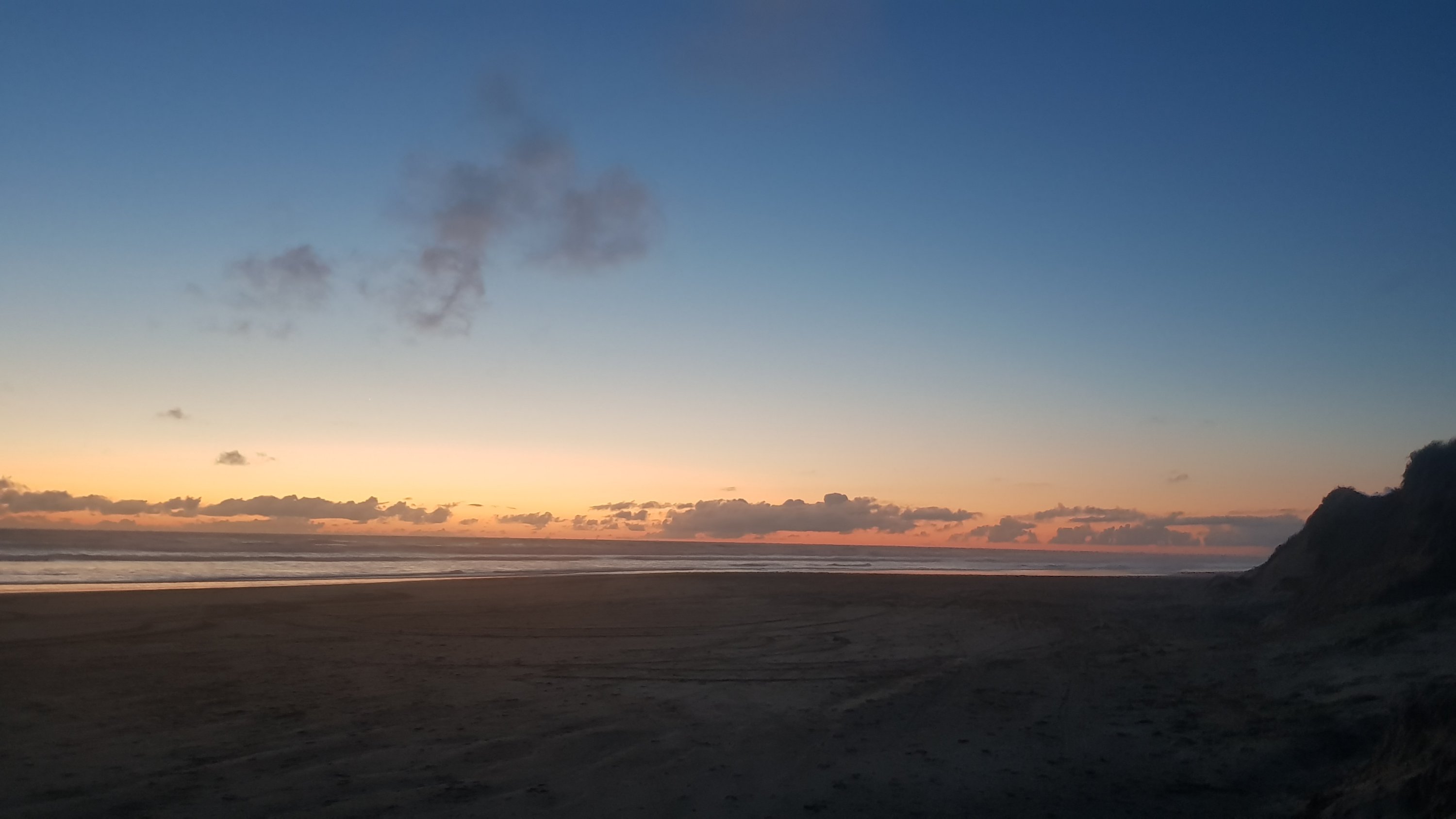
It was about 3:30pm when I arrived at Utea Park. After chilling out for a few hours, I cooked my dinner and went and ate it on the beach at sunset by myself. It was fantastic.
Rehydrated Nasi Goreng on 90 Mile Beach at sunset – does it get any better than this?
7:15pm came around, well dark by now, and who walks into the campground… Rhydian! He had taken 12 hours to get here. I can’t believe he had walked for that long, I really thought he was going to have to camp at some intermediate place once I saw the sun go down. But it was nice to have someone else there to talk to. There were a few Germans there who were staying in a campervan but they were all quite young and all preoccupied on their phones so I didn’t really talk to them initially.
Sunset on 90 Mile Beach
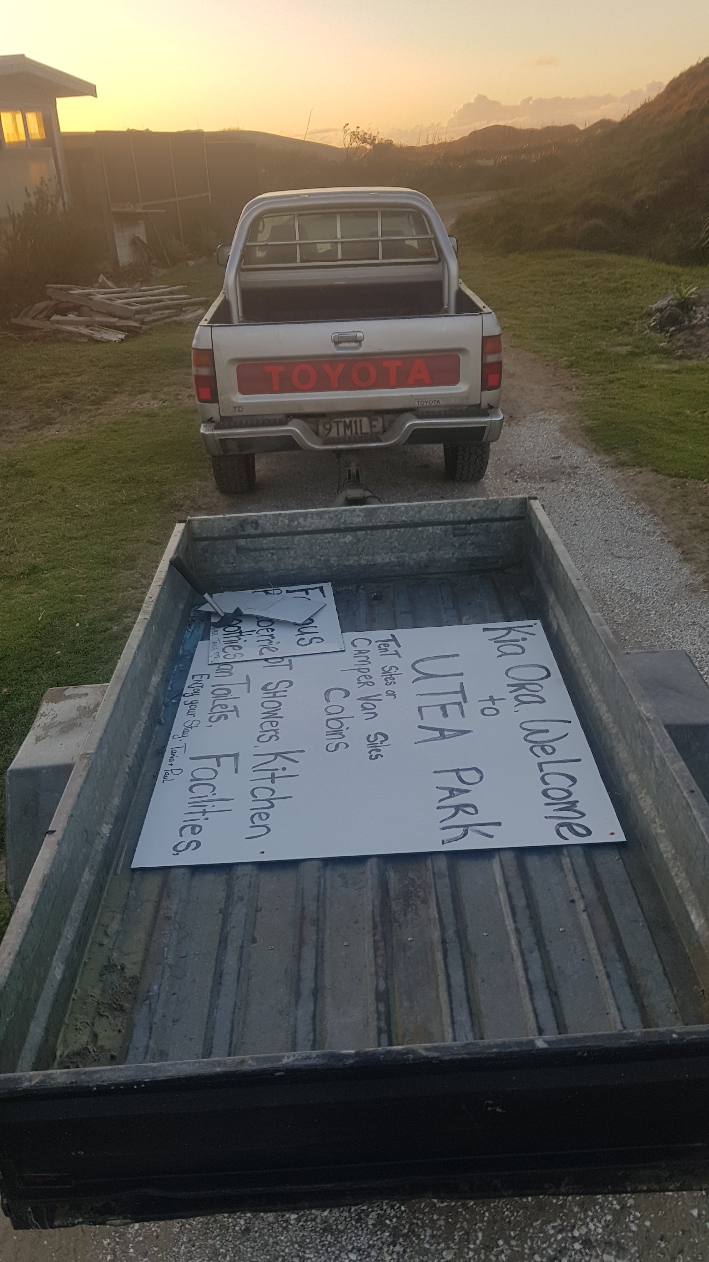
It’s supposed to be Utea Park’s last night of operation tonight. Pauly D (the owner, no relation to Pauly D from Jersey Shore) was taking the signs down while I was there, as well as random people coming in and out all afternoon and taking the fixtures and fittings and decorations and anything they could get their hands on. It was sad to see all the signs come down, but I got to see Pauly’s cool number plate 9TM1LE (I also saw 9TMYLE elsewhere on the beach).
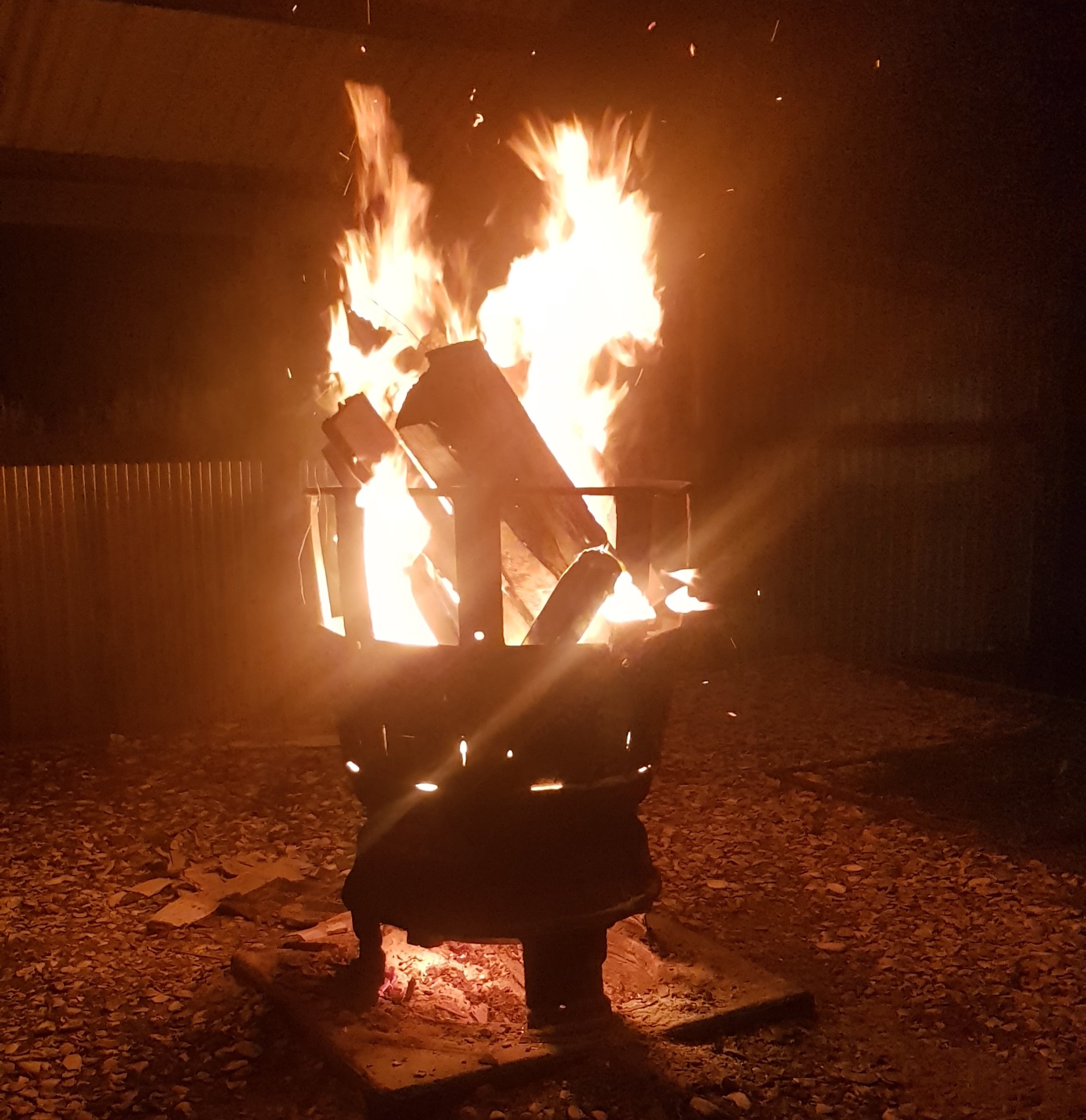
To celebrate us being the final guests of the campground, two of the German boys lit a fire and they also had some wine which they offered to Rhydian and me. I accepted a little bit but didn’t want a hangover so it was at most 75ml. They were no longer on their phones so we sat around the fire with Pauly and had a chat about all sorts of things. It was really nice and a really raging fire.
A picture of the fire when it was at about 70% of its max
After a while though, I was sore, and I went to bed. The cabin I was sleeping in had no curtains, so I could clearly see the stars outside. They were beautiful.
Date: 29 September
Distance walked: 32.9km
Trail covered: kms 69.4 to 101.1
Weather: too hot and no wind
Number of seals: 2
Cost of washing and drying 5 items of clothing: $8
This morning i said goodbye to Tania and Paul from Utea Park. Rhydian and I walked together for the first bit. This morning daylight savings started and this is the time where I usually think “oh no, I lose an hour sleep tonight” but this time it didn’t really matter too much. Although, that meant that high tide was quite a bit later than usual, and we couldn’t be bothered waiting for the tide to recede, so we left just before high tide.
My minimalist room last night
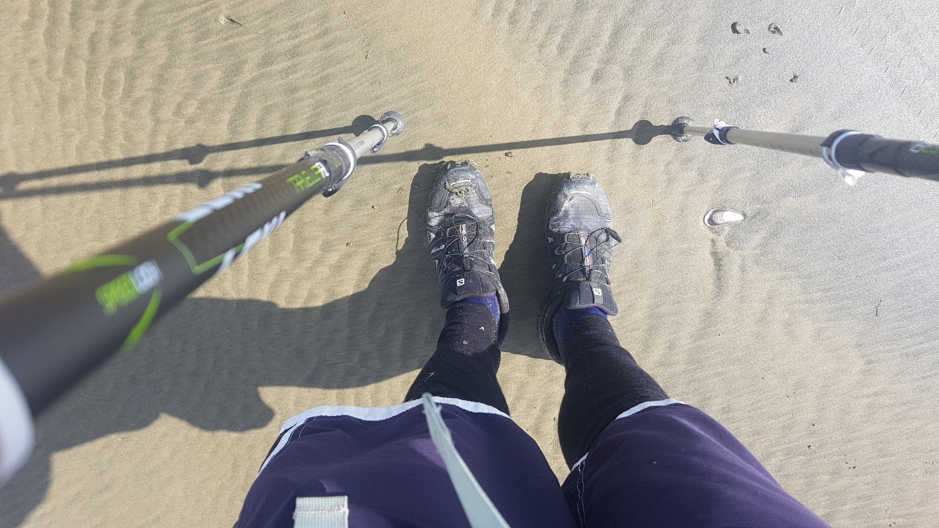
Although before we left, Rhydian took a photo of me in my hiking attire. If you don’t look like this, then you’re not a real hiker. Shirt, shorts over thermals, and crocs. Very stylie.
Hiker’s attire
Rhydian stopped for a break quite early on and so I left him at that point. It was another 30km walk today to Ahipara (in fact it was 32km) and the end of 90 Mile Beach, and I wanted to get it over and done with so again I only wanted to stop once. I planned to stop at the 17km mark where there was supposed to be a campground where I could get water.
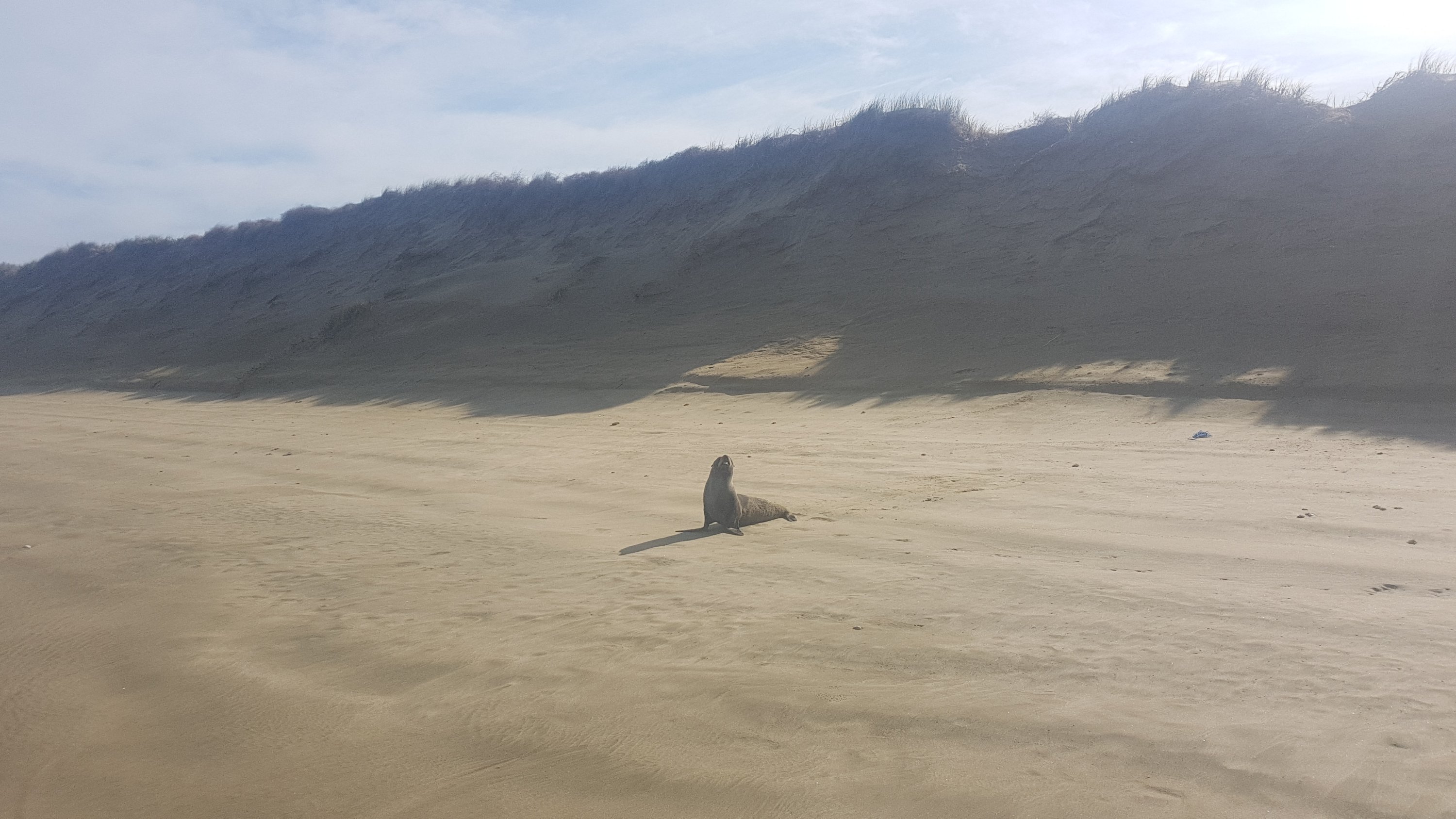
I saw two seals shortly after I left Rhydian. These seals were definitely alive. The first one started making noise and flapping around and started running up to me – I walked away quickly as I didn’t know if they were friendly or not. I had last seen seals in Wellington by Red Rocks in 2013, although those seals just were lounging around on the rocks and didn’t move. I haven’t seen seals before since then.
The first seal that I came across
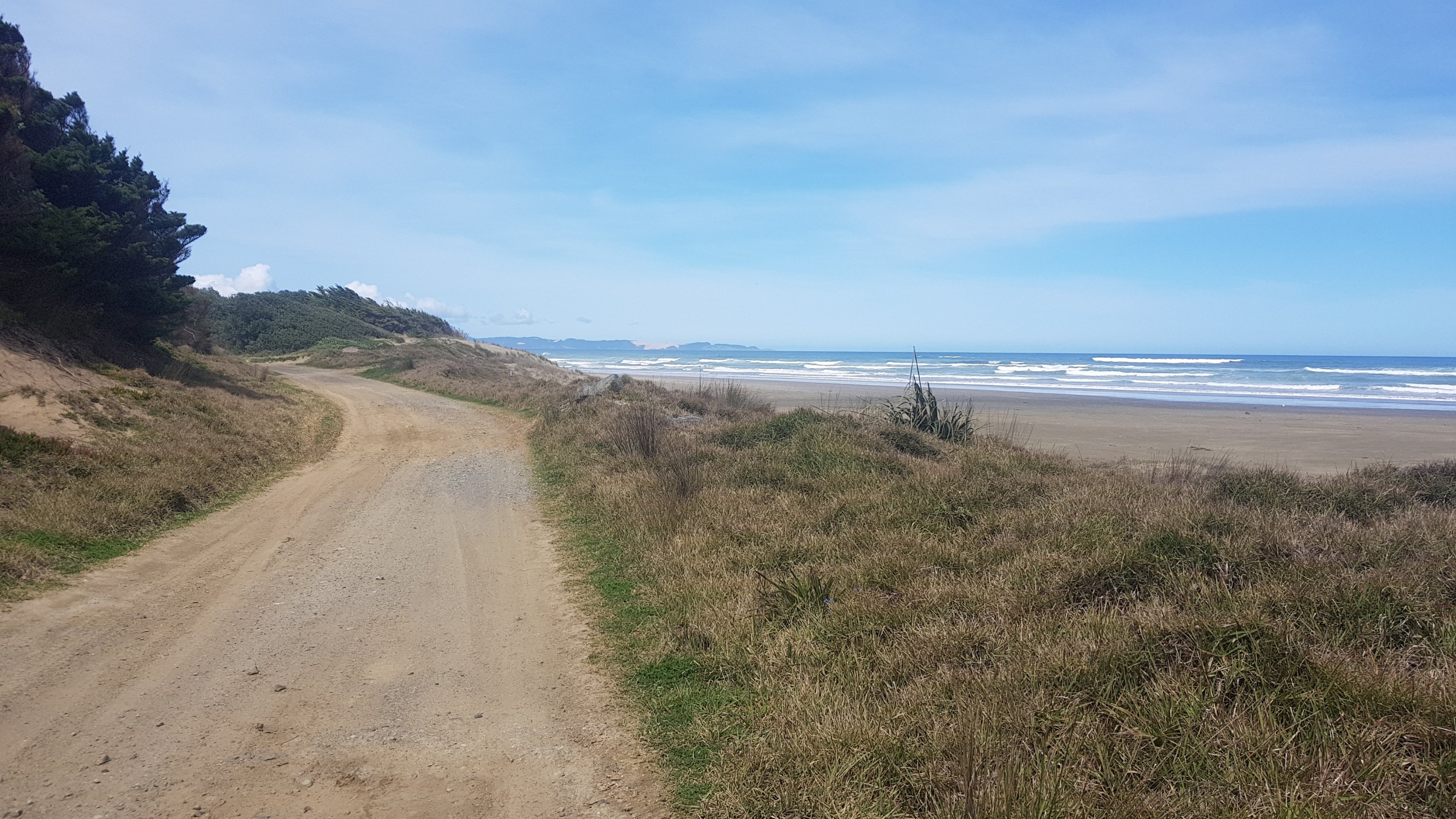
After a while walking on the soft high-tide sand was really draining and hard. I looked on the map and saw that there was a road called “Coast Road” which ran right alongside the beach – so I climbed up over the sand dunes and walked down the road for a while. It was much easier.
Dunes I crossed to get to the road
Shortly after I was on Coast Road it was 11am, so here’s my 11am picture. When I stopped to take this, on went music and hi-viz pack, and off came the jacket and hat. The music was on quietly because, even though it was a forestry road, you still have to be careful walking down roads.
11am picture
Although even walking on the road was hard. The road was a 4wd bumpy road and the blister that was starting to develop on my left foot was becoming very noticeable. But I persevered. I was on the road for an hour or two but only saw one car in that time. When the road next got close to the beach I rejoined the beach and kept walking to the 17km mark. It was a slog and there was no escape from the sun on this hot day.
Where the road rejoined the beach
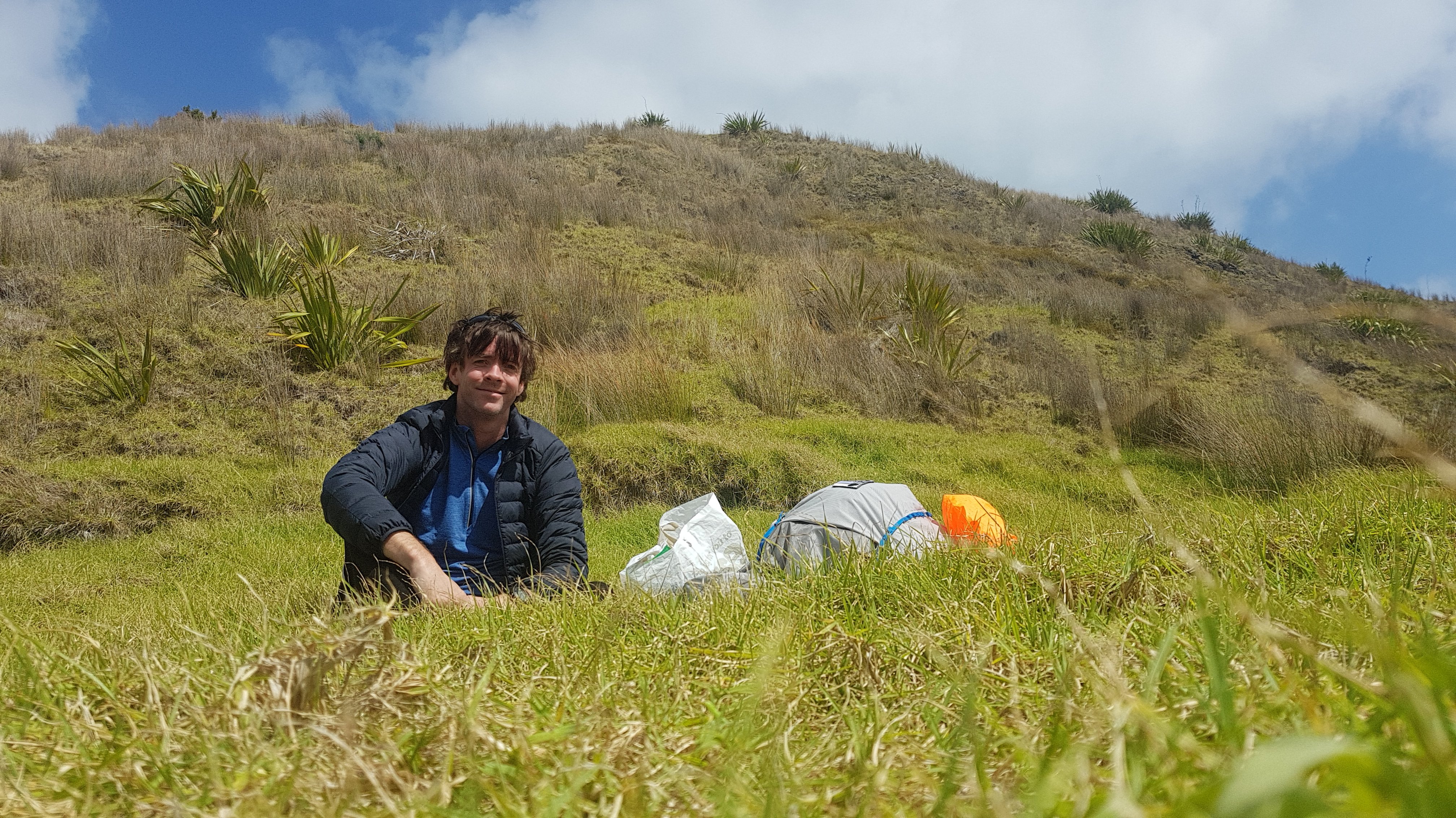
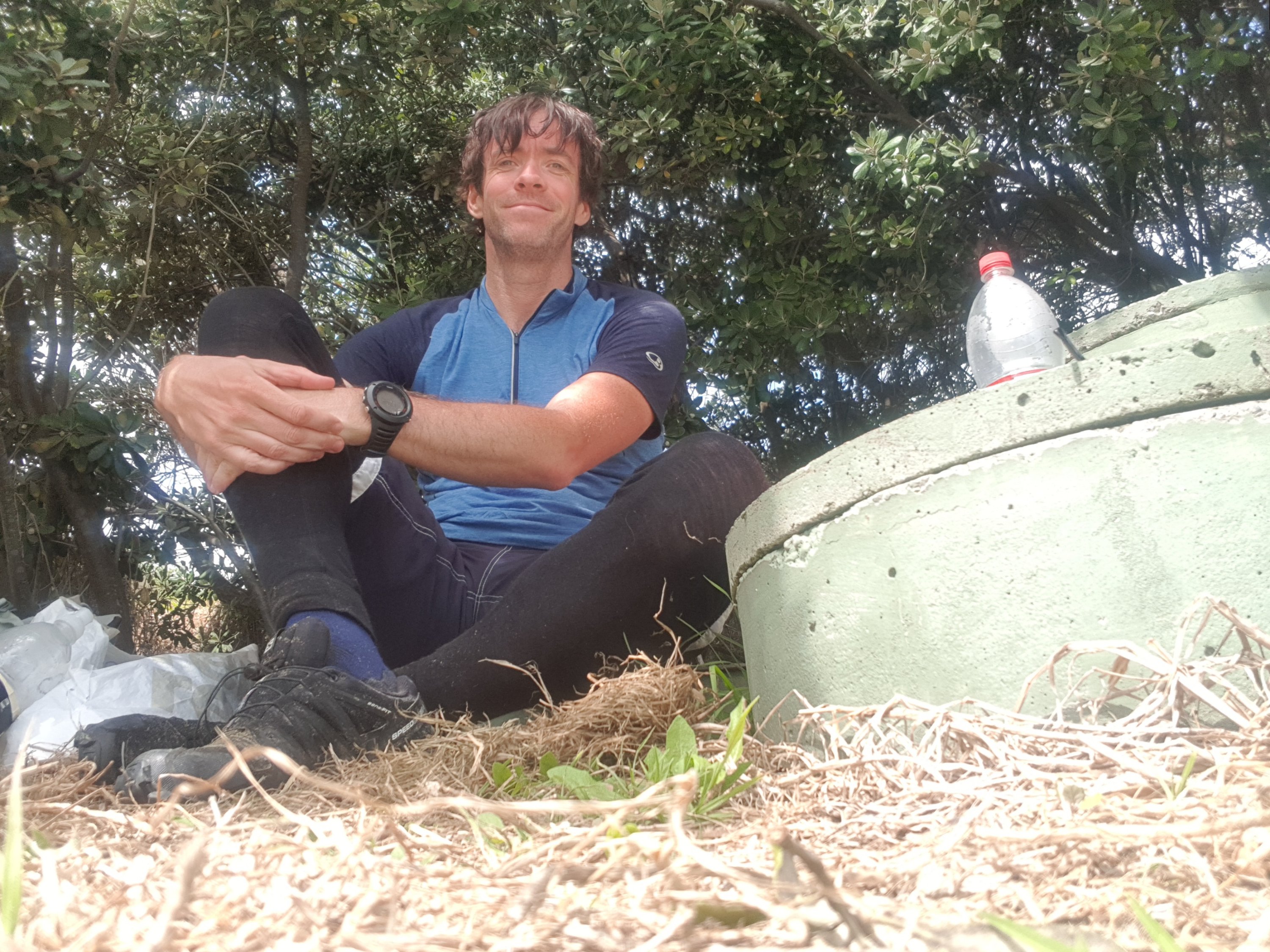
I eventually got to the 17km mark. I saw the campground was a fair way away from the beach so I just sat under a tree in the car park. I was there for 90 minutes and since I knew I wasn’t far away from a town, I ate every thing in my pack that didn’t require cooking.
Me in my shelter
While I was here I booked in at the YHA in Ahipara to make sure that I had somewhere to sleep tonight.
This is also the point where my glasses broke. Now I have to wear my hat or beanie to keep my hair out of my face, even when it’s hot. Will have to get new ones at Kaitaia when I get there.
RIP cheap sunglasses
It was a further 15km to Ahipara. There were a few more people down this end of the beach. I saw people on bikes, on quad bikes, and also at least two 4wds where children under 8 seemed to be driving. Maybe that’s the way they do things up here.
I noticed that my shoes had gone white, which was a bit unusual. I don’t know what caused that – salt maybe?
White shoes
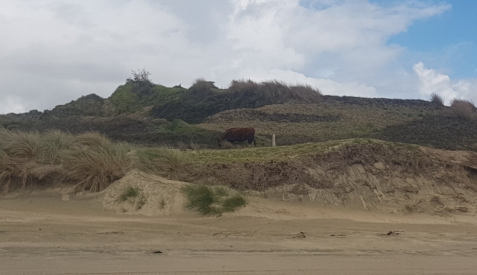
I passed a cow at one point. Not normally noteworthy but it was after 4 days on the beach.
Wow, a cow
And a rickety farm building.
Rickety farm building
And… which was a bit more exciting… the 100km point of Te Araroa! I enscribed a quick message in the sand to mark this momentous occasion, at the exact point.
100km down!
You can see Ahipara in the distance there. That was my view all day. Again, it just didn’t seem to get any closer. But eventually I got there. Thankfully, 90 Mile Beach isn’t actually 90 miles – it’s more like 90 kilometers (55 miles or so). It was nice to finally be off the beach… although it wasn’t actually clear at Ahipara how to get off the beach. The notes referred to a boat ramp that I just couldn’t find. So I climbed up the bank and somehow ended up in a golf course – whoops.
How to get off the beach here??
But I was only slightly off course. I walked through a bit of grass, and possibly through someone’s back yard (I’m not sure) but rejoined the road. It was only another few minutes to the YHA.
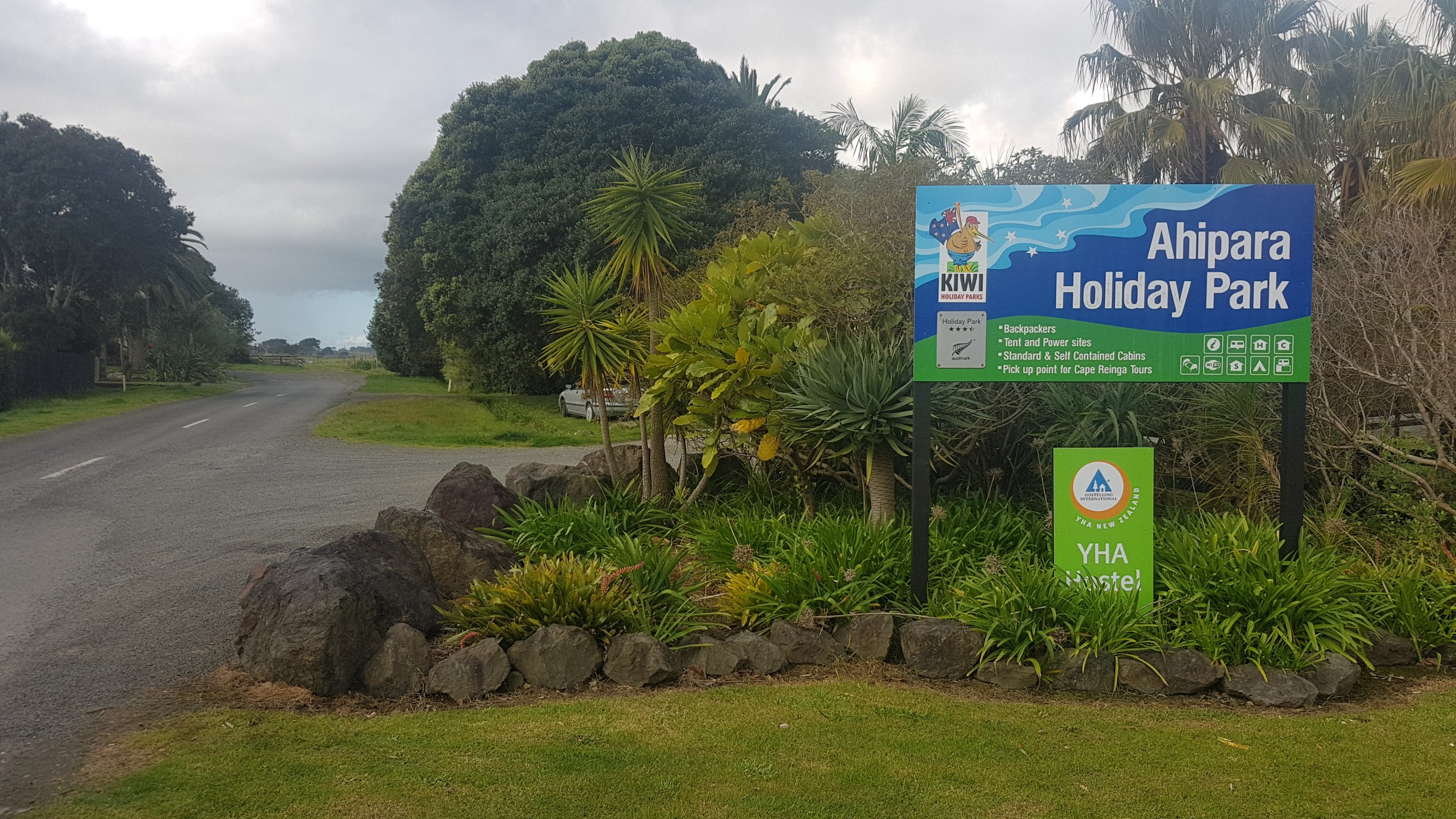
YHA Ahipara
The YHA was good because they had a washing machine. I finally got to do my washing, although with the coin operated washer and dryer it cost $8 to wash and dry about 5 pieces of clothing plus socks – I’ve been wearing the same clothes every day so far in case you didn’t notice!
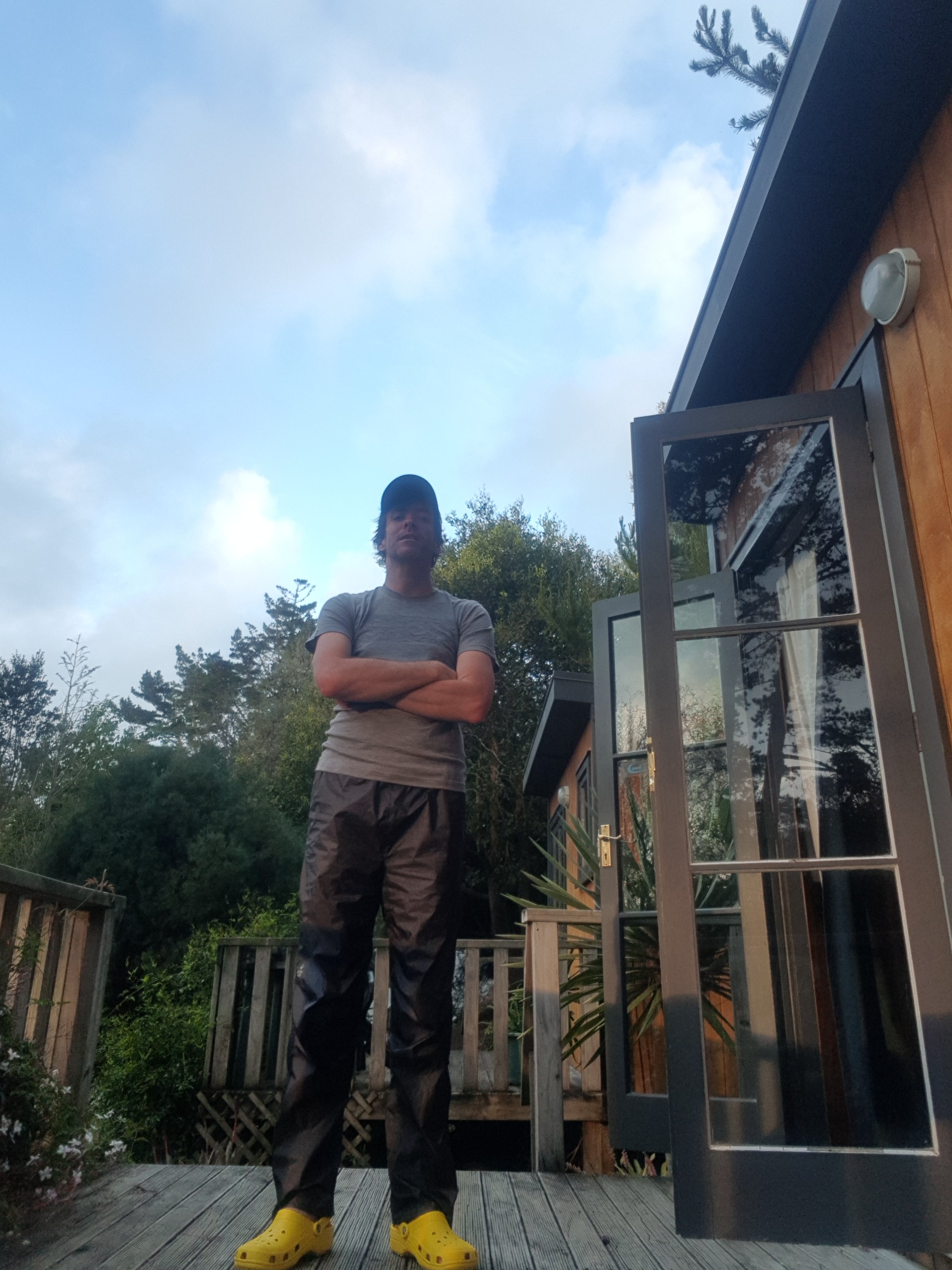
While the clothes were washing, I was dressed in almost the only other clothes I had – a spare shirt and my rain pants. Even more stylie than the hiking attire at the top of the post, right?
More stylie attire
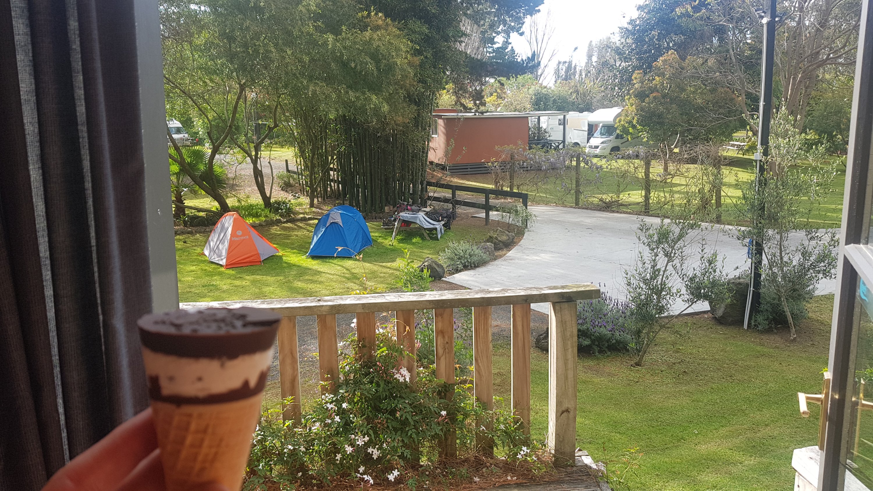
I really had been craving an ice-cream all day, a real typical kiwi scoop icecream but the shops were another 1km from where I was staying and I just didn’t have the energy to walk down there, I was so sore. So I settled for a Cornetto from the YHA shop, and also some 2-minute noodles for dinner.
Cornetto
That was the view from the little cabin I was staying in. I chose a cabin because it is supposed to rain really hard tonight, and a proper bed was just too tempting. I could see two tents from my room… I looked at the gear spread out on the table and I was trying to work out if they were also Te Araroa walkers. I figured not because I didn’t recognise the brands of the gear and also I would surely have seen them on one of the previous days. I was going to ask the occupants of the tents but I never saw them – oh well.
The whole campground was overrun with 17 year old kids who were on something called “surf camp”. They stay here every night apparently and each day they go out for a surf somewhere. They all disappared at 7pm tonight to go surfing but I didn’t catch where. The kid I talked to had a thick American accent but he said that he went to a school in East Coast Bays in Auckland, which I thought was interesting.
I was in the main “common area” using the YHA’s computer because it is much, much easier writing blog posts on a proper keyboard than on a small phone. Also, the WordPress app is supposed to work offline, when there’s no phone coverage, however it can’t handle pictures when offline, which is annoying. I like to add pictures to posts so that sucks a bit.
In the area as well as the kids from the surf camp there were also a lot of people watching the Wales vs Australia rugby world cup game on the TV, two people playing table tennis (who kept whacking the ball into me) and a few other guys talking on their phones in what sounded like German.
I went to sleep still very sore. Yesterday when I was very sore it was gone by the evening. This time it stuck around right till the evening. I’m grateful that I have a real bed to sleep in and also grateful that the walk to Kaitaia tomorrow is only 18km. And no more 90 Mile Beach! No more sand! For now at least. Hooray!
Actually… I’ll miss 90 Mile Beach if I’m honest. Despite being monotonous, it was easy to walk down and beautiful. And I didn’t see Rhydian again. I guess he stayed at the campground at 17km.
Distance walked is the distance I walked according to my GPS Watch (Suunto Ambit 3 Run).
Trail covered is the number of Te Araroa virtual “km markers” I have passed.
Distance walked may be higher than Trail covered if I deviated from the trail, or it may be lower because the GPS Watch often under-reads the actual distance walked.